
A Dream, A line, A Traverse for the Books
Note: two years later, we repeated this route in a single 18.5 hour push.
Between Snoqualmie Pass and Stevens Pass lies a crest of rugged, remote peaks between 7,000 and 8,000 ft; Chikamin Peak marks the southern edge and Mt. Daniel is the northern terminus. With the exception of Mt. Daniel, all these peaks have significant approaches yet lack “top 100” status, so most see very little traffic. Last winter, Logan and I spent many fine days touring, climbing, and running above Snoqualmie Pass, staring at these distant peaks, wondering what secrets they held. Thus was born a dream to create a high route that travels atop or just beneath this rugged crest, never leaving the alpine. Over many months, I drew many lines across the map, eventually settling with this final iteration. Later, this trip became part of a greater vision for the Cascade High Route. This was to be the very first section, the grand introduction to the high terrain of the North Cascades.
I had long been pondering which season would be best for this trip. The PCT had to be clear of snow but there were also lots of annoying boulder fields that could be easier covered by snow. Also, we wanted sufficient snow to make the glacier crossings easier. But I wanted the sparkling lakes to be mostly unmelted. With the low snow year, I was sensing that late June could be a perfect opportunity, but I just needed a partner who was fit, capable off trail, and had the same desire to explore less heralded terrain. When I heard that Logan was back in town from Wyoming, I knew we had to go for it. The weather was iffy, but at least this was a better option than anything technical like rock climbing.
Part 1: Snoqualmie Pass to Iceberg Lake
I woke up around 2 am Saturday and started driving out to the Cathedral Pass Trailhead. I forgot how bad that road is, with miles of potholes and washboards and, of course, the Scatter Creek crossing, which my minivan plowed through with little trouble. I got to the trailhead at 5, hopped in Logan’s car and we drove back to Snoqualmie Pass. Four hours of driving and we finally made it to Snoqualmie Pass!
We started hiking and Logan showed me the Commonwealth Trail, which cuts about a mile off the ridiculously flat PCT switchbacks. Once on the PCT, we began to pass a bunch of trail runners probably in their mid 30s, heading down already so they could get home before they had to shuttle their kids around to events. Trail running is such a classic mom/dad sport around here!
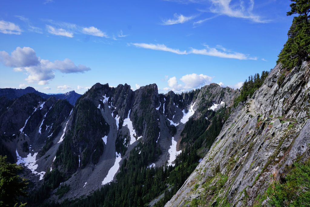
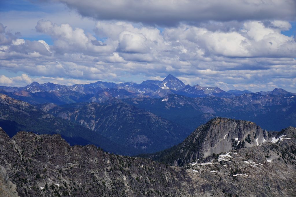
At the Kendall Katwalk, we admired the steep rock beneath the Katwalk and the steep slots and couloirs of the Kendall Adventure Zone (still need to ski there). After that, the PCT became very empty. We started to get our first views of the Alpine Lakes Crest; it looked so rugged and so far away.
I was pretty familiar with this part of the PCT. Four summers ago, at the ripe age of 18, I had attempted a 30 mile loop of Chikamin Peak from Snoqualmie Pass. Previously, I had never done more than 14 miles in a day. Put simply, I bonked hard 20 miles in, the worst I have ever crashed in the mountains. But the strength I found inside myself, my friends, and in the beauty of the landscape that allowed me to push on has stayed with me through the years. It was one of the most transformative days in my mountain career. I learned what it felt like to break through barriers.
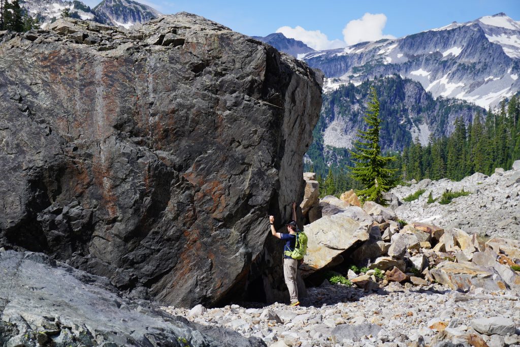
As we neared Joe Lake, we eyed the steep south face of Chikamin for where we should ascend the face. The summit was far to the right, but that would take us further from the optimal high route and require more elevation gain. We decided to leave the trail at the first major gully system while crossing the face.
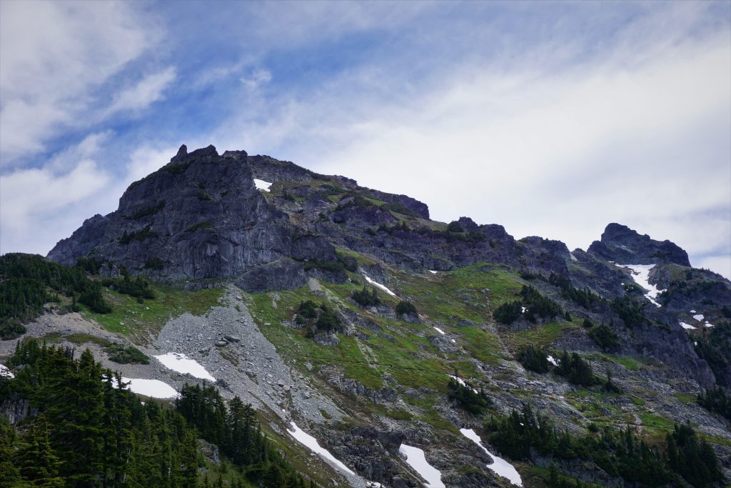
We climbed steep heather to the base of some cliffs, where we trended up and left towards a little snow patch.

Eventually, we found some 3rd class ledges that allowed us to cut back up and right. It was a little hairy, but nothing too bad.
Above, we simply walked more steep heather to the ridgeline and the west summit of Chikamin. It was just past noon, so we were making good time, but the hardest terrain was only ahead of us.
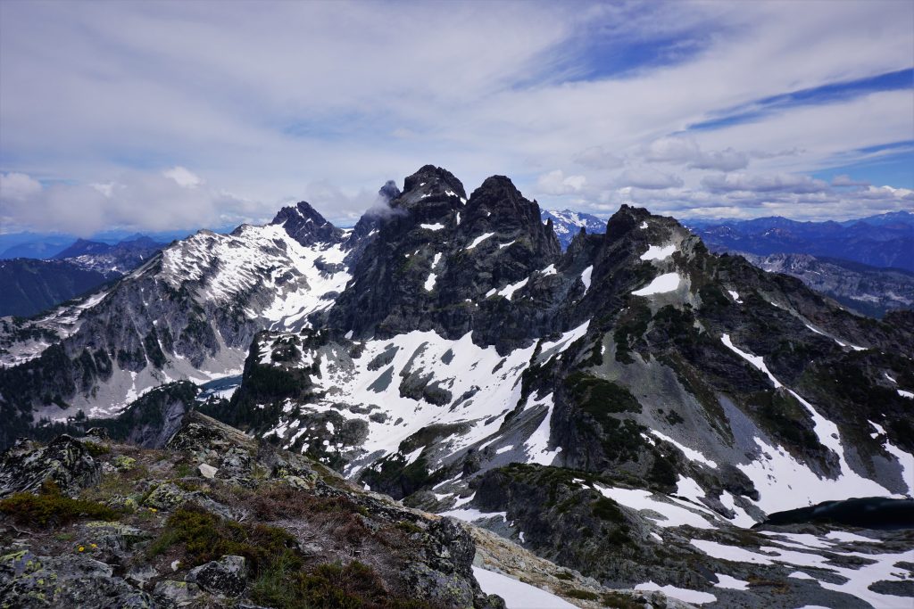
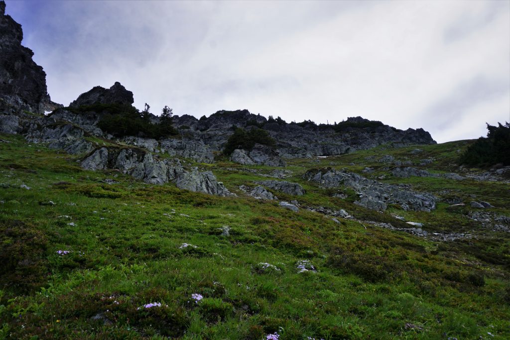
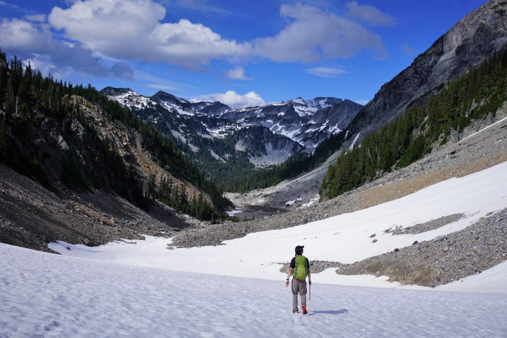
After a short break, we plunged down some nice snowfields, following the north spur ridge towards the saddle just west of Chikamin Lake. There were some gorgeous benches and streams through this section.
We crossed through the saddle and dropped down a ways, trying to traverse north. Various cliff bands forced us up and down as we sidehilled across annoying, loose terrain, trying to eventually reach the col between Lemah and a little outcropping just west of the Lemahs.
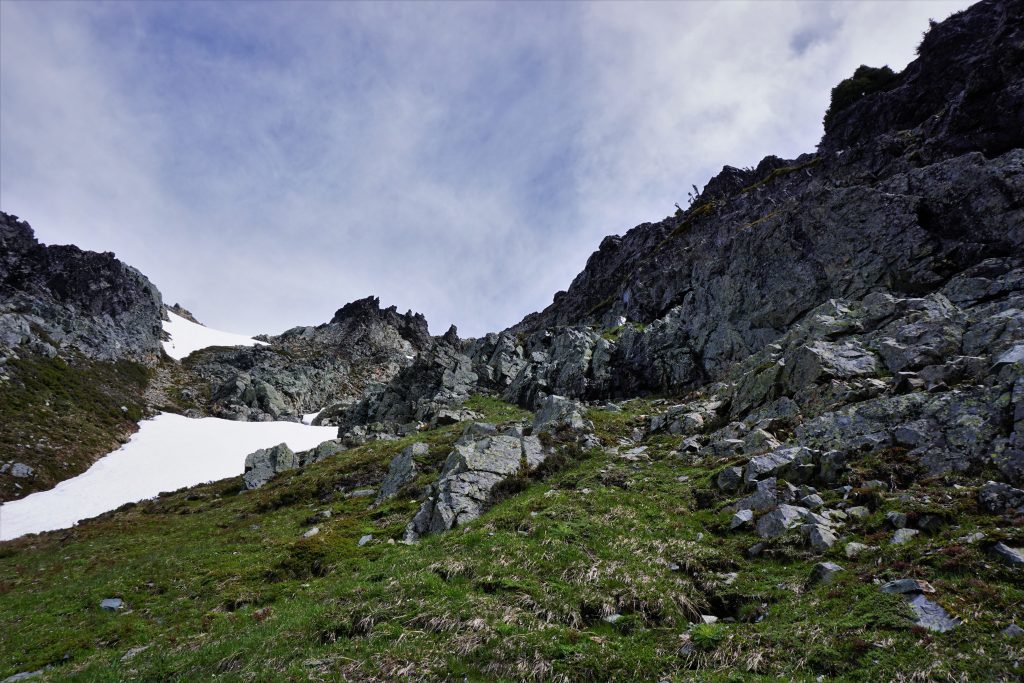
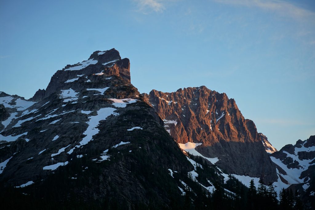
Luckily, much of this was snow covered, including the little climb up to the col. As we traversed beneath the Lemahs, they just kept becoming steeper and steeper, this giant monolithic face with not much anything in regards of cracks for protection!
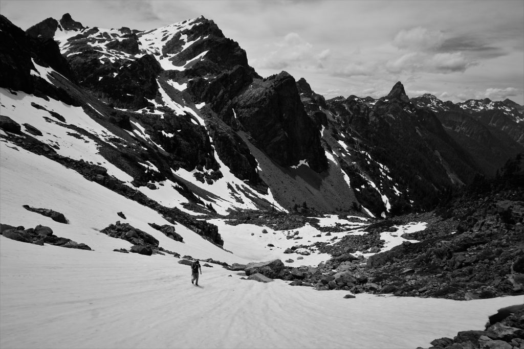
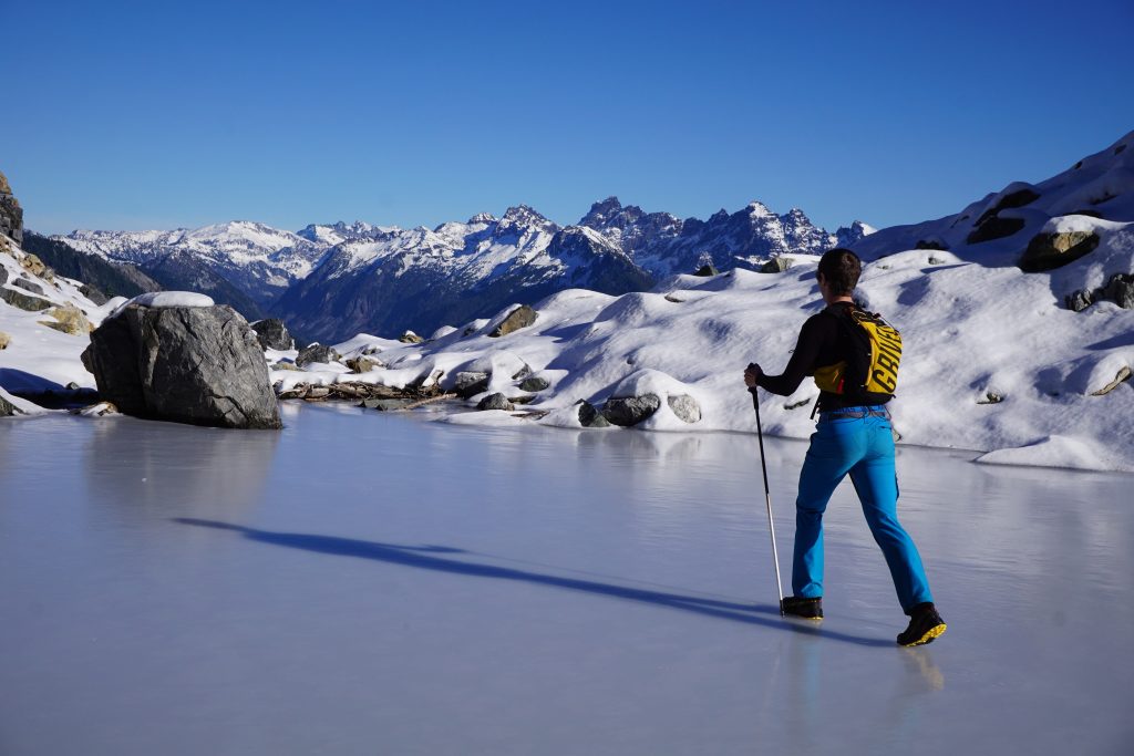
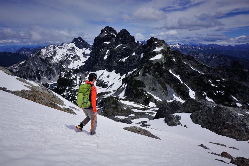
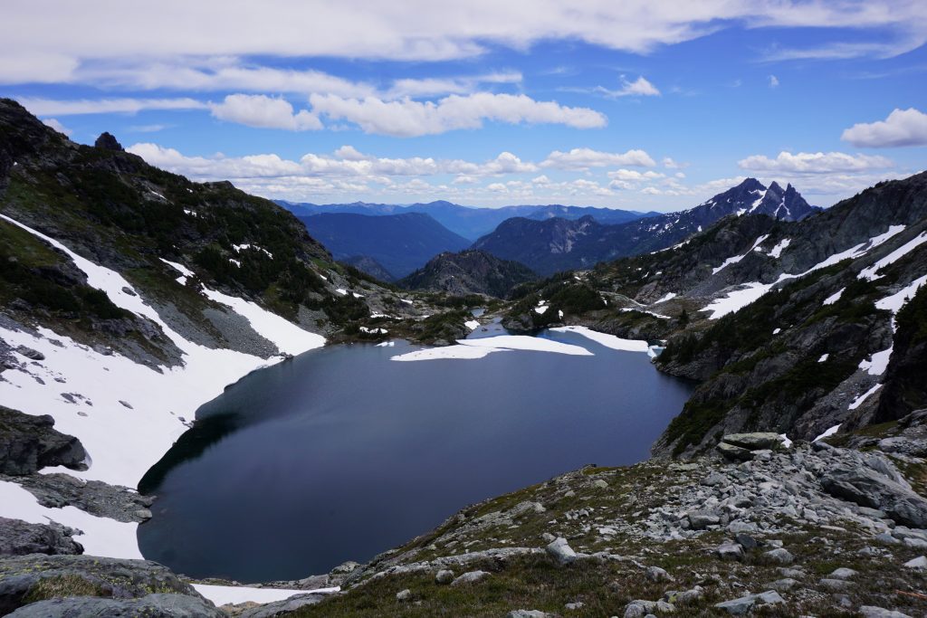
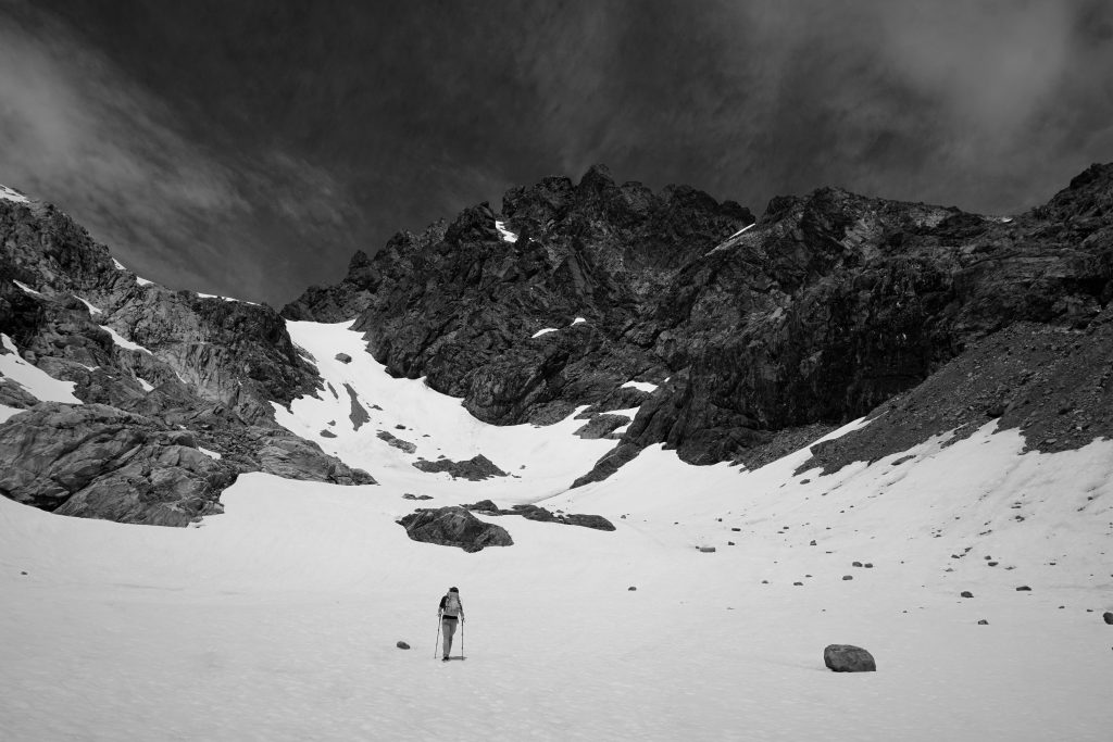
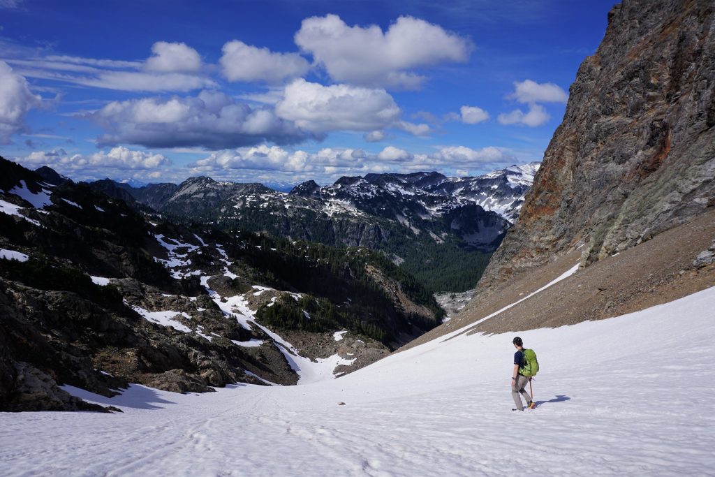
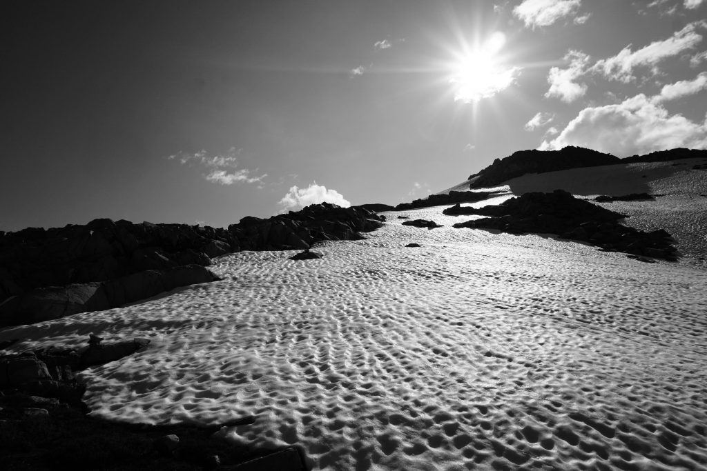
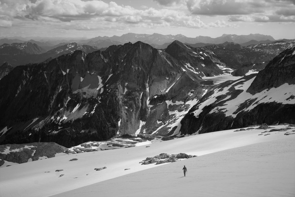
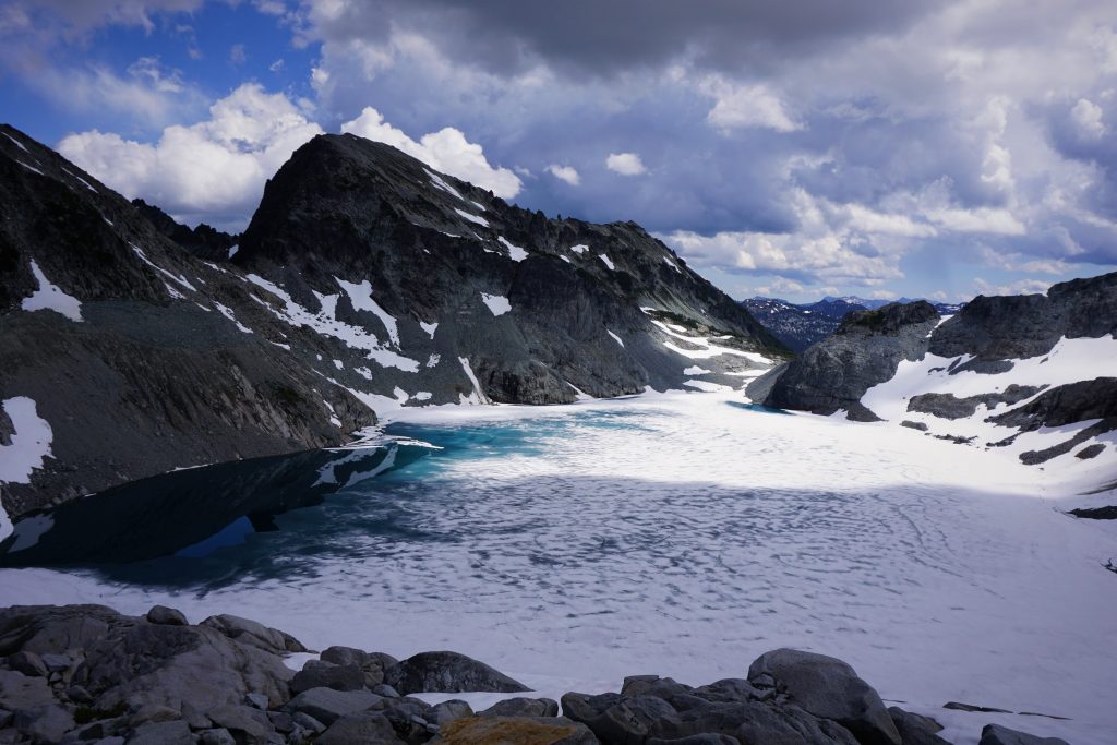
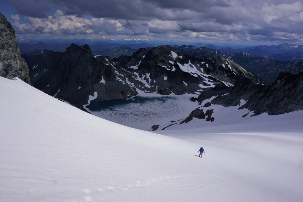
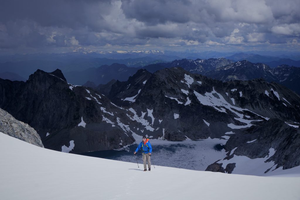
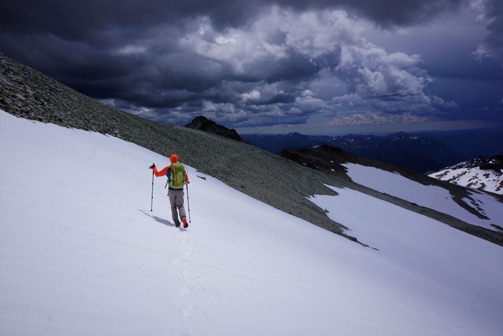
At the col, we were pleased to see a perfect snowfield all the way down to Iceberg Lake in the north facing slot! The snow was the perfect consistency for boot skiing and we flew down the 1000 ft descent to the lake.
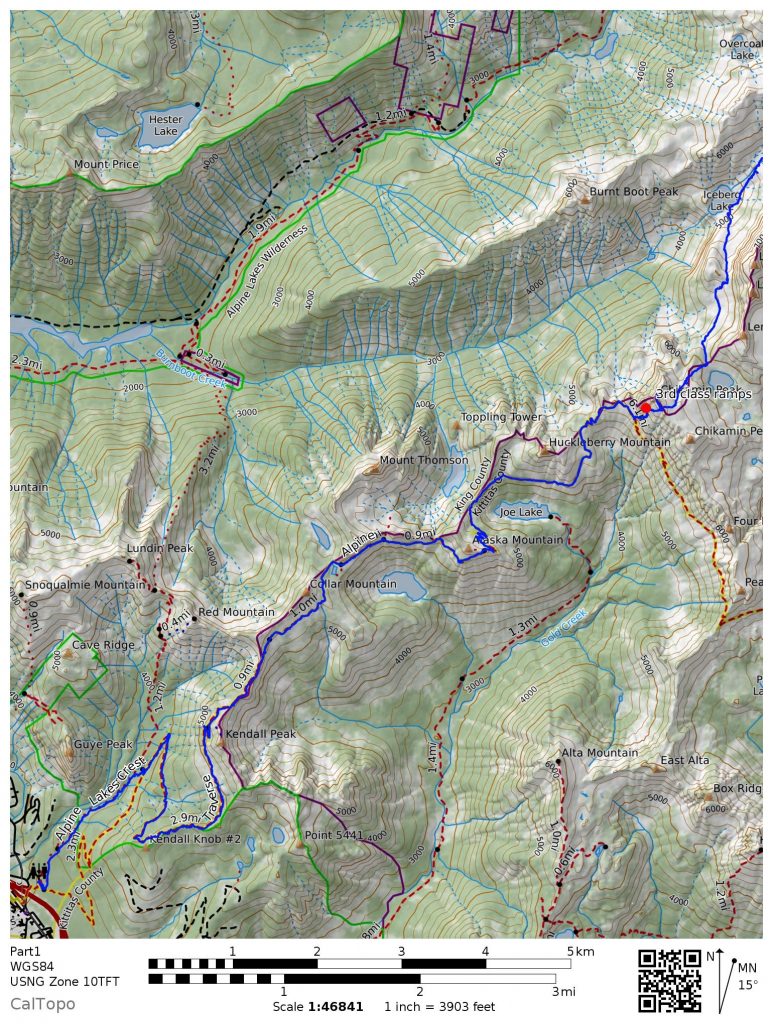
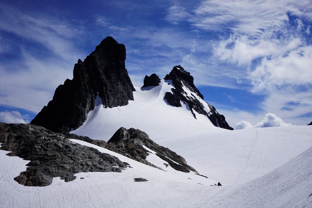
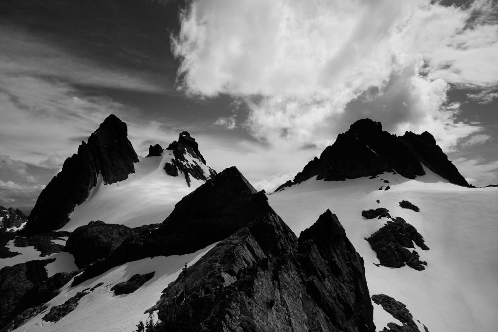
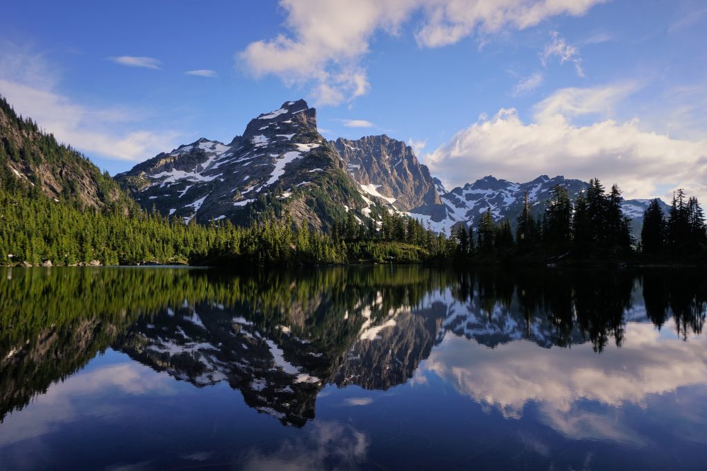
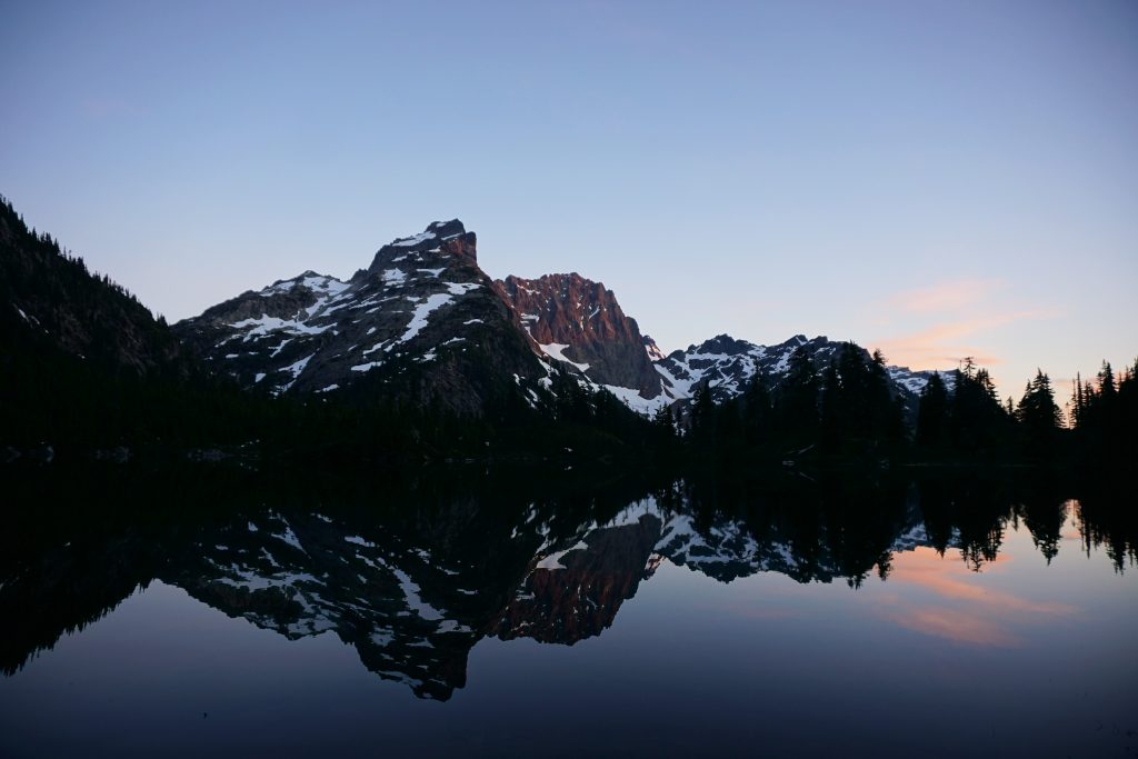
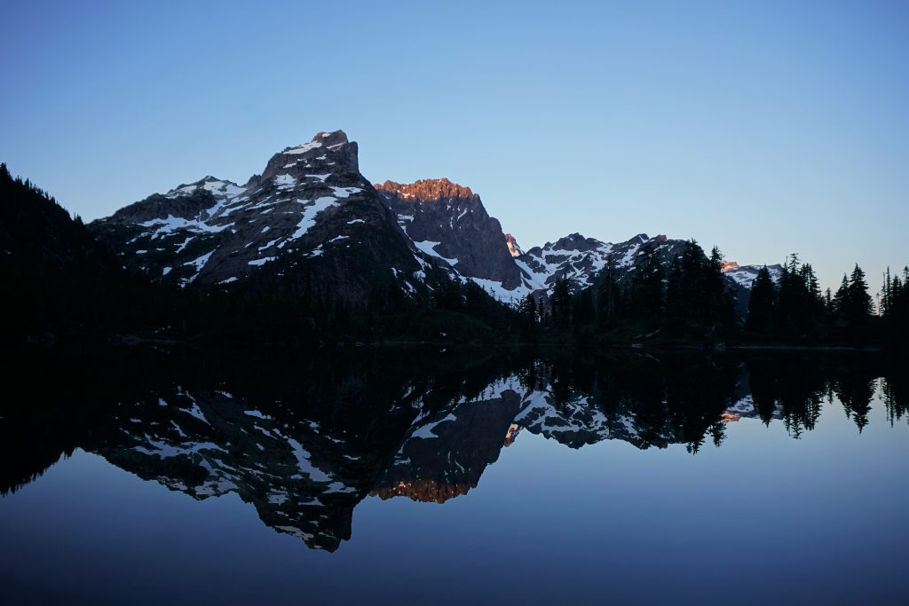
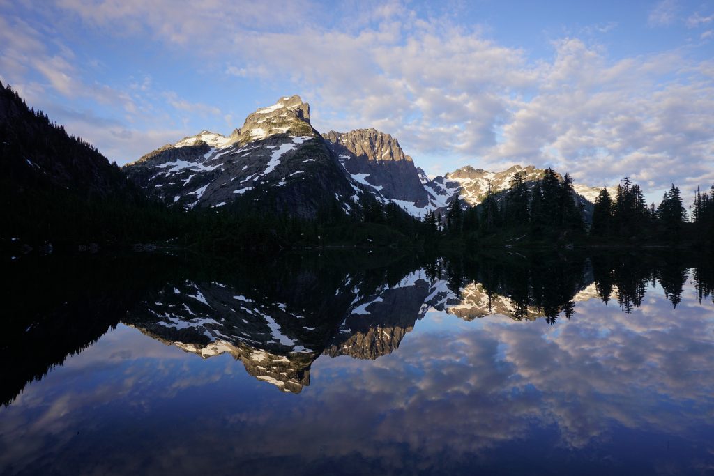
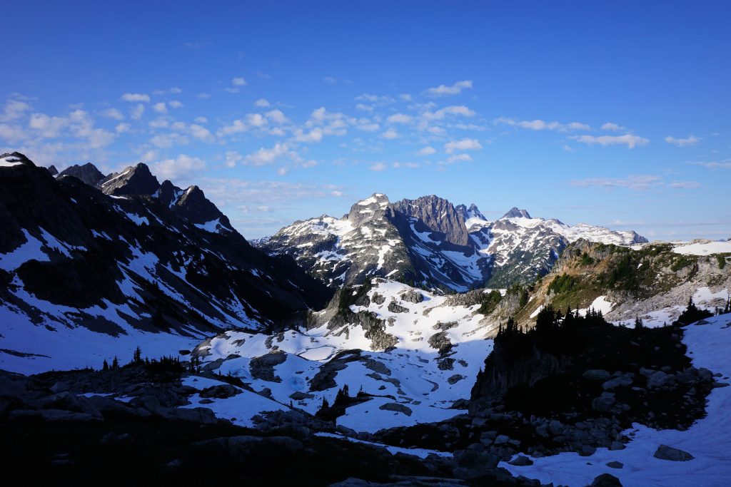
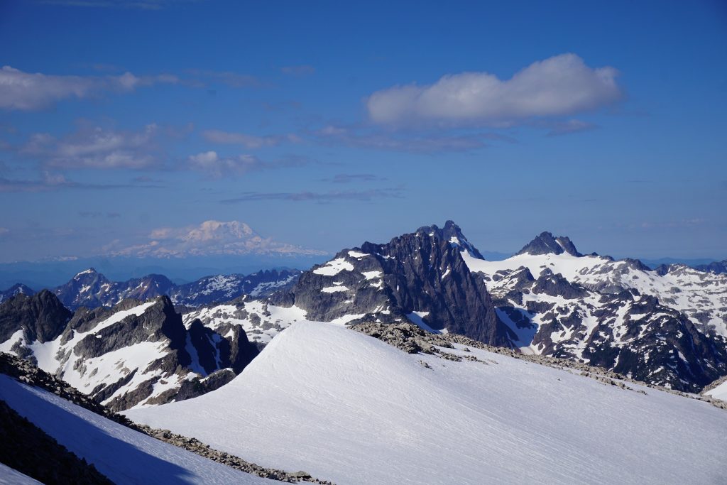
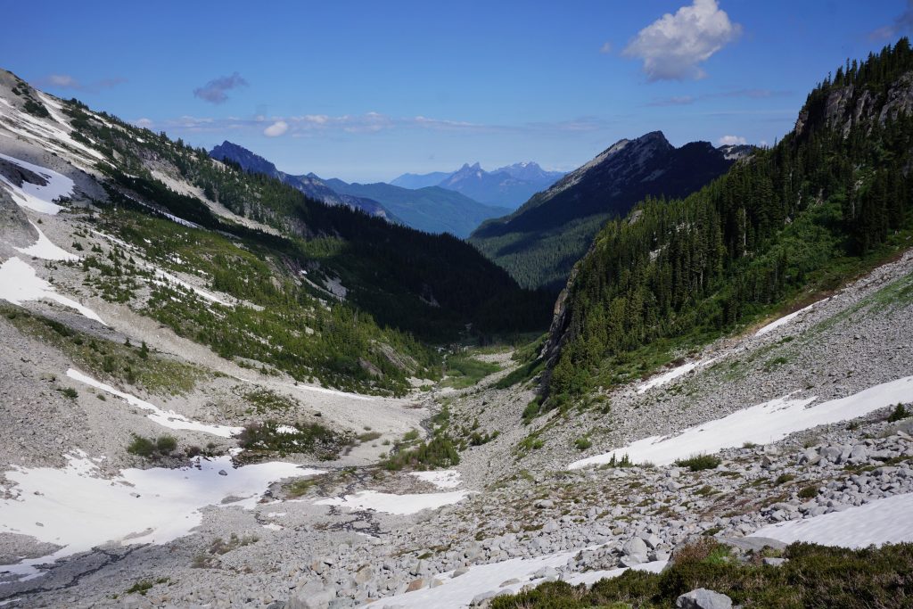
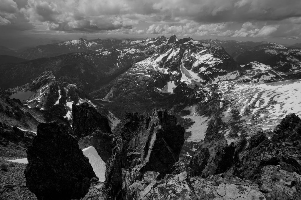
Iceberg Lake is a terminal moraine lake set in this wild, vertical cirque beneath Burntboot, Overcoat, Chimney Rock, and the Lemahs. On three sides, nearly vertical rock walls rise thousands of feet and on the outlet side, a massive waterfall drops straight down from the lake! We sat on some rocks above the lake, admiring the icebergs in the partially frozen lake and the huge vertical relief all around us. We were just a few hours from the PCT, but it already felt like a different world.
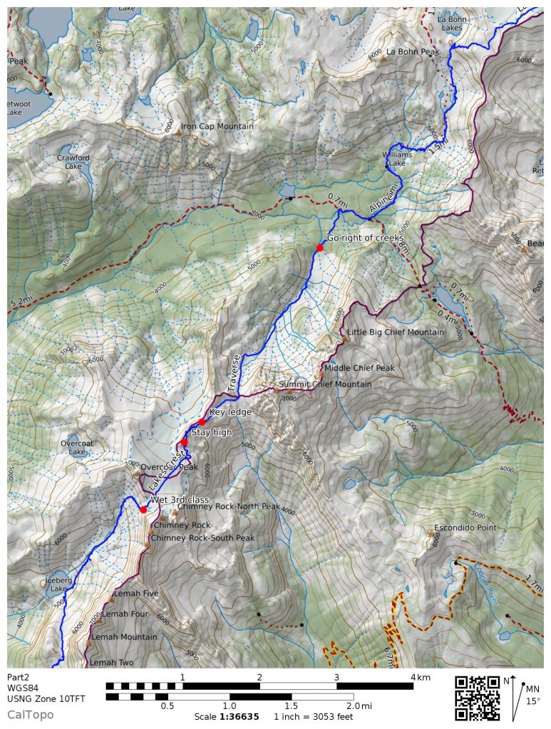
Part 2: Iceberg Lake to La Bohn Gap
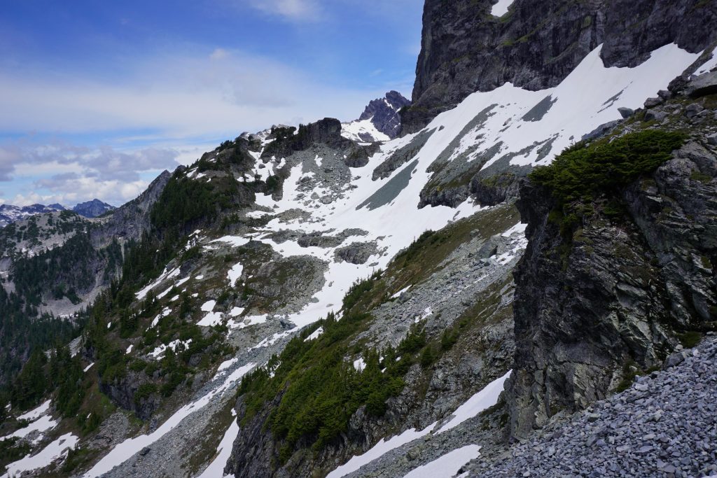
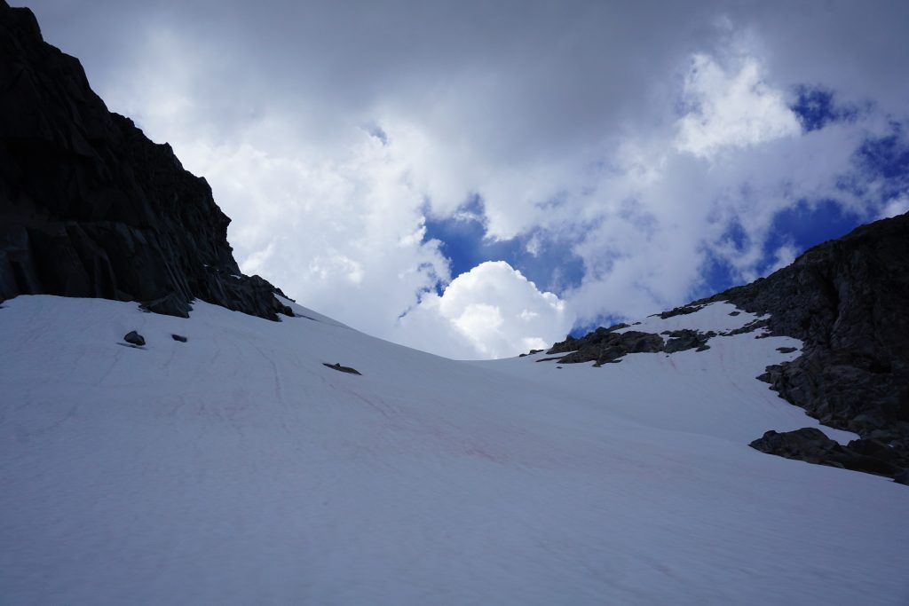
The next climb was a 2000 ft grinder in a south facing oven. Of all sections of our proposed route, reaching the Overcoat Glacier from Iceberg Lake was the only section where I could not find a single trip report. From scouting satellite imagery, it looked like there could be some slabby rock near the top of the climb. Hopefully it would go.
We started up steep snowfields that were nice and soft in the heat of the day. There was one massive house sized boulder that made for a nice photo spot.
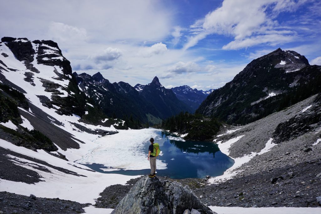
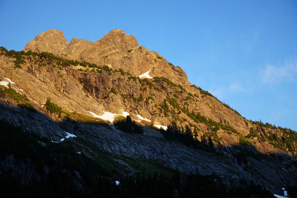
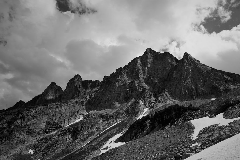
To the east, the Lemahs towered thousands of feet above, the wet, garbage rock shining in the afternoon sun. Huge waterfalls poured down from cliffs. I am not sure I have ever seen such a massive and terrible (for climbing) face.
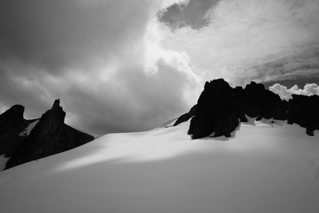
A little higher, we crested another terminal moraine and entered a higher valley. This was a completely alpine setting. Overcoat Peak and Chimney Rock loomed above. We decided to call this defunct glacier the Underpants Glacier, since it sits beneath Overcoat Peak!
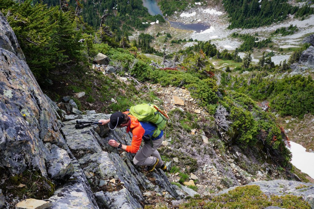
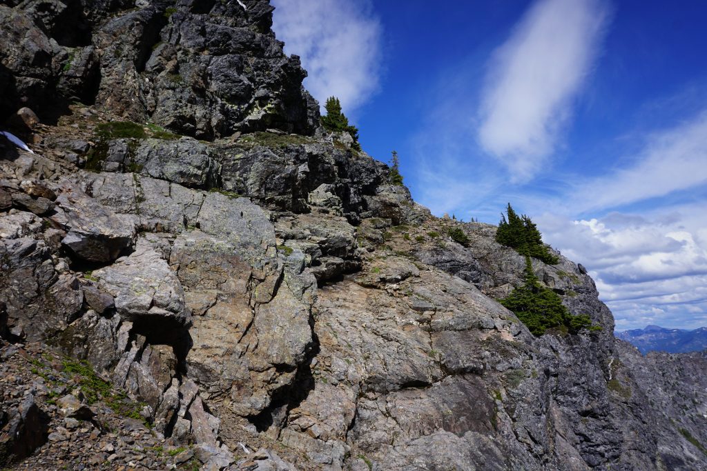
We hiked up and left and then back up and right on steep snow to get around a slabby cliff band. Near the top, we had to find our way through some rock bands. It was all wet from melting snowfields above, but we kept moving right and were able to find some terrain that was never too wet and 3rd class at the same time, usually just one or the other.
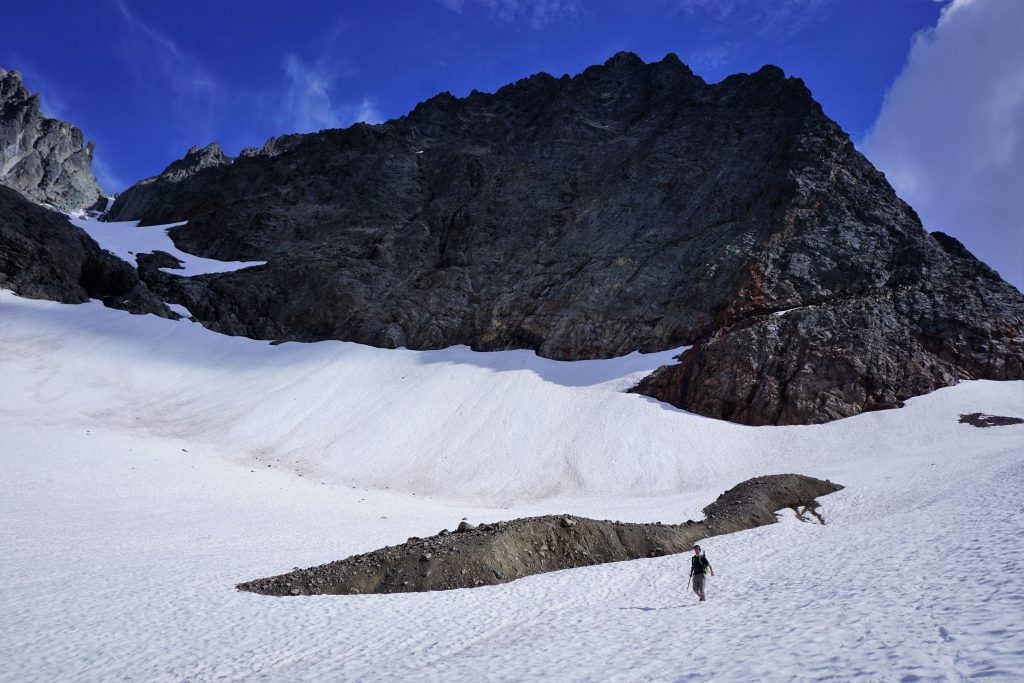
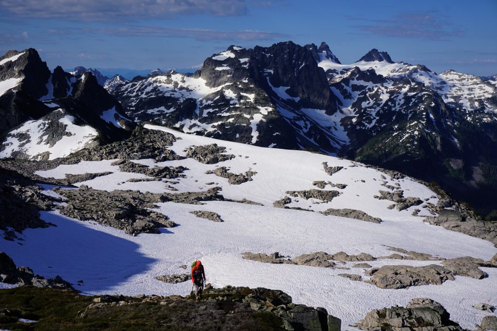
The wet slabs were slightly unpleasant, but quickly we got to the upper snowfield and topped out onto the Overcoat Glacier! I heard Logan exclaim “Woah” ahead of me and I rushed up to join him.
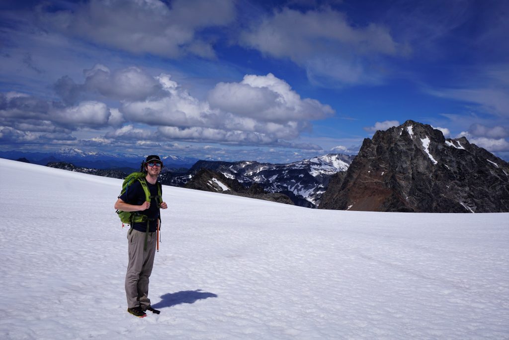
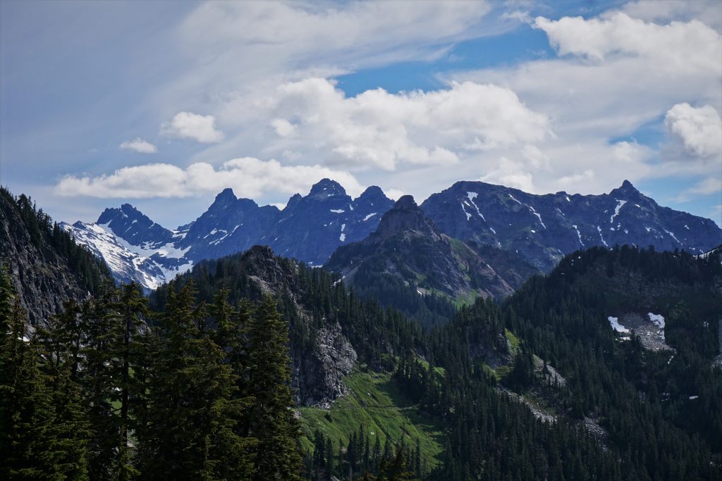
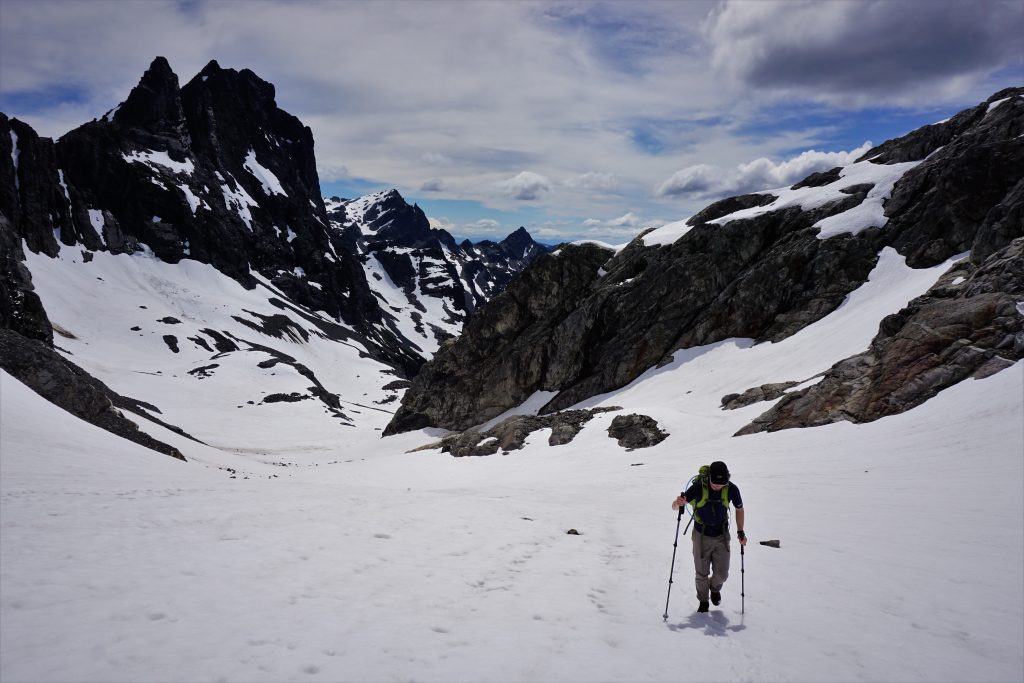
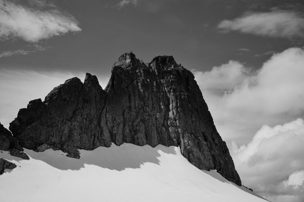
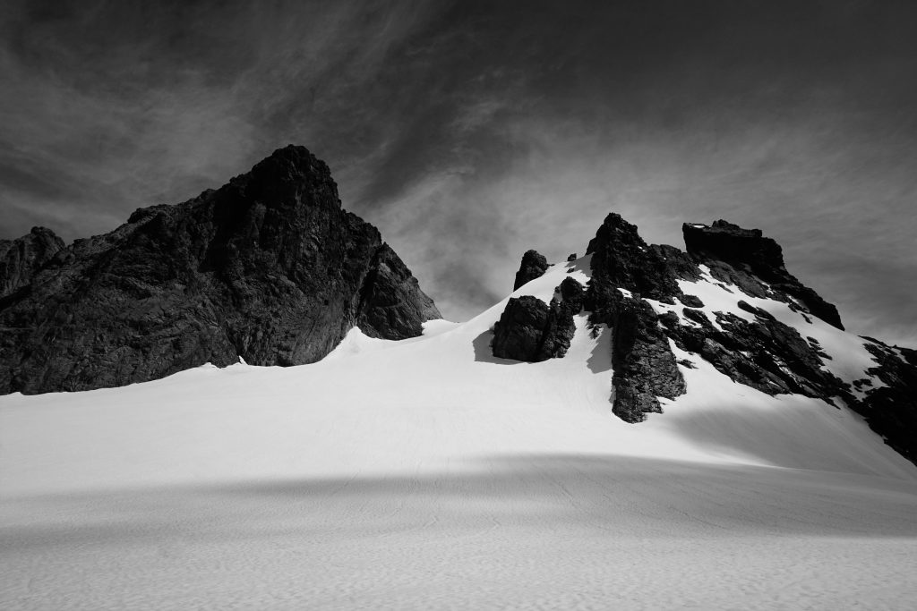
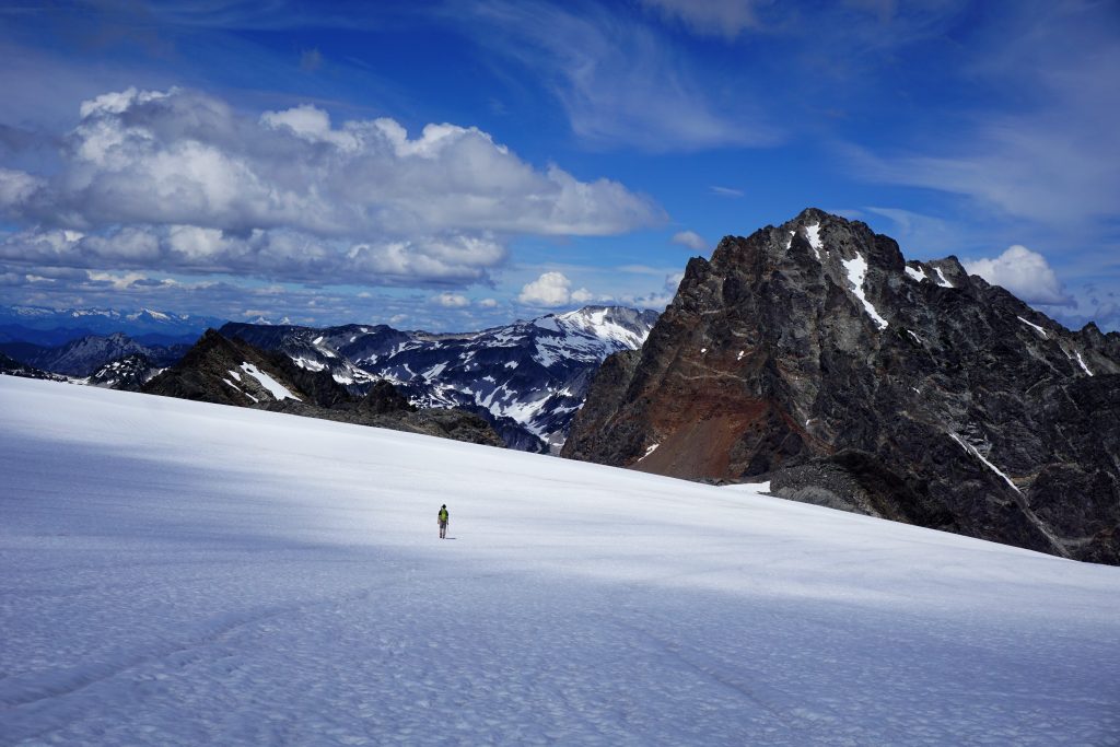
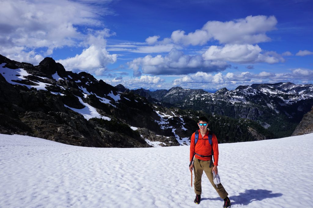
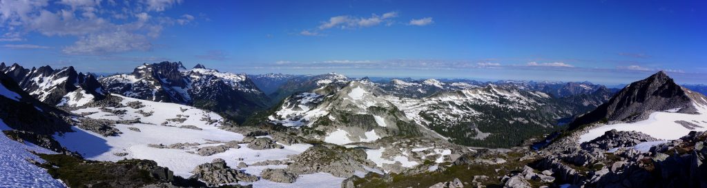
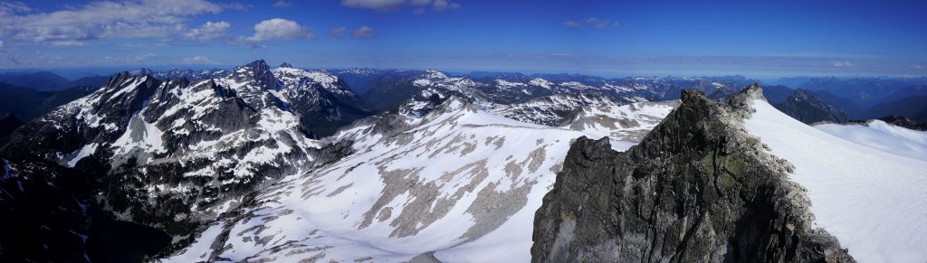
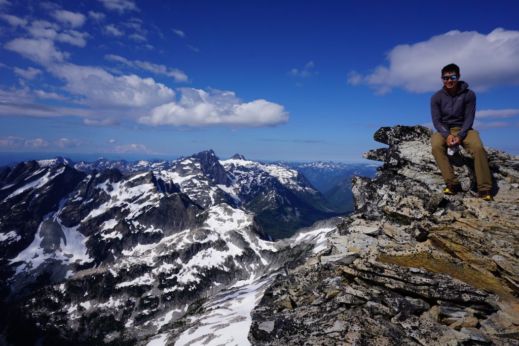
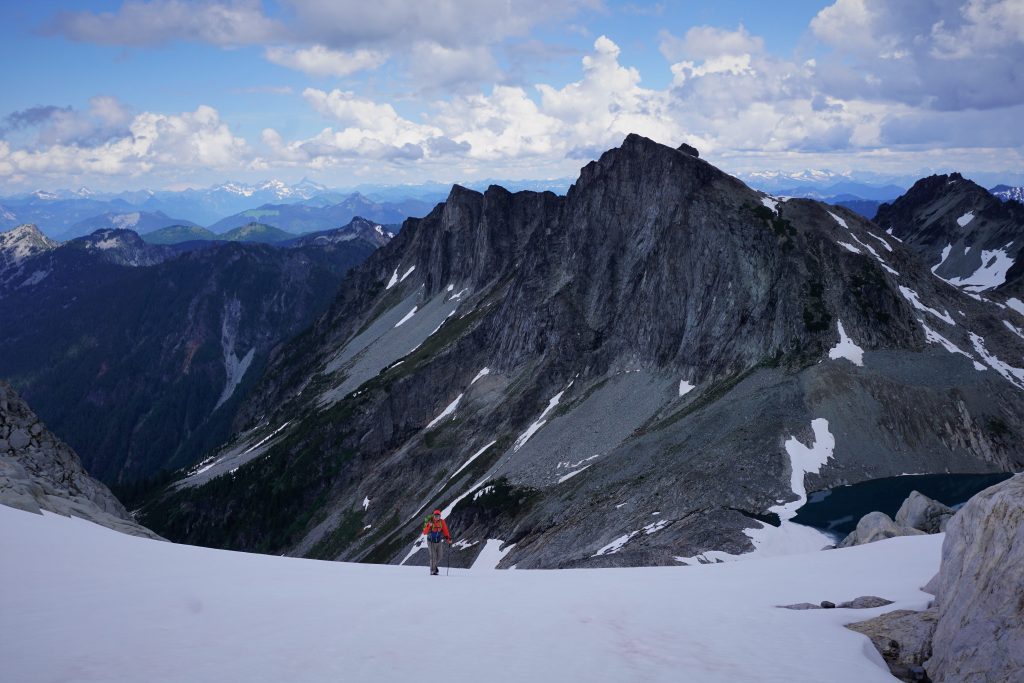
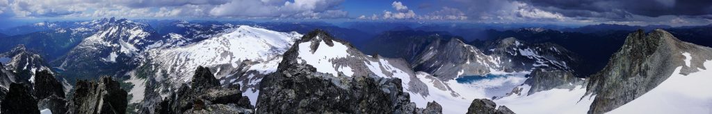
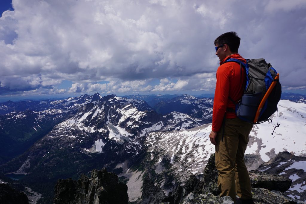
The lofty Overcoat Glacier spilled in front of us. We were standing on a glacier, yet were above nearly all the peaks we could see all the way to the Glacier Peak Wilderness to the north. It felt like we were on an island of ice, yet elevated like a peak. To our left, the summit pyramid of Overcoat Peak stood proud. To our right, the jagged peaks of Chimney Rock sliced their way out of the glacier. We were passing through the gates of the Alpine Lakes Crest. The red rock of Summit Chief beckoned to us across the way. The view was simply tremendous. Only 8 hours earlier, we were at Snoqualmie Pass and now we were standing atop a glacier! It was almost unfathomable.
We had a nice stroll across the glacier to the ridge that would lead us to Summit Chief Pass. This might have been the easiest and most scenic part of the entire high route.
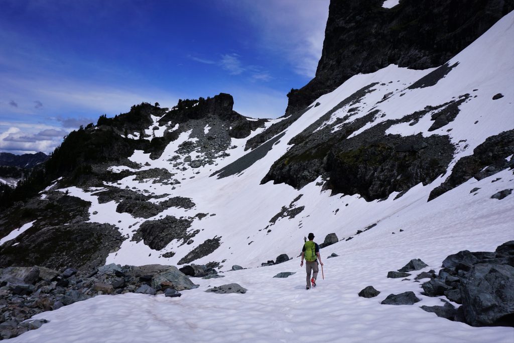
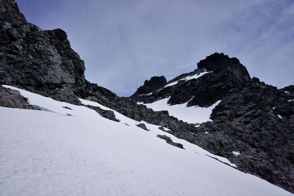
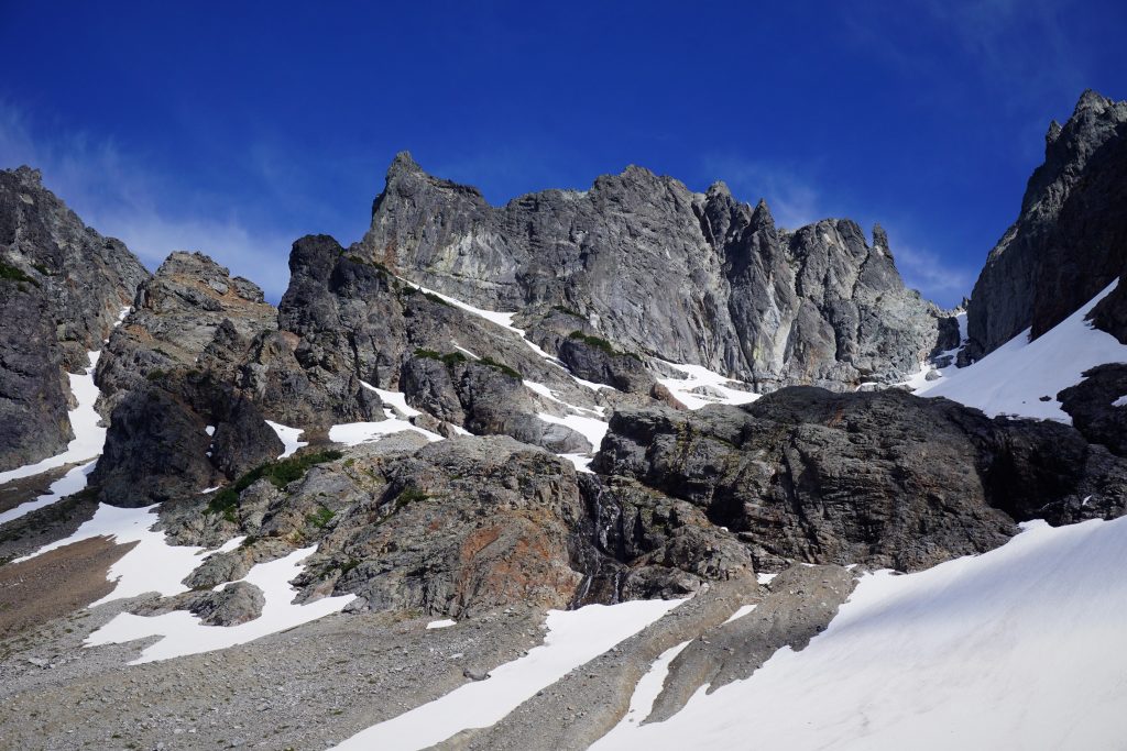
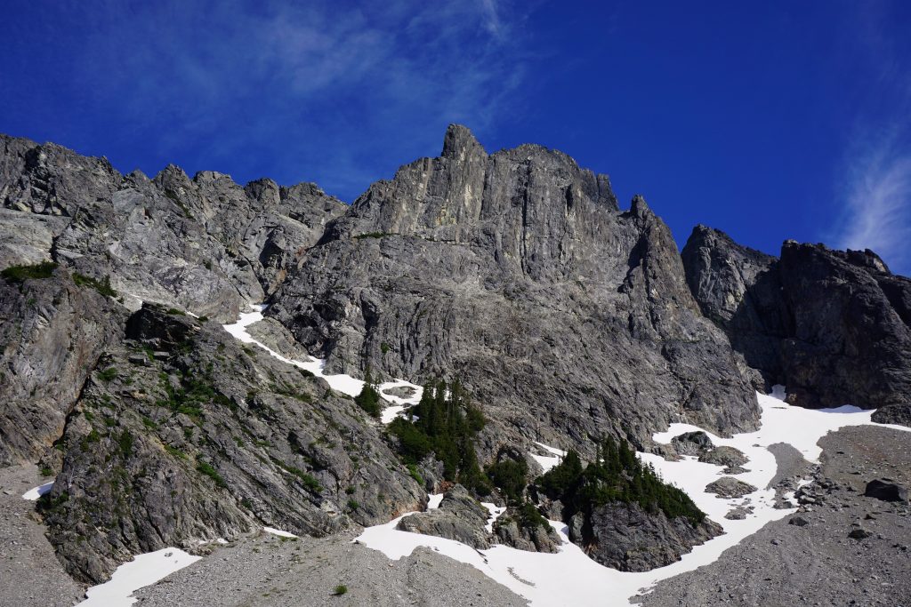
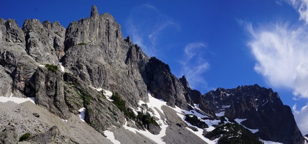
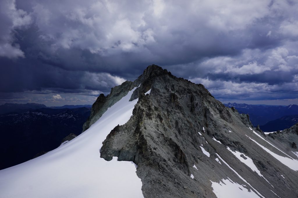
Upon reaching the ridge, we tried to get a good view of this traverse. We knew this ridge would be one of the cruxes of the route and there was some “key sloping ledge” we needed to find. We saw lots of steep snow and loose rock before a vertical cleft that split the ridge. The key ledge was obvious even from a distance, about 100 feet below the ridge top a ways away.
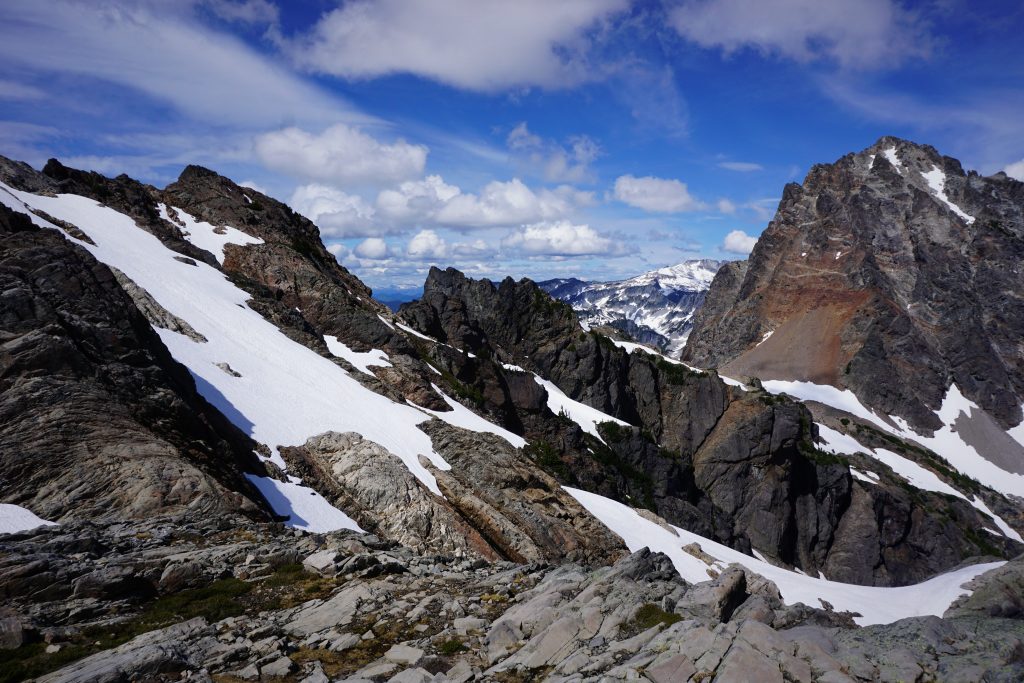
We started traversing, going up and down a lot, trying to avoid sketchy snow traverses above cliffs or garbage rock. We were not very successful at either. I think the easiest way would have been just to stay pretty high on the ridge the entire time, which is what we ended up doing.
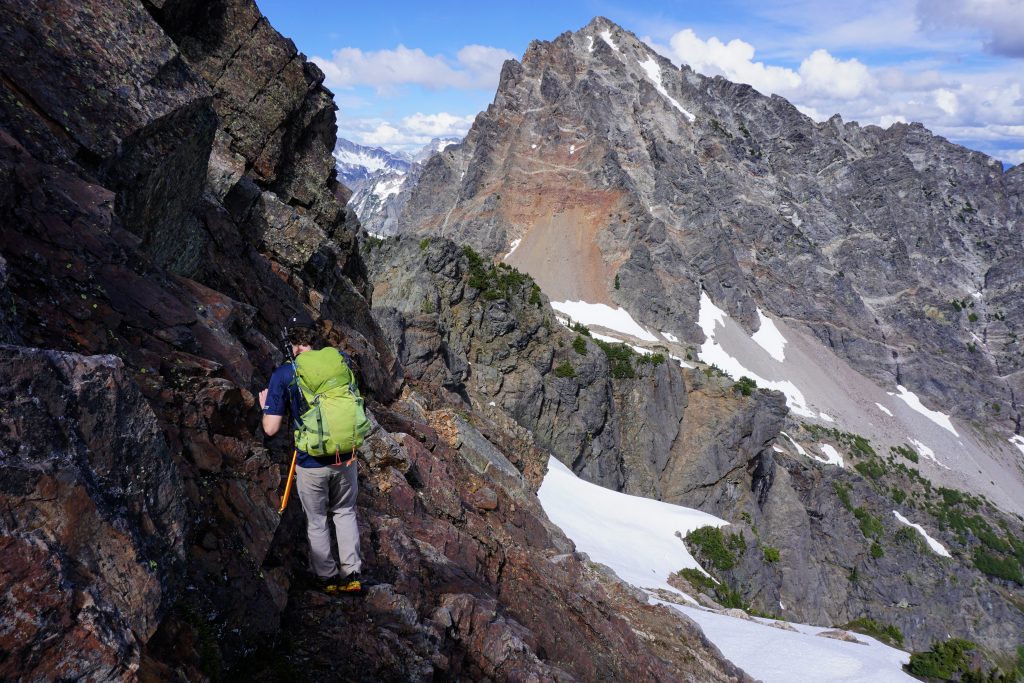
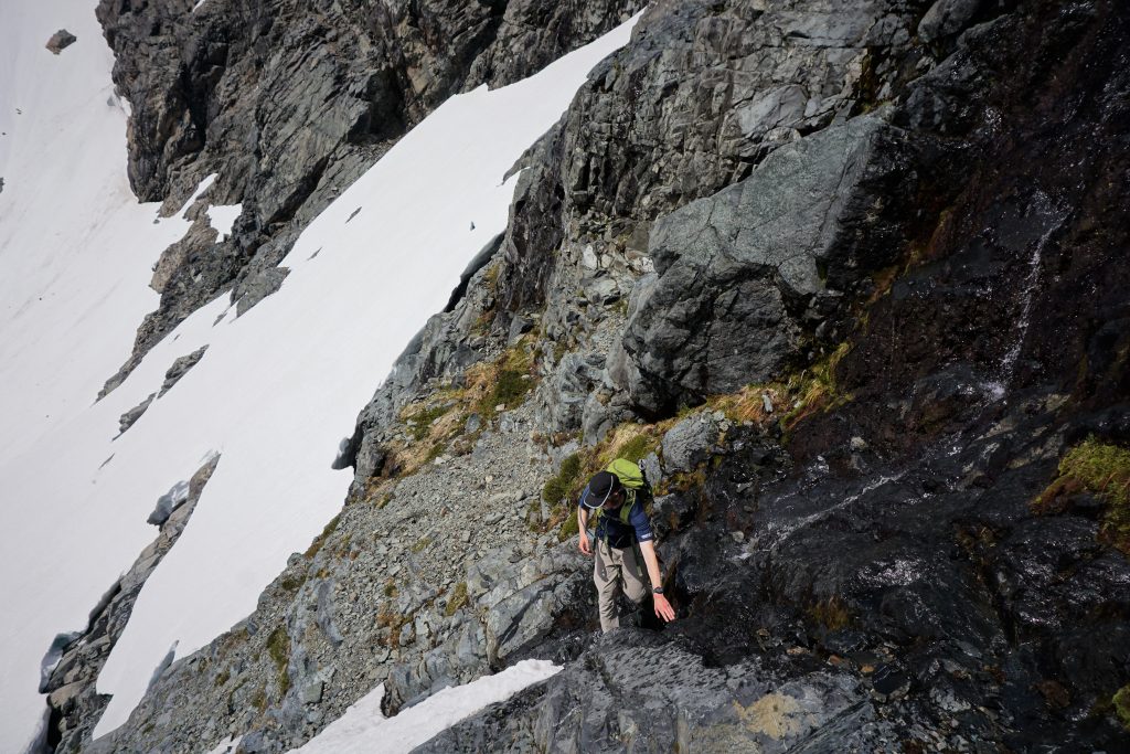
While the ledge looked terrifying from a distance, it was quite chill once we got there. I went across first, finding easy 1st and 2nd class slabs, although exposed. Logan actually tried a ledge 30 ft above, which also worked.
After crossing the ledge, we were delighted to find easy snowfields down to Summit Chief Pass! The day was going so well, we could not have scripted it better.
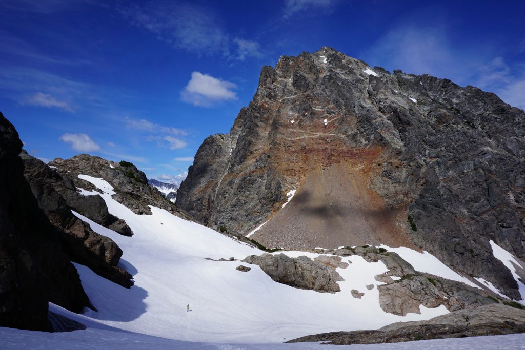
The descent down from Summit Chief Pass once again follows a defunct glacier down into a massive historical moraine. In the late afternoon sun, the north facing snow was the perfect consistency for boot skiing. We enjoyed a solid 1200 ft of skiing and jogging down into the valley of the Chief. It was one of the most blissful descents on foot I have ever had.
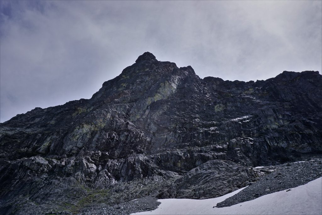
As we got lower, the immensity of the walls grew around us. Little Big Chief, Middle Chief, and Summit Chief towered thousands of feet above.
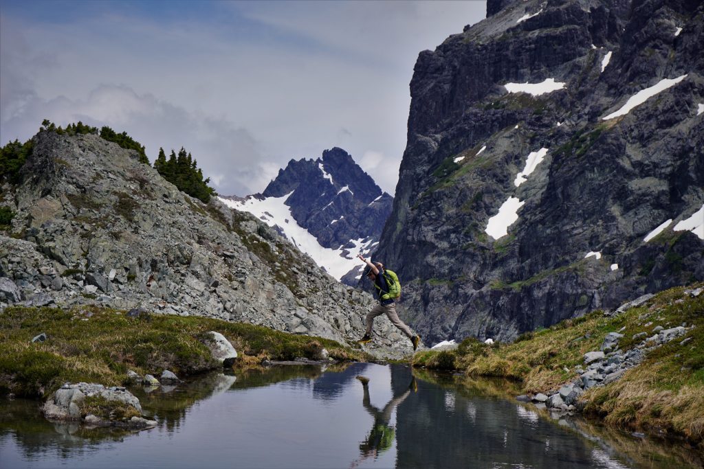
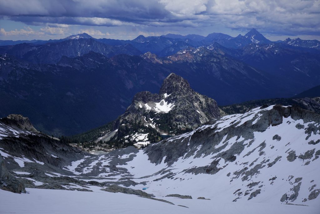
A wonderful, rushing creek led us to the bottom of the valley and a large flat gravel bar at the base of the moraine. Here, we took a break atop a large boulder and stared up at the splitter cracks on Little Big Chief (Martin Volken put up a rock route back in 2001) and the massive, Draongtail-like north face of Big Chief (Colin Haley sent a huge ice route here in 2004). Jacob and I were considering repeating Haley’s route on Summit Chief back in the spring, but decided on the Ice Cliff Glacier on Stuart instead. I had been wanting to visit this valley for so long. It was everything I dreamed of and then some: wild, remote, steep, raw. It was mind boggling to think of how places like this can exist in the Cascades, so close to I90, and still retain such a wilderness, big-mountain character.
For the first time since the Kendall Katwalk, we entered the forest and started schwacking down to the valley bottom. It is best to cross all the outlet streams by trending right before the hanging valley ends and the forest steepens.
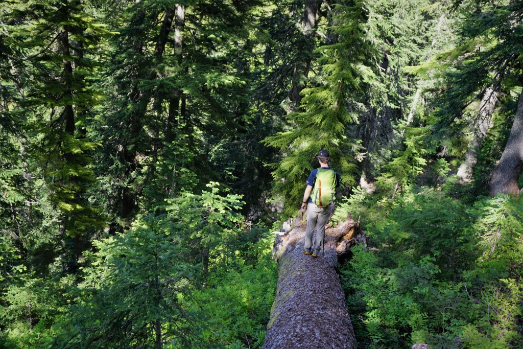
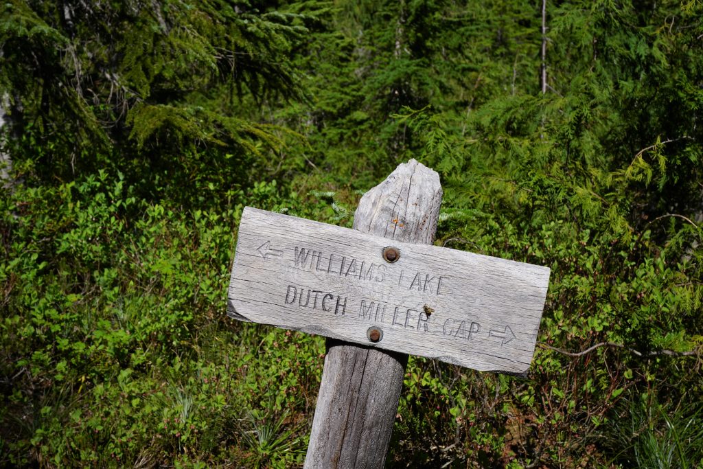
The schwacking was not too bad by Cascade standards and it only took us 15-20 min before we plopped out on the Dutch Miller Gap Trail. We followed it uphill for a few minutes before branching off to the abandoned Williams Lake trail.
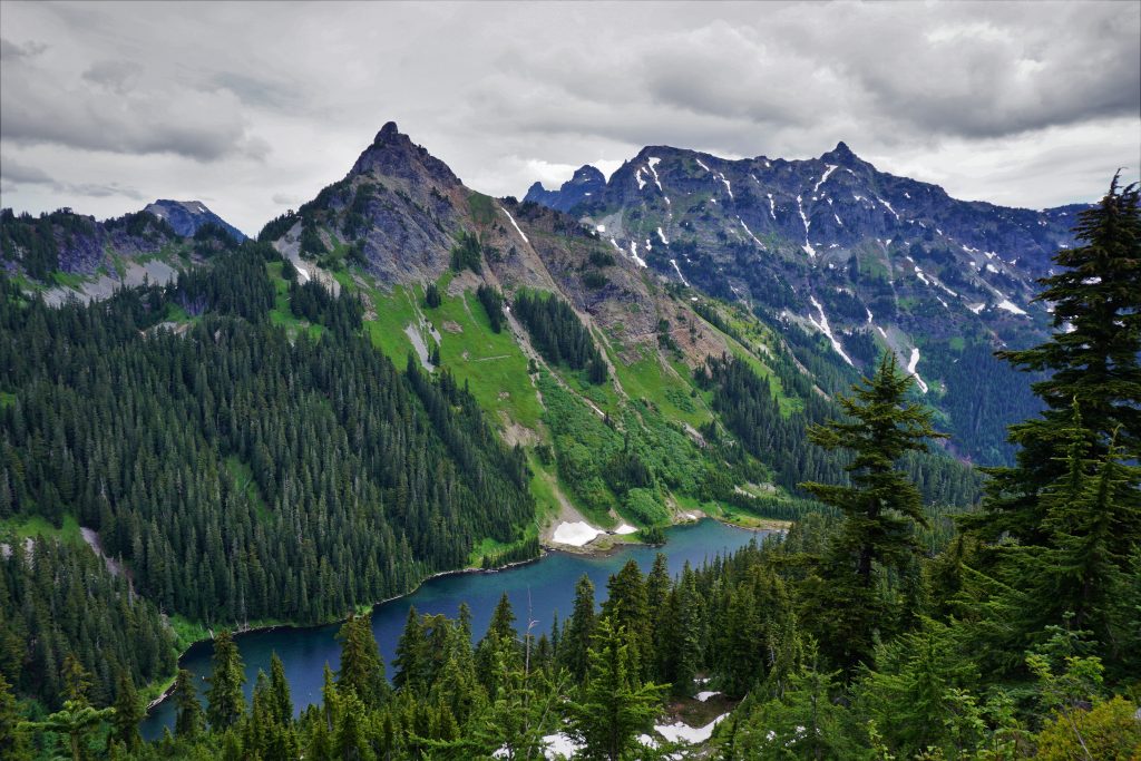
Knowing we had the day in the bag, we dropped the pace and enjoyed an easy hike to Williams Lake, arriving around 6 pm. Not in our wildest dreams did we expect to reach Williams Lake before dinner time, or even before dark. We had covered 21 miles and 8,000 ft of gain, largely off trail, in only 11 hours! So we slowly circled the lake and followed the trail as it petered out on the far side of the lake.
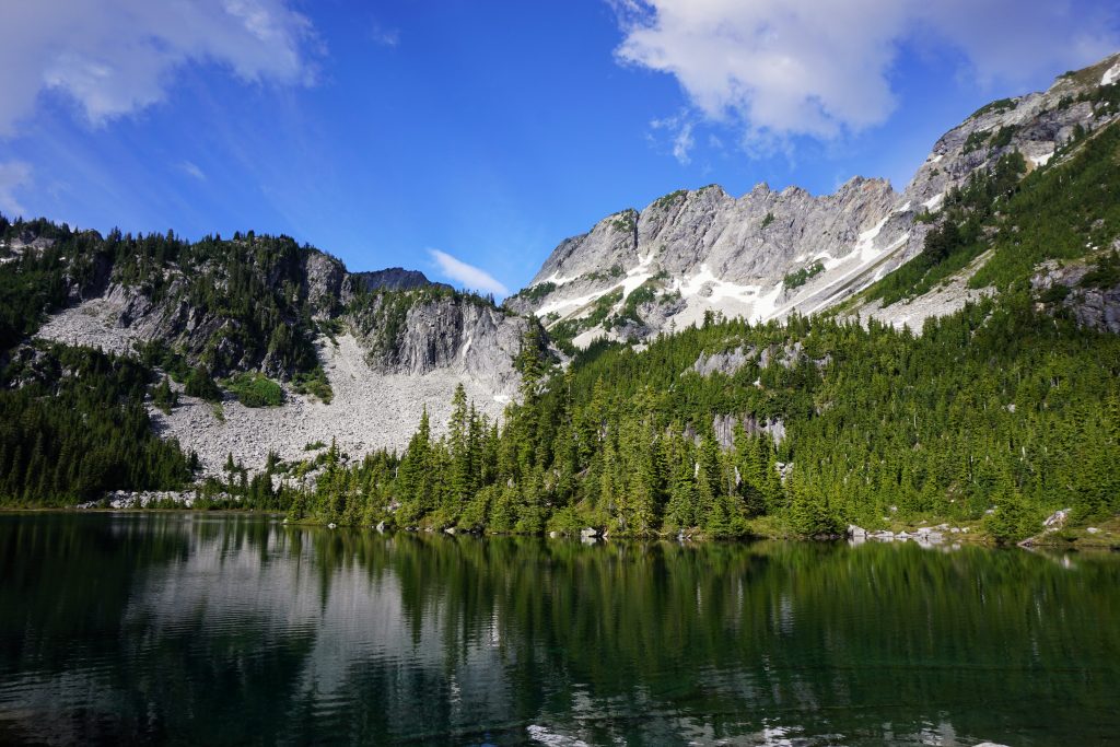
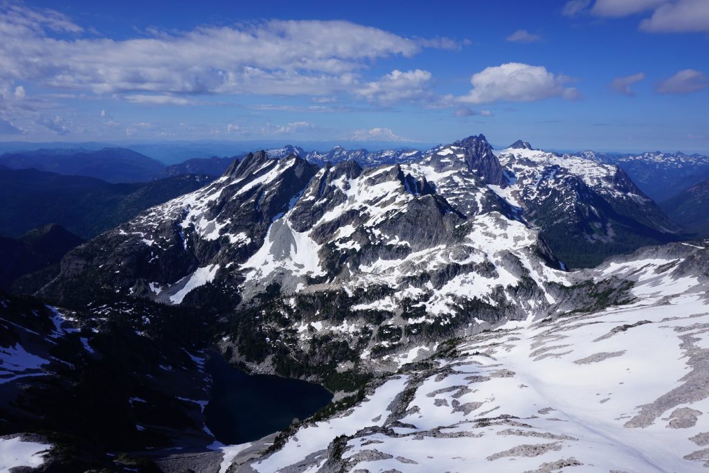
When planning this trip, I did not even look at a photo of Williams Lake. I just picked it because it was low elevation and would have snow free campsites. But the view to the south, looking up at Little and Big Chief, was truly mesmerizing. From meadows to forest to huge rock faces, we had found yet another gem in the Alpine Lakes Wilderness. The scene was so powerful, so utterly Cascadian. Sometimes, the most special moments come when we least expect them. When we dare to stray from the conformity of social media and the internet. When we seek real adventure and go our own way.
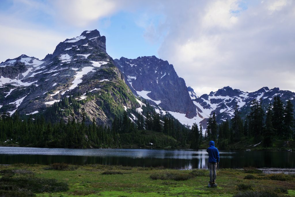
Logan and I enjoyed a relaxing evening on the lakeshore while trying to ignore the hundreds of mosquitoes swarming us at any given moment. We pitched the tent facing the lake so we could watch the evening light through the tent door.
Slowly, the shadows crept across the lake and then up the vertical walls of the Chief. And when no more light remained, we said goodnight to the Chief and closed our eyes.
The next morning was cold and damp, probably just below freezing. We managed in our ultralight quilts, but it definitely was chilly getting out of the tent. But the reward was to capture a perfect morning on the mighty Chieftains.
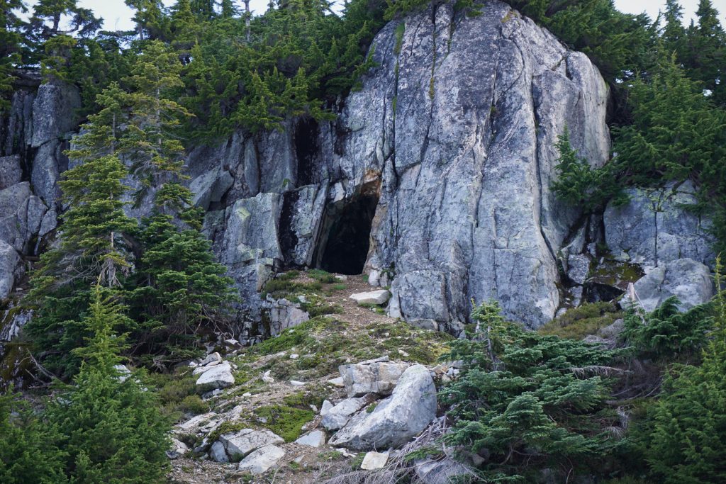
We knew that we were through the toughest parts of the trip, so we took our time eating breakfast and packing up, getting on the move around 6:15 am. We followed faint remnants of the trail up to a mine opening at the bottom of the nearby cliffs.
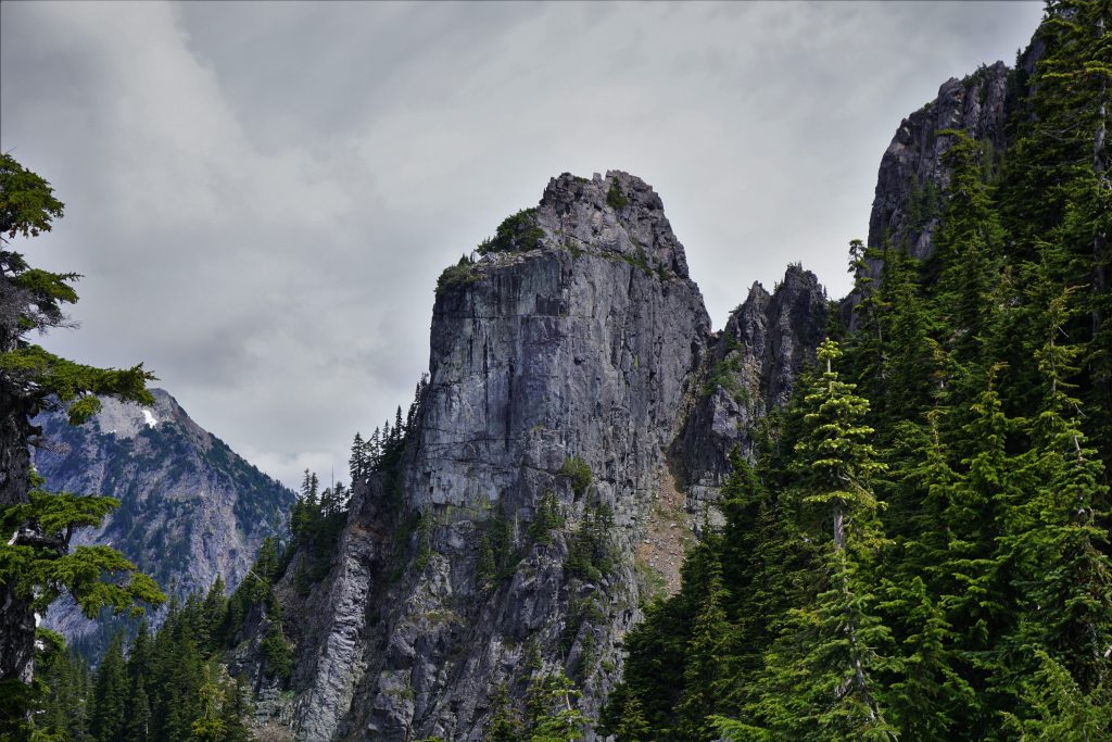
The “trail” was actually pretty easy to follow climbing up through the steep forest. Even though we were moving slowly, the steepness allowed us to quickly put “vert in the bag”, as Logan (a.k.a. Dr. Vertbag) likes to say. Just as it got a little schwacky, we popped out of the trees onto some boulder fields. We turned left, following cairns up into the Chain Lakes Basin.
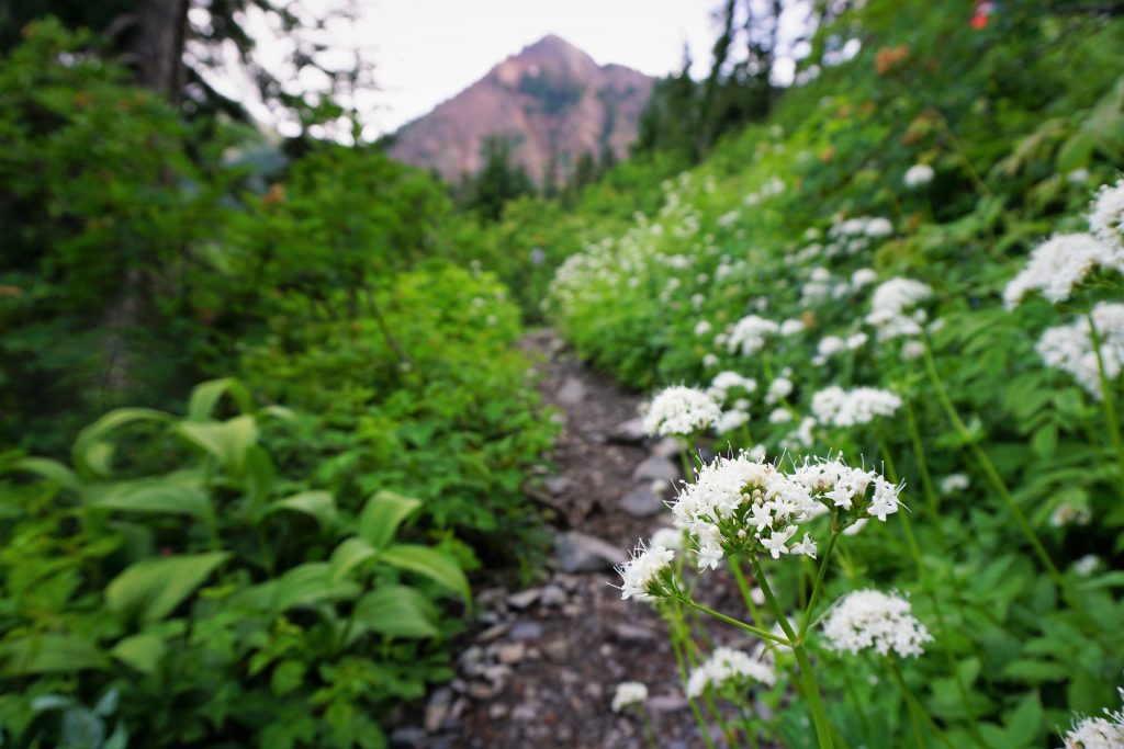
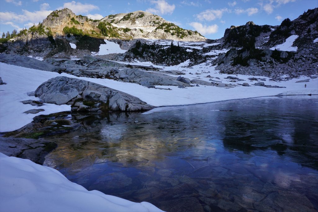
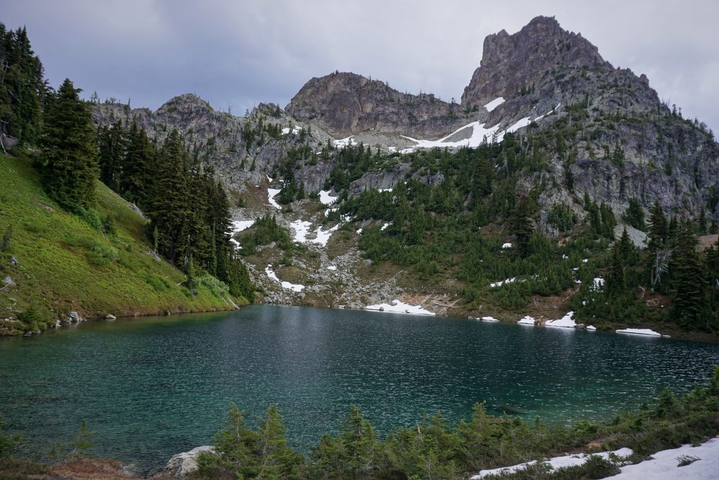
The Chain Lakes are a beautiful tight little grouping of granite bathtub lakes. Many of the ponds are just feet above the others, with sparkling streams tumbling downhill step by step. It reminded us so much of the Enchantments Core Zone, except that there were no crowds, permits, or larch madness. In the morning shadows, it felt incredibly peaceful and meditative.
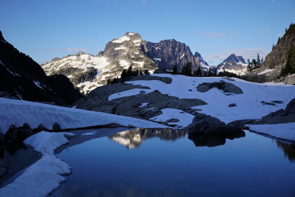
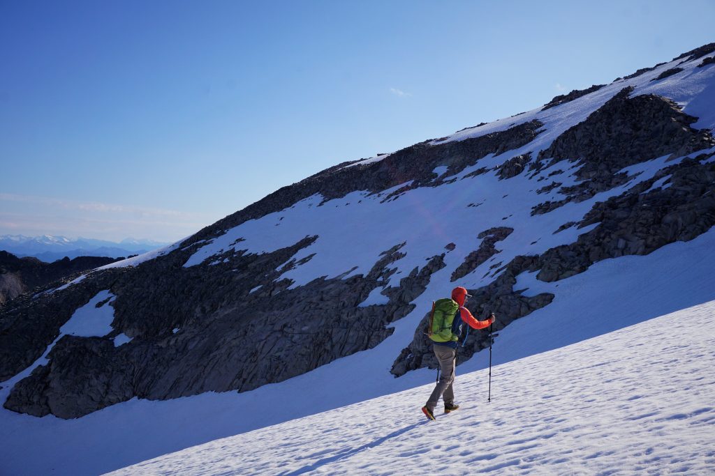
An easy snowfield led us up to La Bohn Gap, and our first view down to the Skykomish Valley.
We were now on familiar terrain, as Logan and I did Mt. Hinman four years earlier. Back then, it was his longest day out and we were all worn out by the end. But we are very different climbers now: so much more efficient, experienced, and with lighter gear. It’s amazing what a few years in the Cascades can do to you.
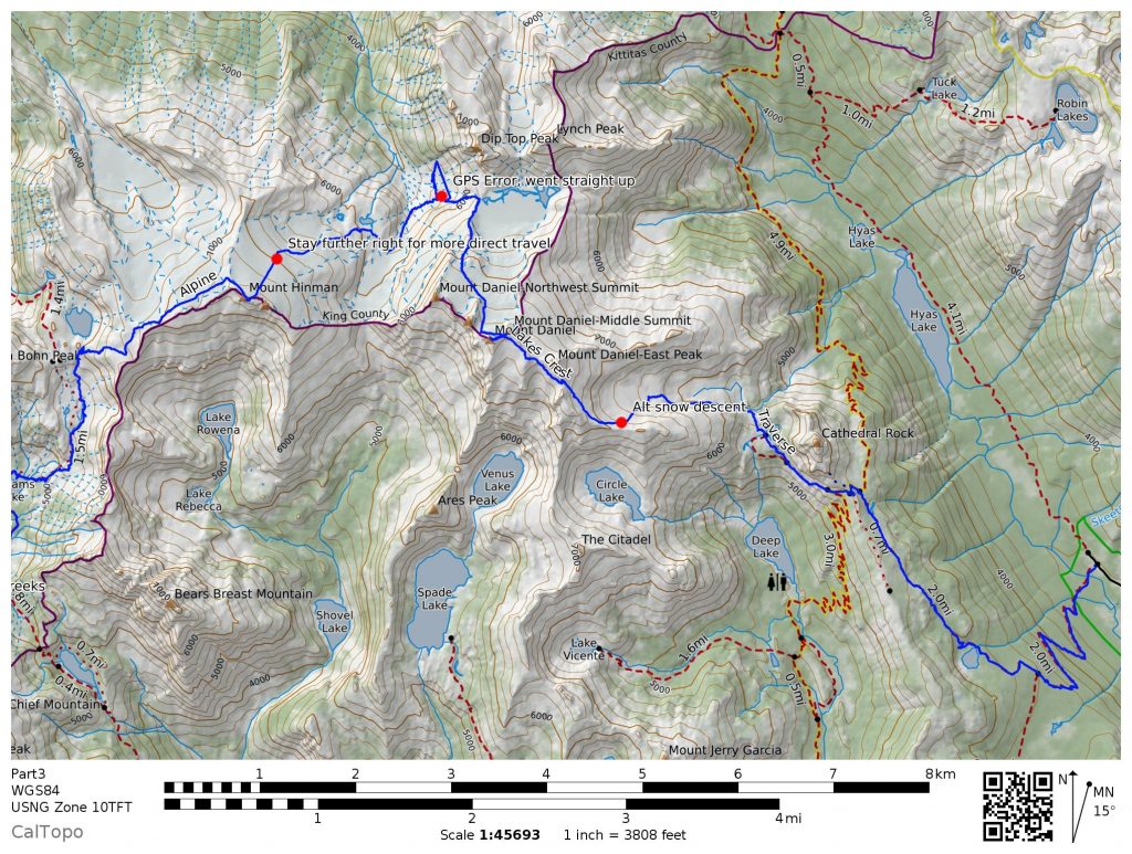
Part 3: La Bohn Gap to Cathedral Pass Trailhead
We felt deja vu as we ascended the switchback rock ramps up to the shoulder of Hinman. Hinman is a relatively popular climb so there were cairns and climber’s trails where there was no snow. We meandered up the shoulder, slowly gaining elevation and views. It was a perfect morning.
Higher up, we crossed over a ridge and began traversing on the upper part of the Hinman Glacier. For the first time all trip, we put on crampons for some extra security, even though it was low angle.
This section of the traverse feels incredibly aloof and prominent. The Hinman Glacier is very long and wide, all funneling down to a beautiful glacial recession lake lined by steep canyon walls. The low angle slopes would be a powder dream to ski. We could understand why Hinman was once considered along with Silver Star and some other locations for a high elevation ski resort (they chose Whistler instead).
We crossed a rock rib and onto another large glacier on the northeast side of Hinman, although this one is not named on the USGS maps. From here we were able to just traverse the top of the glacier before reaching the highest little bump on the rock ridge, which is the summit of Hinman. There was even a bivy spot just below the summit!
It was reassuring to know that we had half of our vert done for the day already at 9 am, but we also knew that climbing Hinman would be the easiest part of the entire traverse!
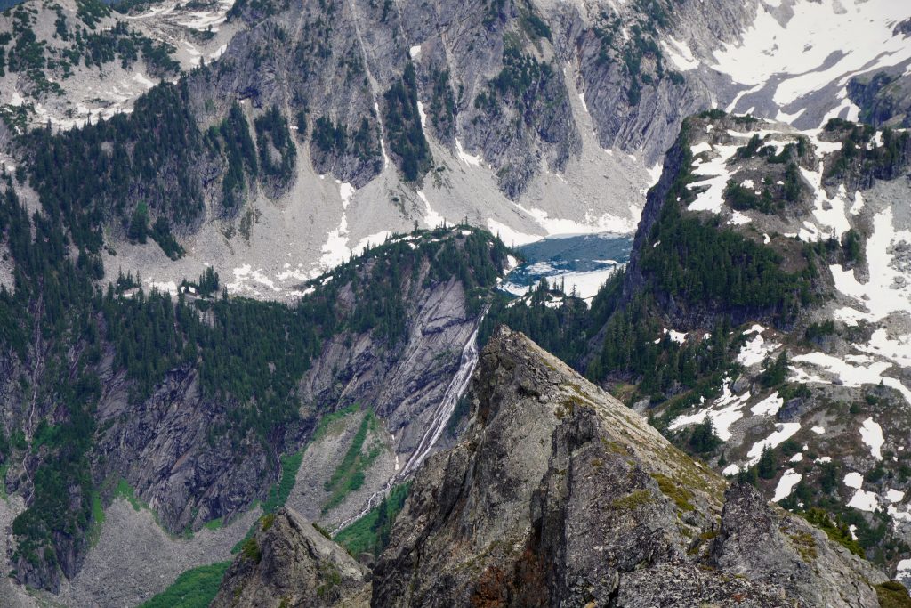
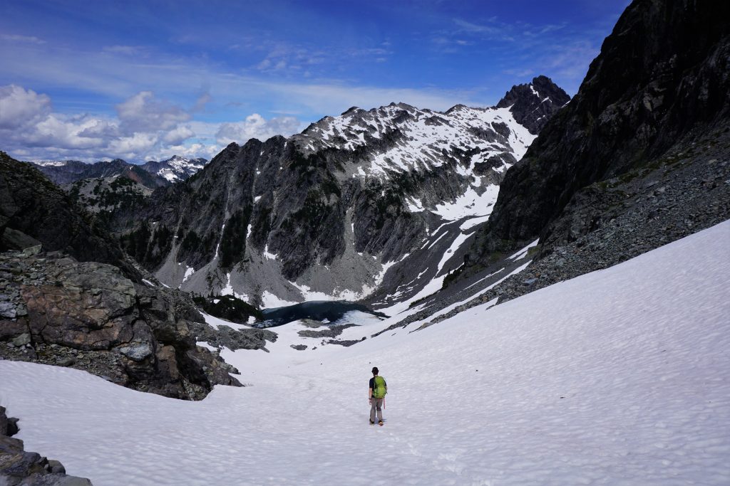
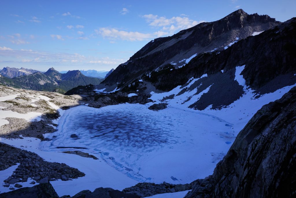
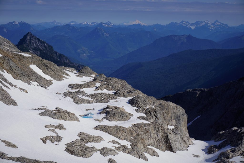
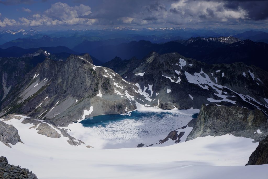
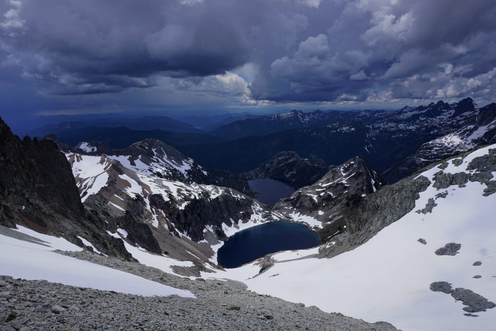
Next, we enjoyed a very pleasant trot down the glacier towards the Hinman Tarns and Hinman Bench. We angled a little too far left and almost got cliffed out by the headwall above the tarns and had to traverse back right more. In general, head more towards Pea Soup Lake.
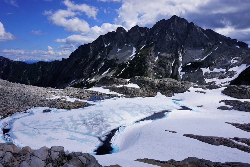
The Hinman Bench and Tarns is truly a raw landscape that has been scarred by glaciation. There are endless slabs and boulders and beautiful deep blue tarns set on the precipice of terrain rollovers. The mighty northwest face of Daniel threatens to fall apart at any moment. This was a spot I have wanted to visit for a long time, and its power did not disappoint me.
From the tarns, we cut back right on easy snowfields down into the deep glacial slot between Hinman and Daniel. This spectacular descent just kept going.
Down in the slot, which is a pretty recent moraine, there were huge boulders strewn across the snow. The steep cliffs above on Mt. Daniel frequently launch projectiles down and some of the skid marks in the snow were fresh. This was not a place to hang out!
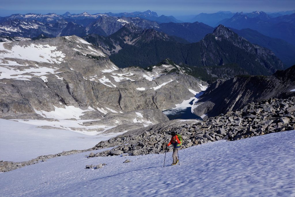
Around 5300 ft, we began traversing right towards the waterfall slabs coming down from Pea Soup Lake. We climbed a mixture of snow and moraine before gaining the wonderful slabs just to the right the waterfalls. This was fast, pleasant 2nd class scrambling in a truly sublime setting.
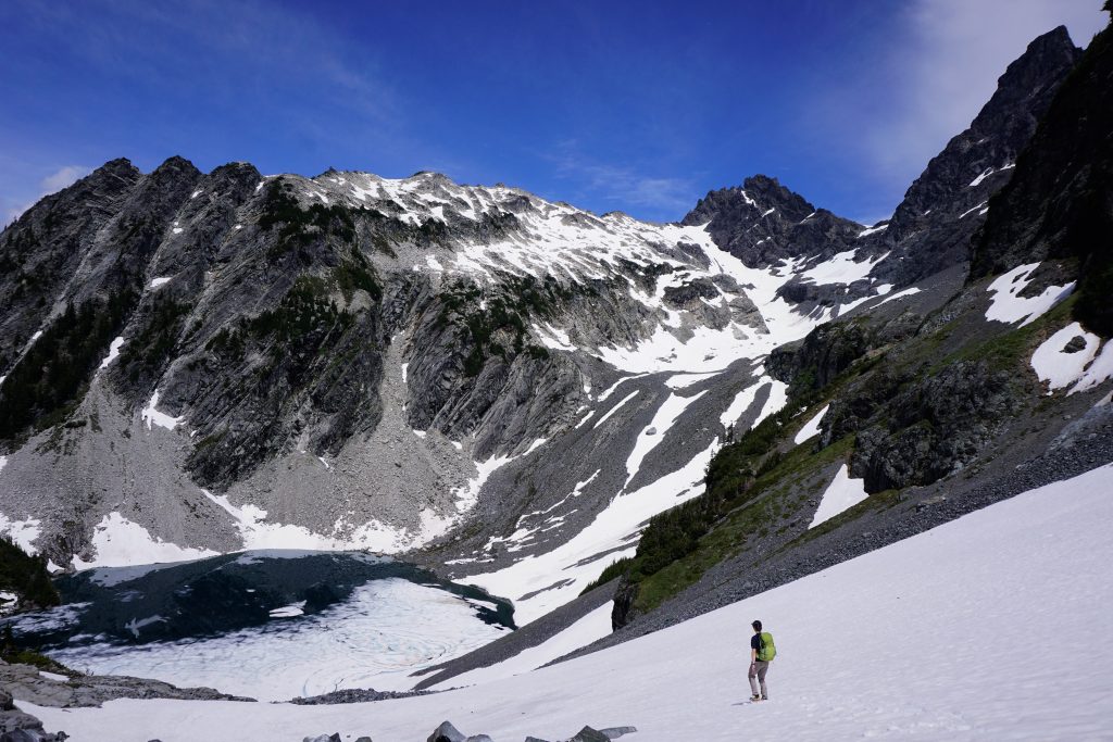
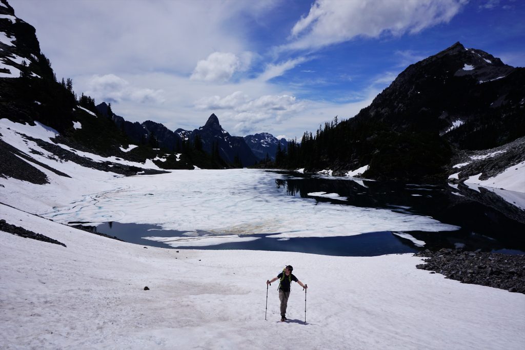
Storm clouds were definitely building as we plopped out on the shore of Pea Soup Lake. We debated bailing out to Jade and Marmot Lake, but felt that there was adequate time for us to get up and over Daniel before the real thunder began.
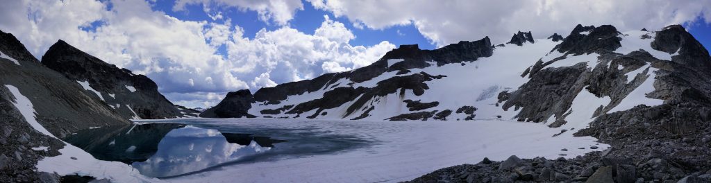
One of the biggest puzzles of this route was how to get over the north side of Daniel from Pea Soup Lake. I wanted to summit Daniel from the north to end the traverse, but the only standard north side route is the Lynch Glacier, which becomes heavily crevassed in the lower icefall and is difficult to access once the lake melts. I poured over trip reports and the Beckey Guide but found no alternatives. However, when looking at a late season photo of Daniel from Dip Top Gap, it struck me: there was a snow finger on the right that leads to the upper glacier, which can be crossed even in late season! Beta unlocked!
We started hiking up the easy ridge, passing a few nice bivy spots. The boulders and slabs were very easy, practically “vert on sale”!
The shadows moved swiftly across Pea Soup Lake and we knew it was only a matter of time before we got wet. At the base of the snow finger, we put on crampons and started up the 35 degree snow. Big rain drops started to plop down, but not in high quantity at least.
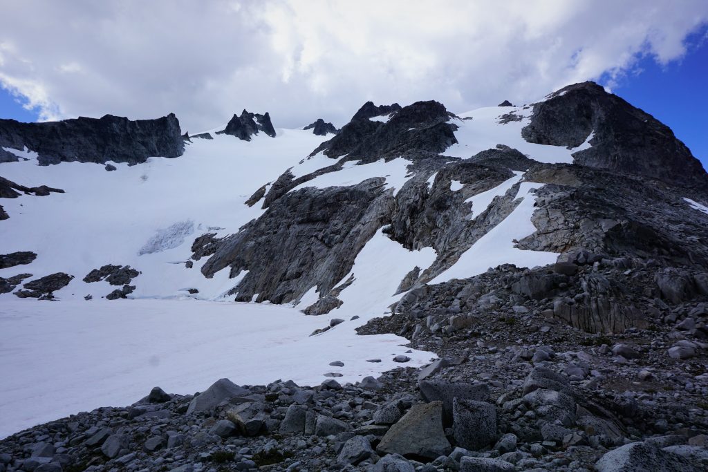
At the top of the finger, we crossed onto the upper Lynch. The whole massif was now engulfed in dark storm clouds, but still no thunder. We could see some yawning cracks lower on the glacier, but none up where we were. We tried to stay close to the rock buttresses, where we felt there probably fewer crevasses.
During our crossing of the Lynch, it started raining hard, stopped, blinded us with sunlight, and repeated this cycle a few times over. This was one of our favorite parts of the entire route, ascending such a large, mellow glacier with the massive Pea Soup Lake behind us. The entire Daniel Massif felt even larger than we had expected, but I guess that was just a theme of these peaks on the Alpine Lakes Crest.
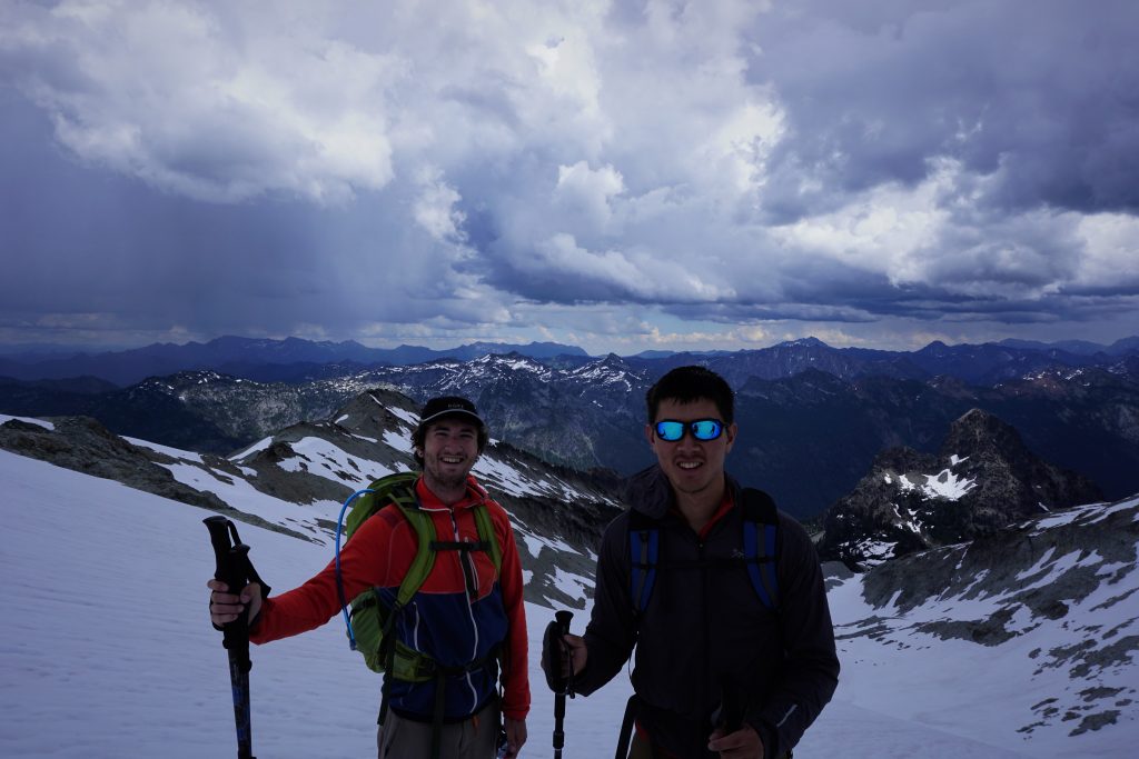
Right as we crested the snow saddle, the sun came out! We were only about 100 ft below the true summit, but we were initially unsure which one was the actual summit! A boot pack led us up the correct block, an easy 2nd class scramble.
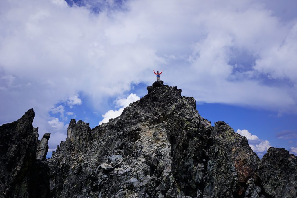
From the summit, we could gaze out at the entire Alpine Lakes Wilderness and the journey we had just finished. We had traversed the mighty peaks between Snoqualmie and Stevens Pass in a line so pure, continuous, and alpine that it almost seemed impossible this was not a classic route, like the Ptarmigan. It was only fitting to end the trip with the highest peak in a small patch of sun, like the clouds had parted just for our arrival. It felt like a metaphor for the entire trip, where the terrain constantly allowed us passage, where one change could have blocked the entire route.
As we began the descent, we heard the first rumblings of thunder to the east! Time to get down!
We followed the bootpack and climber’s trail around a few false summits and then dropped onto snowfields above the basin that has Cathedral Rock and Peggy’s Pond. Here, for the first time in 20 miles, we met other human beings, so naturally we had to get a group picture.
We decided to descend the snow down the headwall instead of staying on the standard SE ridge. As we were getting to the base of the snow, the rain really picked up. One fast final boot ski dropped us off at the far shore of Peggy’s Pond. We were home free!
The rest of the hike out was chill and it actually stopped raining past Peggy’s Pond. I guess the huge elevated Daniel Massif was creating all the instability and bad weather. A hour or two later, in the early afternoon, we arrived back at my car at the Cathedral Pass trailhead. We never expected to be done with this trip so early, but were psyched to head out for milkshakes and burgers!
Reflections
This traverse was one of the most magical experiences I have had in the mountains. To literally draw a line on a map, a line as ambitious and questionable as this one, and then to go out and trace that line across the land with my own two feet felt so empowering. I am a creative person in all aspects of life and drawing high routes is an expression of the curiosity and creativity. While nothing about our route was that exceptional, we did not leave much room for error by attempting the whole route in just two days. When I returned from the Sierra High Route last summer, I made it a goal to bring Roper’s vision of the high route to possibly the only other range in the lower 48 that can match the Sierras in terms of vast, beautiful, rugged wilderness area. This trip is just the tip of the metaphorical iceberg in the North Cascades.
The purity, power, and steepness of the Alpine Lakes Crest blew us away beyond everything we expected. Somehow, in the era of endless beta and social media, there exist true adventures, hidden gems, and lonely lakes so close to home. We felt the quality and consistency of this terrain matched anything else we have seen in the Cascades, although it might not be as classic or objectively perfect as other North Cascades destinations. There was just this Je ne sais pas, this something about the valley of the Chief, the rooftop Iceberg Glacier, or the bowling alley moraine between Hinman and Daniel. One striking aspect was how from Chikamin to the Dutch Miller Gap Trail, we saw not a single sign of human activity: no cairns, no climber’s trails, no faint campsites. The same could not be said about other famous cross country routes like the Ptarmigan Traverse or Alpine Lakes High Route. It was just so pure.
In total, the trip was about 37 miles and 14-15k gain, with the middle 20 miles nearly continuously off trail above treeline. I truly believe we have “discovered” (or maybe just documented) something special. I hope others can enjoy this route while maintaining the wild character of this region. And most importantly, I hope others are inspired to pull out a map, draw a line, and go explore. I only dream bigger…
Notes
- Curious about what gear we used? See this post about my favorite high route gear.
- Our first day was 11 hours and second 9.5 hours, so this trip is definitely doable in less than 16 hours with a daypack, proper conditions, some trail running, and beta. However, it is also completely worthy of a 3-4 day trip with more time to appreciate the lakes and bag some more summits like Overcoat, La Bohn, and Finger of Fate.
- We wore waterproof trail runners (La Sportiva Crossover / Urangos) and they were perfect for the comfort and snow protection.
- If doing a multi day, think carefully about campsites. There are some pretty long sections where there are not many great spots other than on snow (because the terrain is so infrequently traveled and alpine).
- We think south to north is best because then you ascend the cruxiest sections and then you get to enjoy longer boot ski descents on north facing snow. Additionally, the rock quality generally improves from south to north throughout the trip, so you get the worst over early on.
- The two cruxes of the route are definitely getting up to Overcoat Col and the traverse from the Overcoat Glacier to Summit Chief Pass. Nothing is over class 3, but there is exposure, wetness, and looseness at times.
- We think this was basically the perfect time of year for this trip because the trails were snow free but there was adequate snow coverage on the boulders and moraines. This trip will work later season, but would require more annoying loose moraine travel.
- Of the four glaciers crossed, the Lynch is the most concerning. We chose not to bring glacier gear because of the extra weight, but some might not be comfortable with that risk. If you get to Pea Soup Lake and don’t like the looks of the glacier, you can always climb up and left to the saddle between Dip Top Peak and Lynch Peak, then descend the Dip Top “Glacier” (minimal crevasses) down to Jade Lake and take the trail from Marmot Lake to Deception Pass and back to the trailhead.
- We did not bring helmets, but that requires good group management in the scramble sections.
- This is an awesome route. It will surprise you (hopefully in positive ways).
Incredible post, thank you! As a less experienced hiker and backpackers this is so inspiring.
Thanks Joe, glad it is inspiring to you!
Planning on doing this on July 11th-12th. Hoping after this cold, wet June I’ll have similar conditions, but probably less snow
Hey Conor. That’s a good idea for timing. Given the current snowpack, I’d expect pretty similar conditions to when I did it last year, maybe actually slightly more snow, but that depends on how warm it gets the next few weeks. I might give it a go in a single push around the same time, so maybe we’ll see each other out there!
Jeeeez 37 in a day! My legs aren’t quite at that point anymore haha. Ill keep an eye out!
I did the second half of this traverse from Waptus Lake and had a phenomenal time. It’s way snowier than it was last year… Here’s a trip report!
http://www.richardhforbes.com/journal/2020/7/6/trip-report-waptus-lake-second-half-of-alpine-lakes-crest-traverse-hinman-to-daniel-july-3rd-through-5th-2020
Great trip Richard! So much snow left out there!
Hey Richard…that link is dead. Got a better URL?
Someone just told me that link is dead, check here if you’re curious – http://www.richardhforbes.com/trip-log/2020/7/6/trip-report-waptus-lake-second-half-of-alpine-lakes-crest-traverse-hinman-to-daniel-july-3rd-through-5th-2020
Thanks so much for posting this detail report! I have been looking at pretty much the same route for about 5 years now, but still only a dream. The only difference on the route I was thinking about was, I wasn’t going to climb over Chikamin Peak, but skirt around the left. And, my original route was going to go around and summit Daniels on the right (south) side, but later saw the route you did and changed to that. I found LiDAR maps of the two cruxes and studied those, but still not enough detail to know if they were doable. Thanks for sharing about those. I’ve only seen a couple other posts of people doing the route on skis. Someday I’ll give it a go!!!
Thanks Scott! I’ve heard summiting Daniel from the south is tricky actually, there’s supposedly some secret class 3 ledges that get the job done. There north side of that mountain is so beautiful that I cannot pass on it.
Yeah, the only reason I wanted to do the south side of Daniel was to stay off the glacier and eliminate glacier gear. By the way, I found your website when looking for intel (beta) for the north cleaver of Adams for doing the same loop you had done. I might add a comment to that page a little later asking a bit more about the cleaver.
Wow I really value this report. This is a special route! Thank you so much for including gpx images. I think I’ll do the first part of it next summer but double back after reaching overcoat glacier and hike down to glacier lake and back by way of xcountry over east Alta and rampart lakes.
I came to the same conclusion for time of year and had a wonderful success on a “great white Buffalo hike” of my own. I think you’d want to do it if your still interested in this area. Email me at peggadam9@gmail.com and I’ll give you the beta. It’s mostly off trail, south to north. Scrambling dry south faces and boot skiing the north sides at that perfect time of year ((about June 20-30)) By lake in summary it’s rampart, glacier, spectacle, chain, tank, iron cap, chetwoot, azurite, otter, delta.
That sounds like an awesome route Adam! The Alpine Lakes Wilderness is such a beautiful area to explore and go cross country.
This sounds like an epic trip Kyle! I was wondering what kind of tent/shelter and pack you use for this kind of trip? Cheers!
I’d use an ultralight trekking pole supported tent. There are many options from cottage brands and even mainstream brands now, but you can find something that is decently protective and less than or about 2 lbs. For pack, I used a light 30L frameless backpacking pack, but you could also use a fastpack if you wanted to run more, or a more durable climbing oriented pack. I just prefer ultralight backpacking packs if possible because they usually have more pockets, which means I can access food and water without taking it off.
Hi Kyle! This route looks so epic! Do you think the route will open much later this season? I was thinking of going for it mid July. Is kendall katwalk melting out a good barometer for conditions being good for the route?
Thanks,
Yeah I’d expect mid-July to be pretty prime. I would want most of the PCT to Chikamin to be snow free and it is definitely not there yet. I am planning to repeat the route in late July actually in a single day.
Thanks for the info dude! I was hoping to give it a single day push as well, probably July 17. Does that line up with your plans?
I will be going a week later, so if you do go, I would appreciate a conditions report!
Will do!! By the way, do you recall how much elevation gain the entire route has?
Supposedly it has 16k ft gain.
Such an awesome route, loved the report. Been in many of those places but this is a great line!
Thanks Mark!