An Island in the Sky
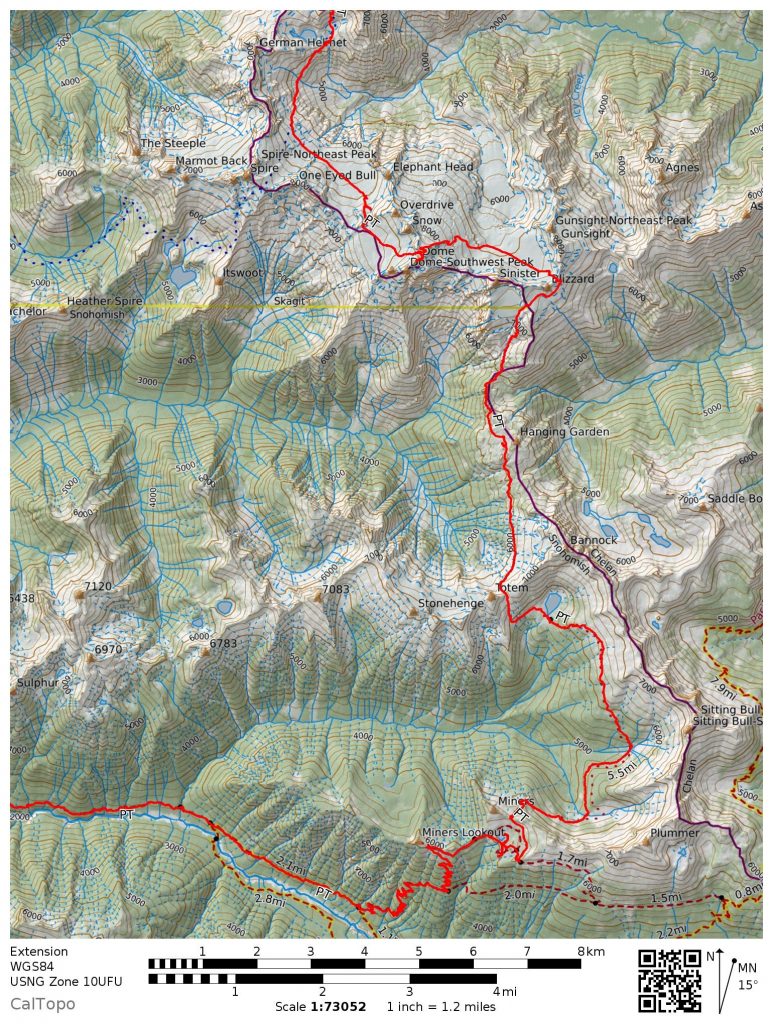
The Ptarmigan Traverse is perhaps the most famous mountaineering traverse in the lower 48. It crosses 30 miles of rugged North Cascade terrain from Cascade Pass to the Suiattle River, across glaciers and above truly wild valleys. It is on nearly every Washington mountaineer’s dream list.
After a life-changing experience on the Sierra High Route last summer, I returned to my home mountains with grand intentions to bring Roper’s vision of high, non-technical cross country travel to the Cascades. Literally the first thing I did was map out a high route from Cascade Pass to the summit of Glacier Peak, which I called the Glacier Peak High Route. It became my obsession and morphed into a greater goal, a Cascade High Route from Snoqualmie Pass to Canada.
Back in the spring, I pitched the idea of the week-long Glacier Peak High Route to Daniel, Jacob, and Logan. They were sold and although we all had different schedules and lived in different places, we found that there was a week in early July that would work for all of us. As the trip approached us, the weather looked downright ugly for July, so we convened at my house Friday night. We agreed on shortening the trip to 4 days and covering just the northern section of the high route from Cascade Pass to Image Lake. I was a little disappointed we would not go for the complete high route, but this way, at least our packs would be lighter and there would be less uncertainty in the weather.
Day 1: Cascade Pass TH to Yang Yang Lakes
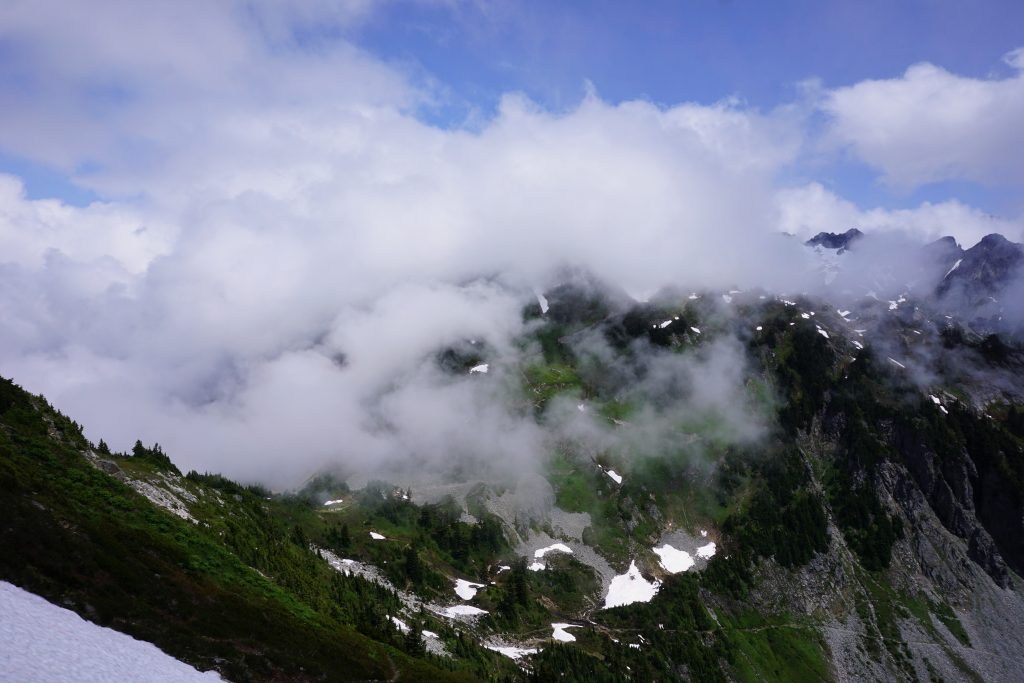
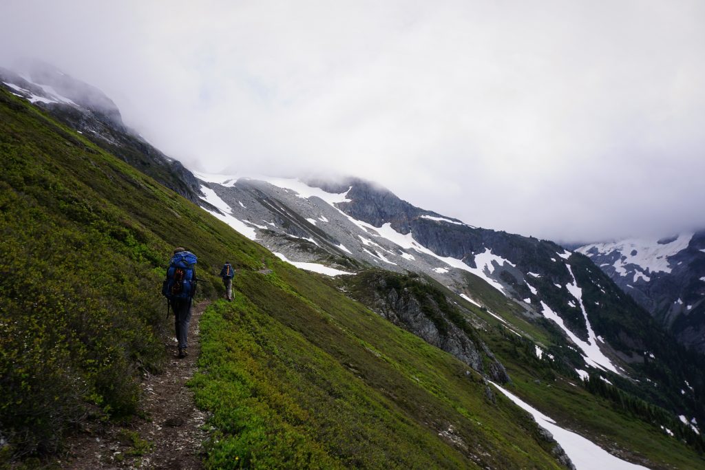
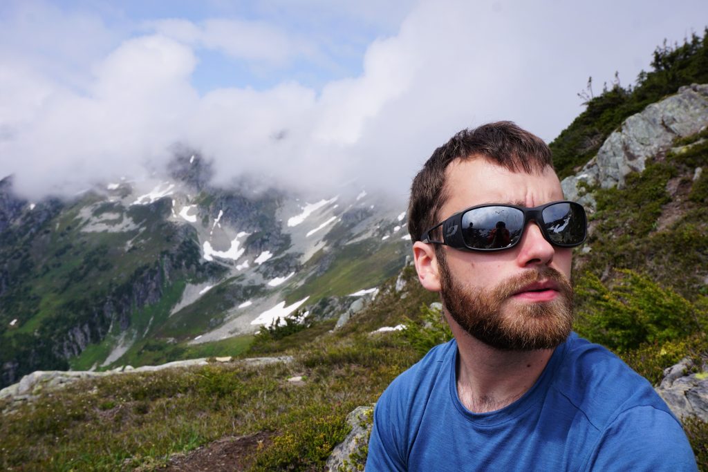
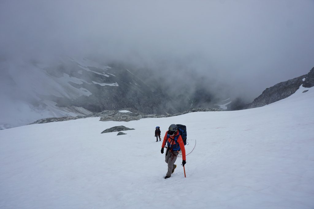
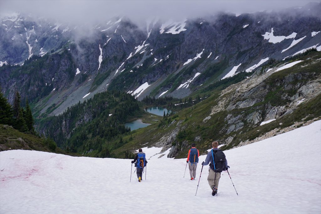
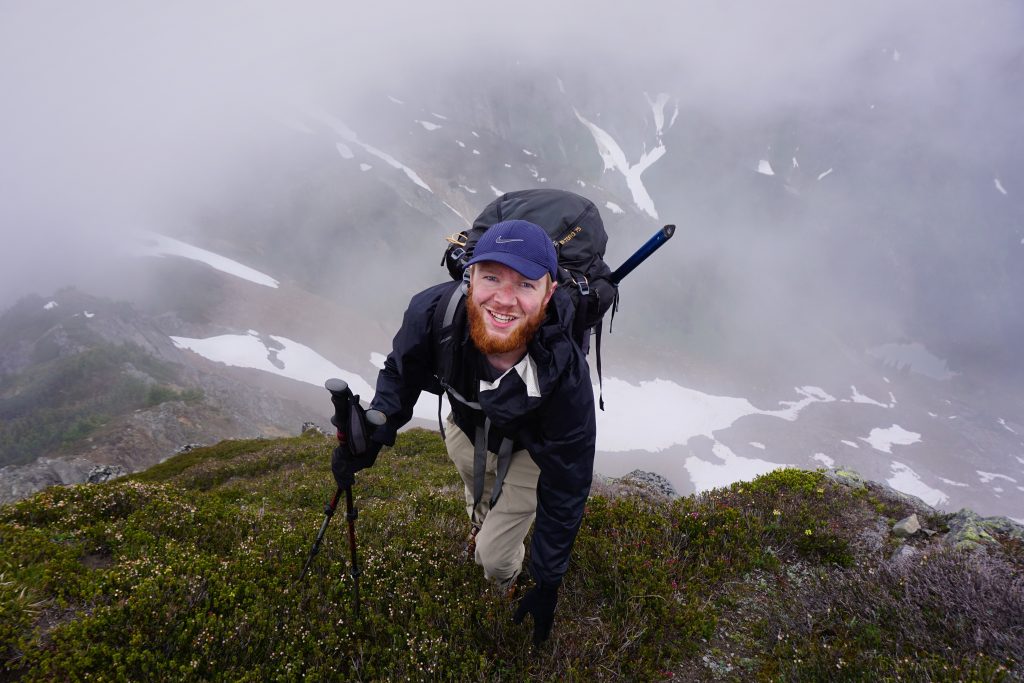
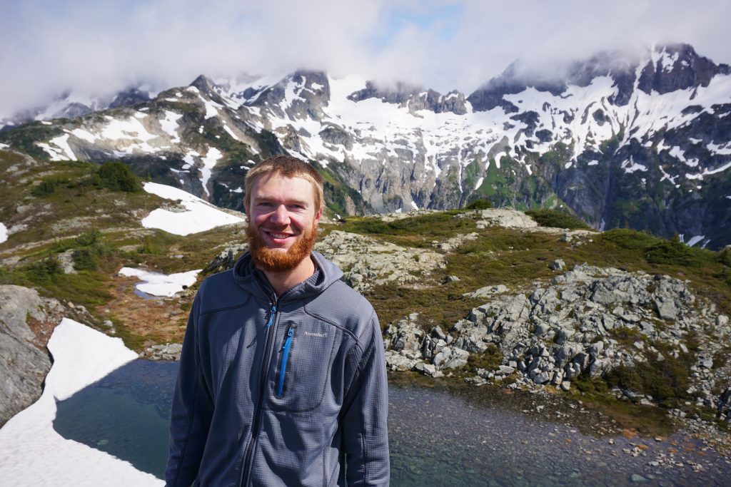
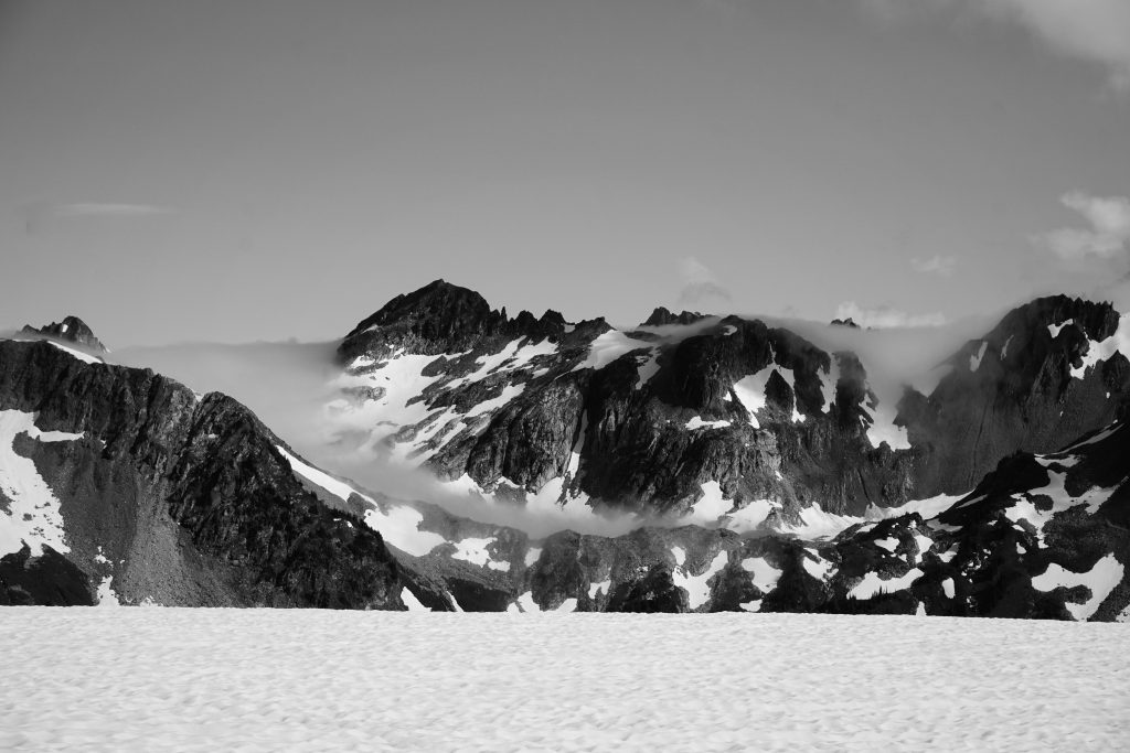
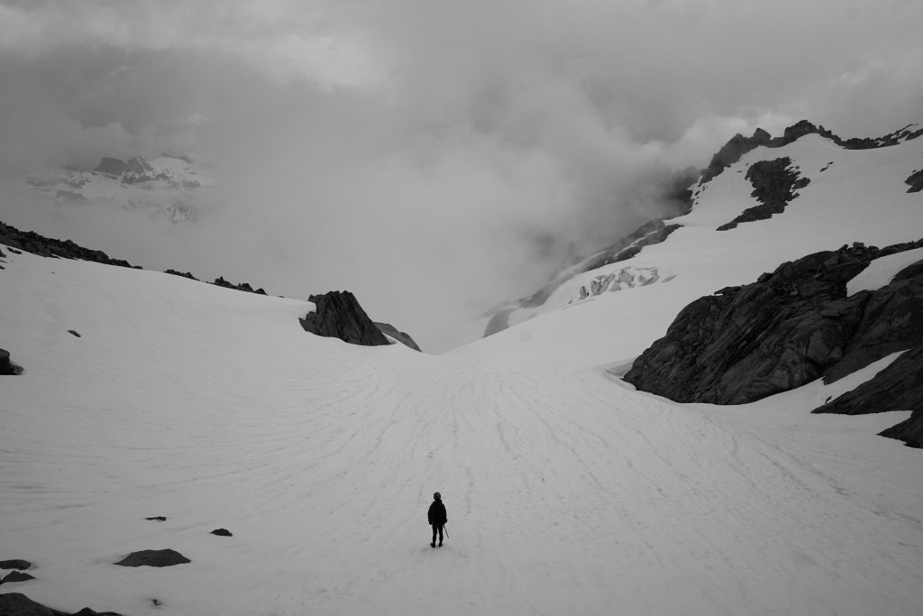
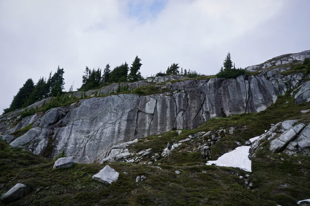
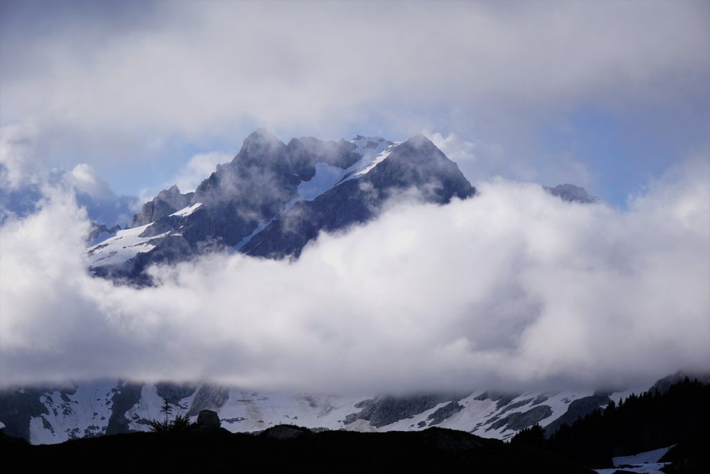
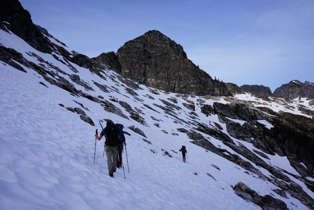
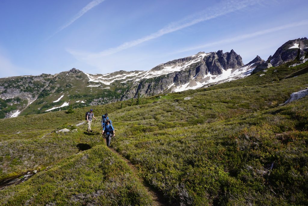
The car shuttle for the Ptarmigan takes a considerable amount of time to set up. The Suiattle River Road was incredibly potholed with large monsters, so driving it twice really sucked. We got to the Cascade Pass trailhead around 10 am. It was a moody morning, with Johannesburg hiding in the clouds.
Like so many times I have been to Cascade Pass, we hiked up the trail in a cloud. We decided on a new measurement system for vertical feet while hiking: the vertbagger system. A “barrel” would be 1/4 of a vertical mile (1320 ft), a “bert” is a vertical mile (5280 ft), and a “bag” is simply however much vert you can fit in a day. Somedays the bag is bigger than others. Sometimes you just have to keep opening the bag more and more and overstuffing it.
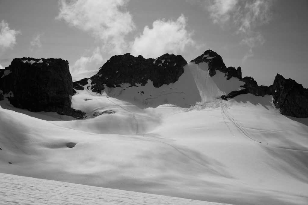
At the pass, we encountered clouds breaking up and some filtered sunshine, classic Cascade Crest action. We followed the obvious climber’s path up and right towards Cache Col.
From a distance, Cache Col looks impressively steep. But up close, it is a nice and easy snow slope, although there appears to a be a sizeable cornice in the earlier season. At the col, we met another party who had been attempting one of the peaks in the area but gave up in the clouds. I guess this is what partly sunny means in the Cascades, right?
As we crossed back onto the west side of the crest, we reentered the clouds, although we quickly dropped beneath the ceiling. The Ptarmigan Traverse snakes its way back and forth on either side of the crest. As we would learn, one mile either way makes a world of difference with the weather. Luckily, our planned camps were both on the east side.
The Ptarmigan Traverse is very popular, and thus there is a well defined trail through the heather sections. Just one week before, Logan and I made the first recorded summer crossing of the Alpine Lakes Crest Traverse, a comparable high route from Snoqualmie Pass to Mt. Daniel. They are similar in statistics and character, but very different in scenery and remoteness. The Alpine Lakes Crest Traverse traveled through miles of terrain without a trace of a human, while the Ptarmigan has a trail that is better than most trails in the Cascades! Regardless, both are incredible traverses and deserving of any mountaineer’s attention.
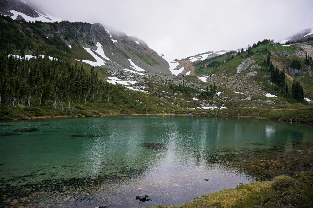
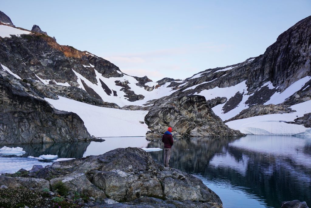
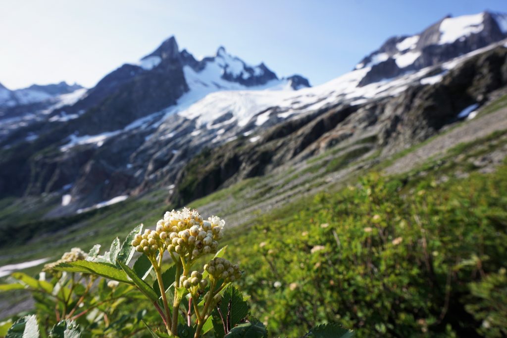
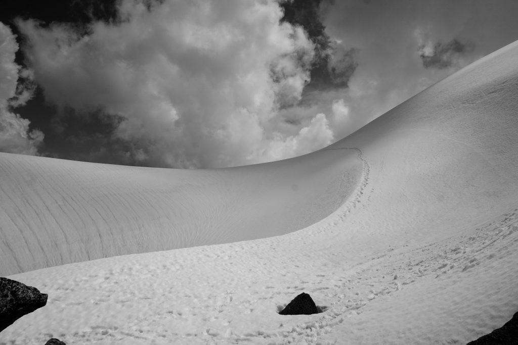
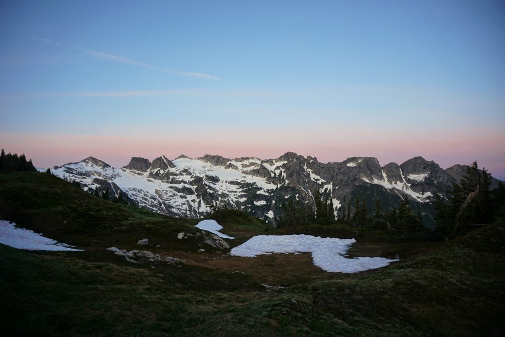
Kool Aid Lake is a small pond on a bench high above the Middle Fork Cascade River Valley. It provides a flat respite in an otherwise vertical landscape of heather, rock, snow, and ice.
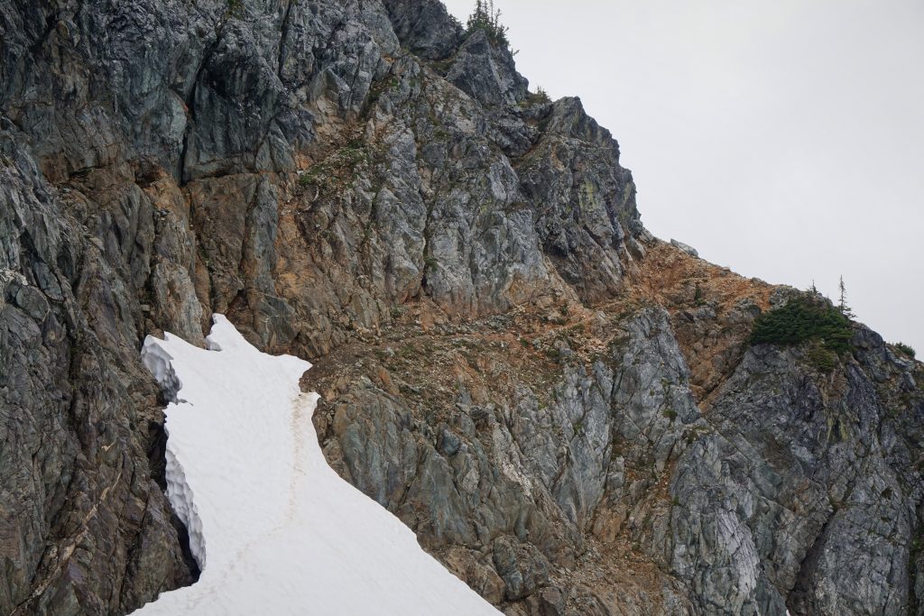
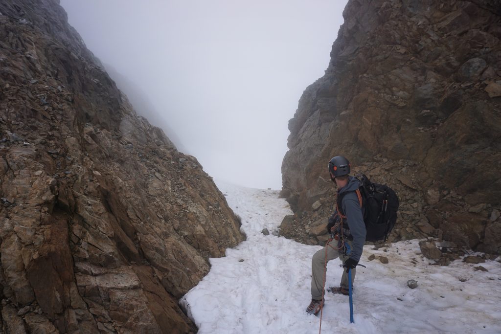
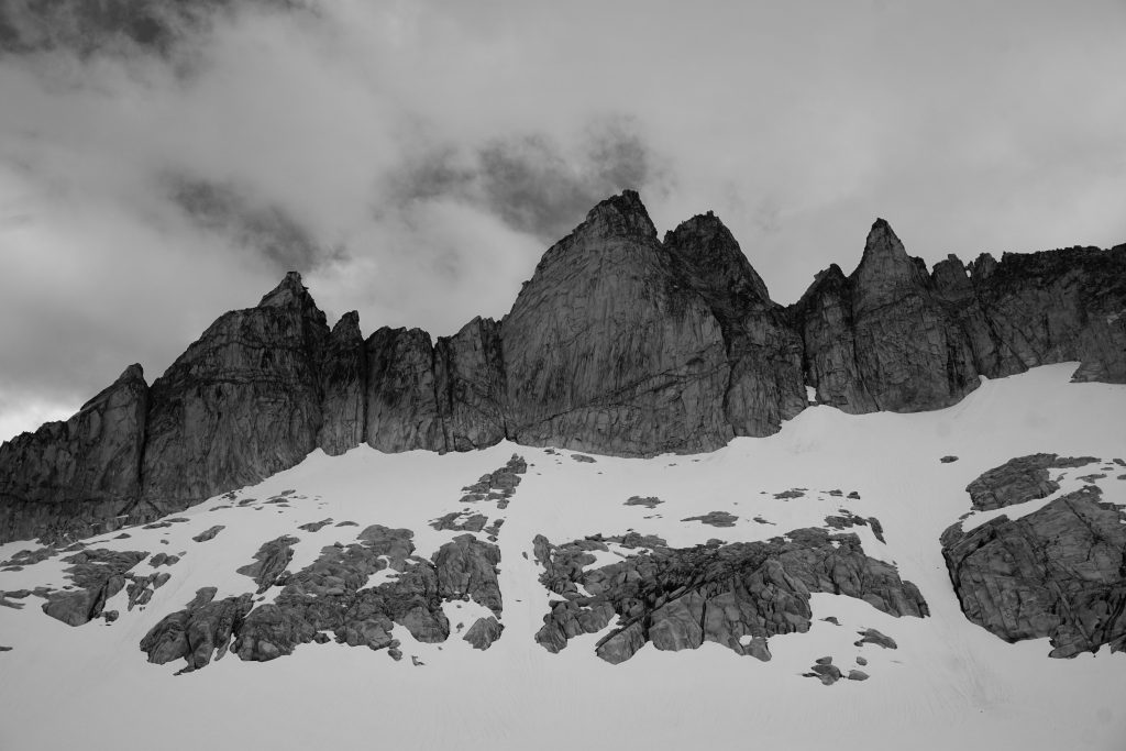
From Kool Aid Lake, there is an obvious rock cleft extending west from Arts Knoll that seems to impede progress. However, there is a narrow, exposed “red ledge” that cuts through the cliff and allows passage.
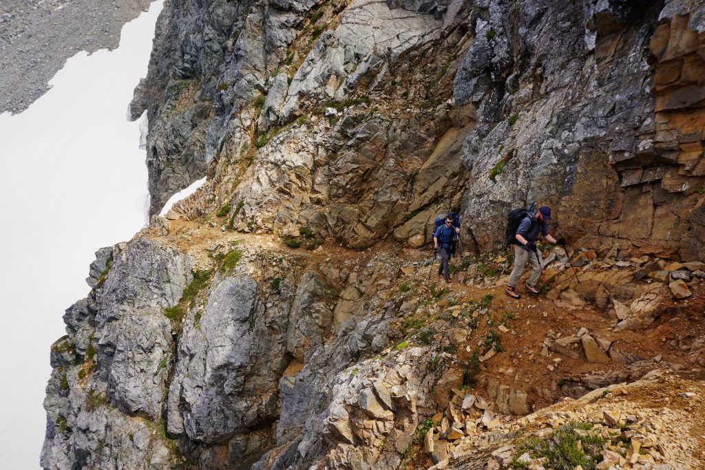
I was very impressed that the original 1938 party found this weakness. In fact, they onsited the entire traverse over 13 days, climbing most of the major peaks along the way. They were way ahead of their time, and this traverse would not be repeated for another 15 years! The third party, led by legendary Ira Spring, actually continued the traverse all the way to Image Lake, just like we would be doing.
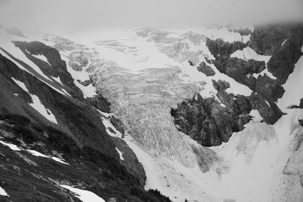
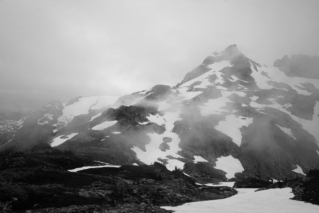
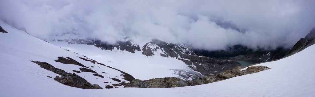
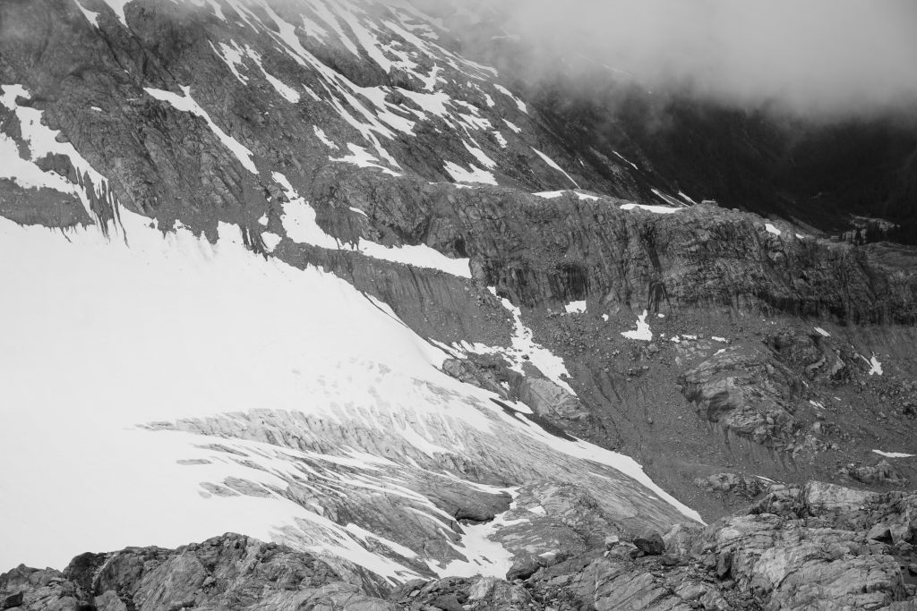
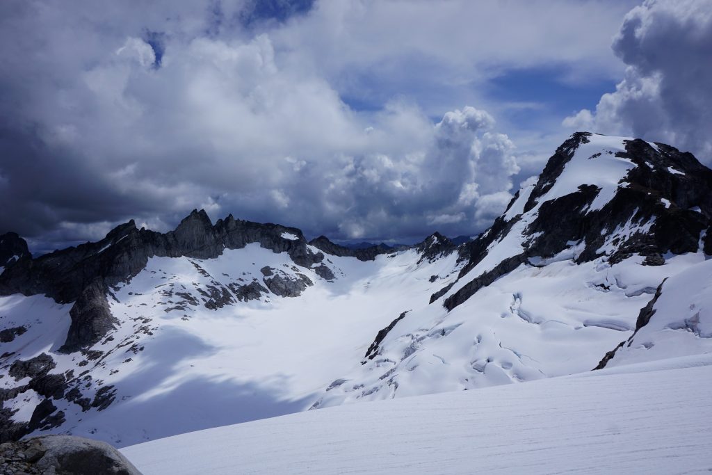
The lower part of the Middle Cascade Glacier came into view. The icefall tumbled thousands of feet below us. Supposedly, the view of Mt. Formidable above was inspiring, but we had to be content with the striking cracks and calving of the lower glacier, as clouds obscured the lofty peaks.
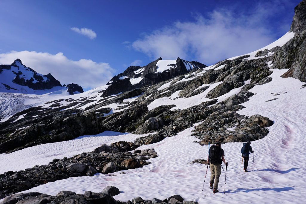
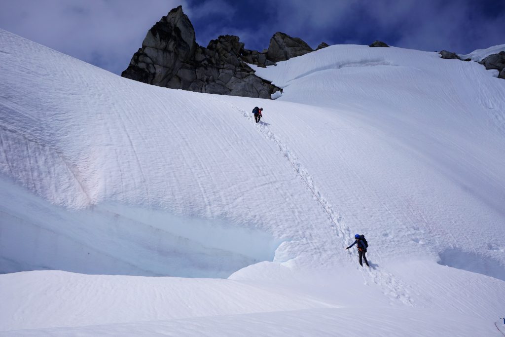
As we ascended towards the glacier, we once again entered the clouds. Since we could not see much, we decided to rope up and start across the glacier.
This is supposed to be a chill glacier crossing, but in a complete whiteout, it was quite cold and disorienting. We could barely see 30 feet in front of us and thus we did not see crevasses until we were nearly on top of them. We followed the GPS and a compass bearing, heading towards the col that would lead us across the crest. This was our first time on a glacier in a whiteout, and it was not a pleasant experience. Hopefully we would not have more later this trip.
Eventually, we found the gully leading down the other side. It looked dangerously steep at first, but was totally fine once we dropped out of the clouds.
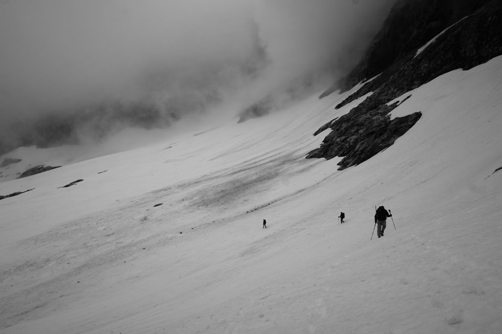
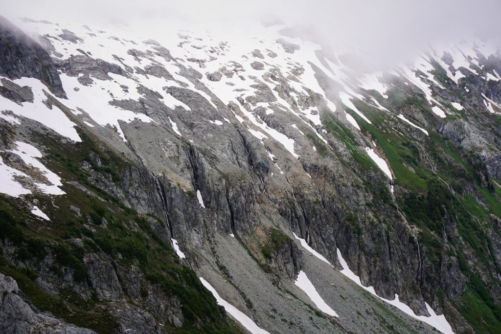
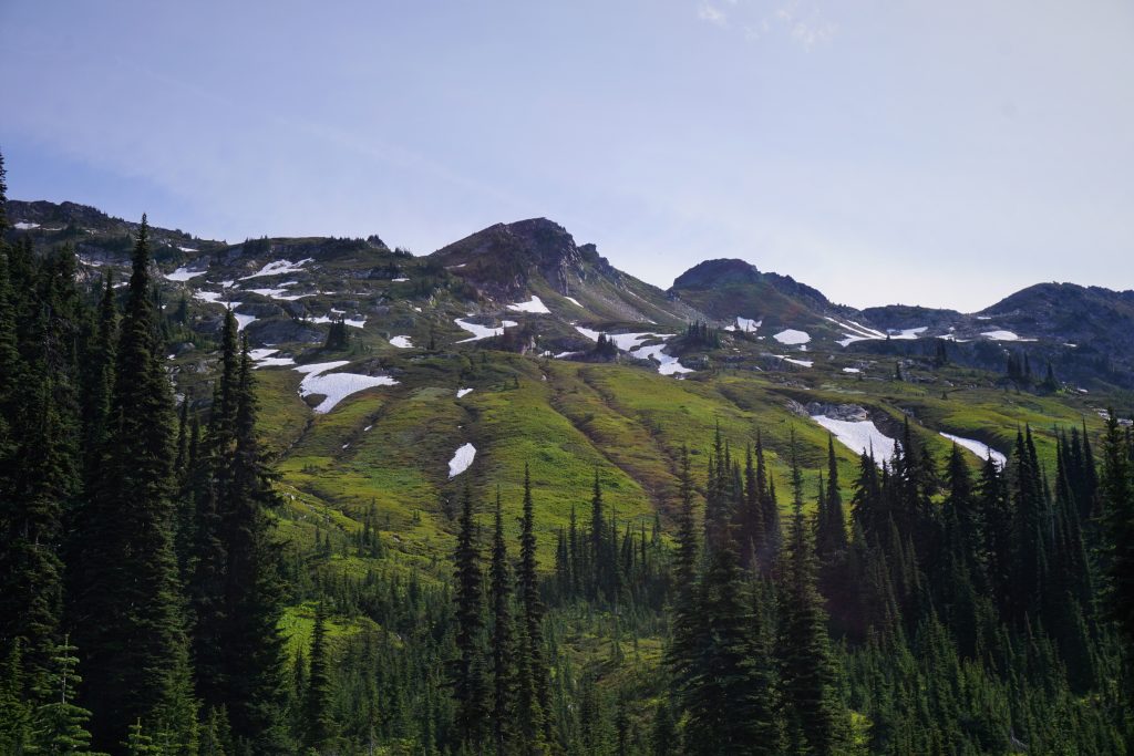
Out of the clouds but still cold, we put away our glacier gear and began a long traverse over to the Yang Yang Lakes. Fog swooped in and out with a light mist, creating an eerie feel to the huge mountains around us. We side hilled easy snow high above rugged cliffs and endless waterfalls that spilled into the brushy valley floor. The North Cascades have many of these two tiered valleys: passable upper slopes and benches followed by a precipitous drop off to the valley floor. In the absence of peaks, we once again marveled at the wild valleys. The ruggedness was simply stunning.
At the lakes, we found a solo tent and a whirling drone above us. Drones are illegal in wilderness areas! We made camp at the lower lake to get away from this jerk.
A light drizzle accompanied our dinner cooking. Although the peaks were still hidden, the setting here was incredible. There is something so magical about standing high above an impenetrable valley lacking a trail. The alpine becomes the only gateway. The only way is up.
Day 2: Yang Yang Lakes to White Rock Lakes
We woke up the next morning to similar weather as the evening before. It was a rare day that I kept my leg thermals on as we started hiking in the morning. Today was our shortest day by far, so we were in no rush.
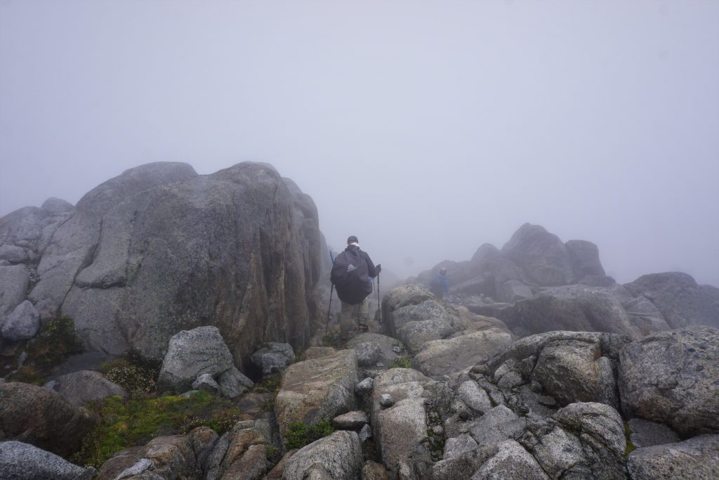
The traverse doubles back here and follows a long broad ridge towards the true crest. This gives access to a weakness in the cliffs. A short chossy little scramble led to the ridge crest. In the swirling clouds, it felt like we were climbing into the abyss. In some ways, the lack of visibility made everything feel even more epic, even though we could not see the huge peaks around us.
As we descended towards the next saddle, we actually got moments of sun as the clouds broke up around us!
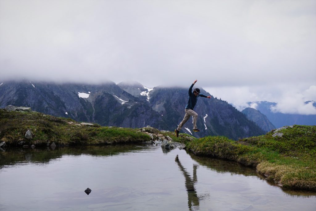
This ridge line had some amazing benches and a nice little tarn. We took a break in the rare direct sunshine and made up a game: rock-tarn-skip. We stood high above the tarn, at approximately a 30 degree angle above the tarn. There were plenty of nice skipping rocks around, but it is pretty hard to skip a rock from such an angle, right? Well, we managed to bounce the rocks off a snowfield on the bank of the tarn and then hit the water at a lower angle, getting them to skip! Everyone should try it!
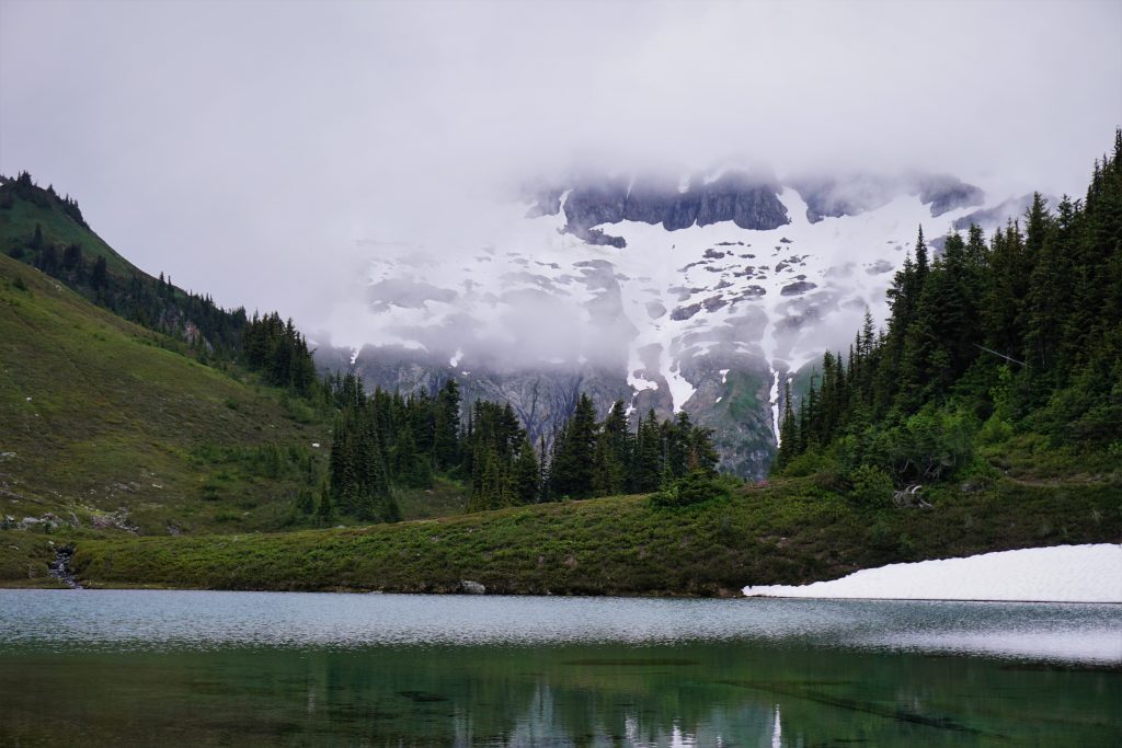
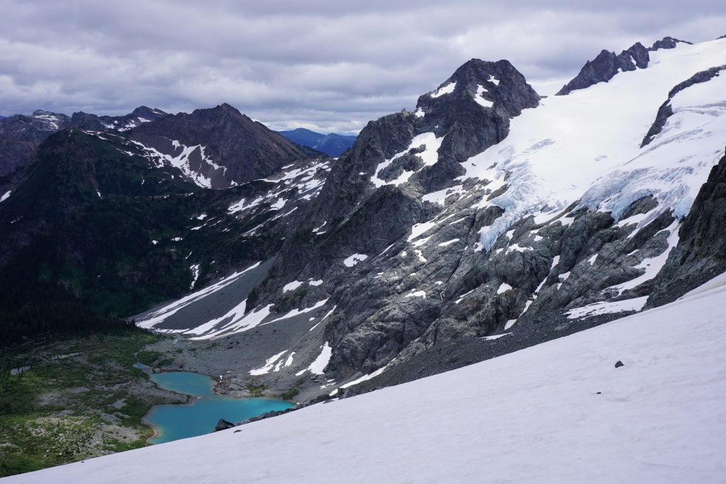
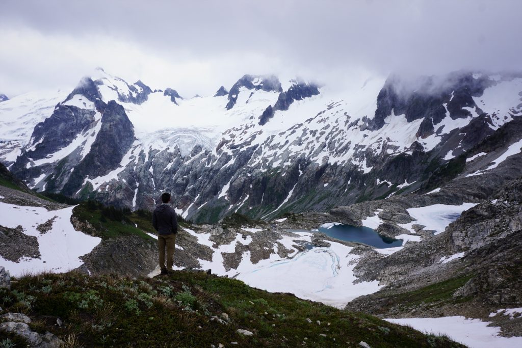
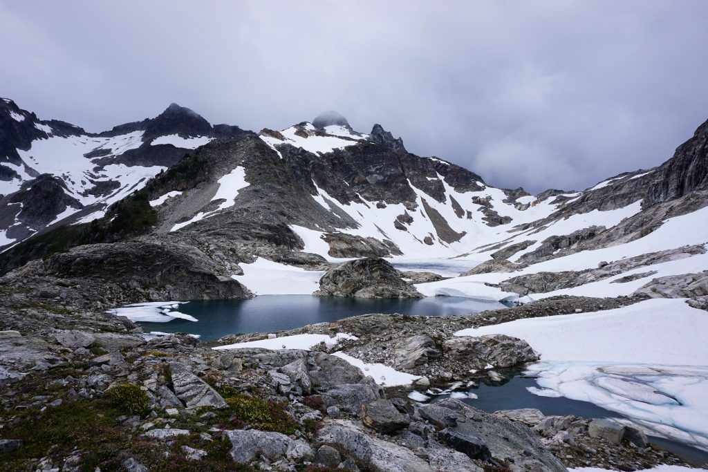
After another short climb, the clouds rolled in again and we began a long traversing descent, mostly on snow, towards the Le Conte Glacier. We gazed down at Le Conte Lake, a turquoise blue lake with lush green vegetation all around. It looked like a magical place to visit.
The route then skirts the edge of the glacier up to another saddle at the crest. There were a few crevasses showing, but we stayed unroped for this section.
The saddle was cold, foggy, and windy, but there were some really nice bivy spots with rock walls, so we took a break here. Wasn’t west supposed to be the best? During this trip, it just meant fog.
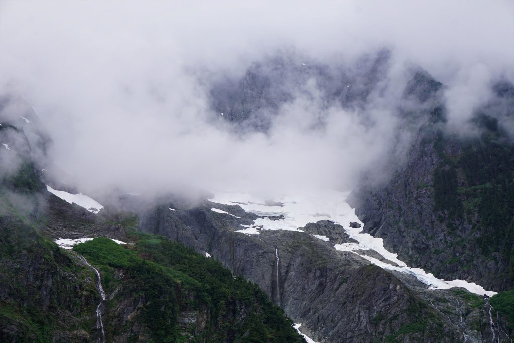
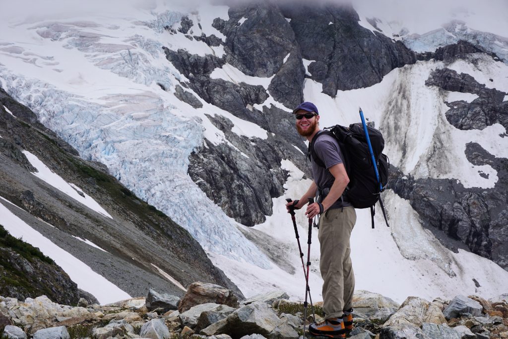
We crossed down and quickly sank beneath the clouds, offering a partial view of the massive South Cascade Glacier.
There is a research station on the lateral moraine just west of the snout of the glacier. This glacier is closely monitored, an example of the many receding glaciers in the Cascades.
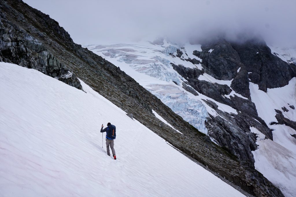
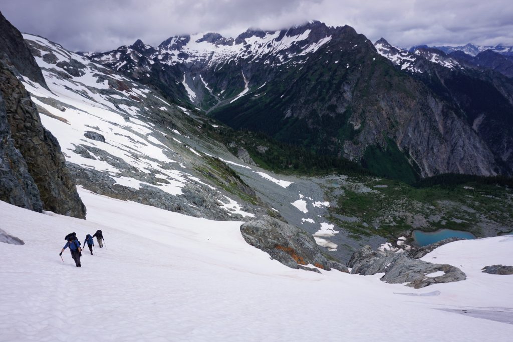
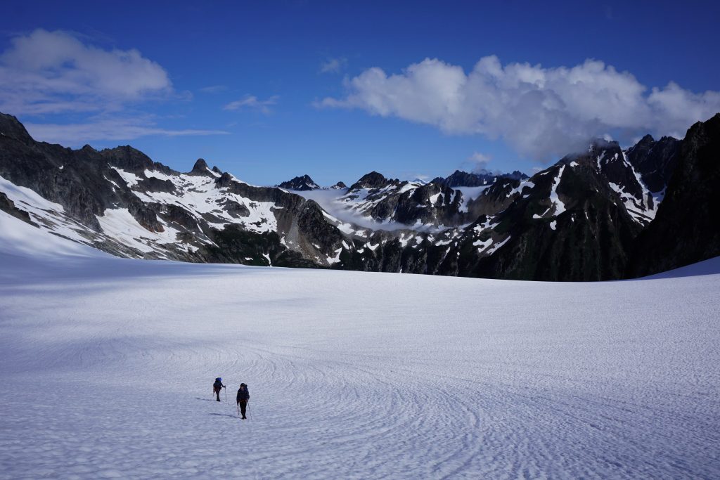
We traversed high above the glacier before descending a nice snowfield to the upper part of the glacier. Logan and I remarked how crevasse free the bulk of the 2 mile long glacier was and how fun it would be to ski. In general, the Ptarmigan seems heaven-made for skiing, with long sidehilling traverses and very few steep sections.
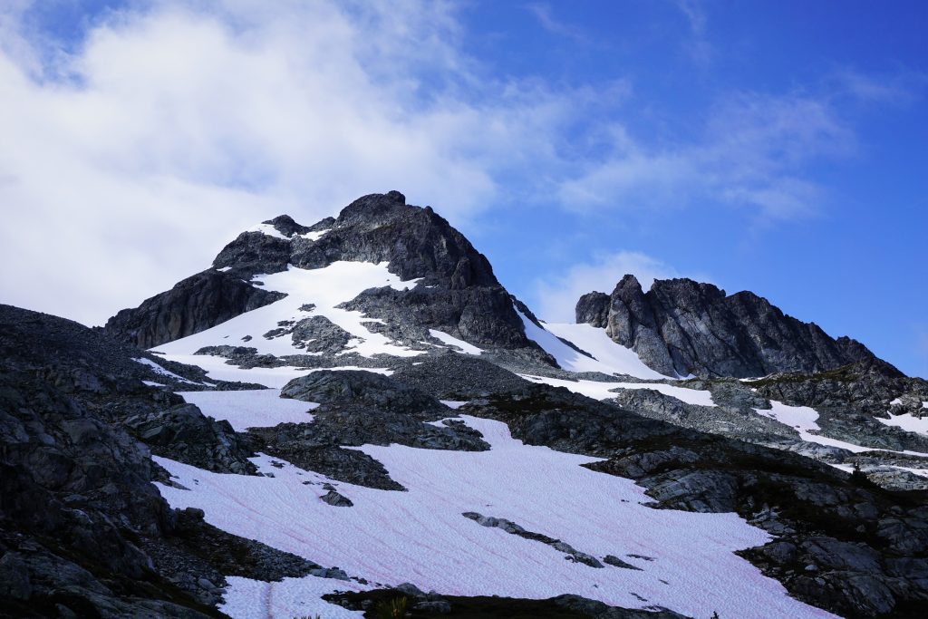
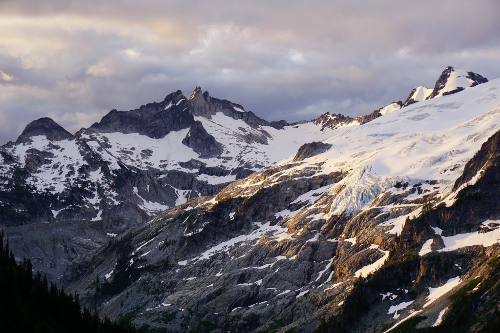
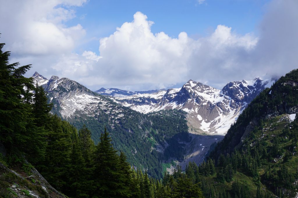
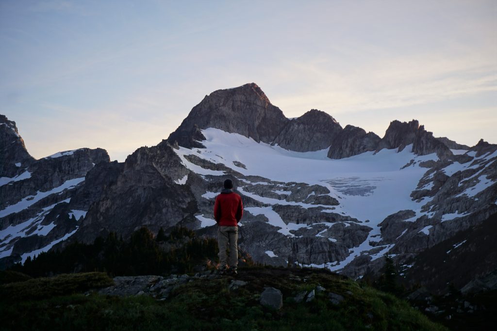
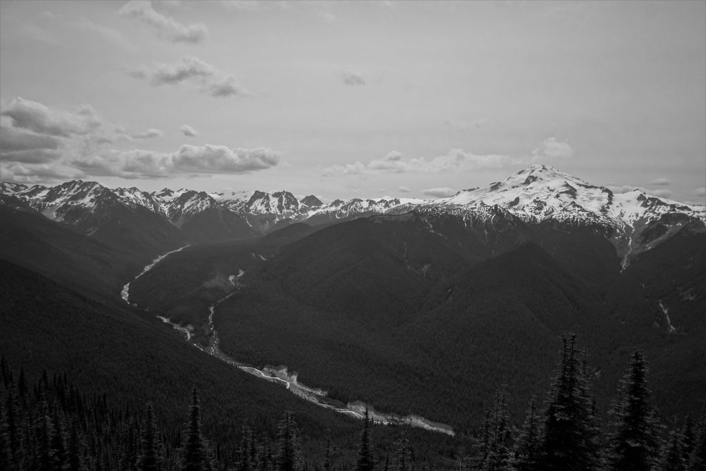
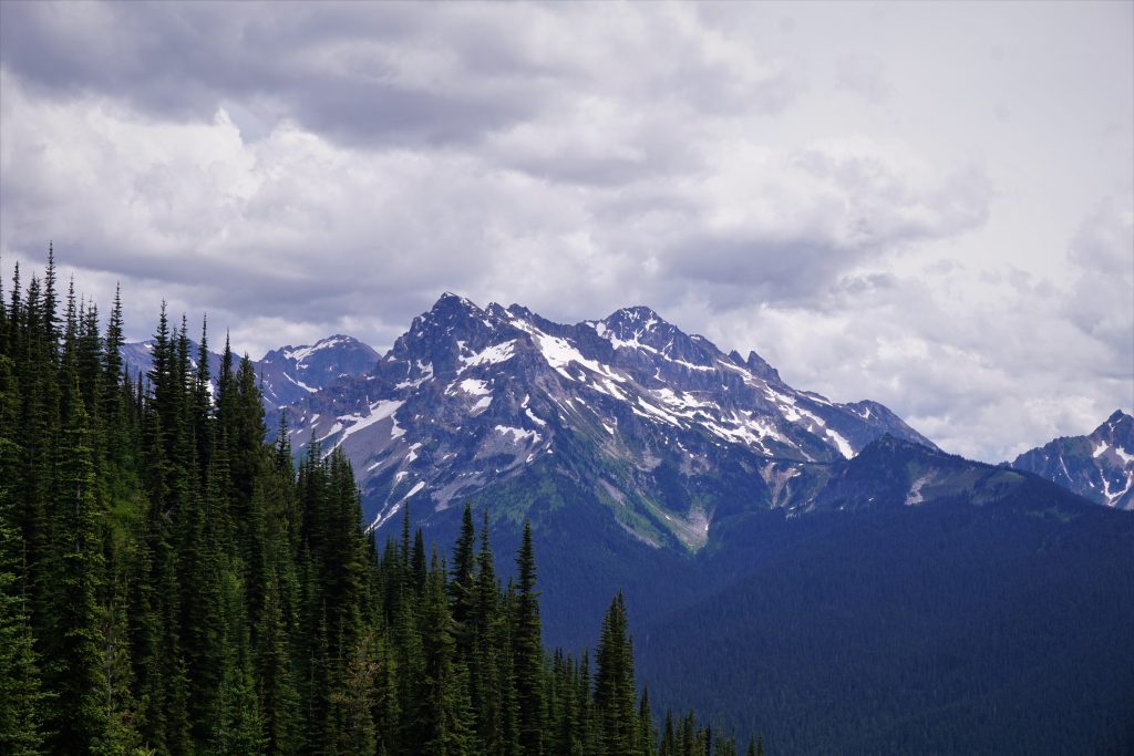
As we crossed back east of the crest, the clouds once again lifted. We were pleasantly greeted by a stunning view of Dome Peak and the Gunsights! Even with the weather, it was a marvelous sight. The cloud ceiling was around 8000 ft, but hopefully it would be at least 1000 ft higher the next day when we tried to go up over Dome.
A chossy descent led us down to the White Rock Lakes. The lakes are beautiful granite walled lakes perched on a bench with one of the most incredible views I have ever seen. Yet another magical spot in the North Cascades.
We found some wonderful campsites and pitched our tents. Right on cue, the rain began, first as a drizzle but then a sideways downpour. Luckily, we had our tent pitched so that the door was downwind and the wind was so strong we could actually keep our door open and stay dry!
This storm was a real soaker, dumping a large amount of rain over a few hours. So this is what 40% chance of showers means in the Cascades? Finally, when the rain lessened, we emerged from our tents to make dinner. Daniel and Logan had to dig an emergency trench to drain water from underneath their tent!
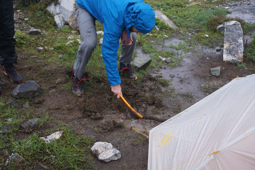
It was a wet evening, so we settled into our tents for a damp night. To make matters worse, it seemed that my Thermarest Uberlite pad had developed a slight leak. Every 30 minutes or so I found my butt on the cold ground. In the dark, I inspected it very carefully and miraculously found the leak and patched it! This is the first time in 4 leaking sleeping pads that I have ever been able to fix one in the field!
We hoped for improved weather the next day, but we knew there was a good chance we would just wake up in a whiteout. When I was younger, I would have been so frustrated with the weather. But now I realize that just being here in such a wonderful place with three of my best friends is a gift in itself. This would be an experience I will remember for years, regardless of what happens with the weather.
Day 3: White Rock Lakes to Hanging Gardens
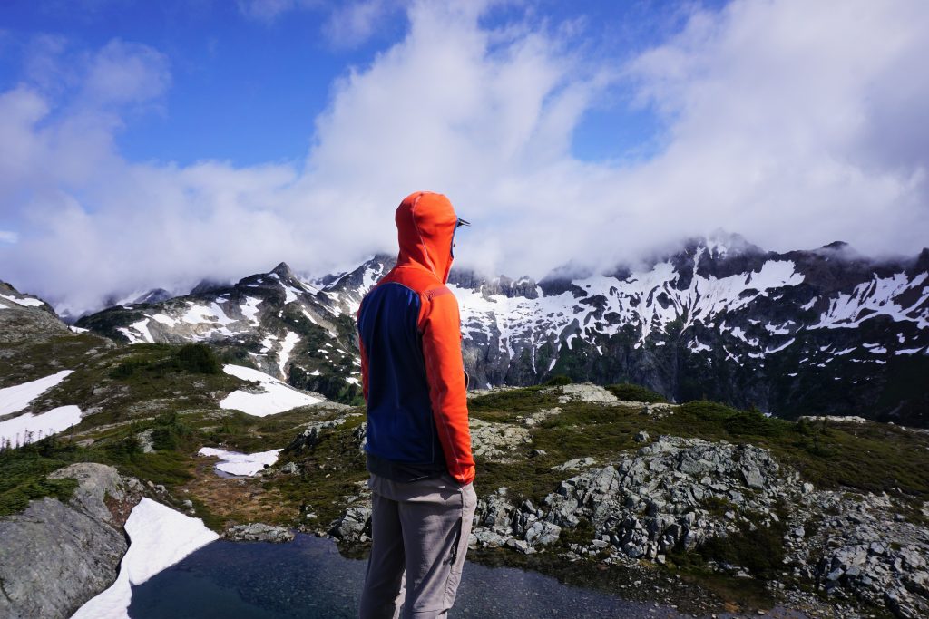
I do not know if there is more magical feeling than waking up after the storm to clear Cascade skies and alpine views. I’ve been lucky many times before, seeing starry skies on our summit day on Rainier, or alpine gold on Eldorado. Our third morning at White Rock Lakes was just that feeling. Grace. Relief. Perfection.
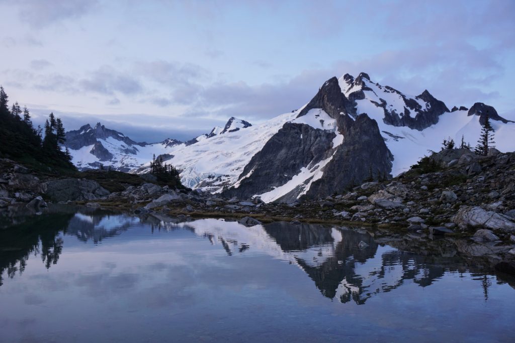
On these magical mornings, despair is replaced by hope. The air is damp and cool, signs of the past. But it feels like the mountains are inviting us back into the alpine, granting us passage. Never do the mountains feel so welcoming and forgiving.
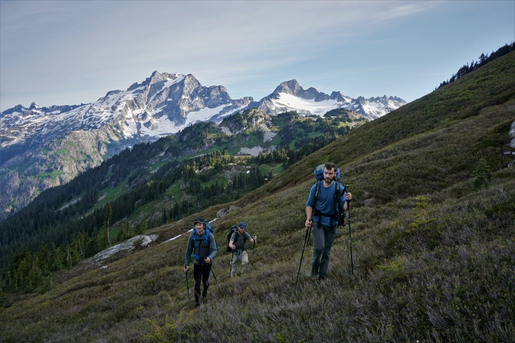
We packed up quickly and got on the move, trying to make the best of the good weather. If we learned anything from the last few days, it was to be suspicious of any weather window.
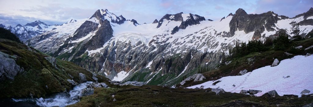
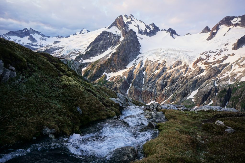
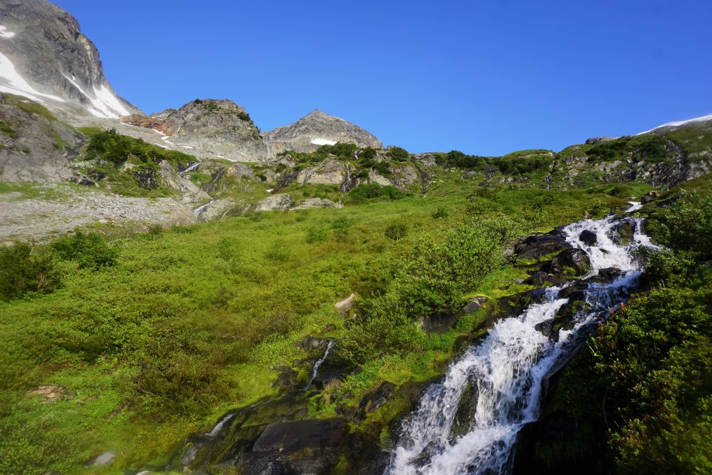
We followed the brushy trail down and traversing. At its low point, we crossed a beautiful section of rushing waterfalls and lush flowers. Looking up, there must have been 20 waterfalls of substantial size, all suspended high in this steep cirque. In the warm morning light, everything felt so hopeful and alive.
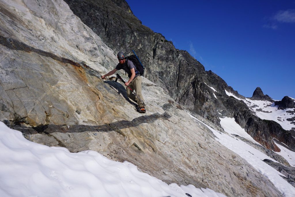
The “entrance ramps” were some easy hiking and scrambling to get up onto the upper Dana cirque. This section was a mix of snow and slabs, which proved to be quite fun.
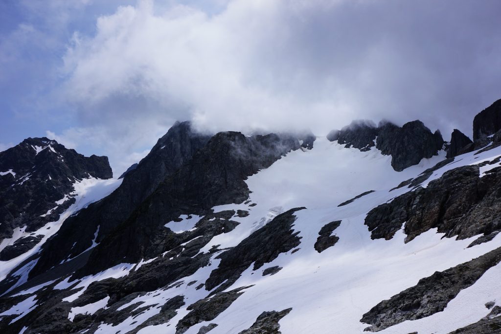
At this point, the traditional Ptarmigan Traverse heads southwest over Spire Point and exits to Downey Creek. However, we were just getting to the good part! Our plan was to go over the summit of Dome and through the Gunsights. So far, it was looking like the weather might actually cooperate!
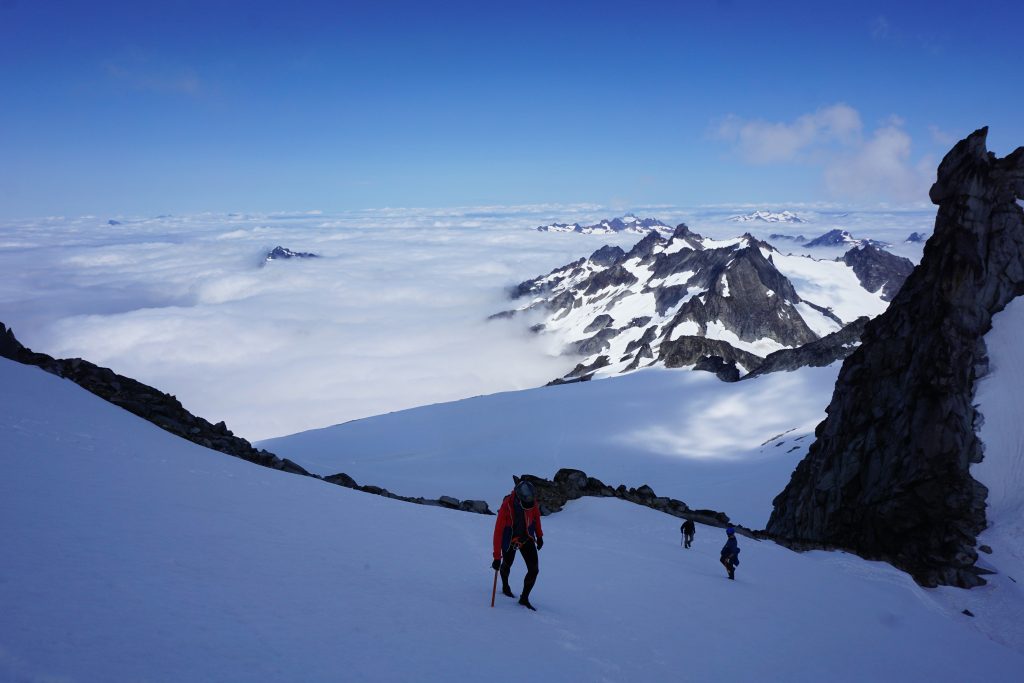
We roped up and crossed the Dana Glacier, aiming for the higher of the two cols that would lead us to the Dome Glacier. As we climbed higher, we watched the edge of a thick marine layer of clouds begin to overflow the crest. It was like watching a viscous fluid spill over a dam. We have such fascinating weather here in the Cascades!
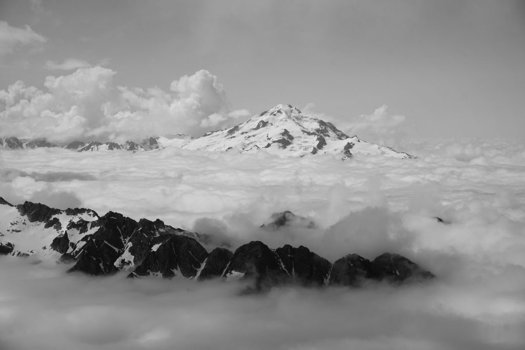
As we neared the 7800 ft col, we gained distant views to Eldo, Shuksan and Baker.
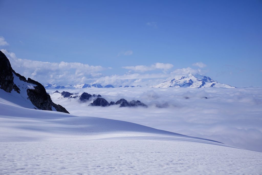
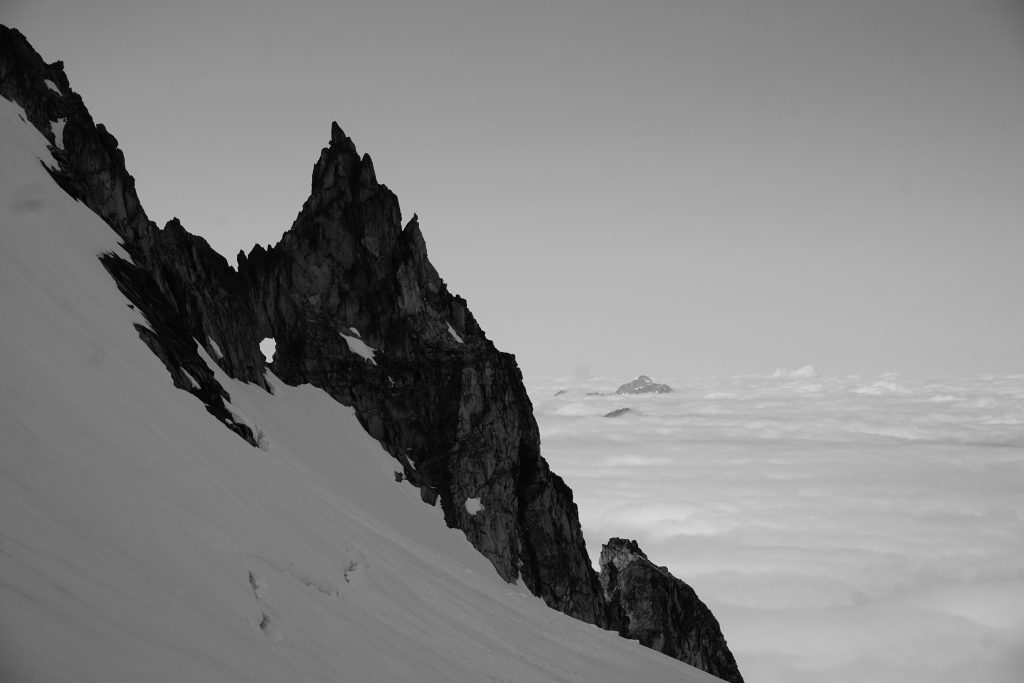
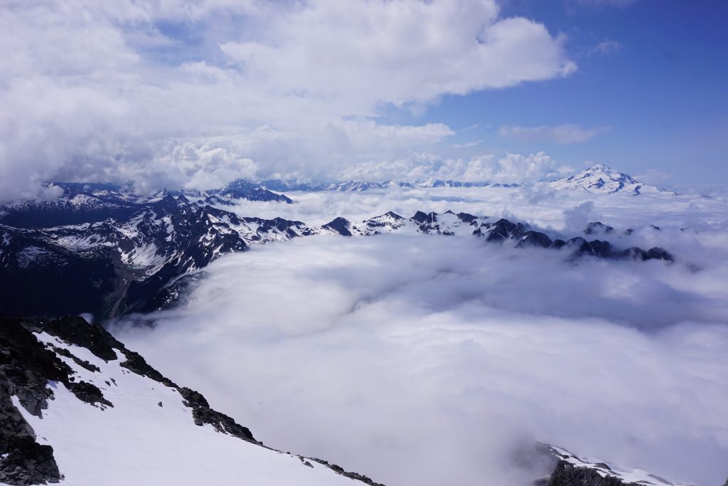
At the col, we crossed the crest (for the 199th time) and stepped onto white pearls in the sky. The sea of clouds unfolded beneath our feet, leaving only the highest peaks poking out. We truly entered a different world, isolated from the rest of humanity that was beneath the clouds. Nothing else can make me feel both so lonely and so content.
We rambled up the Dome Glacier, jaws agape while looking around. The ridges around us were steep granite, cutting through vast fields of ice like how the distant peaks broke through the clouds. There was this awesome cannonhole on one ridge like it was blasted out of the rock.
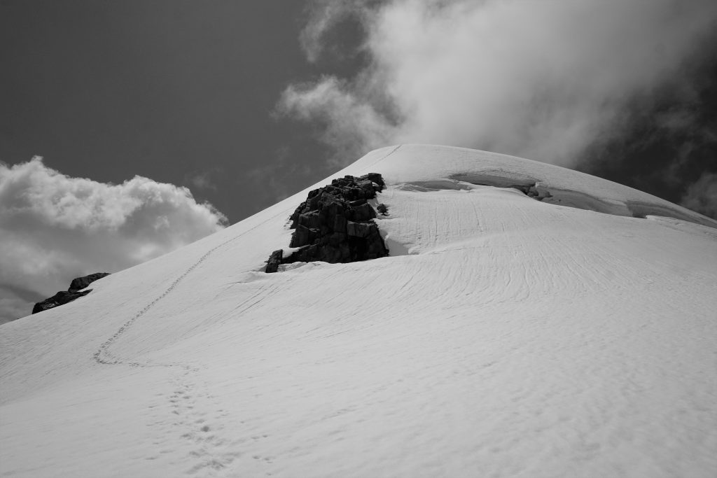
At the col, we took a break and ditched our heavy packs. From here, it was an easy 400 ft or so up to the summit ridge.
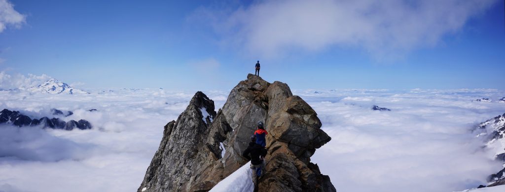
We did not know much about the summit of Dome, except that it might be class 4. We were surprised to find a knife edged rock ridge! It looked incredibly exposed, so Logan looked down and left, finding a low 5th corner, but since we did not have a rope or rock gear with us, this did not seem like a good option.
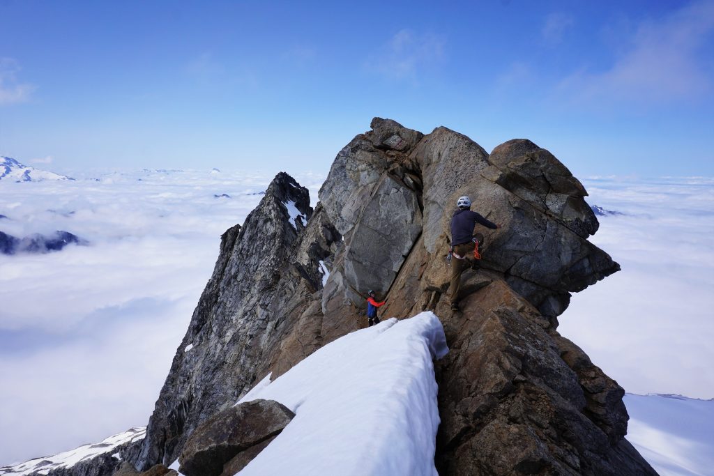
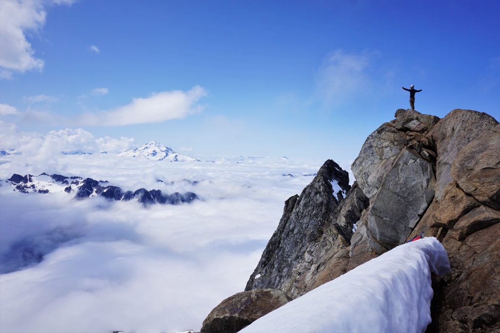
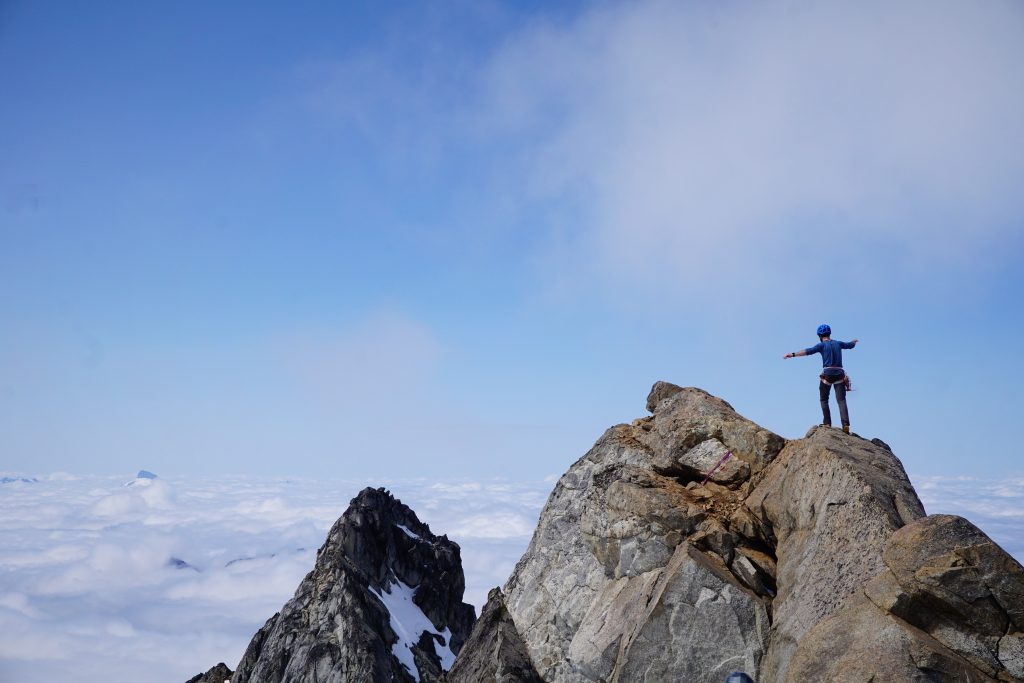
I decided to check out the direct ridge line. After one spicy face move, I found myself walking a narrow “sidewalk in the sky” with incredible exposure on either side! The drop off to either side was massive, with steep snow slopes falling off into the clouds. A few more steps and I stood atop Dome Peak, elevation 8,924 ft!

Rotating around, I saw only jagged mountains, clouds, and blue sky. Dome Peak is in the heart of the Cascades, a white sentinel. On this day, it was an island in the sky. There are moments that stick with you because of the thousands of little things that come together to create total perfection. I could not have dreamed up anything better.
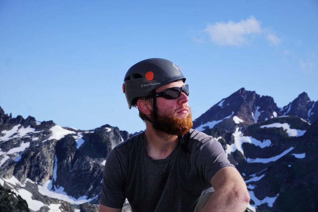
We each took our turn on the exposed summit and taking photos of each other.
We descended quickly to our packs and got going since we still had a lot of big terrain to cover. High clouds were already building east of the crest, looking very thunderstorm like.
We had beta from my friend Kyle that there might be a sketchy bergschrund crossing at the top of the glacier. We found the snow bridge on skier’s left in fine shape, although we were pretty careful crossing it.
However, we later found an alternative steep snow route around the bergschrund on skier’s right. Good to know for future beta.
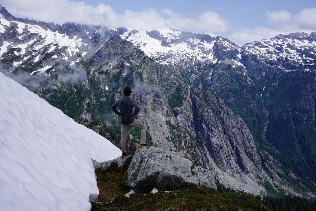
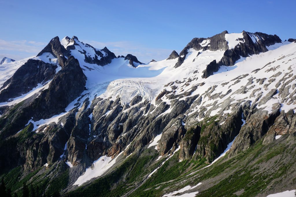
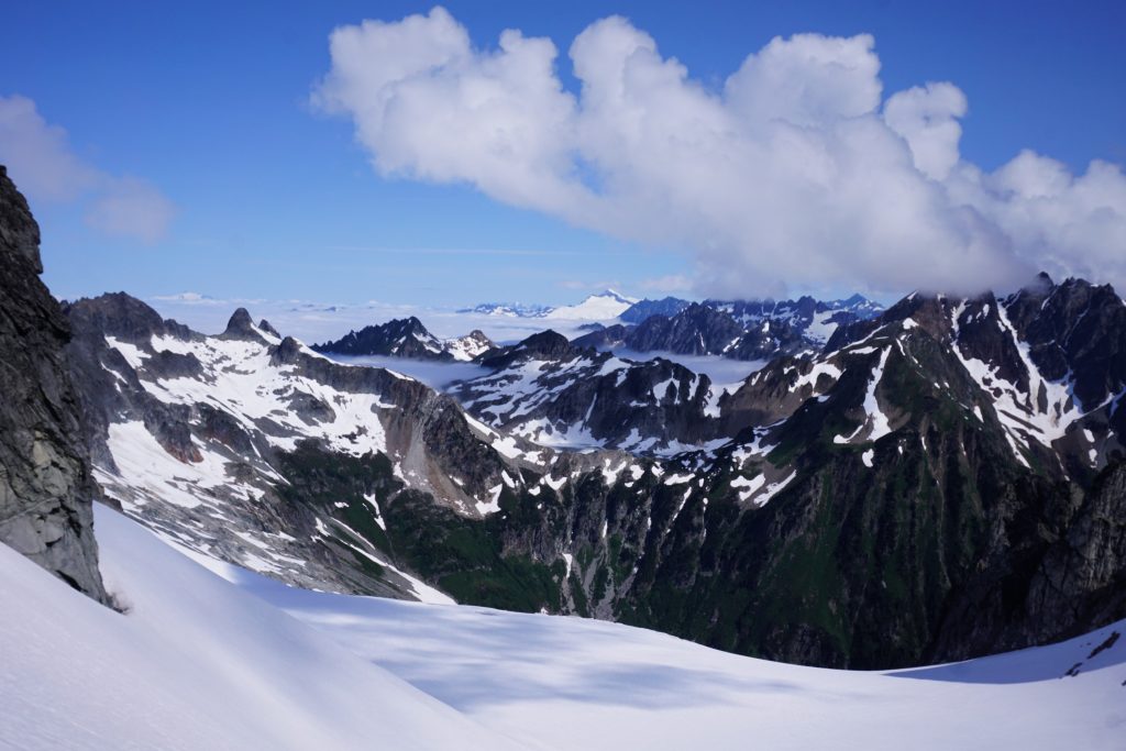
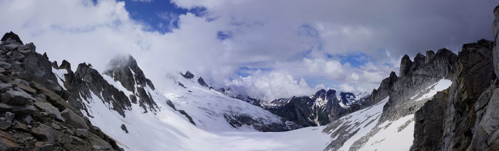
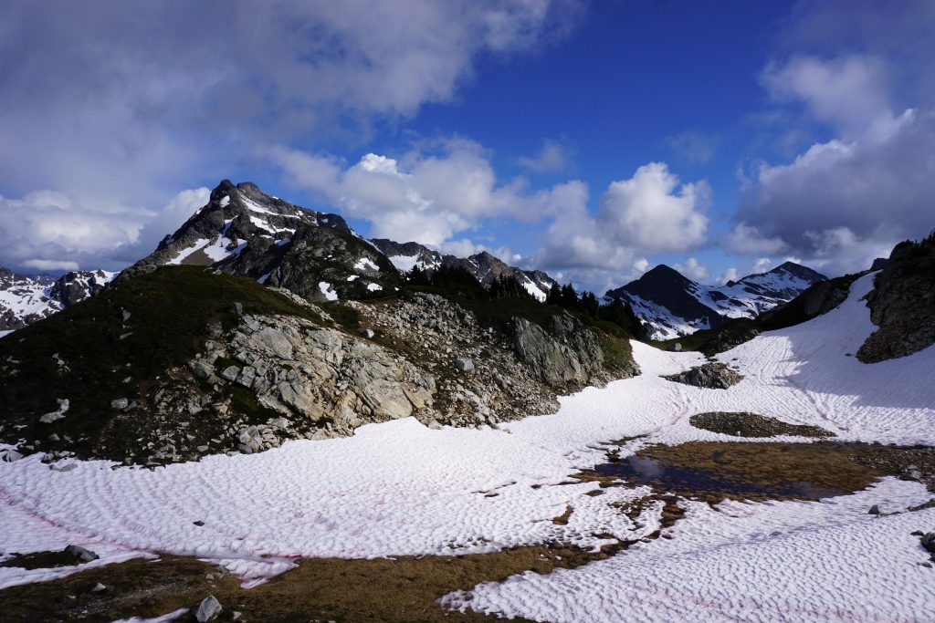
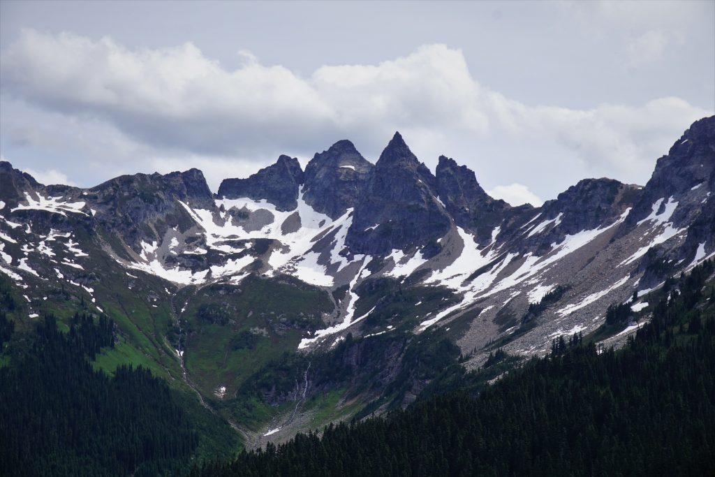
Once on the main part of the glacier, I carefully led us downwards. There were substantial open crevasses, but we were able to descend down and right rather efficiently between the crevasses. The views of Sinister and the Gunsights were stunning. This was a world still dominated by snow and ice and the mighty Chikamin Glacier.
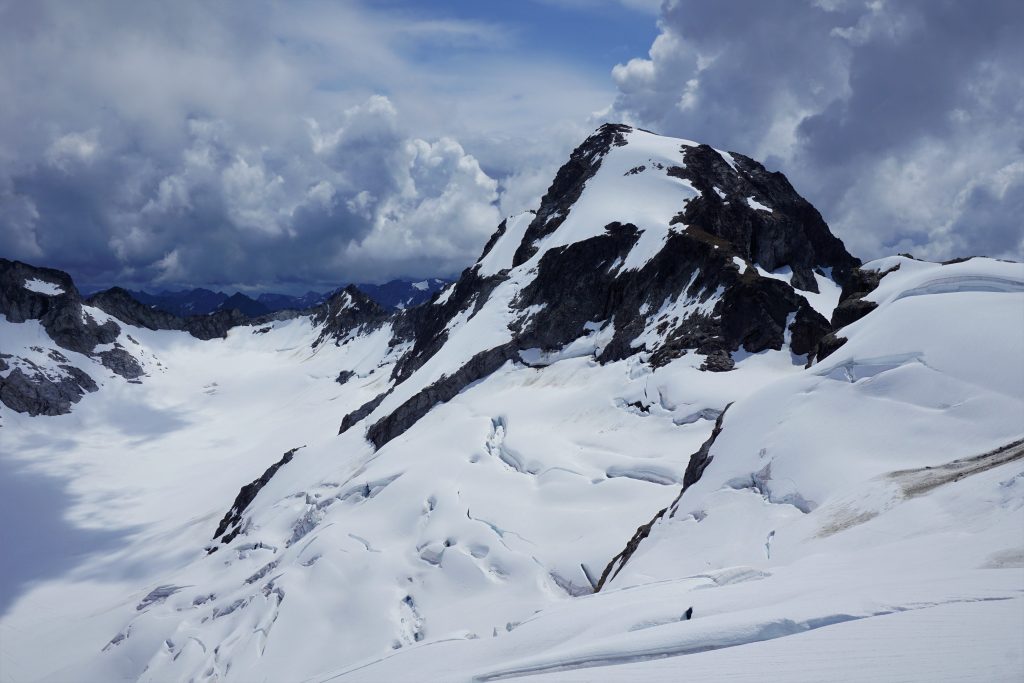
At the flat part of the Chikamin Glacier, we passed house size blocks of ice that have fallen off Sinister. Further along, we got a close up view of the Gunsights. The Gunsights have nearly mythical status in the Cascades. Few have seen them up close in person; even fewer have climbed their majestic granite walls. I know that some day I will come back to this remote spot with a rock rack (and stronger climbing skills). I could not think of a more beautiful spot to climb perfect granite in the Cascades.
We continued up towards the obvious saddle to the south. I scrambled up first, which was sketchy loose death class 3, so I gave a belay to the rest of the guys. Apparently the real Gunsight Notch must be higher and left because this one did not have any bivy spots.
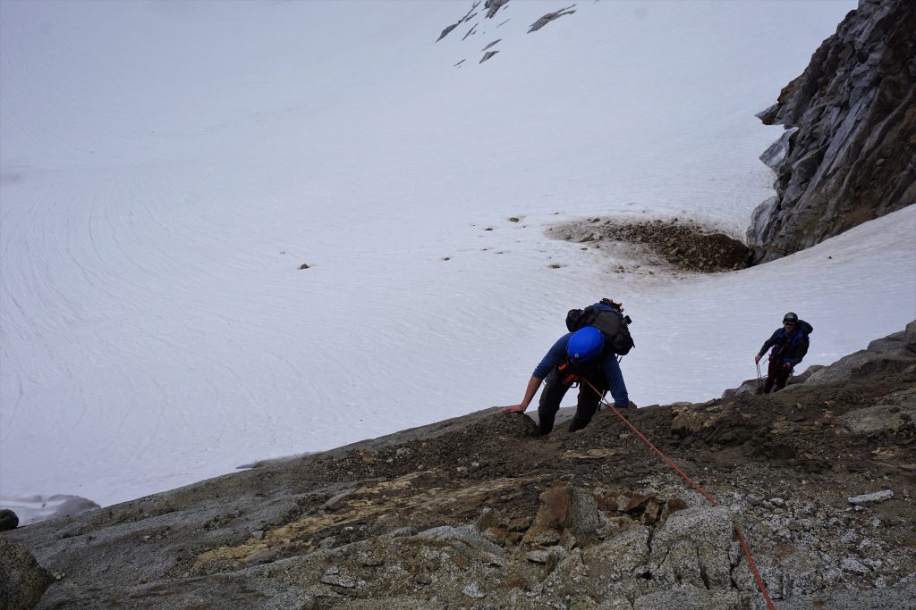
We scrambled down some moderate terrain and onto an old dying glacier. We decided to call this unnamed glacier the “Parmesan Glacier”, since after all, we were on the Parmesan Traverse.
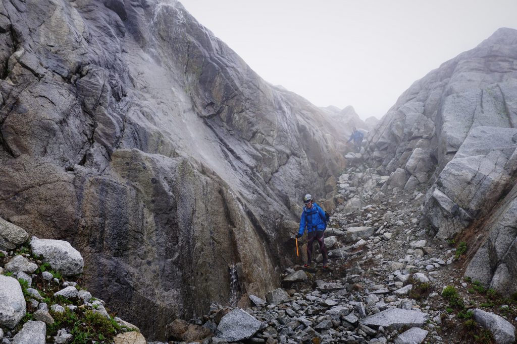
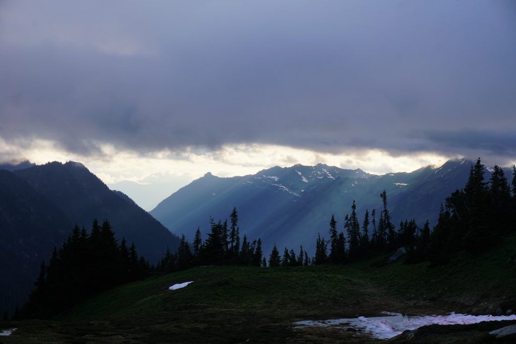
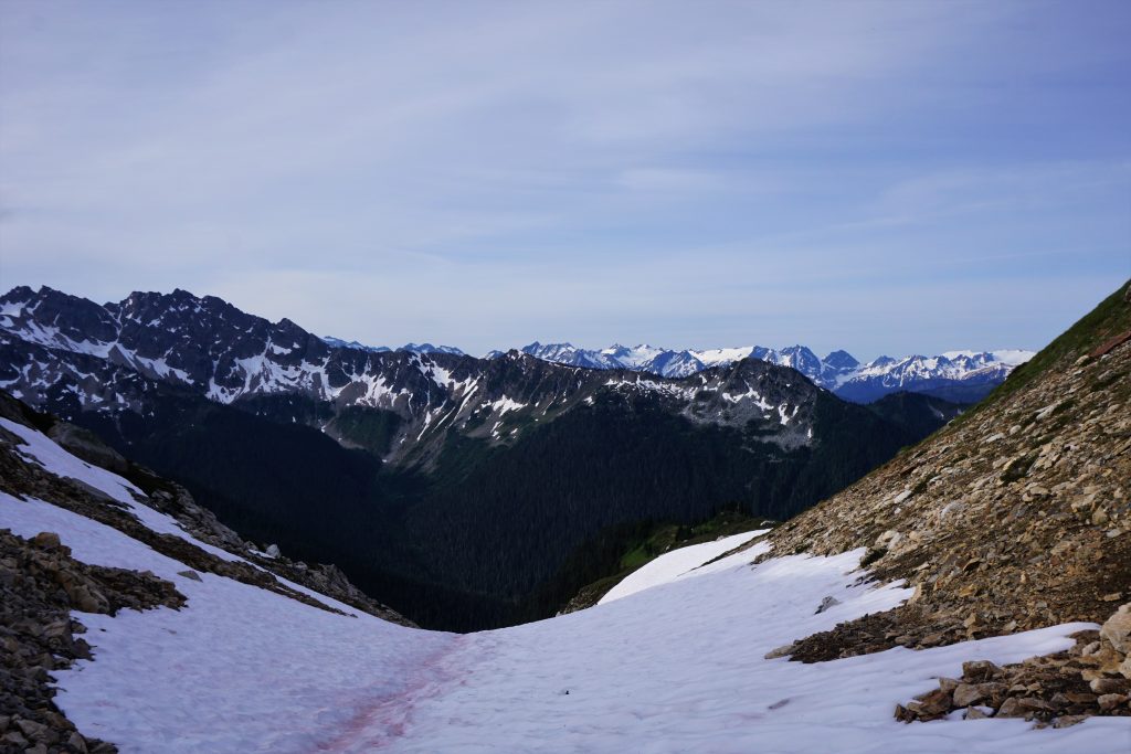
It began to rain. This next section to Kaiwhat Pass was the biggest unknown of the trip. We were not sure whether to descend on the east or west side of the ridge and with limited visibility, it was even tougher to figure out. We traversed right for a while, eventually crossing onto the west side of the ridge and onto the Garden Glacier.
In the clouds, it was difficult to tell if the main snow chute would go. We feared it would steepen and cliff out in a sketchy waterfall, so we trended left onto rock slabs. Visibility dropped to less than 100 ft and we wandered through wet cliffs, just taking it “75 ft at a time”. Logan did a great job leading us through this section.
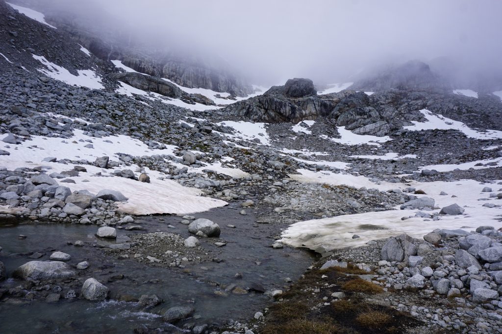
Finally, I found a gully that split some huge cliffs and we stumbled out into a nice rocky basin. It felt like threading the needle. The rain abruptly ended and we walked across a stunning moraine basin. Numerous little streams and waterfalls cascaded around us. At this point, we were so out there, this was a place that probably a dozen people visited on any given year. Even in the fog, it was marvelous.
From here, we traversed downwards easily to Kaiwhat Pass, even seeing sunny skies begin to appear.
At Kaiwhat, we began ascending south through heather and open forests on a faint game trail. We were all getting pretty tired, but knew the day was almost over.
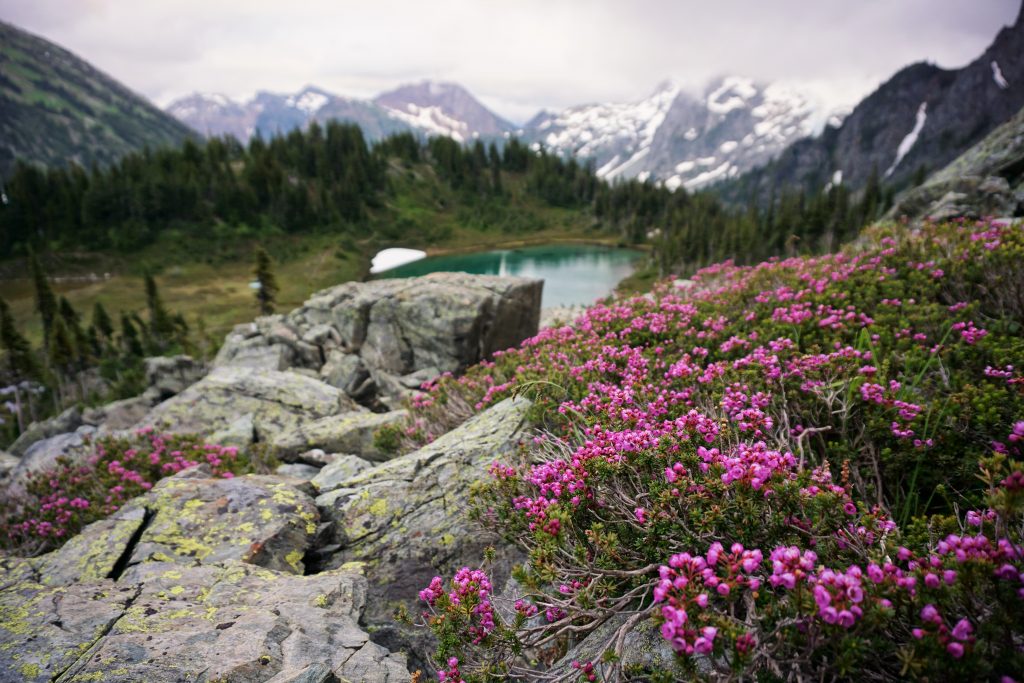
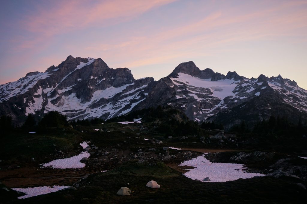
The Hanging Gardens are a series of benches atop the ridge south of Kaiwhat. I had never seen any photos of this spot, but it sounded enticing. We found a lovely tarn, flat campsites, and beautiful meadows abound.
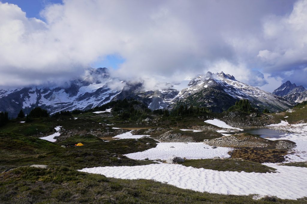
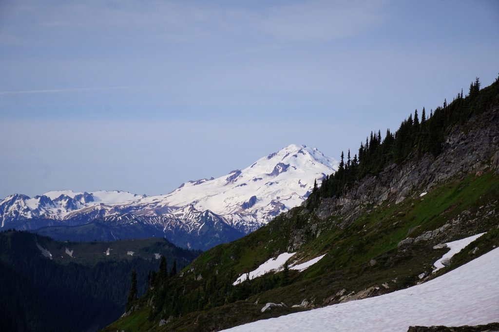
Throughout the evening, clouds continued to stack up against Dome Peak and the Bath Lakes Peaks to our south, but we often had a hole of blue sky above us. We got peek-a-boo views of the giants around us. The dichotomy between the rugged, ice-clad Dome Massif and the gentle meadows around us captures the essence of the Glacier Peak Wilderness. We felt like we had discovered yet another secret, but we know that there are an infinite number of special spots like this for those willing to explore.
We were able to walk around camp barefoot and dry out our wet feet. It was such a relaxing, calm evening, napping in the meadows. Finally, the sun went down and temperatures became frigid, so we crawled into our sleeping bags for the night. It had been a fantastic day.
Day 4: Hanging Gardens to Suiattle TH
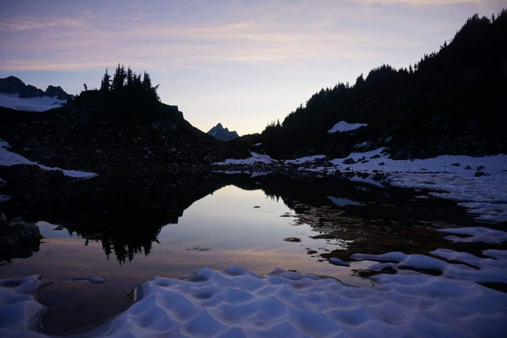
It was a cold, clear night, well below freezing. But at first light, I escaped from the tent and into the pre-dawn light. The mountains around me were still dark shadows, but the sky was already pink and purple. Dome and Sinister finally revealed themselves to the Hanging Gardens. This was easily in the top 5 most beautiful campsites I have ever had in the Cascades.
I ran around, partially to capture the different light and angles, but also to just warm up in the freezing air.

As the sun started to come up, the rest of the crew got up to appreciate the sublime morning.
We did not waste too much time, since we knew a real soaker of a storm was headed our way by the evening and we had something like 24 miles to go even by the shortest route out.
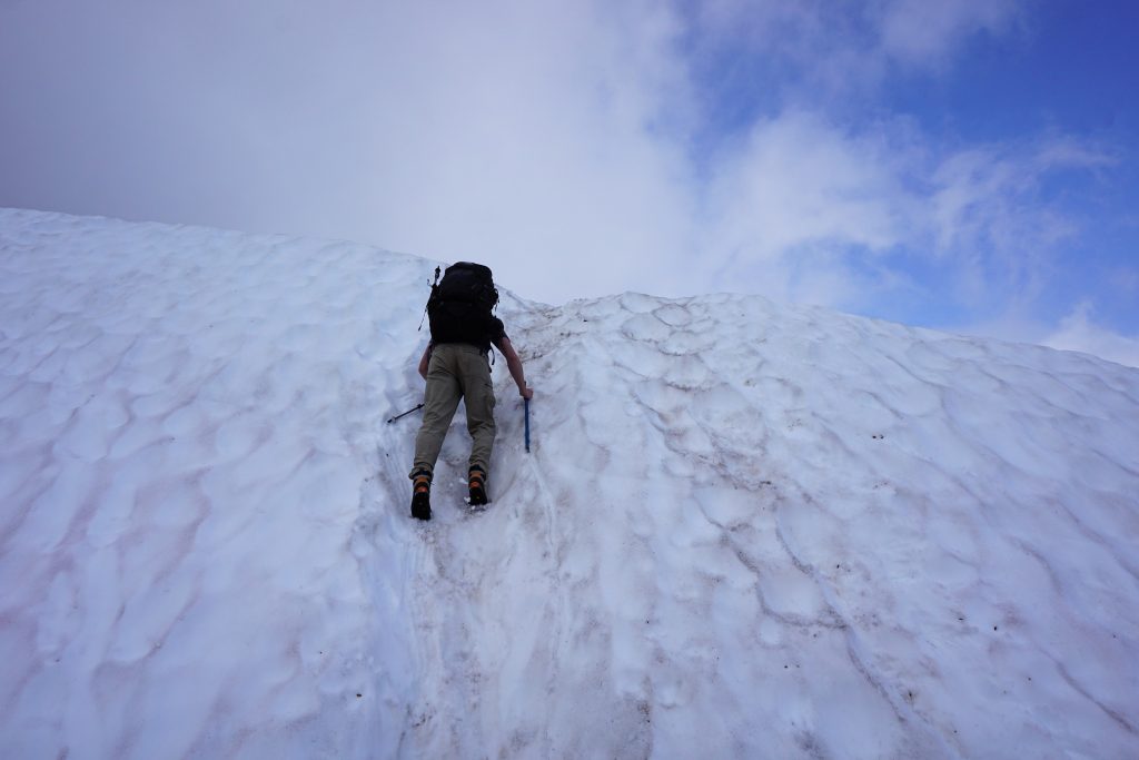
The section from the Hanging Gardens to Totem Pass is not difficult, but it requires a lot of slippery heather sidehilling.
Finally, we got to snow and then climbed up to Totem Pass.
This is where we had to make a decision. We could go big and try to finish the trip via the long and strenuous Bath Lakes High Route or we could take the unmaintained trail from Canyon Lake to Image Lake and hike 16 miles out. We knew the Bath Lakes High Route would be a stretch to finish by nightfall and the weather forecast was not good, so we “settled” for a nice hike by Image Lake.
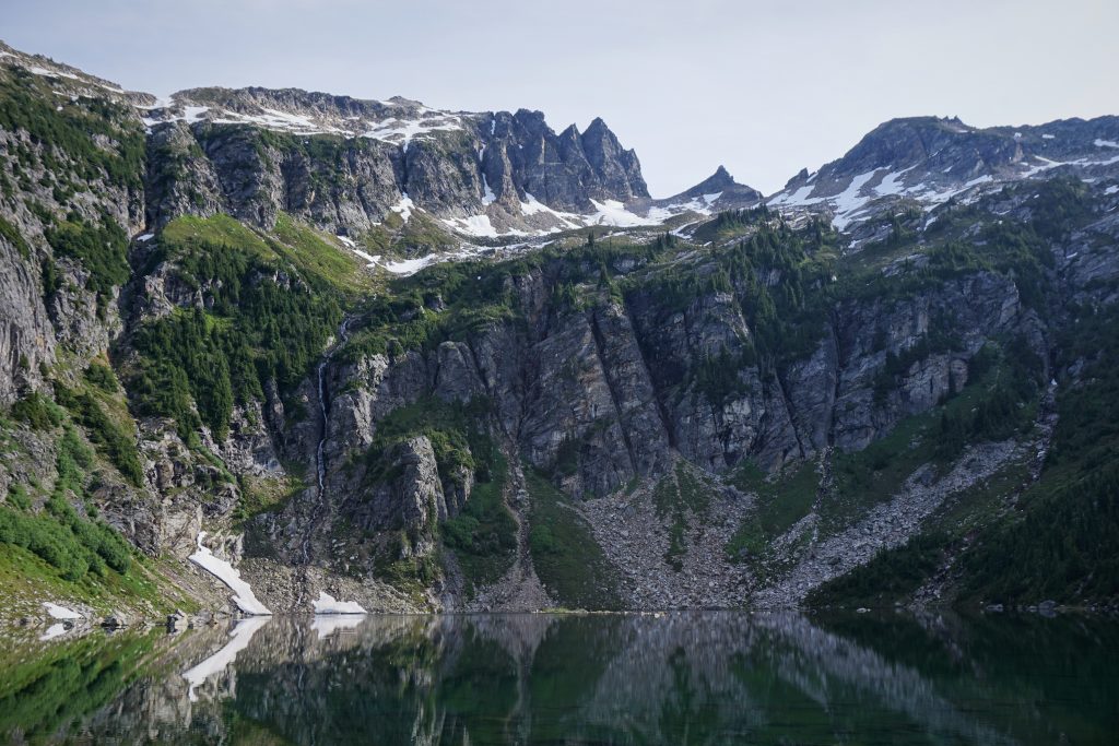
We descended down the snowfield and then cut left when we found a trace of a goat trail. This led us down to Canyon Lake, which is set in this incredibly steep cirque.
We found the abandoned trail at the far side of a boggy meadow and started climbing up out of the forest. The trail was easy to follow, but definitely not in good shape. Higher up, we broke out into nice meadows and had a pleasant few miles.

The trail descended for a while and entered back into the forest. This section was pretty exhausting, climbing over endless blowdowns and fighting through brush.
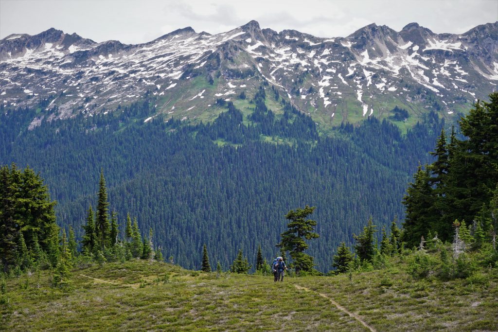
Finally, we started climbing once again and entered sub-alpine meadows beneath Miner’s Ridge. It was striking to look back at the entirety of the Bath Lakes High Route. We were glad we did not attempt such a long heather battle.
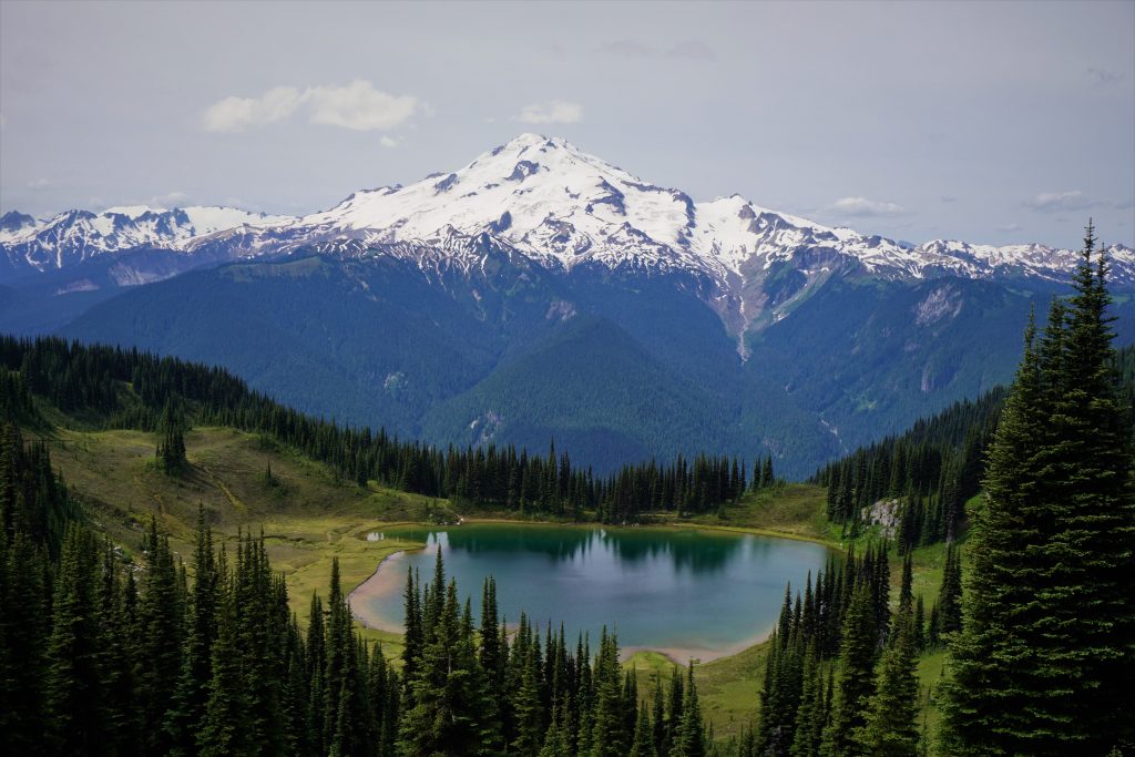
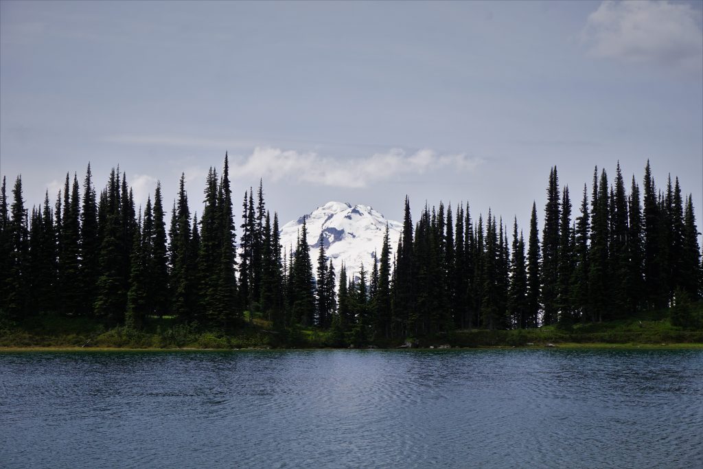
The view from Miner’s Ridge of Glacier Peak and Image Lake is so classic. I remember first seeing an internet photo of Image Lake and immediately falling in love with the Glacier Peak Wilderness, even before I had ever visited. For five years I have wanted to visit this spot. I could not think of a better way to visit Image Lake than at the end of the Ptarmigan Traverse, where rock and ice give way to flowers and water. It was so incredibly perfect.
We followed the super annoying trail a mile to the left and then back to the right just to get down to the lake. It is a little silly, but I guess it is better than having trails all over the place throughout the meadows.
We ate lunch and lounged in the sun on the shore of the lake. We also saw the first people since Cache Col.
There is a nice trail around the lake and we joked there should be a track race out here. Since I did have running shoes with me, I decided to see how fast I could get around the lake. I took off and dropped a 2:15, or 5:20 mile pace. I am definitely not in track shape anymore! My gut felt queasy and my legs were burning, but at least I was only walking a marathon with a heavy pack that day, right?
Eventually it was time to leave. We followed the Miner’s Ridge Trail, which had one more glorious climb to the ridge top before diving towards the Suiattle River.
We plunged down to the Suiattle River Trail, which we followed out to the trailhead. For a river trail, it is not very beautiful because it does not follow the river very closely, unlike the Hoh River Trial or such.
We kept pounding the miles, but Jacob never once complained in his mountaineering boots! He is one tough guy. In the last few miles, the sky once again opened up on us and the deluge began. We arrived back at the car around 7 pm, tired, wet, and ready for real food! But first, we had to do that damn car shuttle again…
Reflections
Although only four days, this trip had the feel of a longer journey. We had challenges – mostly the poor weather – that were frustrating in the moment, but ultimately made the experience so much more rewarding. In good weather, the Ptarmigan is a walk in the park. But in our conditions, it was a constant challenge to stay dry and manage the routefinding with the ever changing weather.
In many ways, this trip felt like a lesson from the mountains to me in acceptance and patience. Even when things are not going your way, there are incredible opportunities during those fleeting moments of sunshine and a certain mystique beauty in the gloom. With the personal challenges I have been facing, I really wanted splitter weather and perfect conditions this summer. But life has had other plans lately, and I need to accept them, no matter how jarring it feels. My new challenge in life is to find the beauty in the darker days.
As for the actual Ptarmigan Traverse, it was every bit as beautiful as expected. It does see high traffic, so it does not feel as remote as it could. However, once you go over Dome and head through the Gunsights, you are in truly wild terrain. We all agreed that the most spectacular terrain was from Dome Peak to the Hanging Gardens, but the regular Ptarmigan Traverse ends before the best part!
Finally, I would like to thank Daniel, Logan, and Jacob for joining me on this wet sufferfest. It takes a certain type of individual to go along with my crazy plans, especially with a questionable weather forecast. This was truly an all star squad that may never again come together, but hopefully we have adventures in our future! If nothing else, we will have these memories together.
Curious about what gear we used? See this post about my favorite high route gear.
Kyle,
You mentioned the mountains were teaching you patience. I had just read this. We may not all develop patience as quickly as we want, but we can learn to tolerate our impatience better. Food for thought! The pictures are incredible.
Thanks for sharing your vast knowledge.
Cherie Feryn
Thanks Cherie! I love getting your perspective on things.
Your eloquence, perspective, patience and appreciation of the mountins is beyond your young years. Well documented trip and spectacular route you put together.
Thanks Mike! This is one of my all time favorite trips. Glad you appreciate the story.
Last week, four of us did the traditional PT route, exiting via Bachelor Creek. Because that trail has not been maintained for years, the bushwhacking caused by blow downs and downed trees over the “trail” made the last day a very long nightmare. Never again. Another group of 4 guys also shared our sentiment.
Your extended route looks like a better option…but honestly, for 70-yr olds, backpacking has appeal, but not technical rock climbing with a heavy pack. Exposed class 4 is now so slow going, esp. when there is unknown route finding. Is doing the PT a hopeless route, unless the USFS spends a million bucks to restore the trail from Cub Lake down?
It also could be partly because the Suiattle River trails are technically closed, so I think you’re not supposed to go out that way?
The extended version does not have to have exposed class 4 I think. Dome summit can be skipped. Then we messed up around the Gunsights and did not go to the actual Gunsight col.
Kyle,
What an excellent photo essay!!
I am looking at the possibility of doing a trip that would end at Holden Village.
We would follow your route to just past Canyon Lake, then it appears (from topo maps and Google Earth) that we might be able to angle up from the Canyon Lake trail to the notch just SW of the summit of Sitting Bull. From that col we would follow the ridge SE for a bit before angling South to meet the PCT in the lower flats. From there an easy exit over Cloudy Pass and down to Holden. The big unknown is the coming down the ridge from (basically) the summit of Sitting Bull.
What do you think?
Looks reasonable but a little steep! I know people sometimes cross over to the Bannock Lakes instead of Canyon Lake so you could do that instead.
Climber Kyle, thanks so much for your response and comments!
I think I see the route, maybe angle down to the lakes from Ross Pass?
Looks like some of you were wearing the La Sportiva Cyklon Cross GTX, a shoe that I was not familiar with until I read your post. Do you recommend them? I have been looking for a light weight spring/summer snow solution.
Those are an older sportiva shoe that is discontinued. Similar to the Cyklon cross, although I have not tried the newer ones. They are good until they get wet, take a while to dry after that. Worked well.
Got it.
I have been using an oversized light shoe over a waterproof sock over a thick wool sock to good effect.
My issue has been that the shoe gets wet, and therefore heavier. Was hoping the over-gaiter on the La Sportiva might solve that
Great post! I was wondering if linking the Ptarmigan and Isolation traverses would be possible on foot. There are few reports of people crossing Isolation without skis, but it seems like a really cool opportunity if possible.
Yes it’s possible. Kaytlyn Gerbin and Jenny Abegg famously did that last summer on the “North Cascades High Route”. Look them up and you’ll see it.
Wow! They are incredible athletes. Thank you so much for your help.
Hi Kyle!
Your work is truly helpful! I was wondering about wildfire season in this part of the Cascades during August. I have heard it can be hard to see at times. Is a late summer Ptarmigan Traverse possible given these conditions? Thank’s so much for everything you do.
Wildfires are rather unpredictable. August typically will have a few, not necessarily right where the Ptarmigan is though. It depends on the direction of the winds. Some years we have none in August, other years it is bad.
The Ptarmigan itself is usually fine later in the summer. You might encounter more blue ice on the glaciers but it’s usually low angle and the crevasses aren’t impassable.
Hey Kyle,
Do you have a gpx file of the ‘extended PT’ that you’d be willing to share? There’s currently a post on PNW peakbaggers (on FB) requesting one…I thought maybe you would have one.
Hey Seth! This was pre-strava for me so I have no idea where the GPX is. But it looks like my post has a pretty detailed map of the extension so that should be enough!
Thanks Kyle!
Amazing photos! We’re looking a doing a portion of the PT out and back soon (to avoid the blowdown section). Did you bring both trail runners and mountaineering boots?
We just used trail runners. You’ll probably encounter some blue ice on the Le Conte Glacier, so you’ll definitely see different conditions than us.
Kyle, thank you for sharing all your reflections and your photos. In 1976 I hiked up to Image Lake with three high school buddies. We took a day hike to Canyon Lake and got lost in the fog and rain. We used our compass skills (pre GPS) to relocate the trail and made it back to base camp just before darkness. Seeing your photo of Canyon Lake brought it all back. Such amazing country.
That sounds like a wonderful adventure! Thank you for sharing.