
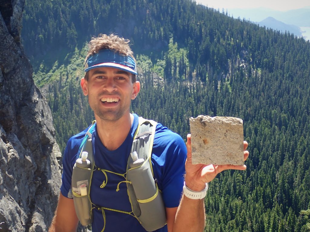
Riding the Ridges of Snoqualmie Pass
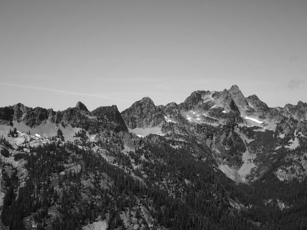
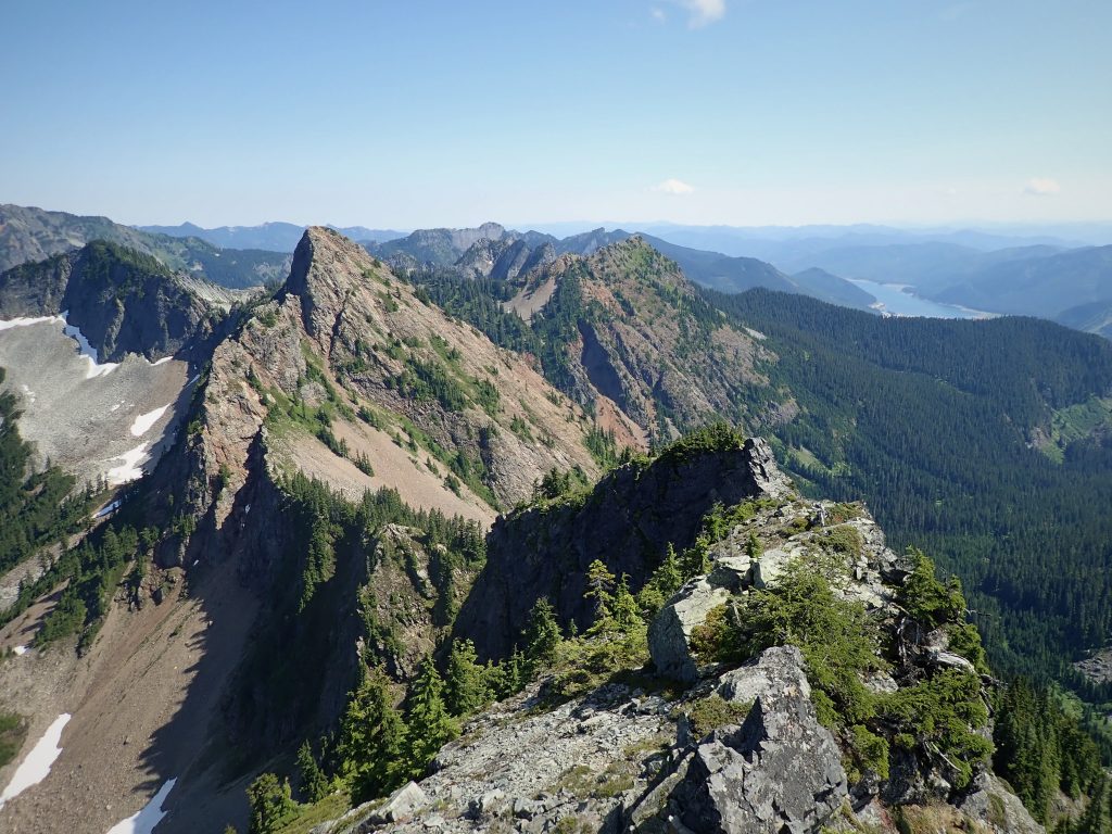
During our first big climb together, the West Ridge of Forbidden, Anthony and I found that we had great chemistry on alpine rock scrambles together, moving efficiently with the same philosophy about staying light, fast, and moderate. The trip was a smashing success, so we decided to keep in touch throughout the summer. We started talking about various ridge linkups near the Snoqualmie Pass area. He spends a lot of time running and scrambling at the pass and spoke about some cool looking ridges around the Commonwealth Drainage. His other speedy friends confirmed the ridges were awesome and worthy of adventure. We hatched a plan to try to ride the ridges around the entire valley, enchaining Guye, Snoqualmie, Lundin, Red, the peak north of the Kendall Katwalk, and Kendall itself. We decided to call this route the Commonwealth Ultimate Ridge Linkup (CURL), a play on the famous Wasatch Ultimate Ridge Linkup (WURL) in Salt Lake City.
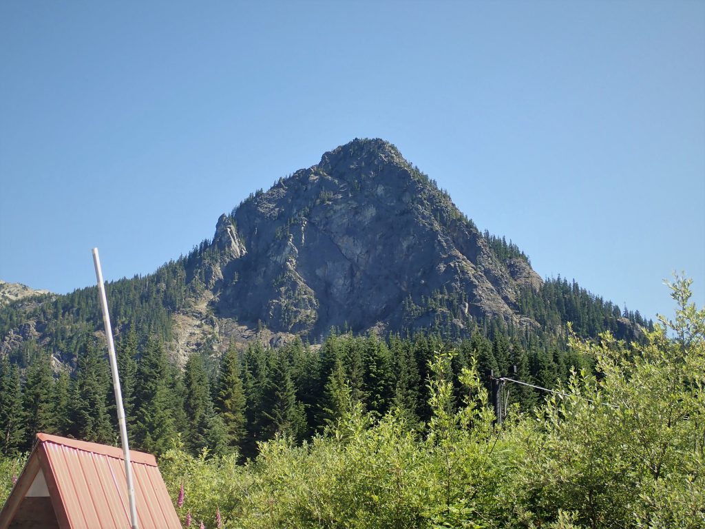
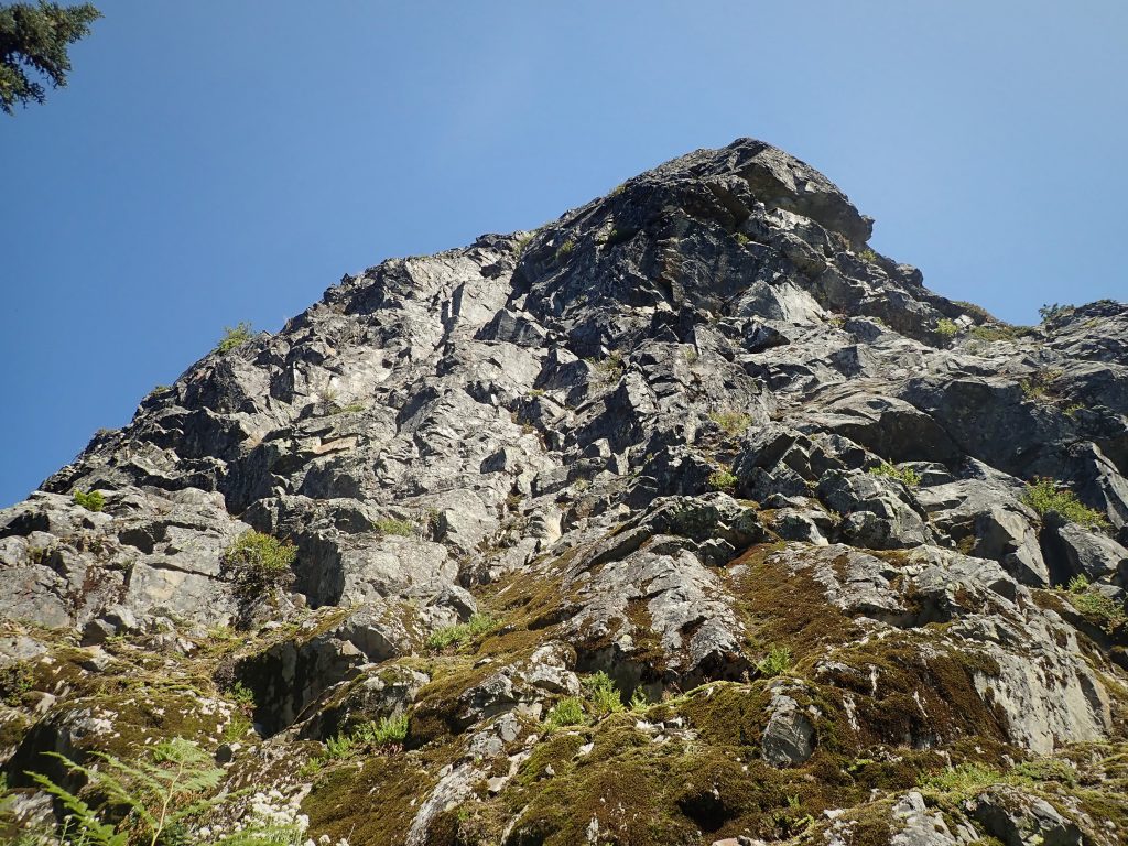
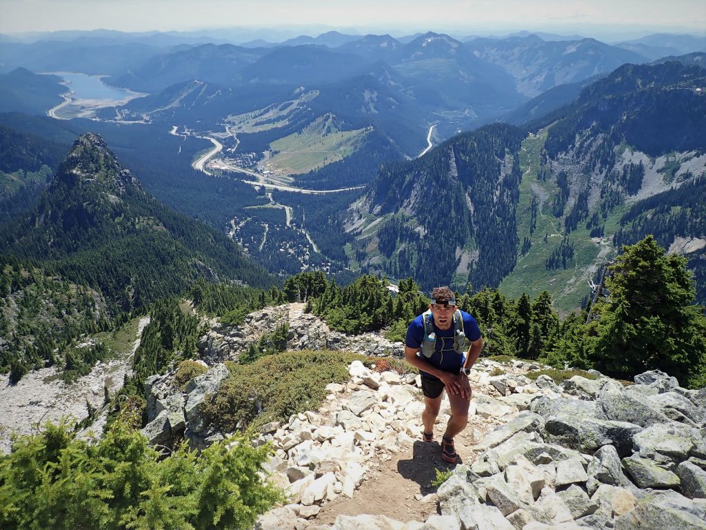
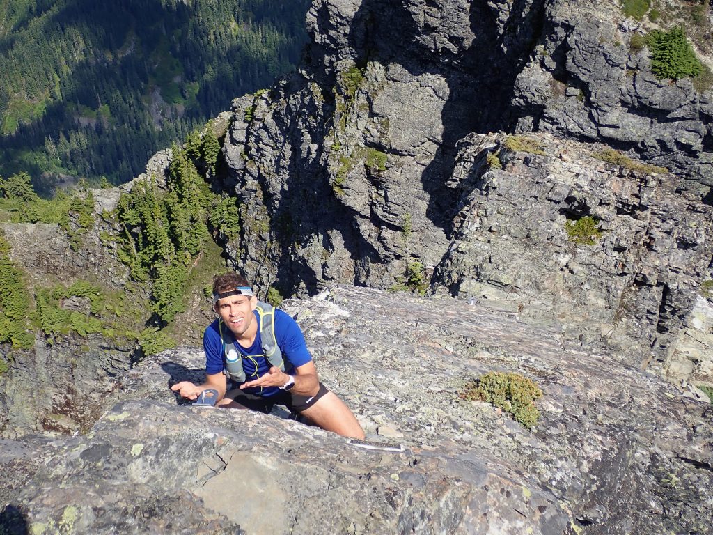
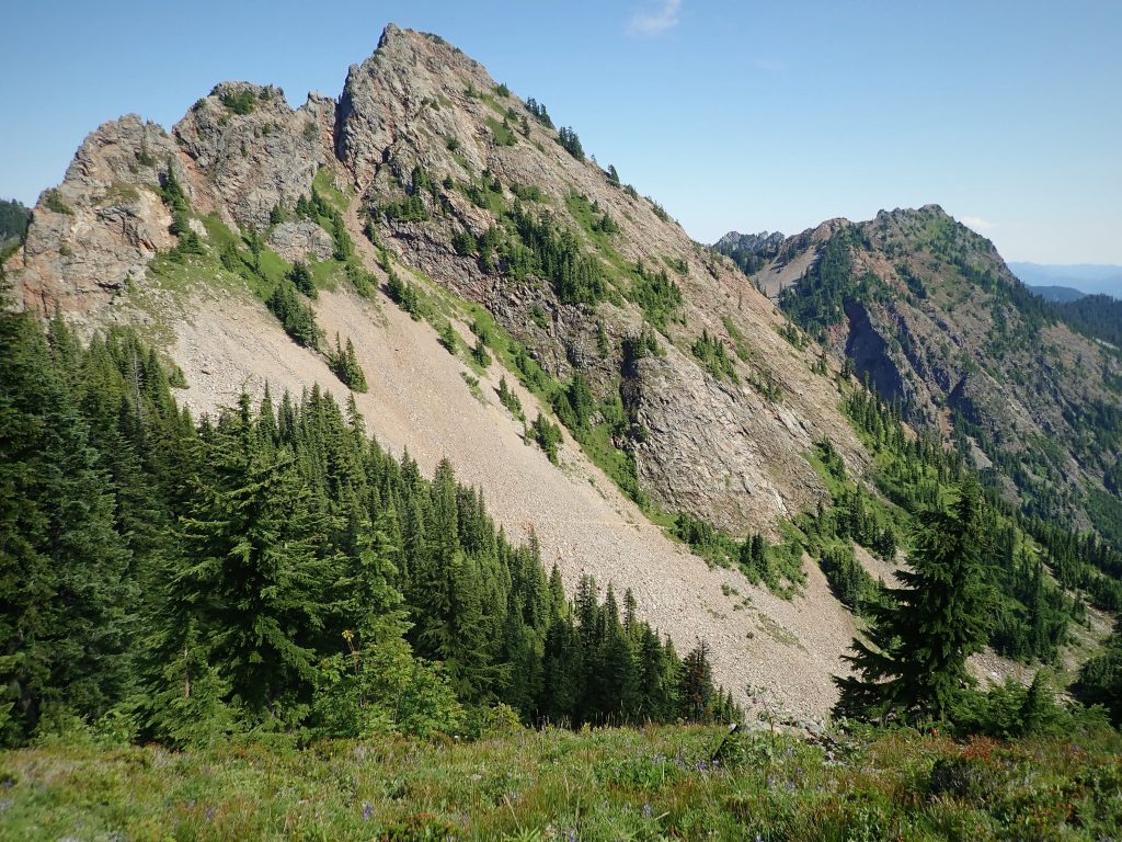
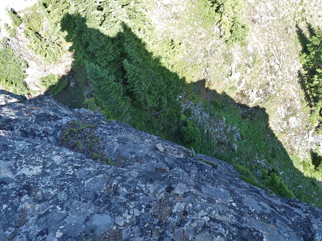
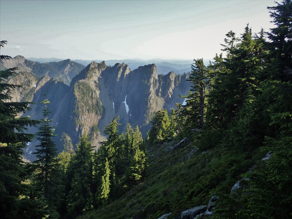
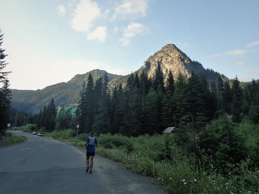
In classic “Euro” style, we slept in on a lazy Sunday morning and got to Alpental around 11 am. We parked on the side of the road and took the first switchbacking road through homes up towards the west face of Guye Peak. Some boulder hopping on talus got us closer to the impressive face, where we trended right through some brush and mossy slabs, curving around the face. This summer, I think I have discovered that my true strength in the alpine is moving fast while bushwhacking, which I’ve coined as “fast-schwacking”. Anthony is a fearless “mossineer”, clambering up mossy slabs like its nothing.
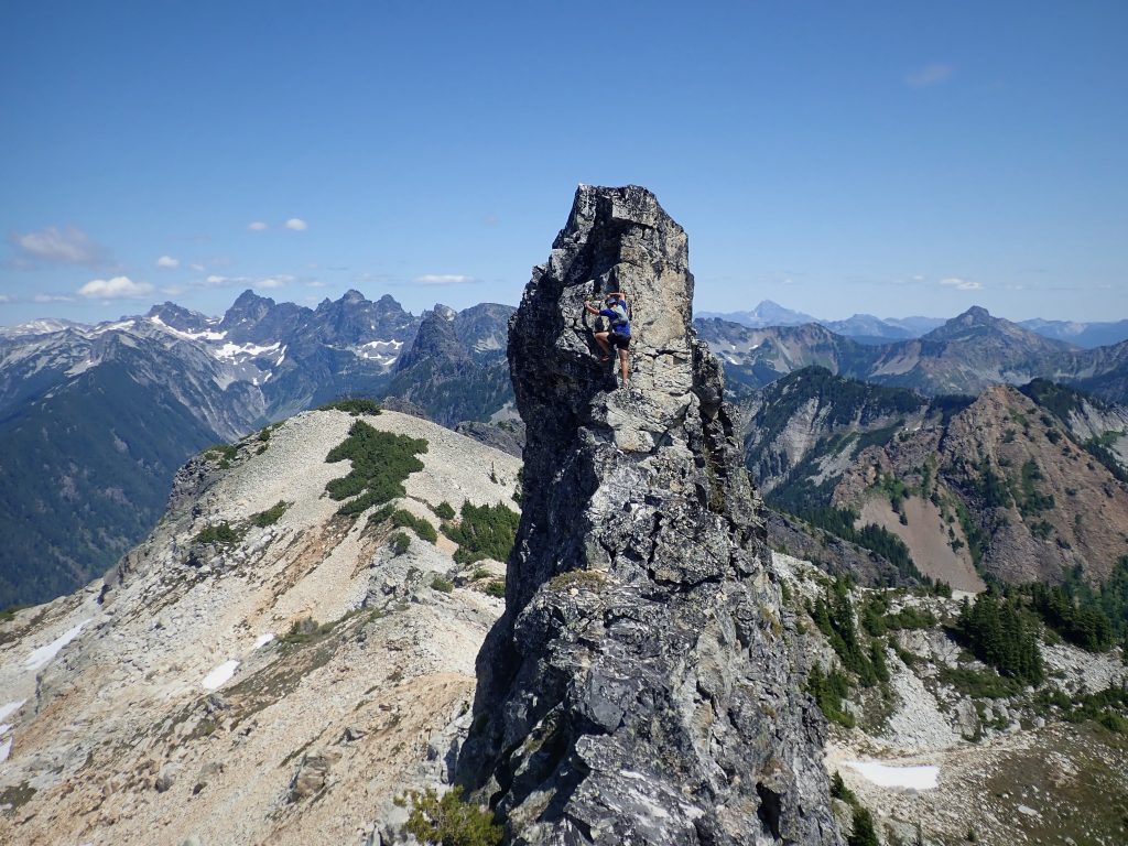
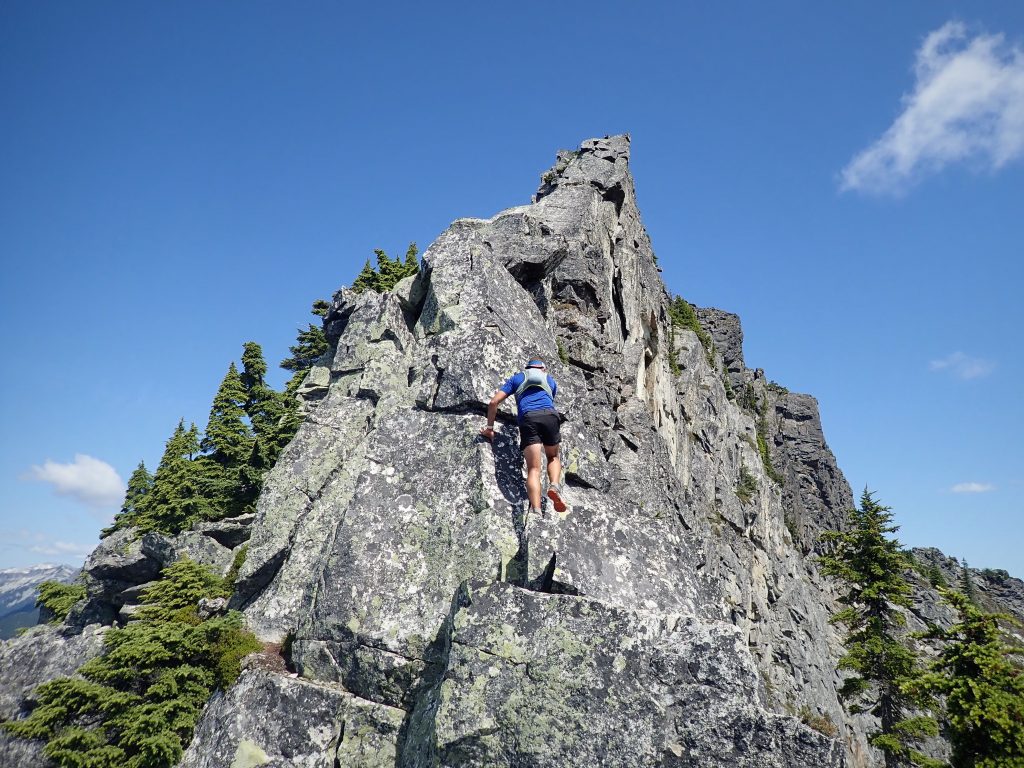
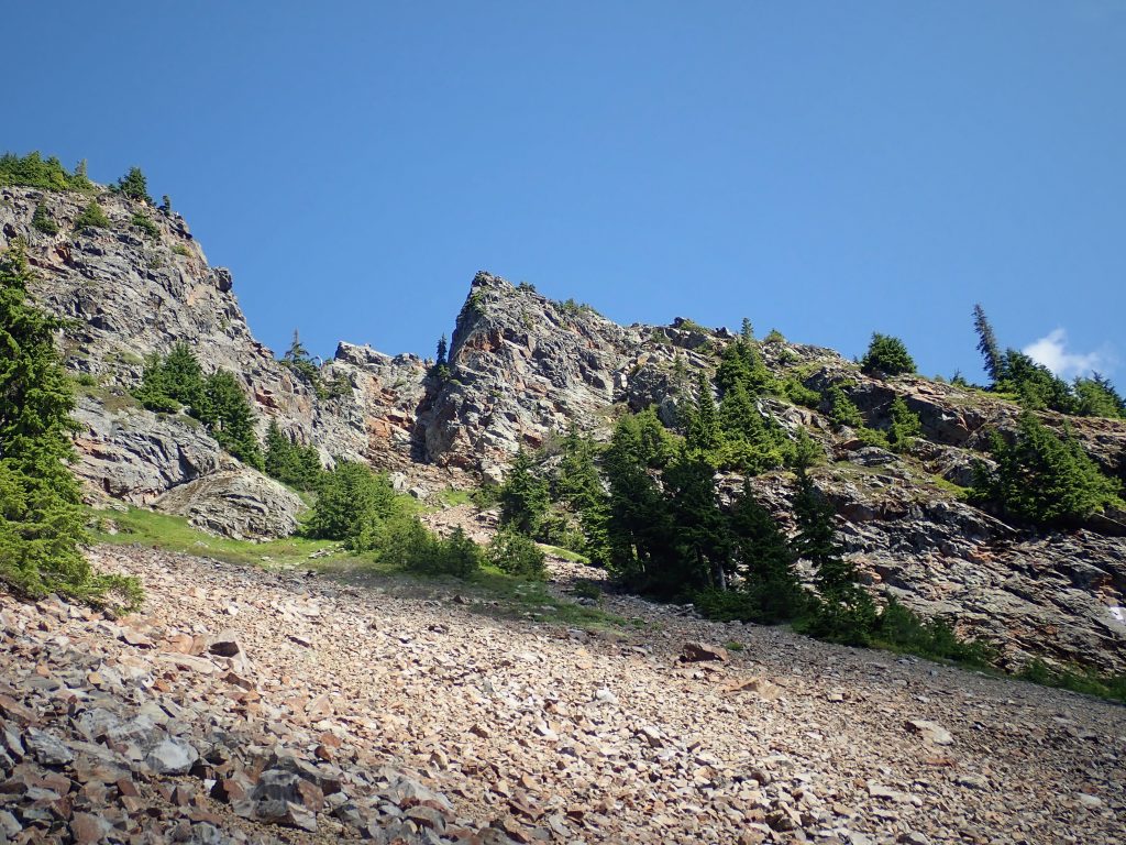
We found the South Gully. There were nice 3rd to 4th class slabs on each side of the gully, but we were drawn by a steep, positive looking wall on the rib to the left (west) of the gully around the corner.
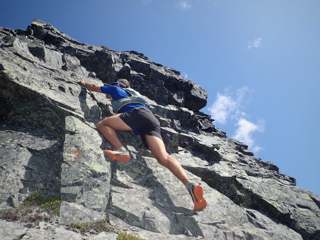
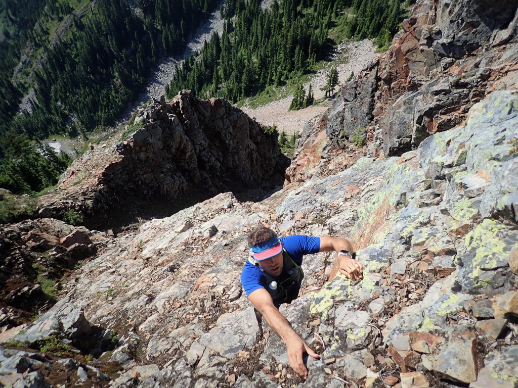
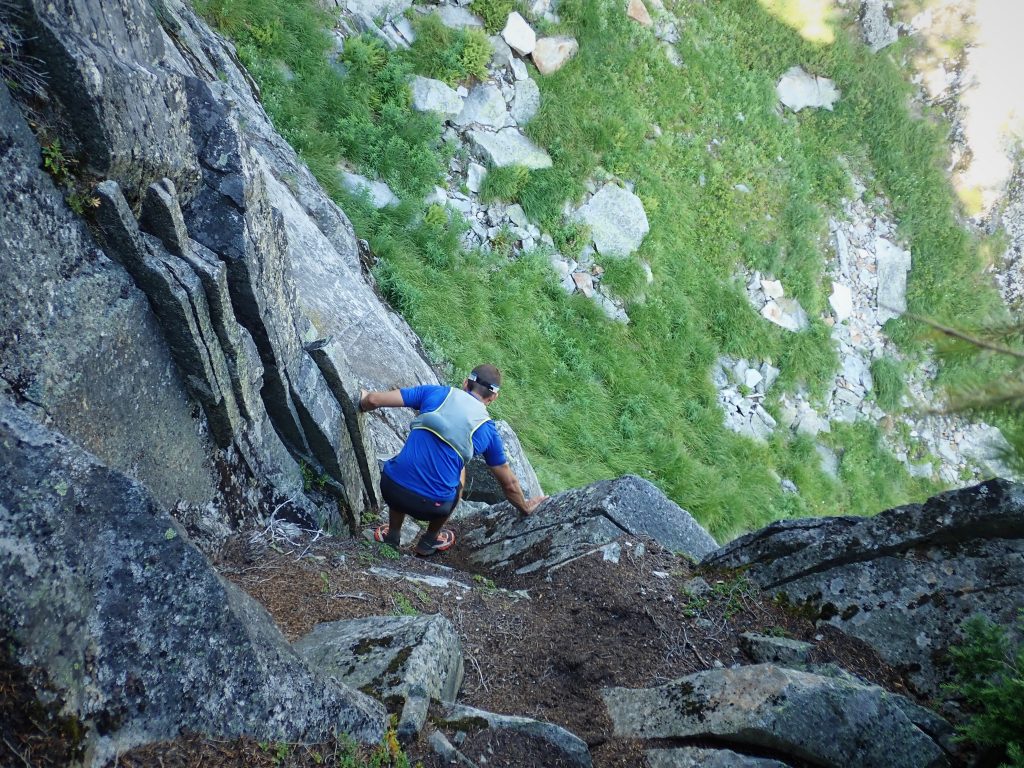
We started up, climbing perfect, near-vertical, juggy rock. We realized that we were already violating our goal of sticking to fourth class, but if you did not use a rope, it’s “Beckey 4th class”, right? But the rock was bomber, some of the most improbable scrambling we have ever done. After a small overhang in a constriction, the angle eased back a little bit.
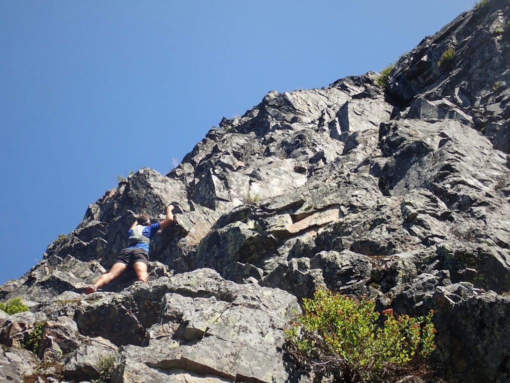
From here, we continued for a good ways on mostly 3rd to 4th class, although it was still pretty sustained and steep. The rock was generally good. Eventually, we reached some tat (possibly from the finish of a rock route on the west face) and our rib petered out, so we crossed right onto the main south ridge.
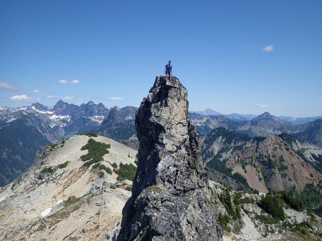
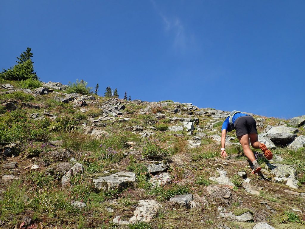
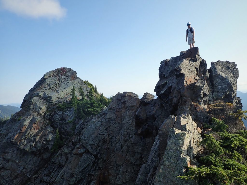
The rest of the climb was mellow scrambling with intermittent harder steps or boulder problems, but the difficulties could be bypassed if you really wanted. Near the top, we took a sick variation that traversed out onto the west face, adding some awesome exposure! It was incredible how close we were to the car and how good the scrambling was! How was this not a classic?

We got to the true (south) summit at about 1:30 from the car and took a short break before continuing.
The middle summit had a fun exposed face to ascend. We passed on the north summit, which would have required an overhung boulder problem. This was not the best idea in running shoes.
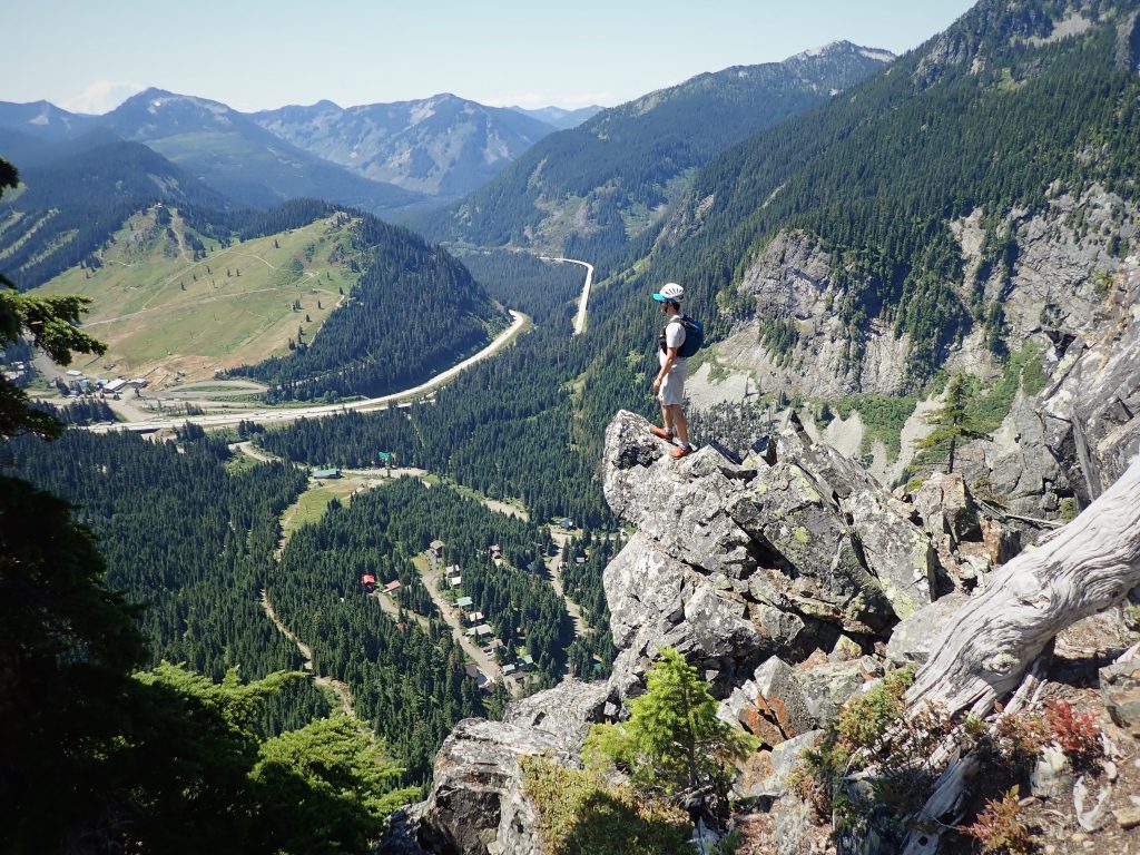
We picked up the descent trail and followed it down to a little pond. This was a pleasant surprise and we downed a liter of water and filtered more, since we were in the heat of the day and about to begin the hot climb up Snoqualmie.
The trail up Snoqualmie was nice and steep like a good Cascade approach trail. We bagged the vert and reached the summit a little under 3 hrs in.
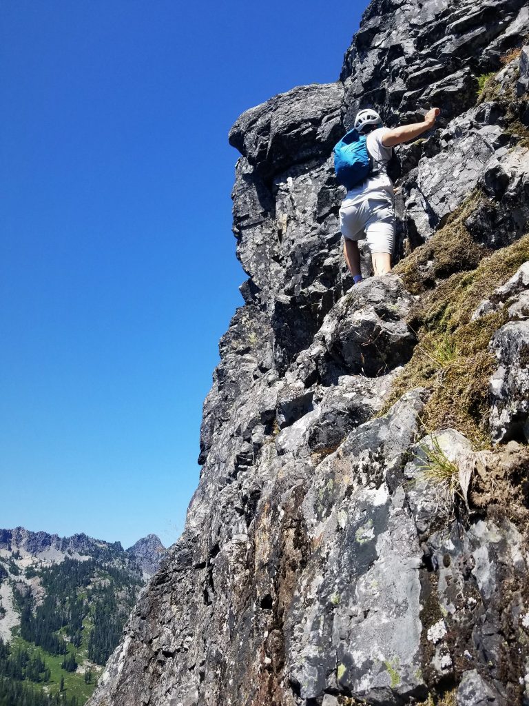
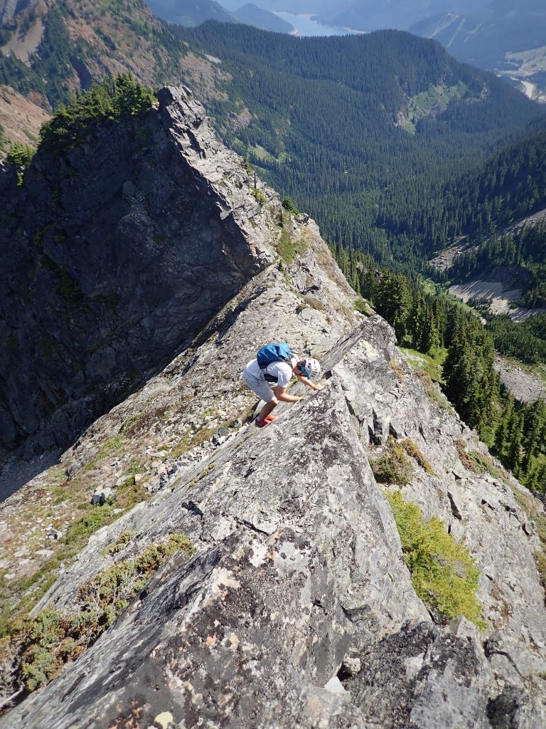
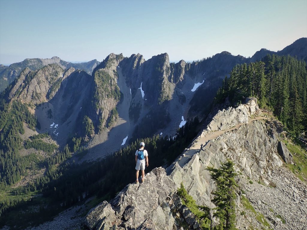
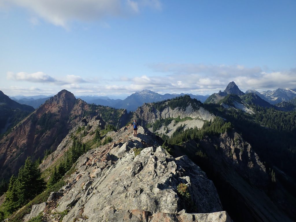
The next section of ridgeline is this awesome knife edge a few hundred feet long with a solid hundred feet of exposure on either side! It is easily bypassed to the side, but why would you bypass the most aesthetic section?
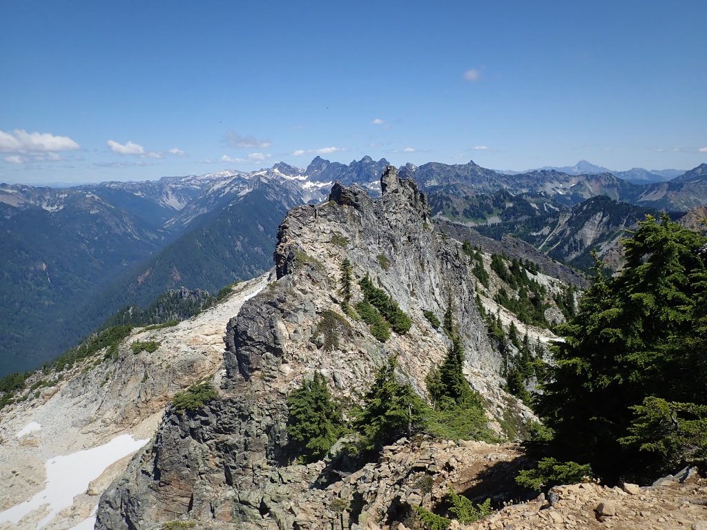
We tiptoed across the exposed ridgeline and made airy moves over a few small gendarmes. The climbing was exceptional! It reminded us of the West Ridge of Forbidden, just narrower with only 100 ft of exposure instead of 1000 ft! It incredibly picturesque. For a moment, I felt like Killian Jornet. “Time to play!”
After the terrain mellowed out to a gentle ridge, we dropped briefly off to the north to pack some snow in our water bottles. Then it was cruiser boulder terrain and open heather meadows.
The start of the West Ridge of Lundin was a long catwalk that gradually becomes more and more exposed. We passed rap slings and started climbing upwards.
We found a super aesthetic slab that looked much like the crux of the West Ridge of Prusik! Unfortunately, at the top, we found a large gap that we did not want to jump, so we had to downclimb and go around to the left. A nice bonus pitch!
We got to one section on the left side of the ridge where it was a little steeper and less featured. This was likely the 5.4 section our friend Gabe described, and the grade seemed spot on. You could protect it with nuts if you wanted.
Above, the ridge flattened out to the summit. We passed two climbers, the only others we would see through the bulk of the traverse!
Strangely, there was a swarm of mosquitoes at the summit of Lundin Peak, even though we had not encountered any so far, even at the marshy pond earlier. So we kept moving and started down the other side, four hours in.
There’s a huge mess of rap slings if you want, but we just down climbed the easy but exposed 3rd to 4th class ridge. There are these humongous bolts placed in memory of a climbing instructor who died on this ridge while placing gear for students.

After admiring the narrow entrance to the north couloir of Lundin (we gotta come back in 5 months!), we scrambled over the east summit and continued down the ridge. The mosquitoes kept following us along the way.
The false summits of Lundin were chill with some fun scrambling. There’s a pretty obvious trail to the left side of the ridge, but we stayed on the ridge line proper for more fun.
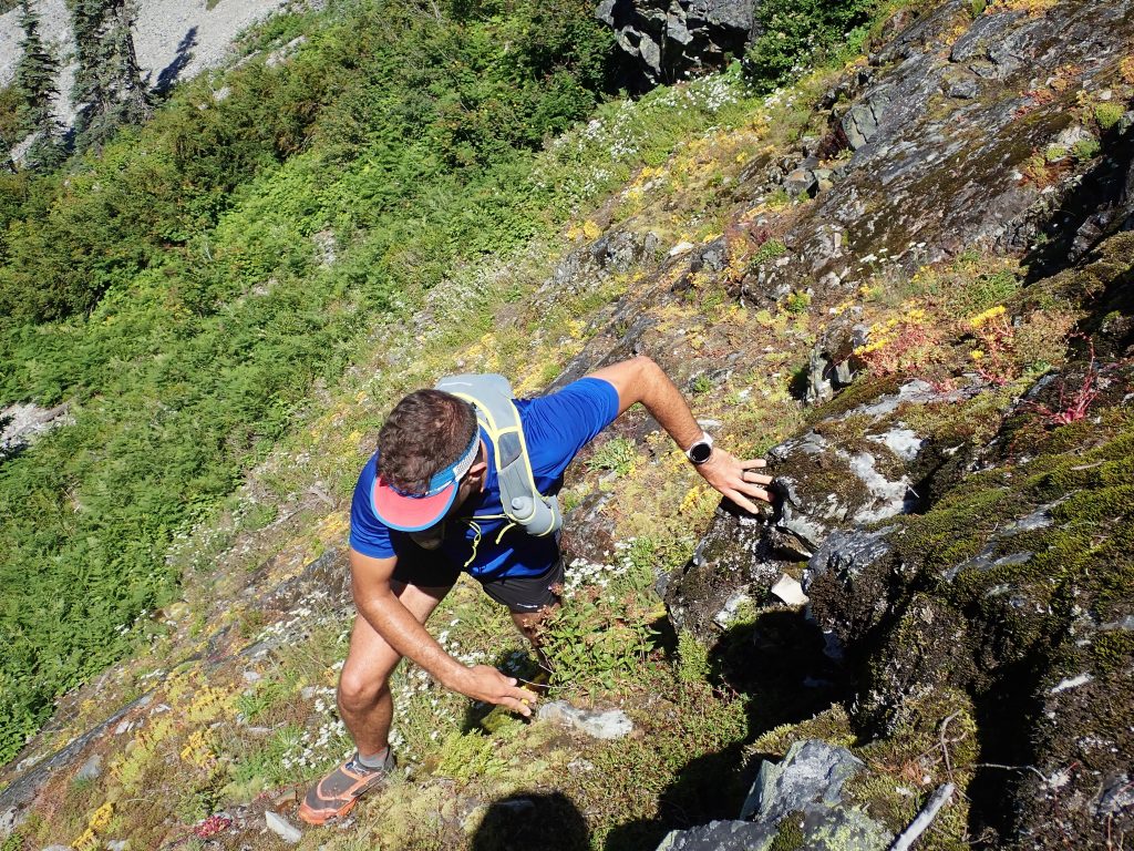
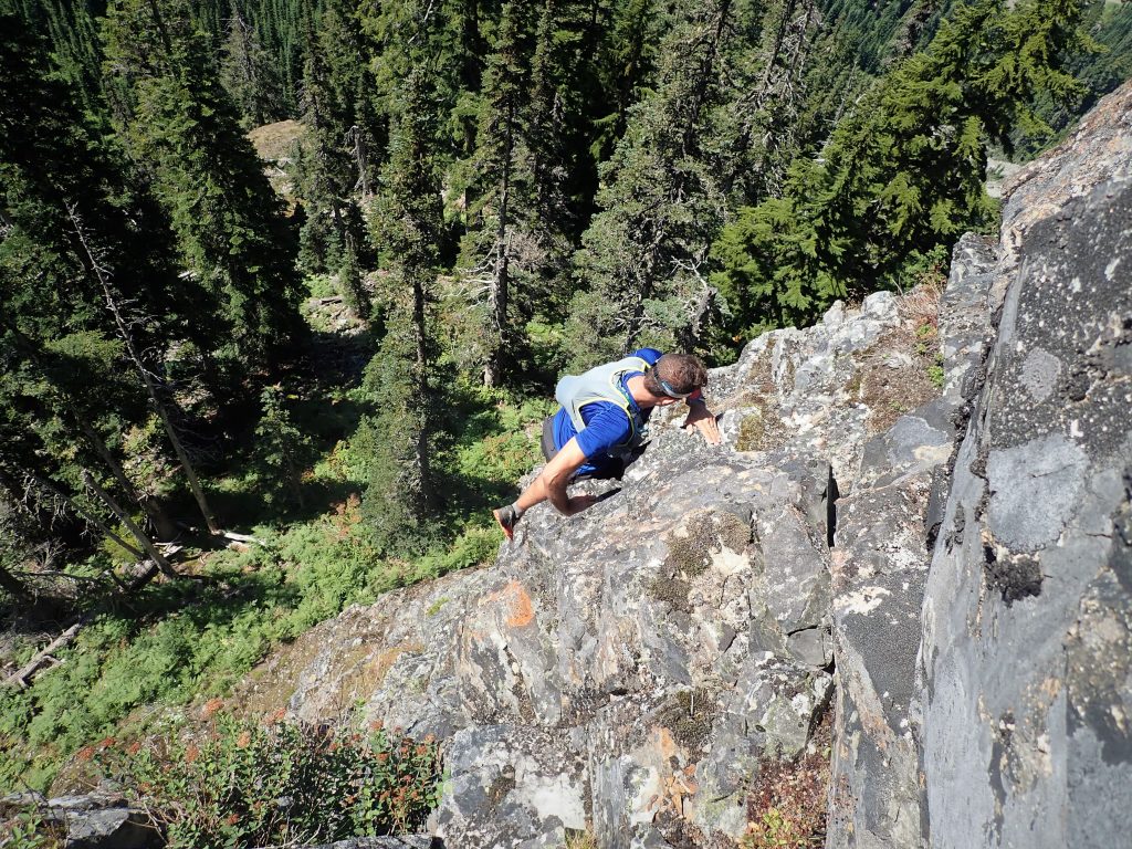
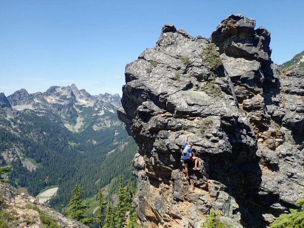
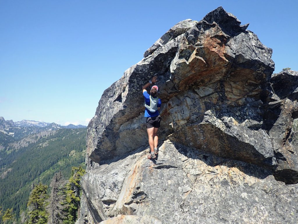
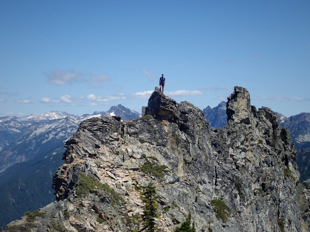
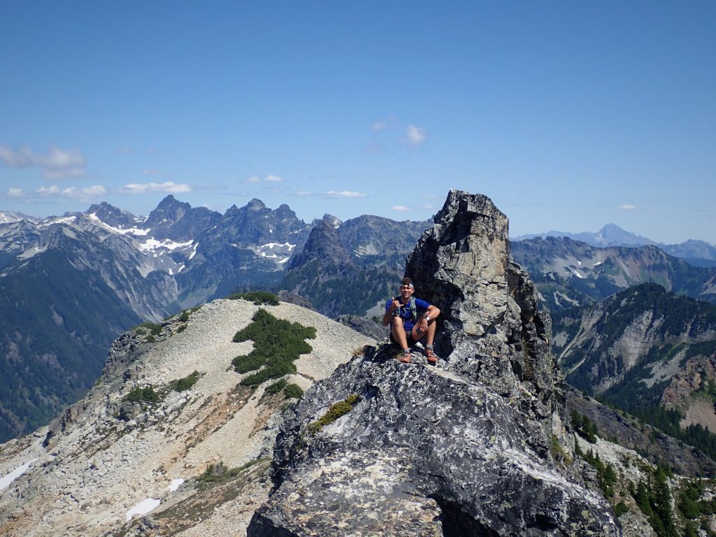
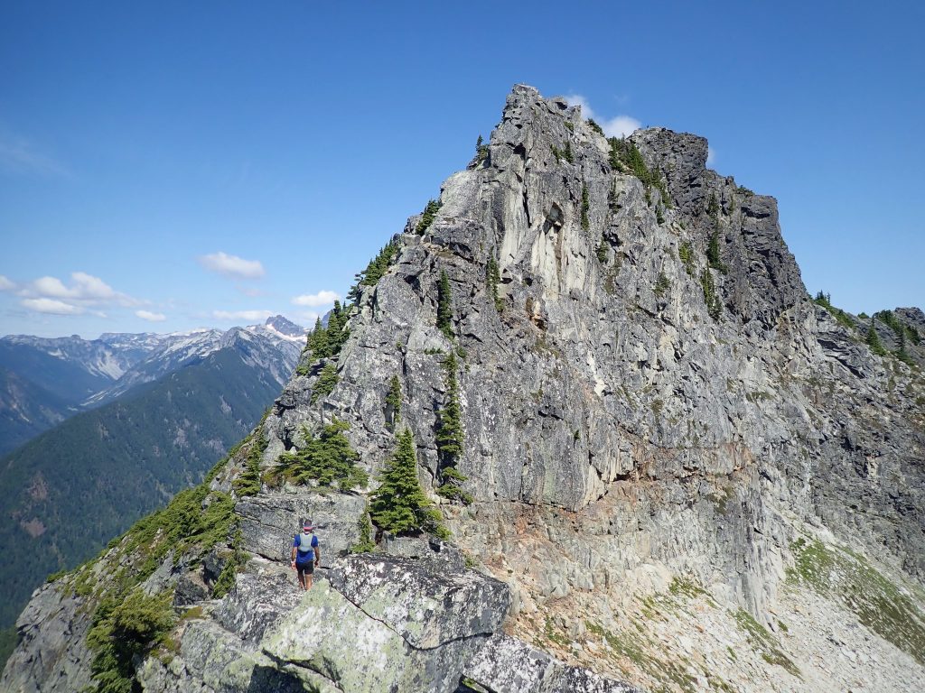
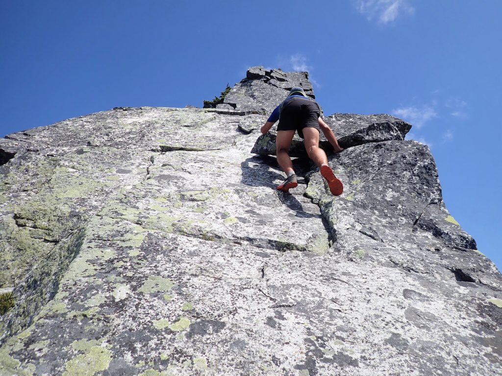
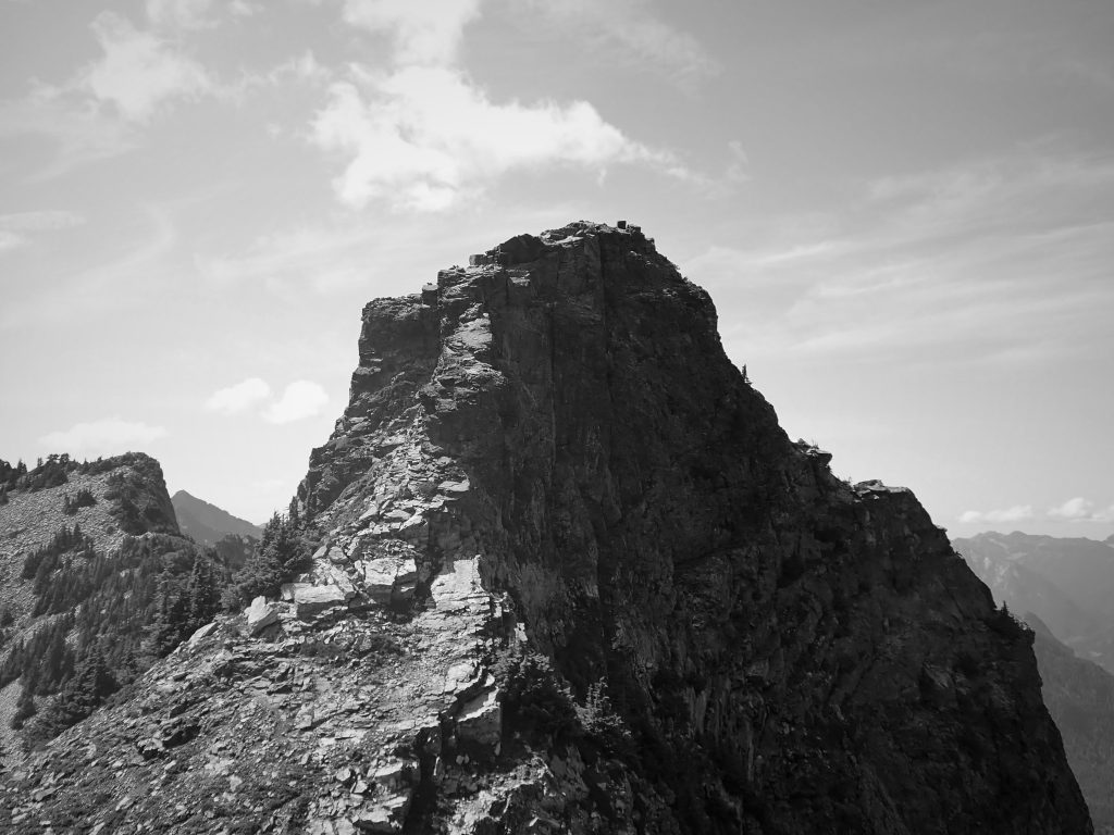
A steep, imposing gendarme came into view. There was an obvious trail around to the right, but that would be less aesthetic, right? We were committed to staying on the ridge proper until impenetrable brush, upper 5th, or just sketchy choss pushed us off.
The gendarme proved to be steep for 60-80ft with jaw dropping exposure to our left! Additionally, the holds and rock quality were not quite as bomber here and I was trying to blow the mosquitoes off my arm while gingerly testing holds at the crux vertical section! True multi-tasking alpine climbing! Maybe it was the slight looseness, maybe it was the mosquitoes, or maybe it was just the cumulative mental fatigue of so much exposed 5th class, but this felt like probably the crux of the entire route.
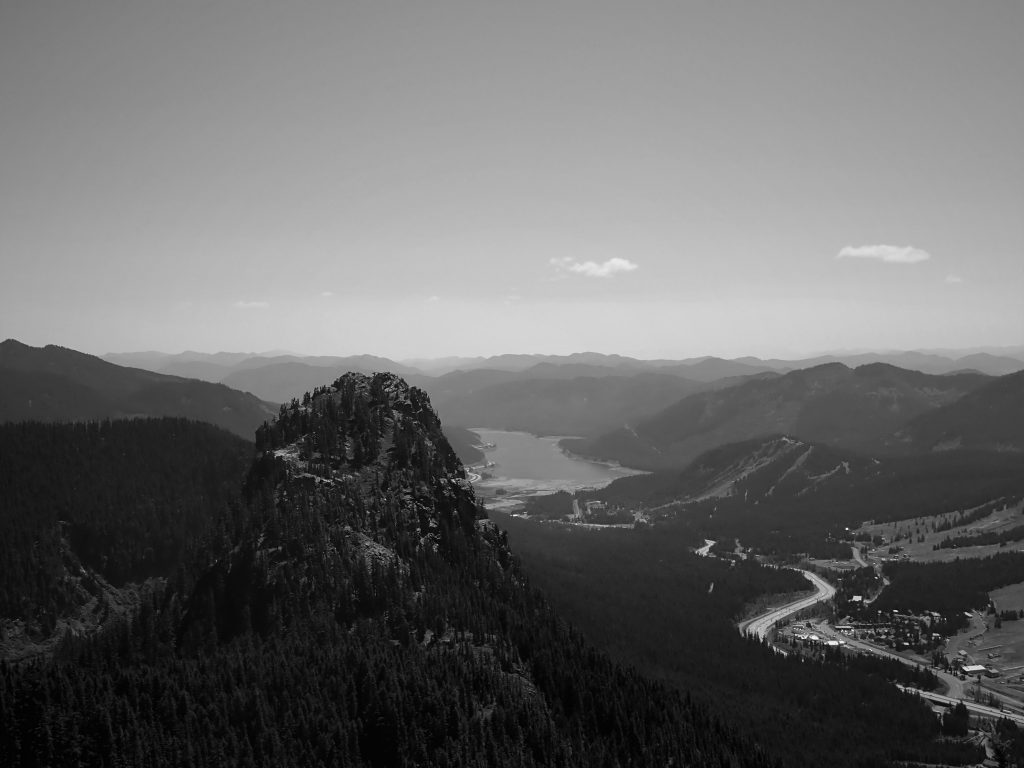
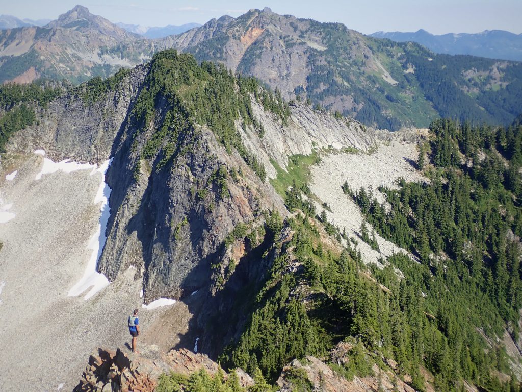
At the top of this tower, we surprisingly found a nice trail, which we followed down to Red Pass. We were even able to jog a little.
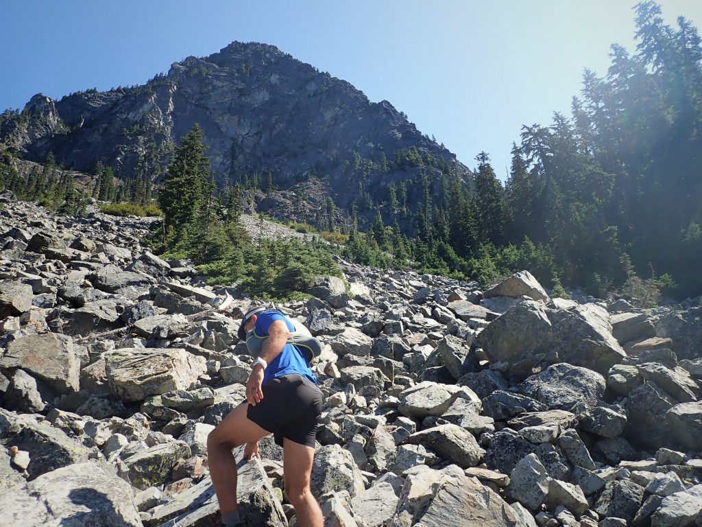
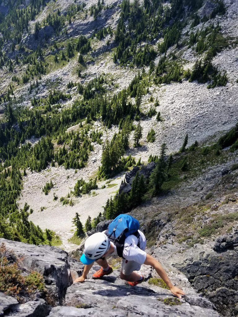
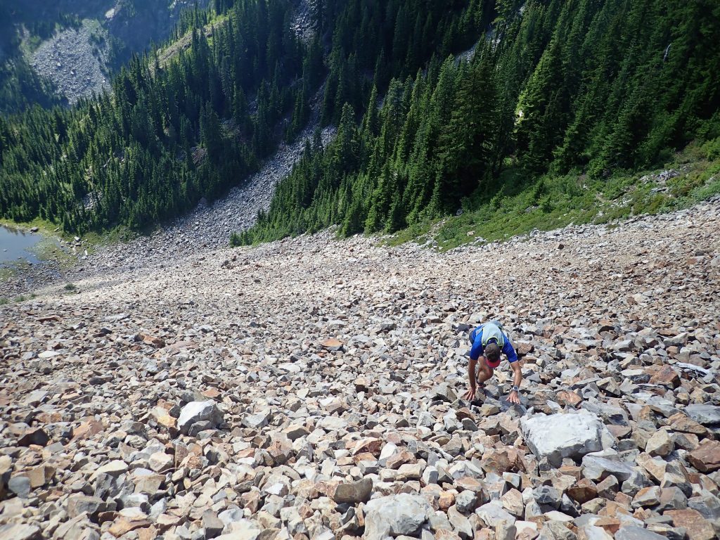
As we approached Red Mountain, we debated our route options. The true ridge looked very chossy, steep, and long. We could drop way down on trail and take the standard route up. But we also saw two gullies on the west face of Red that formed a Y. After testing the scree field, we decided to fall upwards through a few hundred feet of chossy scree to the base of the Y couloir.
We took the right branch of the Y and immediately entered a shaded, cool, damp chimney system. It was a great relief from the heat of the day. The climbing was a little loose, but pretty fun because we had not climbed any chimney features so far.
Eventually, the gully ended and we trended up and left. The scrambling was surprisingly fun despite the looseness, mostly 3rd class. At 5:20 from the car, we reached the summit of Red!
The north face dropped off into the abyss 800 ft below. I wonder if it holds any ice in the winter!
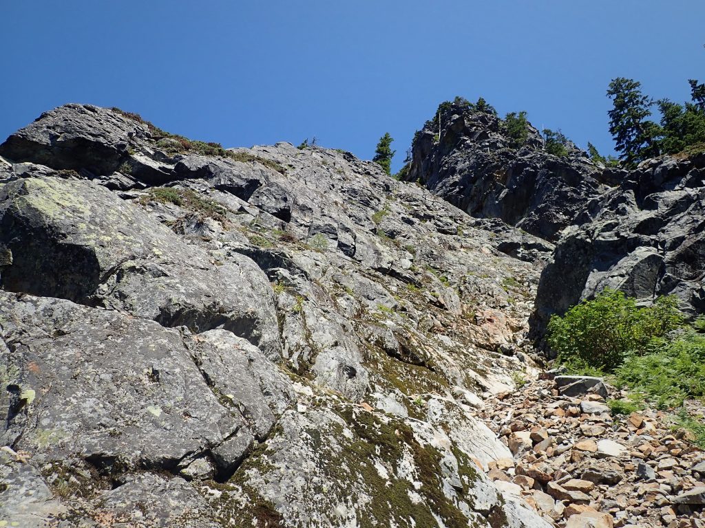
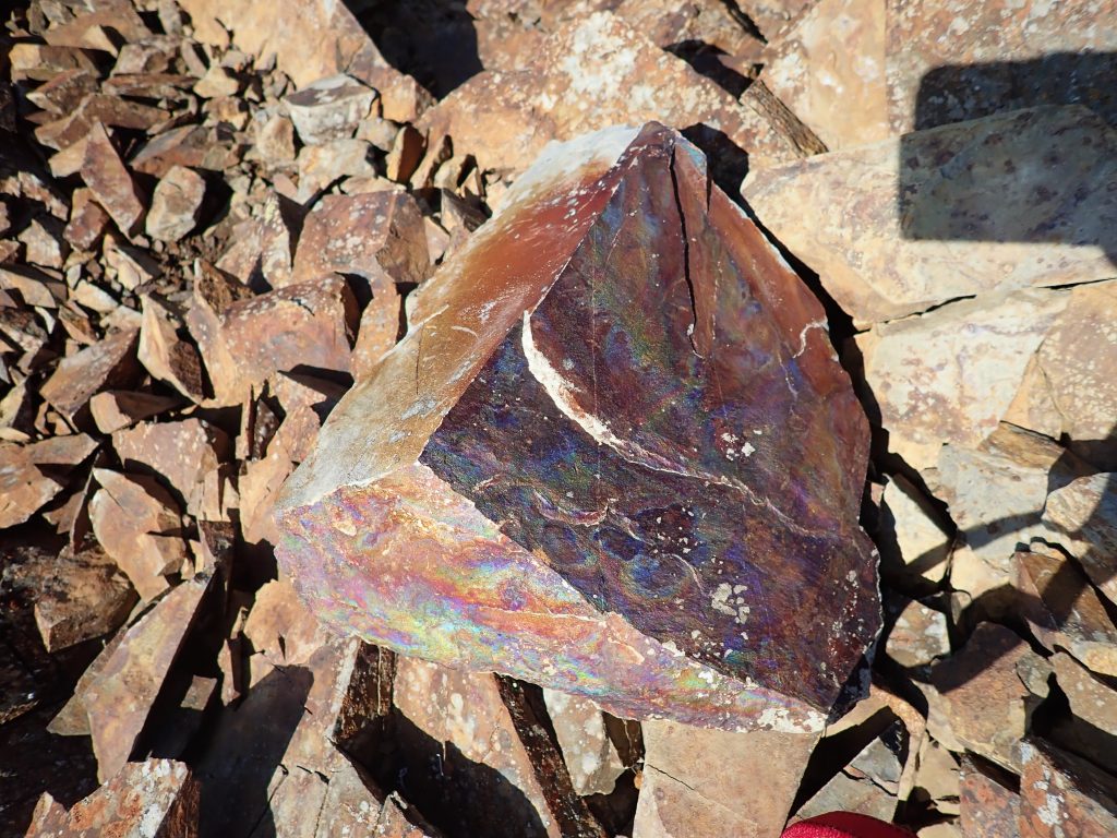
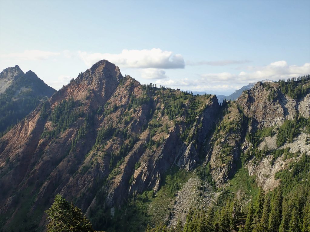
The next section from Red to Kendall Katwalk Peak was supposedly awful choss. We followed Gabe’s advice and stayed close to the ridgeline and found the rock quality to be pretty average. There’s no doubt that it was the worst rock of the traverse, but it did not feel unsafe or sketchy at all, just thoughtful. There was even an improbable slab traverse near the end on tiny, hidden face holds!

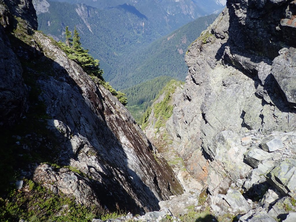
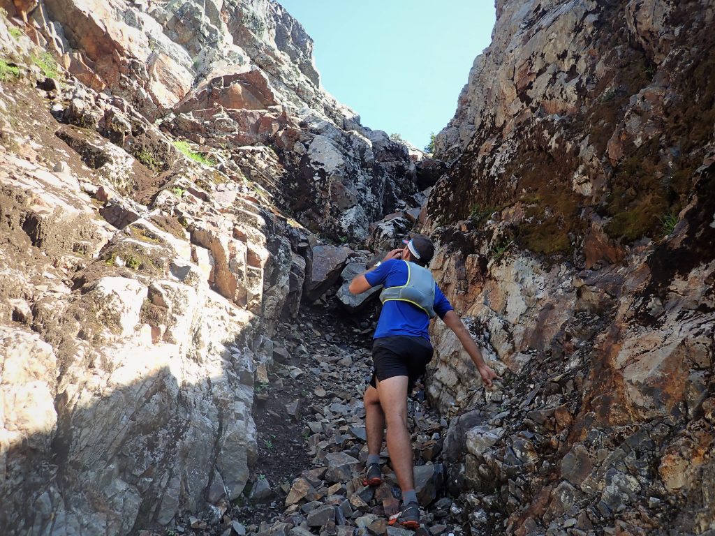
The ridgeline leveled out for a while and we wove our way in and out of trees before reaching “the cleft”. This cleft is the only real show stopper on the ridge, a vertical 100 foot divide that splits the ridge. Anthony’s friend has down climbed it at an overhung 5.8 and did not recommend it. It looked like you could make a few short rappels off trees (maybe 3x15m raps) down the north side, but we did not have a rope, so we started walking down the edge of the cleft, like Gabe did.
We kept checking out the cleft, looking for a weakness. Maybe 300 ft down, just before the terrain really steeped, we found a 4th class weakness that led us down into the grassy gully. This probably saved us 200 ft versus going all the way around the cleft!
From here we started climbing up the cool, shaded gully. This was our last major climb of the day! As we regained the ridge, we wove in and out of brush before reaching one last steep section.

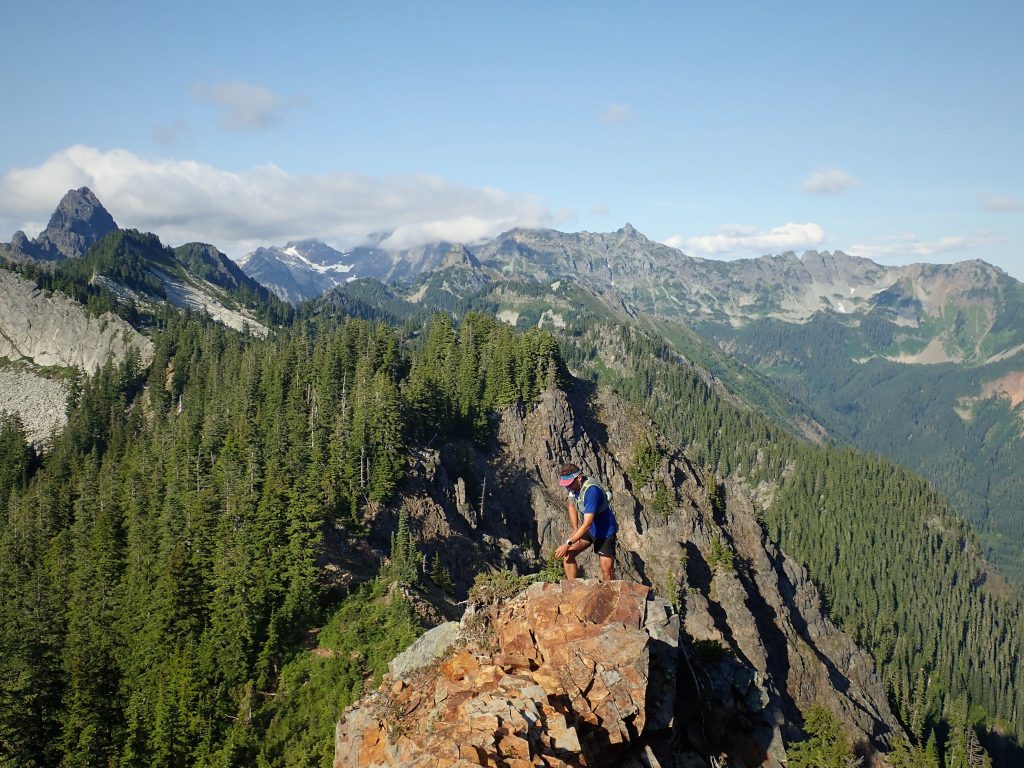
This section of the ridge proved to be steeper and less positive than we had hoped. We both got cruxed out by the final lichen-covered overhang with a chossy topout, but found an exposed fourth class traverse to the right. From there, it was a simple schwack to the summit of the Katwalk Peak, which had delightful views of trees!
It was now 6.5 hrs into our day and we basically had the trip in the bag. We followed steep vegetated slopes on the east side of the ridge down towards the Kendall Katwalk.
For most of this section, the ridge is simple too vegetated to stay properly on the ridge. But near the end, the ridge becomes clean, knife-edge granite. There was some delightful smearing on the “ragged edge” with the Katwalk 50 ft below.
We reached the Katwalk and jogged a little back towards Kendall Peak. Where the trail left the ridge, we started onto the north ridge of Kendall. It was very easy at first, just enjoyable class 2 romping up the solid ridgeline. There was one section of a little exposure, but then we were back on easy terrain cruising over subsummits.
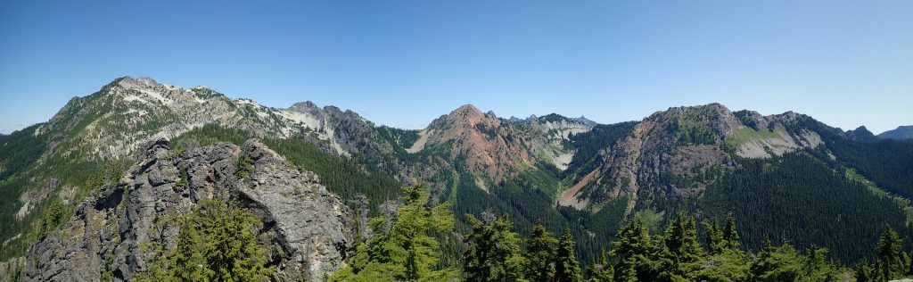
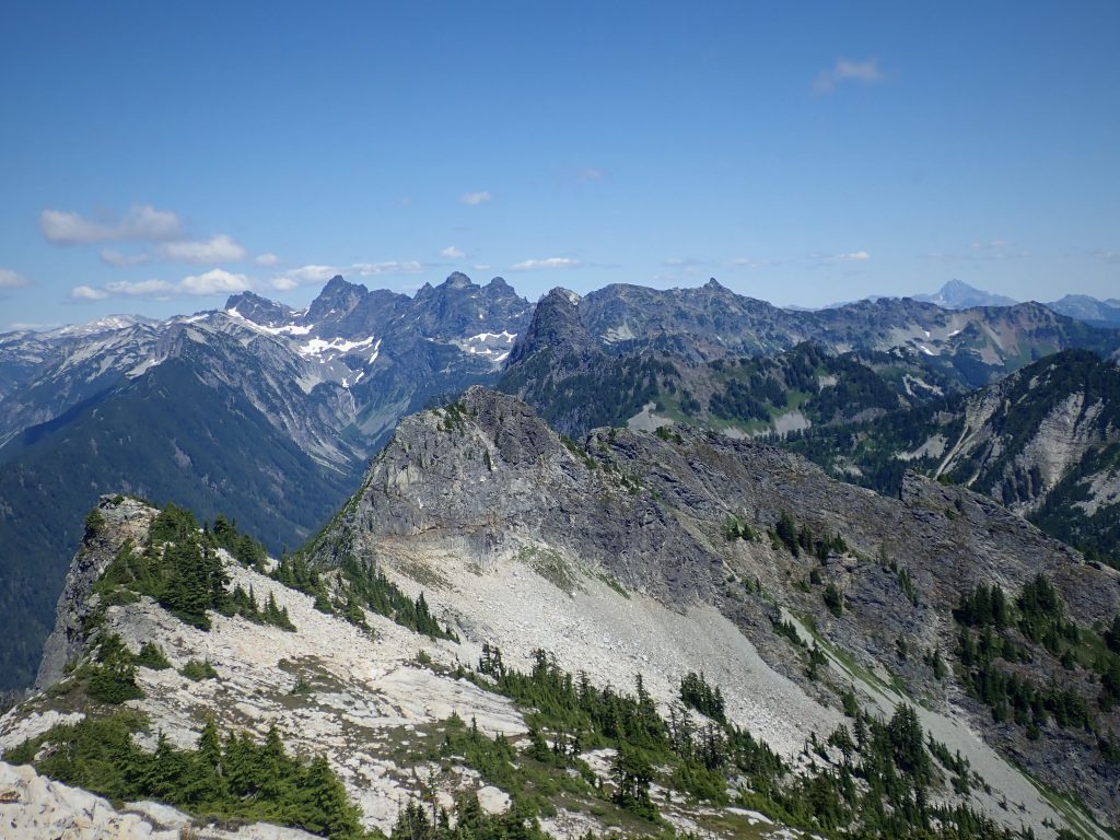
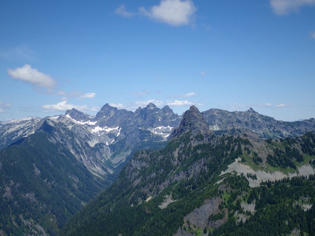
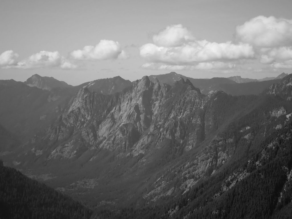
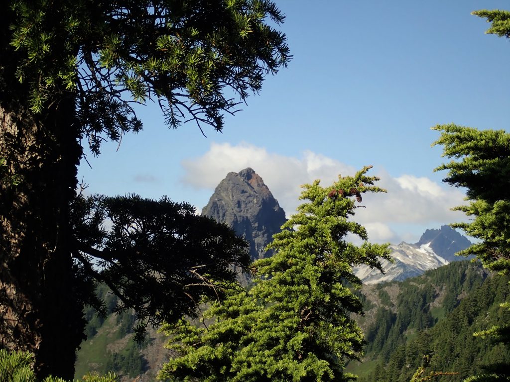
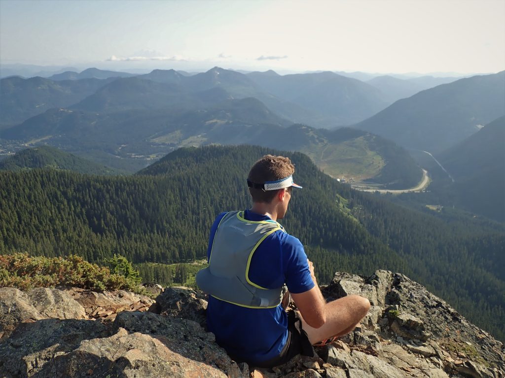
It was that time of day the light softens on the higher peaks and the world seems to slow down around us. Wispy clouds began to decapitate the Alpine Lakes giants one by one – Overcoat, then Chimney, then Lemah. So many memories – my first ultra on Chikamin Peak, climbing a new ice route on Bryant, the marvelous Alpine Lakes Crest Traverse – have been forged in these low-lying Snoqualmie hills. Killian Jornet once said that we don’t have to go far to find great adventure. While Snoqualmie Pass isn’t quite Romsdal, where Killian lives, it is still a special place.
Between us, I think the movement on the ridge began to feel effortless. At a point where seven hours of continuous movement should have been catching up to us, we both seemed to sense the kill, that final summit push of energy. It was the same energy I used to feel 5 years ago when I was just a kid falling in love with the mountains for the first time, a fountain of youth that I can tap into when my movement becomes primal. After the most difficult months of my life, this summer has been all about returning to my roots. Back then, I was not a mountain runner, nor climber, nor skier. I was just an alpine wanderer. Over the years, I have had phases where I worried about distance, or speed, or technical grade, but all that has faded away this summer. The mountains have become less of a place to prove myself and more of a place to find peace with my life. To create meaningful experiences in the void of all that I have lost.
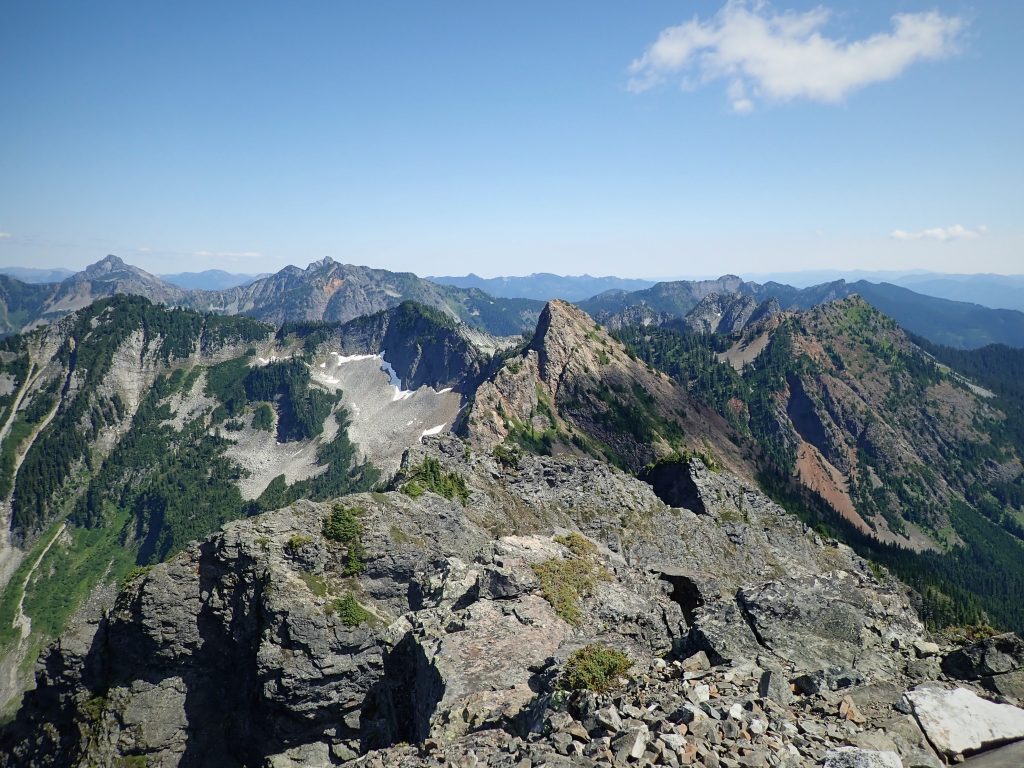
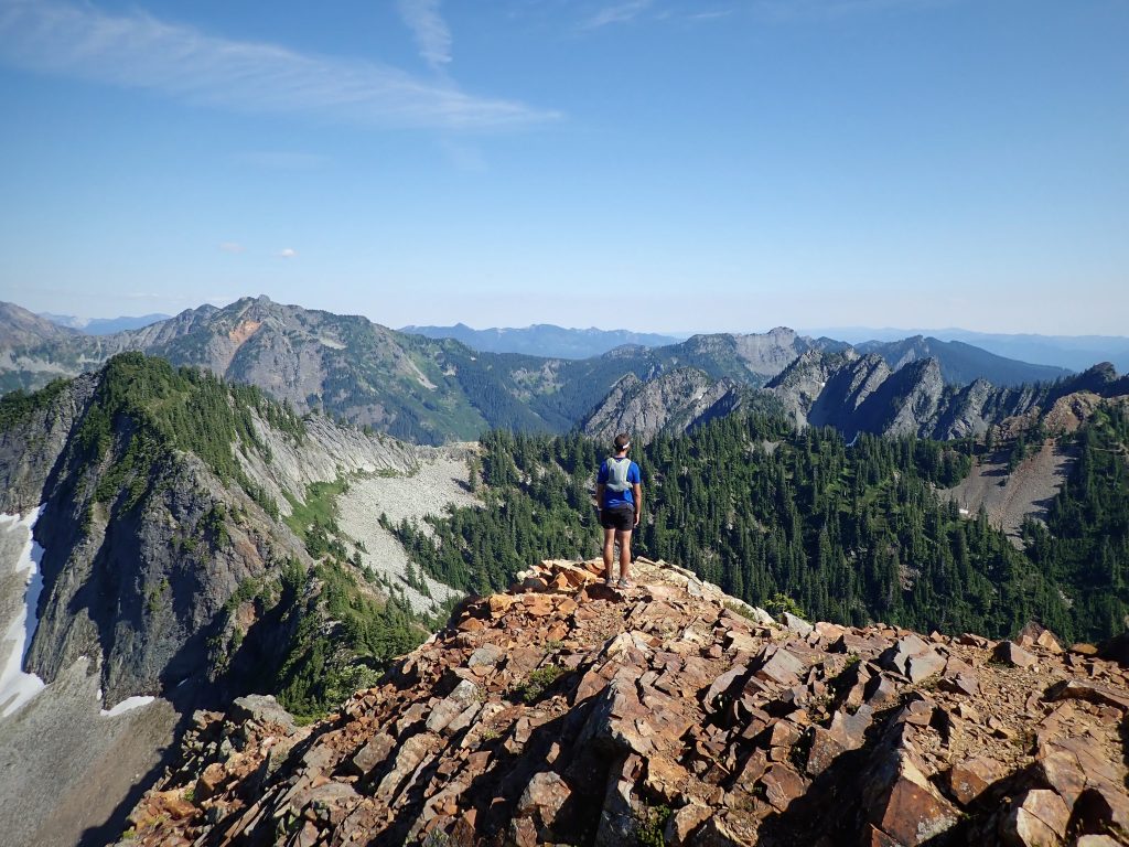
At the summit of Kendall, we finally took a real break, the first all day. 7:15 had elapsed since we had left the car, but the amount of technical terrain we had covered felt staggering. We looked across the valley at the full length of our track. There is something so aesthetic about ridge rides and circumnavigations. It feels like you are wandering through the guardians of something so grand and stately.
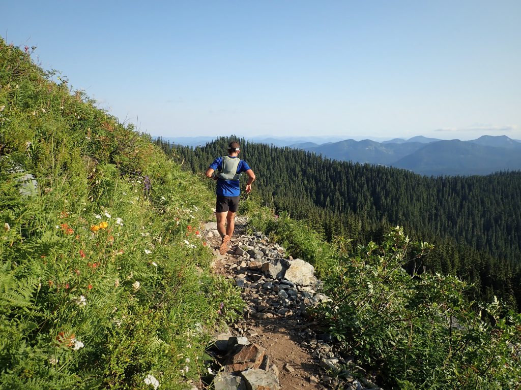
We followed the bootpack down Kendall to where it met the PCT. From there, it was an just an easy 4 miles or so of trail back to the car!
After reaching Anthony’s car, we immediately ditched our gear and jumped in the Commonwealth Creek, a refreshing way to end the day. Anthony remarked how perfect these summer days are where it never becomes too hot but is still warm enough in the evening to jump in a cold creek!
In total, we covered 12 miles and 6500 ft gain in 8:23. We moved efficiently, but did not feel like we were pushing ourselves (apparently one of Anthony’s friends has done this in 4 hours) and left plenty of time to take photos and route find. The stats never tell the full story on a route like this; there were hours of no-fall scramble terrain. I love doing scrambles like this with Anthony because we are completely in tune with each other with regards to what risk is acceptable and how we ideally want to move in the mountains. This day was simple: all we needed was water, snacks, a helmet, and some love for the heights.
Bonus: Check out Anthony’s Relive Link.
Notes:
- What difficulty rating would I give this traverse? It is difficult to capture the essence of this route in a grade. There was certainly substantially more 5th class than classic moderates like the West Ridge of Forbidden, Prusik, or Stuart. The steeper sections were steeper than the Tooth. The rock was generally solid when difficult, but sometimes loose in easier sections. We spent well over an hour in no-fall terrain where every hold had to be tested. But, then again, we are not super strong climbers (5.9 trad leaders) and we never pushed our comfort zone in trail shoes. So it could not have been more than maybe 5.6?
- Speaking of trail shoes, Anthony wore pure trail runners, while I wore light approach shoes (TX3). I loved my decision since there was so much technical scrambling and they ran well enough for the 5 miles of running we did.
- Many of the steep gendarmes we tackled and the variation of the south rib of Guye we took are avoidable, but the west ridge of Lundin is not. So this entails at minimum some 5.4ish moves.
- Water is a little scarce on route. There’s the stagnant pond after Guye, some snow patches north of Snoqualmie, and the tarn beneath Red, which we did not drop down to.
- It is difficult to say if protection would be helpful in all spots. Lundin was very much protectable. The start we did on Guye did not really have much in the way of cracks. If you bring a rope you can rap most of the crux down climbs with just a 30 m rope.
- One nice thing is that bailing is quite easy after Lundin or Red. Just take trails down into the Commonwealth drainage and back to the car.
- The scrambling through a lot of this route is really, really good, especially for the accessibility. Of course there are some loose or schwacky section but we were overall very pleased with the quality of climbing – I mean, scrambling.
- This is just scratching the surface of ridge linkups in the Snoqualmie Pass region. What would the complete SWURL (Snoqualmie Washington Ultimate Ridge Linkup) look like? Tooth to Chair? Roosevelt to Kaleetan? Alaska-Thompson-Chikamin-Rampart Ridge? Get out there and have fun!
I always enjoy your blogs, Kyle.
Jacob Krantz’s grandma,
Cherie
Thanks Cherie! You can look forward to more trip reports involving Jacob once the busy summer is over!
Woah this route looks absolutely incredible. I am a climber/runner visiting the Seattle area from Colorado this weekend and I am so glad I found your website to get a good idea of the best routes. Really tempted to have a go at this one, do you by chance have a strava map, or something similar of the route? Thank you so much! Keep crushing!
Hey Simon, unfortunately I didn’t track things back then. If you’re not familiar with the area, I’d recommend just starting with the Snoqualmie Mountain trail from Alpental up to the summit (skipping Guye Peak does not miss out on that much). From the summit, it is pretty clear how to head over to Lundin, and then to Red, etc.