Table of Contents
Adventures Unwritten
Gates of the Arctic National Park has no established trails and should remain that way. For that reason, I have purposefully omitted place names in my descriptions. After all, planning your own route is half the fun!
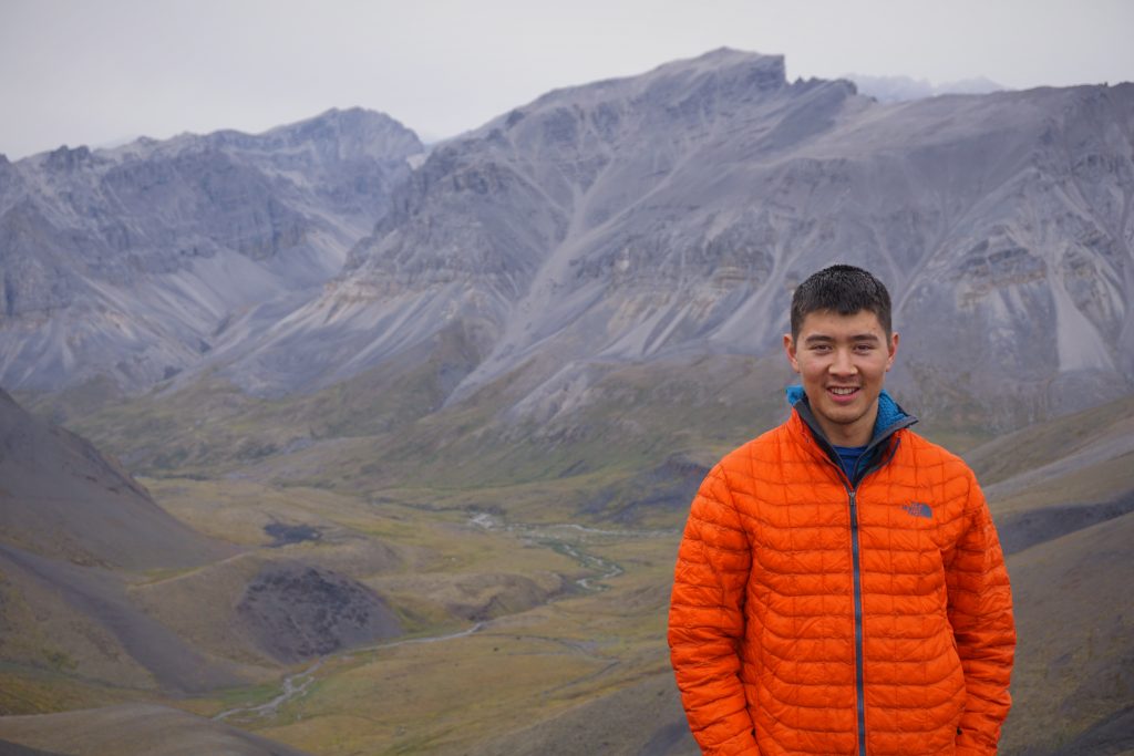
Everyone knows Alaska has great mountains. Most citizens are aware of Denali, the highest point in North America. Skiers hear about the legendary Chugach Range near Anchorage. Backpackers whisper about the marvelous Talkeetna Range in Central Alaska. But when I told people that Daniel and I were headed to the Brooks Range, most people had never even heard of it. Alaska’s largest range, one thousand miles long and formidably wide, is also Alaska’s most remote range. And this is exactly what we wanted: to go somewhere that felt truly out there.
I knew it was only a matter of time before I visited some mountain range in Alaska, but it definitely was not in my immediate plans. Back in March, Daniel pitched this crazy idea to visit the Brooks Range and do an off trail thru hike. He demonstrated it would be amazingly simple and affordable, at least considering how far from civilization everything was. Fly to Fairbanks, bus to the Brooks Range, hike (insert some more activities), fly back to Fairbanks and Seattle. I liked the idea of just hiking as opposed to alpine climbing for a shorter trip like this because there was a good chance the weather would just suck the whole time and the theoretical climb would be a failure. I did not want to travel far and use up vacation time to just sit in a tent in a whiteout for a week. Ultimately, this is only sort of what happened.
In April, I started formulating all my complex summer plans with different people. I was at the point where I needed something to be excited about, needed a reason to look forward to life. I don’t usually like booking all my summer weekends months in advance, but it gave me a purpose and plan. If I was recovered enough, I knew that visiting the Brooks Range would be good for me, to get literally thousands of miles away from this situation that has left me so disillusioned. Plus, there might be no one else who makes me feel as comfortable and positive as my best friend Daniel. So we planned on a week in early August: after the worst of the mosquitoes, but hopefully before the monsoons.
The journey Before the Journey
On Friday morning, Daniel and I got to SeaTac at some early hour and boarded our flight to Fairbanks. I fell asleep nearly immediately. When I woke up, I looked out the window and saw massive snow capped mountains and huge valley glaciers! At first I thought it was the Alaska Range, but the size of the range seemed too big and the ocean was not far away. It was likely the St. Elias or Chugach.
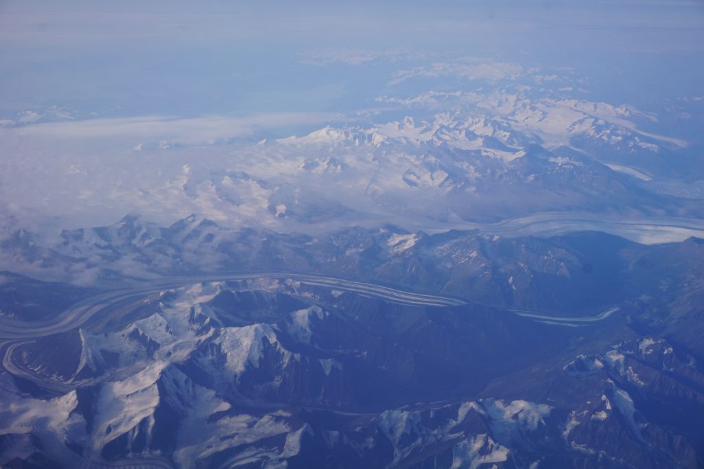
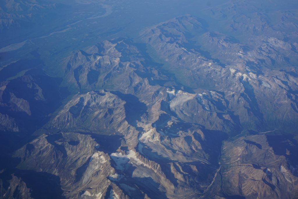
Soon, we passed over the marvelous Talkeetnas and in the distance, we could see the great Alaska Range! Denali loomed over the rest with such incredible prominence. Some people visit Denali National Park for weeks and never see the mountain! We felt very lucky to get a clear view.
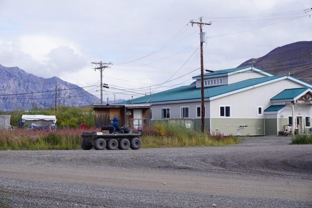
Fairbanks has a tiny airport and thus our bags were in the baggage claim before we even got there. We had booked a room in a hostel near the airport, so we just walked a few miles on the roads, stopping to load up on some food at Fred Meyer along the way.
The hostel was very interesting, an outdoor-themed collection of cabins, yurts, and shared wall tents. The were pigs in a bunch of little pens, and they were constantly snorting up a storm. The owner asked us where we were going backpacking. When we told him the Brooks Range, he exclaimed, “You bastards! You’re going to have such a great time!”
In the afternoon, we took a taxi to visit the Gates of the Arctic National Park Visitor Center (yes, the visitor center is 400 miles from the actual park) and purchase some bear spray and fuel. We got a backcountry orientation from a ranger, which is not required, but we got a cool “Guardian of the Gates” patch for it. He was incredibly excited for us also and raved about how special Gates of the Arctic is.
Dinner was a frozen pizza from Fred Meyer back at the hostel. Daniel and I settled into our cabin for the night. The pig outside our cabin continued to snort away all night long, even with our windows closed…
We awoke early the next morning to eat breakfast and walk over to the tour bus. It was 5 am, and the streets around the Fairbanks Airport were dead quiet, so we decided to add some music. Daniel glanced at his saved music on his phone and decided to play “Unwritten” by Natasha Bedingfield. What a classic! Now this song was going to be stuck in our heads all trip…
There were dozens of people at the tour bus company, but most were just doing a day tour to the Arctic Circle and back. However, there was a middle aged couple, Ben and Nicole, who were joining our van and doing the same hiking trip as us! We chatted with them and discovered they were planning the same route as us, which is not too surprising since it is the easiest route between the Dalton Highway and Anaktuvuk Pass, the endpoint.
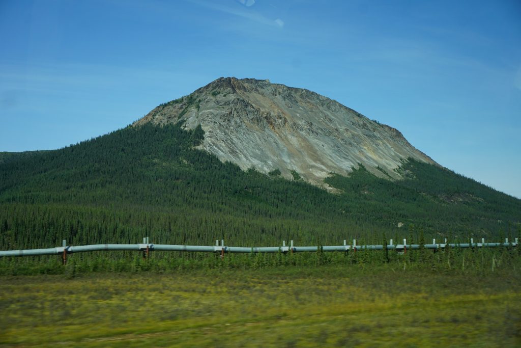
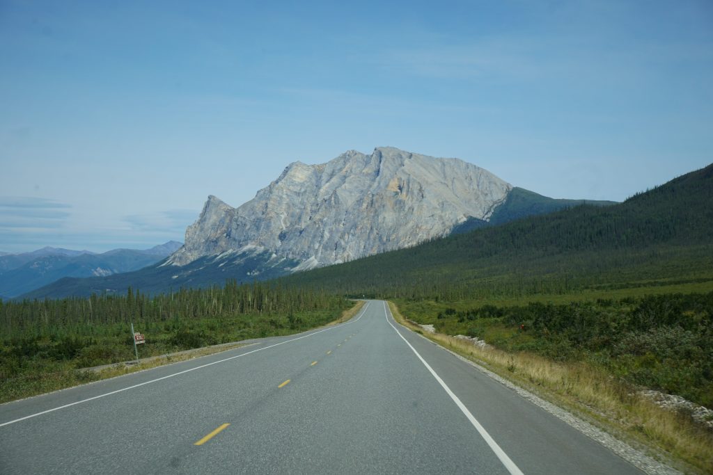
We met Michelle, our van driver, and got on the road. Only a few miles outside of Fairbanks, the Dalton Highway became gravel pretty quickly. The Dalton was built in the 60s along with the oil pipeline to the north slopes. As oil production has slowed in that area, the quality of the road has also decreased. Thus, travel is relatively slow for a “highway”. We probably averaged 30-35 mph, which meant this 300 mile trip would be a full 10 hour day!
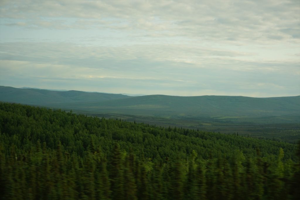
Most of Alaska is, in fact, not mountains but rather boggy. Driving north out of Fairbanks, we passed by miles of rolling hills and dense mini trees. The trees cannot grow too high because the permafrost limits the depth of their roots. They make up for it by growing very densely. I would not want to try to ski through these forests! Or hike…
Although the ride was slow, it felt calming. It is always meditative to stare out a car at the meandering hills and clouds, and the slower pace definitely added to the mood. We passed in and out of rain shadows, through fog and sun.
Michelle was an awesome tour guide and driver. She told us a lot about Alaska, the oil pipeline, the Brooks Range, and the Nunamiut People (the indigenous people of the Brooks Range). The village of Anaktuvuk Pass was not settled until 1949. Until then, those tribes were still nomadic, the last nomadic people in North America.
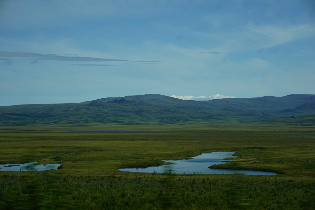
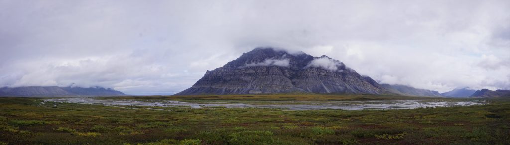
Eventually, we got our first view of the distant Brooks Range. The valleys are massive here, so we eased slowly into the jaws of the range. We stopped and ate a burger at the Coldfoot Truck Stop. They claim to have the best food north of the Arctic Circle. That may very well be true.
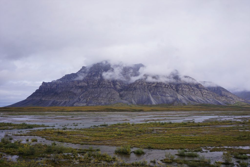
The most striking feature near the highway is Sukapuak Mountain. It has a maze of limestone bluffs and ripples.
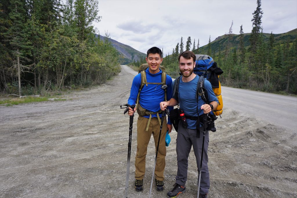
Slowly yet surely, we approached our drop-off point. We watched eagerly on Daniel’s phone until it seemed like we were on the right point. Michelle dropped both us and the other duo off, and so the great adventure began.
The First Valley
Going into the trip, river crossings were our top concern. If you stray any distance from the Continental Divide, the rivers in the Brooks Range can be very challenging and dangerous to cross. When people asked what were the top ten dangers of the Brooks Range, we responded:
- Hypothermia
- Falling in a river and getting hypothermia
- Hypothermia
- Getting rained/snowed on for days and getting hypothermia
- Drowning in a river
- Hypothermia
- Mosquitoes driving you to insanity
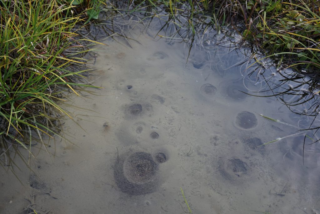
- Quicksand
- Getting charged by a musk ox
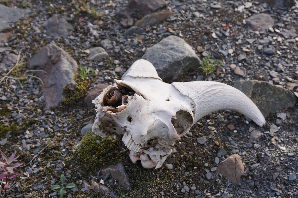
- Grizzly Bears
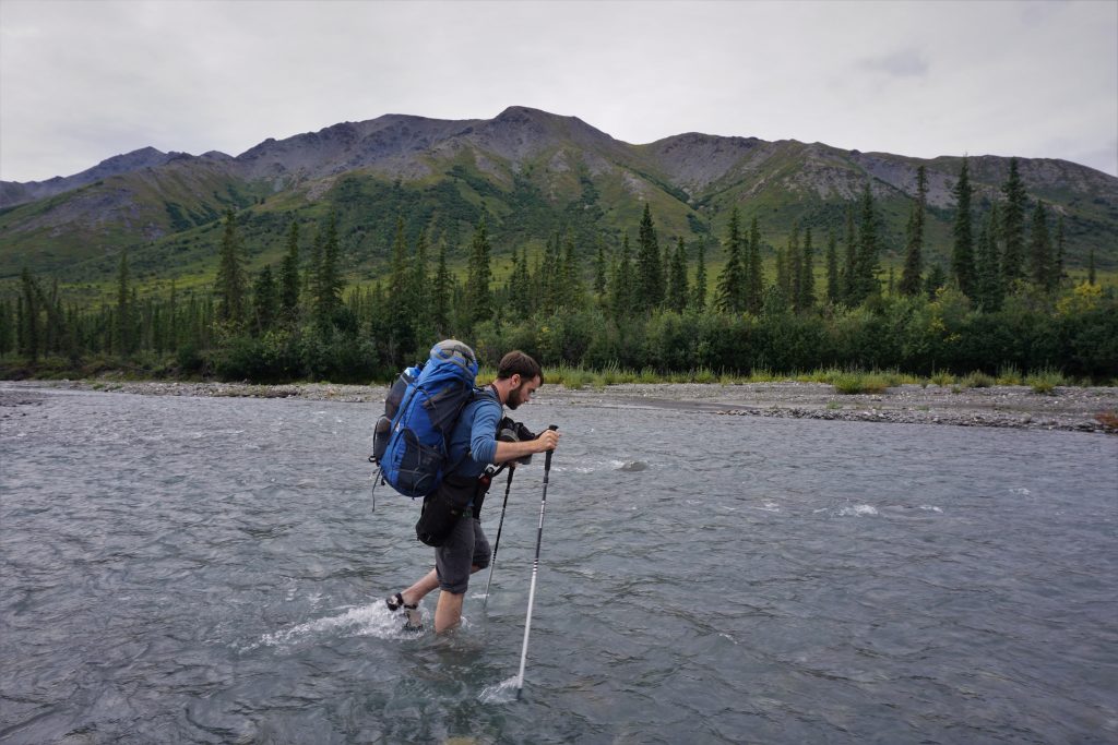
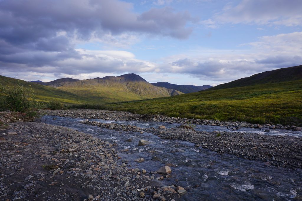
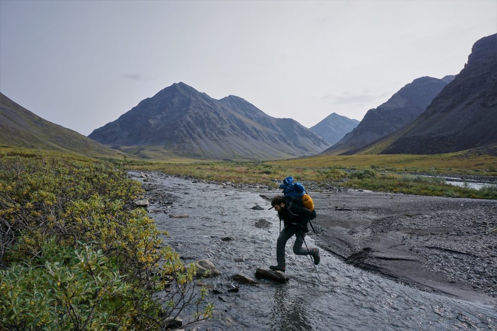
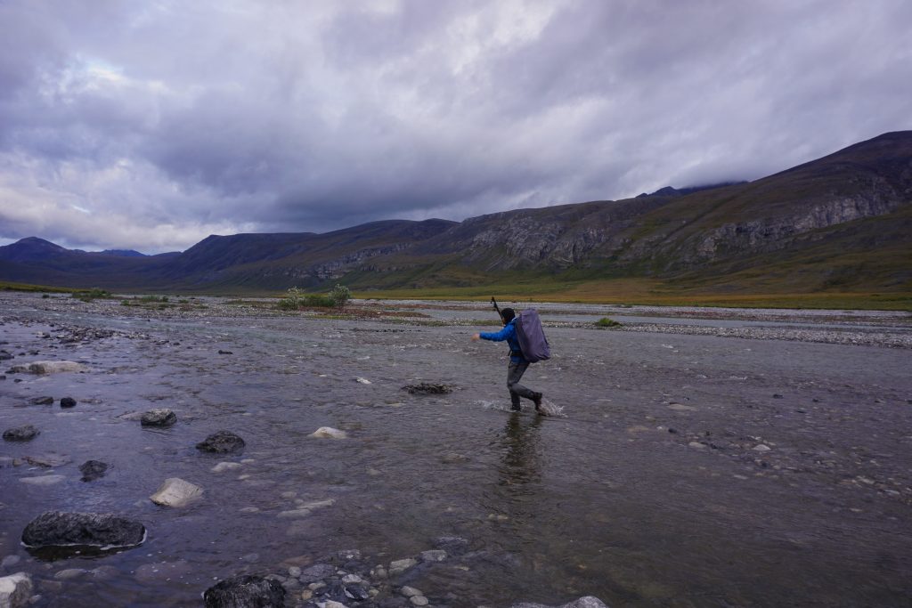
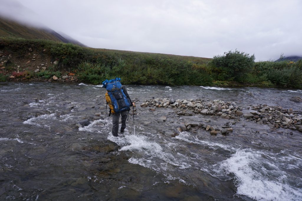
So we were very relieved when the first river crossing, right next to the highway, went easily. It had rained a few inches in the past week during the first monsoon of the season. This was a region that only got 10 inches of annual precipitation, so this was a big deal. However, it appeared the rivers had already settled down.
By the time we had reached the other side of the river, we had already left Ben and Nicole behind. We would actually never see them again.
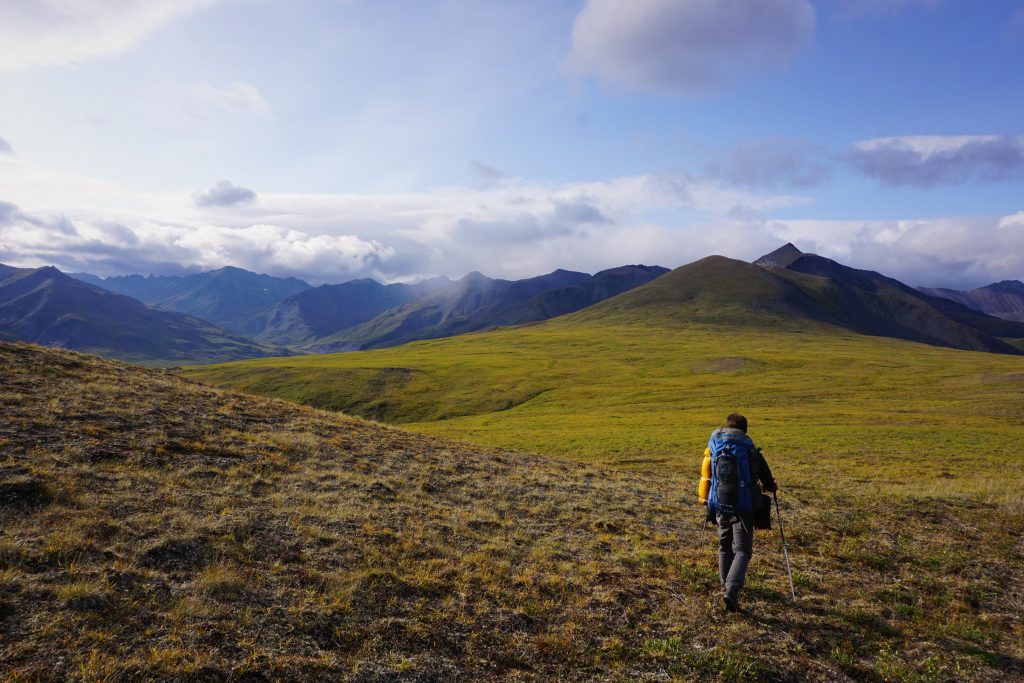
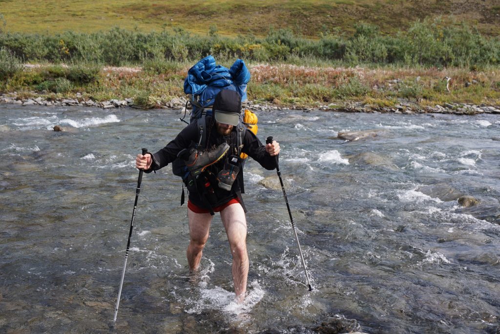
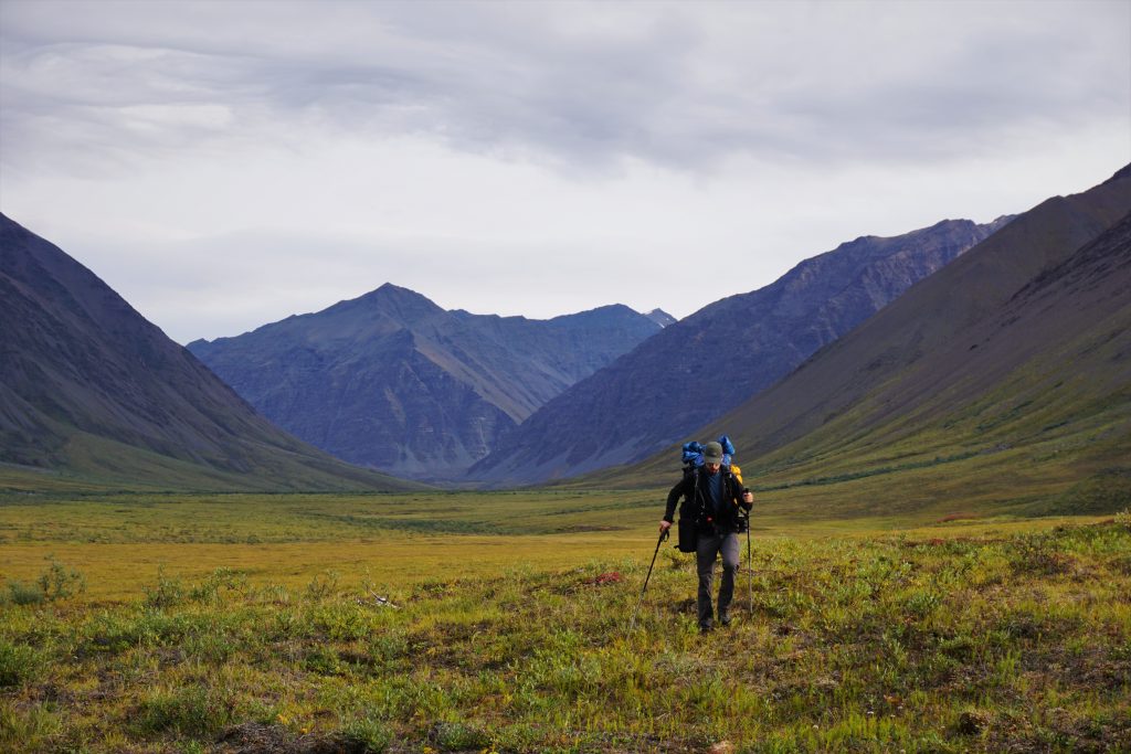
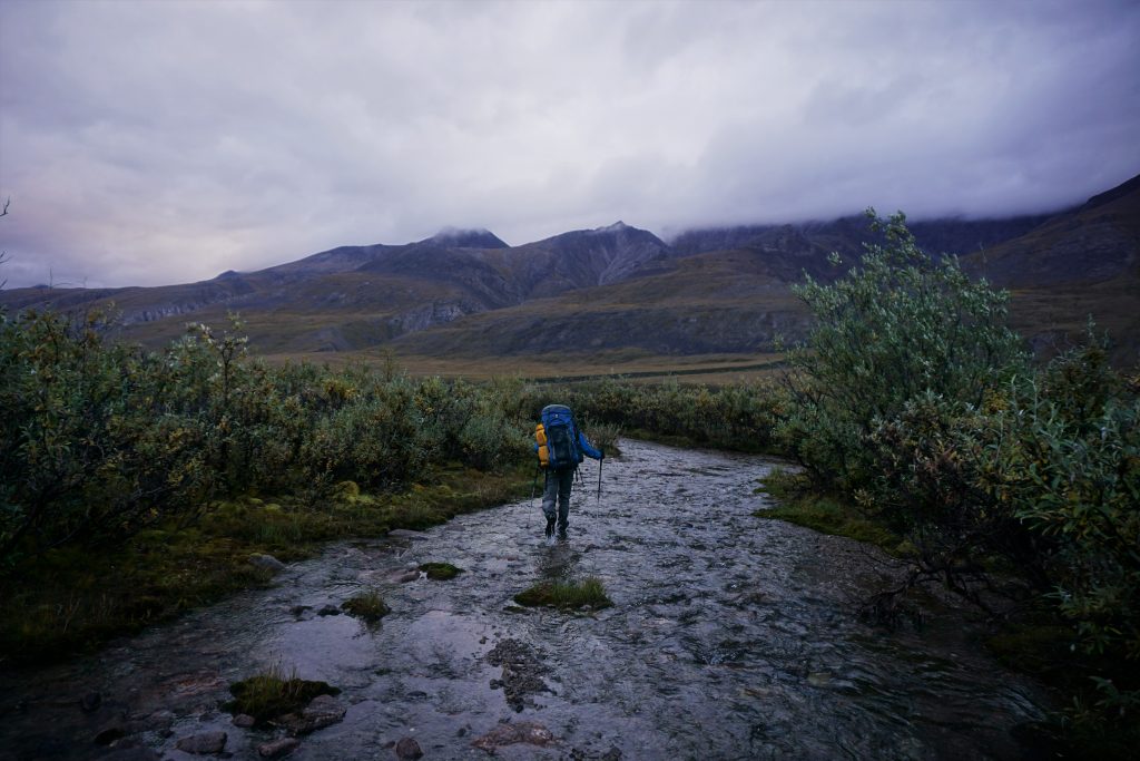
Daniel and I chose very opposite strategies for footwear. Daniel brought light gore-tex high top approach shoes / hiking boots with light sandals for the river crossings. I wore burly trail runners (La Sportiva Ultra Raptors) and planned to do crossing barefoot or just get my shoes wet. Which strategy would win? Only time would tell…
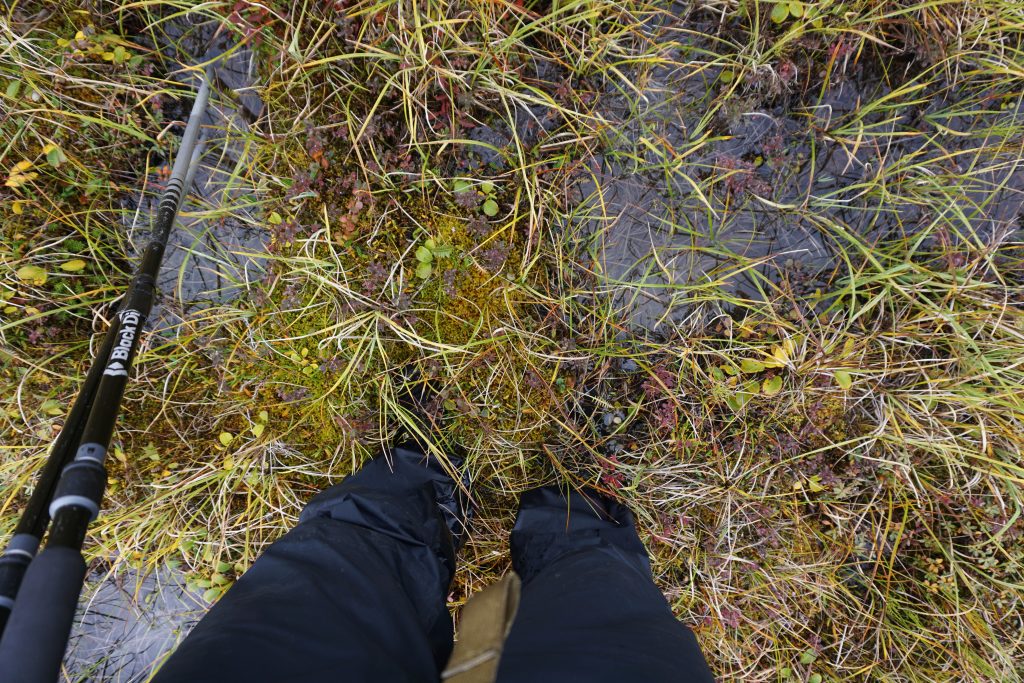
After crossing the river, I had my first encounter with some Tundra tussocks. The ground was made up of all these uneven piles of moss and it was impossible to not roll your ankle every few steps. It was also challenging to tell which steps would squirt water all over your shoes.
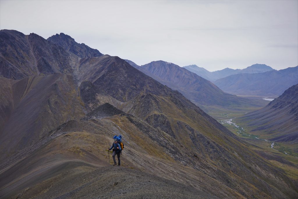
We ascended directly towards the higher terrain and started hiking up some loose choss.
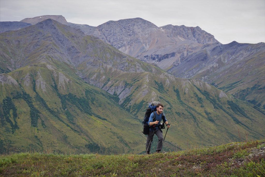
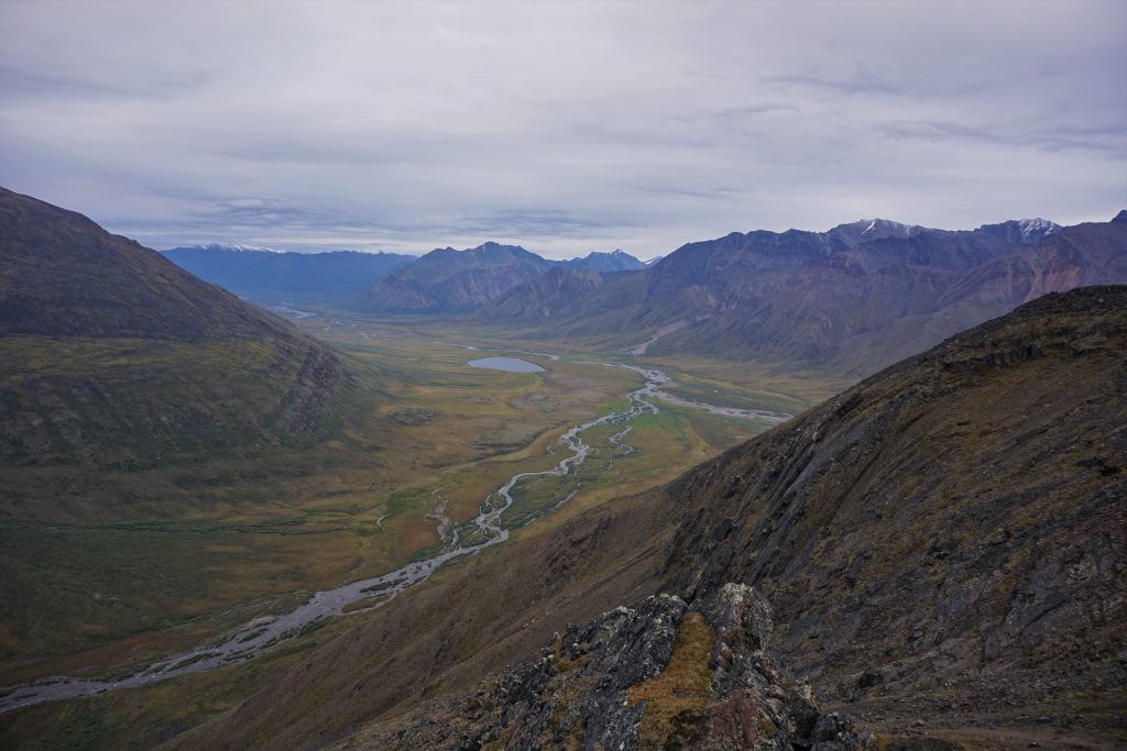
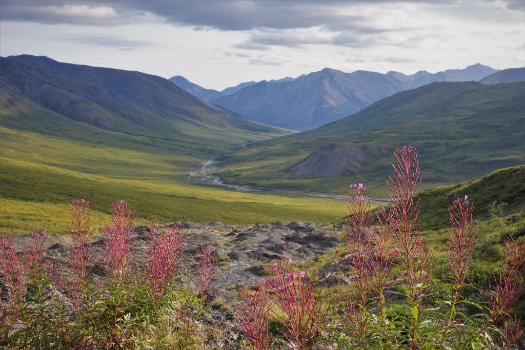
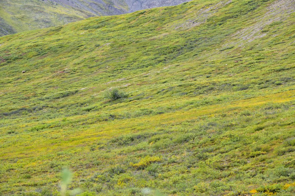
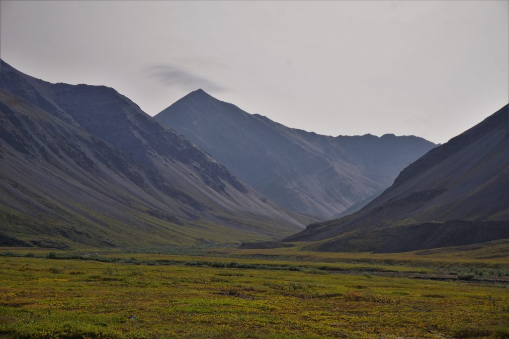
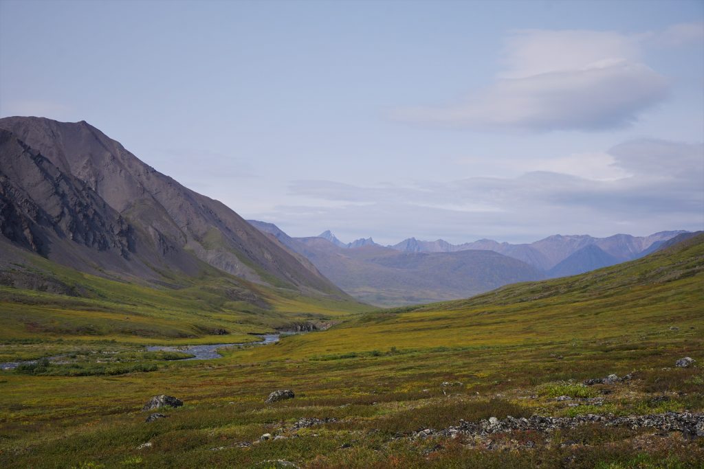
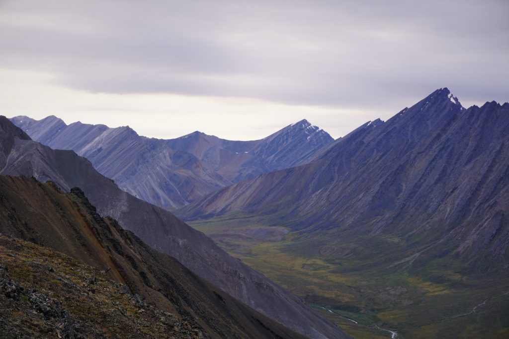
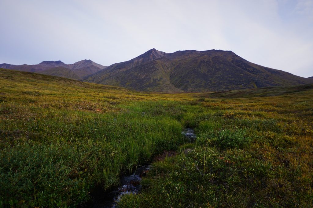
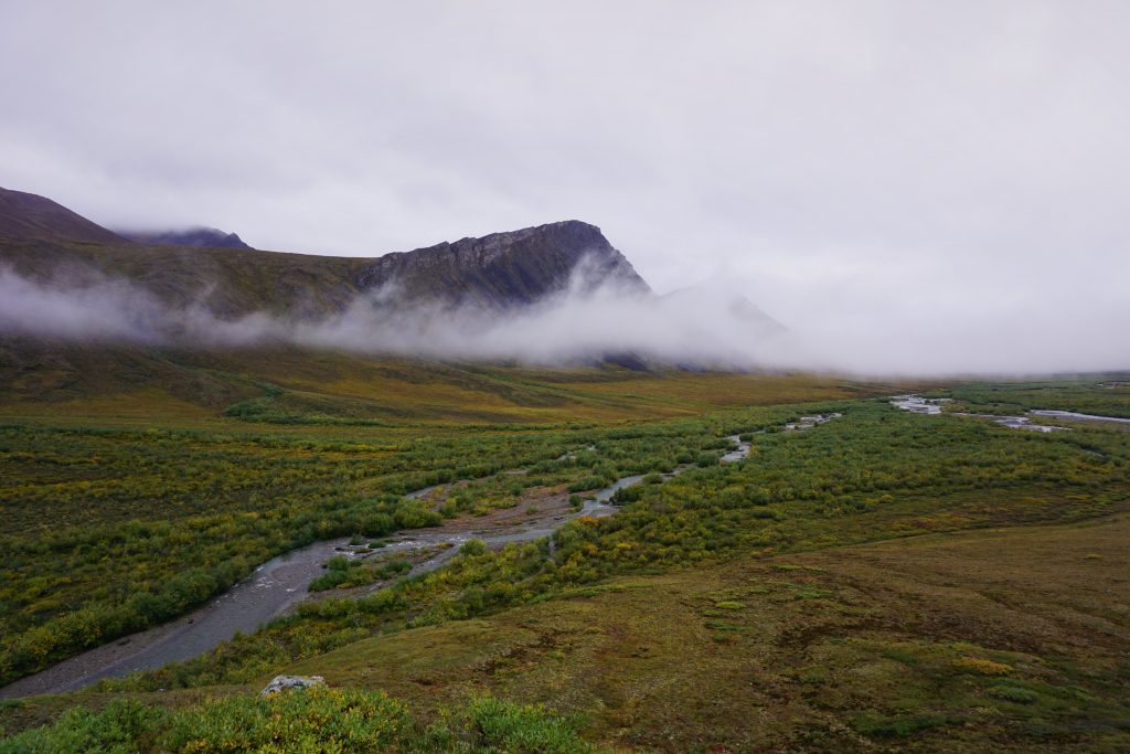
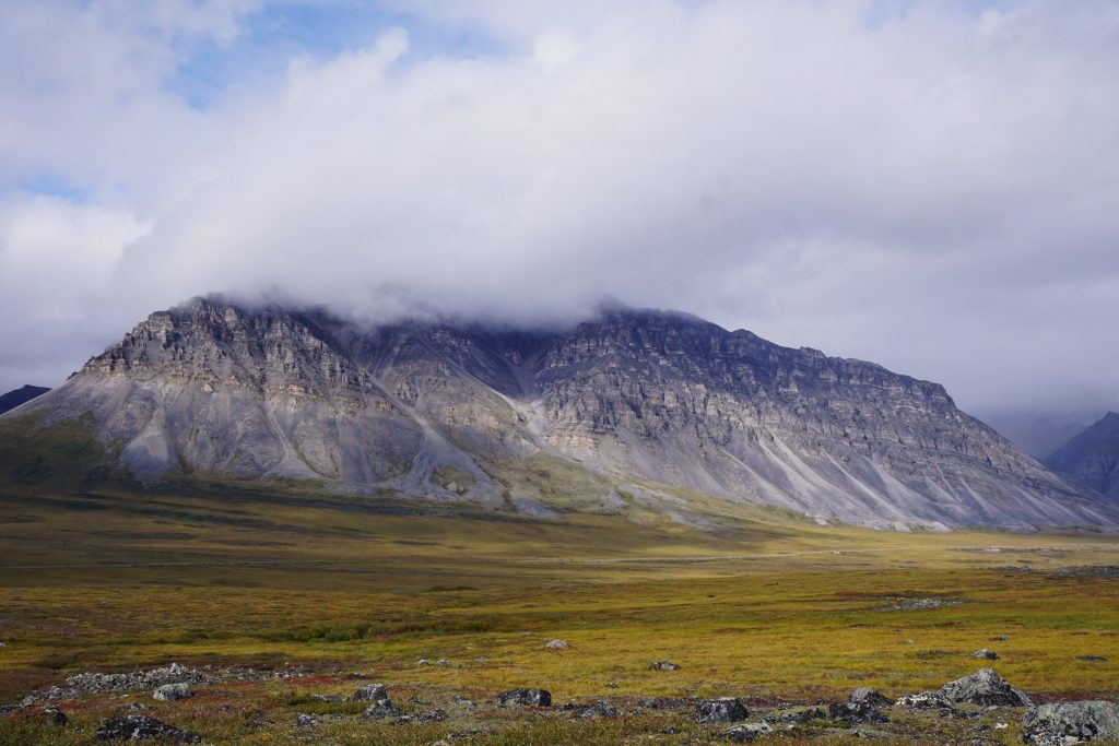
Even though we were so close to the highway, the scenery was already grand. The mountains reminded me of the Pasayten Wilderness back home: massive green hillsides with steep drainages. Autumn was already strong in the yellow hues in the groundcover. We knew the Brooks Range would be good, be we didn’t expect it to be this good. Even more wonderful sights awaited across the pass.
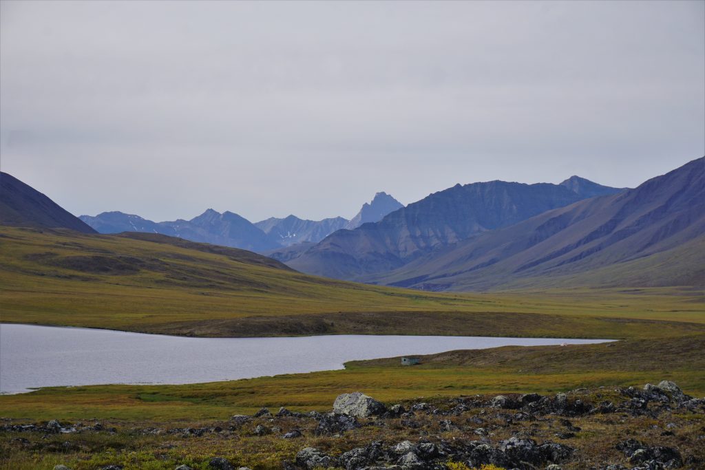
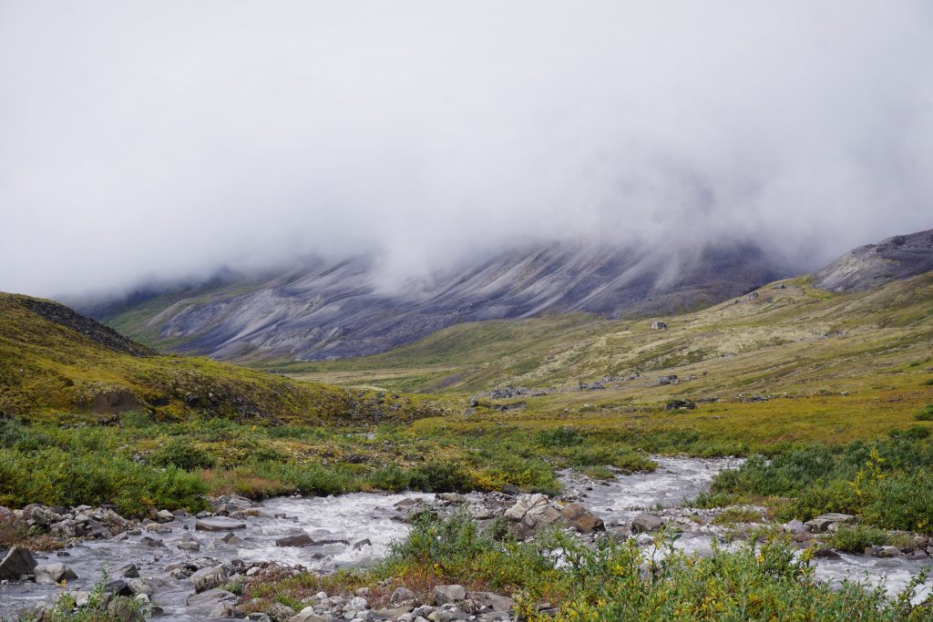
Valley of the Grizzlies
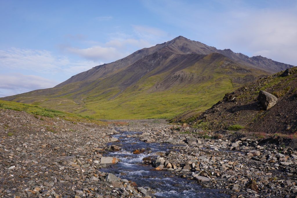
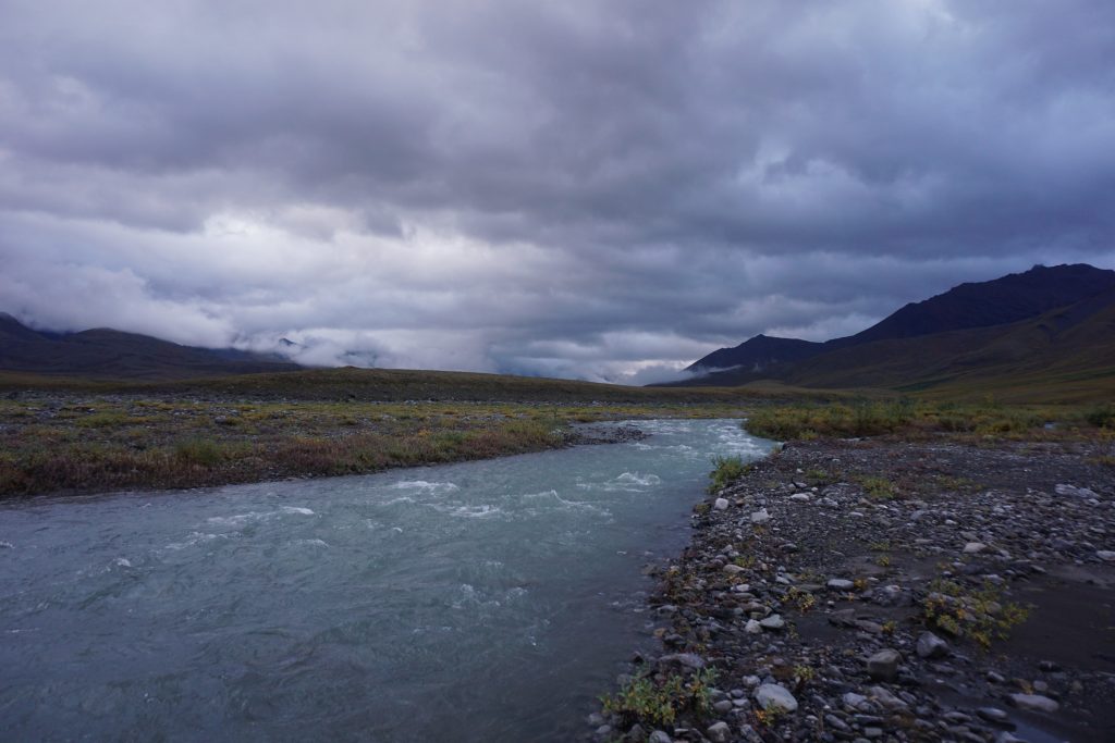
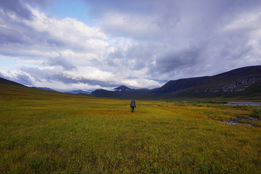
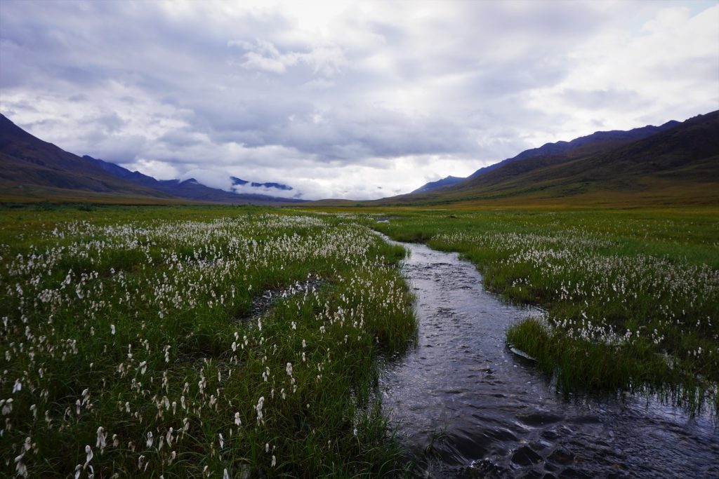
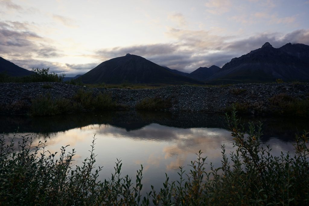
The panoramic view from our first pass was magical. As water trickled from underground springs, the next valley unfolded before us. Slanting hillsides, wispy clouds, a gravel-lined river, and not a tree in sight. It was pure Alaskan wilderness.
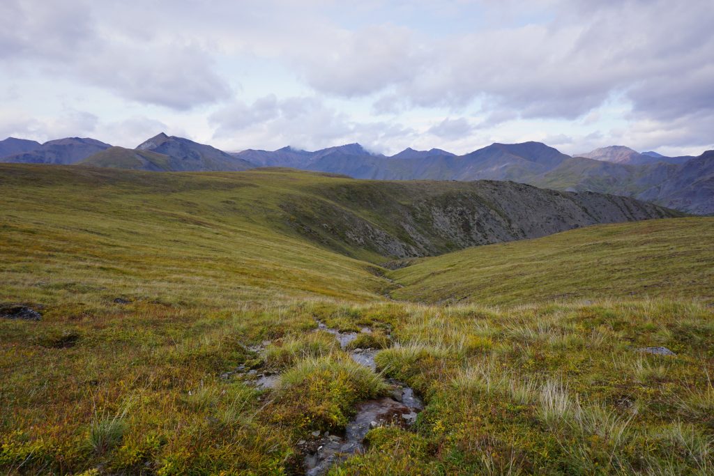
We began a long traverse down into the valley. In some sections, the ground was dry and supportive, but in others, it was uneven and marshy again.
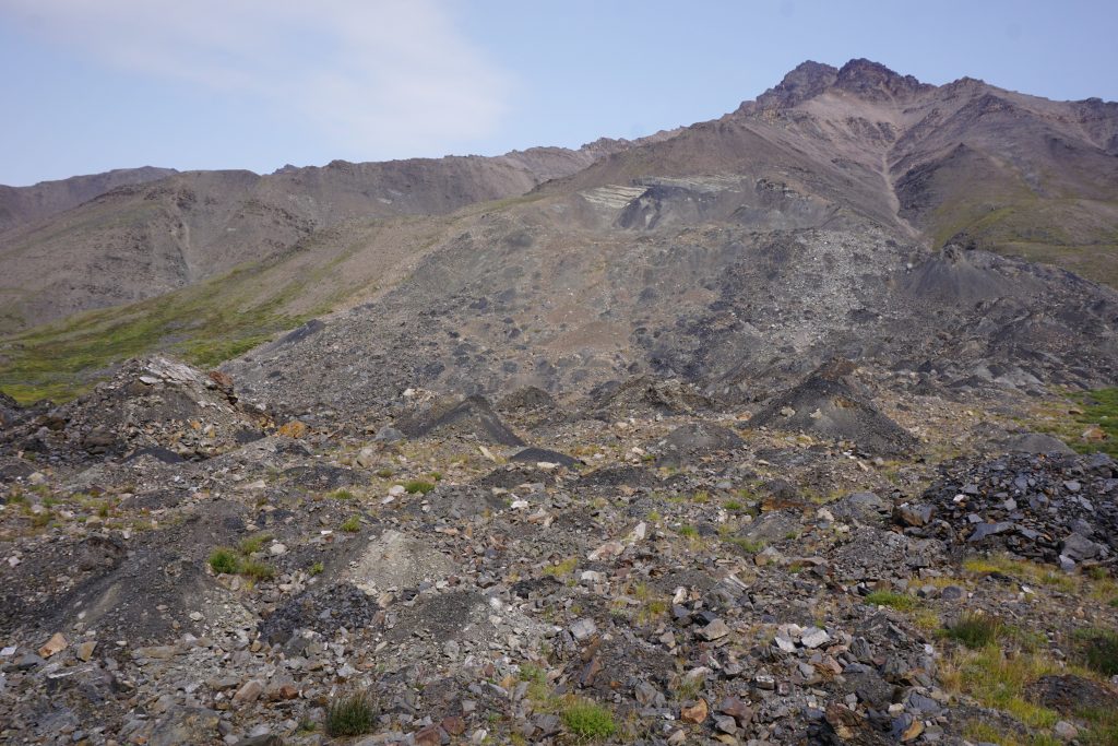
We crossed a rock glacier that was tearing apart the hillside. A rock glacier is a frozen mass of rock sliding down the hillside, eroding away the landscape much like a normal glacier.
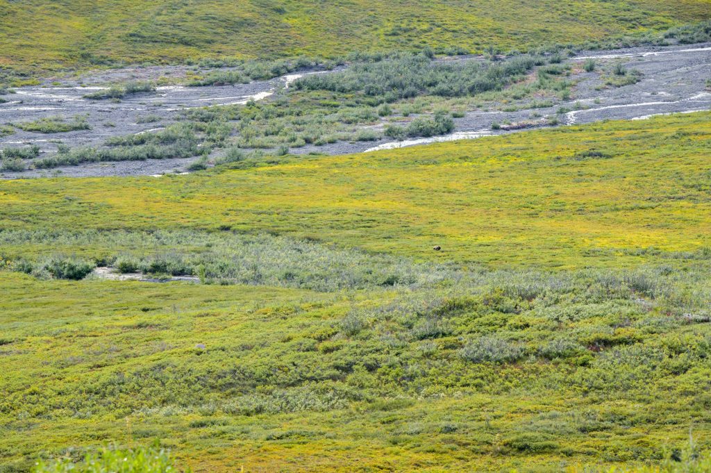
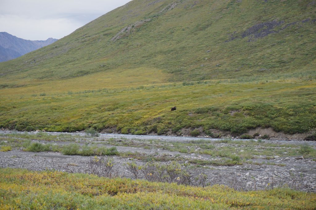
Suddenly, we noticed a brown speck moving in the distance. It had the tell-tale hump on its back. Daniel pulled out his massive telephoto lens and confirmed: it was a grizzly bear! We stayed a good 300 meters above the river, watching the grizzly do its thing and eventually head down river, away from where we were headed.
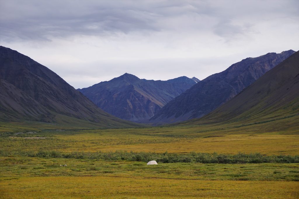
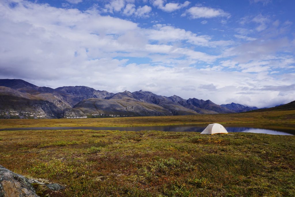
One down on the riverbank, we walked up easy gravel bars for a good distance before deciding on a nice gravel bar to camp. It was past 9 pm but there was still so much light out. Gotta love those Alaskan summers!
I noticed some movement up valley. It was four grizzlies this time: a momma bear near her two cubs, and a papa bear in the distance! They were just munching on berries and could not care less about us. We continued to monitor their movement, but they did not seem to be getting any closer. So we ate a nice dinner, squashed seven days of food in our bear cans, and prepared for our first night out. Five grizzlies on just our first evening out! Incredible!
Daniel and I woke the next morning sometime (it is hard to gauge the time when it is nearly always light out) and got on the move. We were watching the weather forecasts on Daniel’s inReach and it seemed that a big time storm was coming the next day, so we wanted to cover as much ground as we could in good weather over the next day and a half.
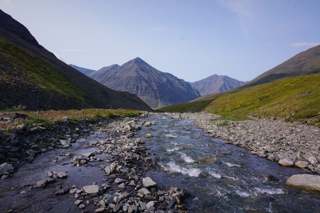
With the river level decently low, we could mostly just walk along the gravel bars next to the river. This was the easiest and fastest way of travel. It reminded me of walking along the beautiful gravel bars in the Cirque of the Butterflies in the Napeequa back home. I always envisioned that the Napeequa was the most Alaskan valley in the Cascades, with its glaciated peaks, wide gravel bars, and meandering silty blue river in a valley void of trees. Coming to Alaska, I can now confirm that truth.
It felt like it took hours for the sun to actually come up. The sun takes such a low arc in the sky this far north that the golden hour for photography can last for many hours.
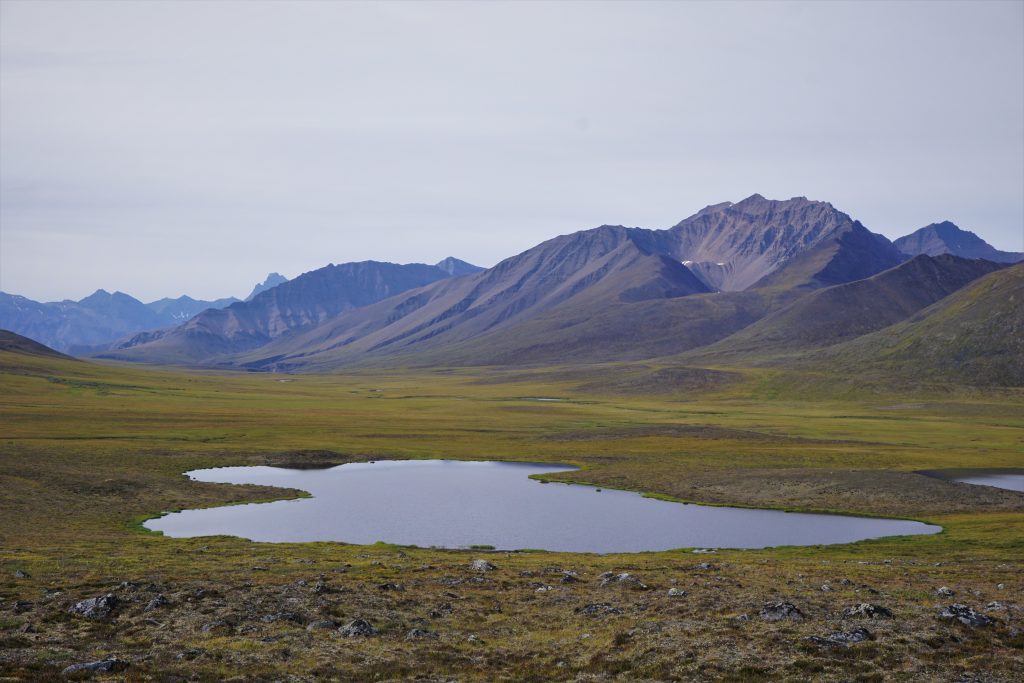
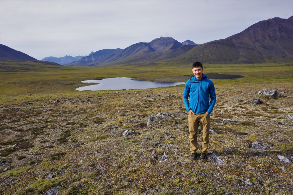
We made great time wandering up this valley. It briefly steepened before reaching our first crossing of the Continental Divide.
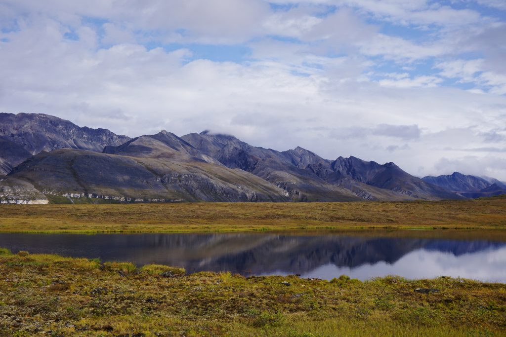
We crossed over a hump and found ourselves staring at a beautiful, desolate alpine lake with craggy peaks behind. Landlocked with no outflow, this lake sat suspended between the western and eastern sides of the continent. It was in permanent limbo, belonging to nothing.
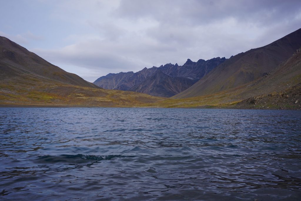
The wind whipped off the lake, chilling our sweating bodies. I put on all my layers and still felt cold, so it was likely below freezing. Still, we took a break to appreciate this marvelous spot before continuing on.
Valley of the Musk Ox
Daniel and I rounded the lake and began down the next valley. Here, the river was often in a deep canyon, so we walked along higher terraces on either side. It was often difficult to predict the optimal side to choose, so we would switch back and forth every hour or two sometimes.
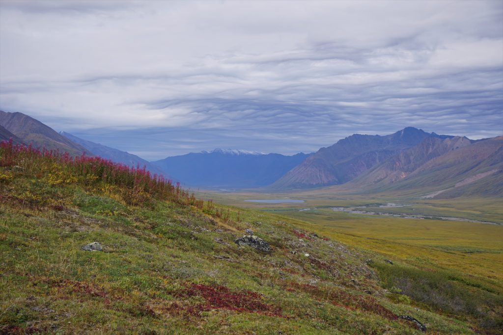
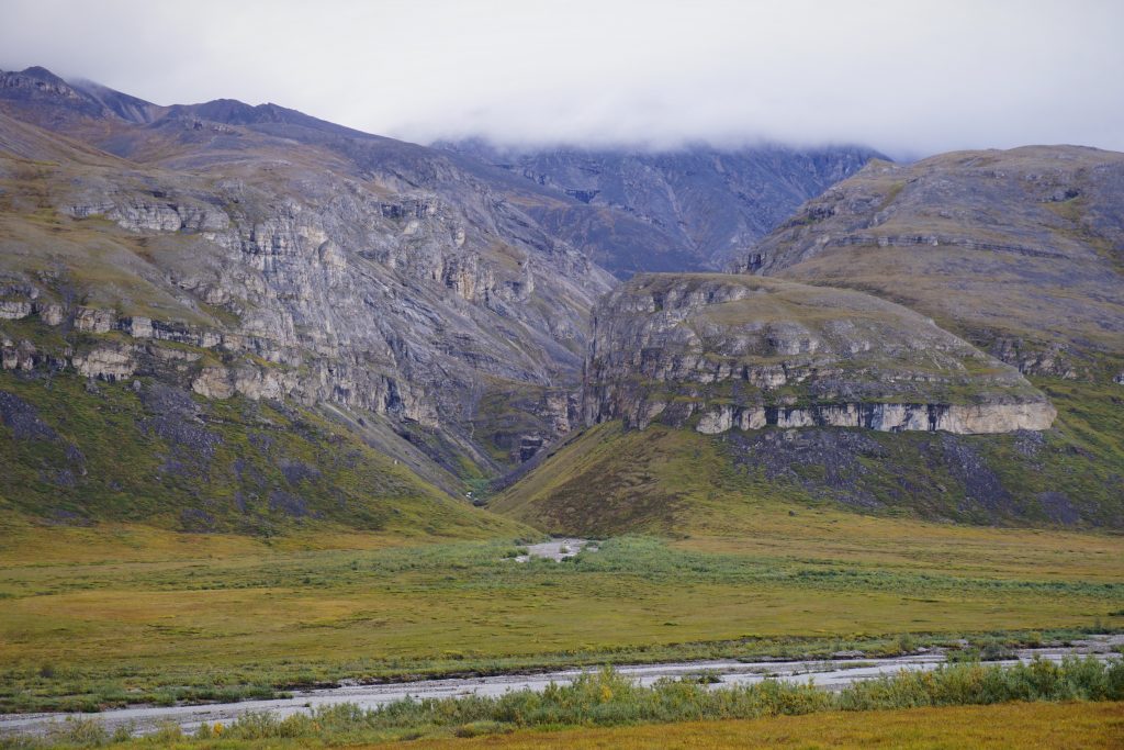
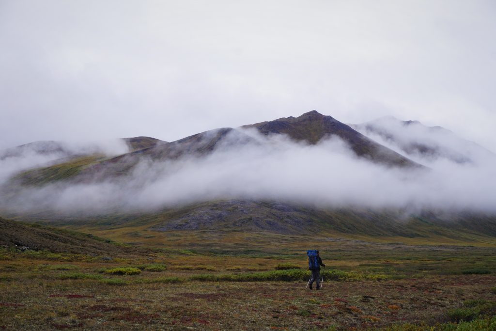
After a good distance, we spilled out into a wider valley. The peaks, broad and chossy, reminded me greatly of the Uinta Mountains in Utah. Previously I thought the Uintas had the largest alpine valleys and strangest looking peaks, but the Brooks Range outdoes them!
We passed an interesting rock glacier that had deposited huge lumps of rock all the way down to the valley bottom, changing the path of the river. Why do these rock glaciers form where they do? This one was at a low elevation, on a southern aspect, not where you would think glaciers form. If only Logan, our team geologist, was here…
The valley kept broadening until we started to get a view of a few distant symmetrical peaks. They were highly regular, giving the appearance of markers for something grand. Looking at the map, we identified them as the entrance the “The Famed Valley”. We had a hopeful high route planned through this legendary valley, crossing a 6000 ft pass and maybe summiting a high peak, which Daniel had read about in an American Alpine Journal from 60 years ago. Pretty soon, we would need to make a decision whether we went for this option or took a more conservative route.
We took a break and checked Daniel’s inReach for an updated forecast. We saw a substantial amount of rain starting midday the next day and continuing for the foreseeable future. When we had left Fairbanks, the weather forecast seemed pretty decent, but this did not sound good. If we went for the higher route we probably would not make it over the highest pass before the storm hit and we definitely would not have time to summit a peak. Reluctantly, we agreed to take the more conservative route, but we hoped to at least peek into the Famed Valley later this evening if we had the energy.
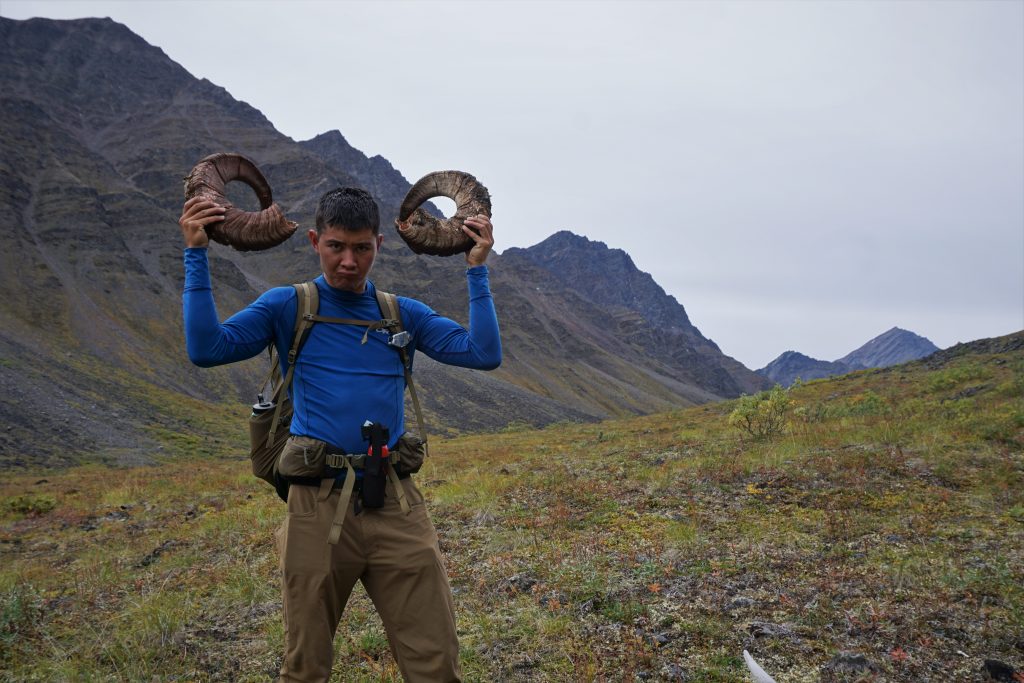
As we neared the mouth of the valley, I spotted a distant brown mound on the other side of the river. It looked too large to be a grizzly. Daniel looked through his telephoto lens and pronounced it to be a musk ox! Musk ox are huge hairy horned behemoths (I think the large brown creatures in Tatooine in Star Wars are based on the musk ox) that roam the tundra above the Arctic Circle. Daniel saw hundreds in Greenland (and even ate a musk ox burger), but they were hunted to extinction in Alaska. Starting about 50 years ago, a limited number were reintroduced to the North Slopes of the Brooks Range. It was apparently super rare to see a musk ox in this part of the Brooks Range!
From a few hundred meters away, the musk ox definitely spotted us and stared us down. We kept moving slowly away, trying not to provoke it. Daniel was charged by a musk ox in Greenland and we did not want a repeat of that. After a moment, the musk ox turned away and continued to gallop up the valley on the other side of the river. It was both awkward and beautiful to watch such a large animal move quickly.
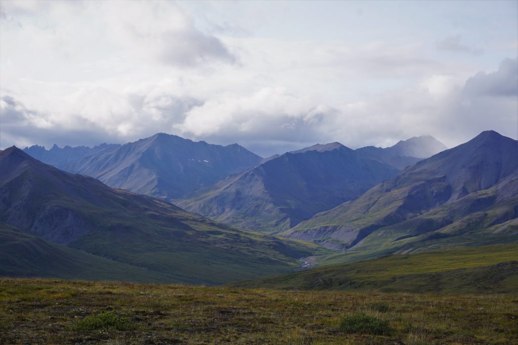
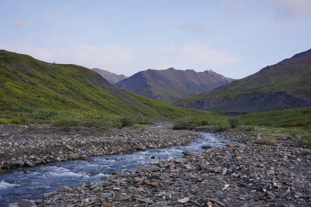
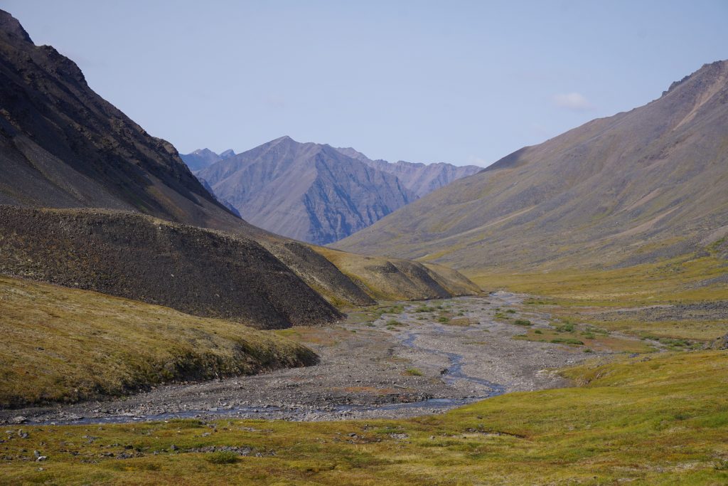
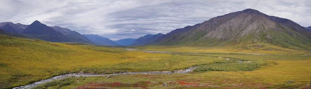
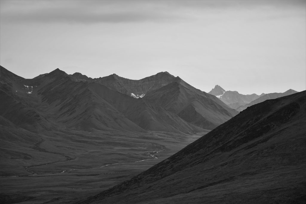
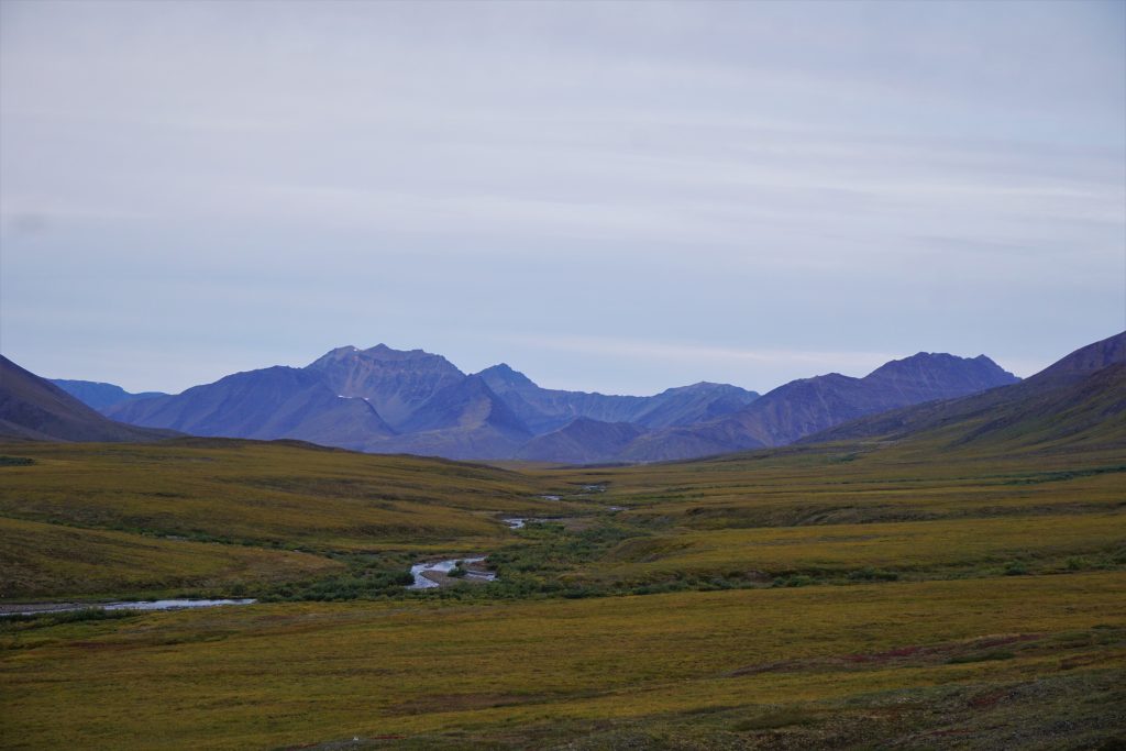
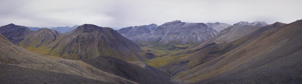
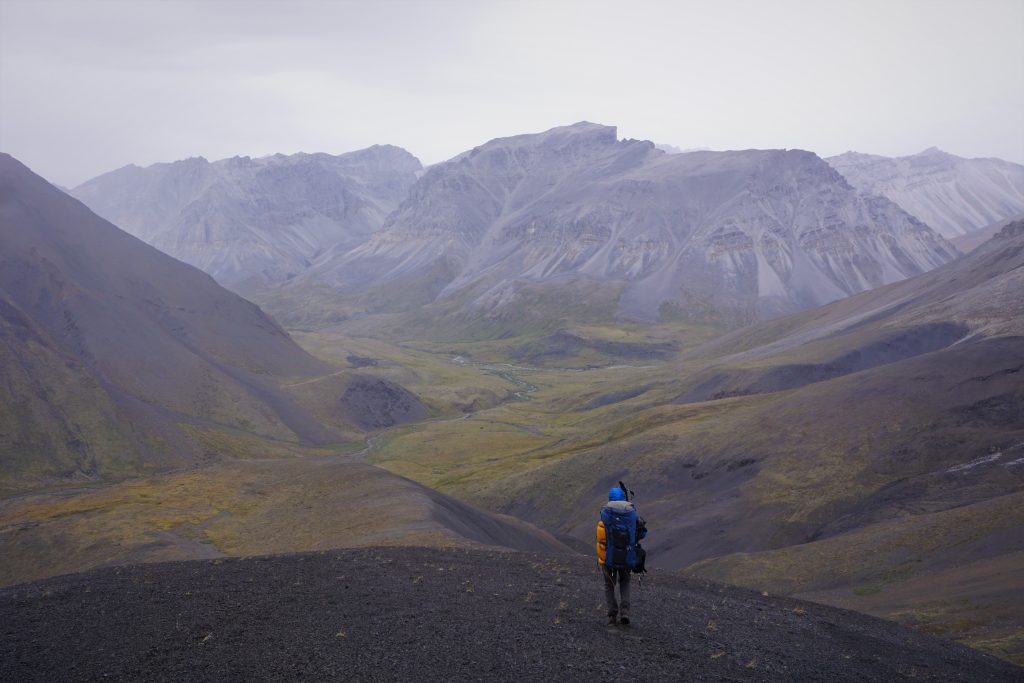
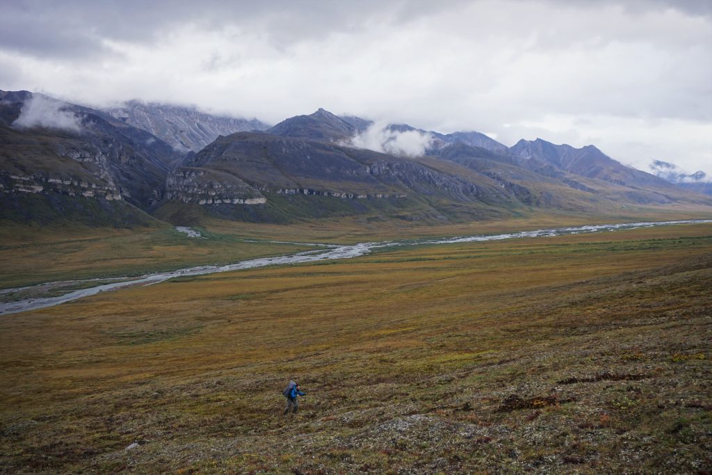
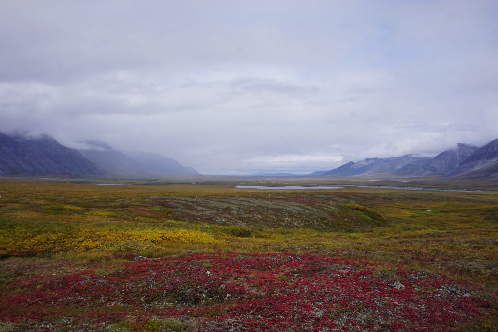
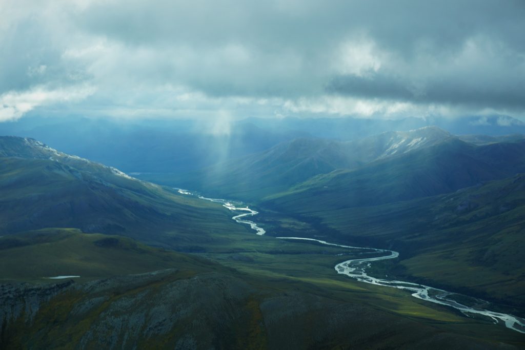
The Great Valley
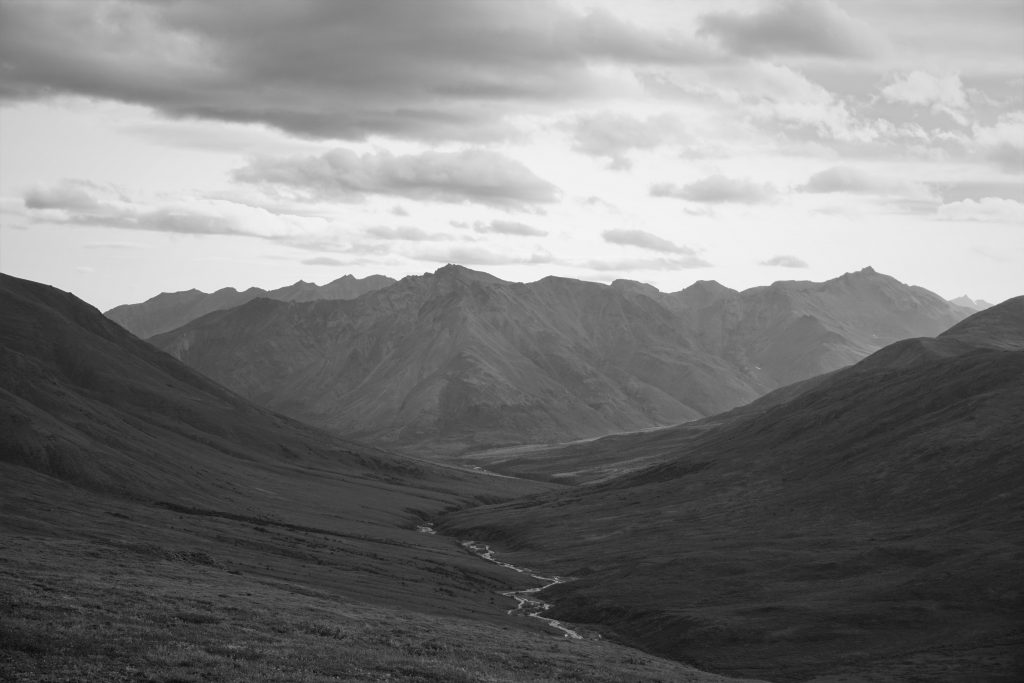
By dinner time, Daniel and I reached the point where this valley joined into an even larger valley. We looked down valley at the grandest fields and walls. It must have been many miles across, and equally formidable in length. In the distance, snow capped peaks signaled the approaching winter. The sheer size and power of this valley was simply overwhelming. It is elusive, evading capture by words or a camera. Some things you just have to experience to understand.
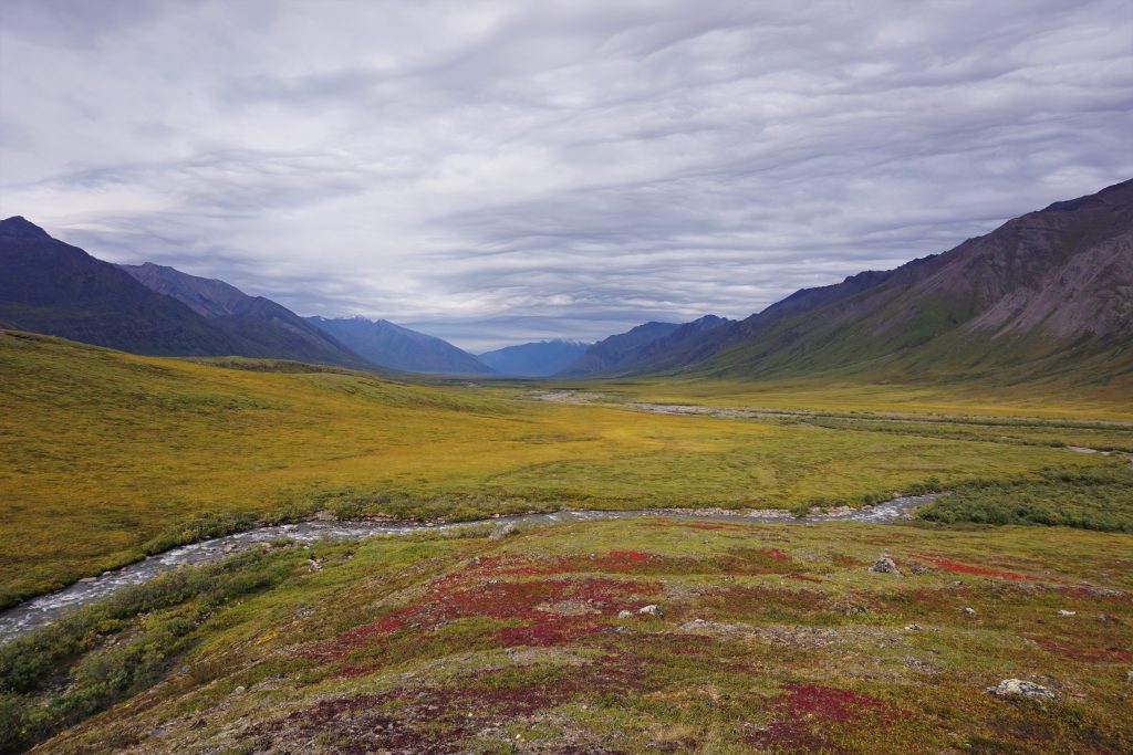
After one more river ford, we found a nice flat camp spot on some soft ground. So far, we had covered 20 miles for the day. The National Park Service recommends about a quarter of that, warning that “an experienced Brooks Range party knows that 5 miles is a good day”. Now, Daniel and I were gearing up for another 5 miles or so as a last ditch push to get a view of the Famed Valley.
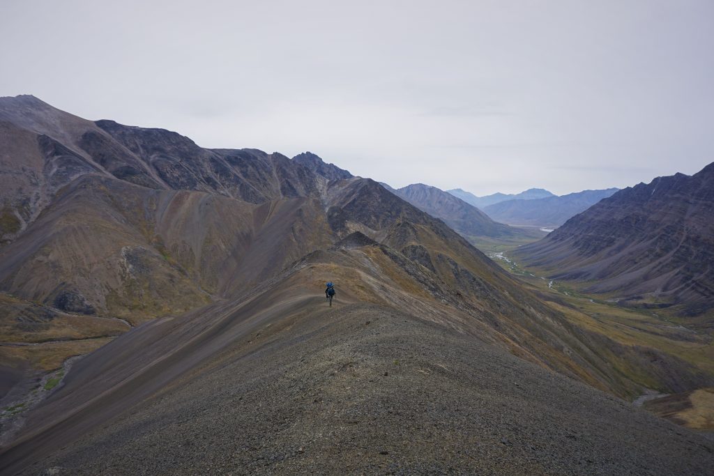
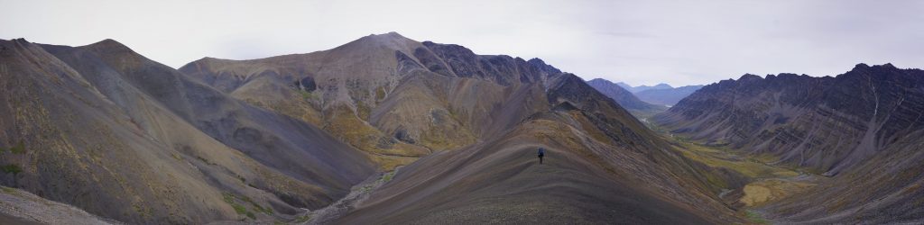
On the map, we picked out a high point on a ridge about 2000 ft above us that we felt like would afford nice views of the Famed Valley. In person, it looked simple enough. We set off with light little summit packs. This was our “summit push” for the trip.
But with no trees or points of reference, size can be deceiving in the Brooks Range. We quickly realized we had a great distance to cover. We dialed the pace back. There was no reason to rush. We had hours of daylight and endless views to soak in.
With every bit of elevation gained, more mountains revealed themselves. The rivers were but artistic squiggles through the landscape, much like the mustache-shaped lenticular clouds that capped the high peaks, signs of the changing weather. It felt like we were walking in a painting, the most beautiful exhibit either of us had ever seen. We all stand witness to nature, the greatest artist of all.
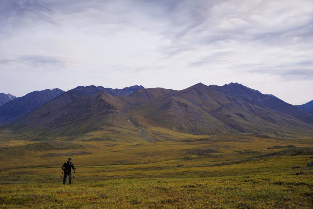
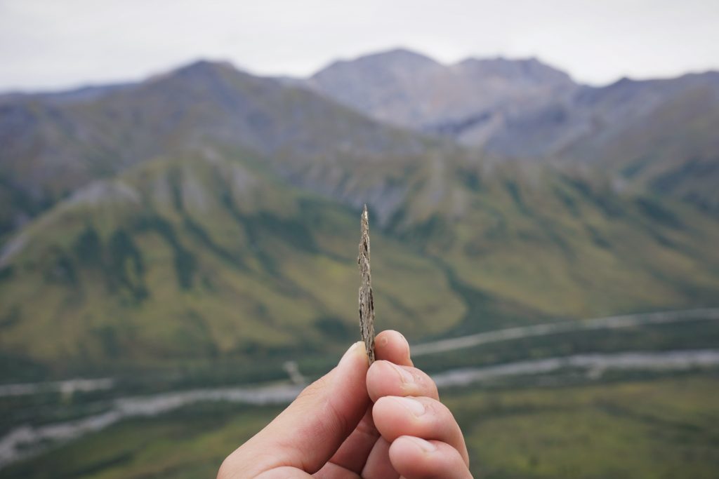
About two hours after leaving camp, we finally crested the ridge top onto a high, flat plateau. The view on the other side was so stunning, it almost felt fake, like a dream. The valley was turned on its side at a 45 degree angle so that the hills seemed to cut out of nowhere. Colorful lines streaked across the hillsides like layers in a cake. A thin white capping of fresh snow added to the lofty perch of the 7000 ft peaks. The fall line of the hillsides was perfectly clean and continuous thousands of feet to a wide valley floor. At the bottom was a river delta that must have been half a mile a wide. There was no doubt: this was the Famed Valley.
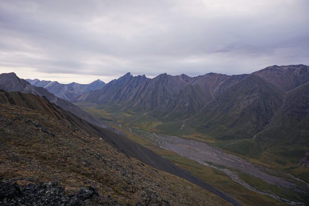
After moving hard all day, Daniel and I took a break to just relax and take it all in. There was such a peacefulness to this moment and place. When in an Alaskan Valley, your world is confined on three sides. But up high, it stretches forever, in all directions. No people, no roads – just rivers, valleys, mountains, and an untainted wilderness. The scale of the Brooks Range is impossible to communicate; it must be experienced. As much as I try, there are no words for this place.

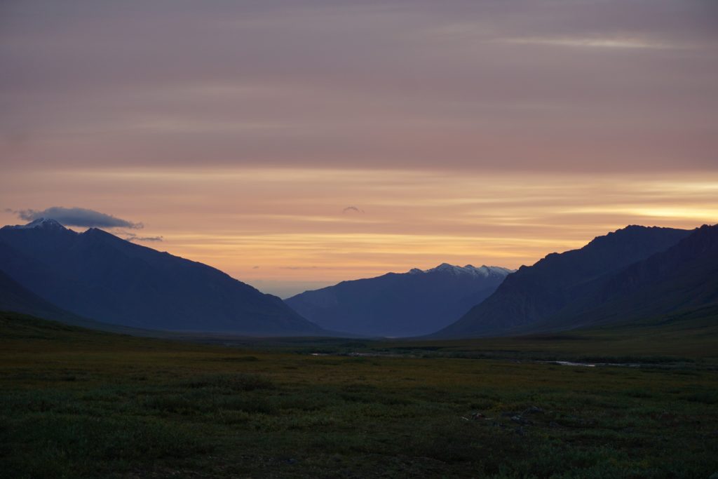
We retreated to the valley floor under a hazy red sun and evening light that seemed to never want to give up. We were both tired but content.
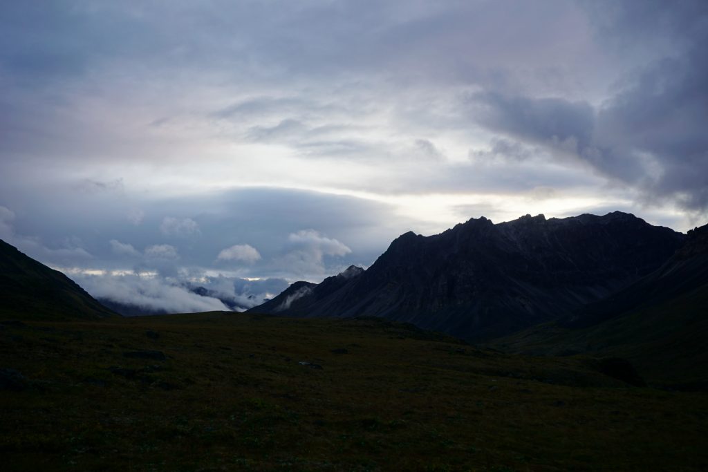
The next morning was still and calm with rosy red hues to the north.
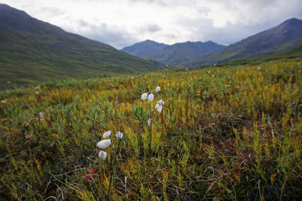
Daniel and I started walking up valley towards the Continental Divide once again. We were starting learning how to predict the ease of travel from a distance: hints of dark green in the yellow meant marshy. Traces of black usually meant higher, more stable ground. The boggy sections were not always where you expected, so this was important. However, we still sometimes got into huge mile long sections of just awful soggy ground where every step felt like work.
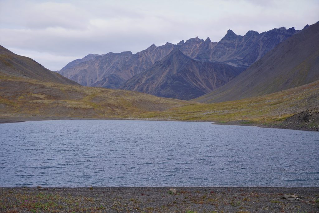
As we approached the divide, we passed above a huge mile long lake. There was a rustic old cabin on its shore and we imagined float planes might land here. It was truly an idyllic location.
The pass at the divide was truly a unique pass. It was essentially flat, so it was difficult to even tell where the water flowing changed direction. The incredible thing was how three massive valleys came together to form an almost triple-pass! I have never seen anything geographically like this. Two beautiful little lakes resided at the confluence of all three valleys.
If we had taken the route through the Famed Valley, we would have missed out on this amazing spot. It seems that no matter where you go in the Brooks Range, you cannot go wrong. Each valley is special and wonderful in its own way.
The Dark Valley
The sun came out and for the first and only time in the entire trip, we actually felt warm enough to just wear our base layers. For the rest of our trip, Daniel and I literally lived in our R1 fleeces.
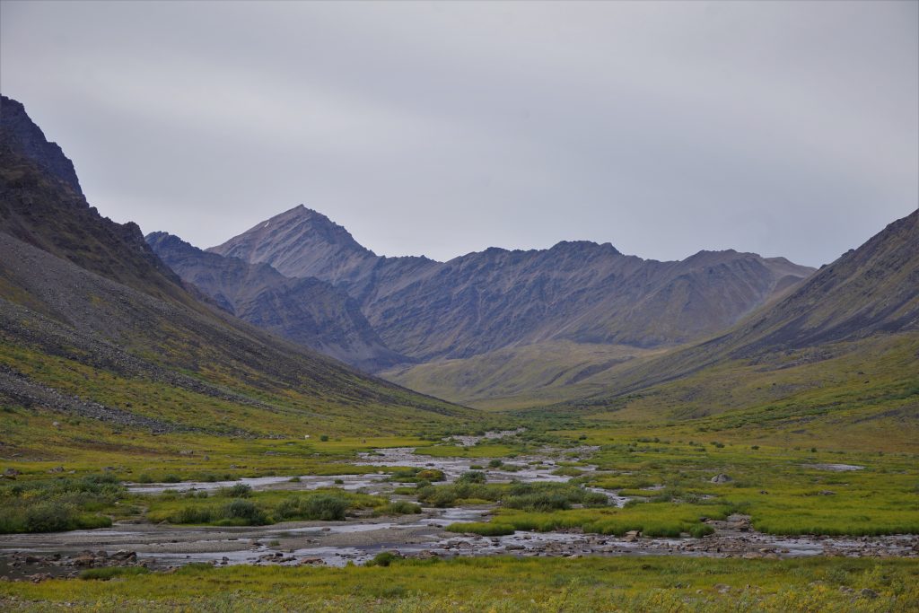
In the distance, we spotted our high pass. This was the only high alpine pass of the trip, and it seemed we might get over it before the weather really went downhill!
As we entered deeper into the valley, we became surrounded by dark, craggy faces. In my mind, I could see ice lines and ski lines everywhere, but I am not sure if the Brooks Range has adequate snowfall for ski mountaineering and ice flows to form. Never mind the fact it is -40F in the winter…
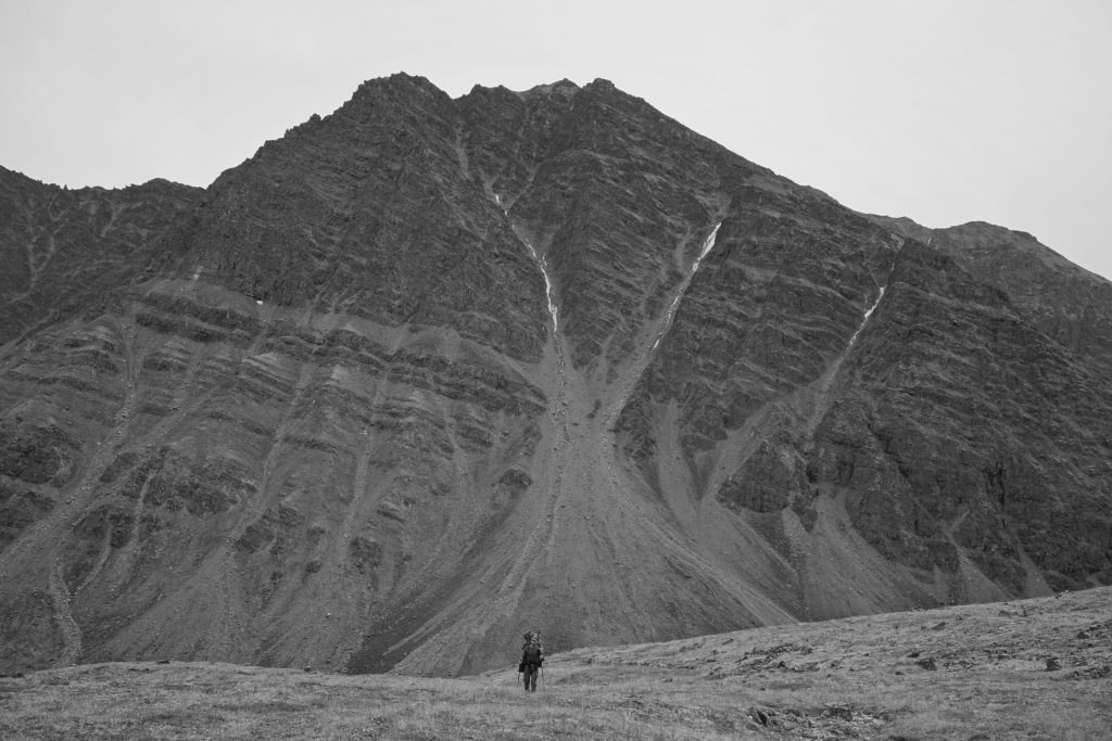
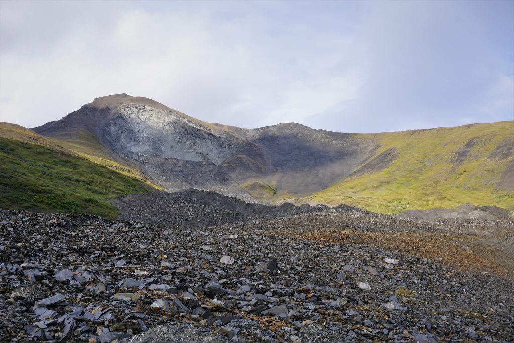
The climb up to the pass was easy enough, mostly just solid shale and grass. We followed goat tracks up the last bit.
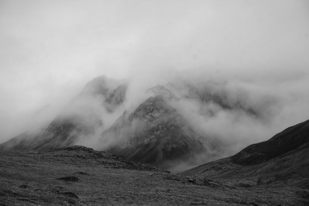
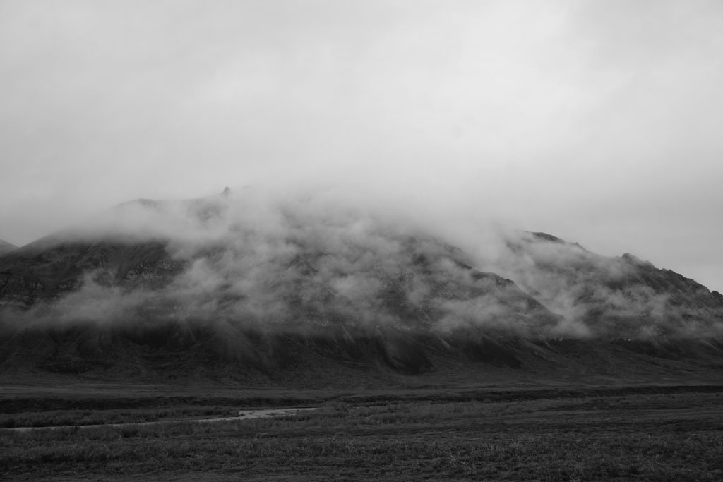
As we crested the pass, we met a foreign world of greyscale. Giant shale ridges descended thousands of feet in perfect fall lines on all sides. The contrast with the lush green valley we had just left was mesmerizing. It was as if we had entered a new world, the alpine world of the Brooks Range. Somehow, the Brooks Range kept getting better and better as we walked deeper into the painting.
Finding ourselves at a false pass, we were a little confused where the actual pass was, but just kept heading up. Slowly, snowy peaks emerged from behind the giant black shale ridges. The giants of the Brooks Range revealed themselves.
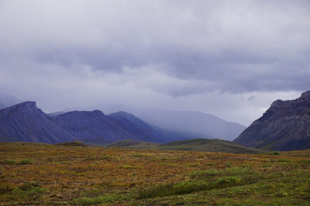
Valley of the Flood
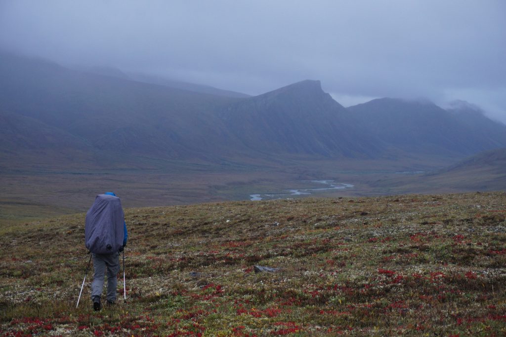
Finally, Daniel and I arrived at our high pass. From the vantage point, we could peer down into the next valley and the incredible gray limestone walls in the distance. To the right, a pointy skyscraper stood above the rest. The colors – shades of yellow, gray, green, and black – were other-worldly. The mountains seemed so idiosyncratic, it almost felt like we were on a different planet.

Rain squalls were obvious in the distance and they were unfortunately headed our way. A few drips began to fall, an encouragement to get on our way. The rain became steady as we plunged down the black shale hillside. I danced, twirled, and jumped for the camera, all with a heavy pack in the rain. Time to play! Our dance music?
Reaching for something in the distance,
so close you can almost taste it,
release your inhibitions,
Feel the rain on your skin!
Once we reached the valley floor we started to look for campsites. We could have kept going, but we felt like it was smarter to set up camp while we were still relatively dry and just wait for the next weather window. We found a spot of high, flat ground above the river that would work perfectly.
After a quick pitch we jumped inside and began to get comfy. We had brought Daniel’s ultralight 3 person tent, which was nice given the extended time in the tent we planned. To the sound of steady rain, we closed our eyes and dozed off.
One of the downsides of waiting out storms in the Brooks Range is that you cannot really keep your food with you in the tent due to bears. However, it also helps you ration your food on a long trip, because it is easy to just start eating for hours in the tent. Eventually, we wanted dinner so we put on our rain gear and headed out to cook a quick dinner in the rain.
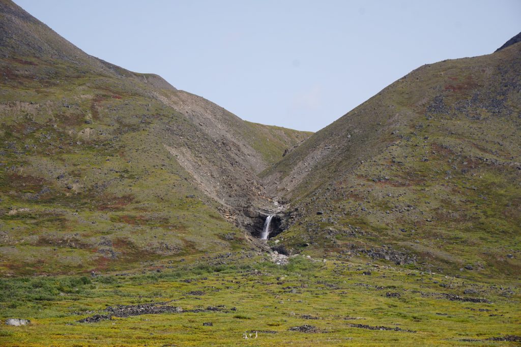
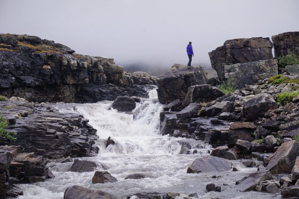
The next morning, there was a brief two hour window in the morning where the rain stopped. We eagerly took the opportunity to get out of the tent, cook a meal, and walk around.
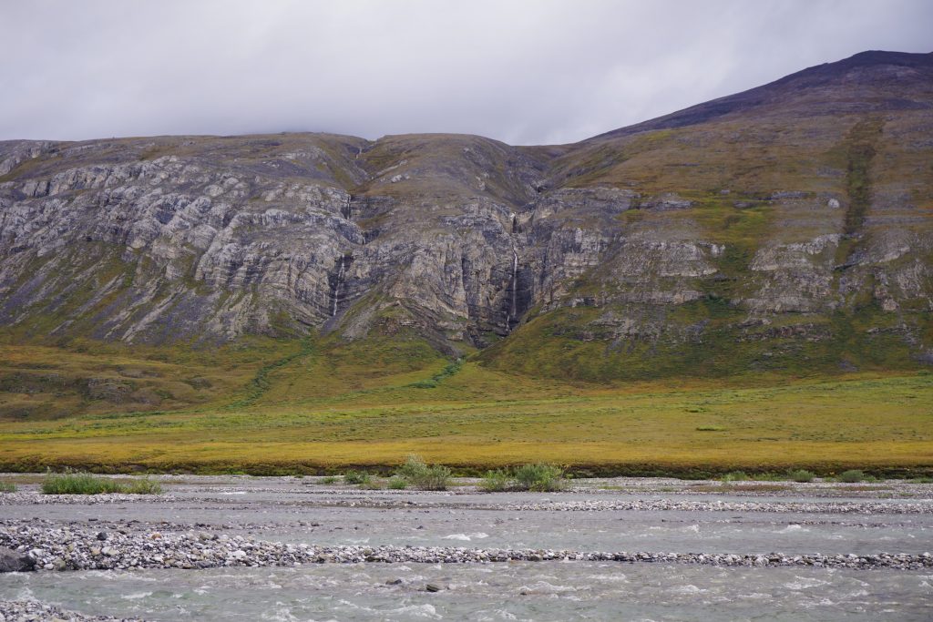
There was a nice waterfall through some highly geometric rocks just up valley.
At a few points, the clouds even cleared back up to the high pass from which we had descended. We occasionally joked that one of us just saw Ben and Nicole striding over the pass. We were really rooting for them, but knew that the trip was becoming exponentially more difficult with the weather. We felt so grateful to have cleared that pass literally minutes before the great storm hit.
The rain returned and so we returned to the tent to sleep, play cribbage, “I hid the thimble”, and listen to music. We must have listened to “Unwritten” a dozen times, shouting the “Feel the rain on your skin” part as condensation dripped off the tent onto our face. “I hid the thimble” is a delightful mind game where one person “hides the thimble” in some spot in 4 dimensional space-time. The other person has to ask questions to eventually figure out where it is. I hid the thimble in the beard of our junior high principal, and that took Daniel a long time to guess.
Daniel’s inReach was calling for an apparent weather window from around 10 pm to 10 am the next day, followed by more heavy rain. Our strategy oriented around taking advantage of the near-endless light and minimizing the number of times we had to setup and tear down camp, because that is when our things would get the most wet. Looking at the map, it seemed like we could push at least half way of the remaining distance to Anaktuvuk Pass in a 12 hour window. Then there would be only one more period of movement before civilization (sort of).
Just when we were ready to go, all packed up inside the tent, the skies unleashed one final torrent, some incredibly intense rain for an hour or two. But right on cue, around 11 pm, the rain stopped and we quickly got going.
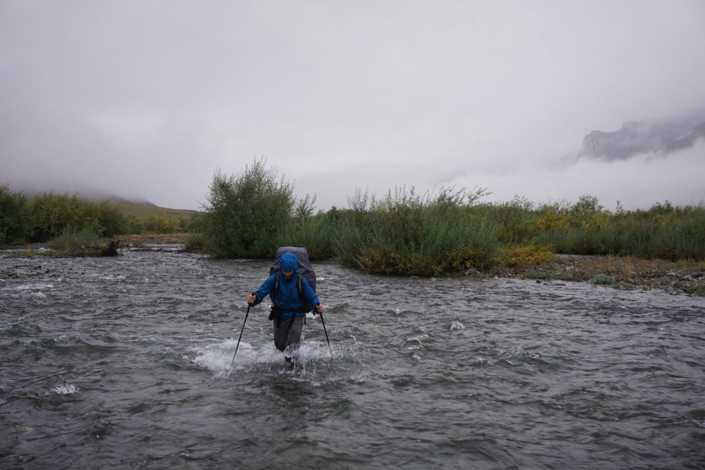
One thing quickly became clear to us: the rains had transformed the landscape. Water poured out of every crevice in the hills, creating dramatic waterfalls everywhere. The little creeks we needed to cross were suddenly suicidal, raging muddy rivers. What should we do? Wait for the rivers to die down? Explore up valley? Caulk the wagons and float? This was not the domain of a thru-hiker, this was the domain of Noah and the Ark.
I tried to cross in three or four places, but I always turned back when my poles disappeared completely into the water in front of me. The murky water made guessing depth difficult, but any depth over thigh deep was unsafe with how swift the currents were. My feet were numb and cold from the repeated crossing attempts, so we decided to check upriver.
We hiked up above the waterfall and continued to try a few more crossings, but none were safe. We were about to give up when I spotted a promising section where the river divided into multiple sections, reducing the flow of each individual one. I took a few cautious steps, leaning hard forward on my poles for balance. Fortunately, the rocks underfoot were not too slick. Slow and steady. Ignore the thigh deep freezing water. One step at a time. I felt more intensely focused than when I solo fifth class rock.
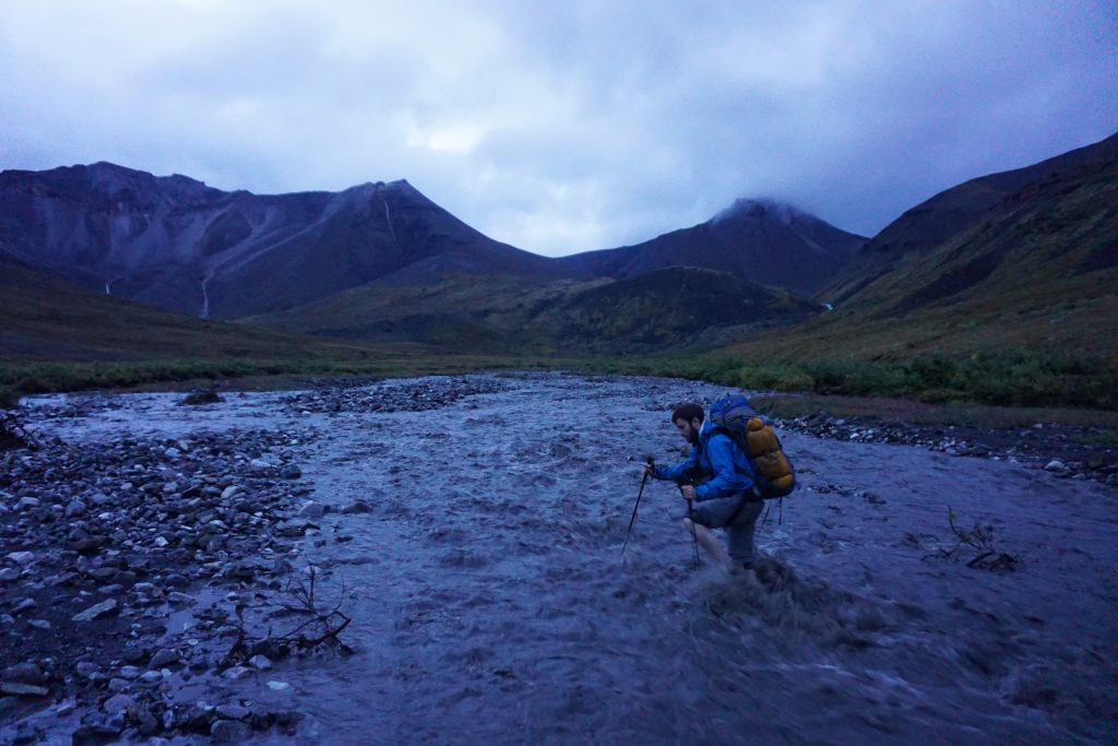
And before I knew it, I was on the other side! It was the biggest send of my entire summer! Daniel carefully joined me and we let out a holler so loud it could have been heard from the Dalton. We pounded our chests, we danced up and down, we hugged, we maybe even felt the semblance of a tear. Elation, relief, and joy washed over us. It was midnight in the Brooks Range, we were soaking wet and cold, but damn it, we were happy.
As we sat on the other side, dumping water out of our shoes, light snow flurries began to fall from the sky. It felt as if the entire trip had culminated in this moment, a terrifying crossing of such a little stream. This was a moment of such powerful emotion that is burned into my memory. The mountains have a way of stripping away our outer layers until we are as raw and untamed as the wilderness around us.
Daniel and I continued down the valley. Eventually, we pulled out headlamps, even though it was still possible to vaguely see.
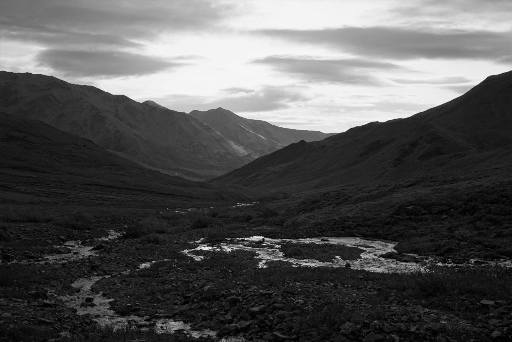
In the night, all perspective was lost and the dark shadowy outlines of the mountains seemed to loom larger than life. The already massive valleys felt even larger and distant ridges were actually only a few hundred feet away. We reached a perch high above the confluence of three rivers. Clouds whisked overhead, shifting the shadows in the everlasting twilight. But at ground level, it was calm and dry. We took a deep breath and let the darkness consume us.
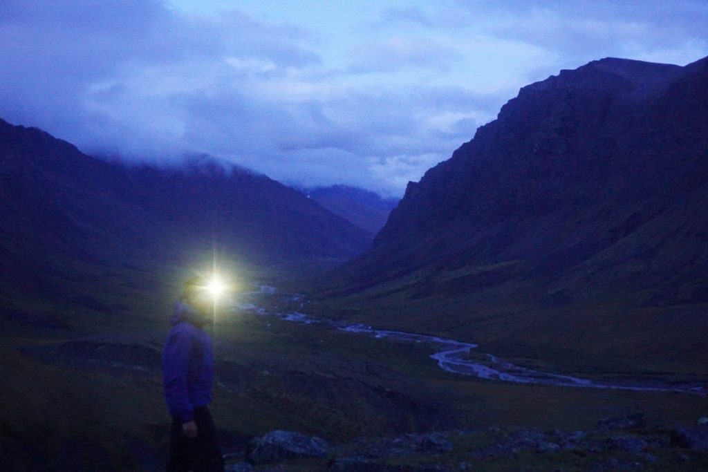
After a short photography break, we marched on towards the last pass of the trip. This pass turned out to be many miles of perfectly flat boggy tussocks. After the adrenaline of the river crossing, I felt my energy dropping in the low light, so I downed some more snacks.
The Final Valley
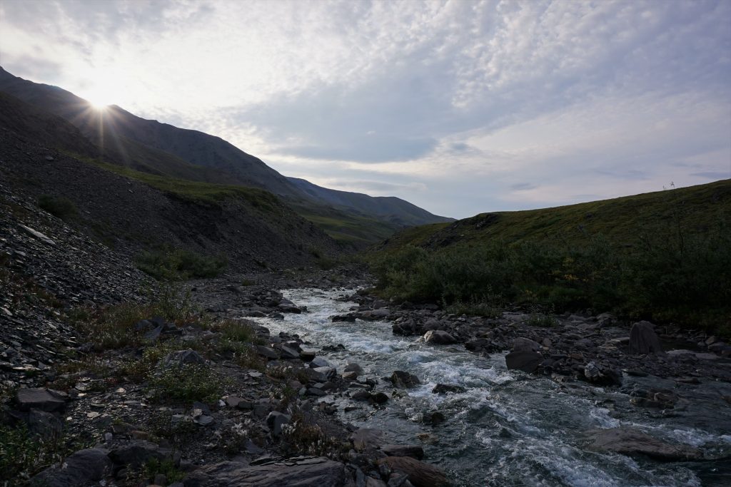
Finally, around maybe 4 am it started slowly getting light again. The cloud ceiling had dropped to barely overhead and a cool wind swept across our faces.
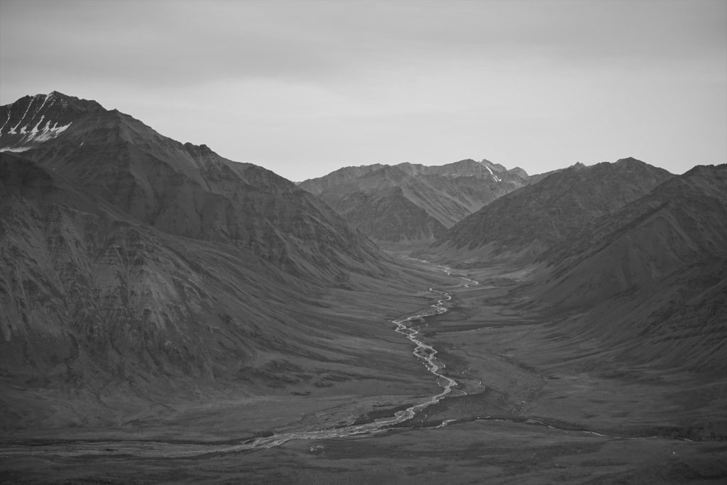
A few miles later, we finally came to the point where our tributary joined the Anaktuvuk River. The path was simple from here: just follow the great river to Anaktuvuk Pass.
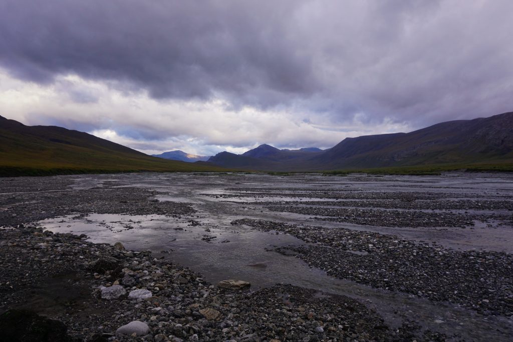
As we descended into the valley, the Anaktuvuk River widened into an incredible river bar probably half a mile wide. A single path split into dozens of streams like a fractal exploding. It was like a river delta before the ocean, except we were still so deep in the mountains, so close to the headwaters.
We quickly figured out that walking the gravel bars in the river was the fastest way to move. Sometimes, it got up to knee deep briefly, so Daniel eventually just accepted getting his boots wet and plowed through it. I had accepted wet feet from the start when I chose to wear running shoes. There is something so liberating about accepting wet feet. Travel becomes so much simpler and more efficient. Oftentimes, we hide from the gnar, but it feels so invigorating to embrace it.
We sang our favorite song, with a slight variation:
Feel the rain in your boots,
No one else can feel it for you,
Only you can let it in…
Drench yourself in words unspoken
Live you life with arms wide open…
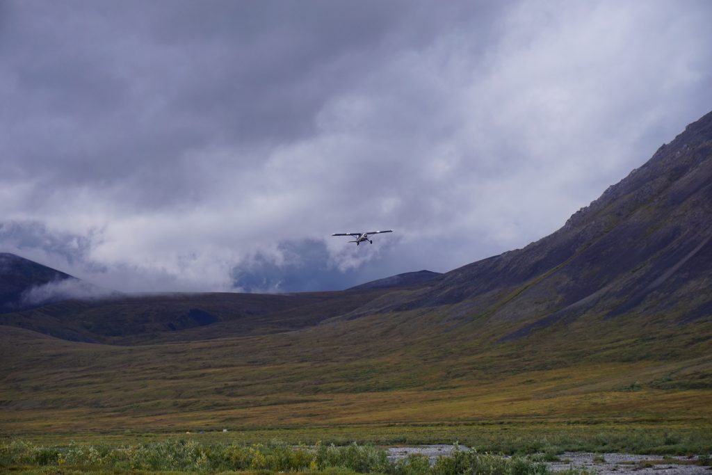
Further down valley, we saw a large group of tents on the opposite side of the river. We watched a bush plane land, drop some food off, and fly out.
Slowly, it turned into a decent morning. The sun came out in a few spots, casting bright spotlights across the landscape. The effects of the monsoon were obvious as waterfalls poured out of crevices high on the mountains around us. We even saw a few caribou passing in the distance.
We hiked a few hundred feet up to a huge bench high above the river valley. We saw a large lake and a nice knoll to camp upon, so we decided to stop here for the day. Showers were coming up valley and about to hit us, so we pitched the tent and jumped inside.
The rest of the day was a periodic cycle of heavy rainstorms and dazzling sunshine. When the sun came out, I walked outside to eat and enjoy the warmth. With each passing squall, the mountains across the valley would be coated in fresh snow, only to melt in the sun. Rinse and repeat. It was beautiful and peaceful to watch these cycles unfold.
The weather forecast called for decent weather starting early the next morning. But it was still drizzling as we got moving the next morning at 5 am.
We started the day with one of the two big river crossing we had left. It was not too hard, but very cold in the morning rain. On the other side, we had our first real encounter with difficult brush. Fortunately, we found a game trail that tunneled through the brush and helped us get to higher ground.
The rain stopped, but the clouds were low and moody. They broke into hundreds of fragments as they clung to the steep cliffy hillsides.
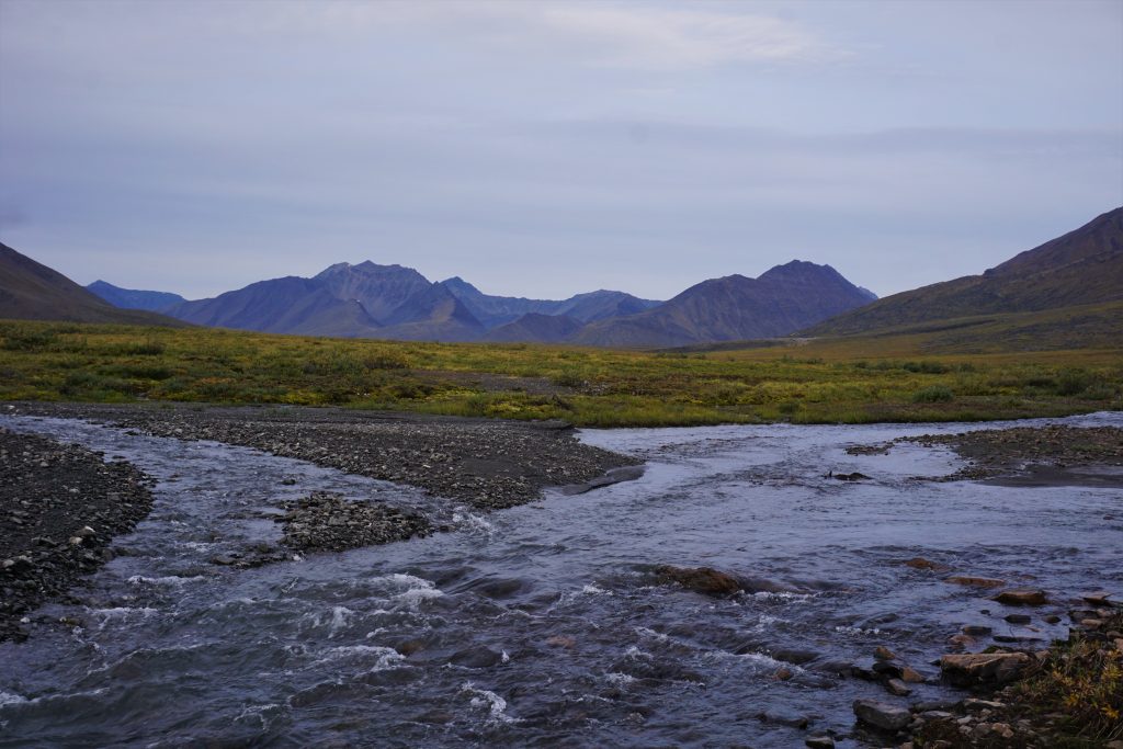
A few hours later, we came across the final major river crossing. The river had a steep pitch and was flowing very quickly. We found a section where it wider and split. Although it was only knee deep, the water was very swift and the rocks slippery, so this was not an easy crossing. We both breathed a sigh of relief on the other side, happy to be done with scariest parts!
As we continued along, the valley kept widening up more and more. In the distance, the Anaktuvuk River takes a right hand bend and heads north towards the Arctic Ocean.
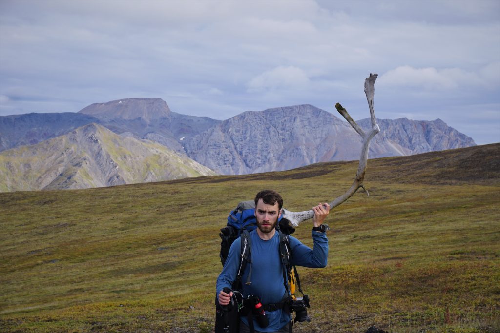
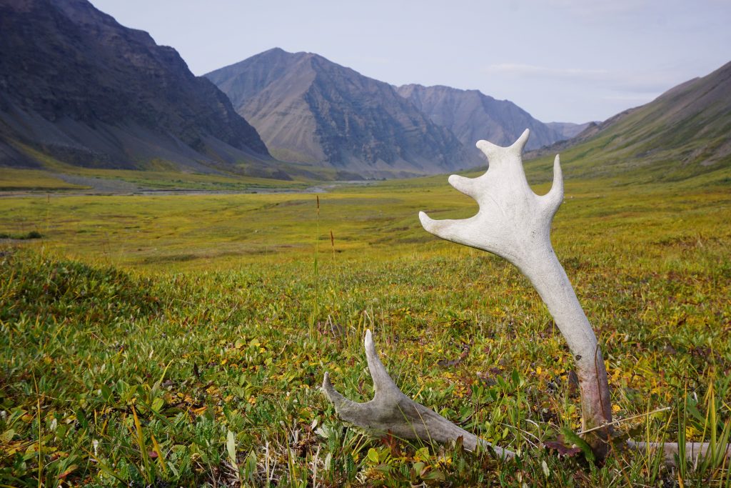
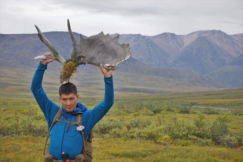
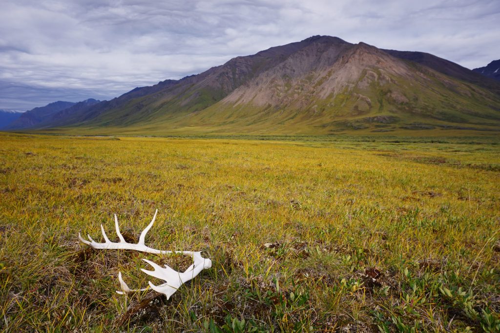
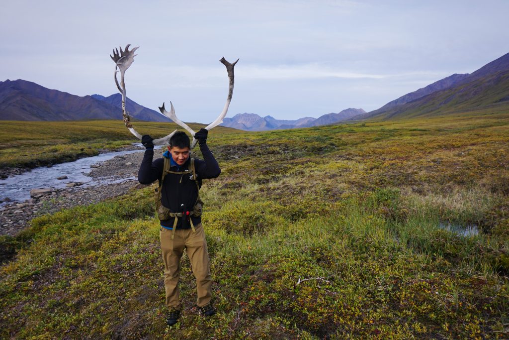
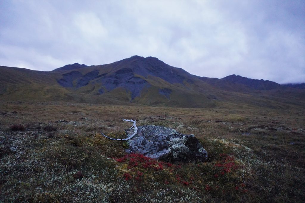
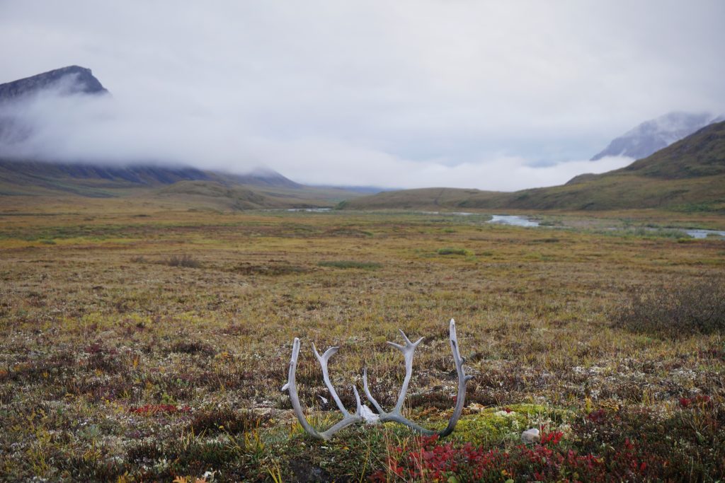
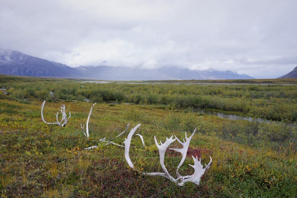
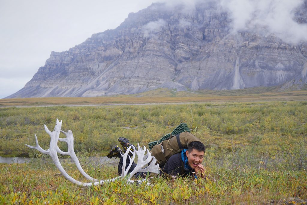
There were more and more caribou antlers, signs of hunting in the area.
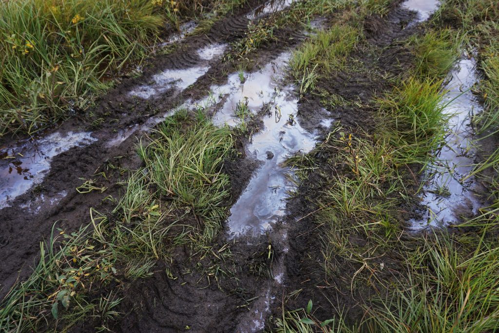
For the first time, we started to encounter faint signs of an ATV trail. It was usually more obvious in boggy sections where the ATV wheels sink deep into the mud.
Gradually, the ATV tracks became more apparent, as did the oil slicks. We had hoped that ATV “trails” would make the walking easier, but the opposite was actually true. The ATVs destroy the meadows and make the bogs even worse. In boggy sections, they end up going wide around previous tracks, creating these huge mud holes hundreds of feet wide that are difficult to go around!
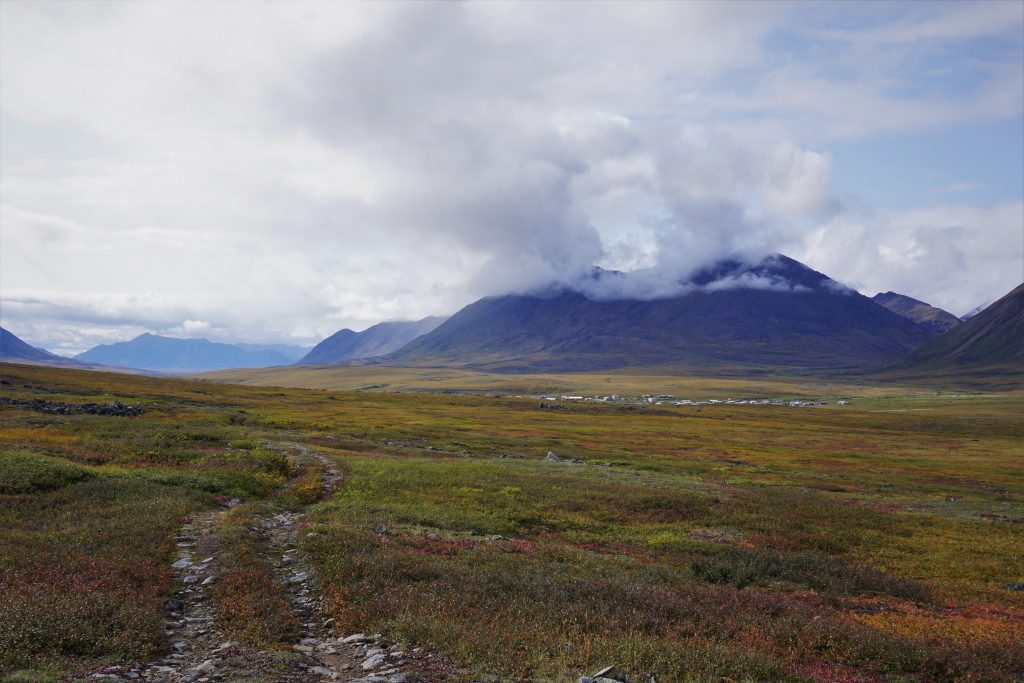
We eventually left the river and start ascending up towards Anaktuvuk Pass. On a map, it looked like we were practically there, but we knew it was a good distance still, and it was particularly boggy in this area. But the sun was coming out and we just tried to appreciate the last bit of this journey.
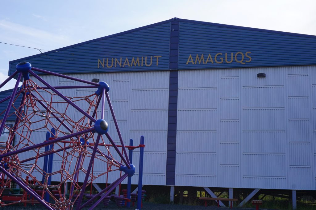
As we crested one last hill, a town appeared in the distance, out of nowhere. It was a small collection of buildings and homes split by a river, set in the massive John River Valley with a dramatic backdrop. Honestly, it was one of the stranger sights we saw the entire trip. Civilization just felt so out of place here in the remote Alaskan wilderness. After all, we were staring at the largest town for a few hundred miles in any direction.
Anaktuvuk Pass
Walking down the hills to the town felt like crossing a threshold between the vast untamed wilderness and the small circle of comfort within which most of live. But here in Alaska, wilderness still reigns supreme. Civilization is the outlier, not vice versa, like we are so used to in the huge US metropolitan areas.
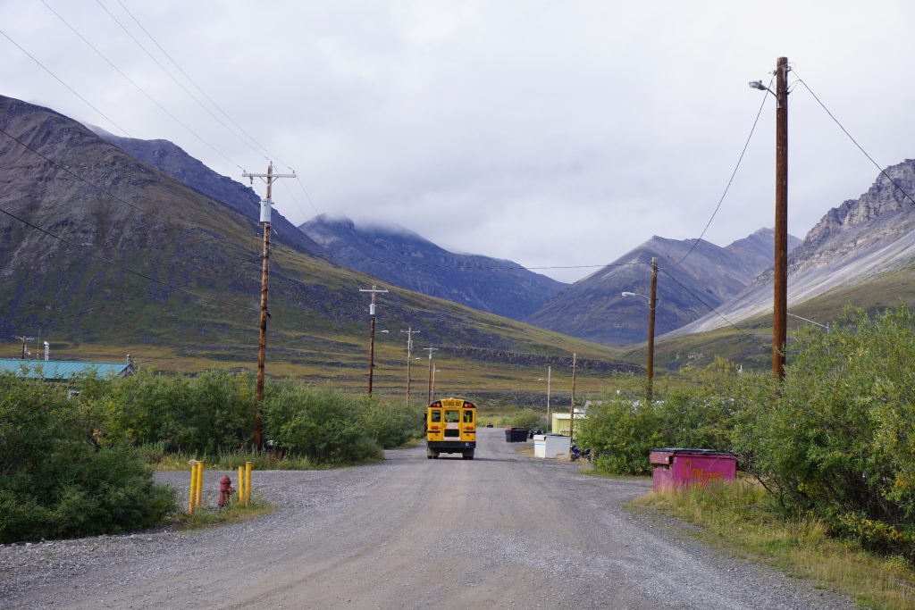
School was getting out as we walked down the streets. The town was small, but the bus was even smaller so it had to make multiple rounds to drop off all the kids. We watched ATVs roar down the streets, some of them operated by kids too young to have gone through puberty yet. People waved to us, the obvious foreigners.
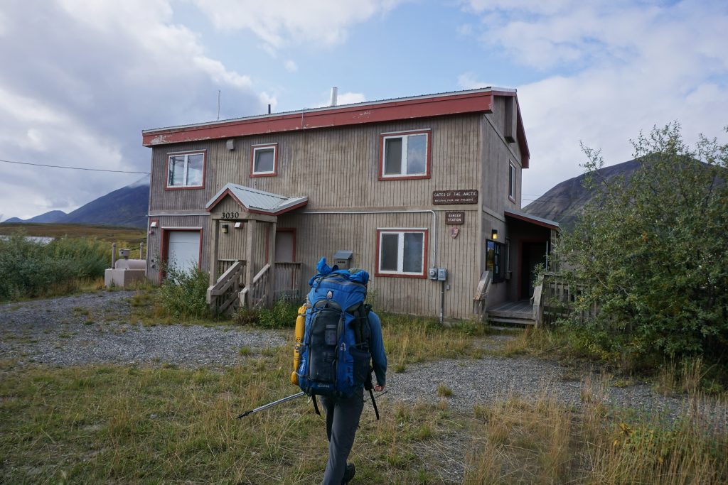
We decided to first go to the ranger station. It was only Thursday afternoon and our flight out of Anaktuvuk was not until Saturday, so we wanted to call the air company and try to move our flight up a day. Luckily, we were successful, with no transfer fees like the big airline companies! The ranger was a quiet guy, which makes sense considering he probably does not get too many visitors. But as we talked to him for an hour or so about the area, the people, the history, and the climate, he became much more open and his passion for preservation of the Arctic was clear.
We were quite interested in the land management of this area. So he explained the complex web of agencies and laws that oversee things. Technically, the valleys around Anaktuvuk Pass belong to the Nunamiut natives, so they are free to hunt and use ATVs for subsistence purposes. Hikers like us are granted passage through the lands. On the outskirts of this area, there are more special designations. Between the national parks and the state Department of Fish and Wildlife, there are multiple governing bodies around hunting, so it all gets very complicated.
After a good conversation, we walked over to the grocery store and bought some snacks. Most products, even packaged food, were 2-3 times what they would cost back home. There was a very limited supply of fresh food. The people of Anaktuvuk Pass still rely heavily on caribou meat. The owner of the store approached us and talked to us about where we came from. He was particularly interested in the status of the caribou, since the herd of thousands usually migrates through the valley in late August. “Dalton to here in four days? You guys must have been taking it easy!” I’m not sure I would have classified our pace as “easy”, but maybe they are a bit better at walking on tussocks than we are!
We walked down to the far end of town. Most of the homes were very small and elevated on stilts, probably because the ground is to soft to build a traditional foundation. Mangy dogs accompanied most of the homes. In contrast, the school was by far the nicest building in the town. It was a new and shiny, since more funding comes in for education than anything else. Some boys arrived, panting, just finishing up their cross country training run. They had to travel hundreds of miles by plane to find any competition to race!
Outsiders camping in town are instructed to camp down by the river out of view of the town. We found another little gravel bar on an island. If not for the telephone pole that barely stuck out on the horizon, you would have thought we were back in the Alaskan Wilderness once again.
It was raining the next morning. The fog had dropped to the lowest levels that we had seen all trip, barely a few hundred feet above the valley floor. We were concerned that the plane would not be able to land, since visibility is needed at this runway.
Our main priority for the day was to visit the town museum, which is the second nicest building in town after the schoolhouse. We paid a small entrance fee and started to look at the exhibits about the Nunamiut people and the history of the town. The town was “settled” in 1949 by the joining of two tribes, the last nomadic people in North America. Until a chance encounter in 1940 or so, they were not even known to exist to Westerners.
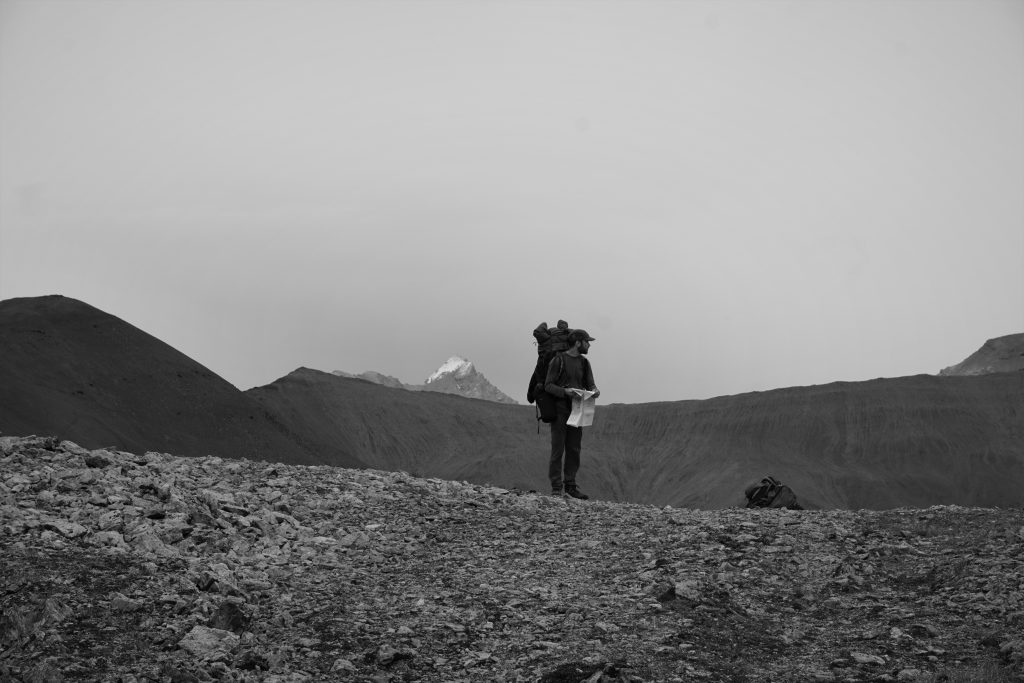
While we were looking around, an old man approached us. He was the town historian, one of the few remaining people who remembered life before 1949. He showed us a giant map of the Brooks Range and asked us to show him the route we took. The map had hundreds of arrows in different colors, showing the migration patterns of the wildlife, traditional cross country routes, and other knowledge of the land. It was fascinating to look at and try to understand. I could only dream of one day understanding the Cascades with such intimacy.
The historian then took us to another even larger map (probably 30×10 ft), satellite imagery of the entire North Slopes from the Brooks Range to the Arctic Ocean. He told us about the history of Nunamiuts as they saw it (not from a Westerner’s anthropological perspective), their interactions with the Inuits (costal natives), and how they lived. He bemoaned the loss of interest in the traditional culture and language amongst the town youth, the warming climate and its affect on wildlife, and influences of Western civilization. It was disheartening to hear how he felt so certain that the world was truly coming to an end. We could see how, from his perspective, their old way of life was irrevocably gone. To him, that is the end of the world, because their way of life is everything. The world is changing at an unprecedented pace, and even a remote Alaskan village is not immune to those changes.
When it was time to go, Daniel and I thanked the historian for his time and expression. We realized how incredibly lucky we were to have the opportunity to talk to one of the last nomadic people in North America and hear his perspective on the changes happening around us. This was the cultural experience we sought, perfectly complimenting the adventure of the previous week.
We spent the afternoon hours back at the ranger station and walking around town, waiting for the plane. The clouds had risen and the plane had no trouble landing.
From 11,000 Feet
We boarded a “Grand Caravan”, a little 8-10 seat plane. There were other villagers with us, heading to Fairbanks for a little big city get-away. In contrast, we were returning from our wilderness get-away. I guess we all just get a little tired of our surroundings and need a change once in a while.
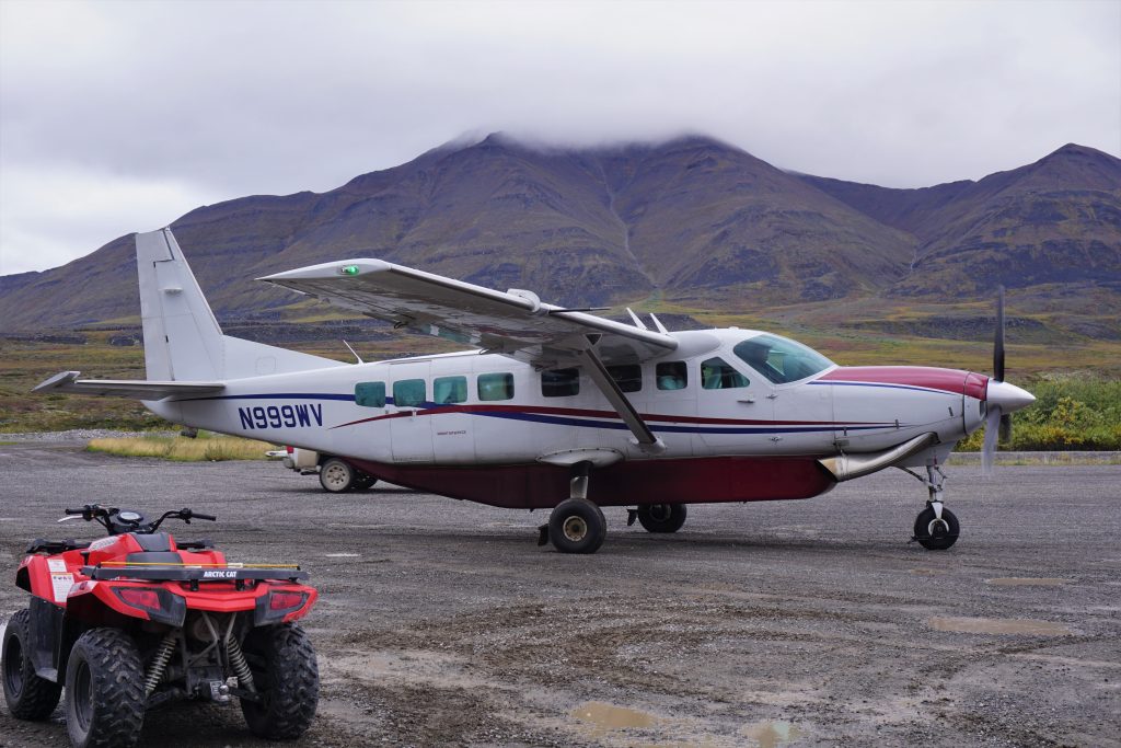
Daniel and I sat right behind the pilot’s seat and had a prime view of the cockpit as the plane sped up and took off. Smaller planes are extremely turbulent, so we shook like a roller coaster as the plane climbed up into the clouds.
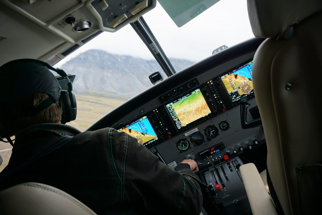
It was a beautiful way to end the journey.
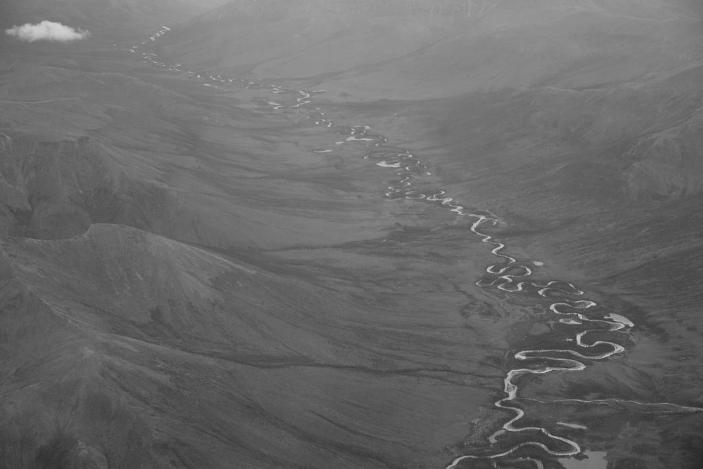
After crawling for many days, now we sailed at hundreds of miles per hour across the massive landscape. Viewed in passing, we saw a hundred snaking rivers, broad valleys, and high plateaus hidden from the terrestrial eye. And if we blinked long enough, we even saw ourselves. In a place so huge and wild like the Brooks Range, there exist an infinite number of places to explore. One could wander their whole life and still find something new. I firmly believe that exploration is fundamental to the human existence, whether it be exploration in the mountains, sciences, or mind. This is where we form our identities. And this is how we tell our stories.
This is the story of the Brooks Range. Of wonder. Of rain. Of adventure. Really, it is just one chapter in a bigger story. In the wise words of Natasha Bedingfield:
Today is where your book begins,
But the rest is still unwritten.
“It felt like we were walking in a painting, the most beautiful exhibit either of us had ever seen. We all stand witness to nature, the greatest artist of all.”
How beautiful! And what a joy was reading this story. You brought your reader along on this trip — all the emotions, thoughts, shivering after crossing a knee deep cold streams, burst of happiness, “white nights”, wildlife and scenery observations, feelings are all real and true. Thank you for sharing!
PS: “Unwritten” is one my favorite songs. I sang it at the karaoke last time (when you couldn’t make it).
Thanks! I really wanted to focus on the storytelling in this post, since so much went into this adventure.
Awesome trip and photos Kyle! I am interested in doing a similar trip this August. My buddy and I are strong hikers and have 10 days. Do you have more details on the logistics of this trip? Thanks and maybe I will run into you in the pasayten sometime!
I feel like I covered the logistics of taking the bus there, and plane back to Anchorage. What other logistics are you curious about?
10 days should be totally enough. I think we only hiked for actually like 4 days with all the rain.
Thanks Kyle, for some reason I am unable to see your map, so that is probably what I am missing.
I purposefully did not put a map and names of features because that is the ethics of Gates of the Arctic. The rangers emphasized how this was the only national park where the goal was to preserve wilderness and thus they do not want trails to develop from repeated use. I think the navigation is very simple in this region. We only crossed one high pass between the Dalton and Anaktuvuk so I think it should be relatively easy to piece together a similar route. I don’t mean to be a gatekeeper, but I truly think you will have a more authentic Brooks Range experience if you piece together your own route and that would align with the goals of the national park.
Thanks, that was the plan, just trying to get an idea for travel times and potential routes in the general area. Appreciate the responses!
No problem. Hopefully my photos give you an idea of what the terrain is like out there.
Hi Kyle, lovely trip you did. I have been walking in that area a couple of times. Mostly solo. Considering the time you actually spend hiking from the haute road (or simply THE road, as there are not so many options so far) you were fast. I guess the comment by the store owner was a bit sarcastic 😉 However, there is one guy who apparently did the entire stretch from the road into AKP in less than two days. Insane and certainly not enjoyable.
I have a question for you. While I recognise some places e.g. Summit Lake (the faded green cabin) or Peregrine Pass, I wonder what you mean with the “Famed Valley”? Are you referring to the valley that extends towards the west from the lake often referred to as Oolah Lake in the Oolah Valley at the border between the National Park and the Preserve (N68.07266° W150.69871°)?
I have seen pictures of people ascending a pass at the far west end of the “Famed Valley” which would provide a route towards Graylime Creek and then onto Ernie Pass and the upper reaches of the Anaktuvuk River. I am just wondering if this was the route you initially planned to take to AKP.
By the way I agree with your take on uploading maps. In the Arrigetch this led to an “established” trail leading from the Alatna up to the base of the Arrigetch Peaks. It’s an “easy” walk but heavily visited or in relation to the rest of the park crowded place.
Takte care and it would be nice if you find time to reply.
Dirk
Hey Dirk,
You are spot on with the “Famed Valley”! And yes, that is the high route we originally wanted to take, but unfortunately weather pushed us to Peregrine Pass. Still an awesome trip and I look back on it very fondly!
I’m glad you appreciate Gates of the Arctic and had some enjoyable times out there.
Kyle
Thanks Kyle! Just another question.
You wrote:
„We had a hopeful high route planned through this legendary valley, crossing a 6000 ft pass and maybe summiting a high peak, which Daniel had read about in an American Alpine Journal from 60 years ago.“
Do you know in which issue of the AAJ this article was published?
Dirk, who is leaving for the Brooks Range soon 😃
I do not know unfortunately. It was something Daniel read, and he planned the entire trip!