
Following the Fables
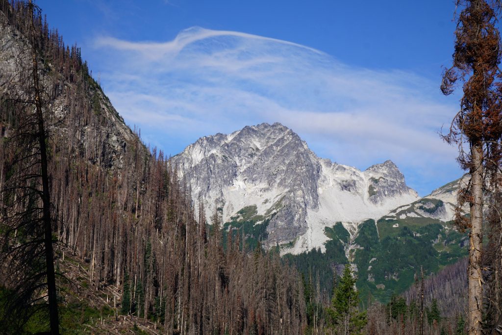
Anyone who knows me as a climber knows I love the Glacier Peak Wilderness. I seek to explore its every nook and cranny and unlock its wild secrets. Last fall, I struck gold in the fall colors on the Little Giant – High Pass Loop. And as I was descending the Buck Creek drainage for the second time, I was once again drawn to the the steep walls to my west. The North Face of Buck is one of the great north faces in all the Cascades, but there is also the surprising granitic East Ridge of Berge. In an area known for terrible volcanic choss, Berge stood apart. Some quick research showed that it was supposedly a 2000 ft long 5.8 rock route, “highly recommended” by Beckey. One climber said it was “comparable in quality and length to the Complete North Ridge of Stuart”. Hyperbole? Possibly, but there was only one way to find out…
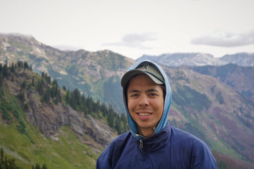
I met Kyle last May on the Birthday Tour near WA Pass. We instantly bonded over our experiences in the High Sierra, our love of ski touring, and a passion for quality gear. We finally booked a weekend to get out together at the end of August. We threw around some options and agreed on an adventure climb of Berge with maybe a bonus summit of Buck. I knew he had the experience and skills to climb a serious route like this with little beta.
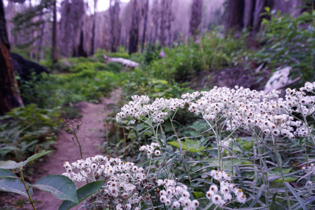
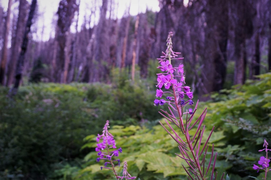
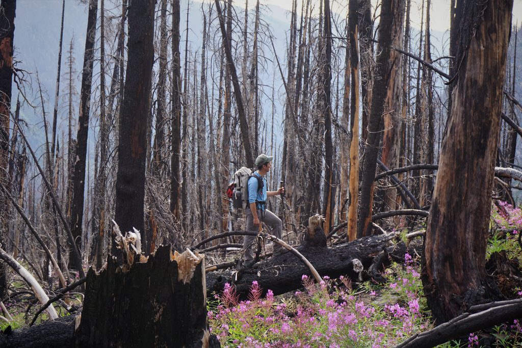
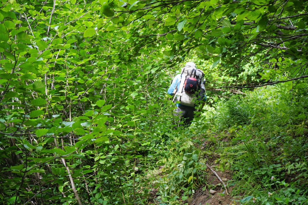
We slept at the Buck Creek Trailhead under starry skies Friday night and started hiking Saturday morning. Most of the trail approach is through the burn of a few years ago, and fireweed is growing back with a vengeance.
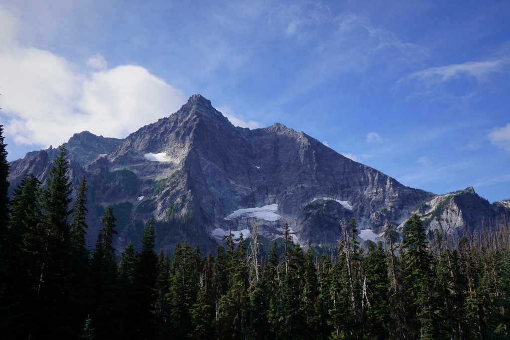
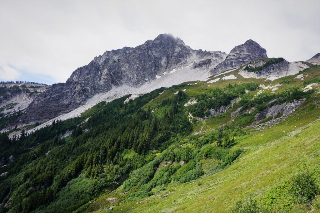
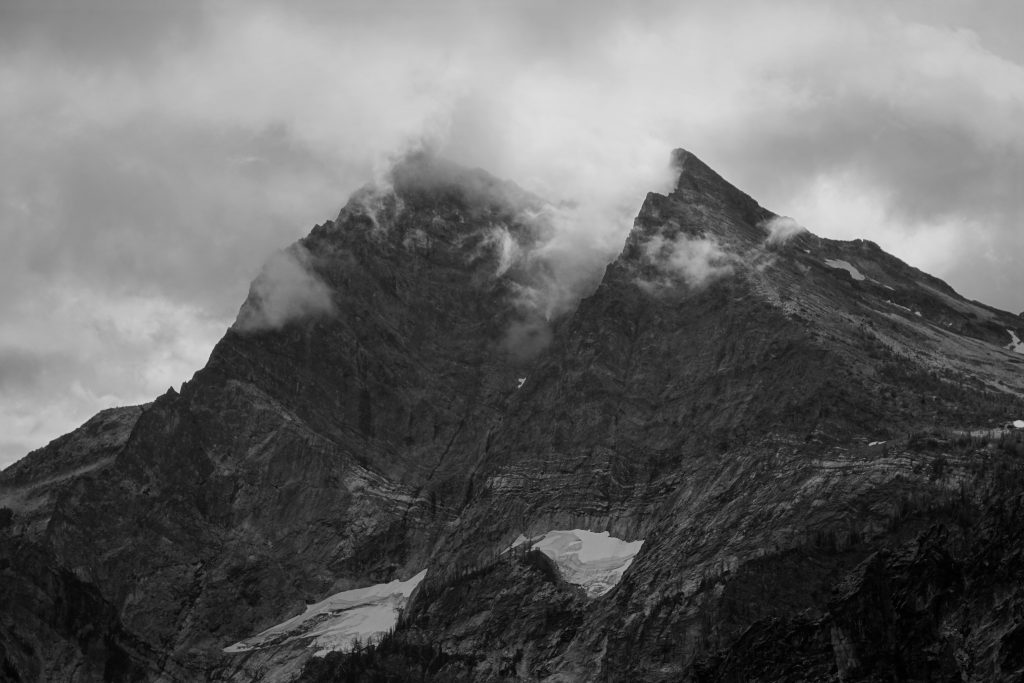
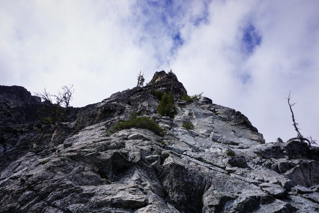
In one clearing, we got our first view of the objective, Berge. The ridge looked long but not too steep. Up high, it seemed like there might be a ton of towers.
We hiked nearly exactly six miles to just past the first major clearing that the trail goes through. Then we descended through a meadow down to the river, which was easy to ford.
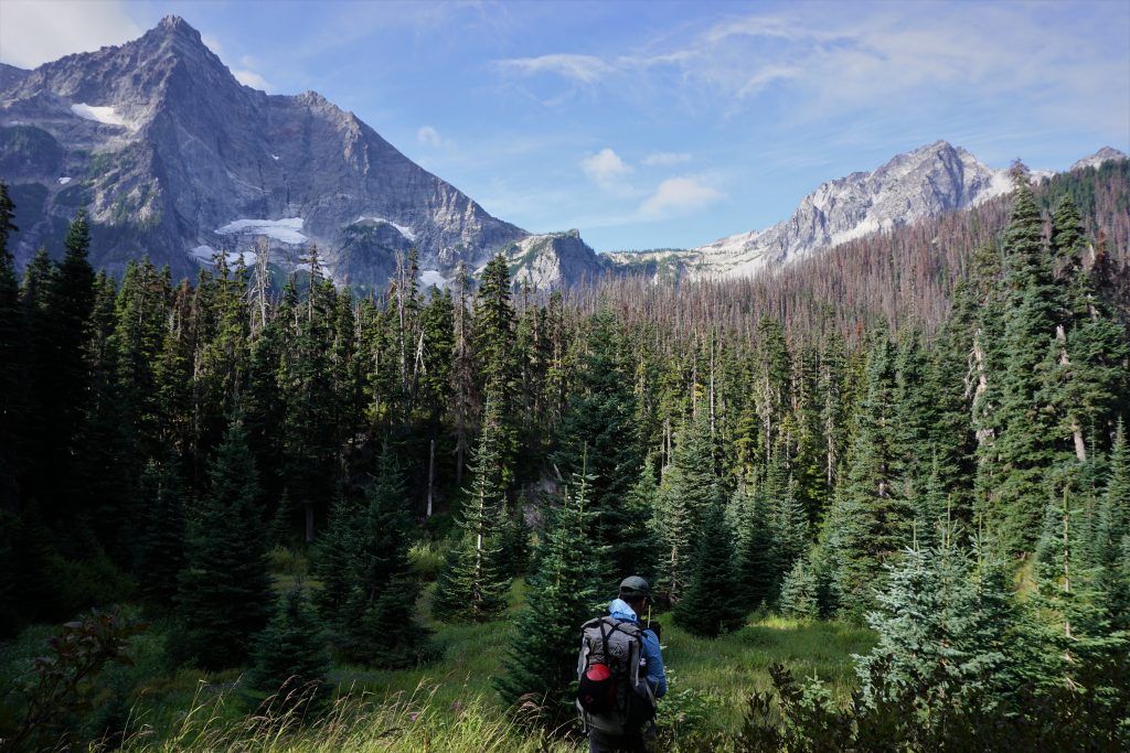
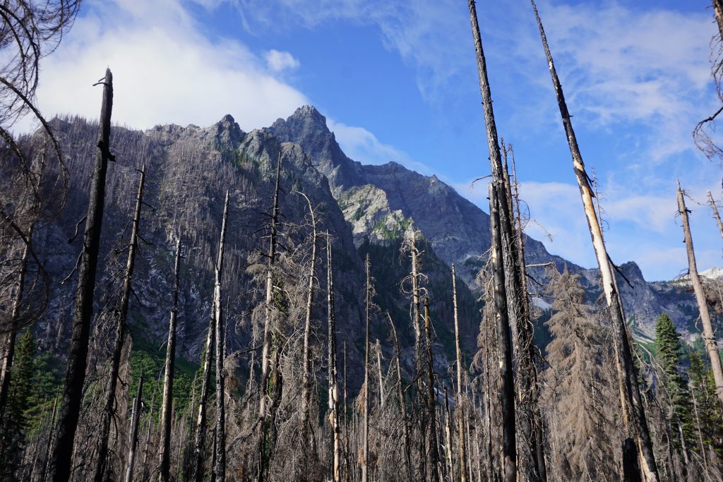
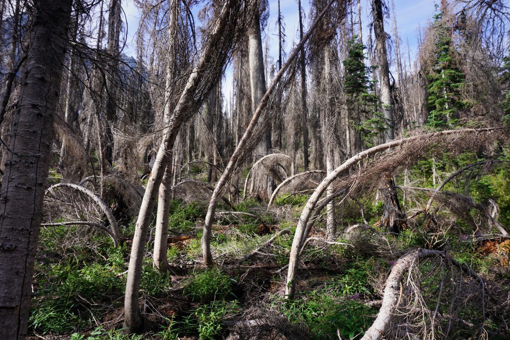
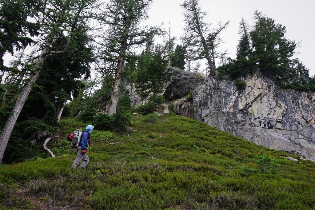
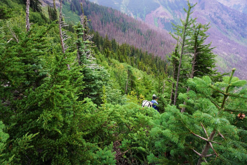
Climbing up to the crest of the east ridge of Cleator, we played the game of “linkin’ logs”, where you try to walk on downed logs to avoid the brush. Pretty quickly, we entered the burn zone on the crest of the ridge. There were lots of little branches to trip over, but the travel was actually quite easy. I imagine in a few years it will get really bad. Then it will absolutely suck, just like Cannon, for a few decades, until the forest recovers.
Above 4800 ft, the forest really opened up more and became really fast. Around 5500 ft, we started to contour leftwards on what definitely seemed like a trail of some sorts. This “trail” made the side hilling pretty easy and importantly lead us to an “alder tunnel” at the base of some cliffs.
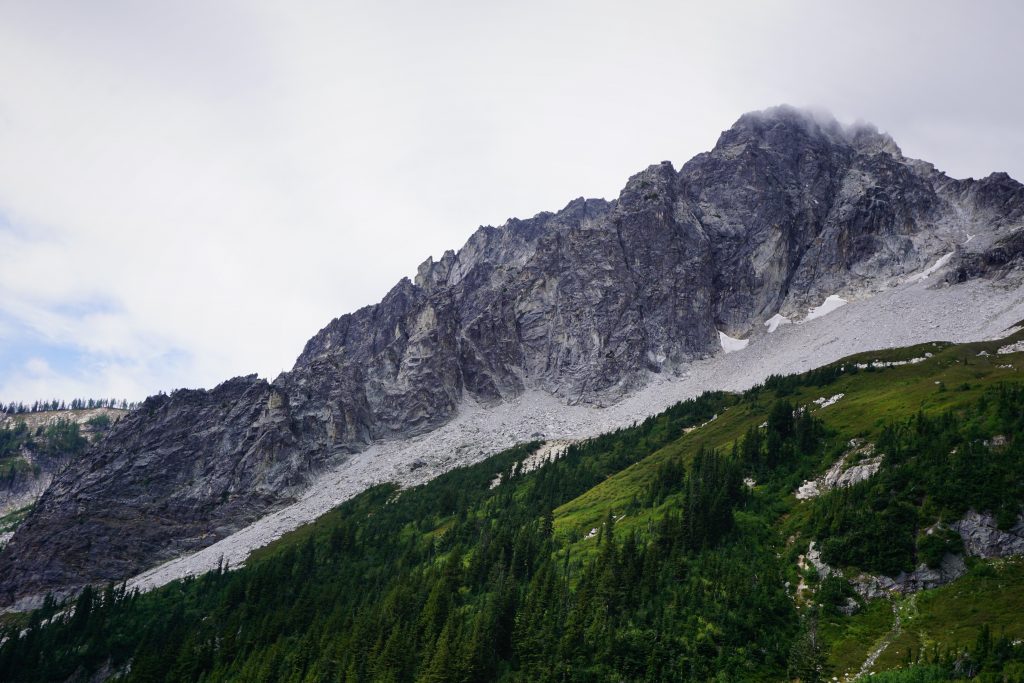
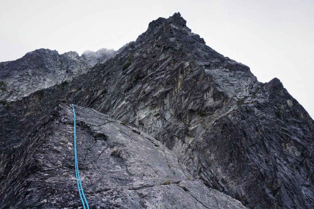
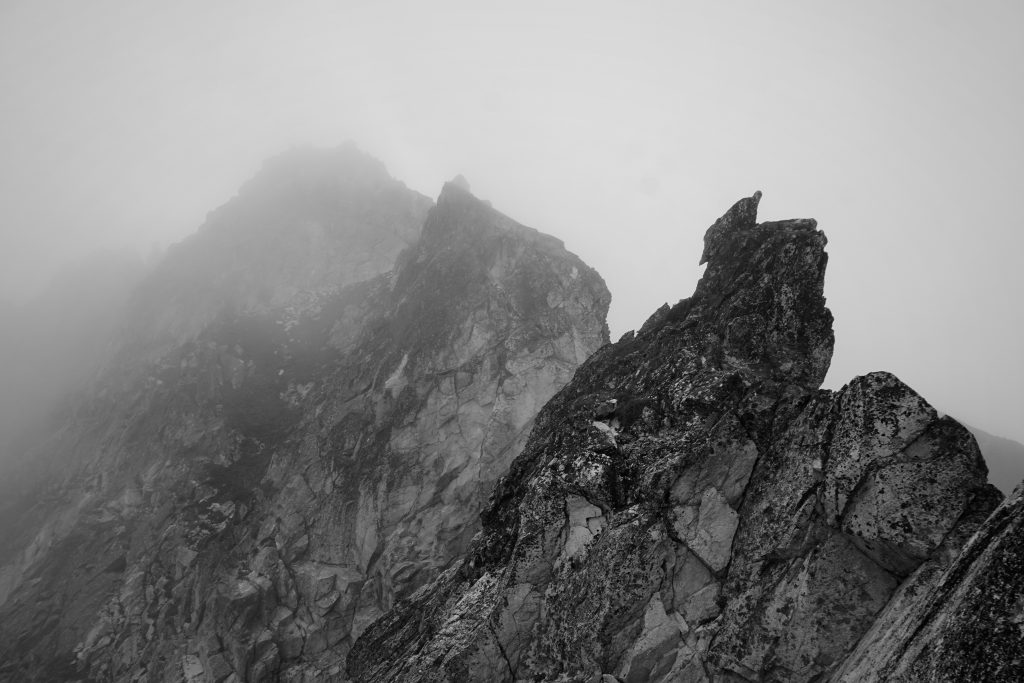
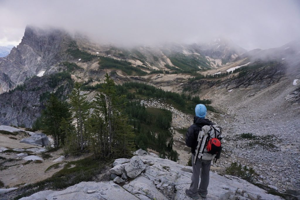
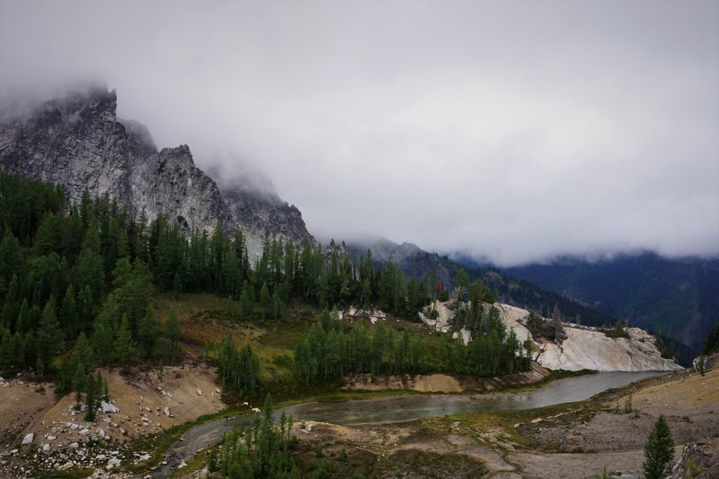
After the alder, we broke out into a meadow and got our first clear view of the East Ridge of Berge! It looked long, with too many gendarmes to count. But we knew that the climb started partway up the ridge, so hopefully it wouldn’t be too long.
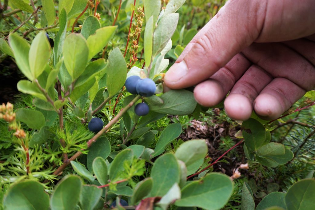
The traverse over towards the climb took on a unique character. We sidehilled across viciously slippery heather and blueberries. The stalks were slick and we kept wiping out. At least the brush was dry…
We crossed a nice little basin beneath a waterfall and continued up on steep goat trail and steep heather. Eventually, we popped out at a nice grassy knoll on the edge of a talus field. We were very close to the twin gendarmes, where the route started.
Unfortunately, clouds had descended, obscuring the upper half of the route. It got really cold and windy. A little sprinkle even started to fall from the sky. This was not supposed to happen! We decided to wait a little and see what the weather did.

We talked about finding a camp and waiting to climb the next day when the weather was supposed to be better, but it was still only noon. The clouds began to lift briefly and we decided to go for it.
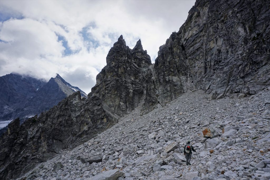
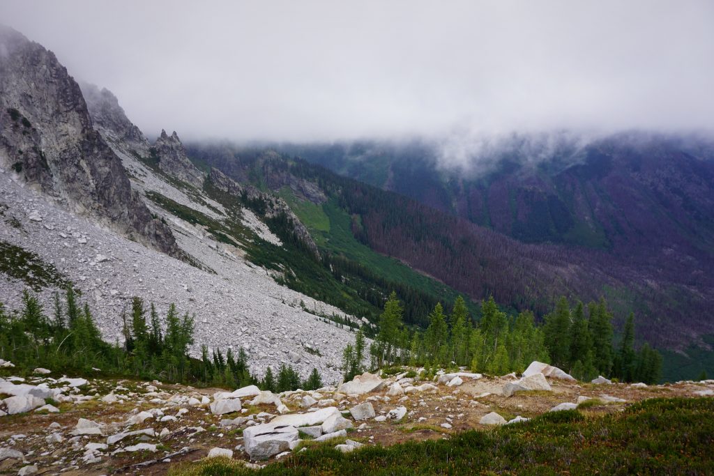
We got to the base of the mangy looking gully to the right of the twin gendarmes. Donning helmets, we started scrambling up in our running shoes and full overnight packs. The moves were a little more tenuous than we would have liked, some easy to mid 5th. The upper section was straight trash and it was challenging not to cause massive rockfall. It could definitely use some trundling!
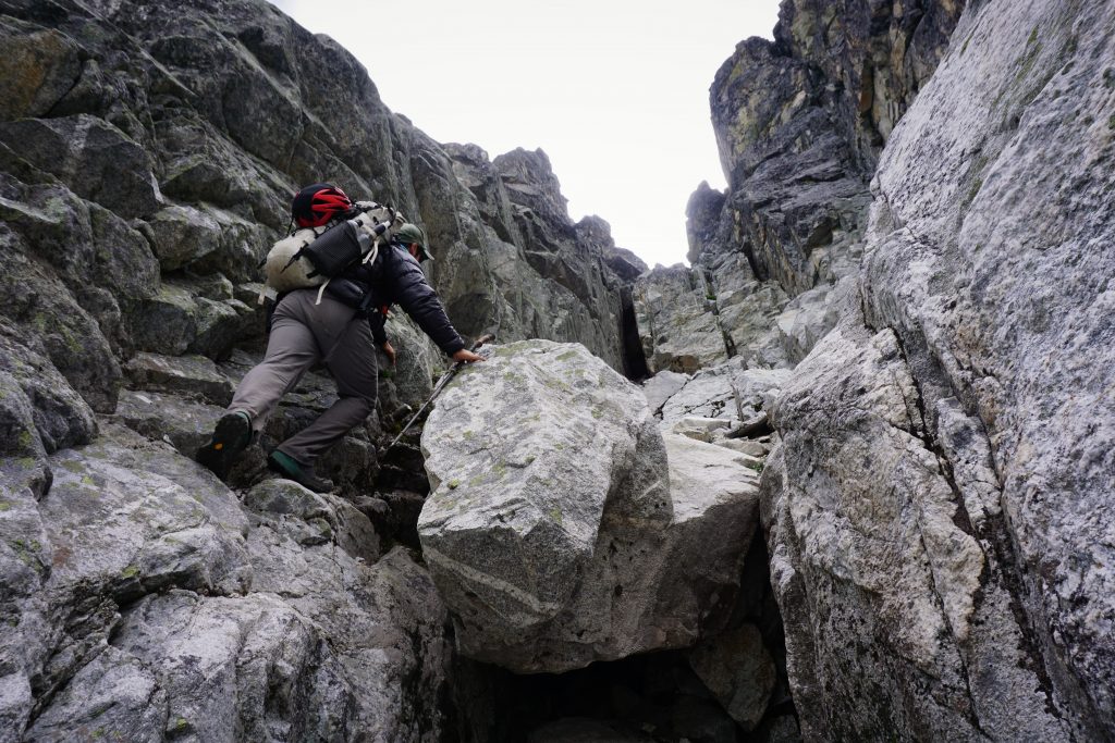
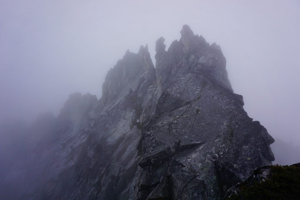
Breathing a sigh of relief, we popped out onto the east ridge in the sunshine! Steep heather slopes led to this notch from the other side, so it is possible to avoid the loose gully, but that would take a substantial amount of time going down and around the bushy toe of the buttress. Looking up, the ridge looked fun! Very broad and low angle, at least for the start.
We decided to double up my rope and simul on 30 meters. I led to the first block, getting us all the way to the top of the first tower. There was definitely some loose rock, like any untraveled route, but it was generally good. There was one cool 5.7ish finger crack we climbed up, although it could use a lichen scrubbing. There were no signs anyone had been on this route, a unique feeling for the Cascades.
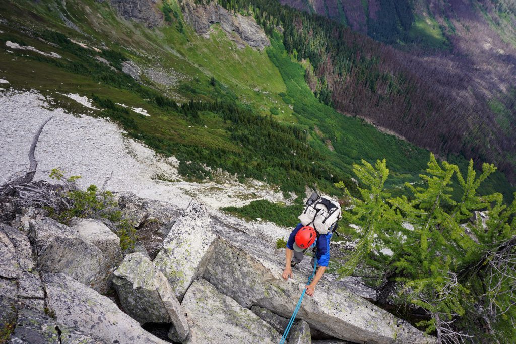
Kyle led the second block, curving to the right of the second tower before re-ascending to the top. There were some sick exposed slabs near the top, basically these sidewalks with massive cliffs on either side.
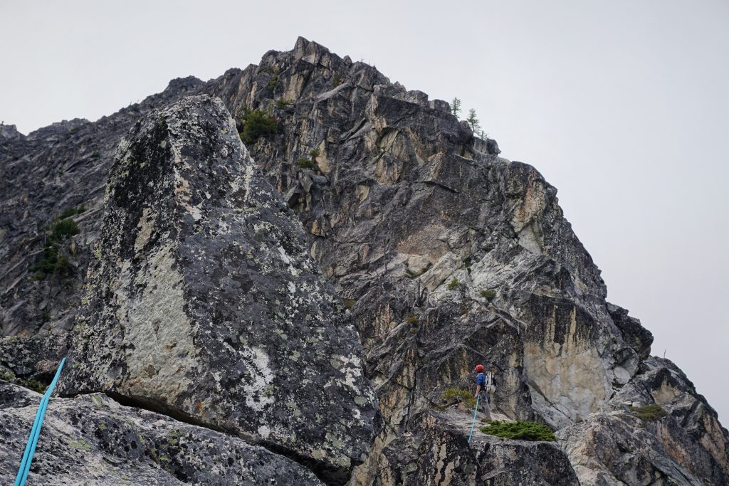
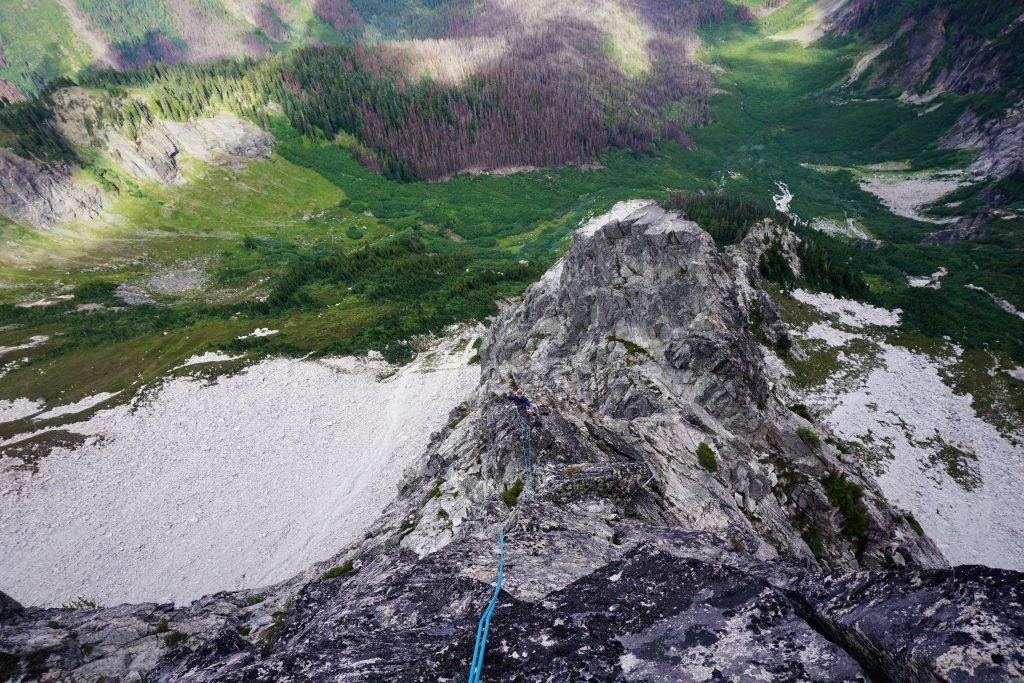
From here, the climb became more ridge-like and exposed. I started the third block with a boulder problem and then an exposed step-across to a 5.6+ slab. I got onto the knife-edge and stayed on it, making super fun and exposed low 5th moves! This was definitely the money pitch of the climb, even more so because we were still below the clouds and could see! The views down to the lush Buck Creek Drainage and the burned trees was exceptional and definitely unique.
The fourth tower was nothing extraordinary. Kyle kept complaining I was getting the good leads! I joked I secretly had all the beta and structured the leads so I would get the good pitches.
At the notch after the fourth tower, a steeper wall rose before us. There seemed to be a chimney weakness leading through it. Perhaps this was the chimney that other trip reports had mentioned? We switched to pitching out, and Kyle led up a bouldery corner and then into the burly chimney. He did a great job of trundling loose blocks during the send! I followed, and it definitely felt 5.8ish.
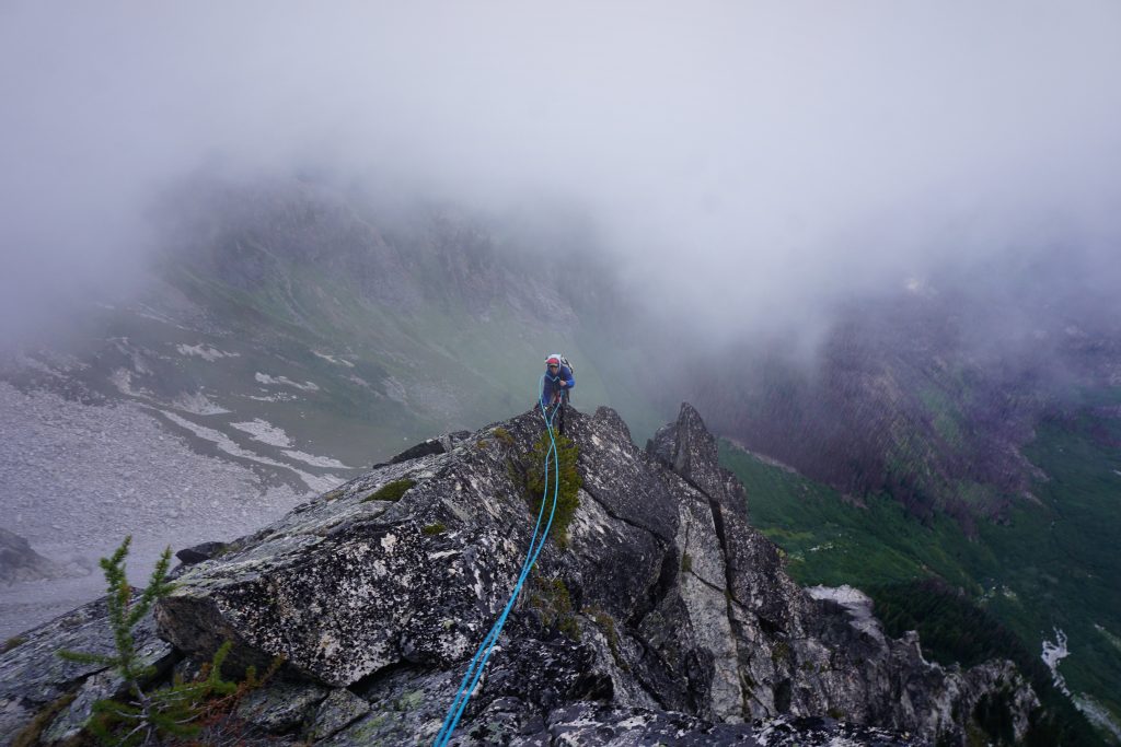
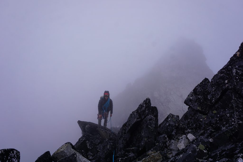
I led a short pitch around the corner, taking us to close to the next notch. We were now completely in the clouds, likely for good. Luckily, the wind was not relentless, so we could still feel our hands.
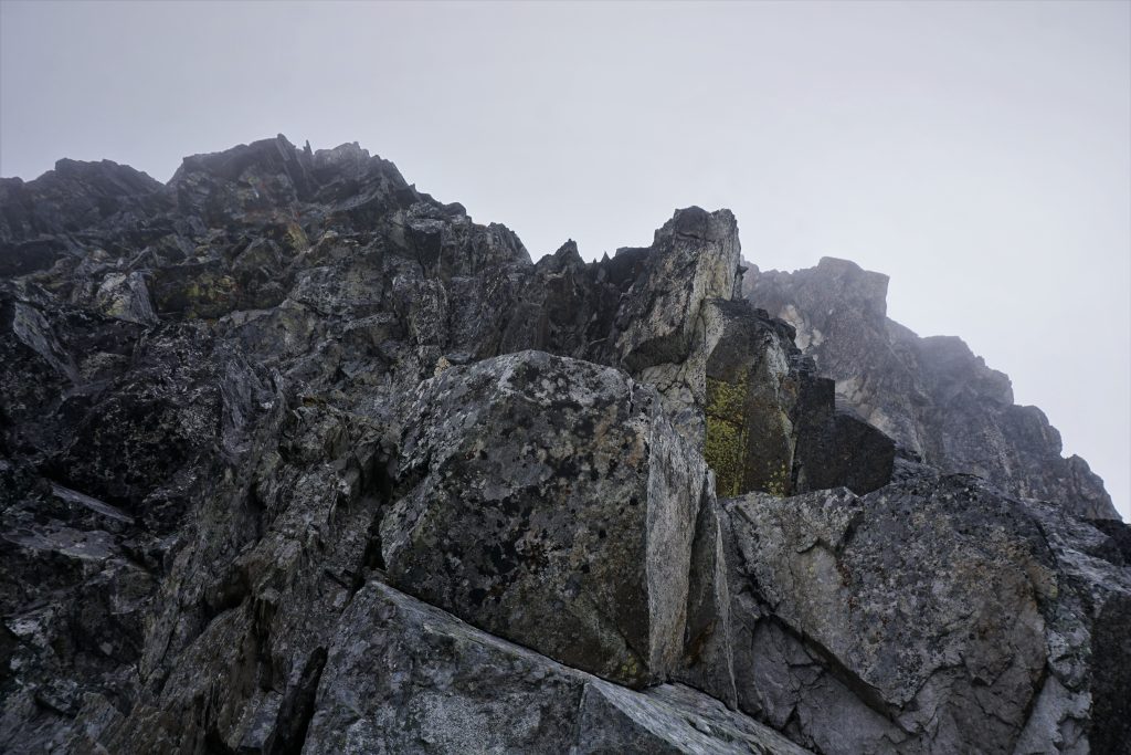
We returned to simul climbing and reached the notch above the fifth tower. It seemed like there was only one more tower before the summit, but it was already close to 6 in the evening and we decided we should just find the quickest way up. So we followed some loose boulders around to the right to another notch hoping this would allow us to bypass the sixth tower. But after I simuled up for a pitch, we just arrived at the top of this tower… oh well, at least we were doing the complete ridge.
Some more easy climbing led me to what I believed was the true summit. My GPS confirmed this was the high point and I could see the walk off on the other side, so I belayed Kyle up. It was nearly 7 pm and the rock was starting to get slick in the mist, so we were glad to finally be done with this long route!
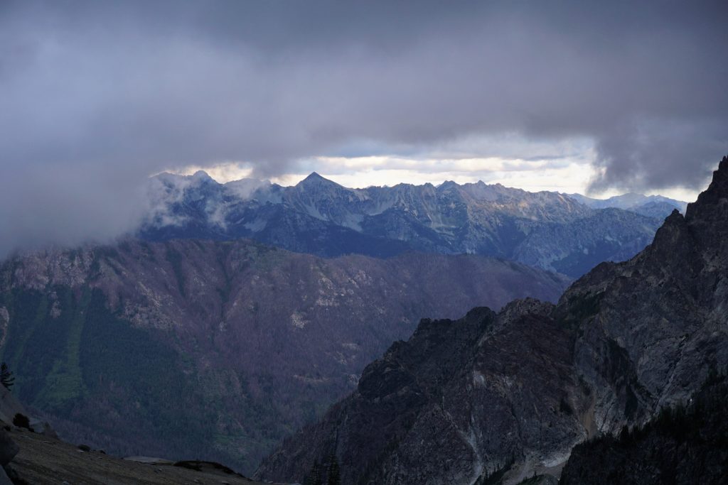
If we were just trying to climb Berge, we could have descended quickly to the saddle between Cleator and Berge, but we were looking to bag Buck the next day. An easy scramble dropped us off the backside and we started to wander southwards towards Buck Mountain. These slopes are regularly traveled on the Louie Creek High Route, so there were occasional cairns and trail like features.
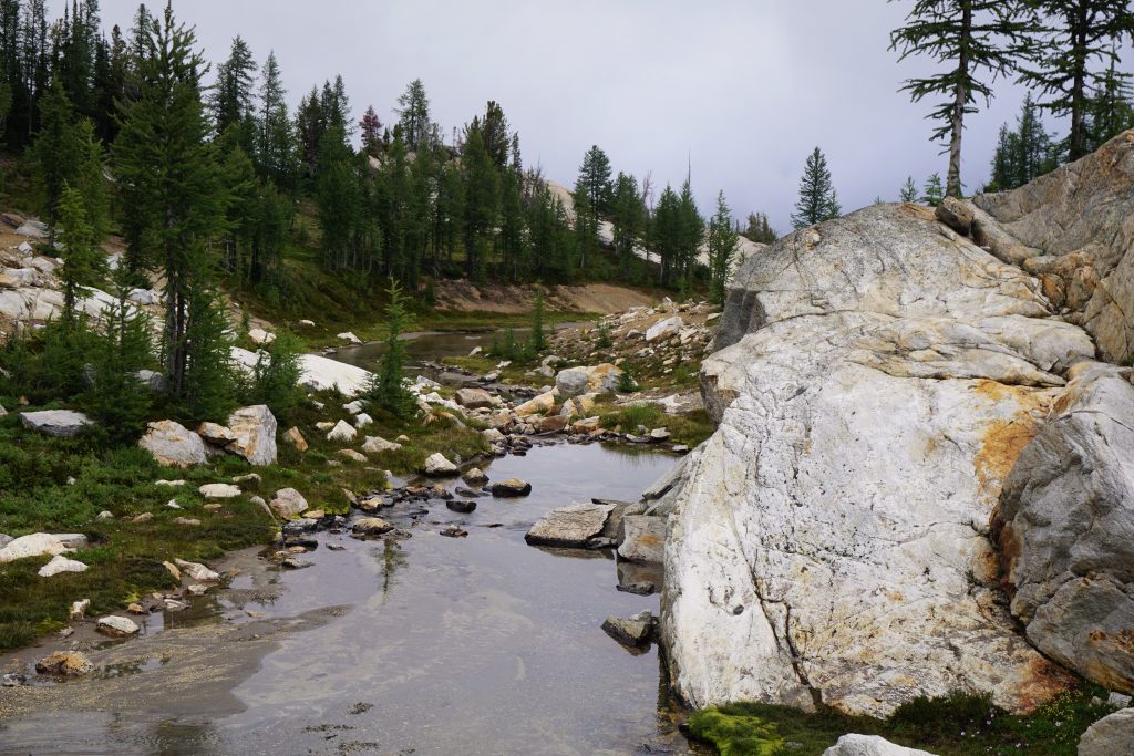
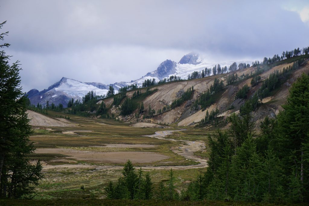
When we got below the clouds, we spotted some nice larch glades in the high basin between Berge and Buck. The evening was moody, with thick clouds dropping and engulfing the peaks all around us and gusts swirling all around.
We made camp on a bench on the shoulder of the little basin, perched high above the Buck Creek Valley. It would be a world class sunrise, we knew, if it cleared like the weather forecast. But the night had other plans…
Throughout the night, every time I woke up, the howling wind and soft rain outside the tent reminded me that the weather had not passed. And as it got light the next morning, we realized that we were due for a spin cycle in the human washing machine of wet brush on the way out.
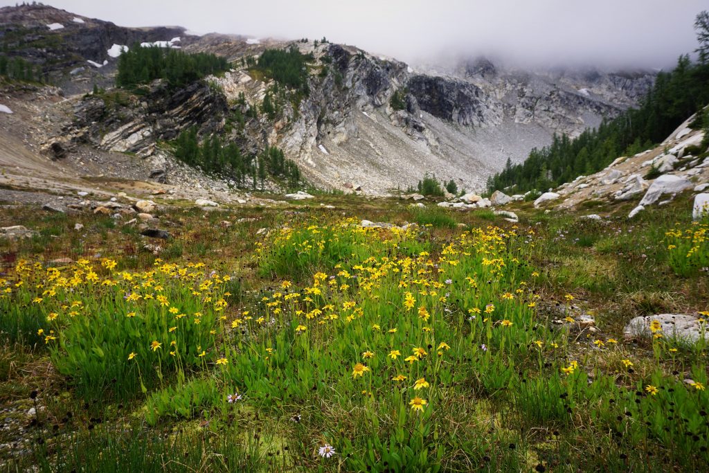
Honestly, I was as interested in bagging Buck as just exploring the marvelous basins on its west side. I had heard legendary things about the Louie Creek Basin. After we agreed summiting Buck was not worth it in the icy cold winds and clouds, I went for a little walk.
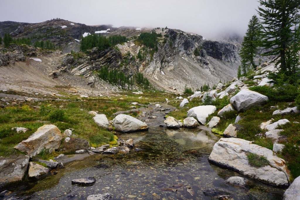
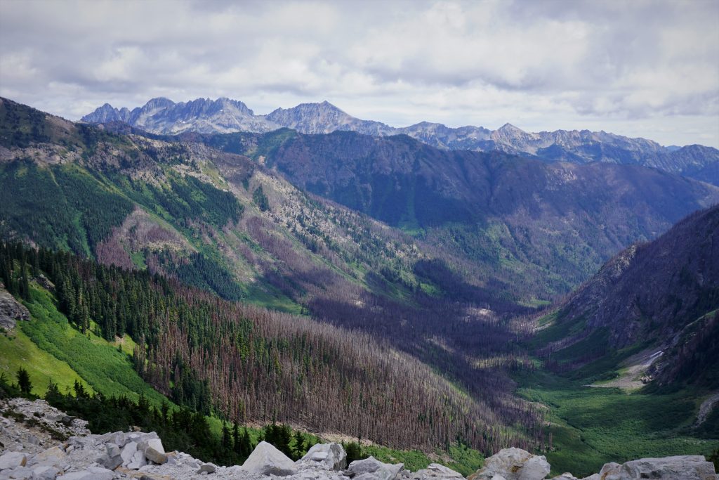
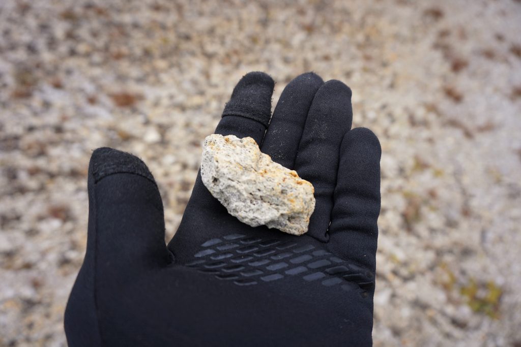
The Buck-Berge basin near where we camped was easily one of the most colorful basins I have ever seen, even without the golden larches. The volcanic pumice streaked yellow out of the hillsides, mixing with blackened cliffs out of which a little waterfall emanated mysteriously. A turquoise blue creek snaked through the bottom, forming perfect little pools next to orange-tinged slabs and lush green vegetation. I had never seen anything like it.
Crossing over the little pass, I peered into the Louie Creek Basin and my favorite place, the Napeequa River Valley. The Richardson Glacier on Clark stood in the background, behind the tightest little larch groves I have ever seen. And the huge flat basin stretched in the distance, perfectly open and wide. Every time I visit a new part of the Napeequa, I am overwhelmed by its uniqueness and charm. There are places that look different, and there are places that feel different. The Napeequa is both. This is truly a magical valley.
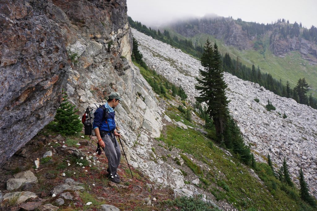
I returned back to our camp, where we packed up and started hiking down. It looked like there were lots of cliffs below us and then brush before the east ridge of Berge. This was going to be wet and gnarly.
As we traversed down towards the outlet of the Buck-Berge basin, we found a pretty good climber’s trail actually. It descended super steeply down this buttress, weaving masterfully between cliffs.
A thousand feet down, the trail petered out into thick brush. Looking across, we were at a similar elevation as the base of the east ridge of Berge, so we figured it was time to start traversing. We tried our best to stay above the brush and there were some super steep creek-canyons to cross full of moraine debris. Eventually, we accepted our fate an entered the alder.
The bushwhacking that commenced was some of the burlier schwacking I have ever done. It was not that sustained, as we probably got to the base of the east buttress in only 30-45 minutes, but it was completely soul-sucking and soaking.
Near the base of the buttress, there is a ledge that cuts across a few hundred feet above even more slabs and cliffs. This ledge is key as it saves quite a bit of elevation.
Back on the north side of the ridge, we had to reascend all the way back up to nearly the base of the route to get around steep brushy cliff land! Then it was a rewind of all the steep heather traversing, except worse this time with everything wet. A steady light rain reminded us to keep moving. My worn out shoes have no tread and I was absolutely hopeless in the steep heather and mud. I probably wiped out a hundred times, just grabbing at heather to keep myself from sliding off the mountain. An ice axe would have been helpful.
Finally, we got back to the timbered east ridge of Cleator and could relax. The sun was starting to come out, but Buck still resided in the clouds. We descended directly down the ridge this time all the way to the valley floor, where we found a log to cross Buck Creek. This cut off a mile or two of the trail on the return and I think this might have been faster on the approach additionally!
We got back to the car in the mid afternoon. After being frozen by high winds and rain up high, it was surprisingly hot down in the valley. The next week would be splitter weather, but the weekend just had to be rainy! I think all Cascade Climbers have been disappointed a little by the poorly timed wetness this summer, but at least it has been a mellow fire season because of it.
Despite the bad weather, this weekend was still a success. It was the our first time climbing together and we onsited a grade IV, 5.8 adventure climb with almost no beta and even some rain. It was a testament to our experience and route finding abilities. Overall, we agreed that the climbing itself was just decent, but it had an adventurous feel, fun exposure, and a beautiful setting. I feel so lucky to live in a place where such adventures like this are still so easy to find. I know there are dozens of solid, but rarely climbed routes out there, ready for exploration. We just need to keep our eyes and ears open to inspiration and imagination.
Notes:
- This climb is long and moderate. There are only a few sections above 5.6, but consistent exposure will make most people want to stay roped up most of the time. We estimate that it would be 15-20 pitches if pitched out.
- We climbed the route itself (from the notch to the summit) in under 6 hours, but simul climbed almost everything except for the crux.
- We carried a double rack of cams and nuts. A single rack would be fine, but more gear and slings allows for more simul climbing.
- It is hard to say whether going around the base of the buttress to the start is worth it. It would definitely add at least an hour to the approach but it would remove the sketchy gully at the start.
- Definitely exit either to the Berge-Cleator saddle and back down the approach route or all the way out the High Pass trail. Unless you really want to tag Buck, it makes the descent a lot more painful.
- There are some campsites in the basins before the east ridge, but they’re not super easy to find and the higher ones don’t have running water super close.
- If you are used to relying on cleaned rock or treaded ledges for routefinding, you will be surprised to find neither on this route. It was a cool experience to climb something where there were hardly any signs anyone had been here before.
- Higher on the route, bailing down gullies to the left looked possible, but definitely not very fun. Easier to climb up and over.
Great TR and sounds like great fun! Do you happen to have GPS tracks to share?
Sure, you can find the actual track in red on this map: https://caltopo.com/m/69T9.
cool post. I stumbled upon your blog and wished to say that I’ve really enjoyed reading your blog posts. After all I’ll be subscribing to your rss feed and I hope you write again soon!