The Pickets at Last
More than any other part of the Cascades, the Picket Range has legendary status. It is the epitome of rugged wild mountains and many consider it to be the most remote area in the lower 48. I had always been interested in visiting, but the stories of impenetrable brush and days of bushwhacking had turned me off. However, recently, the approach to Terror Basin has become pretty well defined and after seeing a post from a friend about it, I convinced Anthony to make a nice little day trip up West McMillan Spire in the Southern Pickets.
The biggest challenge we faced was probably finding the trailhead. All I had researched was that we should start at the Goodell Creek Campground; after that, it was “super straightforward” according to my friend. We failed to realize before we lost cell reception that there were at least three different Goodell Creek Campgrounds. We checked them all out before finding the Upper Goodell Creek Group Campground and the trailhead, which has room for just a few cars.
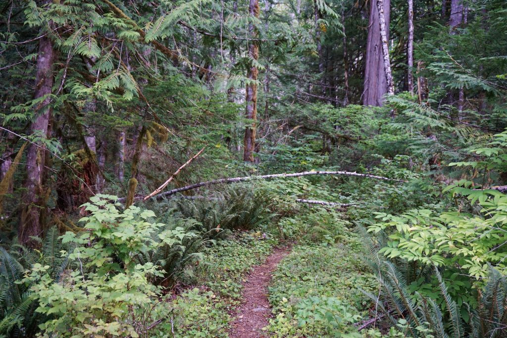
Daniel and Logan had gone up this way back in July but turned back due to “hundreds of blowdowns”. We quickly found out what they meant, as we were constantly stepping over downed logs, most of them insignificant, but some larger. Either way, it really slowed down our pace and made it difficult to jog consistently.
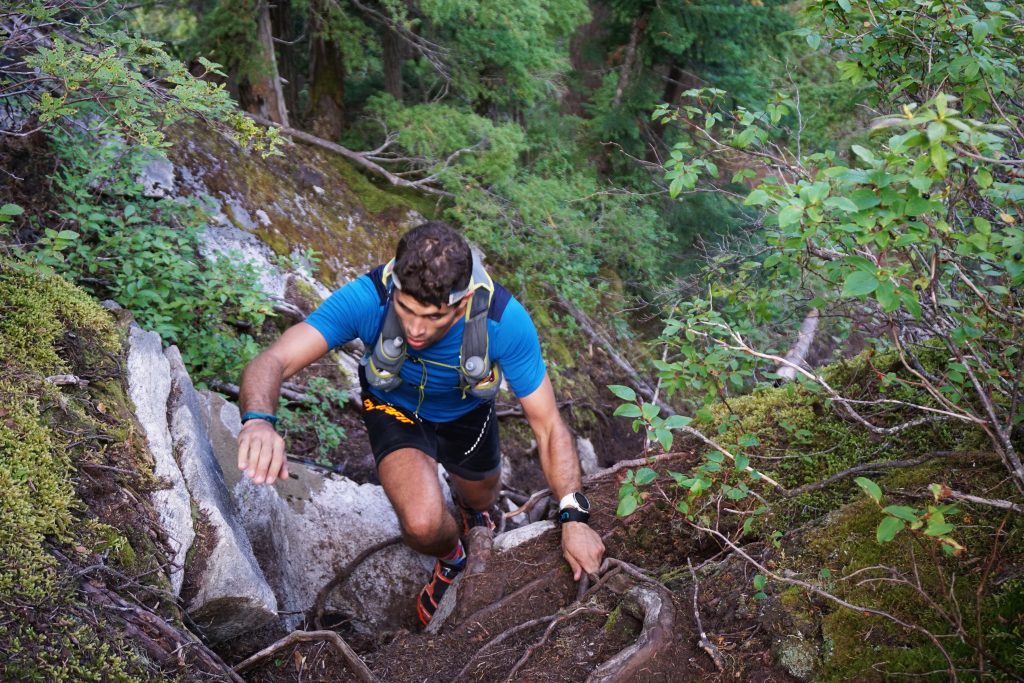
We covered the four miles to the base of the hill climb in 1 hour. The hill climb is a notorious 4,000 ft climb in just 2 miles. Fortunately, it is actually a pretty decent trail, maybe slightly worse than the old Mailbox Trail. Anthony and I joked that this could be the next Mailbox!
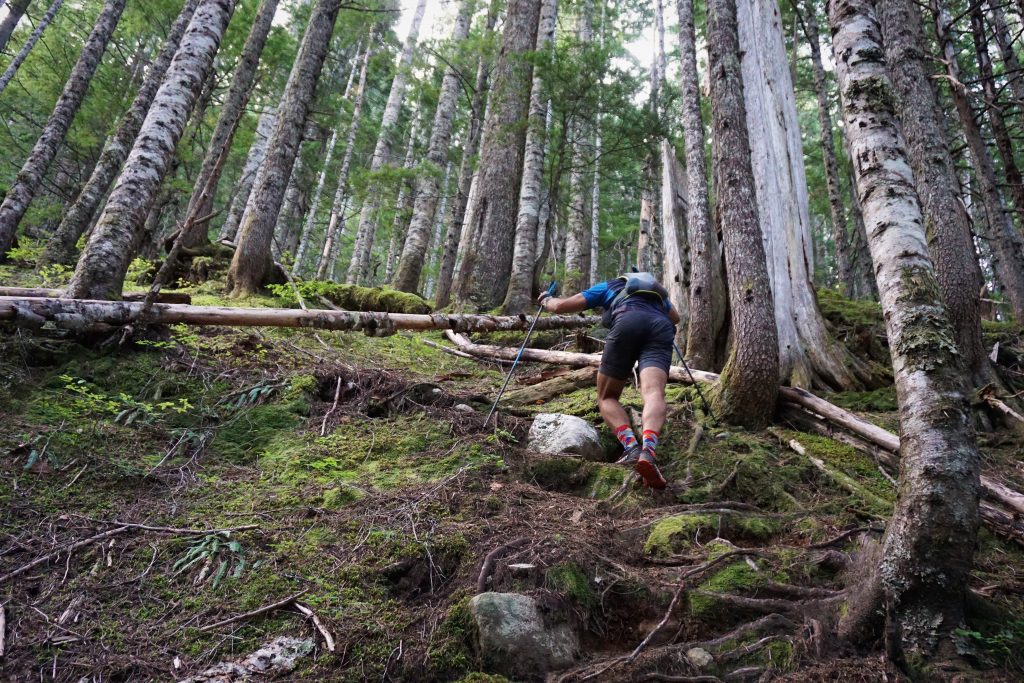
We kept it at an conversational pace, but my calves were definitely not used to such steep climbing! Anthony does Si repeats every other day, so this was normal business for him.
We reached the heather benches and a nice rocky viewpoint around 2.5 hours in. Here, we met two backpackers heading to Terror Basin. We had never heard of backpackers heading up here into such rugged terrain, so props to them! One of them kindly offered us Starbursts!
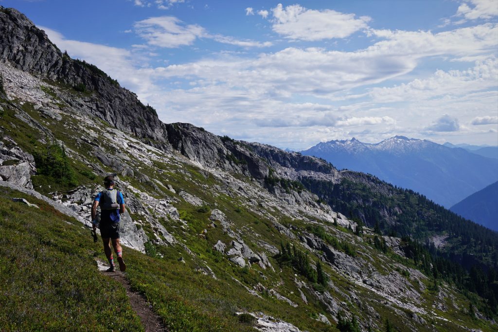
The next section follows a decent trail through heather and open forests. The blueberry fields were almost overwhelming, so we snacked along the way.
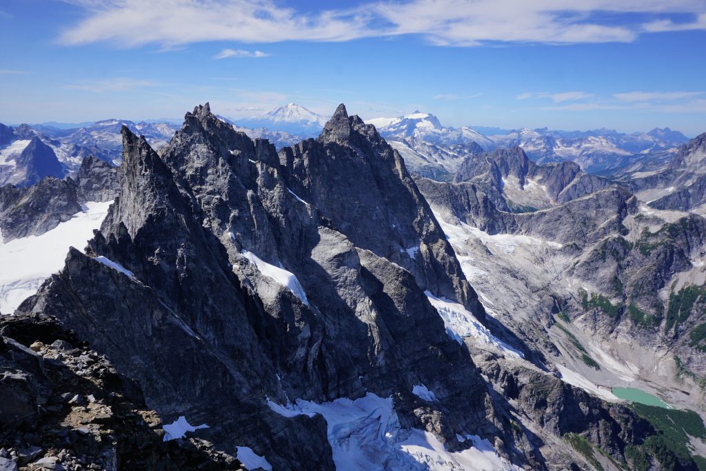
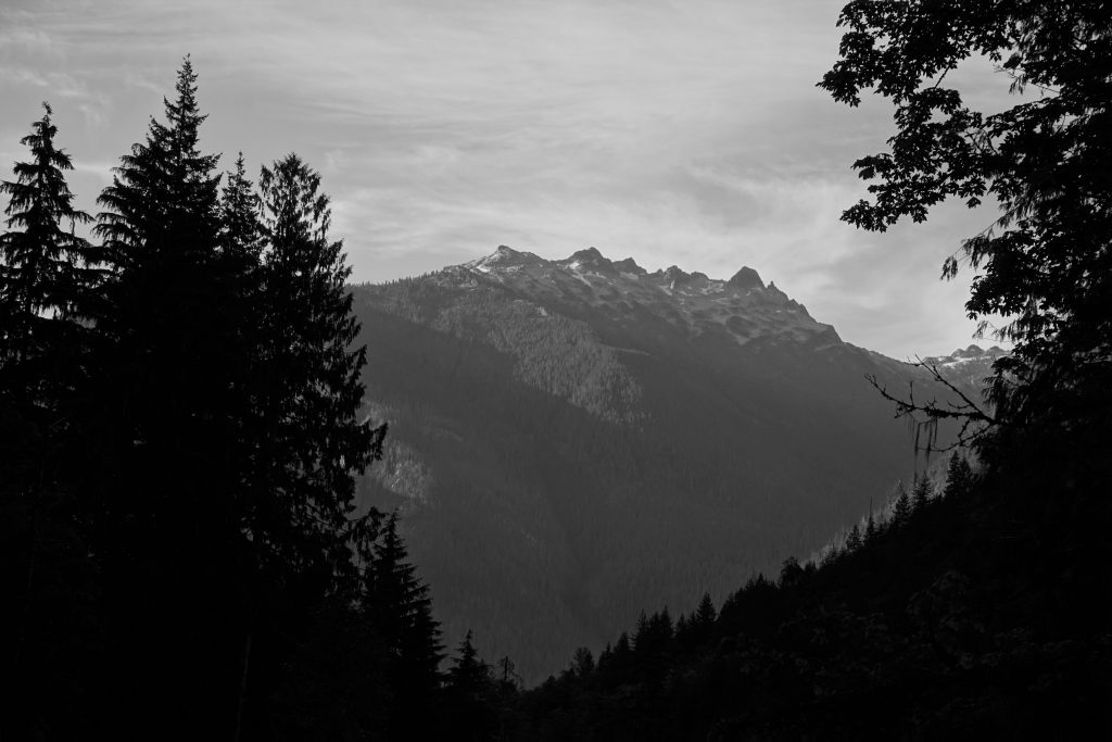
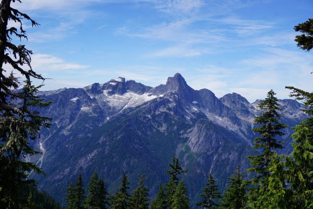
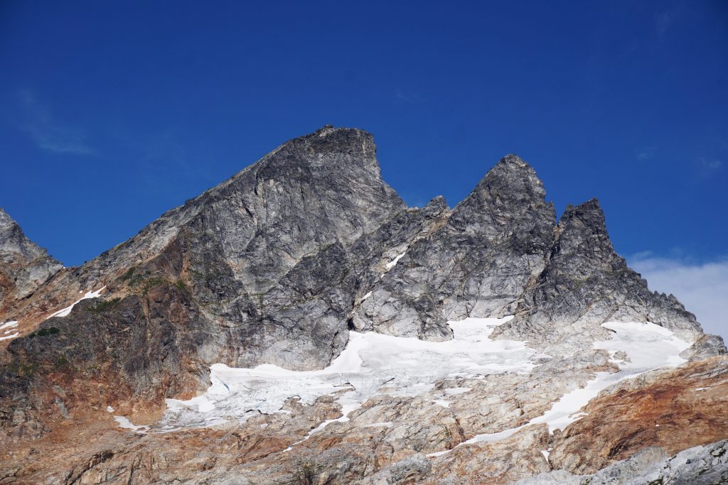
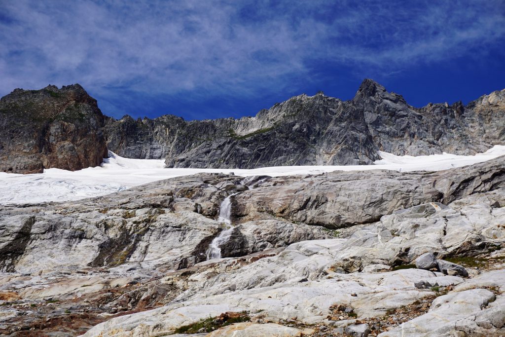
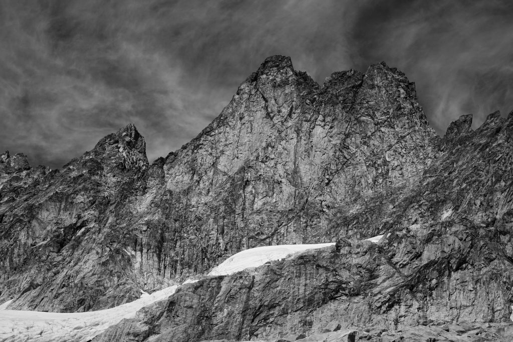
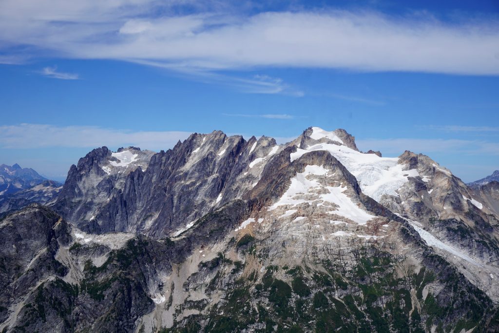
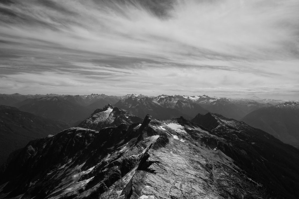
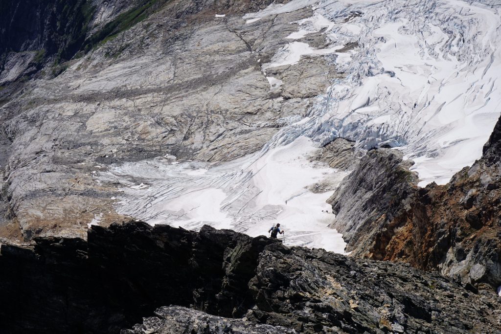
A short rocky section led up to a notch in the ridge and the first unobstructed view into Terror Basin. Terror, Degenhardt, Inspiration, and the McMillan Spires cut through the glacial scoured slabs, forming an formidable northern wall to the basin. The name “Pickets” was understandable.
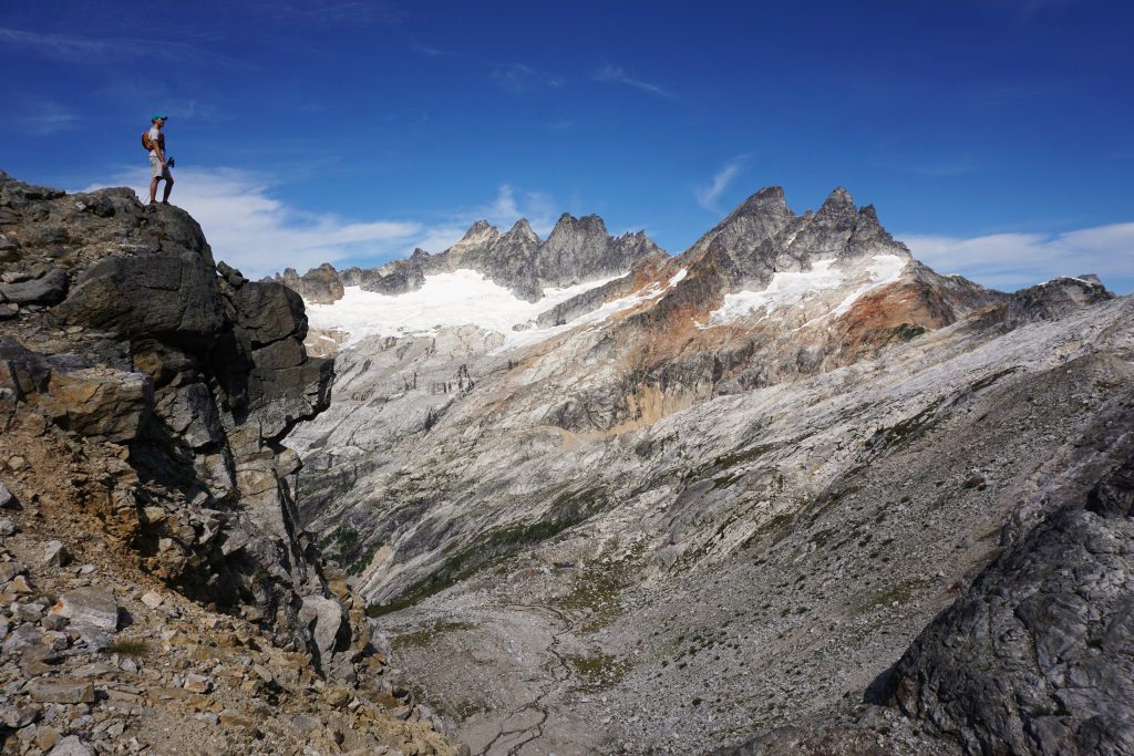
The descent down the north side of the notch was quite intimidating steep loose choss in the absence of snow, but if you stay as far skier’s right as you can, it is manageable. Going straight down would definitely be a bad idea!
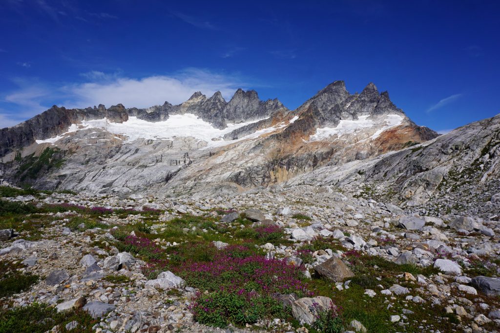
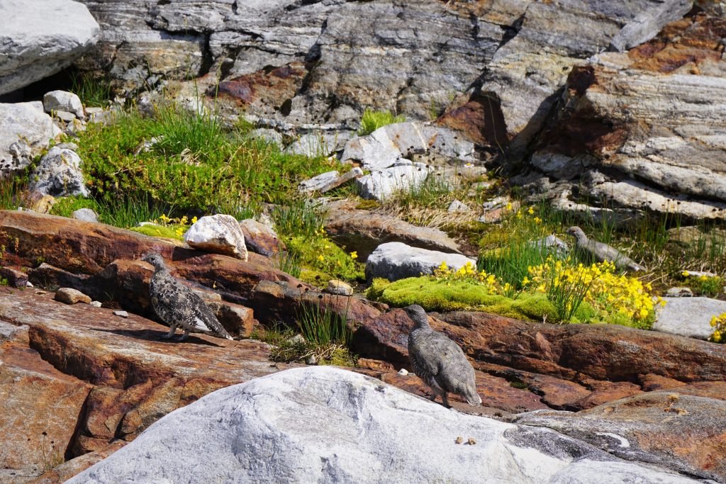
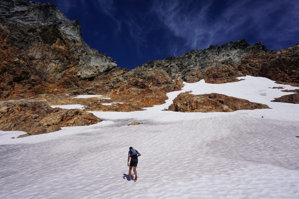
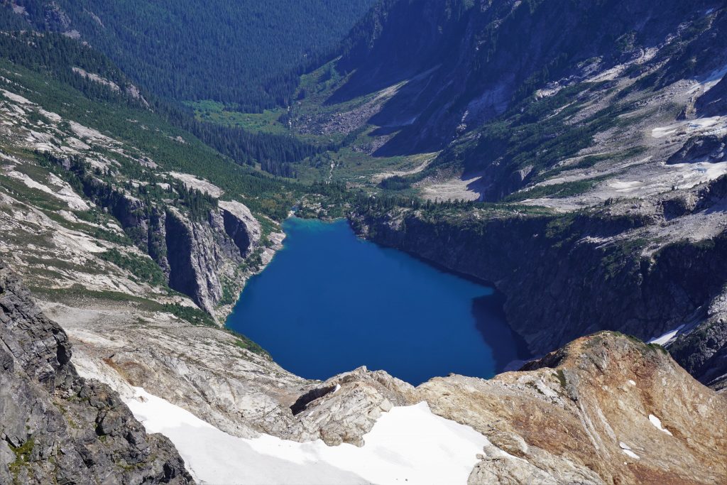
We followed the raging stream down into the flats of Terror Basin Camp. Here, perfect tent sites have been erected in the rocky meadows. Many streams flow through the flats, giving life to a small amount flowers and lush vegetation. We were only 3:15 from the car, but it felt like we were in a completely different world already, a world still recovering from the scars of glaciation. It was truly one of the most wonderful settings I have ever witnessed in the Cascades.
After a good snack and water break, we started the long traverse over to West McMillan Spire. Generally, we followed benches and slabs, trending slightly downhill to the outlet of the glacial lake. It was not hard terrain, but took some time.

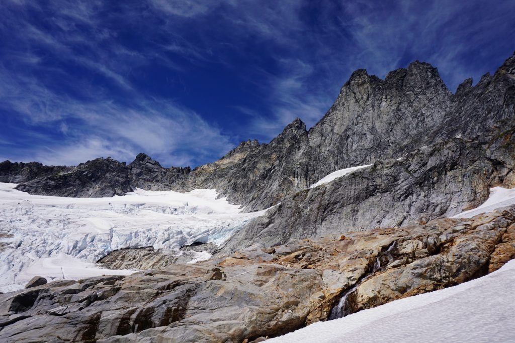
After crossing the outflow of the lake, we started up on beautiful granite slabs. At this point, we still had 2400 ft of climbing left! Fortunately, Anthony was in slab heaven.
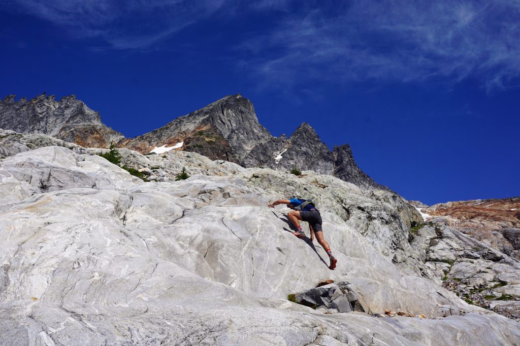
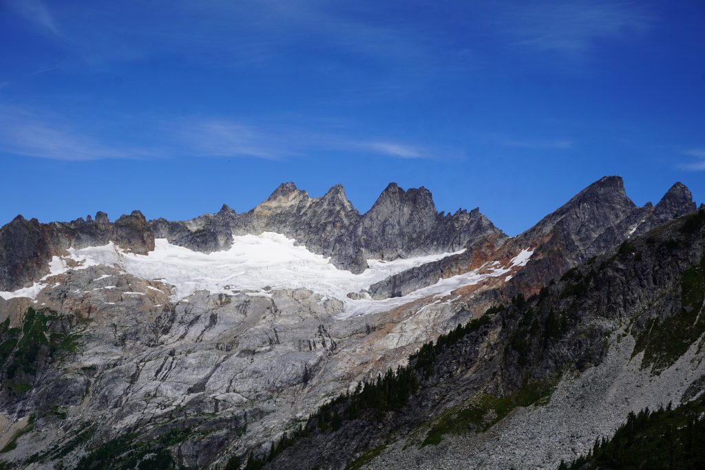
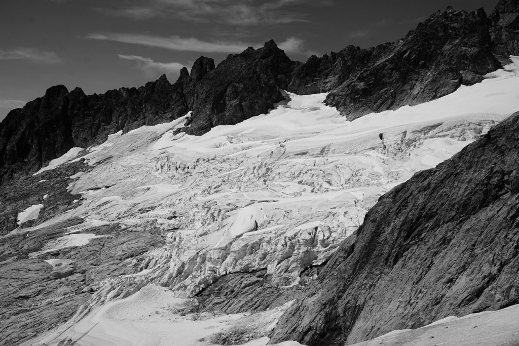
The receding glaciers here have left an absolutely perfect slab highway. It was a joy walking up the sticky rock while all around us, waterfalls poured off the cliffs and spires pierced the sky. This is what the North Cascades are all about.
Higher up, we had to cross a short section of snow/glacier. There was nearly bare ice showing, but it was low angle and the sun had softened the surface so we were fine in our trail runners.
Here, we crossed onto reddish rock and the rock quality disintegrated. However, we were able to avoid the worst of it, the rubble gully leading up to the notch, by climbing slightly harder class 3 rock to the right of the gully.
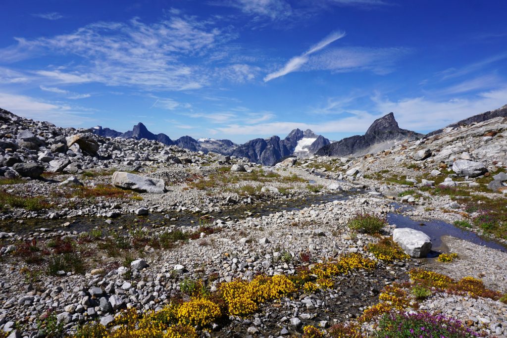
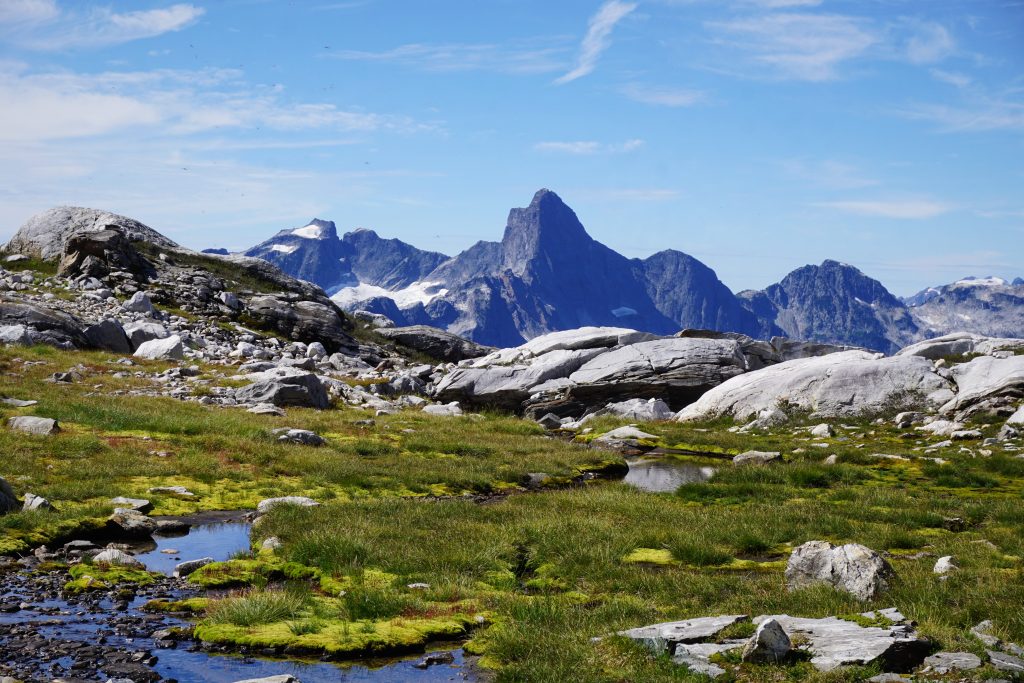
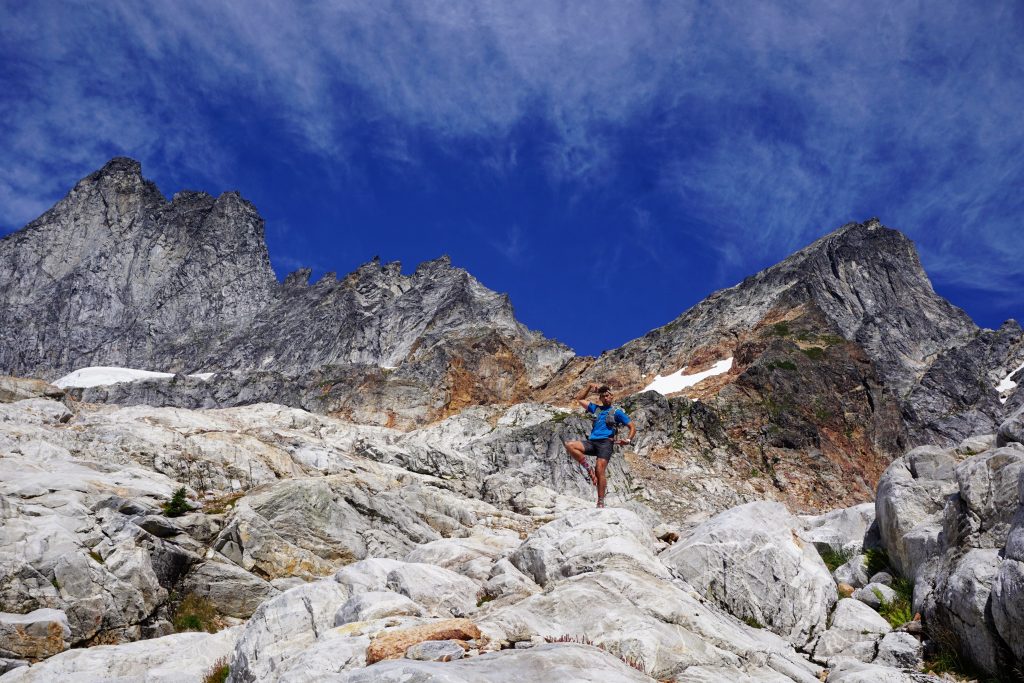
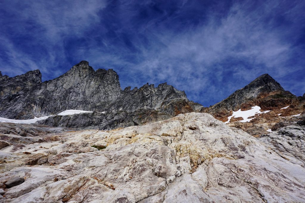
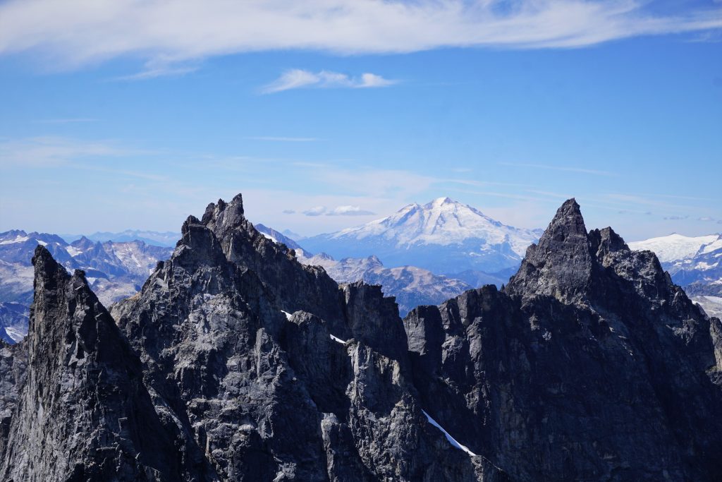
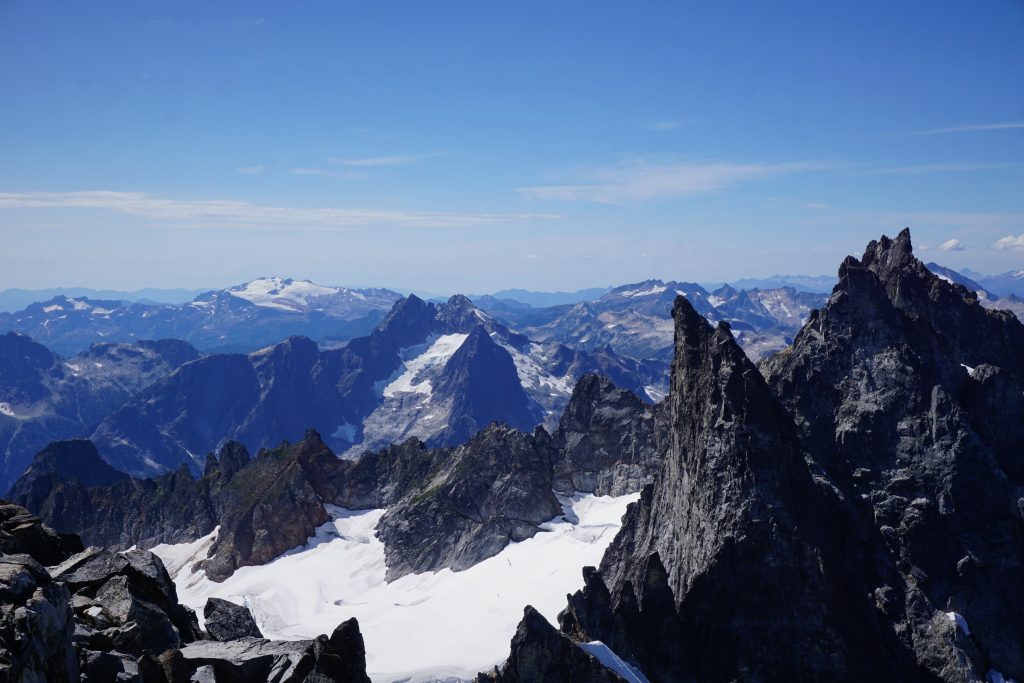
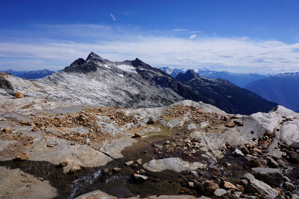
At the notch, we got our first view of the even-more-remote Northern Pickets. The huge Fury massif loomed in the distance and the McMillan Glacier dropped thousands of feet beneath us.
From here, the rock quality got slightly better. It was a mix of hiking and easy scrambling to the true summit of West McMillan Spire.
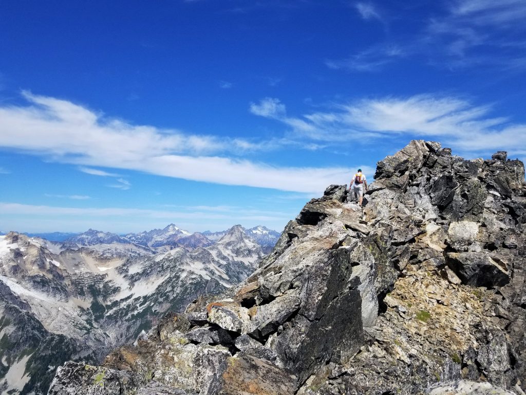
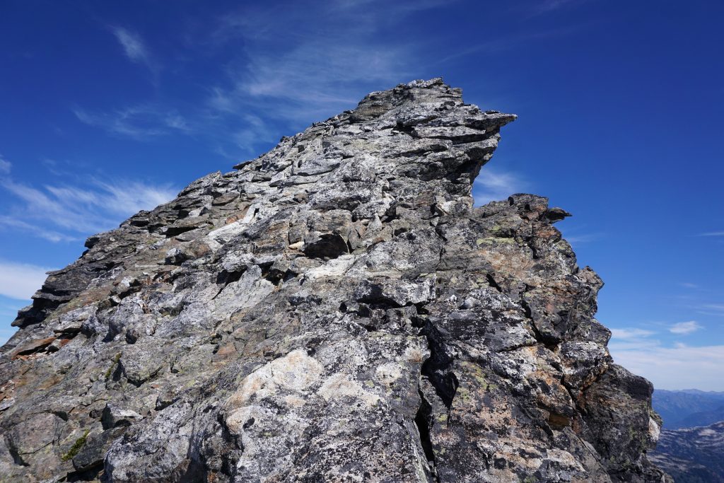
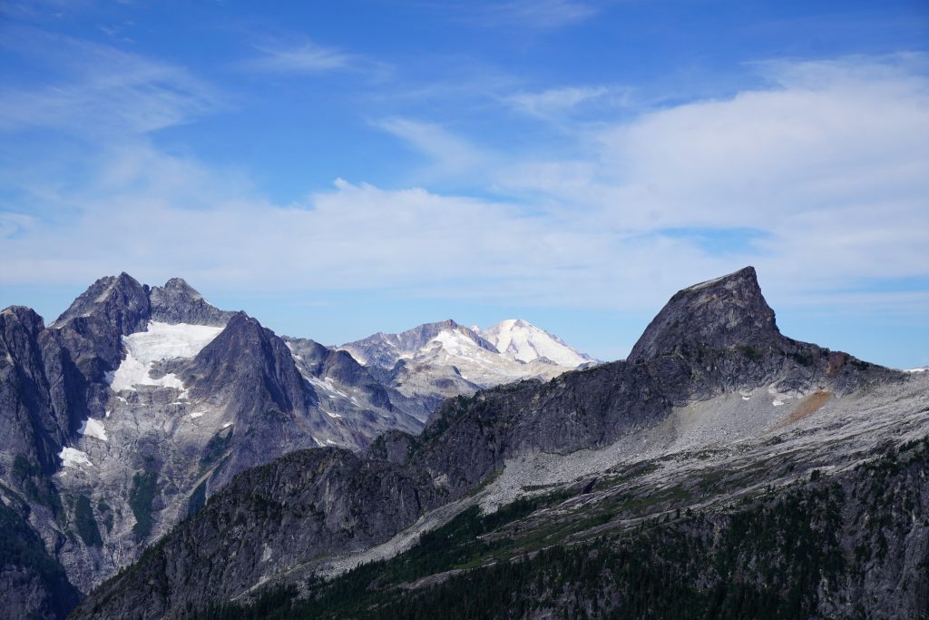
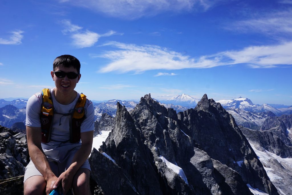
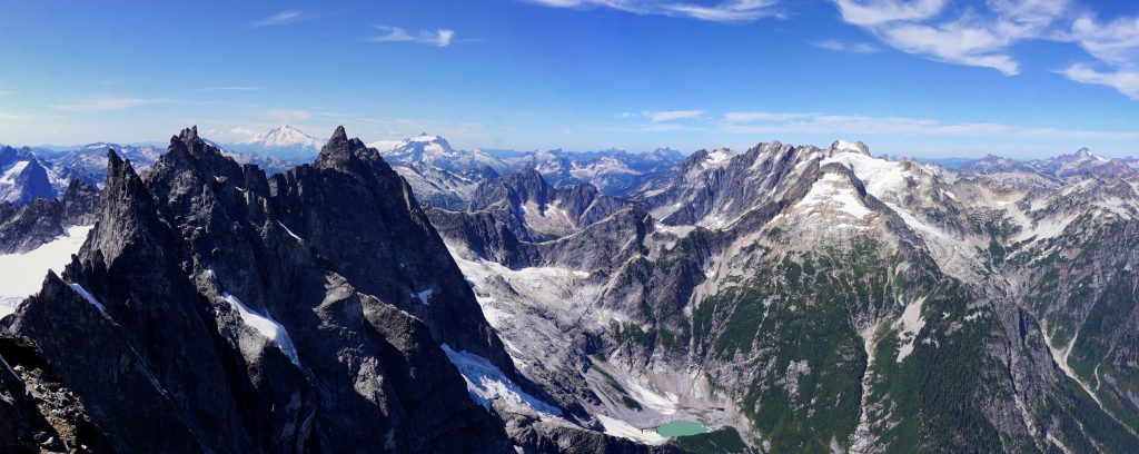
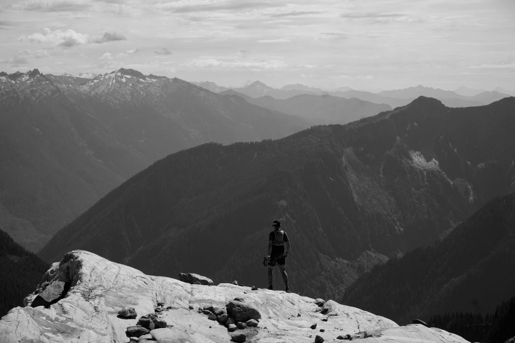
We reached the summit at 5:30 from the car. My uphill muscles were winded, but my soul felt fulfilled as the most marvelous summit view in the Cascades revealed itself. One cannot come to comprehend the ruggedness of the Pickets until standing on one of their summits. The Southern Pickets were like needles, surrounded by spilling glaciers and thick forests. The North Pickets seemed like a stone’s throw away, but the McMillan Cirque that separated us was a vertical land of cliffs, ice, waterfalls, and brush.

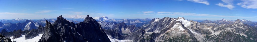
For many years, I had wondered if the Pickets would live up to their hype. So many places – Rainier, the Enchantments – often feel oversold, but the Pickets were just as beautiful and rugged as the legends told. It felt as wild and extreme as I could ever imagine so close to home.
After about 30 minutes on top, we decided to get a move on before the rains came any closer.
We did not do a very good job of staying skier’s left and unfortunately ended up in the loose red gully. This definitely would be a much nicer and faster descent when snow covered! Finally, we got back to the snow crossing and then polished granite slabs.
We retraced our steps back to Terror Basin Camp. One last little awful scree climb got us back to the notch and it was all downhill from there!
We both were dreadfully anticipating the hill climb, but the descent was not that bad! The ground was fortunately very soft and I was able to sort of run / controlled fall down the hillside. After 10,000 feet of gain, my legs were happy to do something other than go downhill, so they actually felt better through the descent.
On the last 4 miles, my legs felt absolutely great and I was able to open up and actually run! Then came all the blowdowns and I felt like I was in the steeplechase, hurdling logs and sometimes even hopping between them. I finished the last 4 miles in 40 minutes, which is a great pace for me on an unmaintained trail like this!
In total, we did 20 miles and 10,000 ft gain in just over 10 hours to climb a barely 8,000 ft peak. What the Pickets lack in elevation they make up for in alpine splendor and ruggedness. This was an incredible day trip, one of the best I have ever done (along with Glacier Peak), and I know it will inspire many more adventures even deeper into the heart of the North Cascades wilderness.
Notes:
- We made it without any traction, but in most snow conditions, I would imagine most people would want traction and an ice ax.
- Overall, I think this climb would be a bit faster with good snow coverage from the heather benches on, as the descents would be much easier. However, carrying minimal gear late season was nice.
- There was no real water source from the base of the hill climb to Terror Basin. However, there was a great water source right before the start of the hill climb.
- There is some looseness climbing up to the notch between Inspiration and McMillan, so some may want a helmet.
- The Pickets are amazing. There’s no other way of putting it.
Hey Kyle,
My buddy just turned me on to your blog as a source of cool mountain running ideas. We’ve been getting into it this summer up here in Bellingham, mostly more modest stuff. But, this post caught my eye because I went out and did a very similar trip exactly a week later! Would have been fun/surprising to run into you guys. I was lucky and actually had the Pickets to myself that day.
If you’re ever looking for partners up north or just want to swap ideas sometime hit me up. If you’ve never been to the twin sisters range that’s our local range and it’s basically designed for this style of running + easy soloing. Check it out sometime!
Thanks for the tip, Dylan! I’ve wanted to check out the Twin Sisters for a while, so maybe I’ll bring my bike out there sometime!
Doing the W ridge of N or S twin is really fun! Bringing a bike makes for a pretty short day unless you do both.
What’s more intriguing I think is the rest of the range. The “Green Creek Circuit” is a pretty amazing day, I’ve done versions of it a couple times. See https://cascadeclimbers.com/forum/topic/91834-tr-twin-sisters-range-green-creek-circuit-6222013. And there are lots of other lesser explored scrambling possibilities back there.
Wow that looks incredible!
Hey Kyle! Wondering…if you were to make the day just a tad bit longer, what would you tack on? How would it be to traverse the ridgeline to East McMillan Spire? Maybe I’m crazy to want to make a longer day out of it, but just curious.
Hey Jenny! East McMillan to West McMillan does got at low 5th I believe. Check out Dr. Dirtbag’s incredible traverse of the Southern Pickets for more beta: http://www.drdirtbag.com/2014/07/28/southern-pickets/.
Hope you crush some Pickets!!
Hello Kyle!
I attempted McMillan a few weeks back. A front moved in during my approach, just as I popped out of the treeline. Didn’t have the visability to continue to the basin. Curious though, on the approach did you go left or right of terror creek? I went up the left ridge line, but had to stop just short of the terror notch, where you traverse right towards the basin. Essentially, I followed beta found on the mountaineers site. However it looks like you approached from the opposite ridge? There’s a route on alltrails that shows a right approach vs left. Just trying to determine when you leave the trail head at what point does it spilt you head right. Much appreciated!
Hey Joshua,
I took the standard Terror Basin approach that most people take. After 4 miles of flat trail, you go right at the obvious cairn and go uphill right (south) of Terror Creek.