
One Last Hurrah for Summer
September is the great transitionary month in the Cascades. The vegetation changes color and the weather starts to go to crap. This year, it seemed like it was happening earlier than normal (but the weather was never that good to start with this summer). I wanted to take advantage of one last summer-like weather window. All my friends seemed to be busy, so I decided to pull a trip out of my back pocket: a high route between the Thunder Mountain Lakes and Robin Lakes. This had been on my list for a while as a logical extension of the Alpine Lakes Crest Traverse. If I succeeded in this high route, I would have created a near continuous high route from Snoqualmie to Stevens! This would essentially close a chapter in the Cascade High Route, so that gave me a little extra motivation to get going.
As the weekend approached, the weather windows kept shrinking, so I eventually decided to change my plans from a big one day push on Saturday to an effort split over Friday afternoon and Saturday. I left work a little early and drove up US2, reaching the Surprise Lake Trailhead around 4 pm.
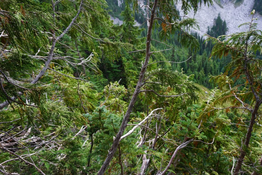
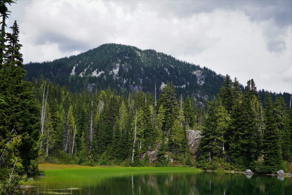
It was a surprisingly warm and humid afternoon as I hike through nice forest up the trail. There are some really impressive older growth trees in this forest despite its proximity to the highway. Near the lake, the trail has more elevation gain and I felt surprisingly tired and light headed. Granted, I was still recovering from a rough day on the Loowit Trail two days earlier, but it was still frustrating to feel fatigued on a trail like this. Perhaps it is the “weakened warrior” syndrome and my body is just running out of gas for the summer. Or maybe it is just being alone, in the mountains and in life. But loneliness is what drives me out to the mountains. This summer, I have faced more doubts and motivation issues than ever before, but I have learned to cope with them by turning my intrinsic mind outwards and finding energy in the beautiful landscapes around me. Alone we are weak. But we are never alone in the mountains.
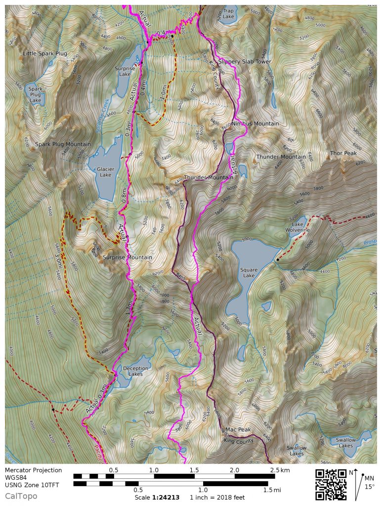
At Surprise Lake, I took the turnoff towards Trap Pass. The constant elevation gain was a welcome change and I slowly started to feel better as I entered the sub-alpine. At Trap Pass, I chatted with a motley group of PCT thru-hikers. They were from all over the world: Czech Republic, Israel, Canada, Florida. They were excited because they were nearly exactly 200 miles from the finish!
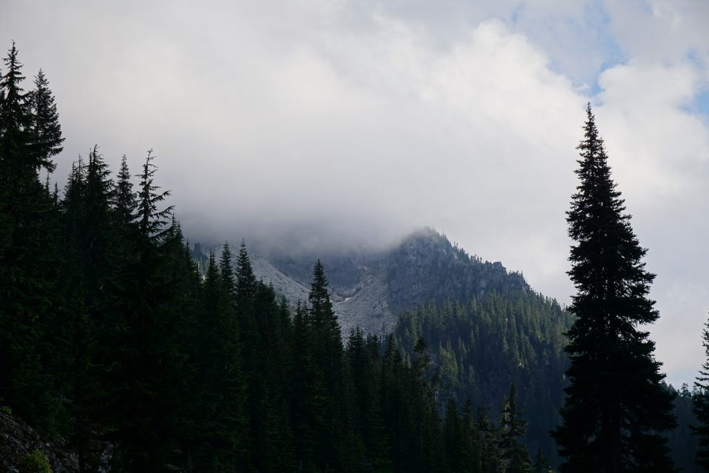
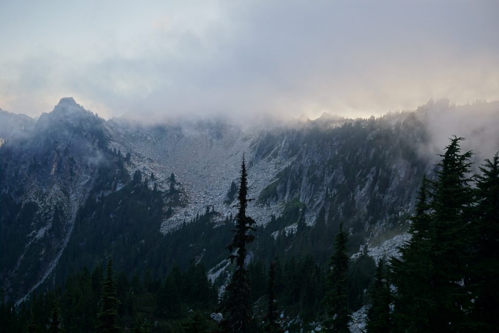
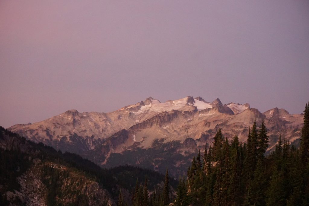
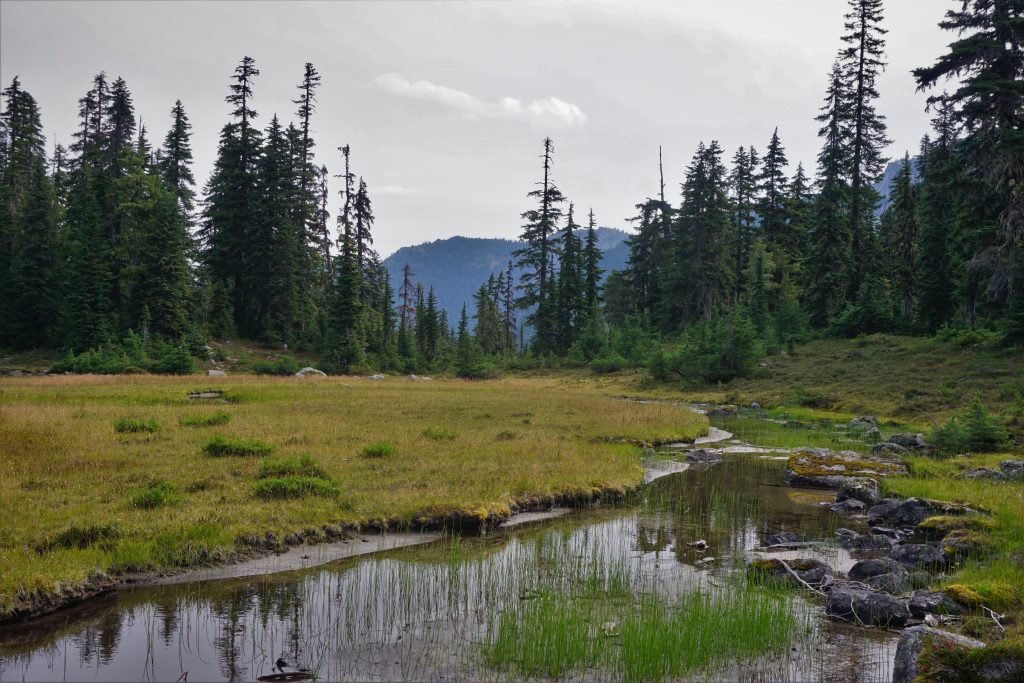
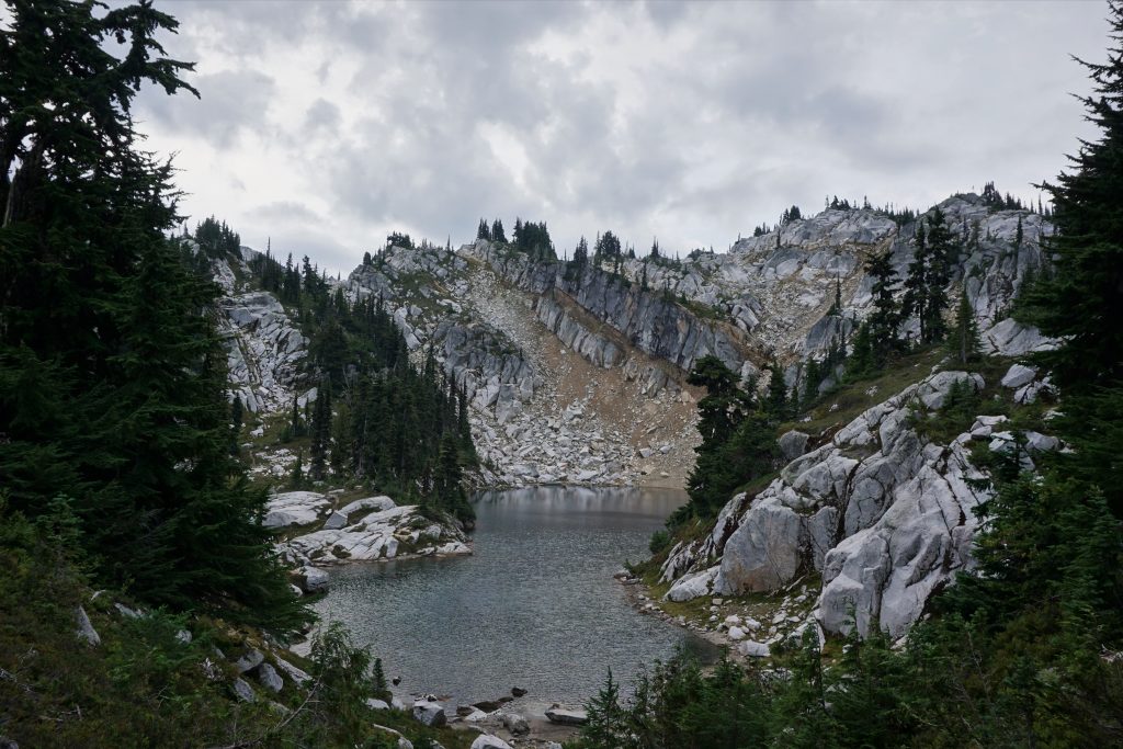
I turned south from the pass and followed the unofficial but well-defined trail towards the Thunder Mountain Lakes. The lakes have received national attention from Backpacker Magazine since I first visited here with Logan five years ago and my dad four years ago. So now they’re a popular destination, fortunately or unfortunately, depending on your perspective.
All the sharp towers on this ridge were shielding me from the clouds. I’ve watched the dance of the clouds on the crest many times before, but never around sunset like this. It was extremely peaceful and brought new life to my legs.
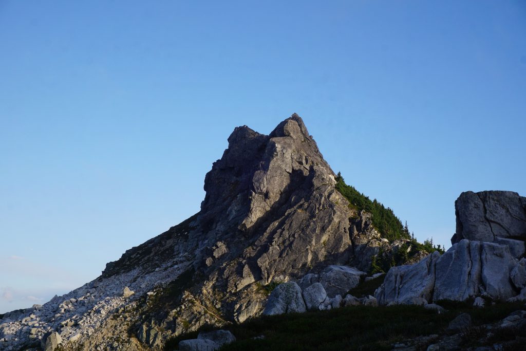
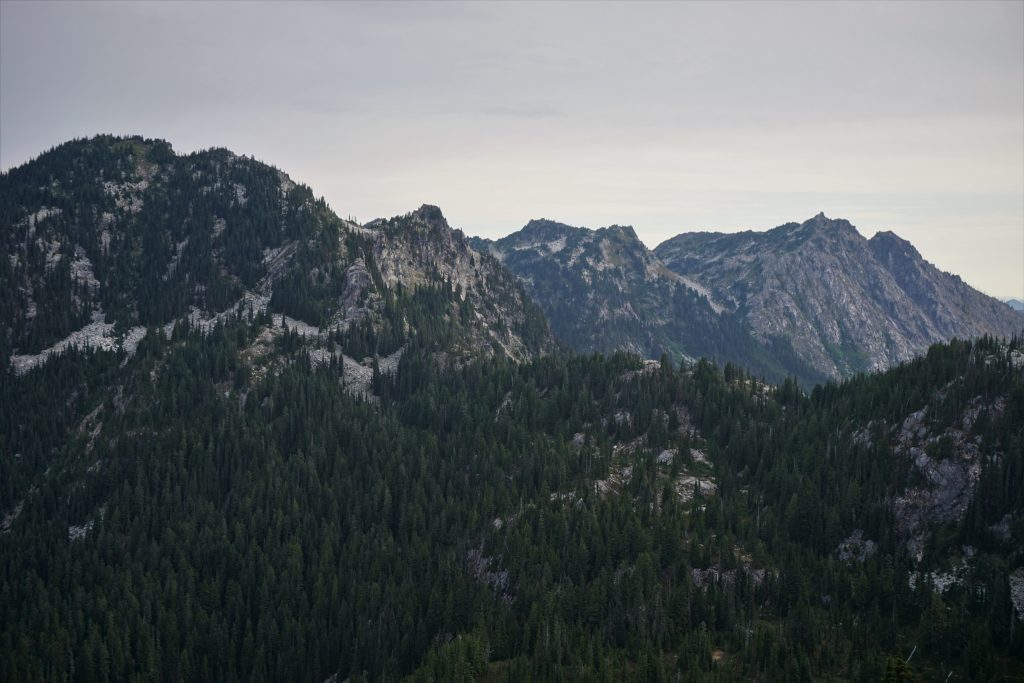
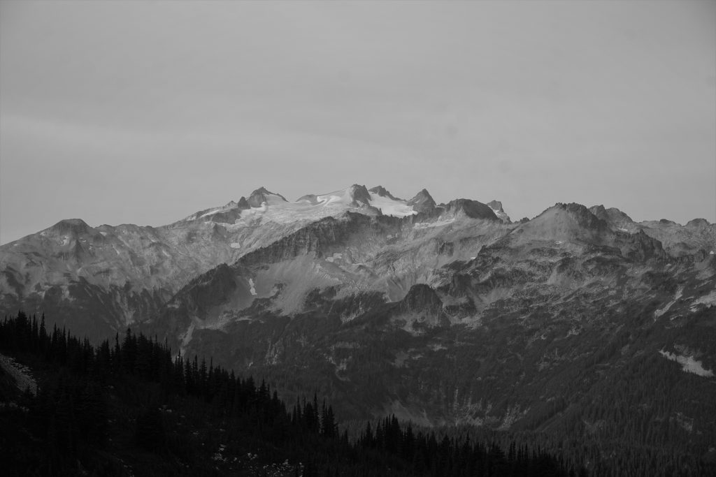
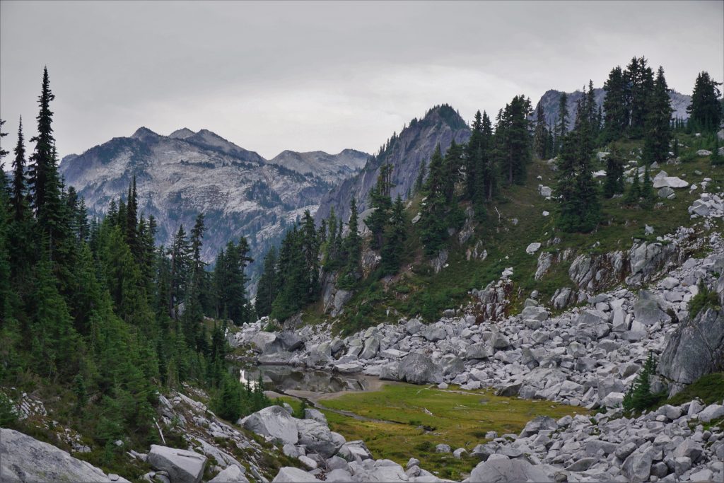
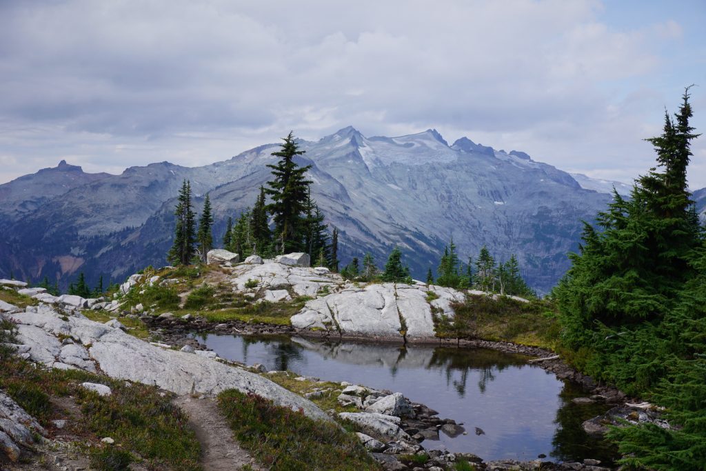
At the saddle overlooking the lake, I found myself with the familiar view of the upper Thunder Mountain Lake and many distant peaks, from Mt. Daniel to Mt. Stuart. It’s not to surprising this lake is a destination now; it truly is one of the most beautiful settings in the area.
There were two parties camped at the lake. I headed down to the lakeshore to fill up on water and decide my next moves. I still had an hour of daylight left, but the next section did not appear like it would have good bivy spots or water sources. But the threat of rain the next day and desire to camp somewhere remote edged me to push on and just get as far as I could in daylight.
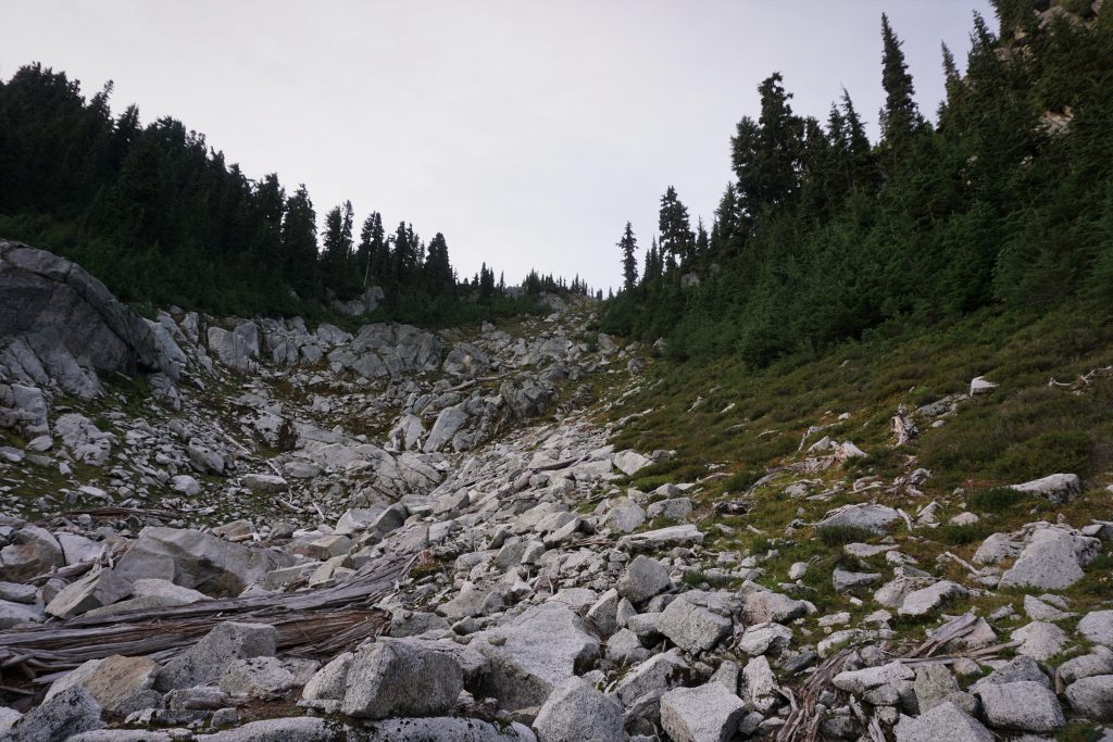
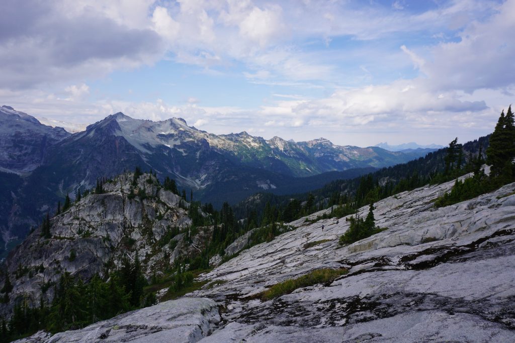
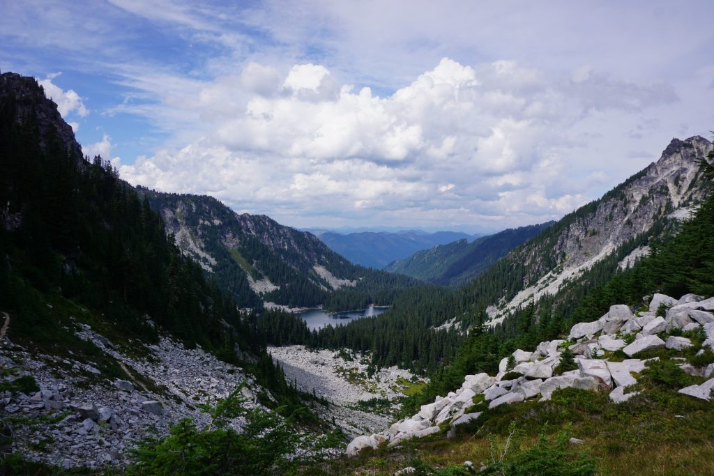
From the far side of the upper lake, I walked through a notch and down benches to the west of the lower lake. I got a clear view of my next section of the traverse. It looked like a lot of boulders and a short forested section before more boulders and a climb to the small pass.
The talus was big, stable, and uneven, a foreshadowing of the rest of the high route. It made for generally easy but slow travel. I dropped a little but then maintained elevation through a very steep, open forest with cliffs beneath. I almost wish I had an ice ax as I sidehilled a brief section of steep forest, swinging by branches as my feet struggled to grip the pine-needle carpet. Thankfully, this was over in a few minutes and I entered a nice boulder basin.
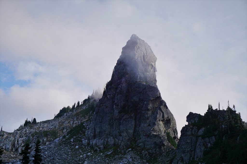
As I climbed towards the pass, I actually found a cairn, so apparently someone else thinks this is a notable route. However, this was the only cairn I would find on my entire high route.
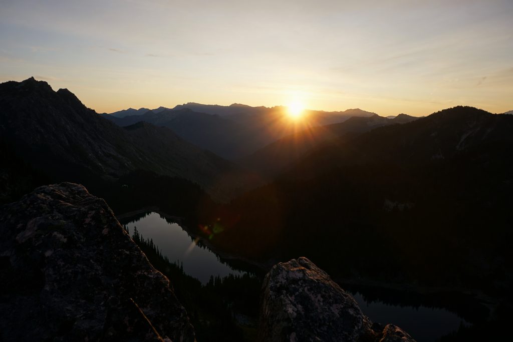
The light was rapidly moving up the peaks to my east and began to fade into the sky as I made my final ascent to the pass, which I called “Thunder Pass”. I was definitely running out of daylight with no good bivy options. As I peeked over the pass, I was elated! 100 ft beneath me, I saw a perfect little boulder basin with a flat spot of heather in the middle, big enough for a single sleeping pad. The terrain was finally graceful. I would sleep well tonight.
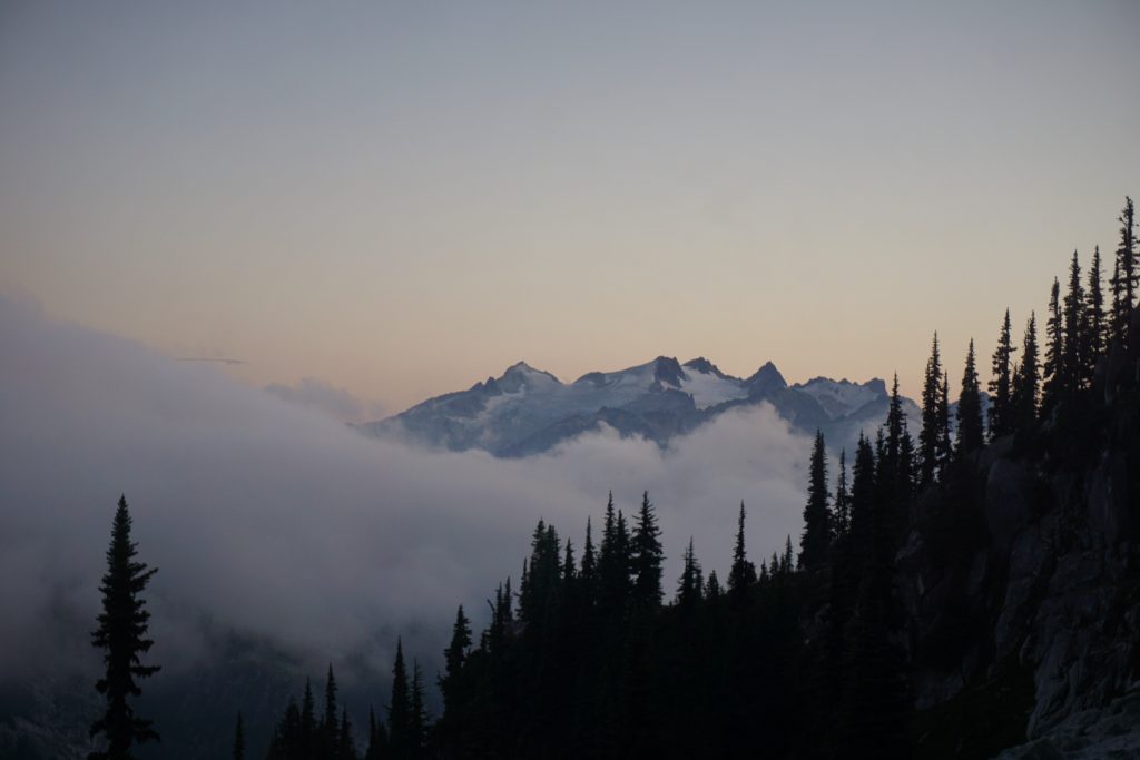
I ate my cous cous dinner as I watched the colors fade from the sky and the clouds continue to flow eastward across the pass just to the south. Even though I was so close to the Thunder Mountain Lakes and PCT, it felt so lonely and remote.
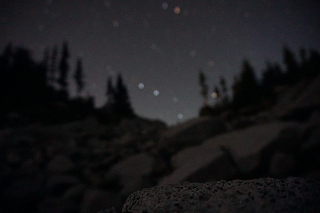
Clouds engulfed me as I went to bed and horrid condensation developed on my quilt. But when I woke up a few hours later, it was perfectly clear! The moon was about to set behind the hill and thousands of stars and the Milky Way were above me.
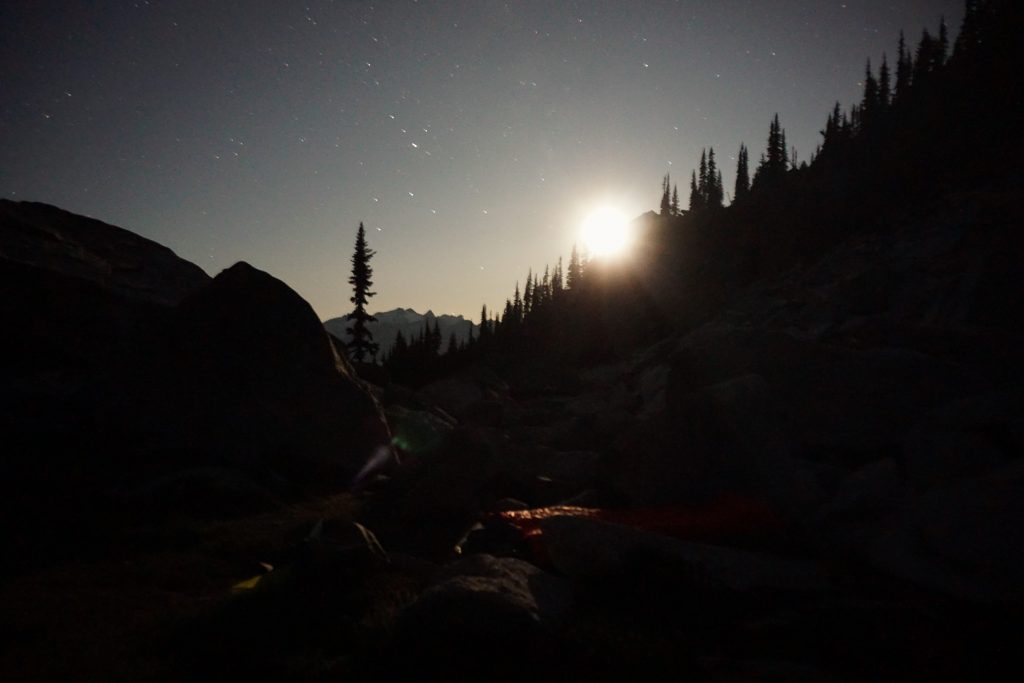
It was a very calm and warm night, perhaps the last of kind for 2019. I slept well and woke at first light the next morning. From my high perch, I could easily watch the glow in the east slowly make its way to the west until the entire sky was glowing in the morning rays.
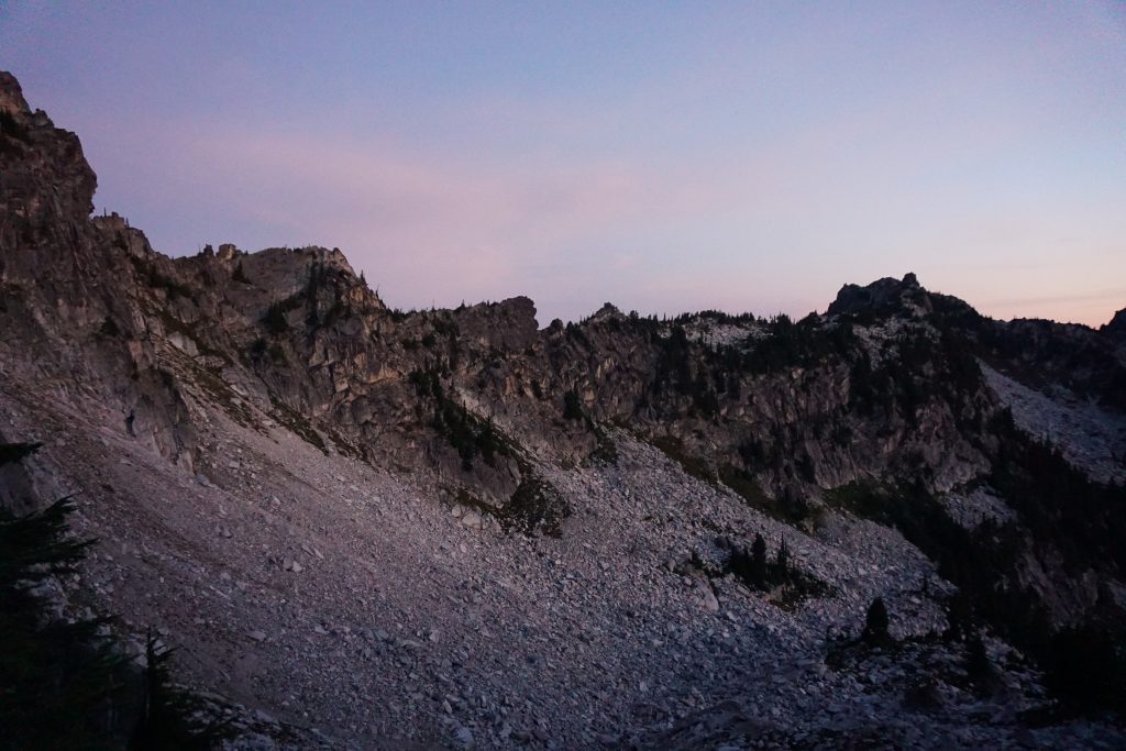
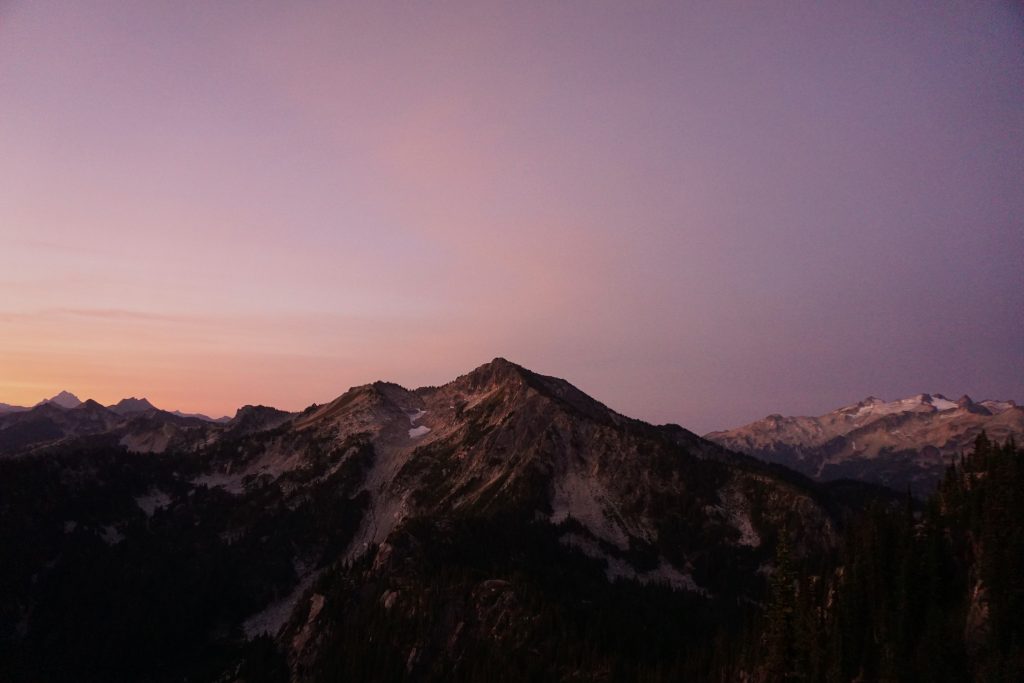
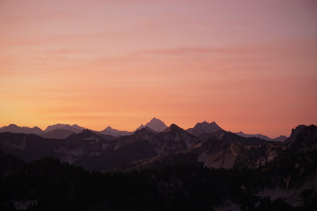
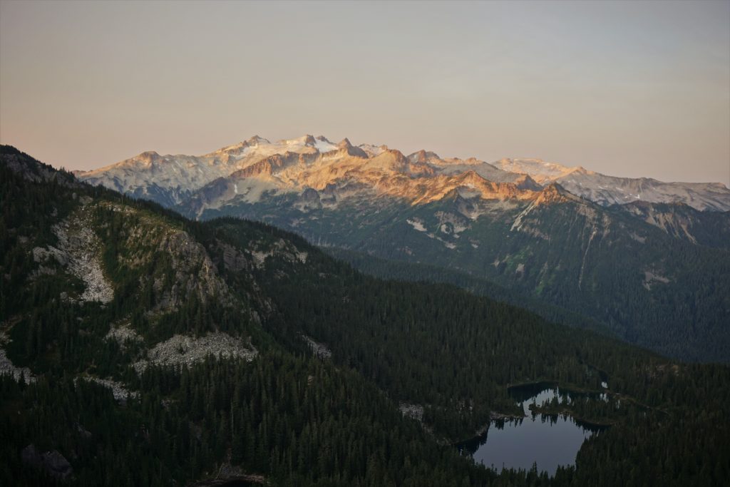
After a quick breakfast, I got moving. I sidehilled some steep heather and crossed the crest of the ridge onto the west side. I followed the right side of the ridge down a ways before arrive at a beautiful rock outcropping. At that exact moment, the sun’s rays crested the eastern skyline and bathed me in warm light. It was a golden moment, with light from the east, and reflection on the Daniel-Hinman massif to the west. After all the self doubt and fatigue, I felt truly vindicated; these are the moments that make life worth all the suffering and effort.
The forest was generally thin enough to make for easy travel. I had scouted this section on satellite imagery and knew to stay high in the basin to avoid bad brush.
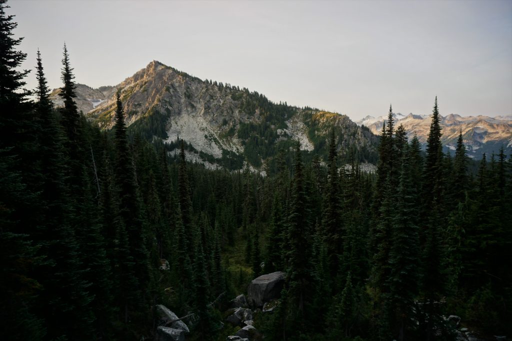
I wandered through creekbeds, stagnant ponds, and quiet little meadows. Eventually, I crossed the south slopes of Mac Peak and ascended a gully that gave me access to the basin west of Mac.
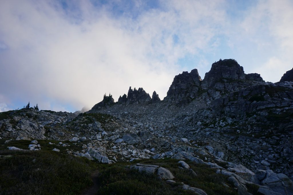
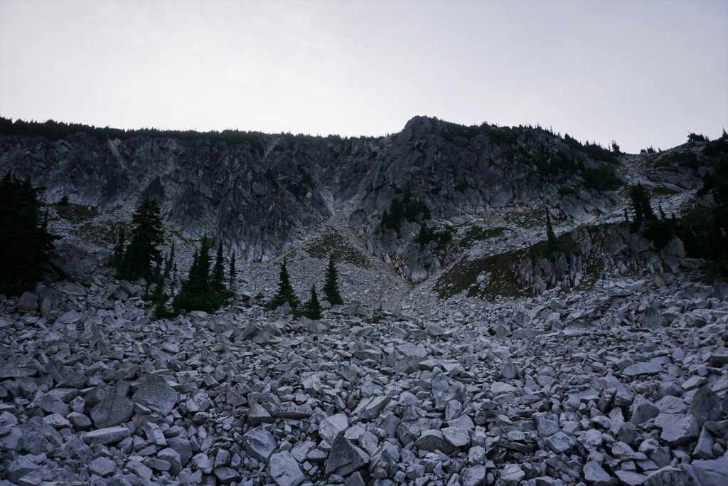
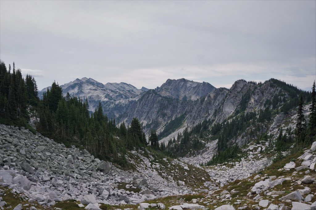
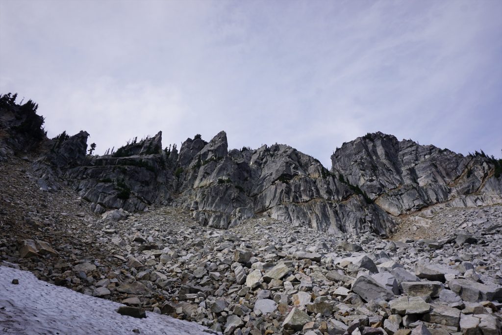
The basin west of Mac Peak is a huge talus wasteland. I clambered over huge car sized hunks of talus. It was cool, but also pretty slow and tiring. There were huge cliffs all around this cirque that looked like they could hold some fun climbing!
At the end of the basin, I saw two obvious notches in the ridge. I figured I’d go for the lower one first. At the ridge, I noticed I was too low and so I tried ascending straight up the ridge to the higher notch, which involved some class 4. I guess I should’ve just gone up the higher gully (top is 5800 ft) in the first place.
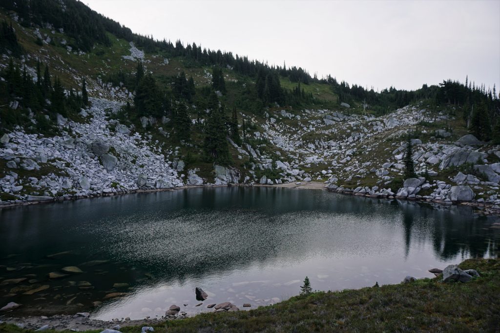
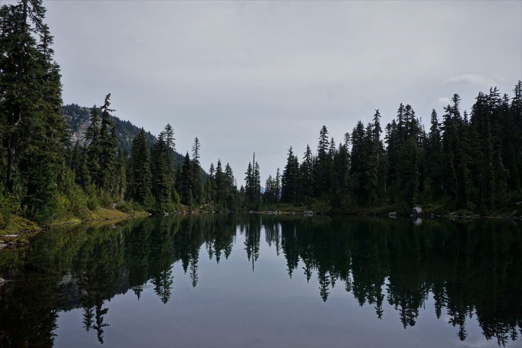
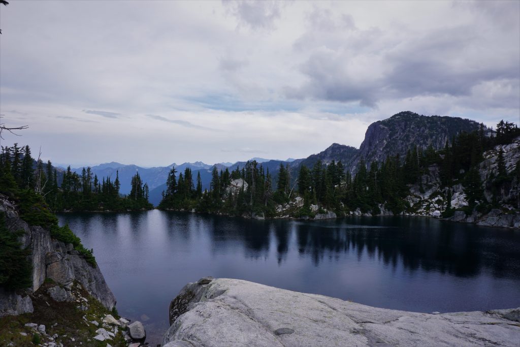
This ascent plopped me out onto a high bench on the west side of Mac Peak that housed a wonderful little lake. Surrounded by ripe blueberries and singing marmots, with Daniel just a stone’s throw across the valley, this was an idyllic little spot.
I continued uphill around the shoulder of Mac Peak. In steeper places where I used my hands to clamber up the meadows, I got distracted and just started picking ripe blueberries. Yum!
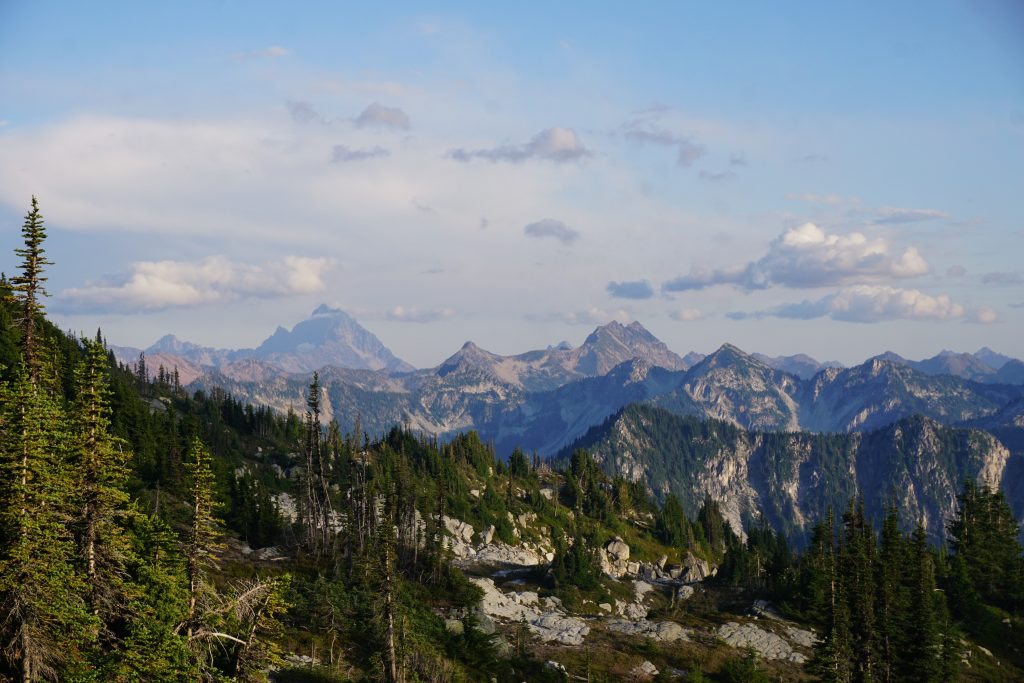
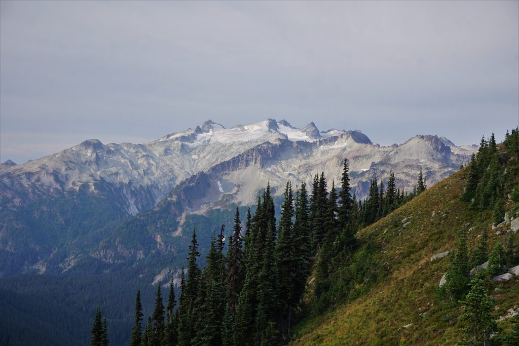
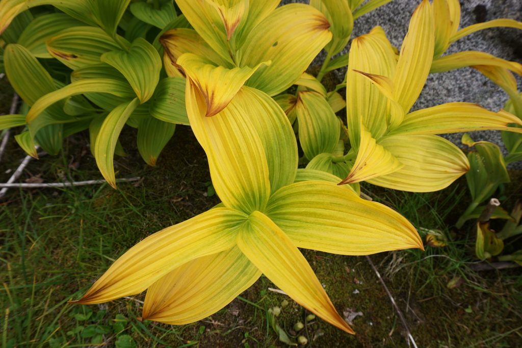
As I contoured around to the south side of the ridge above Talus Lake, I got a fantastic view of Mt. Daniel! The heather was beginning to change color, just a hint of fall.
I knew the descent down to Talus Lake would be cruxy, but it started off well enough. I traversed eastward on amazingly flat heather terraces cut into the steep hillside. It reminded me of visiting the rice terraces in southern China when I was little. Except that these terraces have been carved out by generations of highly advanced marmot civilizations!
All good things must come to an end, however. Once directly above the lake, I saw that there was no good way down, either this weird slide-alder like brush or super steep trees.
I decided to go for the steep forest. There were downed branches and pine needles everywhere, making things extremely slippery. To compound issues, the needles often just disguised cliffs and slabs, but I weasled my way through the brush covered cliffs to the base of the valley. Some more schwacking plopped me out at the lakeshore.
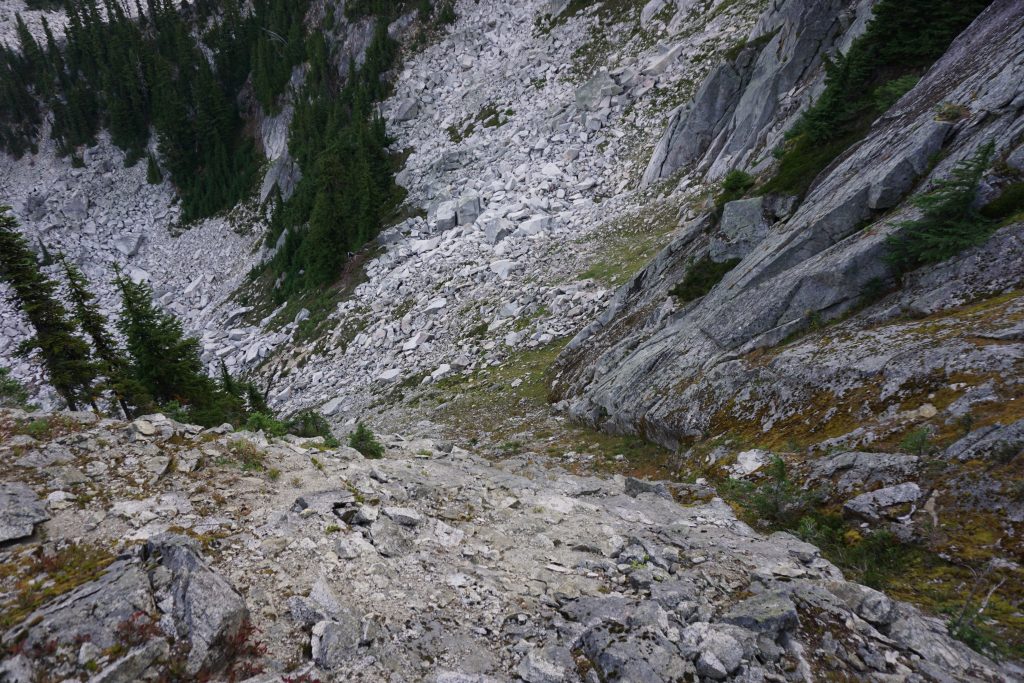
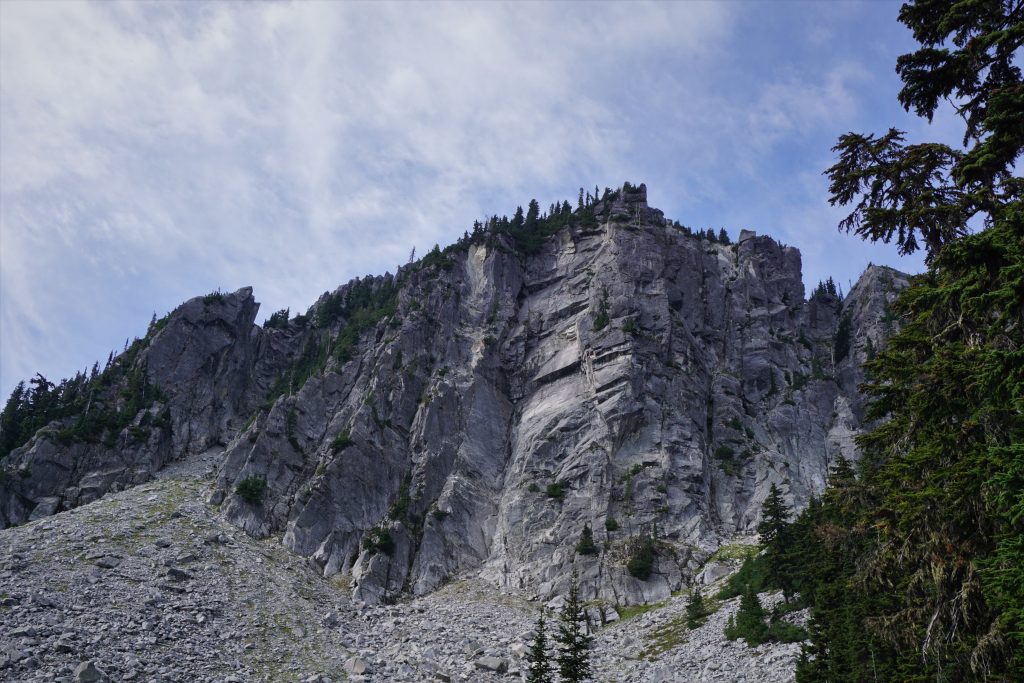
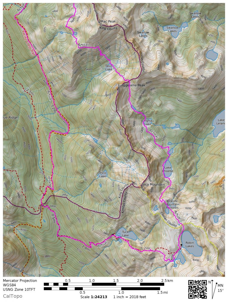
The next part of the climb up to Talus Pass had a few different options. I chose to go directly up the mangy gully in the middle through the trees, which involved some nice class 3 mossineering up top. This deposited me into an upper talus basin.

There is a notch in the cliffs where you can climb up, which is basically the right edge of the trees. It is not too brushy and the climb is pretty easy up to Talus Pass.
The other side of Talus Pass is much mellower terrain, with a nice drainage leading down to the south.
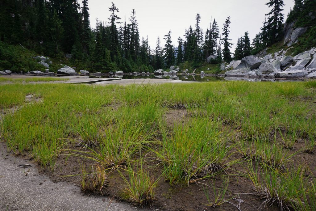
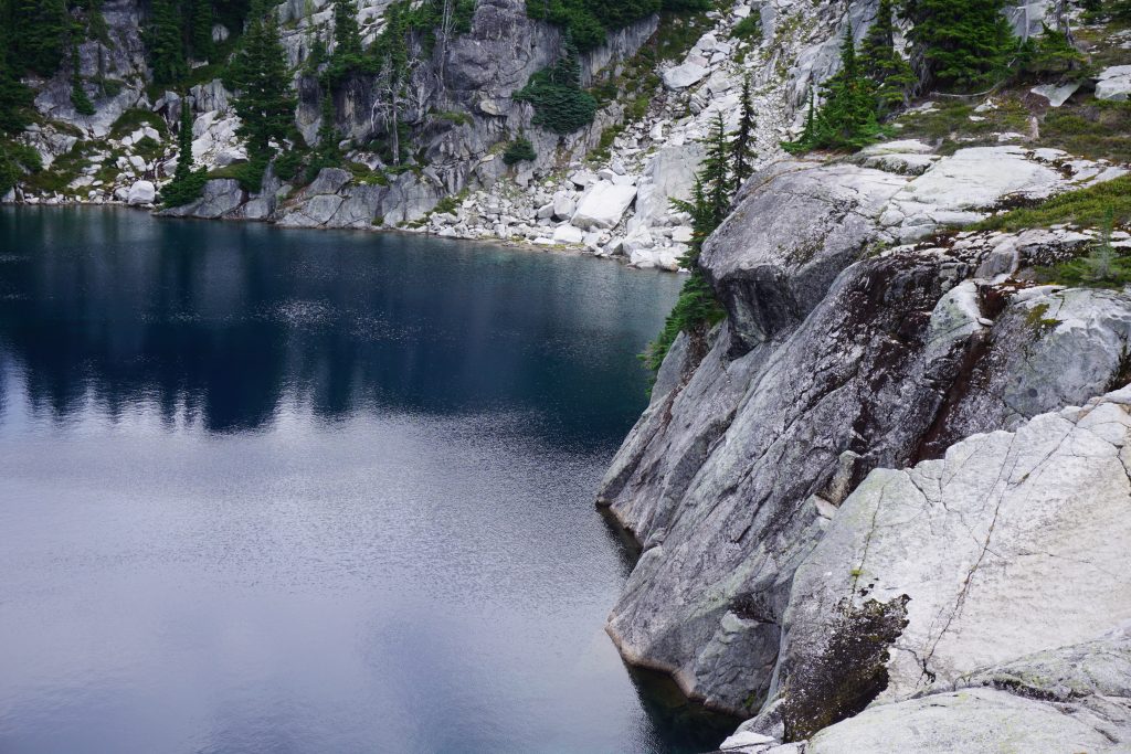
I followed the drainage down a ways to a nice secluded pond. The pond was largely dried up and the foiliage was strongly hinting at fall time. It was a very peaceful spot, one of my favorite in the trip.
Below the pond, the vegetation got a little thicker, but it was still easy to move through the forest. I passed Jungfrau Lake, which was not honestly that attractive. From there, I cut a little right and followed a drainage down to lower Lake Phoebe. There were a few mosquitoes left, which surprised me for early September.
There is a decent social trail on the right side of the creek that drains Lake Phoebe into lower Lake Phoebe. Lake Phoebe itself is much nicer and larger, which an elaborate campsite on the shore.
Now I had one last talus climb ahead of me. Once again, the boulders were large, solid, and obtuse. However, I could mostly stay on heather/gravel mix on the left side of the gully as I climbed up towards Trico Peak and the Granite Mountain Potholes.
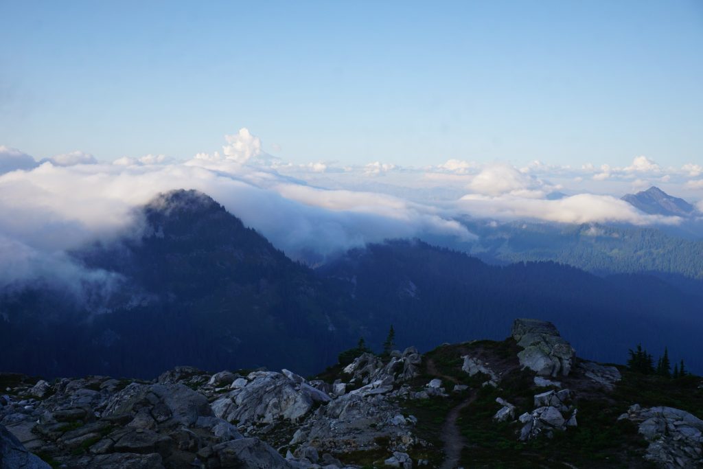
The clouds were building, but it definitely seemed like I would finish my high route before any rain started! I had already mentally accepted getting wet on my long hike back to the car.
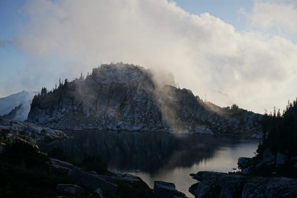
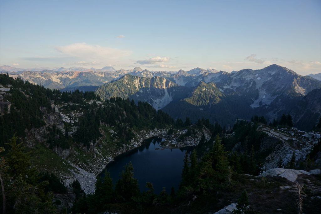
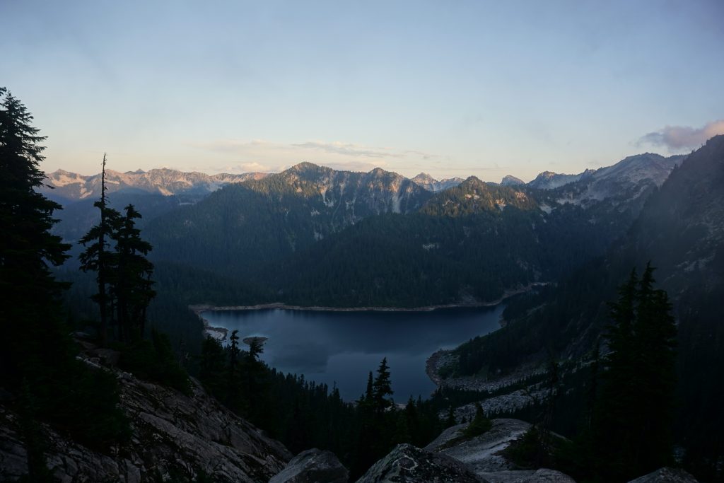
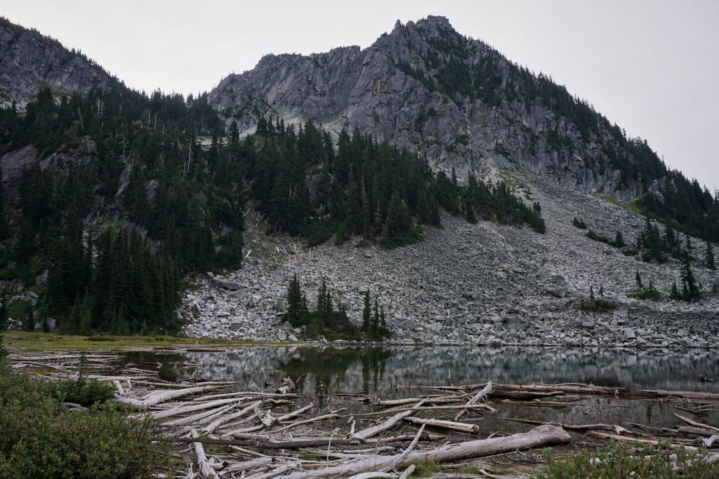
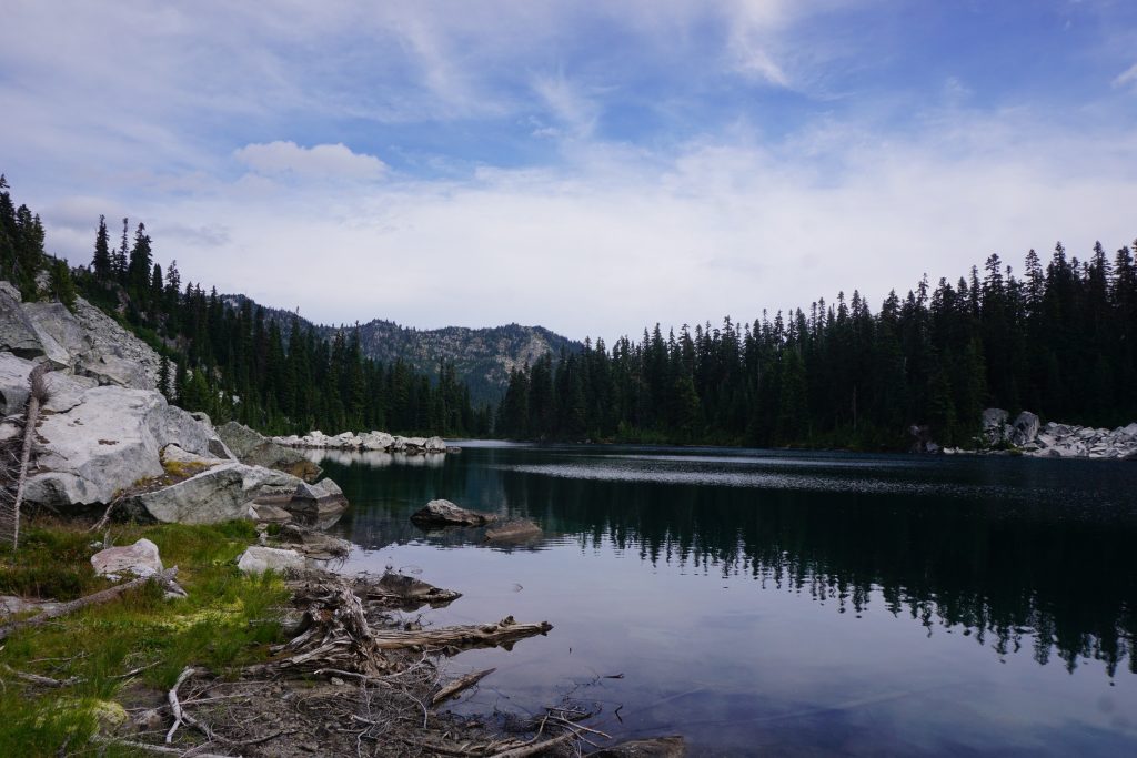
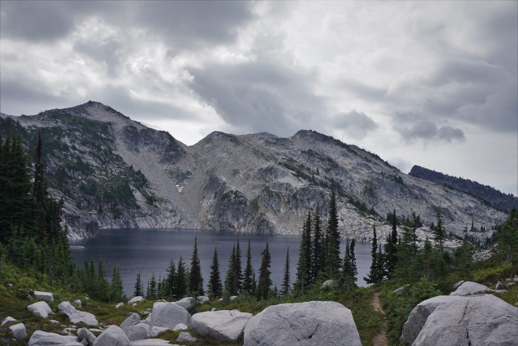
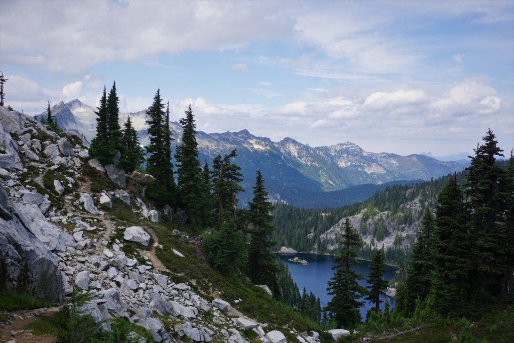
Finally, I crested a ridge and saw the Granite Mountain Potholes. These are some absolutely beautiful little lakes set in deep bowls (much like a pothole). The scenery is similar to the Robin Lakes, but much more secluded.
There is an obvious social trail that splits the lakes and leads over a small pass to the Robin Lakes. I had visited the Robin Lakes four years ago with my dad and sister. They did not seem quite as beautiful as they did the first time, but that is usually how it goes.
There is a massive maze of social trails out here and it is quite difficult to actually find the right one to get out of the lake basin. Once I reached the outlet of the lakes, I took a nice lunch break. It was still before noon, and I was happy with my morning’s efforts. The trip was in the bag.

I said goodbye to solitude and began down to Tuck Lake.
I passed many people: backpackers going up, backpackers going down, trail runners, day hikers, all walks of life. I feel like more than ever, crowds are concentrated in a few spots. But solitude is still so easy to find for those who seek it.
Down at Deception Pass, I met a group of maybe 8 kids around my age or slightly older going to Jade Lake, the utterly cliche, overrun lake I still have not been to. They were fun to talk to since they were my age and very social, but I could also tell they were the kind of group that was going to annoy lots of other campers at Jade Lake with their constant noise and copious amounts of alcohol. But if you are going to Jade Lake on a weekend, you cannot really expect much else I feel like…
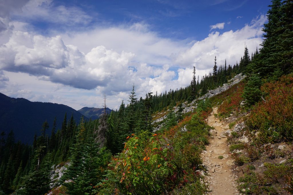
Having satisfied my social quota for the day, I focused on the 13 or so trail miles I had left between me and milkshakes. The PCT is so cruiser in this section and it felt nice after miles of talus and steep heather.
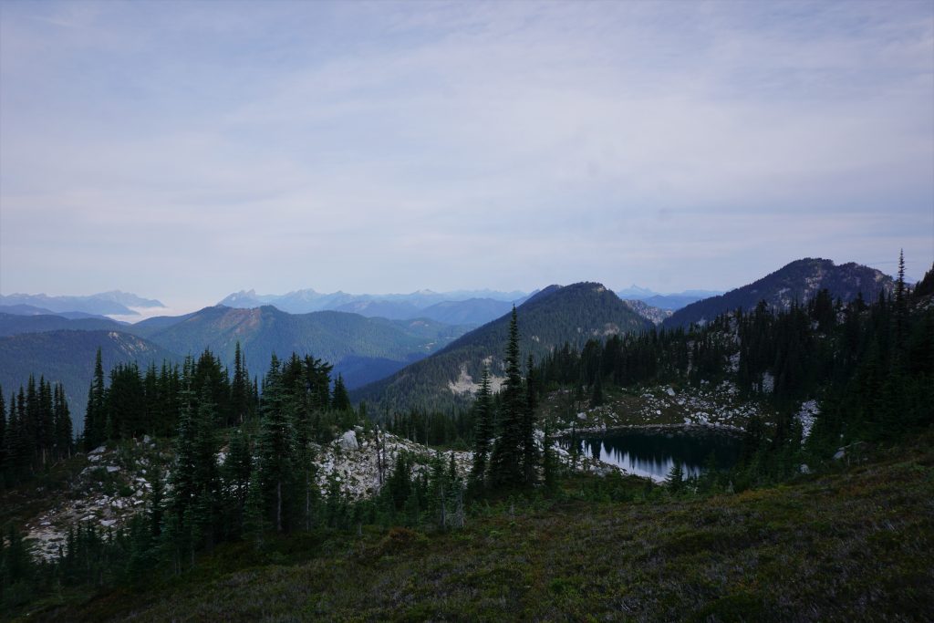
I took the old abandoned Cascade Crest Trail up over Surprise Gap. It is a shame they moved the PCT because the view from Surprise Gap is absolutely lovely. Glacier lakes stretches out in a tight green valley with Glacier Peak sentinel in the distance. Despite the weather forecasts, it was a lovely afternoon. I laid down on a nice patch of grass and closed my eyes for a while, feeling the wind and sun wash over me. Summer was here to stay, at least for another few hours.
The last 7 miles or so passed relatively quickly and I got back to my car at 4 pm, nearly exactly 24 hours after I left it. The rain began nearly immediately after I got back on the highway, so I was happy to have stayed dry and be home for dinner with my parents!
Overall, I am pleased with how this high route turned out. It was not as pure or alpine as the Alpine Lakes Crest Traverse, but the terrain I had to work with was much less impressive. Still, I found a non-technical route near the crest that had relatively little brush and some very beautiful spots. There was a sense of finality to the trip – the end of the summer, and the end of a chapter in the Cascade High Route – that felt fulfilling and rewarding.
Notes:
- Total stats were about 29 miles and 10k ft gain. The high route part itself was maybe 7 miles and 5k ft gain, so pretty rugged.
- If coming the other way, make sure to stay skier’s left when descending from Talus Pass. The notches through the basin west of Mac Peak might be a little challenging to spot correctly.
- The worst brush was by far the descent to Talus Lake. Looking back, I might have been able to traverse even further around the basin up high before following a dry rocky creek bed down to the lake.
- If you’re looking to get a summit, you can actually traverse over the summit of Mac Peak on this cool ridgeline.