
Slow and Light
The Watson Blum High Route connects the terrain between Mt. Watson, Bacon, Hagan, and Blum in the Baker Lake region of the North Cascades. It is a well known high route, documented in the Beckey Guide, and one of the first high routes I ever knew about, before I had even jumped aboard the high route train. I’ve been trying to balance making my own high routes with ticking off the classics, so it seemed finally time to go for this one.
Labor Day 2020 provided with an unseasonably warm and dry three day forecast. We knew it was a little late in the season to do the Watson Blum High Route, but figured we could give ourselves three days to deal with the extra post-glacial slowness. It would continue the theme of this summer: slow and light. While it has been inspiring to see so many elite athletes set crazy FKTs and whiz through the mountains, I’ve felt more inclined to lounge in a meadow, sip some Crystal Light, and watch the sun go down. Slow and light alpinism. It’s the next big thing. Maybe I can write a book about it with Steve House.
Day 1: Watson Lakes Trailhead to Elementary Peak
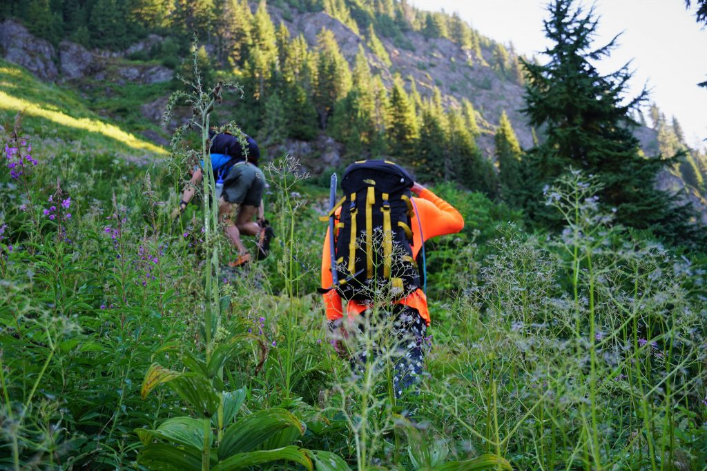
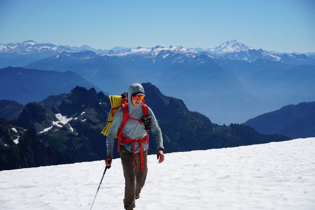
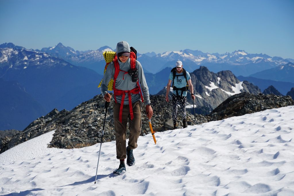
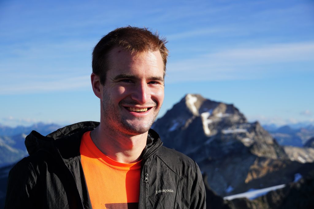
Tyler, Steve, Sam and I got a late start from Seattle, left a car at the end of Baker Lake, and arrived at the Watson Trailhead close to 11 am. There was a line of 20 or 30 people to use the bathroom, but almost no one on the actual trail.
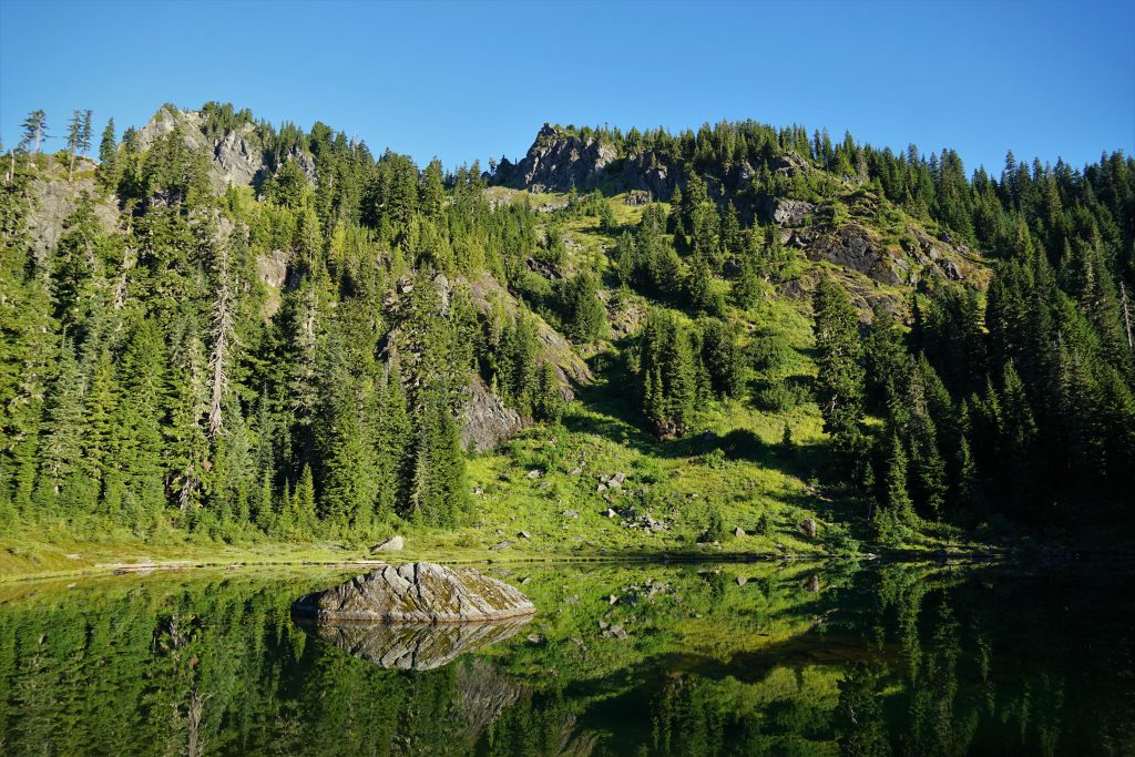
There was a slight haze sitting on top of the marine layer, making for murky lighting. We passed an abundance of camps at the Watson Lakes and started heading uphill towards Mt. Watson.
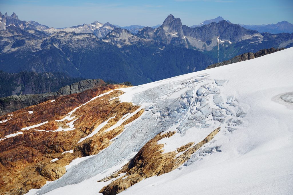
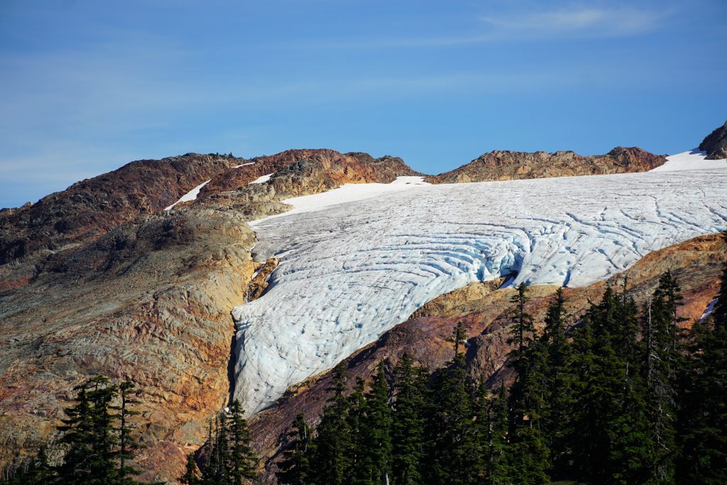
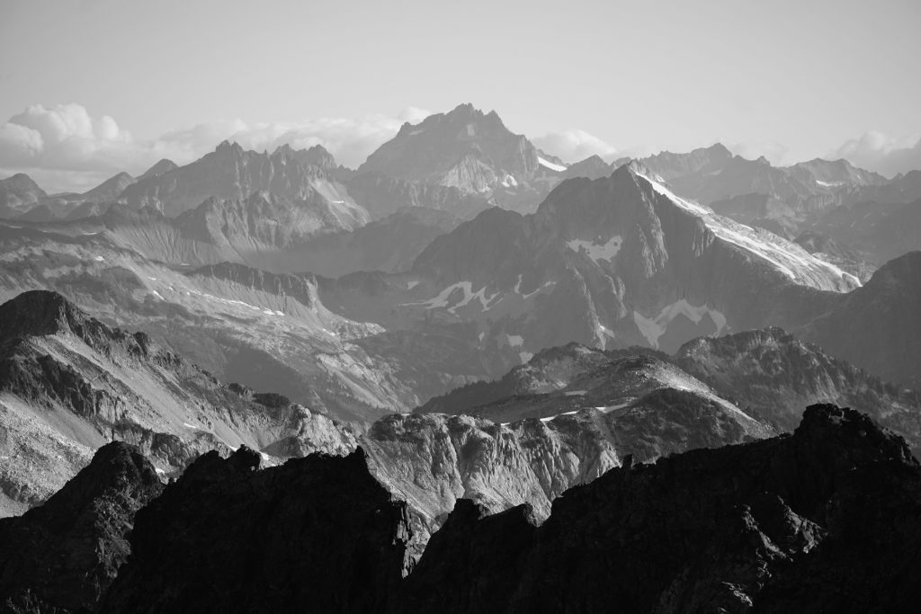
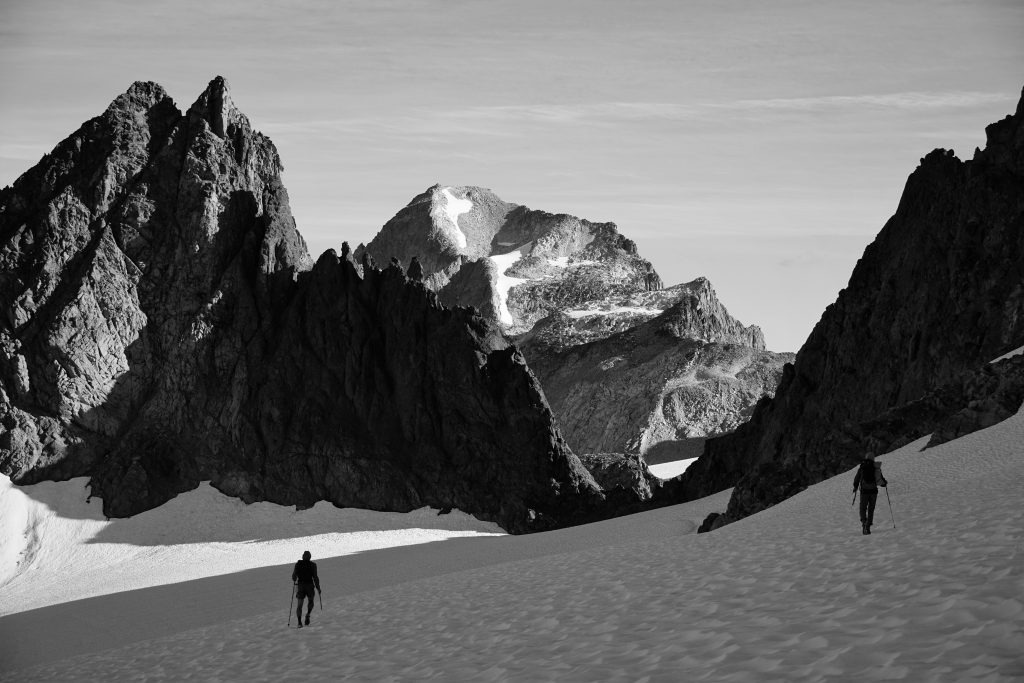
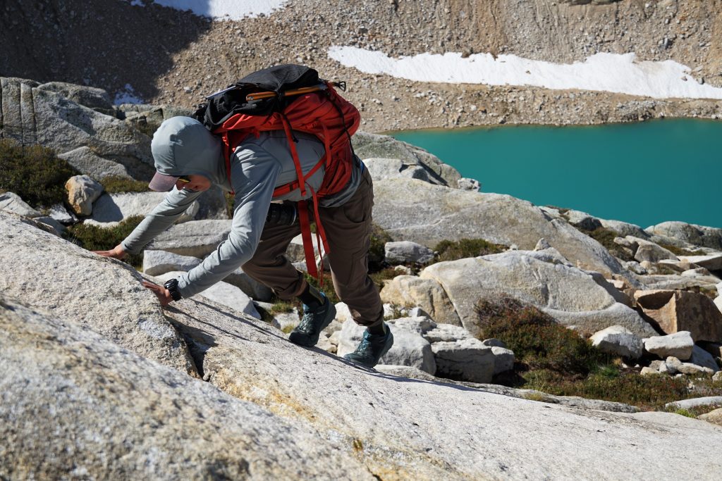
In this section of the Cascades, it is amazing how suddenly you transition from forests to post-glacial and glacial moraines. There is really no in-between alpine meadows. The 19th century glaciers came down so far. Even now, the snowline is still incredibly low on northern aspects.
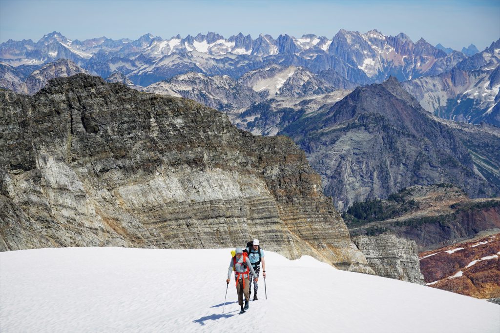
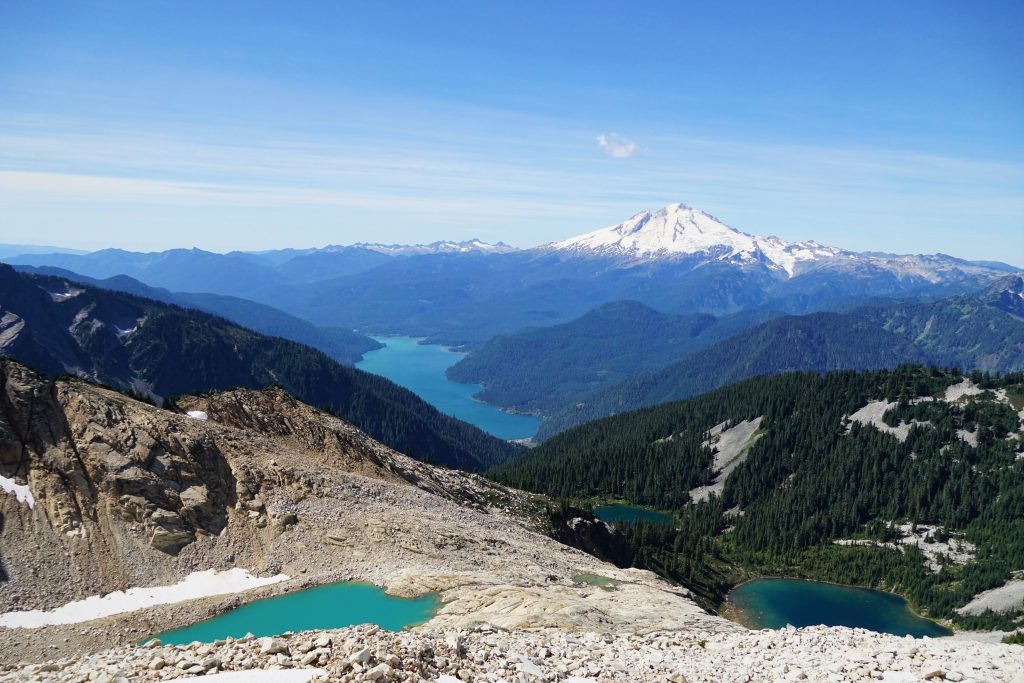
The upper moraine was a beautiful, intricate land of gravel deposits, hummocks, and little ponds. Micro terrain that is only revealed at the end of the summer, when its sheet of white is removed.
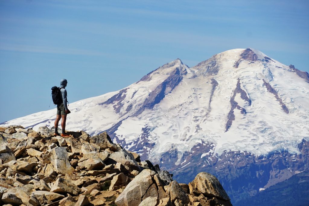
Since our plan for day one was so short, we decided to go for a Watson summit. We ditched our gear and carried crampons and ice ax (literally in hand) up to the little glacier, climbing a steep snow finger between the two summits.
From the notch, we schwacked/scrambled/mossineered to the summit of Watson.
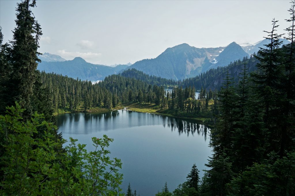
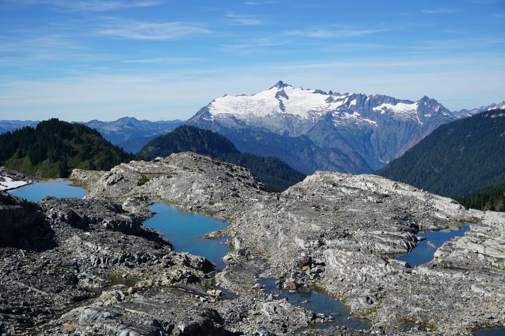
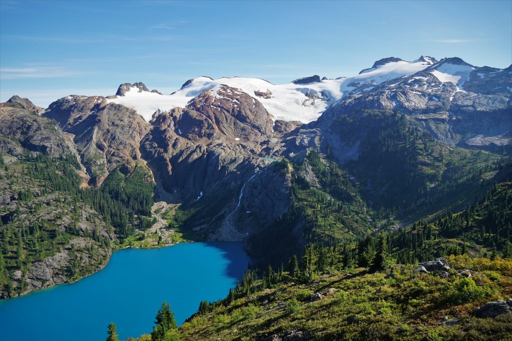
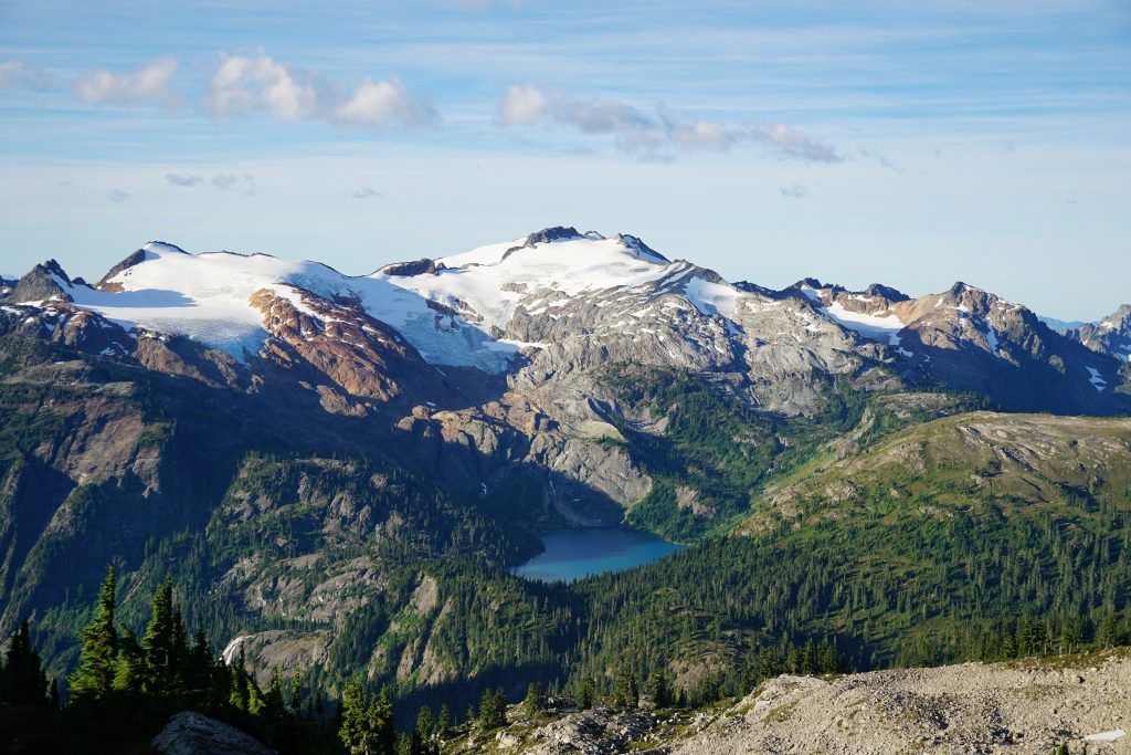
Once back at our packs, we continued wandering eastward, past a dozen little ponds and waterfalls.
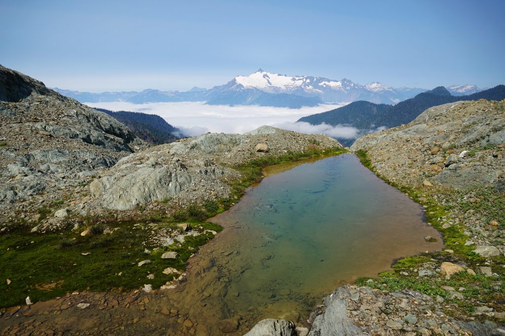
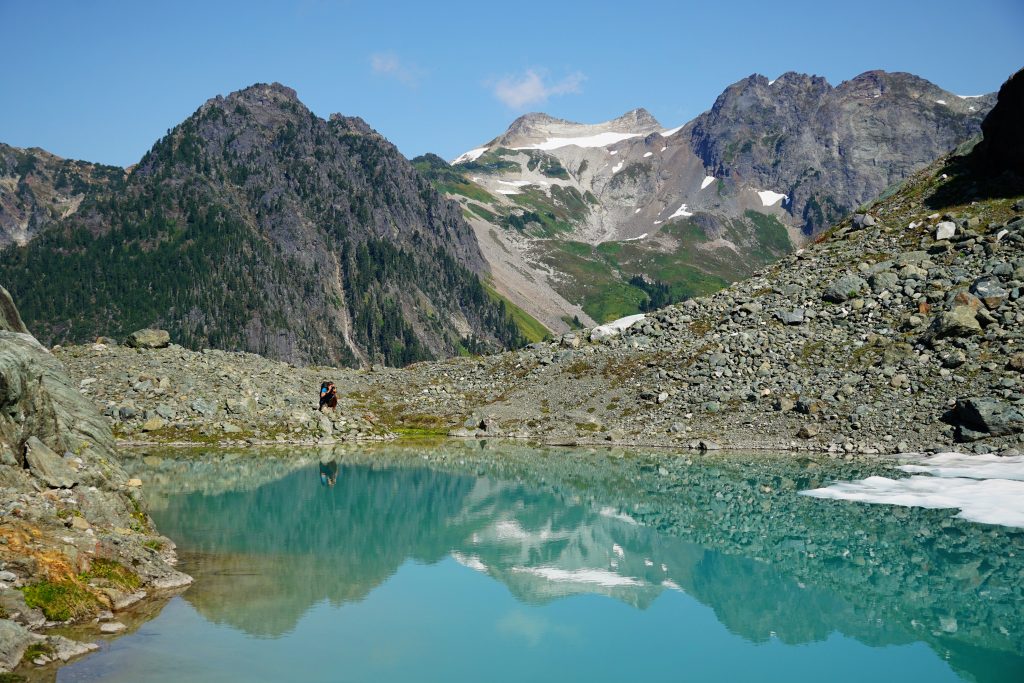
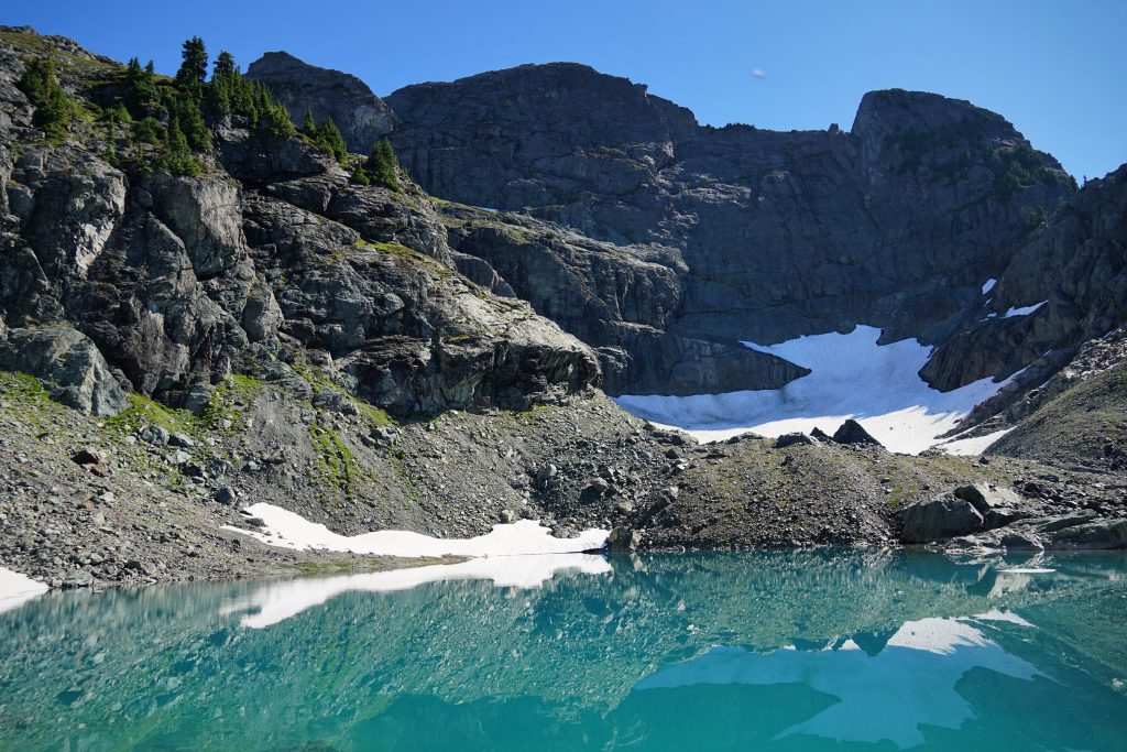
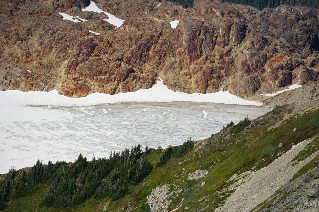
The largest lake was set in a deep north facing cirque and was still mostly frozen, despite its low elevation of 5000 ft!
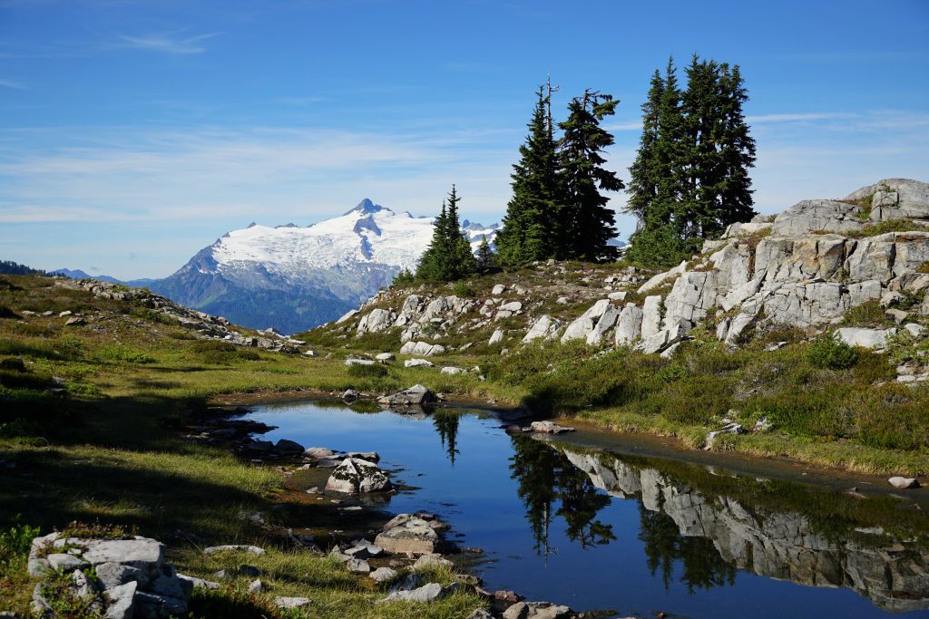
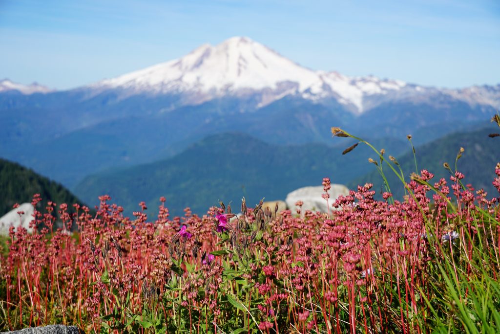
We reached the pass and left behind the moraine wasteland, crossing into heather meadows. We strolled across the benches to a beautiful little pond perched on the edge of the world, our home for the night. There was a soft, dried up marsh where we lounged in the afternoon sun. Slow and light, day one.
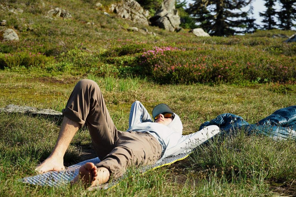
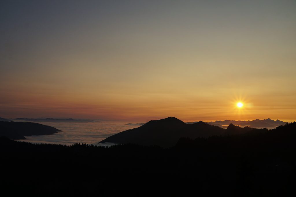
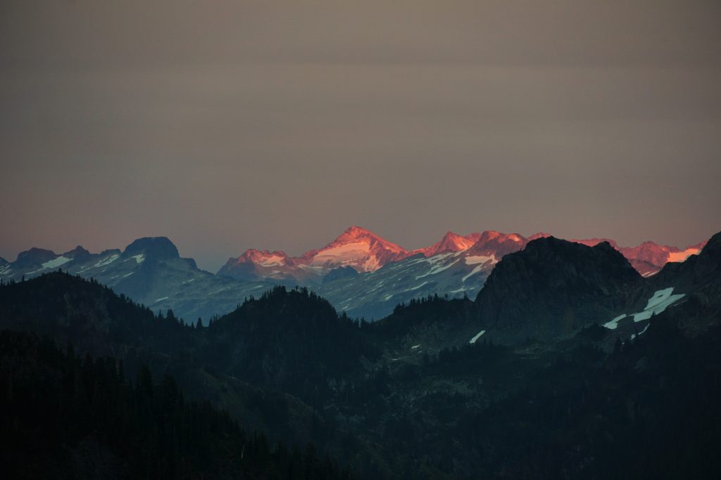
There were ripe blueberries, which gave us an afternoon activity. As evening rolled around, we walked up a few hundred feet to the ridge beneath Elementary Peak, granting us a wonderful 180 degree view to the south for sunset.
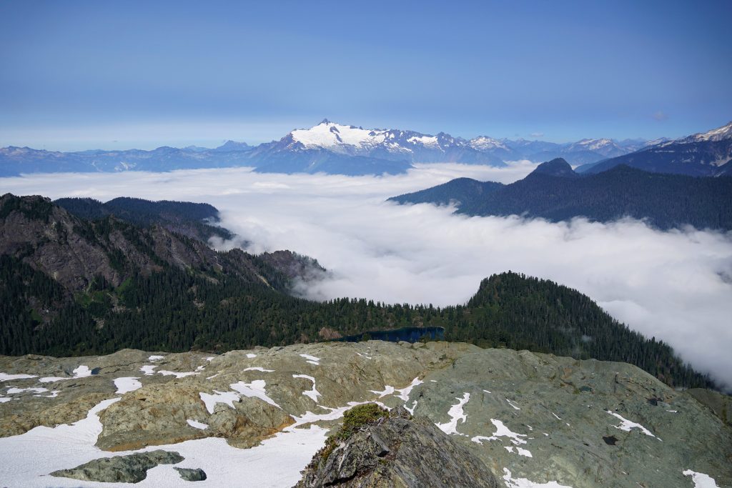
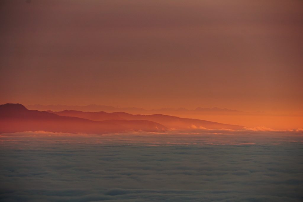
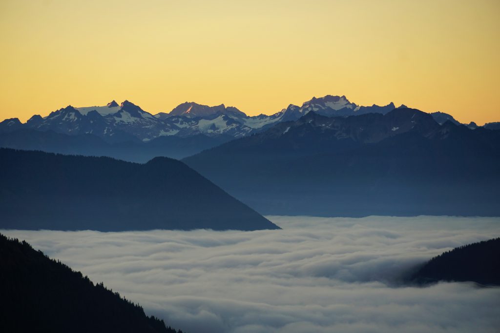
All day, the marine layer never burned off. In all my years in the Cascades, I do not think I have ever had the pleasure of watching a sunset over a marine layer. The blanket of clouds isolates one from the rest of civilization. It truly creates a division between the world up here and the world down there, that feeling that is so drastic when hopping between normalcy and the alpine like we do as weekend warriors.
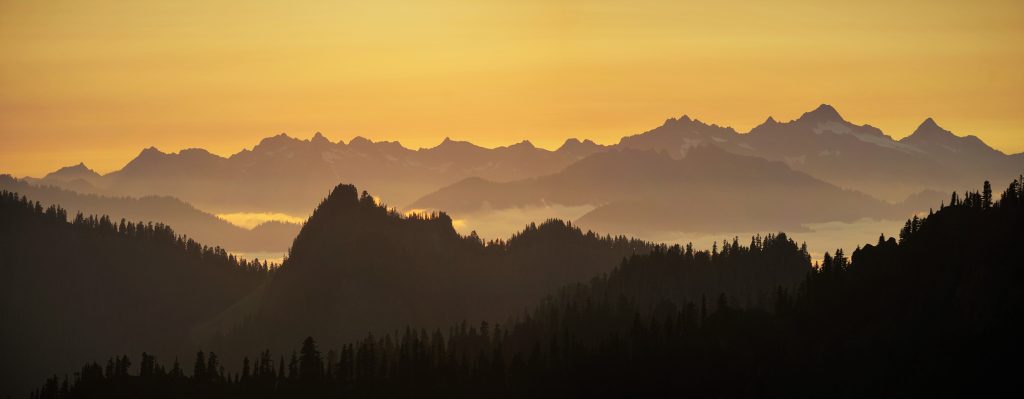
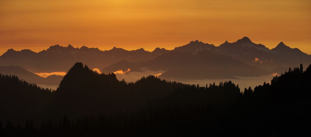
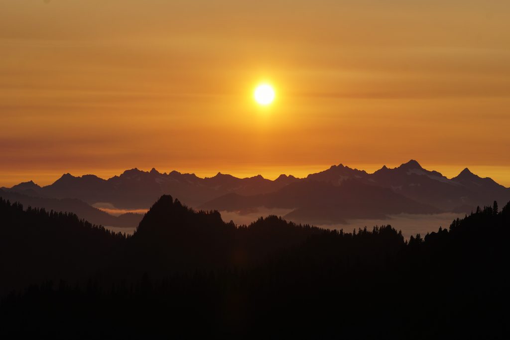
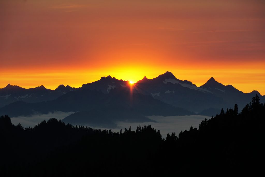
The thing with Cascade High Routing versus in other ranges, is the relief is so great from the valleys to the alpine, that even at camp, you have such incredible sunset views above the valleys, instead of just being walled into a little lake cirque.
There was a thin layer of haze near the horizon, muting the colors when they should have been peaking. However, there was the thinnest sliver of clear air beneath this layer. When the sun finally hit the sweet spot, brilliant light flashed across the tops of the marine layer. A moment later, it was gone.
When we arrived back down at our camp, we were startled to find thick condensation on our sleeping bags, as we were planning to bivy all trip with the warm temperatures and low humidity. So we picked up our gear and frantically searched for higher flat spots, eventually spreading out across the upper heather benches. Fortunately, we stayed dry that night.
Day 2: Elementary Peak to Lake 5360
The marine layer had rolled back even thicker the next morning at dawn.
As we descended towards the Diosbud Lakes, the brush very quickly transitioned from dry to sopping wet. We were very grateful we did not camp a few hundred feet lower!
By the time we reached the Upper Diosbud Lakes, we were all completely soaked, head to toe. I had almost gone an entire summer without entering a Cascade washing machine!
We chatted with some fishermen camped here and then continued on our way. This is where it got really bad. We made the poor decision of trying to sidehill tall, wet grass, seduced by an apparent climber’s trail. Instead, we just spent an hour slipping and soaking ourselves, ultimately having to descend a few hundred feet to the valley floor to get around cliffs anyways. We lost quite a bit of time and sanity here. But the Cascade low routing was only just beginning.
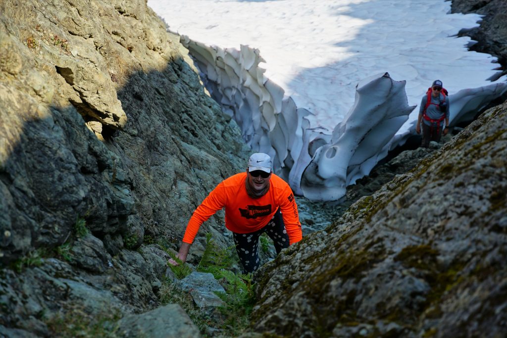
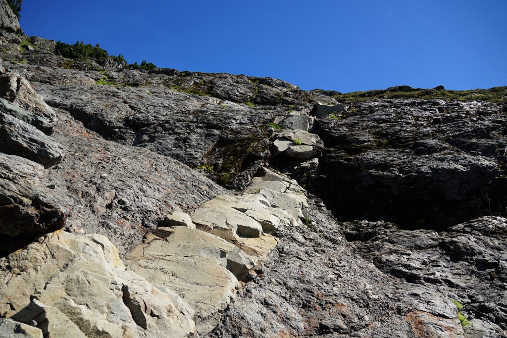
At the base of the waterfall, we regrouped and started following the path of least resistance up and left. It was definitely trampled by other parties. There was some surprisingly fun third class mossineering followed by a wonderful alder tunnel. A hidden rightward traverse led us into some open gullies, finally past the brush.
We generally prefer doing these high routes organically, meaning starting with just a vague description of the route and figuring it out ourselves in the field. However, these gullies were very complex terrain with little visibility.
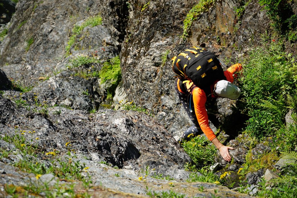
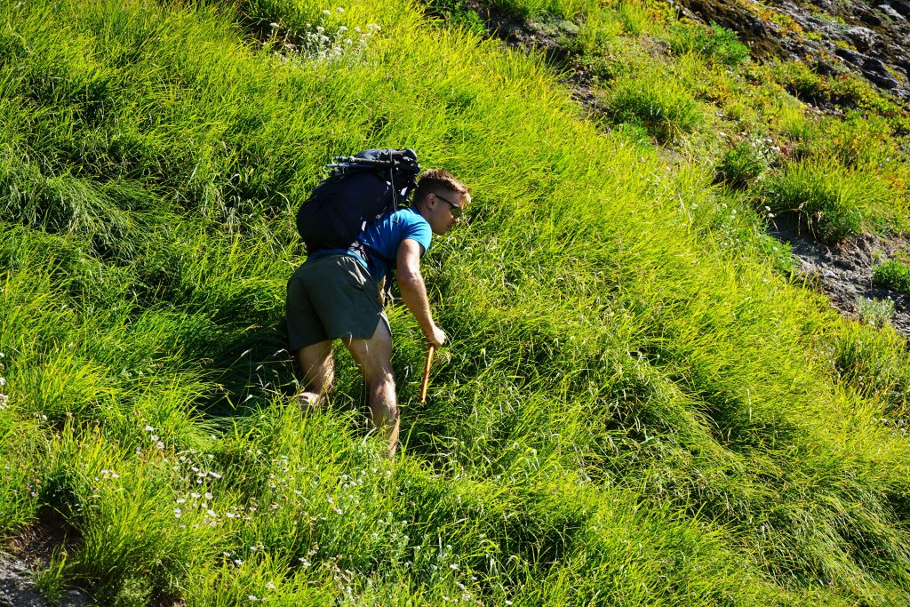
Eventually, we realized that we were way too far left. However, when we tried to cross right, we got cliffed out continuously. Near the top of the ridge, we found a steep, exposed 40 degree grass slope. It was a bit tenuous to traverse. Where the feet were bad, the ice axe dagger placements were strong, and vice versa. It went.
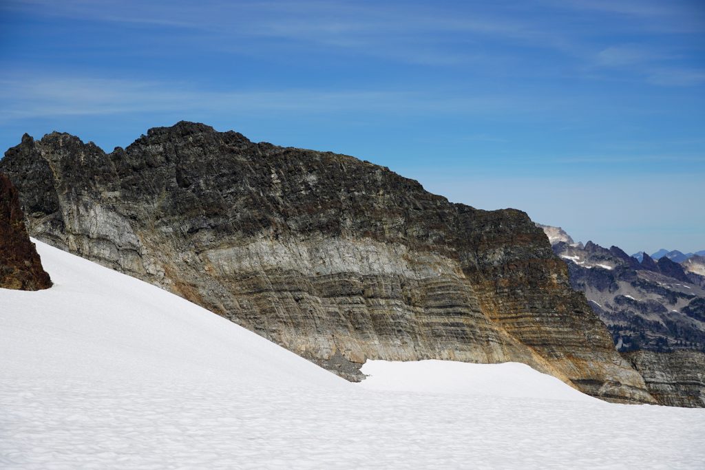
It took us about 4 hours to reach Lake 5400 beneath Bacon from camp, a distance of just a few miles. This speaks volume about how difficult Cascade low routing is compared to high routing, and just how rugged the Cascades are in general. The cliffy forests are pretty messed up terrain.
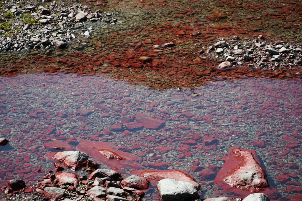
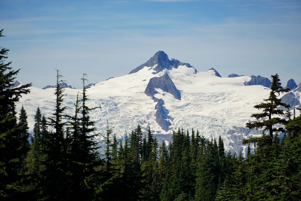
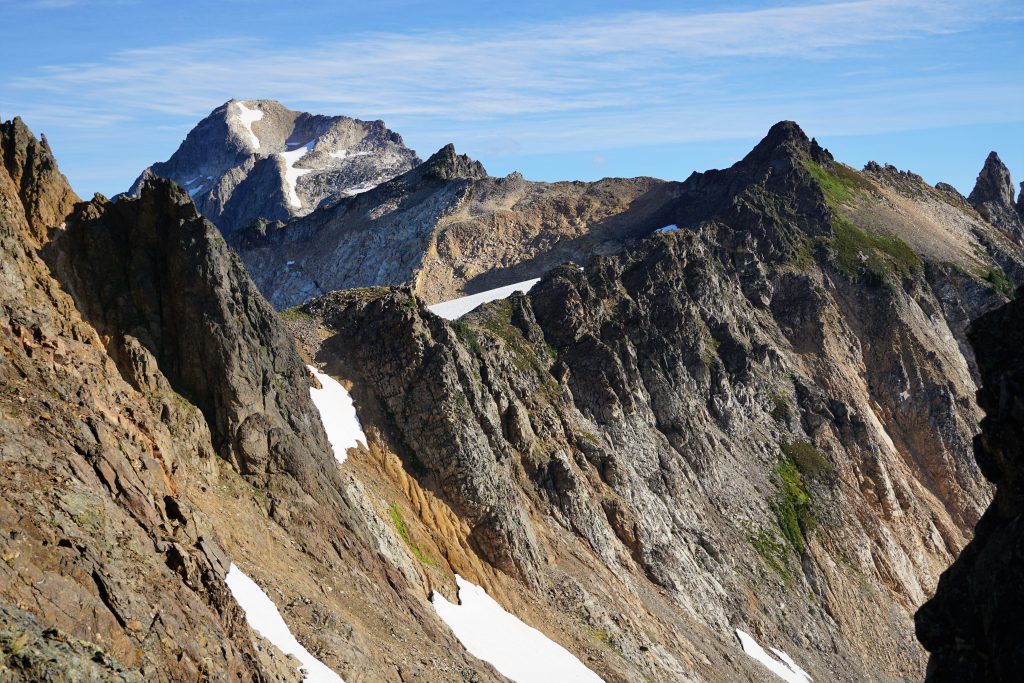
We took a nice long lunch break here, ringing out our socks and drying in the sun. Then we began climbing up the south side of Bacon Peak towards the upper snowfields on the southeast side. There was a rotten looking gully, but bomber dike splitting some 5th class slabs off right, offering a literal staircase through the worst section. The geology of this area is pretty wild. I wish I could say something more intelligible, but that’s really I can manage.
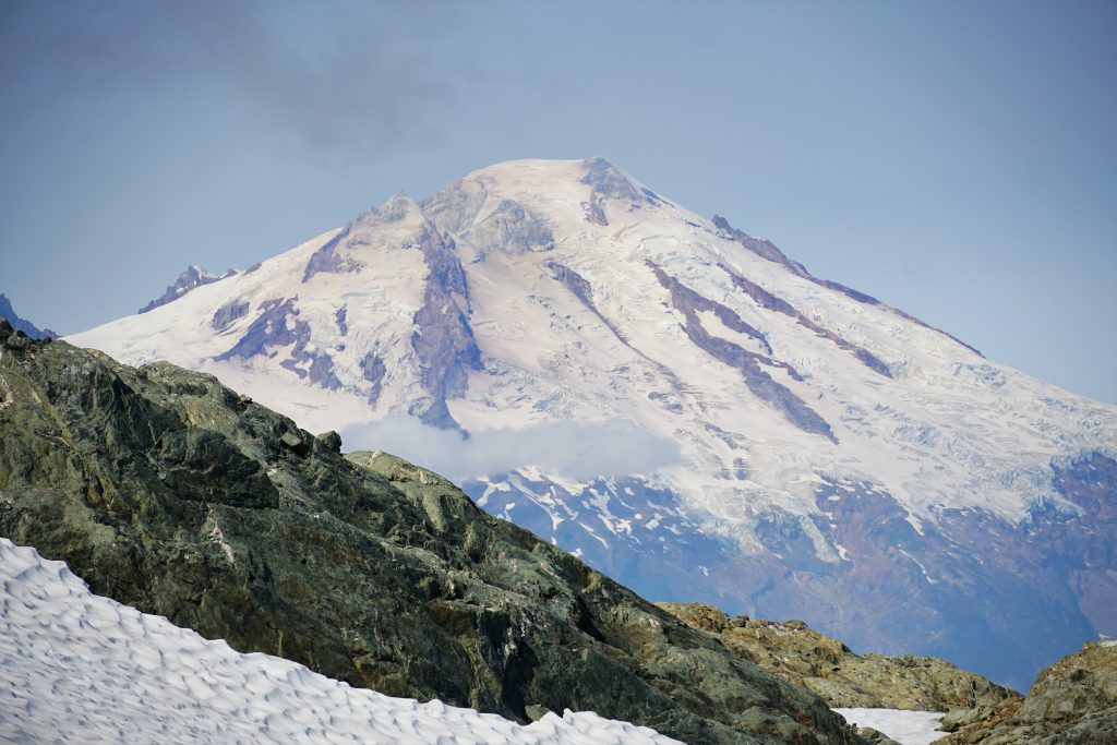
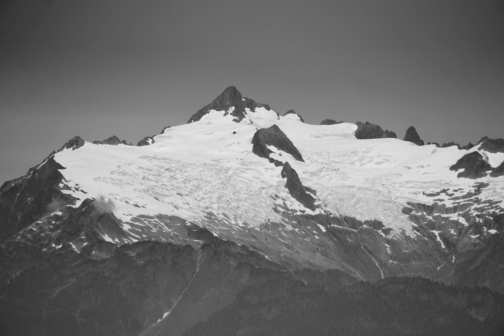
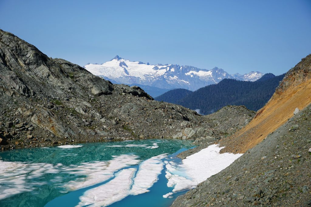
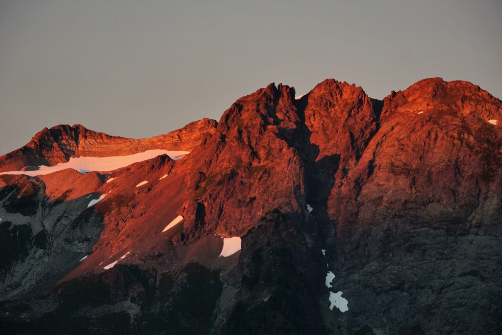
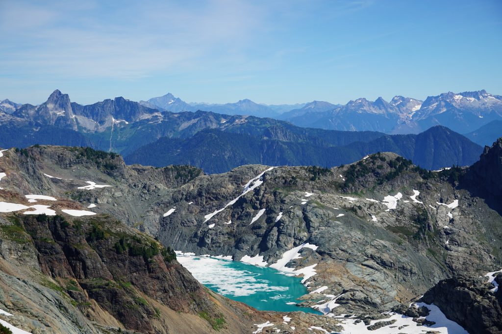
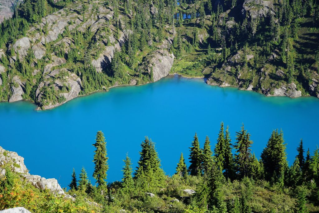
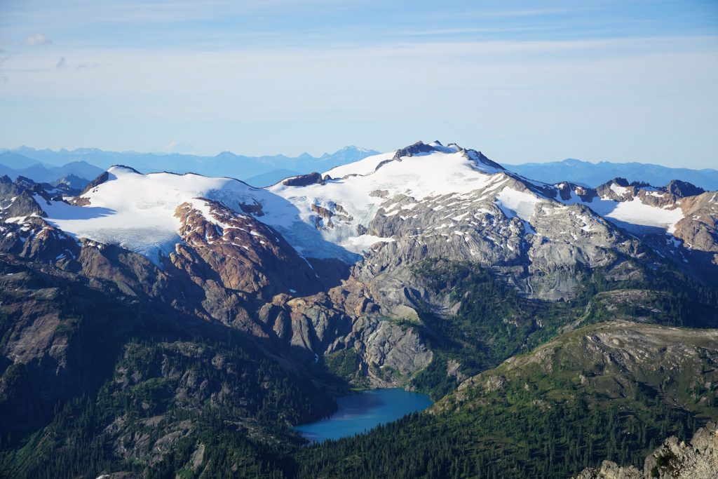
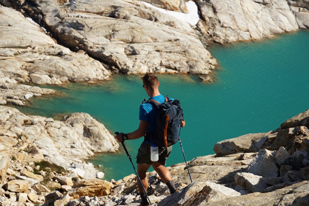
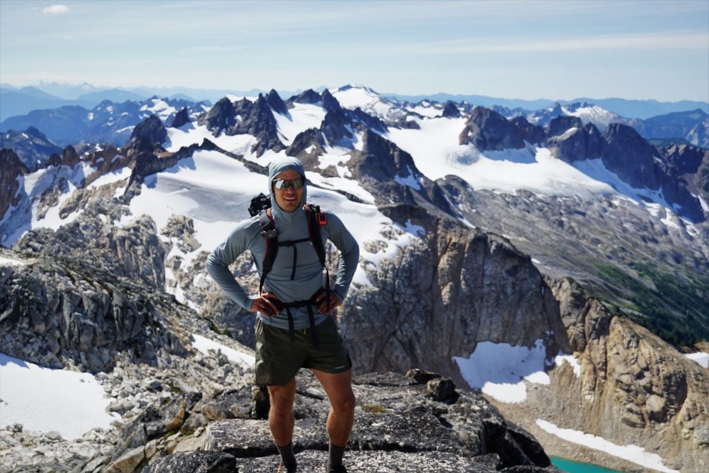
We popped out on the ridge around 6400 ft and got our first views of the east side of Bacon Peak. There was a beautiful glacial lake beneath Canadian Bacon with some big crevasses spilling into it.
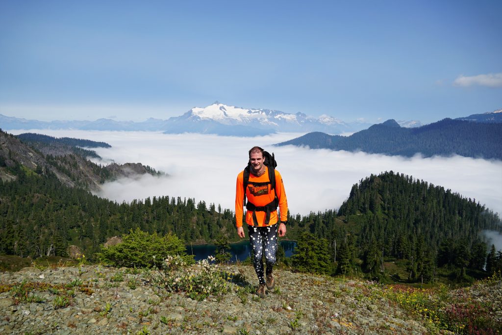
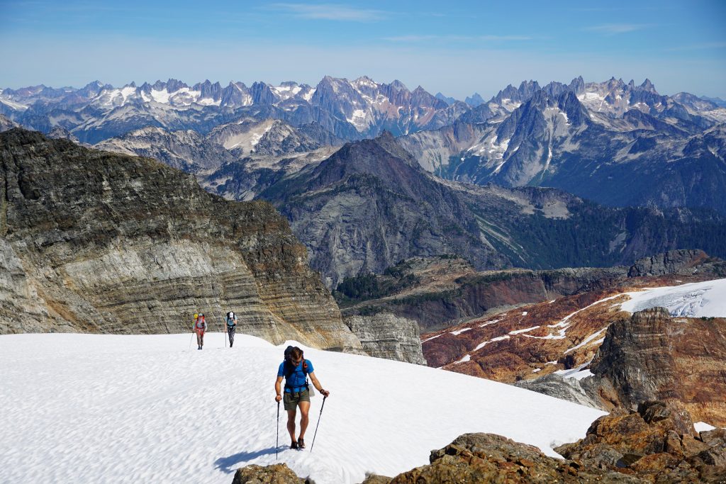
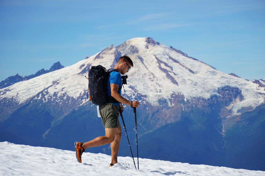
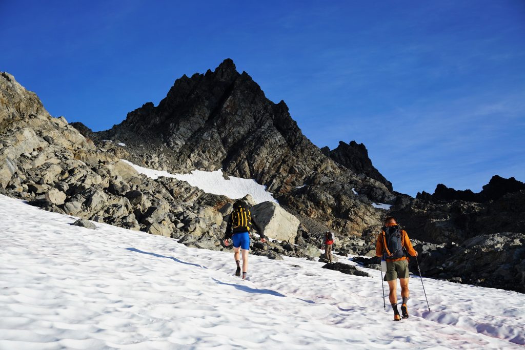
We crossed onto the southern snowfields, moving about 10 times faster than we had that morning. Eventually, we reached the broad glacial plateau and continued onto surprisingly non-suncupped snow. How the snow is less suncupped here in September than the Sierra or Winds in July? Not sure, but it’s that Cascade Magic.
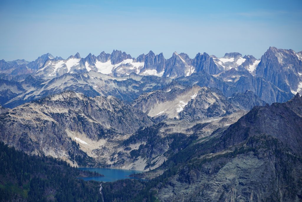
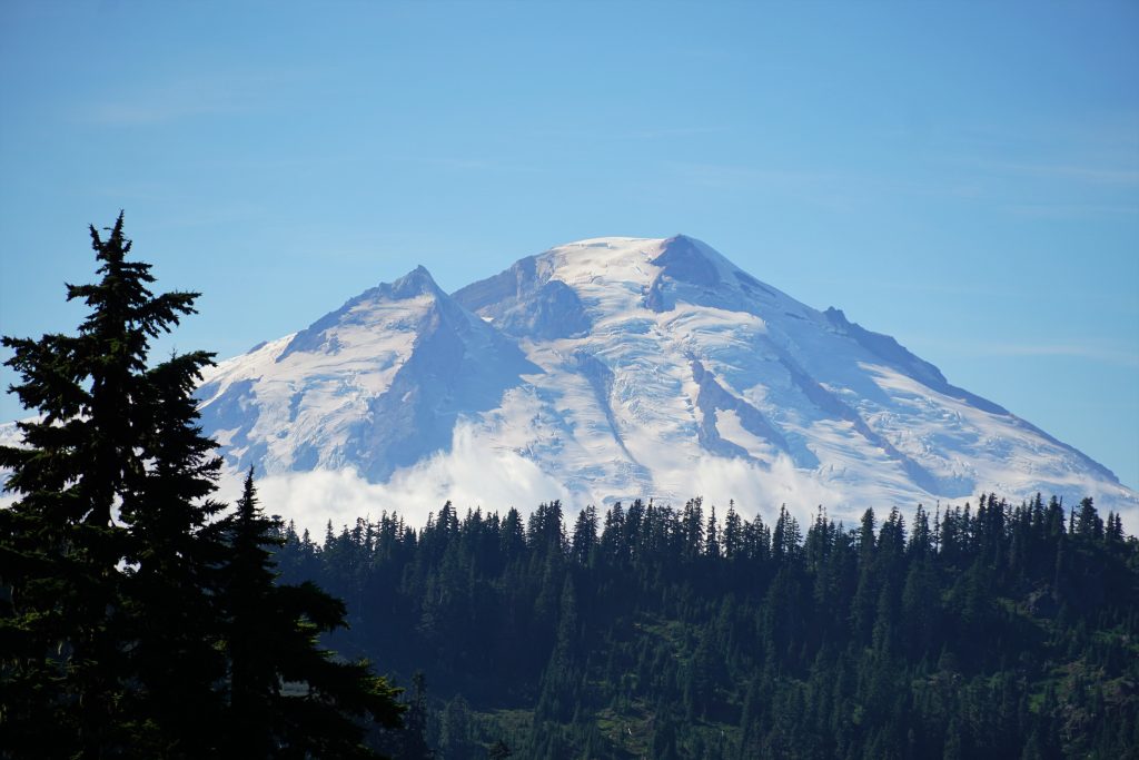
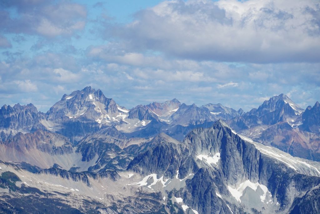
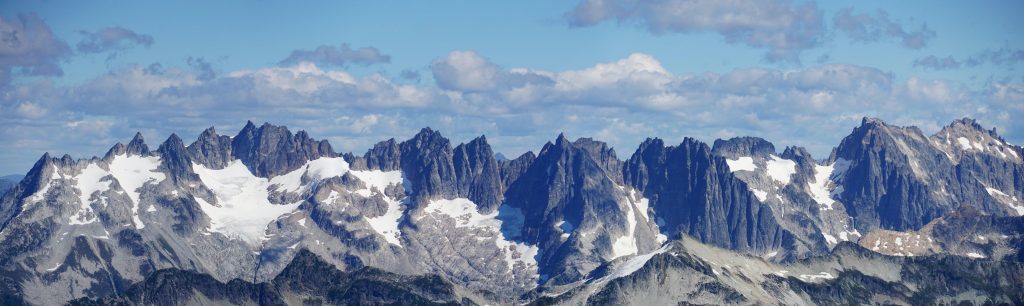
You could just point the camera in some random direction and snap a great photo – the Pickets stood proud to the east, Dakobed and the Cascade Pass area to the southeast, Baker to the west, Shuksan to the north. The eye candy was endless. It was as immersive of a location in the Cascades as anywhere.
On the summit, we met a couple who was doing the high route in the opposite direction. That means 3000 ft more gain than the direction we were doing it! Somehow, they had done it once in that direction before and were doing it again that way. Some people are tougher than us…
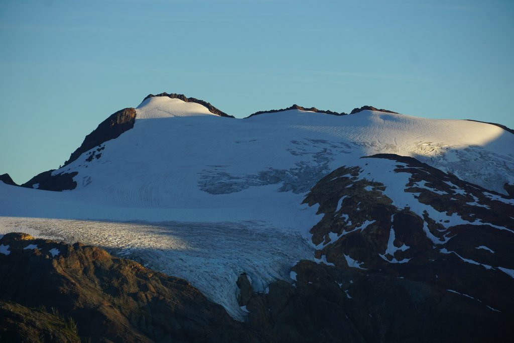
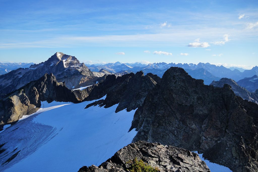
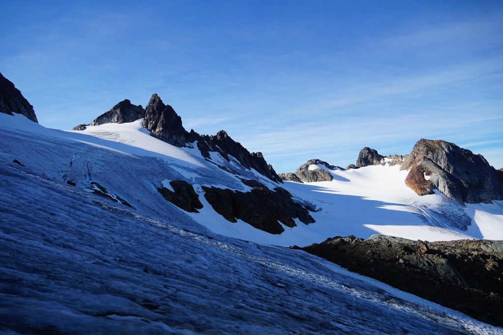
There’s this epic wind cirque near the summit. At this time of year, it is a 100 ft tall ice wall that tips to near vertical at the top. This would be an epic ice crag destination!
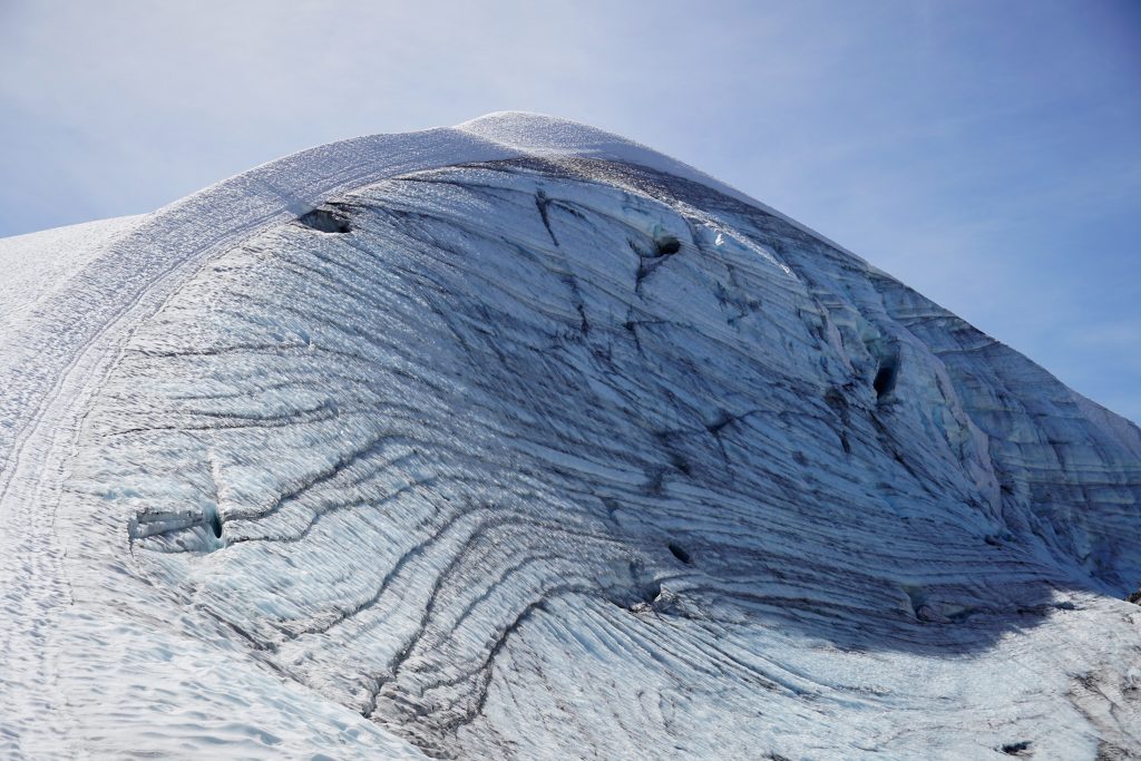
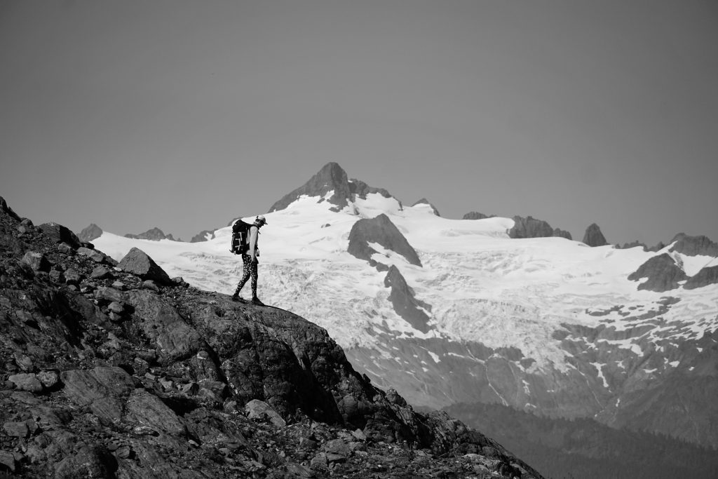
We descended to a notch, crossing onto the north side of the massif and continuing across left and high across the glacier. The amount of ice on this massif is quite impressive for a 7000 ft peak. I cannot think of another 7000 ft peak in the Cascades that is so heavily glaciated. The mountain feels much bigger than it is.
People often ask me, “how do you make the decision to bring a rope or not on a glacier?” There are specifics: season, weather, satellite imagery, risk tolerance, slope angle analysis. As a group, we had a good discussion prior to the trip about this and came to a consensus. In the field, we carefully discussed route choices to improve safety based on our knowledge of glaciers and this one in particular. But I always emphasize to people that with unroped glacial travel, there is always an element of risk and chance. Experience can help mitigate, but will never fully eliminate risk. The nature of the problem is simply too unknowable and dynamic. I think there’s this misconception that unroped glacial travel is a sign of experience or something to strive for. I’ve definitely become more aware of both the risks I take and how I portray the decisions I make to others. Never take the decision to travel unrope on a glacier lightly. Everyone has their own risk tolerance and I don’t like putting hard never/always rules on decision making in the alpine, which is such a dynamic environment. But I do believe that, when in doubt, rope up. At least, that way, you will never be making the wrong decision.
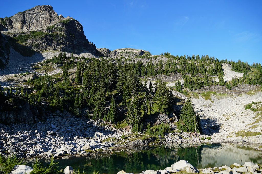
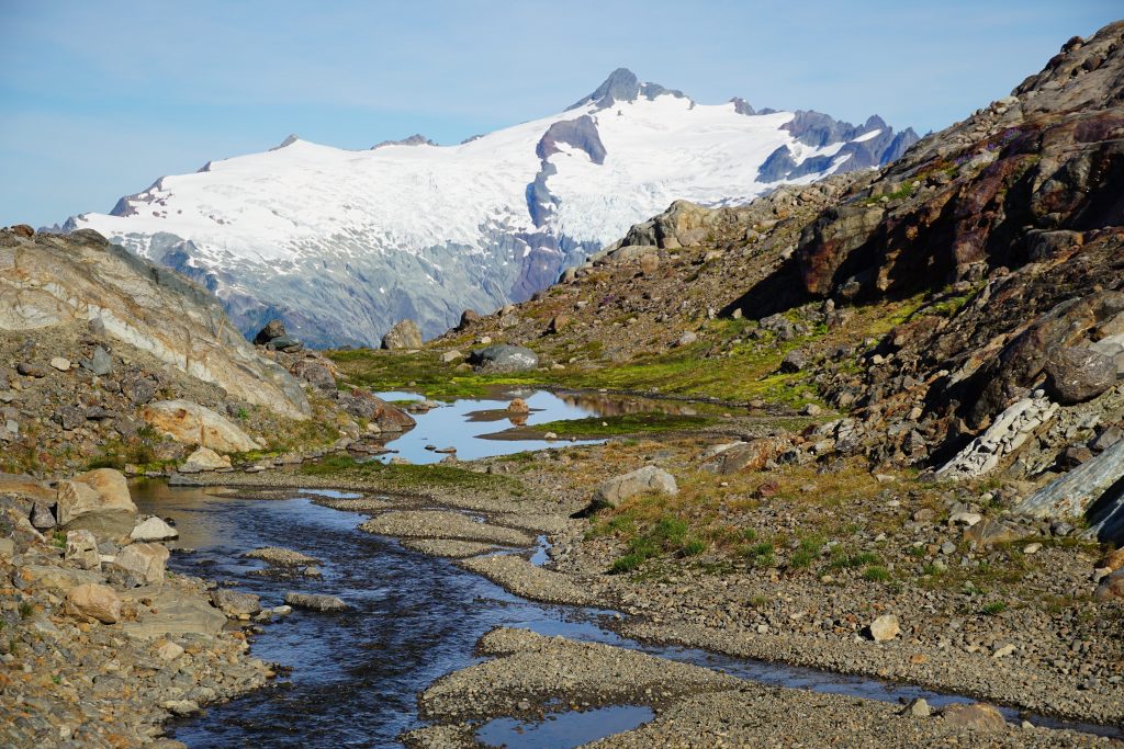
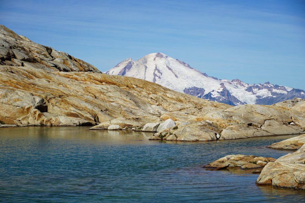
After stepping off the glaciers, we entered yet another wonderland of post glacial tarns and waterfalls. I have never spent so much time in glacial terrain so late in the season. The terrain is deceptively complex, yet wonderfully intricate. Travel is both tedious and mesmerizing. The snow is stripped away, leaving in full sight the power glaciers exert on this landscape.
We eventually found our way across a sloping ledge, splitting the lower cliffs that cross the entire face, and once again into perfect heather meadows, ripe with blueberries. Could the contrasts be any starker?
We traversed over a few high bumps. The subalpine tarns here were stunning, surrounded by fields of blueberries, heather, and endless views. This was a place where it was hard not to linger. It reminded me of the Hanging Gardens – soft in the foreground, harsh in the background, in the middle of it all. Powerful, yet gentle.
What do real estate agents say? “Location, location, location.” In high routes, I’ve realized everything is about “position, condition, position.” The position here was as good as any spot I’ve ever been to, anywhere. We were lucky to also have pleasant conditions.
We would have loved to camp atop these heather knolls, but knew we had to continue to make our last day reasonable. We dropped down towards the 4500 lake, once again diving into the brush. Much of this “high route” is actually a “low route”.
The climb from this lake is hilarious: steep, 3rd class in places, brushy. Somehow, it comes out to an average slope angle of like 20 degrees, but it felt pretty damn relentless. Finally, we topped out on a spur ridge and rambled to Lake 5360.
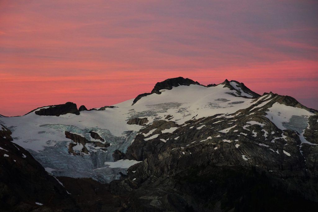
Sunset views were not quite as spectacular as the previous night, but there are certainly worse places to eat dinner. As temperatures dropped, Steve realized he had left his pants back at the last camp! So I lent him my long johns for warmth and leg protection during any future bushwacking. By the time we would reach the trailhead, his tree-trunk thighs had split the crotch open. Oh, Steve…
Day 3: Lake 5360 to Baker River Trail
The night began with vicious condensation. But partway through the night, an east wind began and the air immediately dried up. This was the same easterly flow that would aid in record breaking fires all across the PNW this Labor Day.
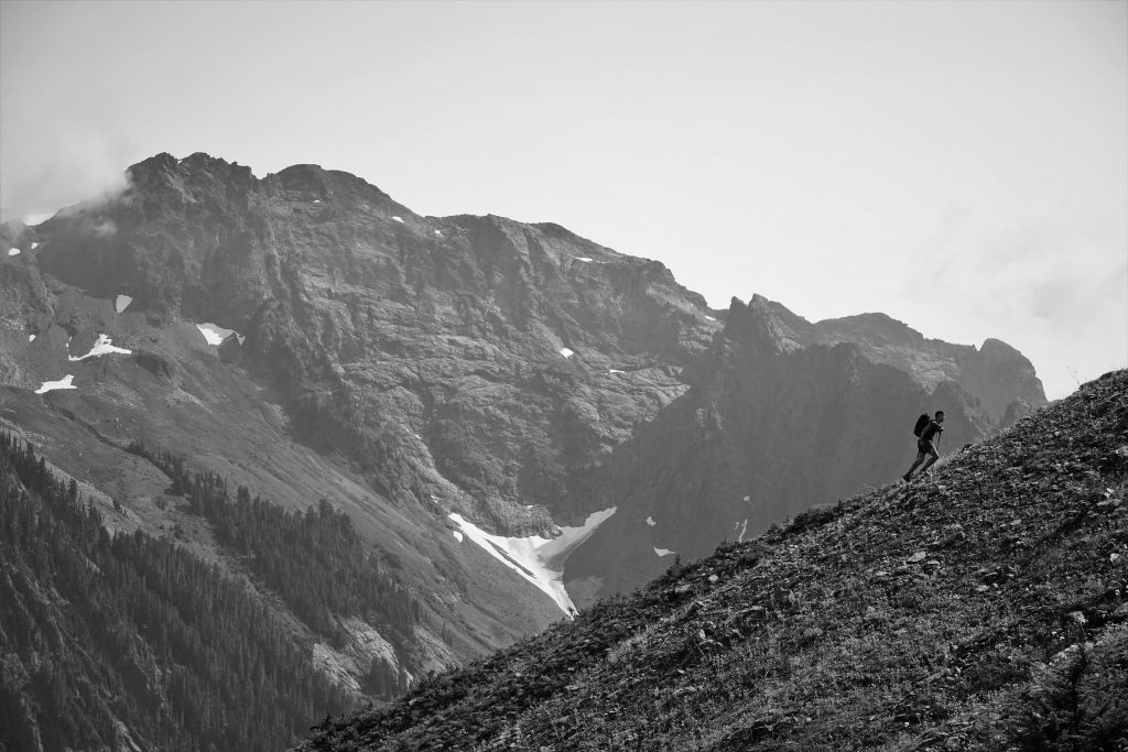
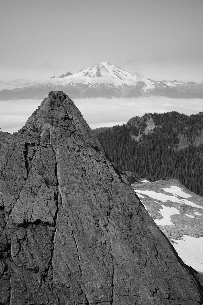
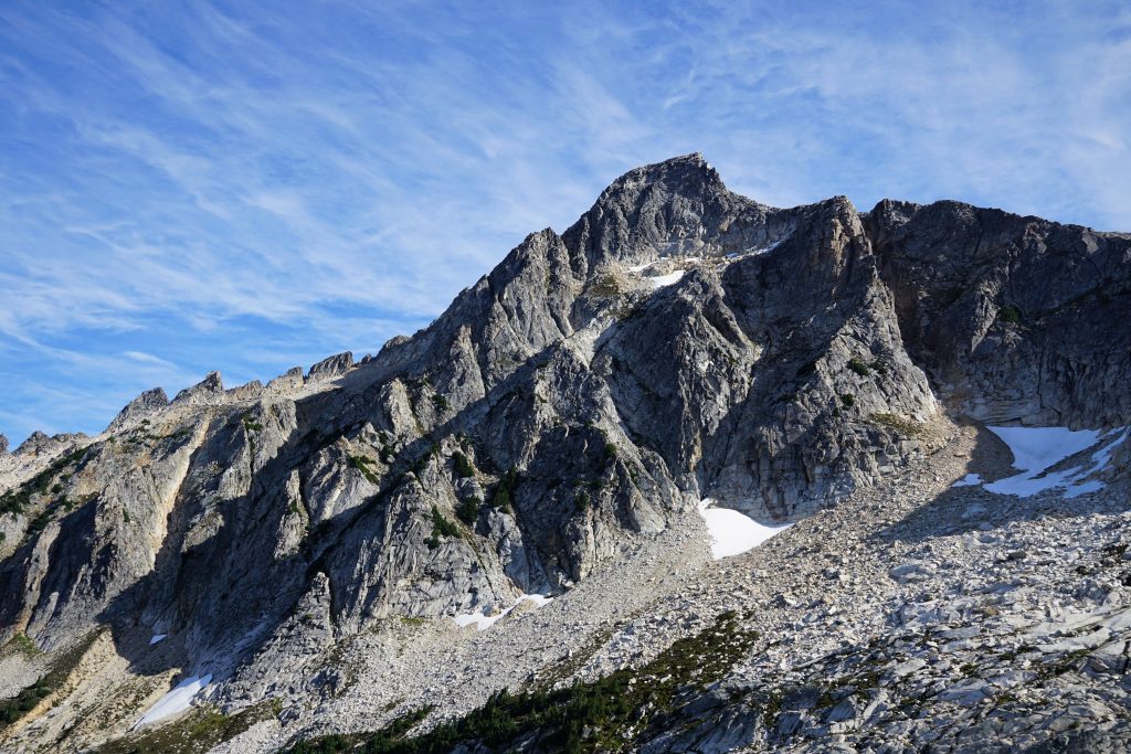
We got an early start, climbing the shoulder towards Hagan. The southeast side of Hagan is a moraine wasteland. Whenever we had northern exposure, a harsh wind chilled us to our bones.
At the high pass, we dropped our packs and scrambled a few hundred feet to the summit of Hagan.
Atop Hagan, we watched clouds race in from the northeast and fade out over the hills.
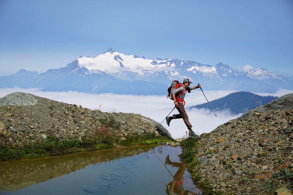
We crossed the upper part of this glacier to a notch that would hopefully lead us to Blum.
At the notch, we viewed the rest of our hypothetical route. It involved some 45 degree sand, which we all agreed was a no-go.
So instead, we continued down the right side of the glacier, skirting the bit of glacial ice at the terminus.
After a nice snack on the morning slabbage patch, we began the long traverse across boulders towards the Blum Lakes. Compared to other post glacial terrain we traversed, this section was rather easy.
We spotted a pass in the ridge in front of us that seemed like it might lead us to the upper Blum Lake. So we popped over the notch and then walked down beautiful granite slabs to Upper Blum Lake.
We took a nice break here and debated going up Blum. Ultimately, we decided to go for it. It would be an aestethic finish to the high route. Additionally, then we would have bagged the four main peaks on the route: Watson, Bacon, Hagan, and Blum. Oh dear, I’m starting to sound like a peakbagger…
We passed a couple who was turning around due to time. They gave us some helpful beta on the descent from the Blum Lakes.
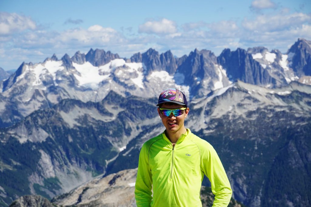
Scrambling from the lake was excellent: polished, yet sticky granite slabs. Up high, we climbed a gully and reached the upper basin. Steve and I spotted an aesthetic ridge leading directly to the summit. Why not? Kinfe edged on one side, we danced to the crunch of lichen, scurrying towards the summit. I love how Steve and I always end up on these random features. Alpine improvisation.
The final few hundred feet were less exciting, but the summit was wonderful. If we peered over the northeast side, we were met with 40 mph winds, but on the flat summit, it was calm.
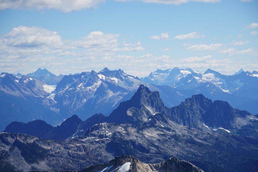
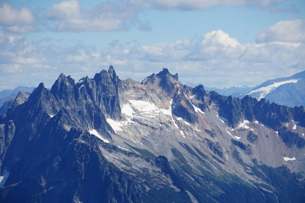
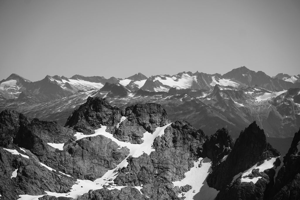
Blum is the highest peak between Shuksan and the Pickets. It is definitely the best view of the Northern Pickets as I have ever gotten. They are simply an impenetrable wall.
Now, only 7000 ft of descent through cliffs and brush separated us from burritos.
Getting down to the lower Blum Lakes involved navigating an absolutely terrible poop chute. From the lower Blum Lakes, we traversed the hillside at about 5000 ft, occasionally finding signs of use but much. This section was not very enjoyable. In retrospect, it was better than what we were about to begin.
The ridge descent started out pretty well. We picked up an obvious climber’s trail around 4500 ft. The ground was soft and travel was fast. It felt like a lot like the Terror Basin Trail. However, as it steepened below 4000 ft, we started losing the trail. We’d just follow the obvious path of use, until it slowly started to fade into a vertical jungle. Then we’d schwack one way until we found the real trail. This happened over and over. We’re quite good a sniffing out use trails, in fact, I might call use this my best skill in the mountains. But this one was hopeless. The flagging was never quite where it was needed, only where we didn’t need it. We somehow kept going down the wrong path and ending up in a wall of cliffs and brush. Progress was bitterly slow. We were hot and tired and beaten.
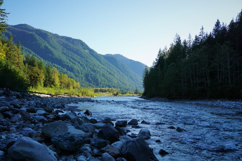
We completely lost the trail closer to the bottom, but heard voices. It was our friends from earlier! They were actually on the trail, so we found them and continued on. At the end, we just walked along Blum Creek until finally exploding onto the road/trail that they call the Baker River Trail. We immediately went to wash off in the river.
The final walk across a broad bridge and gravel trail felt almost too civilized after that epic descent from Blum. In fact, Steve instead took a log crossing because he said the bridge was aid. 3 days in the rugged North Cascades can certainly do a number to the soul. But Steve? He’s always like this.
Reflections
This was by far the most rugged high route I have ever done. On paper, it looked doable in a day, but I am glad we did not try that, because that would have not gone well. The scenery is also as beautiful as any high route I’ve done. There are spots where one could linger for days. I will definitely come back someday. But the entrance/exit fee is pretty steep, so I will give it a few years for the bad memories to fade.
This is the first late season glacier trip I have ever done. While it was definitely slower with such little snow coverage, I thought it was incredibly beautiful and brought a new perspective to the terrain. We passed probably a hundred picturesque tarns and marveled at the crevassed snouts of the glaciers. The power of the ice to shape these landscapes was on full display. As permanent ice begins to leave the Cascades, what forces will shape them in the future?
Notes:
- Our route, including all side trips, totaled to 28 miles and 14k gain, along with 17k descent. The terrain is deceptively complex and challenging.
- There is a lot of steep brush and heather, so I would not want to do this route when wet. The wet brush on our second morning really made things challenging and miserable.
- I could never really see going the other way on this route. Descending steep brush and cliffs and definitely better than going up it. Maybe the Blum climber’s trail would be easier to follow on the way up, I guess.
- Nothing on route ever exceeded class 3, but there is definitely more full on scrambling and mossineering on this route than other classics like the Ptarmigan.
- There were a surprising amount of mosquitoes for early September.
- Don’t forget your pants!
Wow, thank you for this report! In July, my husband and I attempted Bacon and Canadian Bacon in a day, but we were destroyed by the FIRST approach, to Watson Glacier. As soon as we saw the next descent into the valley floor, we said “nope!” and just played around on the glacier (we had our glacier kits), lounged on the boulders, and climbed Watson instead. We keep talking about trying again as a light backpack. BUT after reading this report…. I dunno! Looks like the terrain is even more unforgiving, the whole way through.
Your photos are amazing, but man this trip looks frustrating. Not sure if we can bring ourselves to try again. Thanks so much for this report as there is not a lot of current info about it. I’m sure we’ll refer to it again as the temptation creeps back in.
Congrats!
Hey Angie! The section from Watson to Bacon is definitely pretty full on. If your goal is just to climb Bacon, you might want to take a look at the highway 20 approach. This could be the most direct way. http://www.stephabegg.com/home/tripreports/washington/northcascades/bacon
Awesome, thank you! Been enjoying your posts, gives me great ideas 💡
Wow, I’ve never gone far without a trail before, it looks tricky but also super awesome!
A lot more effort, but most definitely worth it!
Shukee-Cheese hahaha
Good stuff Kyle!!
Thanks PH! That’s one that you have climbed!
Hi Kyle,
Thanks for the inspiration and fun stories. I’m planning on having a go at this route this August. One question I had (forgive my ignorance) is what you mean by “the entrance/exit fee is pretty steep”. Are you referring to the NP backcountry permits or some other fee. I’m new to the PNW and just trying to learn how things work up here. Thanks!
Oh it’s free with a NCNP permit, I just mean that it is a lot of effort!