
Table of Contents
A Land Before Time
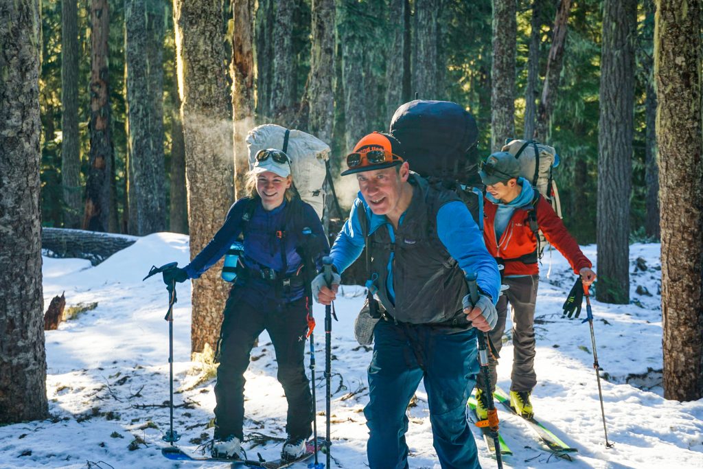
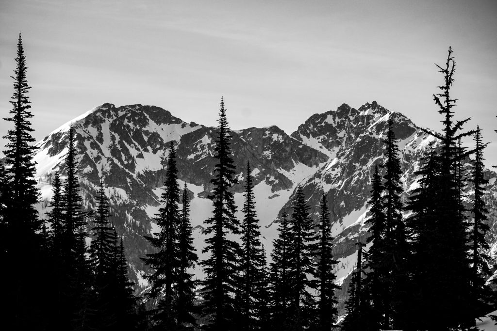
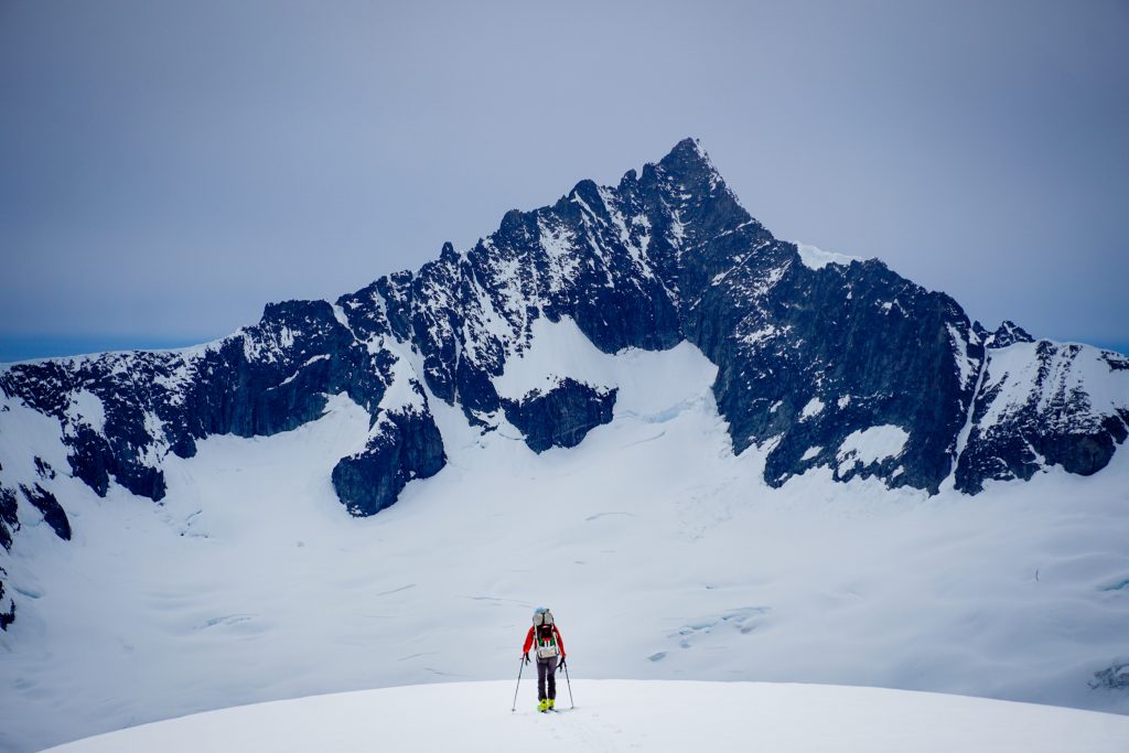
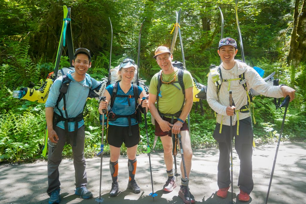
Over an extended four day Memorial Day Weekend, KJ, Silvia, Doug, and I skied from Easy Pass to the Cascade River Road across the Heart of the North Cascades. It was the most continuously scenic route I have ever done and more than made up for the marginal snow conditions. It was the perfect way to cap off an incredible month of spring skiing.
I first met KJ two springs ago on the Birthday Tour. He had just finished a two week High Sierra ski traverse. Since then, we have talked about doing a big Cascade ski traverse and this year, we narrowed in on the Easy Pass to Cascade Pass route. Lowell Skoog completed a very similar route, which he called “The Logan High Route“, over a few attempts many decades ago. KJ drew up a very similar route, except we were going to do a slightly different start and exit and do some extra skiing around Mt. Logan itself.
We all met up Friday afternoon and drove up the Cascade River Road to leave our first car. It was dank and dripping in the lush valley. We talked to a party who had just gotten down from Eldorado and reported two feet of fresh snow and high winds! New snow is never good at this time of the year…
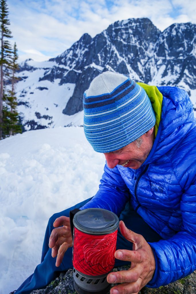
Fortunately, the sky and air dried out a bunch as we got over to Easy Pass and we settled down for the night under clear skies. We woke at first light the next morning, shuffled a bunch of gear around, made sure we knew where our car keys were, and then loaded up heavy packs for the beginning of a great adventure.
Day 1: Easy Pass to Spectacular Ridge
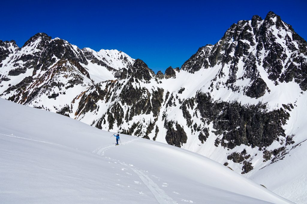
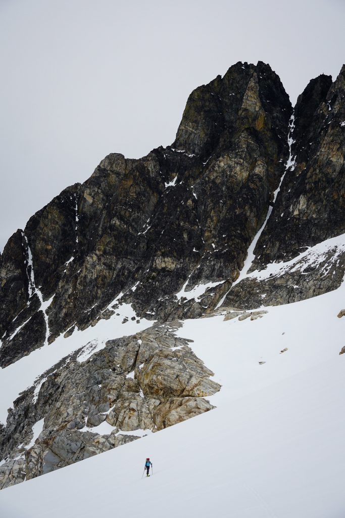
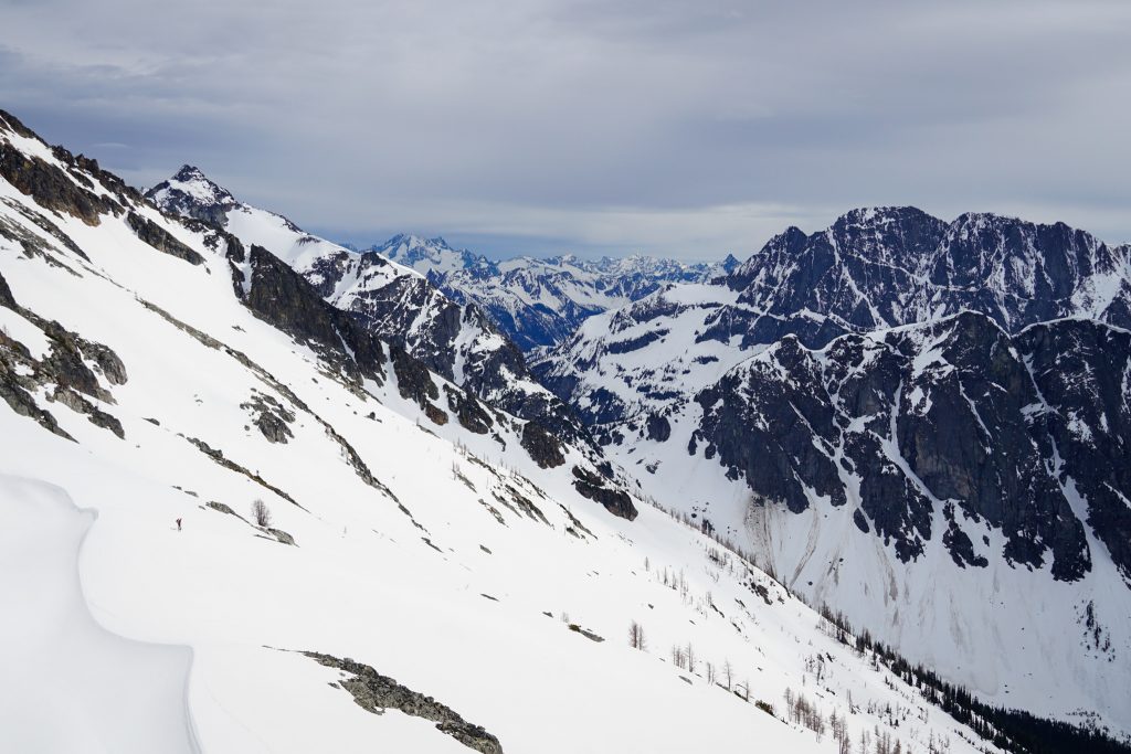
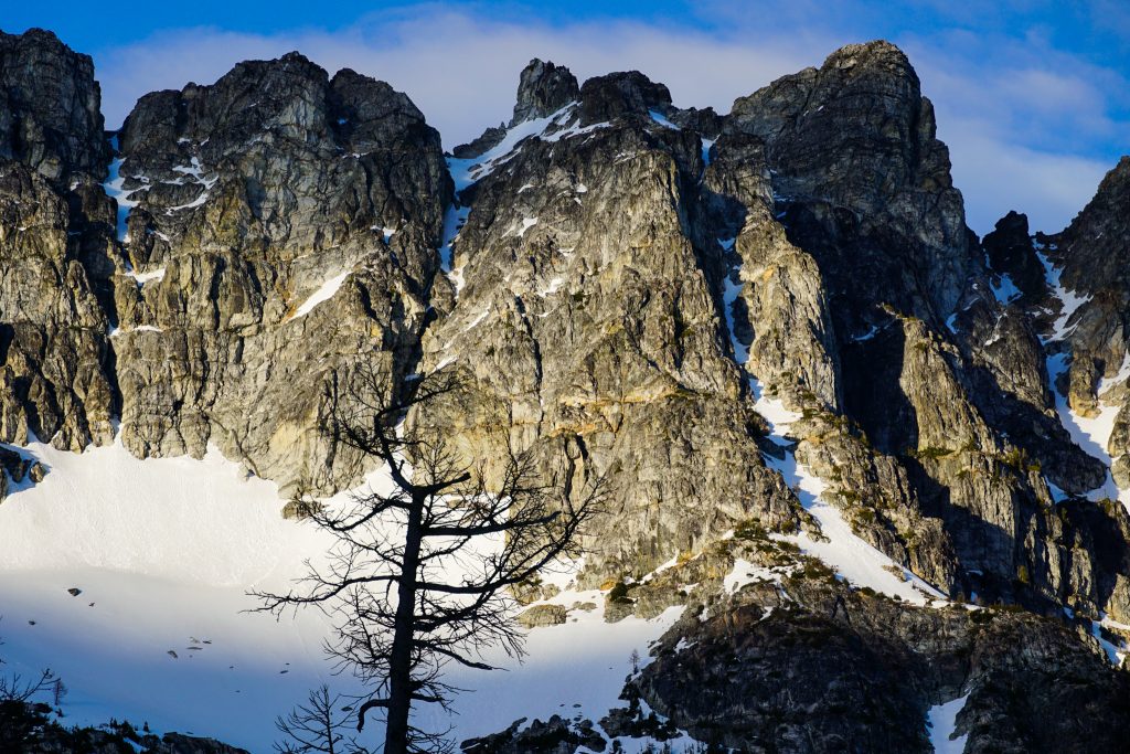
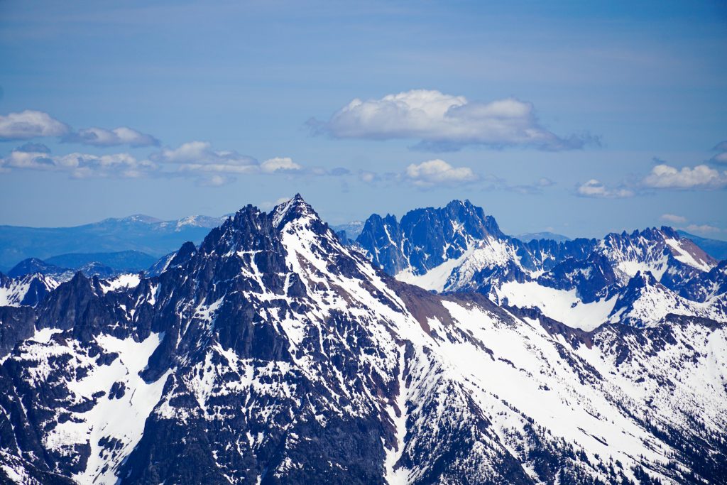
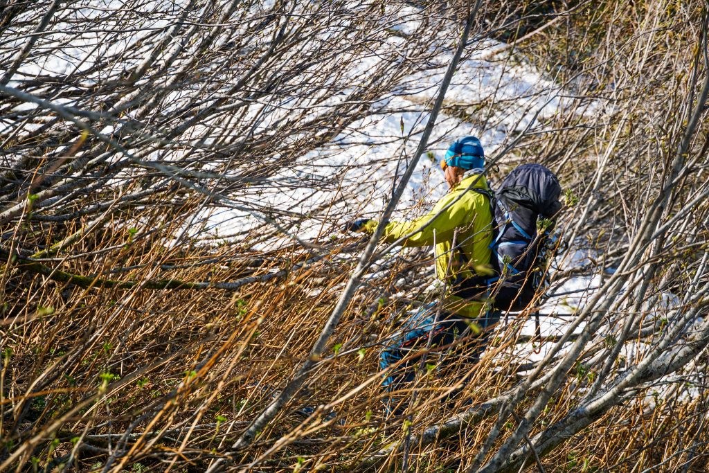
There was still patchy snow from the trailhead, even in late May, so we began by booting in our ski boots. Soon we were skinning through the sunny morning forest and gawking at the North Face of Graybeard. Doug has climbed it a few times and remarks it is one of the greatest, accessible north faces of the Cascades.
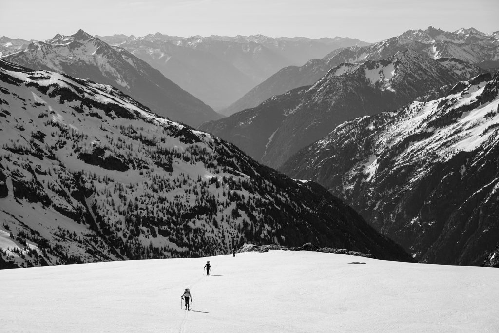
It was easy skinning to Easy Pass. Despite its accessibility, this was still somehow my first time to Easy Pass. The entire traverse, all the way to Sahale Arm, was actually completely new terrain to me. I was very excited to see so much new terrain that I had spent many months looking at on a map, visualizing and measuring. Somehow, it was also new terrain to Doug, even after a century of Cascade exploration.
Here at Easy Pass, there was barely a half inch of fresh snow. The rain shadow cast by the whole Eldorado Icecap is immense. Especially with these weaker spring storms, it seems to steal nearly all the moisture.
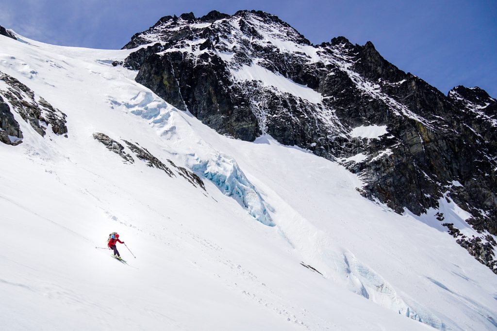
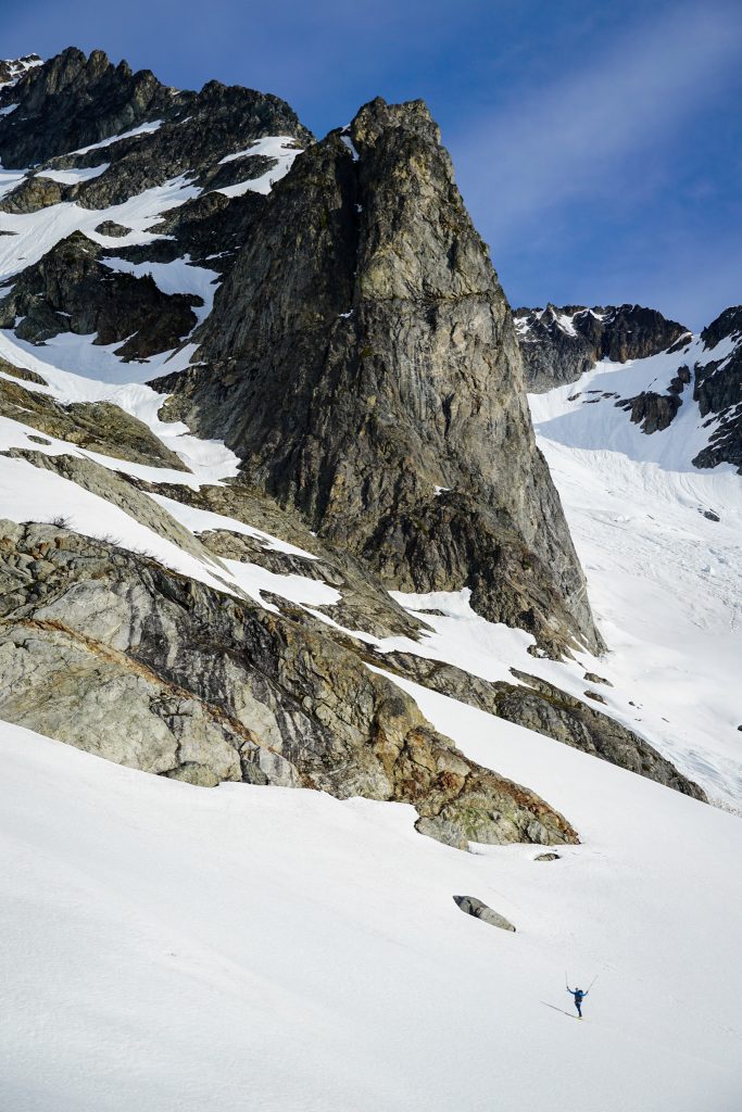
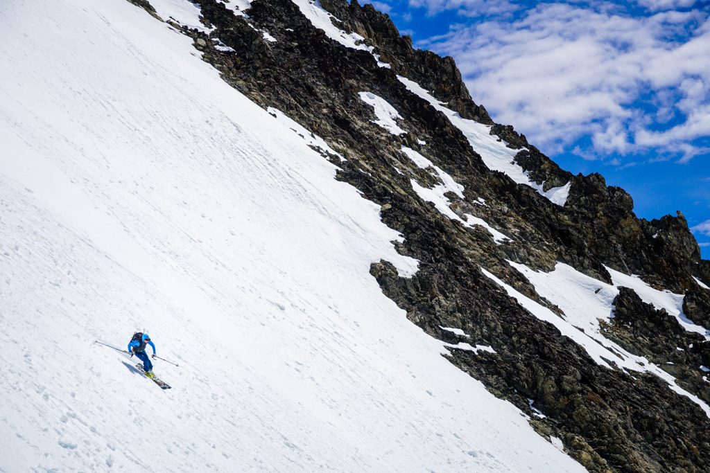
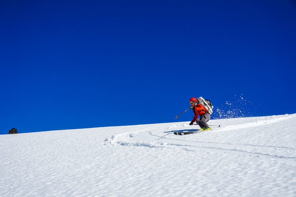
At the pass, I tried to unlock one toe piece and immediately snapped off the little piece that helps the toe piece stay locked. After my multi ski breakage disaster on the Snoqualmie Haute Route the week before, I was super nervous about breaking more skis. Turns out I did not need to be nervous, because I was going to break something immediately. So for the rest of the trip, I could not lock my toe out, which made steeper and firmer skinning challenging.
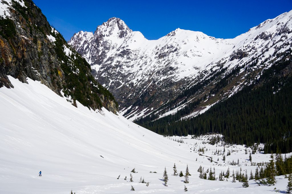
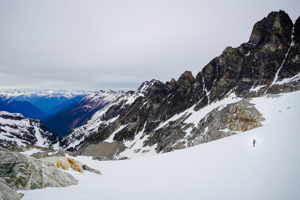
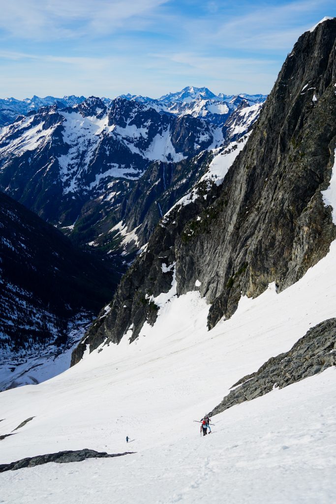
We switched to downhill mode and traversed a bit to the west before descending down into the valley. This south facing slope is pretty darn melted out, but we still somehow managed to link snow for all but about 20 ft to the valley floor.
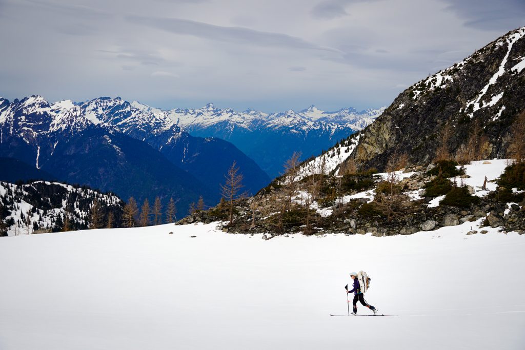
Fortunately, we were heading westward in the range and knew that snow coverage would improve dramatically. Next, we started a long, gentle, scenic skin up the Fisher Creek Valley. It was incredibly wide open and absolutely tranquil in the morning.
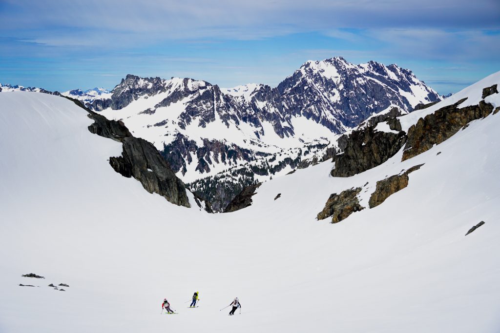
We turned right at the “obvious gully” and climbed to the Silent Lakes. This aspect was windloaded, with about 8-10 inches of hot, already putrid powder. The booting, however, was not too bad with a firm underfoot.
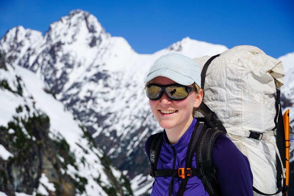
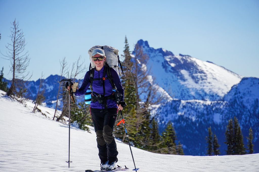
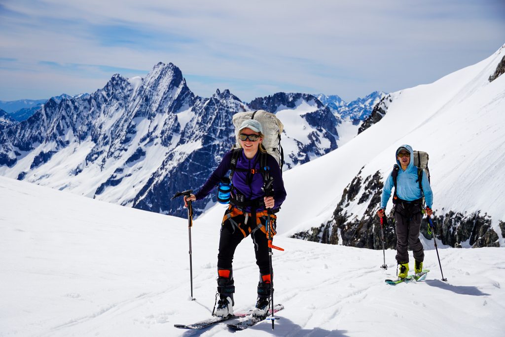
Silvia looked ridiculous with a pack taller and wider than her body. She hails from the (real) Alps, where you never need to carry overnight gear because you can just stay in huts. Along with a big overnight pack, she has adopted American ways by purchasing “fat” 85mm underfoot skis and a whippet. Hopefully her Euro friends don’t see this trip report and make fun of her too much.
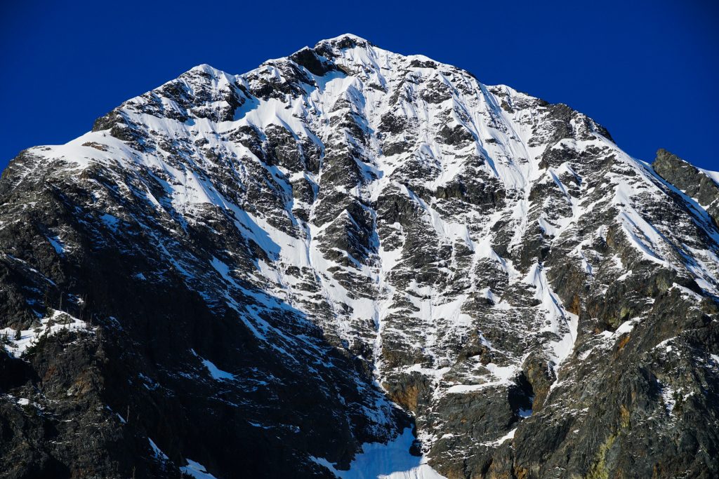
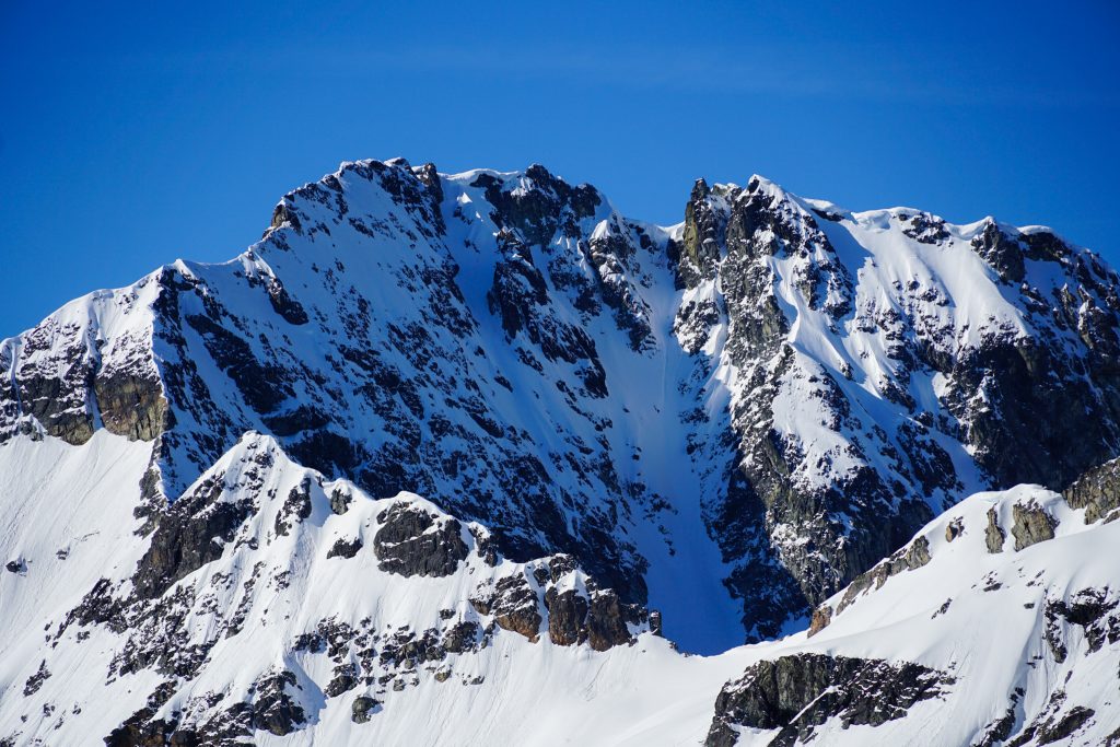
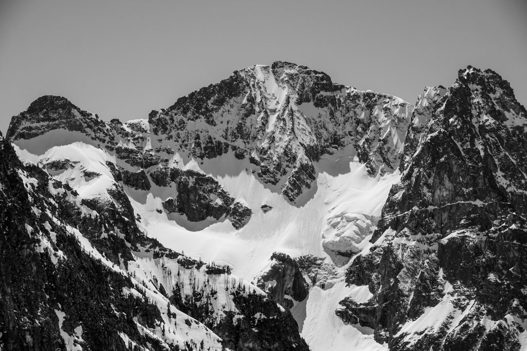
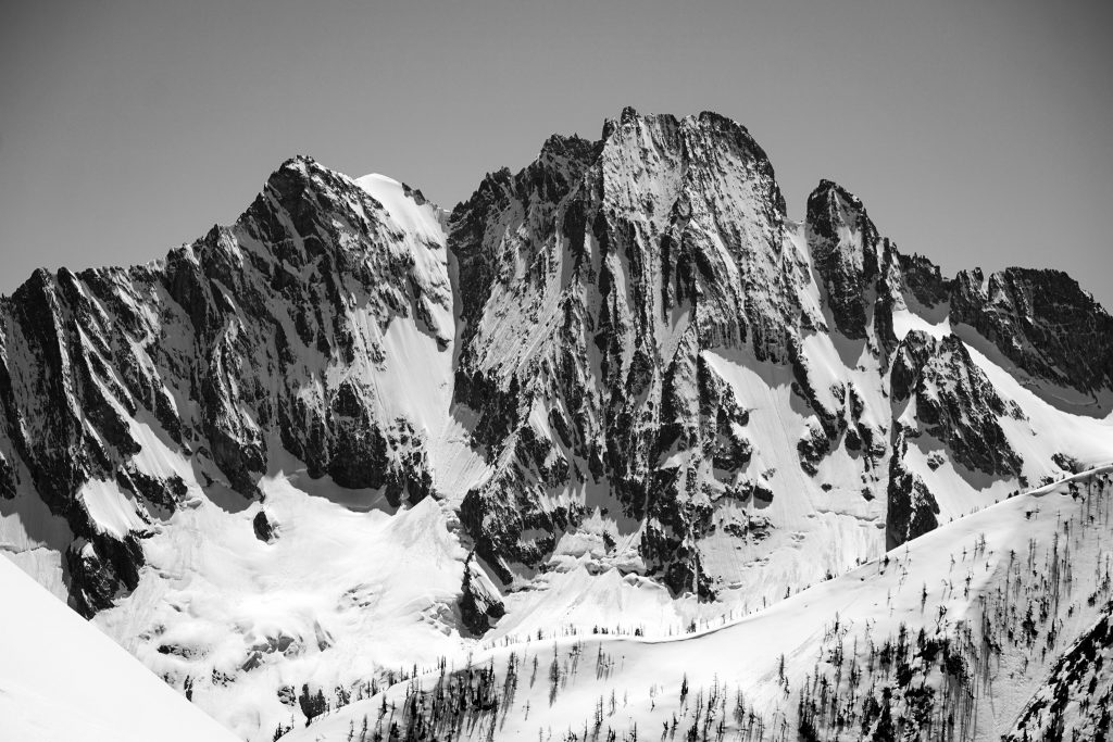
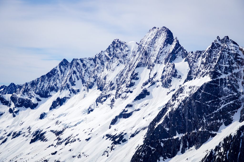
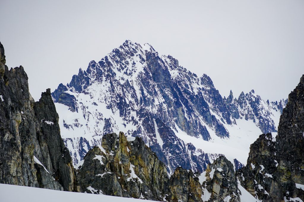
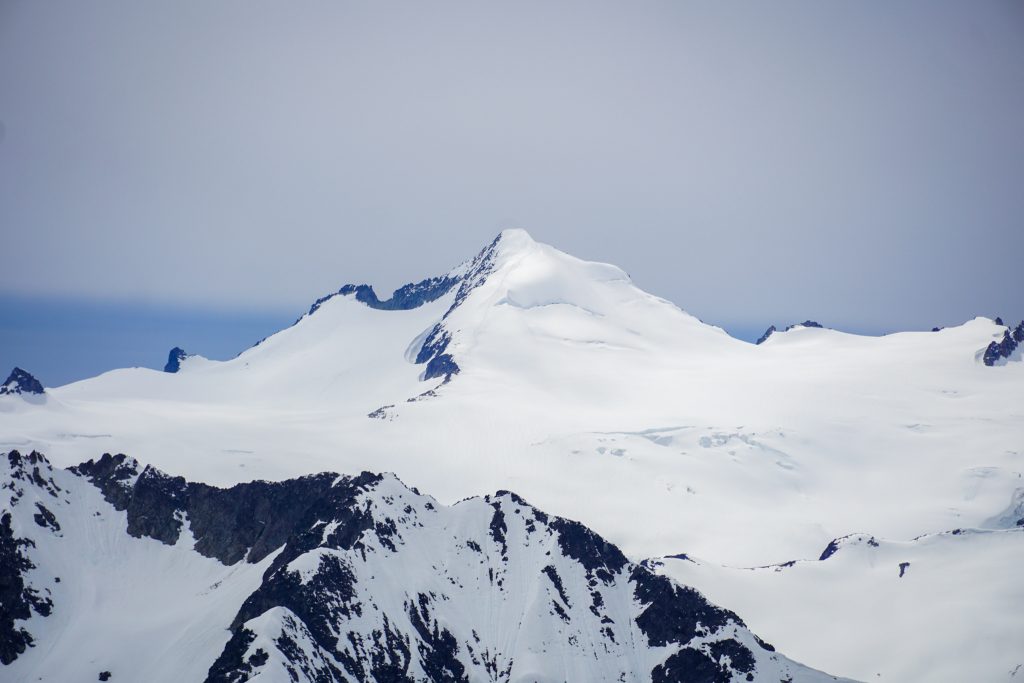
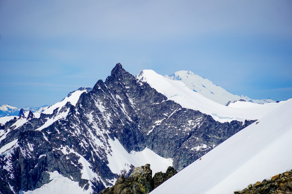
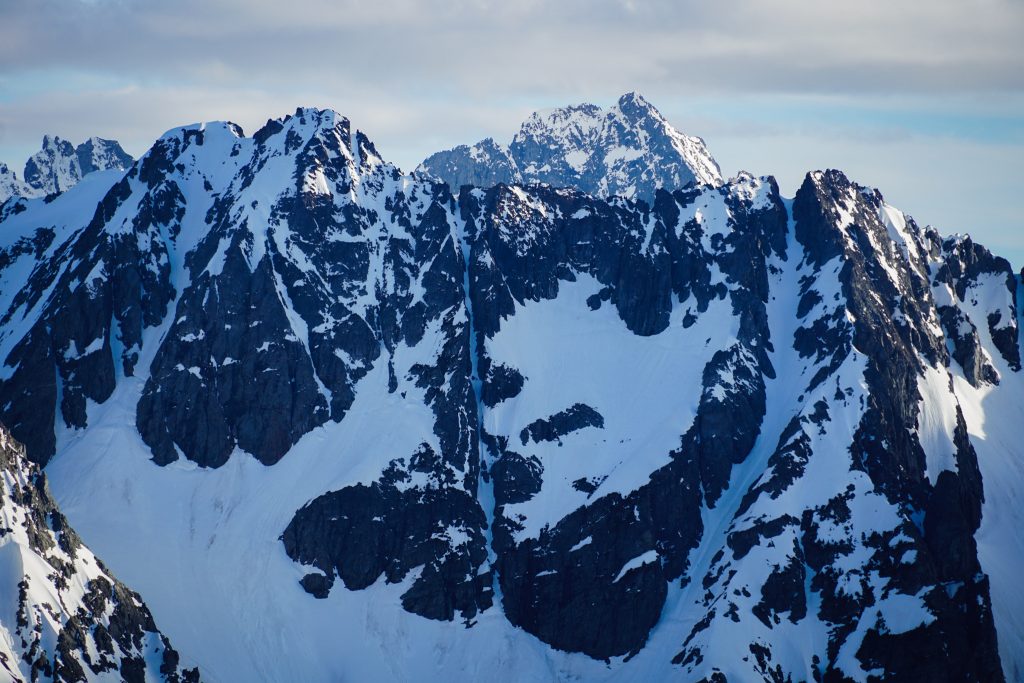
At the Silent Lakes, we got our closeup view of the intimidating backside of Black Peak. Logan and I skied Black a few weeks prior, but on the mellow east and south faces. The north face is straight gnar.
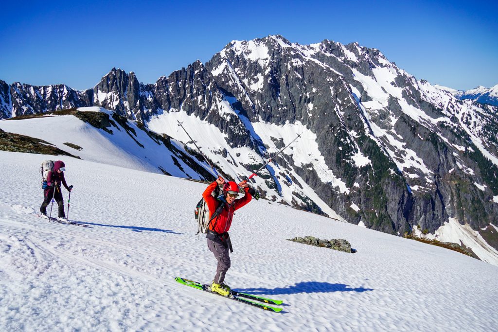
Doug set out to break trail around the Silent Lakes, making sure I captured a photo with him in front for photographic evidence. Well, Doug, here ya go.
From the lakes, we began a downward traverse beneath the south face of Arriva. This was one of the most concerning traverses in terms of a big south face, but the wind had blown all the fresh snow off. In fact, we even found some great instacorn on the shoulder!
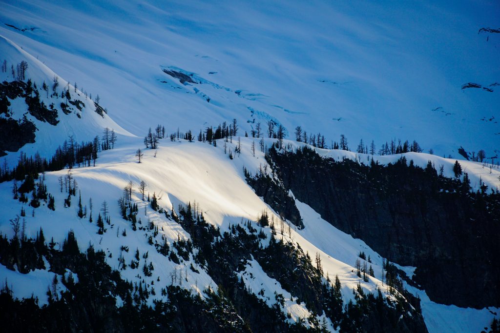
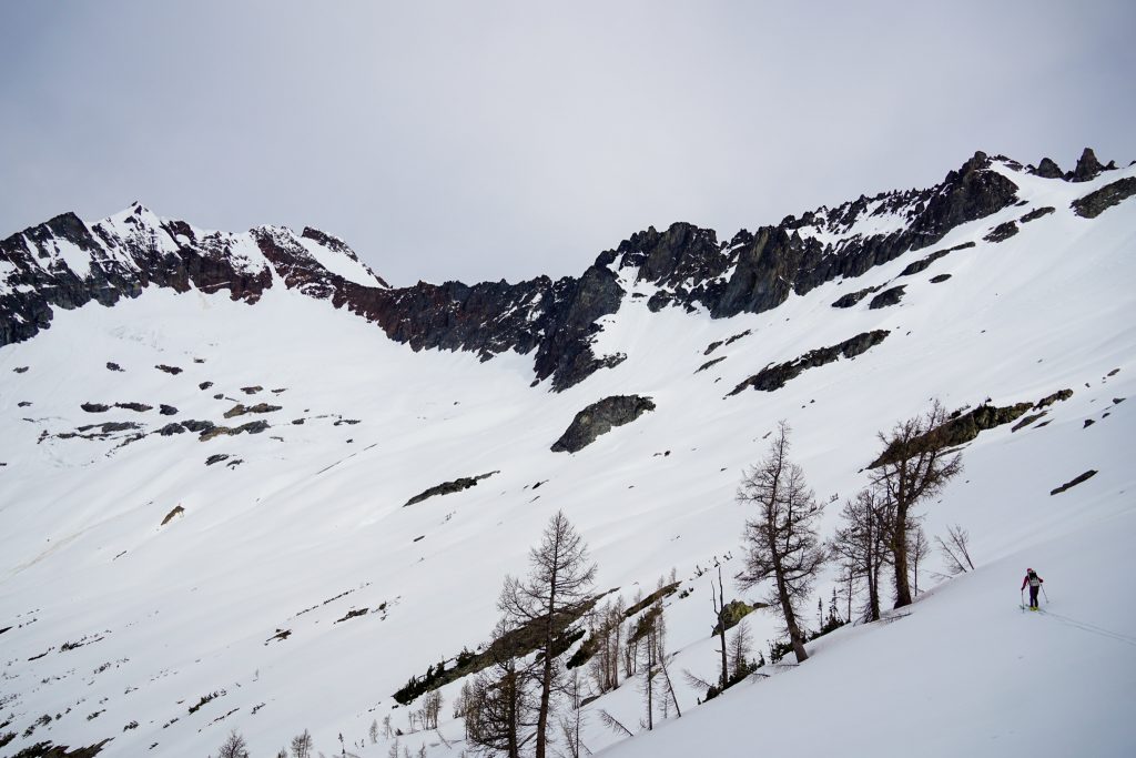
We ended up in another beautiful little larch filled basin beneath Meulefire and Arriva. Larches were a constant theme of this trip. It seems everywhere east of the Eldo Icecap is sufficiently rain shadowed for larches to inhabit. Larches can be found further west in this region than in almost any other region of the Cascades.
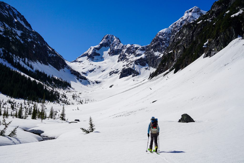
We filled up on some much needed water at a rocky slab and continued up to the pass between Meulefire and Arriva.
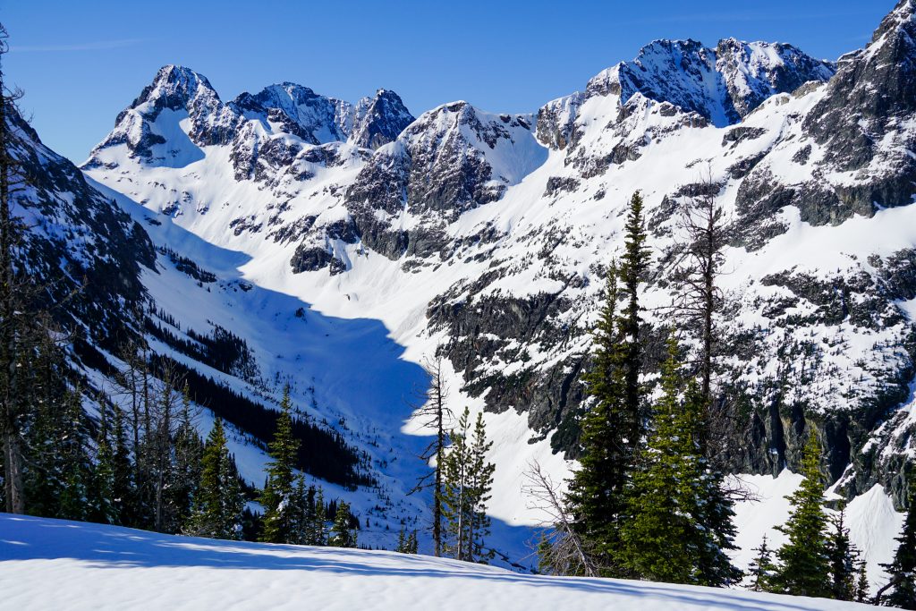
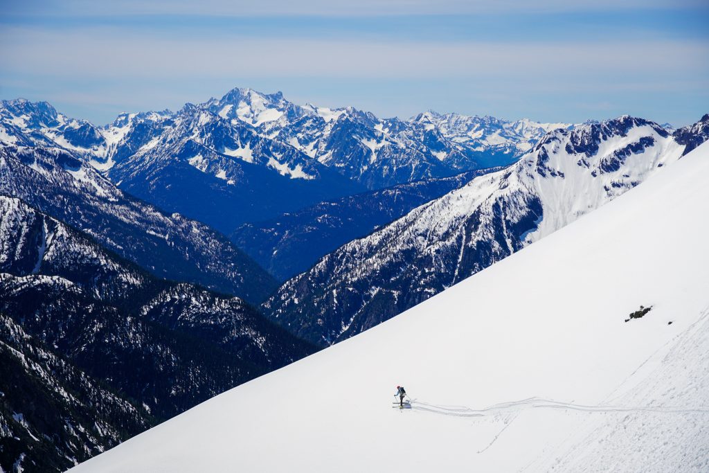
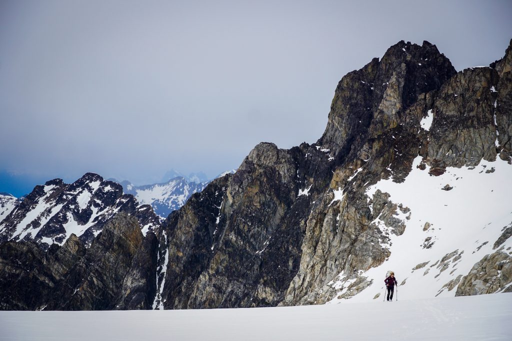
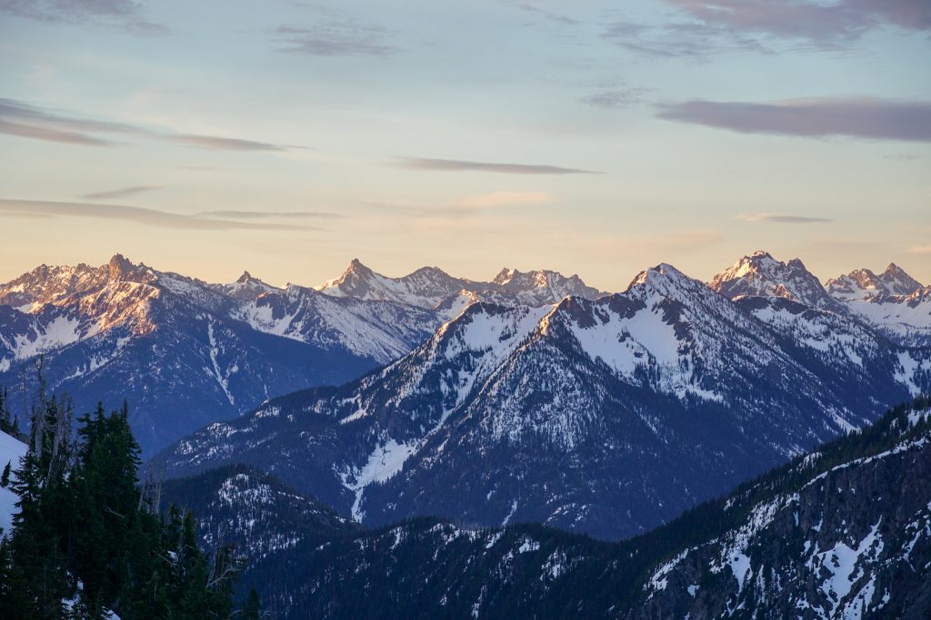
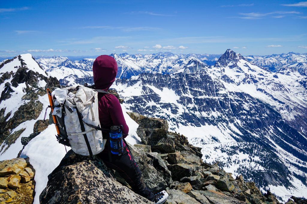
From the pass, we dropped down to a basin beneath towering Natal and Idecision Peaks. I loved seeing such rad, imposing peaks up close for the first time, not knowing their names or how they would appear. Just when the Cascades are beginning to feel old, I find a new zone, a new perspective, a new way of experiencing these timeless mountains. The area between Easy Pass and Logan is as stunning and rugged as anywhere else, but the names of the places escape most mountaineers and feel lost to time. Traveling through them feels like personal discovery, like the first time I set foot on the Inspiration Glacier, or the first time I saw Liberty Bell. It is that sense of deep wonder and surprise.
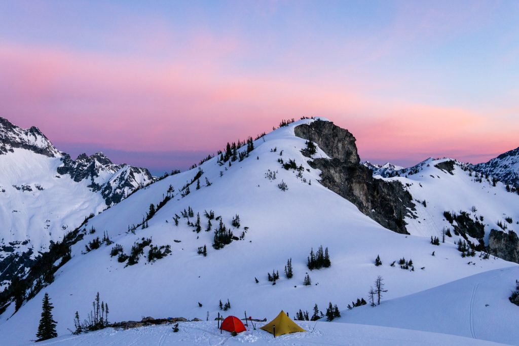
It was just one last hot climb to Spectacular Ridge, our camp destination for the day. Spectacular Ridge, named by Beckey, is the flattish 7000 ft ridge above Fisher Pass. When Steve and I climbed Goode last summer, we looked down at this ridge with longing eyes. I actually think that nearby Outpost Peak, positioned higher and closer to Goode, might be the best position in the Cascades, but I will have to verify that on a future trip.
We found a flat spot atop the ridge with some dry rocks to hang out on and called it a camp. It was still early in the afternoon, which gave Doug adequate time to dry his boots out, so he wouldn’t whine all next day about wet liners like he did on the Pearl Necklace Tour last year.
Overall, we were pleasantly surprised with the first day. The fresh snow definitely made for some mushy skiing and slow trail breaking, but it seemed very settled already and not too hazardous. Friends had asked us on Friday if we were still going forth with all the fresh snow, skeptical of conditions. Throughout this spring, I have learned that we have been far too pessimistic about conditions. I have found that new snow settles so quickly at this time of year and if you have an isothermal snowpack underneath, things are usually manageable, especially if there is a refreeze overnight.
At camp, EZD (Doug’s retirement moniker) fired up his custom “party playlist” of tunes. But by 7:30 pm, Doug was sound asleep and snoring in our tent. Just like Beckey, Doug is a great climber and equally great sleeper.
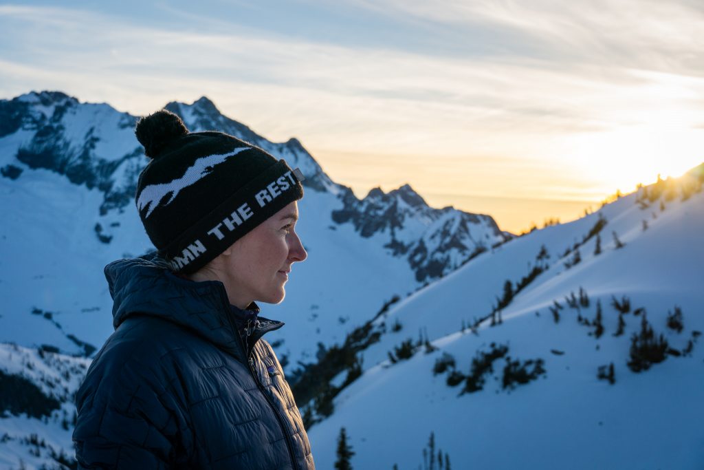
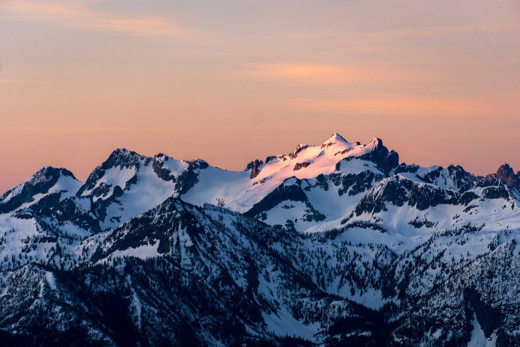
Silvia and I walked a short distance to the top of a hump for a sunset view. The colors were muted by high clouds to the west, but it was still nice.
Day 2: Spectacular Ridge to Park Creek Pass
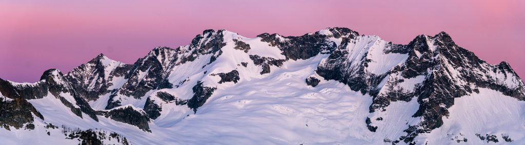
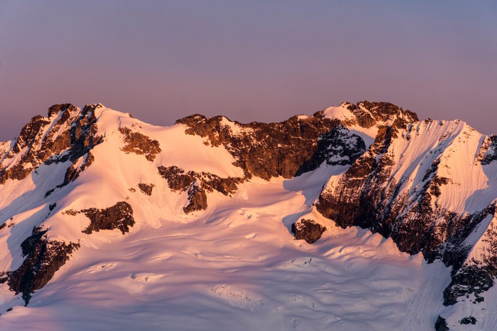
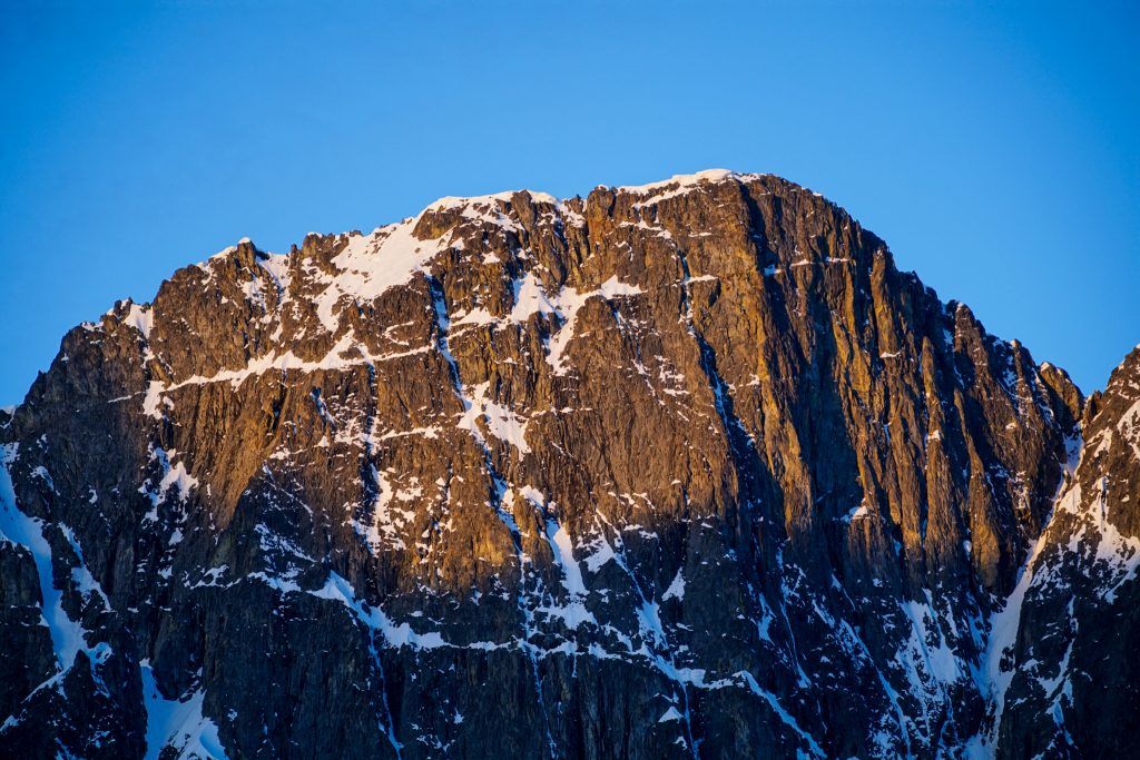
It is always a shock how early it gets light at this time of year, especially on a high ridge. I woke up naturally at 4:30 am and crawled out of the tent, hoping for some goode morning alpenglow photos. Luckily for me, it was clear to the east, with high clouds to the south and west, making for beautiful pink and purple backlight. It was truly spectacular.
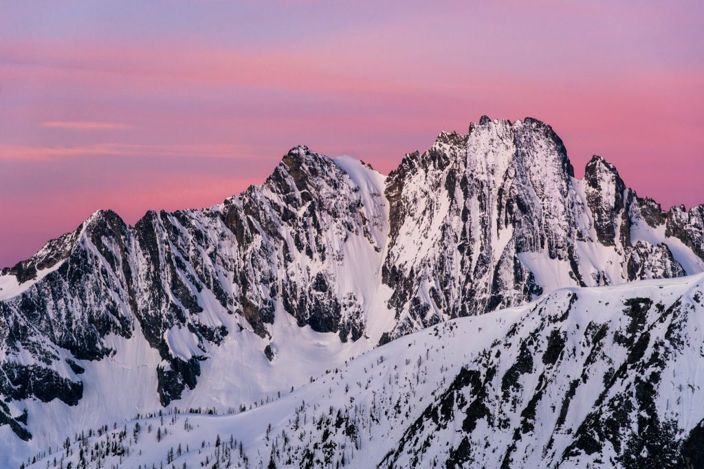
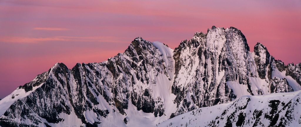
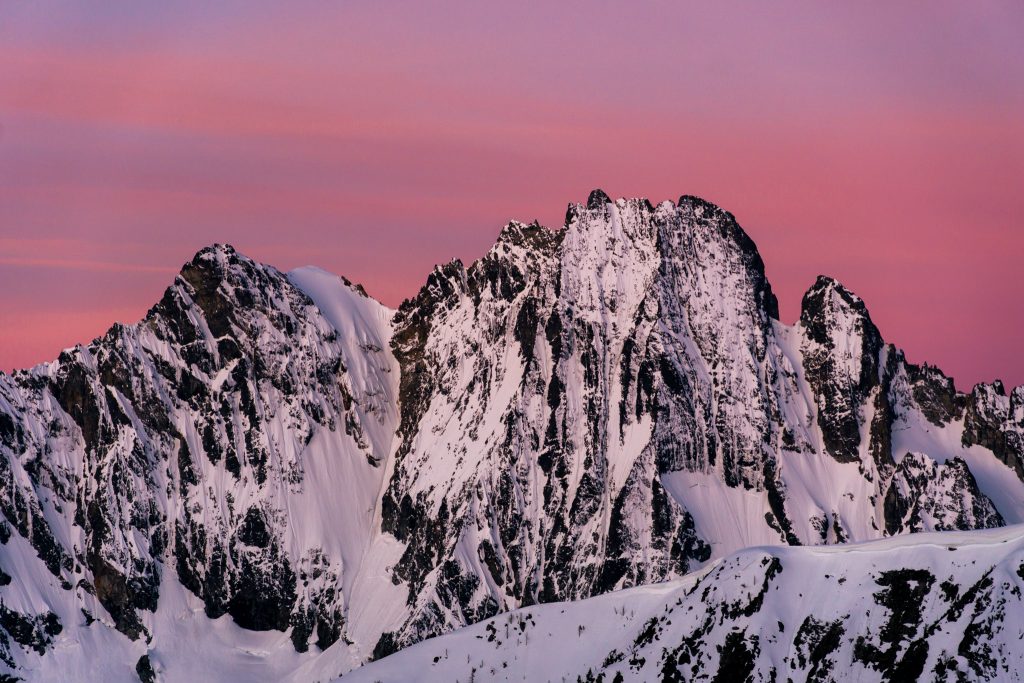
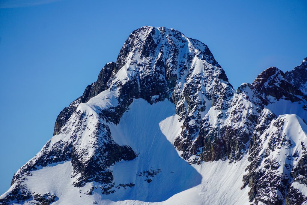
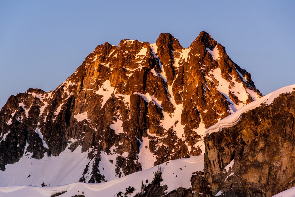
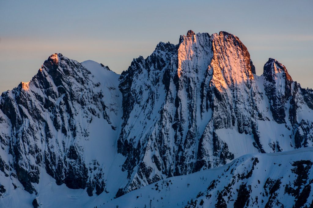
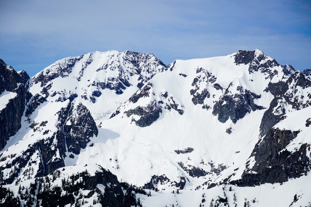
Goode was definitely the centerpiece of this camp, but we also had great views of Ragged Ridge, Logan, and more distant peaks.
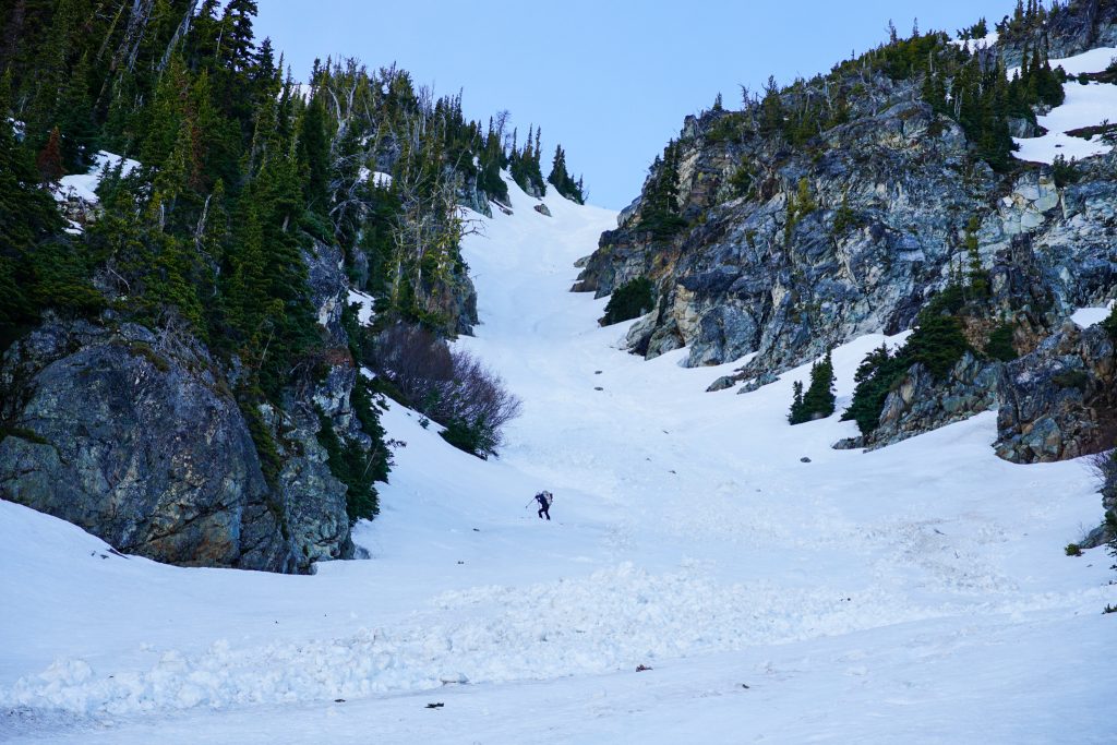
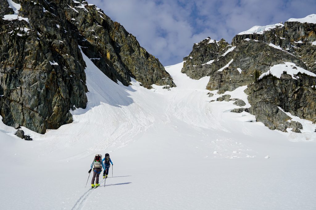
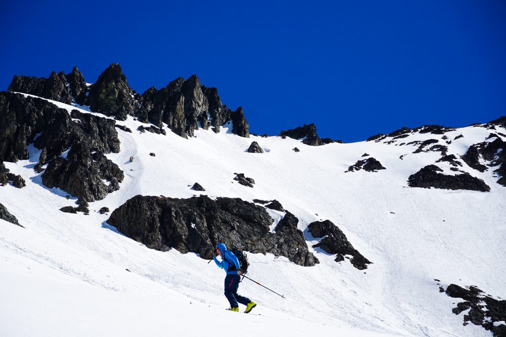
After packing up camp (and Doug repeatedly asking if we were ready to go while he leisurely packed and unpacked his bag), we started down a gully towards Fisher Pass. It was very firm after a cool night and filled with avy debris. This was the only real survival skiing of the entire trip. If it wasn’t for the loud chatter of skis on icy chunks, you would have heard KJ’s signature “oh, gawd!”
Fisher Creek was a complete ice box in the early morning, housing a pool of cold air. We filled up our water bottles and continued to Fisher Pass. Here, we unexpectedly ran into three other dudes who were heading for Logan also, although just as an out-and-back from Fisher Pass. Doug immediately accused me of blowing up the place (“Back in my day…”), rationalizing that I must have been Tik-Tokking to the masses with my inReach the night before. One of the guys recognized Doug and so Doug broke off from our group and joined them. We wondered how long it would take for Doug to talk their ears off…
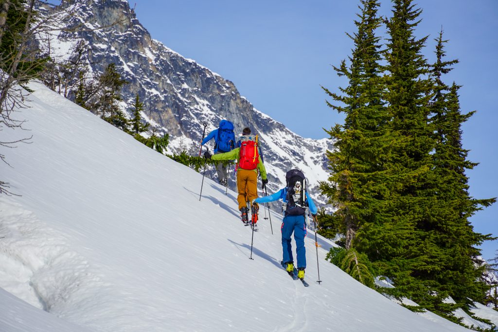
We followed a series of switchbacking benches to the ridge that would get us into the Douglas Glacier cirque. Here, the other party smartly dropped down about 800 ft before climbing up the Douglas Glacier. Instead, we tried to sidehill forever beneath Outpost Peak and maintain elevation. I think it was an excuse for Doug to justify the ski crampons (or “harscheisen” as Silvia says) that he made us bring. Regardless, it definitely took us longer and caused my left leg to light on fire.
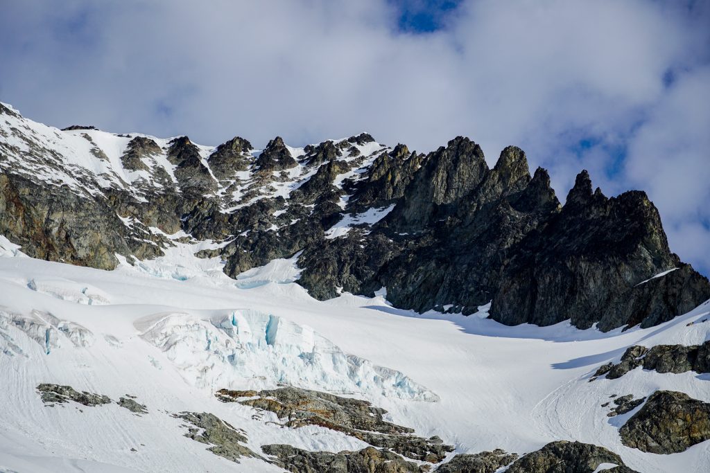
After seemingly endless traversing, we finally got on the Douglas Glacier and started climbing. While Doug sarcastically complained about his “wilderness experience being ruined” by the party of three, I was grateful that I did not have to break trail through the deep mush on the Douglas.
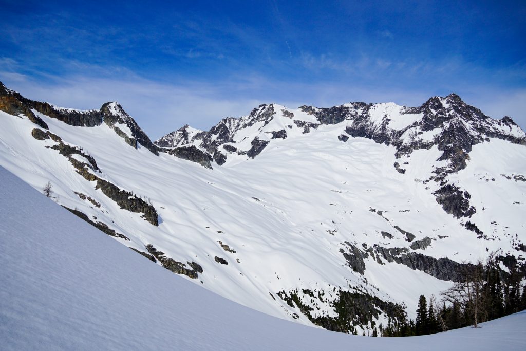
The climb up the Douglas was viciously hot and windless, even with the high clouds rolling in. The glacier was very filled in, making for easy skinning.
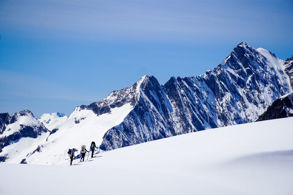
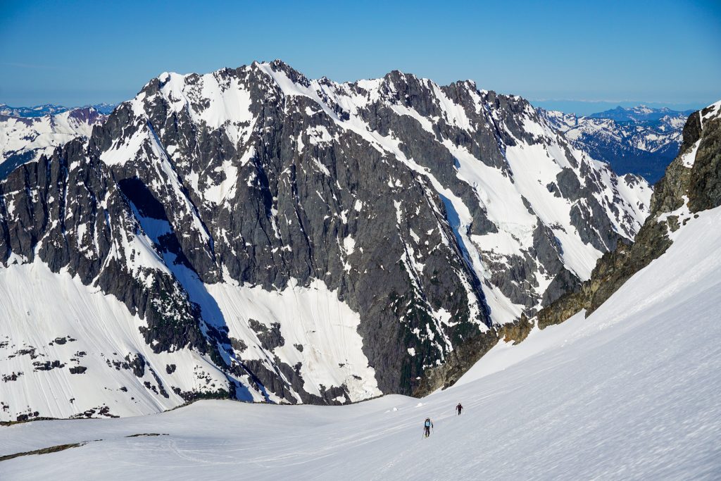
While the other group went for the true summit, we planned for a descent of the Banded Glacier. Skoog’s route goes over Logan to the Fremont Glacier, necessitating some 3rd class rock scrambling. We did not like the idea of scrambling that with heavy packs and ski boots, so KJ drew up an alternative route that descended the Banded Glacier and climbed up to the Fremont Glacier, nearly circumnavigating the summit massif.
Up high, the Banded was a bit of sun softened sastrugi and fermented pow – not bad. The middle felt like the snow had a million arms grabbing our skis. Doug led us the crevasses and rolls. If you stay center and then cut right, the glacier is pretty filled in. But we definitely benefited from a few spots where the fresh snow actually covered blue ice.

We took a long break at the end of the lake and listened to Doug tell the history of the Notorious B.I.G. and explain the musical mastery of Kanye West. Instead of following the lake outlet down further, we climbed a hundred feet or so SW to a bench above the lake and then found a cool west facing gully that dropped us down into the lower valley.
The valley beneath the Banded Lake was a wild glacial carved valley with vertical walls and giant boulders freshly strewn about, falling off the chossy Logan Massif above. As KJ likes to say during rockfall events, “geologic time is now!”
I had been feeling slow all day, but finally I started to re-energize. The rain showers to the north brought cool air and I felt enthralled by the giant walls towering above me. You get the sense that this is a place so out of the way, few people ever visit. The scale is huge, almost incomprehensible. Doug informed me that during the one other time he visited this spot, in the late nineteenth century, the Fremont Glacier still extended down into this valley. Incredible!
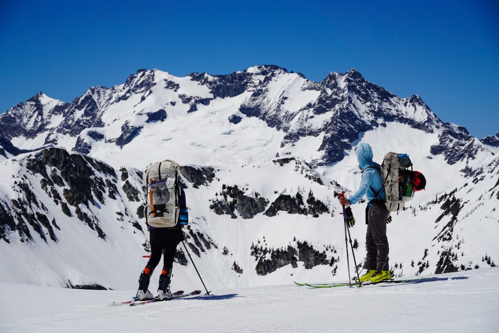
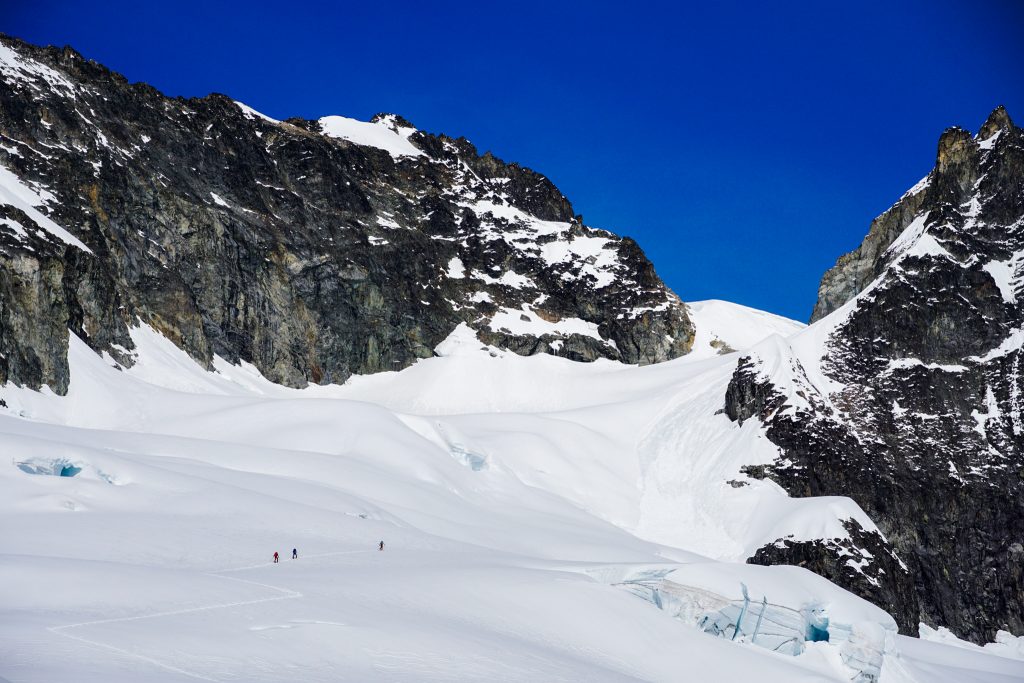
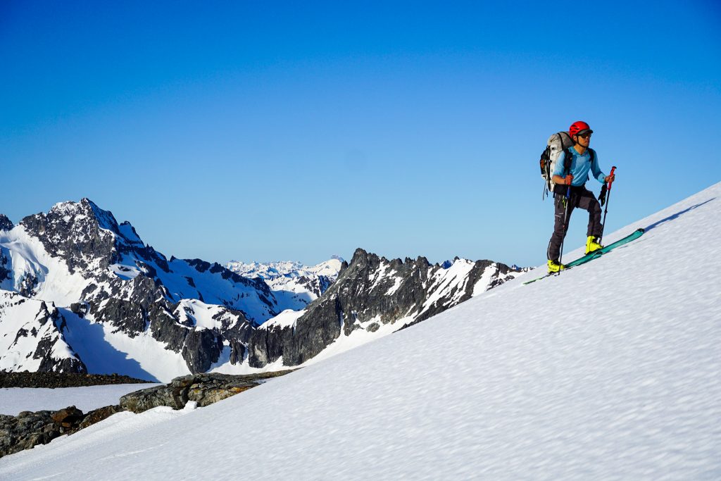
I absolutely flew up the base of Fremont Glacier and waited for the rest of the group here. I was eager to get across the Fremont before we lost visibility. A few snowflakes fell here and there, but the weather ultimately held out just fine, and we were grateful for the cool weather during the long climb.
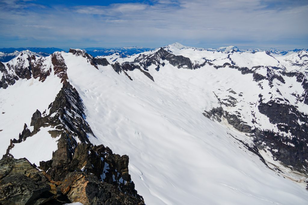
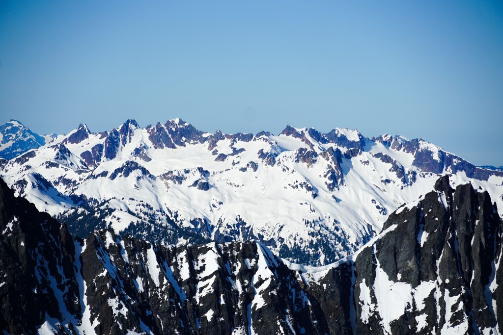
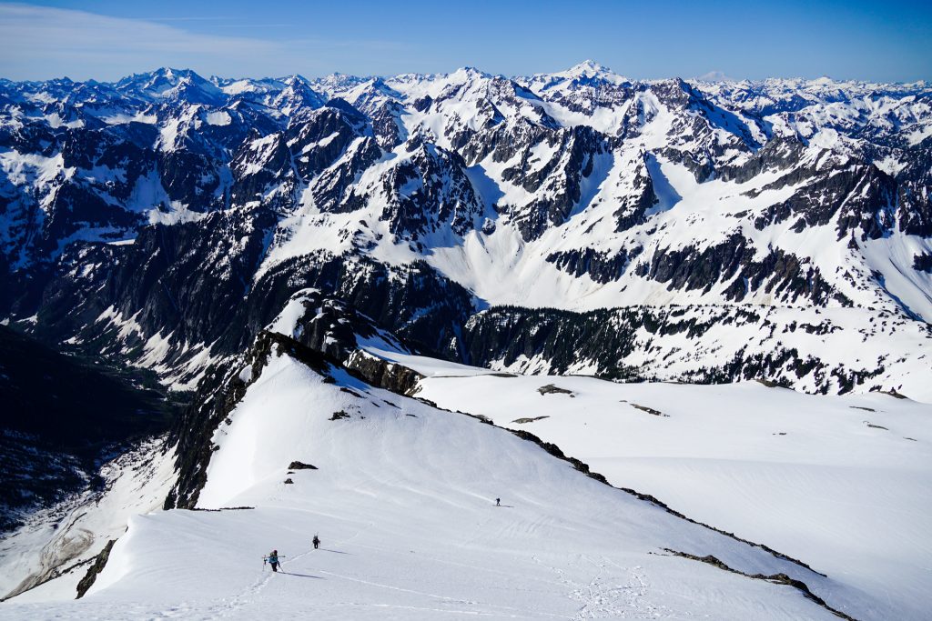
I knew the Fremont Glacier, situated a stone’s throw away from Buckner, Forbidden, Eldorado, and the Heart of the North Cascades, was going to be stunning. But I was not quite prepared for how magical it would be. The giant, nearly continuous mass of ice from the Boston Glacier all the way to the Klawatti Glacier is truly unique. Here we were, gazing at the highest, iciest group of peaks in the North Cascades, so close we could almost touch them. My friend Steve calls this the “Picket Effect”: the most epic peaks (e.g. Pickets) are best viewed not from inside them or on top of them, but from a short distance away.
From the Fremont, we could see the Inspiration Traverse, the Isolation Traverse, the Forbidden Tour, and so many other famous routes.
The Boston Glacier is the largest non volcanic glacier in the lower 48, a testament to the incredible precipitation this area gets. And yet there are larches on its eastern flanks! The larches never end!
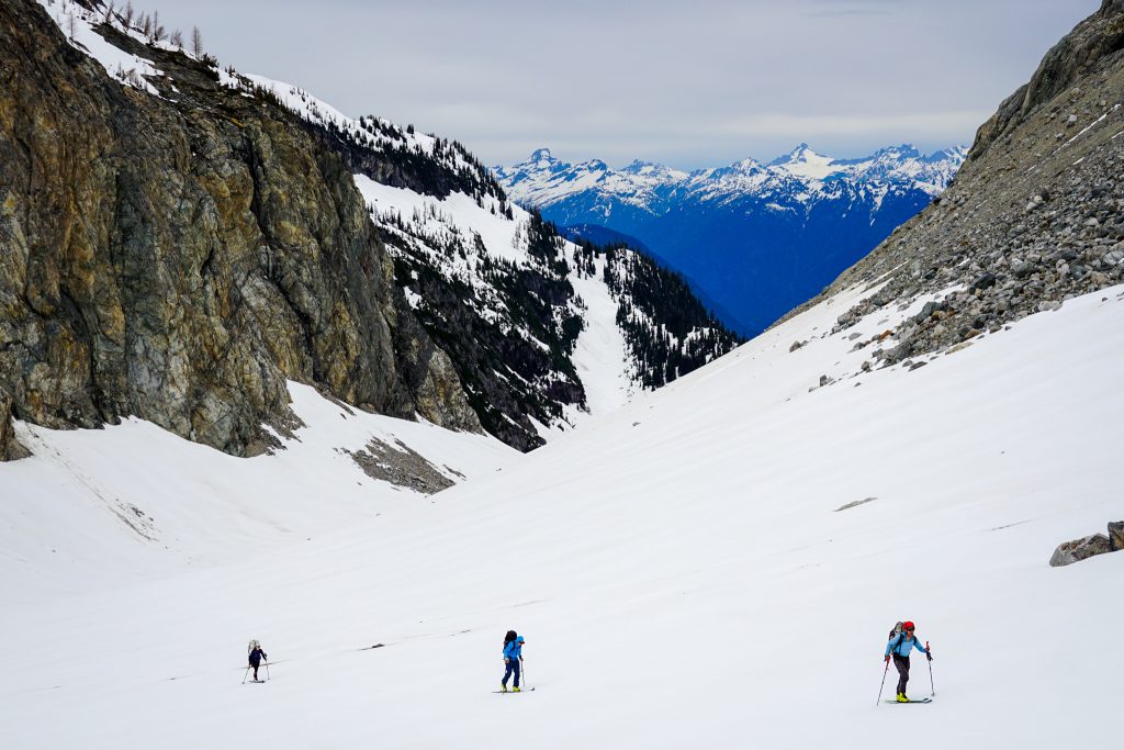
The Fremont Glacier would be an absolutely incredible campsite, but we were concerned about the weather, so we pushed on. We started with a decent ski beneath the Fremont Glacier before arcing hard left to try to hold a high traverse towards Park Creek Pass.
Park Creek Pass looked miles away and the snow was mushy, making it hard to hold elevation, but we sent the traverse nearly the entire way to the pass! Long traverses like this make you appreciate skis so much. Some people would say that ski traversing is not actually skiing, but it still feels pretty epic to me, gliding along as the mountains whiz by.
We skinned over to Park Creek Pass and found two sets of tracks – both bear tracks. Skiers are almost outnumbered out here!
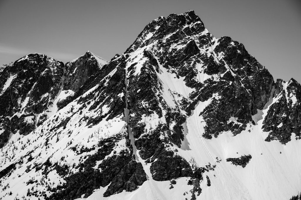
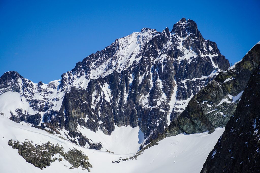
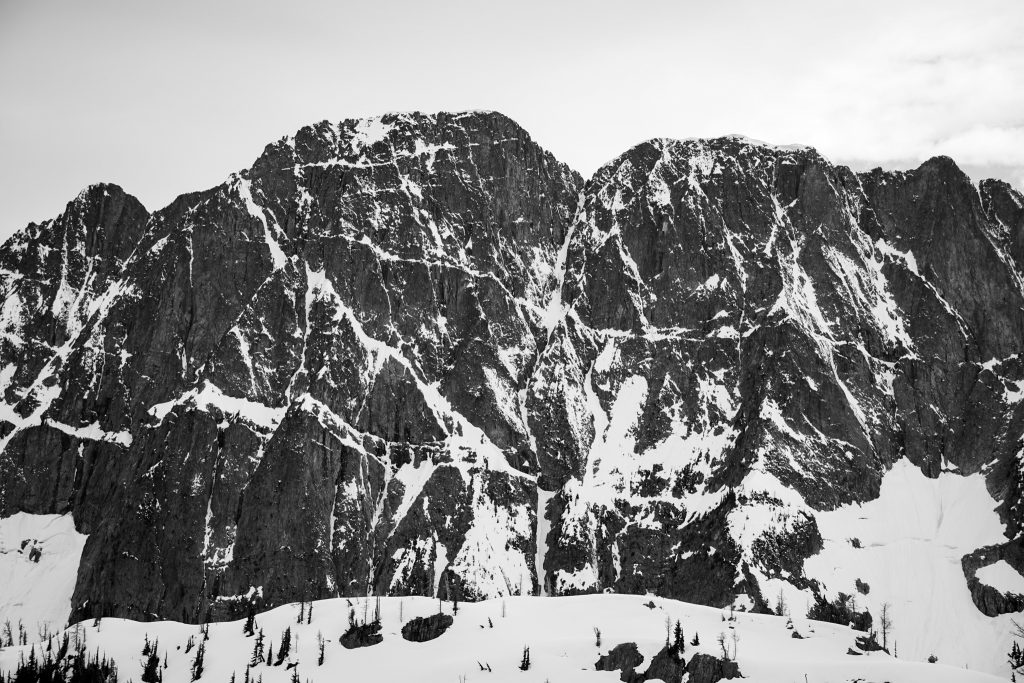
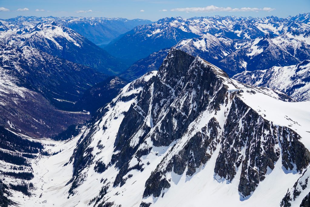
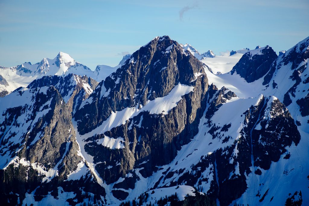
The NE Face of Booker is another one of those sleeping giants of the Cascades. The peak is rather insignificant from most vantages, but from Park Creek Pass, the 2500 ft face is king. I had seen it from the summit of Goode, but it truly took being at its base to really appreciate it. Time and time again, I find new angles, new perspectives, little nooks and crannies.
We found a bit of dry rock on the benches south of Park Creek Pass. We were hoping for more dry ground, but the depth of the snowpack further west in the range was impressive. With some shoveling, we got enough space to cook and hang out once again in our running shoes for the evening.
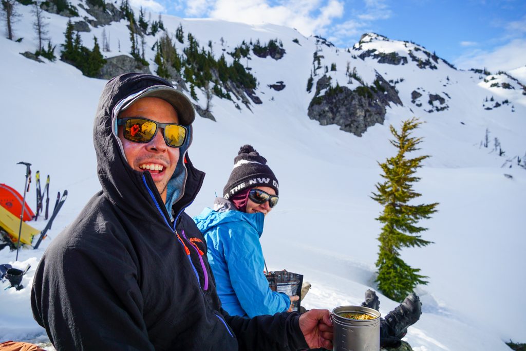
After so many day trips this spring, I was overdue for some quality camp time, hanging with good friends, nibbling warm food, and watching the shadows get long.
Day 3: Park Creek Pass to Upper Horseshoe Basin
We awoke to mixed clouds and the same mushy snow of the day before.
We begun an easy downward traverse into the basin beneath Buckner. The snow was quite good here in the shade at 6 am. Guess sometimes, corn o’clock is before breakfast.
There is substantial avy debris from serac falls off the Buckner Glacier thousands of feet above in this basin, so we zipped beneath the hang fire and transitioned at the far side of the valley. Positioned beneath the towering SE buttress of Buckner and the epic NE face of Booker, this was yet another spot that looked casual on a map but felt totally wild.
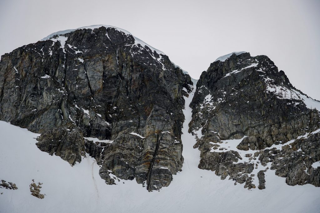
We aimed for the obvious Booker-Buckner col. This col is guarded by a substantial bergschrund. It was pretty filled in for us, but if it was open, there would be no real alternative route for miles. So much of this traverse is dependent on a few small terrain features that link together. When Doug was here many summers ago, he crossed the bergschrund on a thin bridge, then watched in dismay as the bridge completely exploded a few seconds later. His partner was stranded on the lower side of the bergschrund. Read Doug’s report to find out what happened next!
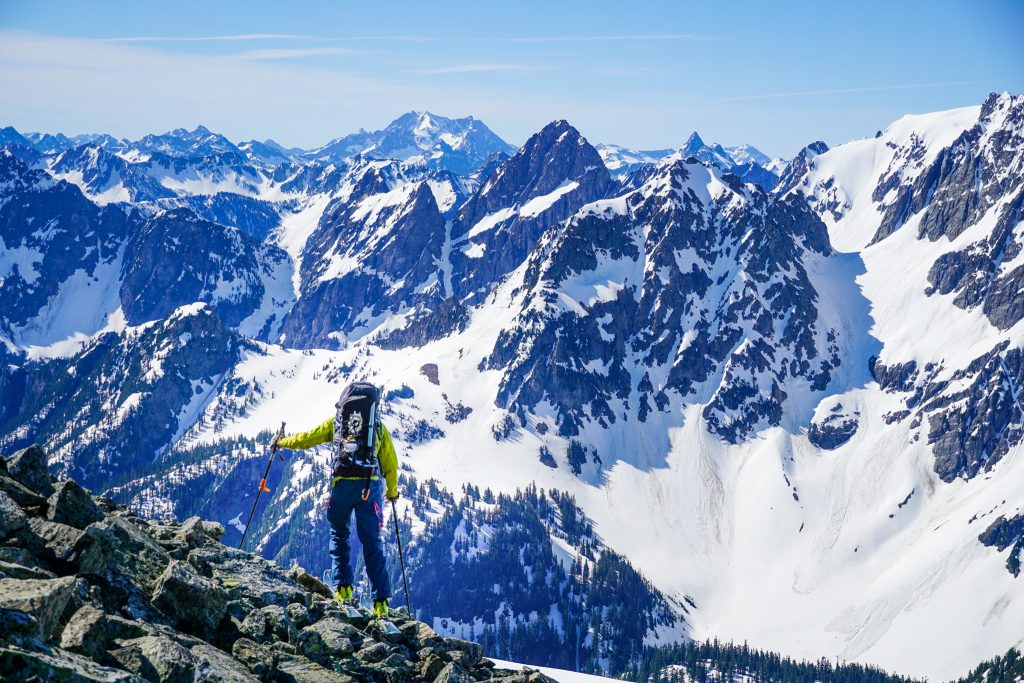
At the col, we had views of Hurry Up Peak and Spider Mountain, familiar terrain of the Magic S Loop. It felt like we were within striking distance of the finish.
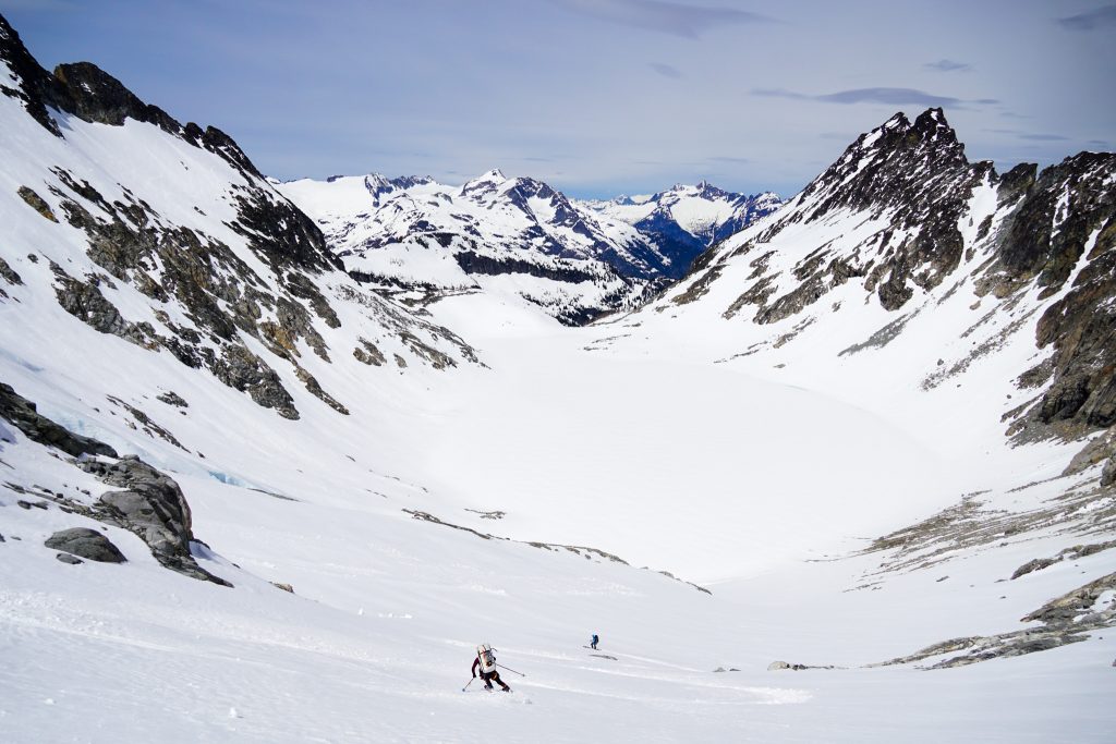
We cruised down a nice west facing run from the col and then contoured right into Upper Horseshoe Basin.
Upper Horseshoe Basin is a “big ole bowl”, as KJ says. He has been here a few times before and pointed out the only real flat spot in the entire basin, a giant rock prow that juts out into the glacially carved slabs. We headed up to the prow to set up our camp.
The snow covered most of the flat rocks where KJ had camped in the past, but we made it work. Doug, always the enterprising landscaper, devised a great plan where we cut a tent platform in the snow so that we could step out of the tent onto dry rock slabs! With some work, it was the best camp yet!
We ditched our overnight gear and started heading up the SW Face of Buckner. We skinned up to about 8100 ft before we switched to booting up the steep face.
The booter was a bit punchy, as expected with the heat. KJ wallowed even deeper in my steps, blaming his smaller foot size. There was consideration a few times to turn back, but it was still morning and what else did we have to do? I was content to suffer a little more. I have certainly suffered in uglier places.
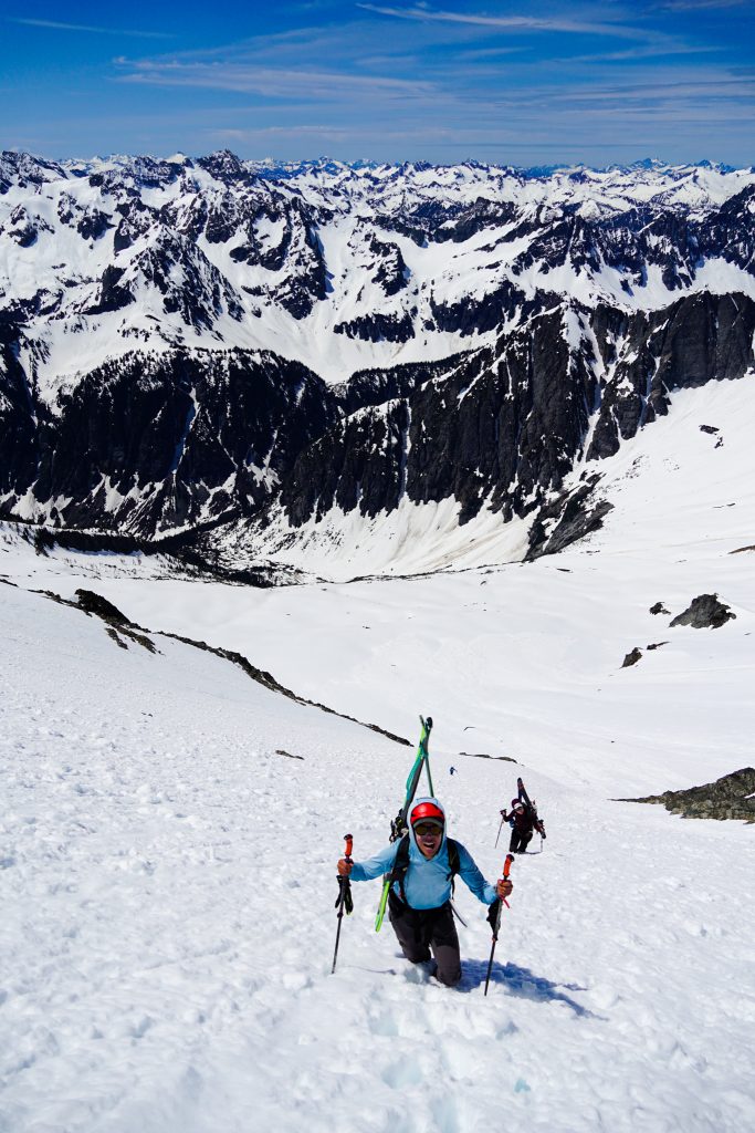
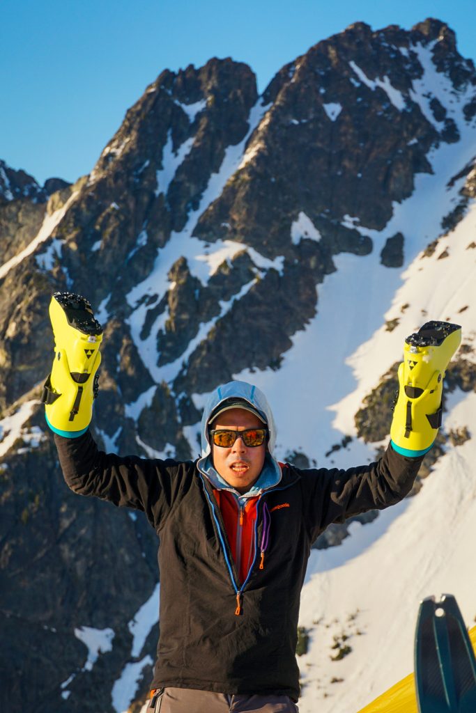
We were able to stay on snow all the way to the summit ridge, from which it was just a short scramble to the true summit, elevation 9,114 ft. Buckner is a big jazz boy!
Although I am by no means a peak bagger, it was nice to bag this one. The views were pretty okay.
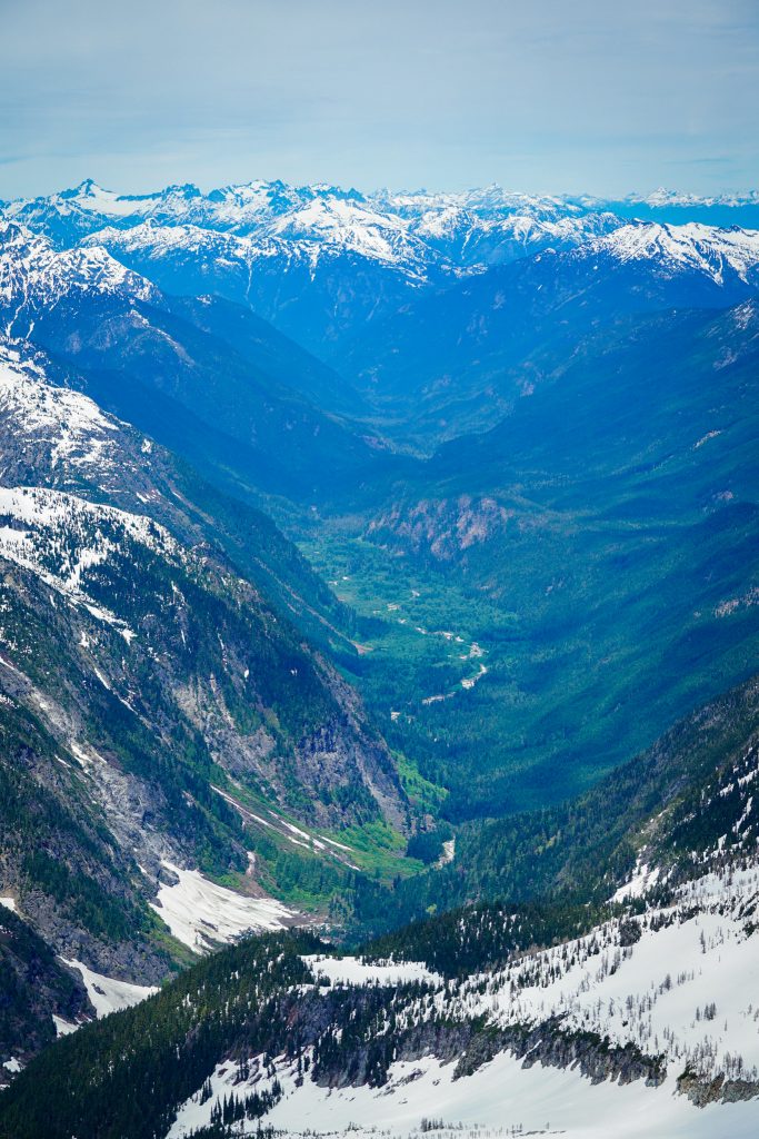
At this time of year, there is such a stark contrast between the snowy alpine and the lush green valleys. Three seasons in one view. It is pure Cascadia.
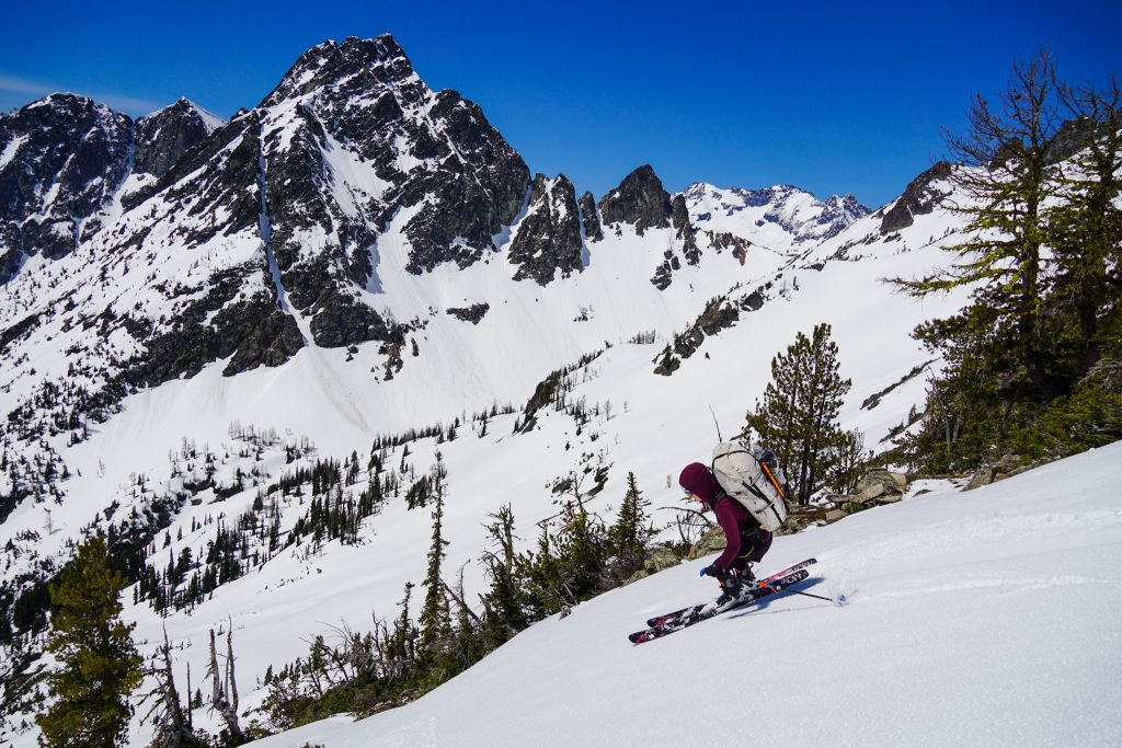
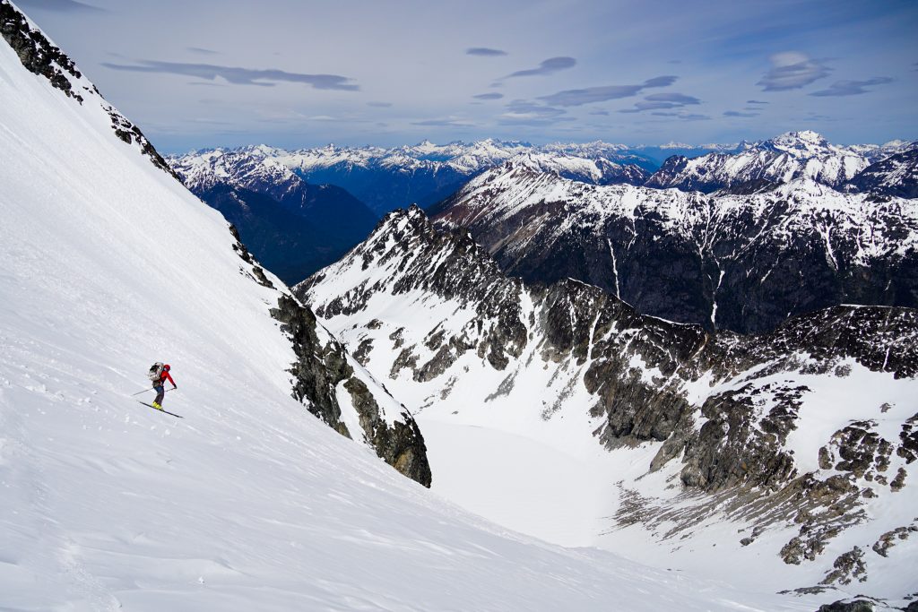
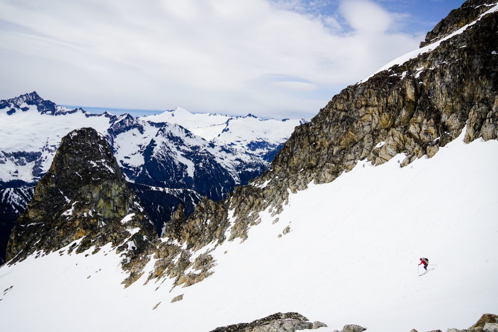
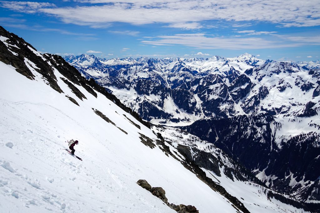
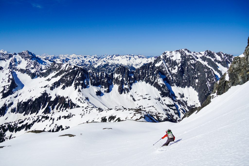
We dropped onto the SW Face a little after noon. The central part of the face was nicely softened wet loose debris. The side had undisturbed snow, but one turn revealed it to be a hot sticky mess. It says something when the avy debris skis better than the non avalanched snow.
I thought the skiing, although tiring, was actually pretty decent. Freed from the weight of an overnight pack, I finally could link turns and feel like I was actually skiing. In good snow, this would be one of the most type 1, epic corn runs in the Cascades.
By the time we got back to camp, wet loose slides were going off all over the place, so we were glad to be in a safe spot. The heat and relentless sun reflecting from three sides was a bit rough, so we crawled into our tents of shade and did anything to cool down. I had evaded sunburns to this point of the trip, but this was the day my lips finally got burnt.
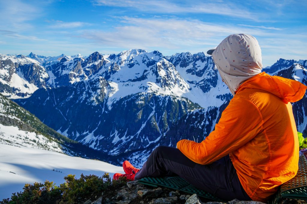
Sometime in the evening, clouds and a breeze rolled in and it cooled off dramatically. The last night of a multi day trip is always bittersweet. After a few days in the hills, you can get used to a new routine, one that is not based off the time on your watch or buzz of a phone but the angle of the sun in the sky, the diurnal cycle of the snowpack, and the undulations of a steep North Cascade Valley. We ate dinner on the prow, in the same spot that miners sat one hundred years ago, gazing out to the same mountains that have remained remarkably unchanged in a century – a land before time, or perhaps a land without time.
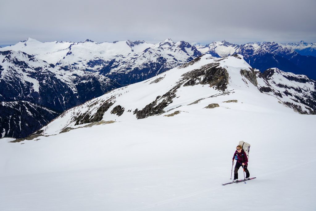
Day 4: Upper Horseshoe Basin to Cascade River Road
The night was warm and balmy, which made for great sleeping but even mushier snow than the previous morning. We packed up quickly and traversed over to our final major obstacle, the climb up to Sahale Arm.
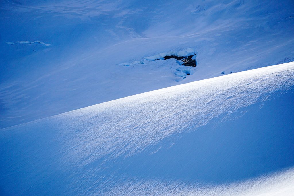
The broad snow slope that connects Upper Horseshoe Basin to Sahale Arm had nearly continuous glide cracks that spanned the slope, much like a bergschrund. I have not been around enough to provide much historical perspective, but it does seem like there is a greater amount of glide cracks this year in the Cascades. Fortunately, we were able to surmount the glide crack bergschrund and continue to the arm.
While crossing upper Horseshoe, our bases got covered in a mysterious brown substance, likely pollen. If the skiing was not already sticky enough, it was about to get worse…
At this point, we could have just headed out, but it was still early in the morning, so we figured we might as well tack on Sahale itself. I had climbed Sahale a few times before, but never with skis.
As we skinned up the Sahale Glacier, we were pleasantly surprised to find a superficial refreeze, making for easy travel conditions. Glacier worms (mesenchytraeus solifugus) squirmed about in the thousands. Here is yet another setting that makes the individual feel very small, like worms on a glacier.
We celebrated atop the snowfield, acknowledging that basically all of the uphill, over 20,000 ft of gain, was over.
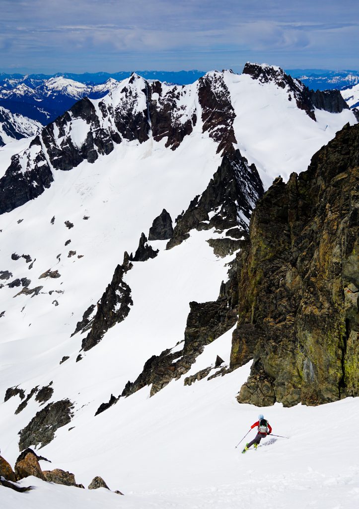
The top was a bit variable, but we found proto corn on the Sahale Glacier, making for some of the best skiing all trip.
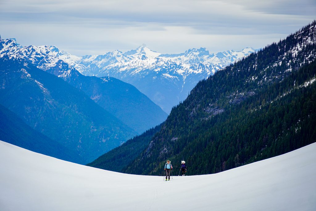
The usual descent route follows the Arm all the way down to Cascade Pass. While we knew that would work with some short carries, we wanted to try the direct Solider Boy Creek exit. So we dropped off into the west facing drainage and found real corn, definitely the best skiing of the trip.
But all good things must come to an end, and soon enough we found ourselves side slipping through alder, caught between raging waterfalls on both sides. But EZD loves this stuff, so he kept us skiing as far as we could.
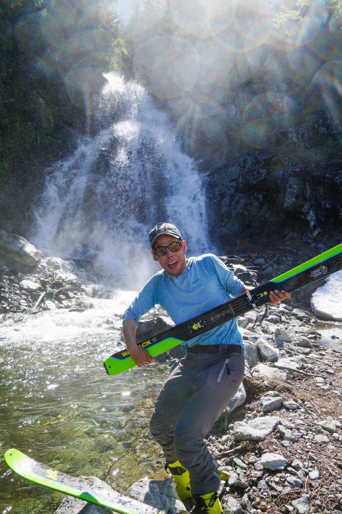
At 4400 ft, we finally bailed into the forest on our left and joined the summer hiking trail. A switchback or two brought us to a sunny open snow slope, which we skied easily to the trailhead and a ways down the road, ending at a perfect little waterfall and pool of water. In fact, Doug says that if he had known it would work so well, he would have kept his skis on during the trail section so he could claim a continuous ski descent the entire way.
We spent a while at the watering hole, changing our clothes, washing our bodies, and adjusting to the summery lowlands. When we were ready, we loaded up our heavy packs with skis and boots attached and began the march down to the Cascade River Road.
A bit below the Boston Basin trailhead, there is an enormous avalanche that swept across the road. The road is covered in 20-30 feet of snow, trees, and debris. The damage is astounding. I doubt the road will be repaired this year, which is unfortunate.
We continued our march on, appreciating the shade of the lower valley. The road is still gated back at mile 18, the entrance to the national park, because the river has rerouted itself and undercut the road just before the Eldorado Trailhead. Maintaining roads in the North Cascades is such a battle.
I felt that this was the most continuously spectacular route I have done in the Cascades. It snakes and dodges its way through forgotten giants and familiar classics, beneath vertical faces and atop majestic ridges. This is the true Heart of the North Cascades – imposing and inspiring. There are dozens of spots along this tour that are breathtaking in their own right. Strung together, it is pure magic.
While the skiing conditions were rather forgettable due to the fresh manky snow, I was grateful for safe passage and acceptable uphill conditions. Despite the ruggedness of the terrain, the descents and climbs are generally gentle, threading the needle through the spiciest terrain. Travel felt relatively relaxing considering the grandeur of the mountains around us.
As always, the most important factor for success was the team: KJ, Silvia, and Doug. It is a privilege to have such competent, experienced partners. More importantly, it is a joy to have such fun, humorous, humble partners. Maybe I have been throwing the term around a little too much lately, but thank you for the “trip of a lifetime”. What a way to cap off ski season.
Notes
- Our route was about 42 miles and 21k ft gain. 5 miles of that was road walking at the end. Skiing Buckner added about 2k ft gain and Sahale added 1k. It would definitely be a manageable tour in 3 days with better snow conditions, but the car shuttle is pretty long so 4 days was nice.
- We chose to bring glacier gear for rescues. Nothing was too spicy, but there were bergschrunds and cracks we traveled over.
- We completed this tour about 3-4 weeks after Highway 20 opened. I do not think there was much of a downside in waiting. Snow coverage was great through all the sections we needed it (expect maybe Easy Pass), even on west facing descents. A few weeks later, however, and you could expect more ski carries on the west facing slopes.
- One could do an alternate start up the next valley up Highway 20, climbing over a col next to Fisher Peak and then to the Silent Lakes. This would be less elevation and skip the bony Easy Pass descent, but you just have to find a creek crossing to start. I think this is what Skoog did.
- Although the Soldier Boy Creek exit worked for us, it is probably best reserved for mid May and earlier. It is probably simpler to just go down the Arm to Cascade Pass and then ski to the trailhead.
- We went east to west and I think this makes sense for a few reasons: it gave a few more days for all the fresh snow on the west side of the range to consolidate, it put us on east facing slopes in the morning and west facing in the afternoon (east facing in the afternoon would have been scary slushy), it started higher, and the road walk was nicer going downhill to end. Also, it worked with our planned camps to have bigger days earlier in the trip, when we were fresh. It gave us more options towards the end of the trip. One could go the other way certainly with little issue, however.
- Terrain management and route finding is very important on this route. There are many sections that felt like threading the needle, such as traversing below and above cliff bands. CalTopo slope angle shading helped us big time in our planning. In poor visibility it would have been challenging.
- The overall ski mountaineering skills required for this route are pretty average. We ascended or descended no slopes over 45 degrees. No rappels were made. There was no scrambling over 2nd class. I never used crampons or ice ax. But route finding is very important and there exists the potential to get in steeper terrain.
Harscheisen erforderlich!!
What an absolute dream trip! Can’t wait to complete something like this myself one day but for now living vicariously through your write ups, keep ‘em coming!
Thank you Jordan!
Enjoyed reading this Kyle. Wonderful trip.
Thank you!
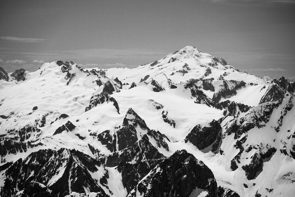
Very cool! Those straight on shots of Black, Goode, and Booker are stellar.So doug has a century of cruzin the cascades, is he one of those highlander dudes? Thanks for a great story and eye candy.
Highlander? He does drive a Highlander…