Table of Contents
The Range of Many Ranges
The Wallowa Mountains of Northeastern Oregon are a unique group of dense, high alpine peaks and lakes. They are at least 5 hours from any major metropolitan area and thus do not see that much traffic. I had always been intrigued by the colorful geology of the range, but just did not have the time to make it our there on each of my past road trips. A beautiful Fourth of July weekend forecast convinced Sam, Steve, and I to make the journey and explore a new range.
As always with a new range, it can be challenging to identify the areas of interest on a first trip. Sam and I conceived a high route loop starting and ending at Wallowa Lake traversing Aneroid Mountain, Eagle Cap, and finally the massively aloof Hurwal Divide. We felt like it offered the most continuous high terrain with short approaches and would allow us to sample many different geologic portions of the range.
Day 1: Wallowa Lake to Dollar Lake
We arrived at the trailhead the night before and Steve unfortunately discovered that he had packed a one person tent, not a three person tent! We were unsure how bad the bugs would be, but there was nothing to do about it at that point…
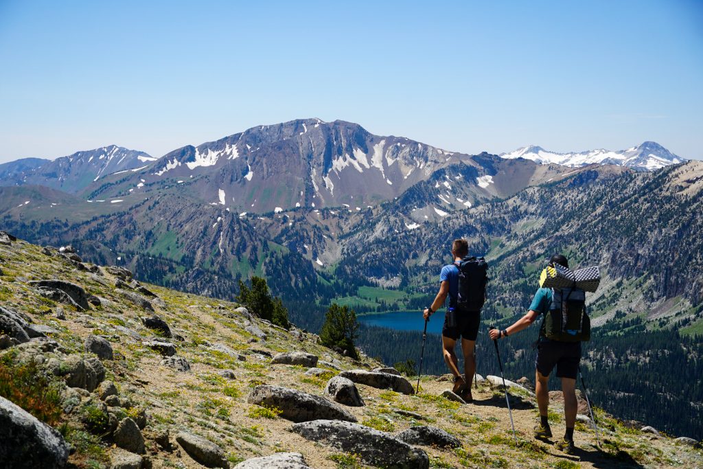
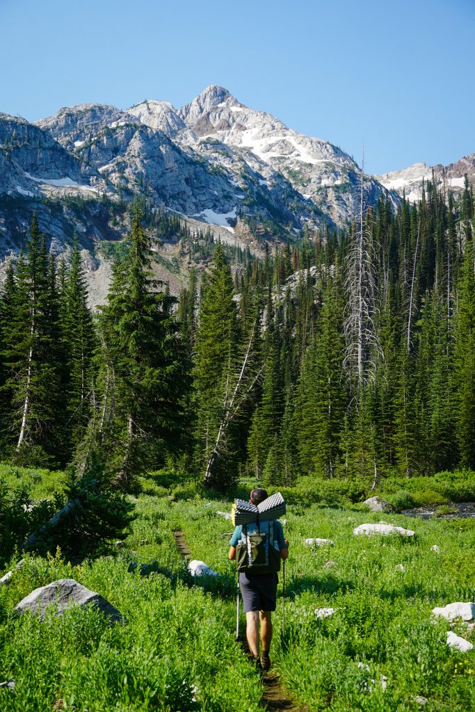
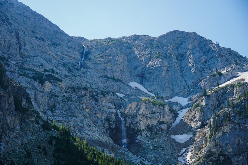
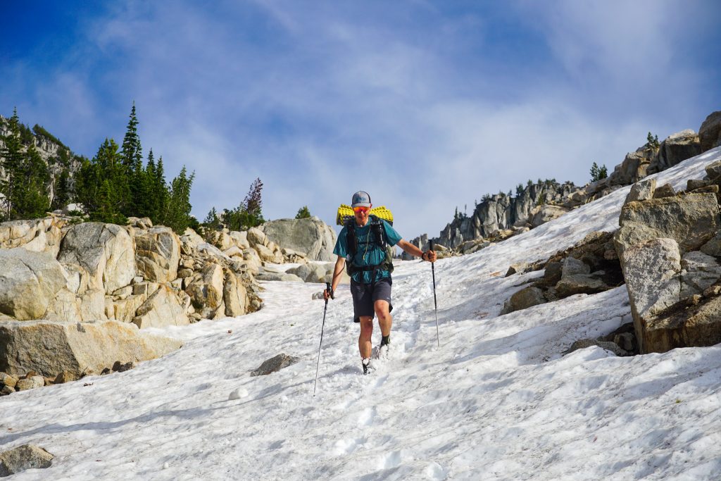
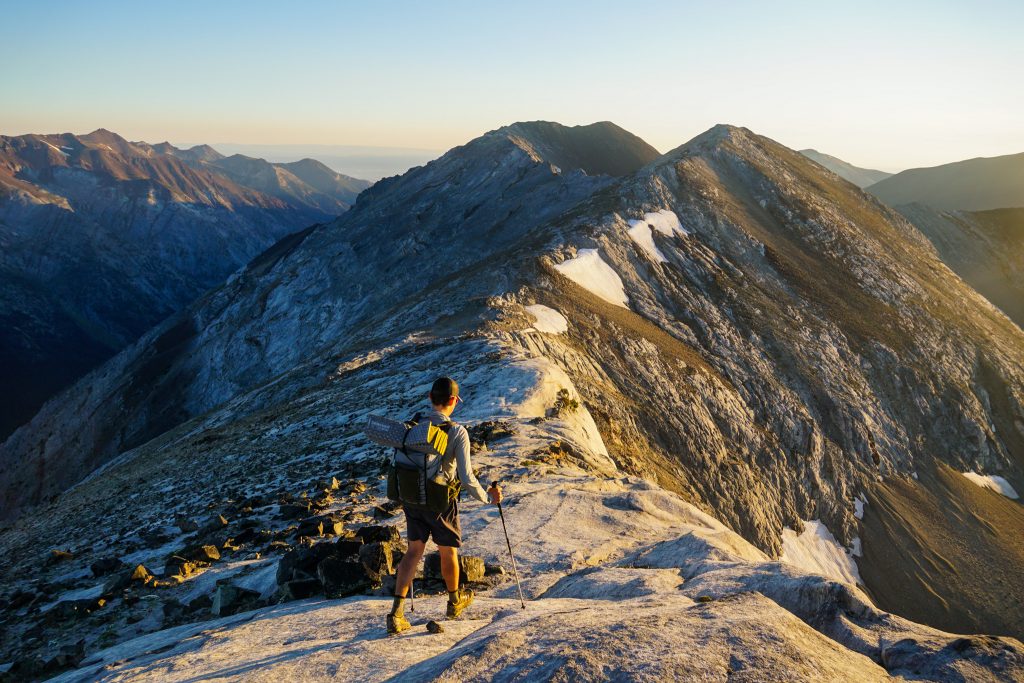
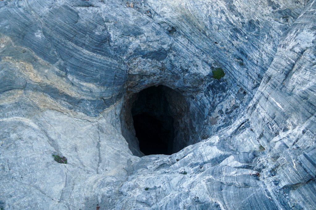
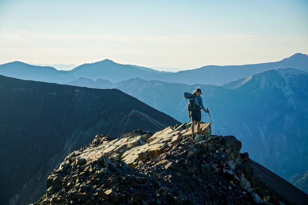
We began by hiking up the East Fork Wallowa Trail for a few easy miles before crossing a bridge and trying to find our way up Royal Purple Creek. We quickly discovered that the desert vegetation in this dry portion of the range was very poky and sharp. We eventually found a use trail that led to an old mine, but above that it fizzled out. We were often stuck between a slot canyon and steep, loose hillside that wanted to fall apart with every step.
We decided to bail upwards and flailed up the ridge until it finally eased up at 7400 ft. From there, the terrain suddenly turned to Sound of Music flowery hillsides as we traversed back to the creek to get water for the long, dry ridge traverse next.
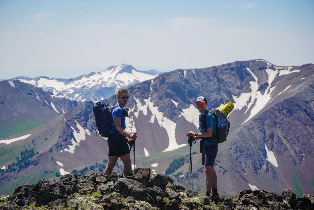
We took a short detour to the summit of Mt. Howard, where perplexed tourists who had taken the tramway up were very confused by our arrival.
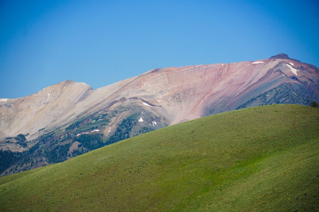
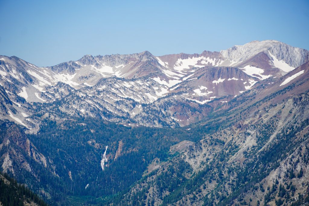
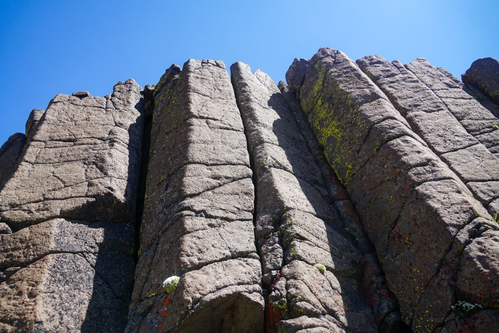
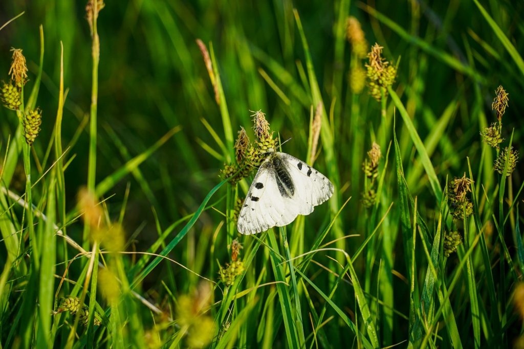
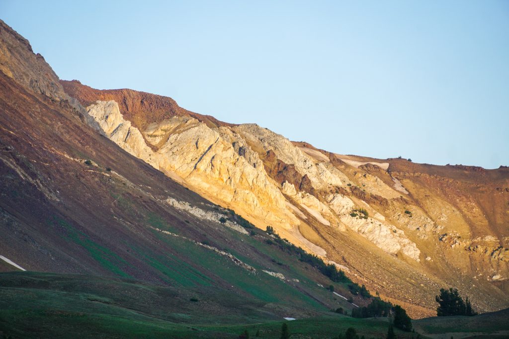
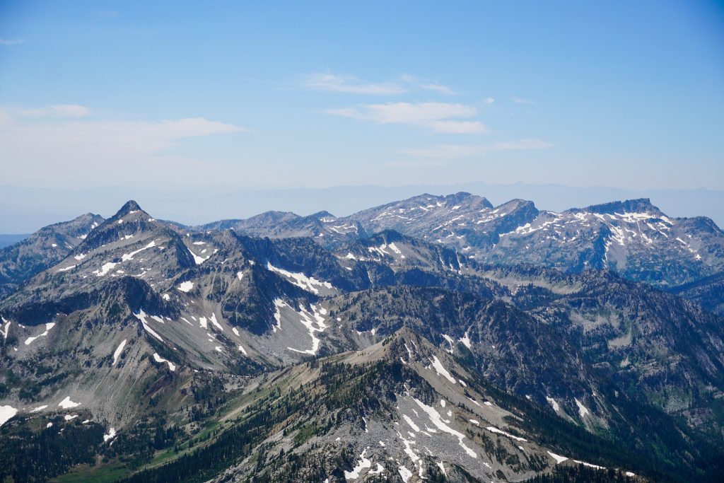
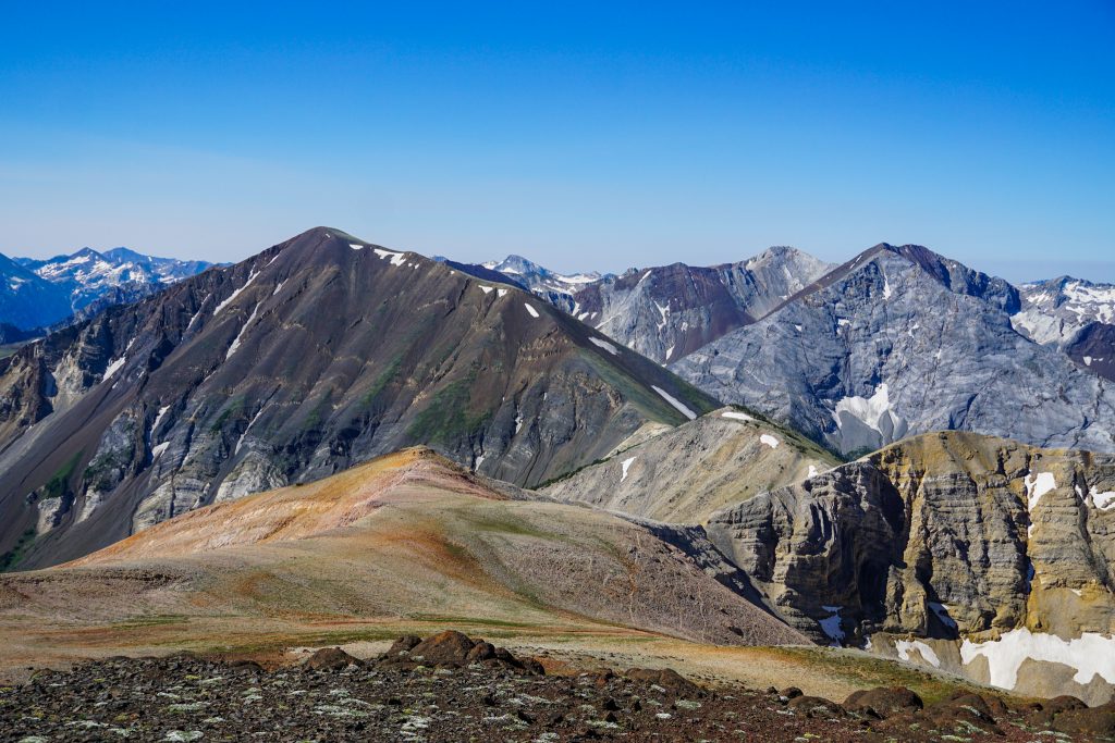
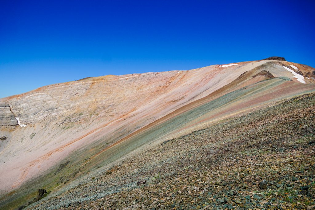
The varied rocks and colors of the Wallowas are the most striking I have ever seen. Some geologists have proclaimed the Wallowas to have “the greatest geology on Earth“! The Wallowas began hundreds of millions of years ago as volcanic islands in the ocean, forming limestone and greenstone at its shores. Eventually these islands crashed into North America and uplifted, forming the Wallowa Terrane. The Wallowa batholith (grandiorite) crystalized underground. Finally, a series of volcanic eruptions across the area covered the region in basalt, which has largely eroded since. The result in an incredible mosaic of limestone, greenstone, grandiorite, and basalt, often all in a single hillside.
From the top of Howard, we left the tourists and followed use trails to the summit of East Peak. The infinite views fading into a desert haze to the north east reminded me of hiking the Ruby Mountains of Nevada.
Travel on the crest of the ridge was very easy, but we traversed beneath North Aneroid to access a beautiful spring on the hillside. The open tundra slopes and sweeping views remind me of the hillsides around Ptarmigan Peak in the Pasayten Wilderness. But then random volcanic deposits reminded us we were in Eastern Oregon.
We did hike directly over the true summit of Aneroid. During the entire trip, we were wondering “what even is an Aneroid?” It turns out that it is a sort of barometer to measure atmospheric pressure.
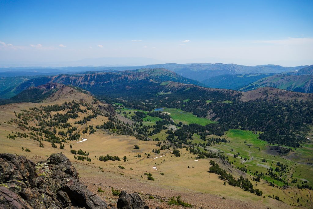
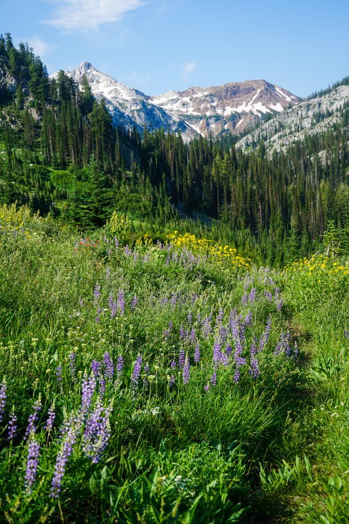
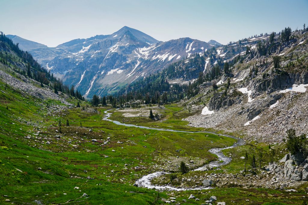
We were impressed by how lush all the eastern valleys looked in this range. There were long, beautiful meadows and ponds in wide, grassy valleys with red rock in the hillsides. These eastern valleys really reminded me in composition of the Unitas in Utah, although on a smaller scale.
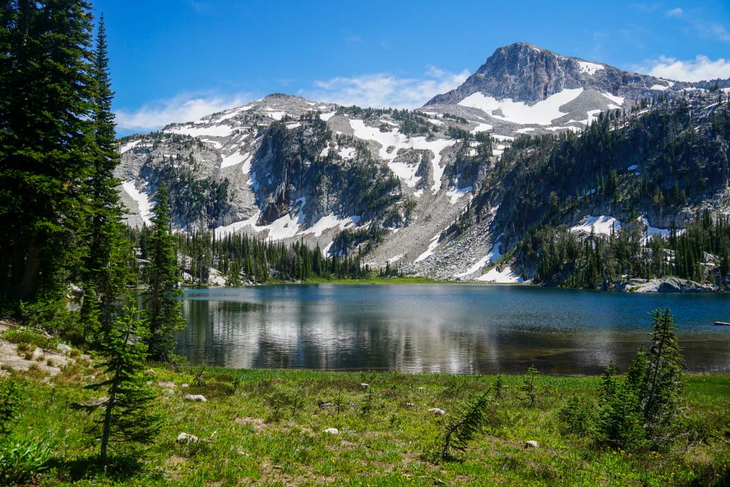
We reached Dollar Lake in the mid afternoon, but decided it was as good place as any for camp. The lake is stagnant, with no inlet or outlet above ground. As a result, it was a perfect temperature for a swim.
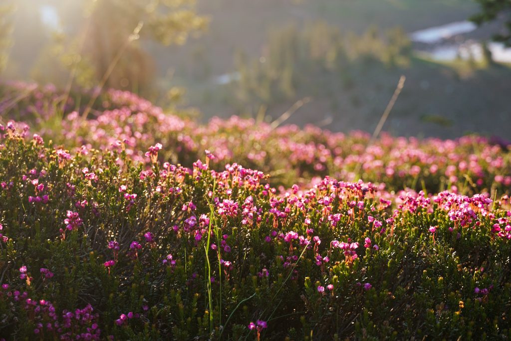
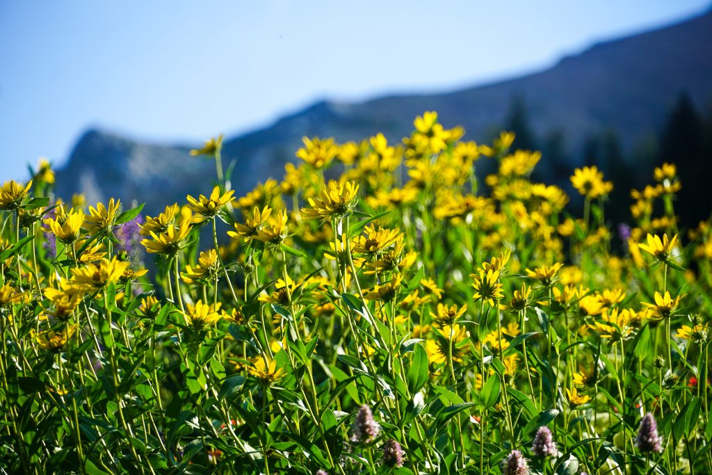
The open meadows around Dollar Lake made for a pleasant evening stroll, with just about endless photography subjects. The entire upper basin of the East Fork Wallowa River was open, green, and loaded with potential campsites. There is so much room to roam in this little range. Almost everyone seems to access the range from Wallowa Lake, but they inevitably spread out and there were only two other parties at Dollar Lake on this Fourth of July Weekend.
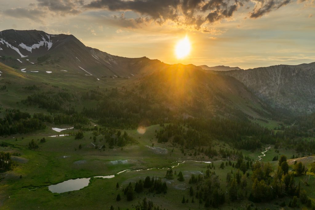
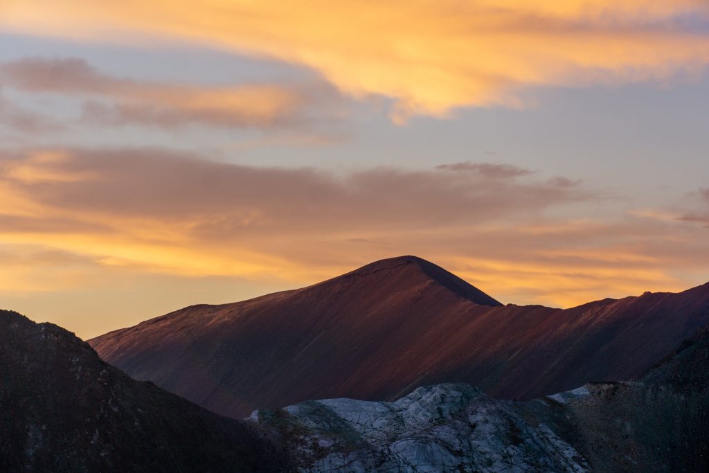
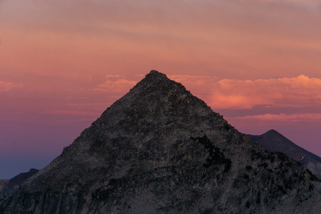
Sunsets are magical in this range, with the distant desert views, sparse clusters of pine trees, and verdant meadows and streams. It reminded me of our camp last summer above Fossil Lake in the Beartooth, spread out above a wonderful mosaic of mountain scenery.
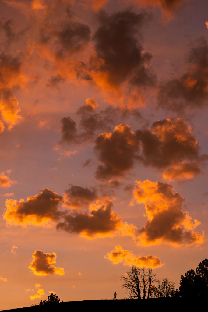
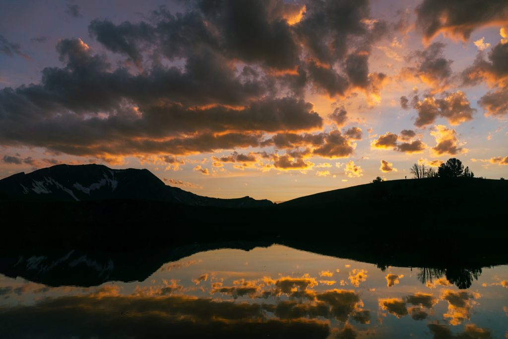
Just when we thought the show was over, the sun underlit the clouds above us and set the sky on fire.
Now for the interesting part: sleeping without a tent. I also discovered that I had forgotten my pant legs in the car, meaning my legs were getting ravaged my mosquitoes. It was so warm that I was sweating in my 40 degree quilt, but I needed it to protect my legs. I bundled up in a light rain jacket, hat and bug net over my face, and put in ear plugs so I would not hear the buzzing around my head. I would say Sam and I slept surprisingly well both nights.
Day 2: Dollar Lake to Matterhorn Peak
In the morning, we dropped beneath Dollar Lake into a nice meadow and then hiked up to the pass east of Pete’s Point.
The trail traverses beneath Pete’s Point above the North Fork Imnaha River. This trail definitely does not see much traffic, but is incredibly beautiful. The higher scree slopes faded into beautiful green hillsides; scree + greenery = “screenery”. It felt like some of the high Olympic Meadows like Cameron Basin and Deception Basin.
The trail on the other side of Polaris Pass is a losing battle. The trail is eroding very quickly in the steep scree hillside. Lower down, the trail is obviously not maintained, but still maintains its insanely flat, long switchbacks. Descending down into the West Fork Wallowa, amongst a faint, flower filled trail reminded me much of the Boulder Pass trail in the Napeequa, which is also too flat for its own good.
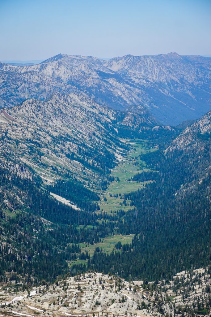
The trail emerged into a beautiful open canyon at the head of the West Fork Wallowa. Flowers and boulders decorated the valley floor, while giant waterfalls poured from steep cliffs above. It reminded me and Sam of Le Conte Canyon on the Sierra High Route, so regal and magical.
The river crossing was about knee deep, cold, and swift. From there, we really started gaining elevation towards Glacier Lake. The trail stays surprisingly open and beautiful.
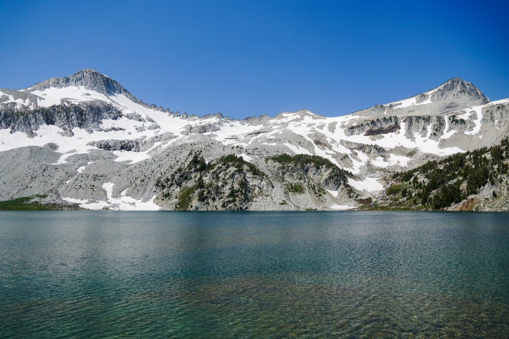
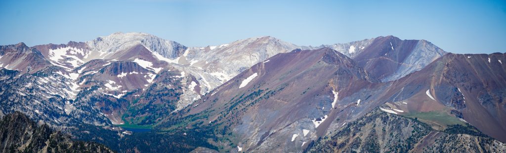
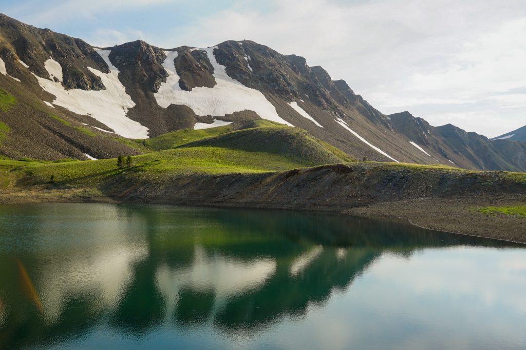
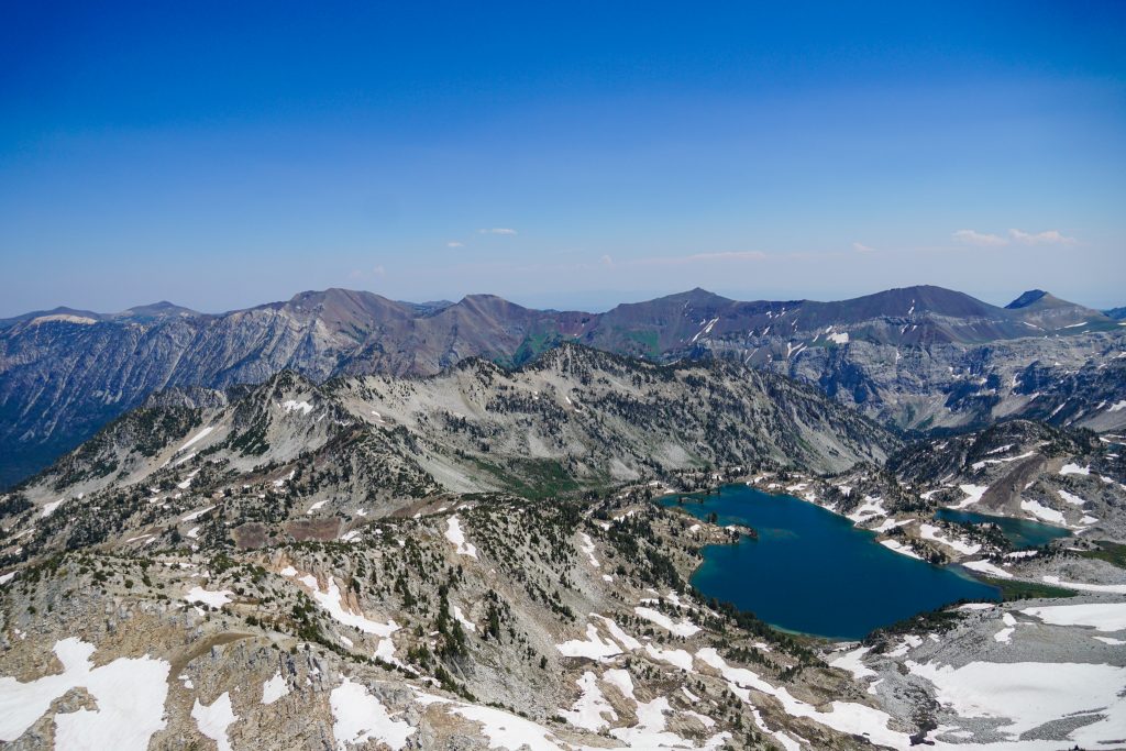
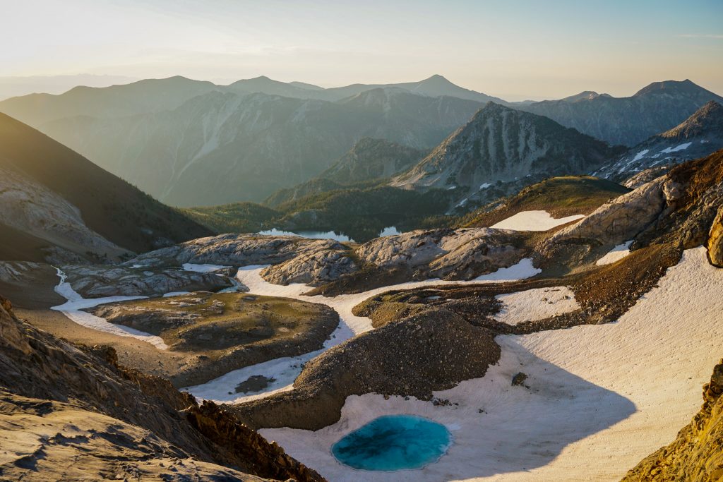
At the crystal cold Glacier Lake, with granite peaks above, it felt like we were in an entirely different range from the day before. That is the magic of the Wallowas – no other range has so much diversity packed into such small area.
We took the trail to Glacier Pass and then followed the ridge up to Eagle Cap. We should have traversed far left to avoid any steep scrambling, but instead tried to scramble through a weakness in the cliffs, which yielded some very unpleasant 4th class scrambling.
Eagle Cap is perhaps the quintessential summit of the range, the namesake of the Eagle Cap Wilderness. It sits at the heart of the range, with ridges and valleys radiating in all directions.
There is a trail down the other side of Eagle Cap, which made for a nice easy descent.
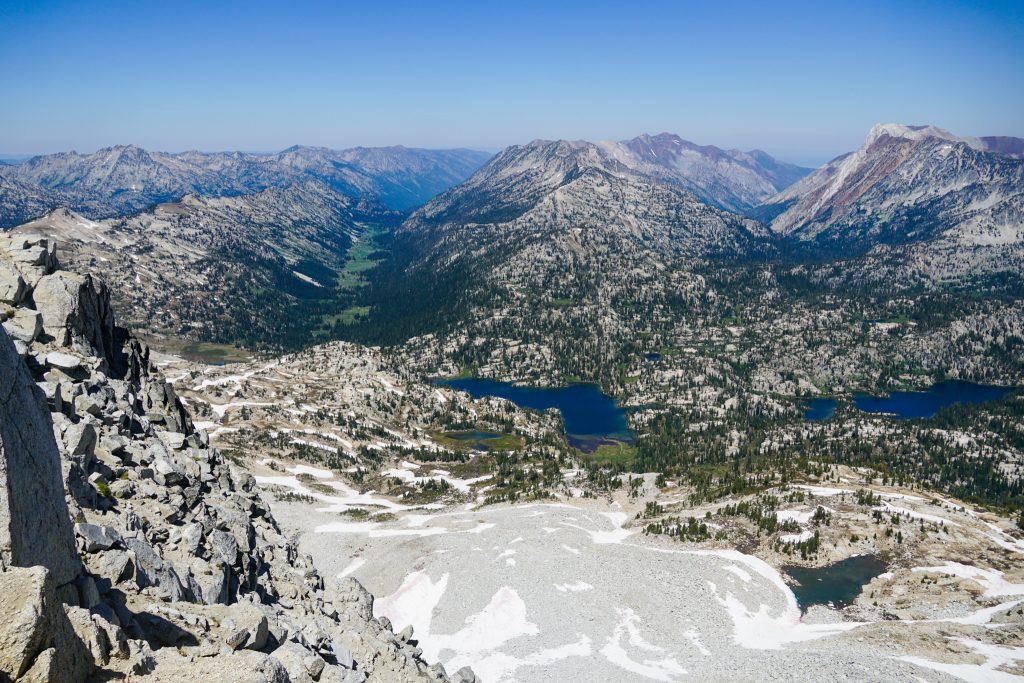
Upper Lake is an interesting anomaly. The outlet of the lake splits and flows into two complete different drainages: the Lostine and Wallowa. The maps draw it feeding the Lostine only, but at this time of year, it most definitely feeds both.
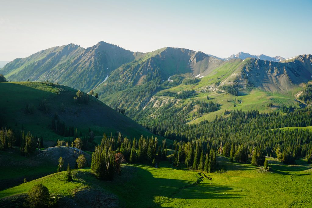
Mirror Lake was the only place you could call remotely “crowded”. The bugs were the bad, even in the midday heat, so we pressed on and pounded the miles. The terrain past Moccasin and Douglas Lakes is very reminiscent of the hummocky granite landscape in the foothills of the Wind River Range. It is very monotonous, with many little ups and downs and no significant landmarks.
Our plan was to take the trail up to Razz Lake and then over a pass into the Ice Lakes Basin, but we never found any trail branching off. As we walked up the outlet stream from Razz Lake, we occassionally ran into an old trail, but then it would disappear under a dozen blowdowns. This section was hot, spiky, and we were all getting tired.
At Razz Lake, we could tell Steve was pretty worn out. He also had been suffering from bad altitude headaches during the entire trip. He said he was done hiking for the day. We knew that we would not be able to do Hurwal Divide the next day if we stopped now. Further complicating things, Sam and I were frightened at the prospect of hanging out at this buggy lake for an entire evening with no bug protection. So we agreed to split up: Sam and I would push over the next pass, while Steve would take a more leisurely exit and meet us at the car the following day. We had inReach devices, so communicating would not be an issue.
There were a few different passes that could potentially work above Razz Lake. The obvious one above the lake looked steep on the other side according to slope angle shading. So instead, we backtracked eastward for five minutes before heading north to a slightly higher pass. The climb up was simple and sandy and the other side provided easy passage into a boulder field. We named the pass “Razz-ma-tazz Pass”.
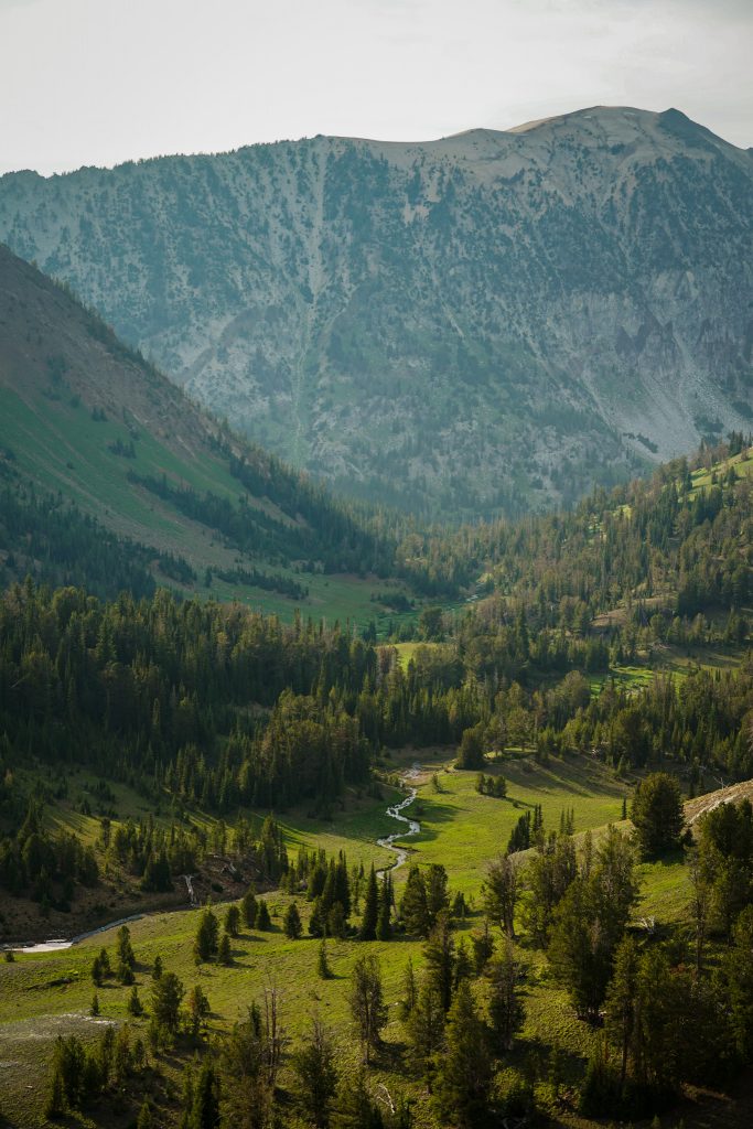
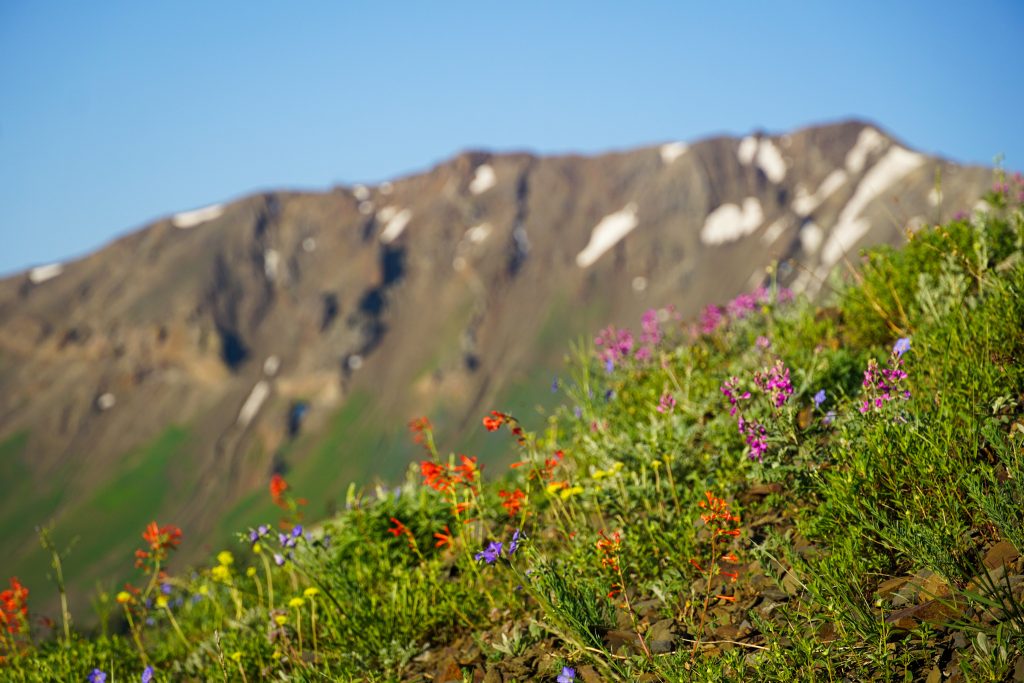
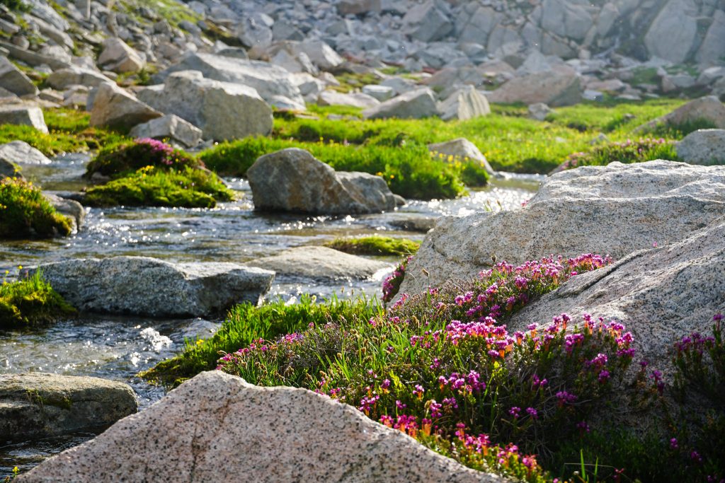
We skied a couloir until it terminated and then hit the valley floor at a marshy pond. From here we turned uphill and hiked through a virgin landscape of flowing streams, granite boulder gardens, and blooming heather. In the soft evening light, it possessed the magic of the High Sierra. After 13 hours on the move, Sam and I felt energy surging through our bodies, drawing from the flow and light of the land. For the first time all trip, I really felt the spirit of high routes coursing through me once again. A sparkling stream, an alpine dream – this is the essence of high routing.
We reached a high bench at 9000 ft beneath the Mattherhorn, our camp for the evening. There was no water here, but the bugs had found us and pestered us through a quick dinner and then early bedtime.
Day 3: Matterhorn to Wallowa Lake
Sam and I woke up under the glow of a pre-dawn sky and were moving by 4 am. We wanted to try to get back to the car around lunch or so, so we could manage the 7 hour drive back to Seattle at a reasonable time.
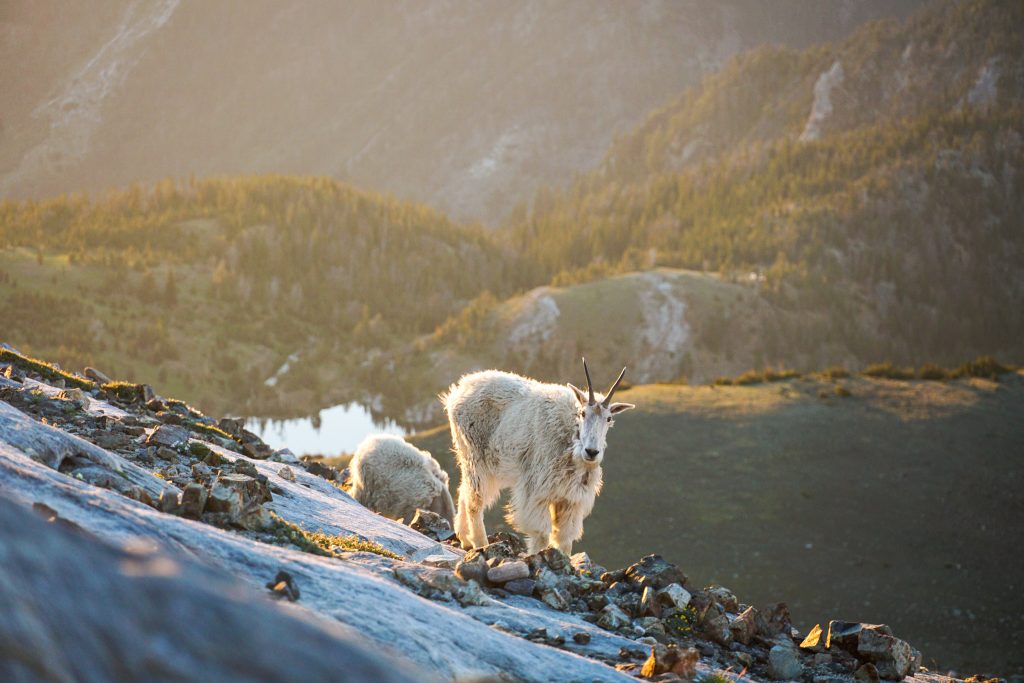
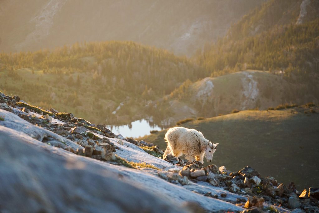
So we dropped down, crossed a stream, then climbed up to a stagnant pond. We gained the Matterhorn trail and continued up to towards the summit. There was a huge herd of goats blocking us, but they slowly moved out of the way at our polite request.
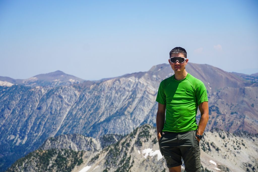
We crested the long, flat summit ridge of Matterhorn just as the sunlight hit us from the east. A summery haze contributed to an incredible purple glow in all directions. I captured some shots of the goats moving below us.
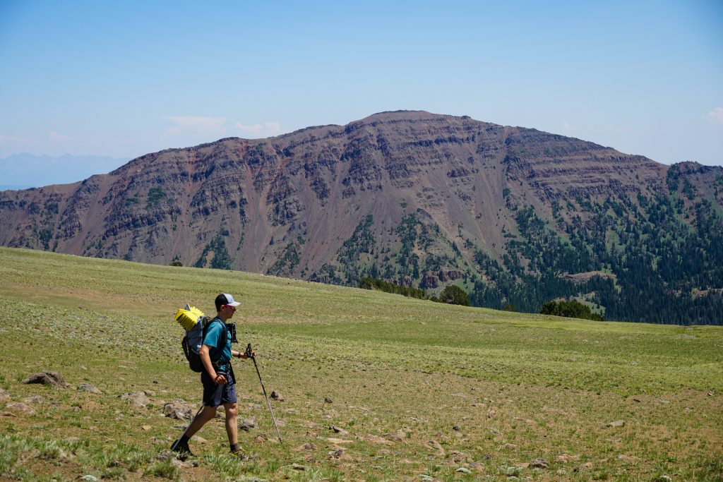
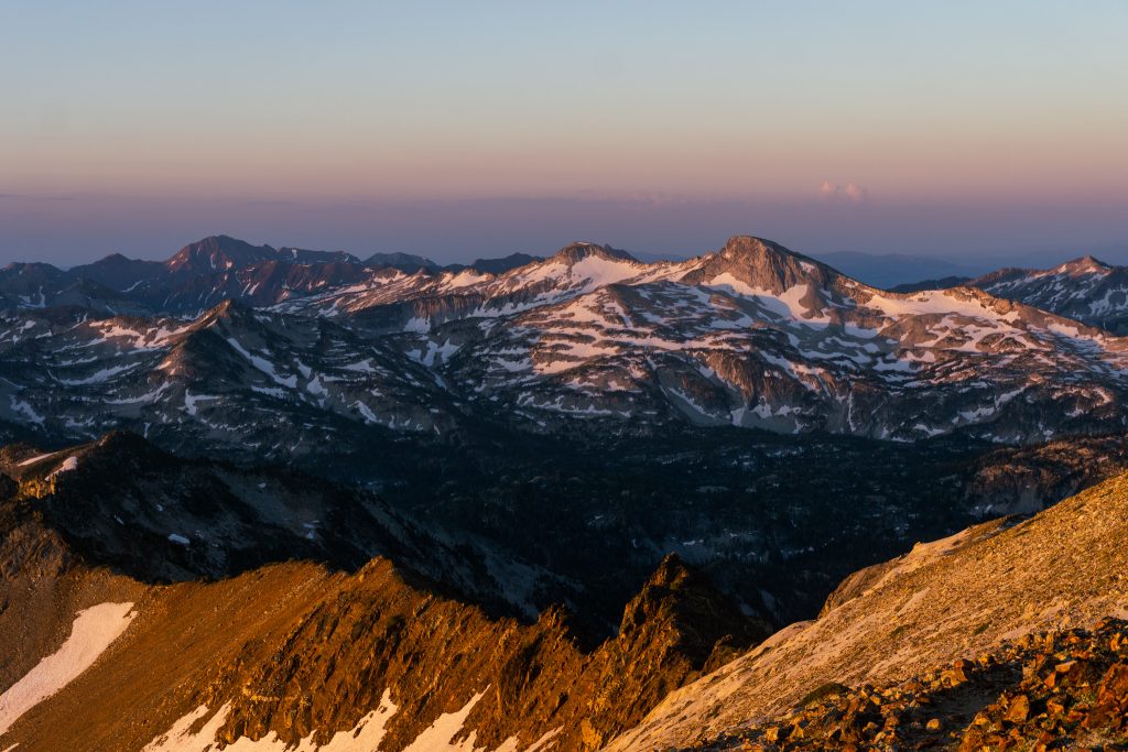
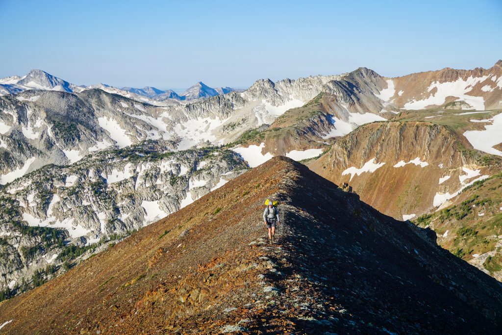
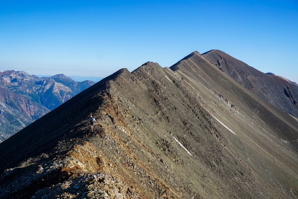
Sam and I begun the long, incredible ridge traverse that would lead us all the way to Chief Joseph Peak, straight on the spine of the ridge. We did not know much except that it would go. The first section towards Sacajawea was on bomber grandiorite slabs, making for easy travel. The warm sun bathed us in morning light and reflected of post-glacial lakes below us.
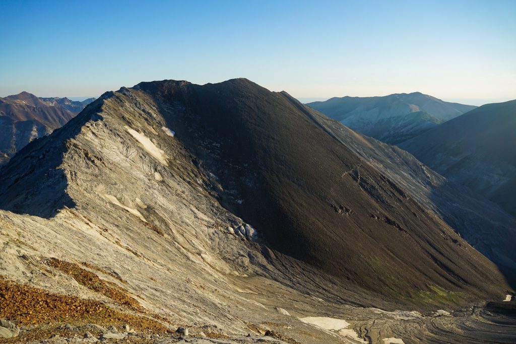
This section of the range, with long, consistent fall lines, giant scree slopes, and worn down ridges, reminded me greatly of Borah Peak and the Lost River Range. I wonder if the ridges there are as amendable to such simple, aesthetic ridge travel.
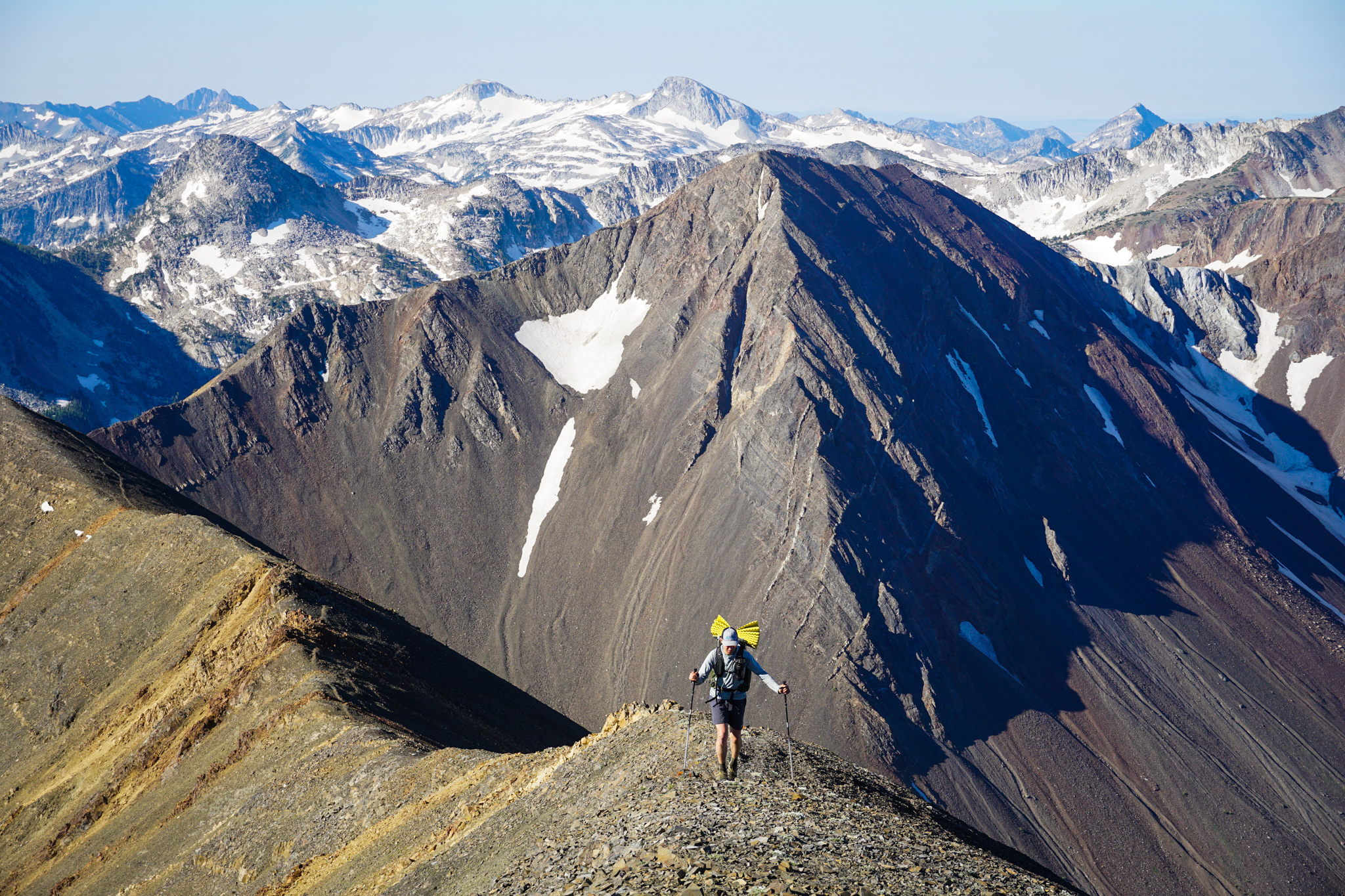
We started to transition from the gray grandiorite to the reddish blackish angular rock of Hurwal Divide. The rock was surprisingly stable and the ridges were easily wide enough for travel. In flatter sections, there was a trail across the ridgetop. With the complete lack of bio material in this environment, it does not take much traffic to create a trail, and I am sure the goats use this one frequently.
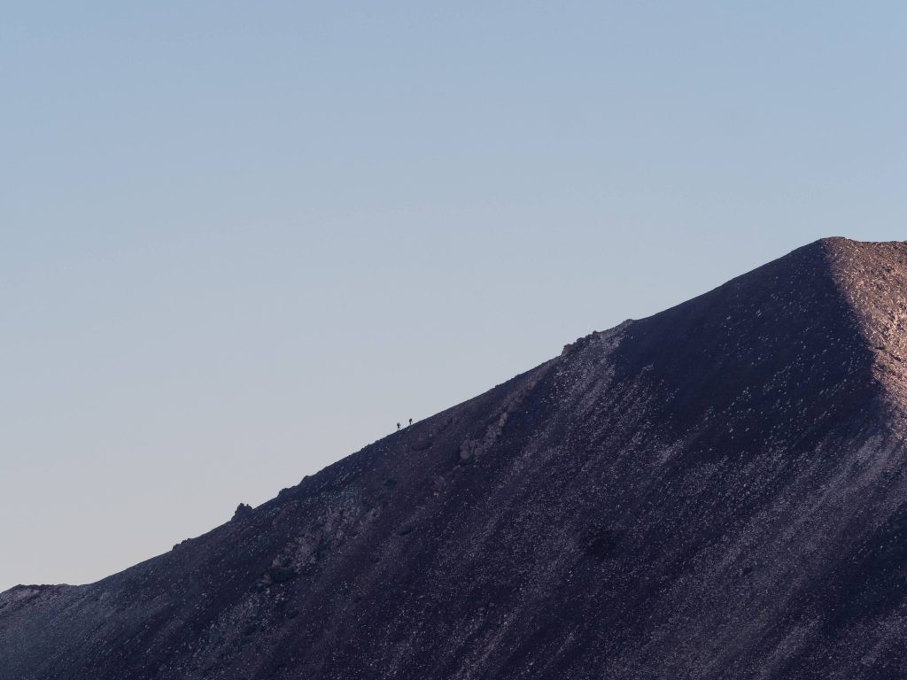
Little did we know, at the same moment, Steve was cresting over Razz-ma-tazz Pass and caught a photo of us with his long lens.
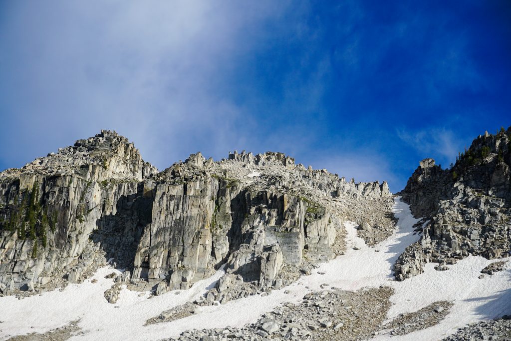
There was one class 3 downclimb section above the Ice Lakes, but once we got to Hurwal Divide itself, it was straight cruiser.
In all our high routing around the West, Sam and I have never encountered a feature like this massive, 6 mile long traverse from Matterhorn to Chief Joseph. There is no other ridge we have found that can offer such easy, consistent, epic ridge travel at the highest elevation of the range. Up until this point, the Wallowa High Route was really good. This section put it over the top.

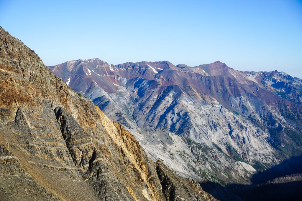
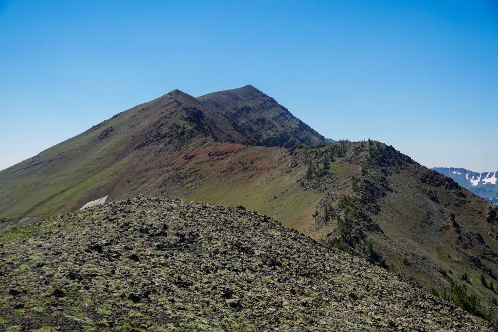
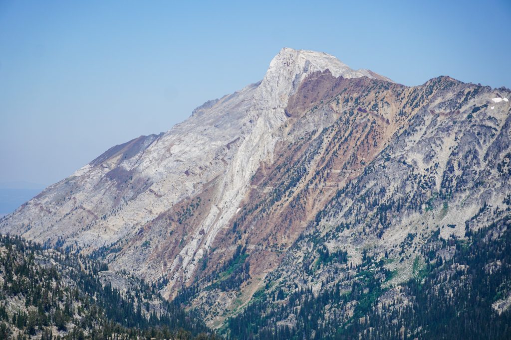
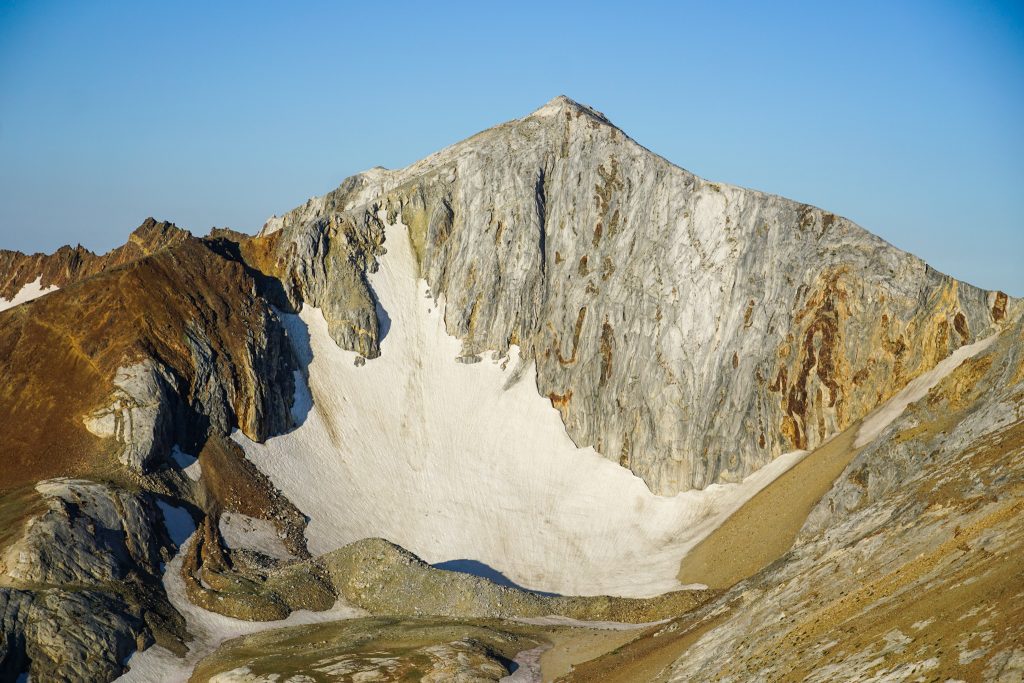
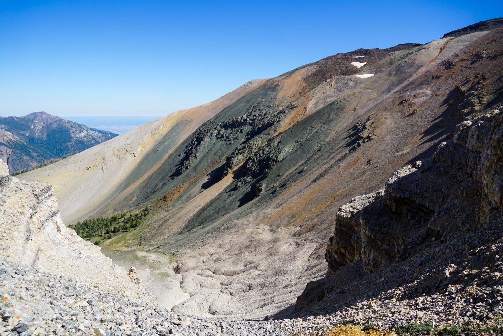
Past the true summit of Hurwal, the terrain changed dramatically, to grassy tundra and then limestone slopes. Chief Joseph Peak is perhaps the most colorful of all the Wallowa peaks.
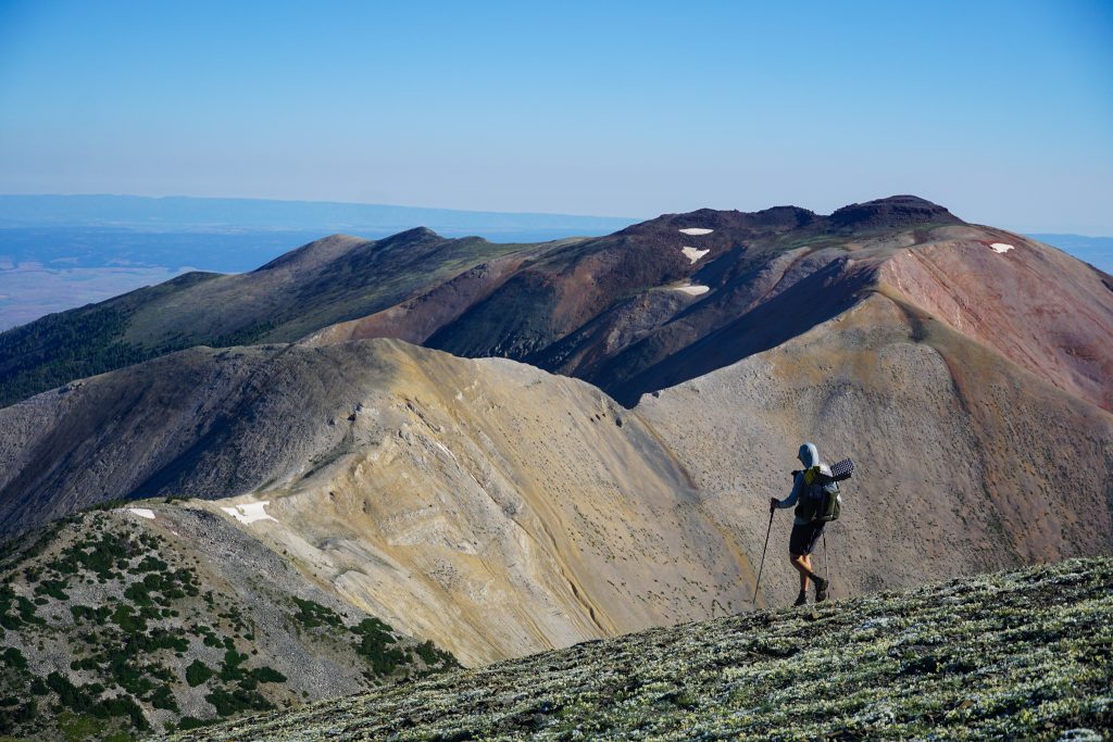
We passed two people near the saddle who gave us helpful descent beta for Chief Joseph and then we pushed up the final climb to the summit.
From Chief Joseph, we gazed across the Wallowas at the giant horseshoe loop we had just covered. We saw so many different colors, so many different settings, so many different ranges, all in one. It was a beautiful line we traveled – easy, varied, alpine, and so aesthetic.
We followed the east ridge of Chief Joseph all the way down to 8000 ft before descending to the north down a sandy gully. This “climber’s trail” was pleasant to boot ski down but would definitely be a pain going up.
We hit the old Chief Joseph trail at 6300 ft and began following it down. To our pleasant surprise, we found a new, more direct trail that intersected it. It actually leads directly down to the Wallowa Lake Marina, so we gave Steve a call to pick us up there. Conveniently, he had just arrived back at the car, so he drove us over and picked us up! It was just after noon, so we drove into Enterprise for a filling lunch and then started the long drive back home.
Our three days in the Wallowas were truly stunning. In our minds, the Wallowa High Route ranks up with the Sierra High Route, Wind River High Route, and Cascade High Route. But none of those trips can provide the same incredible variety and beauty of scenery in such an accessible three day trip. I would even venture to say that the Wallowas are the most beautiful mountain range, mile for mile, that I have ever visited. After all, you could say that the Wallowas are not just one range, but the best parts of many ranges, all packed into one.
Notes:
- Curious about what gear we used? See this post about my favorite high route gear.
- Our route measured 45 miles and 20k ft gain. There are a lot of ups and downs and majority of the trip is spent above 8k ft, but nothing is ever over 10k.
- There is abundant camping in this range. The eastern part of the range is so open and the central part has so many nice alpine lakes.
- The ridges in the Wallowas are incredible! If they are of the terrane or volcanic variety, they are very worn down and flat, making for easy walking. At times, we kept expecting more difficulties, used to granitic ranges like the Sierra and Cascades, but it was always straightforward.
- Hurwal Divide was definitely the most unique section of the route, but we really enjoyed all of it.
- I think the direction we went made sense because it saved the most epic part of last and Chief Joseph Peak would suck to go up. Also, then you would have to carry a ton of water up Chief Joseph and over Hurwal Divide since you would have no water the entire first day!
- If you really want to make life easy on yourself, you can take the tram up to Mt. Howard and avoid any nasty sections!
- We had minimal snow crossings, but that could change obviously depending on the year.
- Mosquitoes were bad, but only really in the morning and evening.
I’ve been waiting for this! Absolutely breathtaking, Kyle! Thanks for taking the time to write it up. Here’s hoping I can squeeze in the time to do a very similar trip soon.
You are welcome! I hope you get the chance to explore the Wallowas.
Nice work! I’ve done the Hurwal Divide 1.8 times, both times as day trips from Wallowa Lake (from Chief Joseph to Matternhorn). The first time was in 2011, and I ran out of water and started cramping after doing the class three section above Ice Lake. So I had to drop to Ice Lake before reaching the Matterhorn ridge to get water. I finally got a chance to try it again last summer- I carried more water, and found a nice tarn not long after Chief Joseph which allowed me to get to both Sacajawea and Matterhorn. That ridge is very dry later in the season, but that ridge-walking is phenomenal! (Also, going up your descent route wasn’t too bad, I was able to walk beside the sandy user path on slightly more solid terrain!)
Very cool! Water is probably the only real challenge on that route, that’s the nice thing about starting with Matterhorn. I wonder when the water source around Chief Joseph dries up.
Last year there was still just a little snow left on July 20. There was no snow on August 19, 2011 (as would be expected, I just didn’t start with enough!) I’m guessing you’d be OK through mid-July most years, possibly end of July in a bigger snow year.
Kyle,
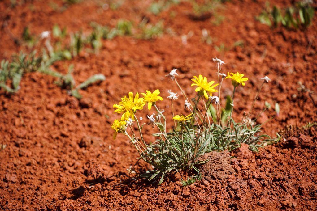
Great write up on the range, enjoyed your take on the unique geology of the Wallowas. The photo of the colored sediments on Joseph is reminiscent of the colored geology in the Peruvian Mtns. Inspiring.
Hey Bruce! It’s a really beautiful and unique range! The Peruvian Mtns. must be incredible!
Thanks for this inspiring writeup, although I don’t think our team fully appreciated just how strong you are! We were considerably more fatigued and slow in comparison, and we took your name in vain more than a few times! 🙂 But to our credit, we also added an offtrail I had previously explored over North Basin peak to spice things up, which I find to be a fun and beautiful bouldering challenge. I recommend it if you feel you have the energy when you get to Lakes Basin.
My daughter, her boyfriend and I knocked this out last week (July 16-19). Of course, this year we experienced way more snow than you experienced (including a mostly ice-bound Glacier Lake) which was a real benefit. We used the tramway since we knew we would be pushing our physical limits as it was. We actually were able to refill water bottles with snow at many locations on the Hurwal Divide, which saved our butts as it was fairly warm.
We camped at the end of the valley over Razz Pass, due to running out of daylight (we dropped 2 fatigued people at Razz Lake – just like you!). On the other side of Razz Pass, it was good camping – sheltered yet early morning sun due to the alignment of the valley. However, in hindsight, we should have pushed just a little further and camped on the beautiful benches and ponds above that. In either case, it makes for a long final push from that location to the State Park.
The Hurwal Divide is the main challenge for sure. For 2 of us, with some rock climbing experience, it was pretty ok. For my daughter, who is a beginner rock climber but very fit overall – she was a little unnerved and shaky in a couple technical spots.
All-in-all, very happy I did it, and the memory of the pain of 9K feet of rocky descent on the final day is fading quickly.
Thanks for all the writeups, you’ve put together a great resource that I know many people appreciate.
I’m glad you had a great experience out there! By Lakes Basin, are you referring to the section just north of Cusick? If so, then my friends did that higher part with an extra day and it seems really fun.
Looks so beautiful! Thanks for the awesome write-up. Do you have a GPX track of the route you guys took?
I think if you dig back through my old strava activities, given the date, you can find GPX tracks.
Here’s a GAIA map of the route: https://www.gaiagps.com/map/?loc=12.4/-117.3180/45.2510&pubLink=WqLEK8yRShaxnCOAIZ53uKXt&trackId=10f5eb86-cb2a-40ab-9d19-ab3ea3c17974
Not sure that is what you need, but its an easy way to share it.
Thans you Chris and Kyle!