Table of Contents
The Way Through
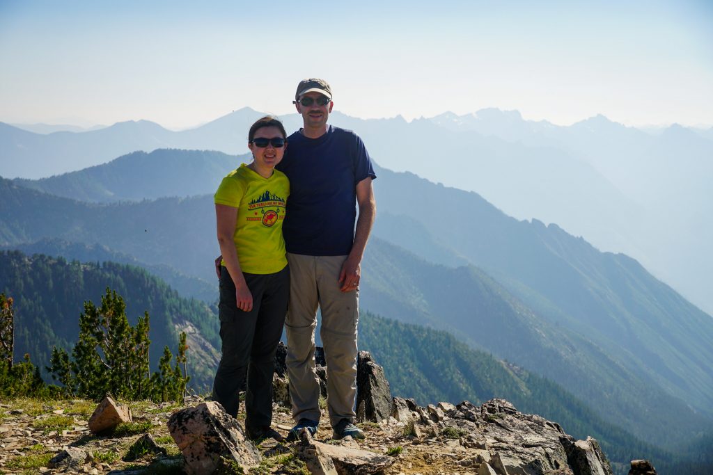
Each year, my dad, my sister Sara, her husband Shane, and I do a backpacking trip together. Last year, we visited the Chain Lakes in the Alpine Lakes Wilderness. This year, Shane suggested we do something involving Stehekin.
Stehekin is a remote town at the end of Lake Chelan, a 50 mile glacial carved lake in the Eastern Cascades. It is only accessible by boat or plane. Stehekin means “the way through” in Salish because it is a very low elevation passageway to Cascade Pass, which was used by the natives to trade. The complex logistics of visiting Stehekin is the main reason that I had hiked almost everywhere else in the Cascades, but never to Stehekin.
I have long been enamored with the Chelan Sawtooth Wilderness, a region of high open peaks to the east of Lake Chelan. The terrain is high and dry, studded with endless larch glades and little alpine lakes. There is a trail that crosses the range called the Chelan Summit Trail. I figured that a thru-hike of the Summit Trail ending in Stehekin would be a great family trip.
Day 1: Crater Creek TH to Angel’s Staircase
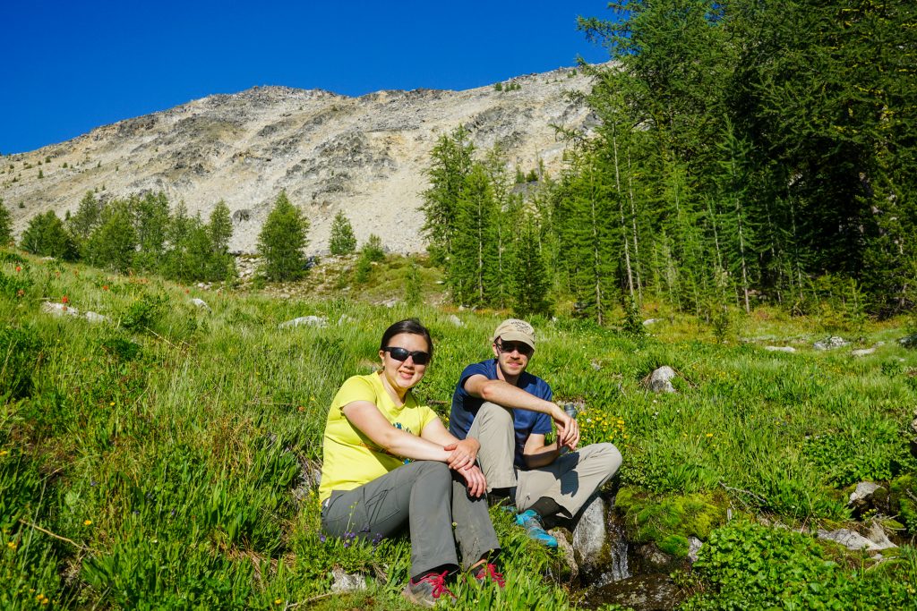
We drove to Lake Chelan and parked a car at the Lady of the Lake dock. I had arranged for a car shuttle to the Crater Creek Trailhead from Methow Motion Shuttle Services, so we would not have to drive two cars over and do the shuttle after a long ferry ride out at the end of the trip. They picked us up on time and took us over to the Crater Creek Trailhead.
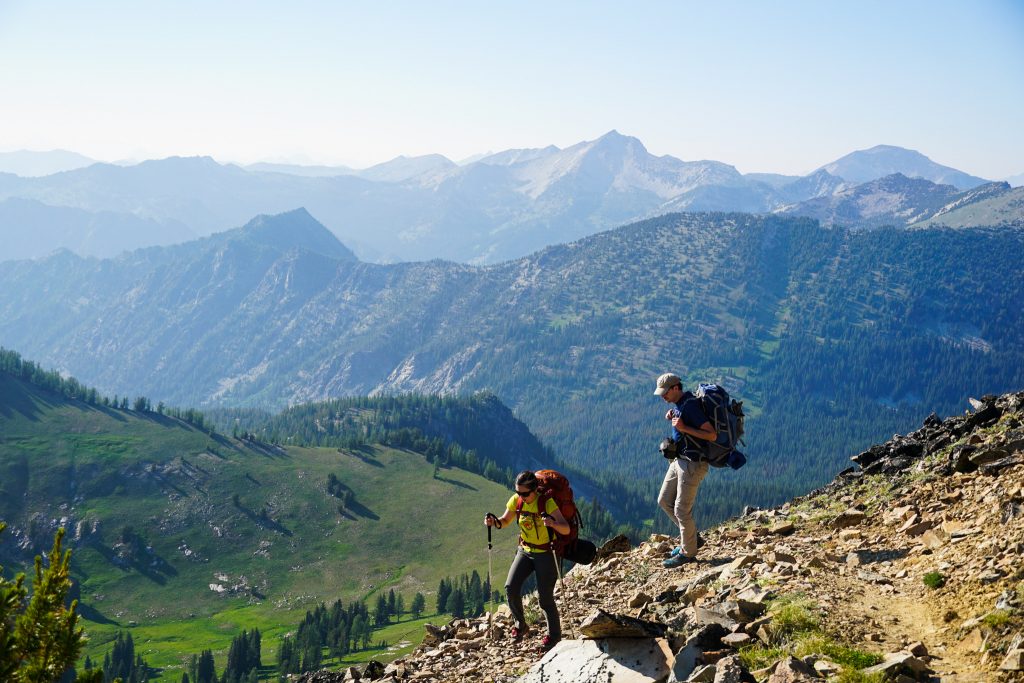
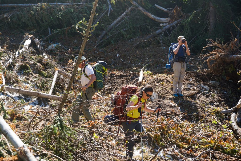
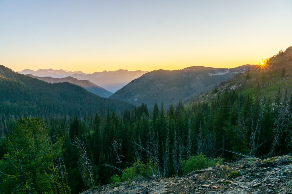
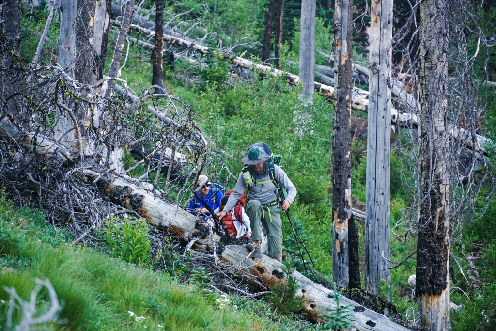
I have been to this trailhead twice before, once while doing the Switchback Bigelow Traverse and most recently while doing the Golden Lakes Loop at the peak of Larch Madness last fall. The trail was surprisingly quiet, but it was the heat of the day and I think this area is much more crowded in the fall, if you can ever call it crowded. The mosquitoes were annoying, so we made relatively few stops all the way to Cooney Lake.
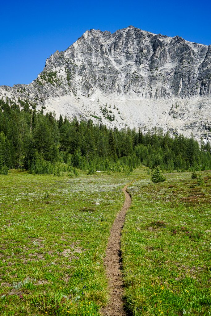
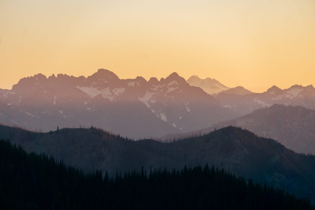
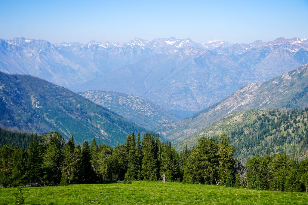
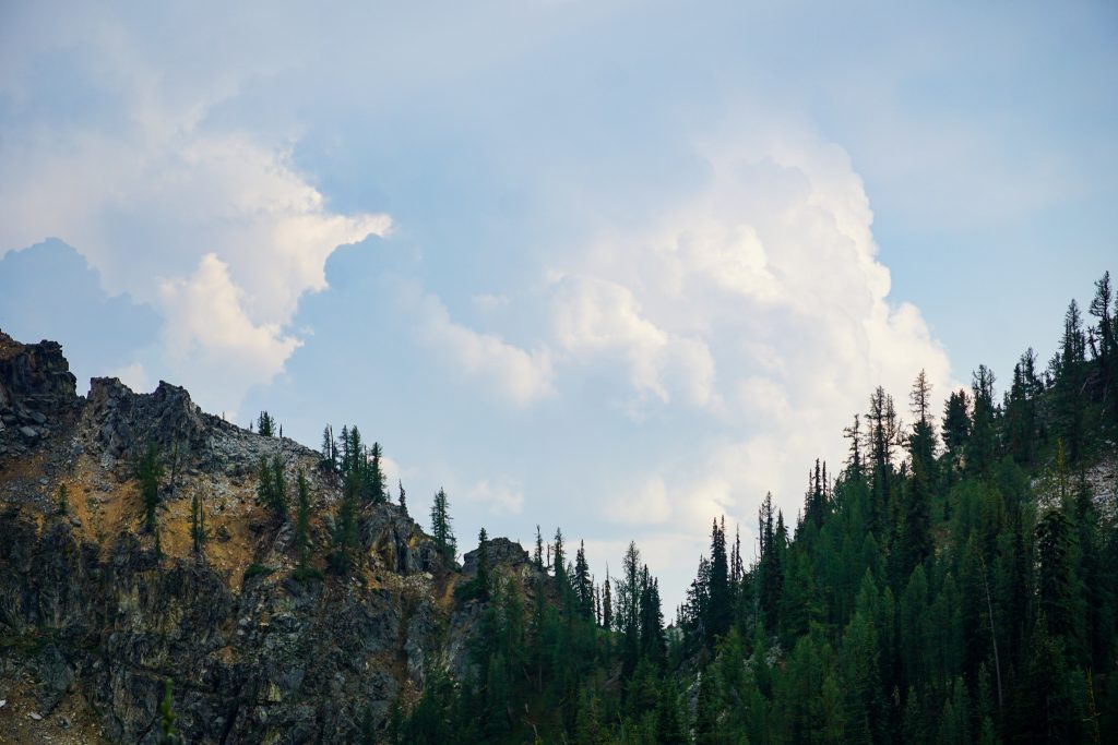
Angel’s Staircase above Cooney Lake provided our first relief from the relentless mosquitoes and afternoon heat. We crested 8,000 ft, an incredibly high point for a developed trail system, and took a nap in the cool breeze and hazy views of the nearby mountains. When it is clear, one can see all the way to Mt. Baker from here, but at least the haze had a way of softening the light.
We had some discussions of where we could place our camp to minimize our chances of mosquitoes, but all the lush green meadows below did not look promising. So we just tried to enjoy our comfort while it lasted.
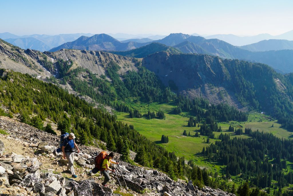
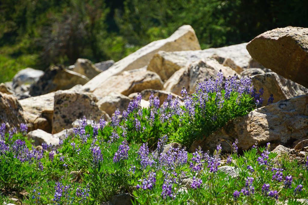
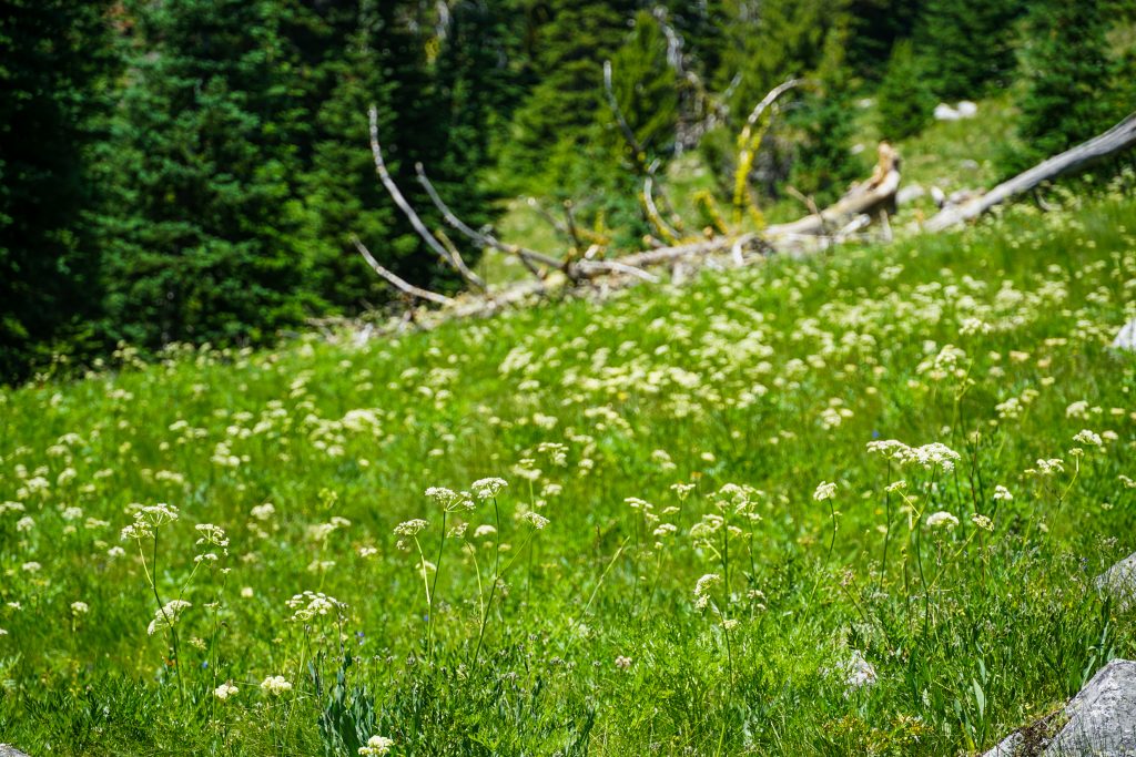
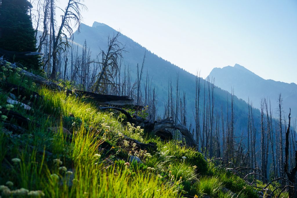
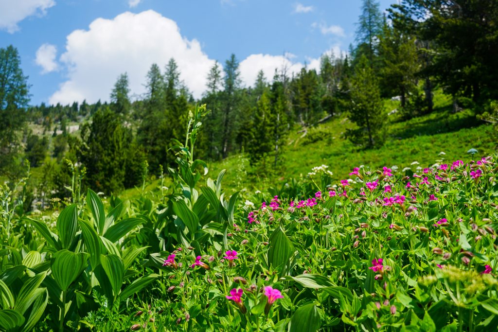
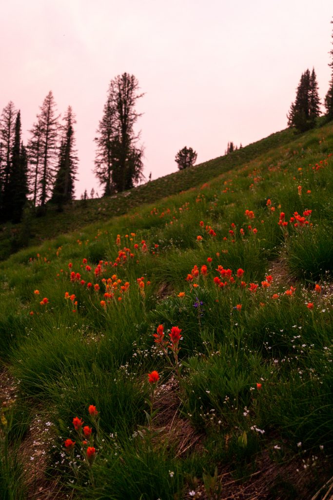
The Chelan Sawtooth range in July was massively different than what I have become accustomed to in my previous autumn visits – bright green larches, abundant springs, and lush meadows. We stopped at a surprisingly bug free meadow and drank the pristine spring water, admiring the flowers all around us.
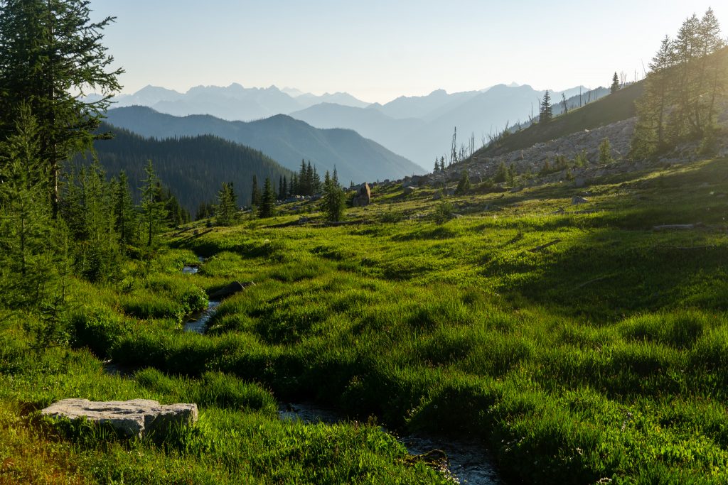
We filled up on the spring water and continued on to the pass between the middle fork and east forks of Prince Creek, where we made camp. One of the appeals to this trail was consistent travel on the west side of the Chelan Sawtooth crest, with uninhibited sunset views to the west. Lake Chelan divides the Chelan Sawtooth from the rest of the Cascades, just far enough away to feel forlorn, but still almost close enough to touch.

There are so many subjects to photograph, and different angles the light kisses in this range. Maybe the Chelan Sawtooth should be Washington’s “range of light”.

Day 2: Angel’s Staircase to Star Meadow
Our second day began with some pleasant miles over towards the wilderness boundary, where we descended into the main drainage of Prince Creek.
We passed two national forest employees who were doing trail maintenance, and they certainly had a lot of work to do! There were many blowdowns in this section, probably a few dozen per mile. They gave my sister and dad a lot of trouble, slowing us down a great deal. On top of that, my sister had bad rubbing on her heels from some old shoes. The heat during the climb out of Prince Creek only added to the misery. We wanted to take breaks, but swarms of mosquitoes would not let us rest.
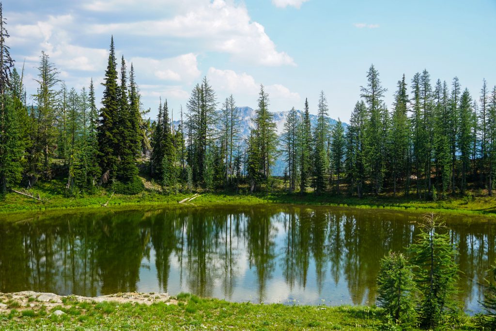
Finally we emerged back into the alpine near Star Pass. It was a welcome change after a long, monotonous section.
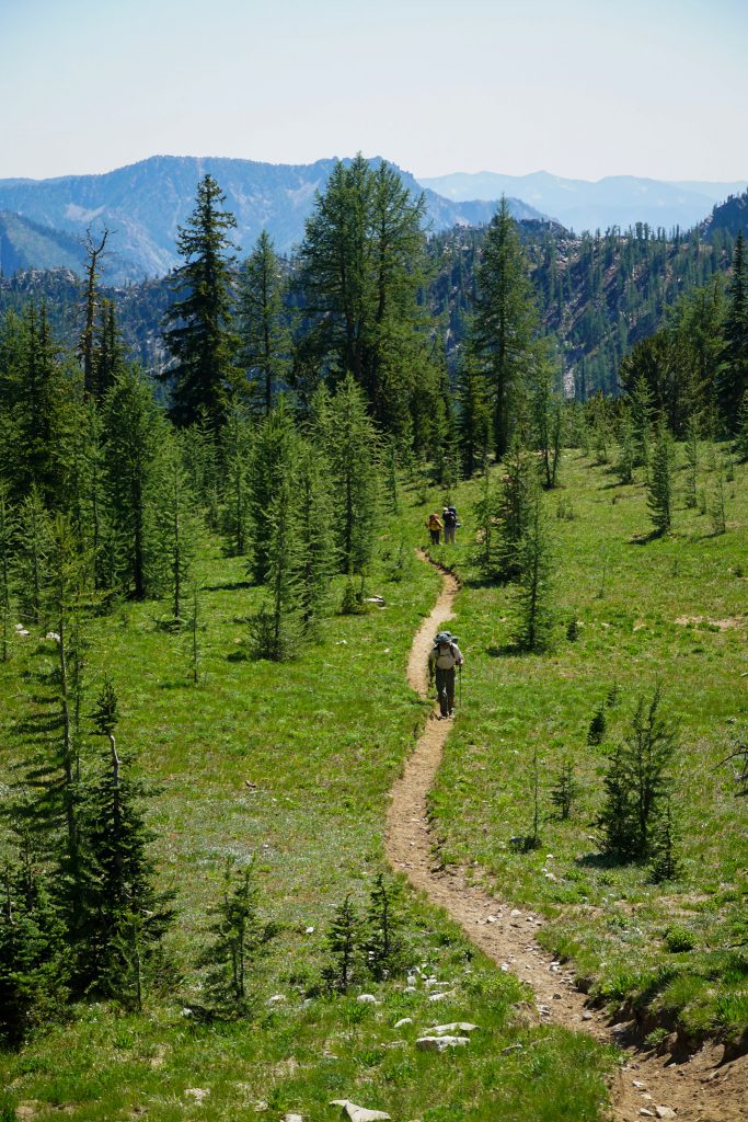
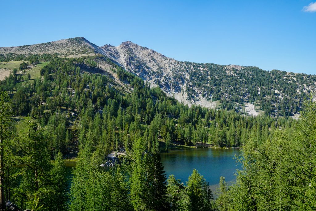
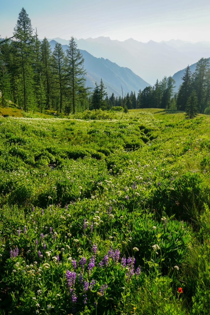
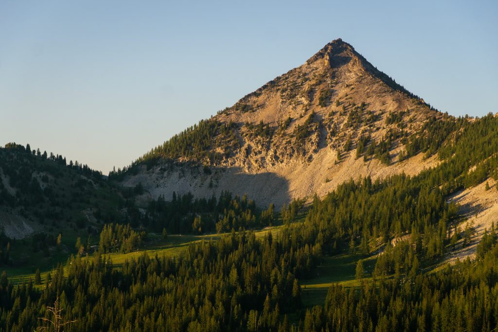
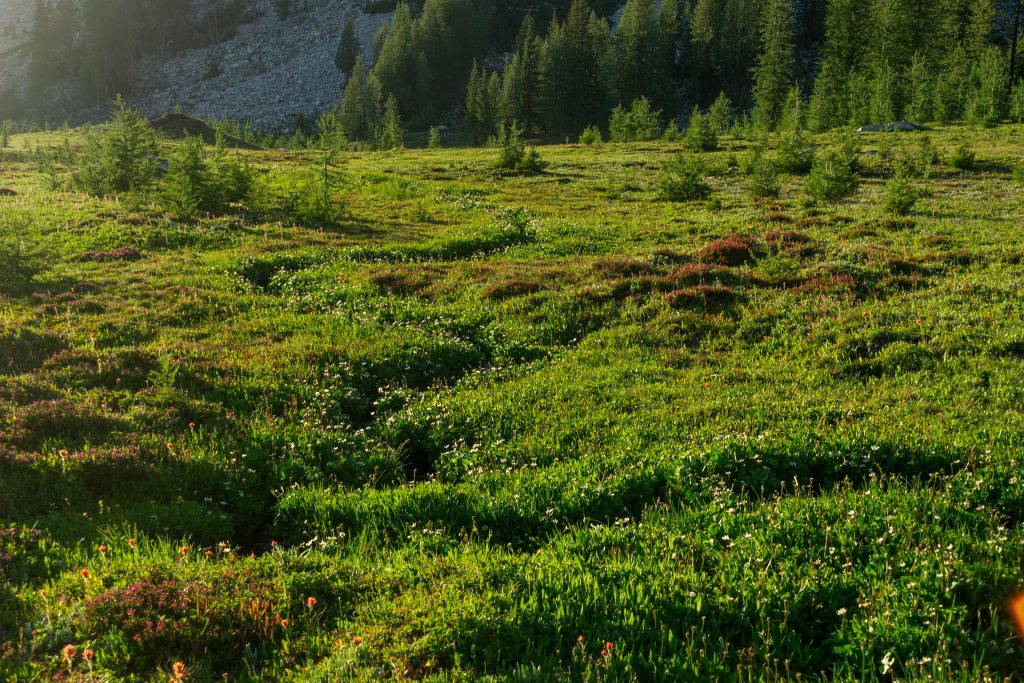
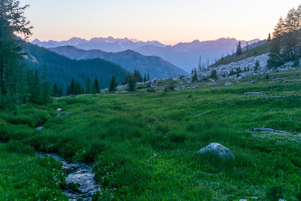
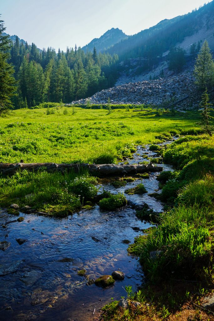
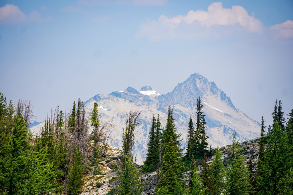
We dropped down and then climbed up to Star Meadow. I visited Star Meadow last fall on my birthday, chasing the golden larches. The meadow struck me as a marvelous spot with flat granite boulders, trickling streams, and distant views of the Entiat Range. I knew I wanted to come back and just hang out.
Star Meadow is a place of stark contrasts. Star Peak is a steep, intimidating granite peak, the most impressive in the entire range. The Star Meadow features bubbly little tubes of water snaking through a verdant landscape, leaving a trail of flowers. It is, in my humble opinion, one of the most beautiful meadows in all of the Cascades.
In the calm, moist meadows, the mosquitoes were even worse. I had to take breaks inside the tent between braving the outdoors for photography purposes. I even had to edit out the mosquitoes of some of the photos. It was definitely the worst mosquitoes I have ever experienced in the Cascades, but then again, I have never really done any backpacking in the month of July here. Perhaps there was a reason.
Day 3: Star Meadow to Purple Pass
We started the day a little earlier than the last and packed up urgently in a swarm of already active mosquitoes. The night time temperatures were so moderate that the bugs were unusually active at dawn. I think these were the warmest nights I have ever experienced in the Cascades, so warm that I just laid my 40 degree quilt on top of my lower body.
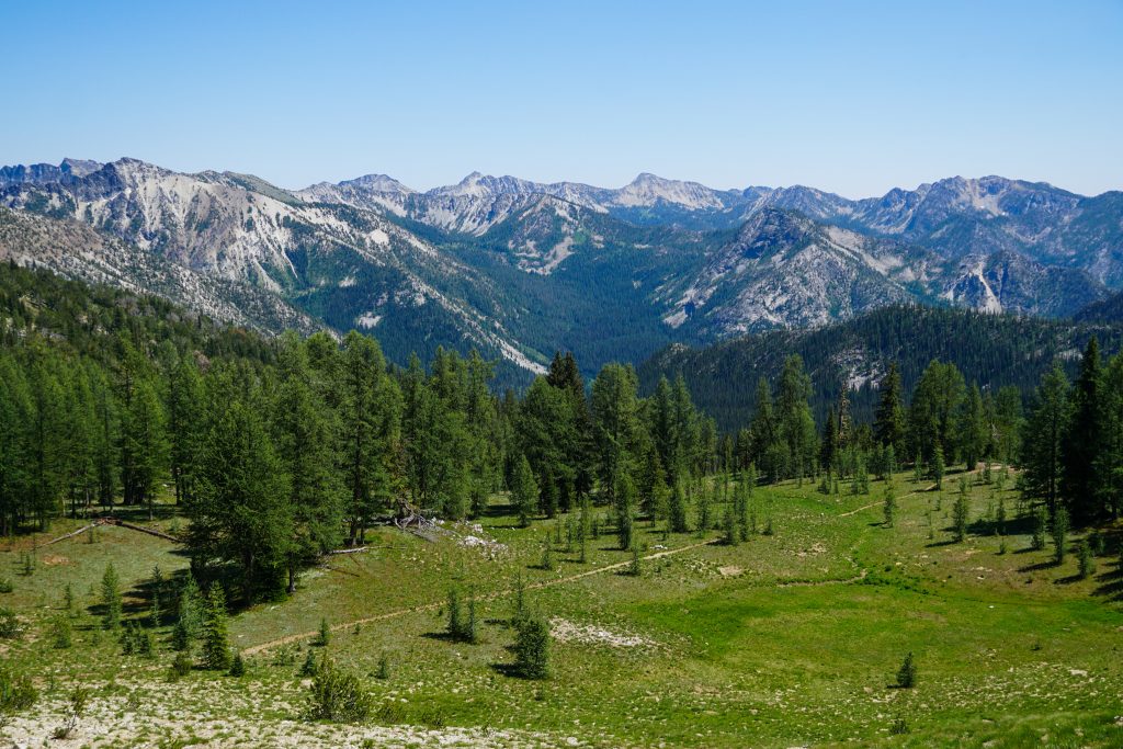
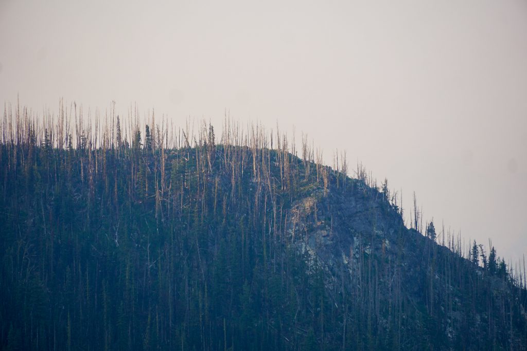
The section of trail that traverses beneath Courtney and Gray has a fair bit of blowdowns in the old burn zone, but is very beautiful. Despite the dry, fire prone nature of this range, this was the only notable section of burn that we hiked through until the very end.
The established camp at Horseshoe Basin was marvelous, with virgin springs flowing out of boulder fields and lush fields of flowers and grass.
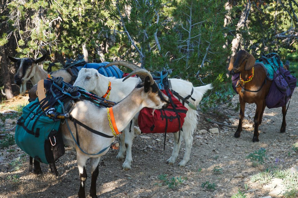
At the next high pass, we ran into an old man and his four goats. He was the only person we would see all day, and one of really only a few parties we saw the entire trip. Aside from the hotspots like Star Lake and the Golden Lakes, this range is just so quiet and has so much room to roam.
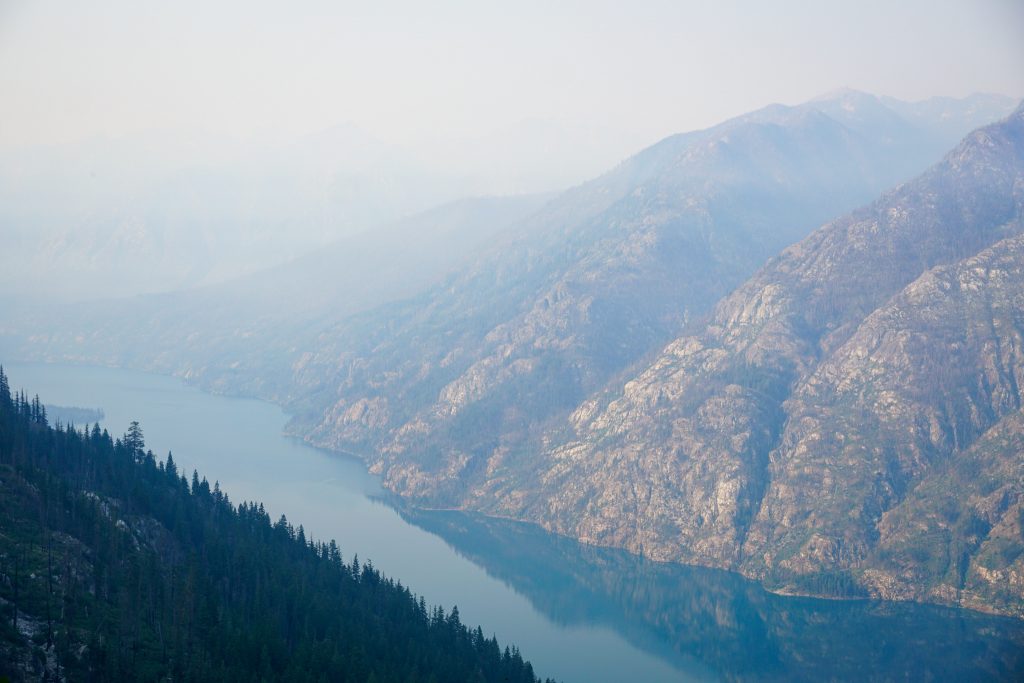
Shortly after the pass, we finally got our first actual view of Lake Chelan! It was 6000 ft below us, but soon we would be heading down.
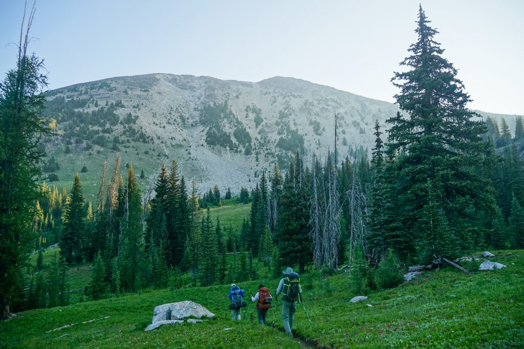
The descent into the North Fork of Fish Creek was a repeat of the day before: long descent with blowdowns followed by a long, hot ascent with blowdowns. However, the blowdowns were not as numerous as the day before. The mosquitoes made up for the lack of blowdowns, and chased us until we simply had to take a break from the heat and rest, bug bites be damned.
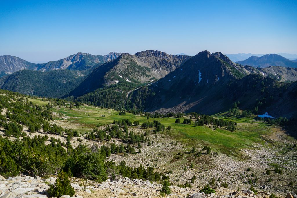
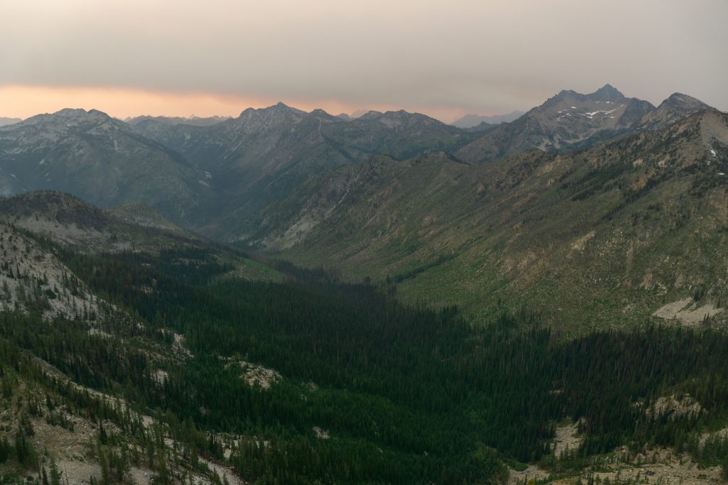
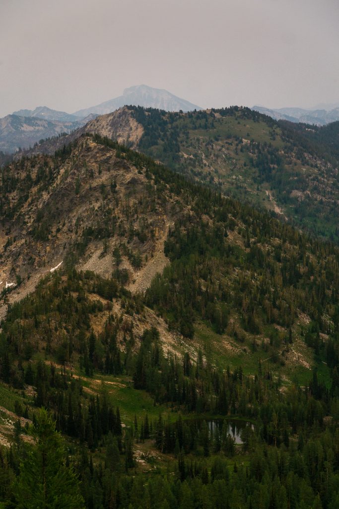
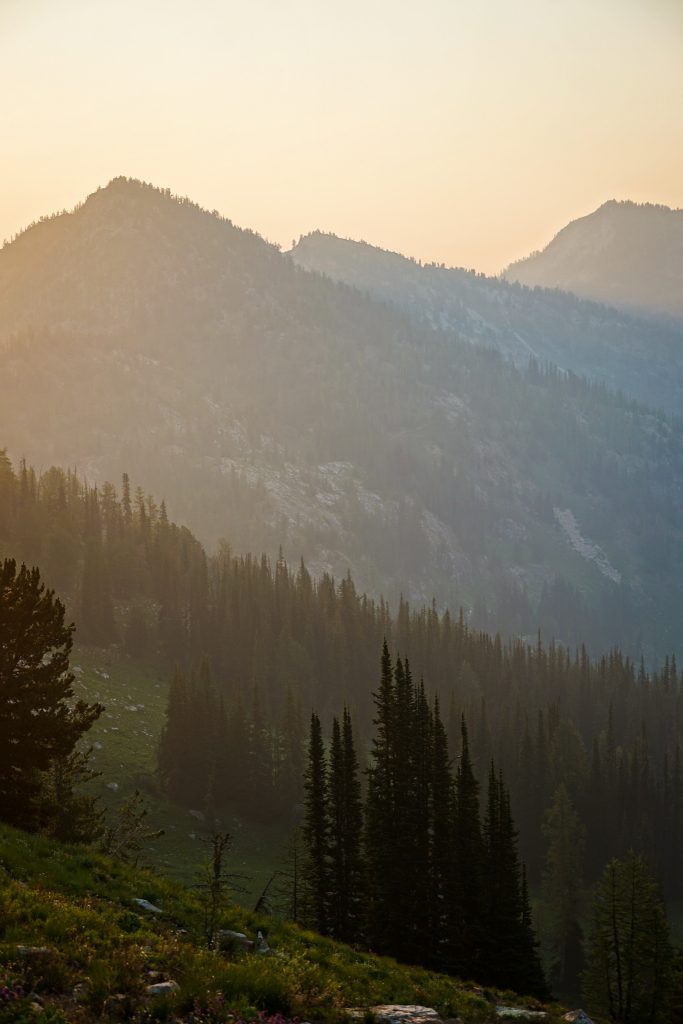
Finally, on the traverse beneath Splawn Mountain, we were granted respite from the mosquitoes. With sweeping views of Lake Chelan and the Stehekin Triangle, this was one of the highlight sections of the trip.
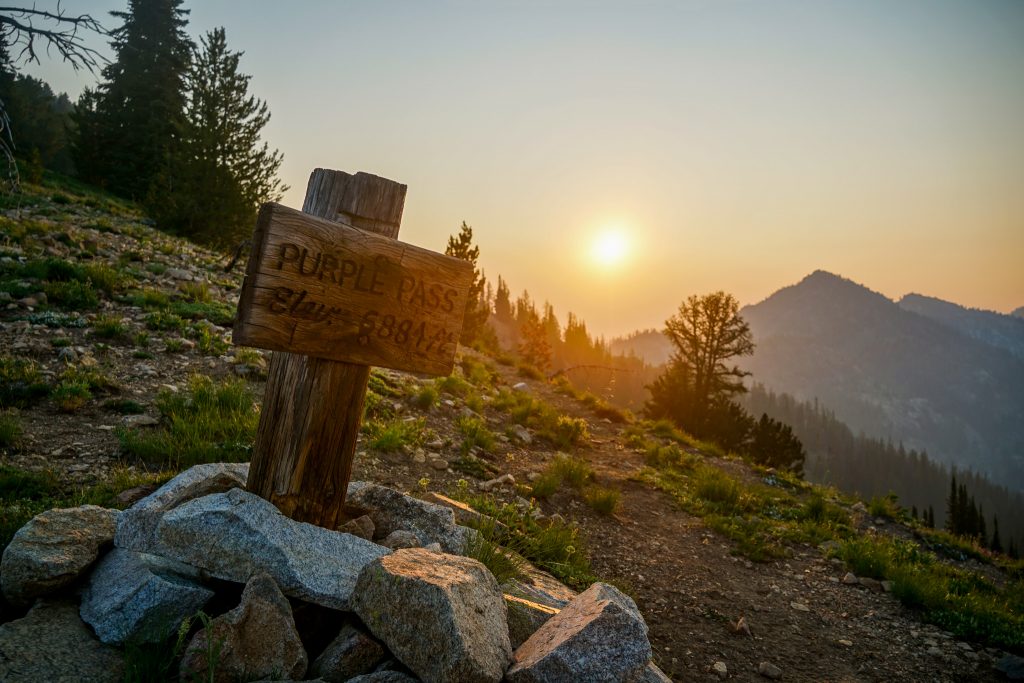
We arrived at Lake Juanita in the mid afternoon and the others rested at the lake shore while I scouted for a good camp. There were some very well established camps near the lake, but I figured Purple Pass might have fewer bugs and nice breeze. Unfortunately, there was only one good tent site at Purple Pass, but I did find a few spots about five minutes before the pass. We decided wishfully to camp there, hoping for fewer mosquitoes. Our hopes were quickly dashed.
Cumulonimbus clouds built as the evening wore on and we heard the rumble of thunder, but never got more than a few loud raindrops on the tent.
For our last night, we had excellent spanish rice with summer sausage and tortilla wrappers. It was one of the best dinners I have had in the backcountry!
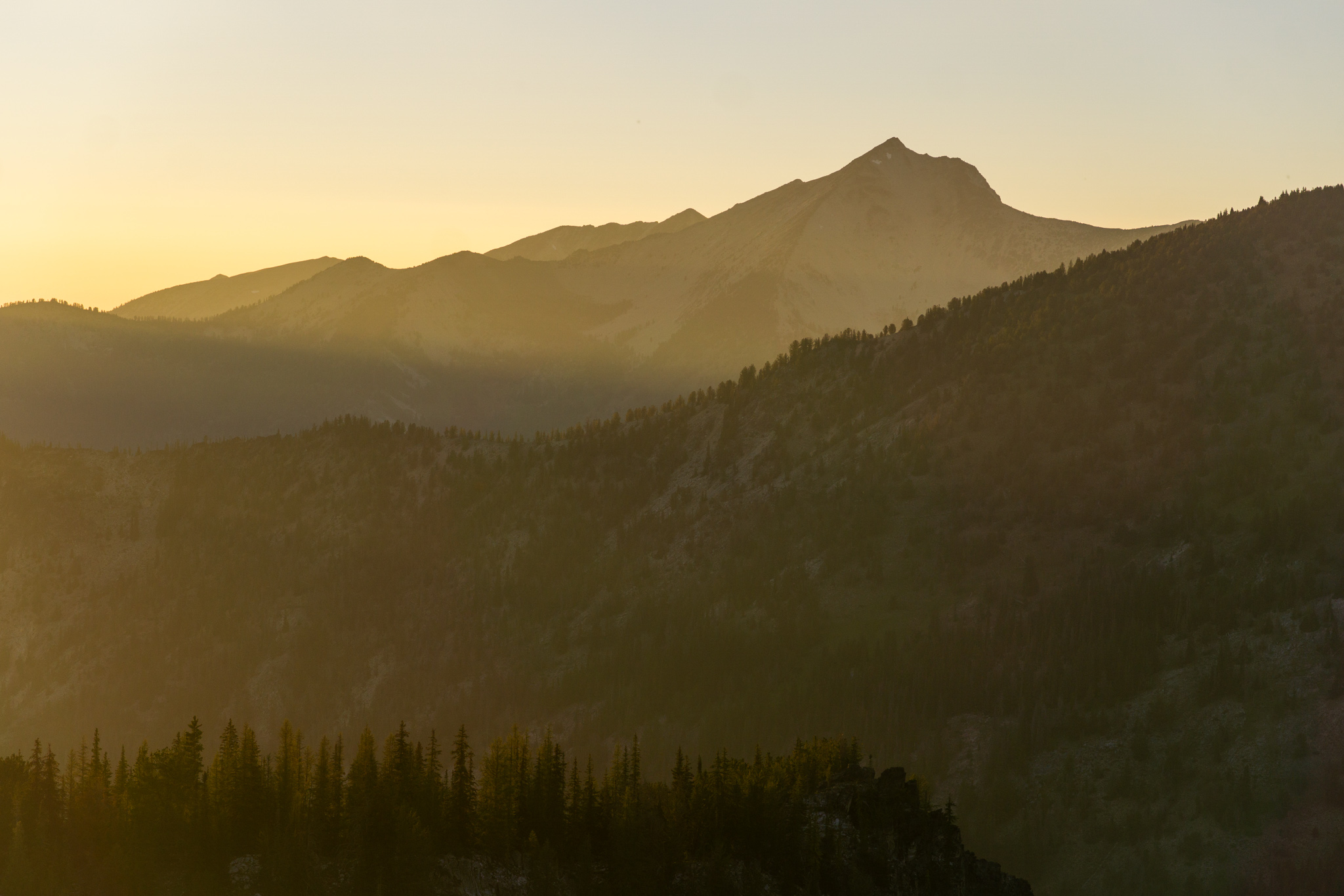
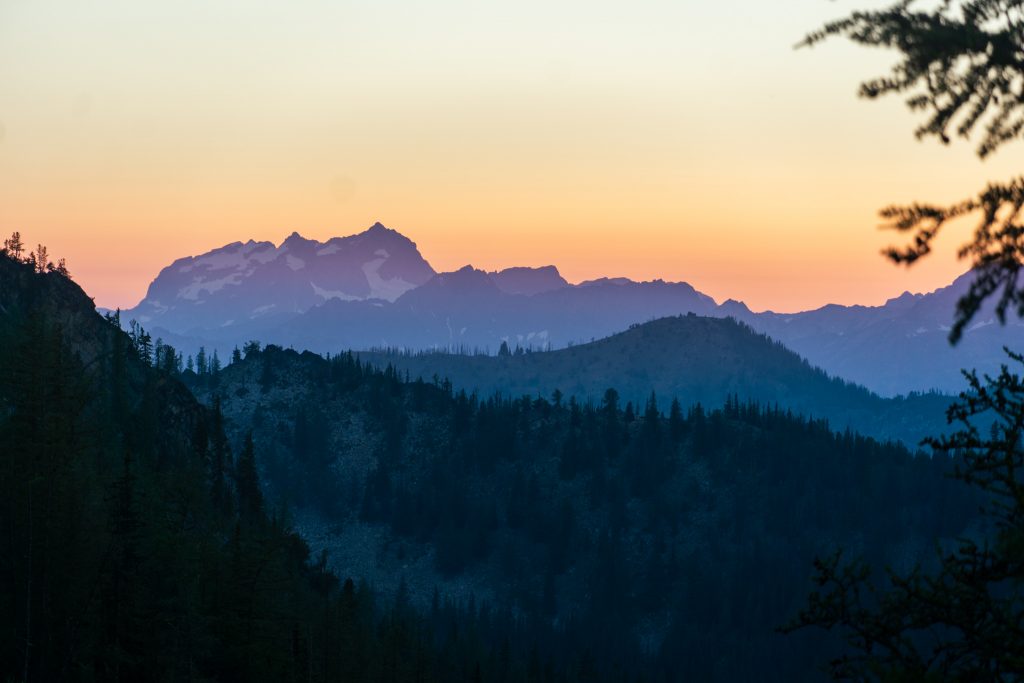
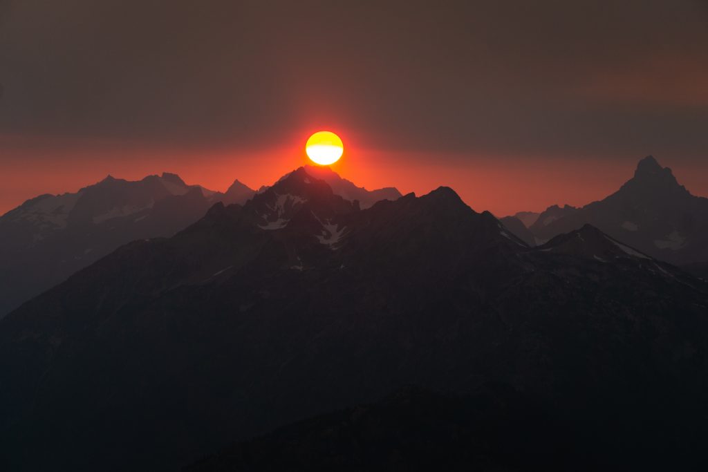
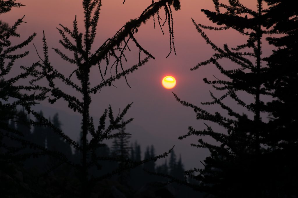
The others were sufficiently tired for the day, but I decided to wander up to the summit of Boulder Butte, an old fire lookout site, for the sunset. The evening had a murky mood, and I quickly spotted the culprit: a new fire sending plumes of smoke into the air. By my estimates, it was north of the Gardners, perhaps Cedar Creek? When I got back into cell service, I confirmed that my guess was correct.
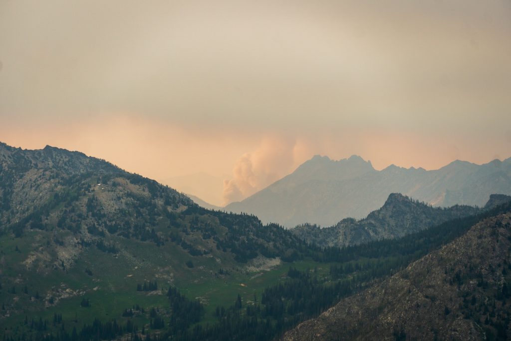
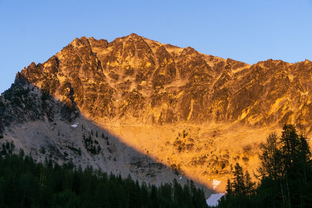
With a plume of smoke floating westward across the North Cascades, there would be no warm light for the sunset. The sky felt muted and ominous. With the record breaking heat we had in late June, there is a very high chance of a bad wildfire season here. But it emphasizes to me how grateful we should be for each smoke free day out in the mountains. And even in moments of impending doom, there can be such incredible beauty. In this particular moment, instead of feeling rushed and panicked, I felt a weird inner peace.
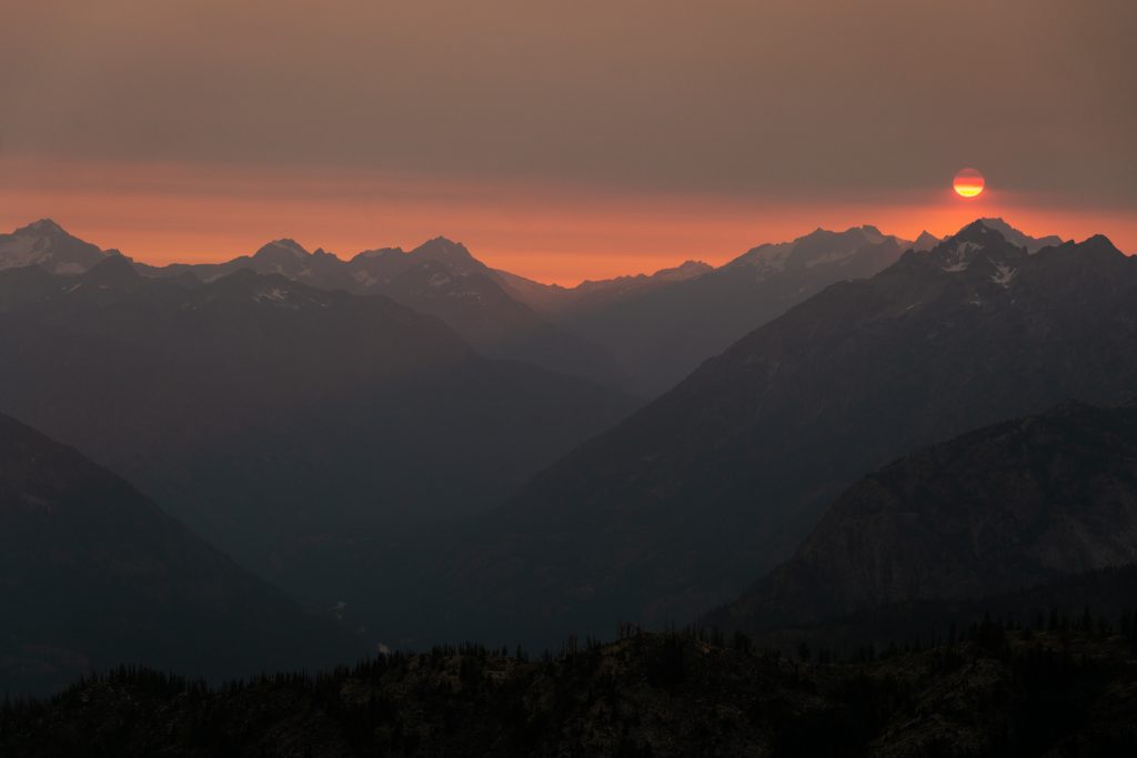
As the sun sank below the smoke layer, hovering just above the peaks, it glowed in a fiery red orb and cast a red shadow upon the great peaks of the North Cascades. It felt like I had finally seen the “Eye of Sauron” and Mt. Buckner was “Mt. Doom”.
As I walked back to camp, the air hung with a certain stillness, painted in shades of grey and green.
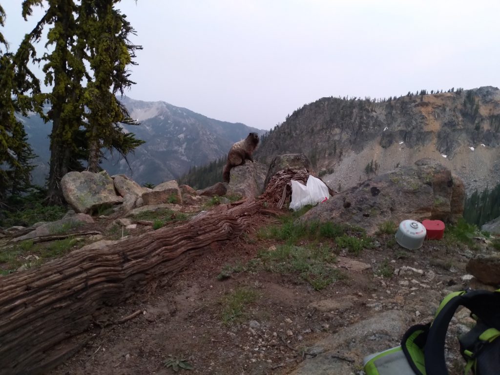
Back at camp, my dad explained to me how a giant mini-bear (marmot) had almost run off with our dishes while I was gone! But he had scared it away and it left our dishes alone after that.
Day 4: Purple Pass to Stehekin to Chelan
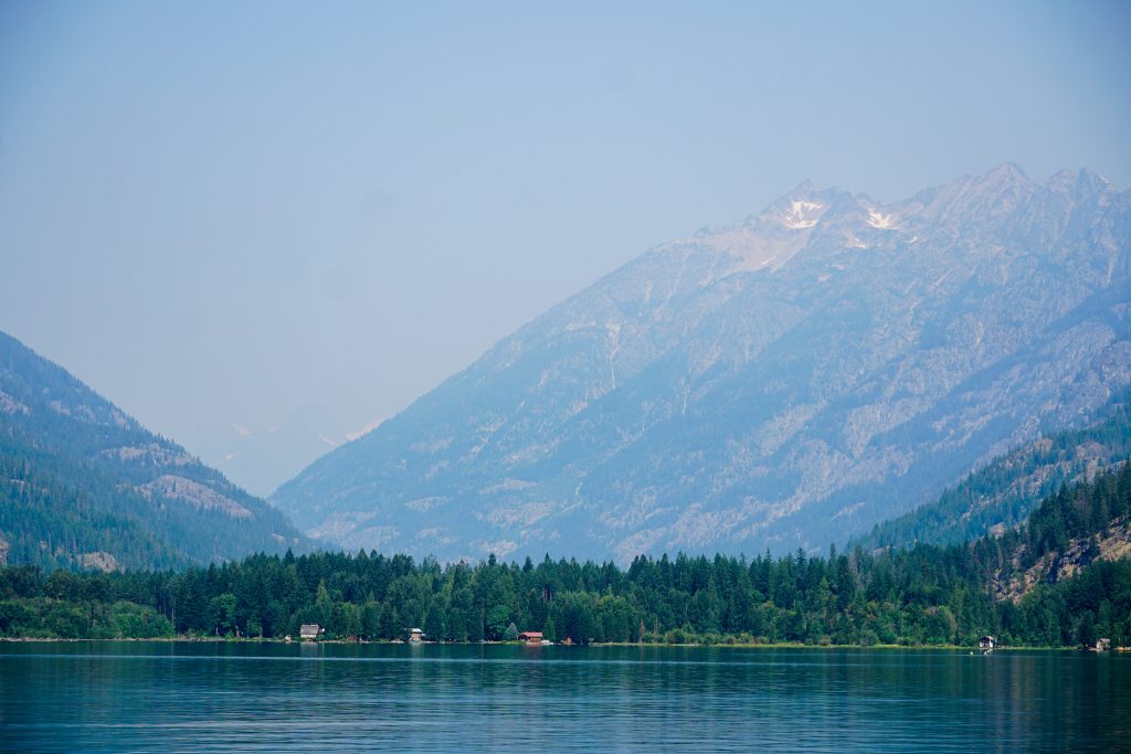
We got up early to make sure we would have enough time to make our noon ferry ride back to Chelan. The smoke was thicker, but not unhealthy.
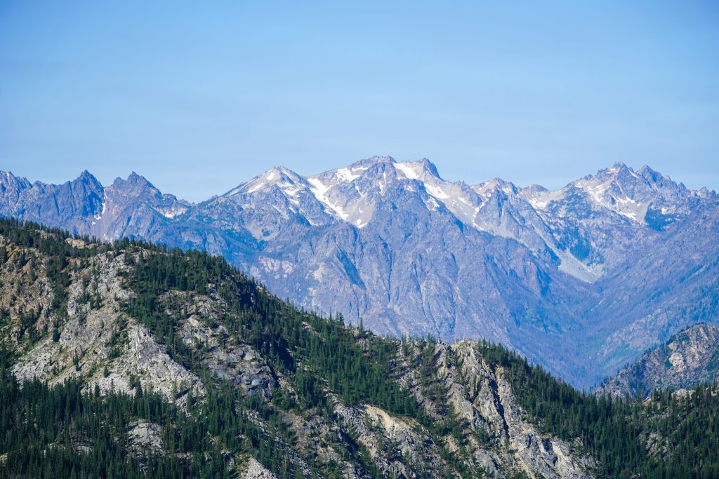
At Purple Pass, we could barely see the peaks on the other side of Lake Chelan, but it made for some soft morning light once again.
The 5500 ft descent from Purple Pass to Stehekin is probably one of the longer continuous trail descents in Washington! Fortunately the trail is nicely graded. It was a bit overgrown at times and had some blow downs, but overall, the descent went smoother than we expected.
The hillside is so continuously steep that, at times, it felt like we could just roll down into the lake.
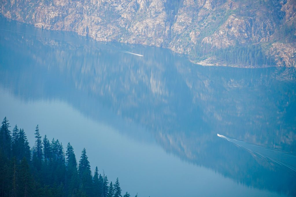
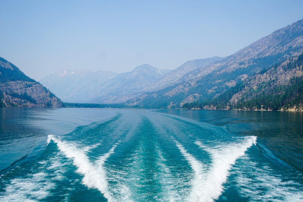
We strolled into Stehekin around 10 am, 4 hours from camp. It felt weird to step into civilization once again, but a civilization ruled by PCT hikers picking up food packages and tourists vacationing. We immediately jumped in the lake to clean off.
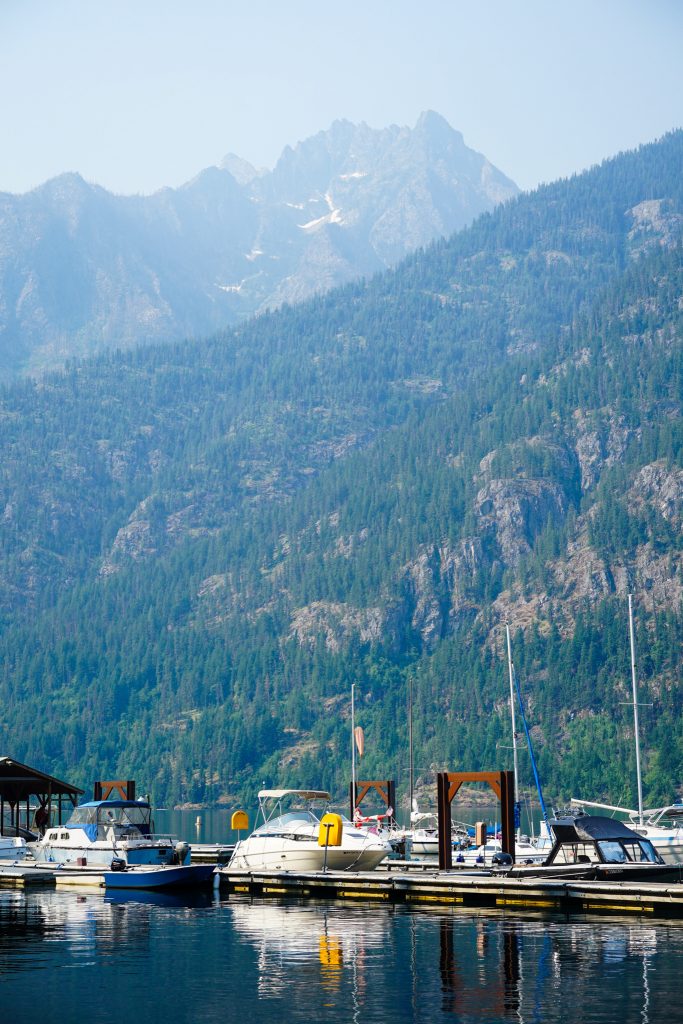
We at lunch at the restaurant, chatted with some SOBO PCT hikers, and then boarded the Lady of the Lake, bound for Chelan.
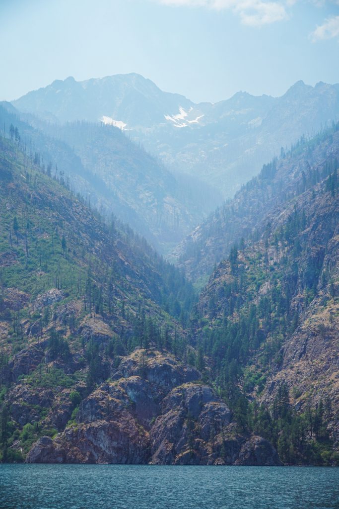
The terrain along the lakeshore is remarkably rugged: steep, burned, brushy, cliffy. Peaks tower 7000 ft above. It is truly impressive.

The nature of the trip – hiking for many days and then returning via an alternative method, observing where we came from – reminded me of the Brooks Range, where Daniel and I flew over the endless tundra which we had just walked and waded for an entire week. The long boat ridge back to Chelan, coupled with the abundant solitude, really created an unexpected sense of remoteness and novelty to this “expedition”. On a map, we were never that far from the Twisp River Road or Washington Pass, but damn it felt out there. We walked for days, passed almost no one, saw peaks from new perspectives, and ended in a town that is only accessible by boat or plane. Honestly, it felt like we were never really in the Cascades at all.
There are places that we see, and there are places that we feel. The Chelan Sawtooth Wilderness is, to me, the latter. It is a place that instills me with a sense of calm, serenity, and solitude. I am grateful that I got the opportunity to share this place, mosquitoes and all, with my family on the Chelan Summit Trail.
Notes:
- Our trip was 42 miles and 11k ft gain, spread out over 4 days.
- There was a lot of running water on this trip. Every creek drawn on the map was running and there were many other springs pouring out of the hillsides. The only exception was the descent from Purple Pass, which had no water until Purple Creek down low.
- The mosquitoes were really, really bad! Although I loved the flowers, the best time of year for this trip is probably fall.
- The sections below 6000 ft had the most blowdowns. The trails around here do not see a lot of maintenance, but near and above treeline, they stay in pretty good shape naturally.