Coming Full Circle
As one becomes more intimate with the Cascades, one comes to realize that the Cascade Mountains are really a tight cluster of interconnected ranges, each distinct with a unique character. The Chiwaukum Range is a high range east of Stevens Pass, north of the Stuart Range, home to huge alpine bowls, many lakes, and giant tundra meadows. It looks and feels different than any other part of the Cascades. The Chiwaukum has long fascinated me (Big Jim was the first large peak I climbed, over 7 years ago) and is a favorite place to roam because of the solitude, beauty, and extensive high country.
The Chiwaukum Range features a very prominent north to south crest before curving eastward and finally northward to the final summit of Big Jim. The outline of the high ridges forms a hook and has always called to me for a continuous high traverse. I had nibbled at the edges many times, enough to understand the character of the range. For a few years, I waited for the right moment. With prolific high router John Berude in town, we made a last minute audible with changing weather to the Chiwaukum High Route: from North Chiwaukum to Big Jim, across the entire range.
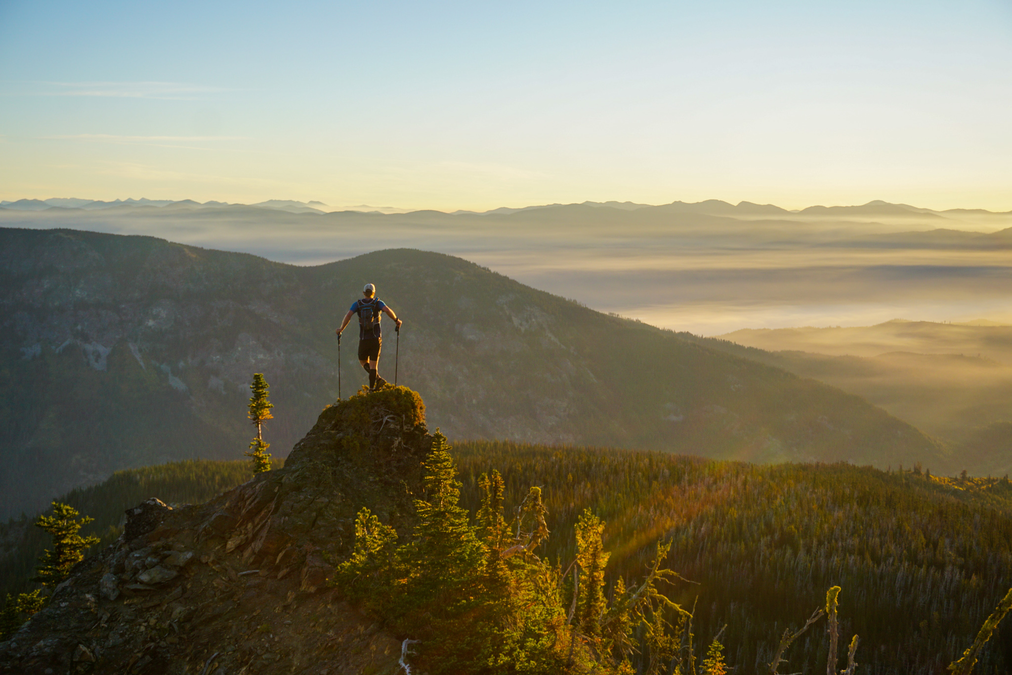
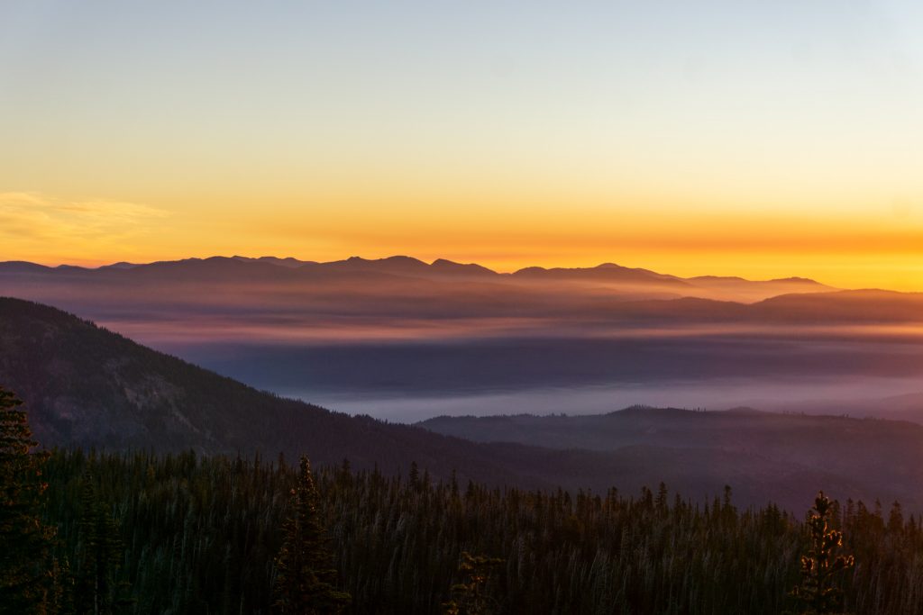
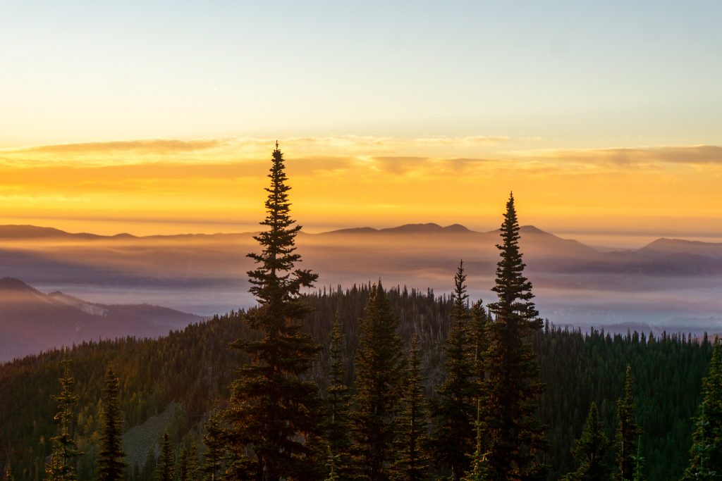
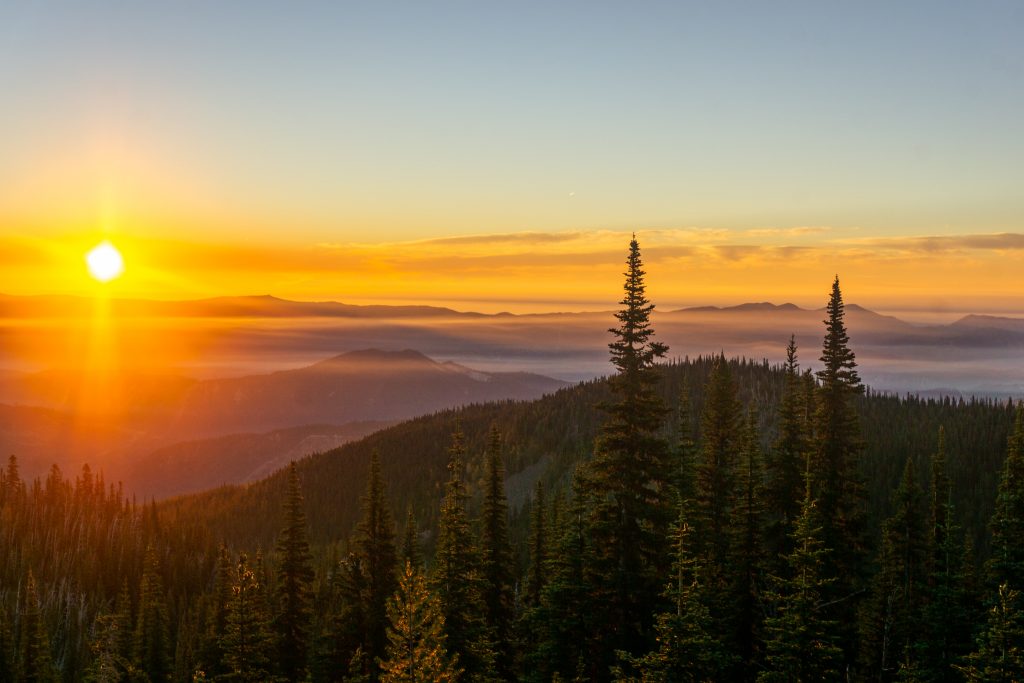
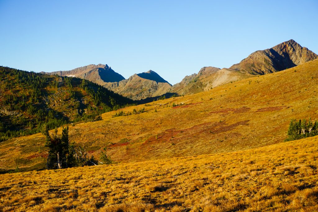
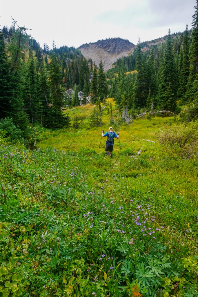
After a few hours of good sleep, we left a car at the Hatchery Creek Trailhead and drove over to the Lake Ethel Trailhead. John wanted to try to get high for sunrise, which I thought was a great idea. We hiked up through clear cut with a hint of pre-dawn glow on the eastern skyline. Right before the trail heads down to Lake Ethel, we started going cross country up the ridge that would lead us onto the plateau above Lake Ethel. The sun began to stream through the trees and paint all the hills in an orange glow. It was definitely worth the 4 am wakeup.
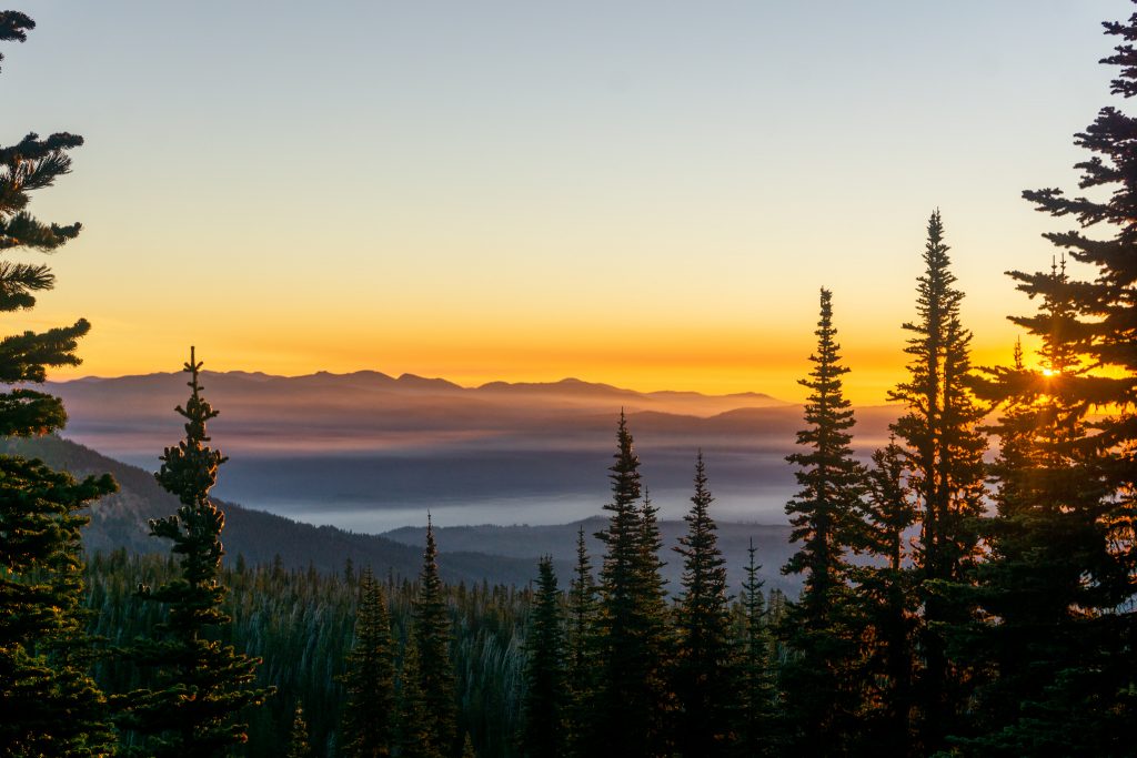
There were fog-like smoke layers lingering down in the Chumstick Valley, filtering down from the Nason Ridge fire. It created an incredible three dimensionality to the light and layers in the Chumstick hills beyond.
I have been really tired lately, moving out of my parents’ home to a place in Issaquah with my friends, meeting new people, and adjusting to a new routine. Sometimes I doubt that I have the energy for more big days this season. But once I get up in the alpine, watching the glow, I always feel revitalized. There exists so much energy out there if you open yourself to the natural rhythm of the hills – the changing days, from dawn to dusk.
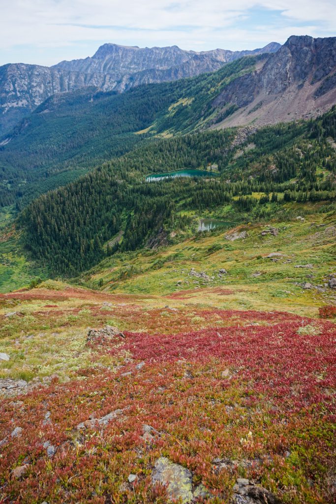
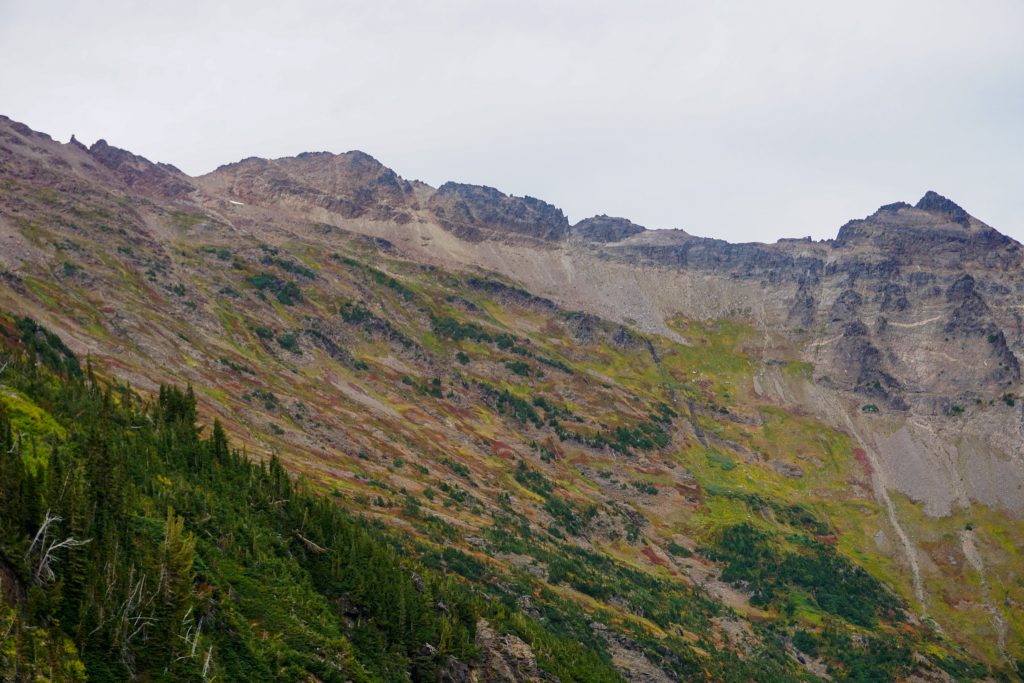
We were pleasantly surprised to see the hillsides above Lake Ethel coated in reds and fall colors – fall was coming in early!

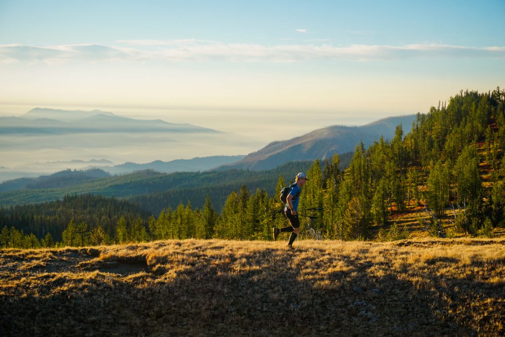
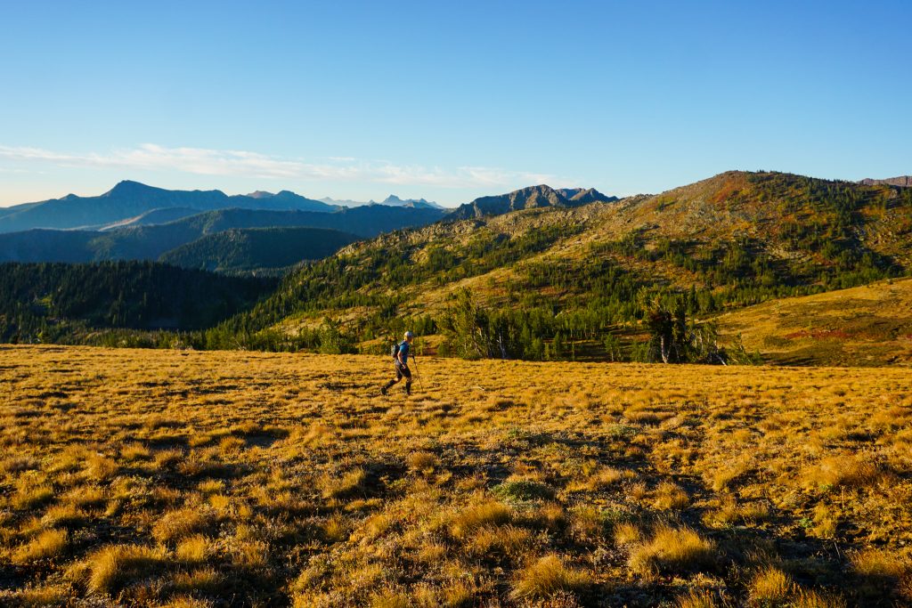
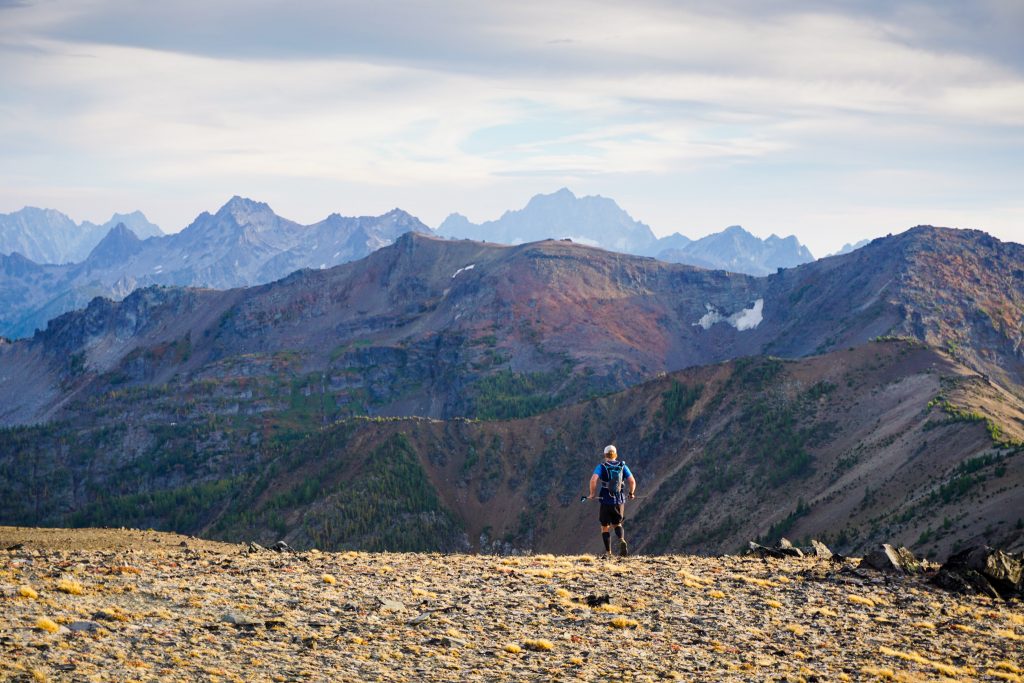
We crested the high plateau above Lake Ethel and began the easiest high route travel across golden grass and expansive tundra plateaus. John is a naturally stoked individual, but even his stoke was abnormally high.
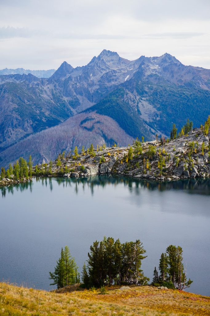
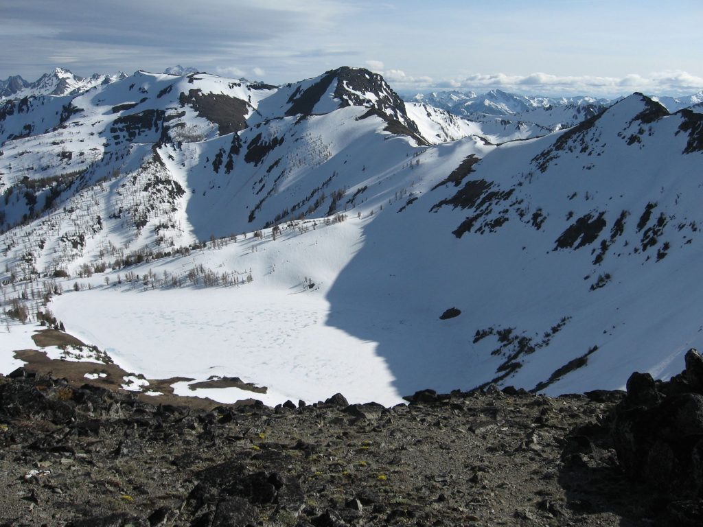
The high bowl above Loch Eileen is an incredibly beautiful plateau of red carpets, granite boulders, trickling springs, and yearning larches. I had experienced it before, but in winter powder from the Alpine Lakes High Camp.
We reached McWaukum Pass just under 3 hours in, very happy with our progress. Here I joined tracks with a previous high route I attempted three years ago, arguably the first “exploratory” high route I ever attempted in the Cascades, the Chiwaukum Brush Battle. After some surprisingly easy zig zagging down a cliff band, we continued down steep grass until a little creek tunneling was required. Looking back, there is definitely a brush-free way further skier’s left, but I missed it both times.
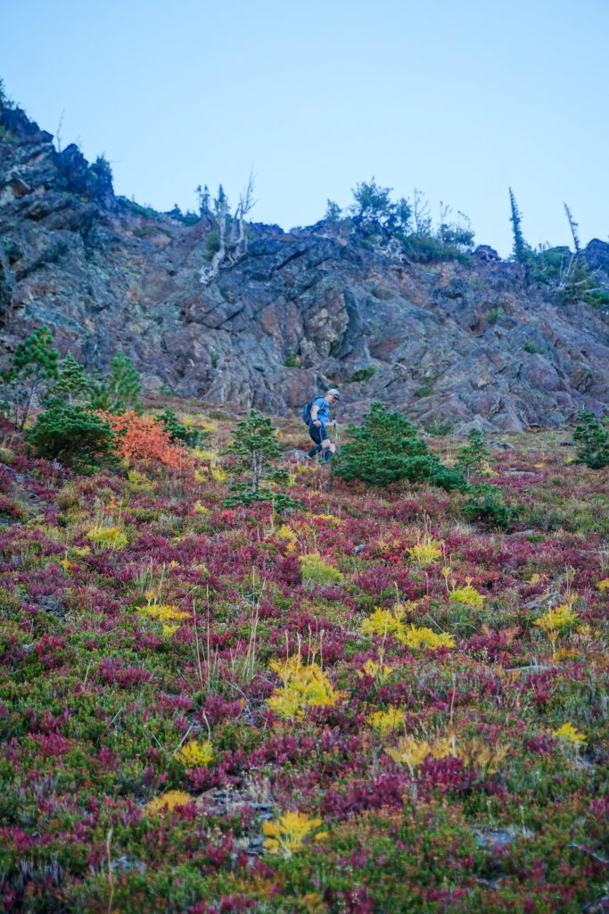
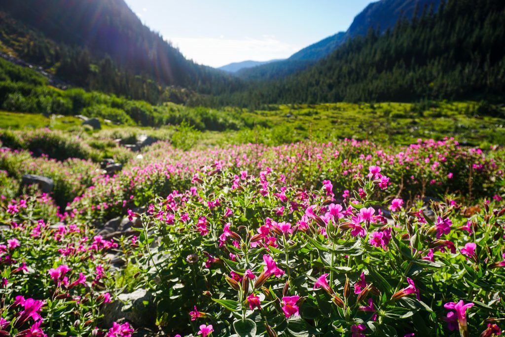
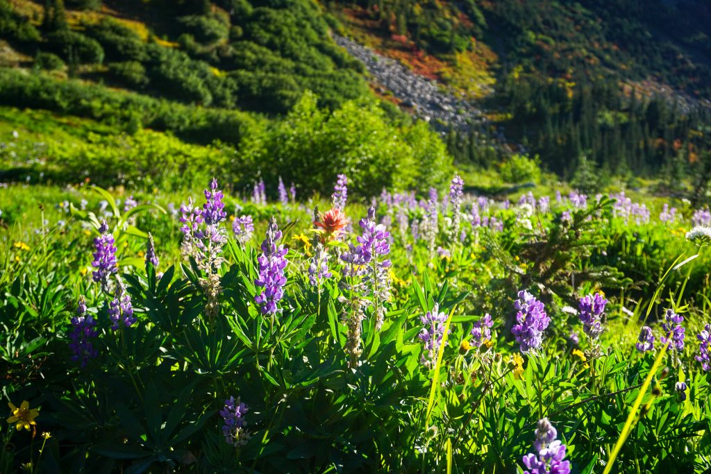
Down in the lower meadows, we found surprisingly lush wildflower meadows. It was a total treat to get blooming wildflowers and fall colors in the same trip!
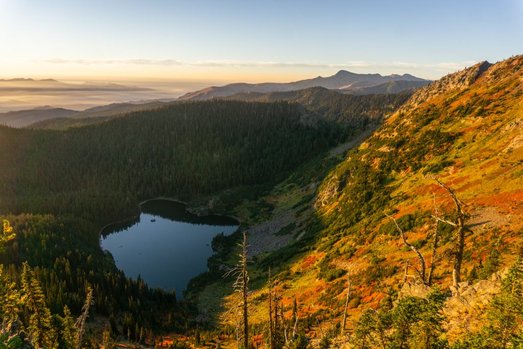
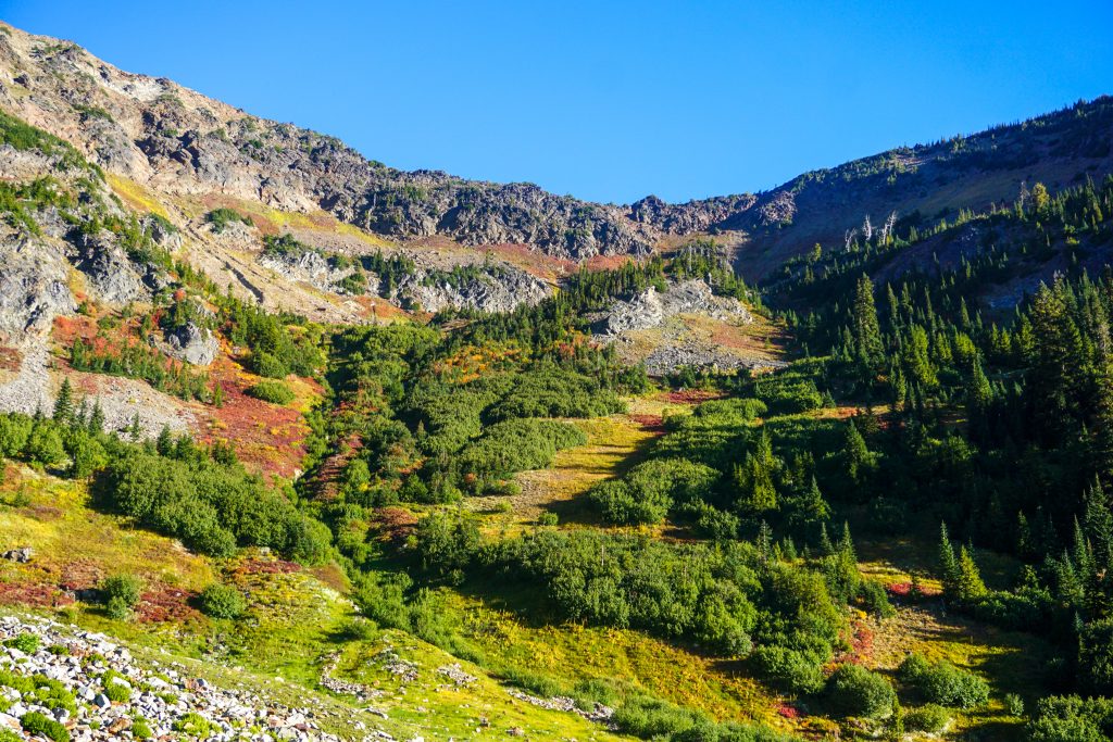
We jumped on the trail and followed it to Larch Lake. From there, we continued off trail towards Cup Lake. The climb up to the Big Chiwaukum plateau looked kind of nasty, but it was remarkably solid and pleasant as we traversed around the lake and climbed to the pass above.
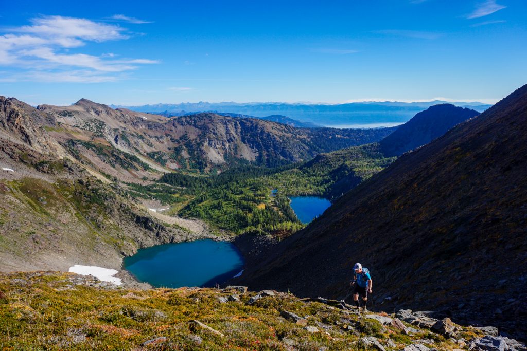
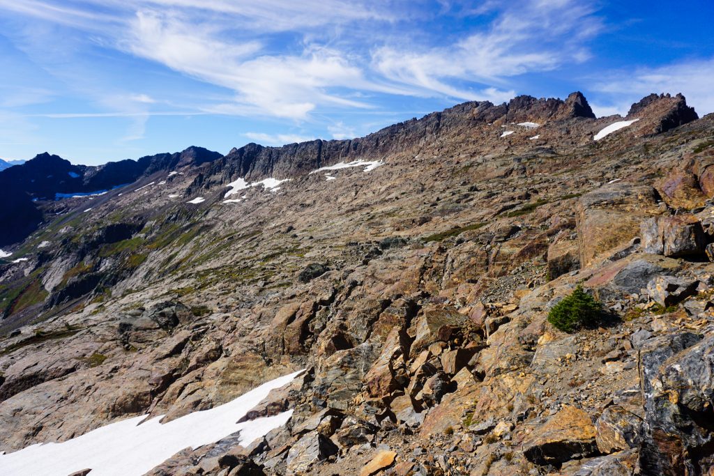
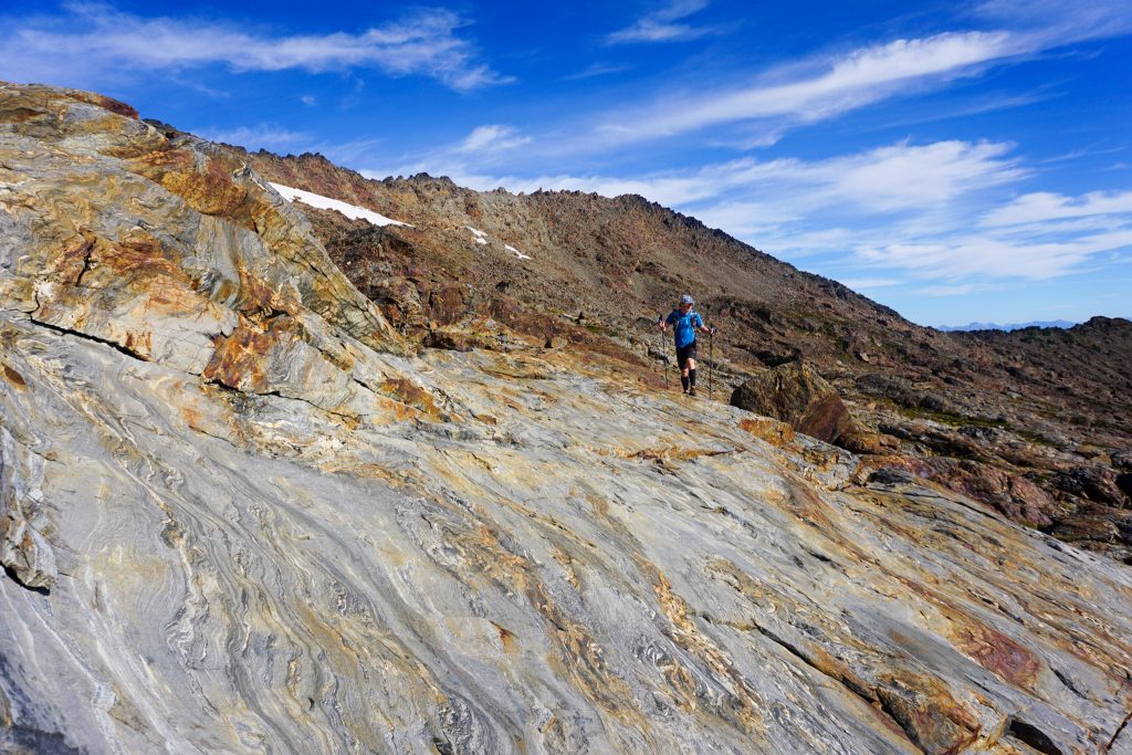
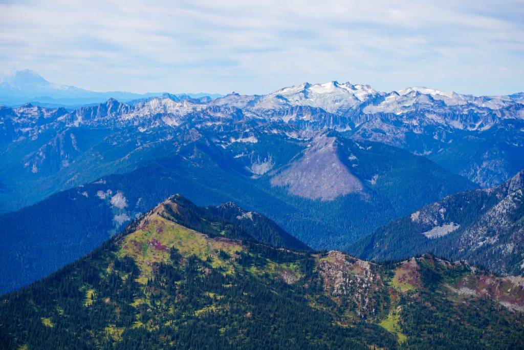
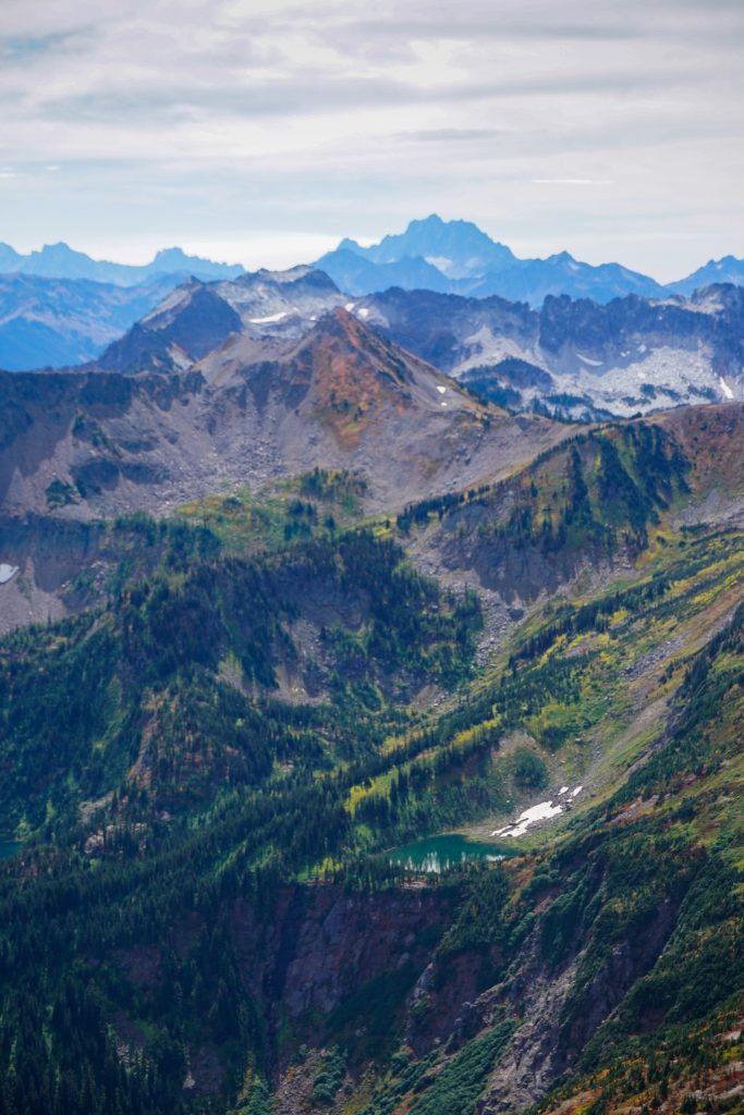
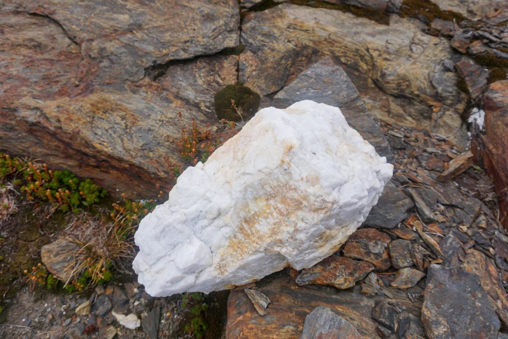
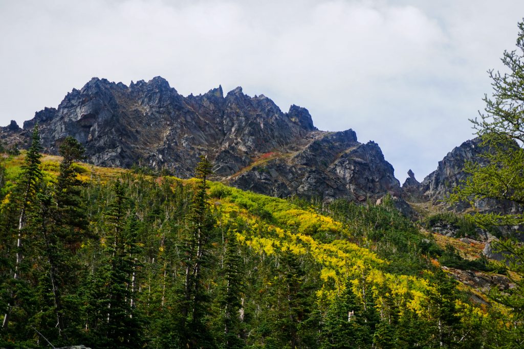
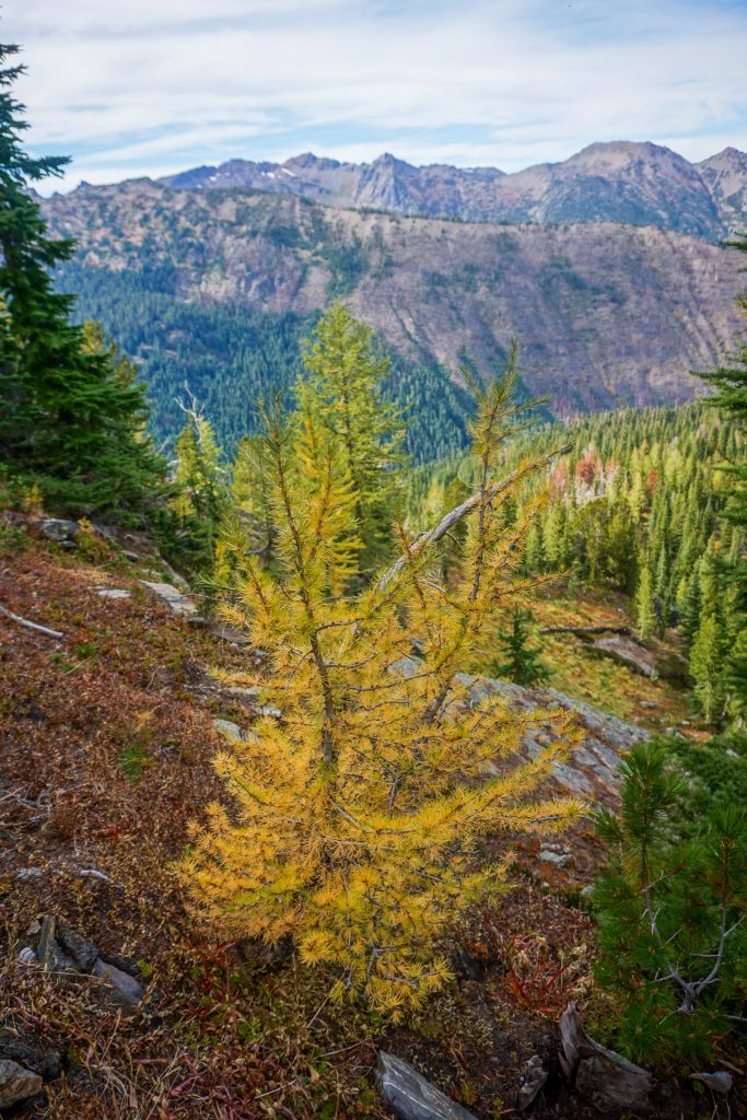
Here at the pass, we got our first view of Big Chiwaukum, the high point of the range at just over 8000 ft. This high post glacial landscape is deceptively complex, with lots of rock ribs, flowing streams, and ups and downs. The distinct Chiwaukum Schist is present here and elsewhere in the range – wavy streaks of red, gray, white, and orange in the rocks. It is very beautiful and unlike anything else in the Cascades.
I had crested this plateau once before, at the top of the NW Couloir of Big Chiwaukum last winter. In fall, it felt so much more alive.
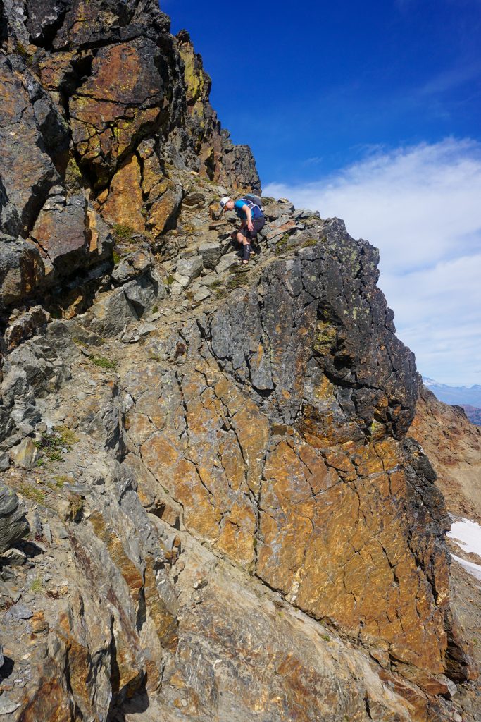
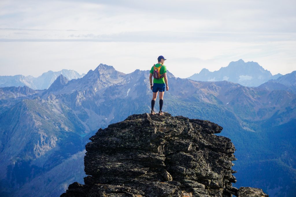
We did not do any research on the summit, but followed the obvious left trending ramp that cuts across the face. At the end of the ramp, we cut back right and made some easy but exposed scrambling moves to the summit ridge. We reached the summit about 6 hours into our day.
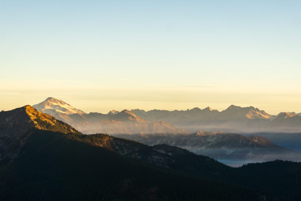
The prominence of the Chiwaukum Range is evident from Big Chiwaukum. Although the hydrological crest is further west, the Chiwaukum is most definitely the highest divide in this part of the Central Cascades and often catches the weather as a result. On a clear day like this, it provides an excellent vantage of the Glacier Peak Wilderness and Alpine Lakes Wilderness.
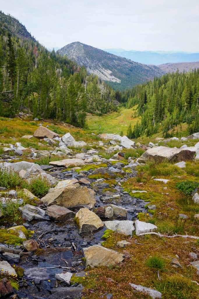
After reversing the scramble route, we found a super enjoyable finger of snow that allowed us fast travel down the glacial benches. There are definitely still a few tiny remnant glacial ice patches tucked beneath the cliffs, but they might not survive past this year or next.
The snow finger eventually turned to tarns and streams flowing through the rocks. At the end of the bench, the water took a turn and began cascading down into the steep U-shaped glacial valley below. Shades of yellow painted the hillsides and haze lingered in the valleys beneath. The air was perfectly still and the only interruptions from the roar of a Cascadian stream were the frequent squeals of the whistle pigs around us. It was an incredibly powerful, tranquil setting, soaring high above the autumnal valley.
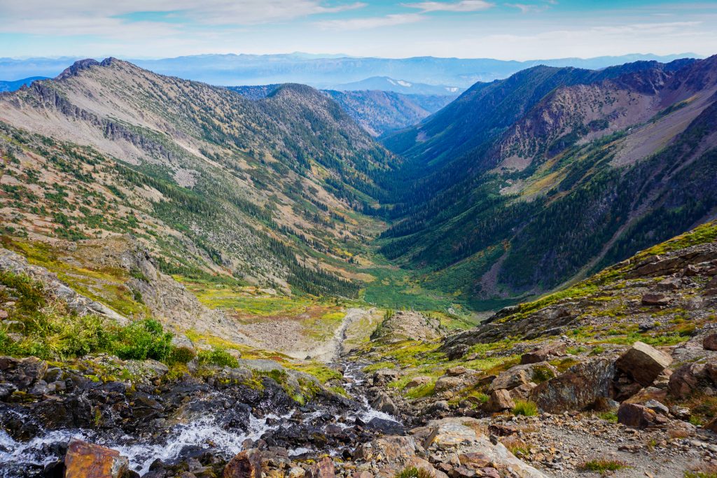
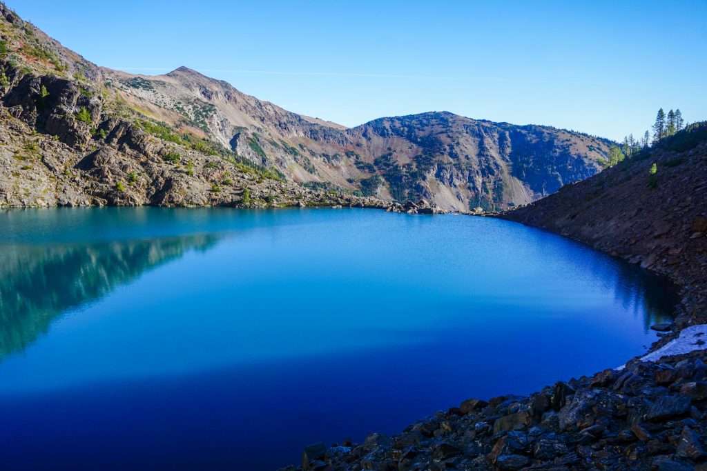
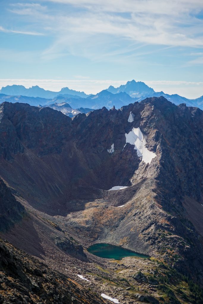
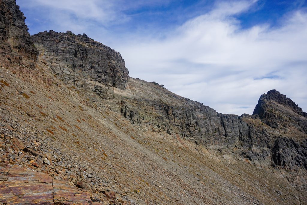
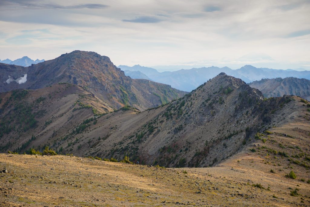
As we transitioned to heather benches and more vegetated hillsides above Lake Charles, we became surrounded by marmots, plump and preparing for the impending winter. We stayed high above Lake Charles, aiming for the pass east of Pt. 7955. This is the key pass that connects the Glacier Creek and South Fork Chiwaukum Creek drainages. On a map, the south side of the pass looks improbable, but yet another one of Trail Cat Jim’s fantastic high route trip reports assured us it would go.
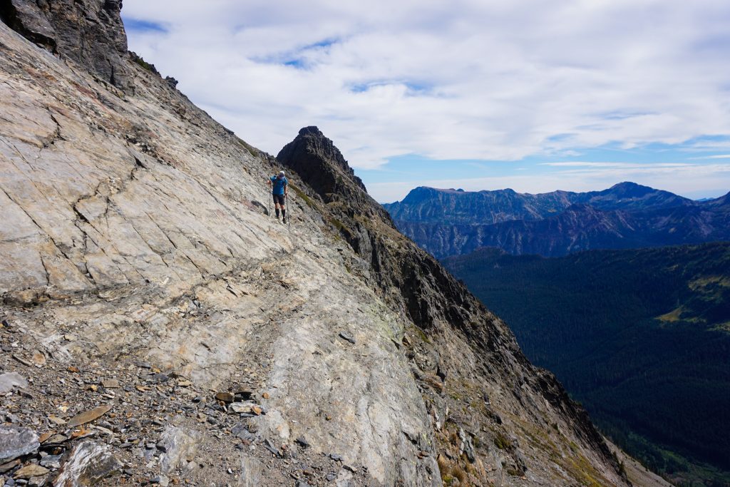
From the pass, we actually ascended the ridge briefly above cliffs, before traversing some graveling slopes to the main cirque. This section was not hard, but had substantial exposure and definitely kept our attention. Even after the worst of the exposure, it was annoyingly loose and we lost a bit of time before finally reaching nicer heather benches.
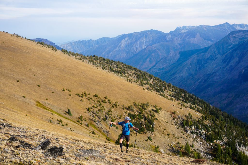
We had hoped for easy heather benches on this second giant traverse, but the grass was often long enough that it was difficult to see your feet. We started to get tired of sidehilling over and over on the same leg. Thank god we brought poles!
John was definitely getting tired from all the off trail travel. In addition to our Big Snow Iron Cap High Route the week before, he had sent at least two or three other ultras in the last week and sprained his ankle on the most recent one! He had done over 100 rugged mountain miles in the past week. But this dude is tough and was going to keep going no matter what.
We finally reached the trail and were happy to cruise switchbacks up to Ladies Pass. We knew we were a little behind schedule, but the hardest terrain was definitely behind us.
At Ladies Pass, we once again crossed paths with a younger self. I backpacked the Ladies Loop five years ago with my family.
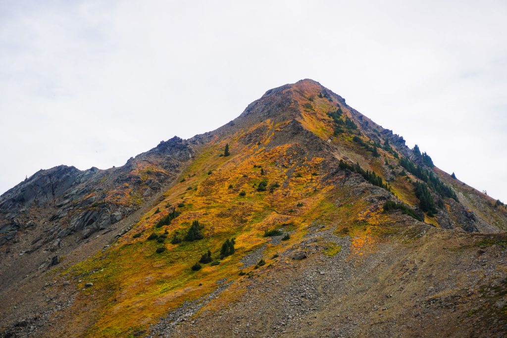
The hillside on Cape Horn featured a bright orange groundcover. The ground looked on fire, like I had never seen before in the mountains. It was stunning!
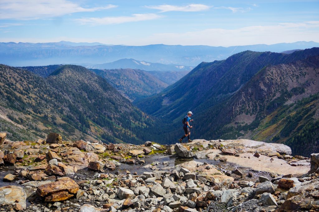
From the shoulder of Cape Horn, we enjoyed our first running of the day down to Lake Edna, where we passed the first people all day. As we descended into Index Creek, the trail became nearly non existent. It was not too hard to follow, but it prevented any actual running, setting us back even further. But the quiet beauty of the faint trail was nice and really fit the character of the region. Even the “developed” areas of the Chiwaukum are nearly lost to time!
We hit the valley bottom at Index Creek and took a good break. We were over 9k ft gain into the day, but knew we had at least another 4k left. My legs were feeling surprisingly good so we filled up on water and started grinding uphill back into the alpine. More than ever, I felt confident about my body’s ability to push over 10k and beyond. I have just done it enough times to know how the fatigue feels and how to keep my body fueled and mind focused.
At the next trail pass, we left the trail for our final off trail section to Lake Ida, Big Lou, and Big Jim.
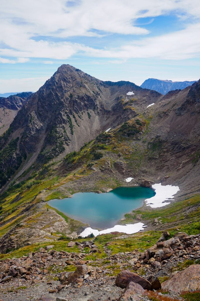
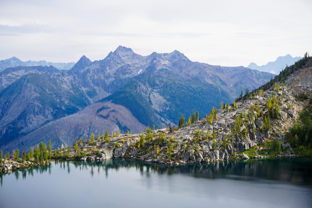
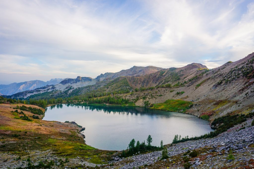
We found a surprisingly well developed trail climbing to the pass above Lake Ida. Lake Ida has a stunning position, cradled in a high alpine bowl, suspended 4000 ft above the Icicle Canyon, with the Enchantments beckoning just across the valley. Larches dot the rocky lakeshore before the outlet drops off into the abyss. While hundreds crowd the mountains across the valley, wilderness reigns supreme here in the Chiwaukum. It is an austere, powerful setting.
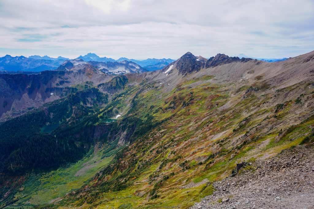
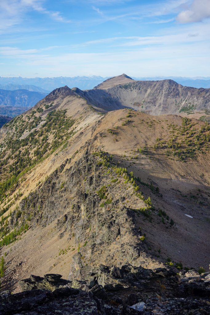
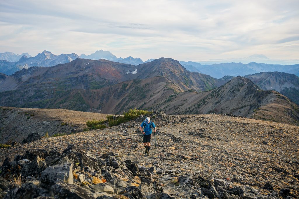
The climb up Big Lou was easy and we caught up to two backpackers near the summit. The giant open tundra slopes of Big Slide provided a dramatic backdrop to the climb.
We wasted little time atop Big Lou and launched into our final ridge traverse to Big Jim. This is the only true ridge traverse of the entire high route, but is some of the easiest and most epic terrain anywhere. My legs were feeling incredible at this point and so I zoomed ahead down the home stretch.
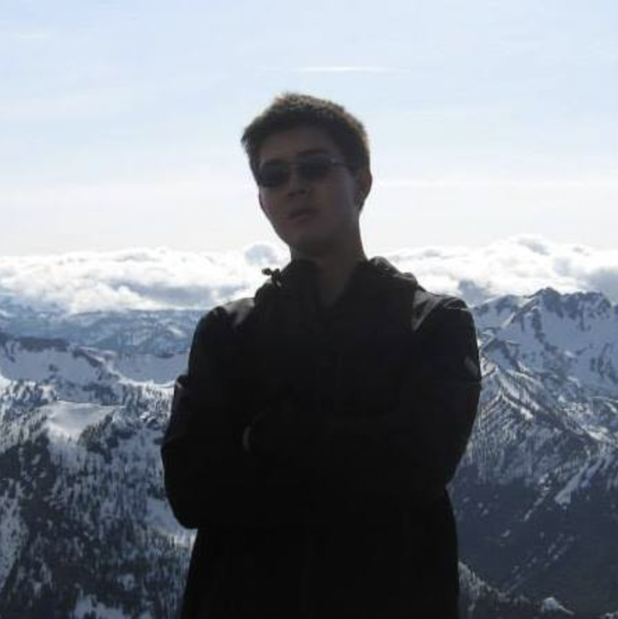
Seven years ago, during our senior year of high school, Chris and I finished our standardized testing and drove out the next day to climb Big Jim. It was our first peak outside of the usual I90 / Mountain Loop zones where I grew up hiking. We snowshoed until our slowshoes broke, post holed, and finally slogged our way up to the summit. Our legs cramped with each step in the scree. We would point to a rock, and then promise ourselves when we reached that rock, we could sit down briefly and rest. It was one of the hardest things I have ever done. But when we reached the top, it also felt like unlocking a whole new world. From the summit, I gazed out on the entire Chiwaukum Crest, a sight that I did not know was possible in Washington, and I imagined the possibilities. You could say it was one of the pivotal moments in my mountaineering career.
But on this day, we cruised our way to the true summit of Big Jim, across the expansive tundra plateau, feeling remarkably strong and alive. I had come full circle – figuratively and literally. Seven years ago, I never could have imagined myself traversing this entire range in a single day. But that is the beauty of progress – it comes so unsuspectingly, so incrementally. Progress can really sneak up on you. Every once in a while, it is nice to look back and admire how far you have come. On this incredible day, we came pretty damn far.
On the summit, we took a moment to process all the incredible terrain we had covered. A breeze picked up and stratus filled the sky, signaling a change in the weather. In the fall, the views beg you to linger, but the temperatures urge you along. We decided it was time to race the impending darkness out to the car.
We plunged our way down to Lake Augusta, which sat perfectly still and beautiful. Oh, the Chiwaukum is so wonderful!
We hit the trail and began jogging back on the Icicle Ridge Trail, catching pink alpenglow in the clouds as we descended through the Badlands. The trail only got really bad in the last few miles, with seemingly a few hundred blowdowns to crawl over in the dark. I had hiked this trail just two falls ago and there were very few blowdowns, but trails that go through a burn zone like this are a losing battle! Anyways, I blasted some tunes and just kept crawling, making it back to the car just about 16 hours after leaving the Lake Ethel Trailhead. What a day!
This day on the Chiwaukum High Route with John was truly one of the most incredible days I have had in the mountains. This was most definitely the largest and most challenging high route I have ever on-sighted in a single day. Everything was just a bit more than we expected: more beautiful, more epic – but also more challenging and more hours required. And it was especially meaningful to complete a route that I had been planning for many years in a place that has inspired me from the start. This was probably my last big day of the season, and damn we went out in style – from Dusk to Dawn, the Essence of Autmun, and the Heart of the Chiwaukum Mountains.
Notes:
- Our route measured 32 miles and 14k ft gain. Only really a few of these miles (outside of the Lake Ethel approach) were on runnable trails, so it felt a lot harder than we expected. The trails are in rough condition and the off trail had more ups and downs and sidehilling than we were mentally prepared for. It took us about 16 hours.
- Those looking for a shorter day could exit out Chatter Creek, like the traditional Chiwaukum Ski Traverse. But the entire route really puts a bow on the Chiwaukum Range and creates an impressive sense of scale. Big Lou to Big Jim is just so easy and fun!
- The Hatchery Creek Road is falling apart badly. There is a steep rutted section that we were able to get up in our Outbacks with some speed, but most smaller cars would probably bottom out here. Above that section, the brush in between the tire tracks was over a foot tall and scratching the bottom of our cars, so most mid sized cars are obviously not going past that point.
- There was abundant water throughout the route, expect for the Big Lou to Big Jim section obviously.
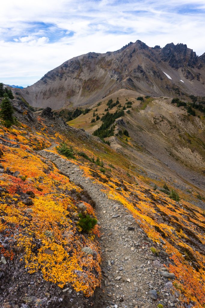
- Early September is definitely the prime time to do this route. The fall colors elevated this route from good to absolutely epic. Later in September risks bad weather and snow up high.
- This route truly deserves status in the upper echelon of high routes. The Chiwaukum is not the North Cascades or Alpine Lakes Crest. But it is unique, vibrant, and so beautiful.
- Nothing in the route exceeded class 3 or so, but there definitely were some exposed loose sections, like climbing Big Chiwaukum and traversing the key ledge after Lake Charles. Poles are highly recommended!
- The best route comparison is the Alpine Lakes Crest Traverse. The routes have similar stats, although the Chiwaukum is a shorter distance. The Chiwaukum is a little more blue collar with loose sidehilling, blowdowns, and overgrown trails. The Alpine Lakes Crest Traverse is a little more dynamic and cruiser, feature lots of nice snow descents and bomber slabs. I am not sure which is harder.
My favorite photographs yet!
Thanks Brian! I hope you’re doing well!
Awesome write up Kyle. I followed along with my map open. Hoping to get in the area for some larches early October.
Sweet! The larches in the Chiwaukum seem to definitely turn later than Chelan Sawtooth, Entiat, or WA Pass. So early to mid October is usually best.