Table of Contents
Not All Trees are Alike
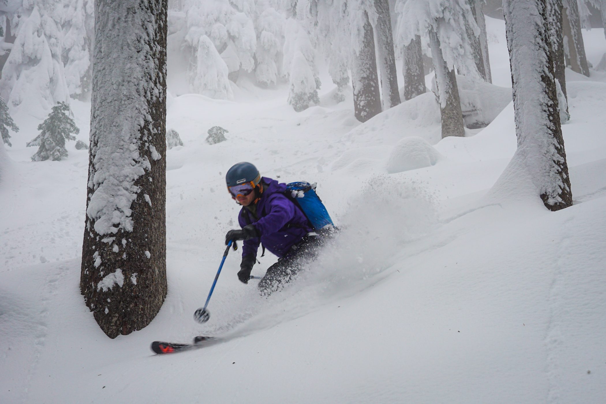
With our wet climate and vegetated terrain, tree skiing is a big part of skiing in the Pacific Northwest. We are both blessed and cursed – depending on your preferences – with plentiful forests and a deep snowpack that makes skiing in the trees a common experience. In stormy weather, trees can offer a great respite with safer avalanche conditions, good visibility, and protection from the wind.
As I started tree skiing (aka storm skiing) in the Cascades, I had some successes and some failures. I think many of us have had the shared experience of getting stuck in the dense new growth trees on Kendall Knob, cursing our decisions. I found that people generally resort to a few known, reliable stands of old growth like Kendall Big Trees and Yodelin. As I began to branch out, I discovered so many more awesome tree zones and realized that there was good tree skiing all over the place, but also really bad zones. I started to learn how to scout tree skiing using modern tools.
Characteristics of Good Tree Skiing
I think that most of us would agree about the common characteristics of good tree skiing:
- Old growth or mature second growth trees with minimal branches close to the ground, well spaced for skiing between.
- Minimal shorter shrubbery or alder that sticks out of the snow.
- Slope angle between 20 and 35 degrees.
- No newer trees with dense branches close to the ground.
In general, zones that have never been logged are usually reliable. These trees are well spaced and minimal light penetrates through the canopy to the forest floor, preventing smaller bushes and trees from growing. Zones that have been logged are more risky. They can offer good glade skiing or decent tree skiing, but it depends on how they were logged and when they were replanted.
When to Go Tree Skiing
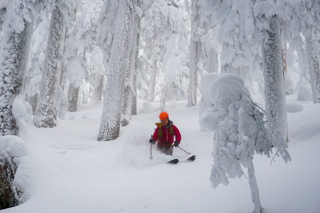
Tree skiing is best when there has been a large amount of snow (2-3 feet) since the last rain event. Depending on the snow density, probably only 25-50% of snowfall makes it to the forest floor in old growth forests. Lower density snow struggles to make it through. Thus, if there was a rain or warm event that turned the forest floor into icy tree bombs, you might want to wait for a few feet of fresh snow, preferably wet and heavy snow followed by lighter snow. Until then, smoother open slopes typically ski better.
Tree skiing is my favorite on stormy days where open alpine slopes may be too risky or windy. Tree skiing typically provides safer avalanche conditions due to more slope anchoring, but avalanches can still happen in the trees if the slope angle is greater than 30 degrees. You must still evaluate conditions yourself and stay safe. And during historic avalanche cycles, avalanches may run through stands of old growth.
Using Satellite Imagery to Predict Tree Spacing
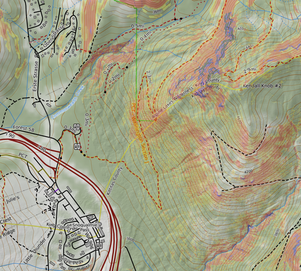
As a case study, I will use Kendall Knob at Snoqualmie Pass. This is an area with a mix of logged and old growth trees. It is recommended as a beginner tour, but if you enter the dense new growth, it is remarkably not beginner-friendly (or friendly to anyone). Satellite imagery can be a big help in planning a good skin track and good ski lines.
Here is what the knob looks like on the CalTopo base layer:
If we select the “Global Imagery” layer, we can see the actual trees. In some places, this layer is dark on shaded aspects. In that case, you might want to just use the general Google Maps Terrain layer.

With this satellite layer, the section that was clearcut becomes very obvious. A few other notes:
- Areas that were not logged have a distinct appearance. You can almost make out each individual tree, although the canopy appears continuous.
- If you can see any ground between the old growth trees, then it will feel more like glade skiing – light gets through the canopy.
- Although you can see ground space between the newer growth, it will likely be more difficult to move through because they are bushy with minimal ground clearance and leave very little space between.
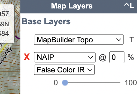
If these details are hard to pick out, I like to use the “NAIP False Color IR” layer because it makes vegetation easier to pick out. I usually stack this on the base map layer, so I can fade it in and out as needed.
With this layer, the vegetation differences become more apparent:
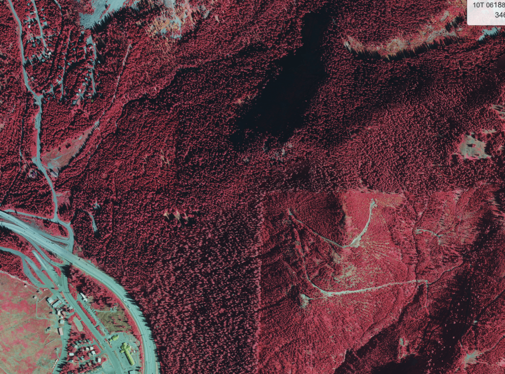
The density and type of trees becomes more apparent with this layer. The main limitation is that certain sections are shaded due to the sun angle when the image was captured. Also, this layer is from 2013-2015 so the vegetation has changed since then.
With these images, I will now demonstrate how I interpret different sections of the Kendall Knob area:
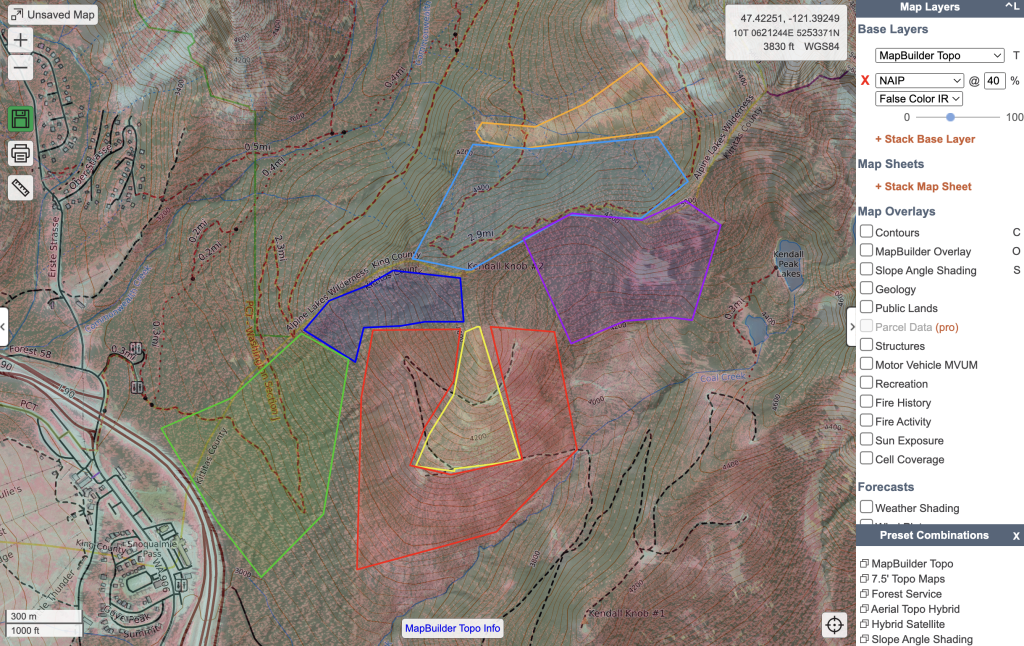
- Orange: This is the Kendall Slide Path. You can see lots of denser, younger trees. These can pose problems early season before they get buried.
- Light Blue: Generally good old growth trees.
- Dark Blue: Old Growth, but so close to the clear cut that light enters the canopy from the side; as a result, the younger new trees have “invaded” this area to a certain extent and the skiing can be quite challenging.
- Green: Below this, further from the clear cut, the trees are more traditional old growth and spacing is good.
- Red: This is an area of denser new growth that can be challenging to move through.
- Yellow: This area was clear cut, but appears to have decent enough spacing to make for easy travel and decent skiing.
- Purple: This old growth area has excellent spacing, with visible space between trees, almost to the point of a glade.
I created this CalTopo map if you want to play around with this a little more.
The most challenging areas to predict are old growth next to clear cuts. The clear cuts do have an impact on the forest health of the neighboring old growth, but it can be hard to know how far the effects penetrate and to what extent.
Ultimately, satellite imagery will not give you all the answers. You will have to go into the field to see if your observations match your predictions. As you explore more zones, you will have more reference points and become better at guessing from satellite imagery. It is a positive feedback loop.
Using NDVI to Predict Alder Density
While some odd fellows like my friend Steve actively seek out alder skiing, most of us avoid it like the plague. Slide alder occupies many open slopes and can be quite formidable in thinner snowpacks. Slide alder is difficult to spot in satellite imagery. Luckily, we can use NDVI (Normalized Difference Vegetation Index) to help.
NDVI is essentially a measurement of vegetative level. It leverages the fact that plants reflect certain wavelengths. So even if the alder is generally not visible at 10m satellite resolution, the plants can still be detected.
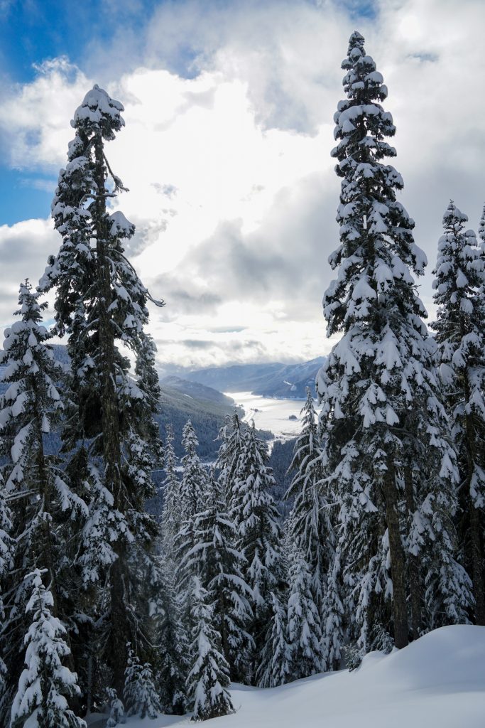
As an example, we will look at the Snowshed Face on Humpback Mountain above Exit 47. From below, on the Palouse to Cascades Trail, it looks nearly like an impenetrable wall of alder. Here is what it looks like on free Sentinel-2 satellite imagery:
Sentinel’s free imagery is only 10m resolution, much lower resolution than Caltopo’s “Global Imagery” layer. Individual trees are not discernable. But it is free and arrives every few days, assuming clear skies.
In this image, it is impossible to see the alder at the base of the snowshed face. But if we toggle to the NDVI layer, we can see the telltale signs of the alder:
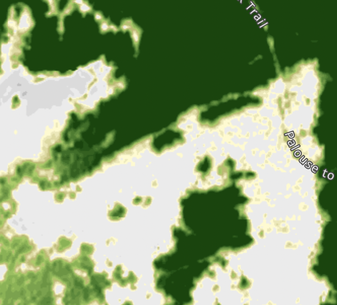
Trees are dark green. The yellow and light green patches in the otherwise open snowy slopes indicate visible alder. As you can see, the densest alder is right near the Palouse to Cascades Trail, but there are plenty of alder-free areas as you get higher.
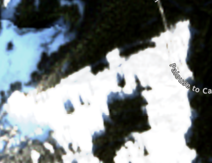
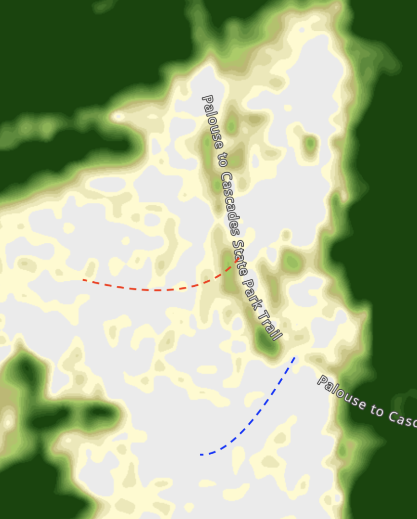
Zooming in further on the section where the face meets the trail:

You can see that the densest alder is actually gathered right against the trail and it becomes better immediately above that. You can also see that to avoid this dense band of alder, you can leave the trail closer to the southern point.
This NDVI strategy works best if you can find a clear satellite image of the area when some of the alder is sticking out. For some areas, that might be mid winter. For others, it might be spring as the snowpack melts out. It is not terribly precise, but can be another tool in your toolbox.
Into the Trees
While tree skiing might not be as sexy as skiing big lines, I find almost equal joy in exploring tree zones, in search of that perfect forest. As I have branched out of the most popular tree zones, I have found an abundance of excellent tree skiing in the Cascades, each with its own unique character. When avalanche danger is higher or conditions are nasty, exploring the trees can be a great little adventure. By sharing these resources, some may accuse me of “blowing up” their secret tree zones, but I also see value in empowering backcountry users to spread out, explore, and become stewards of forest health.
The tools we have at our disposal to plan backcountry trips are constantly improving and vastly different than a few decades before. I see technology not as the death of adventure, but rather an evolution and inspiration. Technology gives me ideas of zones to explore, but it cannot mimic the calm perfection of a swath of towering old growth trees, or the sensation of carving through a forest of ancient giants; there is no replacement for getting out into nature yourself. So I hope this post has given you a few extra tools to plan your next tree skiing adventure!
Flippin awesome. Thanks for sharing this thoughtful analysis!