Exploring Salmon La Sac
Going into the winter, one of my top objectives was to explore the Salmon La Sac region. Salmon La Sac is a broad valley draining the east central Alpine Lakes Wilderness, where big glaciated peaks mix with the drier forests of the Eastside. I have had some wonderful days deep up Salmon La Sac in the summer, but never had seen the area in winter. The ski potential seemed vast, but information was, with the exception of a few spots like Red Mountain, non-existent.
I have had a hard time convincing people to check out Salmon La Sac, but fortunately Logan was as stoked as me to explore a new zone. High snow levels throughout much of the winter kept us away. Finally, for the last winter weekend, we got some sunny weather and decided to go for it. We could have started small with a new region, but we decided to go big, aiming for a linkup of Jolly, Skookum, The Louvre, De Roux, and Hawkins.
We arrived at the Salmon La Sac Sno-Park at dawn. Logan had been here once before, for the Teanaway Country 100.
Our tour began by heading east up Sasse Ridge. We started out on a snow covered road but then quickly ascended up the hillside, following a sled highway that blasted through the trees. The skinning was steep and the snow crusty, but we gained elevation rapidly and easily. Right away, we had great views into the heart of the Alpine Lakes Wilderness.
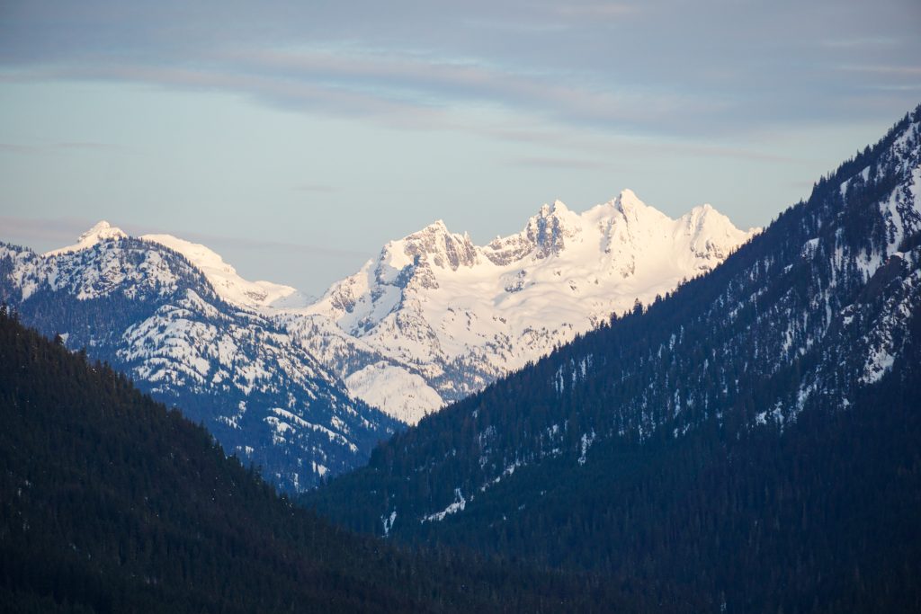
Even down at 4,000 feet, our poles were finding settled powder behind trees. It had been in the 40s at this elevation the day before, but we could tell that dry snow survived in the shade. We knew this would be an incredibly varied day, with strong spring sun contrasting with the cold wintery snowpack.
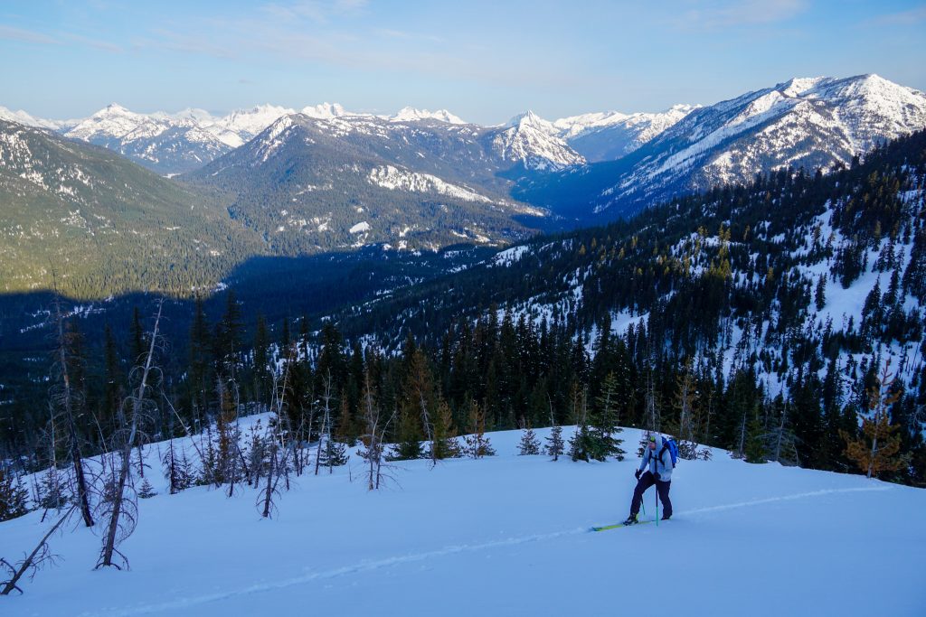
Near the ridge, we entered a matchstick forest, more reminiscent of Western Montana than Washington. The skiing on the west and north aspects looks incredibly fun up here, and very accessible from the car. The views of the Alpine Lakes Crest are outstanding. Many broad river valleys – the Cooper, the Waptus, and the Cle Elum – join together here to form Salmon La Sac. We had wondered if the area would feel more like Snoqualmie, Blewett, or the Icicle. It turned out to feel like none of them – a deeper snowpack than Blewett or the Icicle, but broader valleys and drier forests than Snoqualmie. Yet another unique biome and wonderful vibe, with easy winter access! We were already impressed with the zone.
Once at the ridge, we took time to put on sunscreen before continuing east on the ridge towards Jolly Mountain. Most of this valley burned during the Jolly Mountain Fire of 2017. It kind of reminded me of East Peak at Crystal.
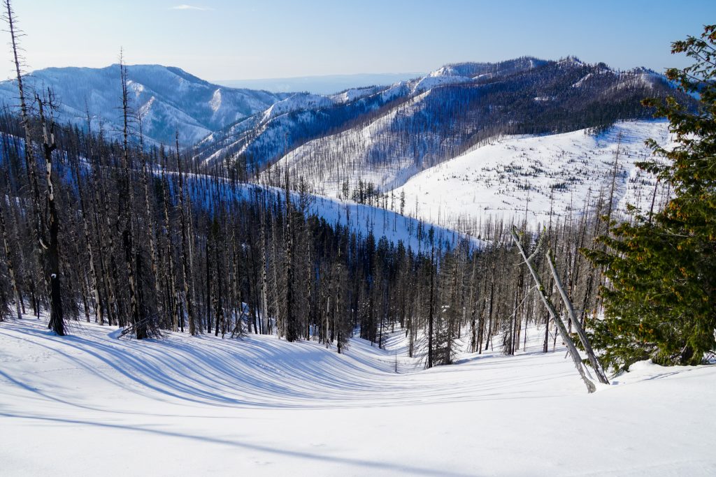
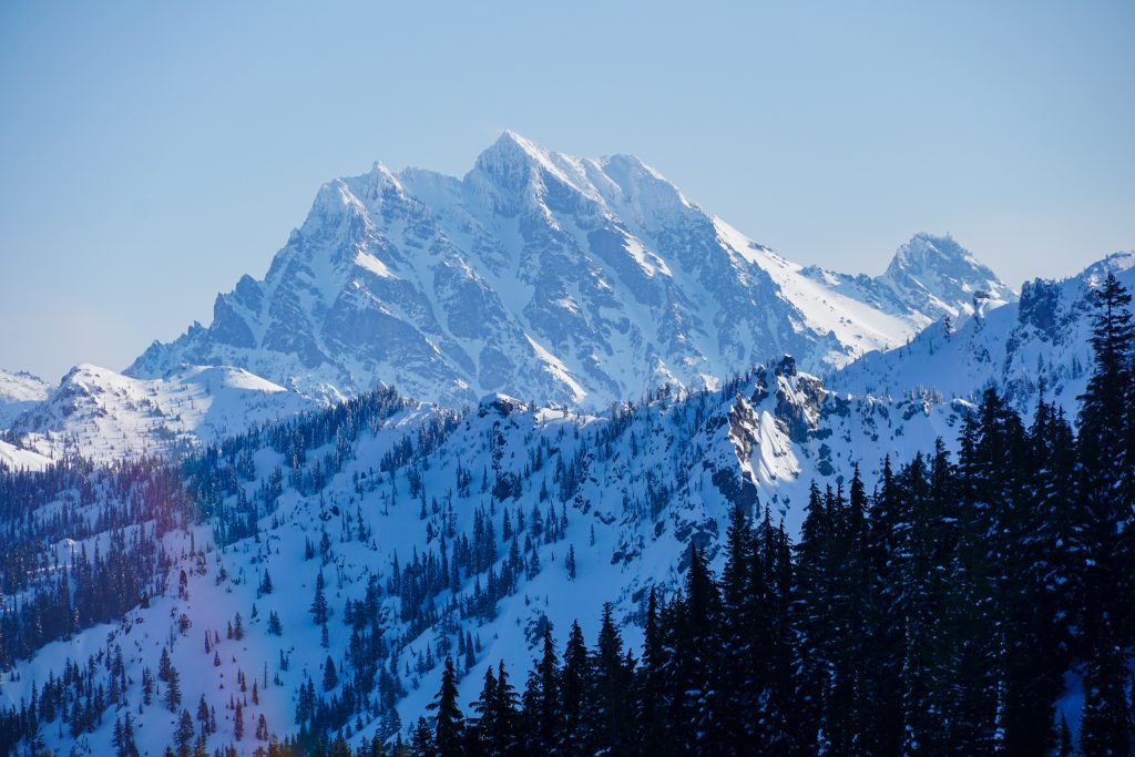
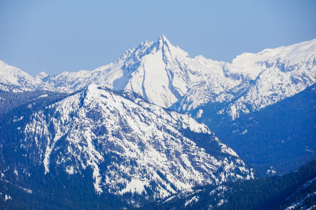
We cruised along the ridge, following a few old snowbike tracks. The skinning was easy and the views were just stupendous. It was a beautiful day for a walk!
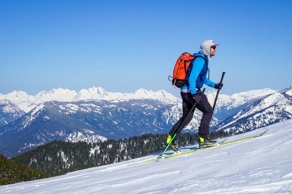
We had bagged nearly 4k of vert when we reached our first run. There are a few different ways to cut over towards Skookum. There are great east facing glades off the ridge, but we chose a north facing tube, hoping for preserved powder. After the fact, an old timer told me that this line is named “Ladybug”, for all the ladybugs that come out here in the spring.
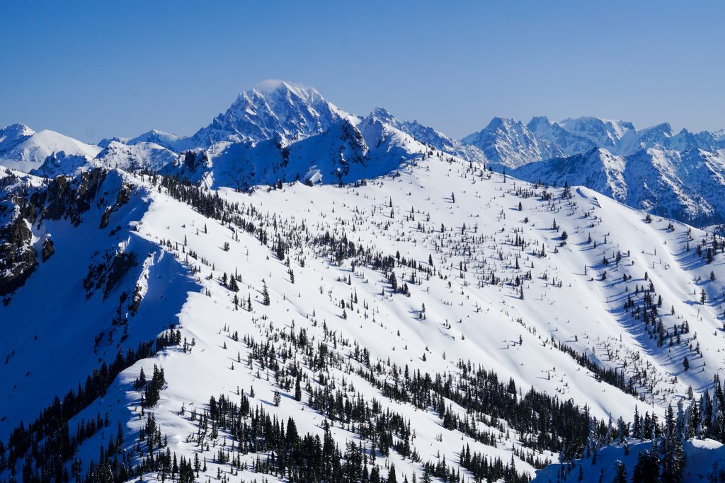
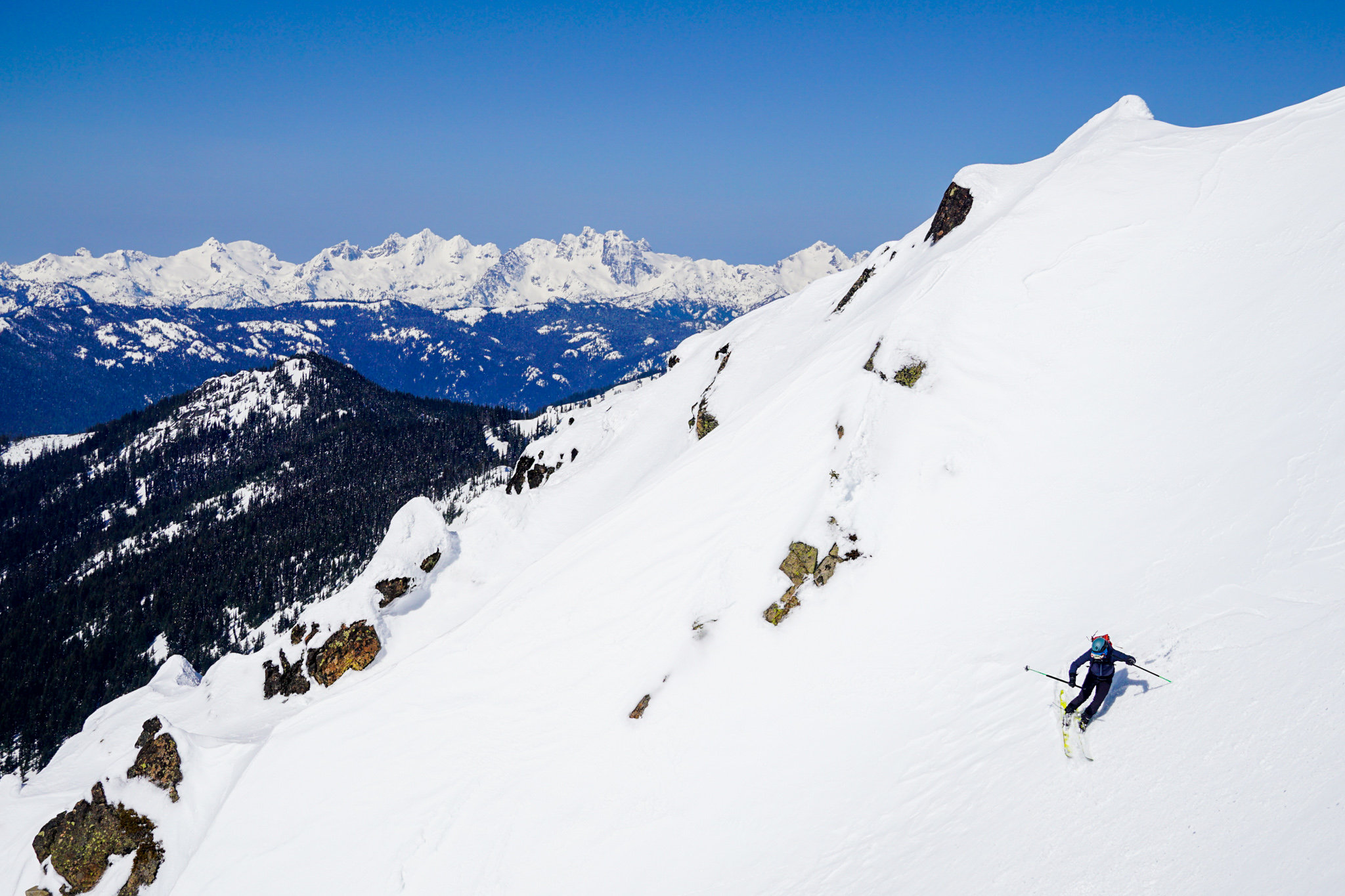
It was also our first clear view of the entire traverse and it elevated our stoke levels even higher. Terrain that had looked just okay on a map was actually a moderate skier’s paradise – thousand-foot glades and fall lines galore, with plenty of steeper lines closer to two thousand feet long. And as far as the eye could see, there was not a single track. How come relatively few people ski here? These are the questions that motivate me.
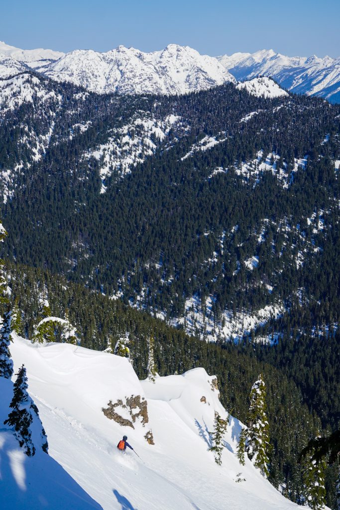
On our first run, the snow was still dry, but there was a wind crust that made the turns a little funky. We followed the gully down to where it leveled out and then started skinning up through faceted powder towards the Jolly – Skookum col.
Skookum has an impressive looking west face, with plenty of chutes and spines. The cornices here face west, unusual with our predominant southwesterly winds. We took a peek, but decided to save this for another day.
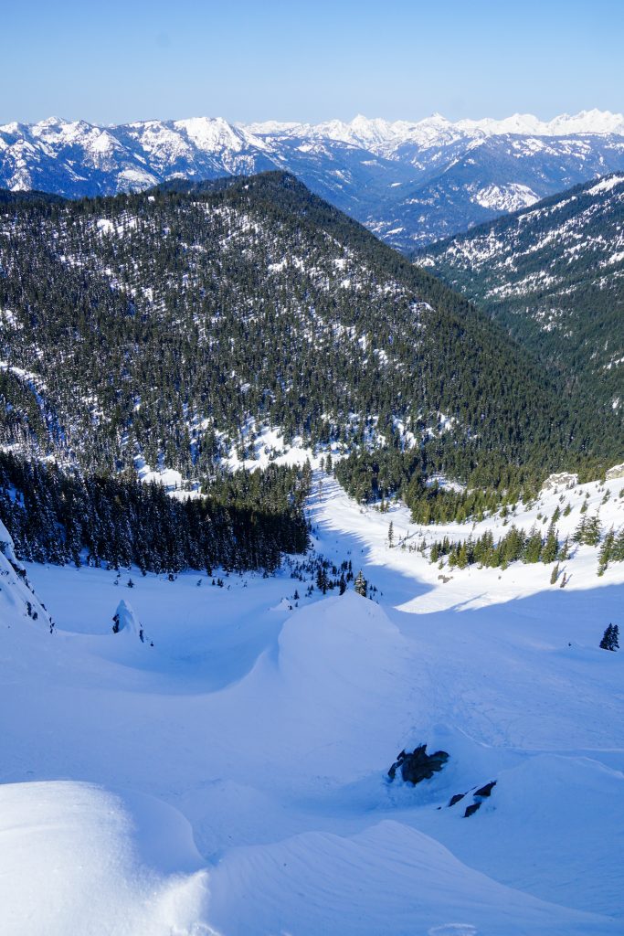
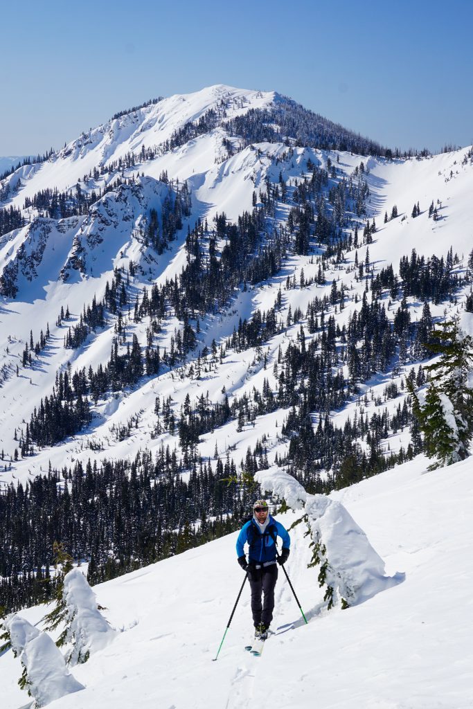
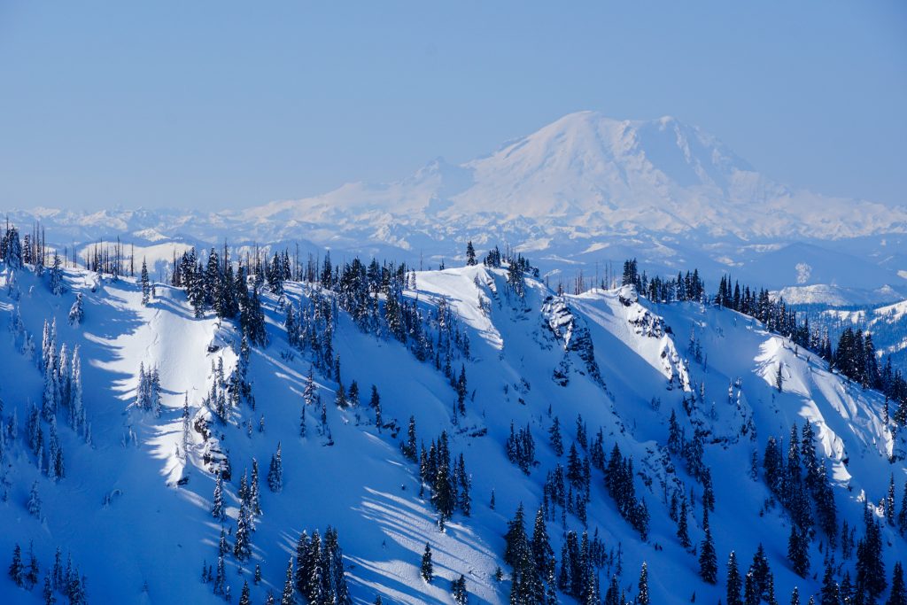
From the summit of Skookum, the west face of The Louvre (pronounced “Loov”, named for the famous French museum) looks like a little French Freeride playground. There are chutes, spines, and cliffs aplenty, with Stuart as a dramatic backdrop.
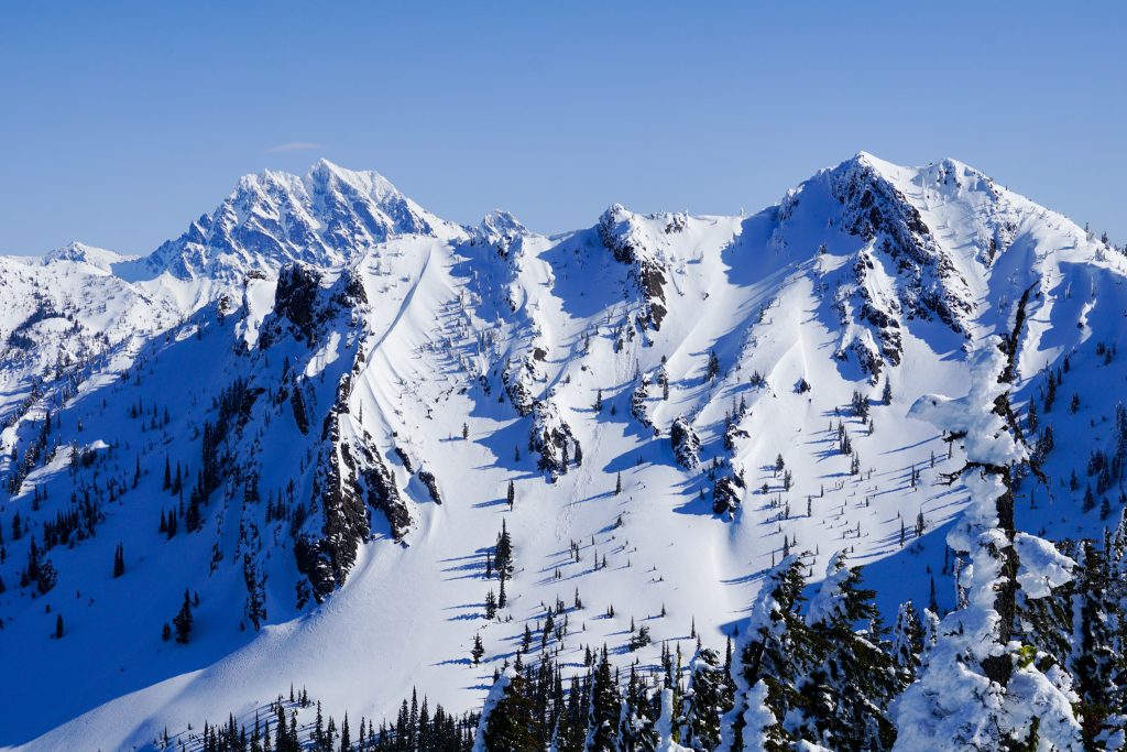
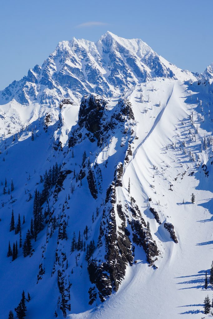
Our eyes were immediately drawn to a chute that dropped right off the summit of The Louvre. It was proud and highly aesthetic. We called it “Le Louvre Tube” (pronounced “Luh Loov Tube”). Our original plan was to ski the north side of The Louvre for the most efficient traverse, but this line was just too stunning to pass up.
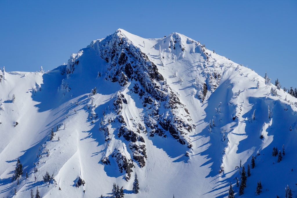
We skinned along the ridge from Skookum, getting more excited by the moment. The final section to the false summit and true summit involved some easy booting. Is it a ski traverse if you do not do any booting?
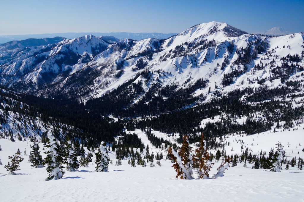
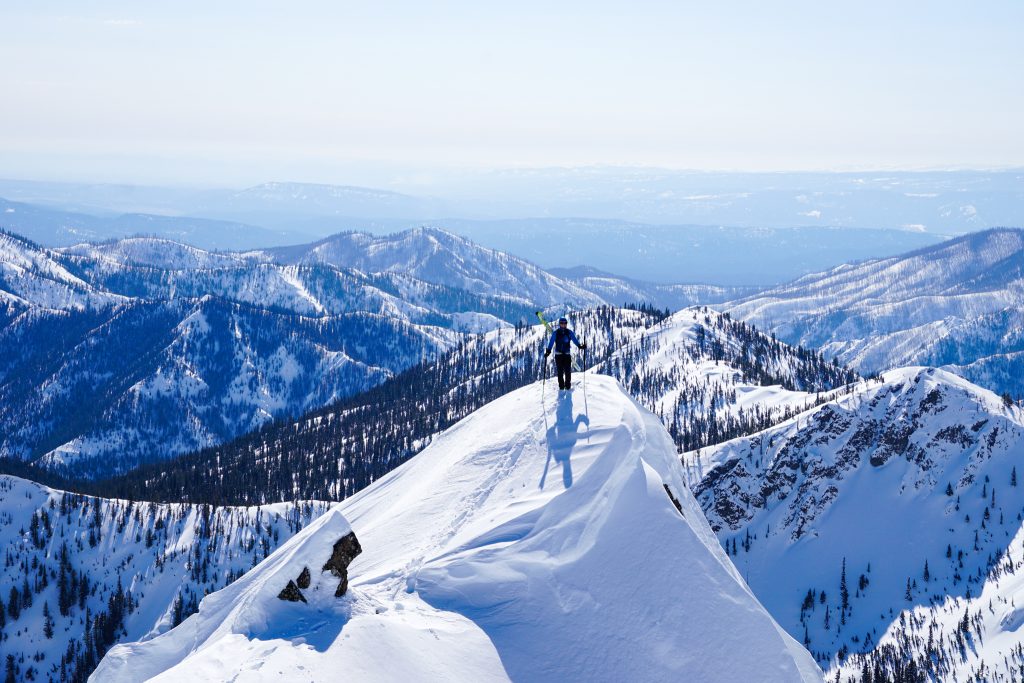
The Louvre was our highest summit of the day and easily the best vantage. To our west, the Alpine Lakes Crest unfolded in a long chain of high, sharp peaks. To our northeast, the Stuart Range closed off the skyline. At summits around Stevens, Crystal, or Snoqualmie, you might be able to see further, but none of those destinations can make you feel like you are surrounded by giants in quite the same way. Salmon La Sac is pretty damn cool.
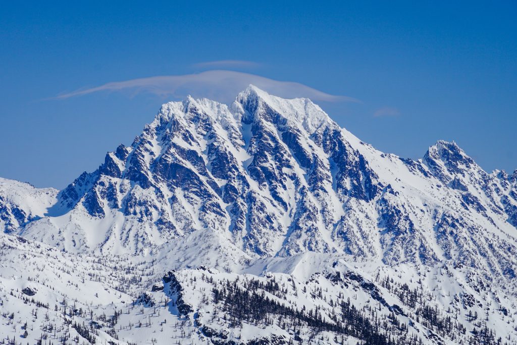
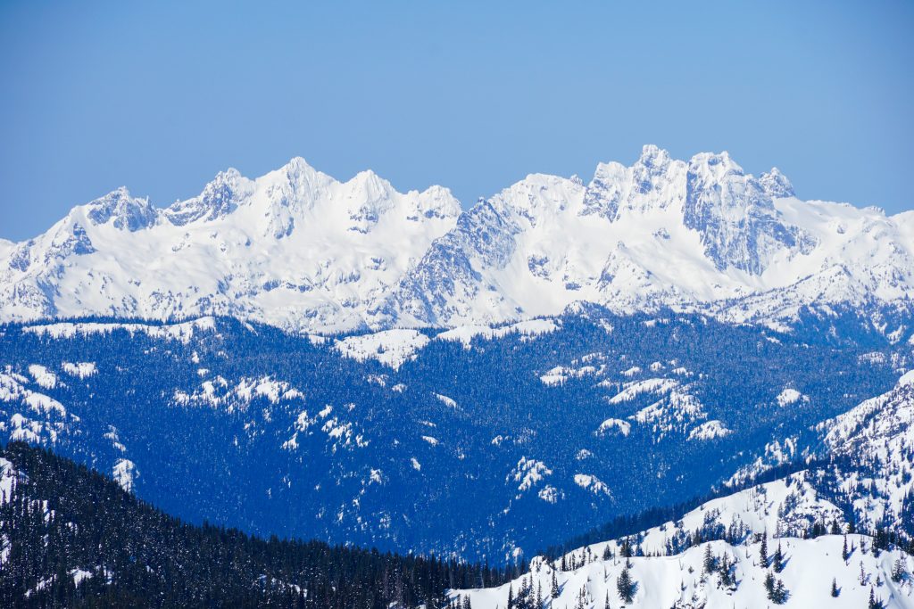
Le Louvre Tube is not that long of a line, and only steep for the top few hundred feet. It appeared pretty firm with some sun softening, so we felt the the risk of slabs was pretty low. Logan dropped in off the summit while I photographed him from the false summit.
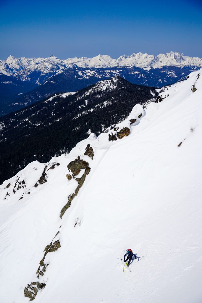
The snow was variable, but the setting was awesome! It also felt so wild to ski such an aesthetic line that we had no idea existed until a few hours earlier. Logan and I originally met in jazz band in high school, improvising on the saxophone. Now we were improvising in the mountains with our skis!
The apron took us through some settled pow down beneath the west face of The Louvre. With this detour, we skinned to the northeast to a high point on the ridge. The trees were somewhat tight here and our skins glopped badly as we alternated between dry snow and wet snow. Ridges were windy all day, but down here it was calm and felt hot like spring for the first time all year.
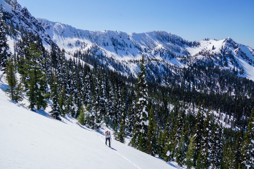
From the ridge, we made another short north facing descent before skinning up towards The Louvre – De Roux col. Glopping was once again bad, so we were glad once we got back on solar aspects and did not have to deal with any more dry snow for the day.
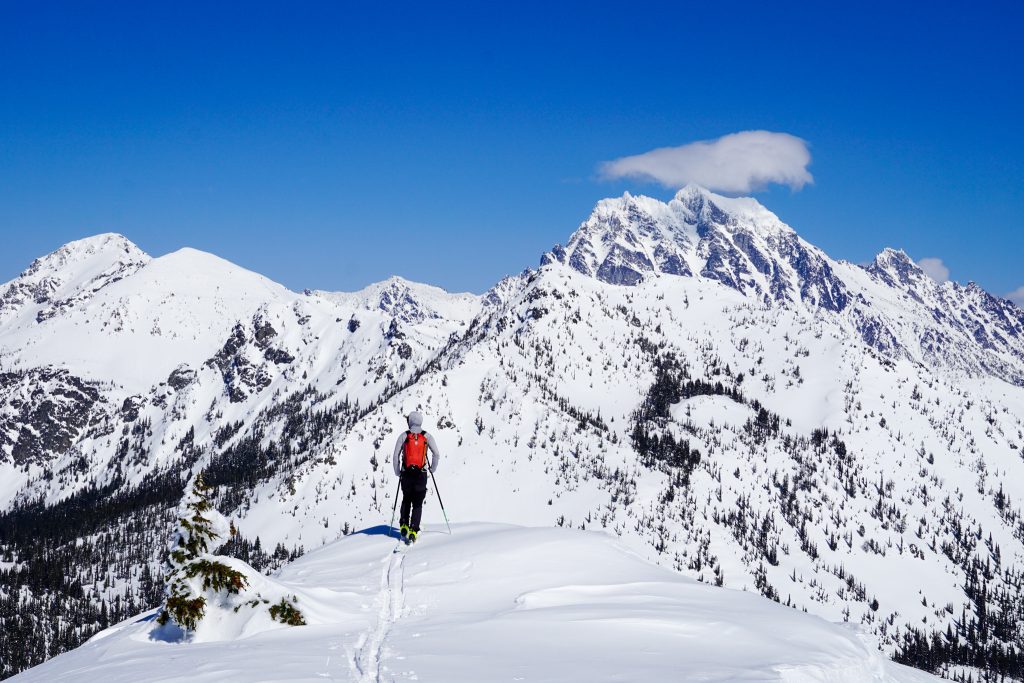
At the summit fo De Roux, we heard the “brapp” of sledders over on Hawkins, the first sledders we had seen all day in this backcountry supposedly dominated by sledders (or at least this is the reputation). And even in places like Hawkins or Sasse Ridge where we encountered sled tracks, they never tracked out the good ski lines. Out here, there is plenty of terrain for both motorized and non-motorized users to enjoy.
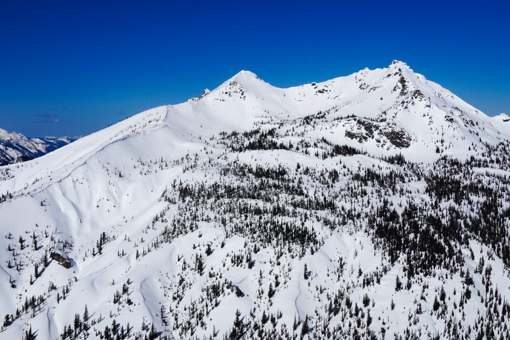
The are a few different ways to descend off the north side of De Roux. We chose to traverse leftwards down open slopes into a gully feature, which we called the “De Roux Tube”. This region of the Cascades is geologically notable for the visible erosion – many of the creeks have carved deep canyons in the soft soils that characterize this region. As a result, there are many “tubes” and fun ski features like this.
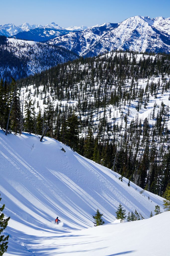
Up top, the snow was similarly wind affected but once in the tube, we finally found that settled powder, making for the best skiing of the day. We flew all the way down to Big Boulder Creek at the base of Hawkins. Even though it was still winter, there were some open spots in the creek at 5,000 ft, so we gladly refilled on water. It took a little creativity, but I was able to descend into a crack in the snow and reach the creek. It felt like spring for sure!
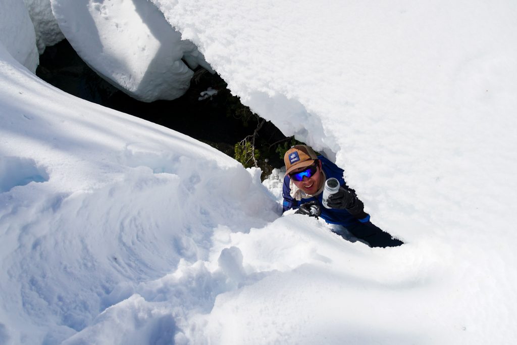
Now our traverse had only one long 1500 ft climb up the shoulder of Hawkins left. With a water resupply, we felt much better and cruised up the gentle terrain, admiring the krummholz on these windy ridgelines. These climatically stunted trees are subject to fierce freezing winds for much of the year. They are beautiful warriors in some very inhospitable places.
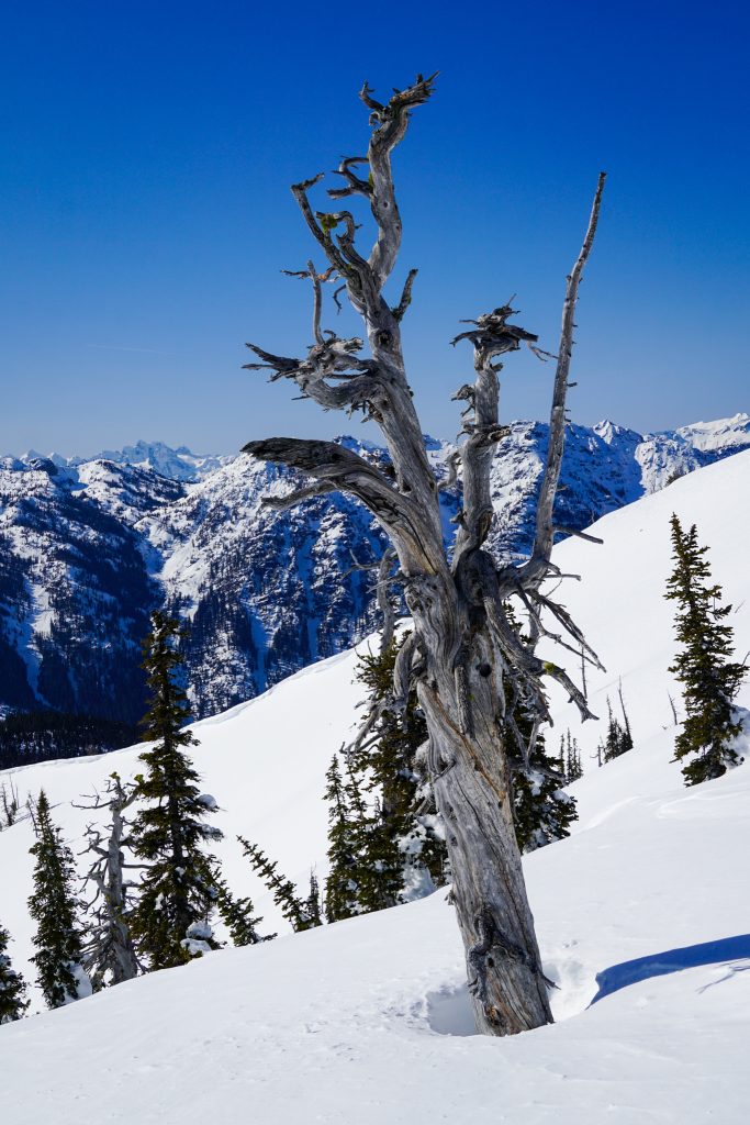
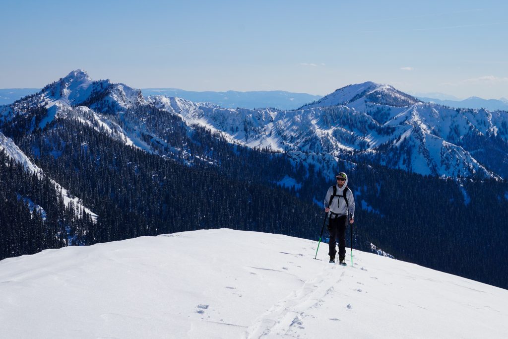
We climbed to about 6500 ft, where we joined with the long west ridge of Hawkins. We could have gone higher, but felt happy with our day and were ready to begin the journey back.
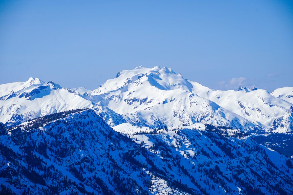
It is unusual to ski directly on ridge lines, but the west ridge of Hawkins is long, broad, and low angle, making for the easiest way to the valley floor. Because it was mostly stripped of fresh snow, the skiing was actually pretty good in the afternoon sun – a poor man’s corn and cream.
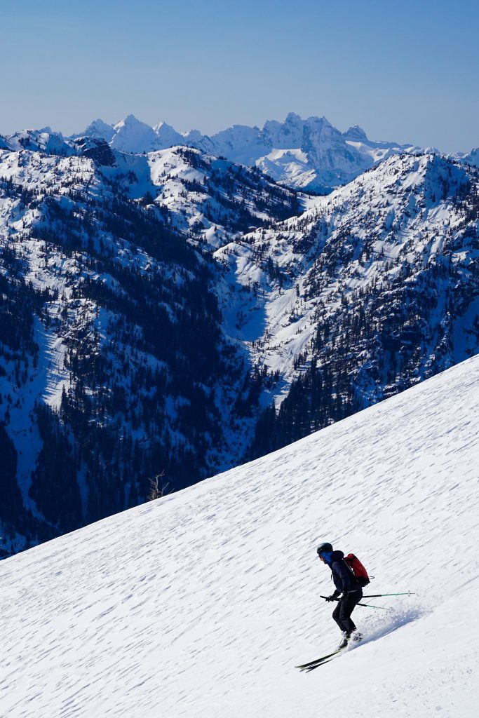
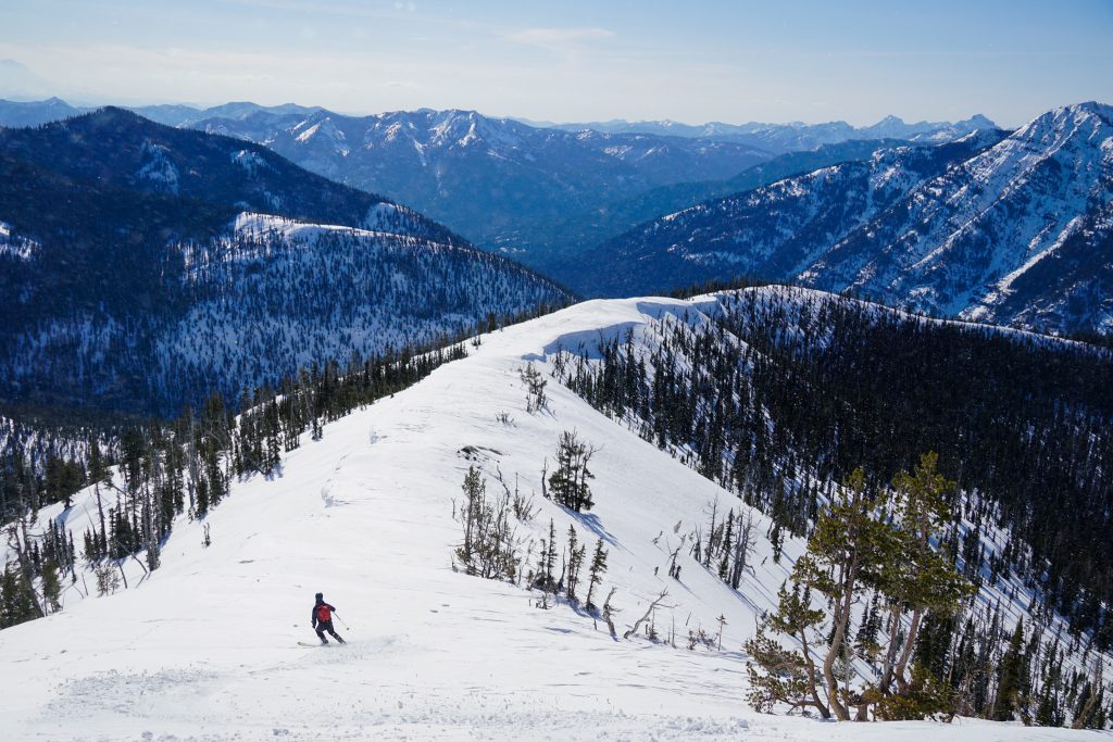
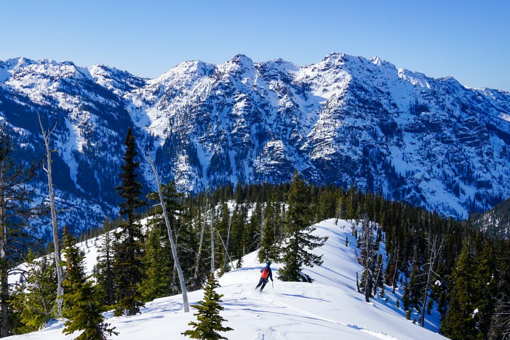
Below about 4500 ft, we skied through steep glades. The snow was deep mush at this point, but the terrain was incredibly fun, with awesome tree spacing and infinite pillows. We were able to ski fall line all the way to the main Salmon La Sac sled road at the valley floor – a remarkably fun and varied 3500 ft descent from the shoulder of Hawkins. For a Cascadian Traverse, that exit was pretty damn easy.
We now had about 5 miles and 600 ft of descent back to the car. I had naively hoped we could skate our way out, like I had done after Victoria’s Secret in the Icicle, but the annoying sled bumps and mushy snow quickly put an end to that pipe dream. We would be skinning.
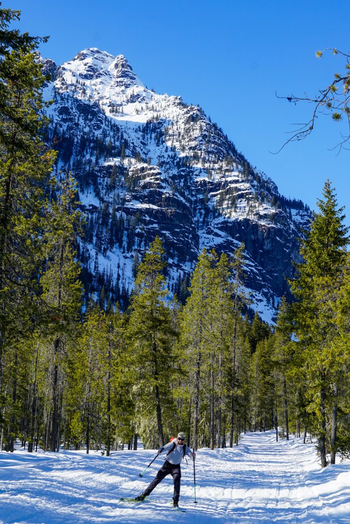
Sometimes there is nothing you can do but just grind out the finish. This is the first day this season that felt like a long spring day, and it felt invigorating, although tiring. We skinned through mushy snow all the way to the plowed end, and back through the nordic trails to the Sno-Park. Gotta pay the troll toll, although for a big ski traverse, that was a pretty small toll.
Logan suggested we call the traverse the “Slammin’ Salmon Traverse”. It was an incredible first taste of the vast skiing potential of Salmon La Sac. Going in, we had wondered if Salmon La Sac was more like Snoqualmie or the Eastside. Really, it is its own thing. It has those dry Eastside vibes, but a surprisingly deep snowpack that makes all aspects skiable. We are super excited to come back and explore more. And the fact it is easily accessible all winter long makes it even more unique.
One of my co-workers recently mentioned the concept of the “Chesterson Fence”. The main idea is that upon encountering a fence, we should always try to understand why the fence is there. I think this applies to mountains also. People write off entire regions because of logic like, “No one skis there, so there must be a reason”. The same sort of thought process can apply to techniques, gear, style of travel, etc. Imaginary fences. In that light, now I want to address a few common misconceptions about Salmon La Sac.
5 Common Misconceptions about Salmon La Sac
- Salmon La Sac is too far of a drive.
- Actually, Salmon La Sac is a slightly shorter drive from Seattle than Crystal Mountain, and does not have the same parking issues as Crystal. True, it is 45 minutes past Snoqualmie. But it offers something different than Snoqualmie.
- You need a sled to get to the good stuff.
- A sled definitely opens up more, but there is a huge amount of awesome terrain close to the car! Sasse Ridge, Jolly Mountain, Skookum – there is so much good stuff that is accessible in a typical day tour. Maybe not Slot-Couloir-rad or Shuksan-huge, but plenty of 1000-2000 ft open fall lines.
- It’s all just brapper-ville (aka sled terrain).
- True, motorized users are more common here than non motorized, but we encountered no sled tracks from Jolly all the way to Hawkins. And even closer on Sasse Ridge, the sleds had not tracked up the nice glade skiing. If you want a completely quiet experience, then this is probably not for you. But there is definitely room for both types of users to coexist. Be friendly to other users! This area is actually in a voluntary non-motorized zone, so it is intended for non-motorized users!
- The starting elevation is too low.
- You do start at 2300 ft. But this is on the Eastside, so 2300 ft here is often the same temperature as Snoqualmie Pass. The snowpack is plenty deep down low and you can often use roads or trails to get higher anyways. The actual skiing is between 4k and 6k, which is similar to most other backcountry zones.
- The ski terrain is not that interesting.
- I’ll let my photos do the talking.
Notes:
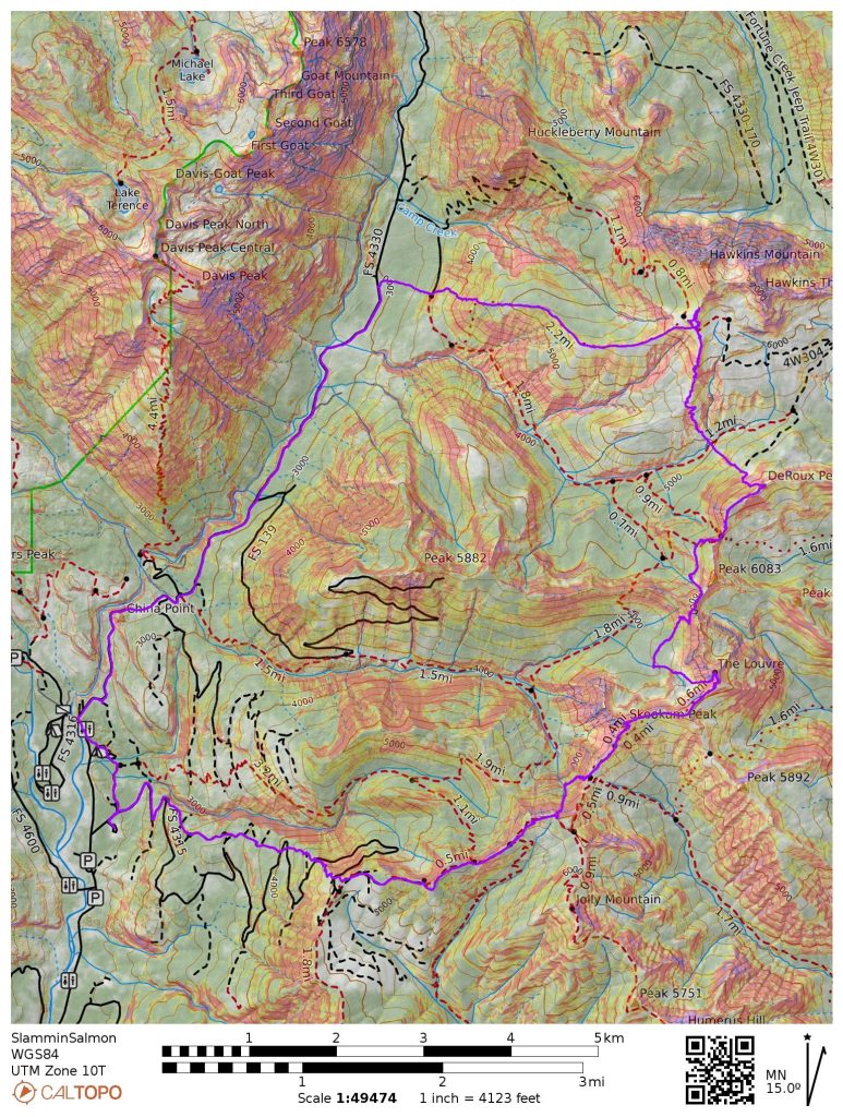
- Our route was 20 miles and 9k ft gain, with 5 miles of that being road skinning at the end. It took a little under 11 hours at a moderate pace for us.
- There are many variations to connect the peaks on our traverse. I think the best route just depends on the conditions that day!
- This traverse works well late winter because most of the descents on our shaded aspects and climbs on gentle solar aspects. Despite NWAC’s warning about wet loose, we never felt we were in any hazardous situations because most of the climbs were rather gentle. I think the spring skiing out here would also be incredible!
- The snowpack is thinner out here than Snoqualmie, but not as thin as the Icicle or Blewett. You can track snow conditions easily with the Sasse Ridge Snotel site.
The critical thought at the end along with
the “debunking” of misconceptions about the area was the icing on the cake. Your topo map addition (literally) highlights how moderate the slopes are. Looked to be a fantastic choice!
I know you are one to question fences, Alden!
Great Stuff, Kyle. Thanks for writing it up.
Thanks for posting. This was my 3rd winter here – If you ever are looking for someone to tour with I’m local. I know more about Stevens, Baker, and Crystal than this area and have limited tours around here. I’m not a sled owner – if need be they can be rented.