Heaven in Hell
The Devil’s Dome Loop is an approximately 40 mile loop in the North Cascades and Pasayten Wilderness. I have wanted to do this loop for many years, but other trips always ended up taking priority. Given the low snowpack in the North Cascades this year, I figured it might make for a good early season backpacking trip for me and Kelly.
Thunderstorms have been oddly persistent this season in the Cascades. For quite a while, nearly every afternoon has featured large cumulus clouds and the threat of heavy rain. We drove up Highway 20 in the dark, pouring rain before finding a place to park our car for the night and sleep.
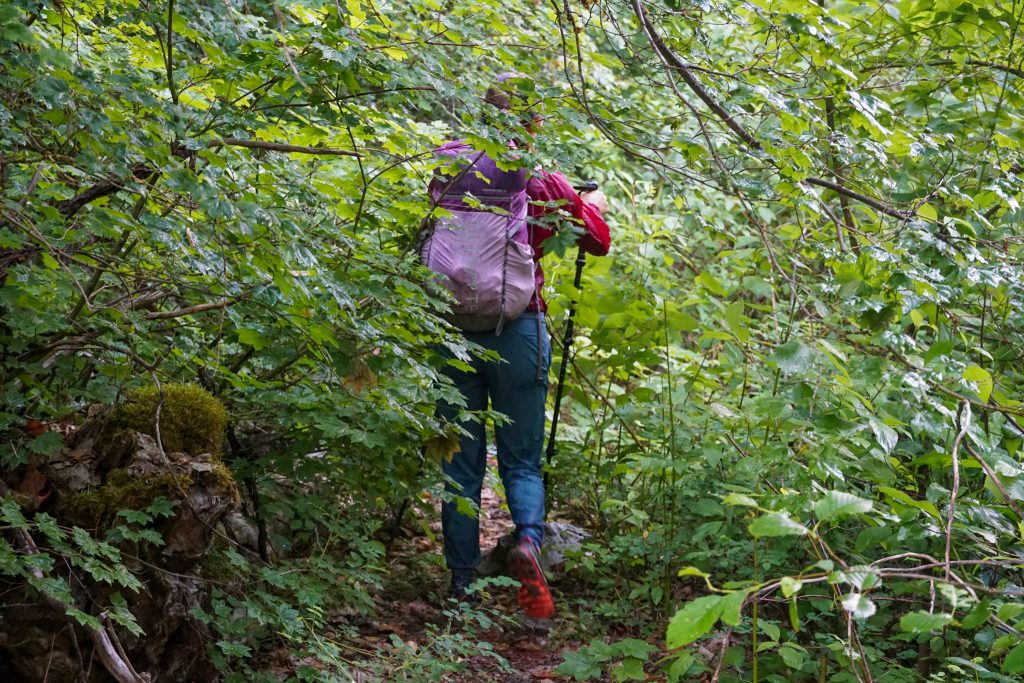
The Devil’s Dome Loop starts from the East Bank Trailhead. We had been warned that the initial few miles along Ruby Creek were brushy. We decided to go counterclockwise to get this section out of the way. The brush was wet and we got soaked head to toe, even though it was no longer raining.
Near the Canyon Creek intersection, there was a massive old growth blowdown that required some scrambling to get around. After that, the trail began to climb and improve in condition.
The trail climbs gradually through nice switchbacks. We chatted with two climbers on their way to Jack Mountain along the way. Once entering McMillan Park around 5k, the forest changed dramatically to the beautiful subalpine biome, with grassy meadows, miniature firs, and passing views. It was my first time of the season being in that signature North Cascadian environment, so I felt very excited. This particular environment brings bask so many great memories for me. Summer is here!
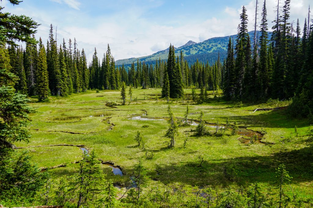
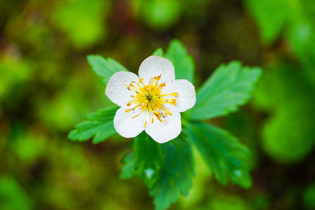
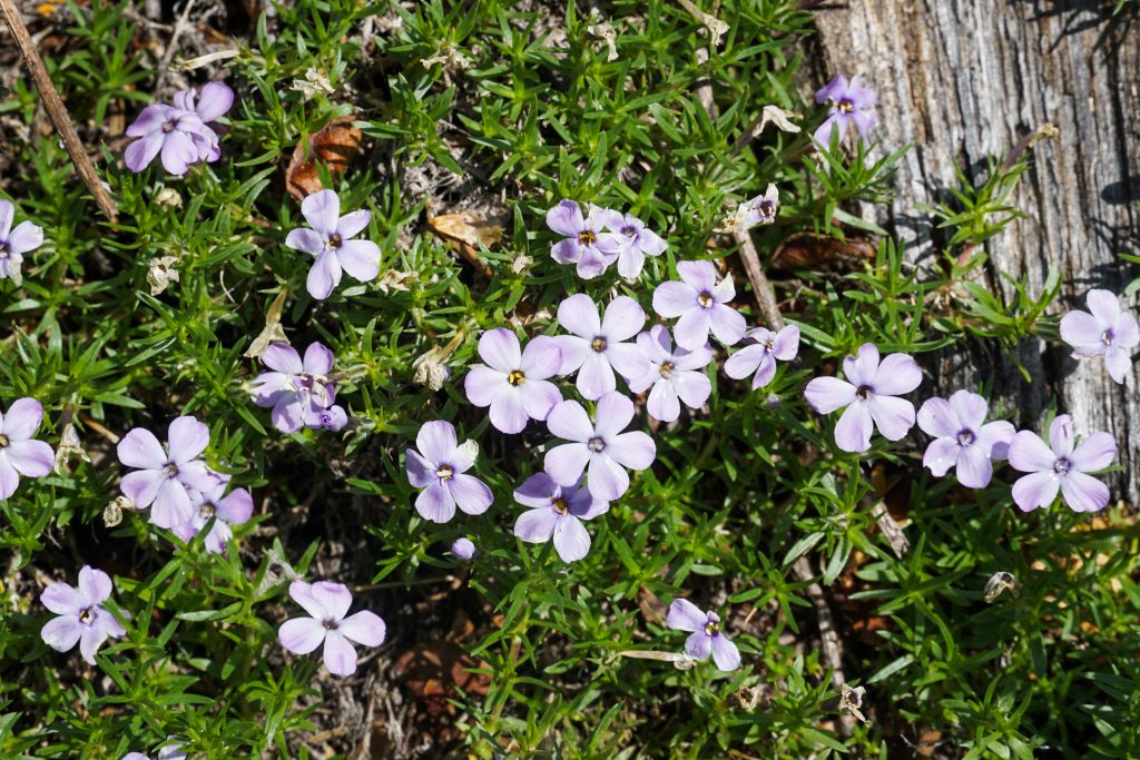
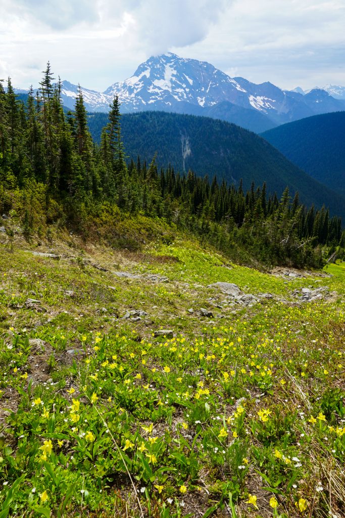
The trail goes mostly flat for a while over to Devil’s Park. Wildflowers were out, although so were the mosquitoes.
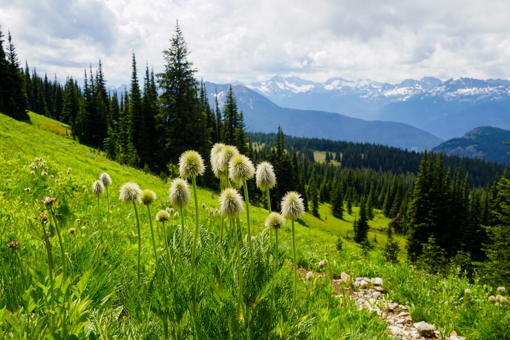
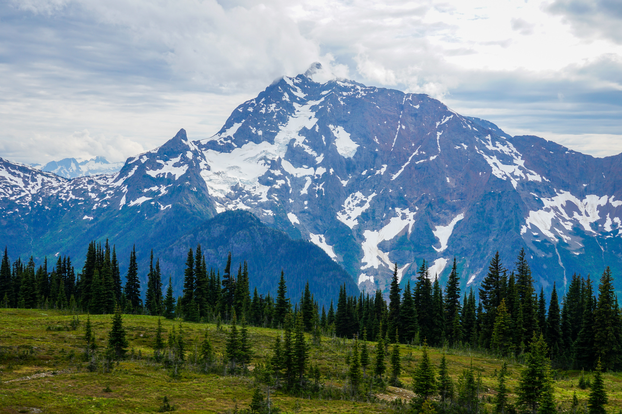
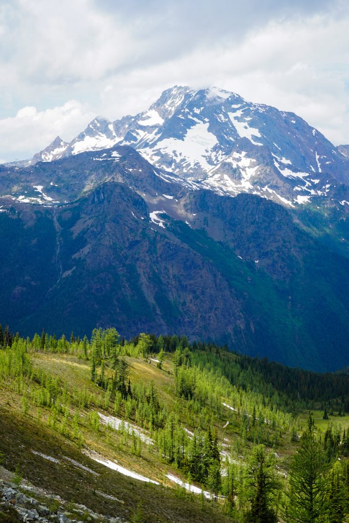
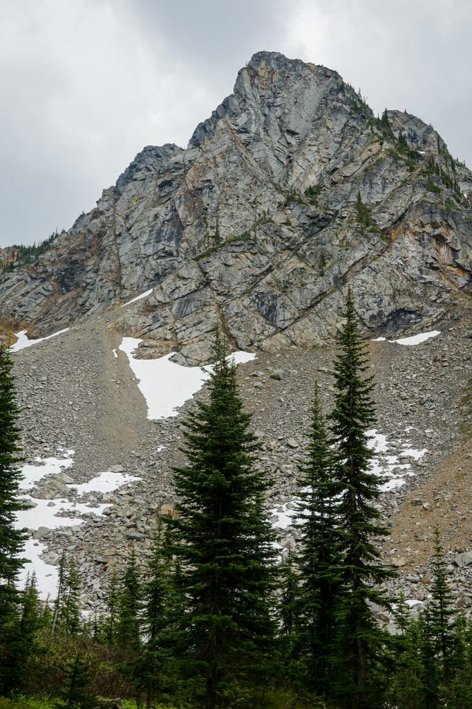
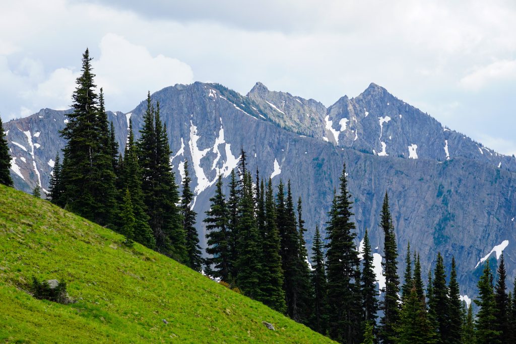
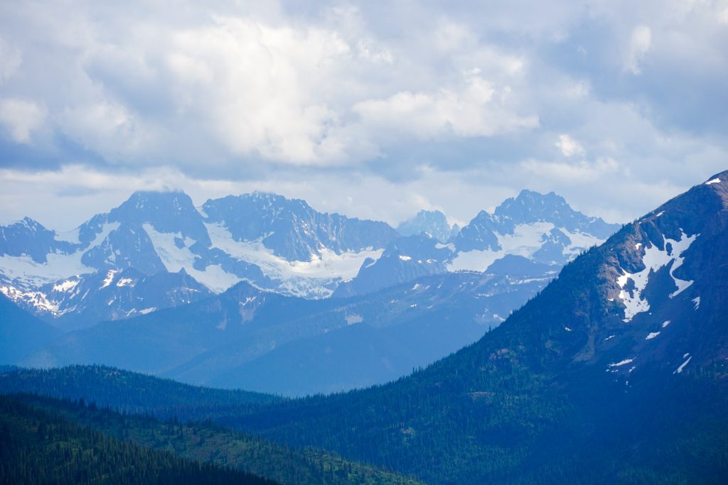
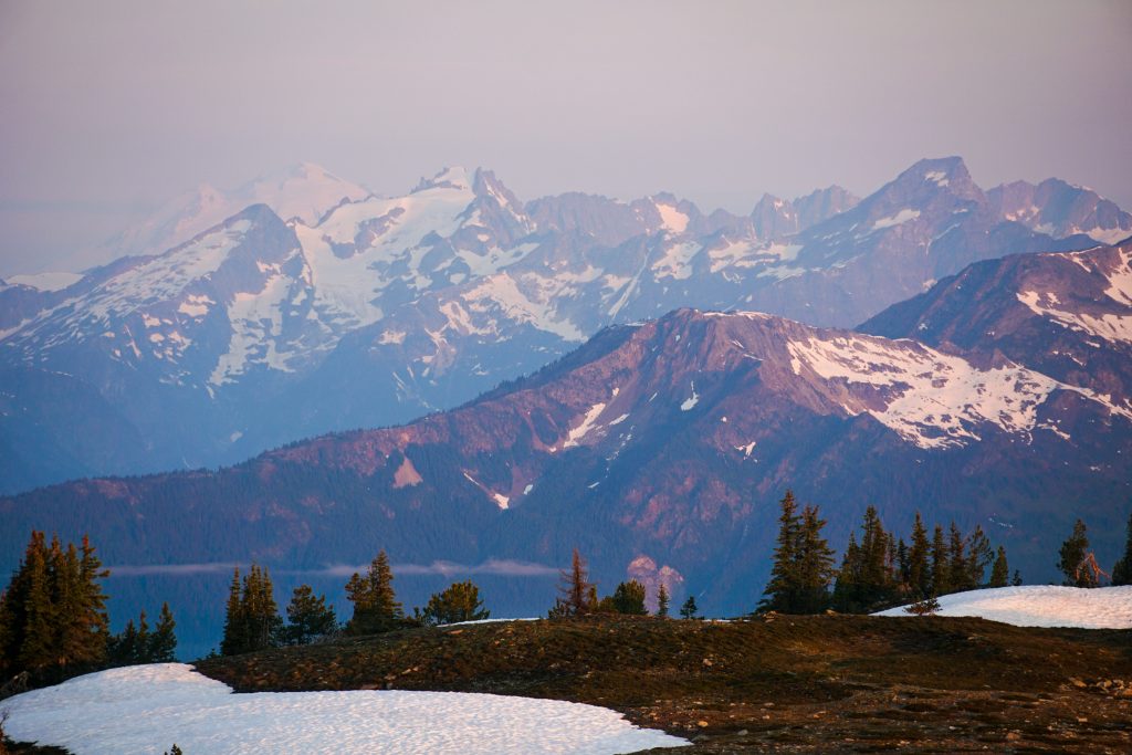
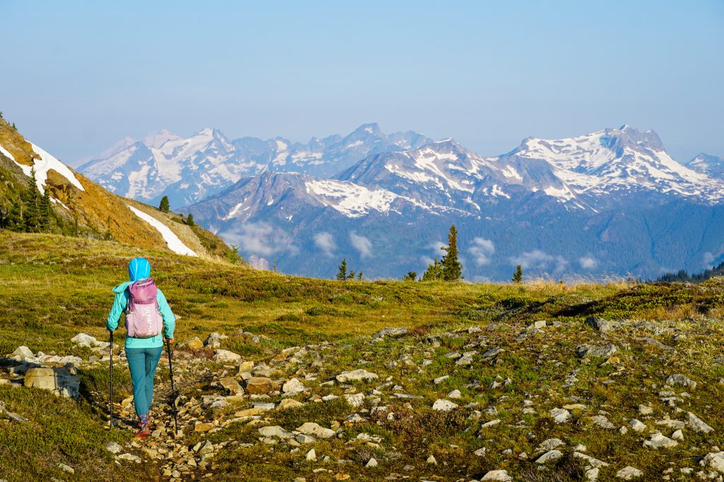
Above Devil’s Park we ascended into beautiful green hillsides with sporadic clusters of evergreens. We could see the jagged peaks of Ragged Ridge and towering clouds building above them. I absolutely love these lush tree line meadows. I have missed the North Cascades!
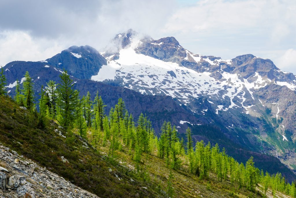
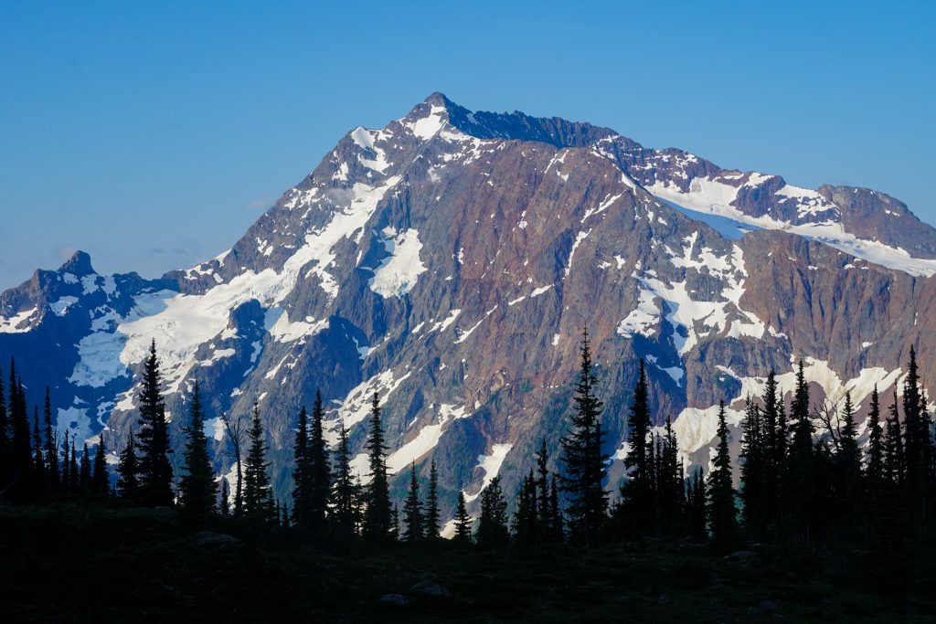
As the trail rounded the corner, the terrain transitioned into a cooler north facing hillside filled with larches and epic views of Jack and Crater Mountain. There was no water here, and thus no mosquitoes. With intermittent cloud cover and a light breeze, temperatures were actually perfect as we took a nice long lunch break.
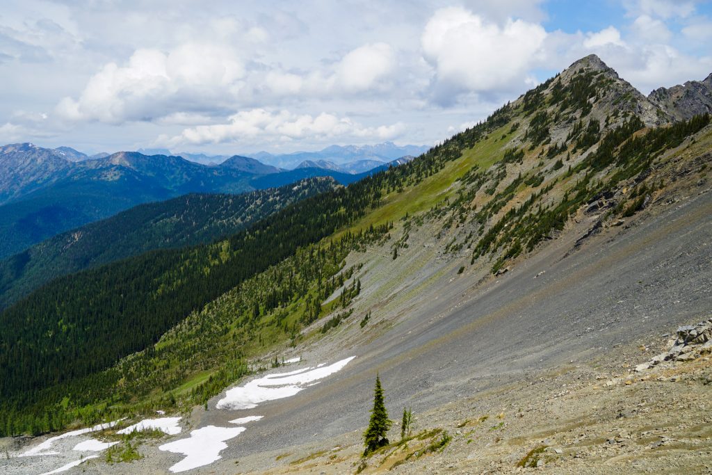
In one of the north facing basins, the trail crossed through a 19th century moraine. The trail was a little steeper and looser here, but not too bad. Fortunately, it was nearly entirely snow free. I do not typically hear of people doing this loop in June, but conditions this year are at least a month ahead of normal melt out.
The trail descends to Devil’s Creek before climbing back up to Jackita Creek. Avalanches had taken out the trail in a few places and some sections were overgrown. But in areas close to tree line where the vegetation does not grow back quickly, the trail was fine.
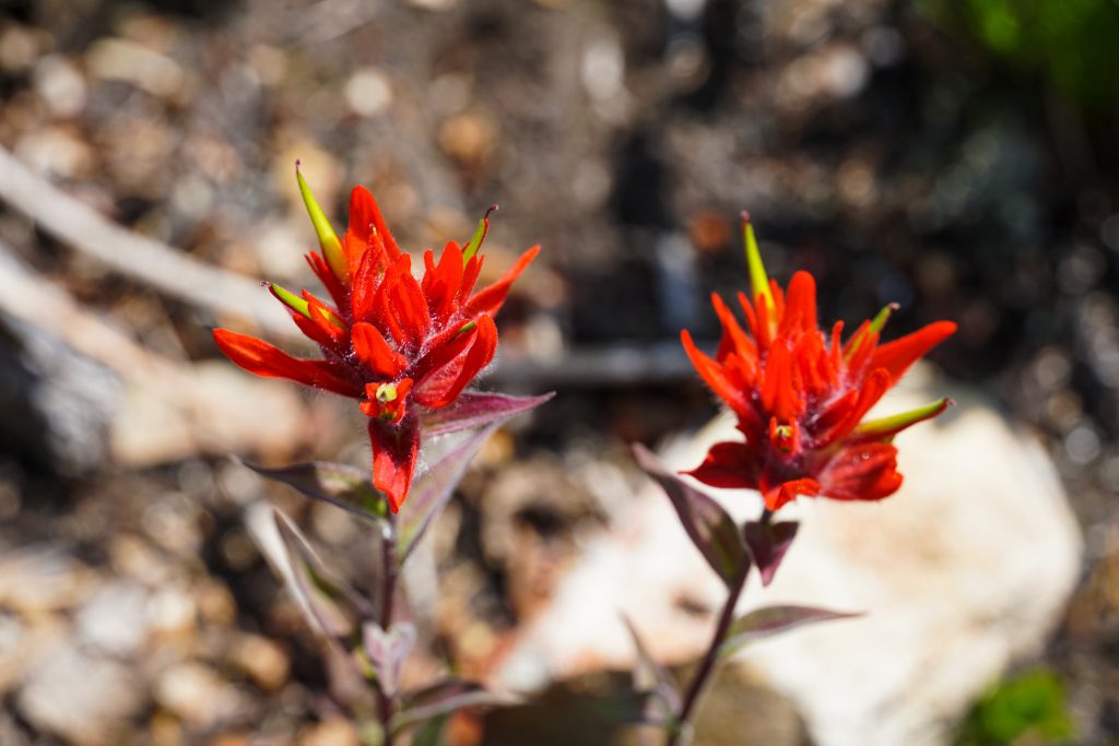
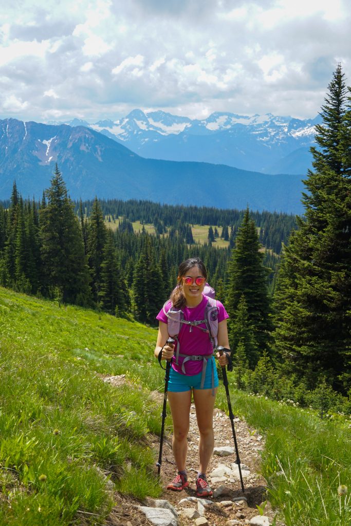
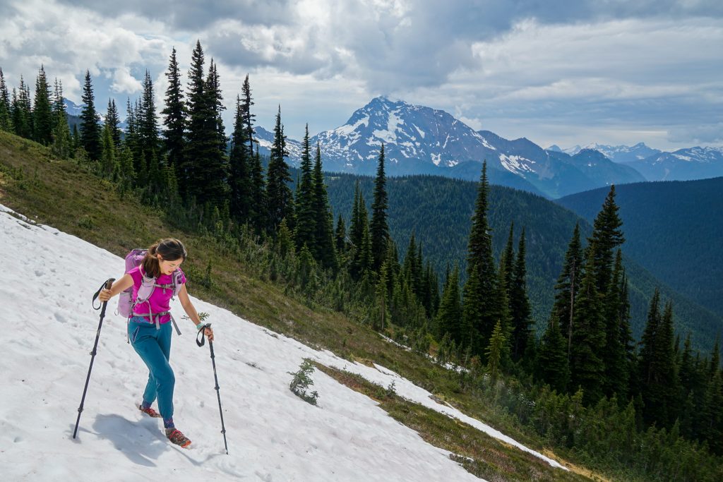
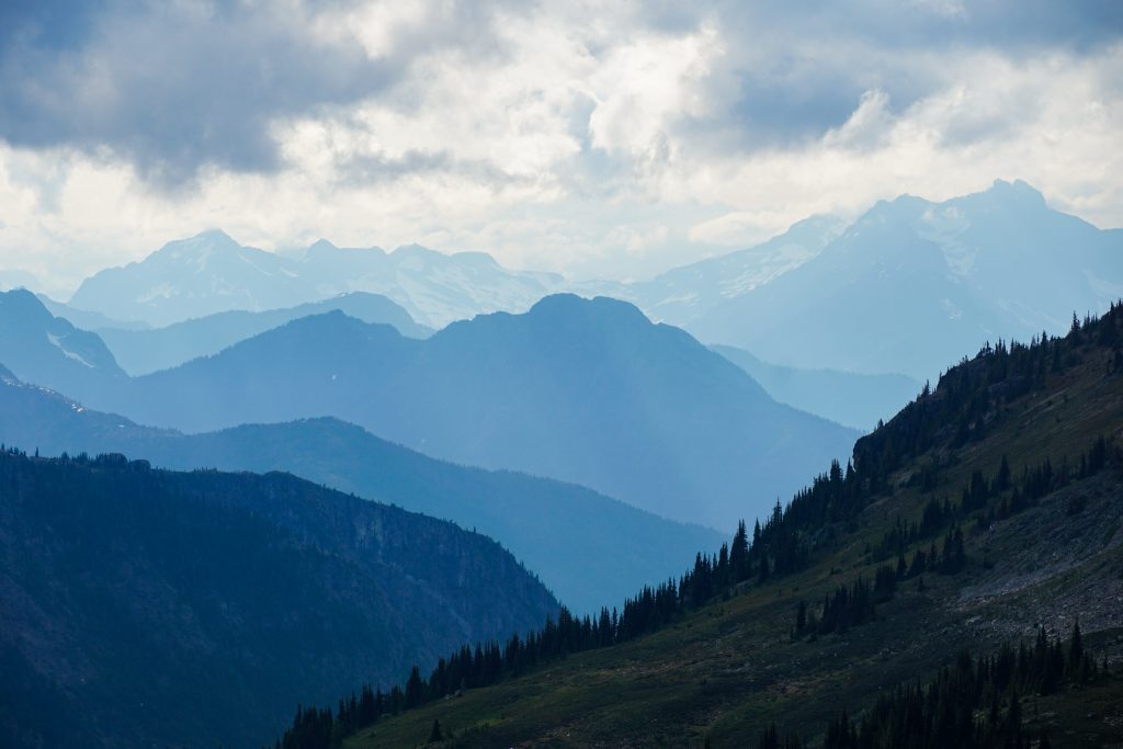
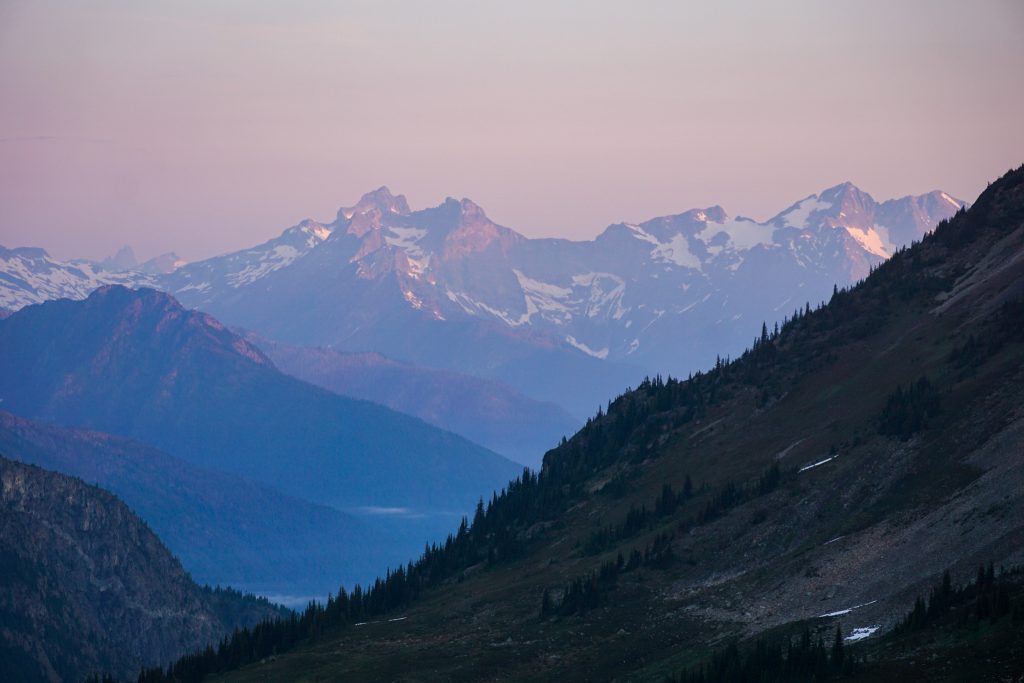
After a steep climb, we followed the mostly flat trail through sparse meadows and endless views. This section reminded me of the Bailey Range: a narrow path across a steep hillside with blooming wildflowers and incredible views of a giant mountain – Jack Mountain instead of Olympus. It was so peaceful and beautiful.
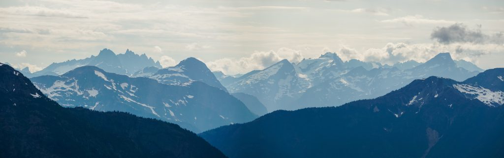
As we turned left towards Devil’s Dome, the scenery just kept on coming. We could see back to Ragged Ridge and across to the Pickets. These few miles of trail are some of the most beautiful I have walked, anywhere.

The clouds were beginning to wane and it seemed like we might get lucky with the weather!
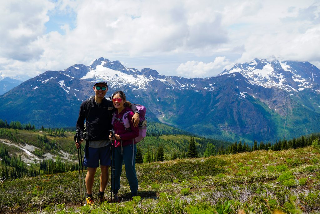
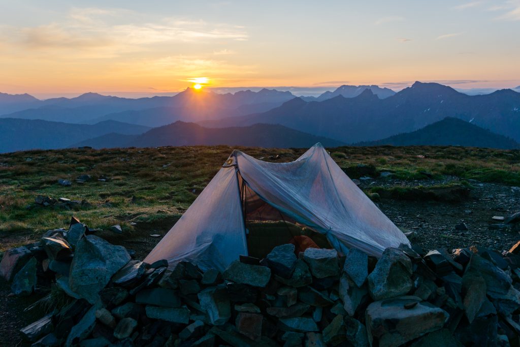
Our legs were tired on the final climb up to Devil’s Dome after nearly 9k gain with overnight packs. We arrived on top to find the perfect campsite on the summit.
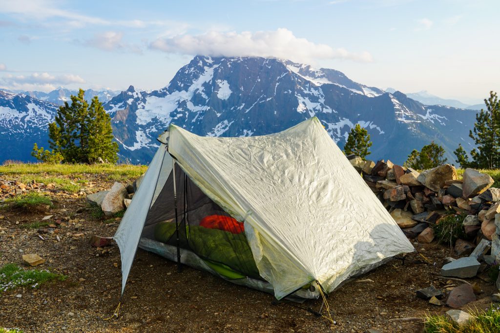
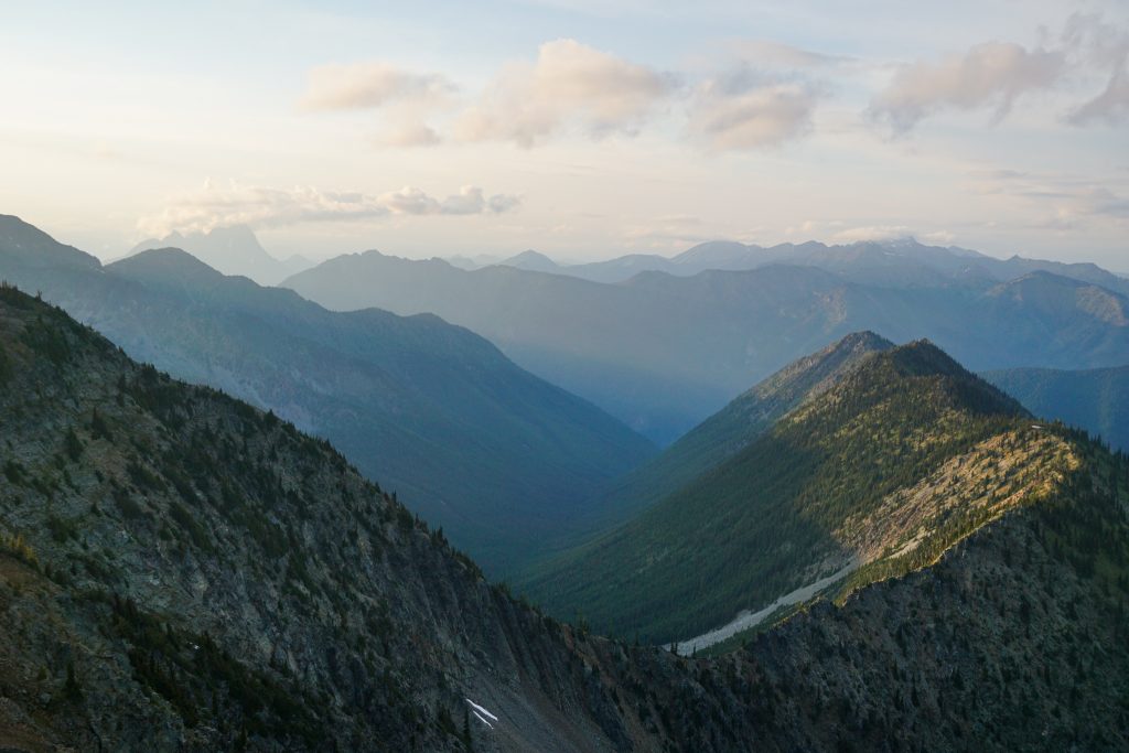
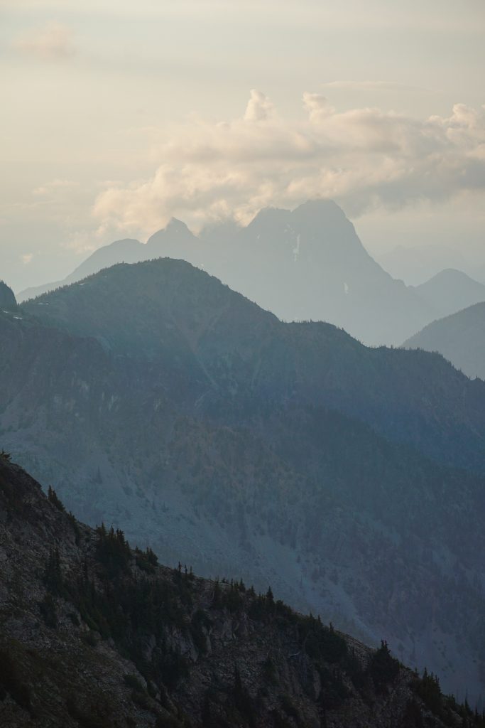
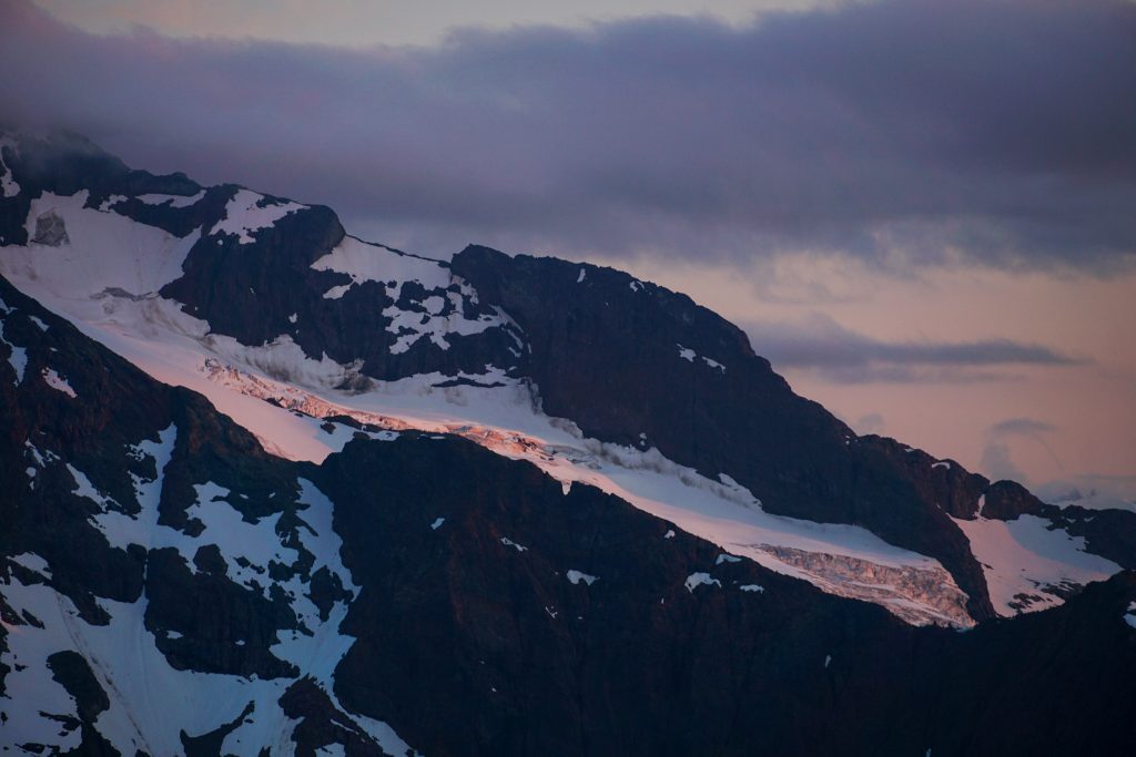
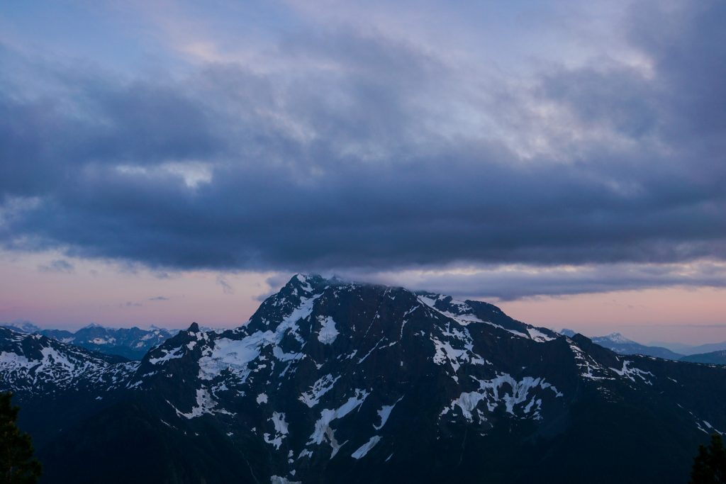
I found some water from snowmelt a few hundred feet down and retrieved enough for the evening. With no water nearby, there were absolutely no mosquitoes. It was a calm evening and we watched the clouds slowly part as we ate dinner with the most wonderful view in all directions.
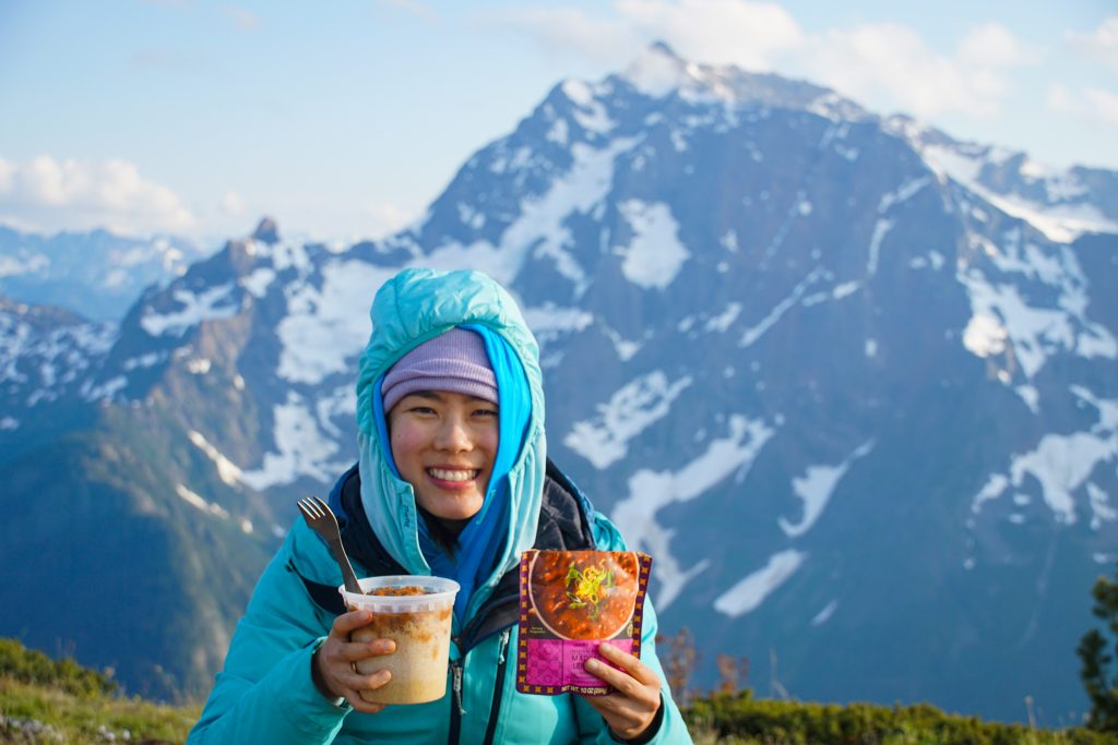
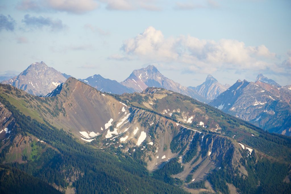
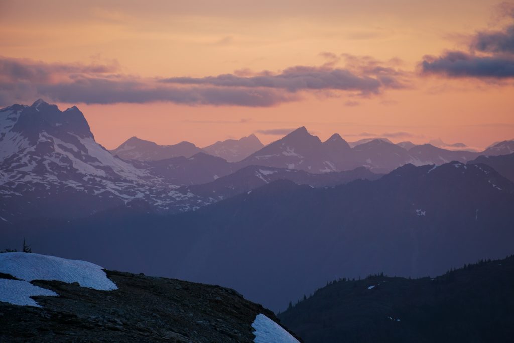
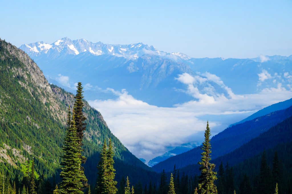
Devil’s Dome sits in a unique position at the transition between the steep, glaciated North Cascades and the dry, rugged peaks of the Pasayten Wilderness. It was fun looking out to so many familiar peaks that I had never seen from this angle. The opportunity for adventure out here is so vast and inspiring.
Although I love fast paced day trips, sitting out and watching the sun set in the mountains appeals to part of my inner child. Back before I had fancy gear, before I knew how to climb or ski, before I had this blog, I was just a kid in love with the beauty of the mountains. I feel thankful that I have not lost that part of me, even as I get older and occasionally jaded.
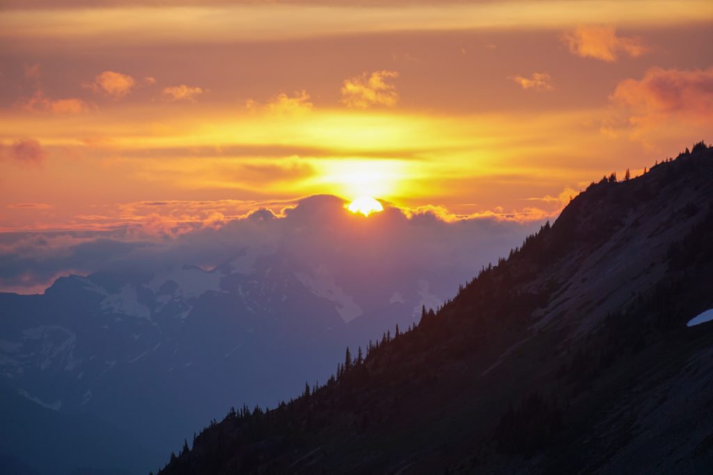
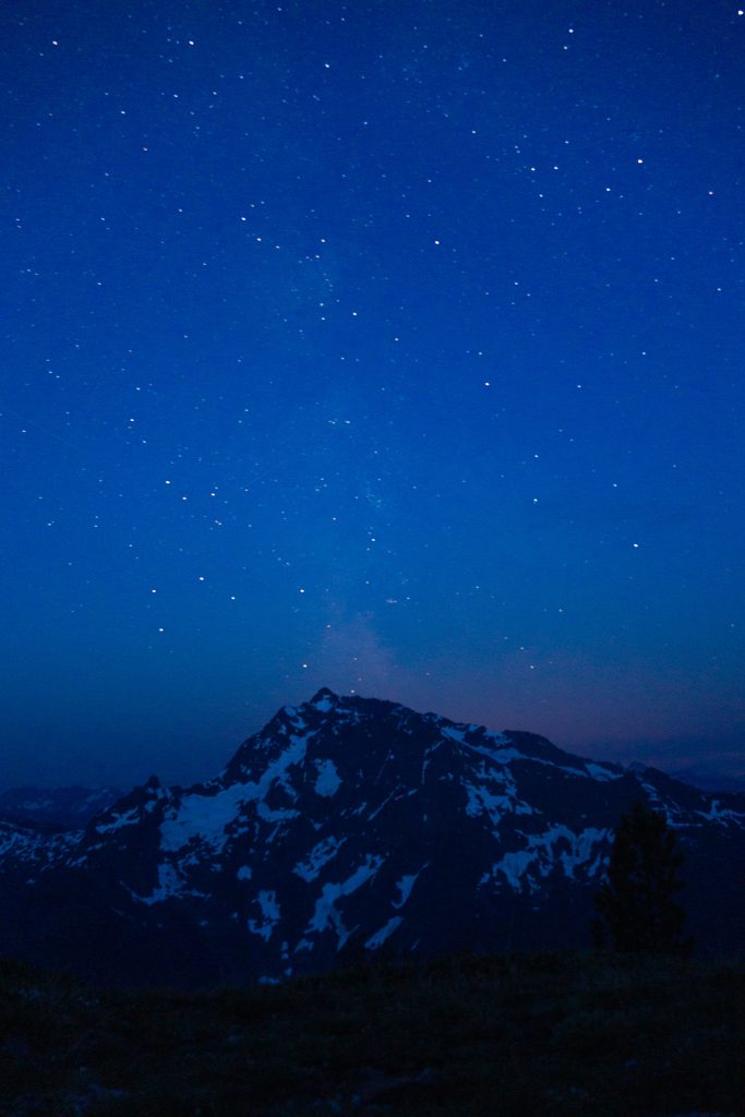
Nights are short when you are so high and north at this time of year. Poking my head outside at 3 am, I noticed that the northeastern sky was already glowing orange! But the southern sky was still dark enough for some astrophotography.
The next day broke clear and cool. Everything was covered in condensation and it was quite chilly.
Kelly and I were invited to an engagement party that evening in Seattle, so we had motivation to pack up and hike fast. We needed to cover the remaining 19 miles in about 7 hours to make it.
The trail was in great shape and had wonderful views until about 5200 ft, when the biome transitioned from the wonderful subalpine to a brushy south facing hillside. Our progress became frustratingly slow, with frequent blowdowns and bushes.

The trail crosses into the National Park around 3500 ft and the transition is hilarious. NCNP has cleared all of the blowdowns right up to the park boundary, where there are literally multiple blowdowns next to the sign for the Pasayten Wilderness. We were overjoyed to finally be on good trail where we could make good time.
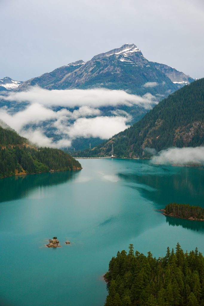
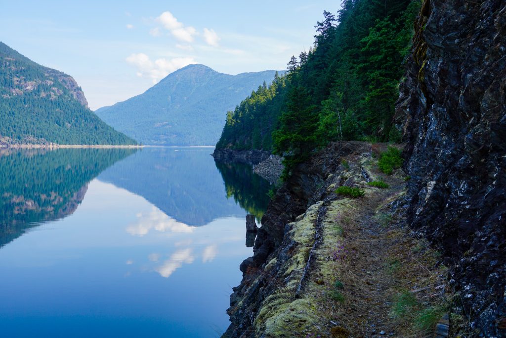
The East Bank Trail along Ross Lake is as close to a highway as I have ever seen in the Cascades. It stays remarkably flat, despite steep, cliffy terrain. In some places, the trail is blasted into the cliffs to create a wide, flat platform. We both appreciated the trail engineering as we cruised 20 minute miles.
By the time we were on the gentle climb to Hidden Hand Pass, we were both pretty tired. My feet ached, reminding me of my thru-hiking days in the past. But we had a deadline to make!
We finally encountered other hikers in the final few miles. Thankfully, the trail was immaculate the entire way back to our car. After driving home, showering, and driving to Seattle, we made it to the engagement party just in time!
The Devil’s Dome Loop with Kelly was such a fun, beautiful weekend trip. The tree line sections were some of the most beautiful trails I have been on. The camp atop Devil’s Dome was majestic. It was super special to share this experience with Kelly!
A few days later, we learned that one of the climbers that we had met on the way up to Jack had died while descending the mountain. It was really sad to hear. He seemed like a really nice guy, based on our brief conversation and other previous online interactions. He was typically brimming with joy and curiosity. The community has come to the support of his family. We give our condolences to his family.
Notes:
- We measured the loop to be about 43 miles and 11k gain. 24 miles and 9k gain was on the first day for us.
- My friend Cherlyn has a blog post detailing the different camps on this loop. If you camp in the National Park, you need a permit.
- There can be long dry sections on this loop later in the season. The longest section we had was about 7 miles, from Devil’s Creek to just past Devil’s Dome, although there was water about 100 ft below the trail near Cinnamon Peak.
- If you wanted to cut out the “boring” 12-15 miles on the East Bank Trail, you could take the Ross Lake water taxi up the lake, and then do the loop and hitchhike from the Canyon Creek Trailhead back to the water taxi parking.