The Wild Heart of the Olympics
Although I have spent a fair amount of time in the Olympic Mountains, most of my exploration has been concentrated in the more accessible eastern and northern slopes. The Southern Olympics have been the biggest mystery to me – a dense sea of rainforest valleys and forested peaks that never climb above tree line. There just was not much out there to justify the long drive to visit – or so it seemed.
That attitude changed when my friend Jeremy mentioned The Skyline “Primitive” Trail. This 30 mile trail travels through sub alpine and alpine slopes above the North Fork Quinault Valley. Being such a long and scenic trail, I was surprised that more trail runners did not talk about it. Trip reports raved about beauty but also cautioned against the ruggedness. I was definitely keen to check it out.
The standard way to do the Skyline Trail is to complete the loop with a nearly 20 mile hike up / down the North Fork Quinault River Trail to Low Divide. This did not really appeal to me. I noticed that I could potentially connect to the Quinault River Trail (Enchanted Valley) via a high route over Delabarre Peak from Low Divide. Beta on this area was scarce, but as I dug in, I discovered a rich history of abandoned trails, trail proposals, and dedicated high routers. Now I was hooked!
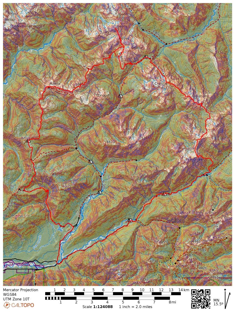
Combining the Skyline Trail with the Delabarre High Route created a beast of a route – 55 miles, 17k ft gain, tons of challenging terrain, and a 9 mile bike shuttle to close it all off. I always have a tough time selling my typical partners on exploring the Olympics – the drive is long, the peaks are low, and the rock sucks. But I knew that one friend Alden might be down, considering he was trying to climb all of the 6500 ft peaks in the Olympics. The one caveat? We had to climb Mt. Meany along the way. That added 2500 ft gain to an already aggressive two day plan.
Alden and I drove out from Issaquah to Lake Quinault on Friday evening. We somehow missed the memo that the bridge connecting the South Shore and North Shore road was out, a key part of our bike shuttle. But we inspected the closure in the dark and it seemed that the bridge was in fine shape for pedestrian traffic (there was an excavator sitting on the bridge), so we would have to just run a few extra miles to the Irely Creek Trailhead since we could not drive across the bridge.
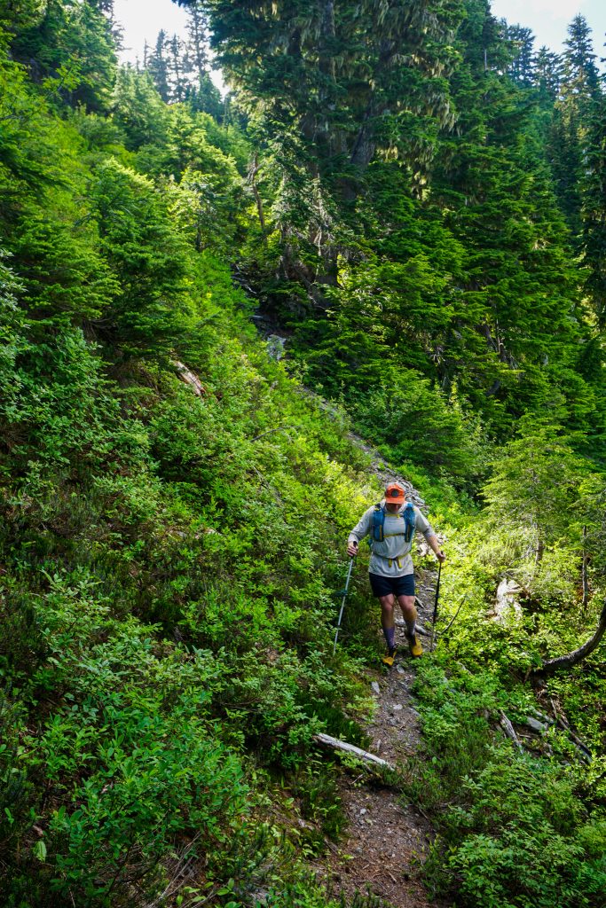
We slept at the Graves Creek Trailhead and left our bikes there in the morning, driving 6 miles back to the bridge. Then we began an easy 3 mile road jog to start the day before sunrise. Although we both packed light, using 30 liter fastpacks, running still was a chore with the weight on our backs.
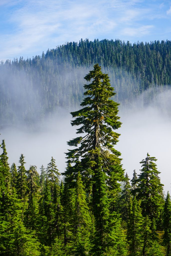
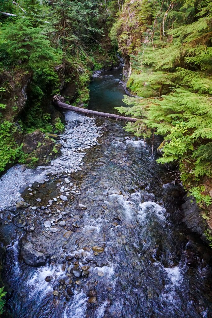
The Irely Creek Trail is in surprisingly good shape, contrary to recent trip reports. We watched fog move around us at first light. The Big Creek crossing was steep, but easy and straightforward.
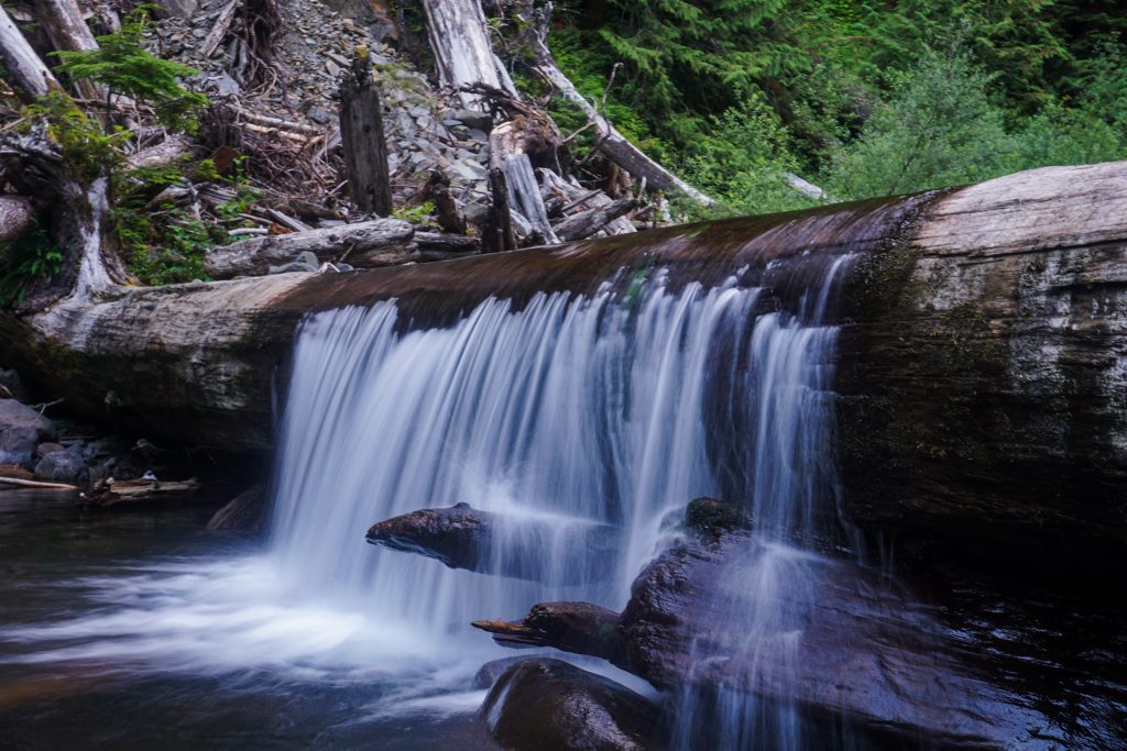
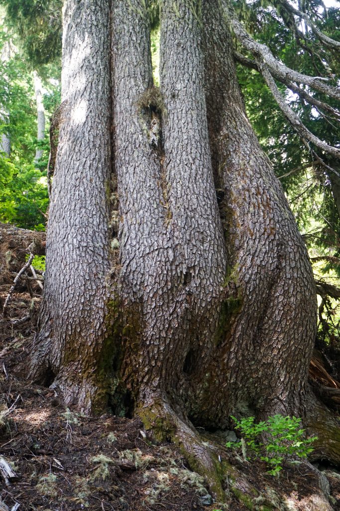
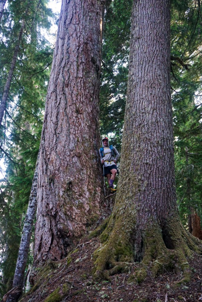
We got soaked by wet brush and there were tons of creeks flowing. It was a nice change from the drought-stricken North Cascades. Even at the driest time of year, water is abundant in the Southern Olympics. After all, it is a rainforest.
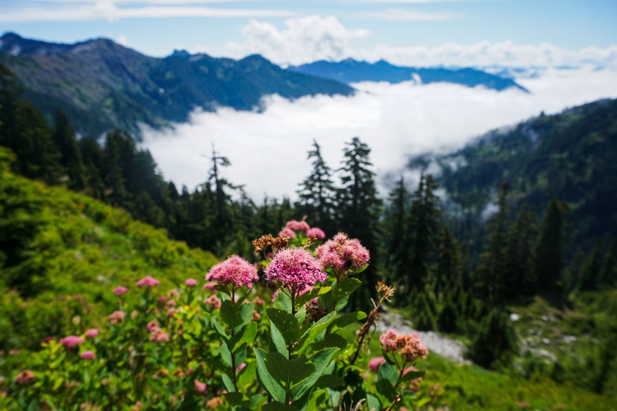
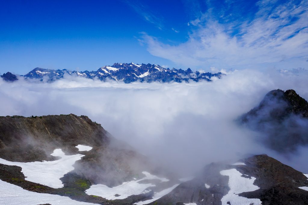
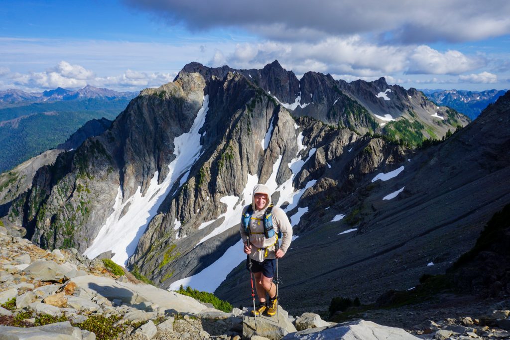
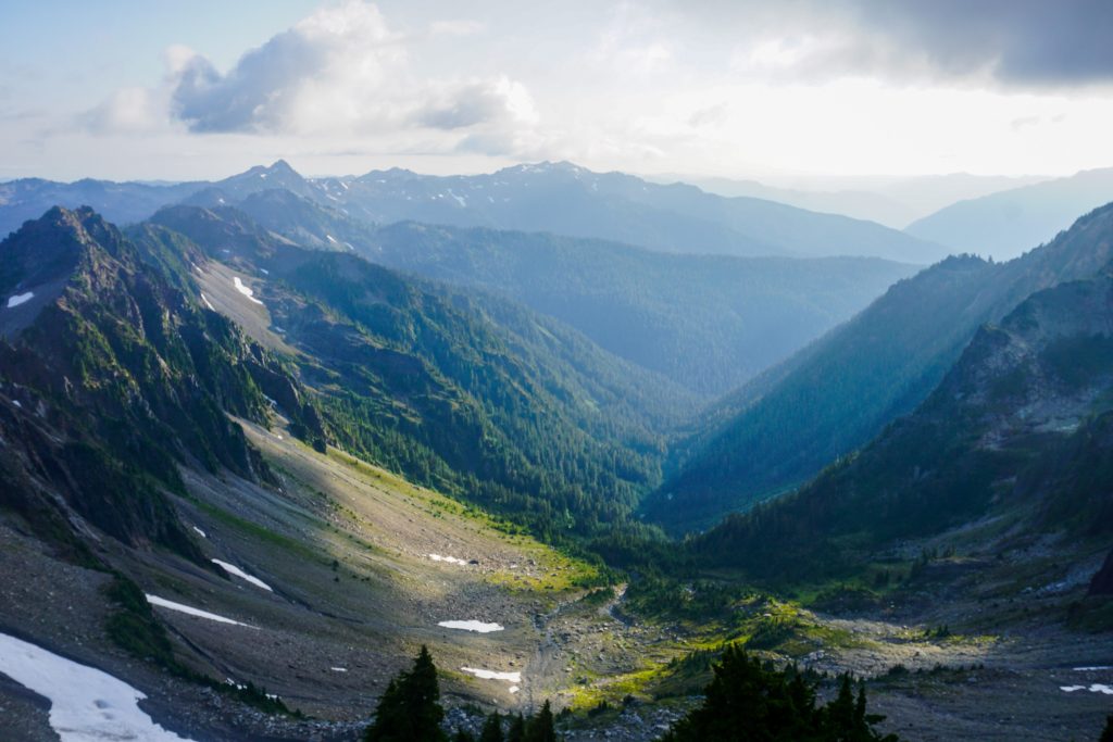
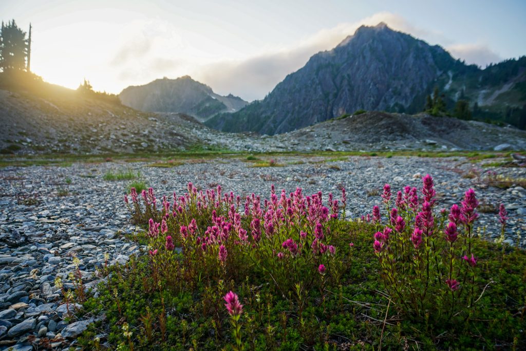
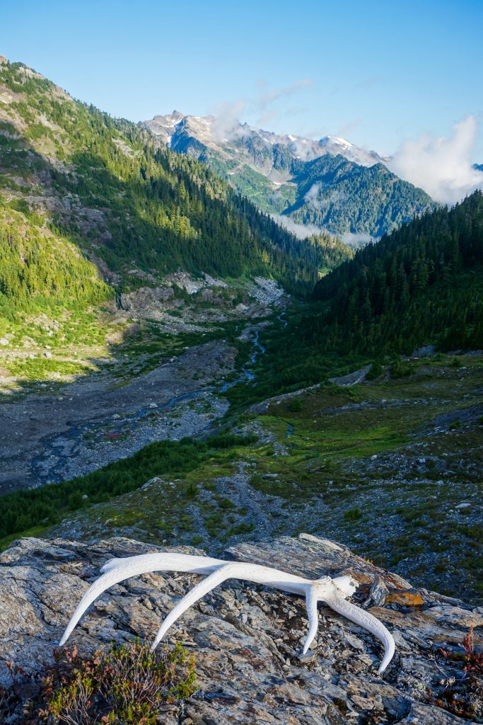
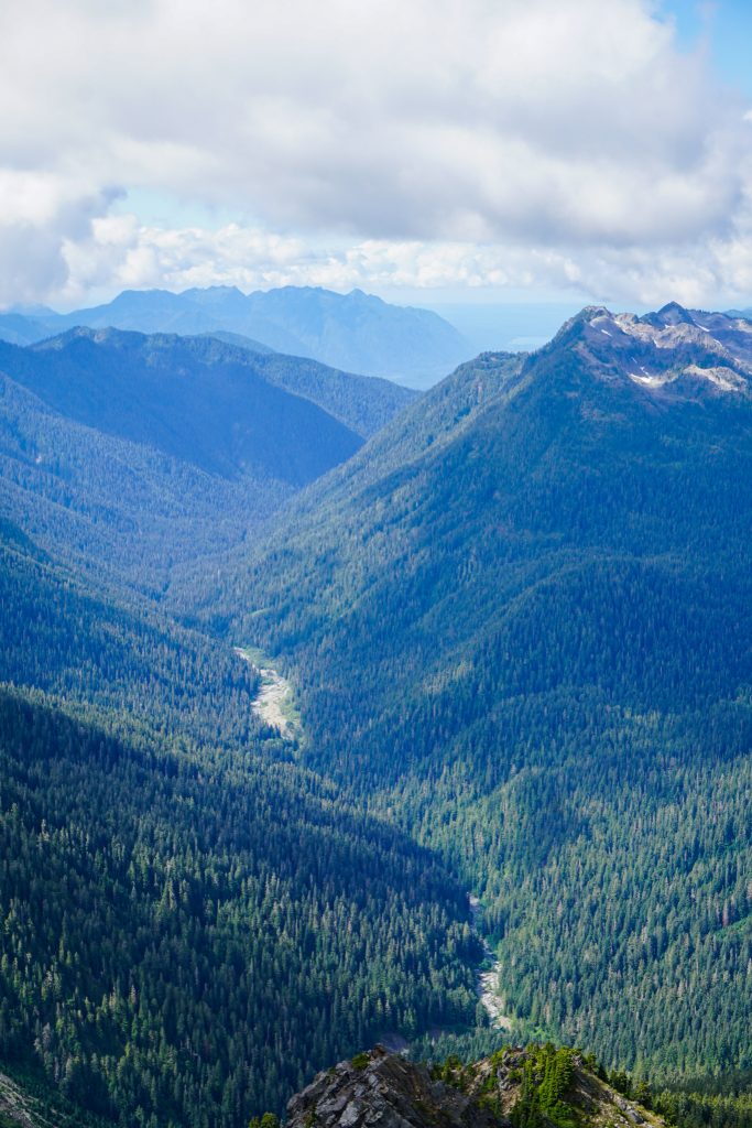
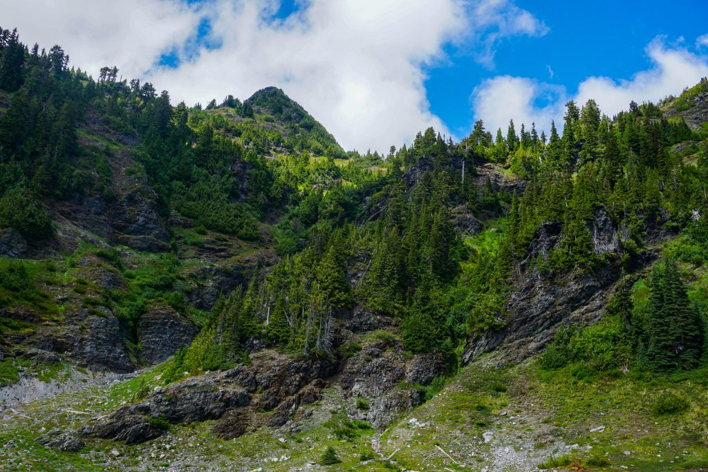
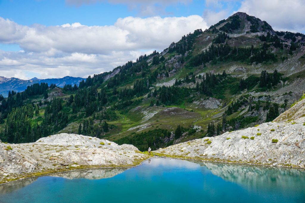
Alden and I both got excited as the trees got smaller and we entered heather meadows, the definite signs of the subalpine. There was one catch – we were only at 2900 ft! It was incredible – if you had asked me what elevation I was at, I would have thought 4500 ft, where there is comparable vegetation in the North Cascades. On a map, the Skyline Trail looks suspiciously low to be worthy of the moniker “skyline”. But elevations are all relative. In this part of the Olympics, the mountains feel much higher than they look on a map.
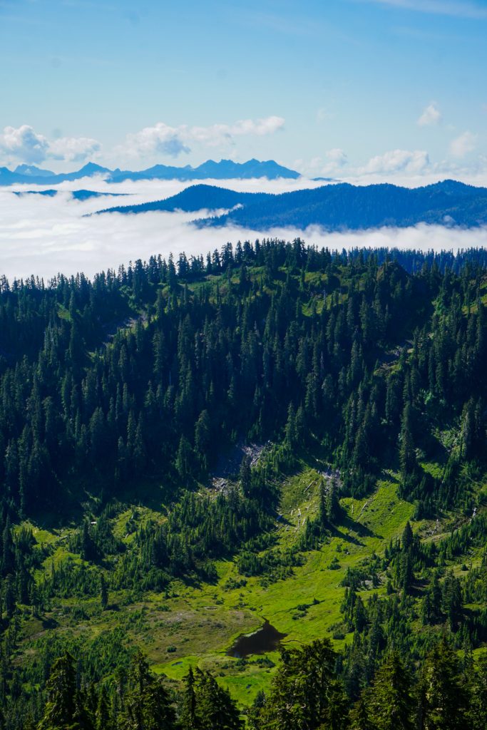
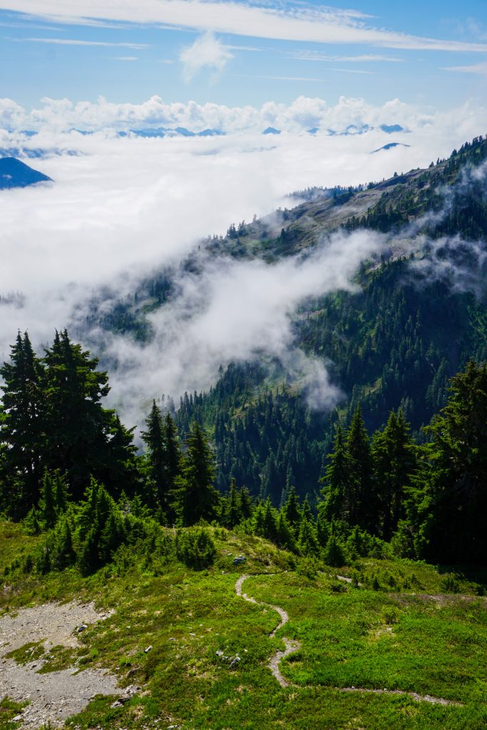
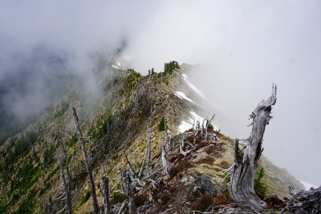
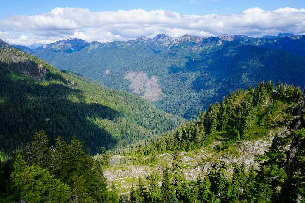
We passed a few groups camped at Three Lakes in the morning. The marine layer of clouds rose with us as we gained elevation, but there were some great views through the thin forest as we climbed through the next section. While definitely still below treeline, the forest is sparse enough that there are still nice views.
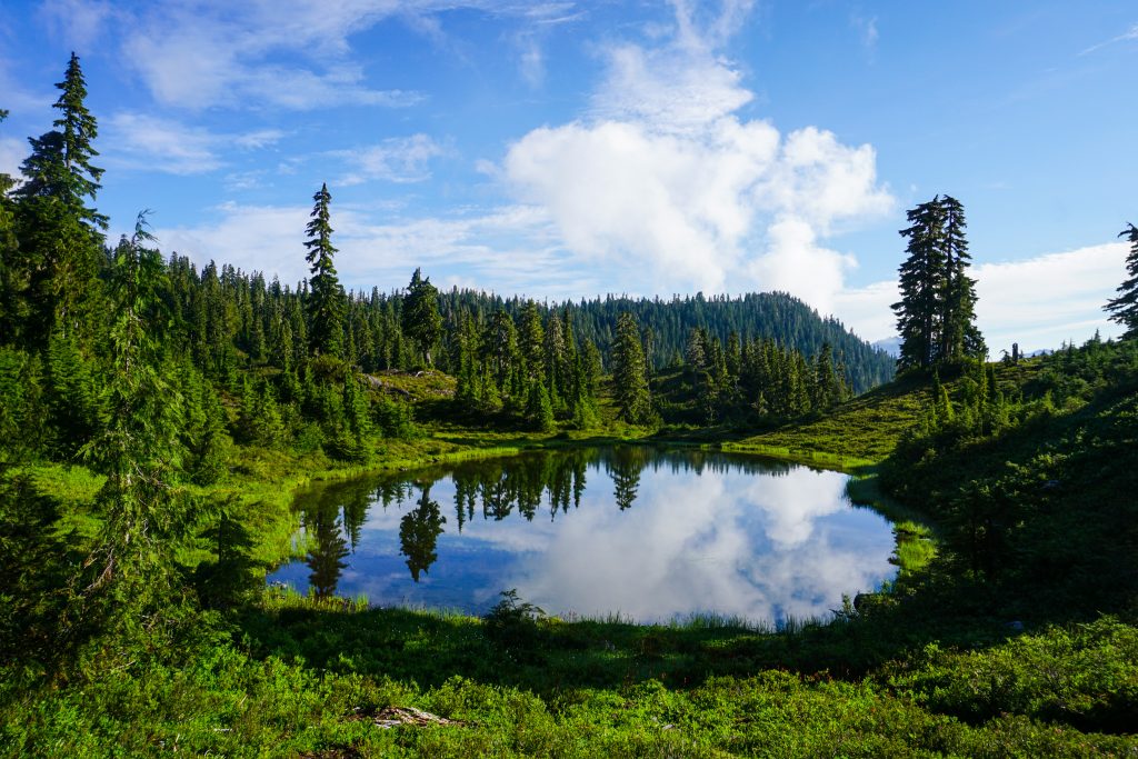
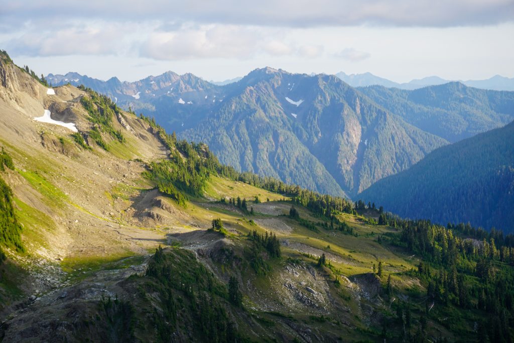
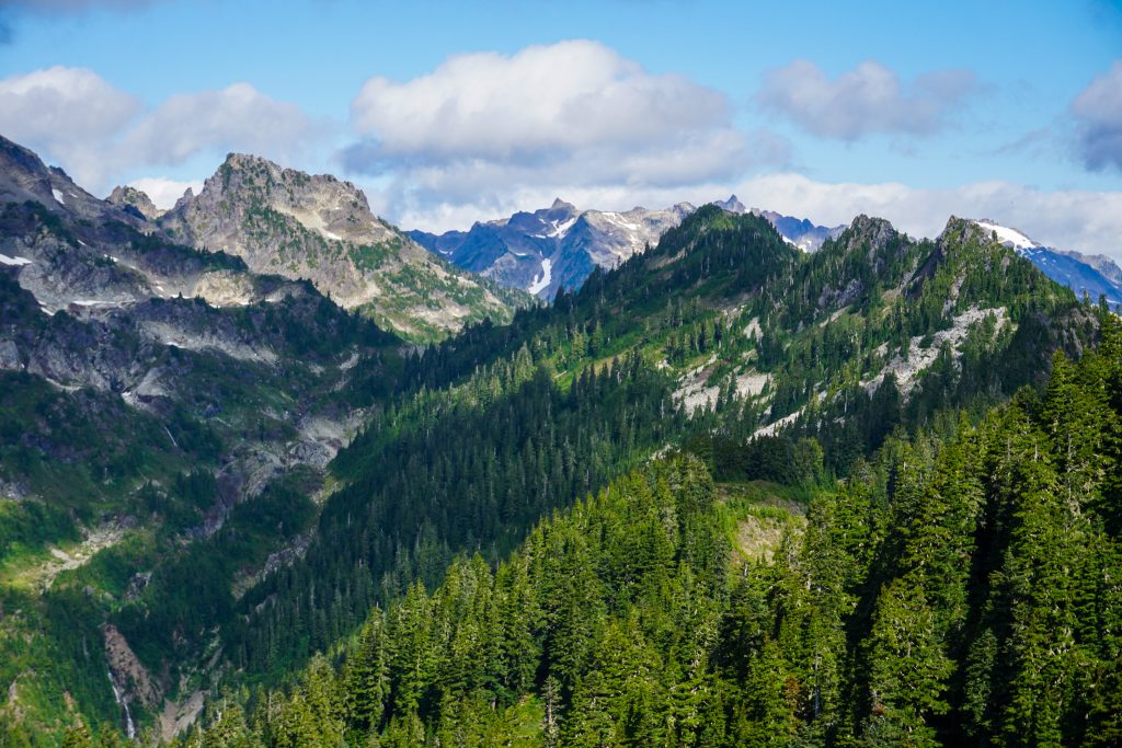
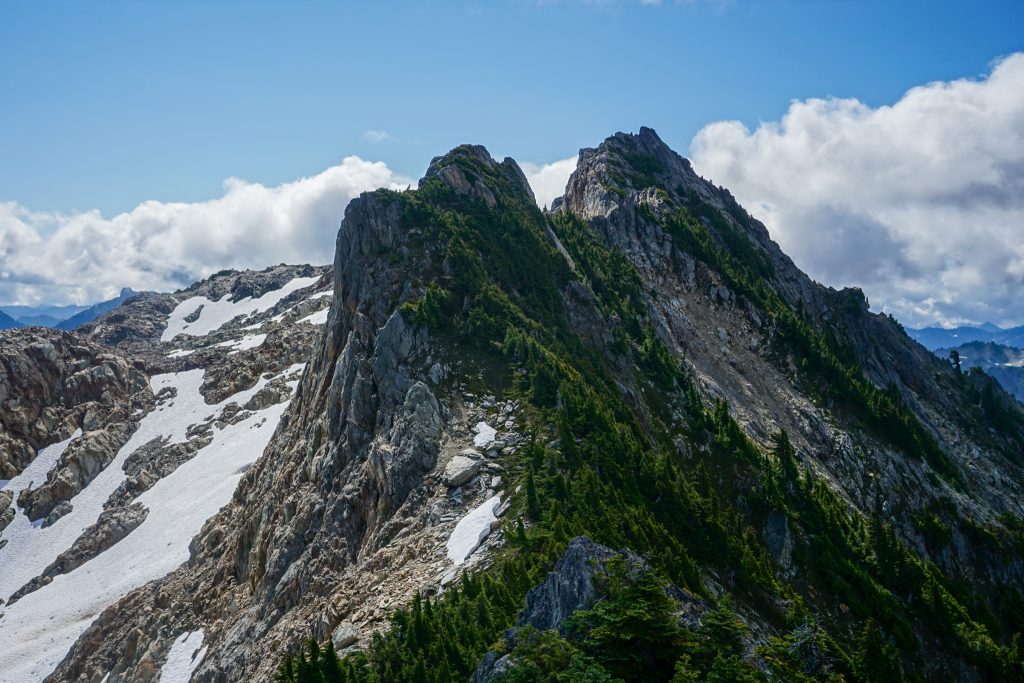
If you love tree line heather meadows, then this is the trail for you! Certain sections climbed into the clear, offering great views of the vast sea of ridges all around us. Unlike other parts of the Olympics, there are no recognizable peaks, but the layers of green and white are very beautiful.

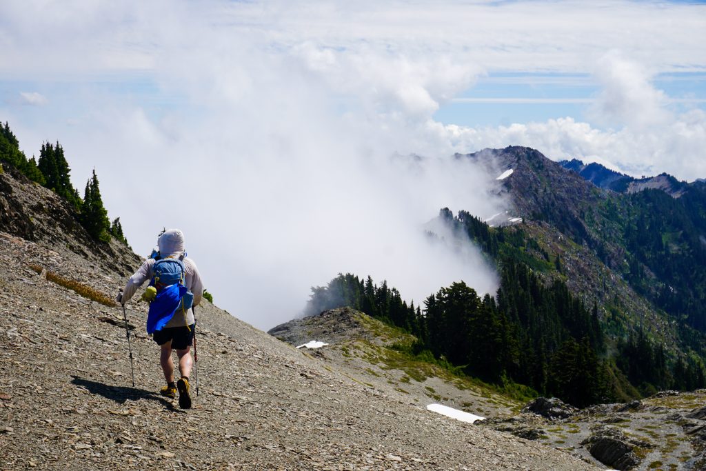
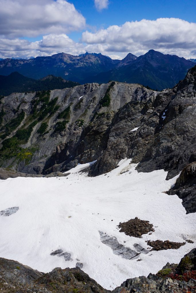
Other than the short dry section from Three Prunes Camp to Kimta Peak, which the Park warns people about, there was abundant water. As we approached Kimta Peak, we saw a cool ridge line and decided to leave the trail and take the ridge for a mile or so.
There ended up being way more ups and downs than expected, so our high route definitely did not save us time. On one side of the ridge was dense shrubbery and the other was steep dirt – very annoying. But it did get us a brief view of Mt. Olympus before being swallowed in the clouds. It would be the only view of the Big O the entire trip!
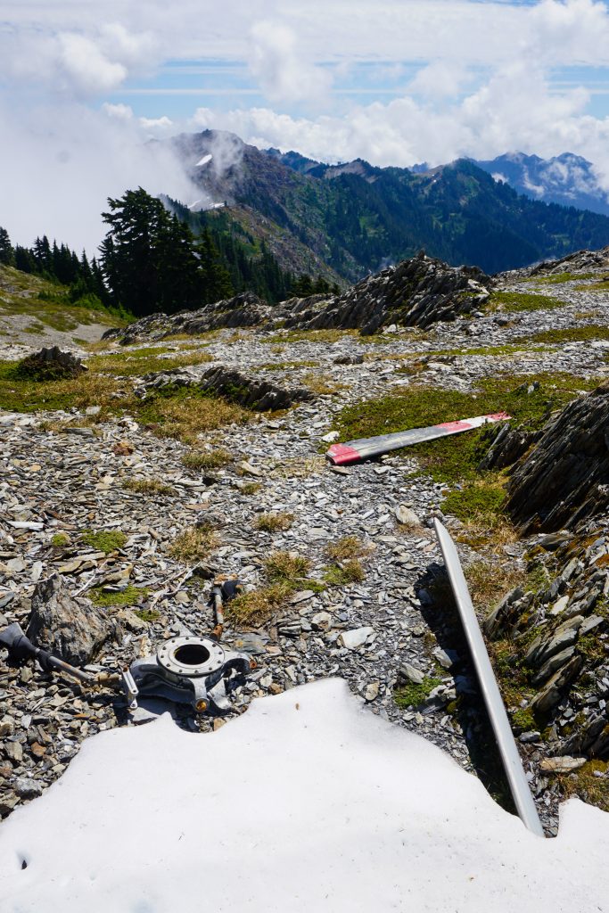
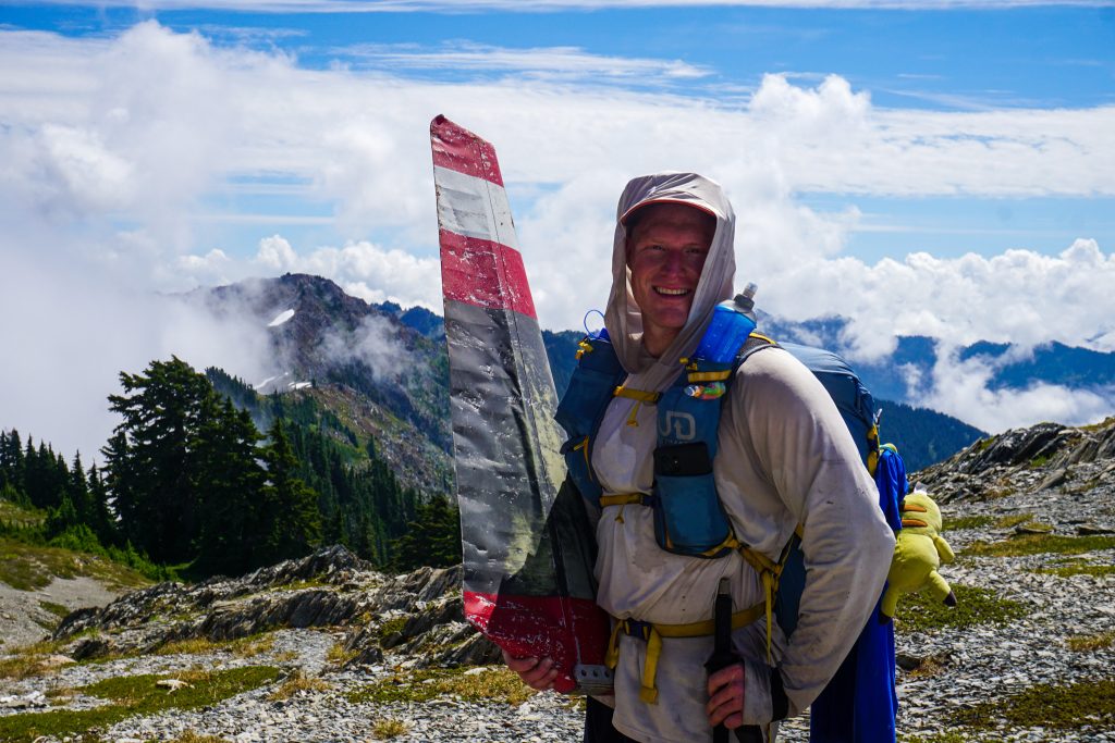
Along the ridge, we stumbled into some old remains of a helicopter wreck. Since this was off trail, I am guessing that few, if any, people have ever found it! There were no letters or numbers visible anymore.
The final bit of the eastward trending ridge was a bit easier to the highpoint just above the “moonscape”.
At this little high point, we took a lunch break long enough for me even to doze off. We felt good about our progress so far, but had been warned that this next section from Kimta to Lake Beauty was extremely challenging.
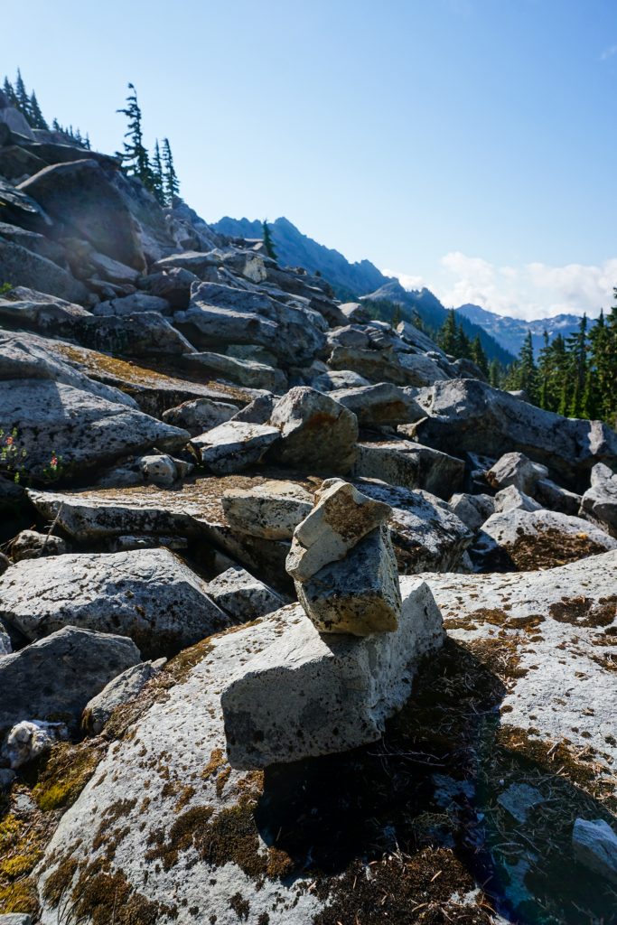
There is a one mile or so long section where there is absolutely no trail through a post-glacial “moonscape”. There are, however, plentiful cairns. I would categorize it as easy off trail walking, but I could see how it would intimidate a typical backpacker.
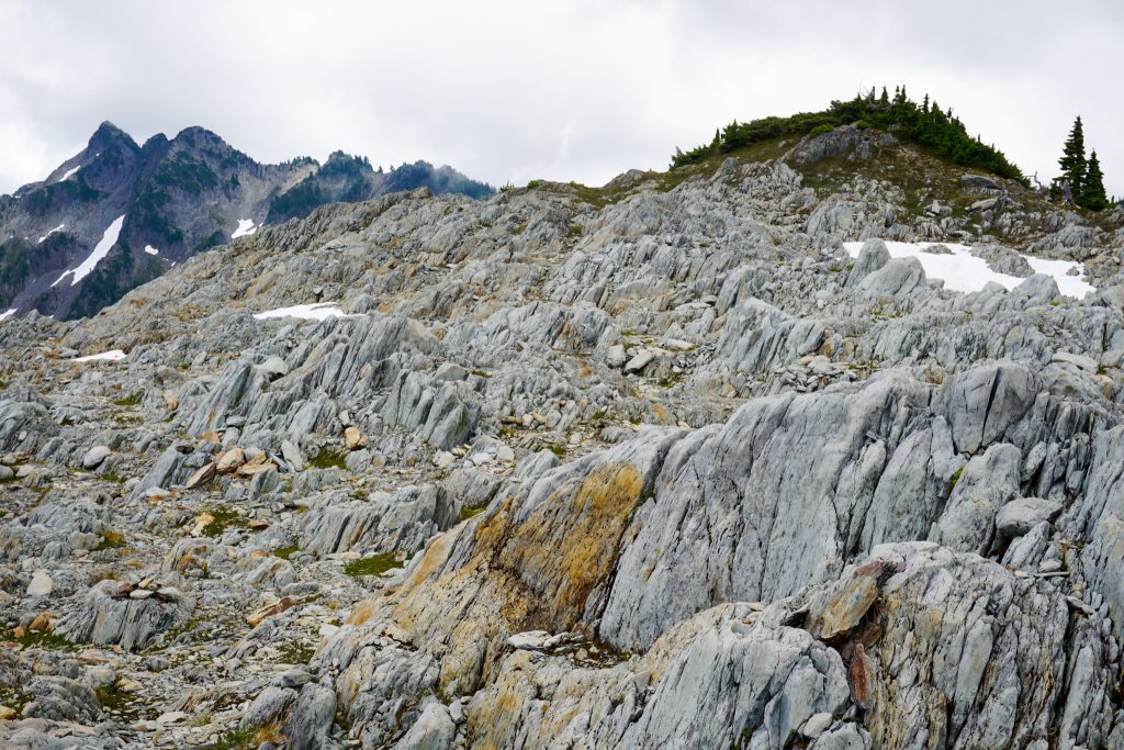
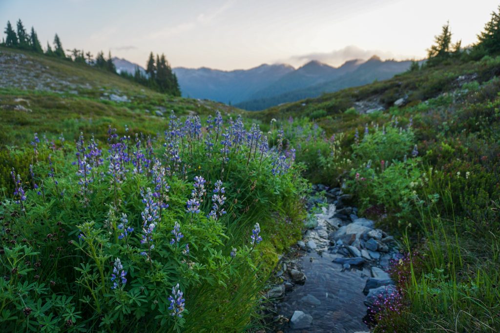
After “the Moonscape”, there are still many steep little ups and downs as the trail crosses steep ravines eroded by water in the sedimentary rock. While it was slow, it was nowhere near as bad as we expected and we quickly approached Lake Beauty.
Past Lake Beauty, the trail gradually heads downhill to Seattle Creek. There are a few steep creek gullies to cross, but always decent steps cut in the dirt. I could see this being challenging early season with snow.
The standard ascent route for Mt. Meany starts from Seattle Basin, traversing over to a saddle just east of Mt. Noyes. We figured we could ascend straight up Seattle Creek instead of following the Skyline Trail further to save distance.
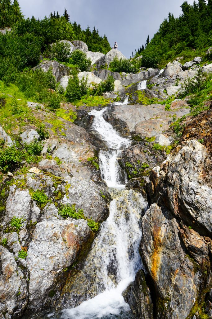
The climb up Seattle Creek begin enjoyable and beautiful, following the coursing waterfalls of the creekbed. But eventually it became too steep to ascend, so we were forced into a rather nasty steep little bushwhack.
At a bench around 4900 ft, we ditched our overnight gear, which only saved a few pounds. Then we traversed over to the Noyes saddle and got our first view of Meany.
The approach took us on a nasty sidehill traverse beneath Noyes. There were some steep eroded gullies that were particularly bad. It was disheartening to know that we would have do it all over again shortly in the other direction! This is why I am not a peakbagger…
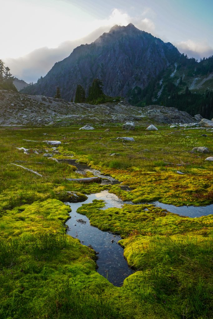
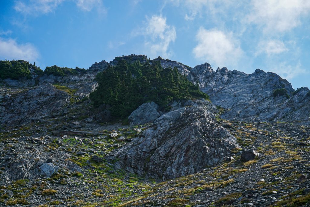
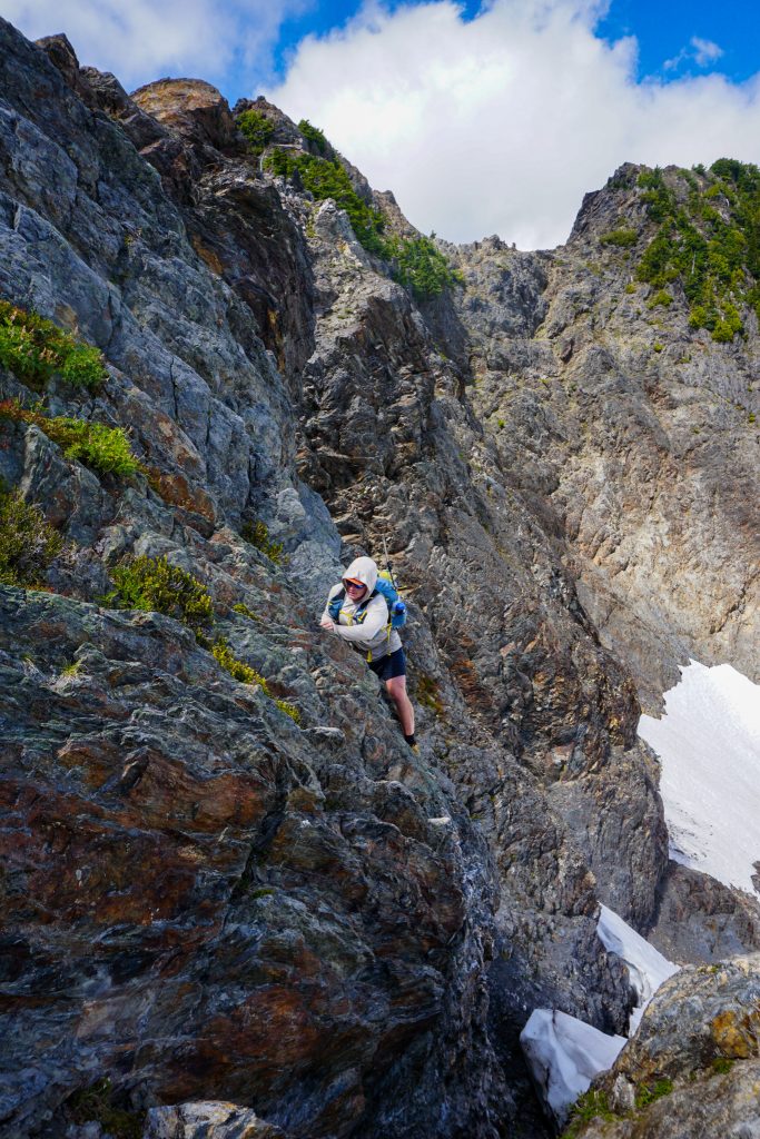
Once on the southeast ridge of Meany, it was actually an enjoyable scramble on some good knife edge sedimentary flakes. The summit block of Meany floated in and out of the clouds and looked particularly menacing in the dark shadows.
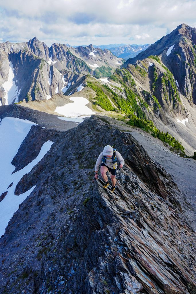
As we neared the summit block, we wrapped around to the right on snow to a saddle. From here, the scramble steepens. Although the Olympic Mountain Rescue Climbing Guide rates the scramble as just “Class 3”, it is most definitely near vertical on positive jugs for about 15 feet. It felt reminiscent of the super easy 5.4 at Vantage, but with loose sand on each ledge. I was glad to have a helmet! Above this, more engaging scrambling takes you to the airy summit.
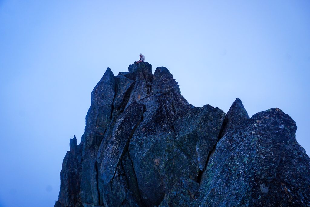
My main motivation to actually summit Meany was to get a view of potential high routes over to Queets Basin. Unfortunately, the clouds were not going to budge. Alden, however, was satisfied with his 6500 ft peak.
We carefully down climbed the summit block. There are rappel anchors for those who bring a short rope.
On the traverse beneath Noyes, I dropped just 100 ft further this time and it was much nicer and quicker. It was a reminder that sometimes doing more elevation gain is faster than side hilling.
After reaching our overnight gear, we could finally take a deep breath and slow down. We had been moving pretty quickly for 15 hours already. Going in, I definitely felt intimidated by all the reports of how slow the terrain was. But now we knew we were going to make it to Low Divide with certainty.
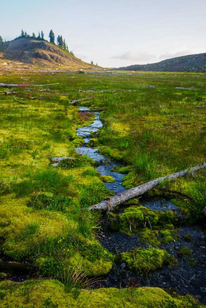
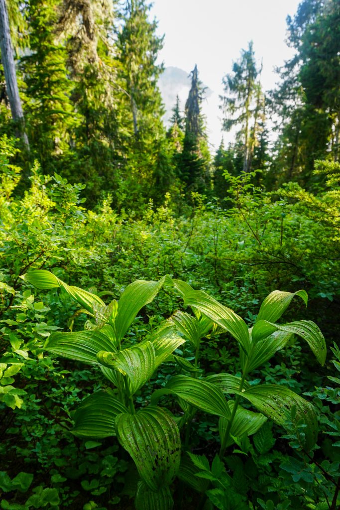
I savored the last bits of light in the flat, gravely Seattle Basin. The signature fluorescent green moss of the Olympics was as vibrant as always.
We got back on the Skyline Trail and hiked the last few miles to Low Divide, needing our headlamps for the final half our or so. We found some nice backpackers who pointed us to a perfect camp complete with a bear hang, flat tent site, bathroom, and stream.
Our first day covered 36 miles and 13,000 ft gain, both single day records for us with overnight packs. I felt surprisingly good as we lounged barefoot in this perfect little forest camp and ate dinner. While I love spectacular alpine camps, sometimes what you need is a good forest camp – comfortable logs to sit on, soft dirt, and not a single mosquito.
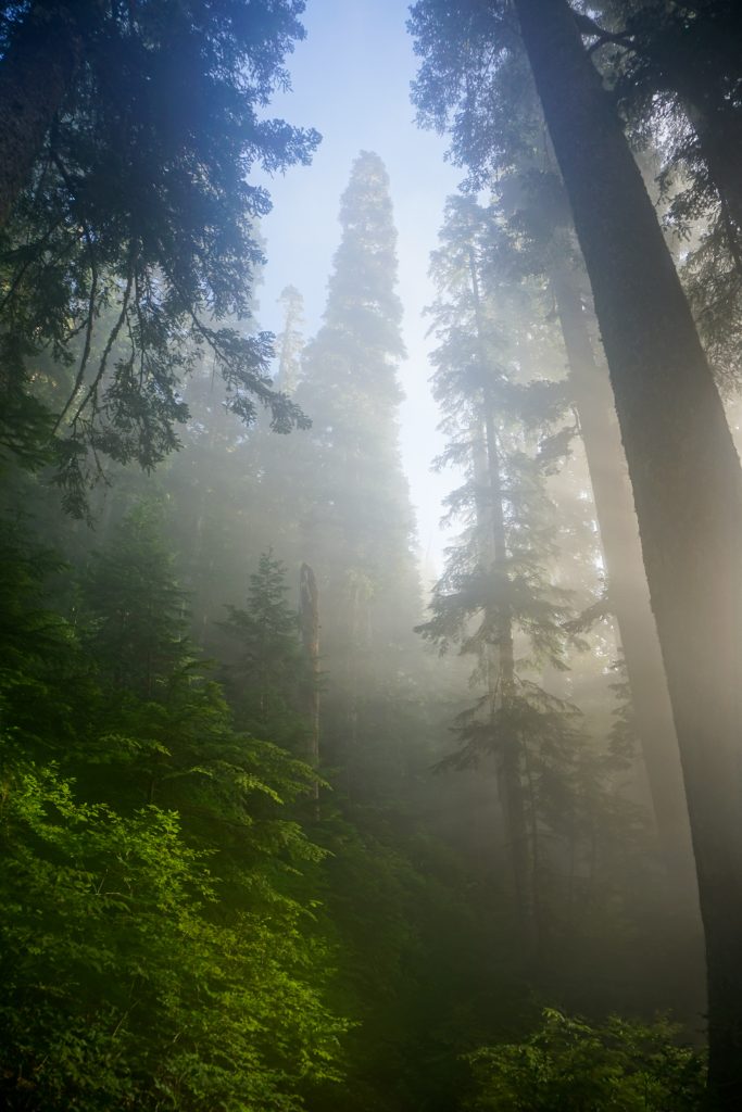
We got a great 7 hours of sleep, choosing to sleep in a little after such a long day. A thin marine layer hovered above Low Divide as we set out.
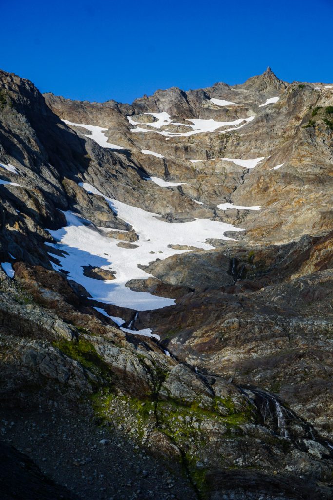
We once again got soaked as we ascended the overgrown trail towards the Martin Lakes. There used to be a rather large glacier on the east of Christie, but it appears to be completely gone. The mid elevation glaciers in the Olympics seem to be receding faster than anywhere else in Washington. I believe Olympics glaciers are even more sensitive to temperature changes than Cascade glaciers. It used to be that basically every 6000 ft peak in the Southern Olympics held a large glacier, but that is no longer true.
.jpg)
At the switchback where the trail turns towards the Martin Lakes, we followed a faint trail up towards the pass.
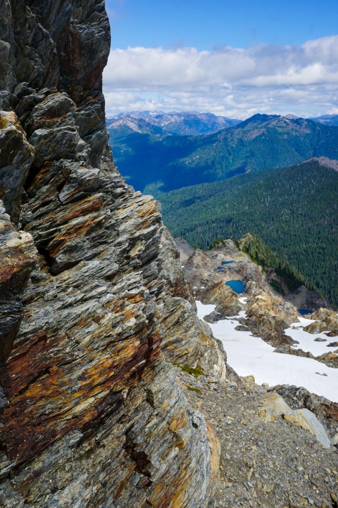
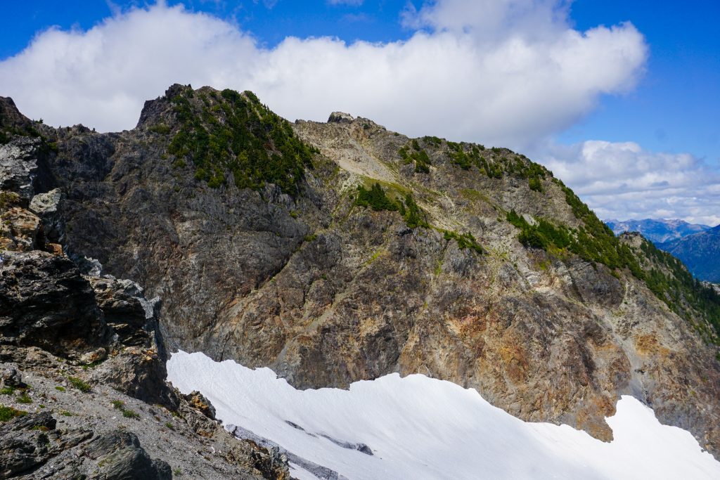
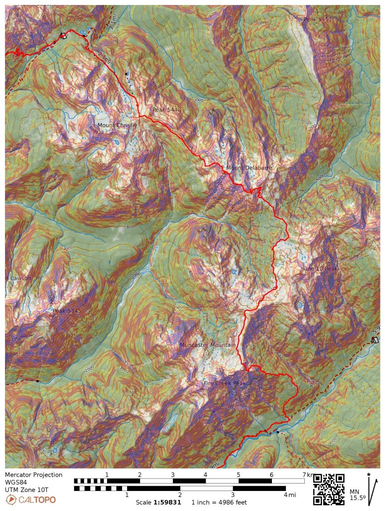
From the pass on the divide between Martin Park and Rustler Creek, we got our first view of Delabarre. It looked a long ways away! The initial sidehill was a bit brushy and slow, but then we dropped a few hundred feet and found easy boulder hopping and even cairns! Crazy!
Travel was generally easy over to Delabarre. I am not sure where the cairns are leading people, since very, very few people have ever traversed over Delabarre. I think that a few more people have dropped low into Rustler Creek and accessed Muncaster Basin this way. But still, this area sees very little traffic so we were surprised to see cairns.
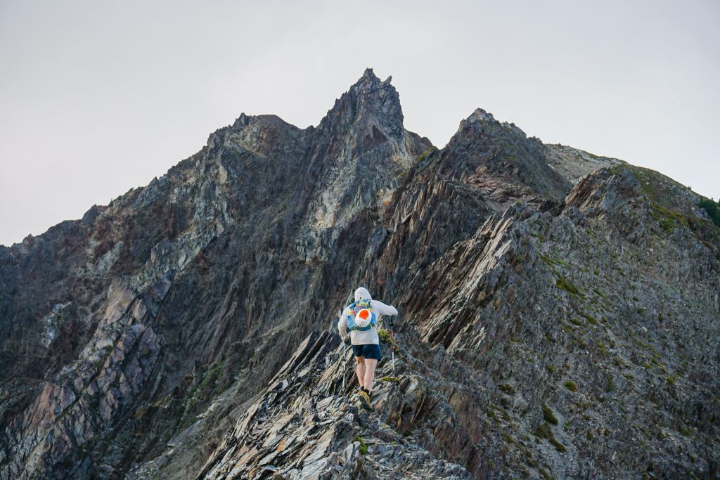
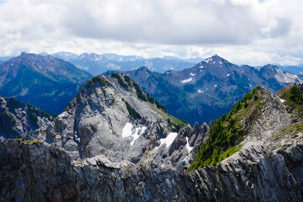
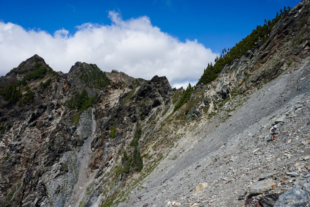
Accessing the NW ridge of Delabarre was mostly just steep dirt and rocks, with a tiny bit of slabby class 3/4 near the top. I imagine this is a whole lot easier when it is all just snow.
All we knew about the NW ridge of Delabarre is that it was “class 3”, but Meany was also supposedly class 3, so that was not very reassuring. However, our scramble up Delabarre went quite well along the ridge with some legitimate class 3/4, some bush, and mostly good rock.
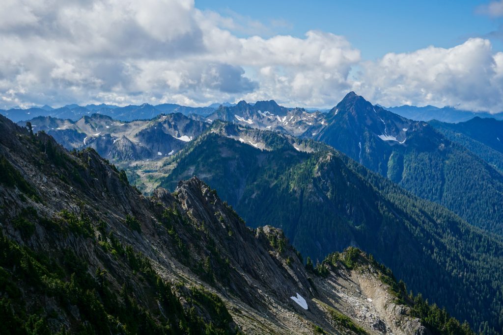
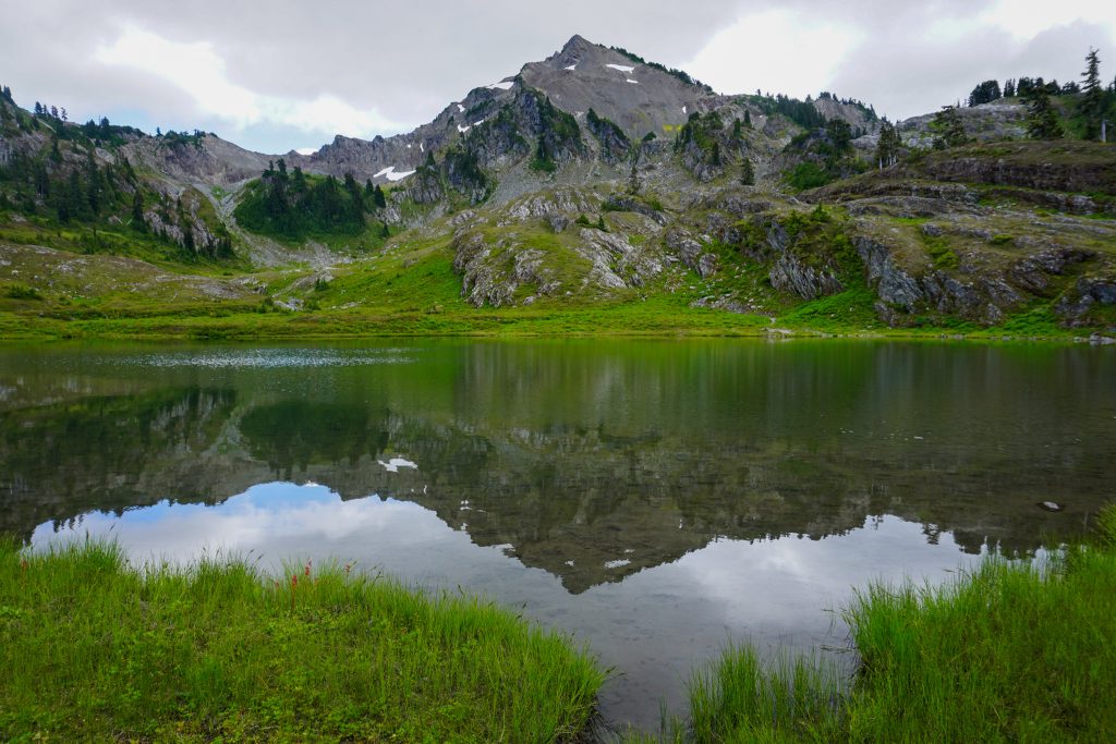
Although the summit is barely 6000 ft, not particularly high for this area, we could see directly out Rustler Creek and the Quinault River Valley to Lake Quinault and even a bit of the Pacific Ocean! Delabarre is really, really deep in the Olympics.
The next section, the descent off the SE ridge, was the most concerning section of the entire route. What few trip reports we could find made this sound quite involved.
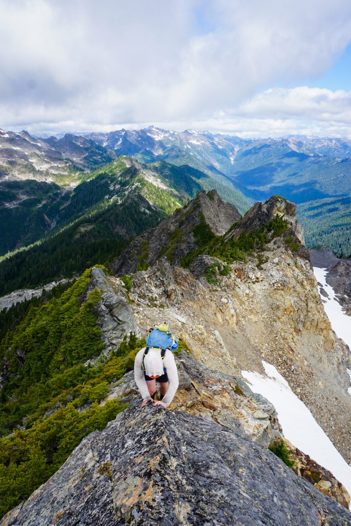
Initially, the descent went well with some highly aesthetic ridge walking.
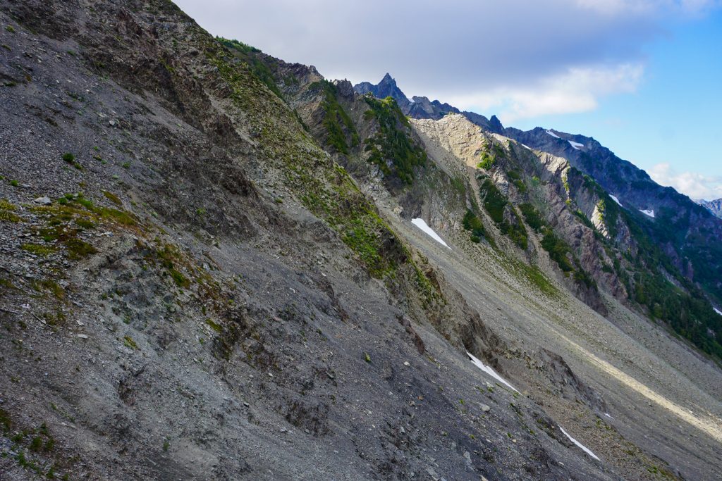
The few trip reports we found and the Olympic Climbing Guide all mentioned crossing a snowfield, which we assumed to mean the remains of the once mighty Delabarre Glacier. Getting down to it looked very chossy, so we hoped the ridge would go, but it looked gendarmed ahead.
Indeed, the ridge began to get very steep. There were a series of small gendarmes. While only 10-30 feet tall, the backside of each was sheer vertical, so we could not stay on the ridge proper. To our right was a disgusting crumbly mess of gullies for a thousand feet down. To our left the glacier was only 50 feet below us, but getting down to it would require scary sandy slabs and choss.
Alden and I took a deep breath to figure it out. We definitely did not want to turn back to Low Divide, as that would make for an incredibly long day. But all of our options going forward looked bad. Even if we could reach the snow to our left, the climb back up to the next saddle looked awful. It seems that glacial recession has turned what was once an easy maneuver to avoid these gendarmes into an impossibility past mid season snow cover! Later on, we found a John Scurlock photo from late September 2007 that even showed adequate snow cover to bypass the gendarmes. But now in late July 2023, that was no longer an option!
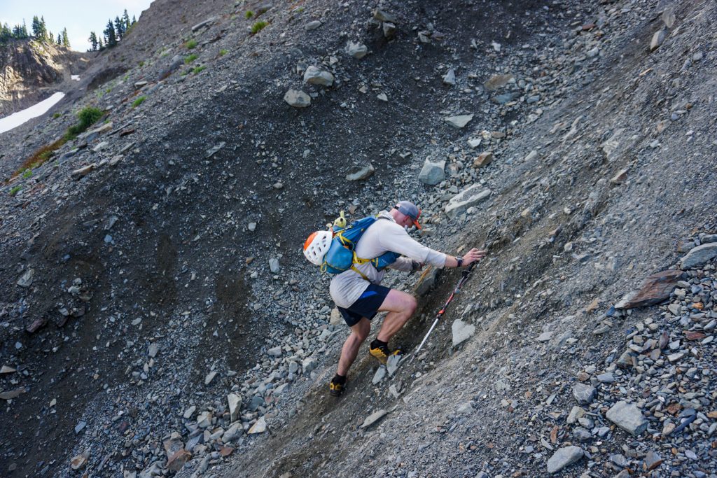
Eventually, we found a way to scramble around the left side of the gendarmes on thin flakey holds. While it was mostly just class 3/4, the quality of the rock meant that it was something I would not like to repeat. I was grateful to have a certified choss wrangler like Alden with me. He said it was still better than the choss on Custer!
Once at the saddle, we were through the worst. We side hilled across a loose slope, unfazed by such conventional choss.
The final part of our descent looked steep and jungly from above, the kind of descent that can be difficult to onsite from above. But I channeled my inner elk and followed the faint animal paths, which led us perfectly through a maze of cliffs and bushes.
We took a long lunch break at a small stream after such a taxing section. We still had a lot of terrain to cover, but at least we knew that the next off trail section was relatively “easy”.
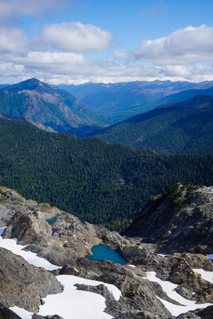
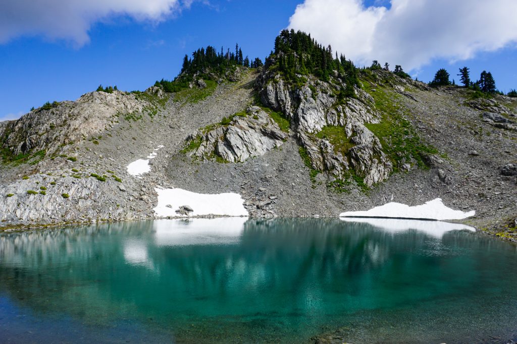
We dropped down to Rustler/Godkin Pass and followed nice elk paths past a few beautiful little lakes. Passing clouds made for a calm, cool afternoon. It felt nice to relax and just wander through this beautiful, remote terrain.
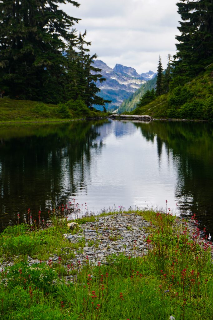
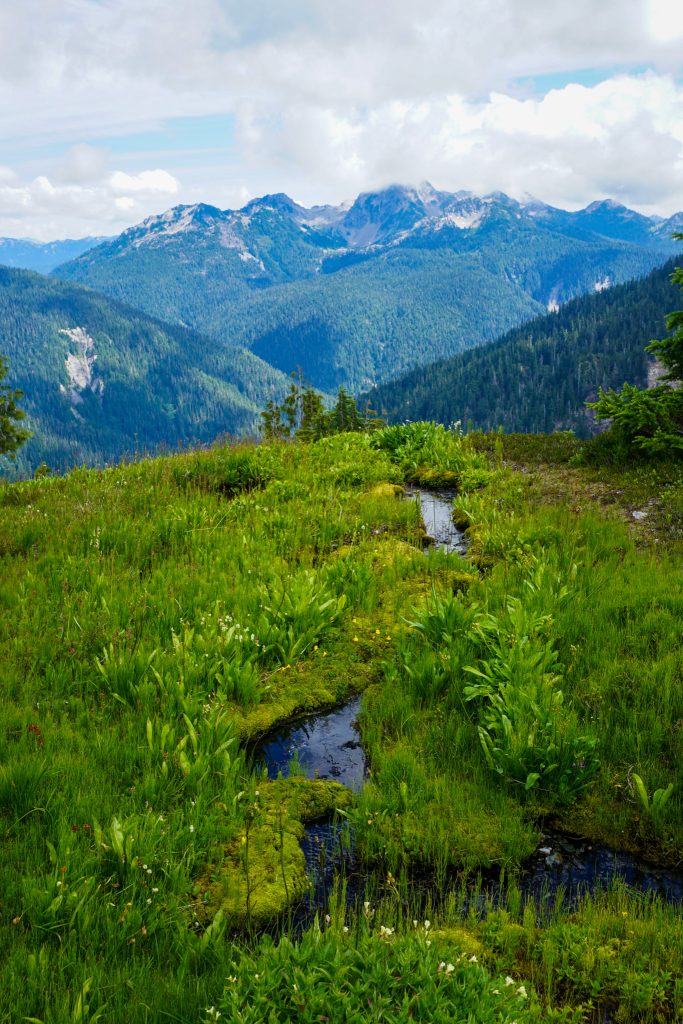
The terrain was undulating, dense post glacial meadows and basins. There were many vibrant green streams, gravel beds, and tight little water canyons. It was classic Olympic high country.
As we neared Muncaster Basin to the south, the elk paths became bona fide elk highways, visible even on satellite imagery! This made travel extremely quick. We aimed for a 5100 ft high point just to the west of No Name Creek. Our plan was to take this east trending ridge all the way down to the Quinault River Trail, nearly 4000 ft below.
The initial descent was the steepest section. This sort of steep, cliffy, jungly terrain can be a nightmare in this part of the Olympics. But once again, I picked up on an elk highway and led us perfectly through some rather complex terrain.
As we got lower, the brush got thicker, but there were still signs of the animal path. Whenever it felt like we might loose the trail, I would drop to the ground and feel for signs of any foot path. Sure enough, I would quickly stumble across more fresh hoof prints and stay on the trail. It was perfectly traversing back to the broad ridge around 4000 ft, which would give us, theoretically, a simple descent to the valley floor. There were definitely some dense sections, but we reached the broad ridge much quicker than expected thanks to the trails!
Once on the ridge, travel was mostly simple and we just headed down. I heard a yelp behind me as Alden got stung by a few wasps. About 30 minutes later, it was my turn and a wasp stung me four times on my left ankle and calf. Fortunately, neither of us experienced much of an allergic reaction on the way out, but both of us would experience serious swelling, fever, and aches over the next few days.
As we got lower, we got greedy and left the east trending ridge and headed southwards, hoping to cut off the Enchanted Valley Trail earlier and save a few trail miles. In hindsight, this probably did not speed things up. Traversing through this forested terrain is much slower as there were many hidden creek gullies to cross. The final thousand feet to the valley floor was rather dense and bad. It was a huge relief when we hit the valley floor. In all, the nearly 4000 ft descent took us about 2.5 hours! Not bad!
We had about 7 miles to our bikes. Over the next 5 miles, we somehow went net uphill in elevation! Unfortunately, the Quinault River Trail is not cruiser like the Hoh River Trail. But we were able to shuffle some of it and reach our bikes just before dark. The 6 mile cruise down the road, next to the mighty Quinault River, at dusk, was a beautiful and enjoyable way to end the trip. Bike shuttles are awesome!
Looking at a map of our massive loop, we decided to call our route the “Quinault High Route”. We stayed near or above tree line for an incredible 40+ miles from Three Lakes all the way to our final descent. This massive section was entirely either off trail or on “primitive” trails. For both of us, this was our most challenging two day effort ever. It felt like we had really experienced the rugged, beautiful, wild heart of the Southern Olympics. It chewed us up and spit us out, but it felt inspiring to know we were capable of such long, burly days in the mountains. Alden is a beast!
Each high route I do has a different character. Some high routes feel too good to be true, like an instant classic. This was not one of those. There are sections (most notably Delabarre) that I hope to never repeat. But not every dart thrown at the map sticks. Learning what “doesn’t work” is an important part of the experience. In the end, we got a grand adventure and an experience we are very proud of!
Notes:
- Alden wrote a great trip report on NWHikers.net.
- Our route was 59 miles and 20k ft gain on foot, with 6 miles on the bike. We were on the move for about 32 hours between the two days.
- One could reasonably do the Skyline Trail and run out the North Fork Quinault Trail in one day for a big trail loop. However, I would expect it to feel much harder than your typical 50 mile trail loop due to the nature of the Skyline Trail. This would be a huge day for a fit, rugged runner.
- Low Divide has a bear hang, which removed the need for a bear can. We were confused why Low Divide does not show up on recreation.gov for getting a campsite. We talked to the ranger on the phone and it turns on the website hides any campsites more than 15 miles from the car (they obviously do not think we are capable of such madness), so you have to call to get such a reservation.
- The Skyline Trail was really enjoyable and not as rugged as I expected. It is definitely a real trail, unlike other high route “trails” that were never actually built. That being said, it is rocky, overgrown in places, and sometimes steep. Even with a day pack, I would not expect to run much, but fast hiking is very reasonable. I am surprised the Skyline Trail is not talked about more in the ultra community. If you love heather meadows and that subalpine biome, then it is perfect for you! In the fall, all the heather turning red would be beautiful!
- The crux of the high route was definitely getting over Delabarre, particularly the descent. With earlier summer snow cover, you could bypass the rotten section. I would definitely not touch Delabarre once the snow is gone on these slopes. Other groups have dropped 3000 ft below the south side of Delabarre to get around via Rustler Creek, but that does not really seem appealing considering there is already substantial bushwhacking on this route!
- Our descent to the Enchanted Valley Trail worked pretty well. The major alternatives are Pyrite Creek and Fire Creek. I did a lot of research and deliberation before choosing our route. Pyrite Creek has an old trail, but that likely does not help anymore and it covers more distance and probably more hidden creeks. Fire Creek has more steep sections. I looked for a moderate angled, broad, forested ridge and this was really our only option. It worked quite well in hindsight.
- This was a really, really burly two day trip. I would only recommend the full route to those with a high tolerance of choss and bushwahcking.
- One could connect the Skyline Trail with the Bailey Range Traverse for an incredible extended high crossing of the Olympics!
Fire creek goes- I know several friends who have taken the fire creek route up to Muncaster Basin. 🙂
Yes I saw trip reports of it! Probably similar difficulty as our route, but fewer trail miles at the end.
Great report, Kyle! It was a true treat and pleasure to share the miles with you. Thank you for such a memorable trip on what would’ve otherwise been a “uninspired” weekend.
It was a pleasure to get out the “Endangered White Ryno”!
Awesome. Totally. I know this country (edited the fourth edition of the Olympic Mountains Trail Guide, Mountaineers Books) and for mortals, this is a 4-5-6 night hike. The writing and photographs are, as usual, stunning. At 84 I can’t romp like this but plenty of time to read about your romps and always a pleasure to read. My hiking partner and I planned but not able to execute a side trip from Seattle Creek, over (?) Noyes and down to Happy Hollow. Maybe not. Any contact with the Elwha Snow Finger, anything left?
Unfortunately the Elwha Snow Finger doesn’t really have any snow left. From the basin beneath Noyes it looks basically brush free to the Elwha!
Having done several popular high routes throughout the ONP, I read your TR with great excitement, following along with a topo map application. The area from Delabarre through to the Enchanted Valley has great appeal, though parts of it would likely be beyond my comfort level. The remoteness of that area must have been wonderful!
I was a bit confused by your reference to Dodwell-Rixon pass. I know this pass to lie at the headwaters of the Elwha river. Perhaps there is a second pass with the same name I was unaware of.
Happy Trails!
Oh I meant Rustler/Godkin – my bad! I’ll correct that. Dodwell-Rixon is up the Elwha Snow Finger, correct. Thanks for following along!