
Goatin’ Around
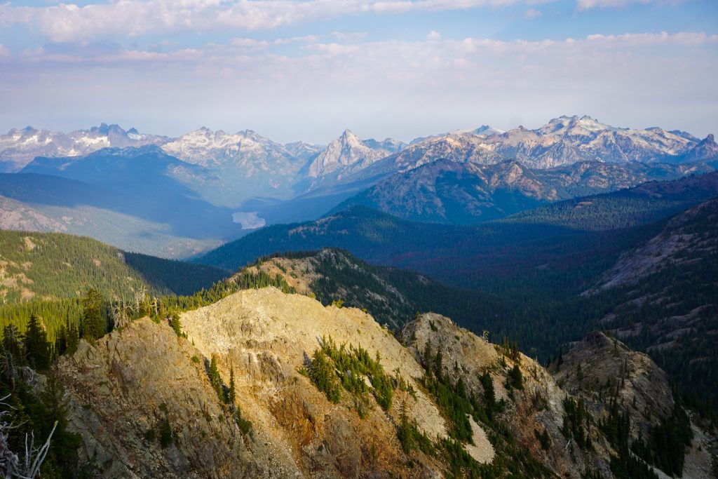
The Salmon La Sac drainage is a vast, diverse region that extends from the rugged Alpine Lakes Crest to the dry Teanaway Mountains. Nestled in the center of it all is the Davis / Goat Massif. This high ridge line stands relatively isolated from the rest of the peaks, like an island in the center of a giant valley. It had caught my eye on maps and from other trips, so I was keen to check it out.
After an incredibly productive July, August has been busy with many other commitments, variable weather, and smoke. But with changing plans, I ended up free on Saturday. My legs were tired from a workout just a few days before and the smoke forecast was mediocre, so I decided that checking out the Davis Goat Traverse would be a low commitment option with plenty of opportunities to extend it if I was feeling good.
I slept at the Davis Peak Trailhead and got a pre-dawn start. The trail up Davis is south facing and mostly in a burn zone, so I imagine it would be incredibly hot during the day. I crested the summit ridge right at sunrise and was pleasantly surprised to find decent visibility.
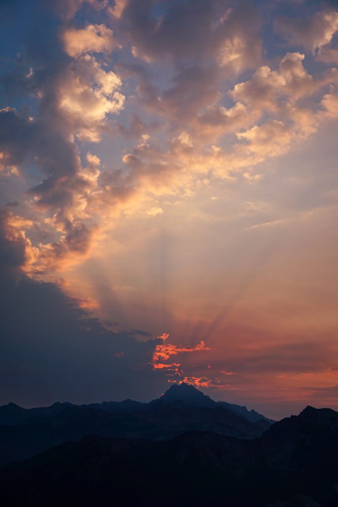
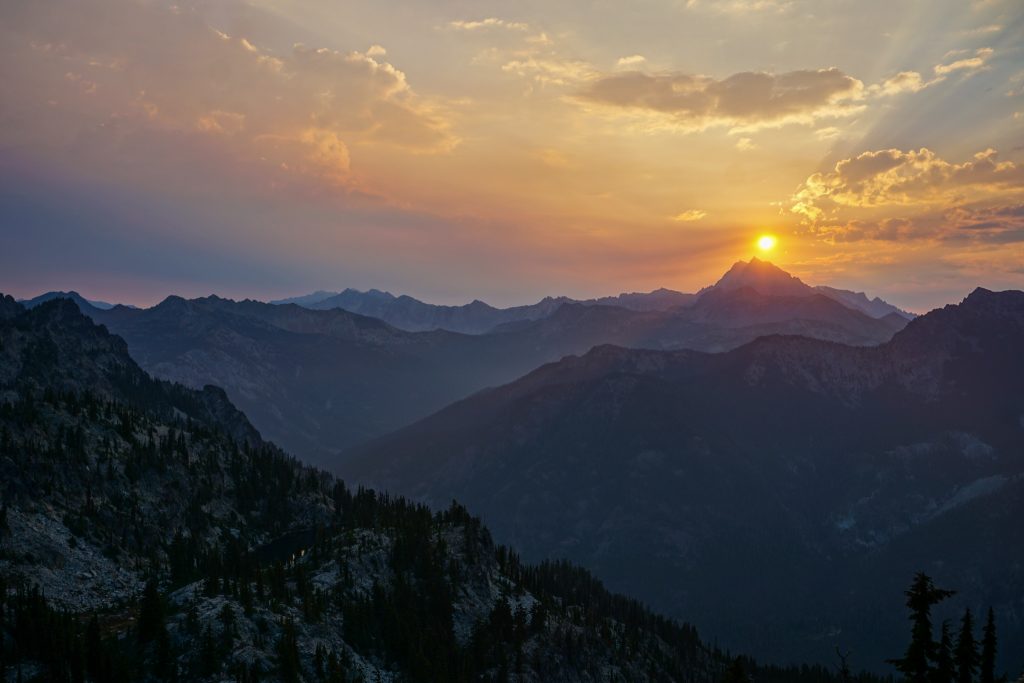
I watched the red sun emerge from behind Stuart and some clouds from the Central Peak of Davis.
I backtracked briefly to descend a steep loose slope, bypassing the initial part of the ridge northwards. It probably was doable, but looked steep so I figured I would just go around it. But after this short deviation, I would end up staying on the ridge proper for the next few miles!
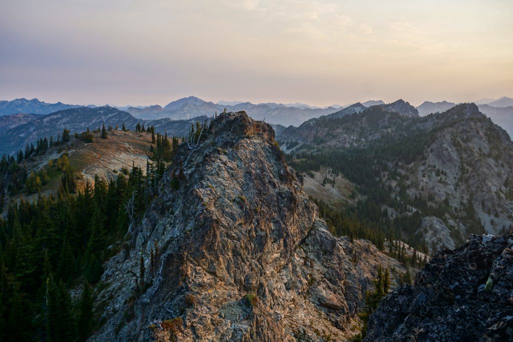
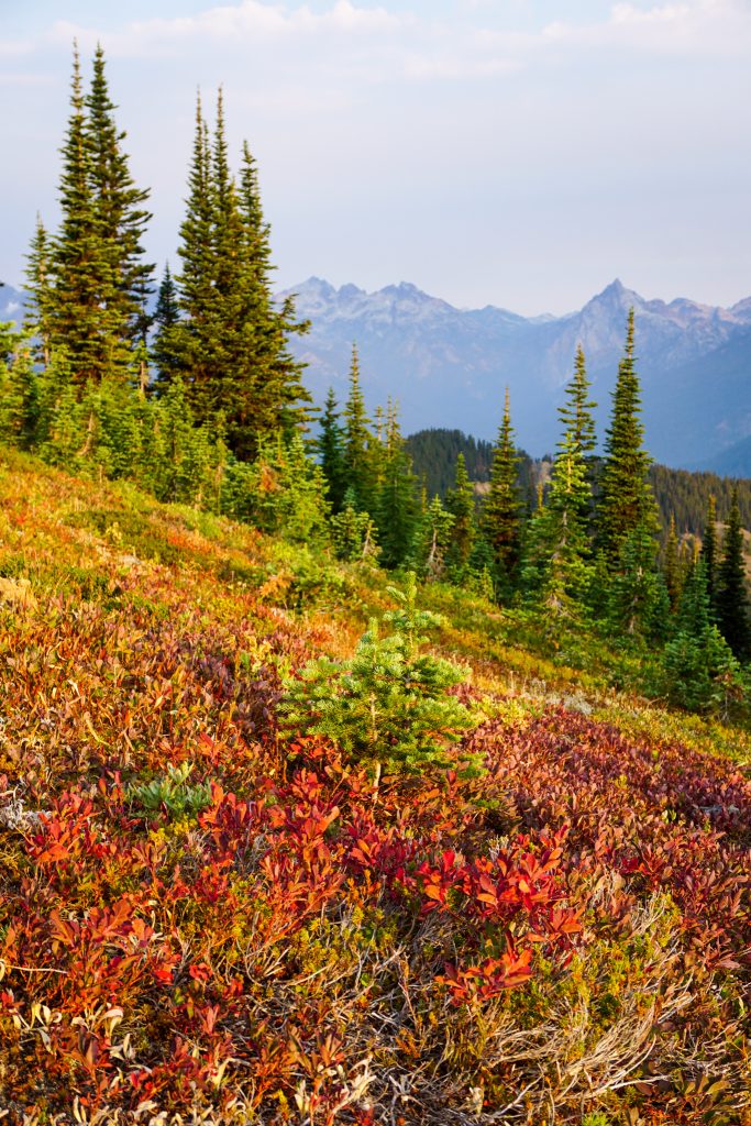
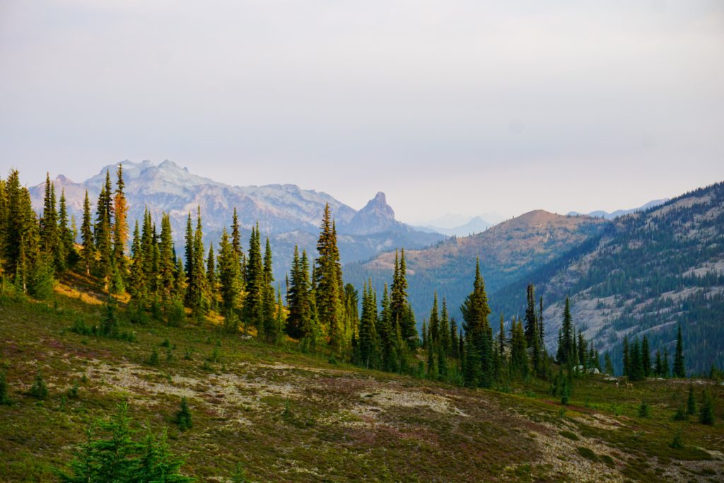
A cool breeze made for a pleasant morning on the ridge line, scrambling over rocky summits, and enjoying easy walking through meadows that were already turning red with a hint of fall.
Near the saddle between the Davis summits and the Goat summits, I stumbled across two bucks locking horns in a cute little meadow, with a beautiful backdrop of Mt. Daniel and the Alpine Lakes Crest. It was such a special, peaceful moment.
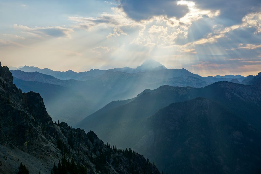
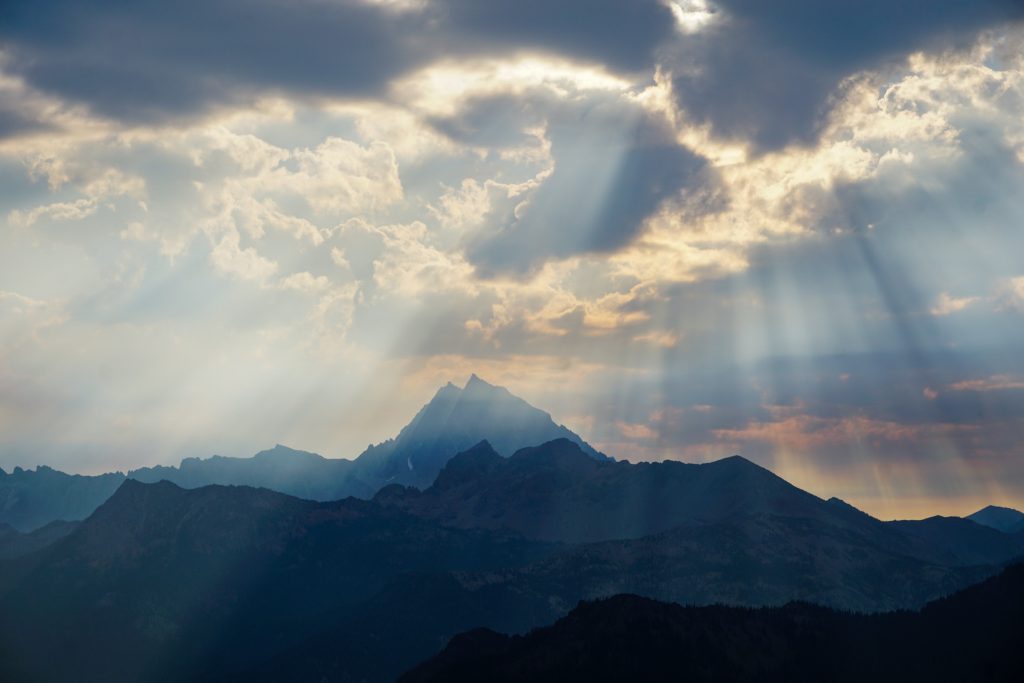
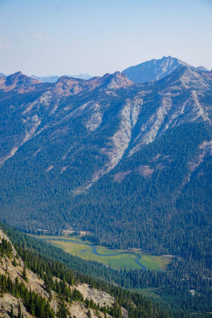
I passed a small pond and continued up easy terrain to the summit of Third Goat. Otherworldly rays of light shone through the smoky skies to the east, illuminating the Salmon La Sac valley below. I could practically hear the chorus singing in my ears. It was absolutely magical!
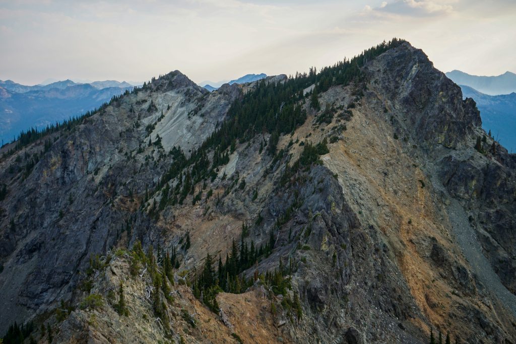
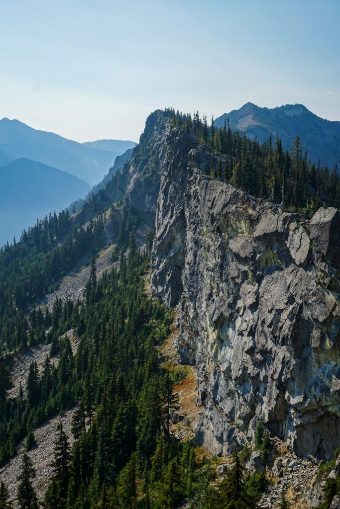
The traverse from Third Goat to Goat looked like the crux of the route on a map. While I could have easily gone around to the right side, I took a crack at the true ridge line. It was a little loose, but never scary and mostly solid at class 3 or so. The crux sections were rather short and easy to avoid if necessary.
At about 6600 ft, Goat Mountain’s elevation is not exceptional by the area’s standards, but it is relatively isolated and prominent. In fact, Goat is a P2K, meaning it is a rarified summit in Washington with 2,000 ft of prominence.
If you look at a map of the Cascades, the Davis / Goat Massif stands out. Whereas most peaks in the Cascades are connected by long ridge lines with obvious glacial valleys, this massif stands apart like an island. In fact, it almost certainly was an island in a sea of ice (a nunatak) during Ice Age times. A smaller glacier paved the Trail Creek valley flat, while a deeper glacier carved out the steep valley walls on the east side of Goat. As I traversed the ridge high above lakes, rivers, and forests, I imagined that instead I was prancing above thousand foot thick glaciers that split around the massif, converging on the south side and excavating the entire upper Kittitas Valley all the way to Indian John Hill. That would have been a sight to behold!
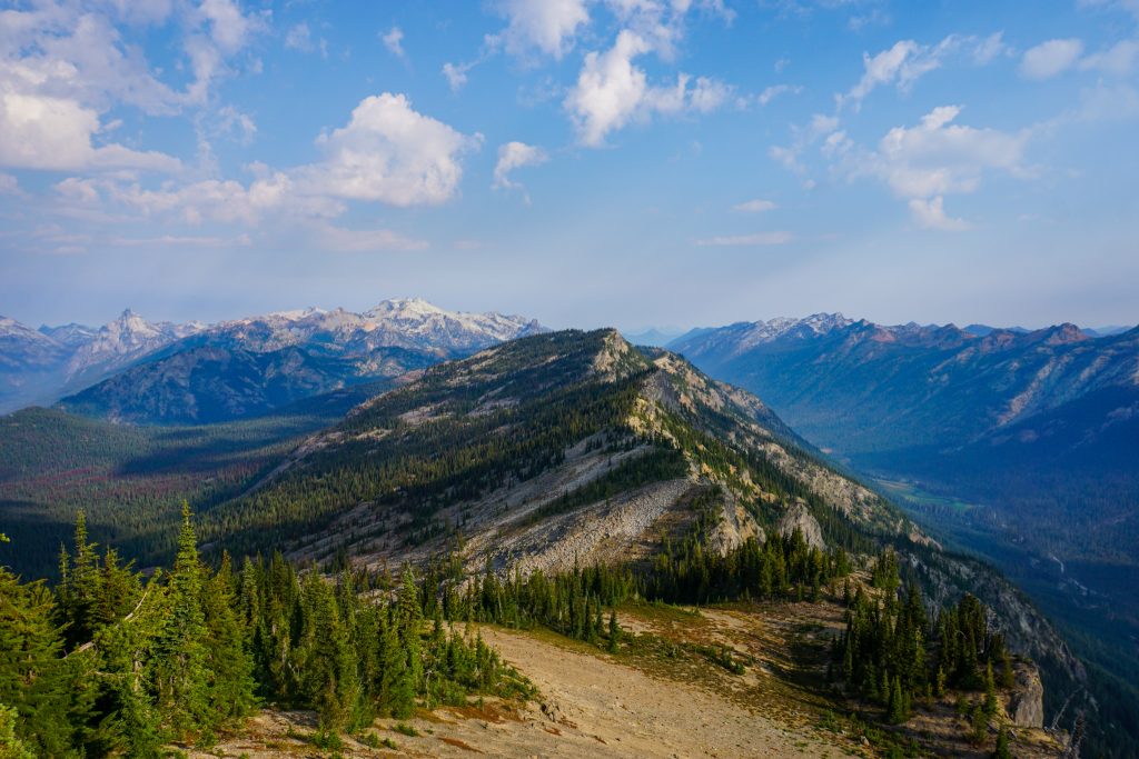
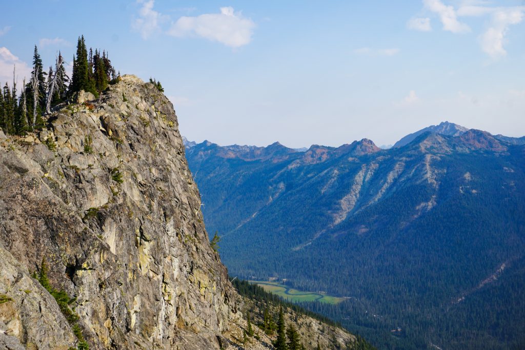
The next long section of ridge was easier, but still never quick. At times, the right side of the ridge had a vertical cliff over a hundred feet tall! The slope tumbled down three thousand feet to the Salmon La Sac road below, where I had gazed up at Goat many times before.
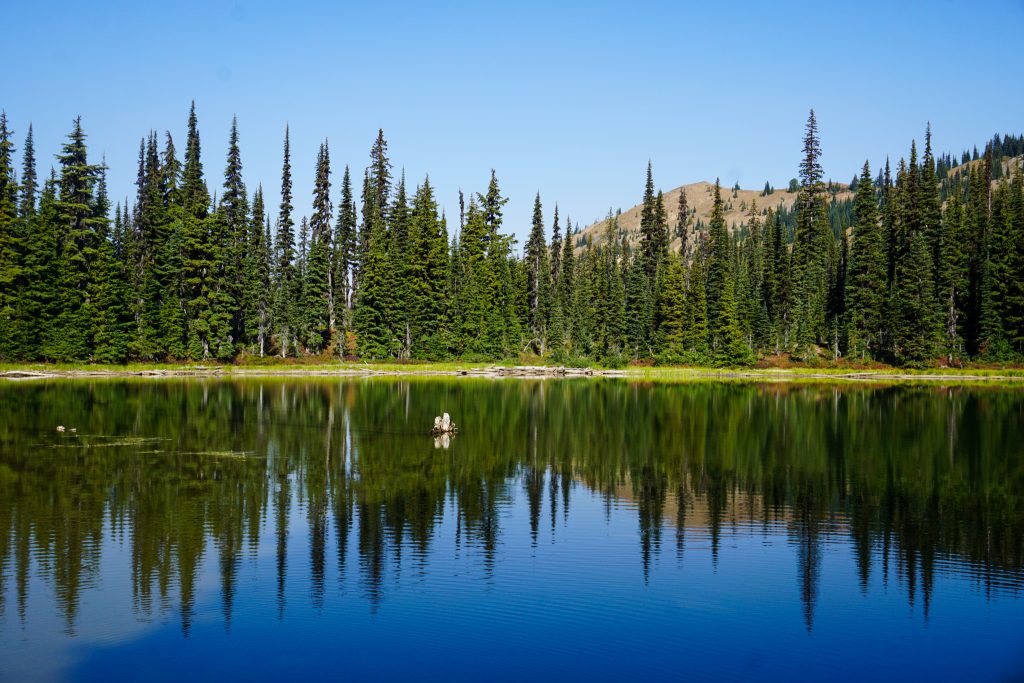
Once I reached the north summit of Goat, I finally left the ridge and dropped down to little Moonshine Lake. The descent was pretty easy and surprisingly not brushy.
With the absence of much wind, it already felt hot. I was feeling fatigued from a hard run earlier in the week and knew that I should probably start working my way back to the car rather than entering more exposed, hot terrain over by Mt. Daniel. I was already very satisfied with the traverse, so I decided it was time to head into to the shade and go swimming!
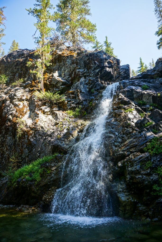
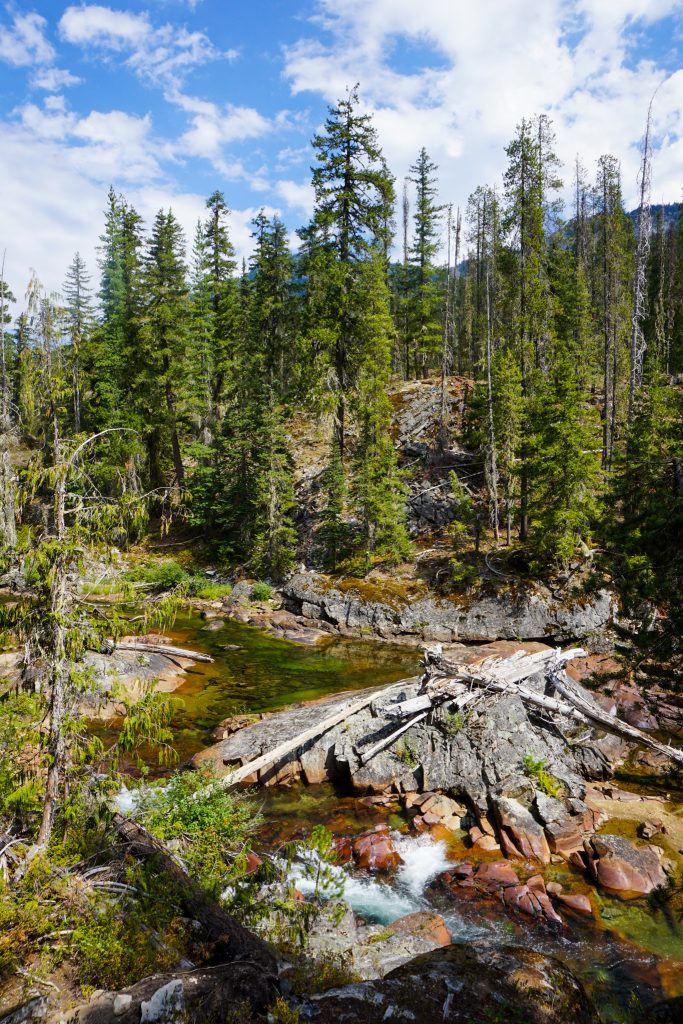
I jogged down the Michael Lake trail and then the Trail Creek Trail, both of which were in pretty decent condition considering how little traffic they get. Just before the valley bottom, I found a beautiful little waterfall to cool off in.
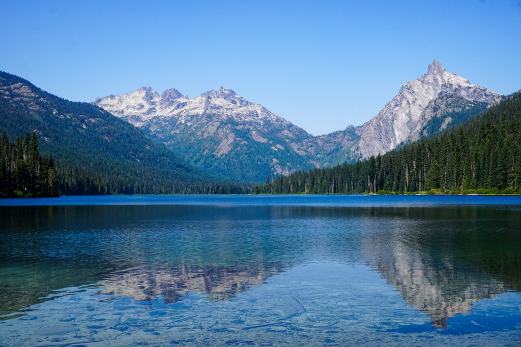
There seem to be few bridges in this area, so I had to take my shoes on and off a bunch of times to cross the Waptus River multiple times on my way to Waptus Lake. The side trip to Waptus Lake added a few miles, but it was definitely worth it! Waptus is giant – probably one of the largest lakes in the Alpine Lakes Wilderness. I went for a little swim and ate lunch on the beach.
My journey back on the Waptus River trail was a hot one, with many little ups and downs. I listened to podcasts to pass the time. Near the end, I peeled off onto an old road, which led me back towards the Davis Peak trailhead. It was a bit brushy and there was an easy ford at the end, but it saved me a few miles of road walking! I ended the day with another perfect dip in the Salmon La Sac River.
The Alpine Lakes Wilderness has an incredible balance between accessibility and wilderness. The complex trail network, variety of access points, and extended high country allow for a seemingly infinite number of routes. The Davis Goat Traverse is a perfect example of rambling through the area, improvising along the way, and continuing to find new ways of seeing familiar places.
Notes:
- The route measured about 27 miles and 8000 ft gain. Most of the gain and time was spent on the climb up Davis and high traverse.
- The traverse was mostly easy with a few moderately exposed class 3/4 sections on decent rock. They were all avoidable with some sidehilling.
- After reaching Trail Creek, the quickest exist would be to the Cathedral Pass Trailhead, from which it would likely be easy to hitchhike back to the Davis Peak Trailhead in the afternoon.
- The small lake before Third Goat was a key water source. Otherwise, there was nothing between the Davis Peak Trailhead and Moonshine Lake. Trail Creek was still flowing well, but other creeks were dry.
Beautifully done, as always, wonderful photos and always appreciate. the photo captions.
And, wow, the two rangers who just did FKT on Rainier Infinity route! Does anyone hike anymore?
Haha I will be just hiking the next two weekends!