Table of Contents
The Finest Line
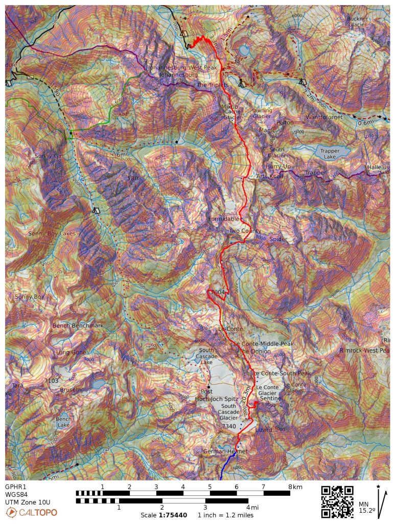
From July 1 to 4, 2023, Anthony, Wyatt, and I hiked from Cascade Pass to the summit of Glacier Peak. Our route traveled across 13 glaciers, over 5 high summits, and never dropped below 5,000 feet. It measured 85 miles and 36,000 feet of gain, mostly off-trail. But stats do not capture the complete experience. Here is the story of the Glacier Peak High Route.
The Origin
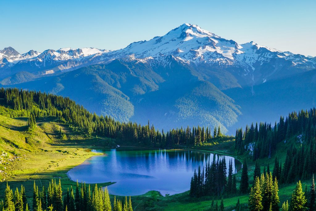
When people ask me what my favorite mountain is, I always respond “Glacier Peak”. Is it my favorite mountain to climb? Definitely not – it is mostly a pile of volcanic choss. Does it have the best summit views? No – volcanoes are too high above the surrounding landscape. Why, then, is it my favorite mountain?
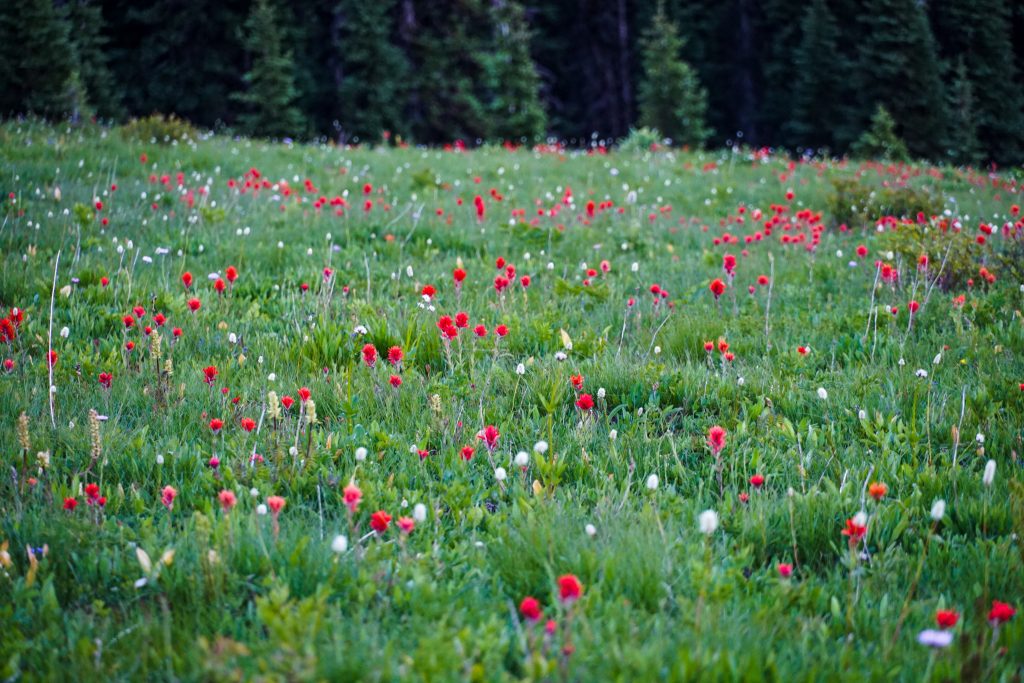
To me, Glacier Peak is not just a mountain; it is a place, a feeling, a memory. Glacier Peak is where fields of lush lupines sway in the breeze as the sun reflects off a nearby glacier. Glacier Peak is where a faint single track weaves its way through a field of blooming heather, with streams sweeping water into the deep valleys below. Glacier Peak is where the harshness of the alpine collides with the softness of the subalpine. Glacier Peak is where I discovered these mountains of almost incomprehensible beauty, coming back over and over again.
I first began really exploring the Cascades in 2014 after graduating high school. During this summer, I also made my first forays into the Glacier Peak Wilderness. The remote volcano became an emblem of my summer, a beacon of wildness and beauty. As the least-known volcano in the Cascades, it drew me in with its mystery and the depth of the wilderness that surrounded it.
In 2017, I climbed Glacier Peak in a long day. At the time, I could not think of a more beautiful approach, passing through old growth forest, lush wildflower meadows, and an exotic post-glacial landscape. With Glacier Peak, it is all about the journey. The beauty lies in how you get there.
During July 2018, I embarked on the Sierra High Route, an epic off-trail adventure in the High Sierra. Over two weeks and 200+ miles, we traveled through endless beautiful lake basins and high passes before finally reaching the summit of Mt. Whitney, the highest point in the lower 48. It was both the most challenging and rewarding experience I had ever had in the mountains.
The Sierra High Route was a fundamentally life-changing experience. Before this trip, I always thought of mountain trips as “objectives”: summit that peak, climb that rock route, ski that line. But the Sierra High Route forced me to look at trips as an experience. It was a rich experience that captured the beauty, challenge, and scale of the range. There was not a single highlight or resolution; rather, the magic lied in the amalgamation of beautiful and powerful moments. Measuring became not a matter of grades or miles but rather the subjective aesthetics and emotions felt along the way. Even though I mostly followed a route that many others have done, it felt deeply personal and unique, because no one else would have exactly the same experience that I did.
The Sierra High Route hooked me on high routes and creating my own experiences. But when I got home to the Cascades, I could not find an analogous route – continuous high, non-technical travel for a week or longer. There was the Ptarmigan Traverse, but that seemed more like a weekend trip. However, I had a vision of extending the Ptarmigan Traverse southwards, wrapping around the massive Suiattle River drainage to the summit of Glacier Peak. At the time, I had yet to visit most of these places, but I somehow instinctively knew that this would be the most aesthetic, beautiful route in the Cascades that I could dream of. It would be a homage to my favorite mountain and the beautiful wilderness that surrounds it. It would be my way of experiencing this powerful place. In the fall of 2018, I drew up the Glacier Peak High Route. At the time, it was simply a dream – a line on the map.
In 2019, Jacob, Daniel, Logan, and I set aside one week to realize the vision of the Glacier Peak High Route. Unfortunately, bad weather caused us to reduce scope and abbreviate the trip to a 4 day Extended Ptarmigan Traverse. Later that week, I explored the southern end of the proposed route with a Dakobed Range Circumnavigation. In hindsight, I am grateful for the shorter trips. I do not think we were ready, physically or mentally, for a trip of this scale. And a few more years of brooding and waiting would make the experience even more meaningful. Sometimes dreams taste better when they can ripen and grow.
I was never in a rush to do the Glacier Peak High Route. For a few years, I kept busy with other routes. Part of me was scared to complete it – what do you do when you have realized your biggest dream? Where do you go when you are at the top? Is the only way down from there?
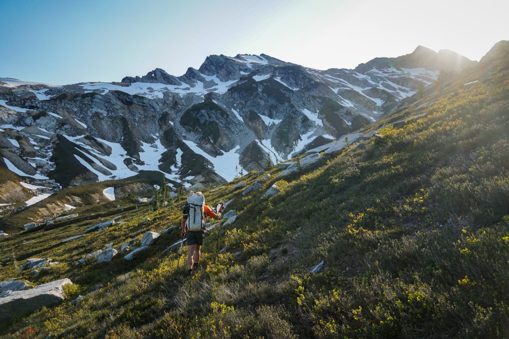
But coming into 2023, it felt like the right time to tackle the Glacier Peak High Route. I felt more confident in my ability to string together long days over challenging terrain. I wanted to complete the route in my style – fast, but never in a hurry. I wanted the feeling of covering vast amounts of terrain, but still the casualness to linger on a summit or saunter in a field of wildflowers.
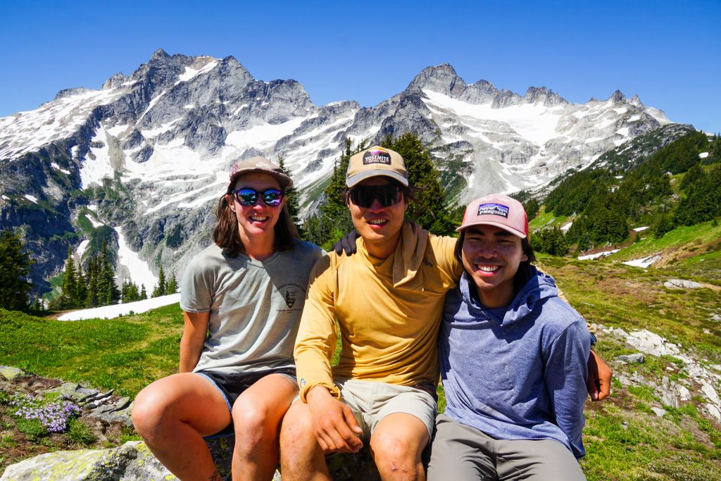
Wyatt and Anthony were two partners that felt right for this trip. Wyatt is even more of an avid photographer than me, so I knew we would not pressure each other into going too fast. Anthony had the toughness to get us through challenging spots. And both had great fitness and were just fun to be out with. We made plans for July 4th weekend, and this time around, the weather played out wonderfully. Here we go, on the trip of a lifetime!
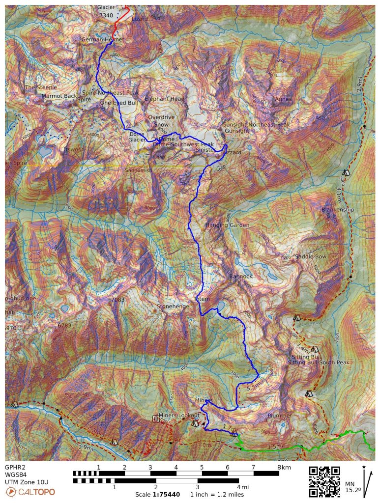
Day 1: Cascade Pass Trailhead to White Rock Lakes
17 miles, ~9700 ft gain, 12.5 hours elapsed.
After setting up the long car shuttle the night before, we began our adventure from the Cascade Pass Trailhead. We had heavy packs loaded with four days of food, glacier gear, tents, and sleeping gear. With all of his camera gear, extra clothes, and large food reserves, Wyatt’s pack was over 40 pounds! Good thing I knew he had the fitness to handle 10k days off-trail with such a heavy pack.
At Cascade Pass, we met a man who had lived a fascinating life, growing up in Hawaii, living in Stehekin in early adulthood, and eventually moving to New Zealand. He mentioned skiing the Ptarmigan Traverse many decades ago and was impressed by our ambitious plan.
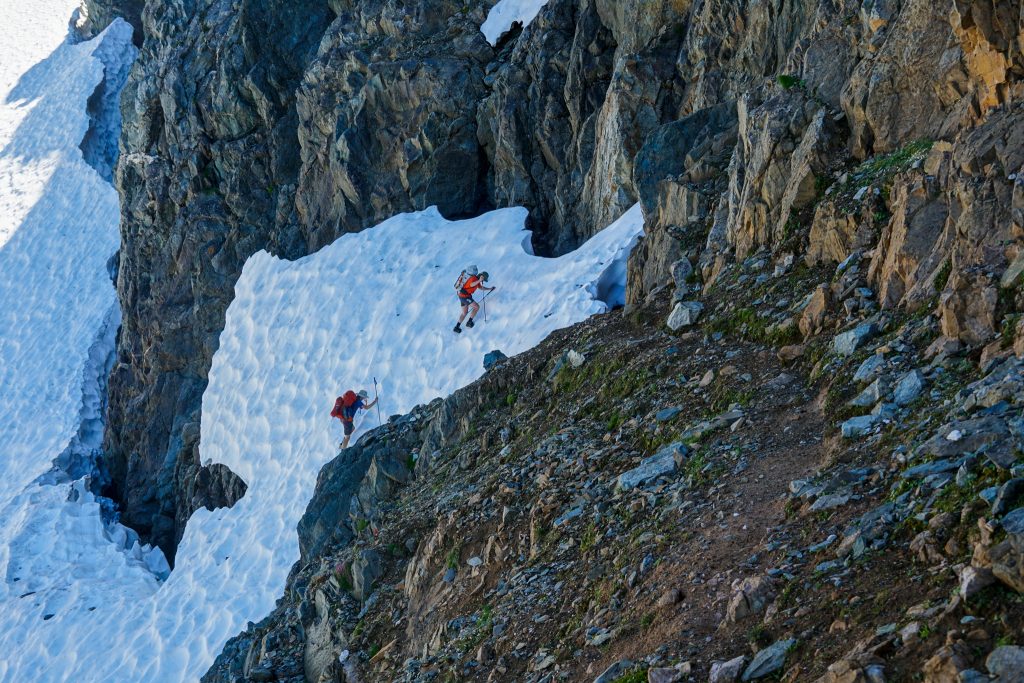
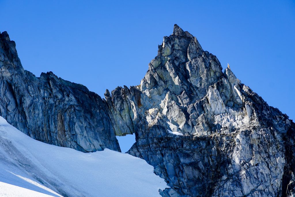
Cache Col had a weird melted out cornice. There were two options: perform a snow mantle problem or crawl through a tight snow cave. I chose the cave out of novelty.
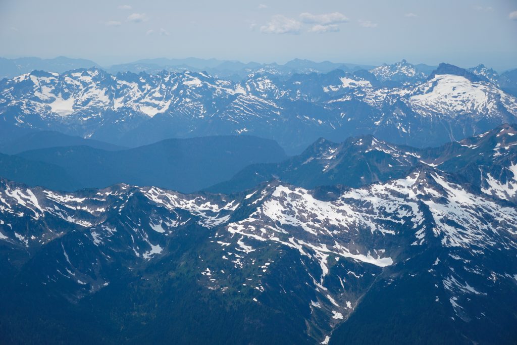
During our 2019 trip, we were always stuck in clouds when west of the crest. But this time we had perfectly blue skies. With great visibility and easy navigation, the Ptarmigan Traverse is pure type 1 fun.
We put on crampons briefly to ascend the Red Ledges, but otherwise the snow was mostly soft and quick for travel. The Middle Cascade Glacier was remarkably simple given an existing bootpack and the fact we were not in a whiteout, unlike last time.
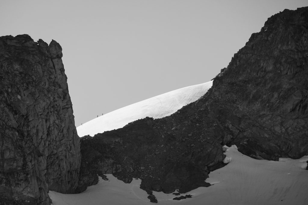
At the Spider-Formidable Col, we caught view of three distant figures ascending the Le Conte Glacier. We would later learn that they were my friends Daniel, Alek, and Kolbe, who were doing the Ptarmigan Traverse in a day!
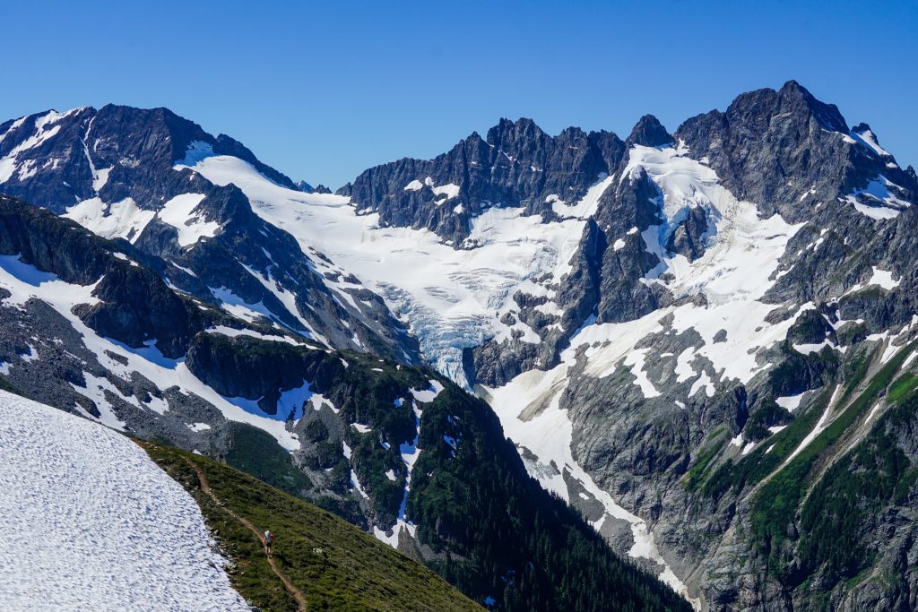
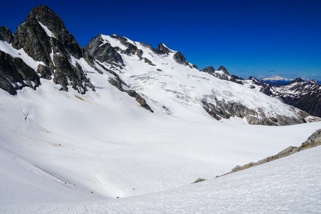
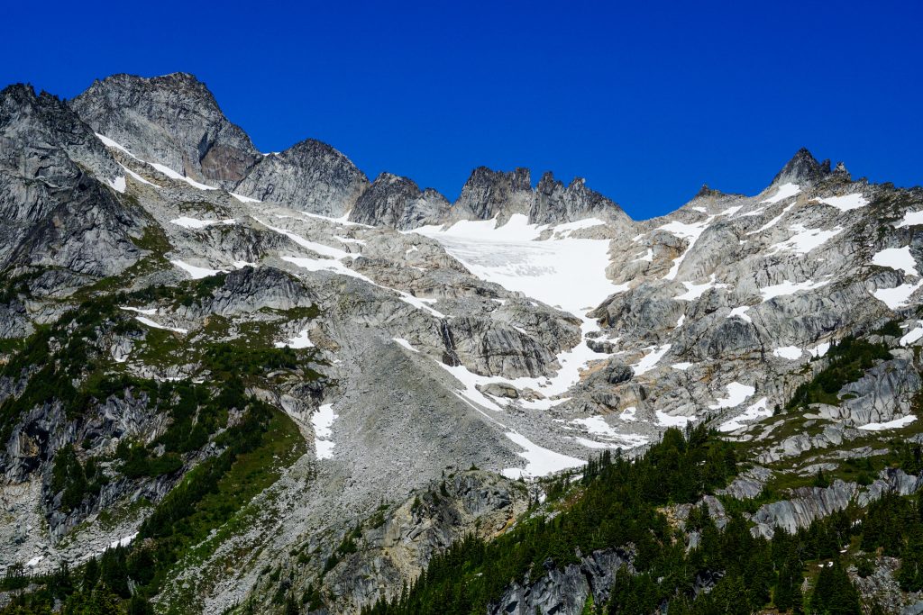
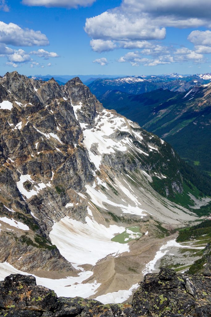
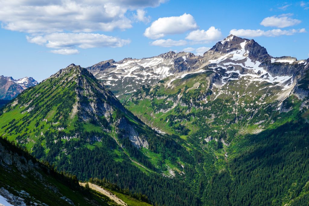
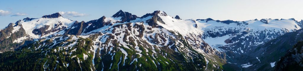
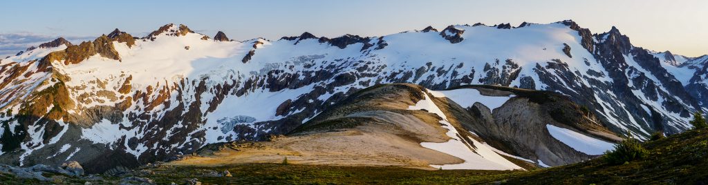
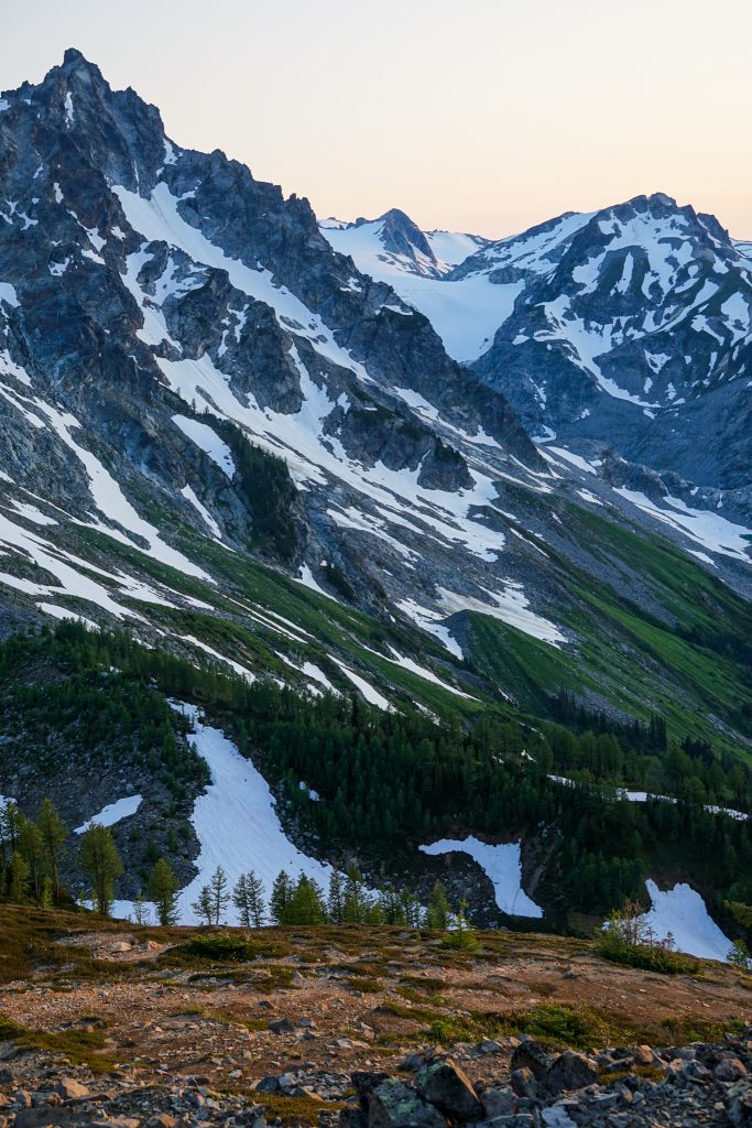
We passed the Yang Yang Lakes, where we had camped last time, and began a long climb up to the ridge. This is probably the most indirect section of the Ptarmigan Traverse, so it takes a while to get from the Spider-Formidable Col all the way to the Le Conte Glacier. However, the views throughout this entire traverse are outstanding.
After climbing up the Le Conte Glacier, the route traverses above the South Cascade Glacier. This is perhaps my favorite section of the standard Ptarmigan Traverse. Even though the glacier has receded immensely, it still feels like a setting from a distant land, not the Washington Cascades. A cool breeze blew puffy clouds overhead as we admired the length of the glacier, the beautiful silty outwash lake, and the ridges of peaks to the west.
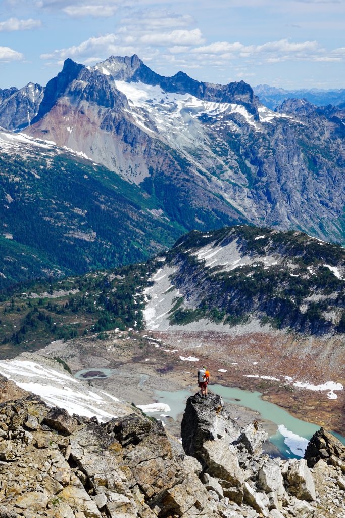
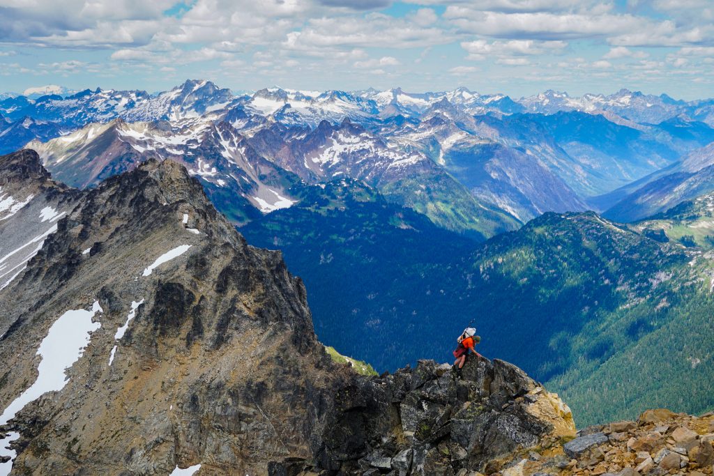
As we contoured around the base of Sentinel Peak, we dumped all of our overnight gear in preparation for a quick scramble up Sentinel. Both Wyatt and Anthony are avid peakbaggers and these were the terms of inviting them along on a high route – we were going to bag some aesthetic summits.
The scramble up Sentinel is rather chossy, but the views more than make up for the unenjoyable ascent. Sentinel stands at the heart of the Ptarmigan Traverse, with glaciers and high peaks in all directions.
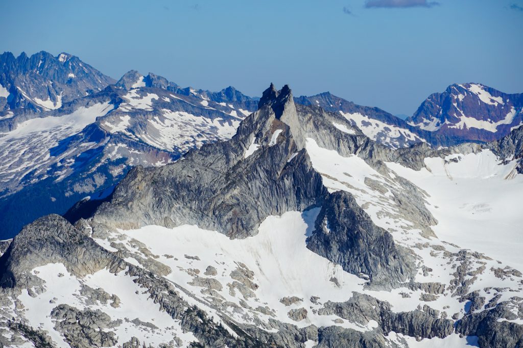
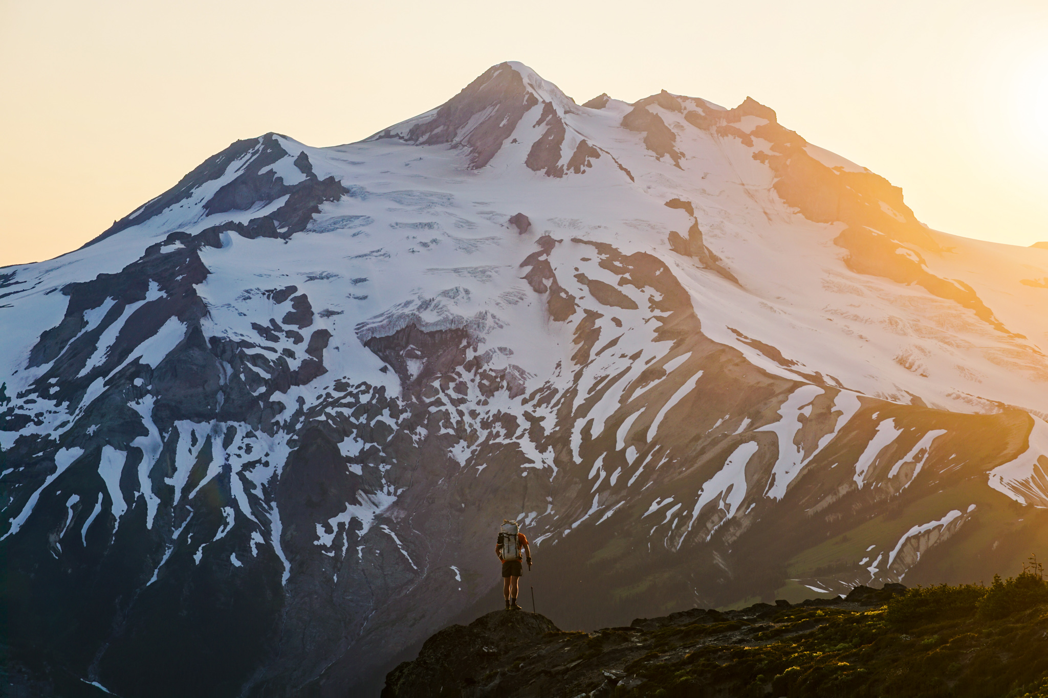
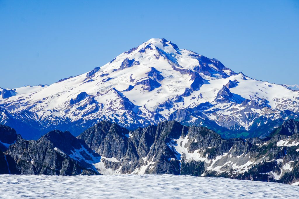
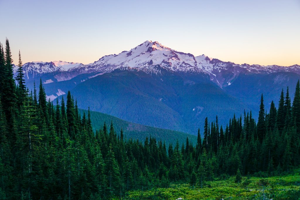
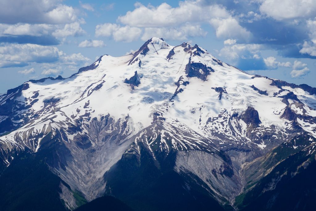
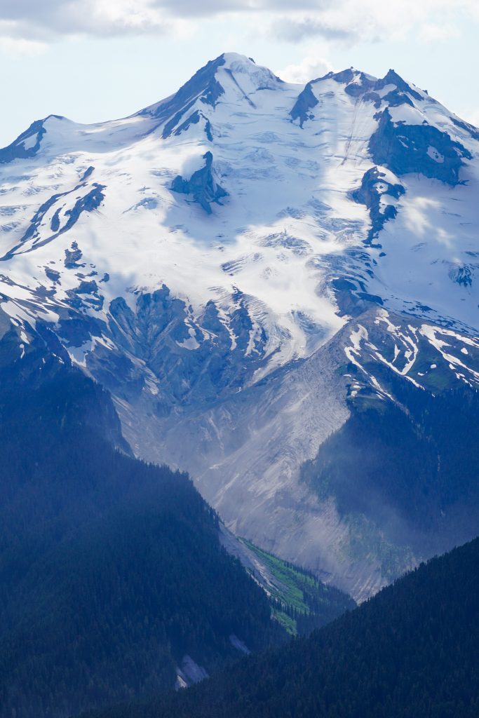
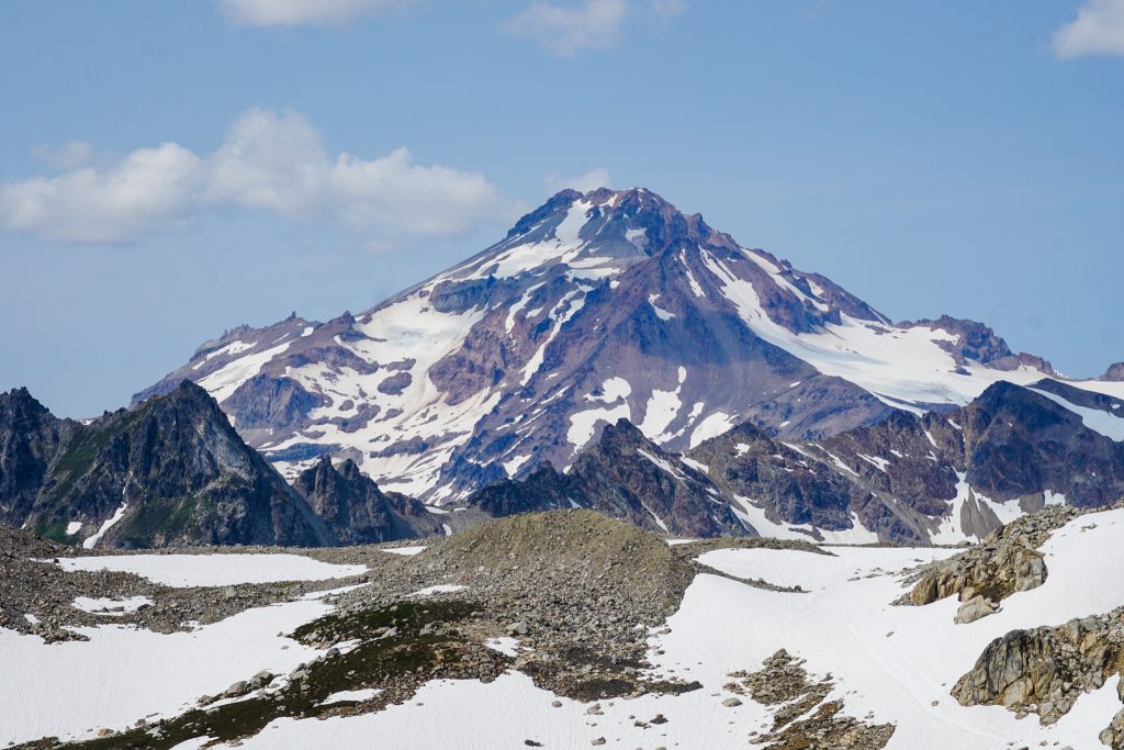
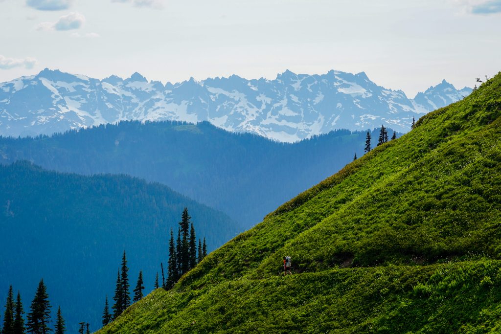
From the top of Sentinel, we also saw Glacier Peak for the first time. It was separated by many ridges and glaciers, seemingly impossibly far away. The view was both humbling and inspiring. It felt like a turning point in the first chapter of our story, where we saw the destination for the first time.
In his measuring of all glaciers in Washington, Wyatt determined the Chikamin Glacier was the largest glacier in Washington outside of North Cascades National Park (i.e. the Boston Glacier), Mt. Rainier, and Mt. Baker. By area, the Chikamin Glacier is larger than any single glacier on Glacier Peak or Adams, and about equal to a few of the glaciers on Olympus!
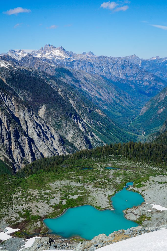
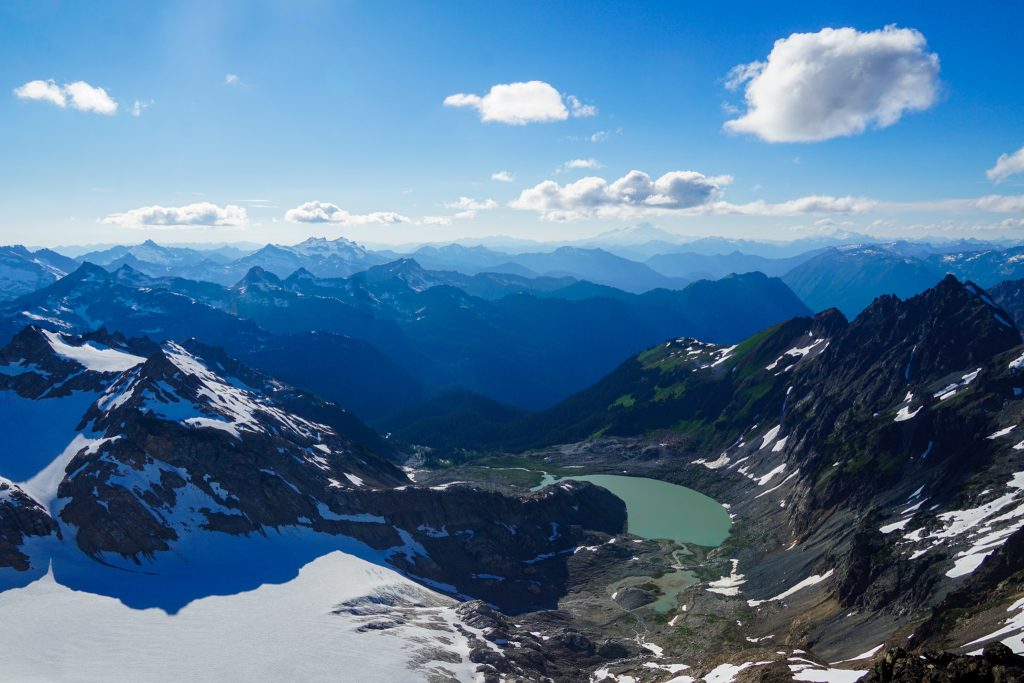
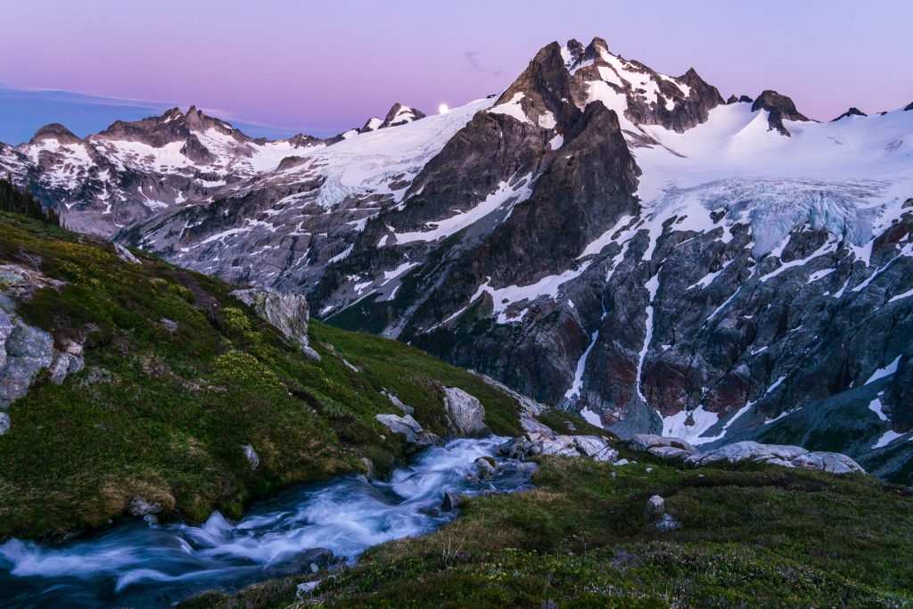
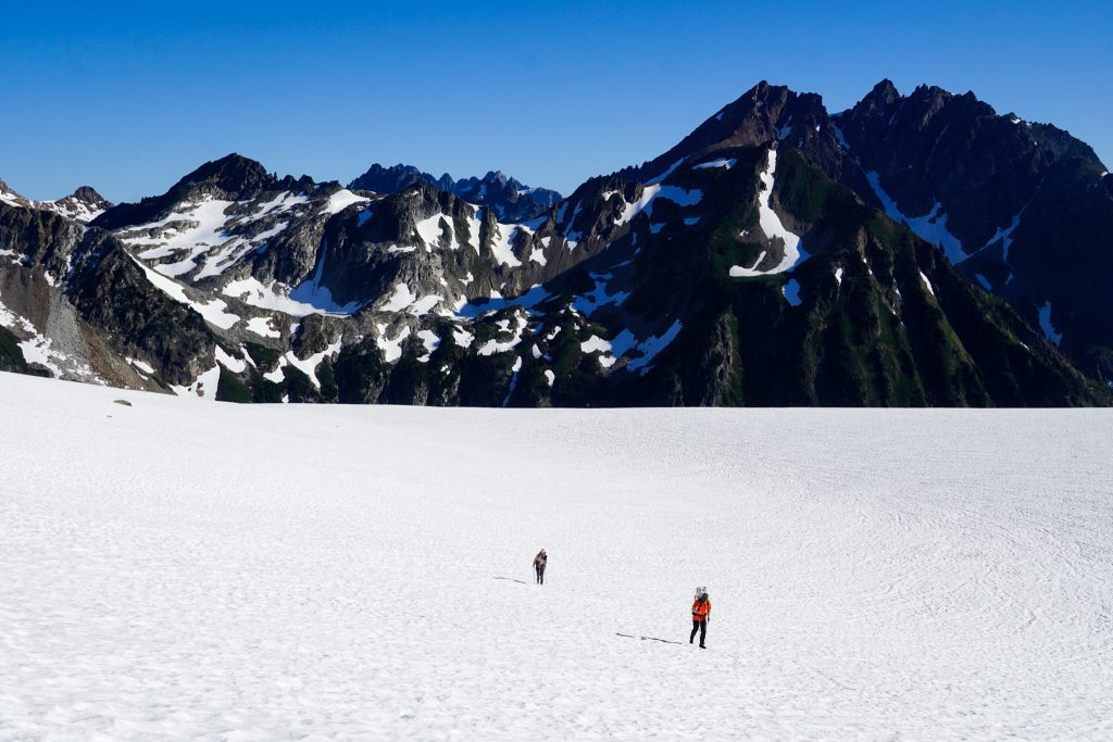
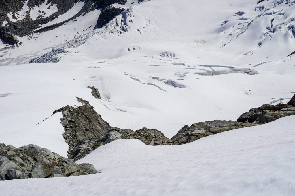
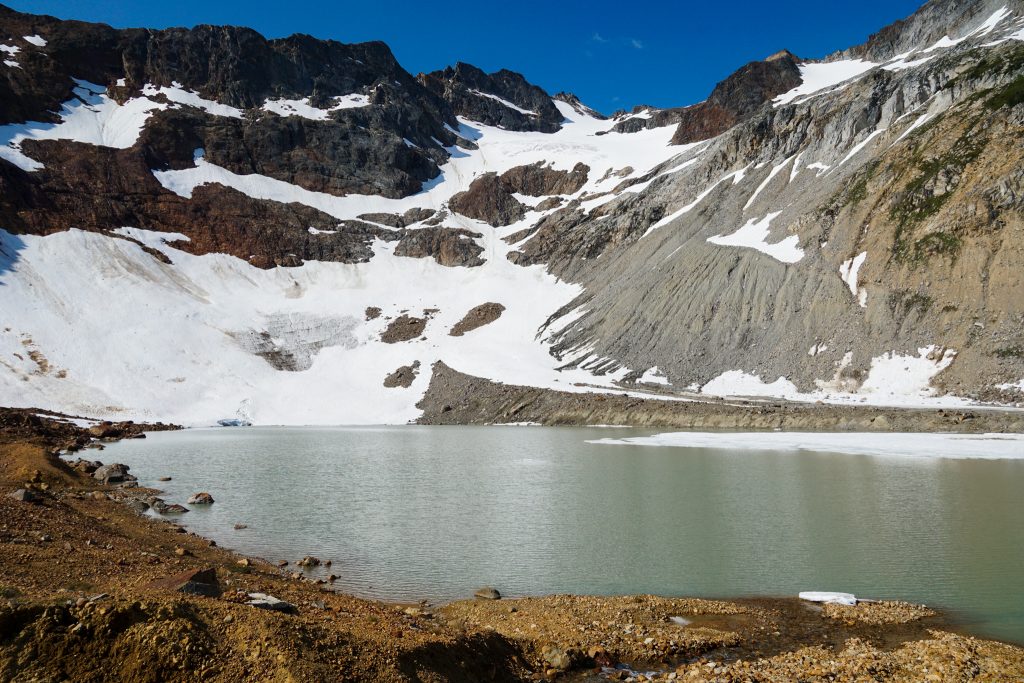
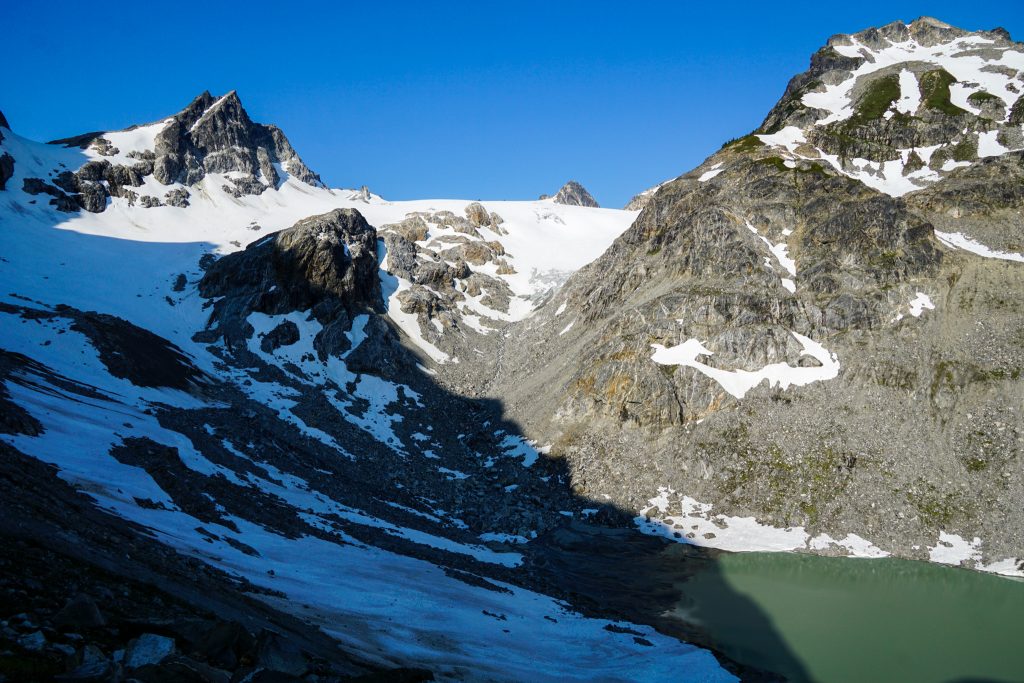
After getting back to our packs, we crossed the upper South Cascade Glacier and descended to the White Rock Lakes, where we would camp for the night. It was a long day, taking over 12 hours, but little did we know that it would end up being our easiest day!
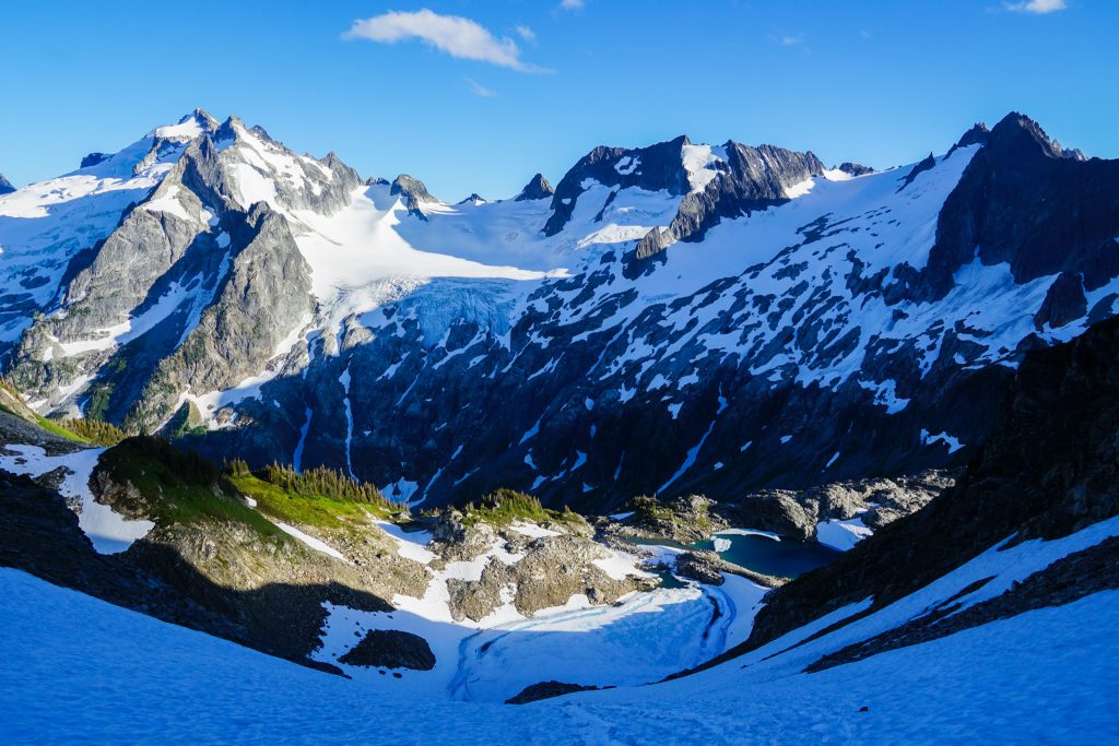
We appreciated the wind walls at camp, but it was still cold with a strong west wind throughout the evening. My friend Westy and his group rolled up right before sunset, coming from the south.
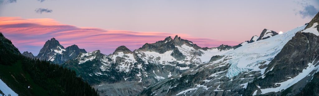
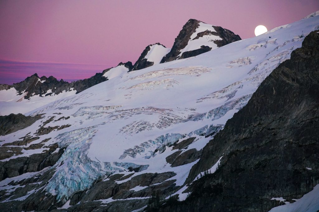
White Rock Lakes is a beautiful venue, with massive glaciers and granite peaks all around. We got lucky with some beautifully underlit clouds at sunset. Wyatt and I rushed around taking pictures.
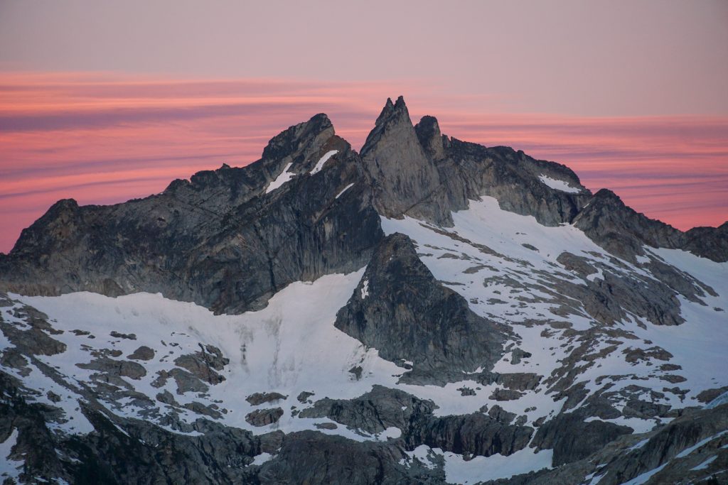
Right as the colors were dying down, a full moon rose from behind the Chikamin Glacier!
Day 1 went flawlessly. But we knew that the next two days had great challenges and distances to cover! So we went to bed quickly, looking forward to another day in paradise.
Day 2: White Rock Lakes to Image Lake Area
19 miles, ~9000 ft gain, 14.5 hours elapsed.
We knew that that our second day would likely be our most challenging. Our goal was to get all the way to Cloudy Pass. The terrain over Dome was steep and slow, as was the long traverse through the Hanging Gardens and the unmaintained trail past Canyon Lake. But we all woke up feeling surprisingly fresh even after a long day with heavy packs.
Our progress got off to a slow start, with multiple short snow crossings that required crampons after the hard overnight freeze. But once we got in the sun and climbed up to the Dana Glacier, things improved.
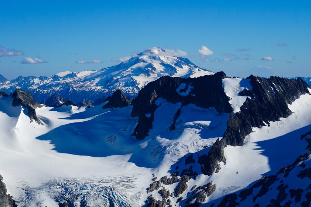
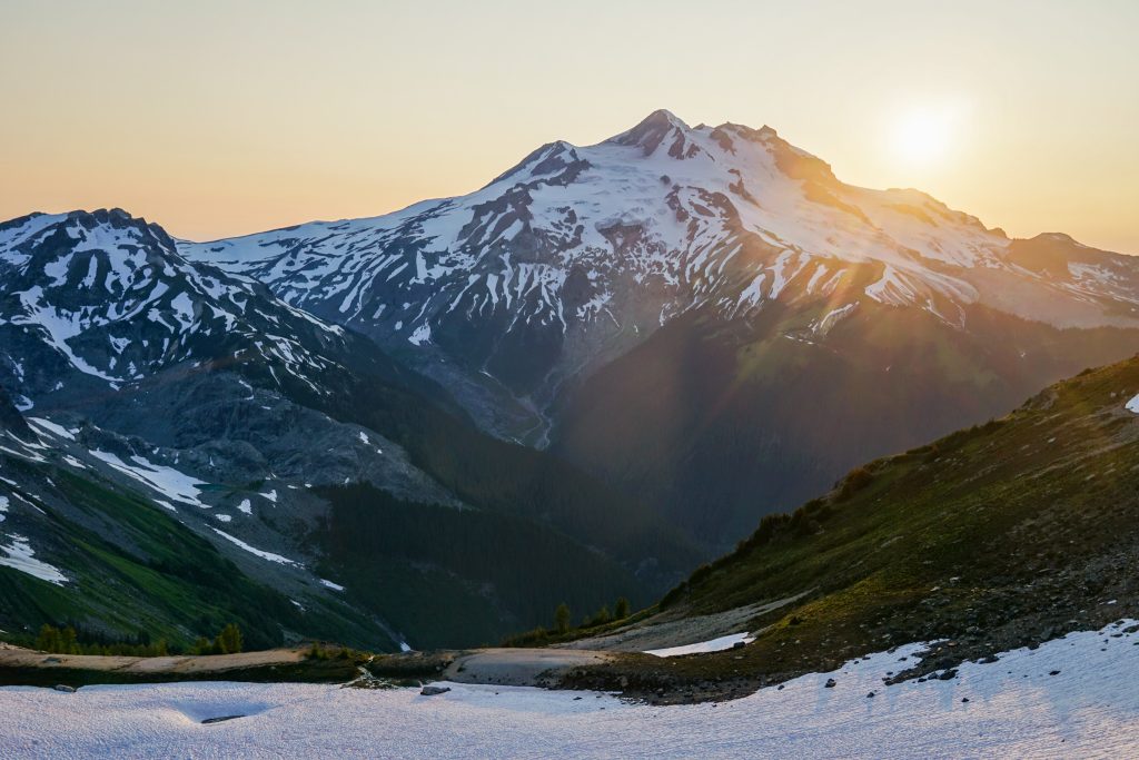
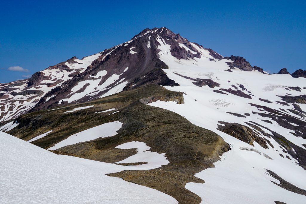
Crossing onto the Dome Glacier, we got an incredible view of Glacier Peak. Wyatt entered photoland while Anthony and I hiked up to another party of three and chatted with them. Up on Dome, I spotted my friends Rio, John, and Kat descending from the summit. We had been using their bootpack the entire trip and were excited to catch up to them.
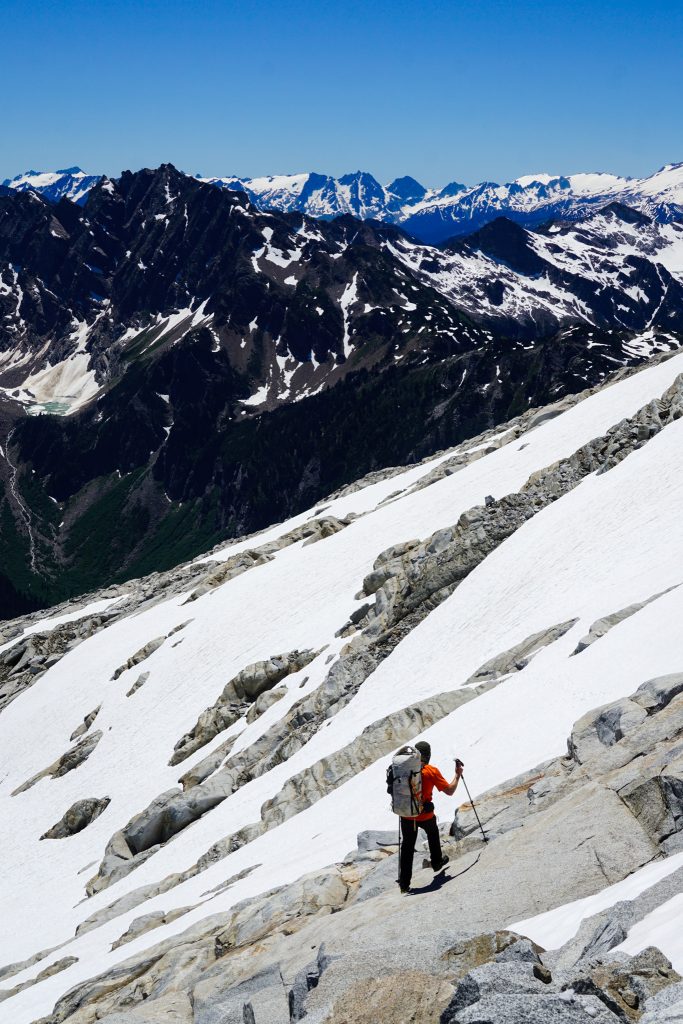
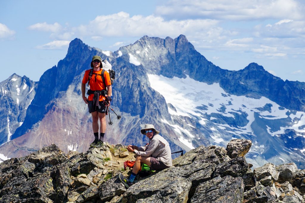
At Dome Col, we ditched our packs and hiked up to the summit of Dome. For Anthony and Wyatt, they got to experience the incredible summit of Dome for the first time. With a brief class 4+ move and an airy traverse above vertical granite cliffs positioned high in the center of the Glacier Peak Wilderness, I think Dome could be the best summit in the state!
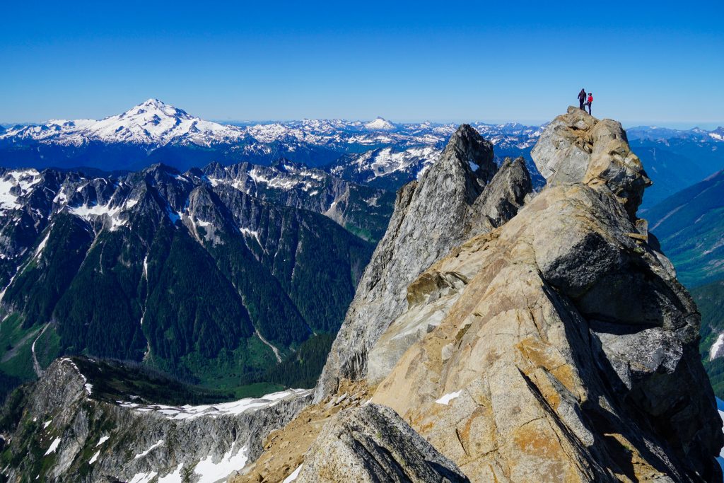
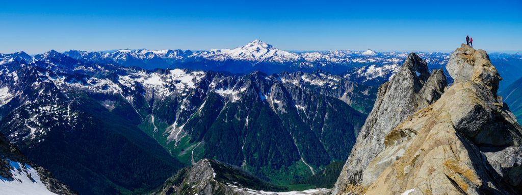
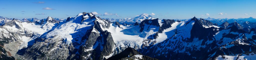
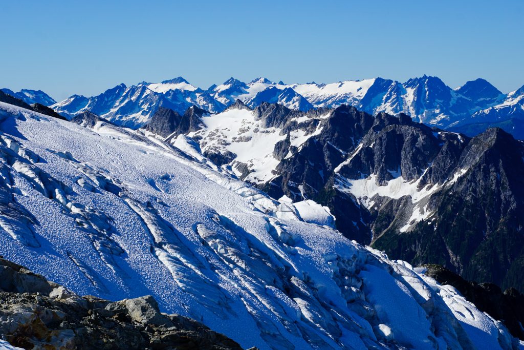
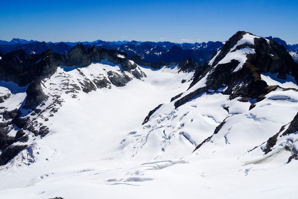
Dome also had the best position in the center of our entire high route. We could see the Ptarmigan Traverse to the north where we came, and the entire remainder of our route, circling Glacier Peak to the east and south. The amount of high terrain we had covered and were planning to cover was astounding.
The next task was to descend the Chikamin Glacier, the most serious glacier of the trip. It appeared that Rio’s group and others had crossed the upper bergschrund, which looked pretty solid. But I was curious about a different route that avoided the schrund and probably worked later season.
I led our rope team a little higher and right through the wind scoop to where it blindly rolled into a 45 degree snow slope. There was a rock island to the left and a steep snowfield to the right without crevasses.
The snow was soft from plenty of morning sun, but it was quite steep. It easily avoided the bergschrund before rejoining the standard descent.
We generally followed Rio’s bootpack down the Chikamin Glacier, with some deviations at certain crevasse bridges. Navigating down this glacier is not simple – there are many large crevasses and it is challenging to see over convex rolls. The descent took a while, so we were relieved when we finally reached the flat section at the bottom.
Last time, I had ascended to the lowest saddle between the Gunsights and Sinister. This regrettable decision led me up disgusting low 5th slabs. This time, we took the slightly higher saddle to the left, which is Gunsight Col proper.
After passing through Gunsight Col, we made a long traverse over towards the Garden Glacier beneath Sinister. Sections like this, where we gained or descended little elevation, were definitely putting us behind schedule, even though we navigated all of this terrain extremely efficiently due to my past experience with the terrain.
We kept catching glimpses of Rio’s crew, but they were moving quickly! The direct descent down to Parmesan Basin went just barely on snow, saving us considerable time. We knew we were getting close to them!
At Kaiwhat Pass, we spotted them and Anthony yelled out “We’re gonna get you!” This only caused them to quicken their pace. Anthony and I huffed and puffed in the midday heat, trying to catch them. We finally reached them at the Hanging Gardens and we all took a break together.
In class Rio fashion, he pulled out some homemade baked goods he had carried the entire way and offered us some! I still remember when he surprised us all on the summit of Mt. Olympus, day 4 of the Bailey Range Traverse, with baked goods! How is this man still single???
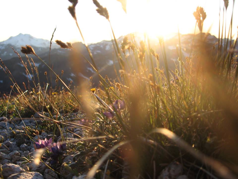
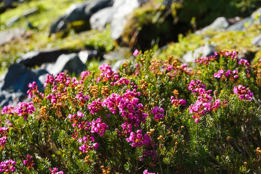
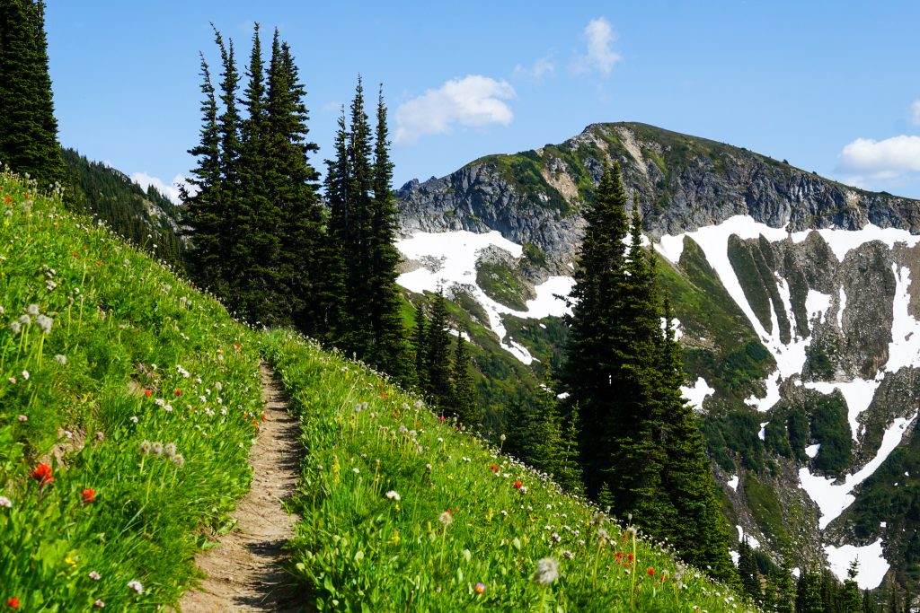
The Hanging Gardens is a significant transition point in the Glacier Peak High Route. It is where you temporarily leave behind the glacial alpine North Cascades and enter the meadowlands of the Glacier Peak Wilderness, filled with wildflowers, springs, and pristine meadows.
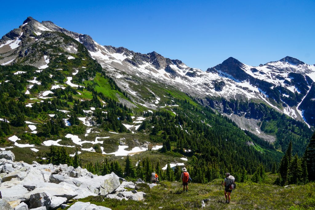
It was nice to hike with them over to Canyon Lake. The traverse to Totem Pass went much smoother than last time, when we battled wet brush. Still, we were cognizant that we were not on pace to reach Cloudy Pass by sunset. All of these long traverse sections were messing with our time estimates, which only really took into account elevation.
We nailed the descent from Totem Pass to Canyon Lake with minimal bushwhacking, picking up on key animal trails. It was incredible how perfectly we were executing this trip compared to the last time I was here. Some of that was due to an additional 4 years of experience, but some of that was due to my memory of the terrain details. I thought I had forgotten the necessary details, but certain terrain cues were resurfacing old memories that helped us forge the most efficient path.
We all took a dip in Canyon Lake to clean the grime and grit of two days in the sun off of our bodies. We said goodbye to Kat, Rio, and John, who planned to spend the night here.
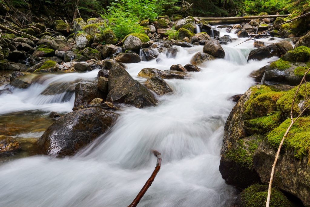
Anthony, Wyatt, and I continued on the abandoned Canyon Lake Trail. I remembered this section to be annoying, but we were pleasantly surprised to find a nice trail above treeline with endless waterfalls and streams cutting through the hillside.
Below treeline, the trail was brushy with intermittent blowdowns, but never hard to follow. We actually managed 25 minute miles despite the trail conditions, so it was not too bad.
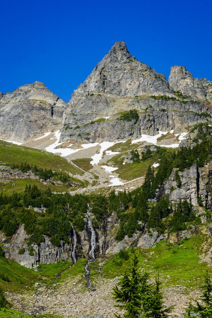
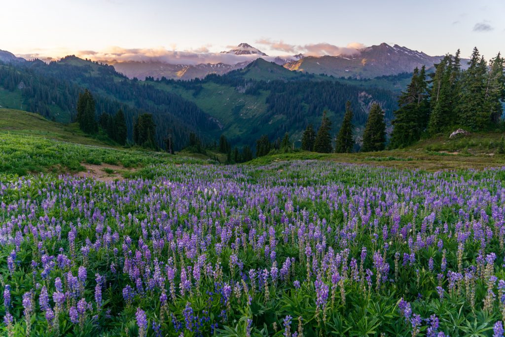
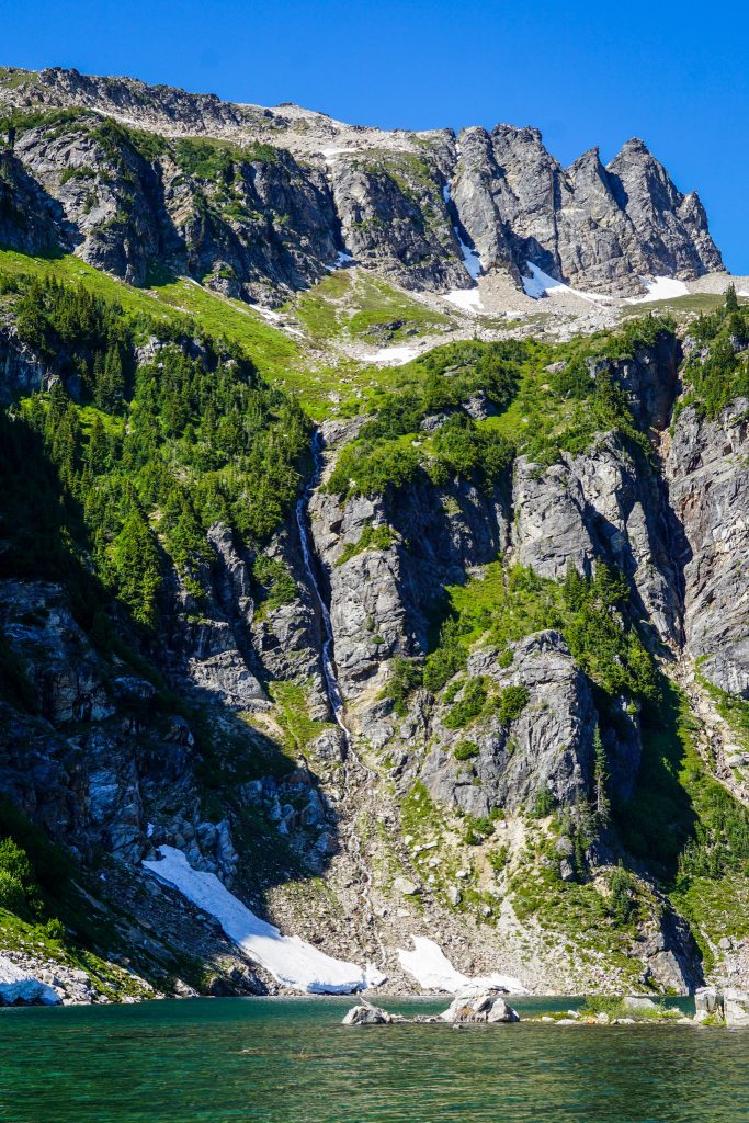
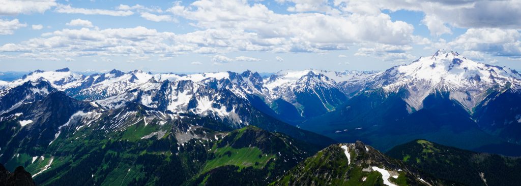
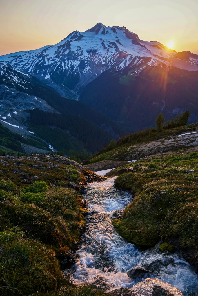
Our last big climb of the day was up to the Image Lake saddle. The temps were cooling off nicely, and we cruised up this beautiful section of trail. I knew what lay on the other side of the saddle, but Wyatt and Anthony had yet to visit the legendary Image Lake. What we saw took their breath away.
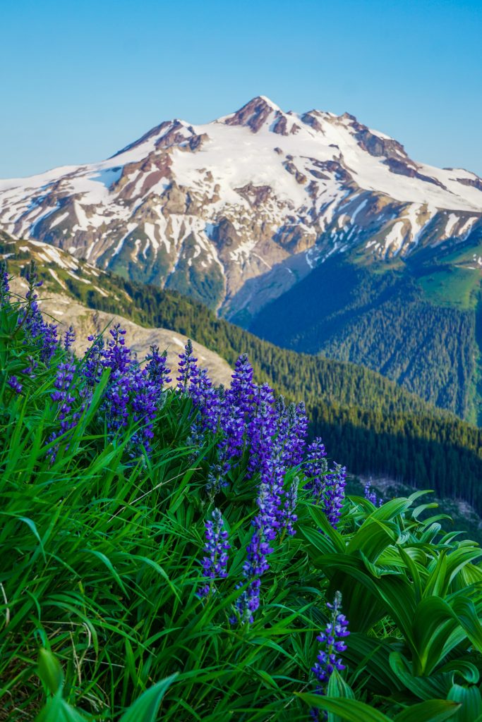
As we crested the ridge, we caught beautiful evening light on Image Lake and Glacier Peak. This little basin that cradles the lake feels like an oasis of greenery and majesty. You could not dream up a more idyllic setting. It felt like a 180 degree change from our last evening at rocky, glacial White Rock Lakes, but equally beautiful and magnificent. The diversity of the Glacier Peak Wilderness was on full display.
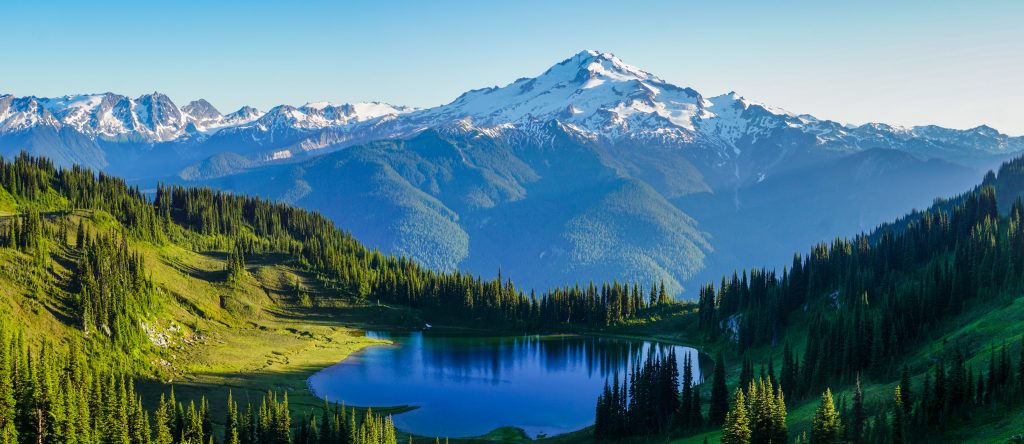
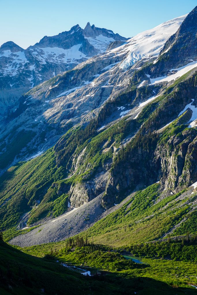
From the edge of this little basin, the terrain drops 4,000 feet to the Suiattle River, before climbing 8,000 feet back to the summit of Glacier Peak. Anthony said it completely changed his perspective of Glacier Peak. From this vantage, the prominence and scale of the mountain becomes elevated. The wilderness becomes three dimensional, impressive in its area and depth.
We also had an incredible view of the remainder of our route. Although the mountain felt close, we now had to encircle it, following the high crest of peaks surrounding the Suiattle River Valley. Our destination was close, but our journey still was long.
Wyatt and I eagerly took photos as Anthony just soaked in the views on the trail leading eastward out of the Image Lake Basin. This section of trail is as beautiful as any in the state, with fields of vibrant Paintbrush and incredible views of the Suiattle River Valley and glaciated peaks beyond. We knew we were behind schedule and would not make Cloudy Pass by dark. But instead of feeling rushed, we slowed down even more, letting the beauty of the moment wash over us. After all, the objective was never simply to complete this route; it was to experience the Glacier Peak Wilderness in a way that would stay with us for the rest of our lives.
We decided to call it a day in a beautiful little basin about a mile past Image Lake, where others were camped. We knew this adjustment would necessitate a truly massive third day to have time for a Glacier Peak Summit on our fourth day, but it felt like the right decision to prioritize sleep and just get an early start the next day.
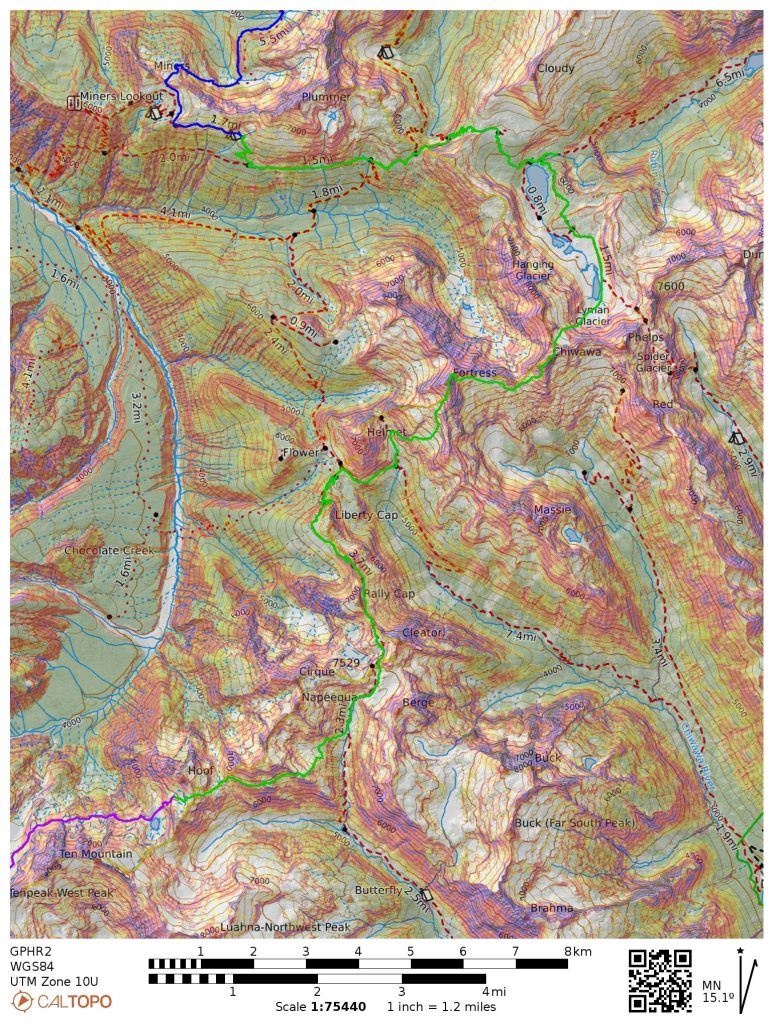
Day 3: Image Lake Area to Butterfly Lake Area
23 miles, ~10,000 ft gain, 15 hours elapsed.
We woke up at dawn and got moving shortly after sunrise. We knew we had a massive day ahead of us to make it to Butterfly Lake by sunset, but we also had a lot of trail miles.
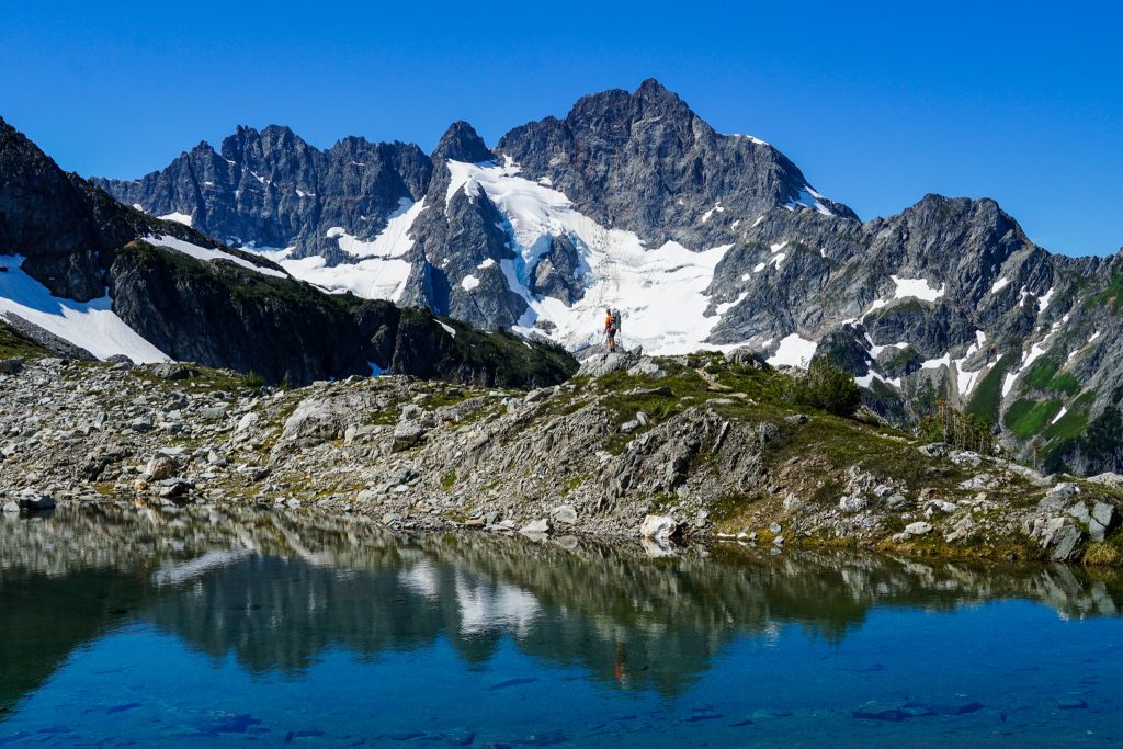
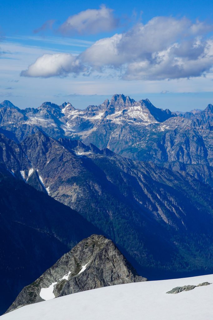
We cruised the trails over to Suiattle Pass, then the familiar climb up to Cloudy Pass, one of my favorite spots in the Glacier Peak Wilderness.
Anthony and I accidentally blew by the turnoff to Spider Gap, costing us 5-10 minutes. It was arguably the biggest route finding error of the entire trip.
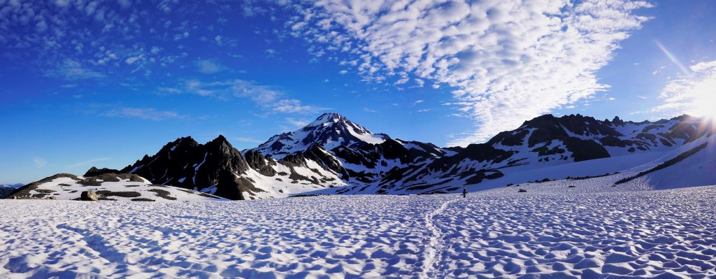
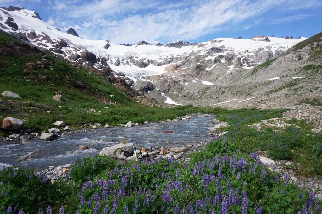
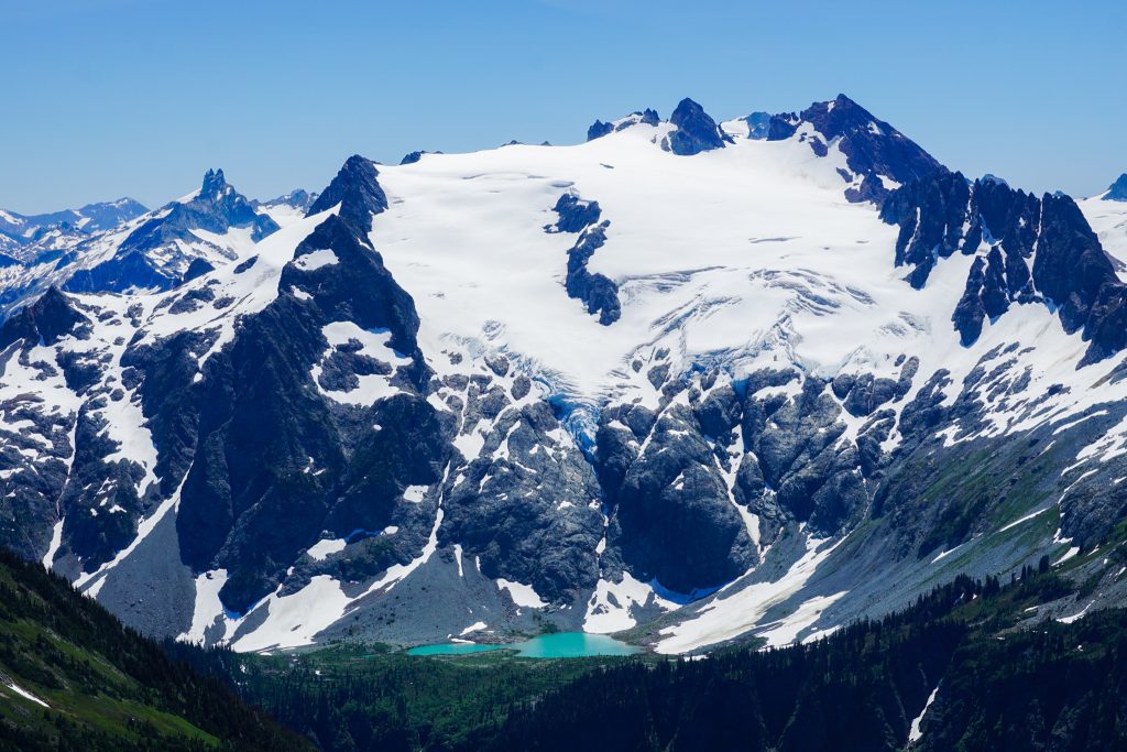
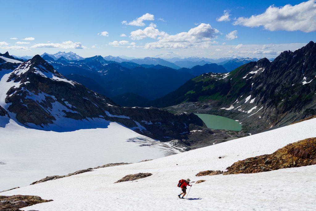
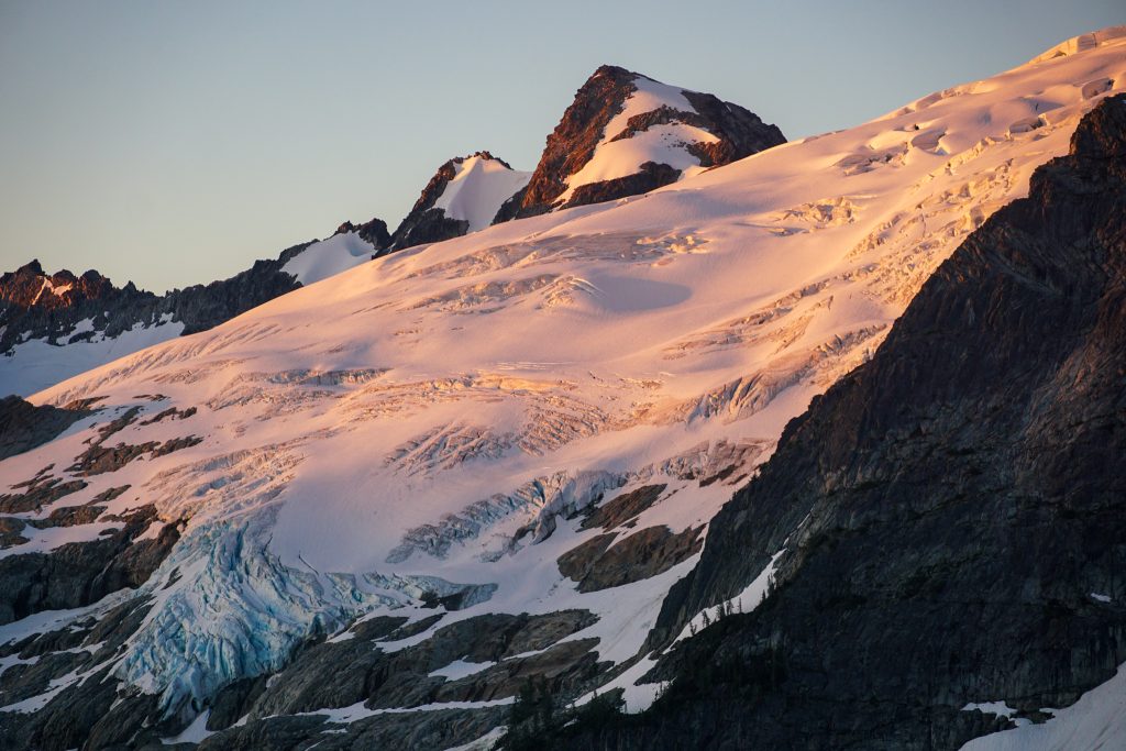
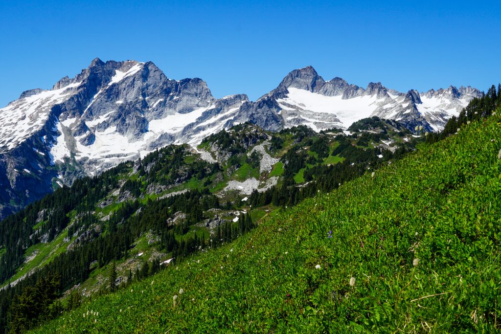
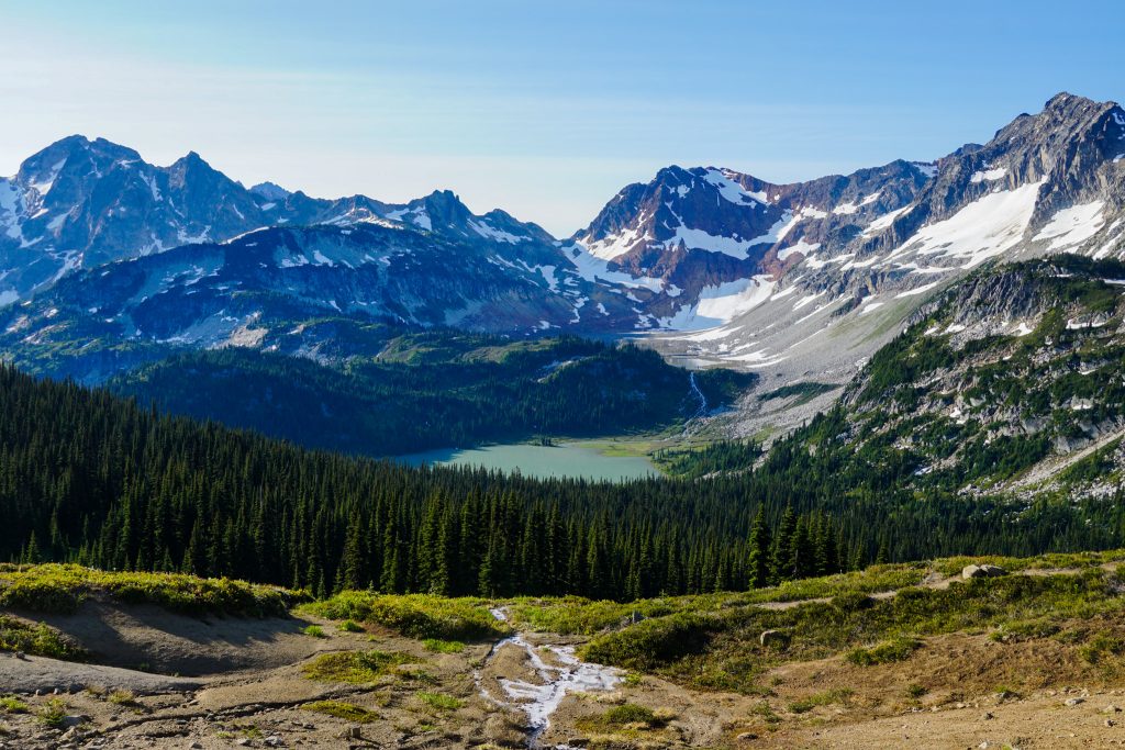
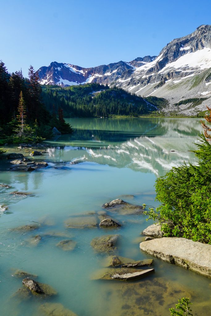
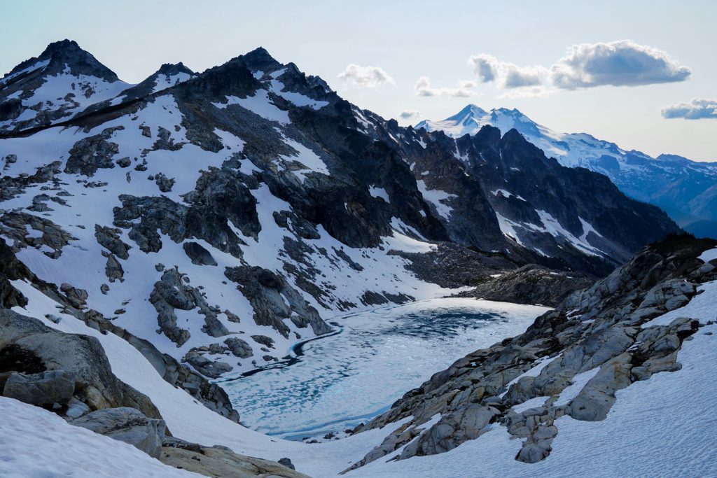
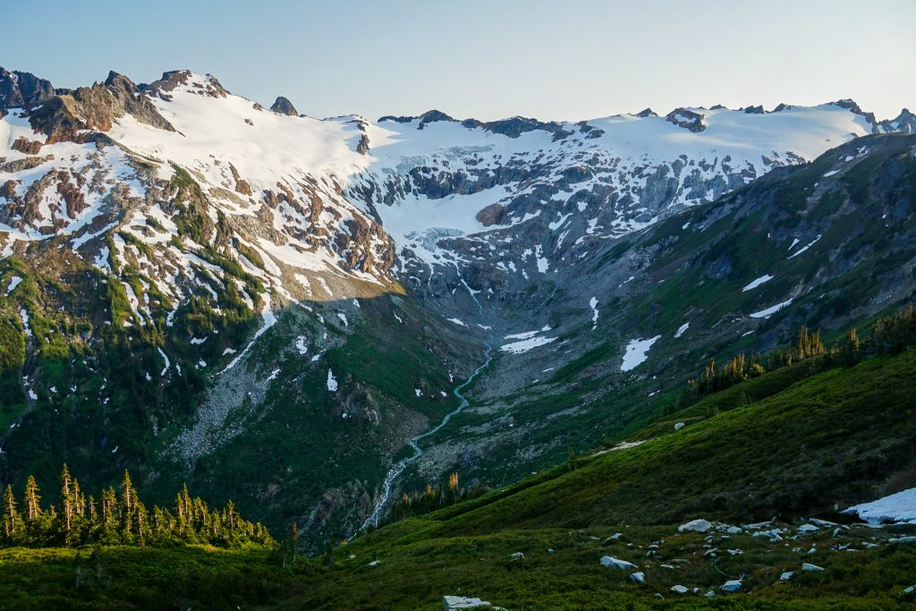
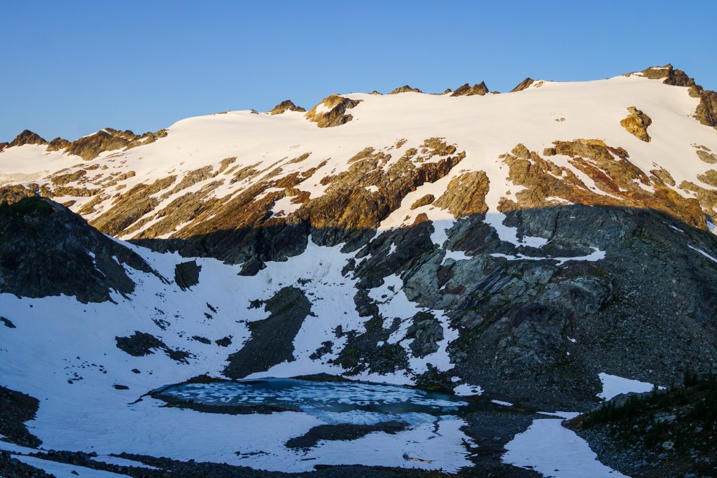
At Upper Lyman Lake, we were pleased to find continuous snow cover leading up towards Chiwawa. Once a mighty glacier miles long, the Lyman Glacier has receded to a small lower ice patch and a larger upper glacier that still has decent mass. Fortunately for us, snow fingers still connected the lower and upper patches.
We donned crampons and moved quickly through the lower part of the climb, which was exposed to rockfall from above.
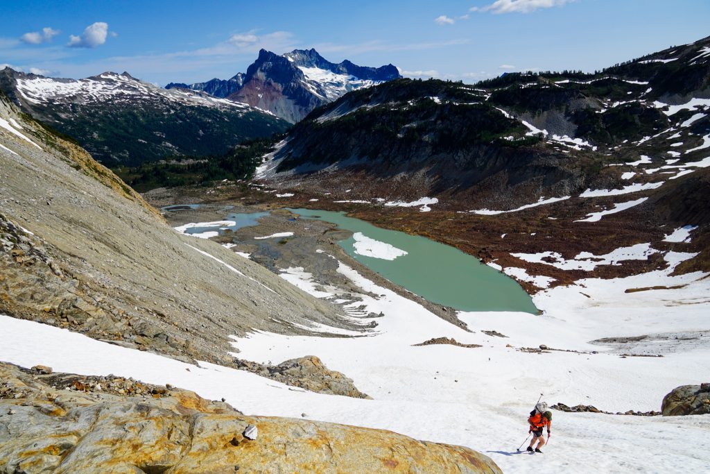
The final snow slope was about 40 degrees and just soft enough to be comfortable with our trail runners and crampons, so perhaps it was a blessing we were behind schedule! The snow led us very close to the ridge, which was great because the scree above the snow was garbage!
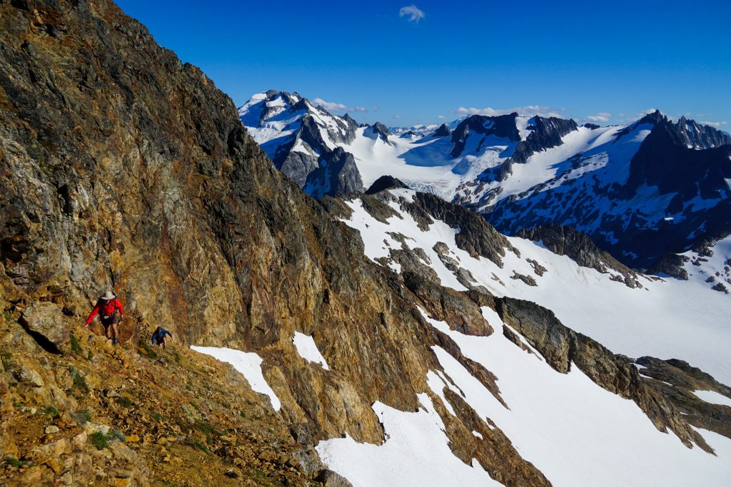
Fortunately, the ridge actually scrambled quite well. It was an easy scramble to the summit of Chiwawa.
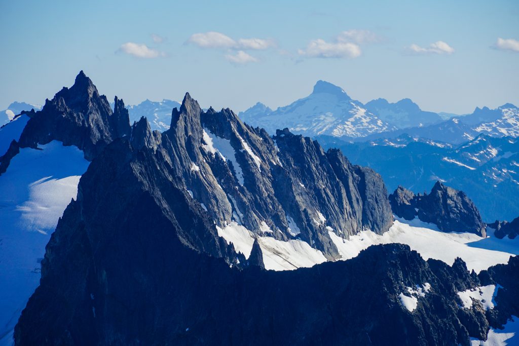
This traverse of Chiwawa and Fortress was one of the few sections of the route I had not done previously. I hoped it would go well without much beta.
It was difficult to pry Wyatt away from his summit views, but we eventually got him going down Chiwawa. The descent was pretty chossy, but we were able to stay on snow most of the way over to Fortress. There we found pretty decent scrambling on the ridge with one harder 4th class chimney. The position was amazing!
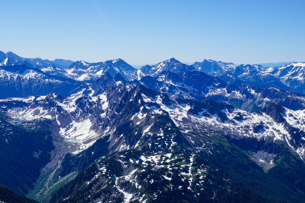
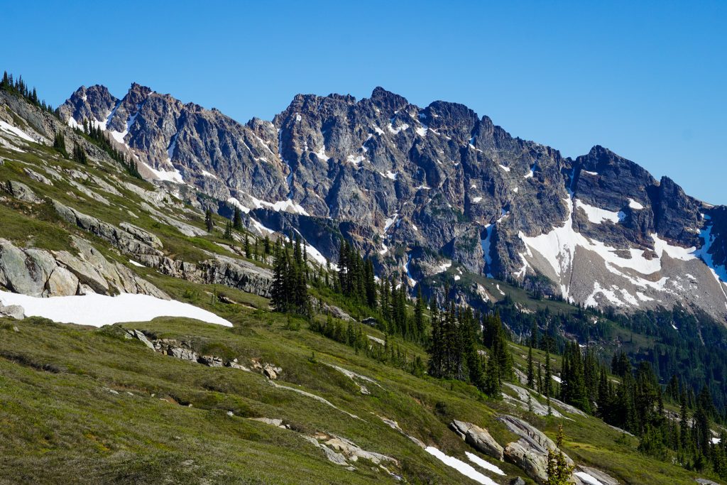
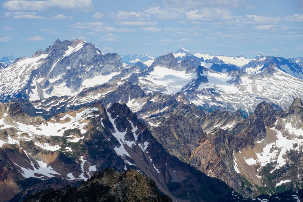
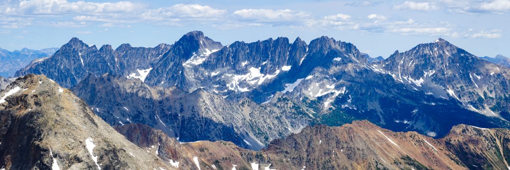
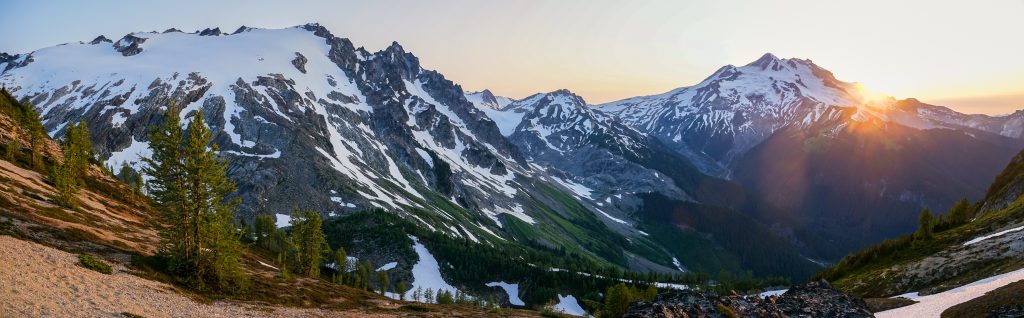
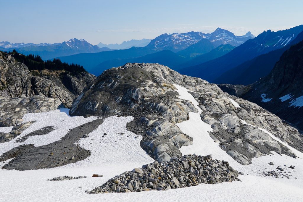
There was a slight chance of thunderstorms in the forecast, but it seemed like we would not get anything more than puffy convective clouds fortunately. Fortress is a great summit, with wonderful views of the entire Glacier Peak Wilderness.
We probably should have done some more research about how to get off Fortress, but we figured it out on the other side. There was some choss, followed by slightly-firmer-than-we-wanted snowfields, followed by more choss, followed by heather meadows, followed by steep cliffy jungly terrain. Eventually we popped out on the faint Pass No Pass trail in an idyllic little valley framing Buck and Cleator. I had passed within half a mile of this spot on the Buck Creek Pass Trail many times, but never made it up here.
We dropped down to the Buck Creek Pass Trail, briefly getting tricked by the old Buck Creek Pass Trail, which I did not know existed! The real trail was in surprisingly rough shape, probably due to the washout on the Chiwawa River Road this year. There were a few hikers camped at the pass, but none beyond towards High Pass. The initial climb up towards High Pass was almost completely buried in blowdowns at first. In half a dozen times on this trail, I had never seen it so bad!
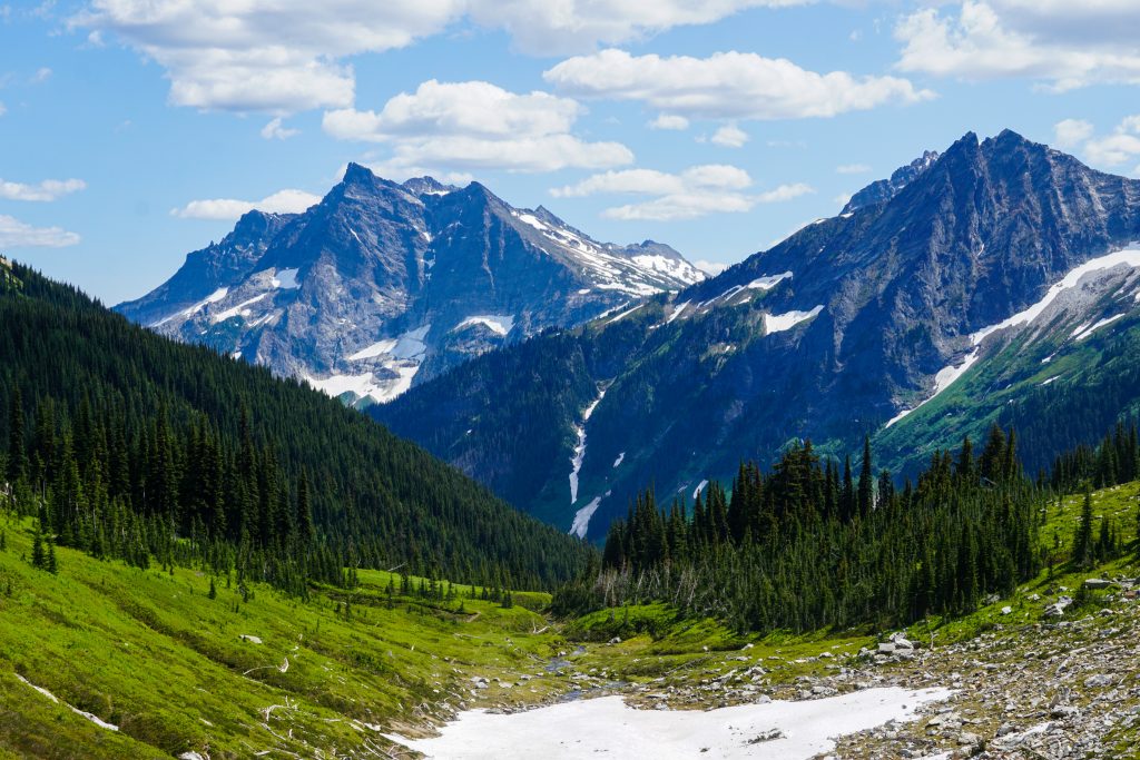
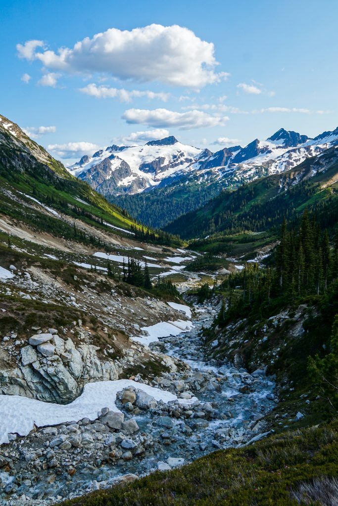
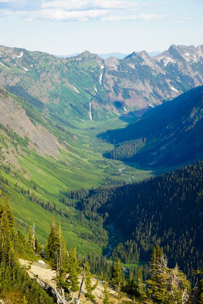
But once we entered the alpine, our morale soared. The trail to High Pass is beautiful and easy, soaring high above the Suiattle and Chiwawa Valleys. It feels like a grand ascent to the gates of the Napeequa, the most unique place in the Cascades.
The shadows were already getting long as we passed over High Pass into the Napeequa. We had to make a decision here: do we go for the high traverse over to Butterfly Lake or camp here in the hanging valley? If we camped here, we would certainly not have enough time for a Glacier Peak summit the next day. But it was not a certainty we would make it to Butterfly Lake by dark because none of us had ever done this high traverse.
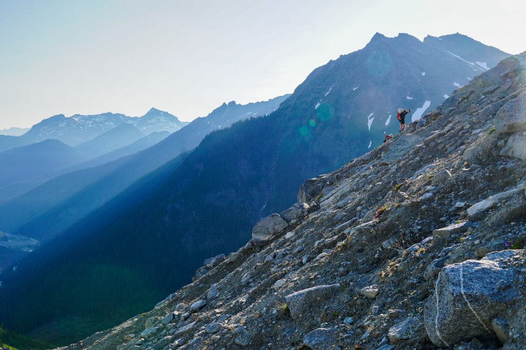
I looked at Anthony and Wyatt. We were all pretty tired, already having been on the move for nearly 12 hours already. But we all really wanted it. Who knew when we would get this opportunity again – to do the true, complete Glacier Peak High Route? I have learned that there are times to ease off the gas pedal, when pushing for an objective is not worth it. But there are goals worth pushing for, and this was one of them. Choosing your moments is part of learning how to listen to your body, mind, and the mountains. It was go time!
We followed the stream down as it coursed through tight waterways and over granite rocks. Around 6,000 feet, we cut right and sidehilled up towards a higher basin with a good deal of schwack. From here, my original plan was to climb high over Peak 7775 and continue along the ridge southwards. But Anthony noticed some animal trails climbing up the grassy shoulder to our left towards the window of light beaming through the granite ridge. Wyatt checked his map and noticed a possible sneak around on the south side of Peak 7775 that would save us nearly 1000 feet of climbing. We decided to make a last minute audible and go for the sneak around. Take a risk, take a chance, make a change… and breakaway!
I rushed up the ridge, eager for the what I knew lay on the other side. And it did not disappoint.
We stood across the valley from the most remarkable landscape: a wonderland of green hillsides, interwoven glaciers, rocky peaks, and pumice deposits. The Napeequa is such a magical place because it is the confluence of all of these elements. And as we traversed across the hillside, high above the valley, it felt like we had front row seats to the grandest show in the Glacier Peak Wilderness.
This was the only part of the trip where I got emotional. I had rehearsed the route so many times in my head. I had visited most of the sections before. And yet I was still not prepared for how powerful this moment felt. I did not realize how beautiful it would all be. There are dreams and there is reality, but at this moment, it felt like I had confused the two. What is there to say when reality is even better than your dreams?
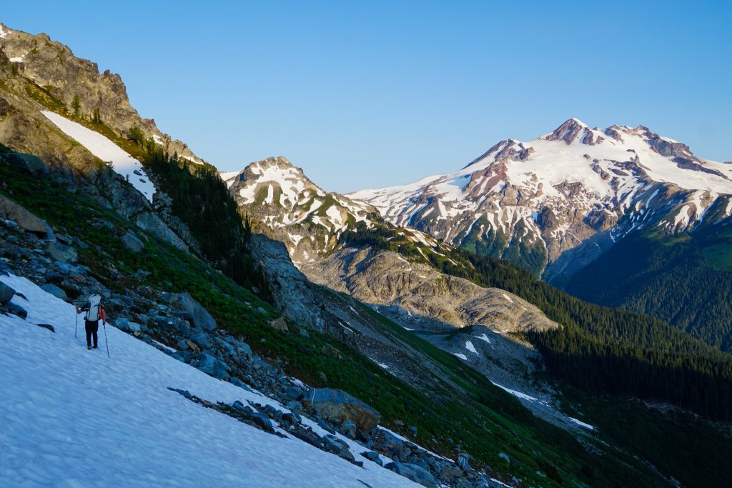
The “Napeequa Sneak” worked brilliantly. We stayed generally around 6900 ft until descending to a col and grinding out one last 700 ft climb over the south shoulder of Hoof Peak. It was the first time I ever saw Wyatt outwardly express fatigue. We were going to make it, and in epic fashion.
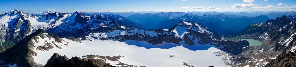
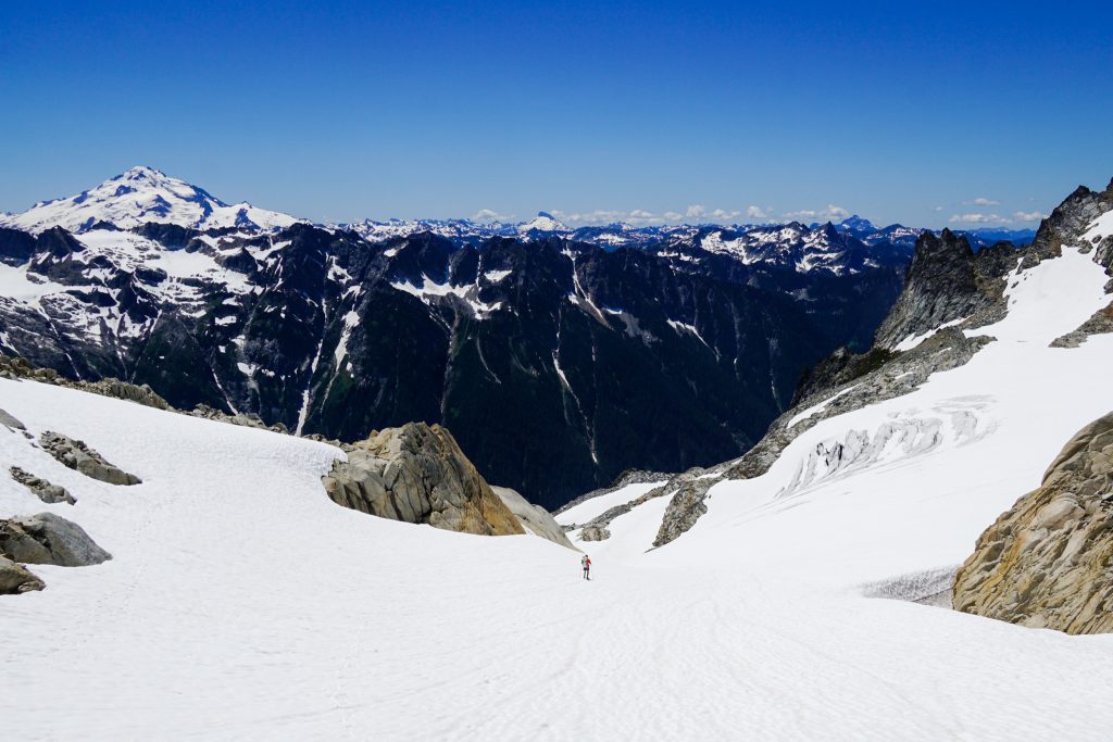
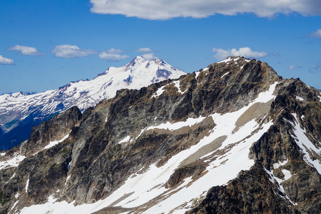
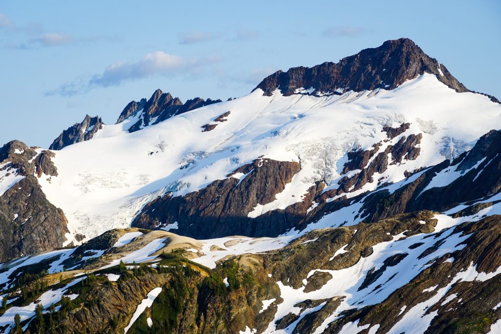
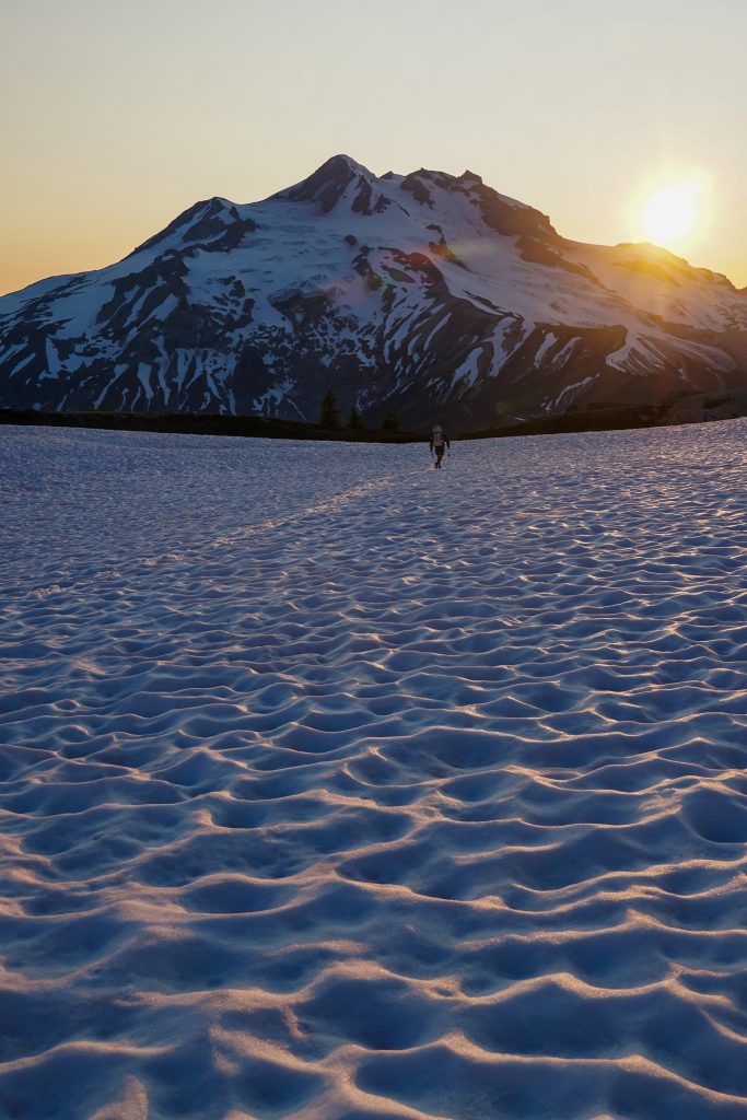
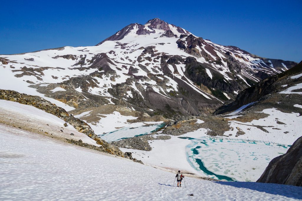
We arrived on a flat, pumice filled ridge with an incredible vista of the Butterfly Glacier and once again, Glacier Peak. It felt like a different world out here. After mustering up our reserves of strength to get here, we all just stopped to soak it in.

As Anthony basked in the evening glow, modeling for the photographers, he exclaimed, “I think I found the best campsite in the world!” The best campsite in the world?! How could that be possible?
Wyatt and I crept up to the edge and laid eyes on what may be the best campsite we have ever seen. A small dying glacial cirque gave way to a stream splitting a flat pumice bench, surrounded by larches and the most epic view of Glacier Peak. If only it had a hot spring, it would truly be heaven.
We called it “Camp Glacier Surprise”. It was a special surprise none of us saw coming. When you think you have seen it all, you have barely scratched the surface.
It took a tiring 15 hours, but we made it. We had set ourselves up for a Glacier Peak summit and exit the following day. We sprawled out in the comfortable pumice and soaked in the last bit of sun before going to bed.
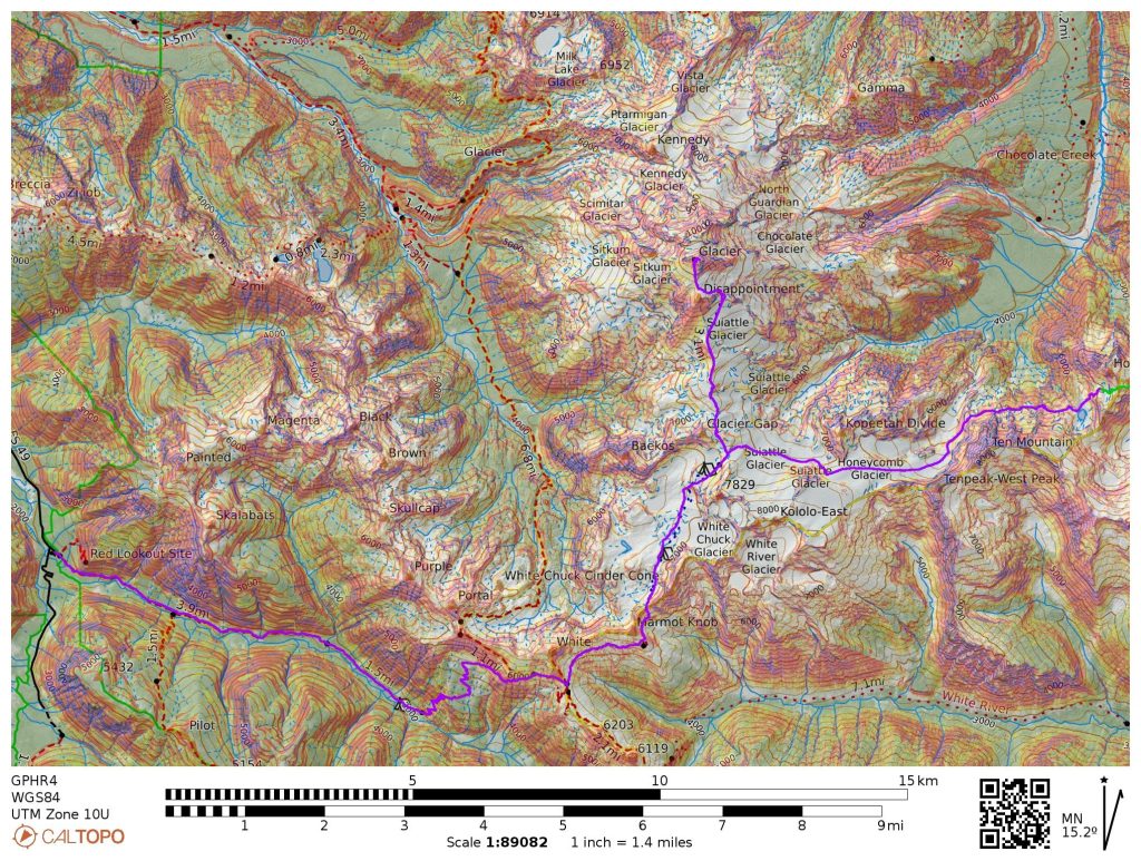
Day 4: Butterfly Lake Area to North Fork Sauk Trailhead
26 miles, ~7600 ft gain, 14 hours elapsed.
After three long days and nearly 30,000 feet of gain, our bodies were tired but surprisingly not sore. We packed up quickly and descended to Butterfly Lake before beginning the long traverse over to the Honeycomb Glacier.
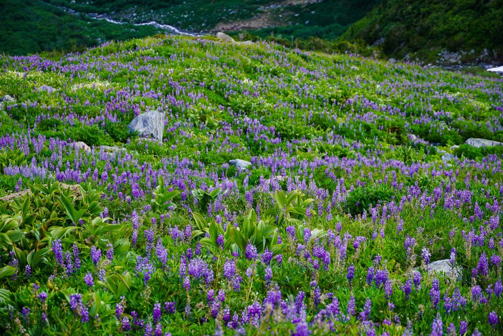
There were some steep snowfields to cross, but fortunately they were already soft so we did not need to put crampons on. The traverse begins innocuously enough, traveling through boulders and beautiful lupine fields.
As we approached a cliff, we had to descend to get beneath it. Anthony thought we were going to get cliffed out, but I had done this traverse four years ago in the other direction, so I knew it would work.
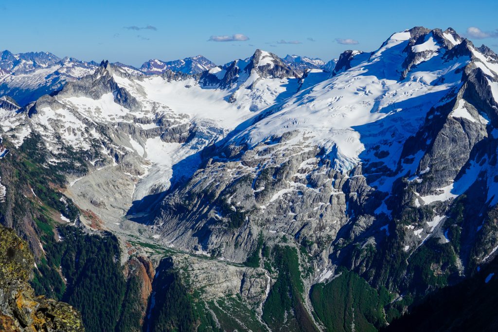
After this section, there are endless ups and downs through fresh moraines beneath Tenpeak. This section is quite tedious.
Once we reached the overlook of the Honeycomb Glacier lake, we still had another moraine to descend across before finally reaching snow. This route would have been a bit easier 50 years ago and will only get more tedious as the glaciers recede.
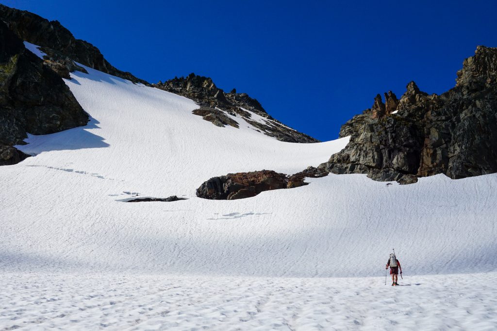
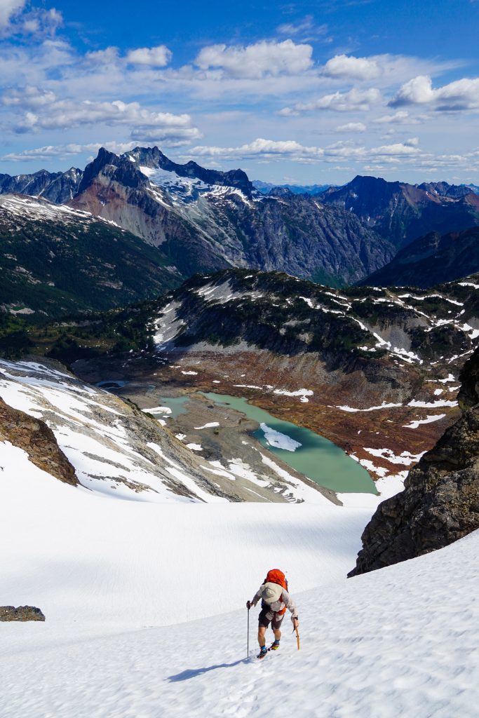
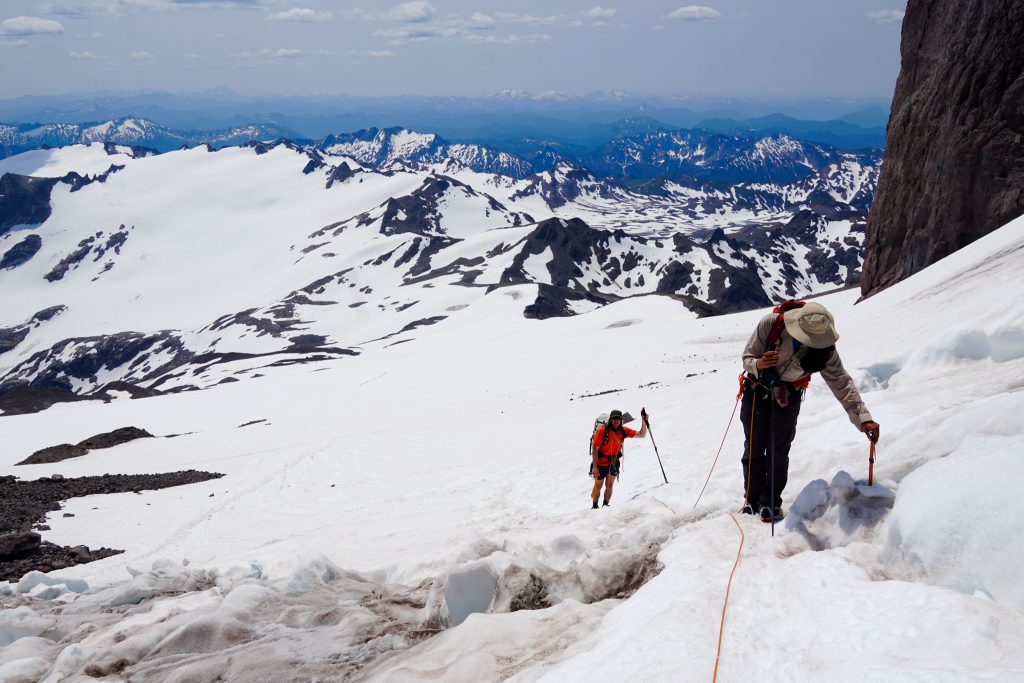
Once on the glacier, we roped up and crossed over to the Honeycomb/Suiattle col. The snow was already soft and breaking trail was tiring in the slushy snow. There was a brief rock transition between the glaciers.
There was surprisingly an old bootpack higher on the Suiattle Glacier heading to Glacier Gap.
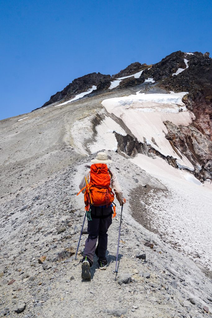
Glacier Gap was a ghost town. It was July 4th, the last day in a four day weekend. I imagine it had been packed during the previous days, but now there were only a few others spread out on the mountain. We ditched our overnight gear and headed for the summit.
It was hot and hazy as we ascended the Suiattle Glacier. We watched rocks tumble off Disappointment Peak and run across the bootpack – then we booked it through the hazard zone.
The crossing to the Cool Glacier was definitely more broken up than my visit in July 2017. There was a little bit of blue ice and a few sagging snow bridges and holes.
Once off the Cool Glacier, it was just a sandy slog to the summit. Anthony and I were once again reminded why walking up dry volcanoes sucks. Wyatt, sensing the ultra-prominence and feeling zoomy after making Anthony and I break trail all day through wet snow, left us behind.
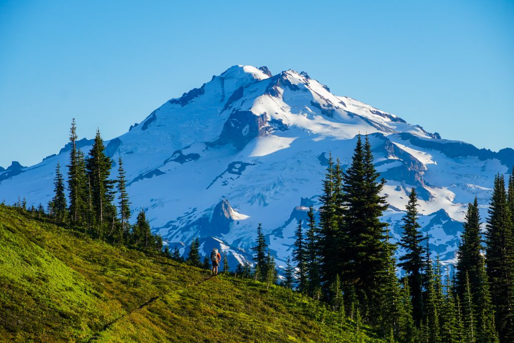
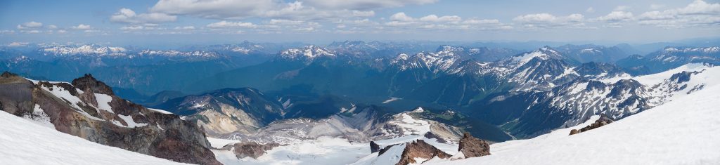
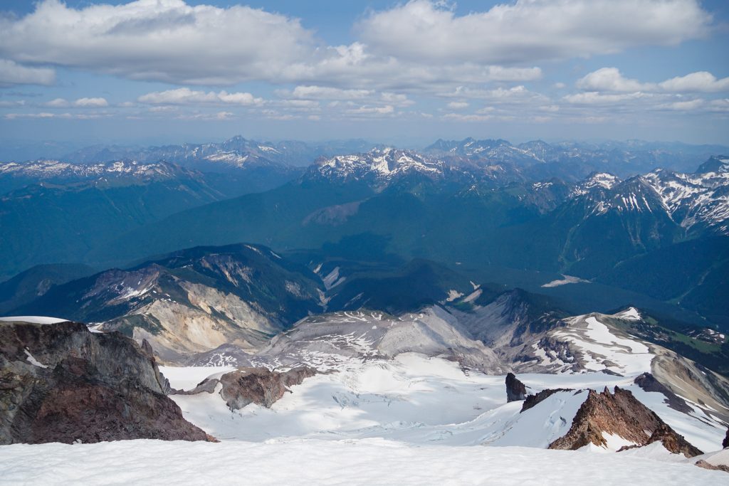
After moving through such incredible terrain for three days, the summit of Glacier Peak felt a bit anti-climatic. Like the other volcanoes, Glacier Peak suffers from being a little too high, making the views feel a bit like being in an airplane. The sky was also hazy from BC wildfires. But it felt fitting to stand on the summit after approaching it for three days. It felt proper.

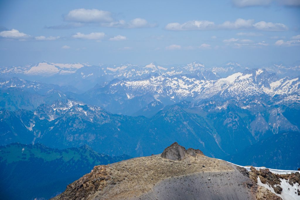
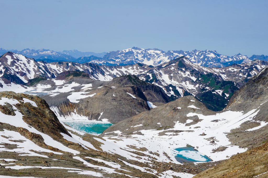
Wyatt and I went over to the shorter eastern summit for a panoramic view of the entire Glacier Peak High Route. It truly was impressive.
It was now time for the long descent to the North Fork Sauk Trailhead. I was surprised how well my body was holding up, but expected a crash any time now.
It was a soggy slog in wet snow back across the Whitechuck Glacier moraine. As we climbed out of the basin, it was time to say goodbye to the Great Parent.
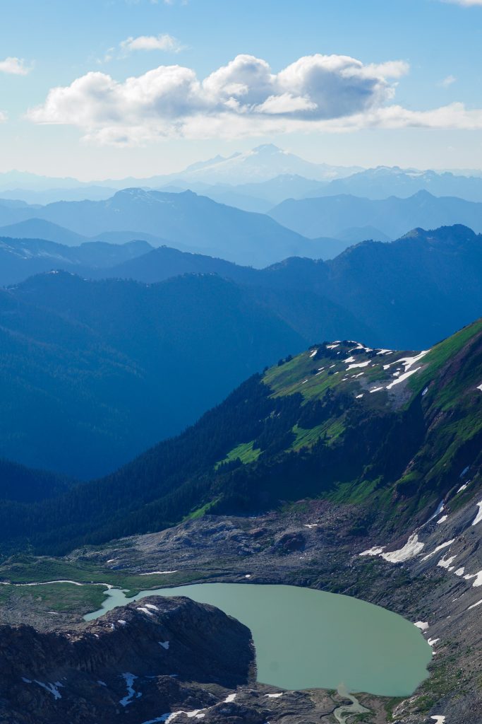
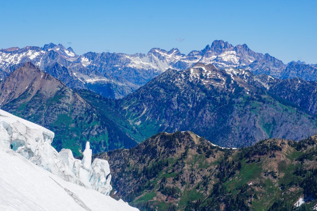
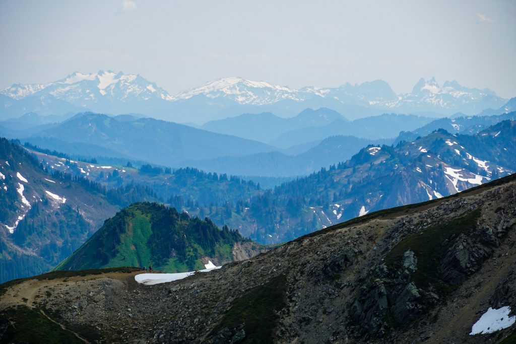
To our south lay a mosaic of ridges, green hillsides, and valleys all the way to the Alpine Lakes Wilderness. The mountains had changed once again. Glacier Peak definitely feels like the southern terminus of the North Cascades.
At White Pass, Anthony and Wyatt started jogging and left me behind. My knees and ankles really started to feel it on the long descent to the valley.
Once at the valley bottom, I had 6 miles of rolling terrain to myself to reflect on the trip of a lifetime. I thought back to the first time I set foot on this trail: a wide eyed 17-year-old hauling up his dad’s old backpacking gear that was older than him, just excited to see Glacier Peak up close. Nearly ten years later, I walked out of the wilderness having seen with those same eyes such magnificent beauty that my 17 year old self could never have even fathomed. It felt like closing out a chapter in my life, coming full circle.
The Glacier Peak High Route is not just any ordinary high route to me – it is a layer of stories woven together. The route itself had a storyline – seeing the mountain from so far, encircling it, and finally climbing it. This multi year journey of piecing the route together is my story of pursuing inspiration and a creative vision. The Glacier Peak High Route is the most aesthetic high route I could dream of in the Cascades – the finest line. It took half a decade, but I finally made that dream come true. Thank you, Wyatt and Anthony, for sharing with me an experience I will cherish for the rest of my life.
Epilogue
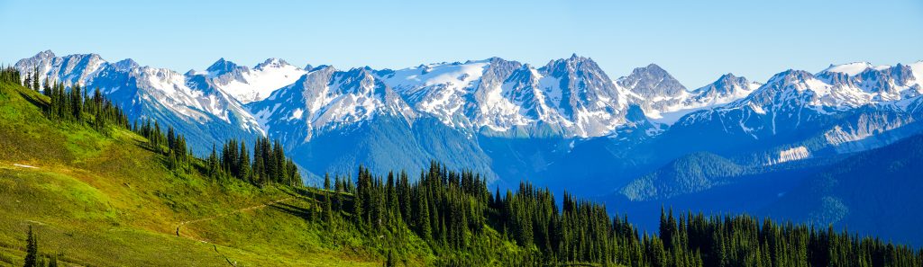
The Glacier Peak High Route is an amazing, diverse, and challenging route. While no section exceeded class 4 scrambling or standard glacier travel, you need to be efficient in so many skills – route finding, scrambling, glacier travel, etc. But for experienced high routers, I do believe it represents the most continuously beautiful weeklong high route in Washington and possibly in the lower 48.
In my opinion, the most challenging sections were:
- Descending the Chikamin Glacier. This is the most serious glacier on the route and the descent is rather “blind”.
- Scrambling up the east ridge of Fortress had some moderately exposed fourth class moves on decent rock. The challenging sections are short, however.
- Traversing beneath Tenpeak to the Honeycomb Glacier has a lot of ups and downs and annoying terrain.
For footwear, we all used trail runners (Ultra Raptors, Bushidos, and Cascadias) with waterproof socks, changing to dry socks when not on snow. This strategy worked well and kept our feet warm enough with all the wet snow. We used strap on crampons, although if bringing aluminum crampons you should be okay with them on short sections of rock since there are frequent transitions.
We brought a light glacier kit with harnesses, rescue gear, and one 30m rope (highly recommend the Petzl RAD system). We did not bring helmets, choosing to be very careful through the few sections with real rockfall hazard.
Our seasonal timing was absolutely perfect. The north facing trails (like Cloudy Pass, High Pass) were nearly completely snow free, but we still had good coverage over chossy sections on the Ptarmigan Traverse and on the glaciers. In another few weeks, certain sections like the climb up Chiwawa would become much more sketchy and tedious. Typically, perfect conditions exist probably later in July, but this year is a low snow year.
Curious about what gear we used? See this post about my favorite high route gear.
I’m still buzzing over that adventure… What a journey! Thanks for all the hard work in putting it together.
Randy Sun
Thanks Randy!
I climbed Glacier Peak for the first time this past weekend via the standard route (North Fork Sauk, Gerdine and Cool Glaciers). I come from a thru-hiking background and recently got into peak bagging with Mounties scrambling and climbing. Found this story on PNW Peakbaggers. Thank you for putting into words my transformative experience on this particular climb… How it reconnected me with the PCT, not just the tiny section at White Pass, but emotionally. It’s so easy to focus on the peak, and forget it’s all about the journey getting there. Thru-hiking is very similar. Thanks for sharing your words and images!
I agree Kurt, thru-hiking is all about the journey. I consider these longer high routes thru-hiking and that definitely was an element of the Glacier Peak High Route.
Hey Kyle,
Great trip report. And great photos! My brothers and I are planning to do the “extended ptarmigan” that you’ve previously described next week (starting Sunday, July 30). I’m on the fence about bringing crampons or if I could get away with micro-spikes? What do you think? I think the main concern I have is the Chikamin.
Hi Seth,
I would definitely bring crampons, and steel crampons if you have them. There will be bare glacial ice on the Le Conte Glacier and possibly in other points. Things are probably at late August / early September conditions already!
Wonderful story and photos, I love your passion for this place!
Thank you Jon!
This was a fantastic read! Thank you
Thank you Torry!
Great photos as always, and enjoyable reading! I could clearly sense your mastery of the place, in the sense of being familiar enough to navigate without a map, and to pick logical lines that usually work. Quite a bit of the terrain is unfamiliar to me, particularly between Spider Gap and Dome, because it’s far from a trailhead and lacking in major peaks (well, Le Conte…), but I could mostly follow along.
Four 10k days back-to-back is a brutal pace, especially in that terrain.
Thanks Sean!