
Table of Contents
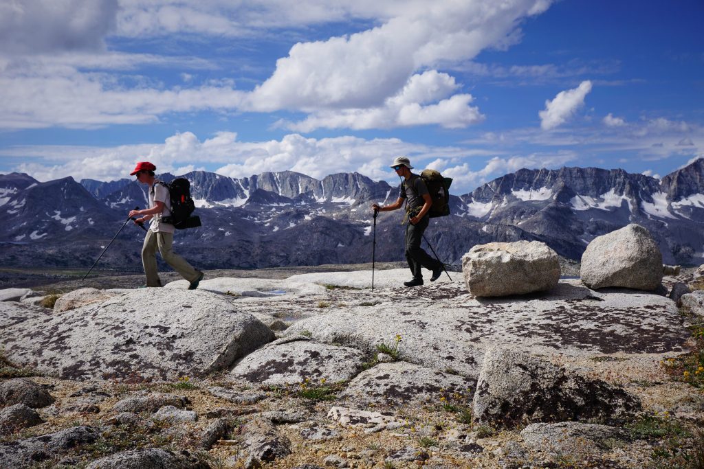
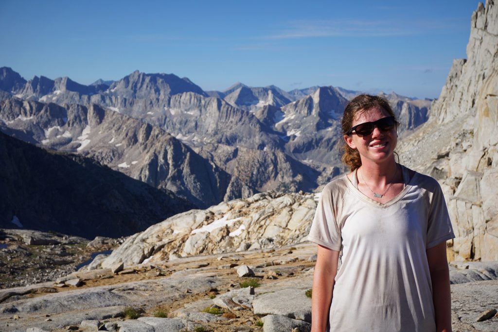
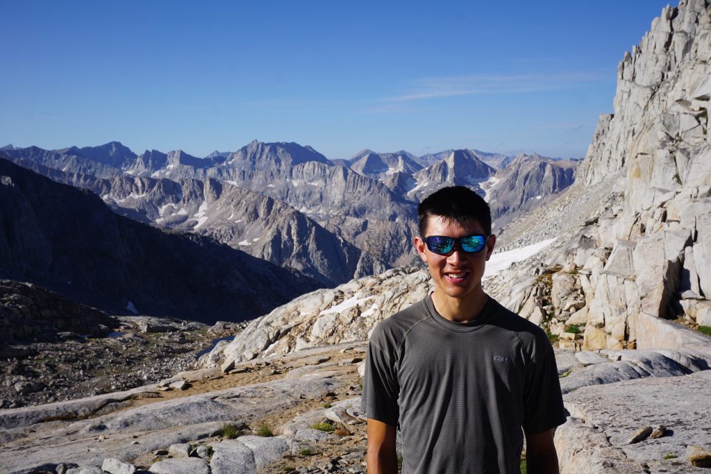
The Trip of a Lifetime
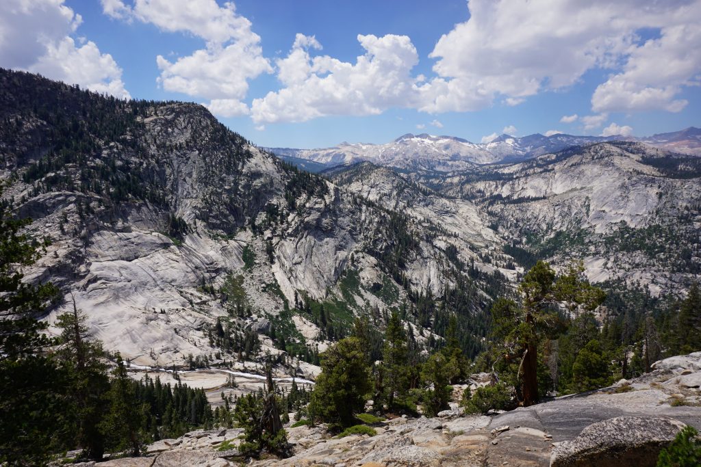
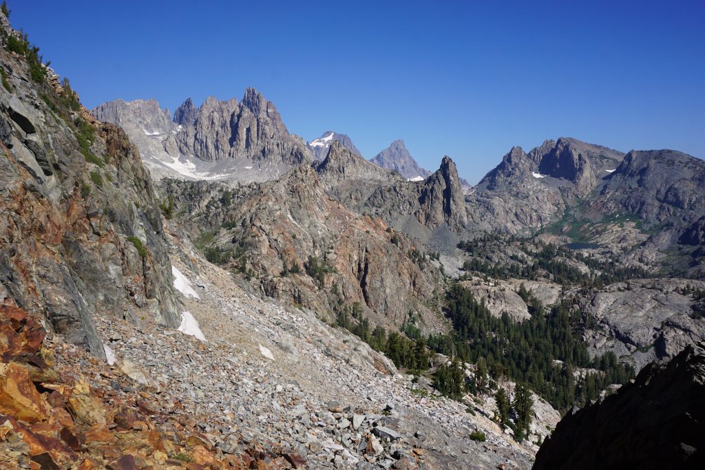
Going into the summer, we had some grand plans, but nothing compared to our goal of completing the Sierra High Route (SHR). The route travels over 200 miles, mostly off trail, through some of the most continuous and beautiful alpine cross country terrain in the world. Although similar to the popular John Muir Trail, the SHR is much more difficult both physically and navigationally. We felt it was the perfect combination of hiking, scrambling, and navigational challenges to fit our skill set.
To make car shuttling easier and to cover more terrain, we decided to combine the Sierra High Route with the Southern Sierra High Route (SoSHR) to make a Super Sierra High Route (SuSHR). Our plan was to leave a car in Whitney Portal, take transit/hitchike to the Saddle Bag Lake Trailhead, meet the SHR near the Conness Lakes, and spend the next 13 days traveling all the way to the summit of Mt. Whitney. In all, it would total to approximately (we did not track anything) 220-230 miles and 55-65k ft. gain, mostly off trail. We knew it was an aggressive plan; Steve Roper, the author of the SHR, advises over twice that time for the SHR alone. But we knew that if we pulled it off, it would be the trip of a lifetime.
Day 0: Transportation, Join SHR at Cascade Lake
Our day started at 5:00am in front of the McDonald’s in Lone Pine Peak. We had arranged to park our car in front of the film museum for the next two weeks, and we were taken the Eastern Sierra Transit shuttle to Lee Vining.
The shuttle was so full! It was filled to capacity at the first stop! So each additional passenger at all stops had to stand in a shuttle designed without standing space. Moral of the story: buy a ticket in advance; and maybe you will get a spot on the bus.
When the shuttle got to Bishop, they had everyone board a second bus that was already full! Everyone was in a uproar! The entire debacle delayed our arrival in Lee Vining by almost two hours. Fortunately, the Yosemite shuttle was delayed by 1 minute, so we still made it in time.
The Yosemite bus driver was awesome and allowed us to get off early at Saddlebag Lake. We were a little worried we might have to walk 5 miles on the road, but almost immediately a big truck came offered us a ride in the back.
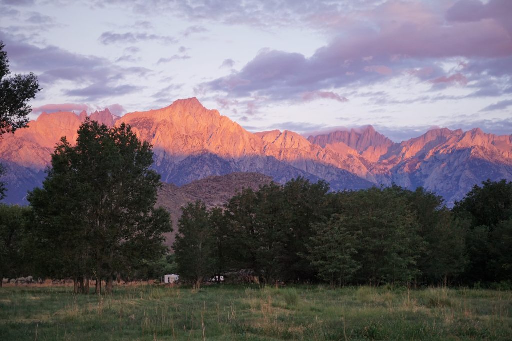
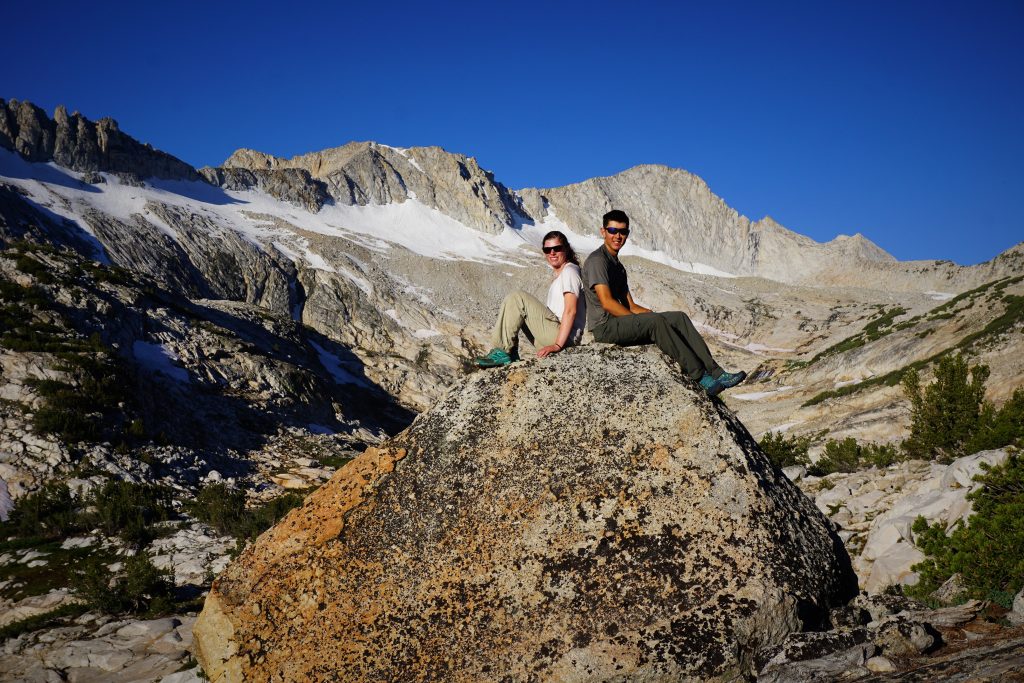
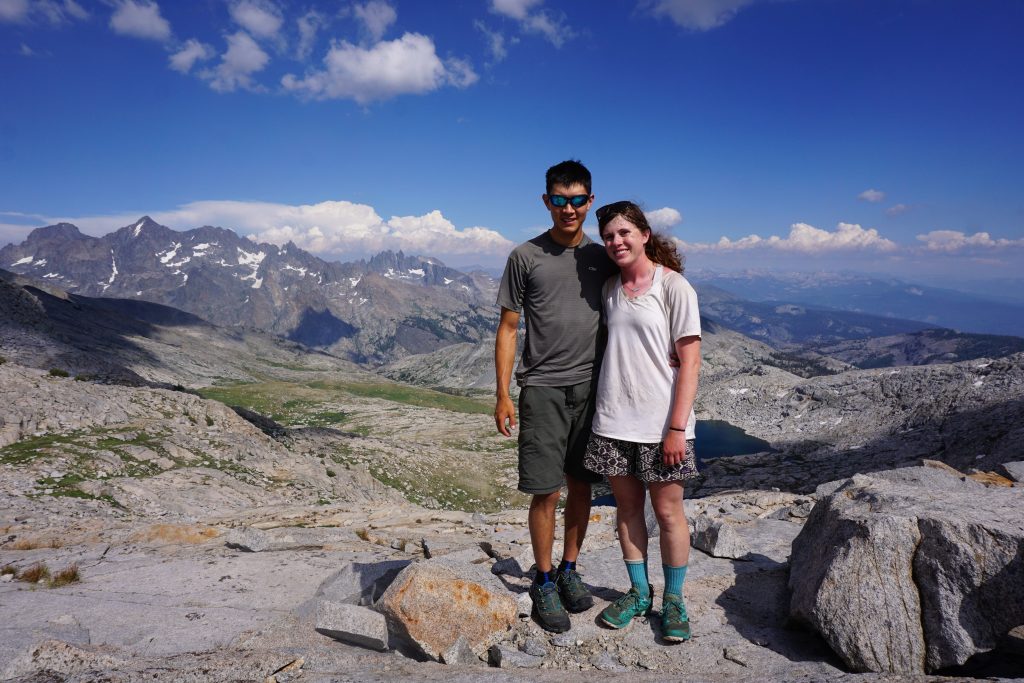
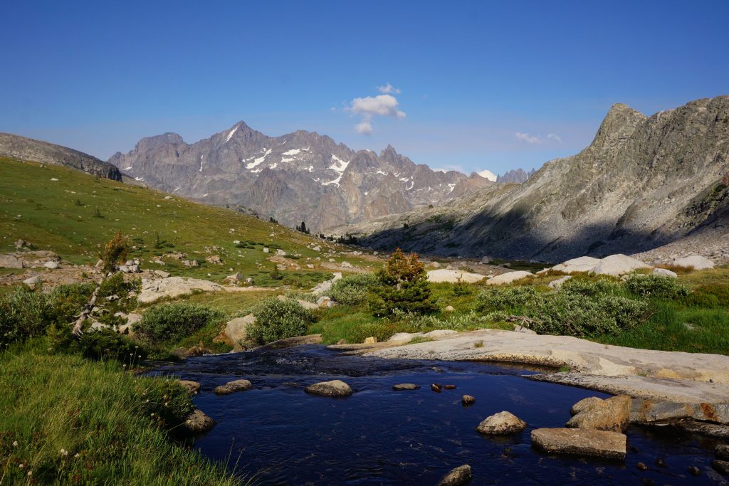
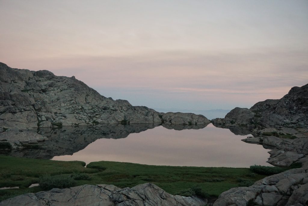
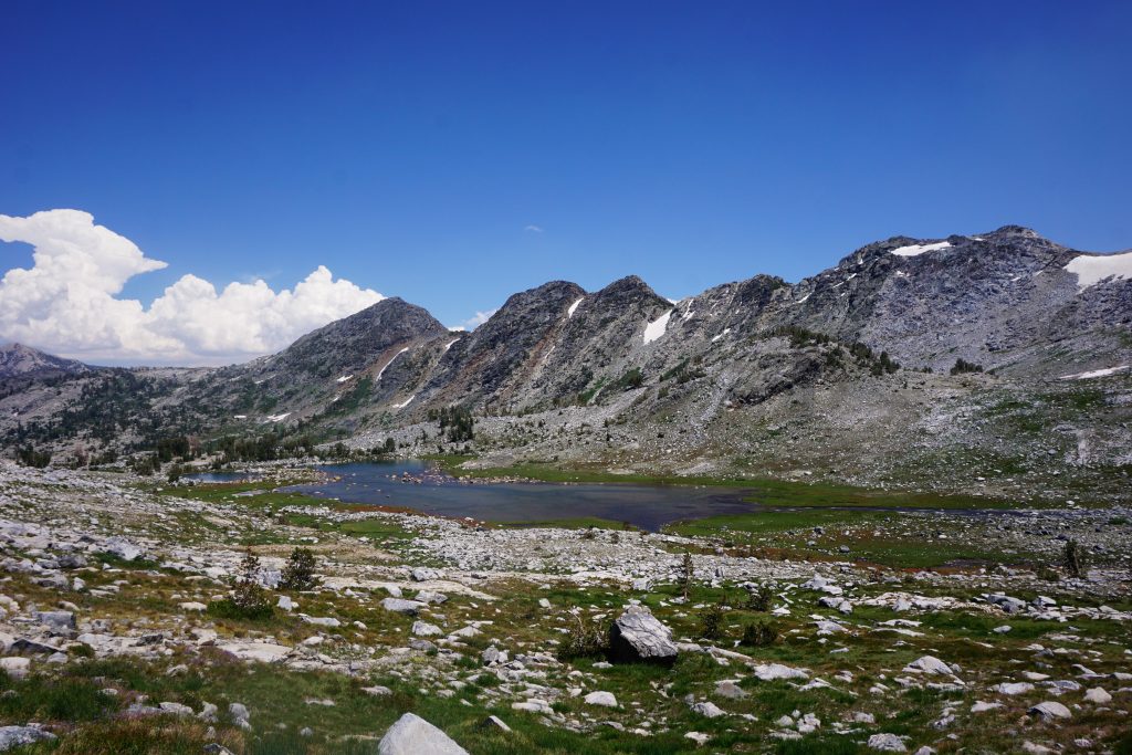
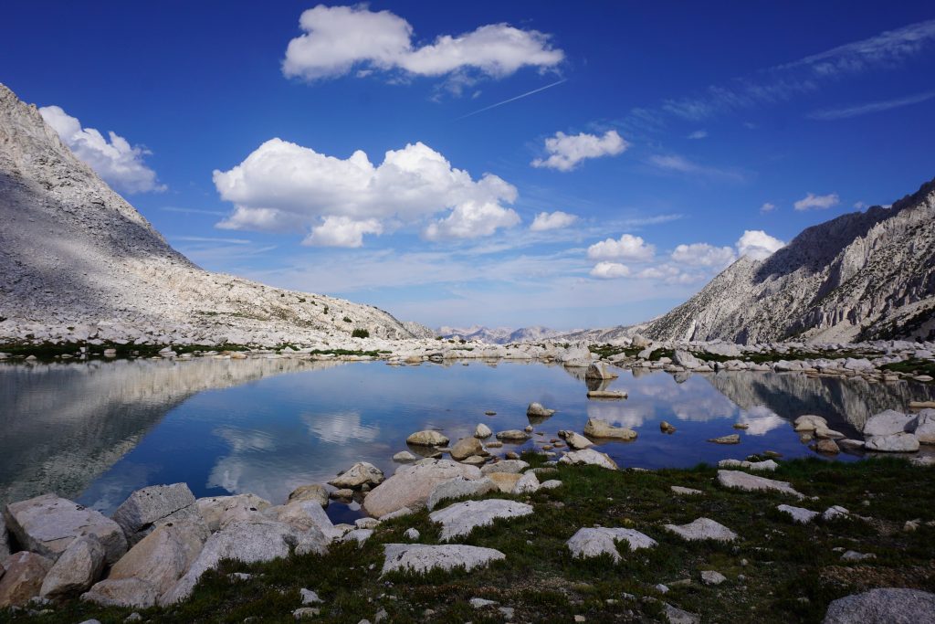
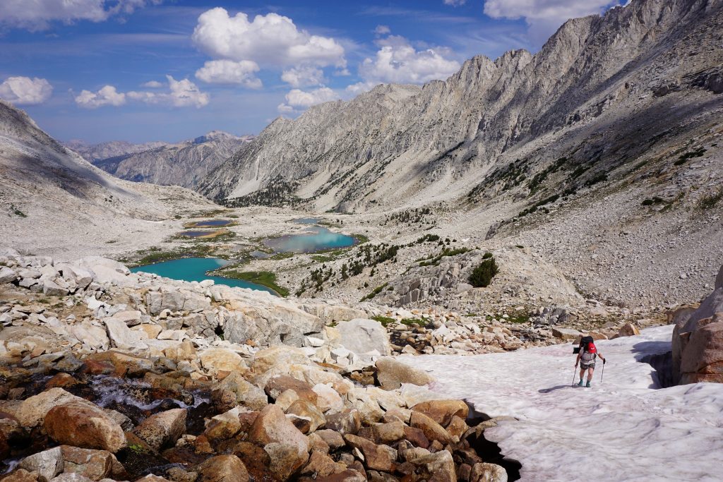
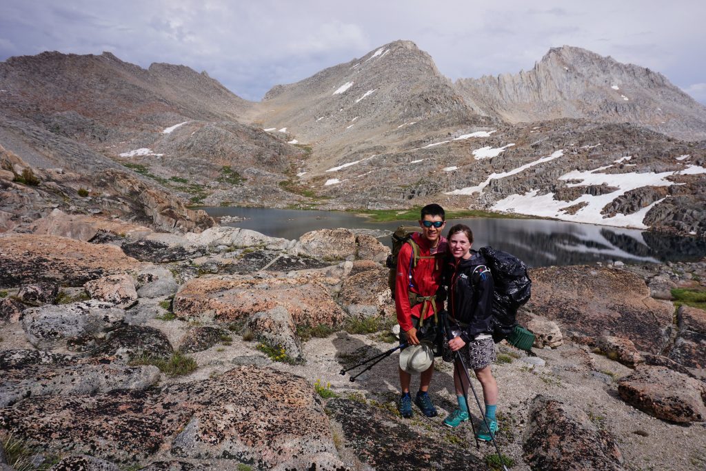
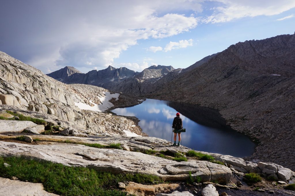
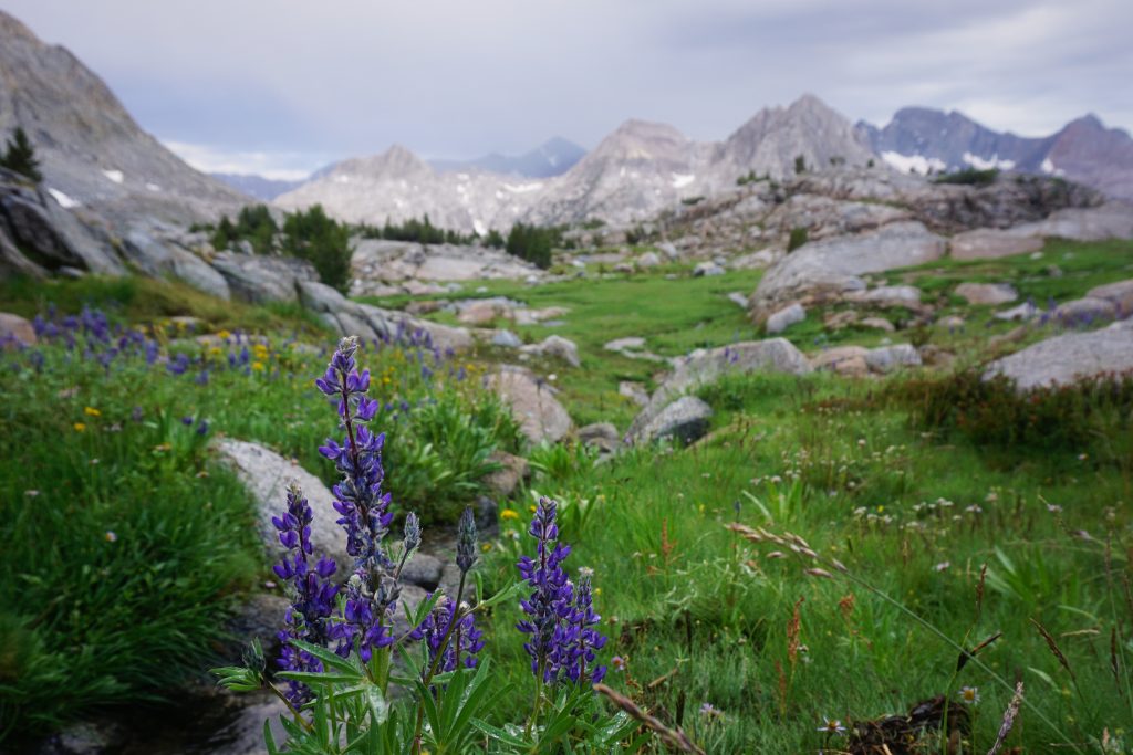
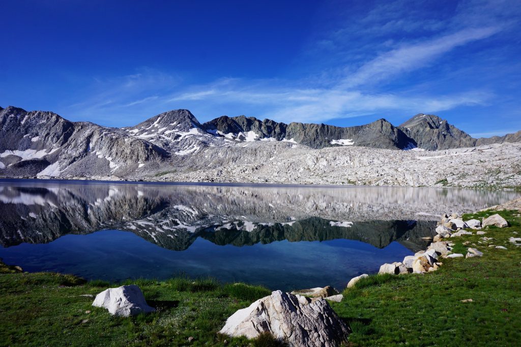
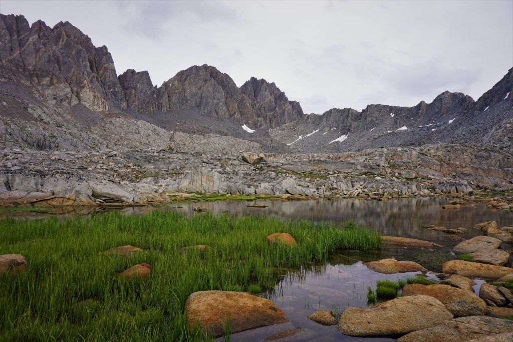
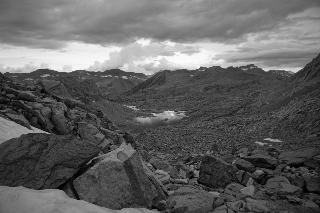
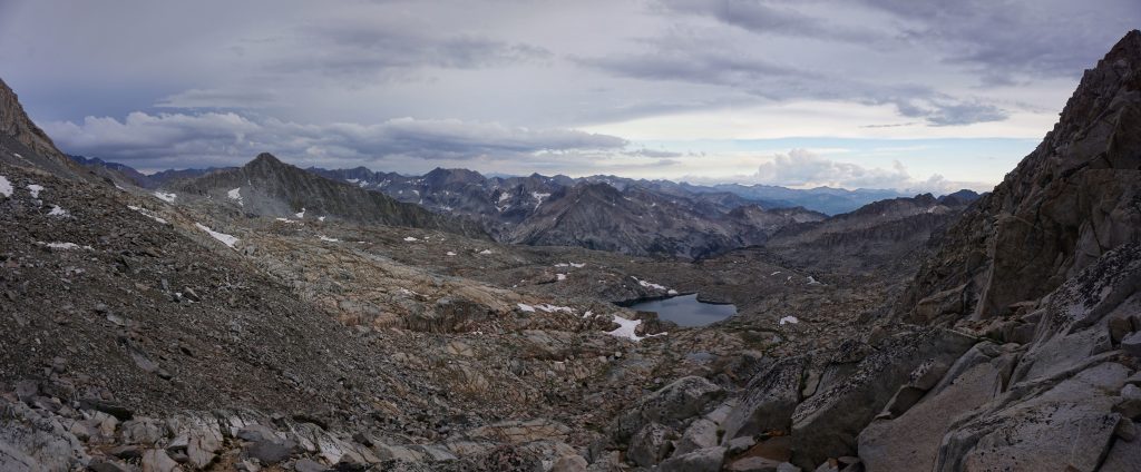
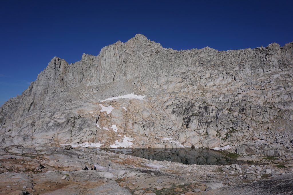
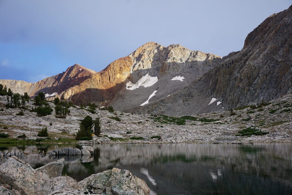
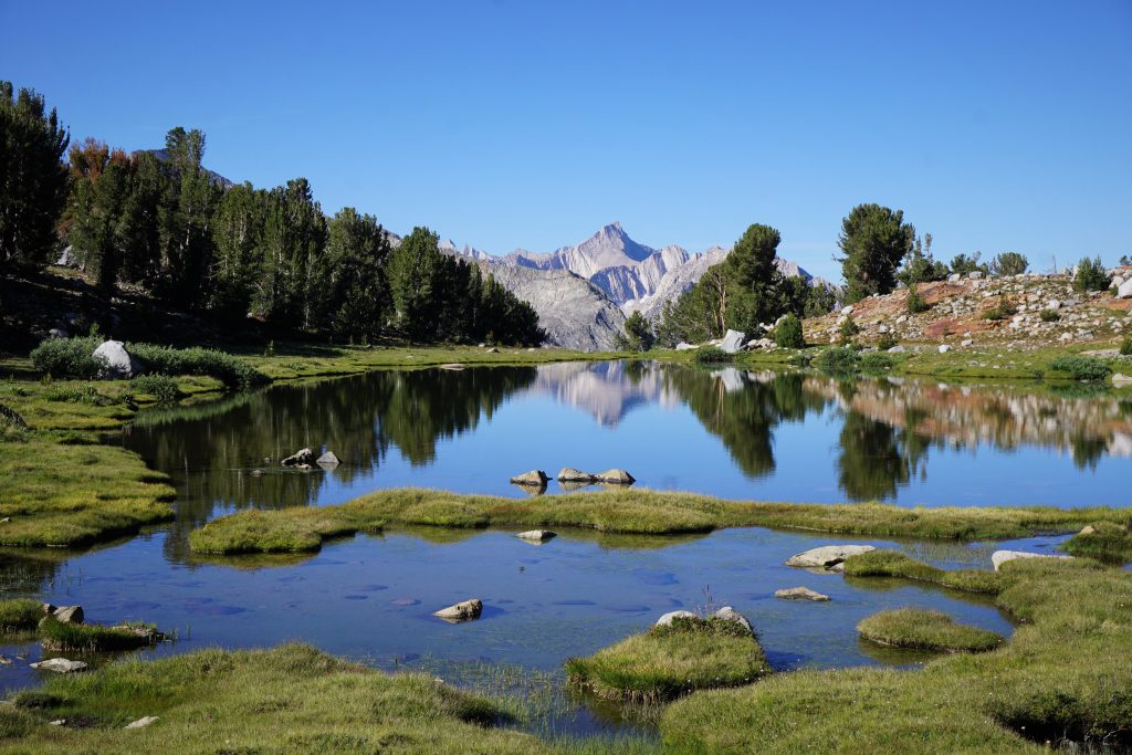
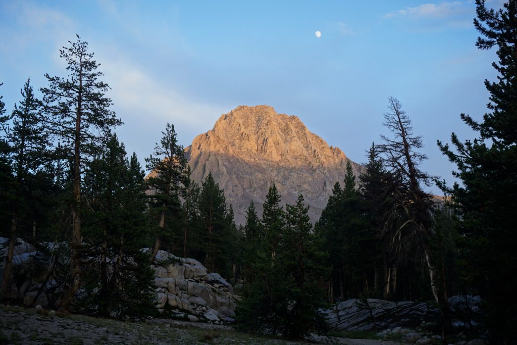
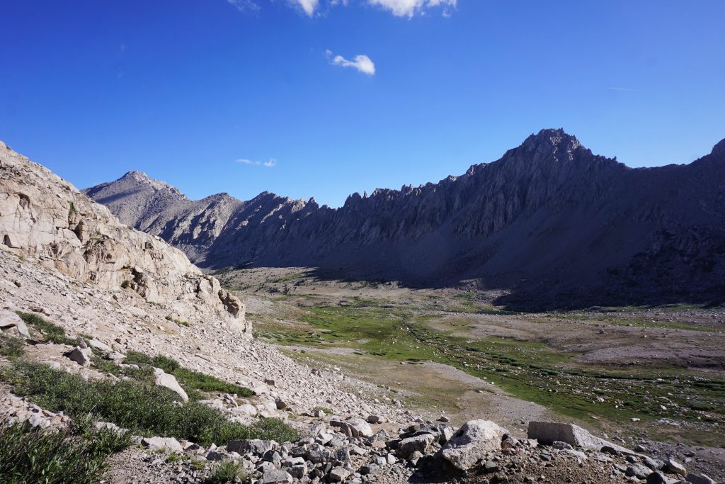
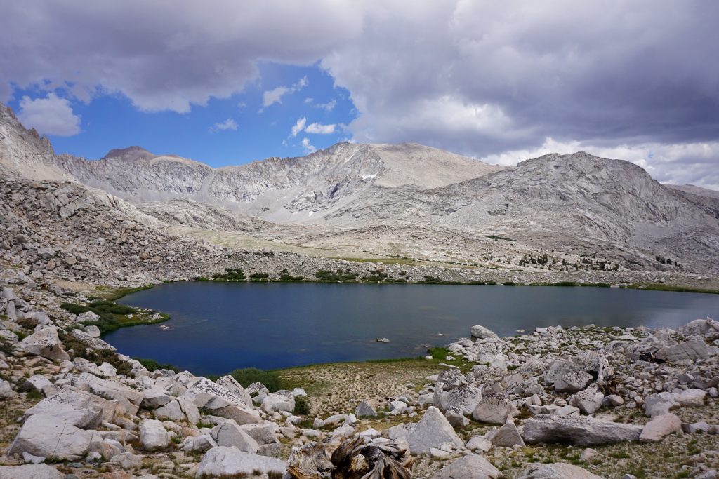
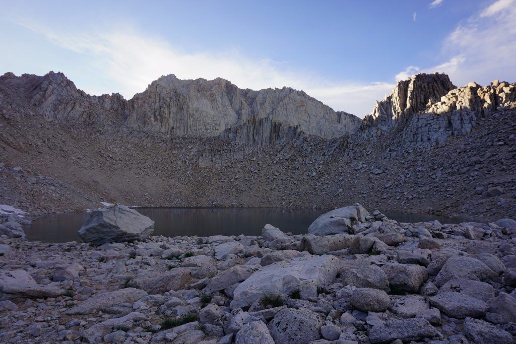
We had set aside an entire day for transit expecting setbacks, but we arrived at the trail head at 10am. So we began our hike around Saddlebag Lake to Cascade Lake at a nice leisurely pace.
This meant that we had plenty of time to explore camp, take a nap, and spend some quality time together. For a nonquota zone, it was a beautiful location.
In the afternoon, while Kylie took a nap, I decided to do a little scramble up North Peak. I left camp with just a camera and a water bottle, the classic Insta-hiker gear. Only problem was that I had no Insta-boyfriend behind me to take photos of me.
I contoured around North Peak and began climbing up the South Face directly. There was some brushiness, but mostly just boulders.
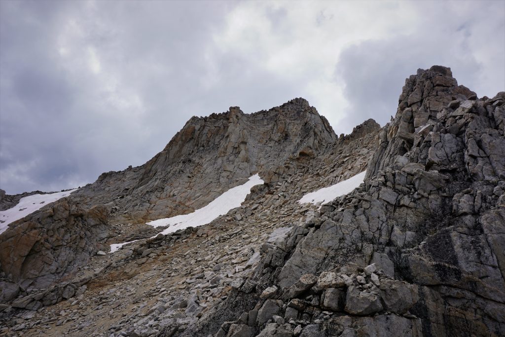
Higher up on the shoulder, there was a snow finger cresting the ridge on the right. I figured this must be the end of the ice climbing route. This ice route is like many Sierra Ice Routes in that it is really just a snow couloir until maybe September, when it finally becomes easy alpine ice. It is kind of like our Washington glacial alpine ice routes that become icier by fall.
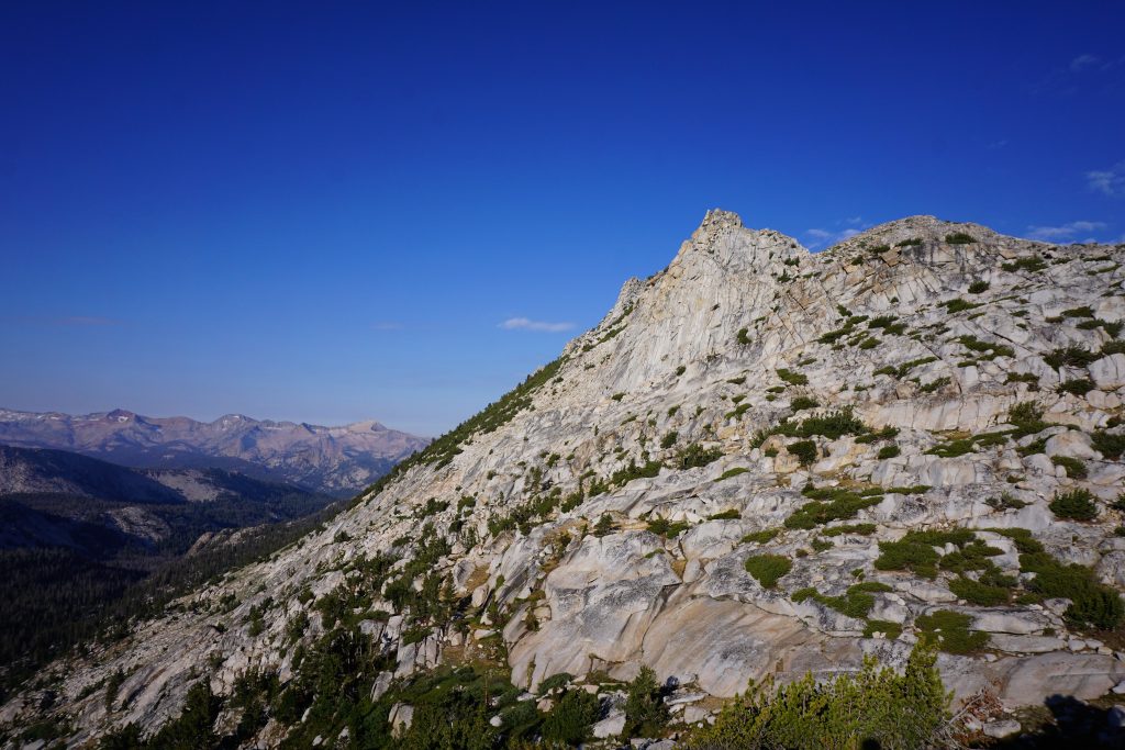
The final few hundred feet featured some 3rd-4th class scrambling, so I left my water bottle behind to have both hands for scrambling, picking it up on the way down. Not surprisingly, I was the only person on the summit. I think Conness is a much more popular peak, with some classic alpine rock routes.
Despite the forecast for showers, the weather had held out all day. After I got back to the tent and settled in for a nap with Kylie, a steady rain began to fall. It was not a thunderstorm, but a just a Washington-like steady rain, very uncommon for the Sierras. Oh well, the trip was off to a good start.
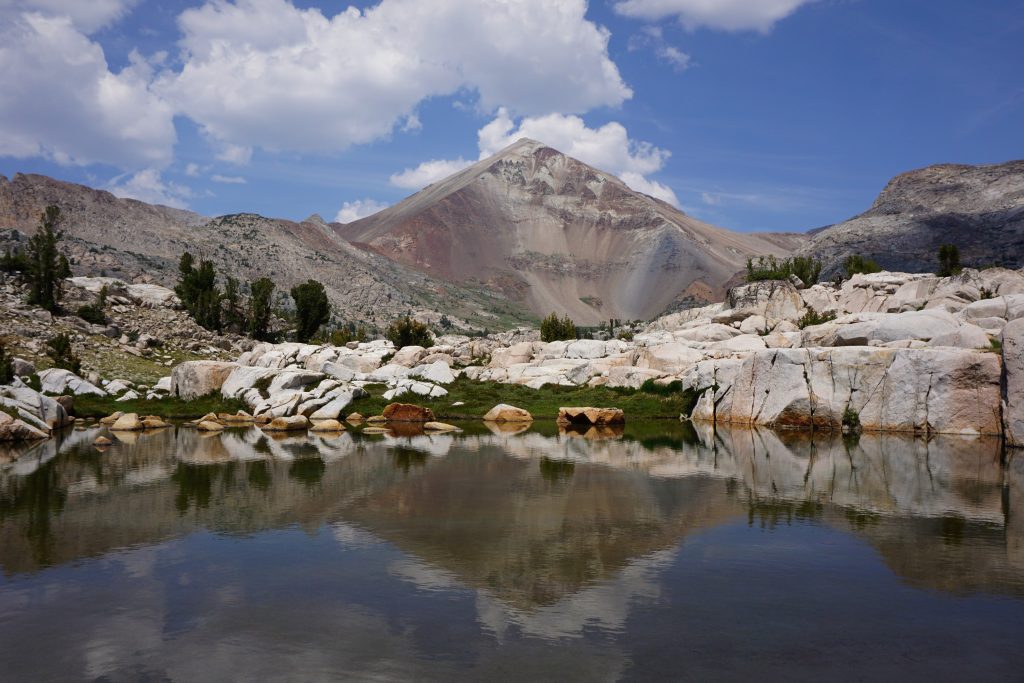
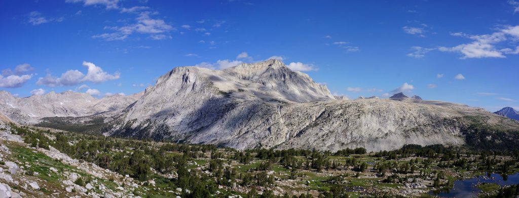
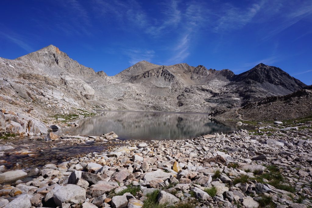
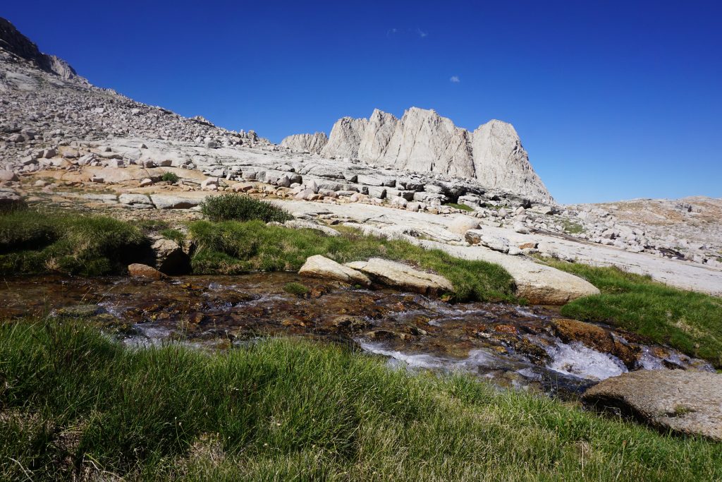
Day 1: Conness Lakes to Vogelsang Lake
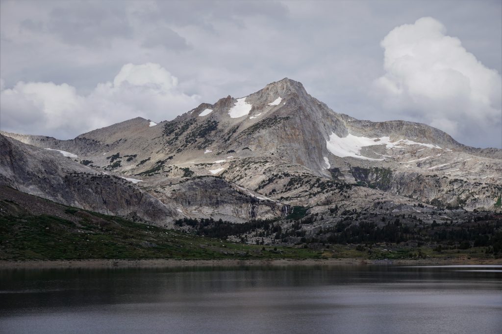
Past Green Treble Lake, through many lakes in Harvey Monroe Hall Research Natural Area, over Mineshaft Pass (Great Sierra Mine), down past Gaylor Lakes to Tuolumne Meadows, up to Tuolumne Pass, to Vogelsang Lake.
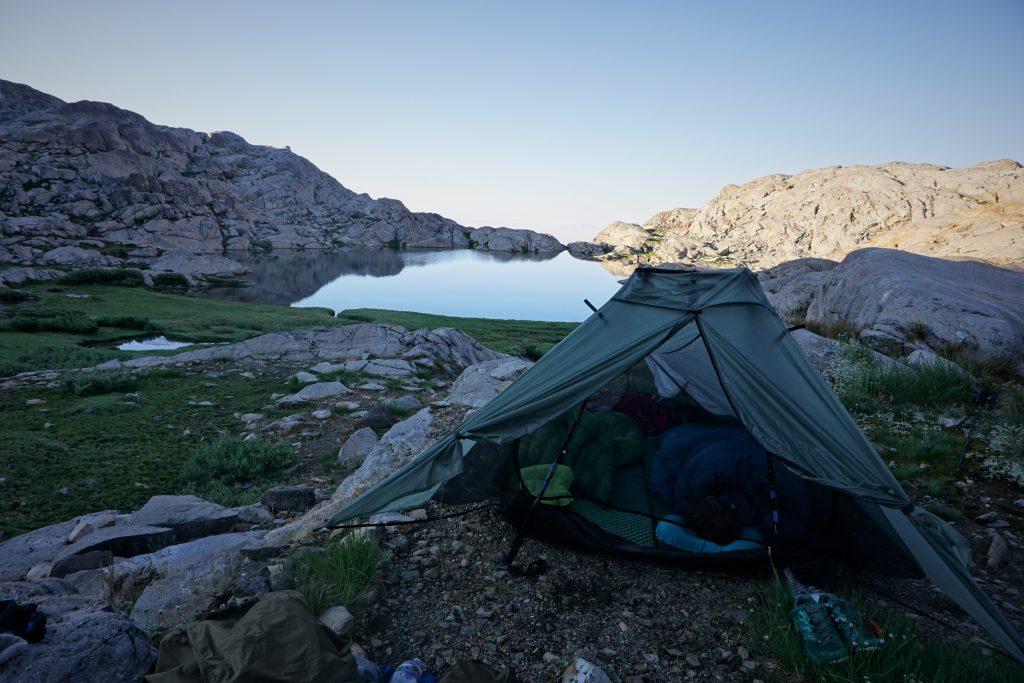
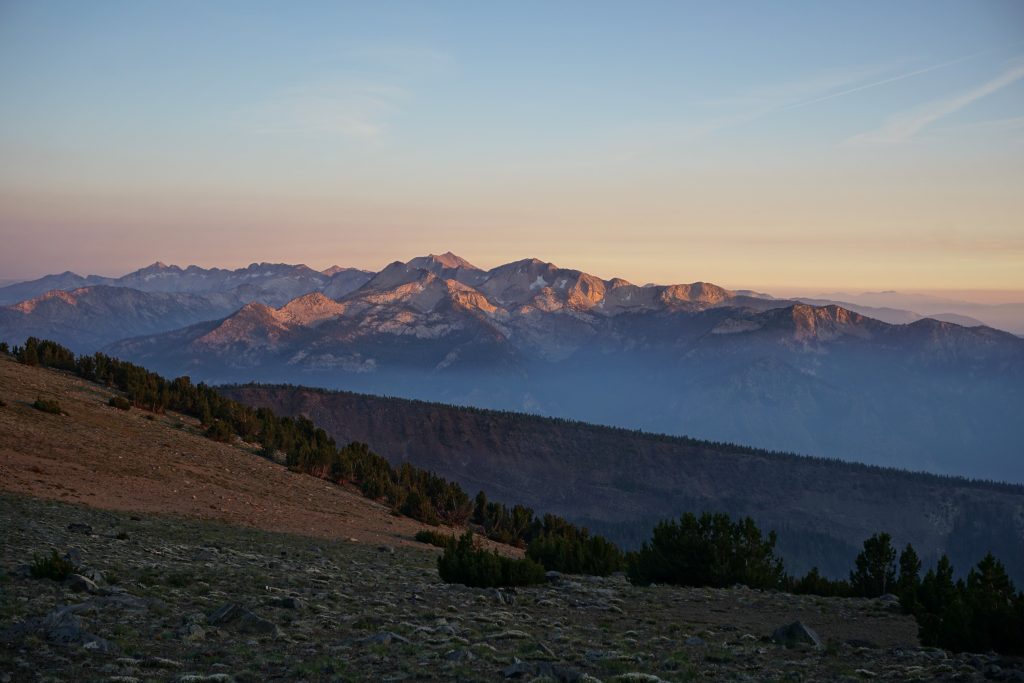
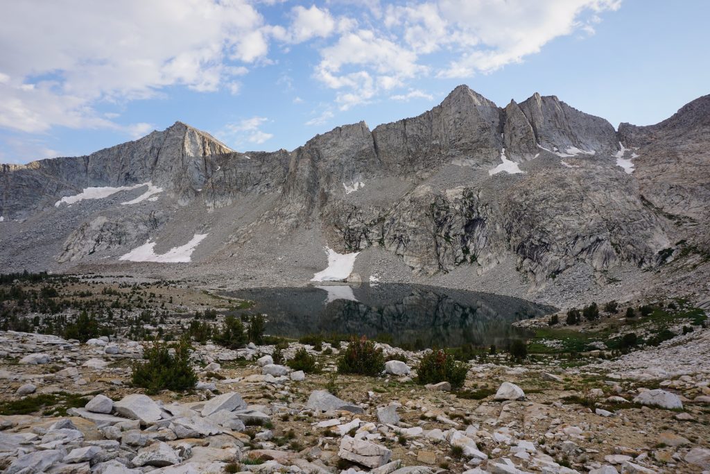
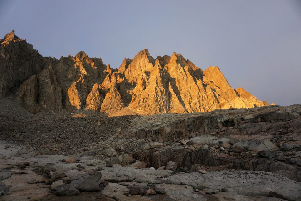
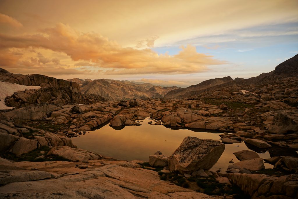
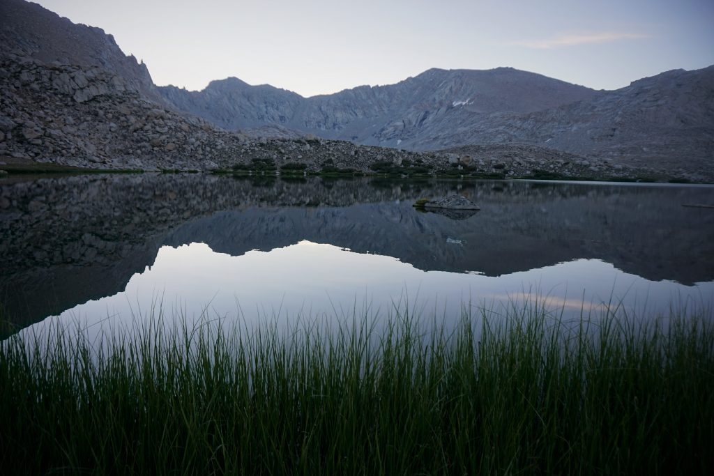
We awoke at sunrise, eager for our first real day on the SHR. We packed up a wet camp (this would become a theme) and caught a magnificent sunrise on Cascade Lake.
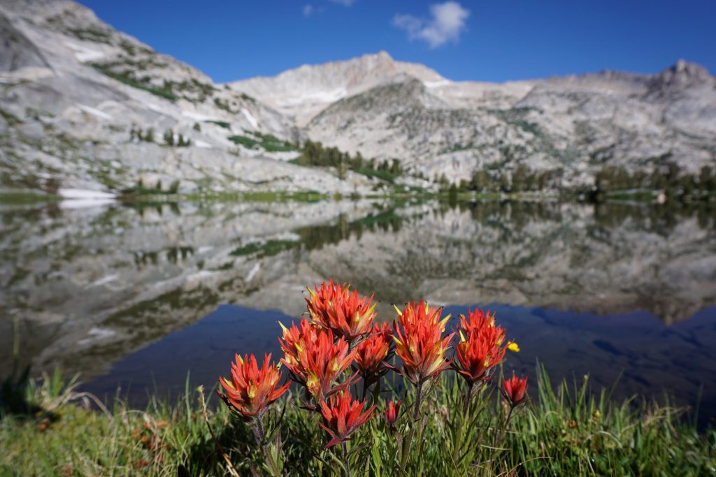
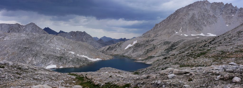
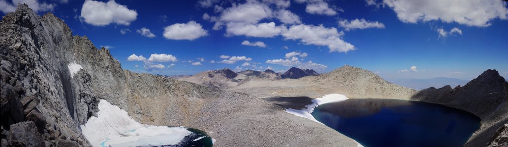
The Conness Lakes basin was sparkling in the sunlight, although the aqua hues were not forthcoming in the early morning light. I managed to do some timer magic, starting the camera and scrambling to the top of a boulder in 10 seconds.
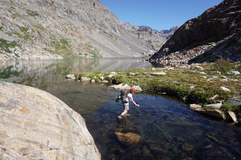
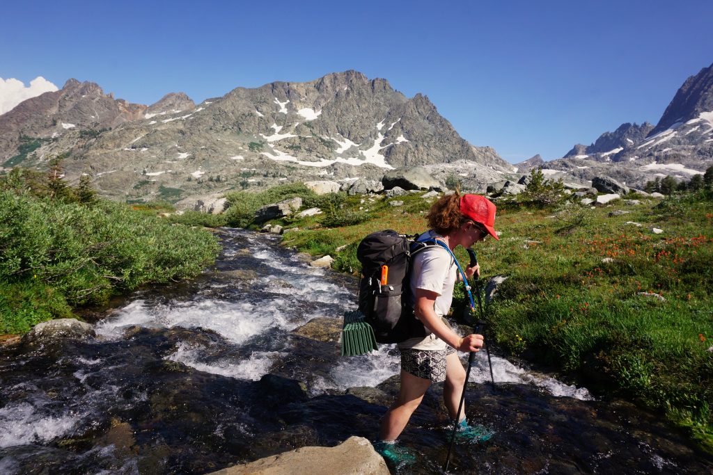
Next, there was a steep climb to a enter a pretty, marshy basin in the Harvey Monroe Hall Research Area. Our feet got wet; little did we know it was the beginning of the end. On a different note, we were now barely a mile as a crow flies from where we had started at the Saddlebag Lake Trailhead. But overnight camping is not allowed in this area or the Conness Lakes so we had to do what we did the first day.
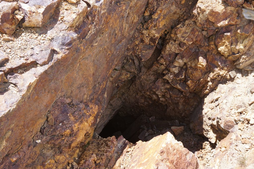
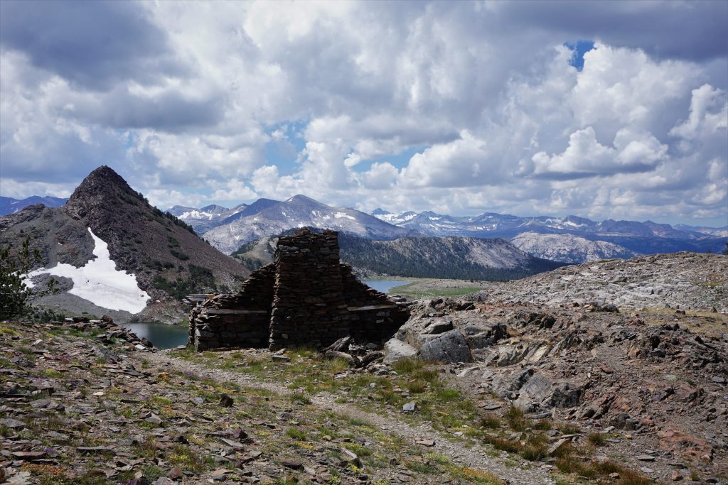
We climbed through a small draw and then descended past Spuller and Fantail Lake. After that, it was a climb up multi-colored rock to “Mineshaft Pass”. We passed some adits along the way.
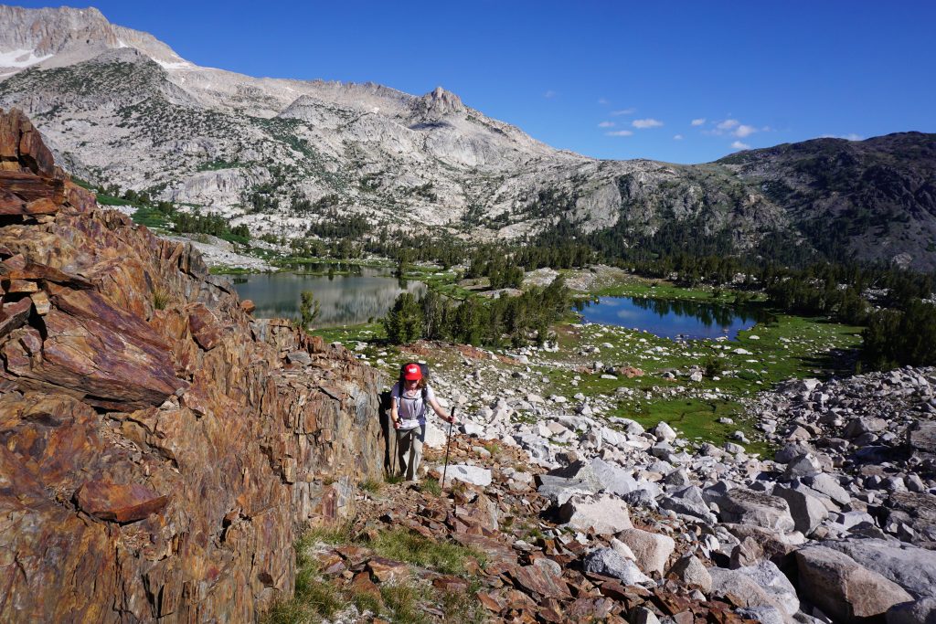
At the pass, we officially entered Yosemite National Park. We took a lunch break next to an old structure that was part of the historic Great Sierra Mine. We met a few other people who were day hiking to the mine and had come up from a trail in the park. Puffy clouds were starting to darken the sky, which we knew was a bad sign.
The next section down by the Gaylor Lakes was particularly nice on a flat, open trail. Even after we left the trail and followed the drainage towards Tuolumne Meadows, the movement was fast and easy. It was fun to look across the valley at striking rock profiles like Cathedral Peak and Matthes Crest, which we had climbed weeks earlier.
Somewhere in the inconspicuous meadows, we eventually found an old trail and followed it down to the valley bottom. We crossed the road and followed a trail on the edge of the Dana River towards the Tuolumne Meadows Lodge. Thunder was booming around us and it seemed rain was immanent. Oh well, at least we would get a chance to try out our new budget, ultralight rain gear!
The rain started falling, and kept falling harder and harder. Kylie ingeniously put garbage bags on our packs, poked holes from the shoulder straps, and made a great rain cover! That’s why she is an engineer. We also donned our jackets and rain kilts.
As we reached the lodge, all the trails had become streams and it was flooding all around us. We were getting pelted by a mix of rain and hail. We followed the sign for the lodge, seeking any shelter. It was perfect timing, and we found some benches to sit on outside underneath an awning. We knew we would not be this lucky with storms later in the trip, but we did not complain! We hung out for probably 45 minutes as the storm ripped all the soil away and drenched the landscape.
When the rain finally stopped, it was time for us to move on. We wanted to get to at least Tuolumne Pass, which was six miles away, before nightfall. The hike up to Tuolumne Pass was one of the most mind-numbing six miles I have ever hiked. It was funny, because here I was, in the most famous National Park, surrounded by eager backpackers raving about its beauty, completely bored. It was just was an honestly boring six miles. It never did anything: never really gained elevation, never changed direction, never popped out of the trees.
As we finally neared Tuolumne Pass, we entered a beautiful wide meadow. We met an international family backpacking along. The dad must have been carrying over 100 lbs of gear, but the kids still had backpacks bigger than us. It was impressive. They kindly took our photo.
We pushed on to Vogelsang Lake. By this point in the evening, the sky had mostly cleared and the ground was drying somewhat. We camped a little above the lake in hopes of less moisture, but were still close enough to enjoy some quiet evening moments. We were tired from a long day, but happy still that we reached our goal even with the delays of the storm.
Day 2: Vogelsang to tarn near Twin Island Lake
Over Vogelsand Pass, down Lewis Creek, across to Lyell Fork Canyon, over Forester Pass, down to Blue Lakes, down Bench Canyon, up to unnamed lake.
The next morning began with a short little climb up to Vogelsang Pass. It definitely seemed like less people continued on beyond the lake. On the other side of the pass, we gazed into a pretty valley, but also saw a little haze, an omen of what was to come.
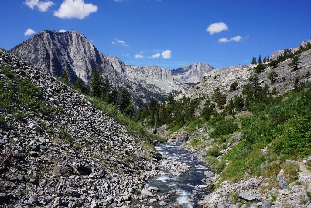
We descended into Lewis Creek. The trail tumbled down the valley like the creek itself. There were numerous huge waterfalls and long granite waterslides. If I was in to Alpine Tubing, this creek would be my destination.
Before reaching the intersection with Fletcher Creek, we branched off onto an unmaintained trail that headed steeply uphill. We were very surprised by the condition of this trail considering it was in Yosemite National Park! But we would soon come to learn that if it is not a main trail in the Sierra, it has been abandoned. In Washington, there is more of an in-between.
Eventually, the trail began to contour into Lyell Fork Canyon. This was a spectacular canyon, with large volumes of water flowing everywhere on perfect granite waterslides! Since we had to ford the river, we took this opportunity to go swimming and eat lunch. Here, we met a old main going the other direction on the SHR, the first of our kind we had met.
After our lunch break, the trail climbed steeply and leveled out for a little before we left the trail, headed east. We passed a little marshy, mosquito infested lake and climbed up some boulders to a broad bench under the shadow of Forrester Peak. This area provided easy cross-country travel.
As we looked back, we realized that the smoke from Yosemite Valley was chasing us! At moments, the outskirts of the smoky mass would engulf us in its tendrils, obscuring Forrester Peak. And then a few moments later, we would outrun it, breaking into the clear. We ended up outracing the smoke on our way to Blue Lakes Pass, just south of Forrester Peak. Our reward was awesome.
As we descended to Blue Lake, we met a dad and two boys maybe age 10 and 13. They were trying to find their way up through the cliffs to the pass. The dad had done this section of the high route 30 years ago and was trying to repeat it by memory! They were fun to talk to. Hopefully I’ll be able to take my kids on amazing adventures like this someday.
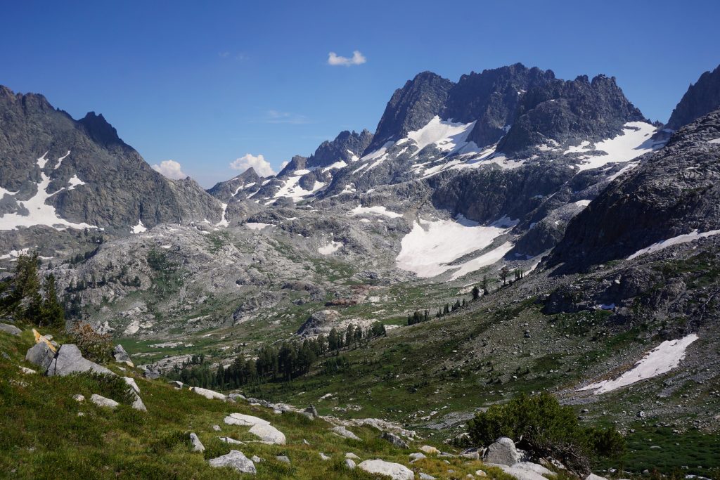
The next section was a gentle descent down Bench Canyon. This mile-long stretch has to be one of the easiest, most beautiful sections of the entire high route. We walked down grassy meadows and across granite slabs directly towards the Ritter massif. A splendid stroll in the Sierras.
At the bottom of Bench Canyon, we passed another couple heading the opposite direction on the high route. Busy times! This also happened to be the only other woman we saw the entire time on the high route.
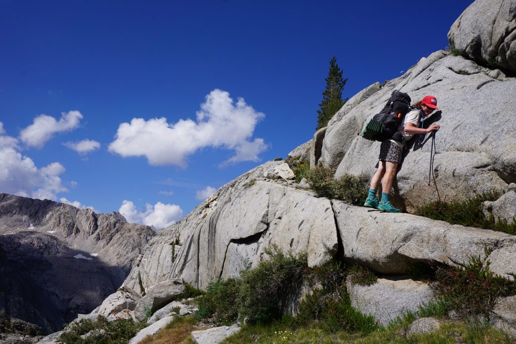
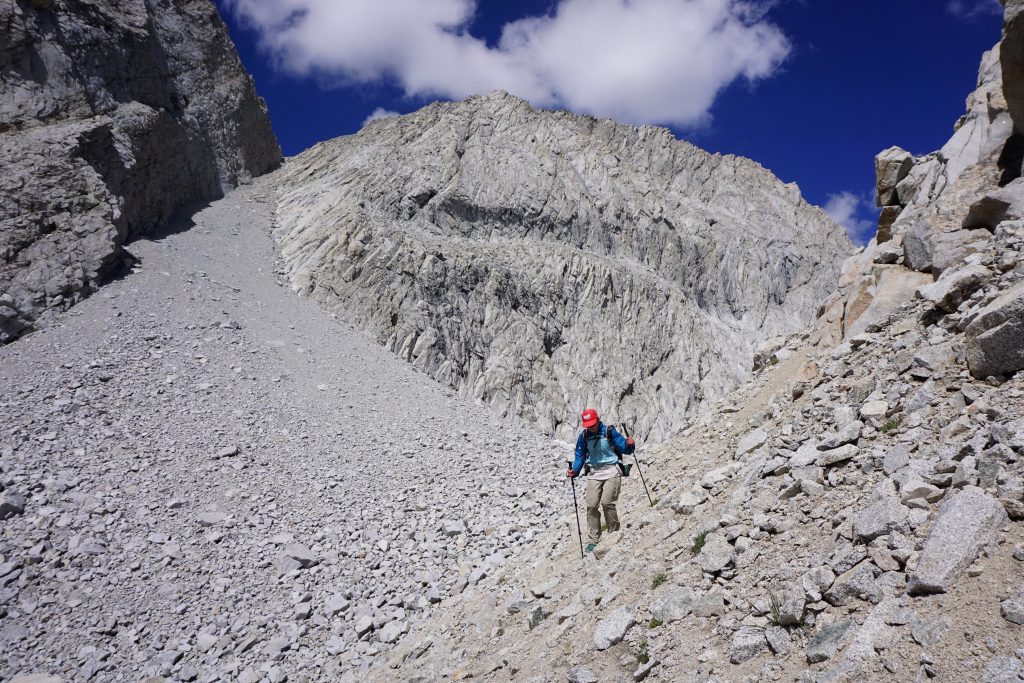
We saw on the map that we now needed to ascend a ridge for about 400-500 feet before traversing high above the canyon. We scrambled up the ridge about 400 feet up and tried traversing over, but got cliffed out. We went higher but still ran into cliffs. It was now late in the evening and we were a little confused where exactly we were since features were not lining up on the map.
I guessed we were too low and so we scrambled higher and reached terrain that allowed a traverse. We still did not find the little lake pictured on the map and it was getting late, so we decided to suck up our pride and check the GPS for our elevation. This was one of two times the entire trip we pulled the GPS out.
It turned out that we were still a few hundred feet too low! As I looked closer at the crappy maps we had printed out, I realized that this specific map had inexplicably switched from feet to meters in the contour lines! Thus, we had grossly underestimated how much climbing we needed to do.
With this realization, we had little trouble finding the little unnamed lake right as twilight settled in. It was cute, set high in the hills above Bench Canyon. We were ready for rest.
Day 3: Twin Island Lake to Cecile Lake
To Lake Catherine, over North Glacier Pass, down to
Thousand Island Lake, past Garnet Lake, Nydiver Lakes, Iceberg Lake, to Cecile Lake.
Although our camp was on a little bench above the lake, we still woke up wet due to all the moisture around this marshy lake. We slept in since today was supposedly a shorter day: only about 12-14 miles, although completely off trail.
We started by contouring around a ridge and descending to Twin Island Lake. This lake was very rocky around the perimeter and had a very different character than where we had spent the night. We debated how it might have been cool to camp on one of the islands in the lake, but that would have been difficult logistically.
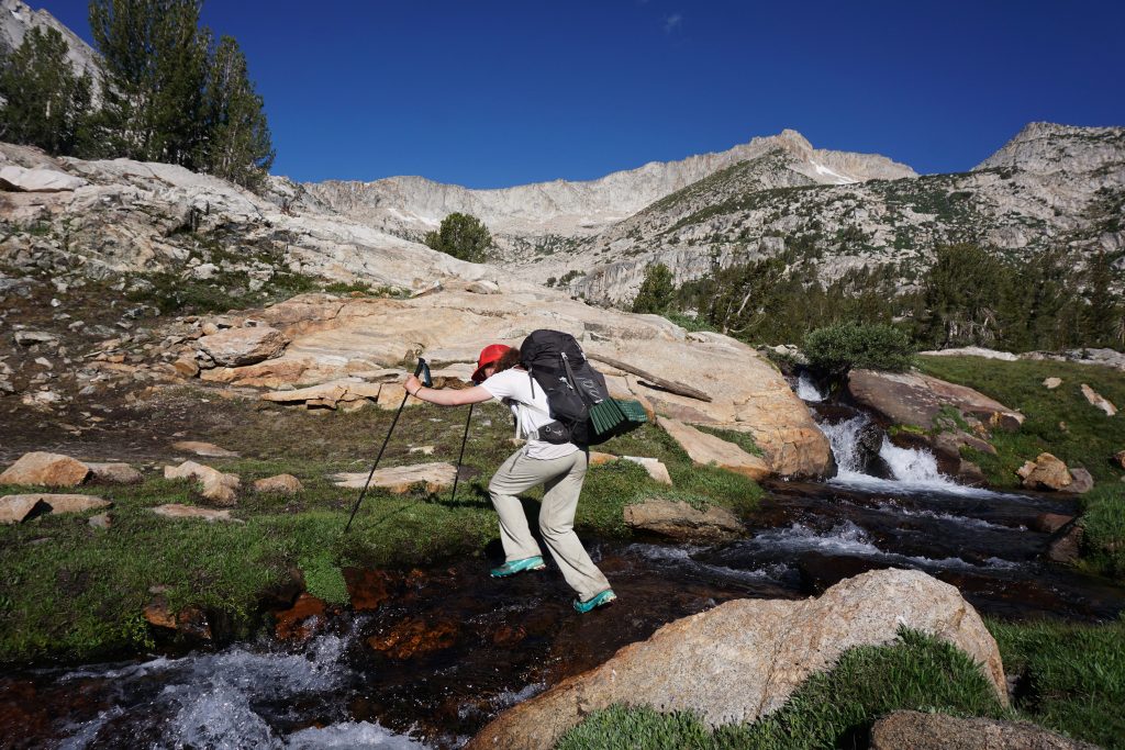
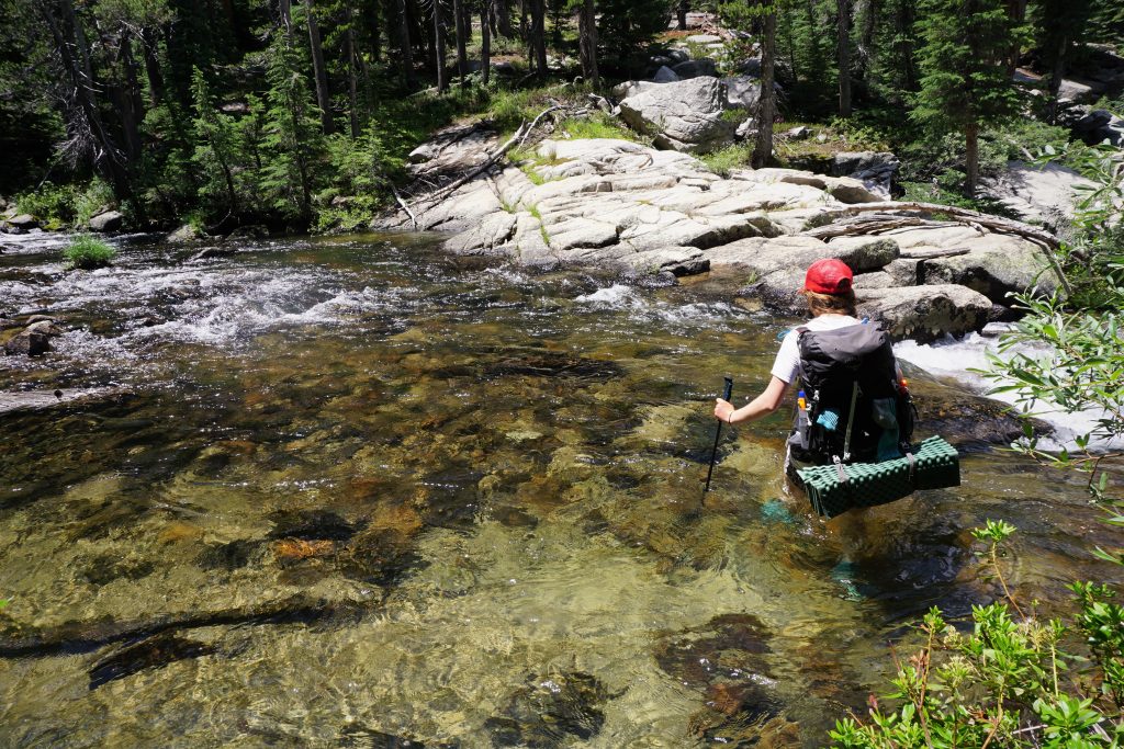
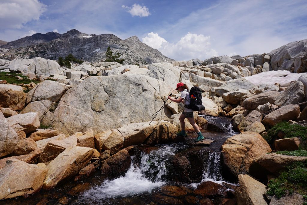
The outflow of the lake is deep, nearly waist deep, and rather swift before immediately dropping off into a waterfall. We kept our shoes on for this crossing and were very careful.
Past Twin Island Lake, we saw what was probably the most complex terrain of the high route so far. We could see our destination, North Glacier Pass, but it was difficult to decipher the maze of benches and gullies that would lead for a class 2 route up to the pass. We took our best guess and began traversing around the canyon. Pretty quickly, we started finding cairns so apparently we were on some kind of route.
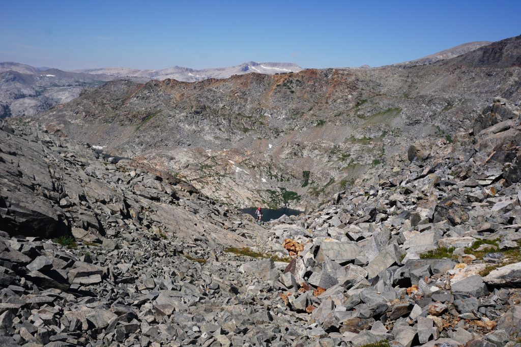
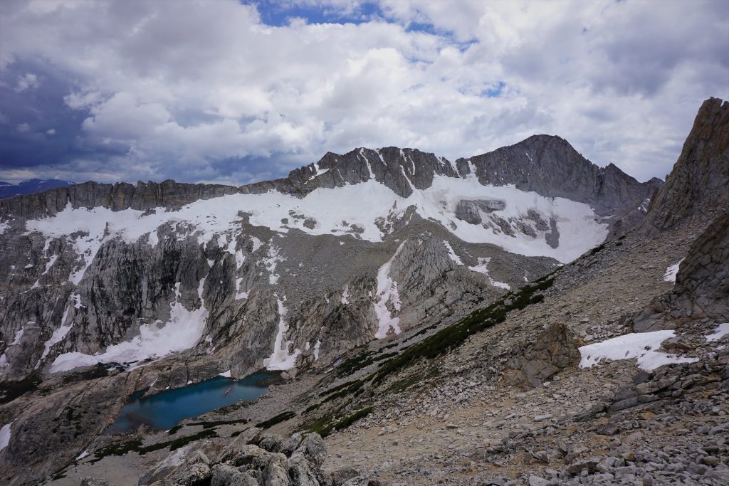
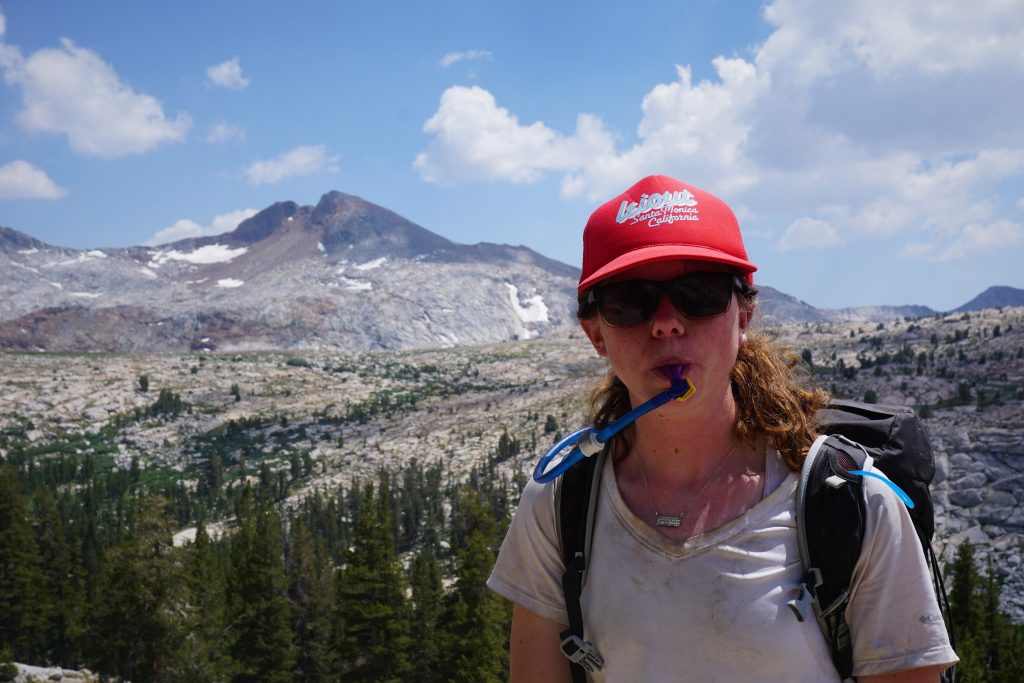
We seemed to naturally find our way through the cliffs, but the extensive talus was still very tiring and Kylie’s blood sugar went low. Finally, we reached some snowfields near Lake Catherine that provided easier travel.
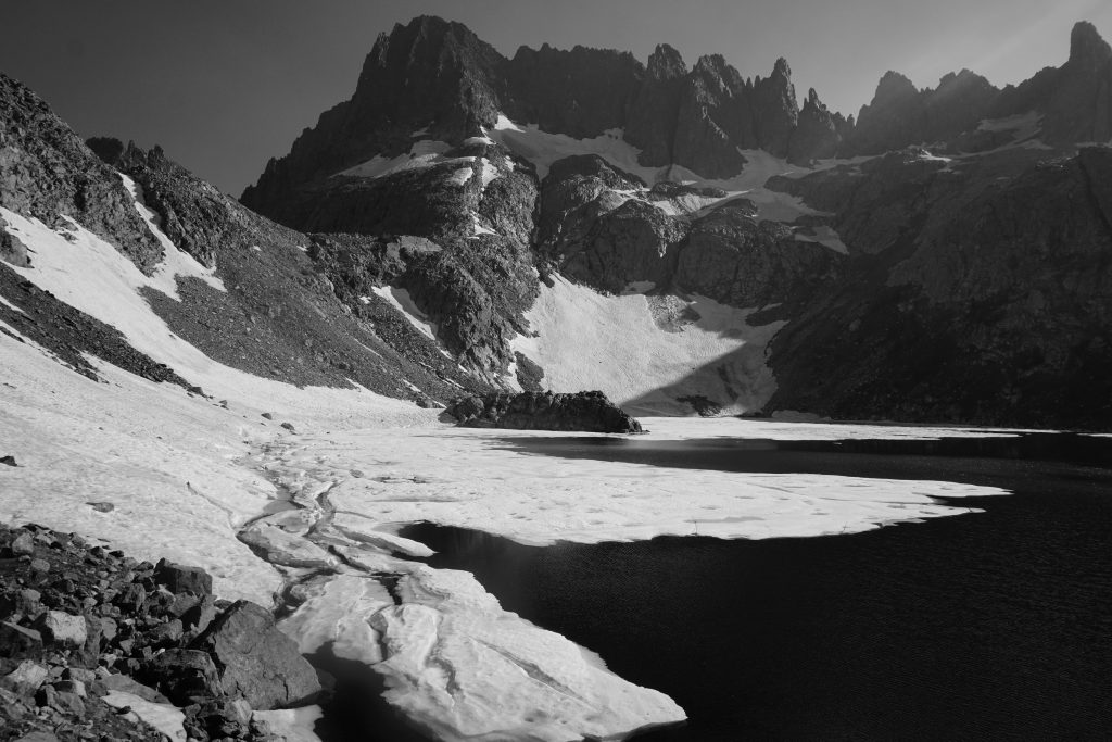
Lake Catherine was very Mars-like (except for the water!) with no signs of vegetation. It was very alpine.
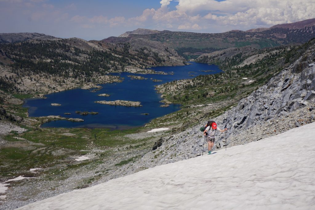
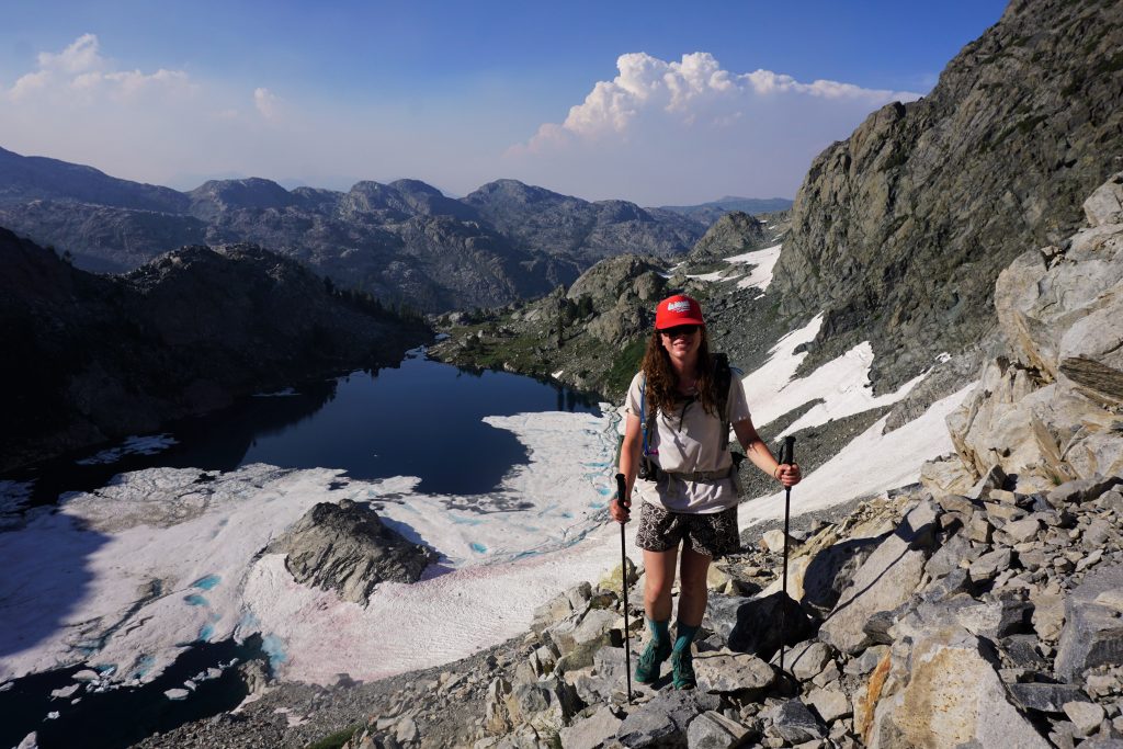
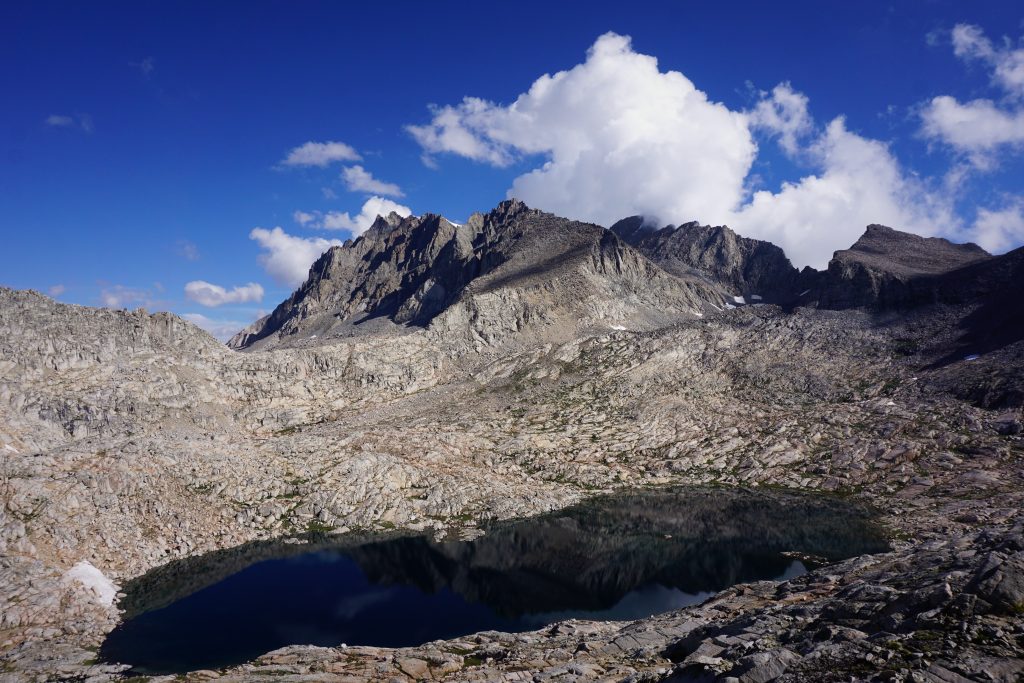
Upon reaching North Glacier Pass, there was some more gnarly boulder scrambling before finally reaching a view of gentle snowfields and meadows leading down. We took a well-deserved break here after the hardest climb of the high route so far. North Glacier Pass is an interesting geographic anomaly in that the south side is much more moraine-like and rugged, while the north side is gentler. This is the opposite of most passes in the Sierras and Cascades, where north and east side glaciation leaves a more extensive scar on the landscape.
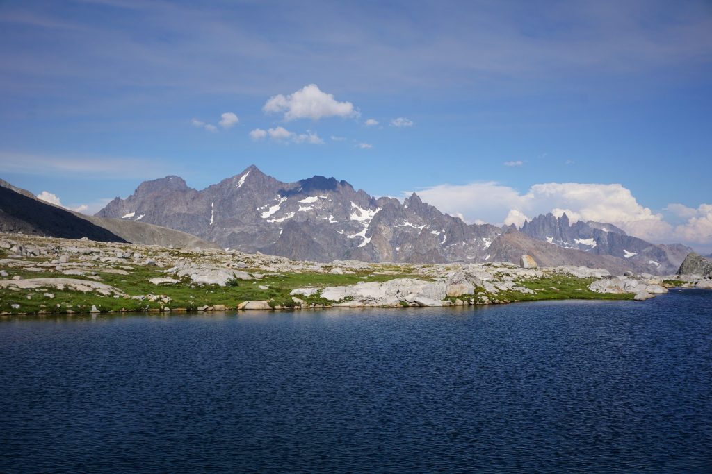
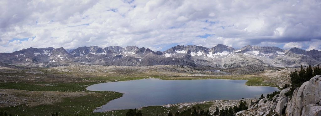
The canyon slowly curved right and we began to get a view of the marvelous Thousand Island Lake. It has been forever memorialized by Ansel Adams’s black and white photos of it and Banner Peak in the background. The wilderness area now bears Ansel Adams’s name.
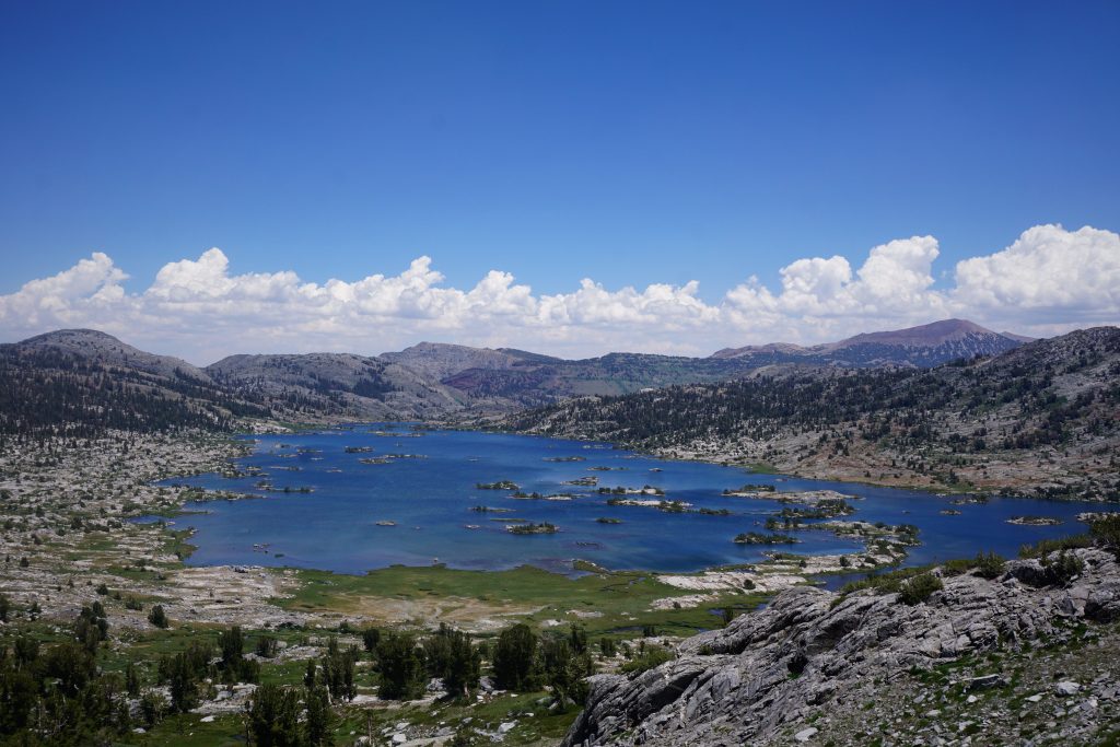
Thousand Island Lake is world famous for good reason, and we imagined a floaty trip swimming and sun bathing on each island. A traverse of every island? This could be a FS (first swim).
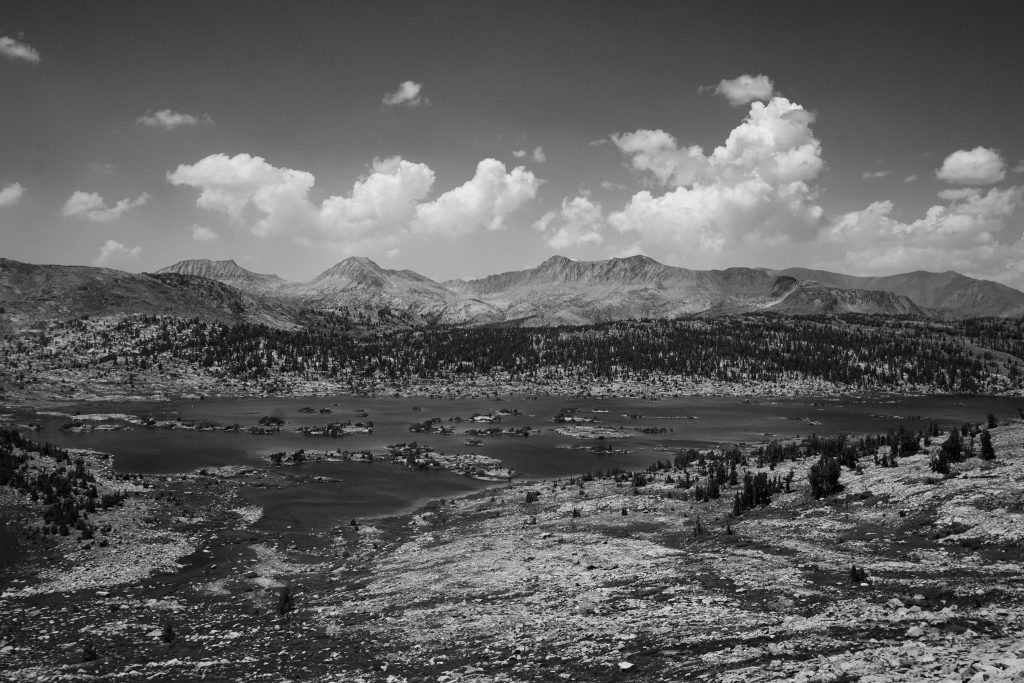
The next climb led us over a small saddle and above Garnet Lake. Garnet Lake looked very similar to Thousand Island Lake, just with fewer islands. If it was anywhere but next to Thousand Island Lake, it would probably be famous. Instead, it was just another lake.

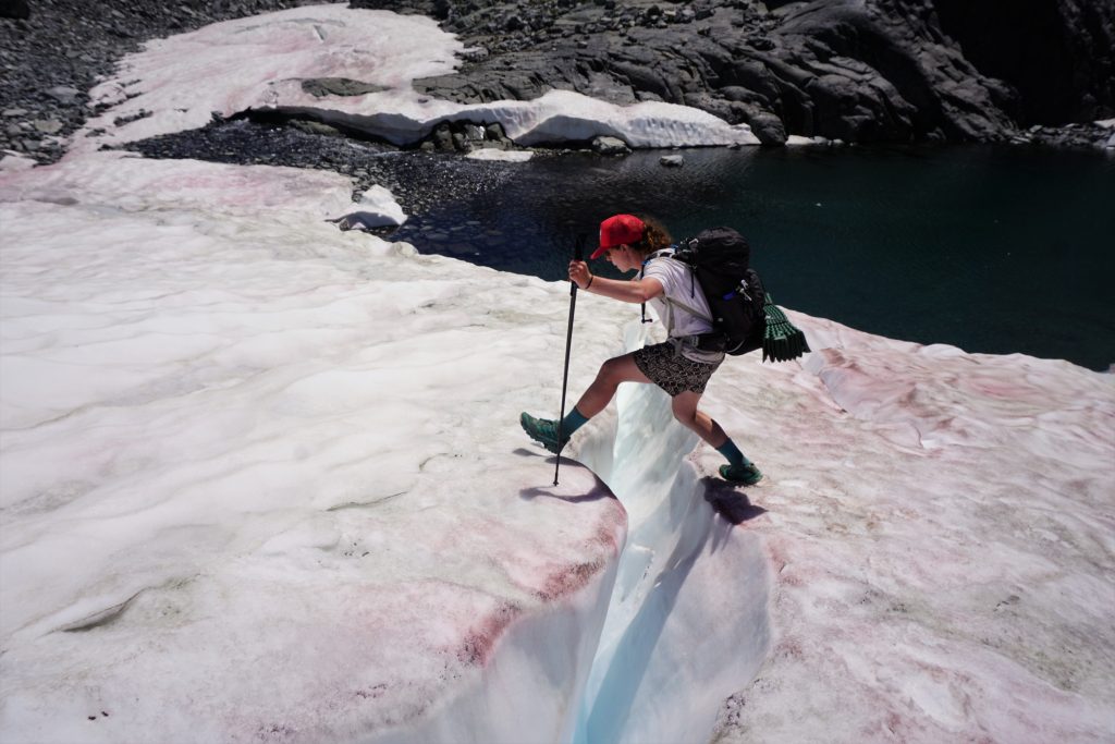
The next climb was either on awful looking choss off to the side or a nice moderate snowfield straight up. Surprisingly, it appeared everyone over the last few days had avoided the snow. It was a little firm, but my La Sportiva Ultra Raptors had little trouble kicking steps, certainly easier than the choss! Too bad most other thru-hikers avoid snow like the plague.
At the next saddle, we had a wonderful view of a broad basin that extended all the way to the base of the Minarets, a group of pointy spires. We could see across the valley to Iceberg Lake and Cecile Lake, our goal for the evening. It was comforting knowing we were not far from our camp and it was only mid afternoon.
We traveled through easy rolling terrain before descending down a more significant drainage. We found a climber’s trail at points, possibly the Mt. Ritter approach trail?
Near the valley bottom, there was a shaded section before climbing up to Iceberg Lake. I’m not sure if it was the moisture, the shade, or the marshiness of it all, but we were attacked by the worst mosquitoes of the trip. Mosquitoes had been pretty bad up to that point, but here they simply went off. I think I went from like 20 bites on my body to 50 in a few minutes. We literally ran up to Iceberg Lake, trying to escape.
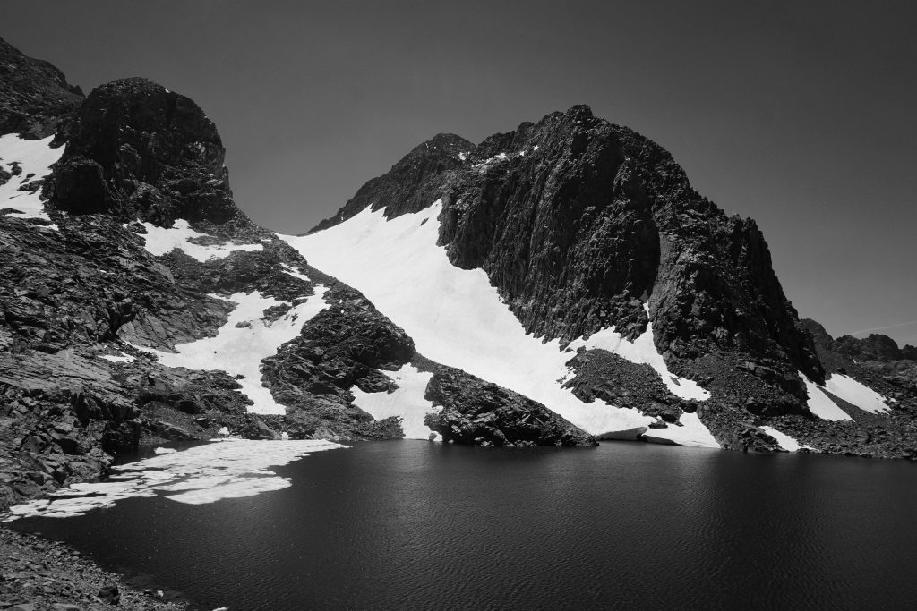
Since we had the time, we decided to take a swim in Iceberg Lake. It had this spot where you could go from ankle deep to infinitely deep (couldn’t see the bottom, and it was clear) in just a foot horizontal, kind of like an underwater canyon. It was perfect for diving in. The water was freezing (as the name would suggest)!
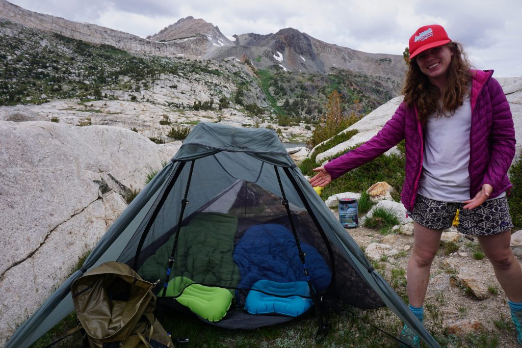
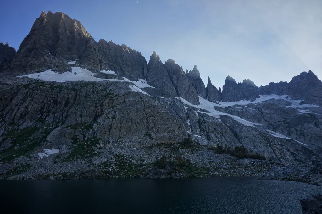
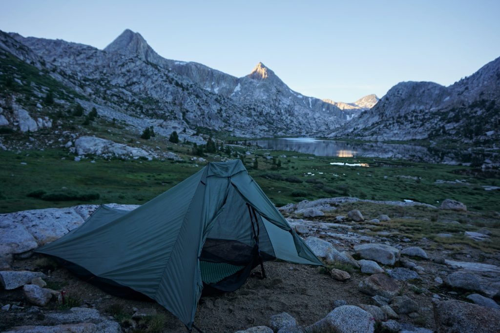
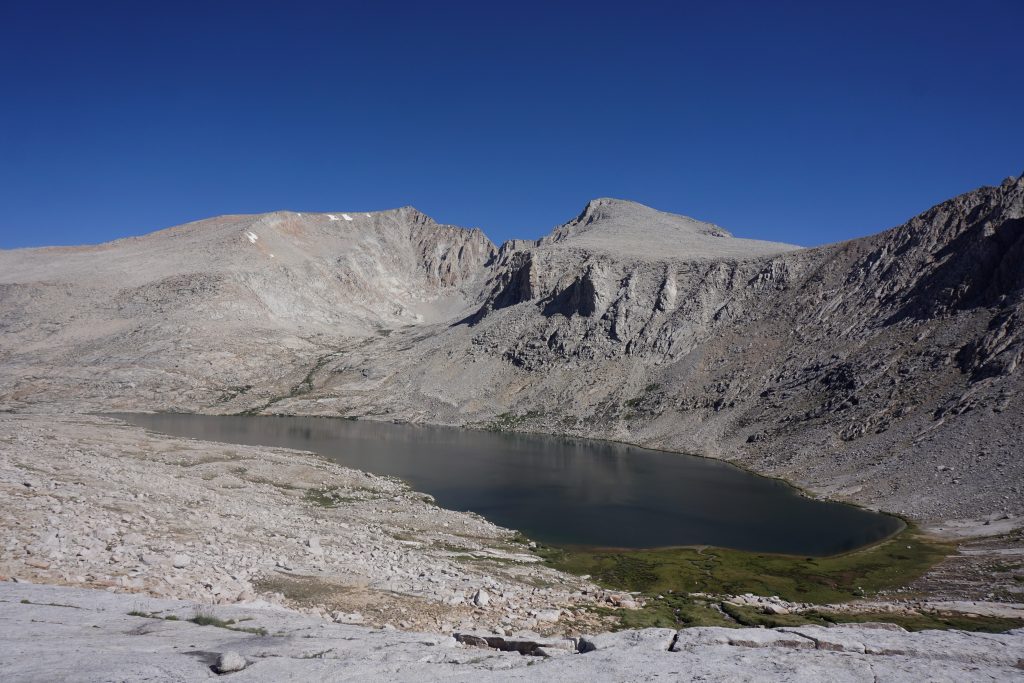
Our final climb of the day up to Cecile Lake was pretty short but somewhat loose. Even though Cecile Lake is similar sized to Iceberg Lake and higher elevation, it had no ice floating it in, probably because it gets more direct sunlight than Iceberg Lake. It was very rocky here, but we found some cleared bivy sites near the lake that worked for our camp.
We had a relaxing evening at camp with the entire lake to ourselves. There was a cool breeze, keeping the mosquitoes down. It ended up being one of our nicer camps, despite the rockiness.
Day 4: Cecile Lake to Deer Lakes
Past Minaret Lake, to Superior Lake, down to Devil’s Postpile and Red Meadows, up to Mammoth Crest, over to Deer Lakes.
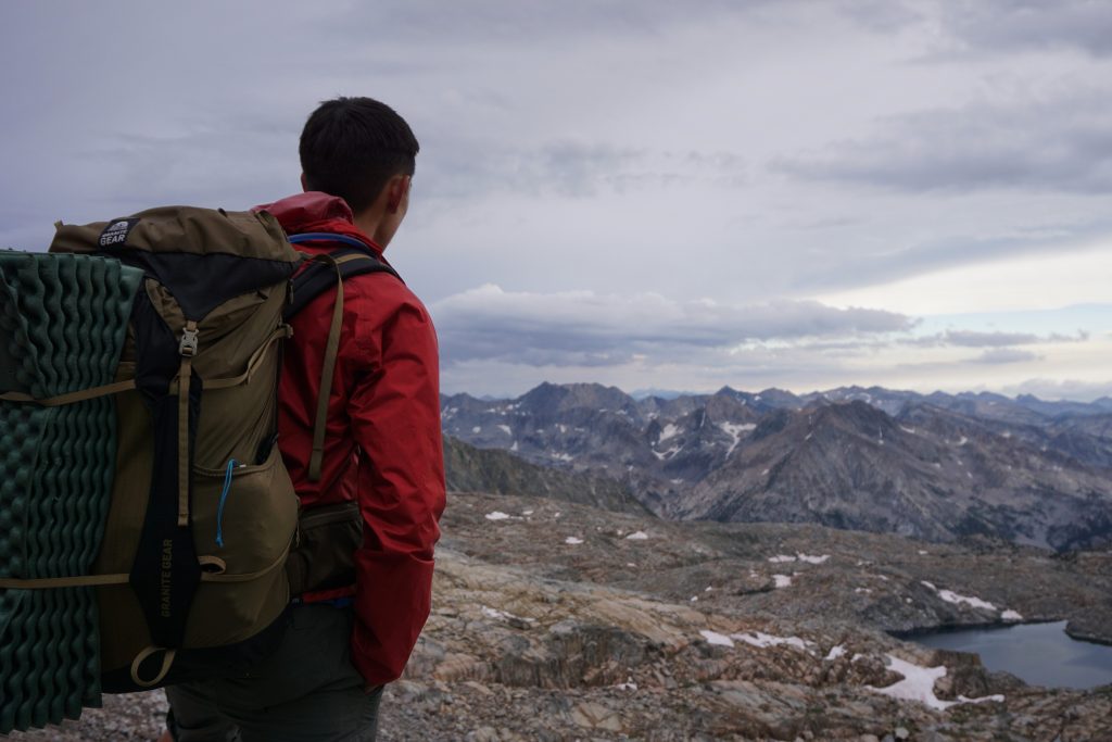
We knew this was going to be a big day, not in terms of views but in terms of mileage. We were planning on getting to Red’s Meadow for lunch and then all the way back up on the Mammoth Crest by dark. At least our packs would be light for the first half of the day.
Initially, we tried to descend to Minaret Lake directly down the outflow of Cecile Lake, but that was a little sketchy so we ended up going around to the north by some small ponds. All this terrain was more complicated than it looked on the maps and cost us probably 30 minutes. At least Minaret Lake was wonderful in the morning sunshine.
Now we had a choice: we could either just take the trail down to Red’s Meadows, saving us time on a long day, or do the relatively short off trail section of the SHR here. We figured there must be a reason that Roper made the high route not follow the trail here, so we would give it a shot. We climbed up to a little ridge near Deadhorse Lake. From there, it was some of the hardest routefinding of the trip to identify which was the next pass to cross because the passes were not well defined from this side. The route to the pass dropped down through a dry, wooded forest, making it difficult to keep our bearings straight. It was not terribly aesthetic.
When we arrived at the pass, we found a plaque declaring it Nancy Pass, named for a little girl who was the first to reach the pass when pioneering this little “Nancy High Route”. She died young. I could see why Roper wanted to include this section for historical and sentimental reason then, even though it was not a very fun or beautiful section.
The descent from Nancy Pass down to Superior Lake sucked even more, with either loose scree or marshy grasses. Superior Lake was the most inferior lake we had seen yet, basically a mudpile infested with thousand of mosquitoes! It was awful, probably the worst mosquitoes of my life. I didn’t take any photos it was so bad. We just put on our rain jackets as protection and ran away.
Once we escaped the mosquitoes, it was just another 6 miles of boring trail walking through the dry Mammoth forest. The vegetation and soil was much drier that where we had been just a few days ago. A few miles from Red’s Meadow, we joined the JMT and passed dozens of backpackers with overloaded 70 liter packs struggling uphill in the 80+ degree heat.
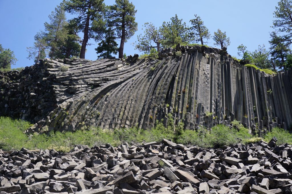
We took the little detour to see Devil’s Postpile and see what all the hullabaloo is about (it’s a National Monument after all). It was probably the greatest scenic disappointment of the trip. It was literally just a pile of basalt columns. You could find taller, more impressive ones at Vantage when rock climbing. Thousands of them. In fact, why don’t we just make all of the coulee land of Eastern Washington a National Monument?
We rolled into Red’s Meadow in the early afternoon. It was bustling with thru-hikers. Our first order of business was to pick up our food cache, which I had deposited before the trip. Then we went in for a delicious burger and milkshake. It was a $10 milkshake, but totally worth it!
We met one other high router who was heading north. Later in the summer, he would meet some other friends and do the high route back south! He sort of scoffed at the pace of our itinerary and warned us about all the difficult terrain we had yet to encounter (he spoke of “vertical scree” at one pass). Kylie and I listened to him but were not really too concerned, since we are climbers, not thru-hikers.
We started up the trail towards Mammoth Pass with heavy packs, loaded up with 9 days of food. My pack was probably in excess of 35 pounds, beyond its recommended “weight limit”. We skimped on water to save weight since there was supposedly a creek on the map and it seemed all the rivers were flowing overload. But we ended up hiking through a completely dry burn zone with no running water. Luckily, we met a nice old man on his way down who gave us his remaining water. Thanks!
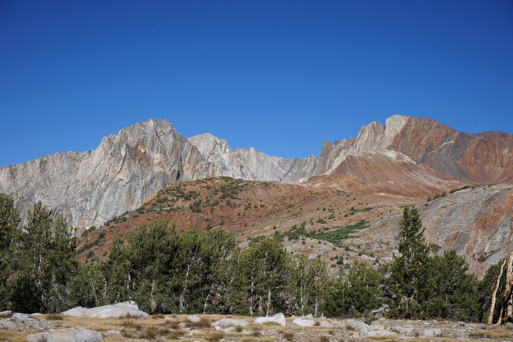
We left the trail around Mammoth Pass and walked through gladed forests and then up a very sandy gully. It deposited us on the Mammoth Crest. We found a few rap anchors at the top of some impressive vertical cliffs. Looked like fun climbing!
Once on the crest, it was very easy and cool walking. There was an unofficial trail well established across the sandy, moonlike landscape. The rocks all around were super colorful.
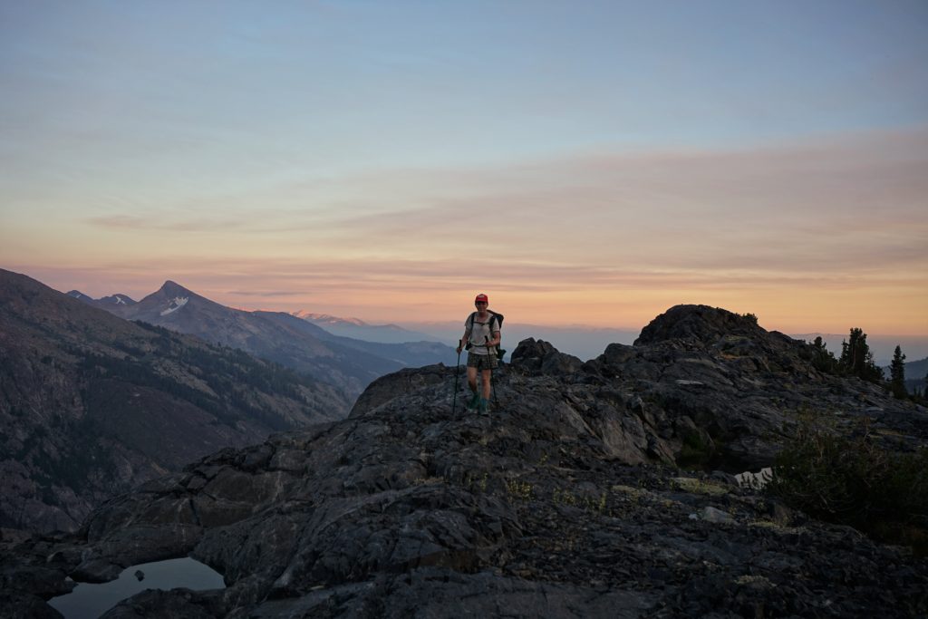
Out of the blue, a guy popped up on the crest from a lower trail with no backpack or anything. Turns out he lives down in Mammoth and hikes up to the crest every evening. He must be in great shape! He was partially blind, but took a great photo of us.
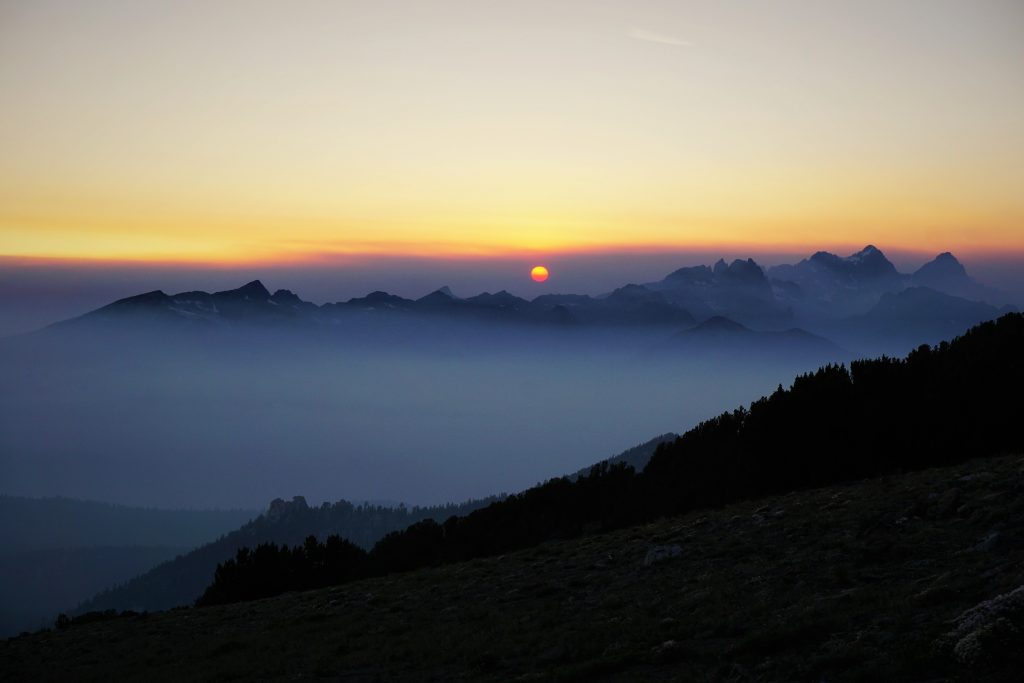
As the sun got lower in the sky, the smoke coming from the Yosemite area became more and more evident. Where we had just been that morning, the Minarets, was now engulfed in a haze. Smoke drifted through the lowland valleys. We were truly escaping by the patchy facial hair of my chinny chin chin. Nonetheless, it made for one of the more beautiful sunsets we have ever experienced.
Finally, we rounded a ridge and got a view of Deer Lakes, our first water source since Red’s Meadows and our destination for the night. We rolled into camp right before darkness finally settle in.
The Deer Lakes were gentle and cool, making for a very nice evening. We were pleased with our ability to put in a long day even with the stop and heavy packs. It just shows what good food can do to your energy levels, especially with a diabetic.
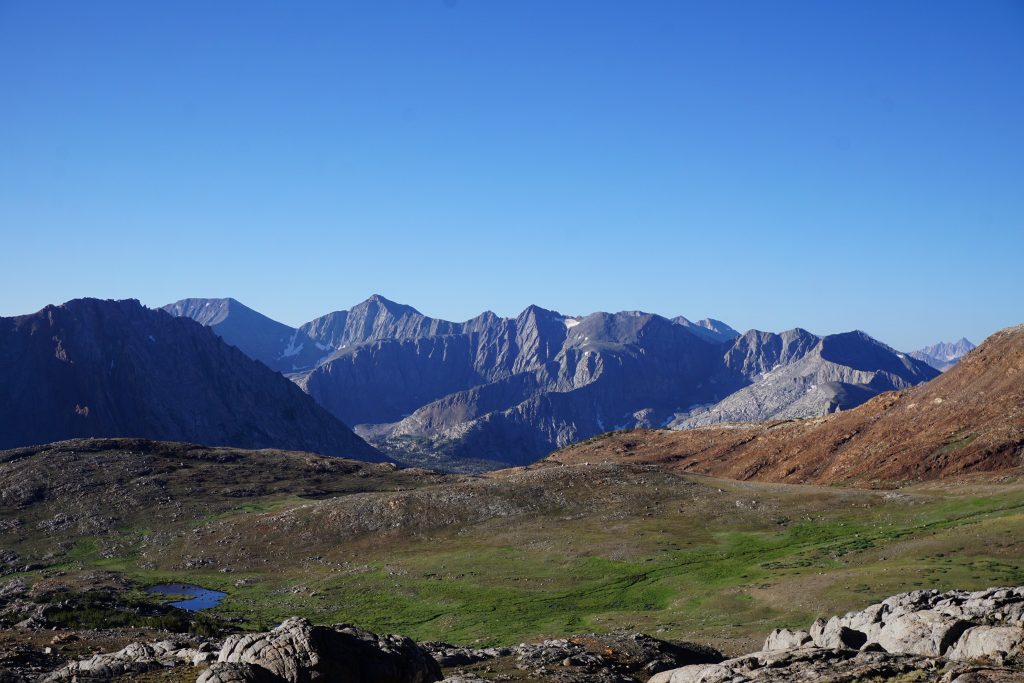
Day 5: Deer Lakes to Mono Creek
Down to Duck Lake, JMT past Purple Lake and Lake Virginia to Tully Hole, off trail up Fish Creek drainage to Silver Divide, past Rosy Finch Lake to Laurel Lake, down to Mono Creek.
The day started with a gentle climb on a decent unofficial trail over a little pass towards Duck Lake. We lost the trail on the way down to Duck Lake, but it was easy enough.
An easy section of trail led down from Duck Lake to join the JMT. It was our first steps on the world-famous JMT! It felt… er… rather nice as we dropped to Purple Lake and then to Lake Virginia. It was immaculately maintained, making for easy hiking. We also met tons of people, so the social needs were satisfied.
After a steep descent to Tully Hole, we said goodbye to the JMT for good. If we were lucky, we would see it 3 days later. The next 50 miles or so were the most committing miles of our trip: off trail, far from bail options, and through rugged terrain. And we were going to do it with our heaviest packs.
Before Tully Lake, we started climbing up to the right. I think I led us too far right and we ended up at Cotton Lake. It took us a moment to get our bearings, but it was a cool little detour nonetheless.
We retreated leftwards, wrapping around into a beautiful lake basin. It was classic Sierra with little granite pools flowing into one another, grassy meadows, and dominant peaks. There was hardly a sign of man.
At the head of the basin, there was a decent sized lake. From there, it was just a final little climb to the crest of Silver Divide and our high pass of the day.
I think it was about this day where I started to feel just perpetually hungry. It wasn’t a hunger of the stomach; it was a hunger of the whole body, of every little muscle. And it would just sit there, slowly growing, despite what my stomach was doing at the moment. I knew I wasn’t eating enough for my thin frame and the huge days we were putting in, but there wasn’t much I could do about it. If we had packed more food, then I would just expend more energy carrying it.
The next section was a traverse above Bighorn Lake and Rosy Finch Lake. The terrain here was more challenging and necessitated a lot of ups and downs.
It definitely looked like the Sierras to the south were getting hammered by distant rumbling thunder and rain. It sprinkled over the next pass briefly, but never really got going, fortunately.
Next, we descended towards Laurel Lake. Above us, there was this super cool looking peak with black obsidian streaks. Strangely, it was called Red and White Mountain.
Down at Laurel Lake, we were expecting to find a trail, as the map showed. We would cruise trail all the way to Lower Mills Lake that night. But unfortunately, the trail appeared and disappeared in and out of the meadows. As we got lower towards the valley floor, it actually got worse at times and we found ourselves straight bushwhacking. Finally, we reached the valley floor at Mono Creek, but we had lost a lot of time.
It was decently clear where the crossing of Mono Creek supposedly was, but there was obviously no bridge and a deep ford required. Almost immediately after, the trail turned into a complete jungle of blowdowns and branches. What happened to the nice Sierra trails?! It felt like I was back in the North Cascades. For the second and last time of the trip, I pulled out the GPS and used it to help navigate through the brush hell.
After getting a few hundred yards, we found the “trail” again and ran into two guys coming the other way. They were also from Seattle! They were hiking at a casual pace on the high route, referring to themselves as “slackpackers”. They convinced us to drop our dreams of reaching Lower Mills Lake for the night, since the trail up Second Recess was apparently awful. As it was almost sunset, we reluctantly made camp in valley, tired and a little defeated.
Day 6: Mono Creek to meadow below Merriam Lake
Up Second Recess to Lower and Upper Mills Lakes. Up to Gabbot Pass. Down to Lake Italy, past Brown Bear Lake, up to White Bear Lake, past Black Bear Lake, by Ursa and Bearpaw Lake. Over Feather Pass, past La Salle Lake, past Merriam Lake.
Our camp down in Mono Creek was one of the least attractive camps we had all trip, so we were ready to get going in the morning. Unfortunately, as the two guys had warned us, the trail was very bad heading up Second Recess. In some places, it was deadfall, in other places, overgrowth, and other places, just plain avalanche debris piles. It was a battle to sort of stay on the trail, having to jump over dozens of logs. It was very disappointing that this small section of “on trail” was actually more difficult than the off trail of the high route!
At the turnoff to Mills Creek, we climbed up steeper terrain for a little, past the “death slabs” the other two guys talked about. These slabs looked slippery and were covered in sand, but we could get around them. Finally, as we approached Lower Mills Lake, the terrain opened up and it was easier walking.
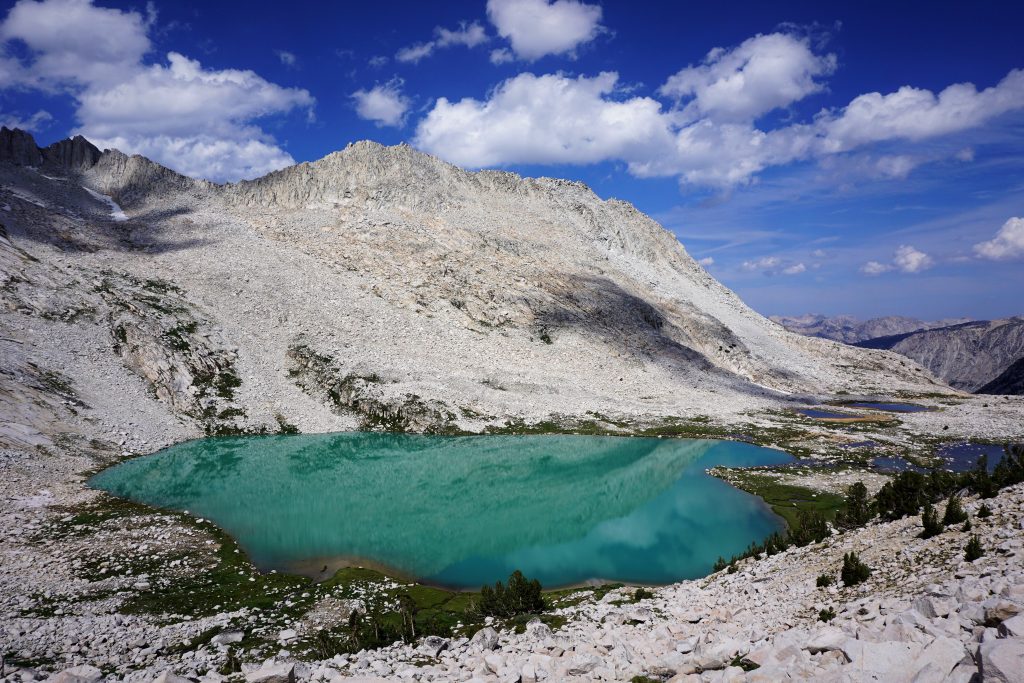
Upper Mills Lake was a actually a wonderful series of turqoise lakes trickling into each other. The combination of the lake color, light granite, and blue skies made for a truly magical setting unlike we had ever seen before. What a shame the trail to these lakes is no longer maintained!
Above the lakes, we began the climb up to Gabbot Pass. We were on a very obvious moraine, from which came the silt feeding the turquoise lake color. The boulders were a little tiring, but it got much easier once we got on some low angle snowfields. I wonder how long ago it was a glacier? This was one of favorite climbs of the trip because it was so incredibly scenic.
At Gabbot Pass, the light fluffy clouds began to darken and we realized it was only a matter of time before we got dumped on. We gazed across the broad valley. The landscape had lateral scars, marks of glaciers pulling rocks across the faces and valley bottom. Above, a lofty peak stood proud and pointy. We realized it was Bear Creek Spire, which we had climbed only a few weeks before!
We traversed to the right, staying high above the valley. This was easy terrain and we were making good time, but we still were not sure if we would get down to treeline (or if we would even go below treeline at all) before the gnar hit. There was absolutely no protection up here, not even a boulder to hide under. Thunder was rumbling all around us.
As we approached the shore of Lake Italy, we began to notice a strange phenomenon: the lake appeared to be rising into the sky. Then we realized it was actually huge hail pellets hitting the water, creating sizeable splashes. And it was coming our way. How long did we have? 2 minutes? 30 seconds?
We looked around for cover, but there was absolutely nothing. We threw on our rain gear and whipped out our foam sleeping pads for protection, but it was too late. Pebble sized hail began to pound us, stinging our skin even through our rain jackets. I think the sleeping pads were the only thing that prevented head damage. We found partial cover underneath a boulder, but I was still mostly in the open. It continued for probably 10 minutes like this, the most powerful hail we had ever experienced. Eventually, we decided we needed to keep moving and so we kept on traversing the shore of Lake Italy, still holding our pads above us for body protection from the hail. Slowly, the hail backed off to a heavy rain.
We left the primitive Lake Italy trail, which was just a stream at this point, and headed towards Teddy Bear Lake and Brown Bear Lake. It was still misting as we climbed up the next pass, but we were beginning to warm up after being frozen and beaten on the lakeshores of Lake Italy.
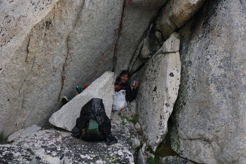
As we crested the pass, the wind picked up once again and it appeared we were in for round two! Luckily, on the shores of White Bear Lake, we found a protected cave where we waited out this storm, which lasted only 15 minutes or so.
When this storm passed, we emerged and made our way to the ridge above Black Bear Lake. Here, we met a guy who was doing a section of the SHR by himself over many days. He did a section each summer. He recited all these specific route details and names, apparently from Roper’s guide. We had not read Roper’s guide, so we did not really understand what he was saying, but he took our picture anyways.
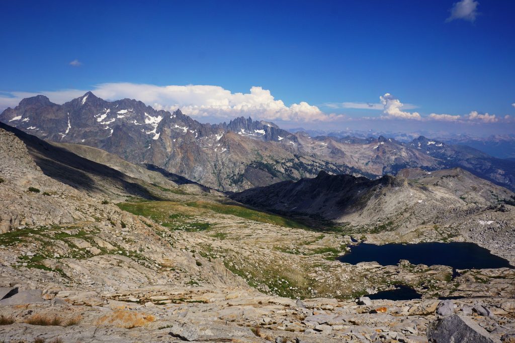
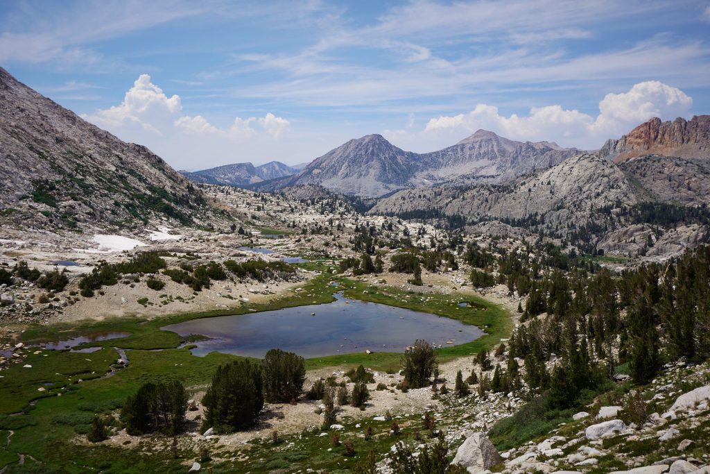
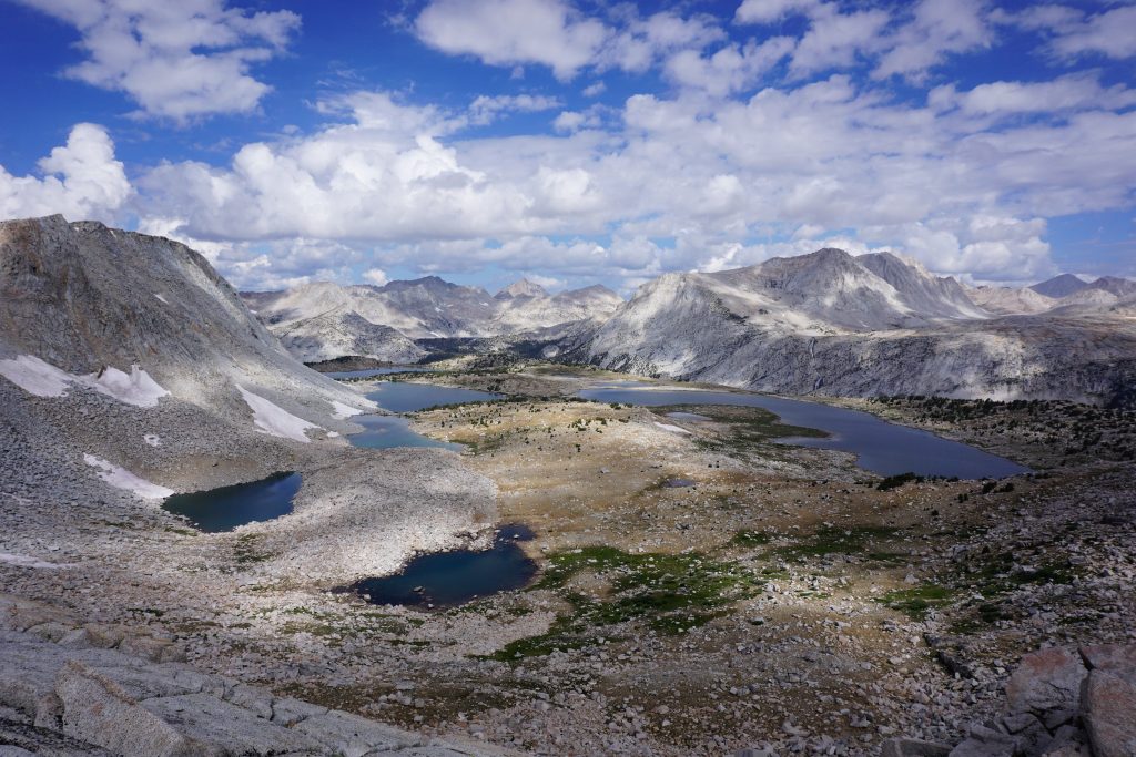
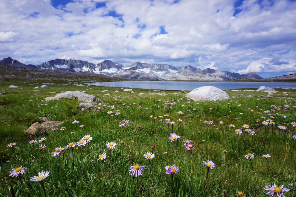
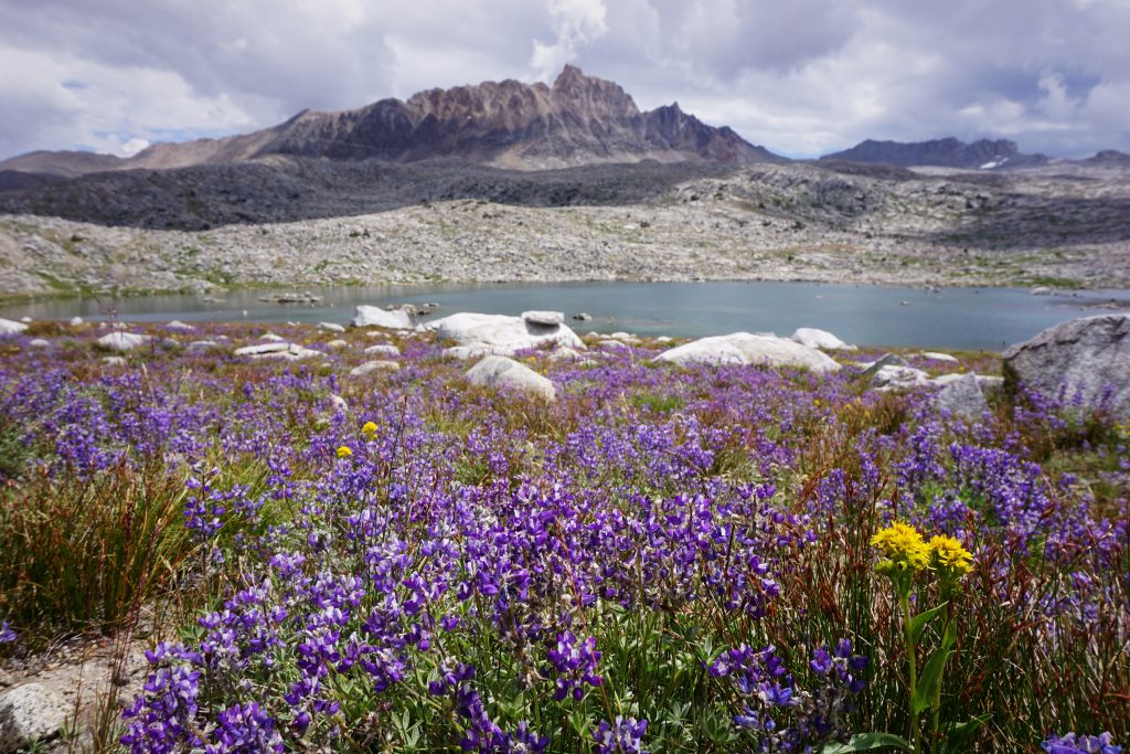
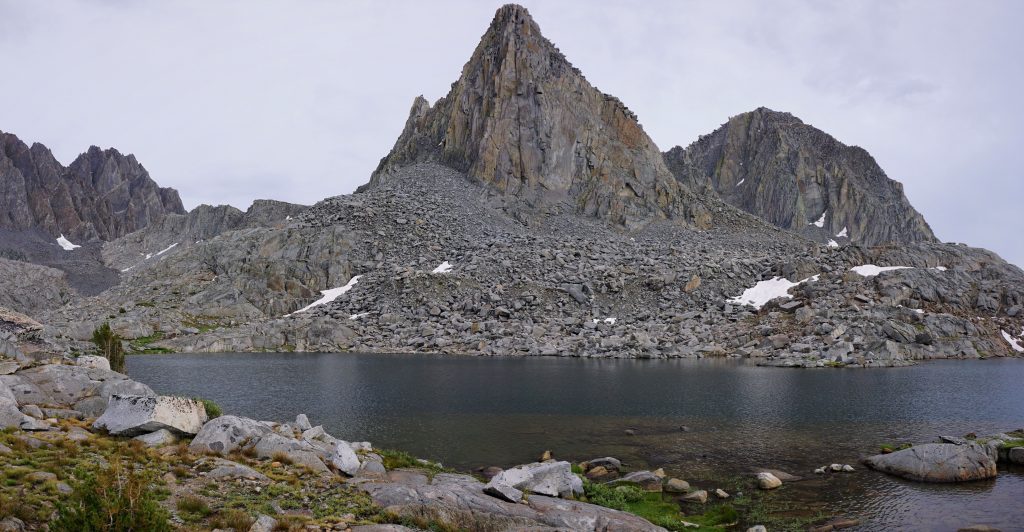
This basin, unofficially called the Bear Lakes Basin because of the lake names, was sparkling and marvelous as the sun came back out and dried the landscape from the afternoon deluge. There was a handful of lakes and dozens of little tarns throughout the landscape, with small meadows, rock gardens, and giant peaks in between. It was the most magnificent sight of the summer yet. We could have explored the lakes for days, but instead we had to power on.
The climb to Feather Pass was easy, but longer than it looked from a distance. An hour or more of boulder hopping and we reached the pass, but it was evening now and it seemed doubtful we would bake it all the way to Puppet Lake for the night. We descended down the next valley to an overlook above La Salle Lake.
Below La Salle Lake, we entered a very long, flat basin where we were able to make good time. A group of 3 passed us from behind on the way to Merriam Lake. They were the only other party the entire trip we saw heading the same direction as us, but we would pass them later that evening and never see them again strangely. We’re still not sure who was going faster.
We opted to keep pushing as far as we could get. As we neared sunset, we finally gave up on reaching the other side of French Canyon and called it a day in the meadows above the canyon.
As we were setting up camp, Kylie started crying. I asked her what was wrong; she said she was upset that she had given everything she had, suffered through the storm, and yet we still had not reached our goal for the day. We were falling further and further behind each day. I tried to point out that the true goal of this trip is not some number or line on a map, but rather to immerse ourselves in this amazing wilderness and challenge ourselves to be the best we can. In the end, all we can ask for is that we gave it our all and never gave up, never backed down. She certainly was doing that, bravely, as she always does. I love that girl more than anything or anyone. She inspires me every day to be a better person.
It was the most amazing day of the high route yet. We saw dozens of beautiful lakes, endless peaks, and hardly ever dipped below treeline. And still, nature had one last gift for us that evening.
Day 7: Merriam Lake to Evolution Lake
Down to French Canyon, up the valley to Puppet Lake, over pass into Humphrey’s Basin, past Mesa Lake and Lower Desolation Lake, across Piute Creek, past Muriel Lake and Goethe Lake, up to Alpine Col, down to Darwin Bench and Evolution Lake.
This was the make-or-break day and we knew it. Halfway through our trip, we would hopefully cross two passes today and reach the John Muir Trail. From there, if all else failed, we could simply take the JMT the rest of the way to make up for lost time. But, as we were learning, we could not simply predict from the map the nature of the terrain and how far we would travel. It could be a stroll down Bench Canyon or boulder hopping like North Glacier Pass or bushwhacking like Mono Creek. We just had no idea what lay beyond each pass.
The day started with a descent down into French Canyon, where we followed the wet, brushy trail up the canyon a little ways. We were not quite sure where to turn off the trail, but at one point we just decided to start heading uphill. We reached Elba Lake but the mosquitoes were so intense that we just kept moving uphill. I managed to snap a few photos through the swarm of bugs.
At Puppet Lake, we crested a huge plateau. There were many lakes, all with French names.
The next climb above these lakes was short and steep and passed in no time.
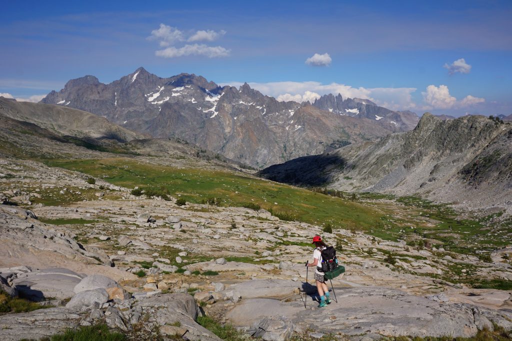
I reached the pass first, and it simply took my breath away: miles and miles of flat, lush meadows in Humphreys Basin all leading to a dark, glaciated ridge of peaks, the Goethe Range, guarding the skyline. It was both relieving and frightening. It was the best of views; it was the worst of views. No obvious pass lay ahead. This was not going to be easy.
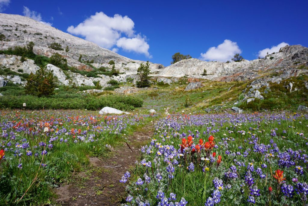
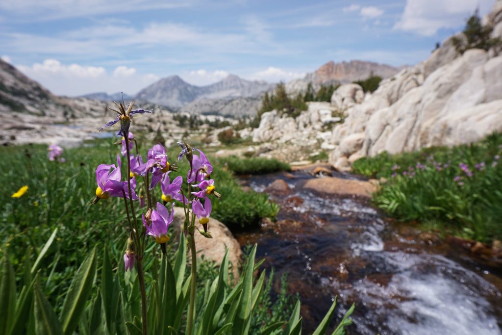
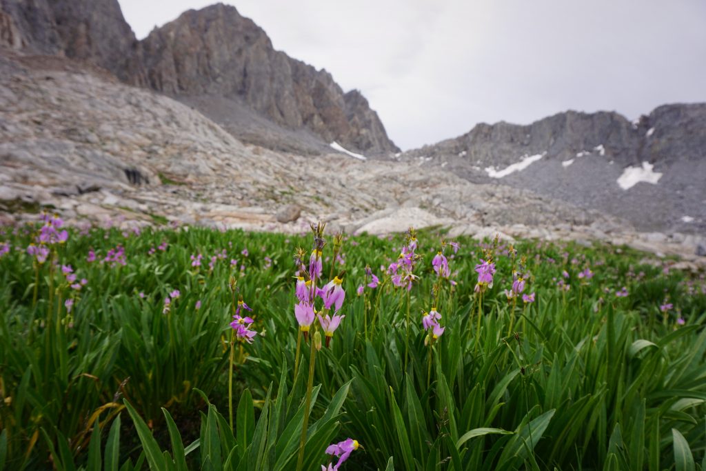
In the warm morning sun, we took a short break to dry out our soaked tent and sleeping bags from the moist campsite we had in the meadows. Then we descended into Humphreys Basin towards Mesa Lake. It was truly a stroll in the park: a grand park of wildflowers, sparkling alpine lakes, and unforgettable views. We thought we even heard “The Sound of Music” in the background as we danced through rolling fields. Humphreys Basin is simply magical.
We took our lunch break at Lower Desolation Lake. It was even warm enough for a quick dip in the lake.
At this point, we were doing well. We just had to cross one more major pass, descend a ways, and then reach the JMT! Unfortunately, the storm clouds were darkening over the Goethe Range. When would we get a break in the weather?
It started to drizzle as we forded Piute Creek and climbed up to Muriel Lake. The closer we got to the Goethe Range, the darker everything seemed. Vegetation slowly faded away, the sky got darker, and the rocks began bigger and more imposing. It felt like entering Mordor. At rocky Goethe Lake, we met some old men fishing. They said the rain made for better fishing. We chuckled.
We debated what we should do with the incoming storm, but we both realized we could not wait this one out. These storms seemed to be more than passing thunderstorms; they would last until sundown. We had to go for it. We had to brave on.
We made it a good way towards the pass before the real thunder and hail started. The boulders here were pretty large, so we found some pretty decent shelter underneath a house sized boulder, but we were still getting wet as huge hail pellets rained down. All around us, thunder boomed and we could see lightening strikes on nearby ridges, followed by rockfall. Honestly, it was slightly terrifying. After about 30 minutes, it seemed the lightning had moved a mile away or so, and a pounding rain replaced the hail, so we emerged and made a break for it.
The climb to Alpine Col was not too bad really, even covered in fresh snow. But when we reached the pass, much to our dismay, we gazed down at more boulder-locked lakes. The terrain was not going to get any easier.
We descended down to the first lake and began traversing around the left side. The rain just kept on coming and it was windy, blowing rain in our faces. The rocks were slippery and our hands were frozen, slowing our progress. But we knew there was no stopping here, no place to set up a tent. So we just continued on and on through endless boulders and snowpatches. It was miserable. Kylie was so impressive, keeping a good pace and never complaining.
And finally, nearly five hours after entering the storm, we left behind the rugged bouldery terrain of Alpine Col. The moment we stepped off the rocks onto a nice grassy bench, the rain turned off. It was as if it had been waiting for us to finish, to maximize our suffering, to test us to our limits.
The grassy bench led to a notch, and through that notch down a magical green canyon full of flowers and streams to Darwin Bench. The world had completely changed. A few sun rays poked through the sky and in the evening mist, a rainbow even formed. Damn it, Katie Perry is right: “After the hurricane, comes a rainbow”.
In an emotional moment, I felt a wave of relief wash over me. We were going to make it! It was as if our whole trip had culminated with that terrible afternoon getting over Alpine Col. We spent 5 hours shivering and scrambling over the hardest pass of the trip in the worst storm of our lives. The Sierras gave us everything they had, and instead of hiding, we embraced it, the highs and lows. I realized that after today, nothing could really feel that difficult. When your shoes are already gushing water, there’s no reason to avoid walking through a river. When your hands are already numb, there’s no reason to avoid scrambling on ice. And when your soul is drenched, there’s no fear to shed a tear. We survived the storm, and we are stronger now because of it.
We followed some climber trails down to the JMT and then up to famous Evolution Lake. It was sunset, and the air felt heavy with moisture. We looked around for campsites, but all the reasonable ones were taken my JMT hikers! They had set up camp back before the storm and were now emerging from their tents. None were very kind to us. Eventually, we accepted we would have to sleep in a puddle for the night. Again.
Day 8: Evolution Lake to Palisade Basin
Past Sapphire Lake to Wanda Lake and Muir Pass. Past Helen Lake down to Le Conte Canyon. Up into Dusy Basin, over Thundberbolt Col to tarn above Barret Lakes.
Neither of us slept very well since everything was completely soaked, but we did manage some sleep when we joined our quilts together and snuggled. Thus, we had an early start the next morning. As always, it was a beautiful, sparkling morning in the Sierras.
The JMT was bustling in the early morning with hikers eager to leave their wet tents also. It was cold until we reached the sun at Sapphire Lake. In some places, the trail was completely flowing with water still. The series of lakes in Evolution Basin is certainly the most beautiful part of the JMT we hiked.
Above us was the Evolution Traverse, a famous 8 mile long ridge scramble / rock climb. We did not do it this summer, but would love to come back some other time to tackle it!
After leaving Wanda Lake, it was a gentle climb to Muir Pass and the famous Muir Hut. The terrain here was barren and exposed, but the sunny morning was no threat. Despite no obvious snowfields, a crazy amount of water seemed to be emanating from the pass, making streams everywhere.
At Muir Pass, we joined about 20 other hikers in emptying our packs and drying out our gear and clothes. We listened to this woman moan on and on about how they got stuck in the Muir Hut during the entire storm. Stuck in a hut! Nevermind that most of us would have loved to be in that hut instead of in a wet tent or even worse, crossing a 3 mile long, 12,500 ft pass full of house sized boulders. But everyone has to have their #firstworldproblems, right?
We got going and began the long descent into Le Conte Canyon. The trail just kept going down and down.
The trail was covered in 6+ inches of water in some places, so we had to do boulder hopping occasionally, but it was still fast travel down the inter-Sierra highway. Slowly the terrain transitioned from alpine to sub-alpine to deep canyon. Le Conte was a very deep, beautiful canyon.
We stopped for lunch at the Le Conte Ranger station hoping for a weather update, but the rangers were gone. We met an ultra runner doing some big 50 miler. I think he was excited that people recognized him as an ultra-runner, but I think it was quite obvious given his little vest pack this far from a trailhead. He informed us the weather forecast had gotten worse and we were in for thunderstorms every day for the foreseeable future.
After lunch, it was a long climb up the trail towards Bishop Pass. We passed a group of Chinese backpackers heading down to the JMT. There seem to be a lot of Chinese tourist groups backpacking in the Sierra.
Upon cresting Dusy Basin, the clouds had completely darkened the sky and it grew eerily quiet, except for the occasional crackling of thunder. We left the trail and started cross country by the lakes. We heard some sounds to our left and saw a father and daughter peeking out from behind a tarp. They had a strong European accent of some sort. They had settled down for the storm and were obviously troubled by how it did not seem to pass quickly (like everyone advertises with the Sierras). They asked us what usually happens, and we were honest: you probably would not see the sun until the next day. So be ready to wait under that tarp for the long haul.
Surprisingly, we made it across most of Dusy Basin without feeling much of a rain drop. At the upper lakes, we got a magnificent view of Isosceles Peak. And the mighty Palisades, the tallest and most alpine group of peaks in the Sierra, were just a stones throw away.
The wind really picked up and cold rain started blowing sideways. Suddenly, we spotted a blue tarp on the far end of the lake. Shelter! We decided just to make a break for it.
At the tarp, we found a group of maybe 7-8 men in the late 20s to early 30s. They were a group of friends from college who made one backpacking trip together each summer and were hanging out in Dusy Basin, fishing and hiking. They were super kind to us, letting us wait out this storm underneath the tarp. And when big gusts of wind came, they were on it, securing the tarp down in so many ways with a variety of impressive knots!
We talked about our trip and their eyes grew wide when we told them what we had been through and what we still had ahead of us. I think they began to realize we must be malnourished so they started feeding us and giving us extra food since they were heading out the next day. It was one of the kindest things we have ever experienced in the backcountry. So an hour or two later, we left their camp with happy bellies and hearts and extra food in our packs. One of them, Mike Kelly, even later on found us on Facebook to check in that our trip went okay! Thanks to everyone in the group for their kindness and concern!
When we said our goodbyes, we bounded towards Thunderbolt Col with an energy we had not felt in days. Shelter from the storm, tons of extra food, and the rain had stopped! My starving body felt light and strong as we made a rising traverse towards the col.
The terrain was not as foreboding as it appeared from a distance, with a series of slabs and benches. The last bit of the climb to the 12,400 ft pass was a little loose, but it was over soon enough. At the col, we stood under the shadows of 14,000 foot peaks, gazing across Palisade Basin and into the vast Sierra wilderness. As far as the eye could see were rocky mountains, bathtub lakes, and not a single sign of man. I think tears started to swell in my eyes; I was so happy to be in this beautiful place, on a grand adventure, with the most wonderful person in the world by my side every step.
We trotted a victory lap down towards the Barret Lakes, finding a beautiful little tarn around 12,000 ft. We decided to make this our camp for the evening. Being so far above treeline, it was the first time in a long time mosquitoes were not an issue. But then again, we had not seen many mosquitoes since the massive rainstorm the day before. They probably all drowned.
At one moment, the sky suddenly turned a soft yellow, painting the landscape with an ephemeral light we had never seen before. It was one of those magical moments that become accentuated in your mind because of the suffering involved in the experience. The mind plays games with the memory, putting aesthetics over pain. They say that alpinists have terrible memory. I’d vouch it’s the same for thru-hikers.
It was a fitting end to a wonderful day. We had reached a turning point in our trip. We were filled with hope and ofptimism as we went to bed.
Day 9: Palisade Basin to Lake Majorie.
Over Potluck Pass, down past lake and up over another pass, down to Palisade Lakes. On JMT to Mather Pass, down Upper Basin, across Kings River, to Lake Majorie.
We slept well. It was one of our drier nights since we were camped so high, but also colder, so we quickly got going in the morning.
We started traversing above the Barrett Lakes. Once we entered the sun, we warmed up quickly. We took a break at Potluck Pass, which had great views of the Palisade Crest.
I remember the guy at Red’s Meadows had mentioned something about cliffs and difficult route finding near Potluck Pass. Looking straight down, it was pretty obvious that we would get cliffed out, so we instead descended rightward on some ramps and benches. It was pretty easy, taking us down to a few little tarns.
There was also a big, beautiful unnamed lake. Behind it was Mt. Sil, possibly the grandest of the Palisade peaks. Unfortunately, there were already some big clouds stacking up against it at only 9 am.
We climbed over another little pass and then down to a nice meadow.
Beneath this meadow, the terrain steepened gradually towards the valley bottom. At first it was just slabby, then there were little scramble sections to get around, and then there were full on slabby cliffs to navigate. Somehow, there always seemed to be a diagonal ramp to link two blank sections together. It culminated with a 3 inch wide tiptoe across a long ledge. Incredible! We called this section the Magical Palisade Ramps.
From here, it was short trot to rejoin the JMT at the Palisade Lakes. We were way ahead of schedule! We had heard the Palisades off trail section from Dusy Basin to here was very difficult, but honestly, it was one of the easiest because there was nearly no choss and no bushwhacking!
High above us was the summit of Middle Palisade, upon which we had stood a mere 11 days before. We took a nice morning break around here to dry out gear and cook some delicious soup one of the guys gave us the day before. The weather started really darkening on our climb to Mather Pass and we got some moderate hail right before the pass. However, when we reached the pass itself, we seemed to be in between squalls.
Here at the pass, we met a single hiker coming the other direction. Turns out he was a boy from New York our age who was doing the SHR solo! Like us, he was a climber trying thru-hiking. I think he was the only one truly of our kind that we saw the entire trip, so we hung out for a while and chatted. Hopefully the rest of his trip went well!
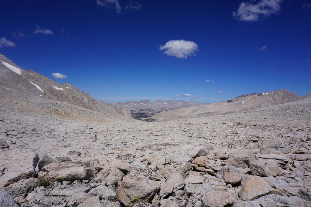
The descent into Upper Basin was easy and very scenic. It is this massively flat basin above treeline, kind of reminiscent of the Uintas in Utah. As we got down into the woods, the storms finally caught us. At first, we took shelter underneath a big tree from the pounding rain, but decided to move on when lightning started striking nearby. The booms were massive, louder and closer than we had ever heard before.
When we reached the Kings River crossing, it was still pouring and the river had swelled many feet above its normal level, necessitating a pretty deep ford. Kylie said I looked ridiculous, fording the river with my rain kilt on, holding my sleeping pad above my head to keep my upper body drier. Why didn’t I just swim across the river?
When we finally reached our camp at Lake Majorie, we were starting to dry out. It was our fourth straight day of getting absolutely destroyed and soaked, so it was getting old, but we also had started to develop an ambivalence. We no longer had any hope in this supposed “mild Sierra weather”. We knew what was coming each day, and we accepted it. When you accept your suffering and try to watch yourself from an outsider’s perspective, your suffering can become an amusement. Slapstick comedy.
Day 10 (only day completely on trail): Lake Majorie to Vidette Meadow
Over Pinchot Pass, down Woods Creek, across bridge, up to Arrowhead Lake and Rae Lakes, over Glen Pass. Down to a little past Vidette Meadow.
This was our big day on the JMT. We had the option of doing the short “Baxter High Route” as described in the Southern SHR, but we felt like we should probably skip it given that we were tired and the weather was so predictably bad each afternoon.
It was yet another vibrant morning. Everyone was getting up at first light around Lake Majorie, eager to move on after another cold, wet night. We bounded up to Pinchot Pass and were the first ones to make it.
We reached the sun shortly after Pinchot Pass, so we had to stop and take some layers off. The terrain here was very easy and open and the trail going up to the rocky passes was always expertly engineered. In some places, it seemed like a miracle that there was a wide trail through the cliffs and boulders. We could see more and more why the JMT is so famous: amazing views, amazingly easy!
We once again noticed how diverse the Sierras are geologically. It seemed the mountains changed character after every pass, with different textures and colors of rocks. Crater Mt. more closely resembled Laurel Mountain and the other peaks back near Mammoth than the other mountains in the southern Sierra.
The descent into Woods Creek was pretty cool. It was a tighter Box Canyon, while Le Conte was very wide.
At the bottom, the trail took a left and crossed Woods Creek, which at this point was a moderate sized river. There was a huge suspension bridge to walk across, which bounced up and down a lot. Only one person could go at a time and some people really struggled to keep their balance. Apparently it was some highlight of the trip because lots of other people had lined up to cross and were filming it and such.
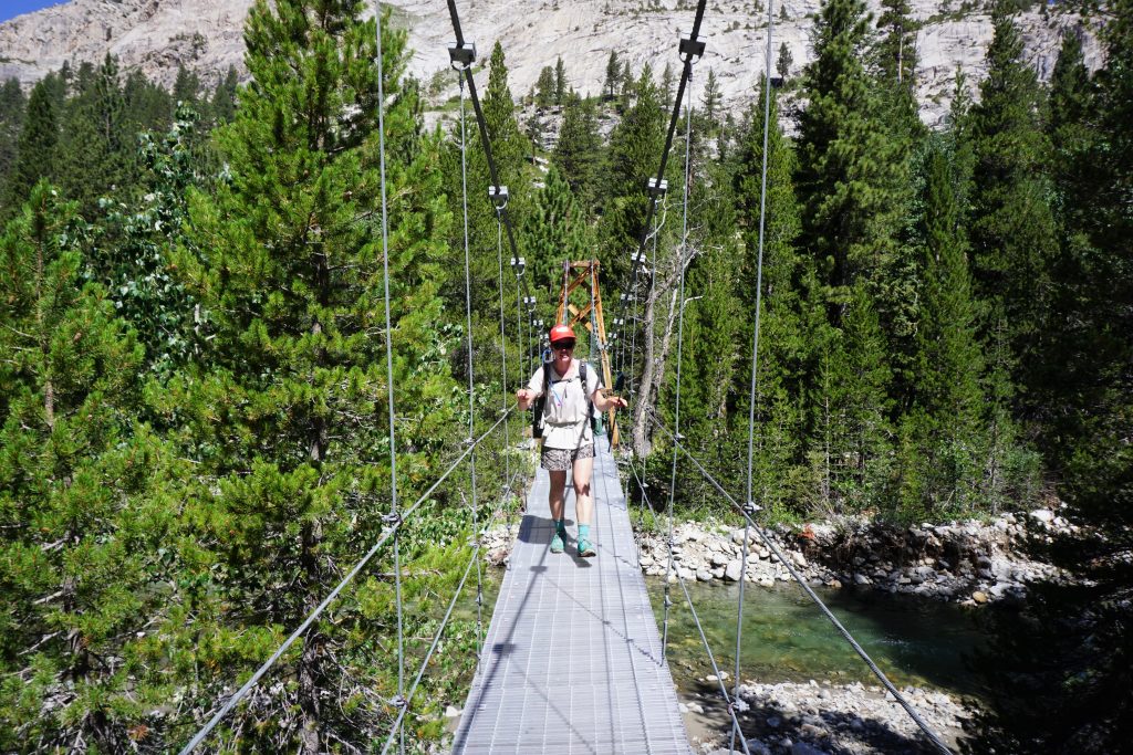
We took a lunch break underneath the bridge by the river and went swimming. We must have seemed like trolls to the others.
We continued to cruise on south, with darkening afternoon clouds. They did not look as bad as previous days but we knew better.
When we reached the Rae Lakes, skies were pretty dark. Adventure Alan in his Southern SHR warned how crowded the famous Rae Lakes are, but there was hardly anyone there, and I think it was even a weekend day. They are very nice lakes.
As we were snacking by the lake, a solo man asked us if he could sit with us, the “cool kids”. He was a guy from Georgia with a southern drawl who had never backpacked before but was convinced to do the JMT when he saw it in a “pamphlet”. He was pretty hilarious, complaining about how the pamphlets had promised perfect weather.
Once we said goodbye to the stranger, we had a significant climb to Glen Pass. Glen Pass is another one of those passes that looks like so many we had already done on the SHR and JMT. Completely above treeline, dark, imposing, bouldery. Yet once again, there was an immaculate trail cutting switchbacks through the car-sized boulders, making for easy travel. Although it hailed a tiny bit on the way up and was thundering all around, we somehow entered a tiny halo of sun at the pass. Perfect timing!
We got some rain on the descent from Glen Pass, but it was not too bad. It seemed the worst of the lightning and rain was a just a little south. there was fresh snow/hail covering the slopes in the distance.
As we descended towards the valley, we got a brief view of a distant Charlotte Dome, where we had climbed two weeks earlier. Soon enough we crossed the Charlotte Dome approach trail, but this time we kept heading south.
Everything seemed wetter once we reached Vidette Meadow, so we assumed it had rained and hailed more here. We kept on trucking all the way to the area where we were looking for a trail turnoff towards Golden Bear Lake. We were not sure if we would make it to the lake before sundown, but at least it was on trail. Or so we thought…
When we got to the point where we thought the trail should be, there was no sign of it. We walked by a decent campsite area and found two old women in the sixties. Remarkably, they were also looking for the trail to Golden Bear Lake! Badass old ladies! They claimed a few years back there was a turnoff with a sign, but it seemed to be gone. They said that they had actually found a Kings Canyon National Park ranger earlier in the afternoon who claimed she had just done the trail a few days earlier, but when she tried to show them the trail, she suspiciously “couldn’t find the trail”. It all seemed quite fishy. We did not want to push it, so we decided to camp next to them in a mudpit. Classic.
All in all, it was not the most scenic day, but we were very pleased with our progress. We covered 25-26 miles at high altitude, an unthinkable amount to most JMT hikers and even PCT thru-hikers! We were in a good spot for our last three days.
Day 11: Vidette Meadow to Wright Lakes
To Golden Bear Lake, up Center Basin to Junction Pass, down and then back up to Shepherd Pass, over Wright Lakes Pass.
We got up extra early this day, factoring in that the ascent to Golden Bear Lake might be a bit more difficult that we had expected. Plus, everything was soaked and cold so we were ready to get going by first light. We went back to where we thought the turnoff should be, but did not find any trail, so we decided to just head into the woods.
We wandered uphill, catching faint remnants of a trail at times, but never anything consistent. At one point, we wandered upon a huge 100 liter locked vault that said “National Parks Property” on it. It was very strange…
We eventually reached a buggy meadow beneath the lakes. The mosquitoes were thick, so we kept moving and reached the open shores of Golden Bear Lake.
Along the shores of the lake, there were nets and other equipment! Perhaps a fish hatchery or research spot? Everything supposedly belonged to the national park. My suspicion is that the Kings Canyon National Park “removed” the trail in the last few years to keep people out of this area. Such a shame! Not cool.
Unsurprisingly, at the far end of the lake, we picked up a decent trail, as there should be when no one purposefully destroys it! This trail leading to Junction Pass was actually the old JMT, so it remains important for historical reasons.
The trail up Center Basin was easy and pleasant, making for a surprisingly stress-free morning. We would undoubtedly clear Junction Pass, the high point for the day, before thunderstorm time. It was a huge basin, so it was kind of disappointing the JMT does not go through here any more.
As we gained the ridge and approached Junction Pass, we could see over to the JMT at Forester Pass. There were even some little ants marching up the little switchbacks!
The last bit to Junction Pass was simply breathtaking. It was definitely one of the best vistas of the entire trip. It felt more like a summit than a pass.
The trail down the other side of the pass was in much worse shape. At first, it was just easy scree, but then it became lots of side hilling through loose choss. We could see why they had abandoned this trail and moved the JMT one pass to the west.
Eventually the awful moraine terrain gave way to some meadows and we crossed a boulder field down to the Shepherd Pass Trail. Then, once again, we climbed back up into a huge moraine field. The eastern Sierra is filled with this massive moraines. The Shepherd Pass Trail is one of those trails that should not exist; massive boulders are moved to make an easy trail out of an otherwise hostile moraine.
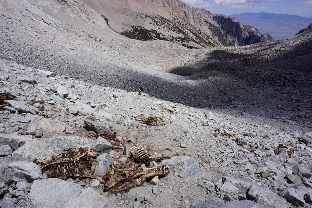
On the way up to the pass, we encountered a morbid smell and the skeletal remains of a herd of deer. They probably slipped on the ice back in the spring and fell to their death, still rotting in the summer sun.
At the pass, we had a nice view into the more mellow and vegetated Tyndall Creek drainage. We took a lunch break here. We were now through two of the three high passes of the day already! We were moving much faster than expected.
Thunderstorms were storming across the valley already, so we kept moving quickly, realizing we might be able to make camp before the storms for once! The climb over Wright Lakes Pass was short and easy. We had a view of our final destination for the day!
It was a pretty lake basin completely above treeline, and completely void of other humans for miles and miles, as far as we could see. A few lonely charred trees stood on the shores of one of the lakes as a gentle reminder of the danger of electricity. We made camp along the shores of the lake, happy to beat the storms for once!
We went for a swim and then took a nap as we listened to the raindrops outside our tent. It was nice to rest, stay dry, and finally be ahead of the weather that had destroyed us for so many days in the row!
Day 12: Wright Lakes to Iceberg Lake
Up Wallace Creek to Wallace Lake, up to Tulainyo Lake, over Russell-Carillon col, down to Upper Boy Scout Lake, up to Iceberg Lake.
For the first time in a week, we woke up to a relatively dry camp. It was nice to not have to roll up a sopping went tent.
Our morning walk through Wright Lakes Basin was very easy and flat. We warmed up greatly once we hit the sun, which was nice. The outflow of Wright Lakes Basin eventually becomes just very marshy, so we gave up on keeping our feet dry and walking through the marshy meadows. They were very beautiful.
We left the creek and traversed left, entering the Wallace Creek drainage. The map showed an abandoned trail and we knew at this point better than to expect this trail to exist. Yet we were actually able to find the old trail and follow it mostly pretty easily all the way to near Wallace Lake. We were pleasantly surprised and this helped our pace all morning.
Looking up from Wallace Lake, we were not totally sure which pass to head over next. What we saw in front of us did not align with the map, but we knew we were headed in the correct direction.
As we crested over the first ridgeline we began to realize that we were simply looking at far too large of a scale on the map. The “passes” we had seen from down low were merely low points to enter the even larger upper basin! All in all, we realized the climb to the Russell-Carillon col would be about two miles long, an incredible amount when you consider that distance is as a crow flies!
Tulainyo Lake is this huge, stagnant lake at over 13000 feet. It seems to. sit on top of the world more like a peak than a lake. It was beautiful in a barren, inhospitable way.
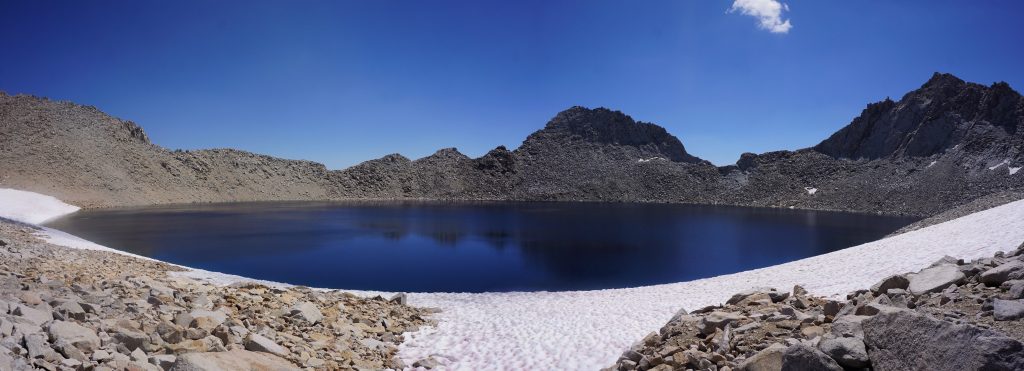
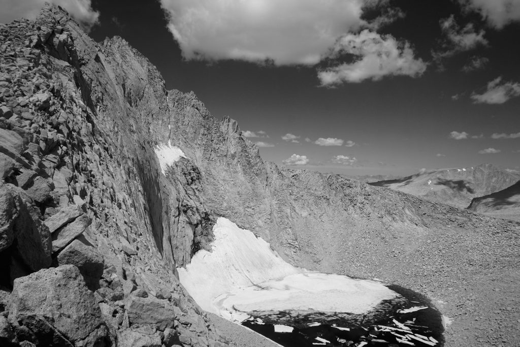
Next, we began the climb up to Russell-Carillon col. It looked intimidating from below, but was actually mostly just class 2 with maybe an occasional class 3 move. We had tremendous views of Mt. Russell and the ice filled lake beneath it.
We took our lunch break here at the pass, admiring the fine view of Whitney. We started our trip hundreds of miles away, but it was now so close! We could see straight down the valley 9000 ft to Lone Pine, where our car was presumably parked. The end was near!
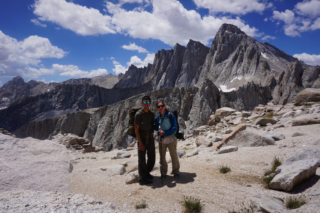
The next descent went easy enough at first before picking up steepness down loose screefields towards Upper Boy Scout Lake. There were cairns, as we pieced together this must be the descent route for climbing Russell.
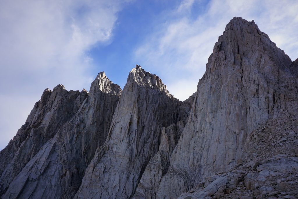
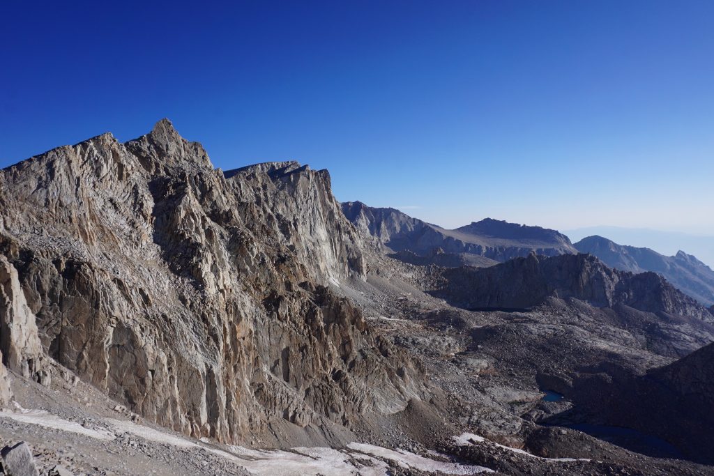
Once down in the valley, we met up with the approach trail to Iceberg Lake, the basecamp for many epic technical climbs on Whitney and Russell and also the famous Mountaineer’s Route, which we would be ascending the next morning. The climber’s trail was pretty easy to follow and we began the start of our final climb of the trip: to the summit of Whitney!
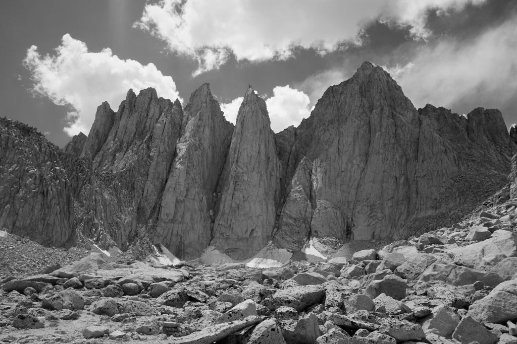
Around each corner, Whitney loomed larger and larger. It was incredible to imagine that the Mountaineer’s Route ascended this face at only class 2 to 3! Keeler’s Needle, the pillar to the left of Whitney, looked so incredible. There is a 20 pitch rock route on it that we would like to climb next time we come back.
On the way up, we passed some climbers coming down. We chatted with them about climbing and explained to them the trip we were on. They were aghast with how long we had been out and how much ground we were covering each day. One of them even bluntly remarked, “I tried thru-hiking once”, suggesting he would never try it again. They must have taken pity on our withering bodies, so they gave us their remaining food and kept hiking out.
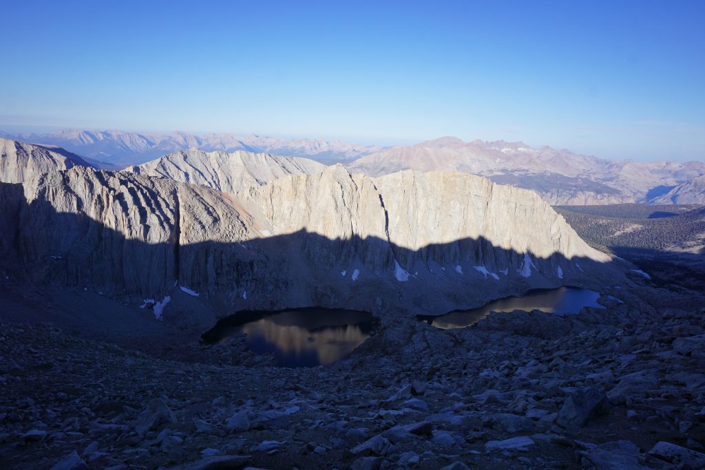
When we got to Iceberg Lake, it was strangely deserted. There are many impressive bivy sites with rock walls built up, so we quickly chose one, went for a swim, and then ran into the tent as the daily afternoon thunderstorm began to pound the highest peak in the lower 48.
We stuck our heads out for a little in the evening, but were early to bed. Our plan was to wake up early the next morning and summit Whitney in the dark to watch the sunrise from the top!
Day 13: Iceberg Lake to Whitney Portal
Up Mountaineer’s Route to Whitney Summit, down trail to Whitney Portal.
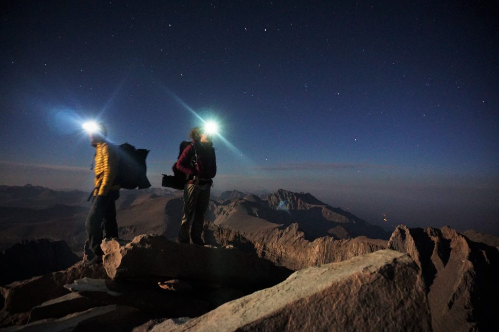
I didn’t sleep well overnight. I felt like I kept hearing rats trying to get into the tent even though our food was hung up outside on a stick. Also, I think we were both just tired of sleeping on thin foam mats for the last two weeks. When our 1 am alarm went off, we were ready to get going.
We ate our last granola and powdered milk breakfast, packed up our gear and were on the move a little before 2. The starry sky was plenty bright enough for us to see the obvious gully that led into the Mountaineer’s Route.
As the gully narrowed, it got looser and looser. At some points, it was difficult to move upwards without two poles (and Kylie broke one back near Lake Italy). But at the same time, we had to be delicate placing our poles. Once I stabbed a pole in the scree and it triggered a large rock slide above me. We listened to the rocks falling, echoing down the walls of the gully. We were glad we had this awful route to ourselves!
Frustrated with the awful rock quality, we bailed to the sides of the gully and found more challenging scrambling, but better rock. We’ll take it. I guess what can you really expect when you climb straight up a moraine gully that has been waterlogged by massive thunderstorms for the last week?
We had no trouble routefinding with headlamps in the dark and pretty quickly we reached the first saddle. Russell looked epic under the stars, but we realized we were already above it, which meant we were less than 400 ft from the summit!
We turned left and started the real scramble. Some icy snow forced us further left. Here, the scrambling was actually high quality 3rd class with an occasional 4th class move. It was fun wandering in the dark, not sure where each move would lead us. But soon enough, the terrain leveled out and we saw the summit hut. We were on top!
It was a little after 4 am, so the route took us maybe 2.5 hours with all our overnight gear, a slow pace, and many attempts at timer night photography. All in all, I’d have to say it was one of the 3 worst scrambles I have ever done! Pretty sad for a classic American scramble route…
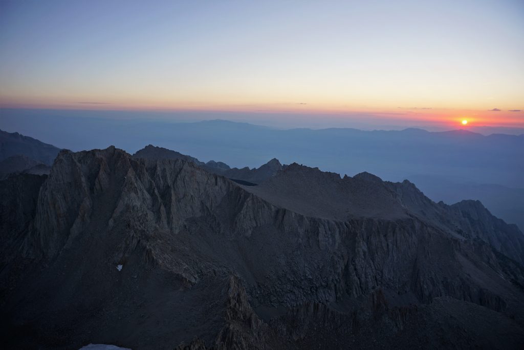
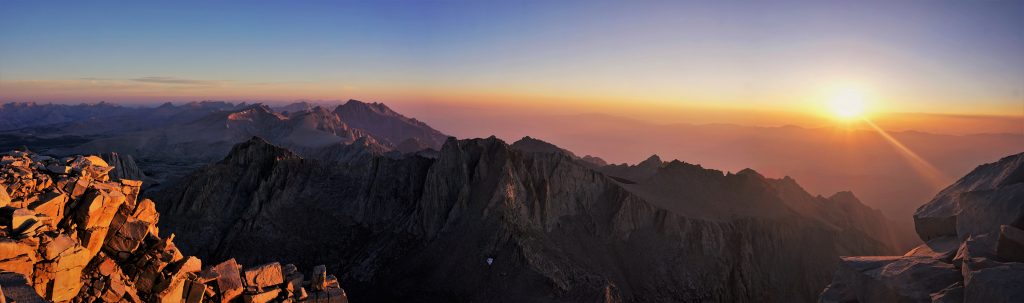
It was cold and breezy on the summit so we hunkered down in the summit hut with a few of the other early arrivers from the Whitney trail in the hut for an hour or so. We came back out as it was starting to get light.
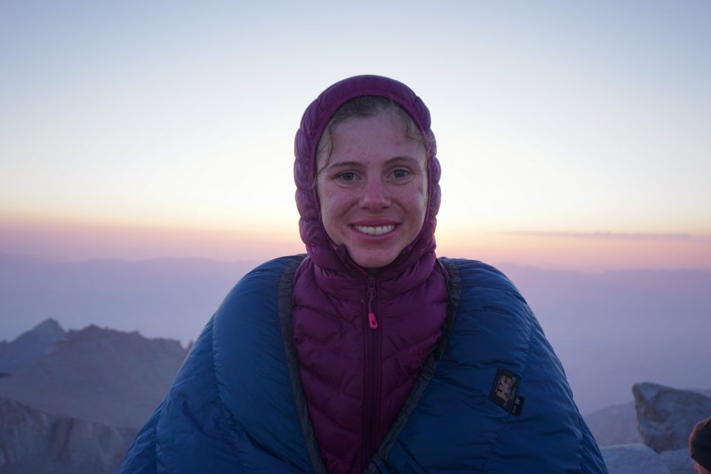
By this time, there was a good crowd on the summit. We found a good spot and threw our quilts on for extra warm. Slowly, the sun crept over the distant White Mountains and first light bathed the highest point in the contiguous 48. It was truly beautiful and with a beautiful girl next to me. Over 200 miles, thousands and thousands of feet of gain, too many passes to count, and a half dozen soaking thunderstorms culminated with this. There could be no better way to end this journey and no better person to complete it with.
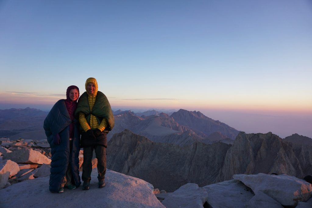
Once we were satisfied the best of the sunrise had passed, we put away our quilts and began the long hike back to Whitney Portal. The trip was in the bag at this point, and it was nice to be able to finally think about food and a shower. The whole walk along the ridge of Whitney was very pleasant and beautiful. We passed a steady stream of hikers coming up.
Going down off the ridge from Trail Crest, we fully entered the sun and were able to take off some layers. The trail here was about 5 feet wide, with probably a hundred of 10-30 ft long switchbacks carved into the side of a class 4-5 slab. I don’t think most of the other hikers appreciated how amazing this trail was. It was truly a masterpiece of engineering and will power!
At this point, we also began to pass the floodgates of day hikers who had started from Whitney Portal early in the morning. We passed people from all walks of life. At the end of the group, the stragglers were these skinny ultrarunners with Badwater100 hats. When we asked, we learned that they had just finished the Badwater100, one of the hardest ultra races in the country through Death Valley, and were now hiking up Whitney with their families! Incredible! We passed one crew with White Pass shirts and asked if they were from Washington. Not only were they from WA, but we had met one of them, Michael, in the North Cascades two years ago and he had taken a photo of us then! Crazy!
When we were no more than 20 ft from the end of the Whitney Permit Zone, we got stopped by a ranger to check our permits. We had traveled over 200 miles without seeing a ranger and were stopped at the last possible moment! He looked at our nightly destinations and bewilderment began to show on his face. “How did you get from here, to here?” He would ask. It was a long explanation…
The rest of the hike out was easy and we pulled into Whitney Portal a little before noon. It was a big moment for us, taking the last steps to civilization, finally letting our bruised bodies relax. It was bittersweet, both relieving and saddening, to be done. We wasted no time finding a hitchhike down to Lone Pine (from an Swiss guy borrowing some nice American woman’s car!) and back to our home away from home, the old minivan. A pizza buffet was the first order of business. 14 days of peaks and valleys, highs and lows, and the biggest adventure of our lives.
Reflections
There is without a doubt in my mind that our Super Sierra High Route was the most challenging, magical, and beautiful trip of my life. Each day, there were moments of great fatigue and hunger but also of such natural brilliance. All the struggles just made the highlights even more incredible. We will remember this trip for a long time.
The High Sierra is an exceptional place. The alpine terrain here is so diverse and vast, making continuous off trail travel above treeline both possible and manageable. In many ranges, like the Cascades, the ridges are steep and the valleys deep and brushy, so such easy off trail hiking is simply not possible. I think the high basins, lakes, and plateaus are the most unique aspect of the High Sierra, so it was fitting to experience almost the entire range in this way.
In the future, I know I will be drawn more to high routes. They are a perfect blend of mountaineering and running. It suits my identity as an alpinist: a slow runner, a weak climber, but an adventurous soul. Maybe some day I will be able to bring this same vision and experience to the North Cascades.
Finally, I must acknowledge that what truly made this trip special was my incredible partner, Kylie. She brought joy, humor, and beauty to every moment in the trip, even the worst ones. Because no matter what was going on around us, if I was with her, there was no place I’d rather be. Thank you, dear, for joining me on the journey of a lifetime.
Notes
- Although this route is long, shorter sections could be appropriate for the thru-hiker looking to try cross country travel or the climber looking to thru hike because the navigation and terrain is pretty easy.
- There was very little class 3 throughout the route, and none of it was exposed. Just a lot of boulder hopping and class 2. Most importantly, very little choss! Thanks, Roper!
- We found navigation to be mostly straightforward, even with terrible maps and no guidebook. You are mostly above the treeline and routefinding is intuitive. Only twice did we use a compass or GPS.
- While the southern SHR was the easiest and most bang for your buck, we felt the middle section between Red’s Meadow and Palisades was the most beautiful and wild part.
- While we managed with no resupply from Red’s Meadow to Whitney Portal, I might recommend resupplying at Parcher’s Resort near Bishop Pass. It adds a day, but then you do not have to carry 8-9 days of food.
- While the route is traditionally done south to north and routefinding may have been easier this way in a few spots, we felt north to south was fine and made more sense to culminate with the highest peaks.
- Mosquitoes are awful here!!! Only DEET works, Picardin is no good.
- Don’t believe the bullshit: the Sierras can have awful weather in the summer, just like any other mountain range. Actually, it was much worse than even the Cascades in the summer. We got literally inches of rain every day. Give up on keeping your feet dry. Also, plan the storms into your schedule. If you’re not comfortable crossing high rocky passes in a lightning storm, dial back your plans. You will get destroyed. We just did not have much of a choice and had to brave the storms.
- Speaking of footwear, our La Sportiva Ultra Raptors and Akyras handled all the terrain amazingly. Superior grip on rock and snow. Durable and comfortable.
- If doing this earlier season, some might want microspikes and/or an ice axe.
- I’d recommend reading Roper’s guide, not necessarily for the route descriptions, but because the history of the high route is super interesting!
- The Mountaineer’s Route on Whitney is awful! Worst choss and scrambling of the entire trip, funny enough.
- If it’s a trail, but not the JMT, don’t count on it being in very good shape. They don’t really maintain any trails here except for the JMT and the trails leading to the JMT.
- We got away with only one bear can, using an ursack when we had more food because those nights we were in an area where bear cans were not required. Tricky! We never had any issue with animals and food.
- Do it! It’s amazing and you won’t regret it.
I’m constantly in awe of your trip reports. I’ve got a couple weeks off in August and this looks great. Do you have a rough map you can share with me? Otherwise I guess I can piece it together from your descriptions. Did you carry 2 weeks of food?
We resupplied at Red’s Meadow, so carried 4 days and then 9 days of food.
Oops, left a comment on the wrong trip earlier… I’m curious if you are able to share a rough map for this trip? It looks fantastic. Your trip reports are, as always, a big inspiration.
Hi Chris! It follows the Roper Sierra High Route very closely, and then the Southern Sierra High Route somewhat, which you can find online also!