
Secrets of the Glacier Peak Wilderness
This summer, I’ve started to branch away from the classic climbs and trails of the Washington Cascades. We have such a vast wilderness sitting just east of Seattle yet it seems like people just go to the same places over and over again. In the past, I’ve been guilty of this too: “questionable weather forecast? Let’s head to the Stuart Range.” But I’m beginning to discover that the most moving adventures come when dare to be bold, draw a line on the map, take a chance, and venture where few others do.
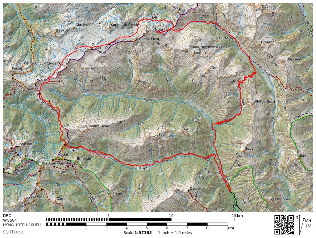
A big project of mine has been to revive the lost art of high routes in the Cascades. I was so inspired by the Sierra High Route last summer that one of the first things I did when I returned home was map out of an off trail route that splits the Glacier Peak Wilderness, which I called the Glacier Peak High Route (part of the greater Cascade High Route). Originally, Logan, Daniel, Jacob and I were planning on tackling the entire behemoth in one week from Cascade Pass to the summit of Glacier Peak, but with some unseasonably wet and cold July weather, we “settled” for an extended Ptarmigan Traverse from Cascade Pass to Image Lake. The biggest question mark on the southern half of the trip was getting from the Napeequa to Glacier Gap, so with a small weather window later in the week, I drew up a loop from the White River Trailhead to capture this section. The rest of the guys were still too tired from earlier in the week to join me, but I didn’t mind going solo; after all, it felt fitting to return to the Napeequa River Valley, the most magical place I’ve visited, alone.
Part 1: White River TH to White Pass
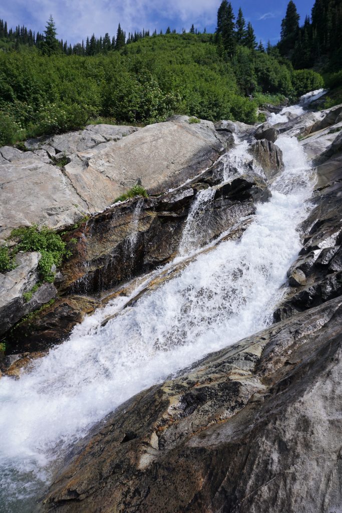
I hate driving in the dark in the summer, so I did not leave home until 5 am and pulled into the White River Trailhead around 7:30am. I had read that the Indian Creek Trail to approach the PCT was awful brush, so I was surprised to see such a nice bridge crossing the White River to start the day.
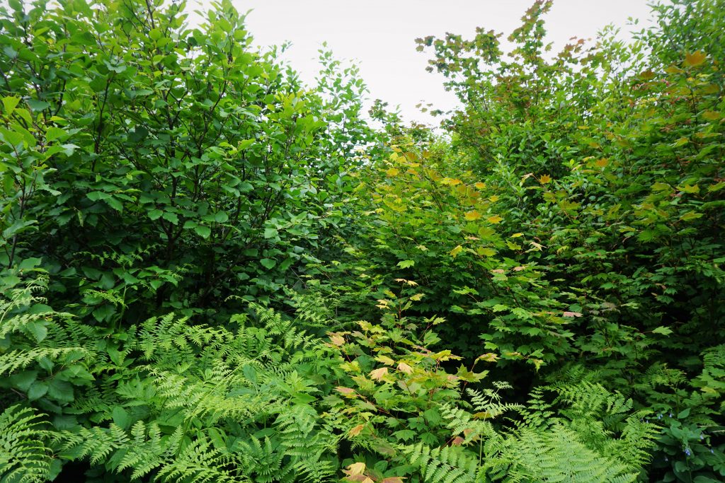
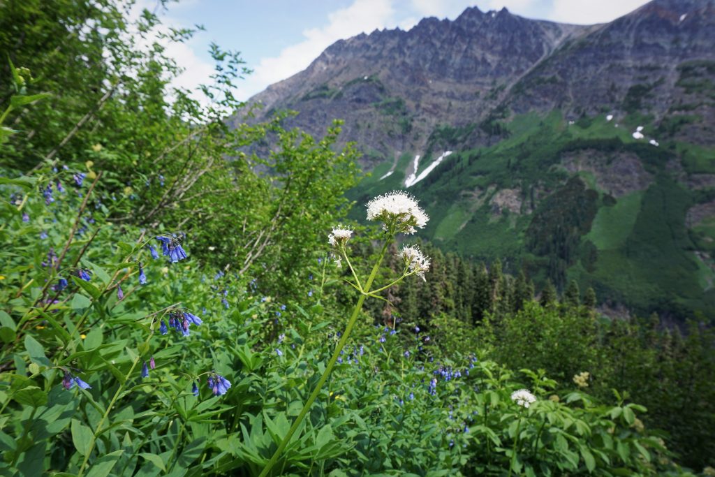
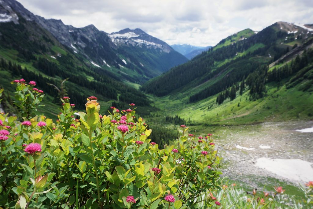
For the first four miles, there were a few overgrown sections, but overall the trail was pretty decent in gently spaced forest. I was moving pretty fast and beginning to think that the recent trip report on the WTA had over-exaggerated the brush. But the mosquitoes were awful! My friend, other half-Asian Kyle (or maybe I am the other one?), had warned me about them and I luckily brought a bug net for my face. I was moving at close to 4 mph to keep them away. However, about 4 miles in, the trail started entering meadows in the Indian Creek Valley and the true battle began.
At its best, the brush was waist height, obscuring my feet, and I could feel my way through the meadows with my feet, sensing where no brush was emerging from the ground. And at its worst, the brush was 8 feet tall, thick, disorienting, with creeks and marshes running underfoot. It was the most soul-sucking, clothes-drenching, mosquito-swarming, swearing-inducing, awful awful bushwachking I have ever experienced. You’d think that in a lowland trail like this, you’d enter the forest some and the undergrowth would thin out, right? Wrong! It was just so relentless; I was Sisyphus, condemned to an eternity of Cascade brush.
All along, I just kept expecting things to get better, but it was not getting better. How could the forest service even call this trail “the access trail to the PCT”? There was no trail! Fake news! I consider myself pretty damn good at tracing animal trails and such, and I even lost this trail a few times in thickets of brush, stumbling through mud and mosquitoes. Should I just give up and go home? I was soaked and mentally beaten. But if I’ve learned anything from the Cascades, it is that the most rewarding experiences involve intense suffering. It would all be worth it in the end, I told myself.
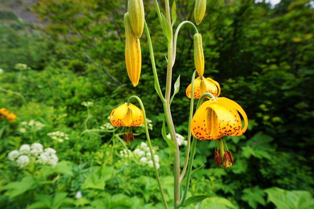
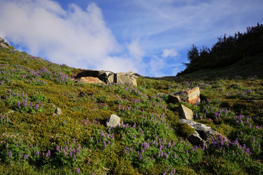
I decided to distract myself by taking pictures of the nice flowers and creating some musical parodies:
“Baby now we got bad brush…”
Or perhaps the more risque:
“I like big brush and I cannot lie!”
I contemplated writing a bestseller: “Zen and the art of bushwhacking” where I’d travel the country, searching for the brushiest trails and forests, getting all philosophical, comparing bushwhacking to searching for meaning in life or finding a life partner in the “brush” of distractions in modern society. It’ll be a bestseller. I just needed anything to pass the time and distract myself.
Around 12:30, I stumbled out onto the PCT. Joy and relief rushed through me. I had completed 12 of the brushiest miles of my life in only 5 hours, for an average pace of nearly 2.5 mph! It is definitely one of my proudest accomplishments in the mountains to date.
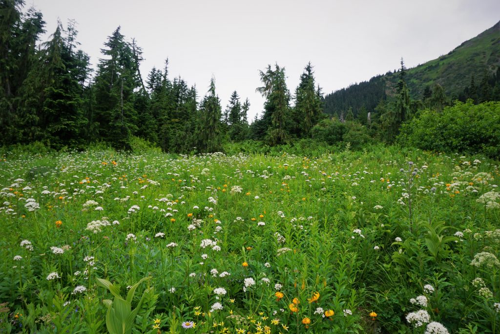
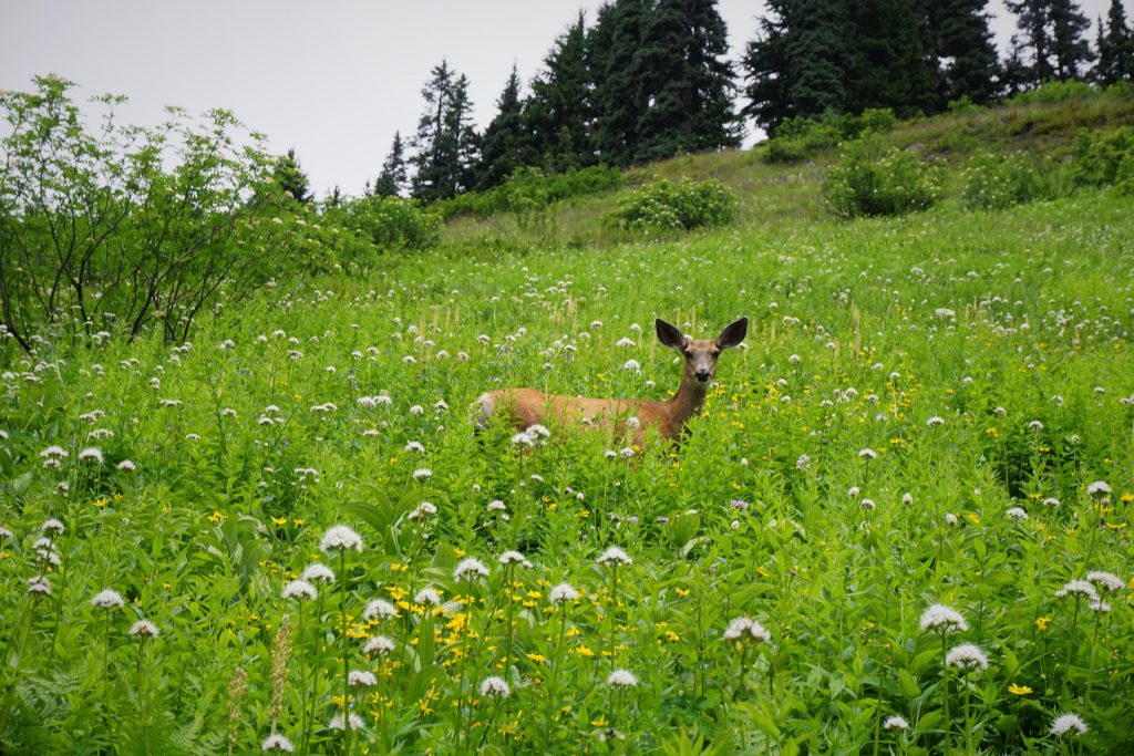
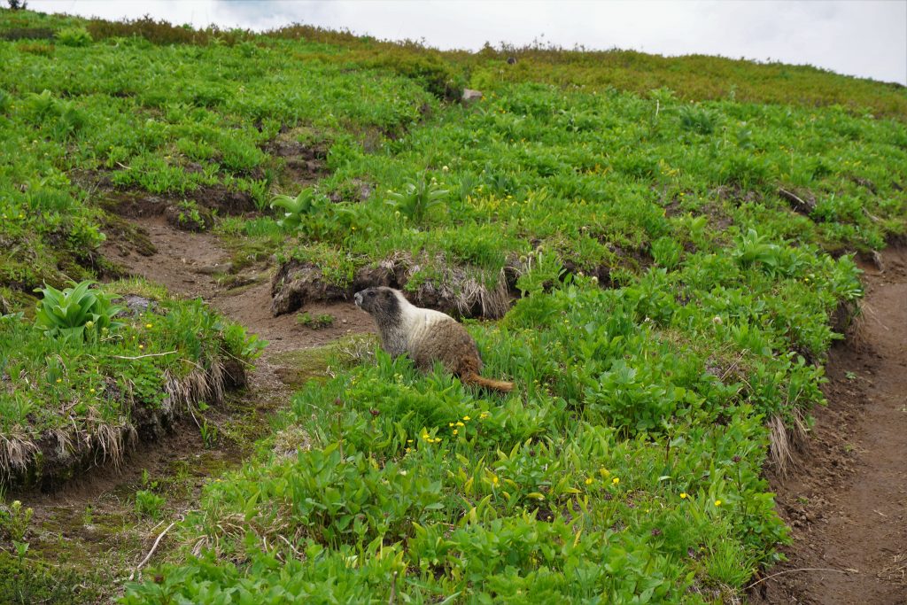
The PCT was like a fantasy land of flowers and meadows. I saw some marmots and a deer up close. If I was a mini-bear (what we call marmots), this is where I would hang out. But then again, I say that about every picture-perfect meadow in the Glacier Peak Wilderness.
I passed a few thru-hikers heading south. Seems like the popular choice this year was to skip up to Canada from Lone Pine and do the rest of the trip southbound, ending with the High Sierra. I commend this decision rather than trying to cross the snowy Sierra in May.
At White Pass, I stopped and ate lunch next to a nice couple probably just older than me. The woman, Kayla, was from Bainbridge Island and asked me if I know a guy named Jake Robinson, who supposedly was one of the youngest people to complete the Bulger’s List. I did not know him, but when I arrived home after this trip, the Jake Robinson had commented on one of my blog posts! What a coincidence!
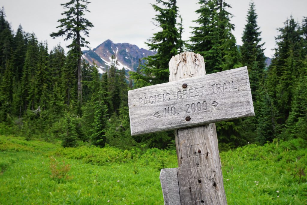
Part 2: White Pass to Butterfly Pass
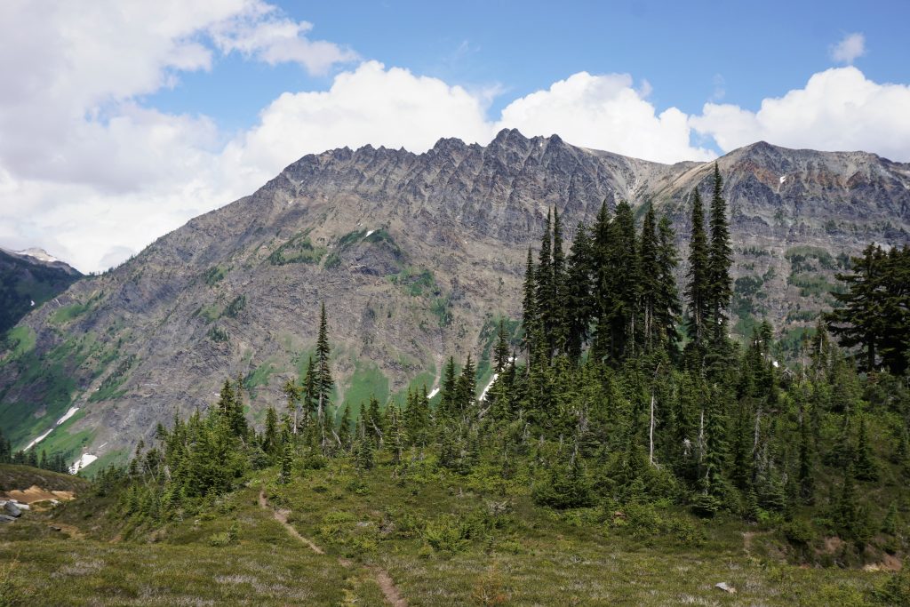
I said goodbye to the PCT highway and started on the nice trail that heads toward Glacier Peak.
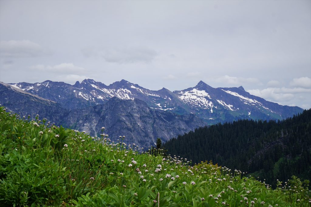
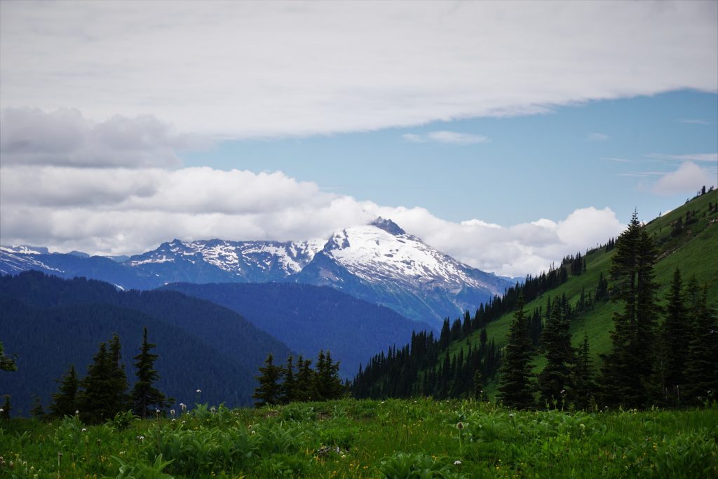
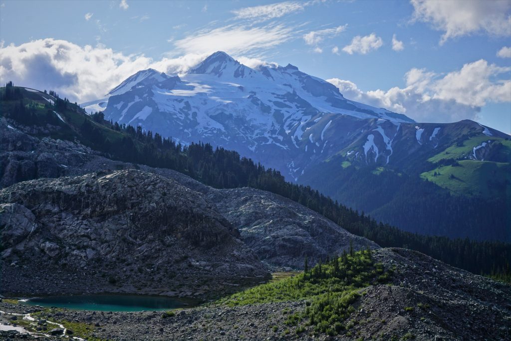
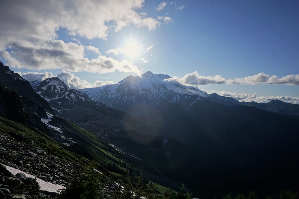
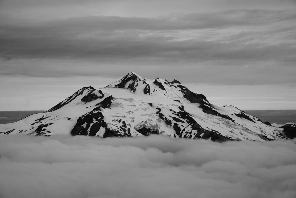
I got a little tired of the trail and decided to head up and over the ridge, even though it is certainly faster to take this trail for as long as possible. At the top of the ridge, I peered into the marvelous Whitechuck Valley, although Glacier Peak itself was obscured in the clouds.
I descended rightwards, traversing towards the basin. At the valley floor, I started heading towards Glacier Gap on easy terrain, a mix of snow and rock. In the distance, I saw some runners heading back. They seemed to be moving pretty fast, even for someone doing Glacier in a day. After returning home, I learned that this was a dude from Spokane who had just set a new Fastest Known Time (FKT) on Glacier Peak of under 8 hours! Incredible! I took about 16 hours a few years ago and will never come close to that kind of speed.
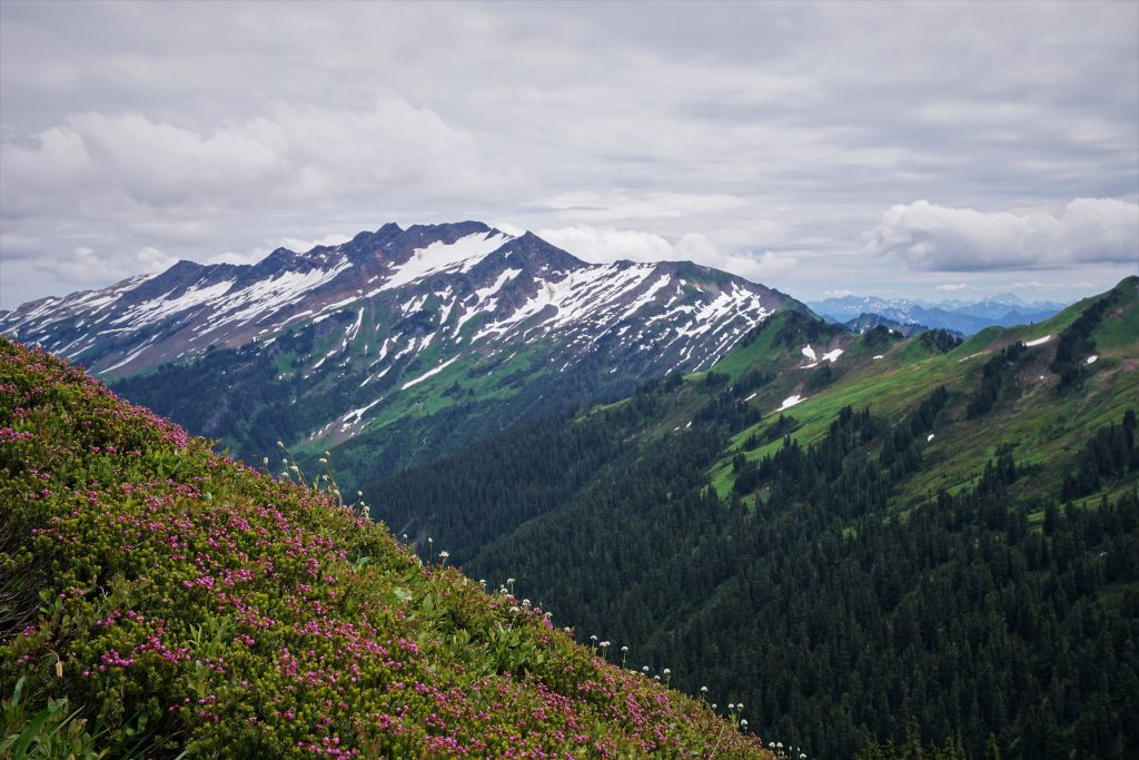
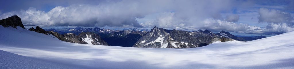
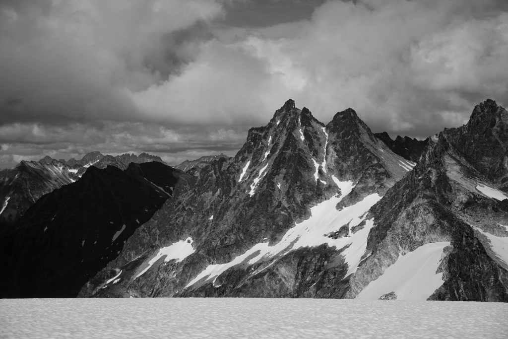
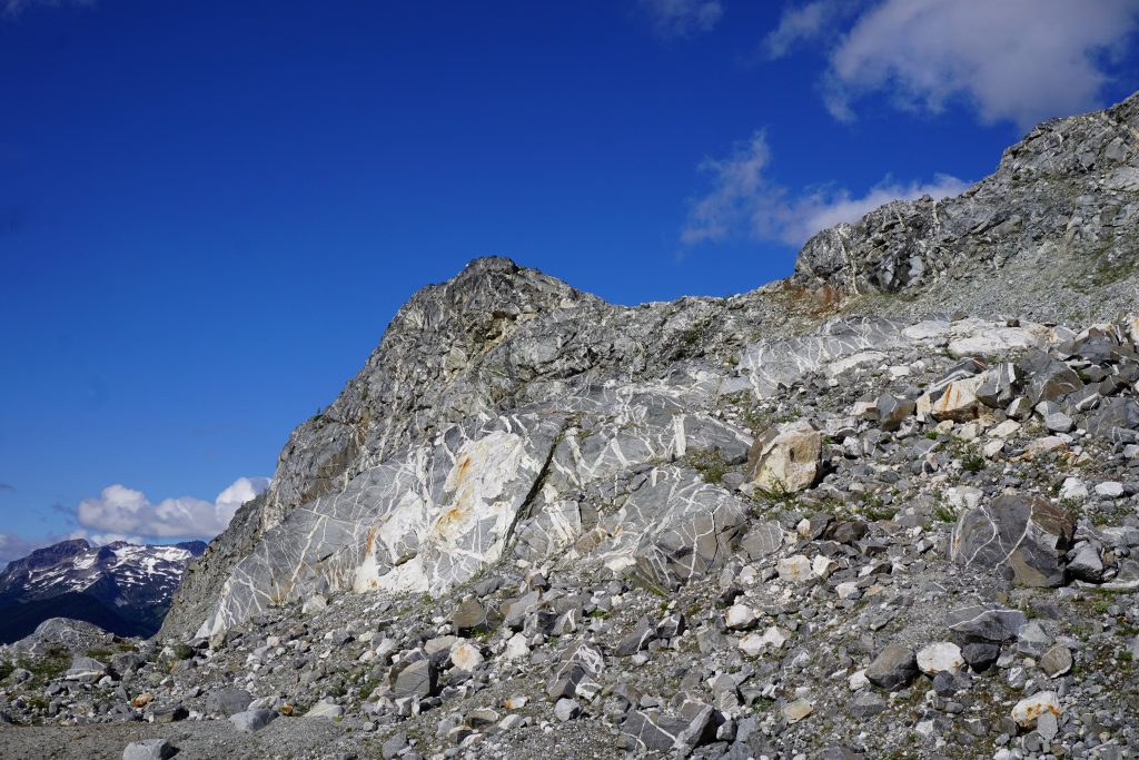
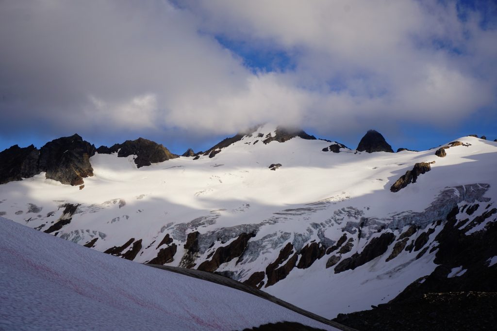
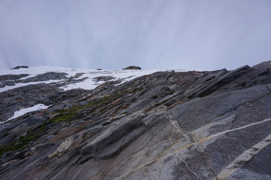
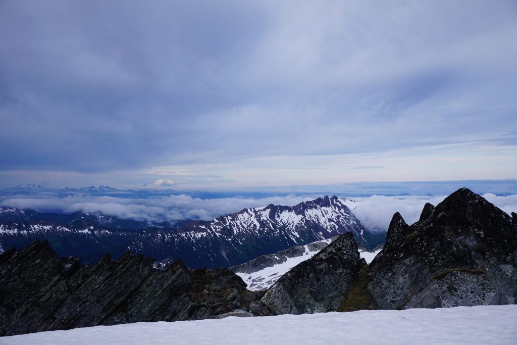
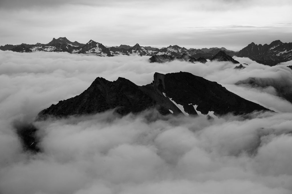
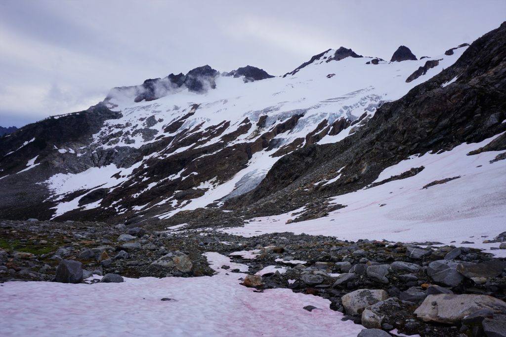
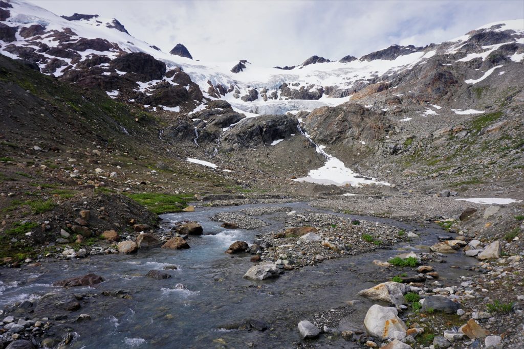
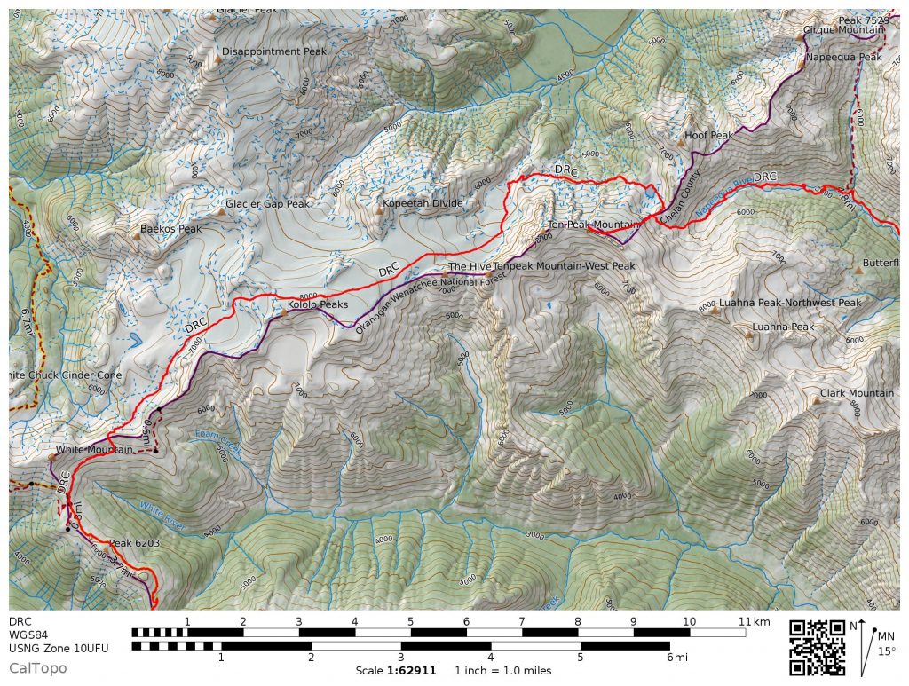
As I approached the much diminished Whitechuck Glacier, I left the normal path and started heading up and across the glacier. The Kololo Peaks were coming in and out of the clouds, but basically my goal was to get near the top of the Kololo Peaks through some snow finger on the upper Whitechuck Glacier. Fortunately, I had just enough visibility to see the passage and headed up onto it.
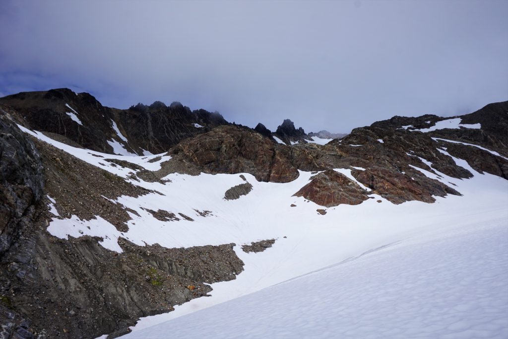
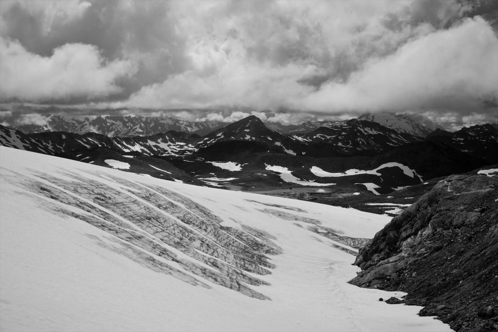
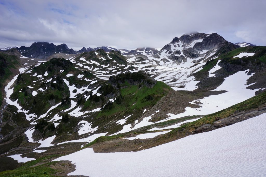
I ascended low angle snow through a cloud all the way to a rocky headwall. It was difficult to see where to cross, but it seemed I had chosen the correct spot because the little slot I moved through was obviously worn down by other people. I was only a few hundred feet below the summit of Kololo, but decided to pass, since it was still obscured by the clouds. Additionally, it was already 5 pm and I wanted to make it into the Napeequa Valley by nightfall!
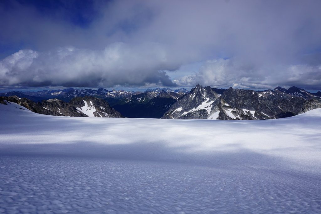
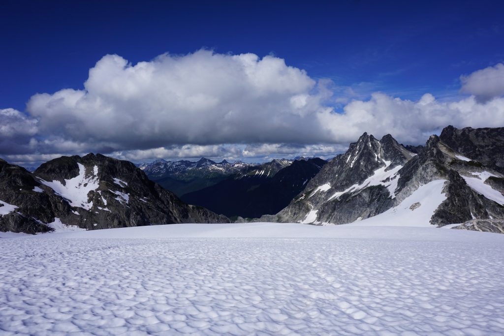
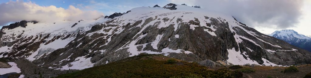
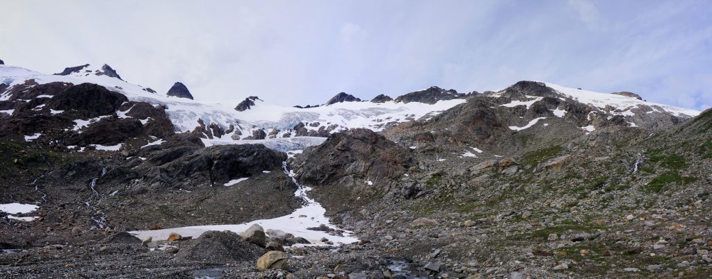
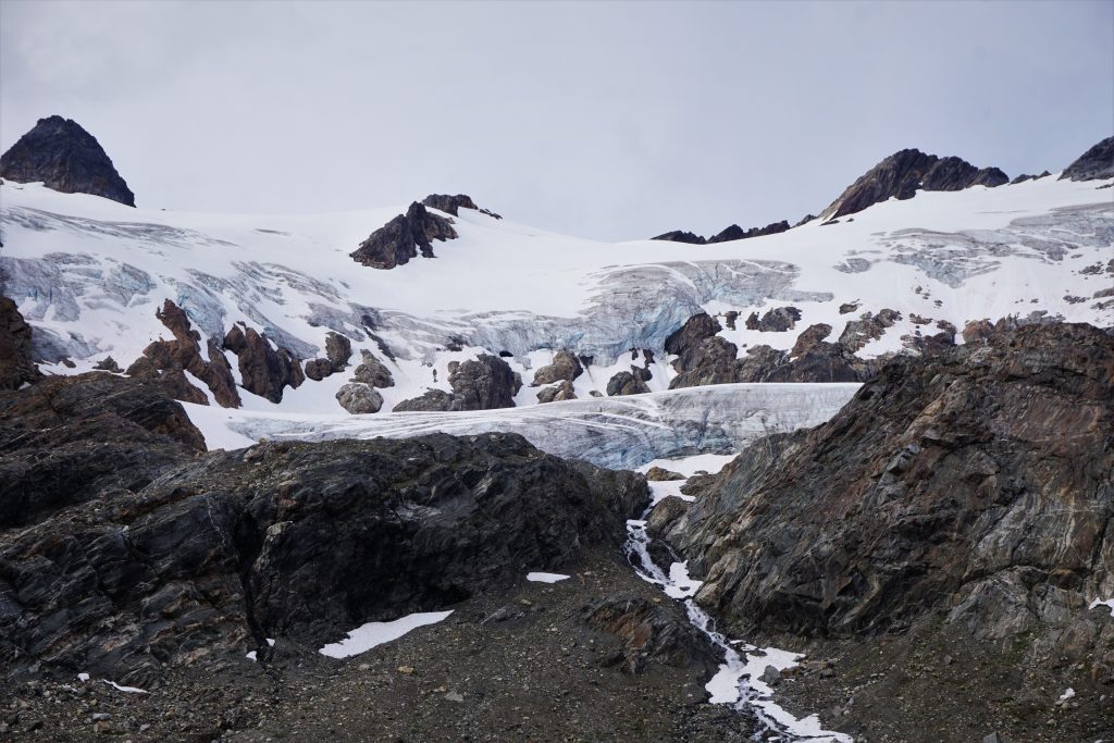
I stepped onto the upper Suiattle Glacier and immediately the clouds started to breakup. The Kololo crest was catching and breaking up the clouds. I stayed high above visible crevasses and traversed slightly uphill towards the Honeycomb Glacier. It was exciting to start to be able to see things again.
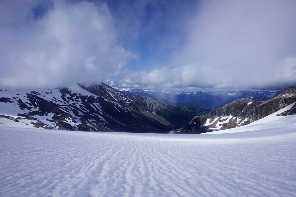
The view from the upper Honeycomb Glacier was a sight to behold. It was huge, wide, filled in, and low angle. It was like multiple football fields in width and slowly carved its way downhill towards Tenpeak and the distant Entiat Range including Fernow, Buck, and Chiwawa. Earlier in the week, we had gazed across at the expansive Honeycomb Glacier from Miner’s Ridge and dreamed of running down its gentle slopes. Now I was about to get to experience that dream.
Shadows shifted across the landscape, a gentle breeze cooled the afternoon sun, and I trotted easily down the massive hunk of ice. Alpine climbing, rock climbing, ski mountaineering, and sky running is really all about movement: we move in the mountains in different ways depending on the season, whether it be on skis, rock, or foot. The purest moments come when our movements are not at odds, but in harmony with the mountains around us. It can feel just so damn effortless. And ultimately, these are the moments that move us.
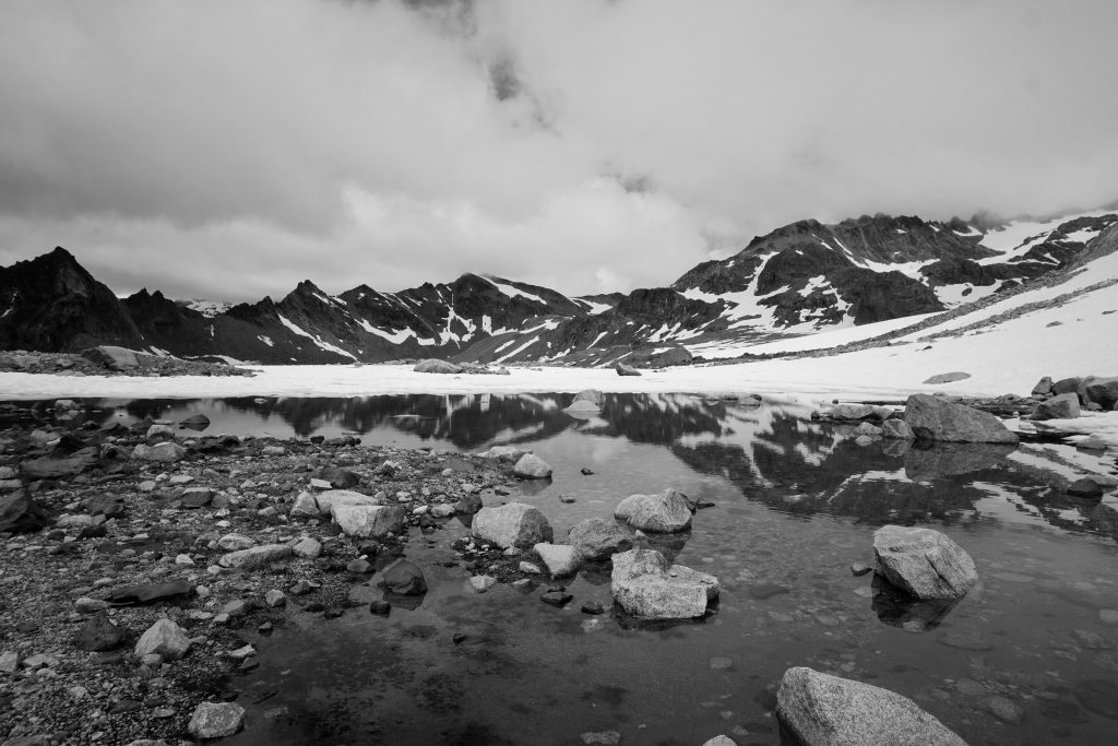
I clung to the right side of the glacier as it steepened a little. The glacier has receded massively, creating a melt lake at the terminal moraine. It appeared that there was a bench high above the lake I could sidehill to, but the terrain looked very loose and unstable so I decided to descend all the way to the lake and work my way up from there.
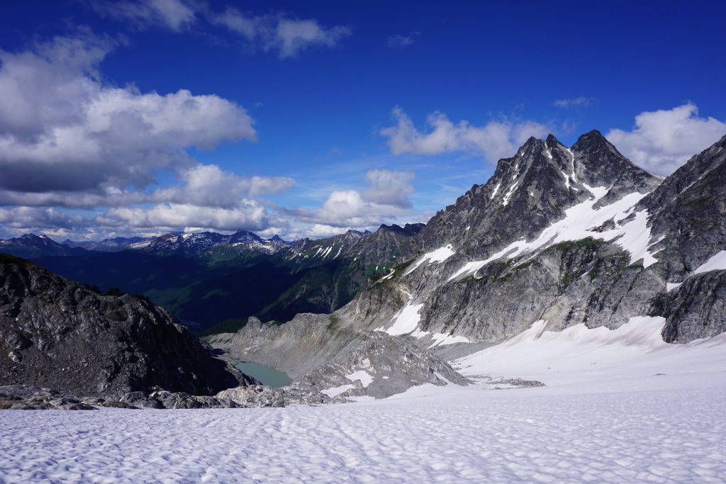
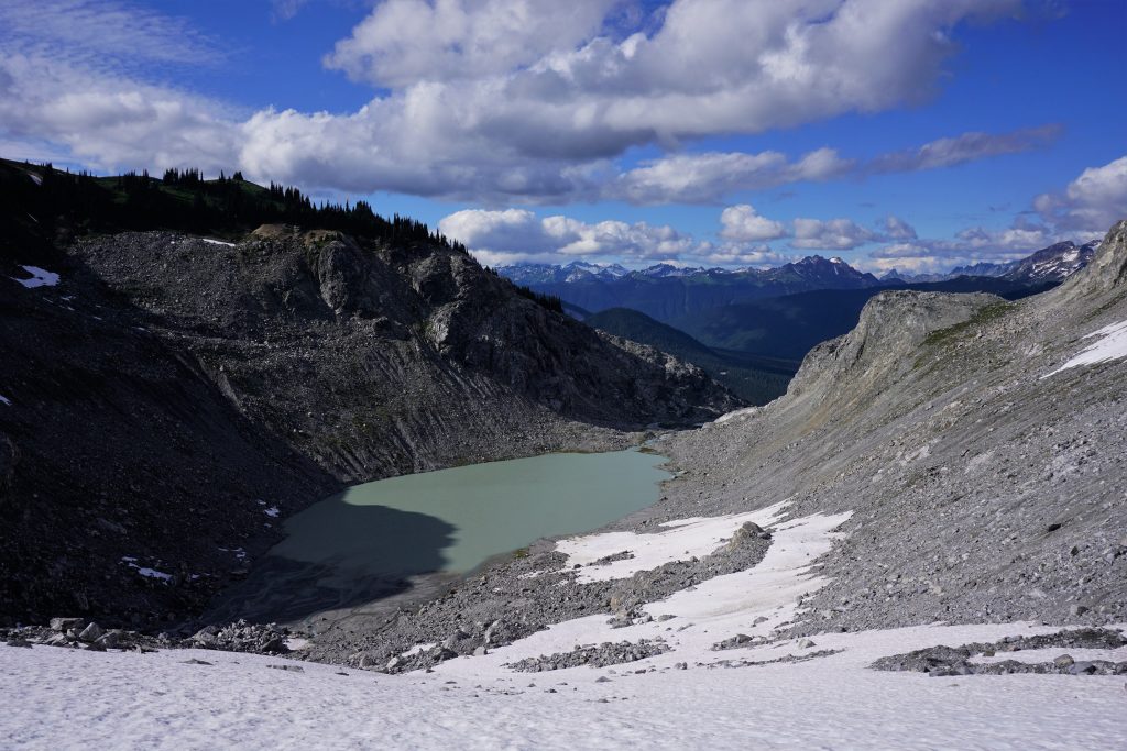
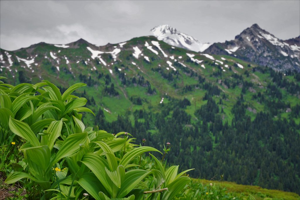
Honeycomb Lake was a mix of turquoise blue and silty grey. All around, the terrain was shaped by rock and ice. It was such a fresh, raw landscape, where the power of glaciation was drastically evident. Yet just a few hundred feet above the lake, I could see a perfect lush alpine meadow juxtaposed against the steep chossy moraine walls, a sight both beautiful and beastly. The Glacier Peak Wilderness is certainly a place where extremes clash, and the result is Cascadian perfection. This dichotomy between glaciers and wildflowers is why I am so in love with this region.
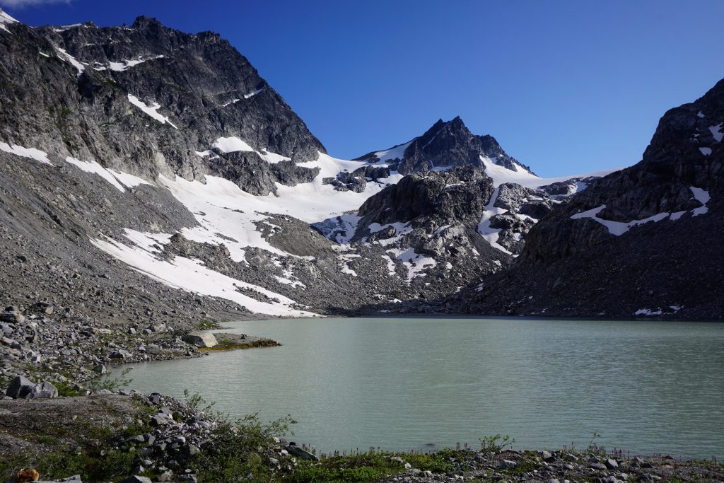
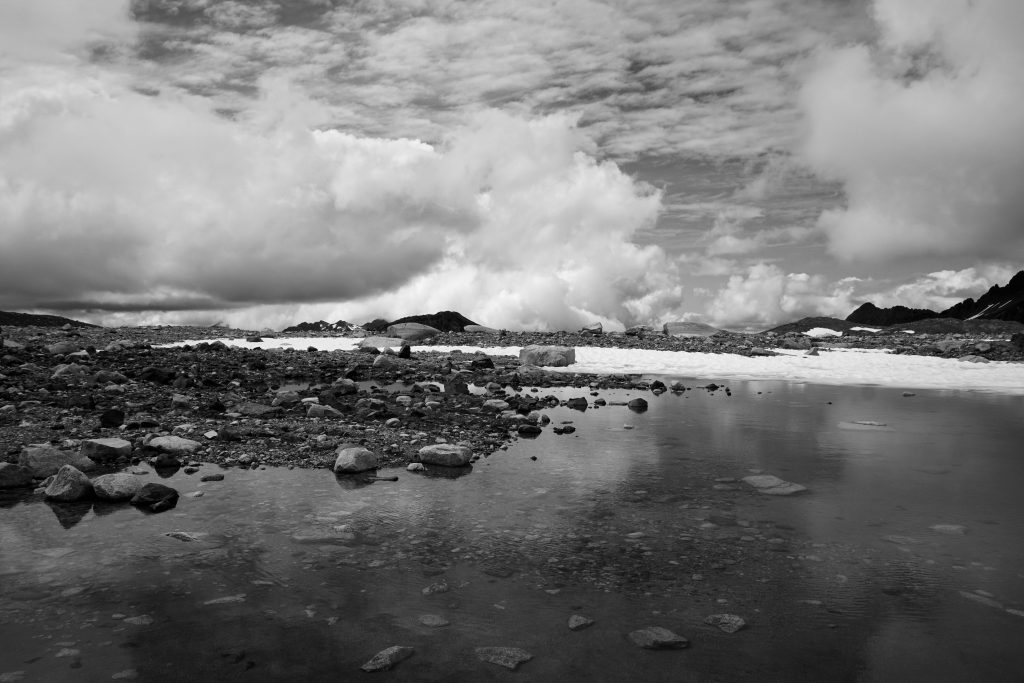
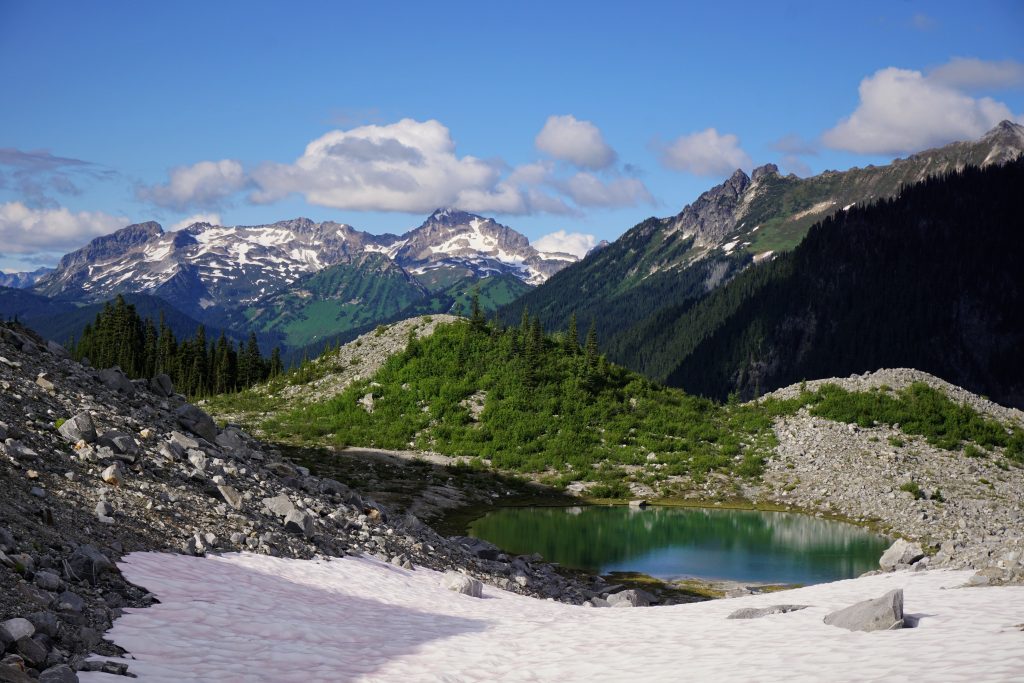
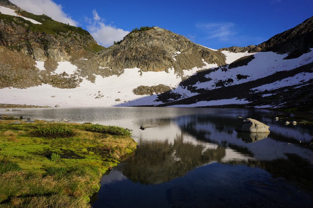
From Honeycomb Lake, I climbed a few hundred feet to an obvious shoulder with a little tarn.
I passed the tarn and found myself on a lovely bench formed by previous glaciation on the north side of Tenpeak Mountain. This moraine was not quite as fresh and had enough soil aggregation that vegetation was growing on its far end. It had a lovely little lake at the terminal moraine, perched high above the wild Suiattle River Valley. I decided to call it the Tenpeak Tarn.
Next, I prepared myself for a long mile or two of sidehilling beneath Tenpeak. I knew from reading “Routes and Rocks” that this would be the most taxing section. The hillside seemed to vary between steep heather hillsides and rocky moraine gullies every few hundred feet. I crossed probably two dozen steep gullies, each presenting their own unique challenges. I slipped on wet heather way too many times to remember, but powered on.
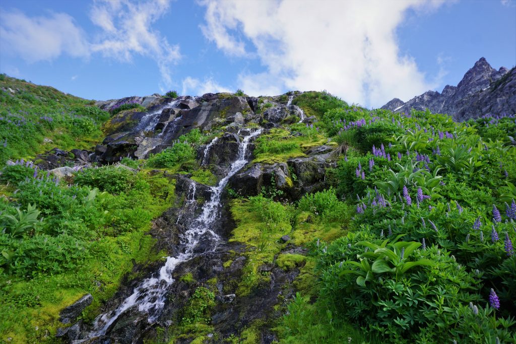
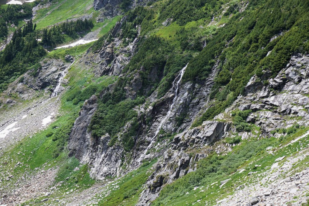
All around me, waterfalls cascaded down the lush hillsides. The sun was setting behind me, with clouds curling around the upper reaches of Glacier Peak, and the peaks in front of me softening in the golden hour. The position was intoxicating. I felt just so wild, so out there.
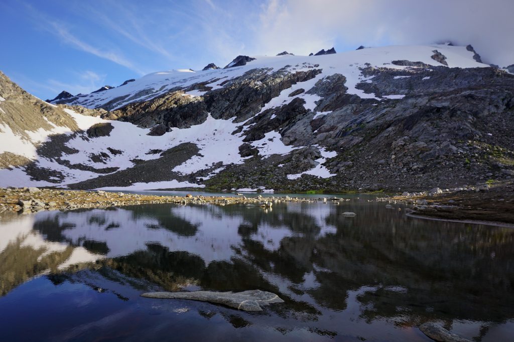
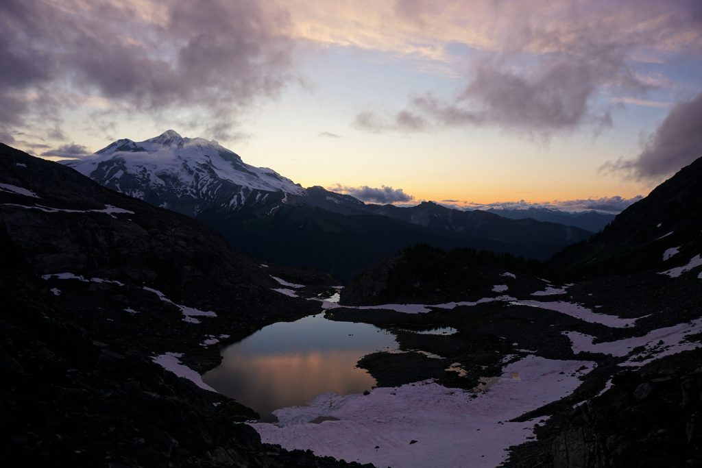
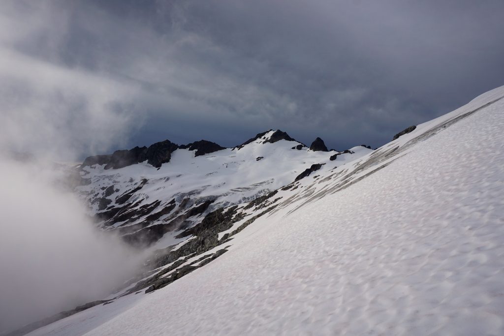
Eventually, I started trending uphill towards the unnamed lake that sat below the pass to the Napeequa. I followed some goat prints in the snow and crossed into the lake basin. I lounged in the evening sun, trying to dry my feet and ate part of my dinner. The pass was so close! It was relieving to know that I would make it.
After a short break, I walked around the shore of the lake, taking in the view of the Butterfly Glacier reflecting in the lake. This was yet another perfect little lake that I could hang out at for days, but I kept moving. The lake was set in a west facing bowl, with a dominating view of Glacier Peak across the valley. I decided here that this would be called Butterfly Lake and the pass above Butterfly Pass.
The final climb to Butterfly Pass was pretty easy and I arrived around 8 pm. There was a near perfect little bivy spot of flat, dry dirt at the pass so I decided to stop here so I could get a sunset view of Glacier Peak. Looking at my GPS, I had covered 27 miles, mostly off trail or bushwhacking, in a little over 12 hours! Not bad!
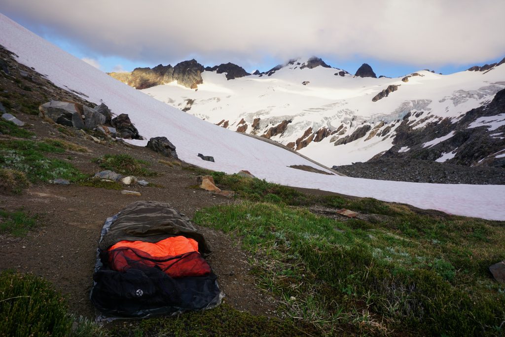
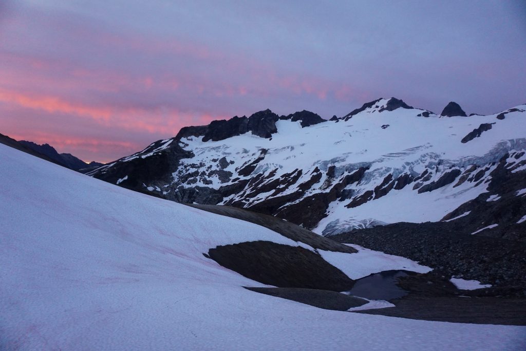
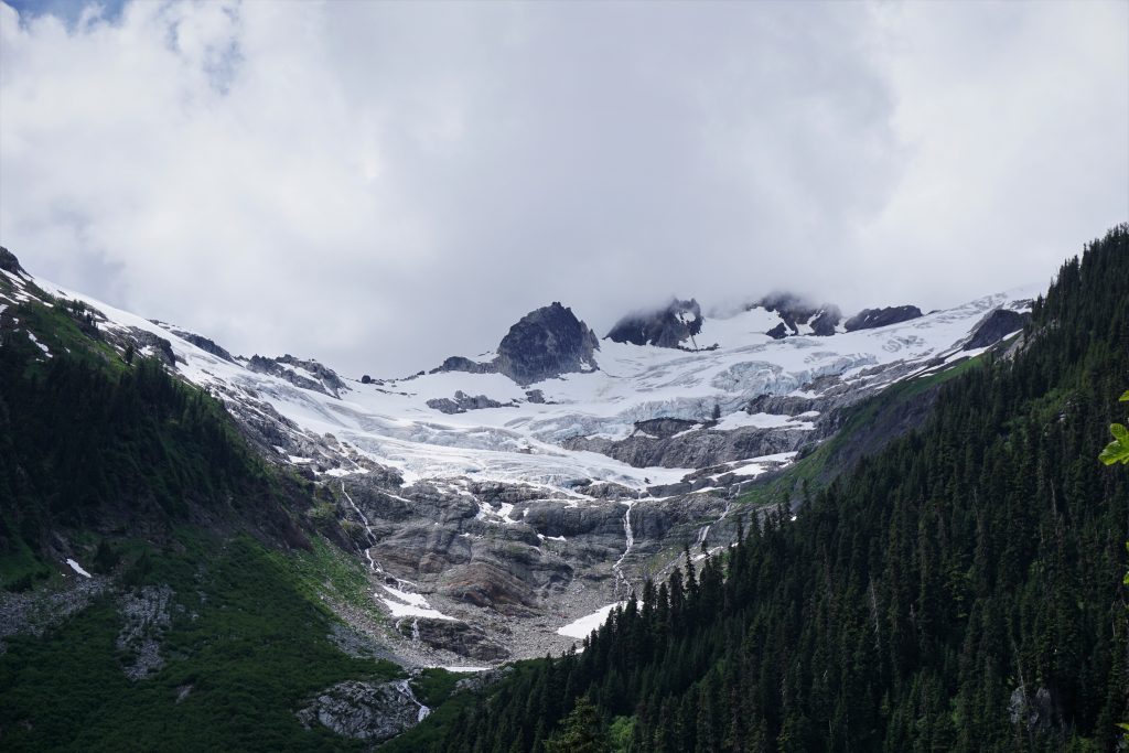
After setting up my bivy, I hiked a hundred feet up to the top of a knoll to watch the sunset. The Butterfly Glacier stretched out in front of me, from Chalangin Peak to some outcroppings to the west. I had not been planning climbing anything in this cirque, but the glacier looked pretty chill and so I contemplated heading up to one of the points the next morning.
Clouds rolled in and out for the next hour, but it was still beautiful to watch the light fade on my favorite mountain from one of my favorite spots. When it was time, I said goodnight to The Great Parent and crawled into my already damp bivy. It was going to be a cold night. Why is it so damn cold in July in the Cascades?
Part 3: Butterfly Pass to White River TH
Shortly after nightfall, the wind picked up again and the damp clouds began racing over my head. It was pretty surreal to watch the clouds wiz by overhead, illuminated by the near full moon over Chalangin Peak. I curled up the best I could inside my 40 degree quilt, trying to stay warm. I think I actually slept most of the night, which was pretty impressive considering everything was absolutely soaked by morning. I never even needed to put on my down jacket.
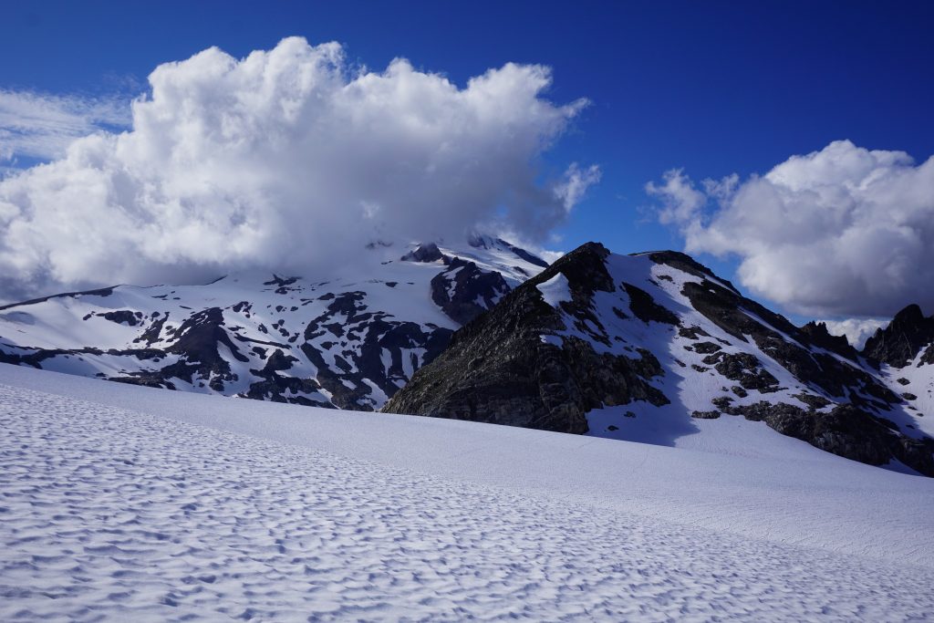
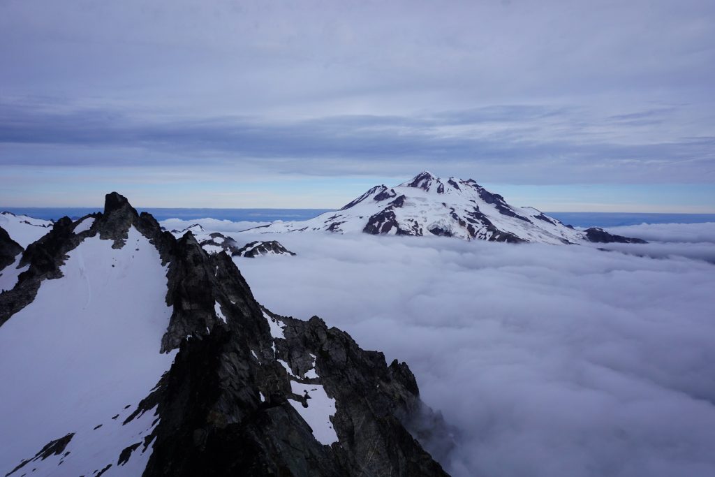
I woke up and hiked to the top of the knoll again for breakfast. Dakobed was glowing high above the clouds and Butterfly Lake reflected the morning colors.
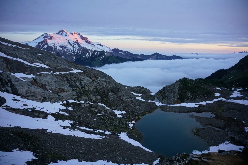
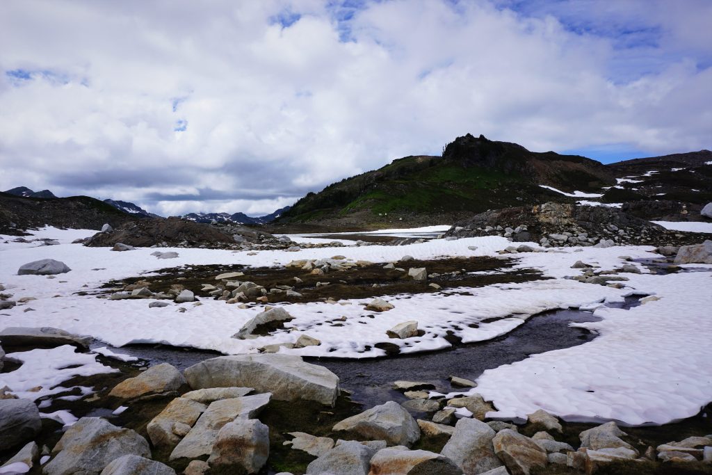
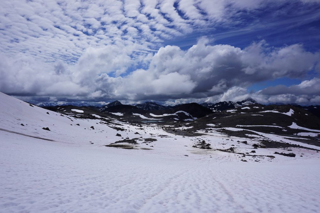
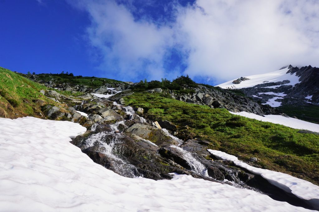
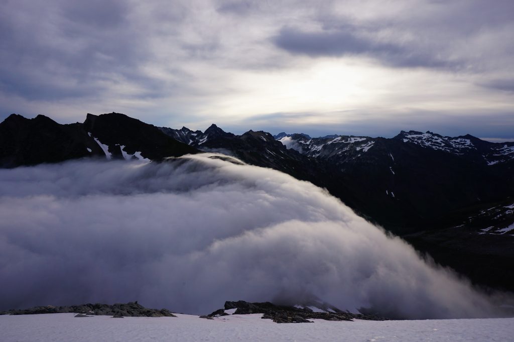
The marine layer looked thick this morning, but had a top of at least 1000 ft below the pass, so it seemed I would have good visibility for a while. But as I was packing up my bivy, I noticed the clouds began to rise really quickly. They must have risen 1000 ft in ten minutes and they were pouring over Butterfly Pass into the Napeequa by the time I got moving. I sprinted over towards the Butterfly Glacier, deciding on a whim to go for the ridge. I started scrambling up easy slabs and waterfalls and quickly got above the clouds.
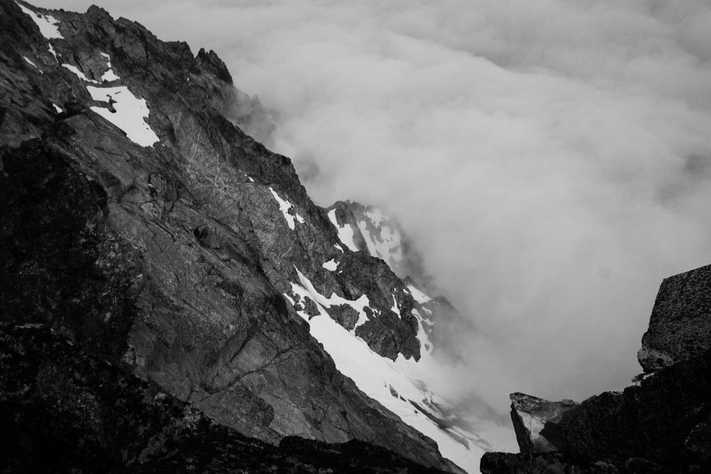
At the base of the glacier, I stopped for a moment to just admire the incredible movement of clouds before me. The clouds poured over Butterfly Pass like a reservoir spilling over a damn. Yet they broke up almost immediately as they met the drier air of the Eastern Cascades. In the distance, I could see the same thing happening over High Pass and Buck Creek Pass. It is so magical to be on the Cascade Crest on these sorts of days, far more tantalizing than a bluebird day. Sometimes, we head out and get stuck inside a ping pong ball, but other times, like this, we witness a scene overflowing with beauty. I’ll take the chance.
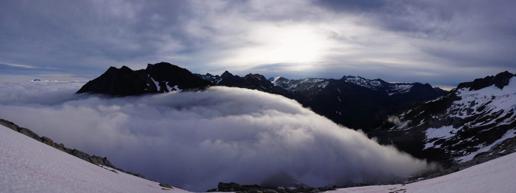
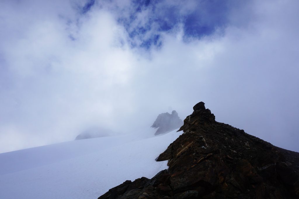
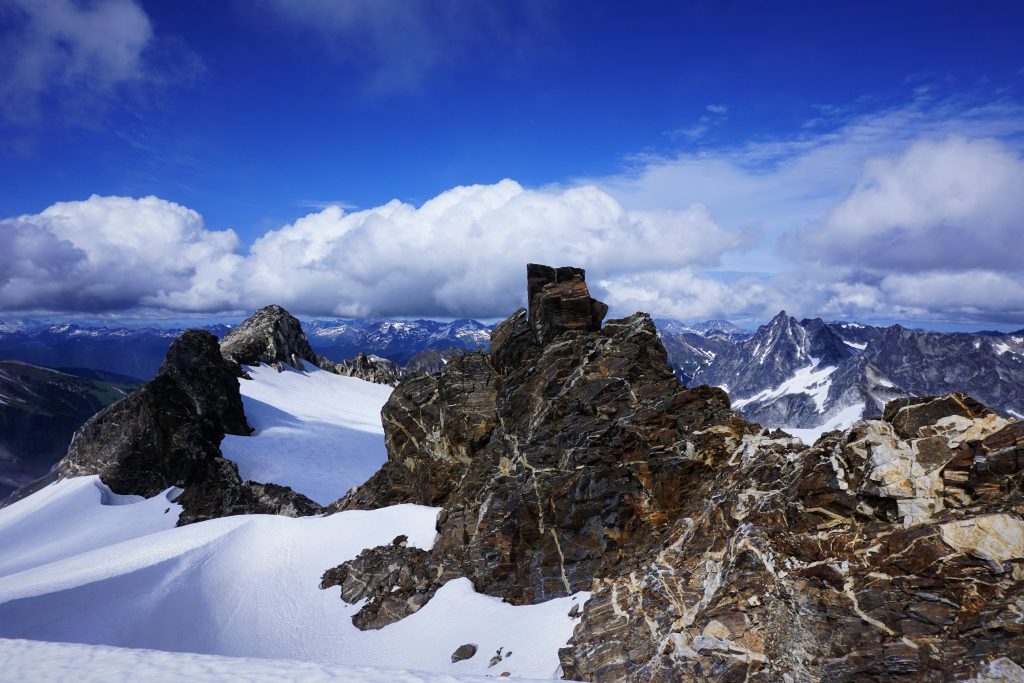
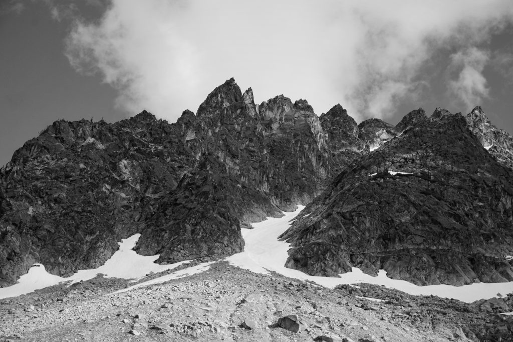
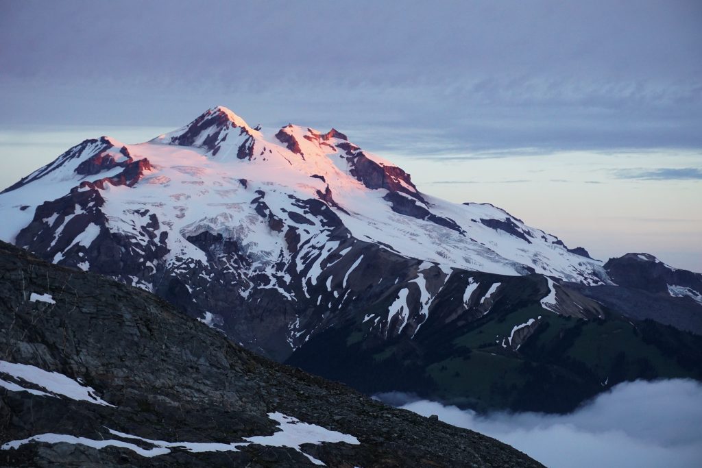
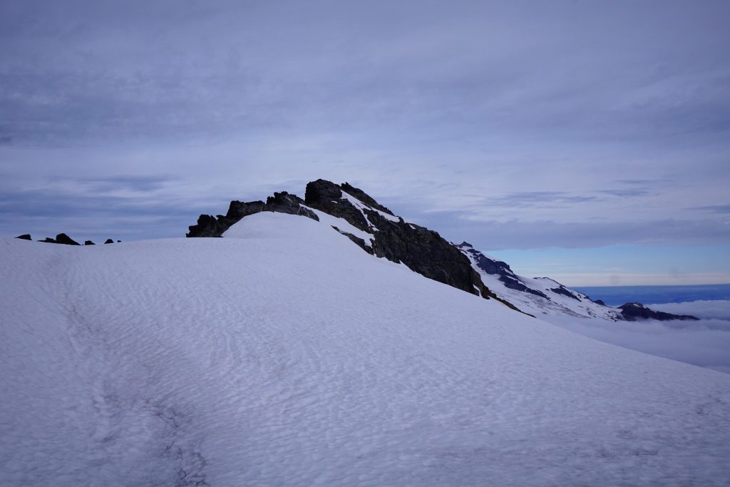
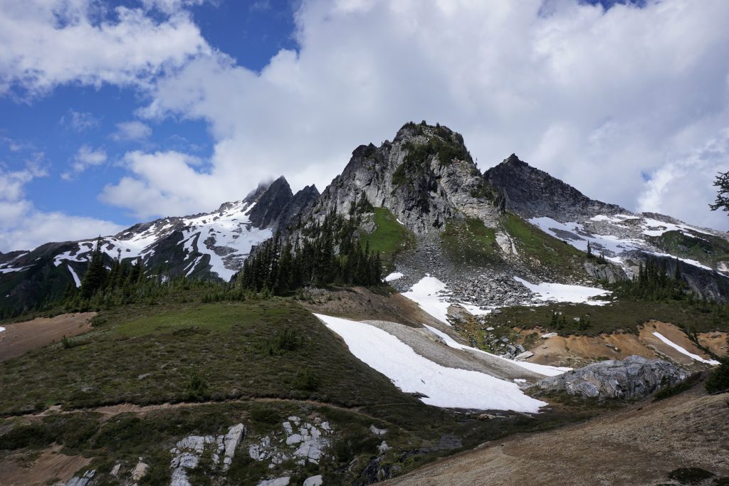
I wandered up the glacier on the austere morning. High clouds filtered the morning sun and the lower clouds raced towards their demise in the eastern valleys. Higher rocky points kept revealing themselves until there was one last point, the last monarch of the butterflies. This was to be my summit. I later learned it was called Neyah Point.
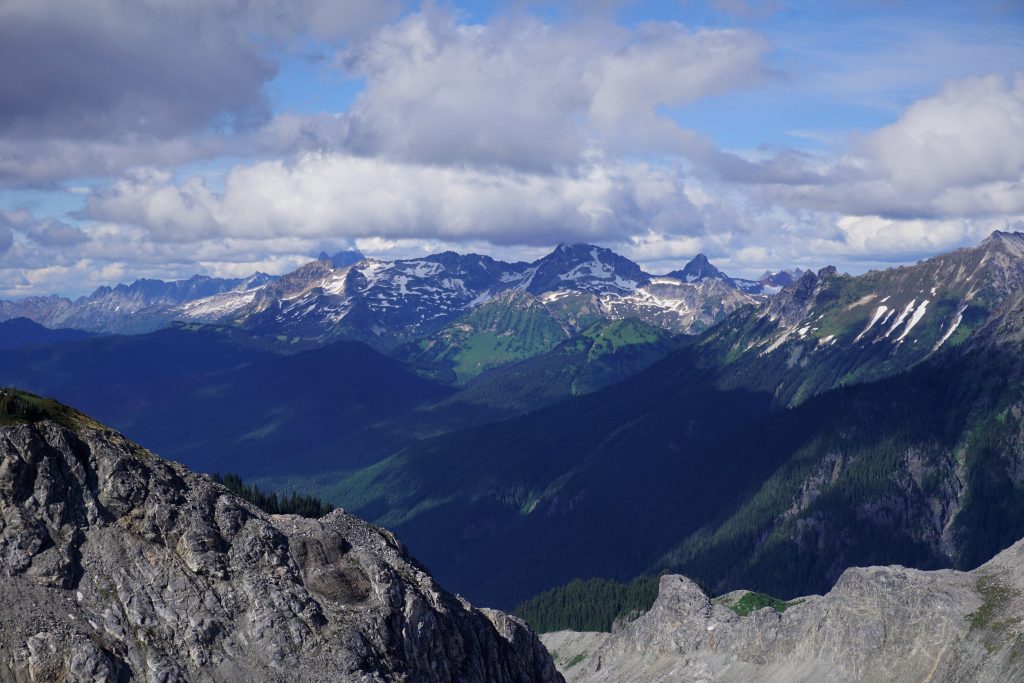
There was a little bit of easy 2nd and 3rd class scrambling and I arrived at the exposed summit. My GPS read 8200 ft. The ridge towards Tenpeak dropped off into an abyss of clouds. To the north, I could see Dome and Sinister, where I had stood atop a similar sea of clouds just days earlier.
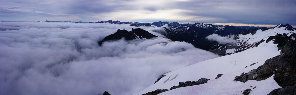
In every direction, the Cascades unfurled themselves in an endless vista of valleys and ridge lines. I am still blown away by the vastness of the North Cascades. They hold a lifetime of summits to conquer, and an eternity of secrets in the valleys to discover. I felt like I had discovered another.
I plopped back down the glacier, into the thinning clouds, and scrambled easily down to the pass.
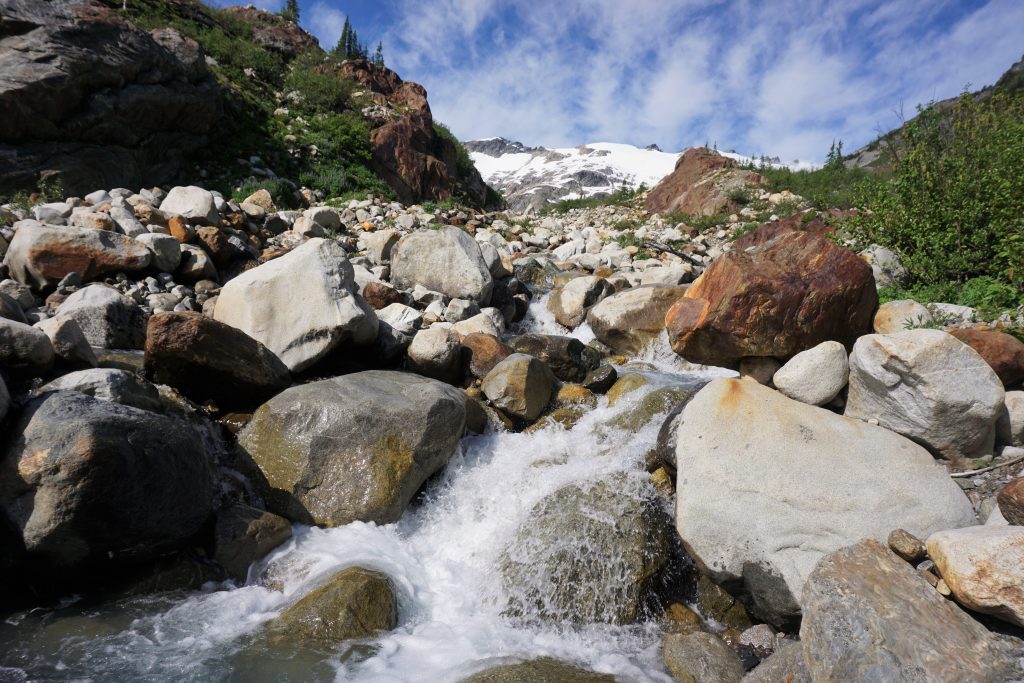
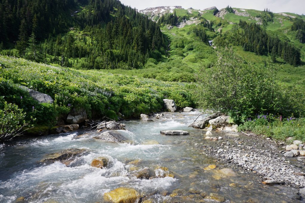
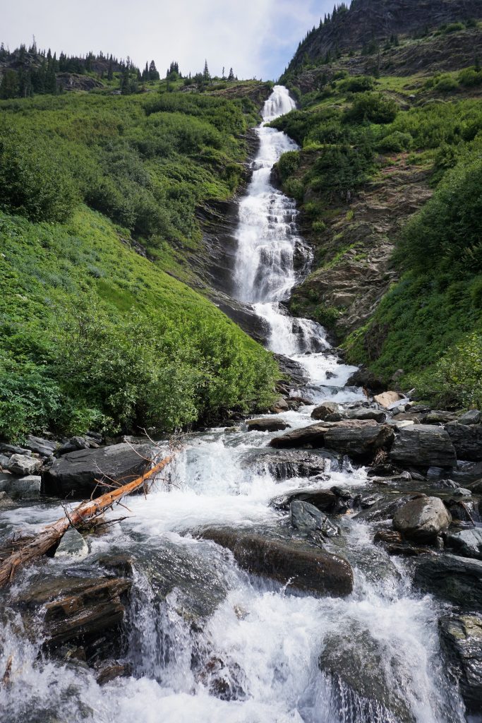
I then began the easy descent into the Napeequa valley, past endless waterfalls cascading down from the Butterfly Glacier. I knew I had plenty of time today, so I moved slowly for once.
There were a few benches and many waterfalls before it really dropped off to the valley floor.
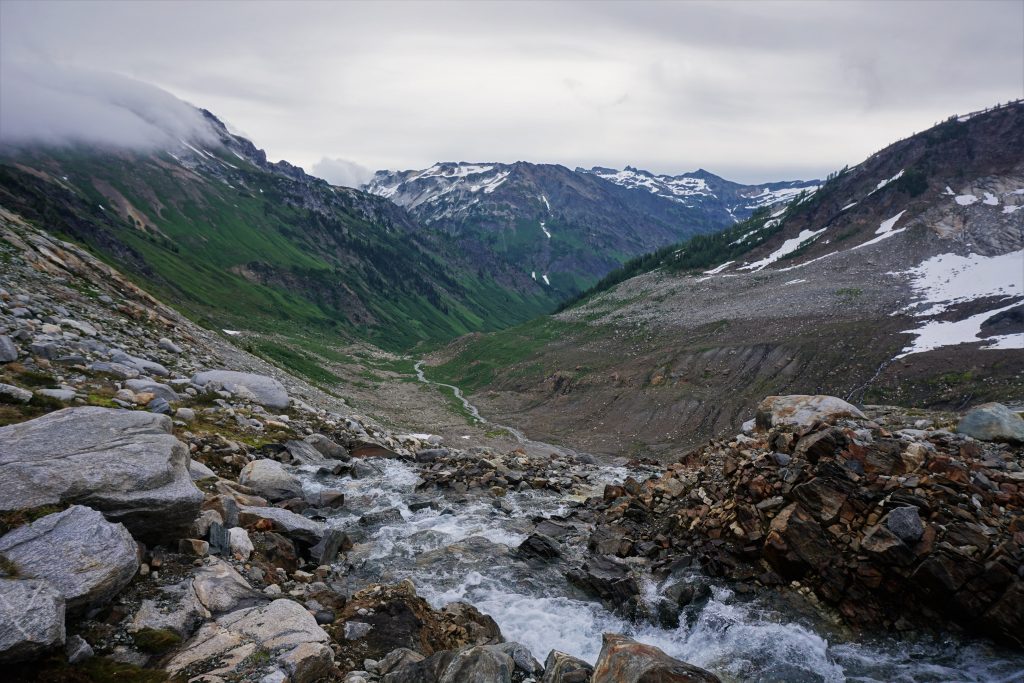
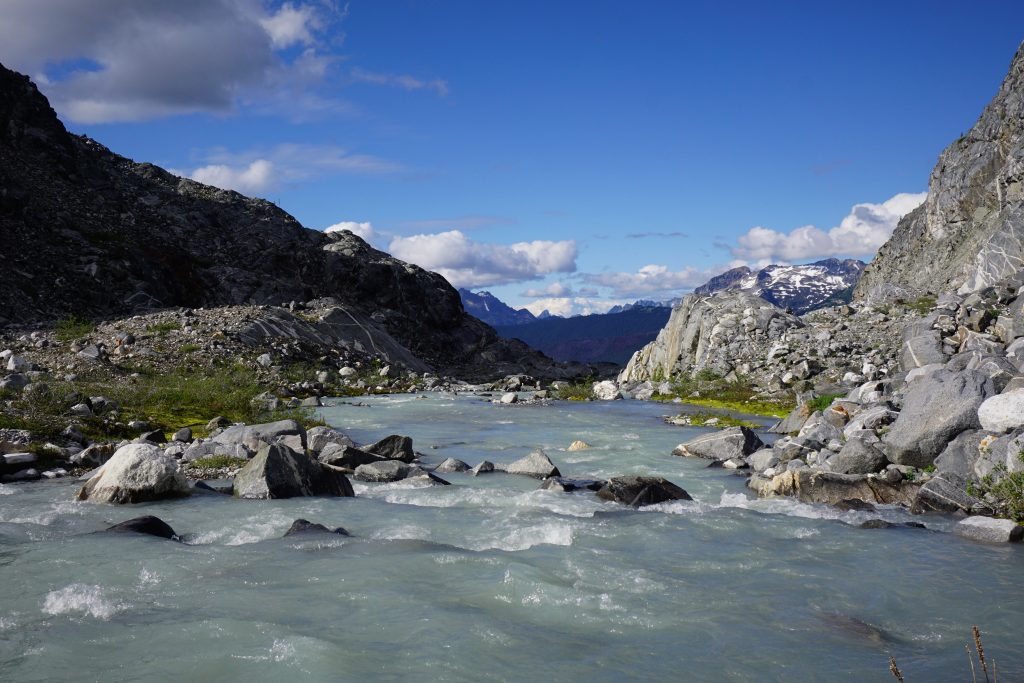
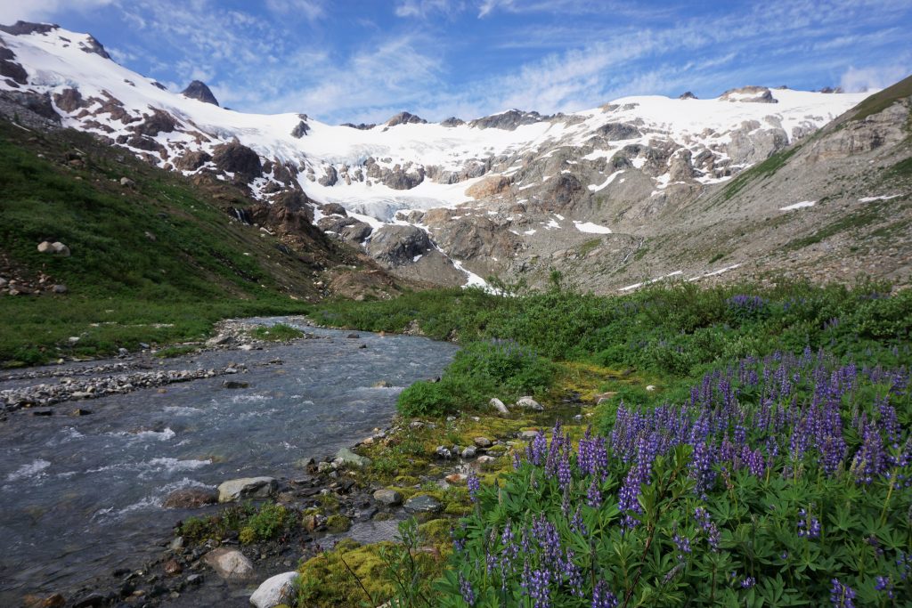
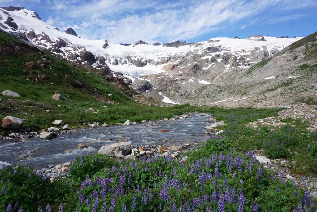
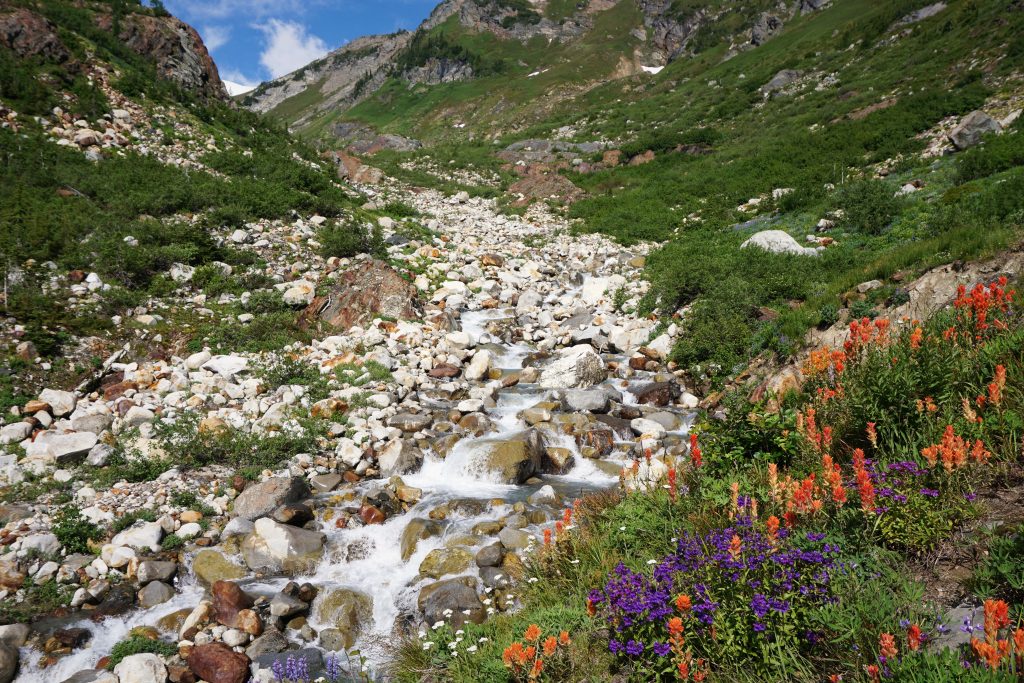
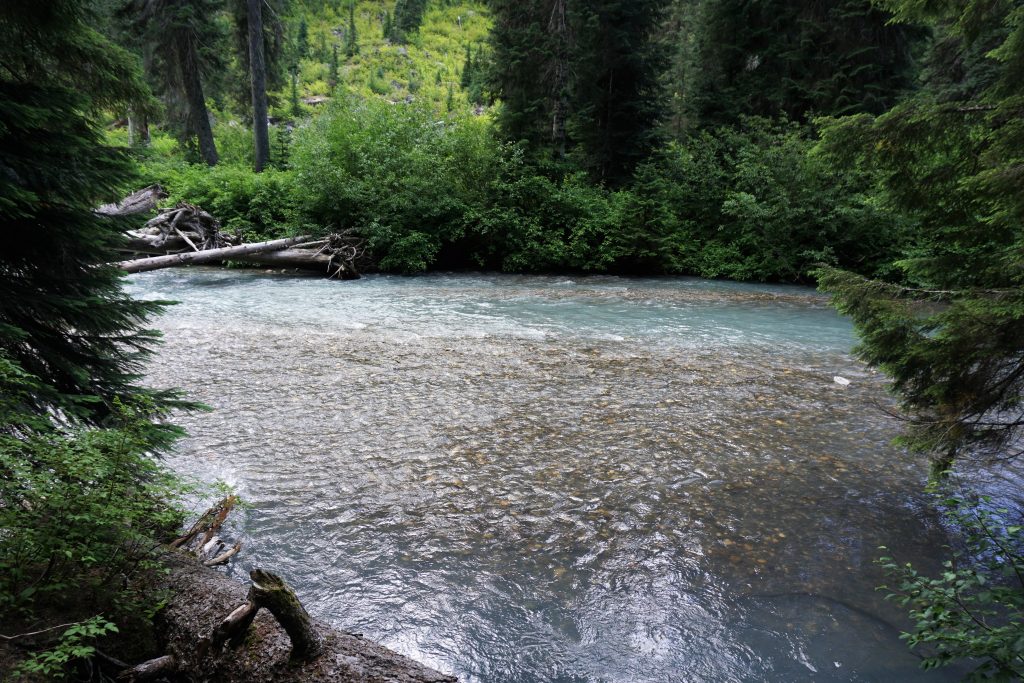
At the bottom, all the streams from the glacier joined together in a single silty blue stream the carved its way through flat gravel bars and light green brush. It was a sparkling landscape, walled in on three sides by the Butterfly Glacier, all filtering down this Alaskan stream. The name hit me: Cirque of the Butterflies.
There are certain places that overwhelm us with their magic and power. The composition of the peaks, glaciers, waterfalls, streams, and flowers was just so goddamn perfect – almost too perfect. Last fall, the Napeequa stole my heart away. It has done it again. Somehow, someway, I fall in love with this place more and more every time I visit. A part of me will stay behind in the Cirque of the Butterflies.
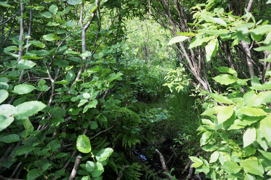
Regretfully, I moved on and continued down valley. I generally followed the left side of the stream, moving on boulders or through brush when it was impractical to stay right next to the river. There were a few sections of slide alder, but nothing too bad.
Eventually, I reached a section where I could not follow the stream but the alder looked really bad, like 20 ft tall and thick. I searched around for a while but could not find any good alternative. I walked uphill from the stream a little and decided to dive into the alder. Incredibly, I found a magical alder tunnel! Goat prints in the mud lead the way to safety. Thanks, goats! I would have been screwed without you!
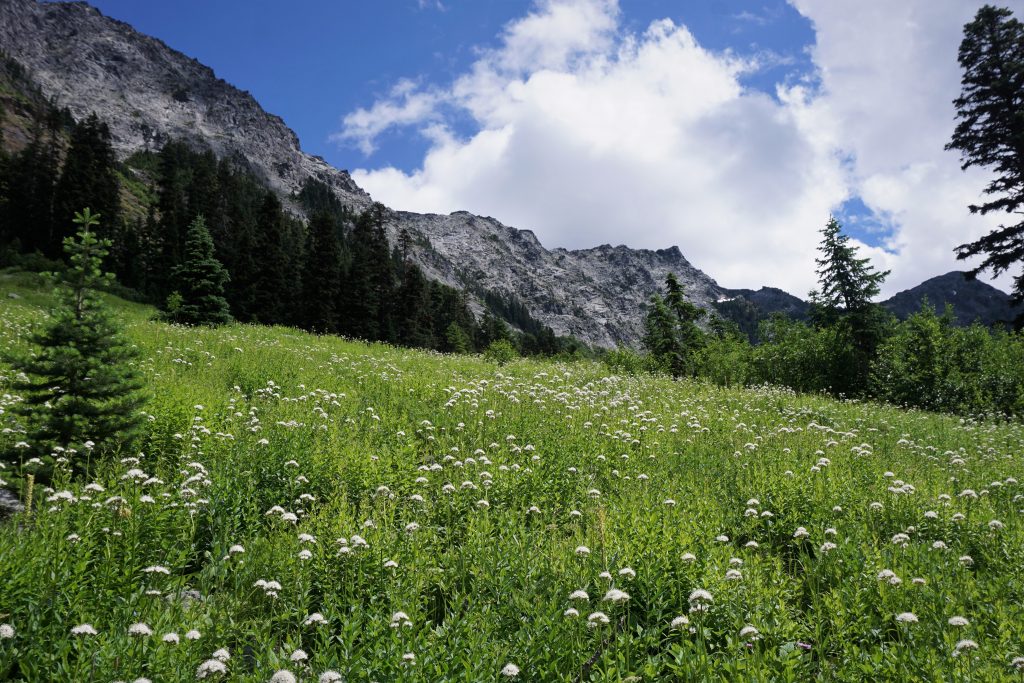
After the magical alder tunnel, I continued to follow the faint goat trail, which expertly navigated the brush. Suddenly, I entered a nice grassy meadow that was blowing gently in the morning wind. It was so peaceful.
I came to another alder road block and searched for a while but decided I needed to cross the river. I found a section where it was not too deep or fast, maybe just over knee deep.
Incredibly, I crossed the river and found the goat trail immediately! I guess the goats do the ford also. I followed the trail into timbered forest and eventually back across the river again at a log jam. From here, the goat trail led to a horse camp and the junction with the North Fork Napeequa Trail! I was home free!
I took a good long break here, trying to dry my feet some. Sadly, there was a fair bit of trash left in this remote valley! I packed out what I could.
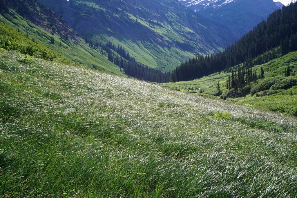
For the first time in a long time, I was on familiar terrain. The Napeequa trail is obviously not maintained, but it still felt like a highway compared to the Indian Creek trail! The scenery was very different than last fall when the world was lit yellow, orange, and red, but still very beautiful. So green, so alive, yet so lonely.
I am not quite sure what it is about the Napeequa that captures my soul. There are places that are objectively beautiful, and then there are places that just make you feel something. The Napeequa is the latter. And maybe the former also.
I forded the thigh-deep Napeequa River and started up the Boulder Pass Trail. While the trail out of the Napeequa to Little Giant Pass is incredibly steep and exposed, the Boulder Pass Trail is stupidly flat and PCT-graded, with even downhill switchbacks! And, of course, it is terribly brushy and overgrown.
I started to feel a little tired near the top, so I slowed down. I was still probably the only soul in the entire Napeequa Valley. At the same moment that literally dozens of people were likely waiting behind the crux pitch of the West Ridge of Prusik or hundreds were gazing up at Dragontail from Colchuck Lake, I was on my way to nearly 30 miles through some of the most beautiful terrain in the country without seeing a single other soul. The herd instinct is strong, I guess.
A Boulder Pass, it was sunny with a nice breeze, so I took a nap for a while in the sun. I felt so calm inside.
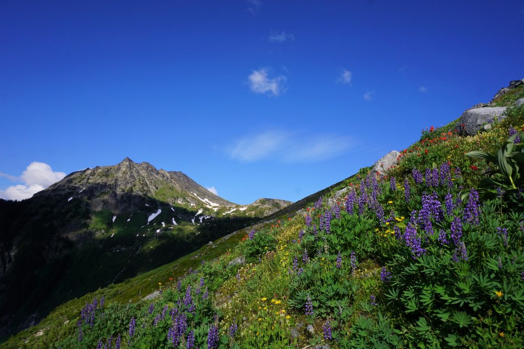
The descent into Boulder Basin was, at first, not brushy and very beautiful. The hanging valley was alive with wildflowers and butterflies darting in front of me. Huge waterfalls poured down the hillside from Clark Mountain, one of the giants of the Dakobed Range.
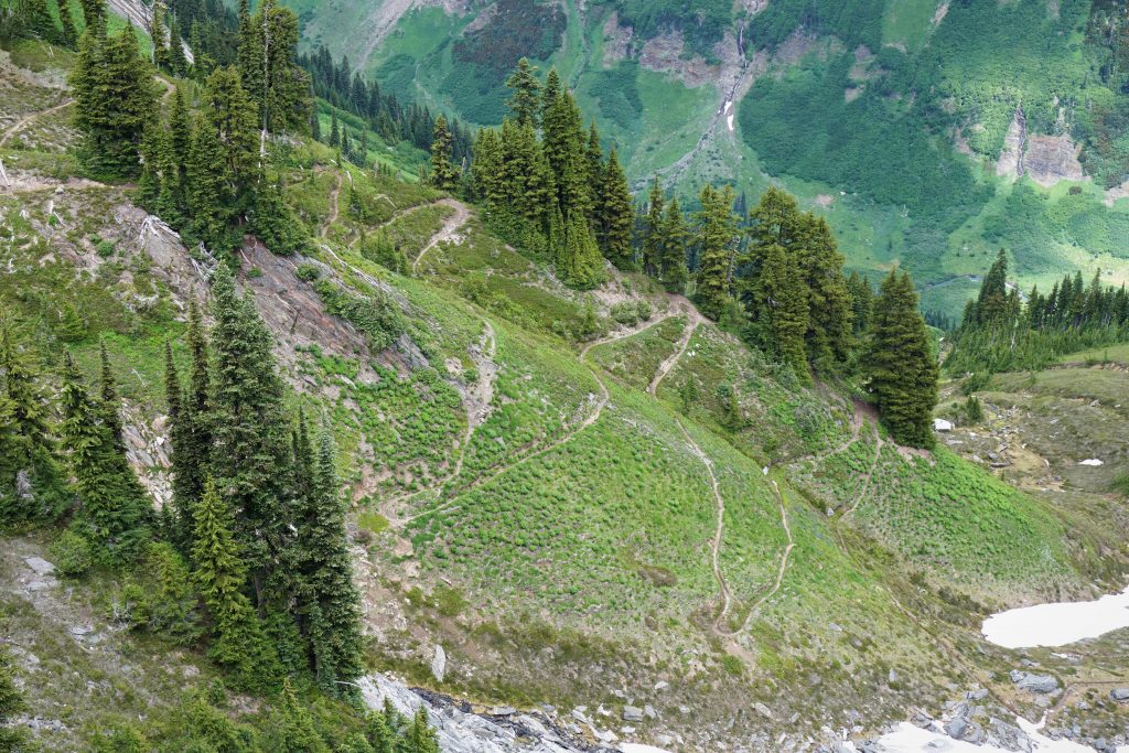
The trail got pretty brushy below 5000 ft. It felt like hours to make my way down the annoyingly flat and brushy switchbacks where I could not see my feet, but I knew it was not really taking that long. Finally, I stumbled down to the White River Trail junction, where I saw the first other humans since the Whitechuck Basin!
It said on online that the first four miles of the White River Trail were maintained. Fake news (once again)! The brush on this trail was the worst since the Indian Creek Trail. At some points I had to push my way through 10 ft tall alder! It was crazy to think of how such a prominent trail so close to the trailhead was so awful. So sad…
Swatting mosquitoes, I moved as quickly as I could and got back to the car a little before 5 pm. A nice family with little kids was trying to head down the trail for a little river walk. They turned back from the brush within 5 minutes. The dad said he used to hike here all the time along the river when it was not as brushy. So sad…
Reflections
The Dakobed Range Circumnavigation totaled about 50 miles and 12k ft of gain. The stats do not capture the exhaustive nature of the trails. It was mentally tiring and frustrating to twist my ankles on rocks I couldn’t see and get soaked by wet brush over and over. It is honestly really sad to see how all of these marvelous trails have been abandoned (maybe all the resources go to the Enchantments). I understand that there is little funding for these trails because they do not receive much traffic, but they won’t receive more traffic until they are improved, so it is just a feedback cycle. But at the same time, the gates of brush are what keep these valleys so lonely and remote and make them so special to me. I’m not sure what I really want. It is a wilderness area, after all.
This route is certainly very different in nature than the Alpine Lakes Crest Traverse. The scenery is completely different, the feel of the land is different, the technicality is different. It is not as objectively pure of a line. There is much more brush. But it was just as rewarding nonetheless. These places – the Honeycomb Glacier, Honeycomb Lake, Tenpeak Tarn, Butterfly Lake, Cirque of the Butterflies – just felt so wild and untamed. They made me feel free.
People have asked me how I think of obscure trips like this. Obviously, there is a lot of research and past experience that goes into them. Obsessions with bizarre places (like the Napeequa). What am I seeking? I am not peakbagging, not trying to set an FKT, not linking classic routes, not trying to visit notable places. I think at the core, I am not planning a trip, but rather trying to create an experience. I want to be moved. I want to feel something inside myself and inside these wild places.
This was the biggest solo trip I have ever done. With what I am going through, I was worried that I might feel intensely lonely or anxious going off so far by myself, but I never once did. Truth is, I feel more lonely sitting at the computer writing this trip report or walking around the streets of Seattle every day. There was so much life and vivacity in this landscape, I knew I was never alone. All I had to do was look around. Lakes, glaciers, butterflies, memories that will never die.
Notes
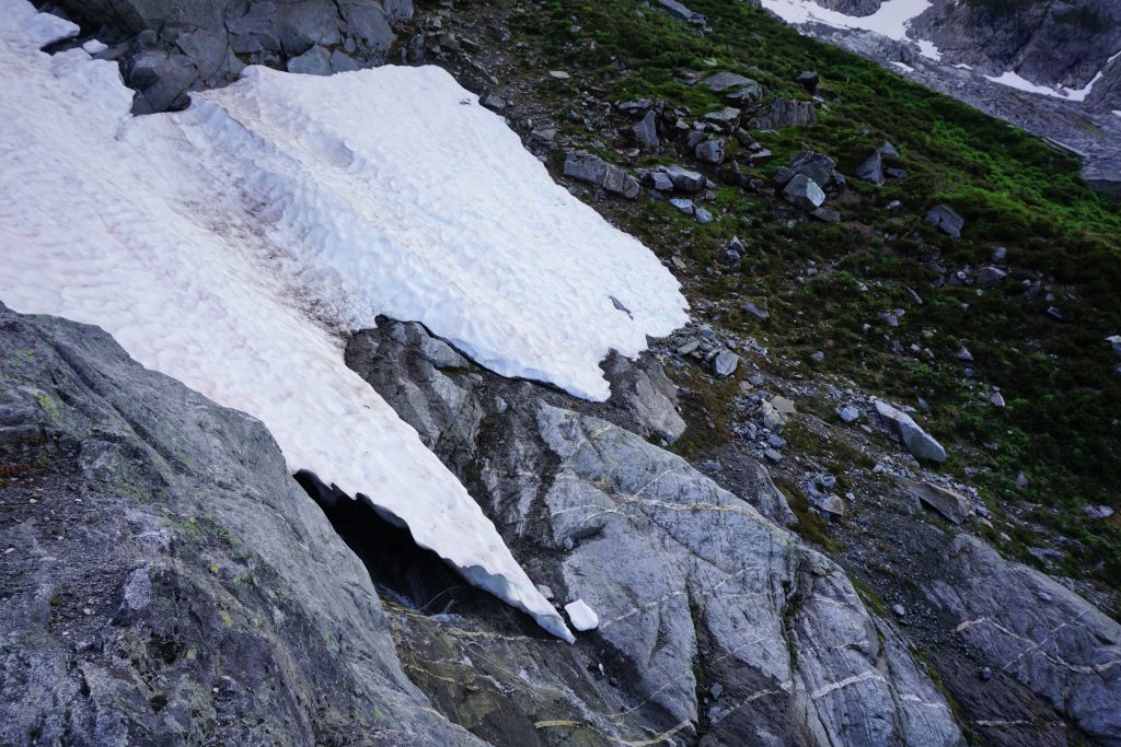
- I used nothing more than running shoes and trekking poles. Crampons and an ice axe could be helpful in certain conditions, but the snow was almost exclusively low angle. In earlier season, obviously there would be more steeper snow to deal with.
- I (obviously) did not rope up on the glaciers, but these are very real glaciers, so choose wisely based on your risk tolerance. Note I never had to step over any visible crevasses larger than a thin thin crack, but obviously bigger ones are lurking.
- There is not that much actual scrambling in this trip, maybe a tiny bit of 2nd and 3rd class in a few places. Most of it is just rough off trail hiking and bushwhacking.
- Speaking of bushwhacking… there’s a lot of that. The Indian Creek Trail is the only section that is really bad though. The rest is just annoying.
- Make sure you find the magical alder tunnel in the Napeequa Valley or else it could be bad!
- There are plentiful water sources and flat gravel bars for camping. So many wonderful spots.
- If you have more ambition, it looked possible to traverse the Butterfly Glacier to Chalangin, Pilz to Luahana, then continue over Clark all the way down to the Boulder Pass Trail for an epic ridge/glacial traverse!
- Caltopo trail distances are wayyyy short on some of these trails. I think it was like 30% short on the Boulder Pass Trail compared to my GPS!
In many ways, this is your best photo-essay yet.
Love,
G
Nice writeup — it made me want to visit that area (and I also learned that someone did Glacier in under 8 hours from the Sauk trailhead!). I agree that it’s sad that so many old Forest Service trails are abandoned in the North Cascades. It would only take a little regular maintenance to keep them open, but once they’re overgrown with alders or berries, they can be worse than useless. I should pack a pair of clippers next time I’m up there so I can do my part.
Thanks Sean! This is a special area to me and I think you understand it even after seeing basically everything the lower 48 has to offer. There is a WTA work party heading up Indian Creek later this summer, but it’s hard to say how far they will get. If you’re back in the area sometime and want to crush another FKT (obviously low hanging fruit since I’ve submitted the only time), check out the Alpine Lakes Crest Traverse, it’s Ptarmigan-like but a little bigger and more remote feeling in my very-biased opinion 😉 I’ve added it to FKT.com: https://fastestknowntime.com/route/alpine-lakes-crest-traverse-wa.
Thanks for the pointer. I haven’t done the Ptarmigan traverse, partly because of the car shuttle, and partly because I keep getting distracted by peaks. I’m not terribly familiar with the Alpine Lakes, especially the western part, so I’ll definitely think of doing that traverse next time I’m up in the PNW.
Yes, the car shuttles could be challenging solo. With the Alpine Lakes Crest Traverse, you do have the option to run back on the PCT and the old Cascade Crest Trail over Dutch Miller Gap, making for a huge figure 8 loop! The Western Alpine Lakes is surprisingly remote and uncrowded and has some amazing rock faces and peaks, even though their elevations are not that high.
Do you have any GPX files or map references? We had planned on doing Ptarmigan Traverse in a few weeks, but BOTH trailheads are now closed. Looking for alternatives. I live in Utah, so the names of different peaks and routes are all greek. A shuttle is OK. Of all the routes you have done, would be the stand out route providing 3-5 days of snow-filled travel?
Hi Richard. This route has a map at the bottom of the post. I don’t have the GPX anymore. The Dakobed Circumnavigation is pretty good, and could be extended by hiking over High Pass to the Lyman Lakes and then ending at the Phelps Creek Trailhead.
If you’re looking for a Ptarmigan equivalent, I would do the Alpine Lakes Crest Traverse. https://climberkyle.com/2019/06/30/the-alpine-lakes-crest-traverse/ has descriptions and maps. This route is incredibly aesthetic, has no bushwhacking, and is similar length/quality to the Ptarmigan. The car shuttle is not bad. The glaciers are perhaps slightly more tame than the Ptarmigan. Mid July should be perfect timing for this route.
Thanks for the info. Incredible site. As a general rule, on either of these routes, for mid-summer time, do you wear high-top “hiking or backpacking boots” (with strap-on style crampons) or does one need to upgrade to mountaineering boots (which can be problematic on long trail approaches due to the stiffness)?
No, I do all this stuff in burly running shoes (La Sportiva ultra raptors) with strap on crampons. I don’t like stiff mountaineering boots. Hiking boots would be fine too! Particularly, this route and the Alpine Lakes Crest Traverse don’t really have much steep snow.
Love the pictures and stories! Been thinking about heading into the Napeequa for the first time. Looks enticing! Thanks for sharing!
It’s an amazing place, I hope you get out there!
These days, for those doing Ptarmigan Traverse, are most climbers also wearing beefy running shoes, or, due to the increased mileage on snow, require something heavier?
Everyone doing the Ptarmigan in a day is using running shoes. I’d say it is a mix for multi day. A lot of people wear traditional 3 season boots. I think the happy medium is a waterproof running shoe or approach shoe like the Scarpa Ribelle, Salomon Slab Xalp Carbon, or La Sportiva Crossover (what I personally used). It all depends on your preference and how early in the year you go (and thus how much snow is encountered).