A Cascadian Dream
Ever since spending two magical weeks on the Sierra High Route, I have dreamed of creating a similar high route back in my home mountains, the North Cascades. But the North Cascades are even bulkier and more rugged than the Sierras, so I know that it will be a huge challenge. Daniel and I have started planning routes and hopefully this summer we will start doing certain segments. I will update this page with each exploration.
Steve Roper, the father of the Sierra High Route, had a simple vision: stay as high as possible without needing technical gear. This methodology has really captured my imagination. There was something so wholesome and beautiful about carrying minimal gear, staying high and off trail, and moving quickly above the tree line. I think what I enjoy most is that it makes me feel the maximum degree of freedom: unrestricted by trails, and unburdened by excessive gear and a heavy pack. This type of movement feels pure and simple, and it can take you to amazing places.
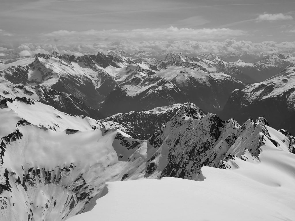
In the North Cascades, high routes are not as easy. We simply do not have the huge mile long flat basins above tree line and endless granite lakes of the High Sierra. Instead, we have huge, steep glacial carved valleys, jagged ridge lines, and a whole lot of brush. In many cases, travel in the high country is actually easiest when on snow or glaciers, so for this trip, we will have to make the exception that light glacier gear is okay. To avoid the glaciers of the North Cascades would be to remove the essence of the range, what makes it so wild and unique compared to the other ranges in the lower 48.
Cascade High Route exploration has a rich history. In a different post, I compile a list of high routes and traverses. It should also be noted that the Cascade High Route is not a new idea. In 2017, a few skiers skied from Snoqualmie Pass to Canada along a similar route! And history goes back generations before that in these mountains…
There is no doubt the Cascade High Route will be a very different adventure than the Sierra High Route. The lower 48’s two most extensive, impressive ranges are unique and so will these experiences be. Next, I will give a general overview of each section, as we have planned.
I90 to Deception Pass
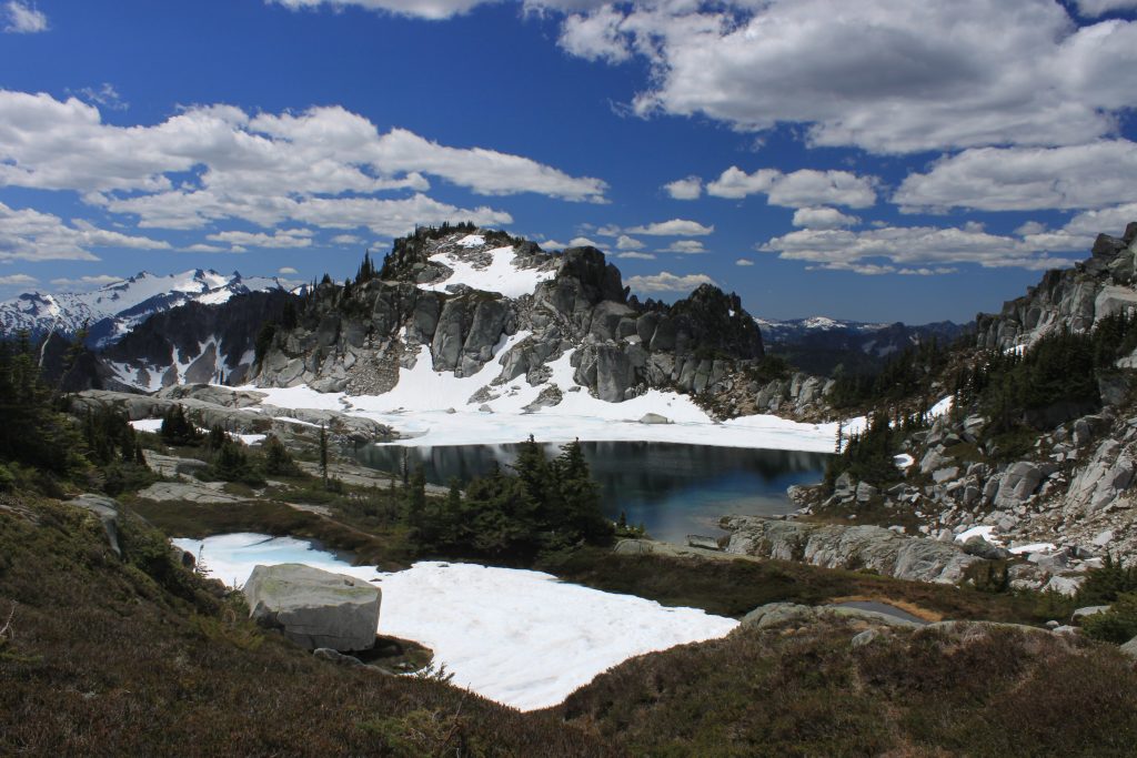
There are a few ways to do the I90 section: staying close to either the Alpine Lakes Crest (Lemah to Daniel) from either the Middle Fork Snoqualmie River or Snoqualmie Pass, or an eastern route through the Stuart Range and Chiwaukum. In my experience, the eastern route would be challenging to stay high off trail because of the excessive steep choss in the Stuart Range and ruggedness of the Chiwaukum. Also, the Alpine Lakes Crest actually feels less traveled, with its own share of sparking blue lakes.
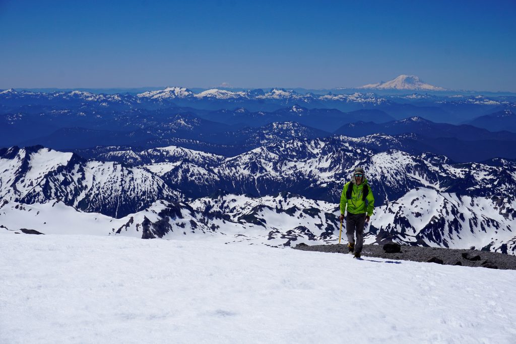
Currently, our route starts on the PCT from Snoqualmie Pass before branching off and climbing up over Chikamin. This is the beginning of a wild, remote off trail section across the Overcoat Glacier, beneath the Chiefs, over Hinman, and then up to Pea Soup Lake. Here, one could take trails back from Jade and Marmot Lake to Deception Pass or try a more direct route on the east side of Daniel, or go up and over Daniel from the north. More exploration will be needed to determine the best route here.
Update: 6/30/2019
Over two days, Logan and I completed this high route from Snoqualmie Pass to the summit of Daniel. It was rugged terrain, with 35 miles and 14k ft of gain, but the route finding went without a hitch. We went over the summit of Daniel by ascending a snow finger from Pea Soup Lake to gain the upper Lynch. An alternative that doesn’t summit Daniel is to head out to Jade and Marmot Lake.
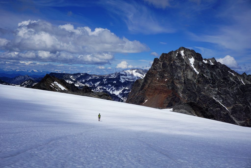
Overall, this section blew us away with the quality and consistency of off trail above treeline travel. We did nothing harder than class 3, as the route always seemed to grant passage at the most questionable of points. It worked great early summer with snow coverage on the boulders and choss. This will be a fantastic start to the Cascade High Route!
Deception Pass to Stevens Pass
This section could be very simple, cruising the PCT for a short section. But I believe there could be some beautiful terrain just east of the PCT. From the Robin Lakes (a true alpine lakes gem), I think you could traverse by the Swallow Lakes and Square Lake (hopefully not too much brush) and up to the Thunder Mountain Lakes (a true hidden gem) before descending to the PCT. This is not the most spectacular terrain, but still could be very pleasing.
Update: 9/7/19
I completed a high route from the Thunder Mountain Lakes to Robin Lakes. It was surprisingly rugged and brush free. It featured lots of talus, steep heather, stunning views of Mt. Daniel, and lots of little tarns. My favorite part was the high tarns on the west side of Mac Peak, although the Granite Mountain Potholes were pretty sweet too. I ended up staying closer to the crest than Square Lake and more on the west side of the crest by Mac Peak and Talus Lake. This won’t be the most scenic or alpine section of the high route, but it is pretty solid.
Stevens Pass to White Pass
We have struggled with what to do in this section. The only feasible option that does not require dropping low onto roads or extensive bushwhacking is to simply take the PCT north. There is not a lot of continuous alpine terrain allowing for high route travel. The Monte Cristo Group to the west is beautiful and rugged, but getting there is convoluted and would require large sections probably just on a forest service road. East of the PCT has long lowland valleys. Maybe we will come up with a better idea in the future, but for now, our plan is to cruise the PCT.
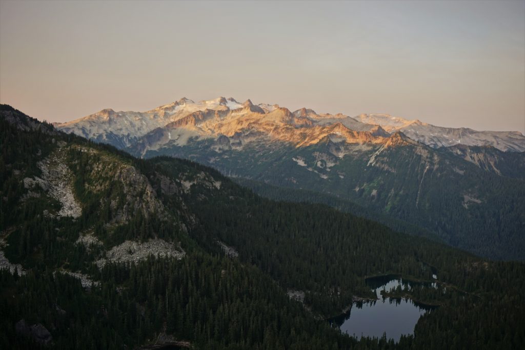
White Pass to Cascade Pass
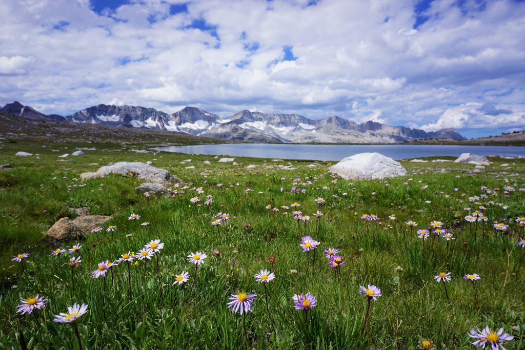
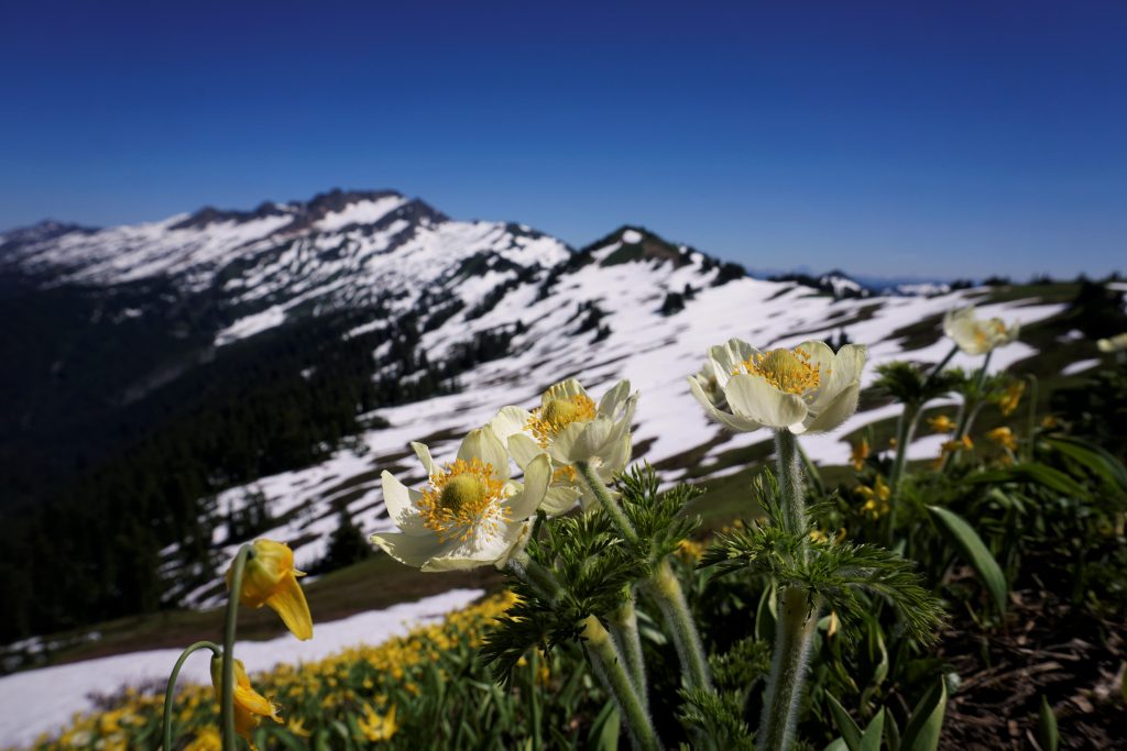
This section is where the high route really ramps up in terms of scenery and scale. The Glacier Peak Wilderness is my favorite place to hike and trail run, so we are calling this section the Glacier Peak High Route. The most obvious option crosses the Whitechuck and Honeycomb Glaciers, meanders through the wonderful Napeequa River Valley, crosses High Pass, Buck Creek Pass, towards the Lyman Lakes somehow, past Image Lake towards the southern end of the Ptarmigan and for the full length of the famous Ptarmigan Traverse. The second option goes completely over the summit of Glacier Peak to the Lime Ridge High Route, down to the Suiattle River Trail (possible resupply) and then the often-forgotten Bath Lakes High Route to join the southern end of the Ptarmigan Traverse. The former option stays high more consistently but the latter involves a summit of Glacier Peak. We are leaning towards the former because it travels through the wonderful terrain just east of Glacier Peak, home to silty blue lakes, deep valleys, endless wildflowers, and mighty peaks. This very well could be the most beautiful and diverse section of the high route.
Update: 7/09/2019:
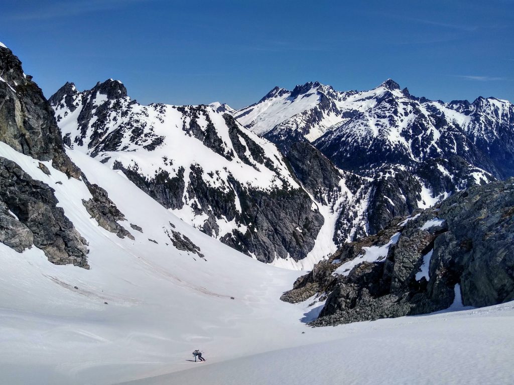
Jacob, Logan, Daniel and I did a four day trip from Cascade Pass to Image Lake which we called the Extended Ptarmigan Traverse. The first two days were the classic Ptarmigan, and the next two days went into incredibly remote and beautiful terrain up over Dome Peak, through the Gunsights, Totem Pass, and to Image Lake. This is incredibly beautiful country. The section over Dome Peak is very alpine and definitely requires good weather and glacier skills. This section will definitely be a highlight of the Cascade High Route.
Update: 7/15/2019
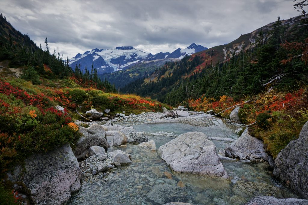
I did a solo recon circumnavigating the Dakobed Range. This included the off trail section from White Pass, over Kololo Peaks, down the Honeycomb and into the Napeequa. The terrain from Kololo Peaks into the Napeequa was stunning, remote, and not too difficult. The glacial crossings were simply in mid July and there was not too much sidehilling or choss. The Cirque of the Butterflies in the Napeequa was simply magical.
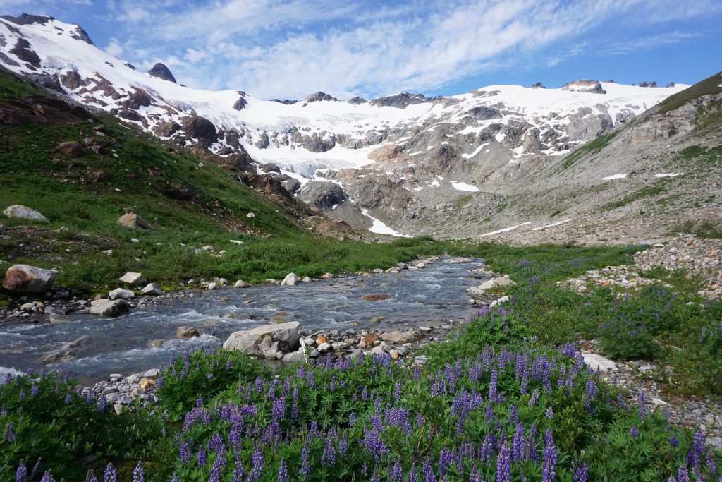
The brush was kinda bad to get to the North Fork Napeequa trail, but really not too bad since I found the “magical alder tunnel”. It was key.
Cascade Pass to Highway 20
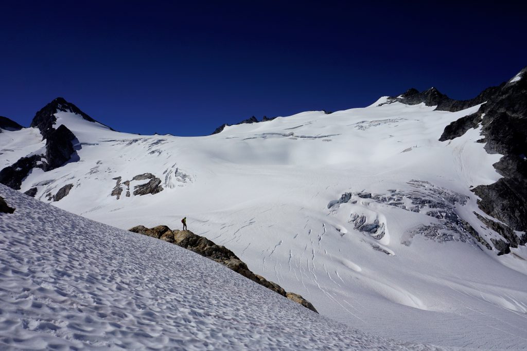
There are a few options, but it depends where you want to arrive at Highway 20. We want to arrive somewhere near Diablo Lake for a Pickets Traverse, so naturally, the Isolation Traverse, an established classic route, makes sense. This traverse is extremely glaciated and even will involve a short rappel. It offers the option for some extremely aesthetic summits like Eldorado and Snowfield Peak. This is very alpine terrain, unlike anything else in the lower 48.
Update: 5/27/20
I completed the Isolation Traverse in a single push on skis. It was a fantastic ski traverse, the best I have ever done. The terrain feels remote, the descents are good, and the views are marvelous. On foot, I think it would still be good, although it would not be quite as good. In the summer, I believe that many groups traverse beneath the west side of Dorado Needle instead of climbing up the McAlister Glacier to the rappel onto Backbone Ridge.
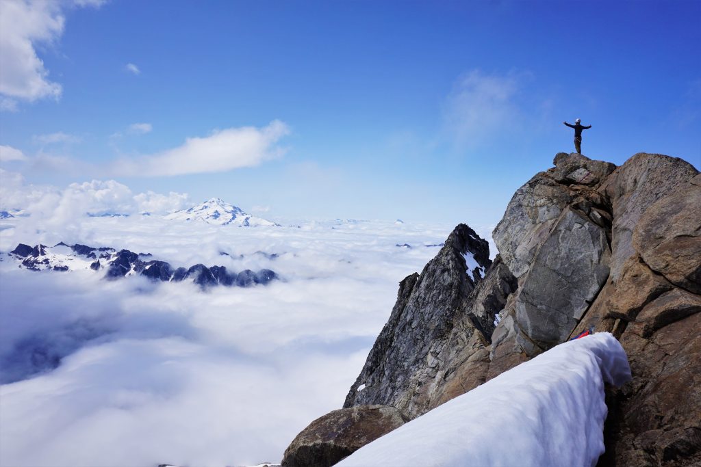
Highway 20 to Whatcom Pass
There are many places to cross the North Cascades between Highway 20 and Canada, but we are favoring a west side traverse through the Pickets, the most remote and rugged area in the lower 48. We just felt like not including the Pickets in the high route would be wrong. The Isolation Traverse ends very close to the Sourdough Mountain Trail, which can be ascended to Stettatle Ridge and traversed to the beginning of the Southern Pickets. There are many options in the Pickets Traverse itself, but we will likely stick to an easier option since this section is very challenging already. Regardless, we will end up at Whatcom Pass.
From Whatcom Pass, we think there is a high route that leads to the imposing, lofty Redoubt-Spickard group. This section will likely require some scouting, but it should work. The Redoubt-Spickard group is a fantastic way to finish the trip, a collection of 8000+ ft peaks with an aqua blue lake at the base. From there, one can either hike out the Depot Creek Trail to Canada or schwack down to Ross Lake and catch a boat ride back to Highway 20.
Resupply
Another unique challenge is resupply points. Between US2 and Highway 20, no roads are crossed and no trailheads are even that close, with the exception of the North Fork Sauk and Cascade Pass Trailheads. Food could be left at these trailheads, but this brings into question the legality of such food caches. There is also Holden Village only ~6 miles away from the Lyman Lakes, and I think you could send packages there. Finally, Stehekin is not too far from Cascade Pass, although this is a substantial detour. For the northern part of the high route from Highway 20 to Canada, there are no easy resupply options, although we think this section will be manageable in a week.
The Challenge of the North Cascades
Even as we began to figure out the pieces to the puzzle, this high route will be extremely challenging physically, navigationally, and logistically. Hopefully, once we have answered the question marks and etched the dotted lines on the map into pen, we can give it a go in one long, epic adventure. We definitely consider this a multi-year or decade project, but climbers here know that the challenge of the North Cascades is one that can occupy an entire lifetime.
What a great idea!
Would be nice to hear more about how to prepare (train) for this scale of a hike, if you are a beginner. Also, will be interesting to learn about necessary gear and how to be ready for encountering wild animals (like a bear). Thank you for sharing!
Thanks! Well aerobic fitness is the base of all hiking and alpine climbing and there really is no substitute for extensive training at a conversational pace. I recommend the book “Training for the Uphill Athlete”. For gear, it comes from experience in doing easier and shorter backpacking trips and then off trail traverses. I don’t worry about wild animals here in the Cascades, they tend to be scared of humans.
Very good resource, thank you!
All questions answered: https://www.uphillathlete.com.
Cool idea! Just wanted to alert you to this if you haven’t seen it already – in 1990, Don and Natala Goodman did a high route from the Canadian Border (Depot Creek) to Downey Creek in one effort. Seems like they figured out a pretty good way to do the N Cascades portion at least.
http://www.alpenglow.org/nwmj/05/051_GrandTour1.html
Thanks Jake! That’s exactly the same route we had envisioned through that section. So it seems we’ve basically pieced together the entire thing, we just need to “unlock” one last section from Deception Pass to Stevens Pass.
You may also want to look at what skiers have been doing for the past few decades, for example:
https://www.seattletimes.com/life/outdoors/from-snoqualmie-pass-to-the-canadian-border-in-34-days-on-skis/
Some earlier background can be found here:
http://alpenglow.org/ski-history/subjects/A-info.html#american-alps-traverse
and here:
http://alpenglow.org/skiing/cascade-crest/index.html
Thanks Lowell! I think my idea came originally from those skiers in 2017 that did the Snoqualmie Pass to Canada traverse! I guess my idea is more of a summer time route, like Roper’s Sierra High Route. Ski travel and foot travel have different preferences, so the routes will diverge some naturally, but generally are very similar. Your website is such a good resource, and I’ve used it when planning ski traverses. I put it as one of my recommended references in the list of high routes and traverses post.
suggest Crowder and Tabor, Fred Becky’s guides and other online resources. Many climbers have been through these areas. Don and Nat , as Lowell noted, would be a great resource. They restocked along the way As a cautionary note, we bushwhacked up Silver Creek from the drop off point on Ross Lake to Silver Lake. It took us two days, including the boat ride. The second day we covered 2 miles in 9 hours, doing one mile in the last hour. Going down that way might not be much faster.
Wow that sounds rough in Silver Creek. I might try that bushwhack this summer… thanks for all the info!