Where the Giant Things Are
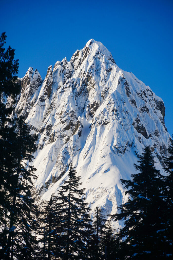
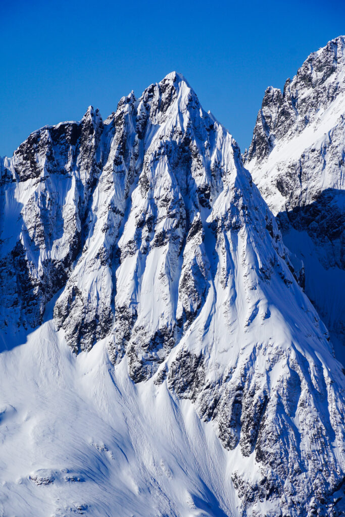
Among the high peaks of the North Cascades, Forbidden Peak is a classic, with three knife-edge rock ridges radiating from a singular rocky summit. The terrain surrounding it includes some of the largest glaciers in the lower 48. Having climbed the West Ridge many years ago, I have gotten to experience the mountain as a climber. As my ski experience has increased, now I had my eyes on a ski circumnavigation of the mountain – the Forbidden Tour.
The Forbidden Tour is a classic ski circumnavigation of Forbidden Peak. The route climbs up to Sharkfin Col via Boston Basin, traverses the Boston Glacier, descends the Forbidden Glacier to Moraine Lake, and finally climbs up towards Eldorado before exiting the Eldorado approach trail. Although the route looks pretty simple on a map, there are some notable cruxes. The most troublesome section seems to be the descent to Moraine Lake, which melts out sometime in the spring, leaving a skier stranded above slabby cliffs with poor bail options. With a bad snowpack this year (about 60% of normal in the North Cascades) I knew that I would have to go earlier than the typical April-May window for this tour.
Mid-March brought an unusually warm heat wave and seemed to signal the end of deep winter. As modest storms brought fresh snow on top of the now consolidated snowpack, I sensed that the window for the Forbidden Tour was approaching. While people typically do this tour in corn, I thought it could be better in powder. I wanted some fresh snow, but not too much. Most importantly, temperatures needed to be relatively mild. At the end of March, it seemed like we were finally getting a nice weekend for it!
I recruited Jon, Logan, and Anthony, veterans of other great Cascade River Road adventures like the Isolation Traverse and Sahale Glacier, to join me. I wanted a decently large group to share trail breaking duties and in case of crevasse rescue. The Boston Glacier is the largest non-volcanic glacier in the lower 48, and has the crevasses that come with that size. I mapped the route at around 9-10k ft gain, which would be a full day with the expected shenanigans and trail breaking.
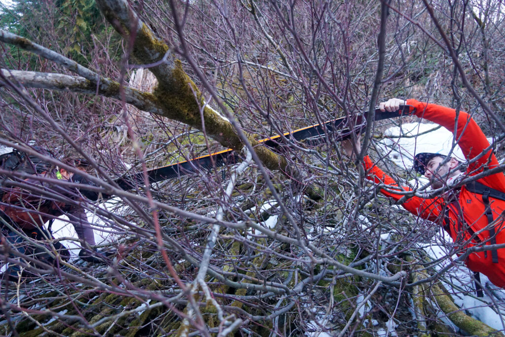
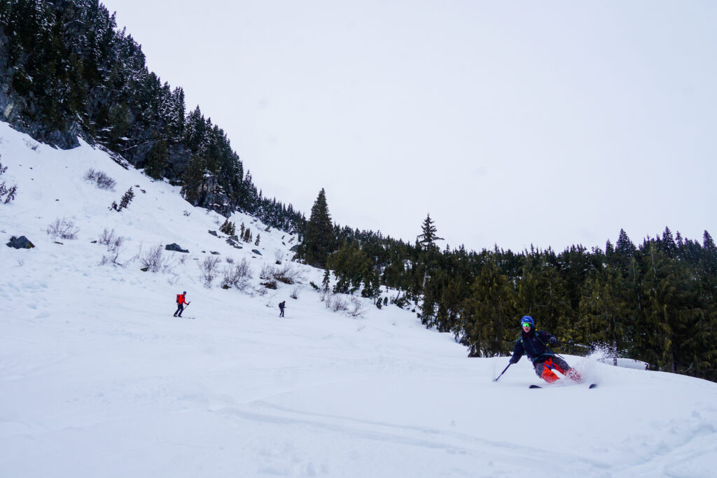
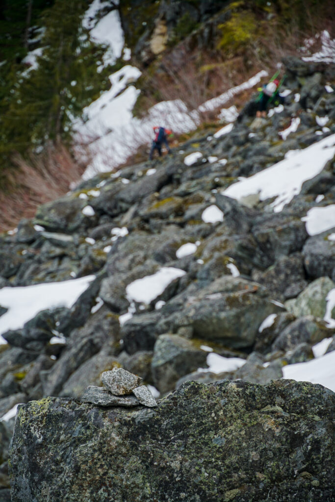
We began shortly after 5 AM from the Eldorado Trailhead, where the road was gated. The washout at Morning Star Creek necessitated an icy boulder hop, but otherwise it was easy walking to the Boston Basin Trailhead. This is where the shenanigans began. Typically, when others do this tour, there is consistent snow coverage on the Boston Basin Trail, even later in the spring. But this year we were treated to overgrown alder that pulled on our skis and boots, and patchy snow that was wonderful for post holing. On the way up, Logan and crew had been debating why the North Cascades are not very renowned as a ski destination. Perhaps this is why?
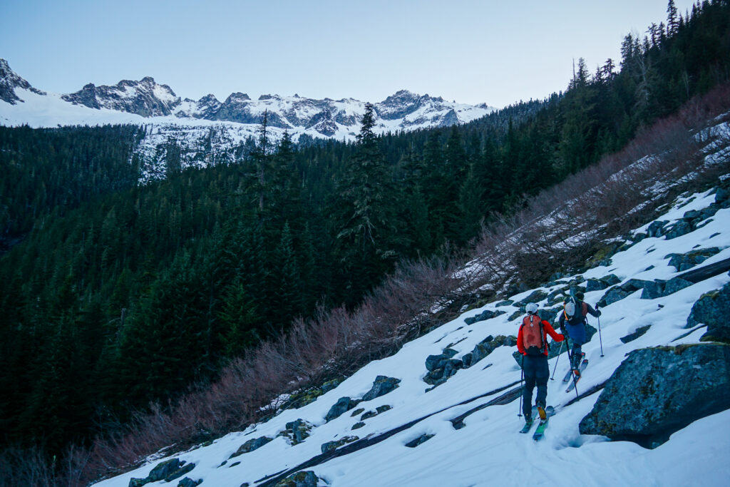
It was easy to be distracted by the brush and miss the incredible alpenglow on Johannesburg just across the valley. Could there be anything more Cascadian than a view of JBerg through a thicket of alder?
Around 4200 ft, we were finally able to skin comfortably uphill. Instead of trying to cross the creeks like the summer trail does, we just went straight up, staying south of Midas Creek. As we entered the alpine, we crossed the drainage, getting chilled by icy katabatic winds racing down from Sahale.
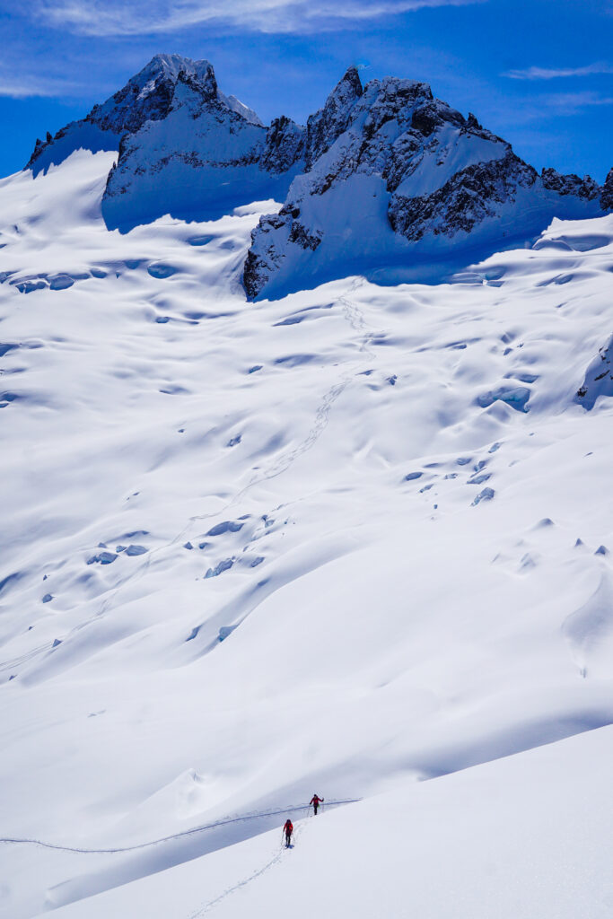
Once in the alpine, we began a nice simple traverse towards Sharkfin Col. The snow had a stout crust, making for quick skinning. It was a comfortable temperature in the shade, and we were happy to finally be making good progress after a beatdown on the lower Boston Basin Trail.
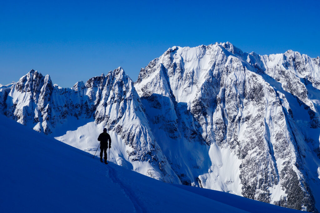
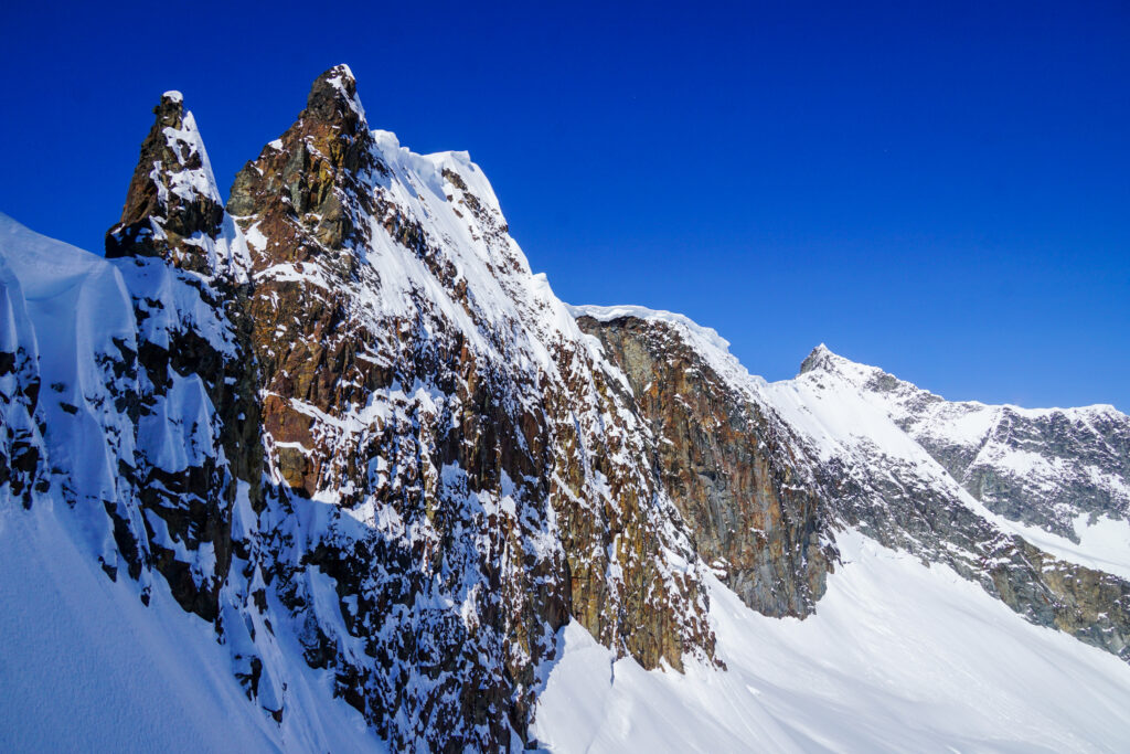
From afar, we spotted a group of four transitioning at the base of the climb up to Sharkin Col. Maybe we would have a booter up to the col! Unfortunately, as we got closer, it became apparent that they likely had the same thought when they saw us; they had not moved in 30 minutes. Given our constrained timeline, I was not going to play the game of “trailbreaking chicken”, so I guess it was our pleasure to set the booter!
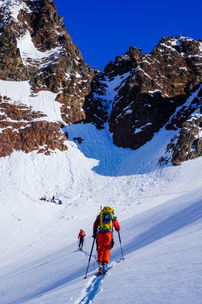
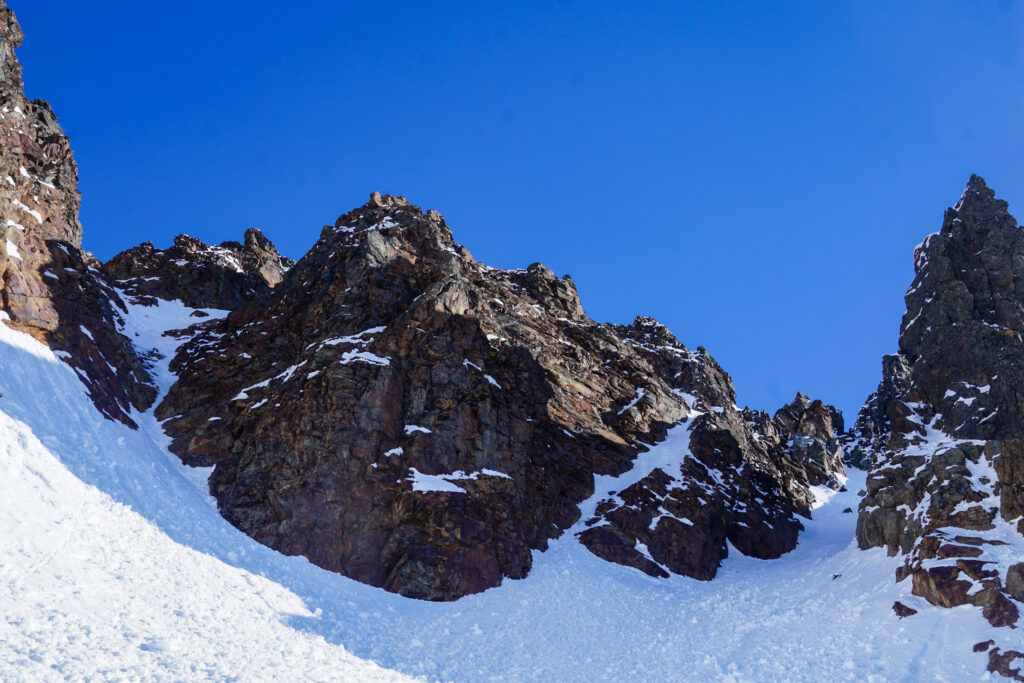
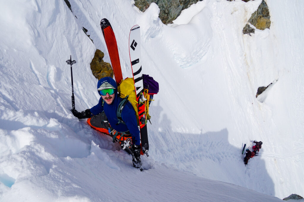
It turns out Jon had taken his Avy 1 with one of the members of the other party! They were on the 3 day itinerary, which is more typical for this tour. After transitioning, I went to wallow-town booting up deep dry snow beneath the crusty surface. Initially, I tried ascending the left hand variation to Sharkin Col, but was turned back by hard alpine ice in a narrow runnel. Fortunately, the right hand variation worked with a short mixed step.
We found an existing rap anchor at the top and Anthony rigged up the rappel. It was a straightforward 20m rappel, although you could have gotten away with a single 30m rope with some down climbing steep snow. Jon even remarked that if he had his fat skis he might have just skied the entire rappel.
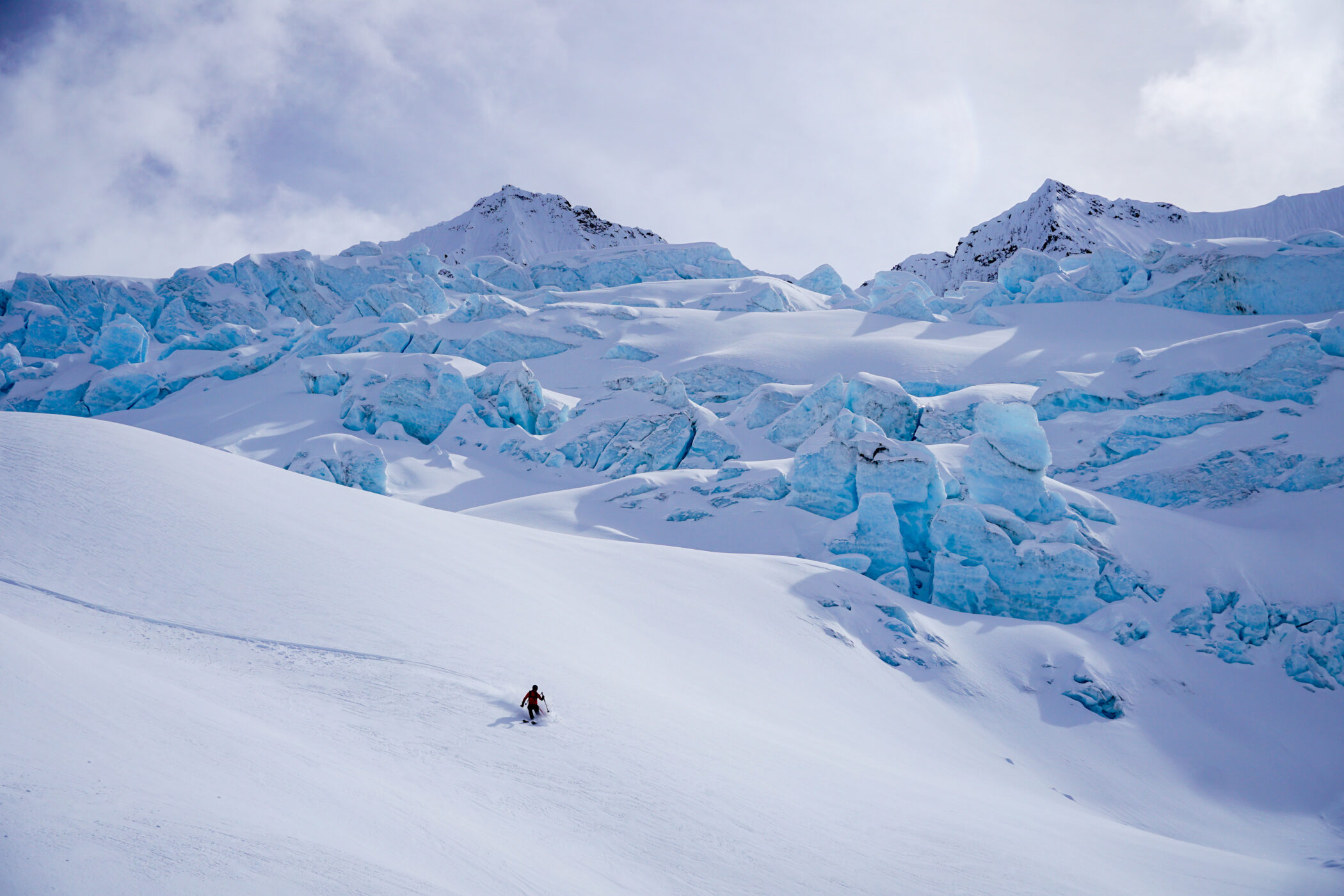
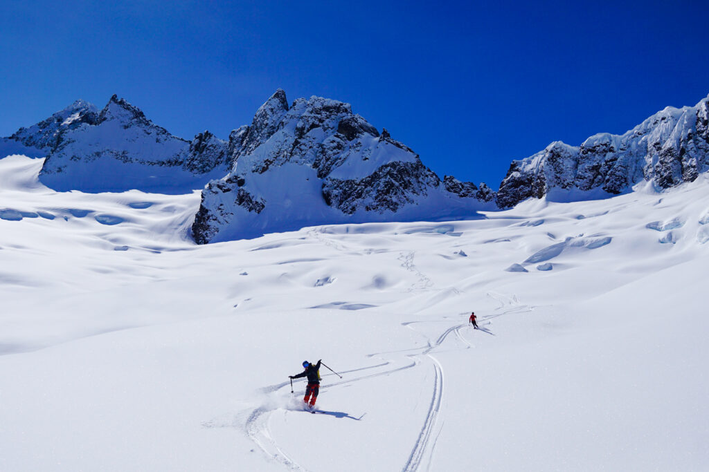
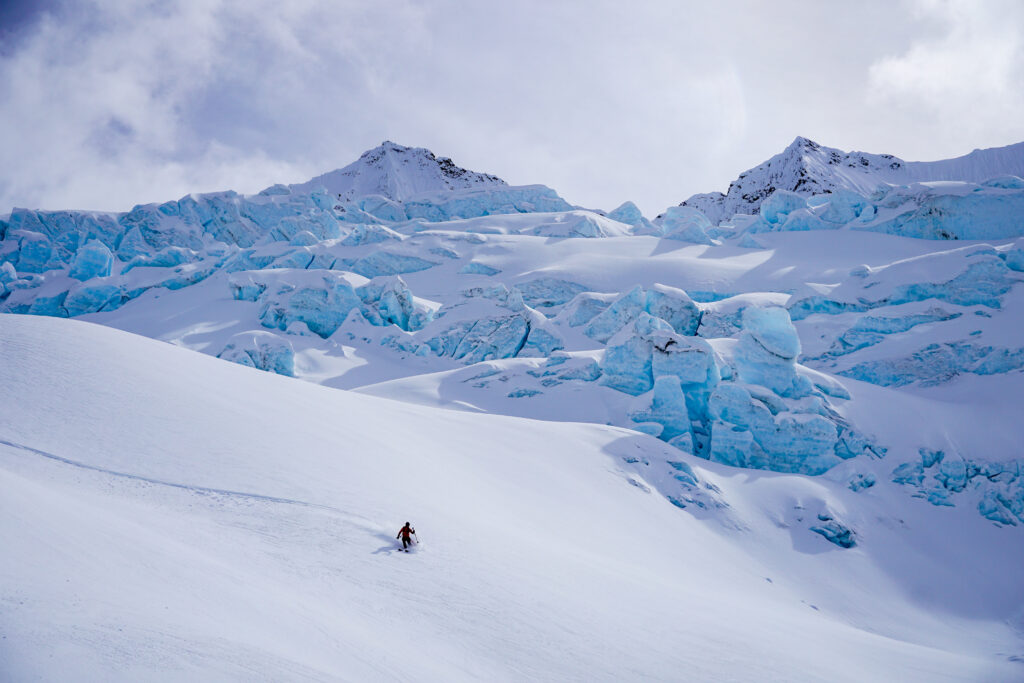
We excitedly clicked into our skis in waist deep cold powder. Just like on Sahale, we were shocked to find such deep, blower powder in a high alpine environment.
We regrouped in the sun after the first section, already stoked out of our minds. We had to keep our skiing conservative with all of the covered crevasses, but we knew we were in for an absolutely incredible descent down the largest glacier in the North Cascades outside of Baker in hero powder!
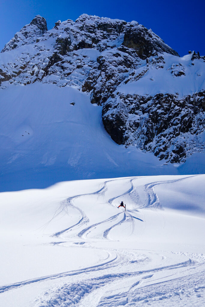
We hooted and hollered our way carefully down the glacier. I had to keep looking around to remind myself that this wasn’t the Alps or Alaska or BC; it is my home range, the North Cascades. It was really special.
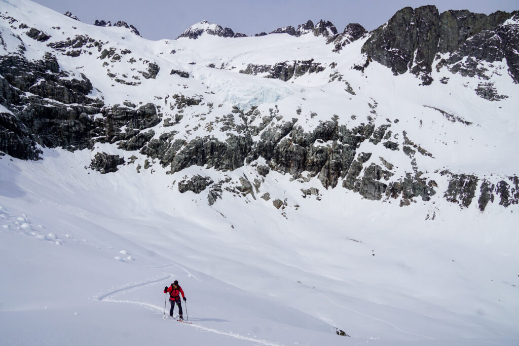
We ended our run around 6500 ft, roped up, and started skinning towards our next col on the North Ridge of Forbidden. The glacier was well filled in, making for easy travel, although the hot east facing powder was hard work to break trail through.
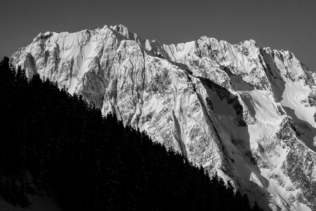
As we got higher, we were able to fully appreciate the scale of the Boston Glacier. It occupies a massive cirque beneath 8-9,000 ft peaks, and is miles wide. I had gazed at it previously from above and afar, but being on it was an entirely different experience. The scale of the terrain is absolutely immense.
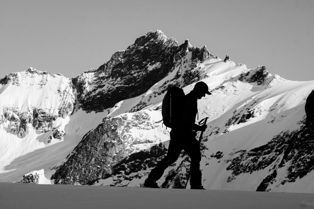
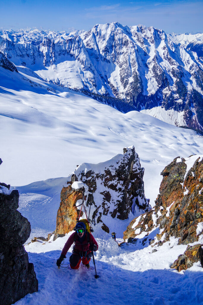
I was able to skin all but the last 30 ft or so to our next col on the North Ridge of Forbidden. The final slope had some 60 degree snow, but fortunately it was supportable so not too bad to climb.
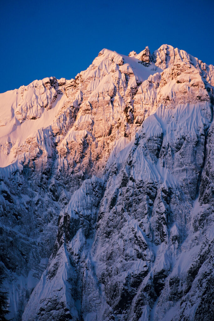
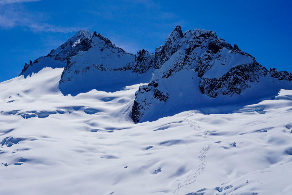
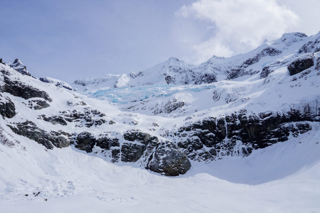
At the col we gained our first view of Eldorado, the Inspiration Ice Cap, and the famous 3300 ft descent down to Moraine Lake. I led us towards the base of the North Ridge so we could ski drier powder on the “false north” aspect, where we took a nice lunch break. I might only ski this run once in my life, so I wanted to soak it in. The weather was changing, with a cold wind from the west generating some clouds over the lofty summit of Forbidden Peak. But eventually it was time to ski!
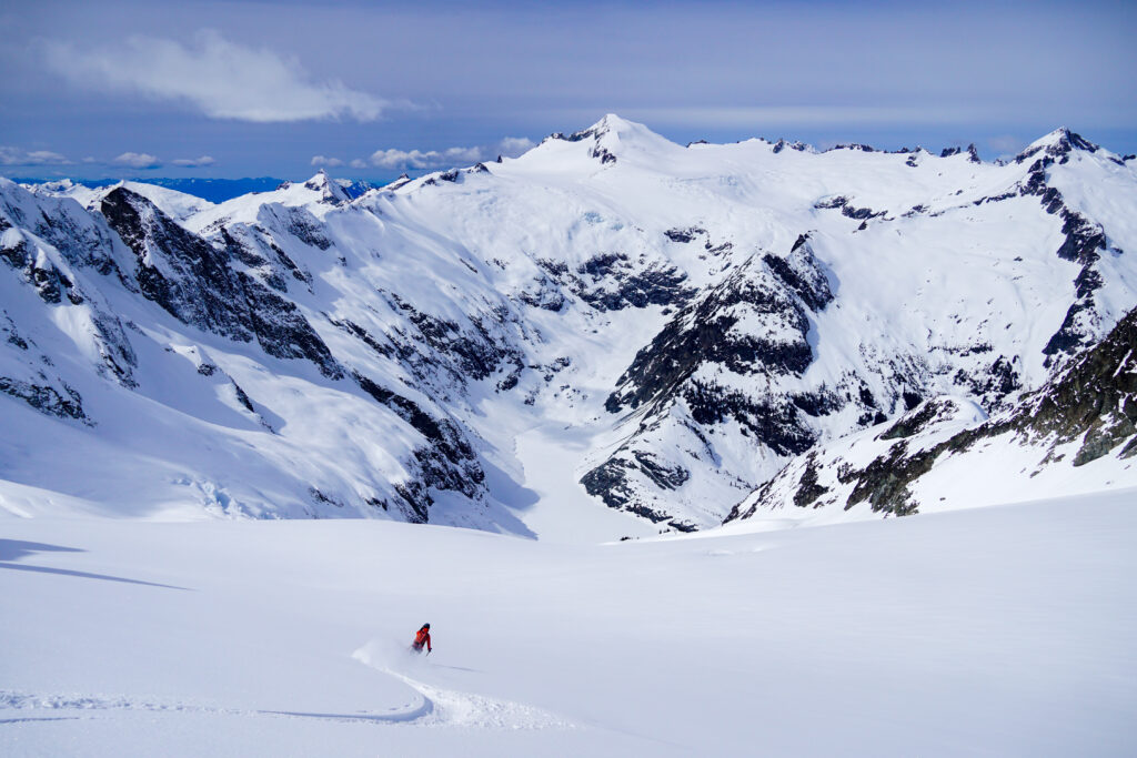
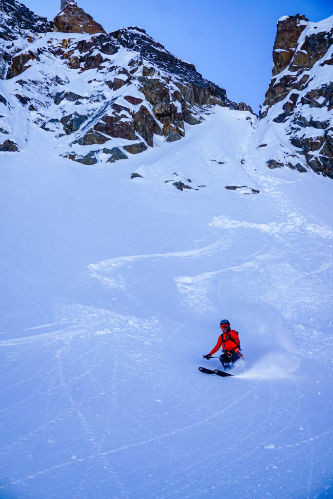
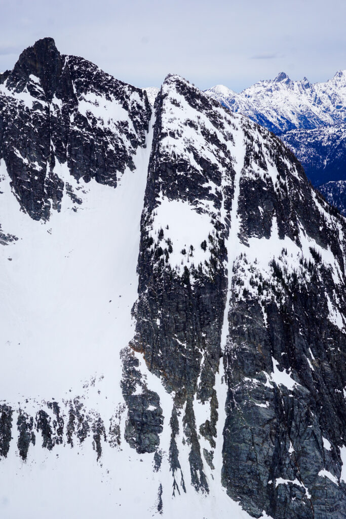
The descent down to Moraine Lake is legendary amongst PNW ski mountaineers – not because of its steepness or radness, but because of the simply magnificent position. All around us were giant glaciers, towering peaks, and vertical cliffs. This is the massive, wild heart of the North Cascades.
The top thousand feet was straight hero boot top powder. Below that, there was some sun crust on more solar aspects from the day before, but we could partially avoid it by playing the aspects correctly. The descent just keeps going and going, with dozens of blind rolls, twists, and turns. The most incredible section was the main gut beneath the hanging ice cliffs of the Forbidden Glacier. We did not linger beneath, but the feeling of being so small will remain with me for a long time.
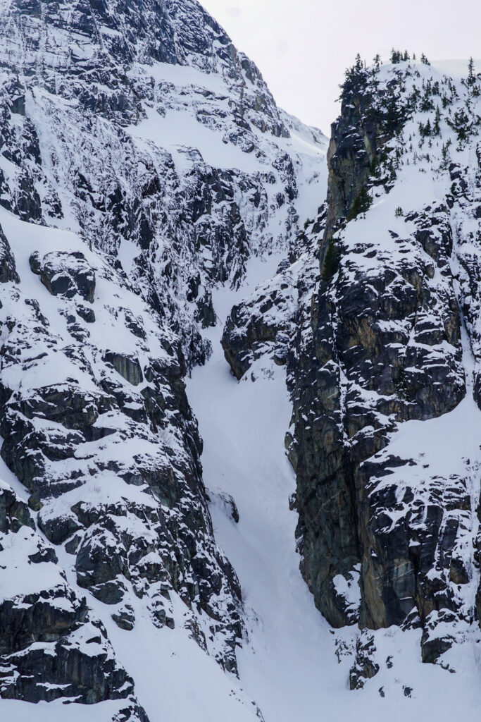
The final obstacle is a series of cliffs around 5200 ft. I had seen some pictures from Eldorado the weekend before, so I felt confident that the slope still “went”. There was a blind gully to the left that looked promising, but ultimately we made a long traverse skier’s right. The thinnest section had just a little bit of snow left on the rock slab, but it worked! We had passed through the gates to the Forbidden City – Moraine Lake.
We breathed a sigh of relief down at the lake. This tour is like unlocking a series of doors, each one hidden until the last moment. Turning back is difficult or near impossible. Upon further investigation, Logan determined that the skier’s left line could have worked, but would have required a small mandatory air over an open crack. We knew it was a low snow year, but we were surprised how close to “out” the direct Moraine Lake descent was already!
We hydrated from an open hole on the shore of the lake and let the incredible descent sink in. We still had a lot of work ahead of us, but things were going very smoothly!
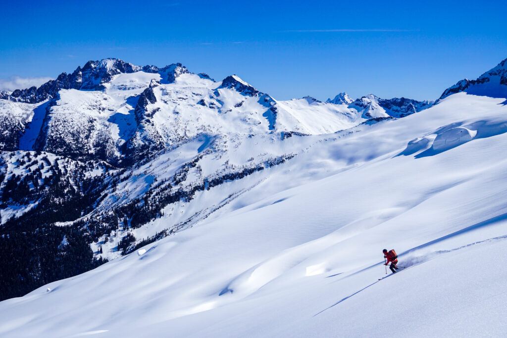
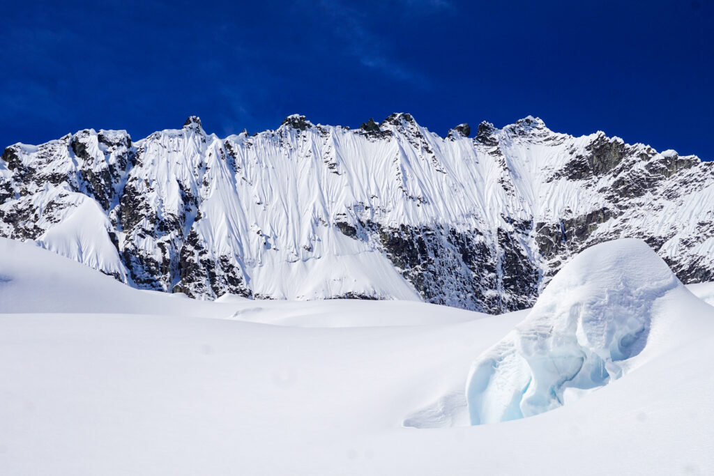
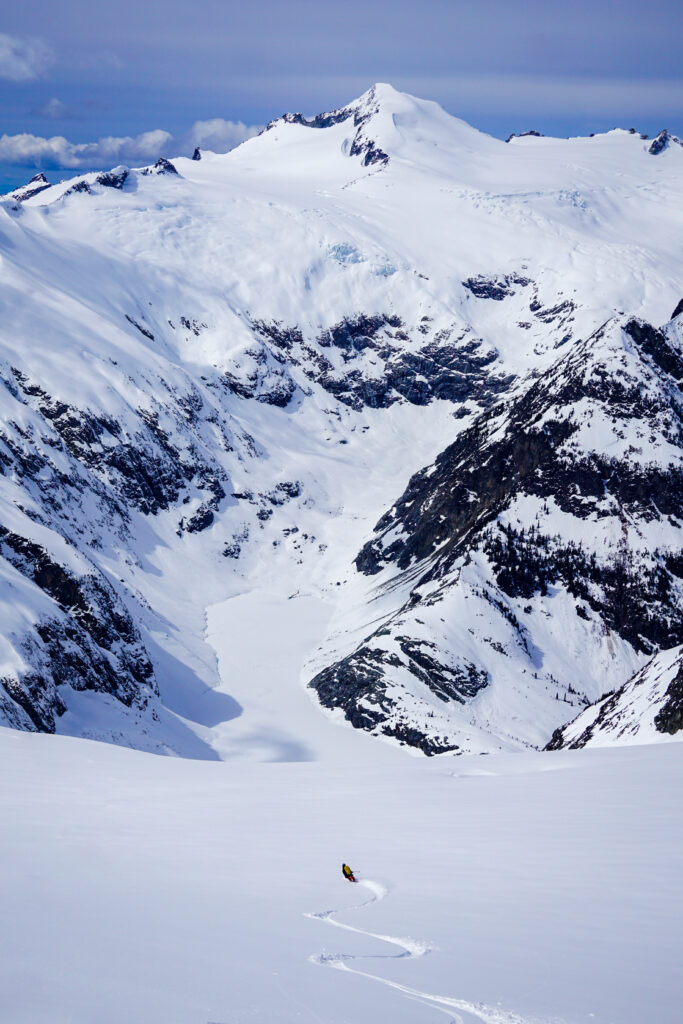
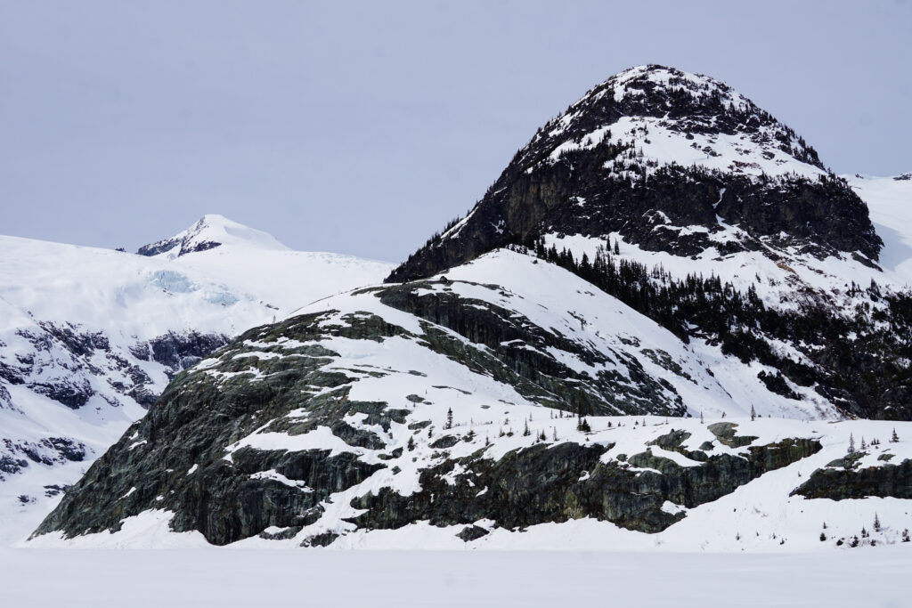
Moraine Lake sits in a deep hole 4,000 ft beneath Forbidden, Torment, Eldorado, and Klawatti. Cliffs surround the lake on almost all sides, with dark couloirs cutting through the rock, and frozen waterfalls pouring over the rock. There was large ice debris in the middle of the lake, evidence of massive serac chunks tumbling down from thousands of feet above. This is where the giant things are.
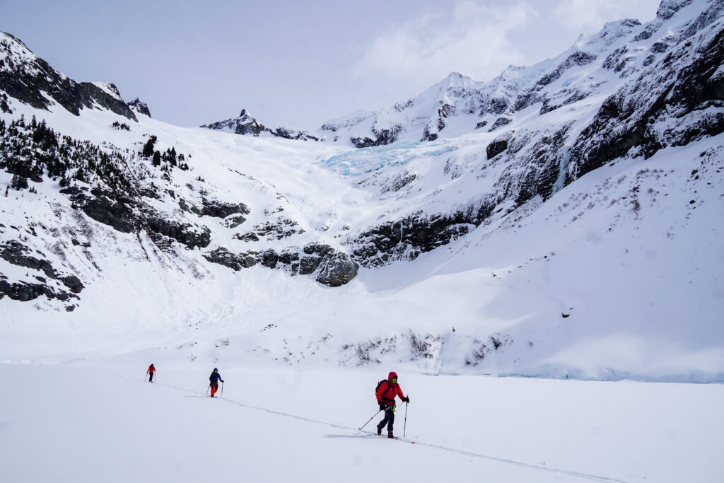
The standard ascent from Moraine Lake climbs south facing slopes towards Klawatti Peak and the Inspiration Glacier. For us, this had a few disadvantages: it would put us beneath steep south facing slopes in the afternoon, and it required much more distance and gain to reach the Eldorado Glacier.
Instead, our plan was to ascend north facing slopes towards the divide separating Moraine Lake from Eldorado Creek. This would keep us off of south facing slopes and cut off over 600 ft of gain, along with a good amount of distance.
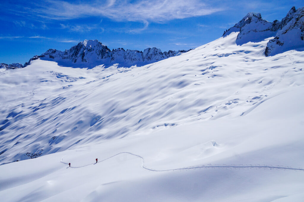
There was one steeper gully that required a lot of kick turns, but for the most part, the ascent was rather simple. We put a beauty of a skin track up the north facing slopes. The snow was still dry powder, but we were too tired to consider throwing down any bonus laps. Additionally, the weather had deteriorated, with a cold wind and clouds engulfing Eldorado above us.
Fatigue was starting to set in from all of the trail breaking, but I managed to lead us to the ridge at 7200 ft. The wind was bitterly cold, so we transitioned quickly and started the mysterious descent into Eldorado Creek. We had never heard of anyone using this shortcut. It worked really well, as we easily got around some cliffs and skied down right above the boulder field! The snow was awful breakable crust with flat light, but it was still better than walking.
We had heard the boulder field was dry the weekend before, but apparently a week of snowfall had filled in it for us! We were able to ski all the way down to 4200 ft with minimal shark attacks, although we knew that hundreds lurked just beneath the surface.
This was actually my first time descending Eldorado with skis on my back. Skis and boots make that descent many times worse! At least the trail takes you down directly. Down at the river, we were too tired to look for a log crossing, so we just forded the river. After all, it felt like a fitting way to end a proper Cascadian adventure.
The Forbidden Tour has to be one of my favorite adventures in the North Cascades yet. Although the skiing is relatively moderate, the tour is rather technical, with some rope work, tricky cols, and constant puzzles to work out. I loved the feeling of unlocking each step one by one, joining together some of the most scenic and incredible terrain I have ever experienced. Thank you to Jon, Logan, and Anthony for an unforgettable day!
Notes:
- The tour was 18 miles and 10k ft gain. It took us a little over 13.5 hours. I think we lost an hour or so with poor coverage on the Boston Basin Trail and backing down on the first gully at Sharkfin Col. Otherwise, we were decently efficient, although the trail breaking was often slow and deep, and we took our time to enjoy the descents and take lots of pictures.
- Ideal timing would have better snow coverage on the Boston Basin Trail from where it leaves the Cascade River Road. This would also probably mean the entire Eldorado boulder field would be covered.
- The rappel we did over Sharkfin Col was very simple. The Volken guide says that it is more complicated, but it seemed very chill to me. There was a small cornice we had to break through, so perhaps this cornice can be bigger at times. Anthony initially did the rappel with a single 30m rope, but then told us to tie two ropes together to make it easier.
- The direct descent to Moraine Lake will probably be out sometime in early April. This is very early, but we are at a 60% snowpack in the North Cascades. The alternate tree descent looked more filled in, but the direct descent is certainly more aesthetic.
- The Boston Glacier was well filled in and easy to navigate despite our below average snowpack. However, we have had a lot of 5-7k freezing levels this winter so the upper elevations are likely closer to average.
- Our north facing climb out of Moraine Lake worked really well. It felt less hazardous, and saved us significant gain and distance. I also would imagine the snow coverage stays better late into the spring. I am not sure why more people do not use this exit, but perhaps groups doing the tour over multiple days want to take a longer route over to Eldorado.