Two Tickets to the Darrington Rodeo
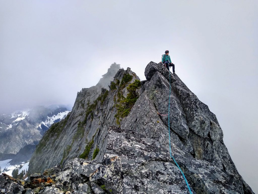
Over a long 16 hour day, Jenny and I climbed an adventurous linkup of Squire Creek Wall (Skeena26, 5.8, 12p), Buckeye Peak, and Whitehorse Mountain. The terrain was continuously steep and rugged and the climbing was varied and engaging. The most stunning section was the knife edge traverse from Buckeye to Whitehorse, which featured great exposure and a wild position in the heart of the Boulder River Wilderness.
Growing up in the northern suburbs of Seattle, Whitehorse is a peak I have always looked at. Of course, it would be nice someday to have climbed every peak I can see from home, but I am in no rush. I seek not to just stand atop these mountains, but to find a more creative, unique path to the the summit. The creative process of ideating, researching, and revising can span many years, as it has with Whitehorse.
The two main ways Whitehorse is climbed is on skis via Avalanche Gulch or the mountaineering route by Lone Tree Pass. Avalanche Gulch is impressive, as Whitehorse rises 6,000 ft above the flat fields of Darrington, truly one of the imposing sights in the Cascades. But over many drives to the North Cascades, I became interested more in the backside of Whitehorse, which can be caught in brief peek-a-boo views from Highway 530.
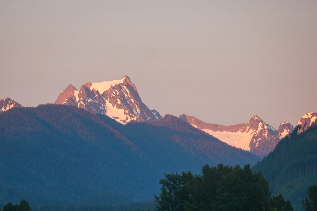
The SE Ridge of Whitehorse is a striking arete, with over a thousand feet of vertical exposure on the east side. It connects to Buckeye Peak via a sharp rock fin, which is visible from the heart of town.
These ridges looked beautiful and wild. Researching in the Beckey Guide and online provided no real information, other than that the SE ridge of Whitehorse was “Beckey class 4”. I saw the potential for incredible scrambling and technical climbing connecting the two dominant peaks of the Boulder River Wilderness – Whitehorse and Three Fingers.
But the more I thought about this idea, the more problems I had with it. Going from Whitehorse to Three Fingers seemed like it would make most sense, but downclimbing that SE ridge of Whitehorse could be challenging. Traversing the Three Fingers seemed like it was best with more snow, as Wayne Wallace described, or in rock season would involve a lot of unknown rock climbing, which is something that still scares me. The car shuttle was massive. The idea fizzled and another year passed without making an attempt.
This spring, I have been dealing with an overuse knee injury from the fall. Reckoning with this injury forced me to change my summer plans to focus more on rock climbing instead of big runs. Out of hope for inspiration, I bought the beautiful Blake Herrington Cascades Rock guidebook. Reading through the section on Darrington, I noticed that Squire Creek Wall was right next to Buckeye Peak. Like most Washington trad climbers, I had always thought of checking out the Darrington climbing, but always came up with an excuse. Suddenly, I had the idea for a Squire Creek Wall -> Buckeye -> Whitehorse linkup! To connect a giant sub-alpine granite dome with the high alpine ridges of Whitehorse would be an experience that felt powerful and encapsulated the unique character of the Boulder River Wilderness.
The only problem was that all of the routes in Blake’s book are 5.10 or harder. I knew this would be challenging to climb with a pack. Looking on Mountain Project, I found the route Skeena26, a moderate 5.9 route on the south face. The original CascadeClimbers.com trip report detailed their year long experience putting up the route (although the FA is debatable, because self-proclaimed CrazedManiac “Zippy” free soloed dozens of routes all over the south face during his hey-day). I loved one comment specifically:
At odds with the rest of the world since day-one D-Town has rambled on with the barest minimum of love for just over forty years. Too far, too weird, too low angle, too obscure, too wet. Two-thousand feet tall?? Two ropes?? Two hours from Seattle? Fuck that!
David Whitelaw
The skills required for such a linkup I had planned are not extreme, but rather diverse. There are not too many people I knew who could handle such a variety of challenging terrain from 5.8 slab to vertical jungling to steep snow to exposed scrambling. Last year, Jenny found my blog and reached out to me. She had been climbing hard rock grades for a decade and then suddenly discovered the North Cascades and fast and light mountain running. Ironically, it is her sister’s blog that largely inspired me to get into mountaineering. Jenny seemed like the perfect partner for this objective, and when I pitched it, the first question she asked was “why?” I knew we were going to get along…
Jenny and I met at the Niederprum Trailhead early Saturday morning, left a car, and drove over to the Squire Creek Trailhead. The overgrown, jungly road, like a tunnel of vegetation, had a unique feel for the Cascades.
We started at first light hiking up the Squire Creek Trail, passing the time getting to know each other since we were finally not just internet strangers. About 6-8 minutes after passing the actual Squire Creek Trail sign, we found the white stone cairn, and a trail leading down to the river. We found some logs to cross just downstream, where Squire Creek split into two sections.
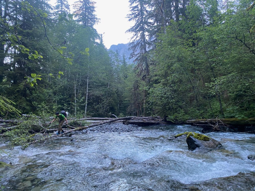
On the other side, we quickly found the trail again and started heading uphill. There were so many little things that had to go well for us to pull off this linkup “onsight”. I was worried about finding the trail and river crossing, so it was nice that this went quickly.
A giant D4 avalanche, probably a casualty of the deep persistent weak layer last winter, ripped off the SE aspect of Buckeye Peak at some point and decimated the valley of trees below, continuing nearly all the way to Squire Creek itself. Fortunately, the trail stays mostly on the right side of the drainage, although the trail got nuked in a few spots. Still, it was pretty easy to follow and soon we found ourselves crossing the snowy gullies that led to the grassy camp beneath the south face of Squire Creek Wall.
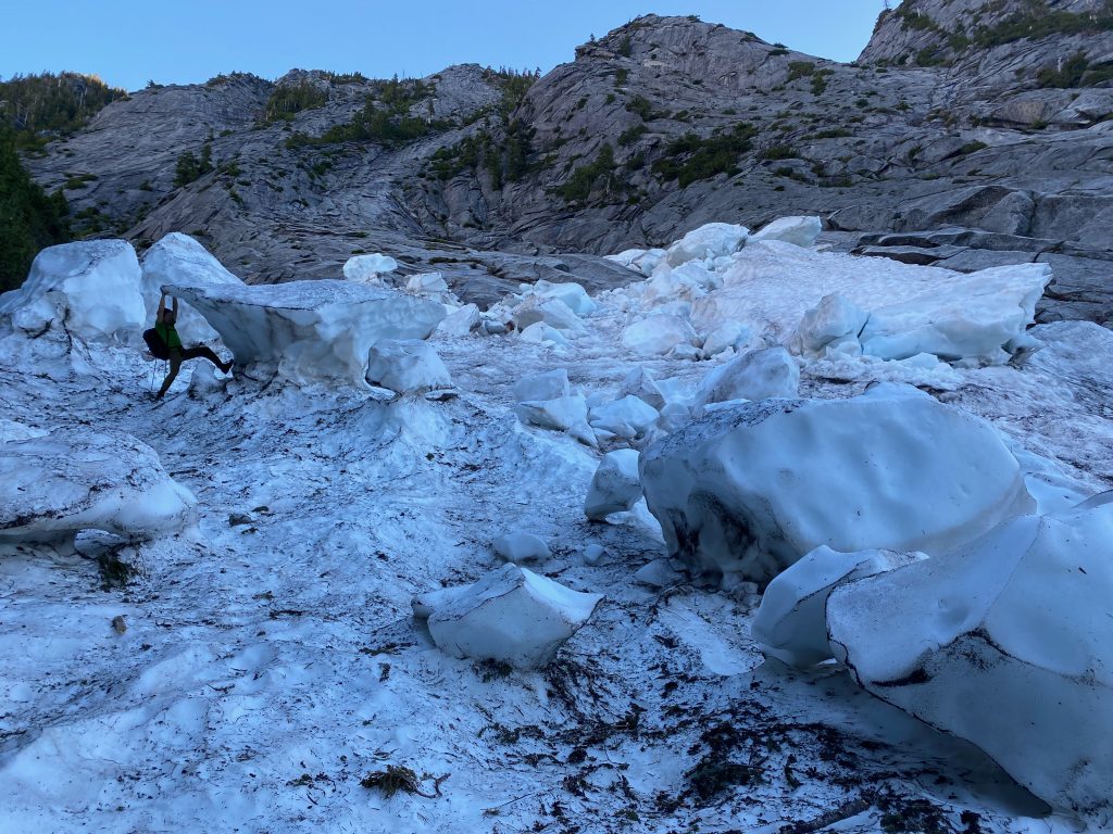
We reached the grassy saddle (which was covered in snow) exactly two hours from the car. So we set out to find the start of Skeena 26 somewhere in the upper reaches of the snowfield. The setting was beautiful – like the giant slabby domes of Yosemite were plopped into the lush, Western Cascades. I had never seen anything like it, except maybe in photos of the BC Coastal Range.
We looked around for a while, but did not find any bolts. However, we knew the general route direction and were confident we could intersect the route partway up, so we roped up and started climbing easy low fifth slabs with occasional pro. Near the crest of Primal Scream Buttress, we finally found a bolt, camouflaged in the shady rock. We had bypassed the first three pitches, but were now on route!
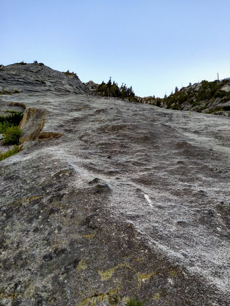
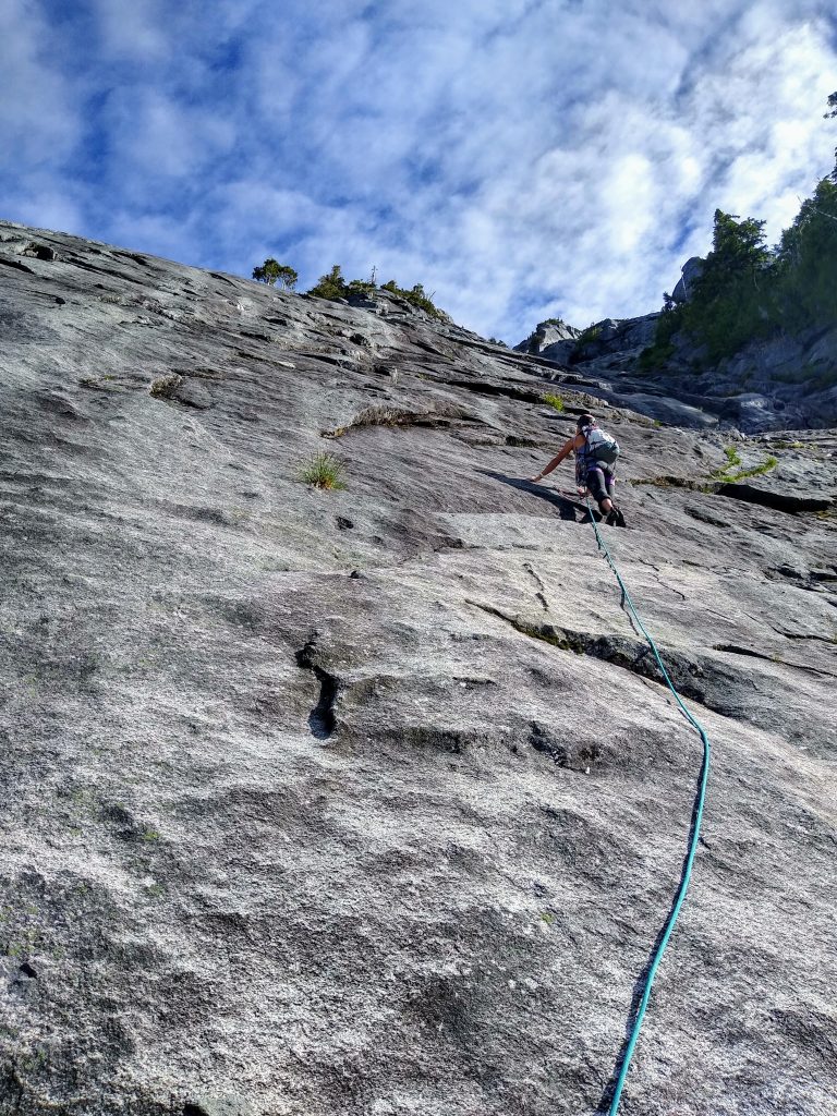
Our strategy was to climb the route with 60 meters of rope out, simul climbing as much as we could. We generally linked two to three pitches at a time. The rock was immaculate – sticky, knobby, clean. The climbing reminded me of Tenaya Peak in Yosemite – beautiful slab that climbed almost like a cardio workout.
The bolts were moderately spaced – usually 10-20 ft. Not the Darrington horror stories I have heard of, but definitely still engaging. The real challenge, however, was just seeing the bolts! In the shade, they were nearly impossible to see, even when they were right in front of us. So we wandered up the route, hoping to stumble across the next bolt. Sometimes I would see a bolt 30 ft above me and climb quickly up to it, only for Jenny to remark while cleaning that I had skipped right over an intermediate bolt!
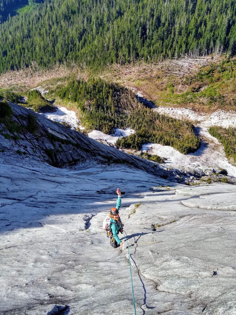
The 5.8 section to start pitch 7 had a bit of water still coming down, but Jenny was so cool on lead. Other than that, the rest of the route was dry. The only big run out came on pitch 9 where I completely missed the “good gear crack” and was pretty run out before traversing around and finding the anchors.
Above pitch 9, we entered the sun and the bolts became much easier to see, shimmering in the sun. We topped out at the dead snag 2.5 hours after roping up, well ahead of schedule!
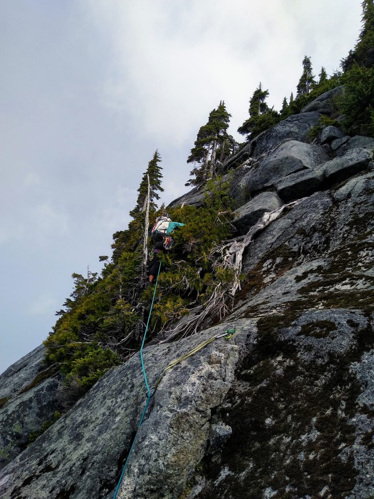
Skeena26 does not actually reach the top of the wall, so we had to continue up the buttress. The Mountain Project page casually mentions scrambling to the top of the wall, but instead we found full-on blue-collar climbing, grabbing little shrubs and pulling ourselves up pine-needle covered slabs. It was not quite as sketchy and desperate as North Index, but still engaging. This is where Jenny really started to leave me behind. Mutual friends had said she was fast on rough terrain, and they were right! #inshrubswetrust
The going was slow and rough and we opted to try a gully traverse near the top of the buttress instead of more jungling and then rappels to traverse the top of the wall. Two sparsley protected leads got us to a tree, from which we could make a 30m directional rap that just barely got us off the steepest terrain.
The terrain got less brushy as we traversed the top of the Far Western Wall. Here we actually found pleasant scrambling with good exposure on both sides. We were able to downclimb slabs and cracks to finally finish the Squire Creek Wall traverse.
From the top of Skeena26 to the end of the Far Western Wall took us a full two hours, a bit longer than we had hoped. But delays have to planned into big adventure days like this. We were just happy to be through one of the major obstacles and hiking up easy snow to Buckeye Peak.
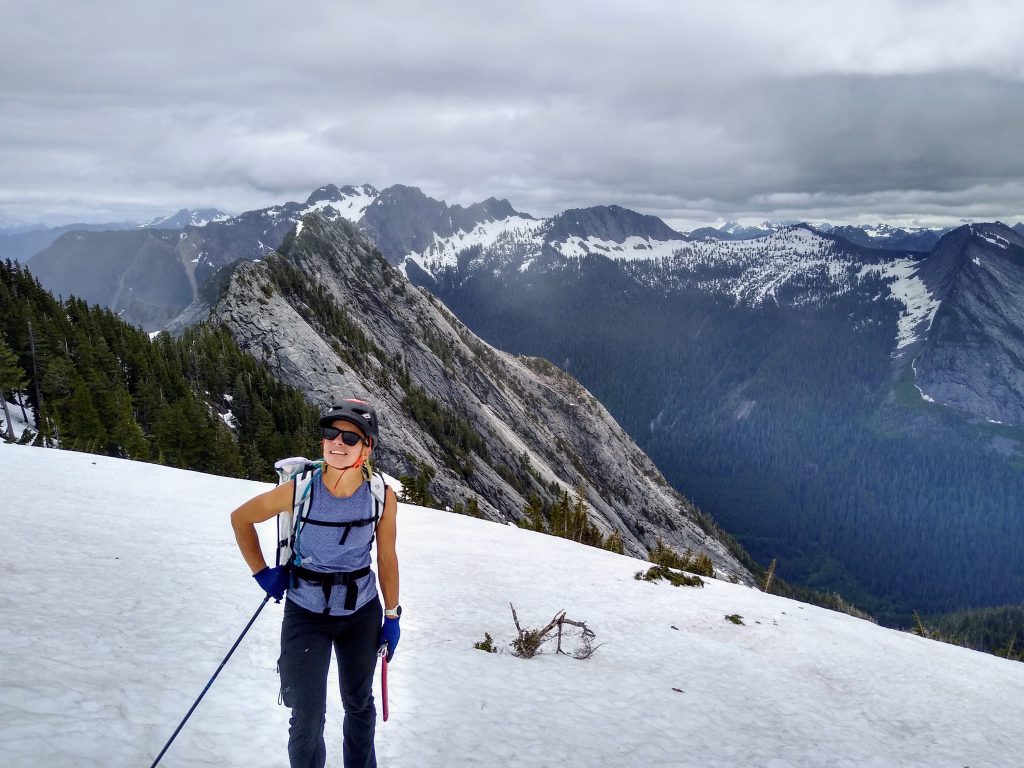
The forecast was for “mostly sunny” but clouds had already chopped off the higher summits and a light mist fell. We were just hoping we would not lose all visibility for the mysterious section between Buckeye and Whitehorse.
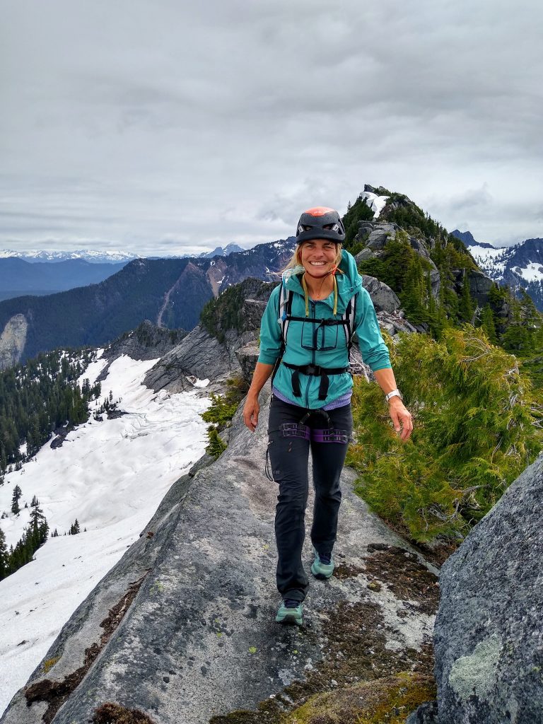
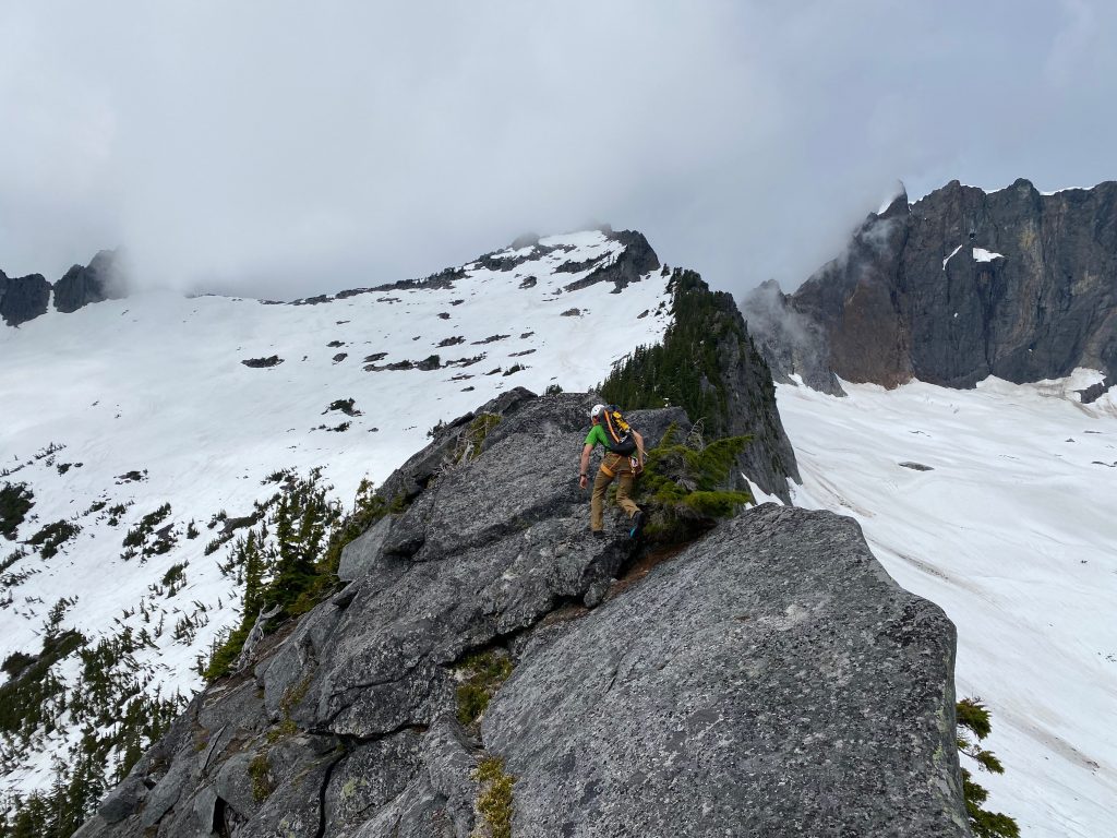
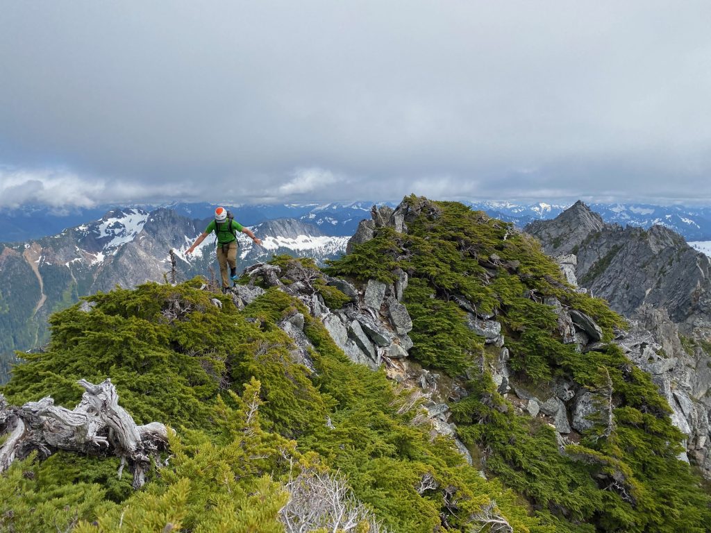
A few hundred feet below the summit of Buckeye, we left the snow and started scrambling the excellent east ridge of Buckeye. This ridgeline feature absolutely bomber 3rd and 4th class rock with cool exposure to the north. If it was in a more accessible location, it would be an instant classic.
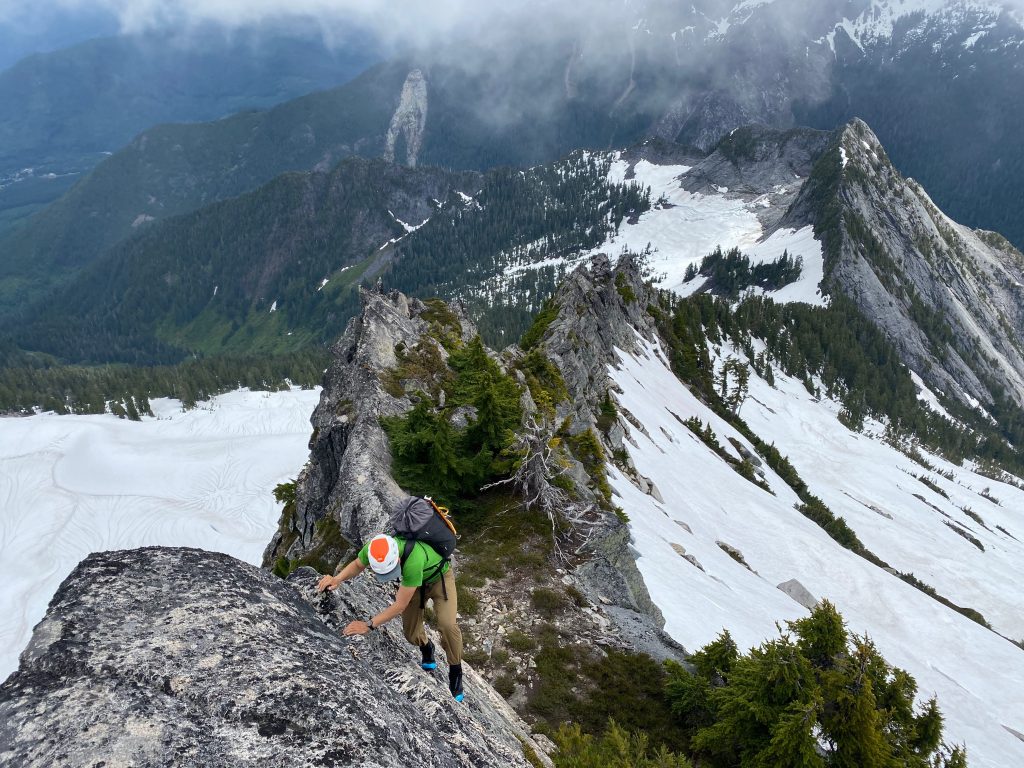
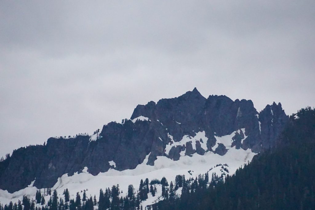
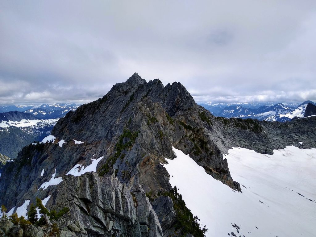
From the top of Buckeye, we had a clear view of the mysterious north ridge that connected to Whitehorse. It looked incredibly intimidating – many gendarmes with blocks stacked precariously on top of each other.
We had to decide here whether we were going to try to traverse the ridge of gendarmes or rappel down to the snowfields to the west and get over to Whitehorse quickly. We were both pretty tired, but still had plenty of daylight. It was tempting to just make the rappels and get off the technical terrain, but we remembered a quote from the original FA trip report:
The not knowing isn’t merely a part of it, it’s the heart of it.
David Whitelaw
While I am comfortable wandering into the unknown on non technical high routes and ski traverses, and dabble in unclimbed ice lines, rock climbing has always been very procedural for me. I am not a particularly strong climber and so I have always stuck to route topos and found satisfaction in following them precisely. Doing something like this was new and exciting – to move through unknown terrain of the vertical realms. I was glad to have such an experienced partner like Jenny along.
We slung a block and made a rappel down the north ridge towards the first notch. We were going to go for it.
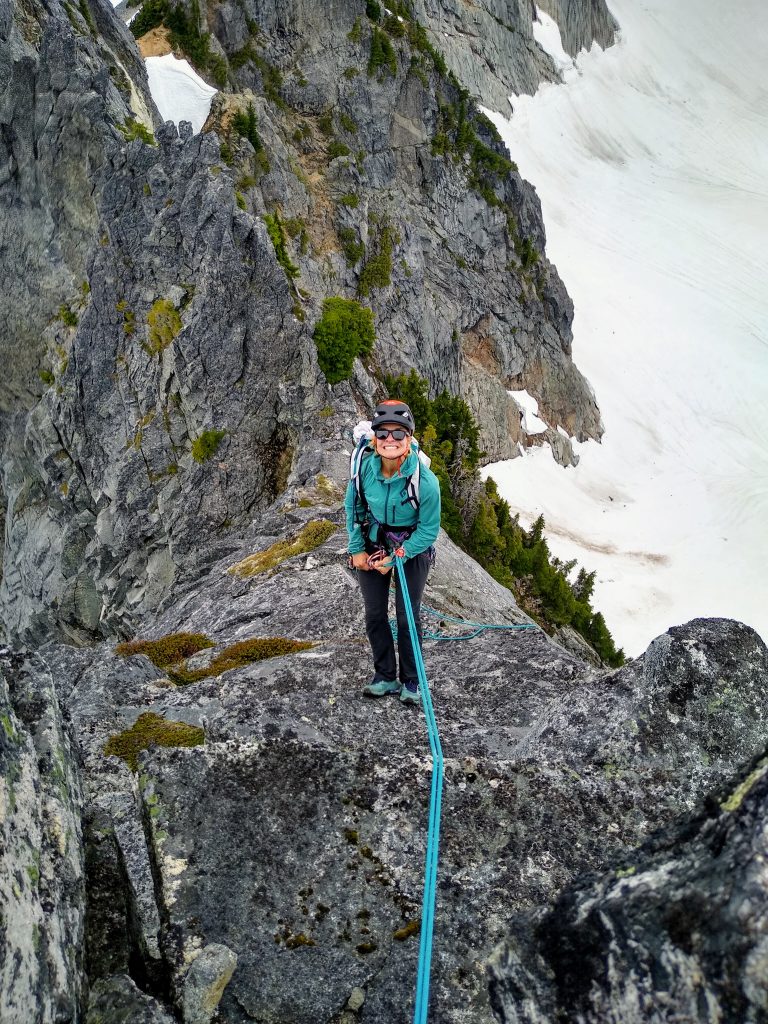
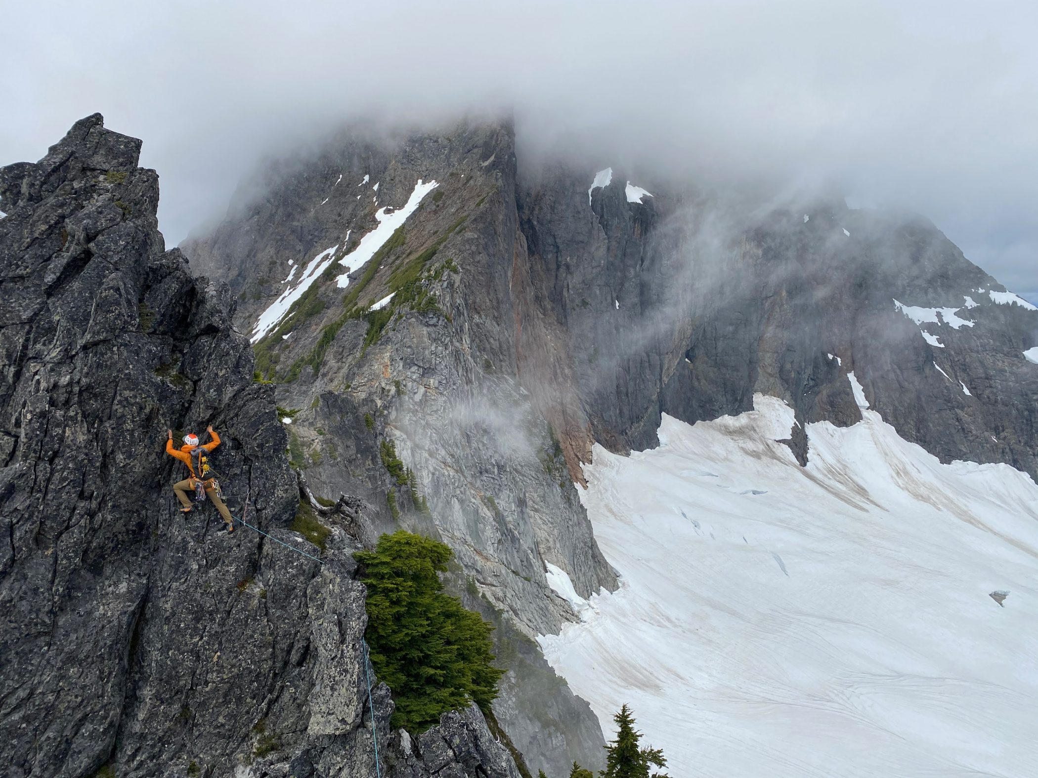
I took the first lead, climbing up over the first few gendarmes. The rock was highly fractured, but always proved solid enough. Placements were abundant, but we only had a few cams and who knew which cracks would hold a fall. So I gingerly climbed up and around the towers, reveling in the exposure.
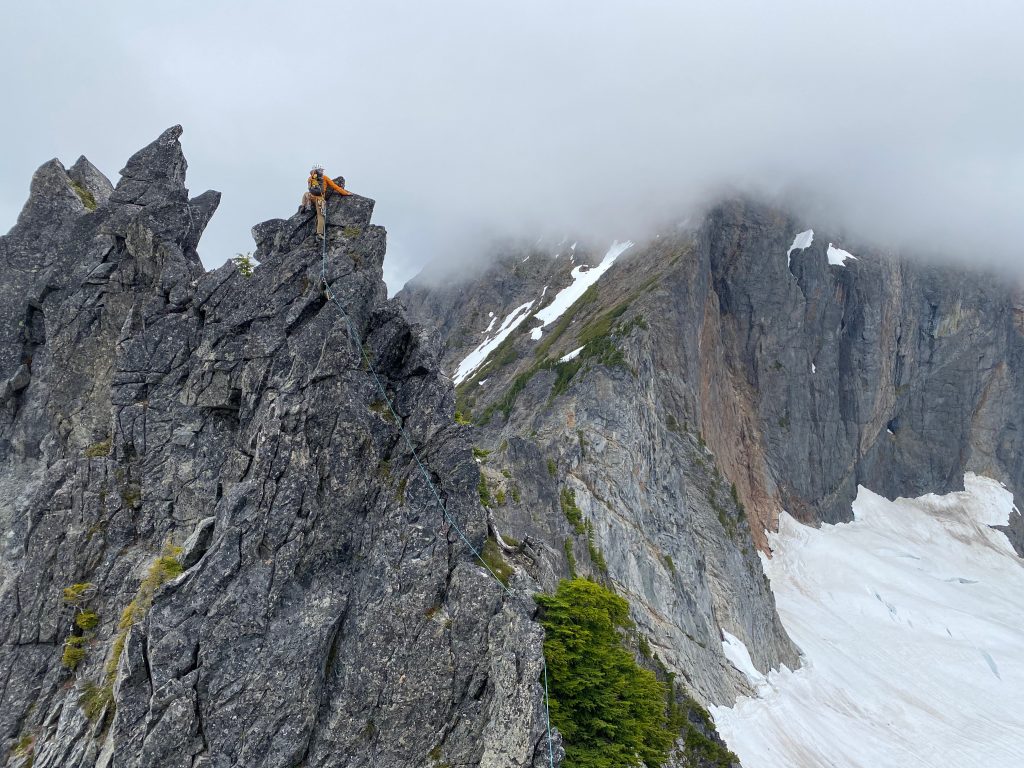
There was one memorable section where I traversed a narrow ledge, with a bulge above me that wanted to push you off the wall into space. But hidden hand holds provided passage. It goes!
Jenny took the next lead and got us to another steep drop off. We made another rap anchor and pushed onwards, surprised by how long the ridge was. But at this point, we were most definitely committed.
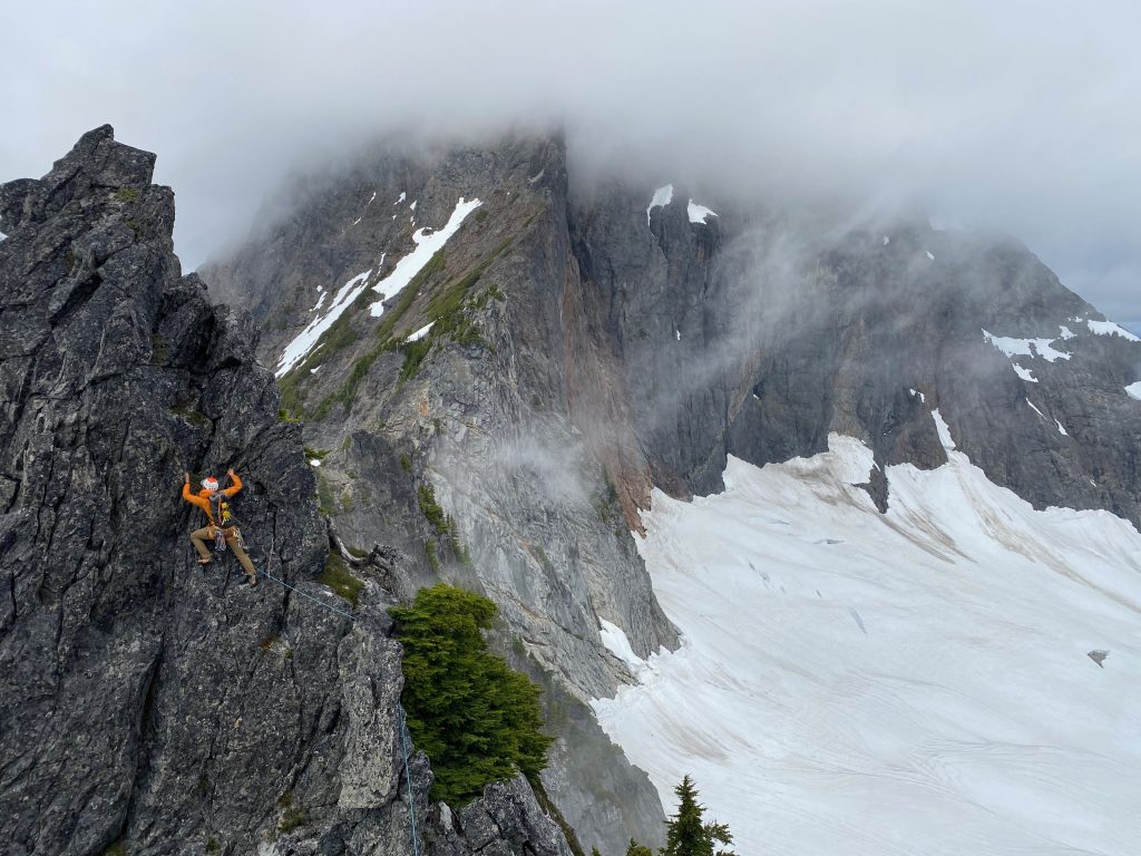
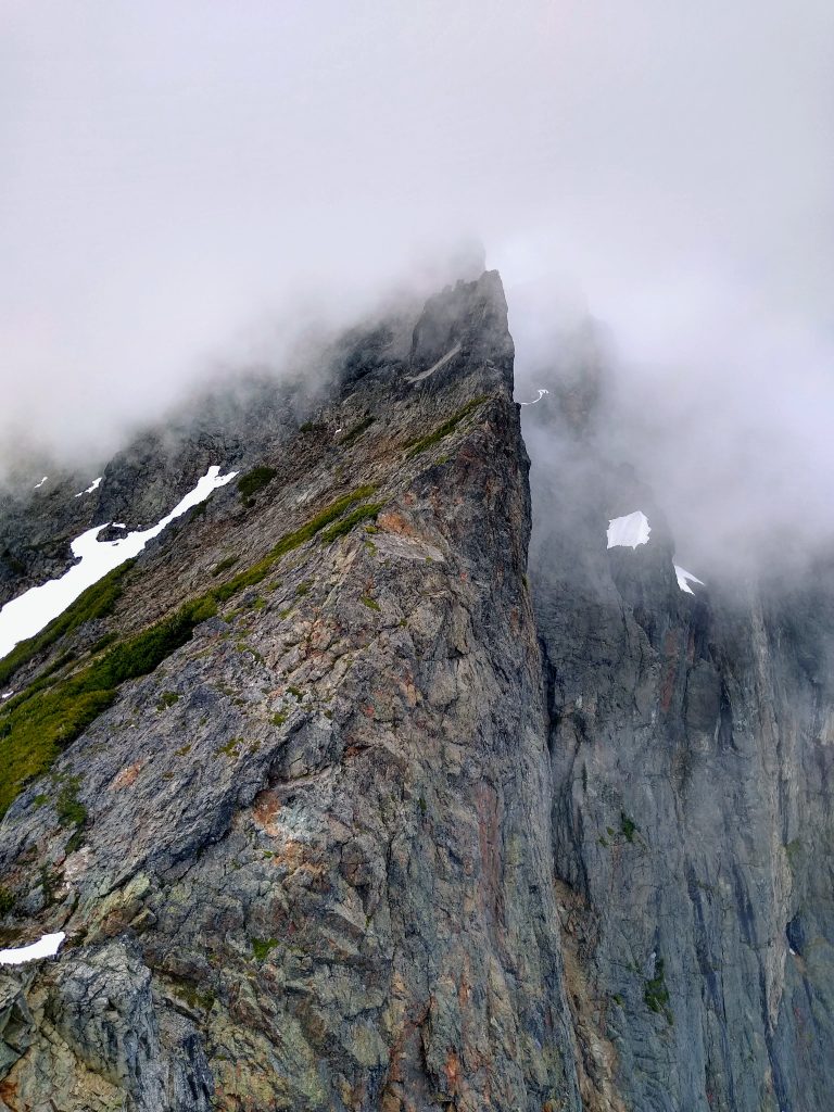
Clouds rolled in and out, enhancing the mysterious, alpine ambiance. I took us through another long pitch to the end of the sharp ridge crest. We would certainly have to rappel from here.
This was a steeper rappel, vertical mostly. Once again, we encountered no old tat or signs of people. Perhaps Zippy free solo downclimbed this section, but any reasonable person would want to rappel.
From this notch, we were just one last tower away from the notch that designated the start of the SE Ridge of Whitehorse. We decided we had enough ridge climbing and bypassed the tower by downclimbing a sandy goat trail a hundred feet to snow and then crossing the upper snowfield.
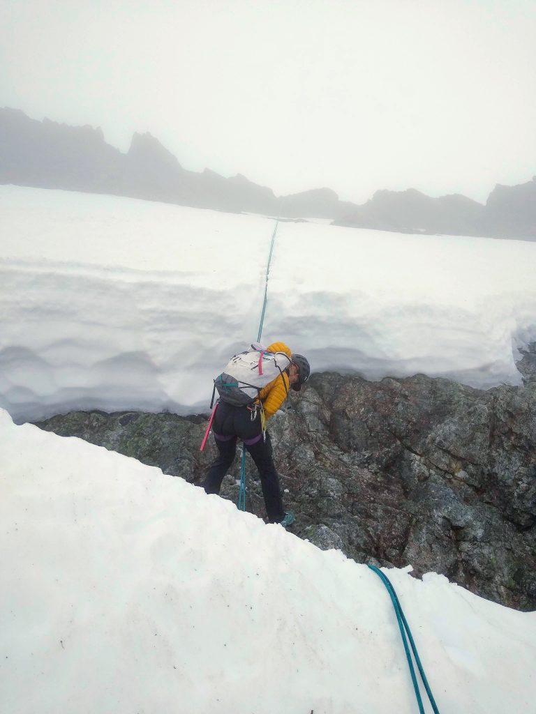
The first few hundred feet of the SE Ridge of Whitehorse was once again distinctly blue collar. Aggressive shrubs and trees covered the 3rd class terrain and the buttress proper was most definitely 5th class. Some sections even required crawling below the canopy.
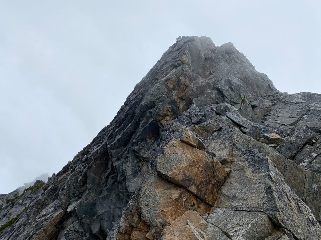
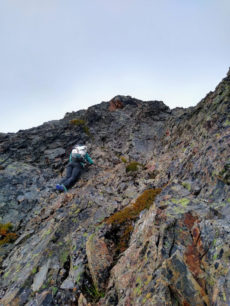
Around 6200 ft, the ridge dramatically steepened. There was no way to skirt the steeps so we started scrambling up increasingly steep and exposed terrain.
The angle was probably 60 degrees and we were climbing on small, but positive, edges. The rock was okay, but every hold had to be tested before we committed to a move. It most definitely felt like low fifth class climbing, aka “Beckey fourth class”. It was not hard, but after a long day on so much technical terrain, we were both getting tired of focusing so hard. At nearly the same time, we suggested to switch back to rock shoes and simul climb. It is great to be on the same wavelength as your partner, especially when traveling in high stakes terrain with someone new.
Another few hundred feet brought us to shallower terrain. Completely in the fog now, we stumbled up the final push to the true summit of Whitehorse!
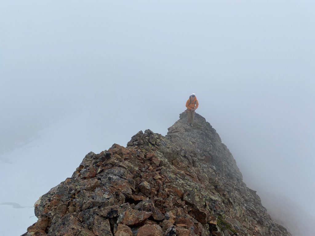
We reached the empty summit 13 hours after starting, and not a moment too late. We were mentally exhausted from so much challenging, adventurous terrain and ready to be cruising down the standard route. But the vision had been completed, and we were so stoked.
Jenny remarked how it was nice to see the rap anchor on the summit, signs of humanity. One rappel (25m or so) got us over the bergschrund, which was completely open. Then we plunged down the soft snow of the So-Bahli-Ahli Glacier, emerging from the clouds.
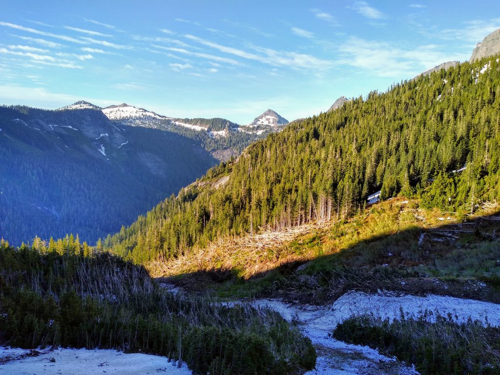
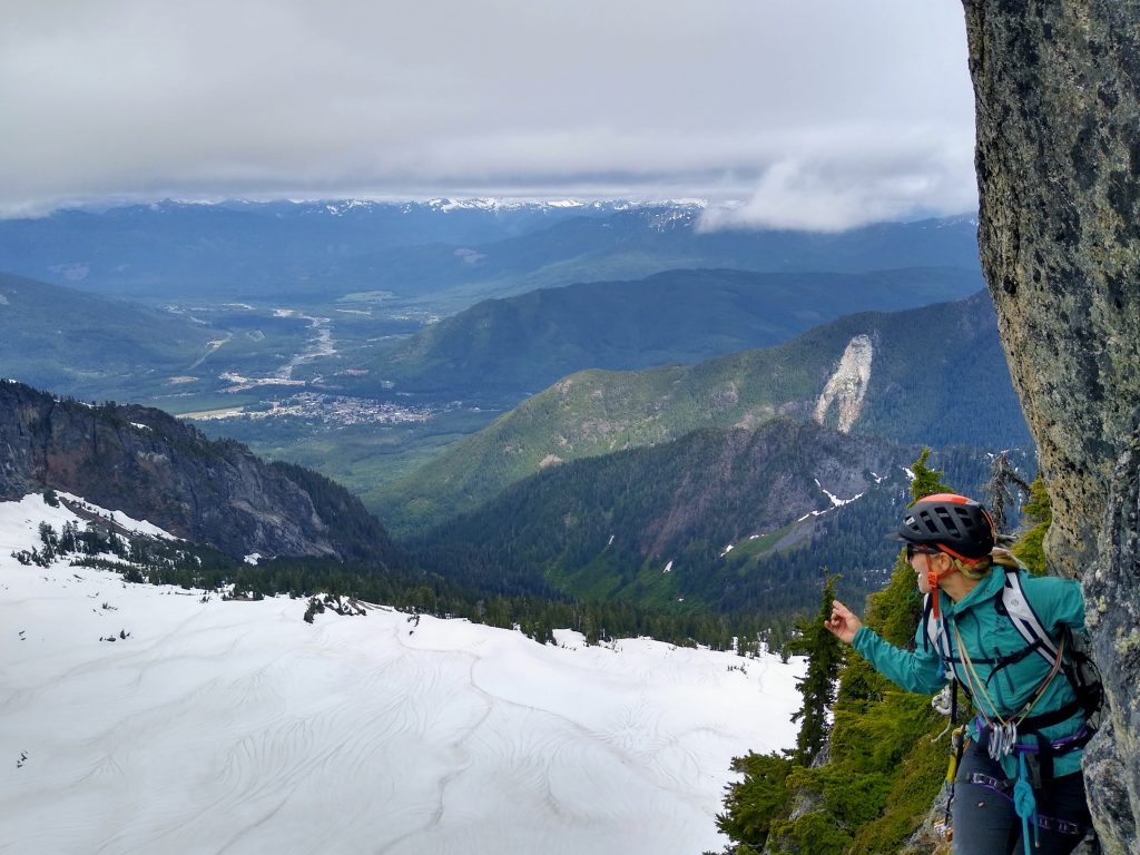
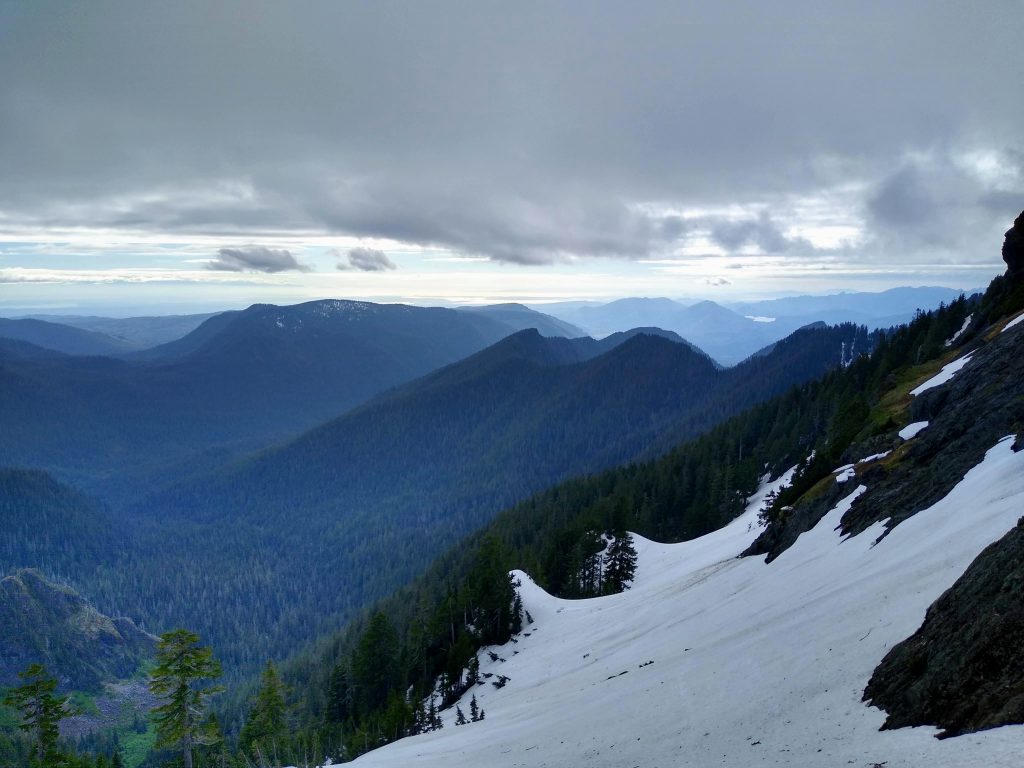
Below High Pass, we got an excellent view of the sun shimmering down on the Salish Sea and Lake Cavanaugh. It was warm and calm. The climb up to Lone Tree Pass felt hard, but we we knew we were home-free with a bit more snow traversing and a long, steep descent to the valley floor.
We reached the car 16 hours after we started the day, in time to get Mexican food in Darrington. We ate ravenously and quietly, because sometimes you do not immediately find the words for an incredible experience like this.
The “Darrington Rodeo” was possibly the most continuously full-on day I have ever experienced in the mountains (barring an accident). So many moments toed the line between control and fear, challenge and impossibility. For both of us, it truly felt like the culmination of so many different skills and experiences. Jenny was an amazing partner: talented, understanding, and stoked out of her mind. Our opposing backgrounds – me as a runner, her as a climber – yet shared vision of the moving in the mountains is a powerful reminder that diversity is synergistic, sparking and enabling creativity.
For me, I could not have asked for a more perfect resolution to this creative “project” around Whitehorse. In some ways, I enjoy ideating and dreaming as much as I do executing. There is nothing wrong with following guidebooks and prescriptions, as I do frequently, but there is something deeper in creating an experience that expresses yourself and your relationship with the mountains. So I urge you next time to start not by asking “what”, or even “how”.
Instead, ask yourself “why”?
Notes:
- Our route covered 13 miles and 8000 ft gain. The stats obviously do not tell the entire story, as the terrain was challenging. We both felt pretty worked over the 16 hour day.
- Skeena26 beta: Bolting felt adequate to us, but you definitely have to like slabs to like this route. If you do not like 15 feet of 5.6 slab climbing between bolts, you will not like this. If you like slabs, you will love it! Most of the climbing is around 5.6. The rock feels trustworthy and sticky. Gear placements are few and far between. A #2 cam would be good for the “good gear crack”. The bolts are hard to spot in the shade! Bring lots of long draws because the route wanders. Approach beta from Mountain Project is spot on.
- We chose Skeena26 because it was the easiest route on the south face. However, there might be better routes for this linkup. Concerto in C takes you more cleanly to the top of the wall, but then you have to traverse more along the top of the wall. Routes on Illusion Wall, followed by the moderate Dick Ridge (supposedly 5.7), could work, but then you have to climb 5.10 with a pack on. Finally, the routes on the Far Western Wall look shorter but still high quality and would greatly cut down on the annoying jungling atop Squire Creek Wall.
- Beckey mentioned that the optimal season for the SE Ridge of Whitehorse was late May to early June. I think is because if you are only climbing this ridge, you have to climb up a steep snow finger out of Buckeye Basin. With how we did the route, there is really no need to do the route so early. In fact, if you wanted to start with a route on the Far Western Wall, it would be best to give that more time to melt out. I would not attempt a south face route earlier than we did, because it seems like you need to wait for all the giant snow blocks to slide off that wall.
- The ridge traversing past Buckeye was definitely the aesthetic highlight of the trip. The rock was solid enough and had great exposure. Moderate sized cams worked well for placements. Don’t bring nuts. Climbing was mostly mid fifth class, but there was some downclimbing.
- We brought a single 60m rope, which worked well. It was barely long enough for a few of the rappels.
- We brought crampons and ice ax, but never really used them. It could have been necessary if the snow was firmer.
- We both brought climbing shoes for the real climbing. Jenny wore low top hybrid approach/running shoes. I wore the Salomon XAlp Carbon 2 GTX, a super light waterproof approach shoe. They worked perfectly for this day, scrambling well and keeping my feet dry the entire day, despite being in wet snow and crossing rivers. Unfortunately, like most good products, they have been discontinued.
Inspiring! Loving the creativity of your routes.
I loved the excitement I could hear in your writing. Reminded me of when my cousin Chris Greyell would talk about climbing before he passed. Thank you for sharing!
Thank you! I’m glad I can convey that excitement.
So wild! Mad props to you both. Great TR and an epic adventure.
Thanks Jeff!
Burly day, then you go ski Baker the next day as a wind down! Great eye and vision for these enchainments.Damm I would be soaking my legs in a glacial river for hrs after that.
Hah thanks! It took some rallying to get up early the next day. Fortunately ski vert is fake vert, so my body was fine.
wow…. kudos dude and dudess….
i never went north from buckeye peak up whitehorse. DID do A LOT of solo free on the south face with many other climbers, mostly ken strong. we never placed gear, altho had A lot with us many times. never know on unknown climbs and adventures!!!!
the ridge from top of south wall to the notch that goes into buckeye basin is so loose and all over the place.. would like to see more pics of that. did you notice the excellent camp with the natural fire place just up west ridge from the knotch or pass??? we found a note there from the mid 20,s from ppl who left granite falls in the morning… should still be there?
We always though “aliens” made that fire place. spent some awesome nights there, once saved our asses once cause we got caught in a MAJOR storm on jet tower…. with zero chance of rain for 5 days…. stole all the wood from pikas to stay alive….
So sorry to see that “primal scream” got covered with bolts.. and the next gully to the east of that (conc c)… was a lot of fun climbing with no signs of others, or a shinny metal trail. gave it a totally different feel…. i got lucky to be there b4 that happened…..
KUDOS AGAIN!!!! can check out my youtube channel…. acrazedmaniac or search for ” SCWall stories by Zip” talk about your trip in one of them, andhow that got me into climbing… (ken carpenter)… then designing wall tents, then… the vertical jacket zipper, then….
Wow it’s great to hear from Zippy himself!
I didn’t post too many photos of that ridge from the top of the south wall to the notch, but it definitely more just annoyingly brushy and heinous rather than super loose. Although the top of the Far Western Wall was actually nice scrambling!
I don’t recall passing a natural fire place, so we may not have gone exactly in the same place. Maybe I’ll have to go back and look for it 😉