
Alone on the Ridge
The Washington Ellinor Traverse is one of the more popular traverses in Washington. Despite its popularity, I had not gone for it, partly due to the longish drive versus relatively short traverse, and partly due to the perception that it is mostly chossy sidehilling (no, I don’t actively seek out chossy sidehilling, contrary to popular belief). I had hiked Ellinor back when I was a teenager, but not returned to that corner of the Olympics since.
While staying at my grandma’s, I wanted to do an after work run. But I have sampled most half-day objectives in the NE Olympics, so it finally made sense to check out the Washington Ellinor Traverse. Most people do more of a lower traverse between the two peaks. When I started to dig into trip reports, I found only a single account of a traverse that stuck to the actual ridge. In 2015, the person was ecstatic about the traverse. But when they added it to Mountain Project in 2021, they said it was awful. It only has 1 star on Mountain Project (out of 3 votes). What was going on? Now my curiosity was spiked. Was it an awesome, overlooked traverse? Or was it a chossy mess?
I pulled into the Washington lot and gazed up at the mess of steep vegetation and cliffs. The Olympics are damn rugged.
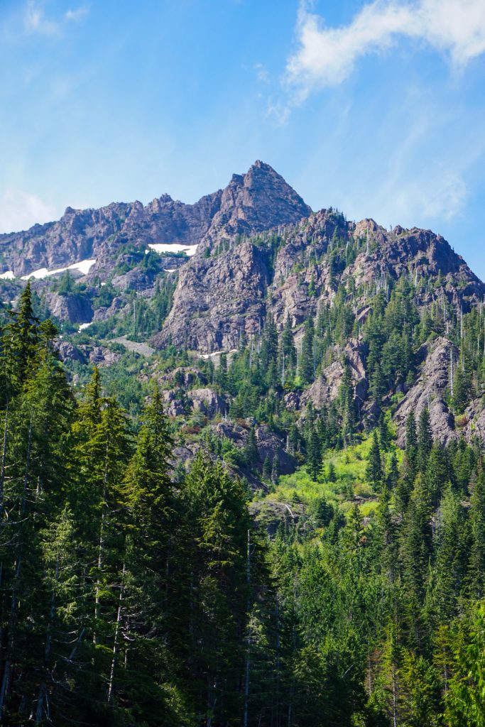
The standard Washington climber’s trail was in rough but fine shape, but I lost it briefly halfway up the route near a steep creek crossing, costing me about 10 minutes. I could tell there might be creek problems higher up.
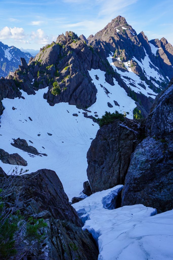
In the upper basin, the route zig zags through some cliffs, crossing a hanging snowfield. The snowfield had a creek raging beneath it. I poked my pole through a weak snow bridge and said “Nope”. So instead I scrambled up the moat between the snowfield and rock, exiting on some wet slabs at the top. Little did I know that would be the most difficult scrambling of the day. I did not want to reverse those slab moves, so I guess I was doing the traverse!
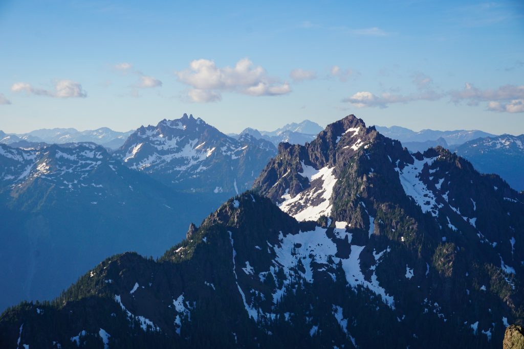
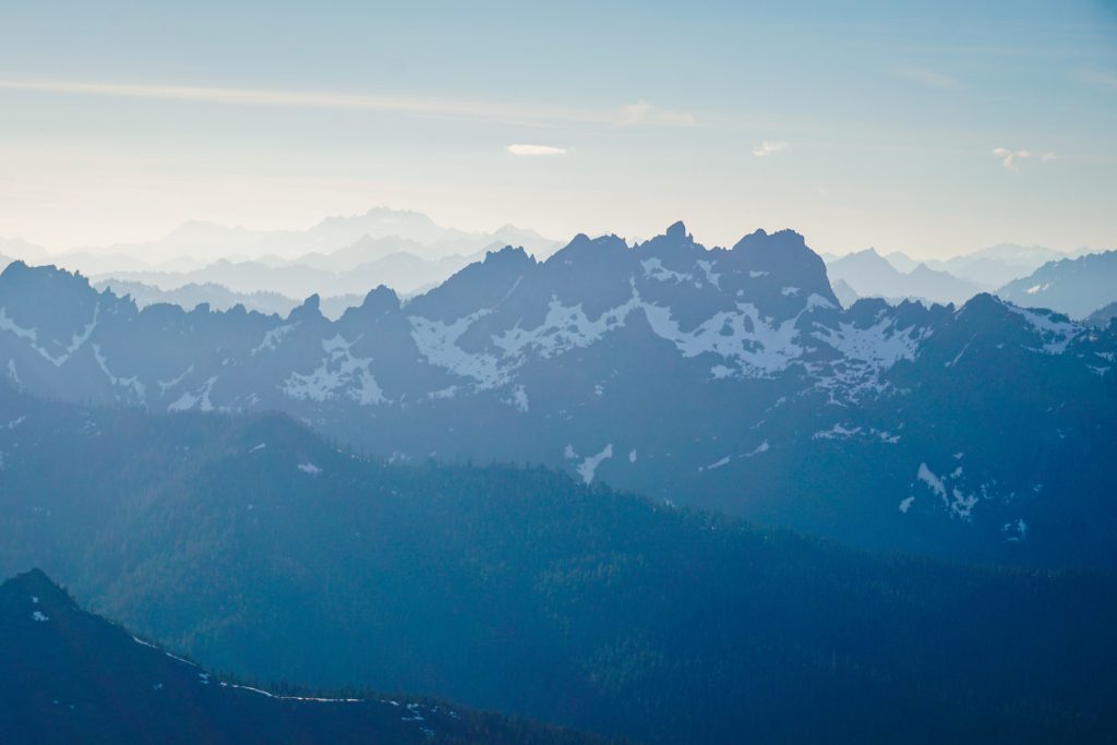
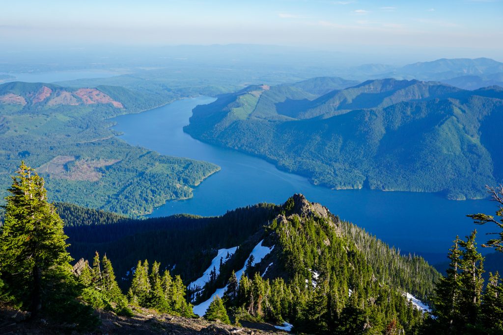
Some fun ledges around the right side of the summit block led me to the summit of Washington. After a hot, humid climb, my morale soared in the cool evening breeze and endless views into the heart of the Olympics. The peaks in the Southern Olympics may be relatively low, but they are incredibly rugged and beautiful!
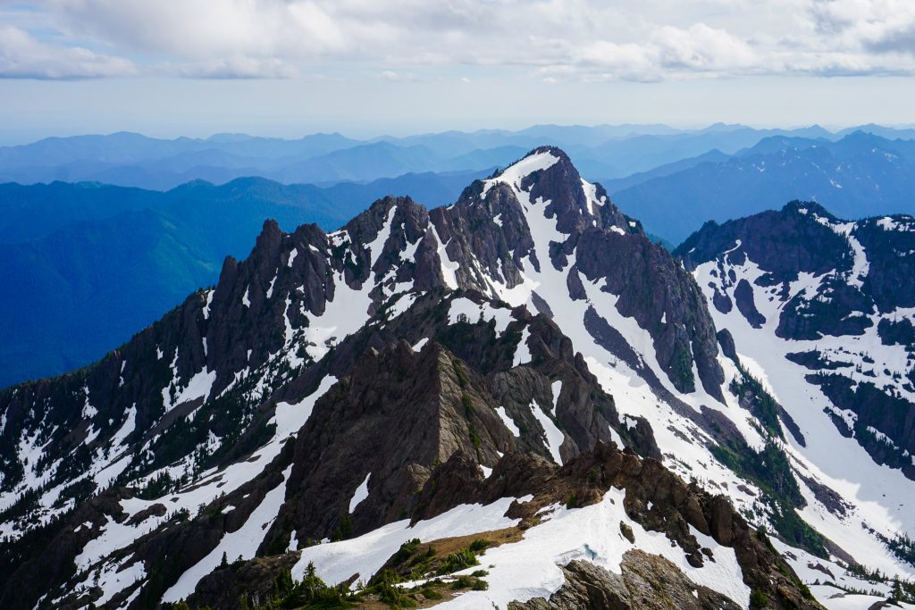
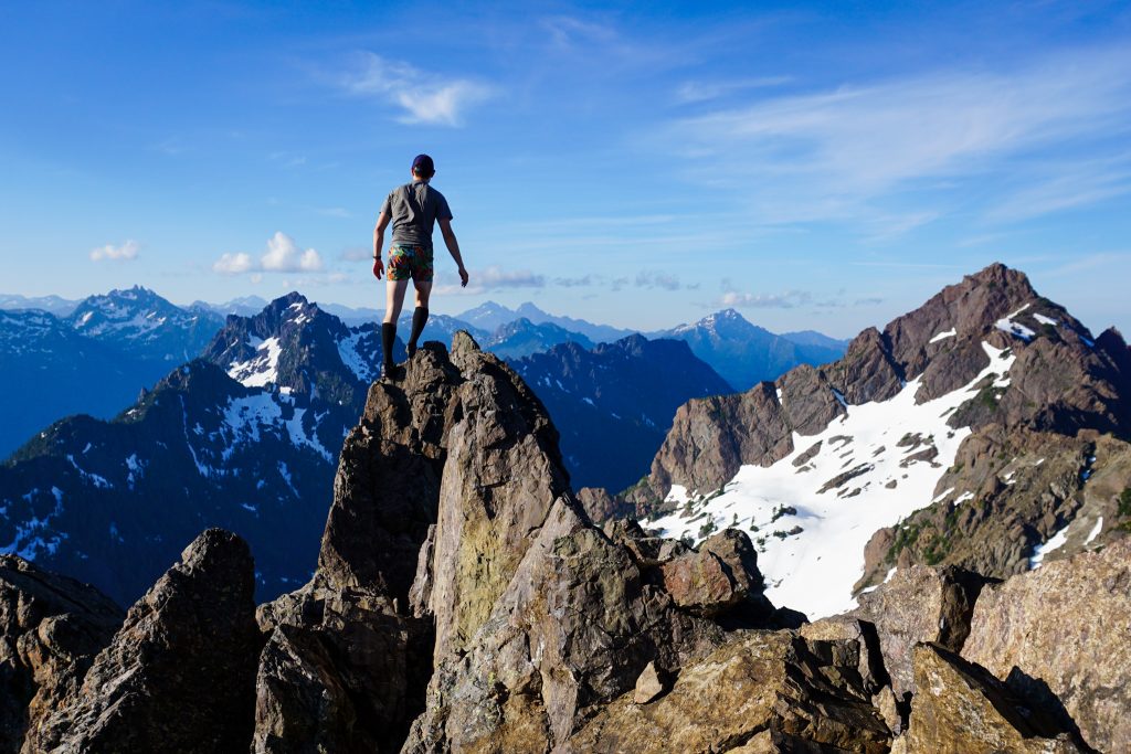
I turned my attention to the traverse. There was an initial sharp knife edge (“The Wedge”) followed by many ups and downs. Like I expected, nothing was too sharp and it definitely looked plausible. It also seemed like there would be plentiful bail options if I got tired of the scrambling.
I walked down snowfields and approached the first obstacle, “The Wedge”. It was a beautiful knife edge of solid rock and positive holds. I cruised up this feature with ease. I knew that the entire route would not be this great, but it was off to a pretty great start!
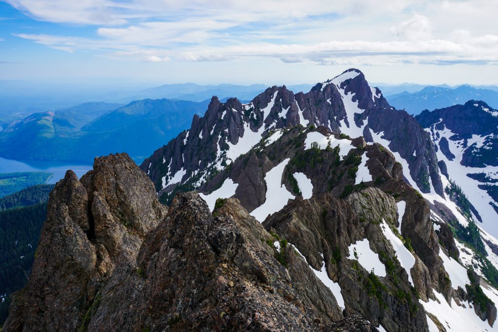
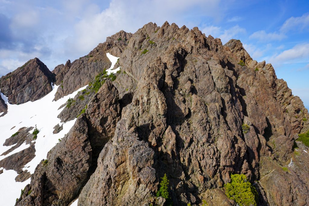
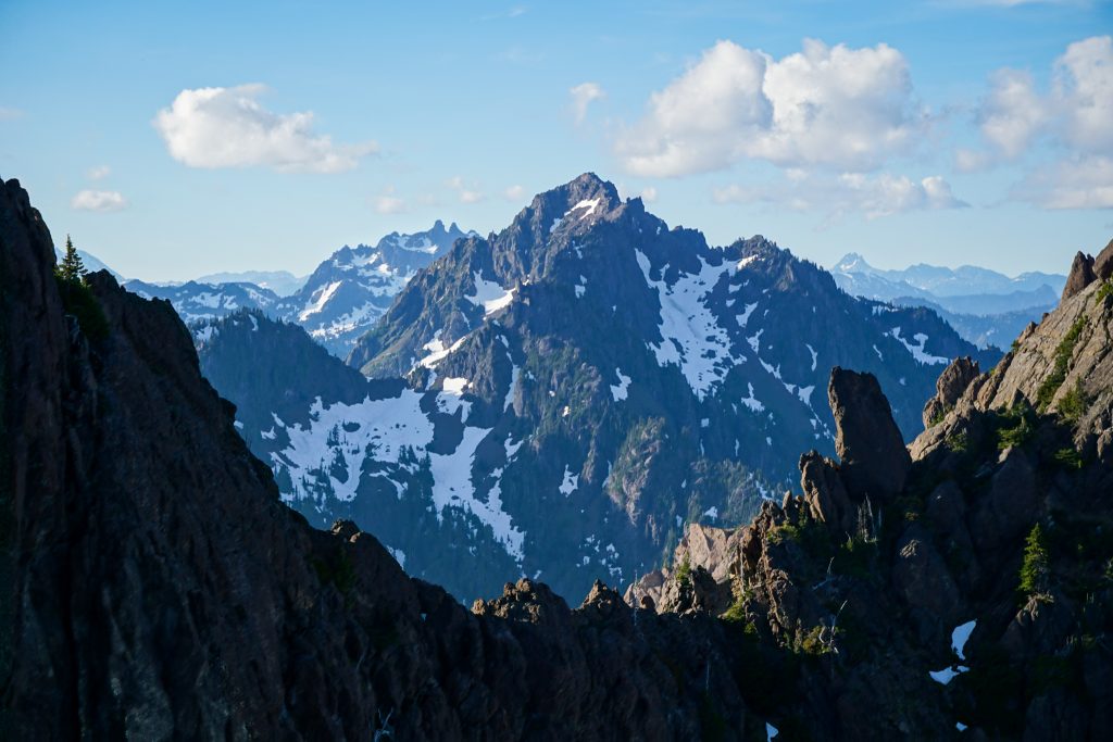
Next, I encountered a series of small gendarmes. I was tempted to traverse around them but every time I went over a tower expecting to get cliffed out, a series of hidden ledges revealed itself on the other side. As I have found time and time again, the basalt scrambling in the Eastern Olympics is much better than its reputation. The rock is solid enough where needed and difficulties can almost always be passed at Class 4 or lower.
The pillow basalt that characterizes the “Crescent Formation”, an arc of basalt from Hurricane Ridge to Constance to Ellinor, was formed in underwater lava eruptions on the ocean seafloor 45 million years ago. It was uplifted starting about 20 million years ago by plate tectonics. While most of the Olympics is sedimentary rock, this basalt formation creates steep ridge lines that make for pretty decent scrambling, along with the distinctive steep rugged appearance of the Eastern Olympic skyline.
There was about a 50 ft downclimb to the midway low point that was uncomfortably loose. This was the only section of the entire traverse that was not enjoyable. I may have been able to avoid the looseness by staying on the ridge proper, but it was hard to tell.
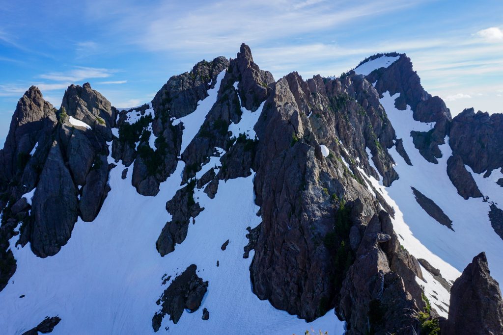
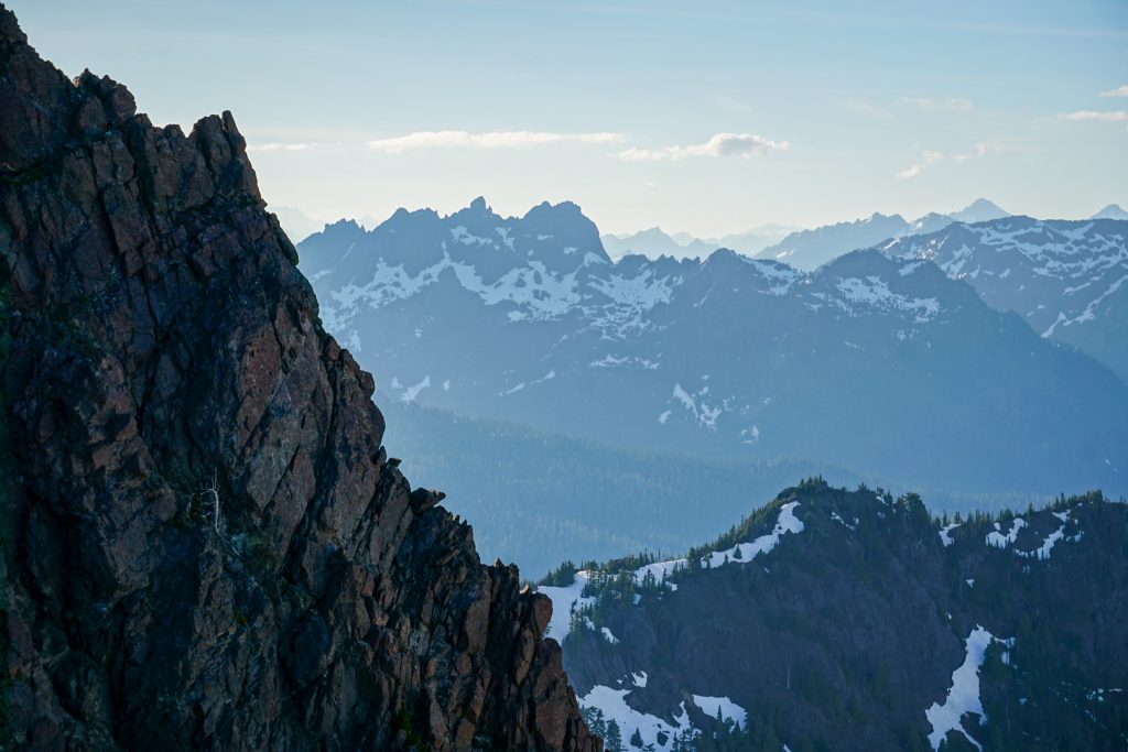
After this section, there were many more ups and downs along the ridge. The clouds were clearing and the light was soft, casting lines across all the deep valleys around me. A light breeze kept temperatures perfect. It had been a long time since I had done any serious scrambling, but I was once again in the groove, alone on the ridge.
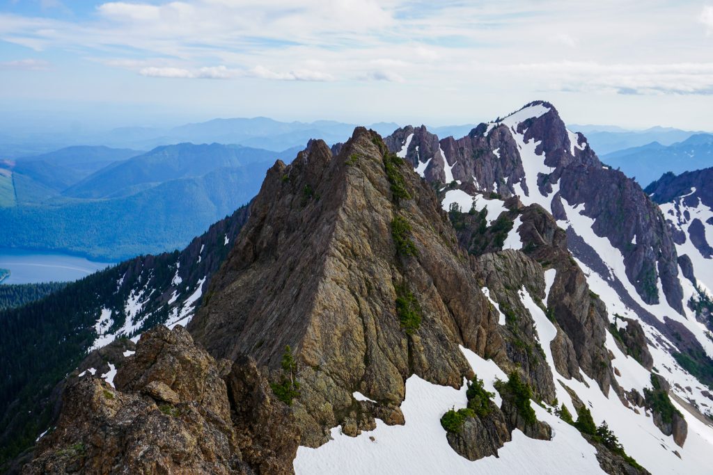
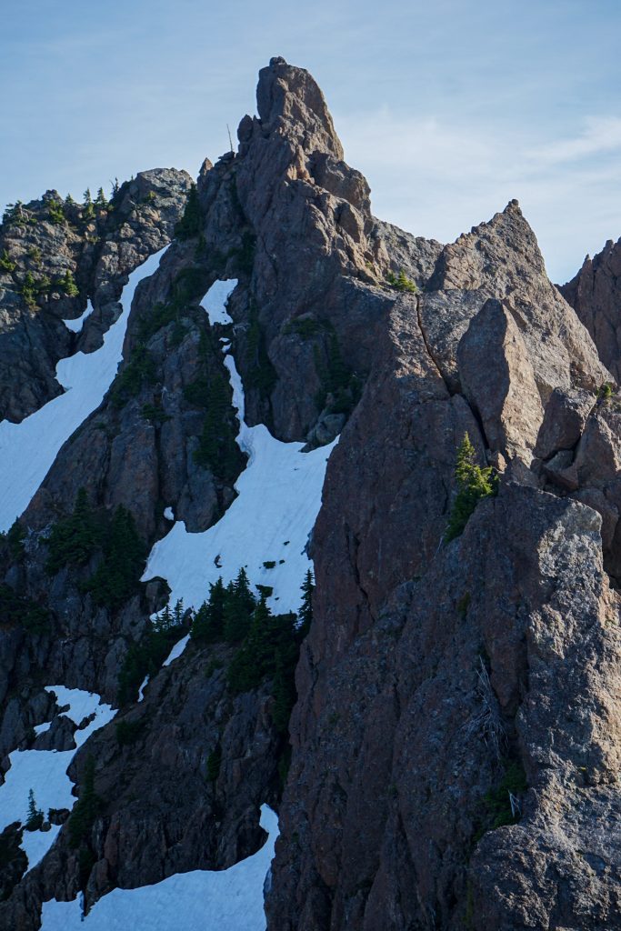
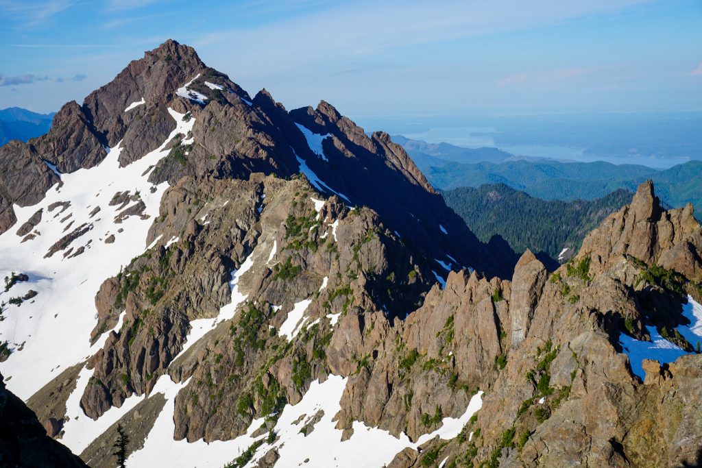
As I neared the final section of ridge, I eyed the terrain cautiously. The only report I found of this traverse bailed before the final climb to Point B and I could understand why: the ridge steepened. The rock looked super solid and fun. I could see a squeeze chimney, splitter fist to OW crack, wildly exposed arete – the sequence looked awesome. But I was also uncertain about a few hidden down climbs. So I decided it was the safer decision to just take the snow bypass to the left.
At the ridge low point, I hopped off onto snow and climbed towards the Point A / Point B saddle. The snow was moderately steep, but soft enough I did not need my crampons. I ascended the final snow finger by scrambling once again in the moat between the snow and rock, using my ax as a tool in the firm snow. It had been a few years since I had done this sort of funky snow climbing and was pleasantly surprised by how fun and chill it felt.
And with that, the difficulties were over. It was an easy snow walk over to the summit of Ellinor.
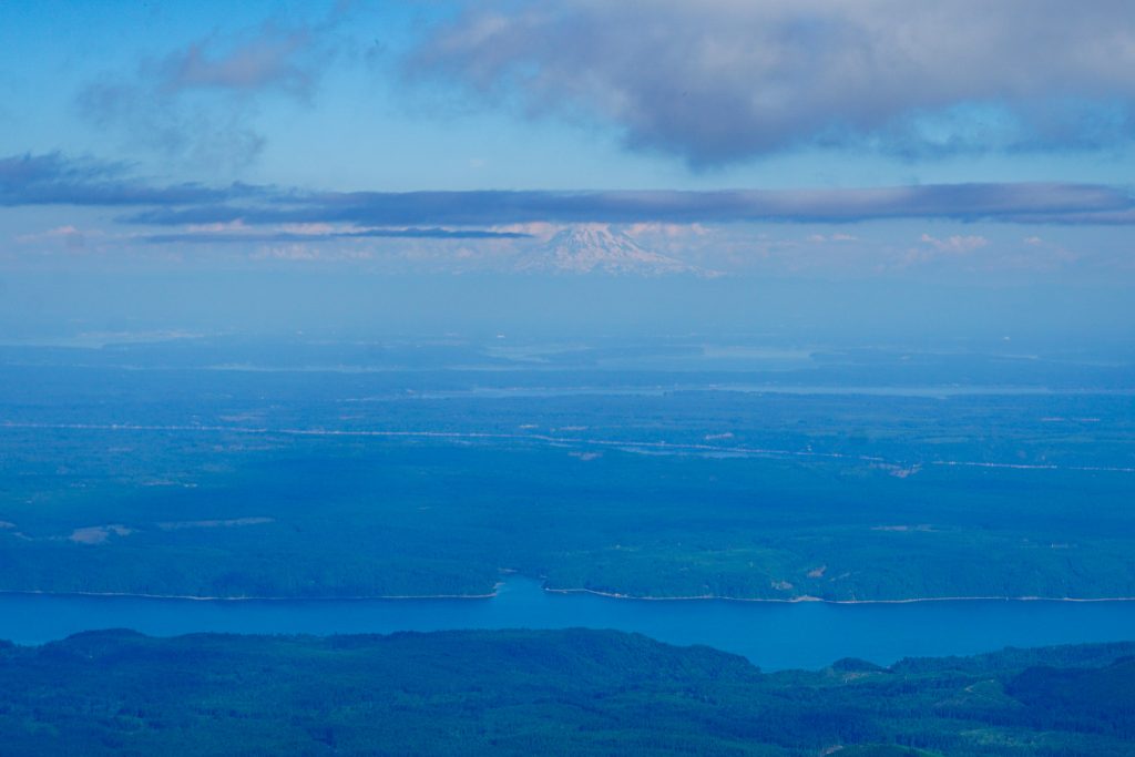
It was golden hour and the light streaked in magnificent ways through the maze of valleys and peaks of the Southern Olympics. It was such a wonderful, peaceful evening. Usually, I move constantly during evening objectives, racing the sunset. But this time, I just sat there and took some time to appreciate the moment.
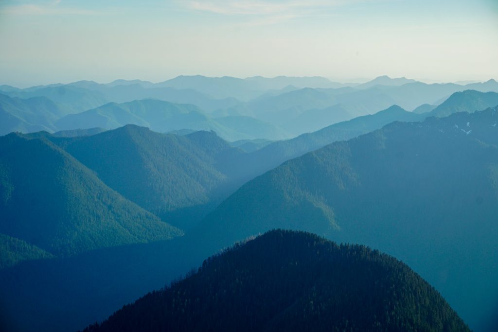
I chose to descend the summer route, since I had heard of a SAR mission just a few days ago due to creeks under the snow on the winter route. Lake Cushman and the hills to the south were beautiful at this time of day.
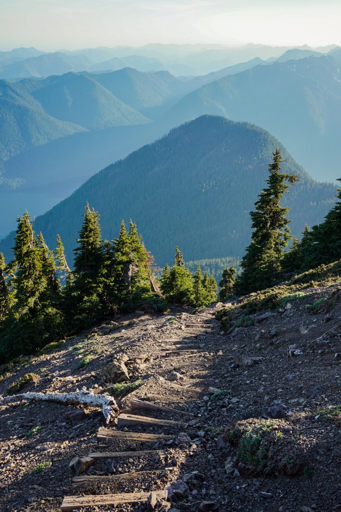
I still got a thousand feet of great boot skiing on the summer route, nailing the reverse corn cycle. Snow continued all the way down to the basin, from where it was a quick hike out and jog down the road to my car at the Washington Trailhead. No headlamps would be required!
I was not sure what to expect from the Washington Ellinor Traverse. What I found was a beautiful, technical, unique alpine traverse with great movement and variety. I cannot think of another route that combines comparably fun exposed scrambling and alpine vibes in such an accessible package, except maybe the Twin Sisters, or something near Washington Pass. The evening views into the vast Southern Olympics, which I have yet to explore, were inspiring. I may have to return for more Summer Olympics!
Notes:
- My route was 6 miles and 4250 ft gain. It took me about 4.25 hrs at a relatively relaxed pace by my standards (1.5 hrs to Washington, 3.25 hrs to Ellinor).
- I have avoided giving a difficulty rating to the scrambling. I hate the arguments about class 4 vs low 5th that often seem so steeped in ego and misunderstanding. This route is definitely in that category of class 4 – low 5th. Honestly, I cannot really tell the difference between class 4 and low 5th. To me, there are only really two things that matter: the chance of me screwing up, and the consequences if I screw up. Neither of those evaluations are that highly correlated with the scrambling difficulty in my opinion. Rock quality, exposure, duration are much more important. If you want to do this route, you need to be comfortable with loose rock, route finding, exposure, and endurance.
- The rock quality was pretty good except in that one spot. You could probably make a rap anchor on a horn and do a 20-30m rappel through the difficulties if you wanted to avoid that section. I only found one rap anchor on the route, and that was very early on the traverse, just after “The Wedge”.
- There were not many cracks or opportunities for natural protection.
- There were a few bail options along the ridge, where you could take a steep snow finger down to one side.
- I brought an ice ax, crampons, and helmet. Even though I did not use the crampons, you should definitely bring them at this time of year. Later in the season, you might not need the snow gear but water sources would be sparse.
- You could make this an even more incredible linkup by scrambling the west ridge or climbing the technical Shield Wall of Washington and then traversing to Ellinor.
- I would not reverse the route, not because of the scrambling, but just because the Ellinor trail is so much more enjoyable to descend than the Washington trail.
- How does this compare to the Townsend Buckhorn Traverse in the NE Olympics? This traverse is much more technical and sustained, although shorter overall. The rock is similar.