The Golden Days
The Chiwawa River Road is a special place to me during the fall. Deep valleys, extensive meadows, large glaciated peaks, and of course, those golden larches are found throughout. My favorite trail loop, the Little Giant Spider, is located in this region. But this fall, I wanted to do something a little different.
My first time into this magical part of the Cascades was hiking Carne Mountain, the Carne High Route, and climbing Mt. Maude nine years ago. It was my first top 100 peak, my first time in the Glacier Peak Wilderness, and my first high route! I wanted to return and explore the backside of the Entiat 9ers by crossing through Entiat Meadows to Holden, and running back over Spider Gap. Fortunately, my friends were also stoked on the idea!
I met up with Logan, Anthony, Wyatt, and Sam early in the morning for our big day. We began with the easy Carne Mountain trail, gazing across the valley to endless larch slopes as sun kissed the ridge lines at dawn. Unfortunately, Logan was coughing all night and feeling bad this morning. He decided to turn back in the Carne Basin.
The basin was cold with widespread frost (at least in the basin). We gave Wyatt some trouble for his “isolated frost” forecast in our latest Cascadia Mountain Weather forecast, but he maintained that this was a perfect example of isolated frost and exactly what he meant.
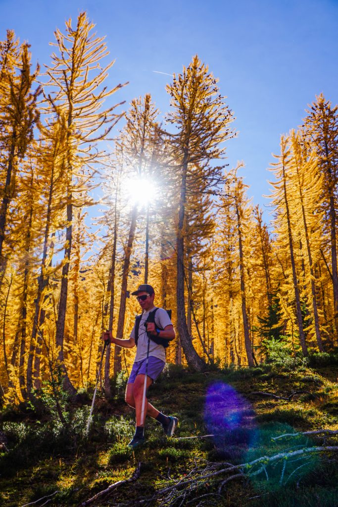
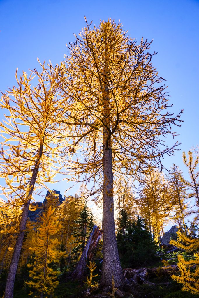
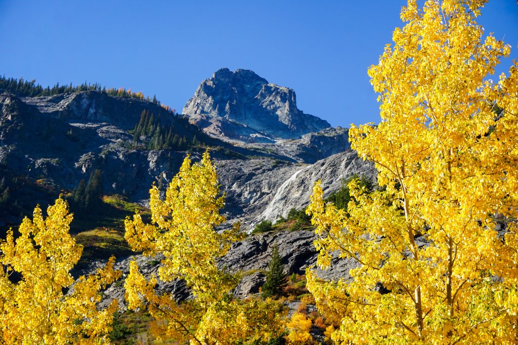
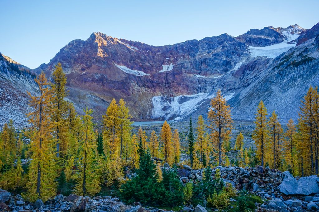
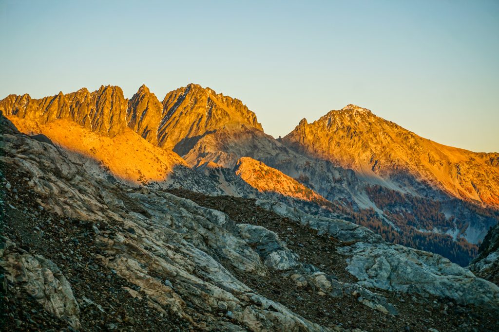
Once we hit the ridge, we entered the warm morning sunshine and we were once again in the land of yellow trees! The larches were a deep gold, at their peak glory.
We could not resist a quick side trip to the summit of Carne. This was where I previously first set foot in the Glacier Peak Wilderness. Now, I could look out and name every single peak and trace each ridge I had crossed, with its unique memories. It was pretty special.
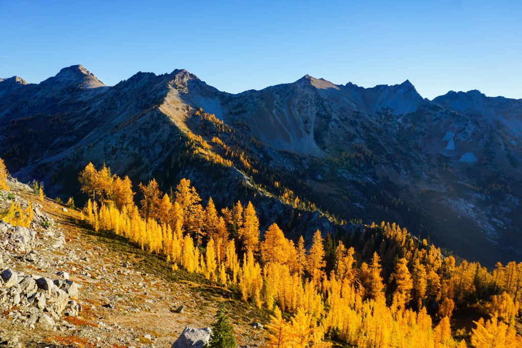
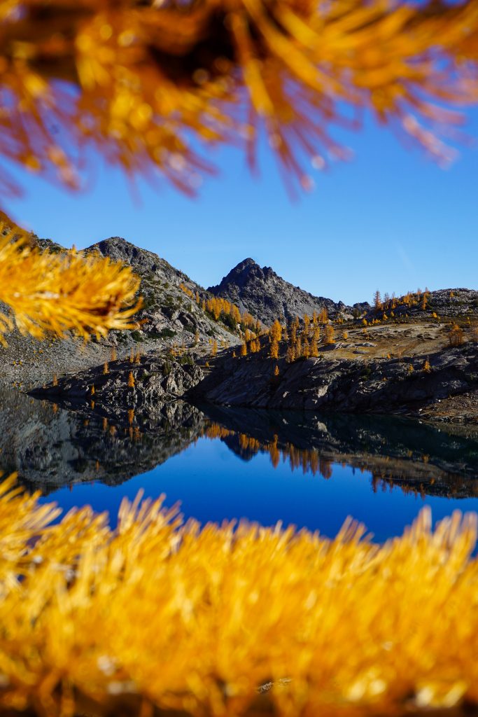
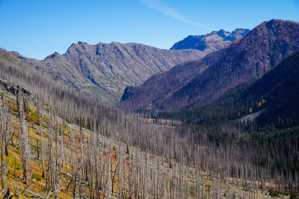
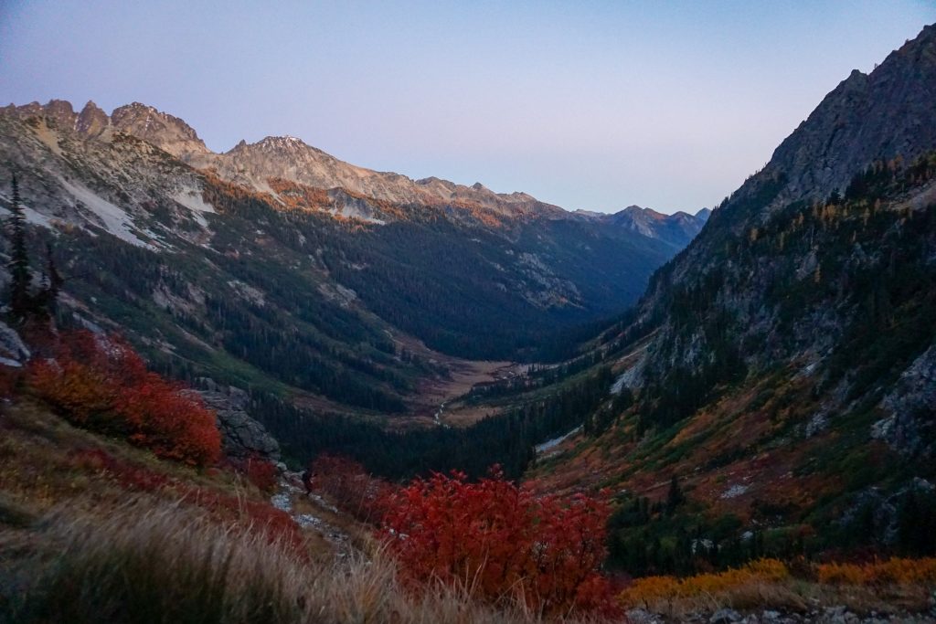
We dropped back down to the Carne High Route, which is a legitimate trail for the most part. It travels northward through beautiful meadows and forests right around treeline.
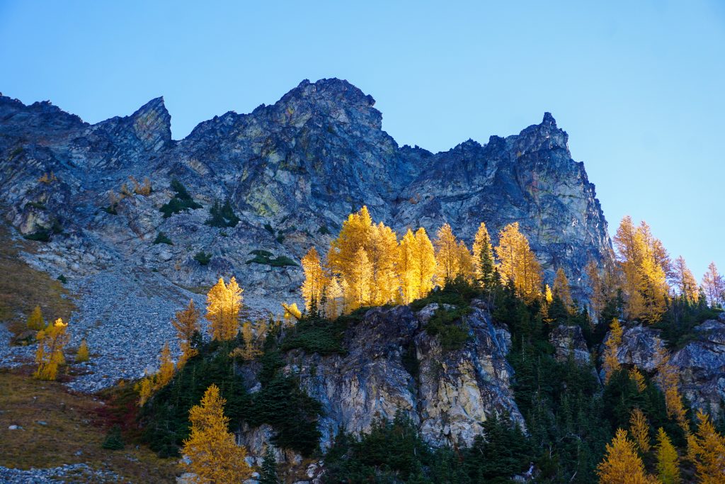
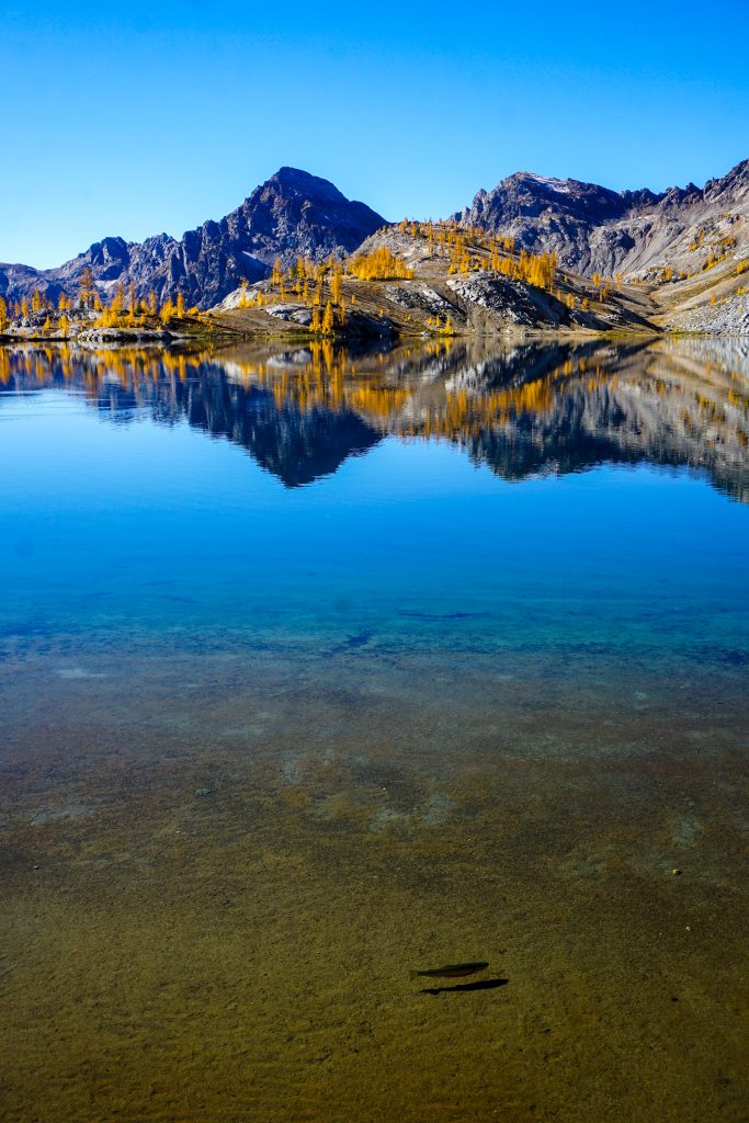
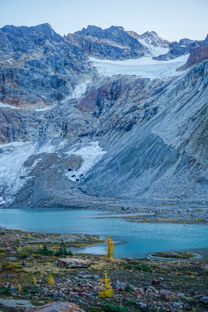
When I was here previously, I camped at Ice Lakes Pass. Our campsite was higher than I had ever been in the Cascades previously! This incredible spot has awesome views of Glacier Peak and the massive Upper Ice Lake below. I remember the pumice and barren landscape feeling so foreign and exotic.
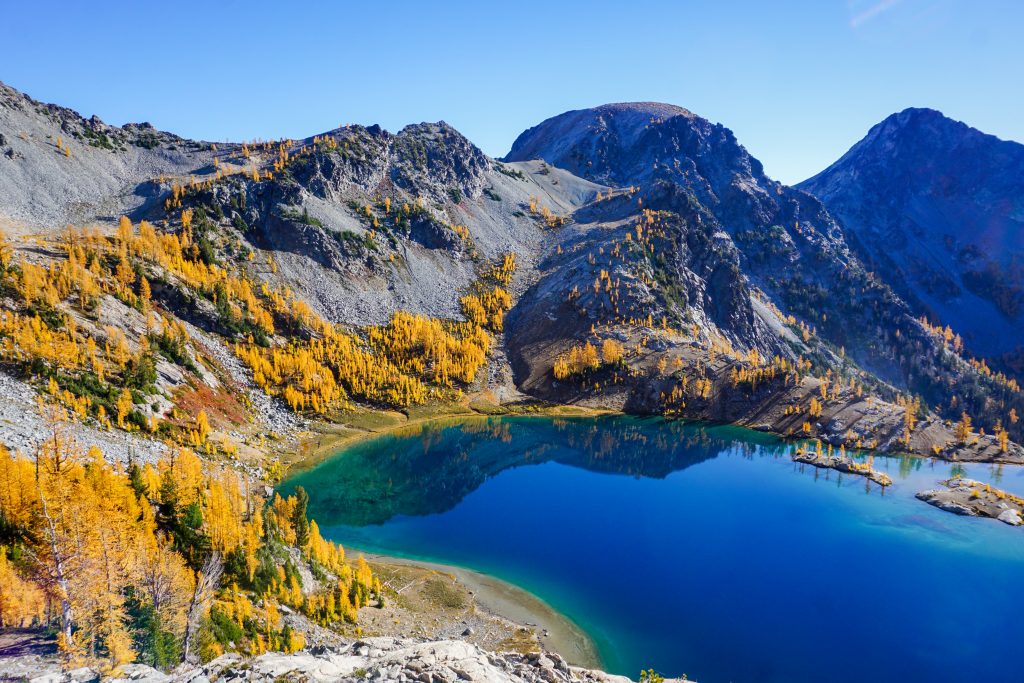
We had made good time to this point, but our progress slowed greatly around the lakes. Wyatt was in larch heaven and I had some fun taking different photos.
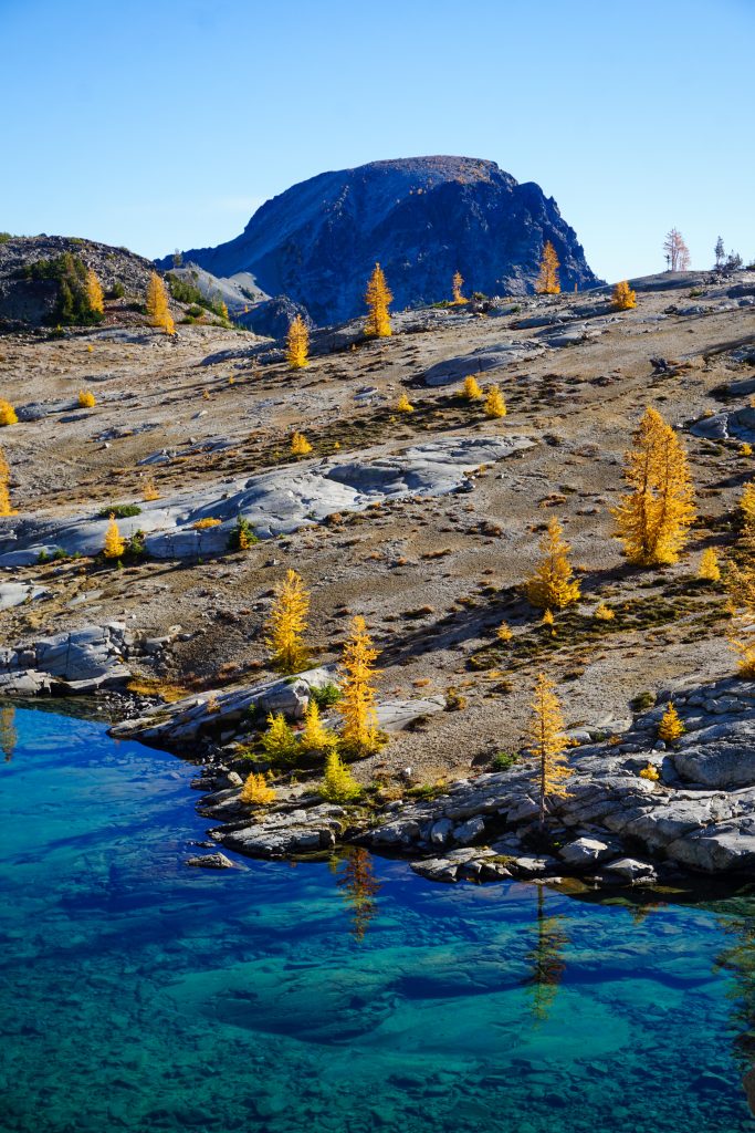
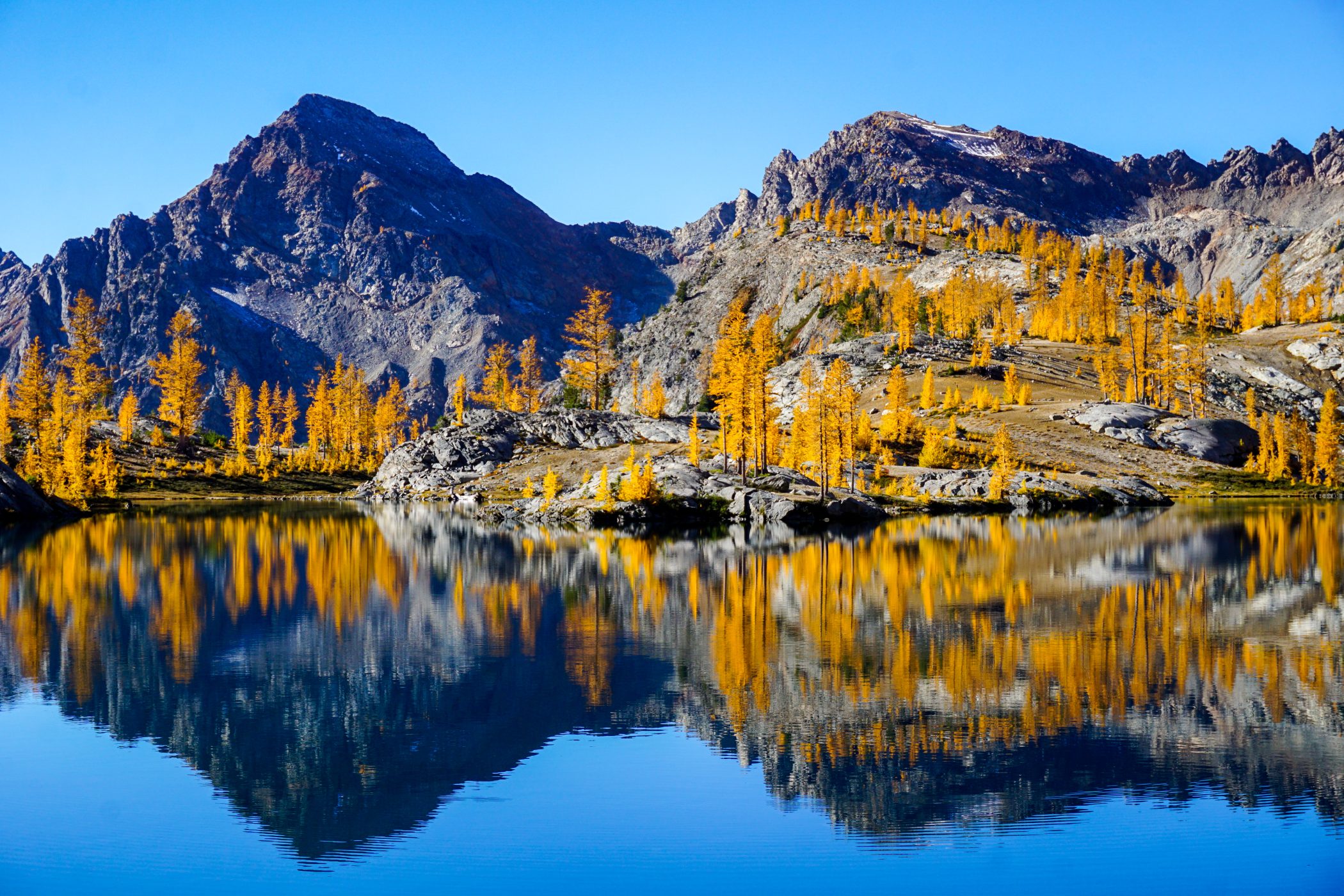
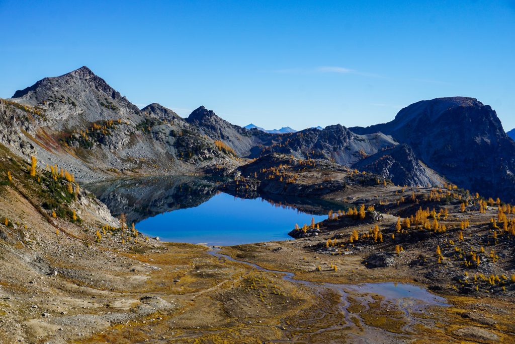
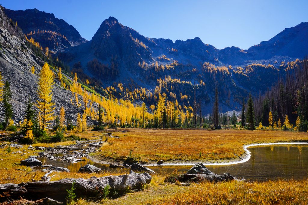
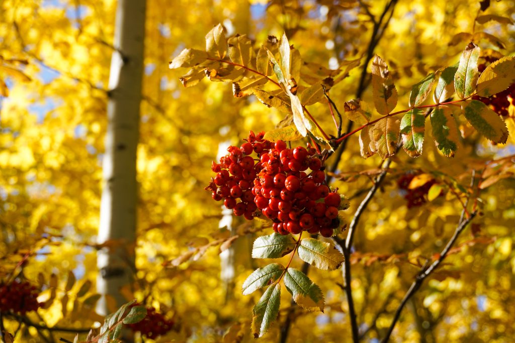
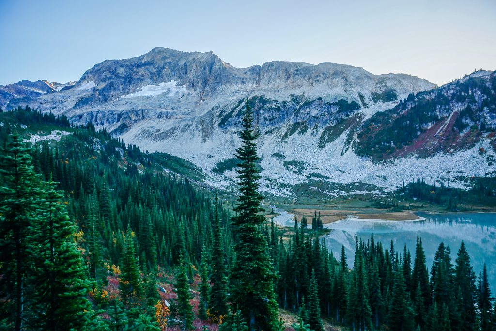
As cool as Upper Ice Lake was, Lower Ice Lake was even more breathtaking! Situated a little lower, this lake is more of a “larch farm”. The deep blue waters and golden larches made for absolutely stunning contrast.
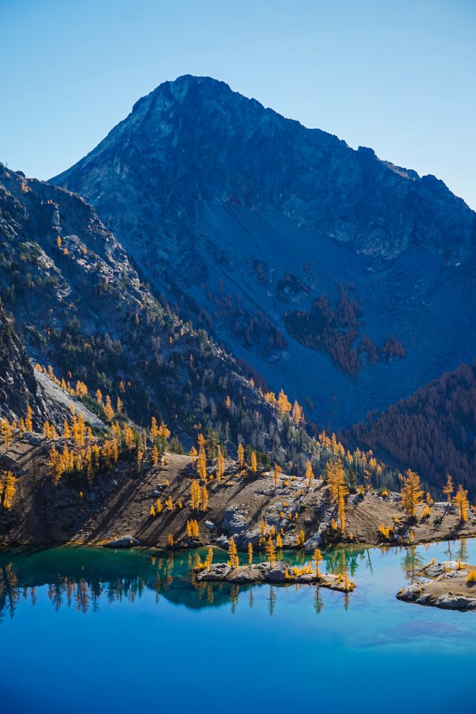

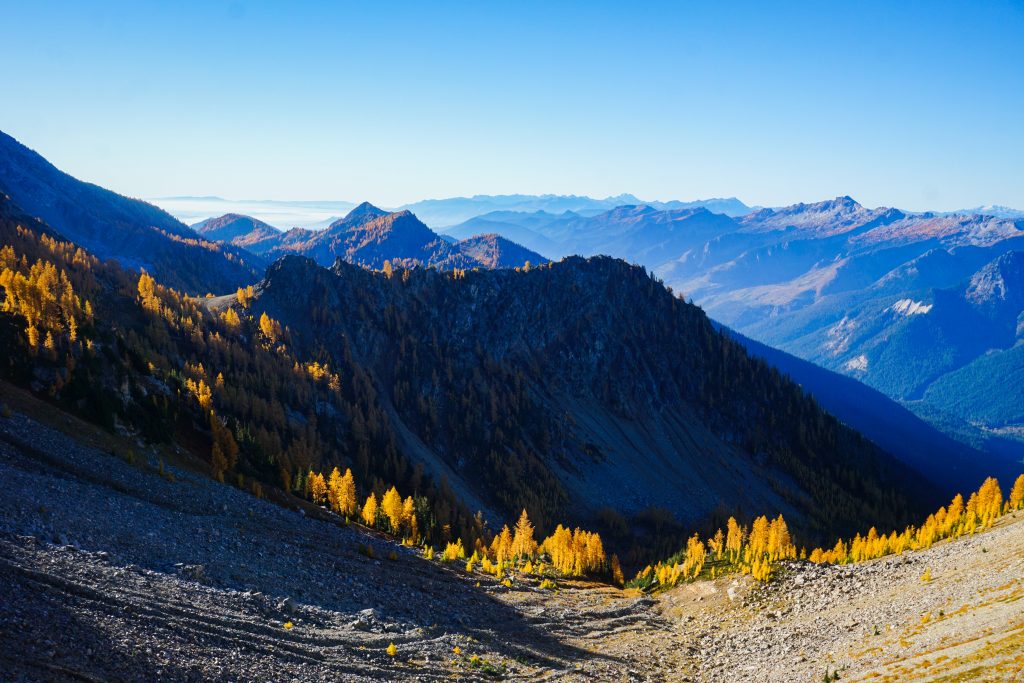
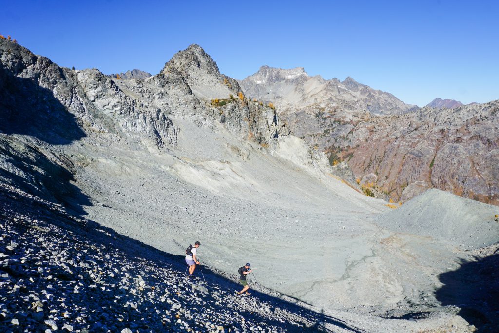
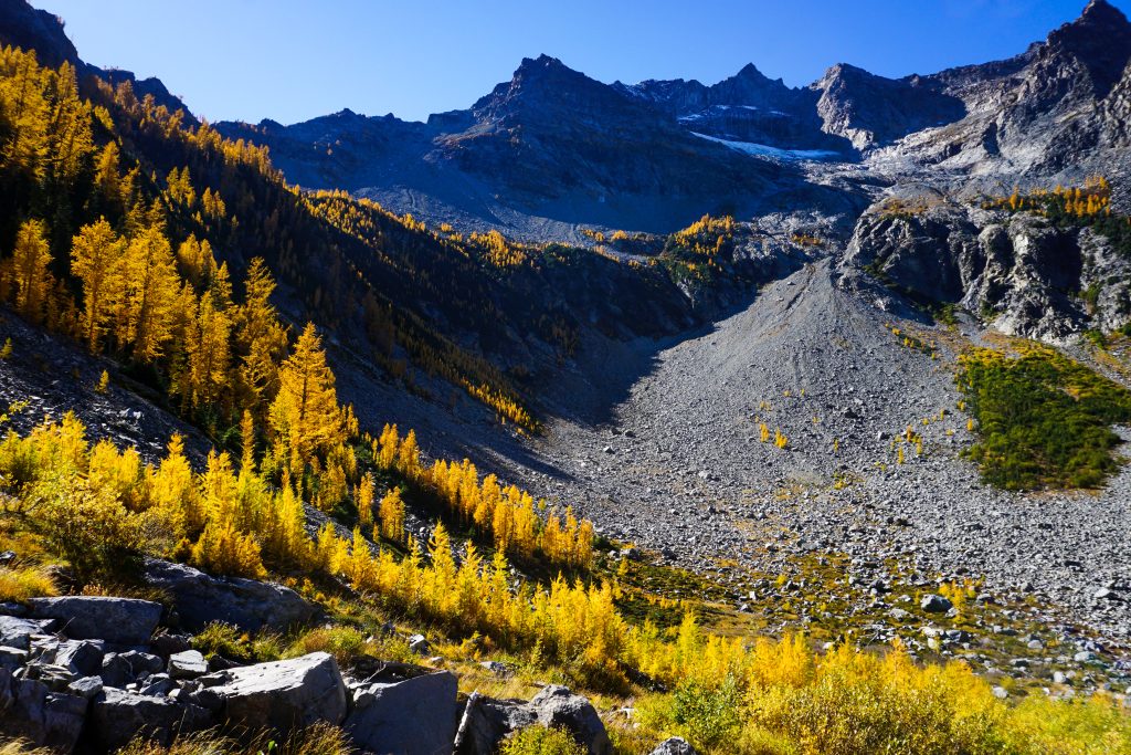
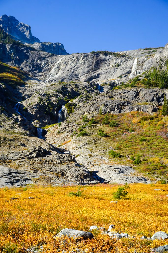
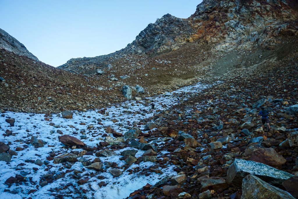
It was tempting to lounge at Lower Ice Lake all day, but we eventually got moving with the challenging part of the route. We continued east from the lake to a 7500 ft saddle. From here, we were able to drop into a north facing basin down some easy scree. Up until the last 10 years, there was a small glacier here. Wyatt’s research indicates it actually is one of the 10 largest glaciers that has completely disappeared in the North Cascades. The next basin just west is similar, but the final basin to the west still holds a small part of the Entiat Glaciers.
Lower down, we transitioned into a beautiful larch corridor. With golden light and soft ground, this terrain was a pleasure to descend!
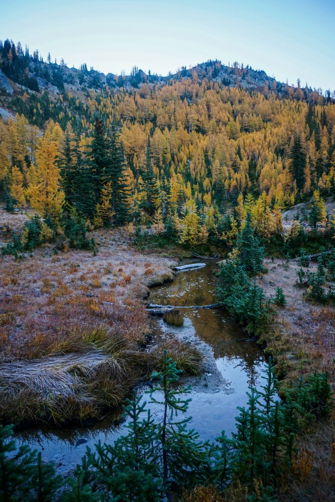
This led us perfectly to dry creek beds and obvious animal paths all the way to the valley floor. The descent was not completely perfect, however. Anthony had a few slips in the wet north facing terrain and an unfortunate encounter with a stick.
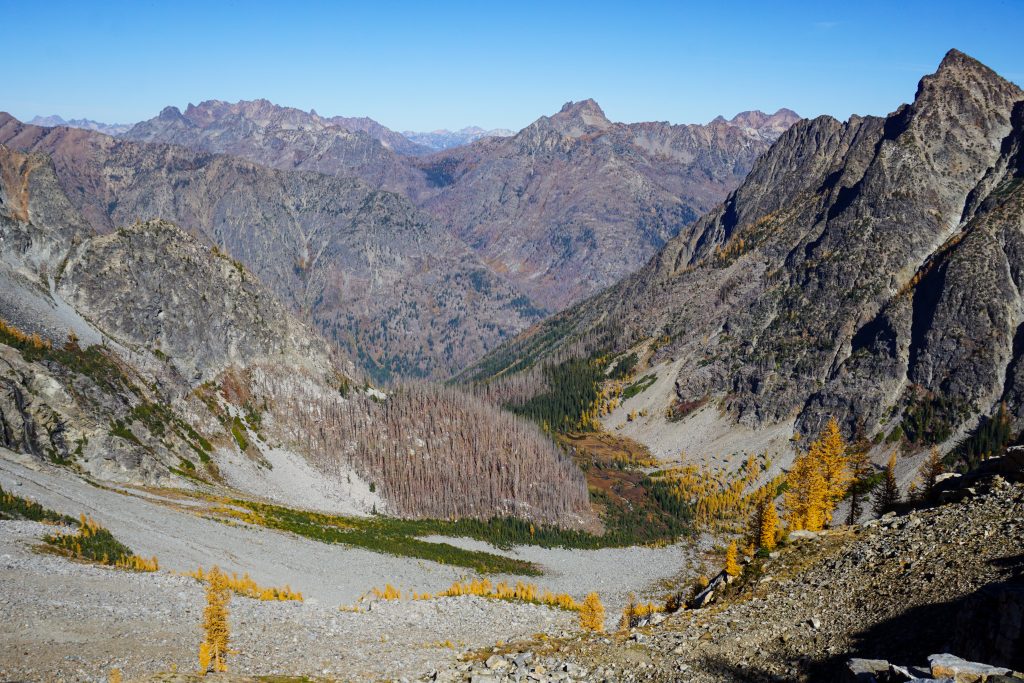
Once down at the Entiat River, we forded the river and took a lunch break. The 2015 Wolverine Fire burned much of this valley and nearly all of the Railroad Creek Valley around Holden. Holden was completely evacuated during this time period, but the town was preserved.
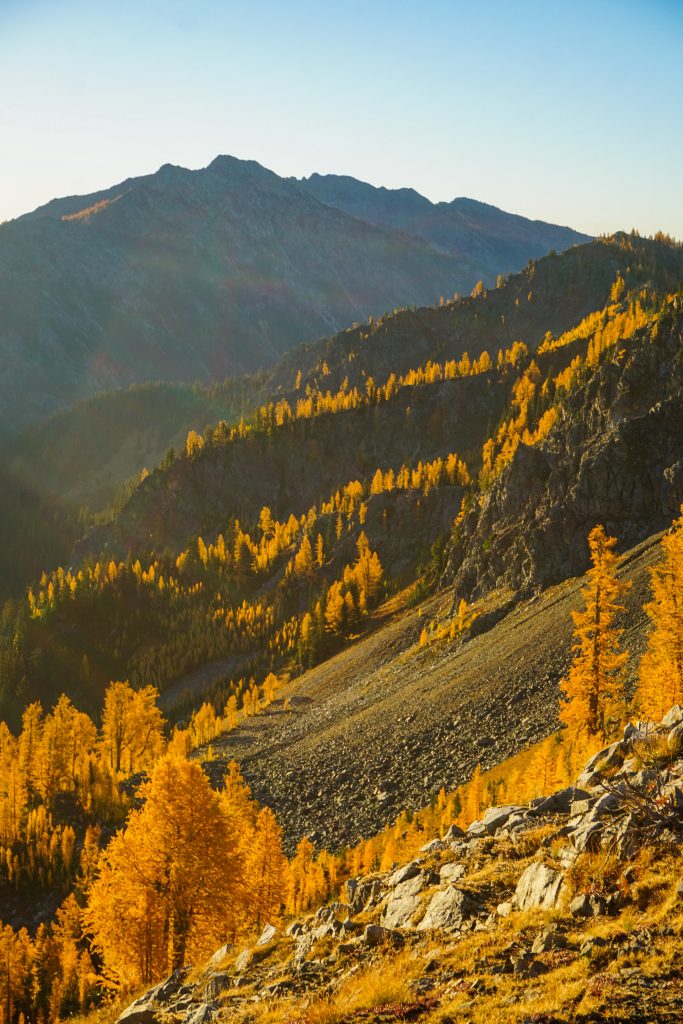
We ascended the burned south facing slope towards a 7200 ft pass that would lead us down into Copper Creek. For an October day, it was quite warm, but it never felt truly scalding like a summer day. There were abundant hoof prints once again, so it seems like we were following a common animal route between Holden and the Ice Lakes.
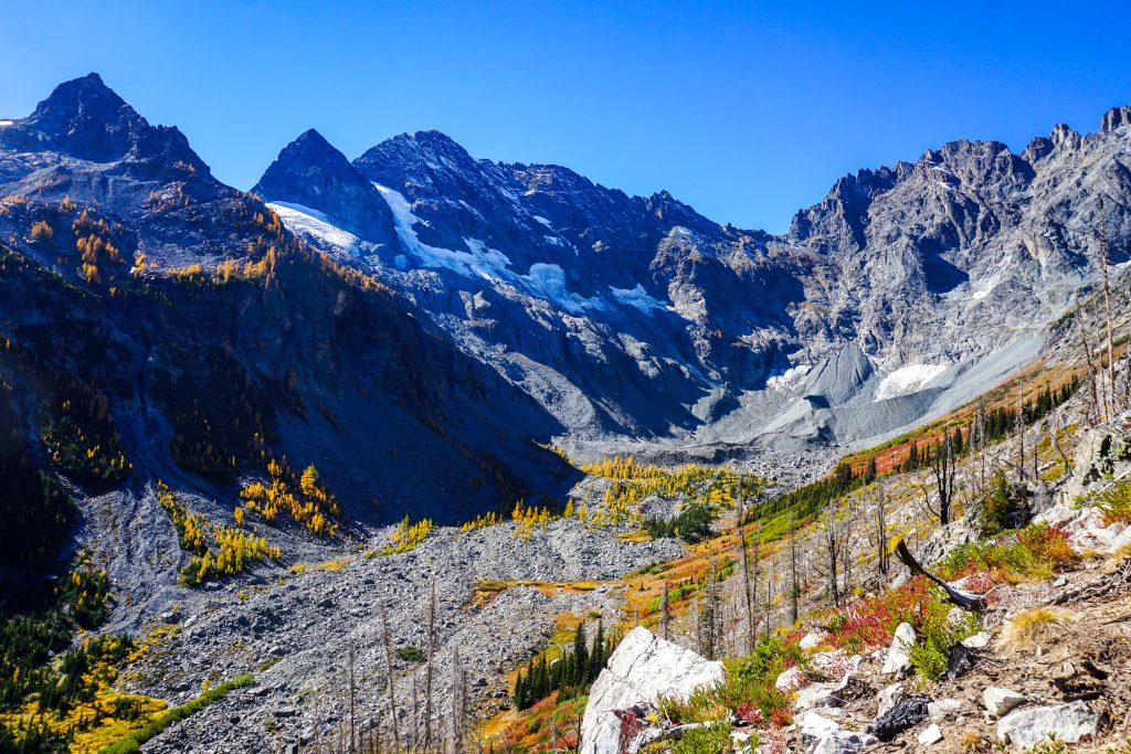
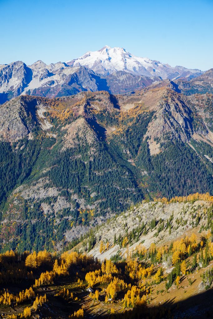
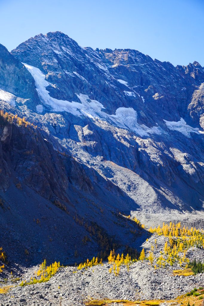
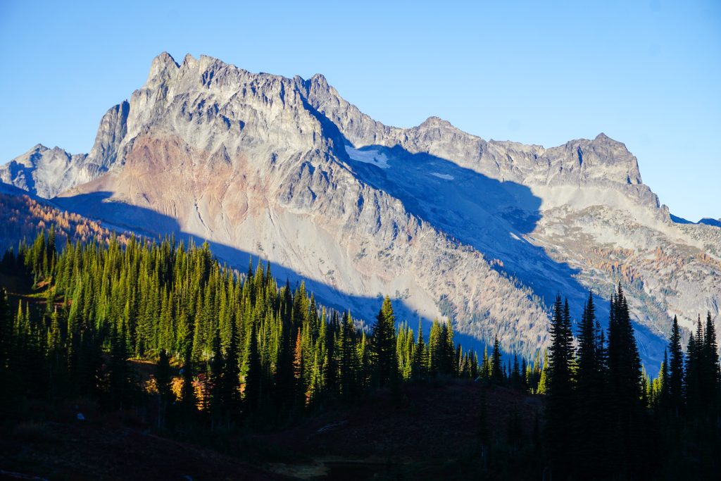
I had long wanted to get this view of the North Face of Mt. Maude. The rugged, rocky valley reminded me of the The Needles in the Northeastern Olympics, but the golden larches growing out of the rocky moraine were very Cascadian. The amount of ice here 100 years ago must have been a sight to see, but now the valley is nearly void of ice, much like that portion of the Olympics.
From the pass, we only had one more off trail section down to Copper Basin before trail miles the rest of the day. This descent was a bit tedious, with plenty of boulder hopping. We angled our way skier’s right across a series of benches to avoid cliffs.
At the end of the flat Copper Basin, we found the trail that would lead us down to Holden. We said goodbye to the larches (at least for a while) and headed down. It was nice to be on good trail again.
We popped out of the woods into a giant open area filled with gravel. I believe this is the former copper mine site that operated from 1937-1957. After the mine closed down, the town site was given to the Lutheran Church as a gift. Now, Holden is a unique Lutheran Retreat village, although people of all backgrounds are welcome to visit. A few hundred people live here full time. There is no car access; one must take the ferry up Lake Chelan then bus up to the remote town.
Down at Holden, we were actually lower (3300 ft) than our starting trailhead. We had completed 18 miles and 9k ft gain, but we still had another 18 miles and 4k ft gain to go, including a long 10 mile climb up to Spider Gap.
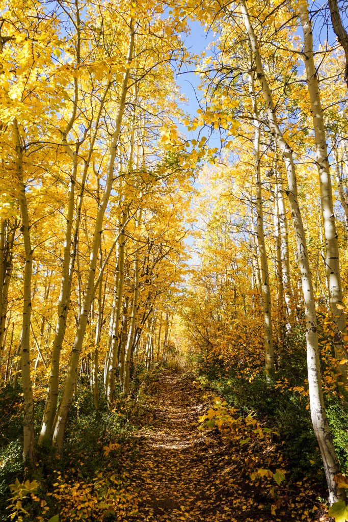
I expected the long, gradual climb up Railroad Creek to feel boring and exhausting, but I was pleasantly surprised. Everyone in our group was feeling pretty strong, so we jogged the gradual (#totallyrunnable) uphills. We passed through beautiful groves of poplars and even a sparkling aspen tunnel! Even down low in the valley, we were still in a wonderful world of yellow trees!
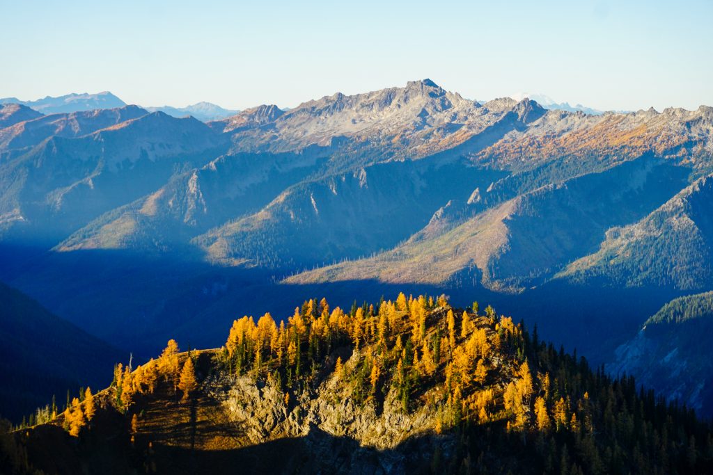
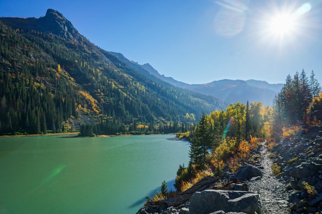
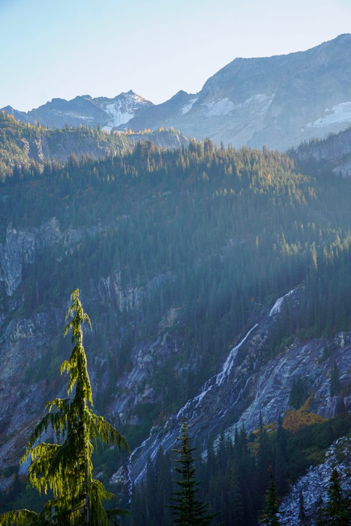
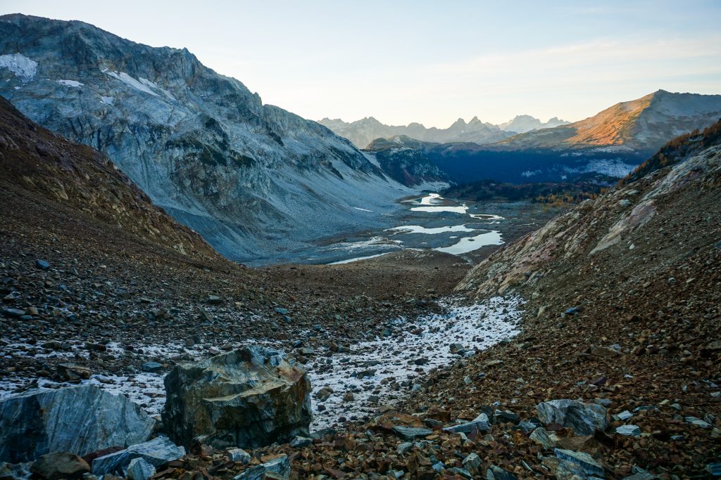
In other spots, we got clear views through this classic glacial valley to the soaring peaks above us. Bonanza towered 6,000 feet above us, cascading waterfalls down its glacially polished slabs. Larches dotted the steep rocky basins to our south, as dying pockets of ice breathed their last breaths above on the flanks of Greenwood. Turquoise colored waters from the glaciers all around us filled Hart Lake, itself a terminal moraine lake. And downstream of us was Lake Chelan, carved over a thousand feet deep by a Continental Ice Sheet from Canada that cut through the Cascades. This is a landscape made by glaciers and all their power, but they will soon be gone from this valley. At the end of a historic summer of glacial loss, it felt like we were truly witnessing the end of an era.
After pushing pretty hard up to Hart Lake, I came dangerously close to bonking. But I slammed a bunch of calories and de-bonked successfully. We were still moving quickly as we hiked up to the Lyman Lakes.
I always love the gradual, rolling trail past Lower Lyman and up to Upper Lyman Lakes. The sun had gone behind the hills and we were racing the sunset to Spider Gap. A cool wind greeted us in the open. This is what autumn is all about!
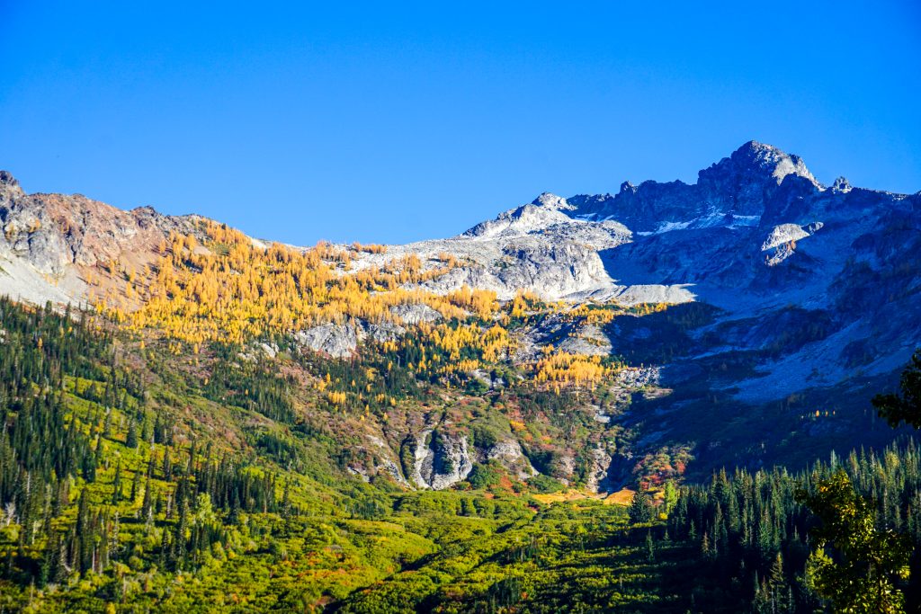
Upper Lyman brought back fond memories of our Glacier Peak High Route just months earlier. The Lyman Glacier, which once covered the entire upper lakes basin, has retreated up into the highest reaches of Chiwawa’s shaded slopes. As a whole, the glacier has lost nearly 90% of its area since 1890. But the glacier has left behind these beautiful lakes, and a young larch forest taking hold. As much as I would love to have seen the Lyman Glacier in its full glory, there is beauty in the loss.
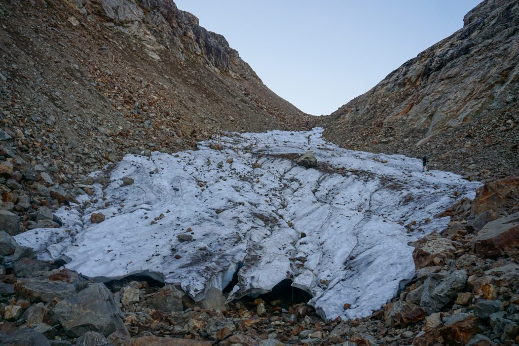
The climb up to Spider Gap, which once used to be completely on a glacier, was a rocky chossy mess. There is still some bare ice to cross, a former arm of the Lyman Glacier. It is now mostly covered in rock and is probably a rock glacier now. With all the rocks, we were able to cross without traction.
We made it to Spider Gap in 3 hours from Holden! It was cool and windy in the impending darkness, so we got moving down the other side. The “Spider Glacier” has changed remarkably even in the 7 years or so I have been coming here. There are just a few patches of ice left. The descent is really quite annoying now. I got to use my ultralight microspikes, but they were not completely necessary.
We reached Larch Knob and a nice trail just as dusk set in. Finally, we were able to take a sigh of relief and soak in the immensity of the terrain we had just covered.
Complete darkness set in as we jogged across Spider Meadows, four separate lights floating across the vast expanse. I felt shockingly good for such a long, fast day. I was able to run the entire 5 miles out with no stopping! Whatever I did this day, I need to repeat, because this was one of the best performances I have ever had!
Fall is such an incredible, fleeting season in the Cascades, and there is no way I would rather spend it than exploring and revisiting incredible places with such a fun group of friends. The “Golden Holden High Route” was dramatic, varied, and huge. It combined both the unknown and the familiar into such a fun, challenging experience. It was an incredible way to celebrate my birthday and close out the fall alpine season!
Notes:
- Our route was 36 miles and 13k ft gain. It took us 14 hours. We wasted some time in the first half, but moved very efficiently after Holden. I think it would be hard for most people to complete Carne to Spider Gap in daylight at this time of year. Doing this route in two days, with one night in Holden, would be extremely enjoyable and one of the most “Euro” experiences you could get in the Cascades!
- There are multiple basins you could take down from the Ice Lakes to Entiat Meadows, but I am glad we took the eastern most. The western ones have cliffy sections near the bottom.
- Railroad Creek was the most surprising part of the entire route to me. I really enjoyed this long, beautiful climb. Look for the aspen tunnel!
- This was the first opportunity where I got to test out the Blitz Microspikes. These are relatively cheap and weigh only 4 oz. They really felt perfect for the Spider Glacier and situations where you have to travel a long distance for a very short period of low angle ice. They’re not for steep terrain or anything that would warrant real crampons, but they are useful because of how small and light they are.
- None of the off trail was particularly challenging on this route. The descent from the Ice Lakes and then down to Copper Basin was probably most tedious.
Looks like a nice route and a lot of ground to cover given how short the days are now.
This is a random sidebar, but I’m very curious about Wyatt’s research regarding North Cascades glaciers that have disappeared. Do you know anything more about that?
He’s posted some facts on his Instagram. Maybe we’ll do a more in depth video sometime on our weather channel https://www.youtube.com/channel/UCPe0Ck-hGVDR3BsXH1TMDVg.
Cool! I’ll have to take a look.