
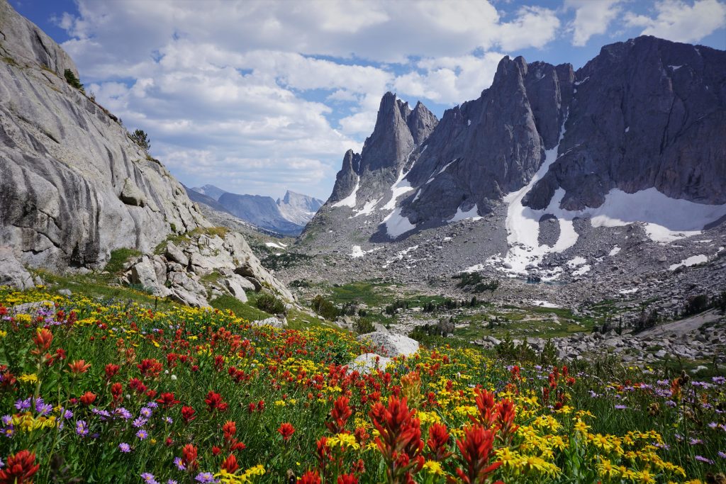
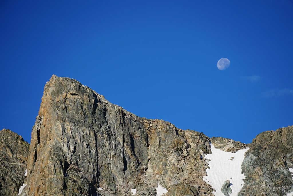
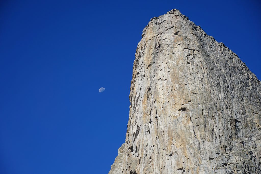
A Week in the Winds
Ever since I completed the Sierra High Route in July 2018, I have wanted to do the Wind River High Route. The Winds blew me away (no pun intended) during my two visits in 2018, once to ski Gannet Peak and another to climb alpine rock in the Cirque of Towers, but I knew there was so much more to this incredibly alpine, remote range. The much-hyped Wind River High Route became a bucket list trip.
There are two popular versions of the Wind River High Route (WRHR). Adventure Alan’s WRHR starts and ends on the west side of the range. Andrew Skurka’s WRHR is a bit longer, at over 100 miles, and covers the stunning alpine, glaciated terrain in the northeast corner of the range. In my opinion, Skurka’s route is the true WRHR, so that was the route we chose to follow.
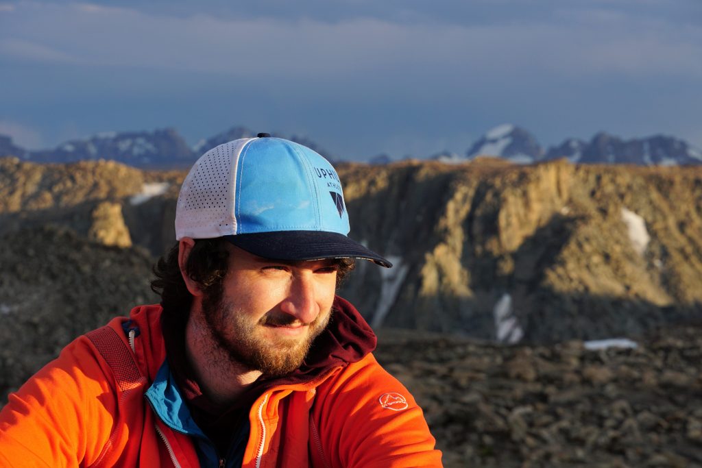
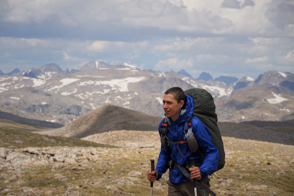
I am grateful for all the experiences I had during the summer of 2020, but it was certainly not what I expected. My Alaska trip was cancelled and my travels were restricted to domestic. Back in May, I remember that Sam had mentioned in passing that he was interested in the WRHR, so I hit him up and we made plans for a road trip. First, we met up with Logan for 3 awesome days in the Beartooth Range, and then we were gone with the winds.
Table of Contents
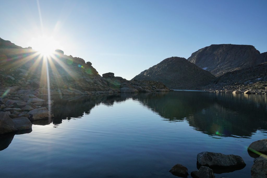
Day 1: Glacier Trail to Downs Mountain
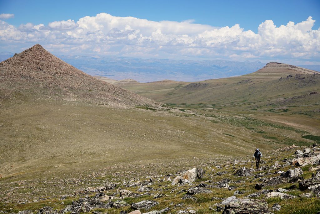
All approaches to the winds on the east side start in the desert sagebrush. From the east, the Winds are amongst the least impressive ranges I have ever driven by. The eastern foothills are so gradual and long that you can not even see the alpine peaks in most places. I like to tell people that the Winds are the worst range in the West for day hiking, because these approaches are so long and mundane.
We chose to give ourselves a leisurely seven full days for the high route. During the Sierra High Route, Kylie and I experienced terrible thunderstorms every afternoon. Even pushing through these storms, we were often hiking from sunup to sundown. It made for a really exhausting experience. This time around, I wanted to plan in more buffer for bad weather, lounging around, and peakbagging. I probably will only do this trip once, so I wanted to do it right.
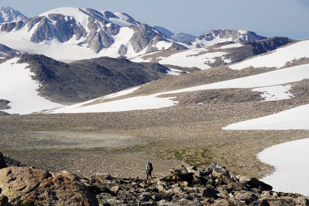
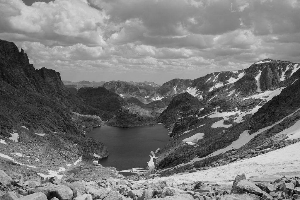
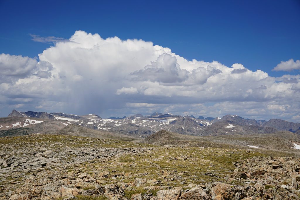
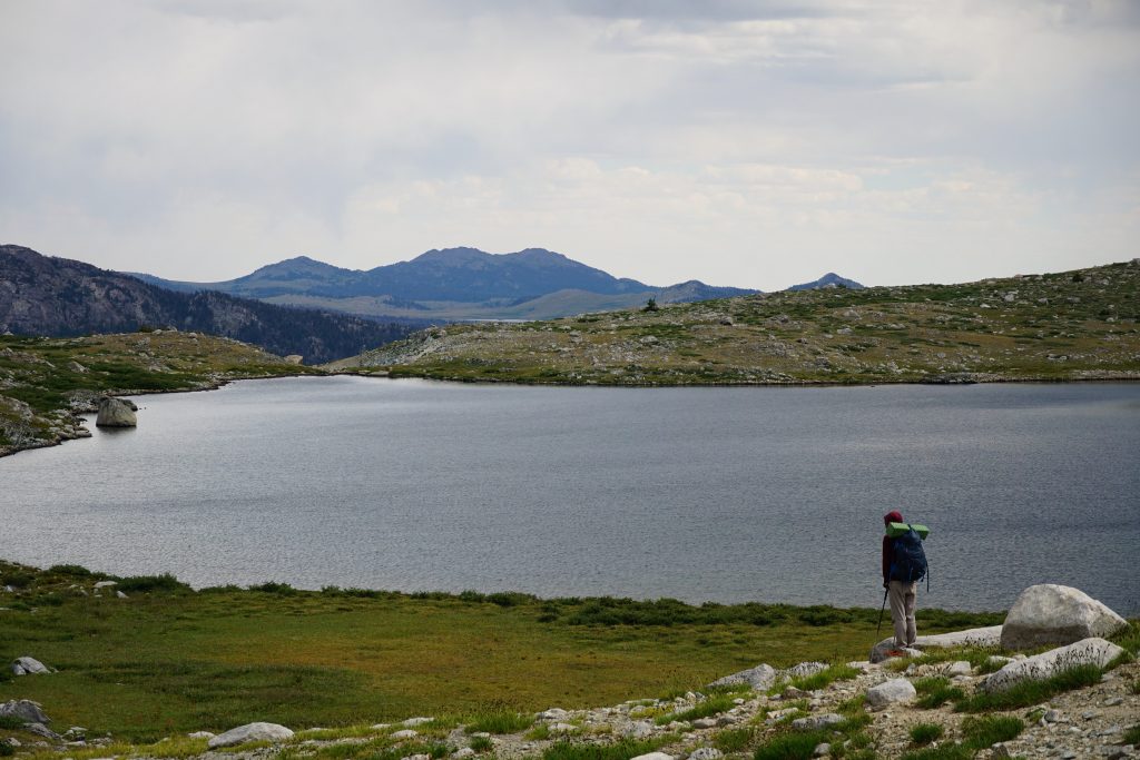
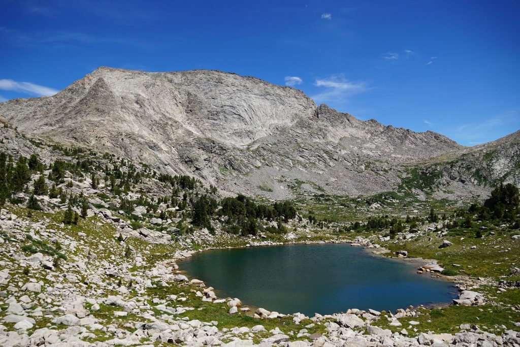
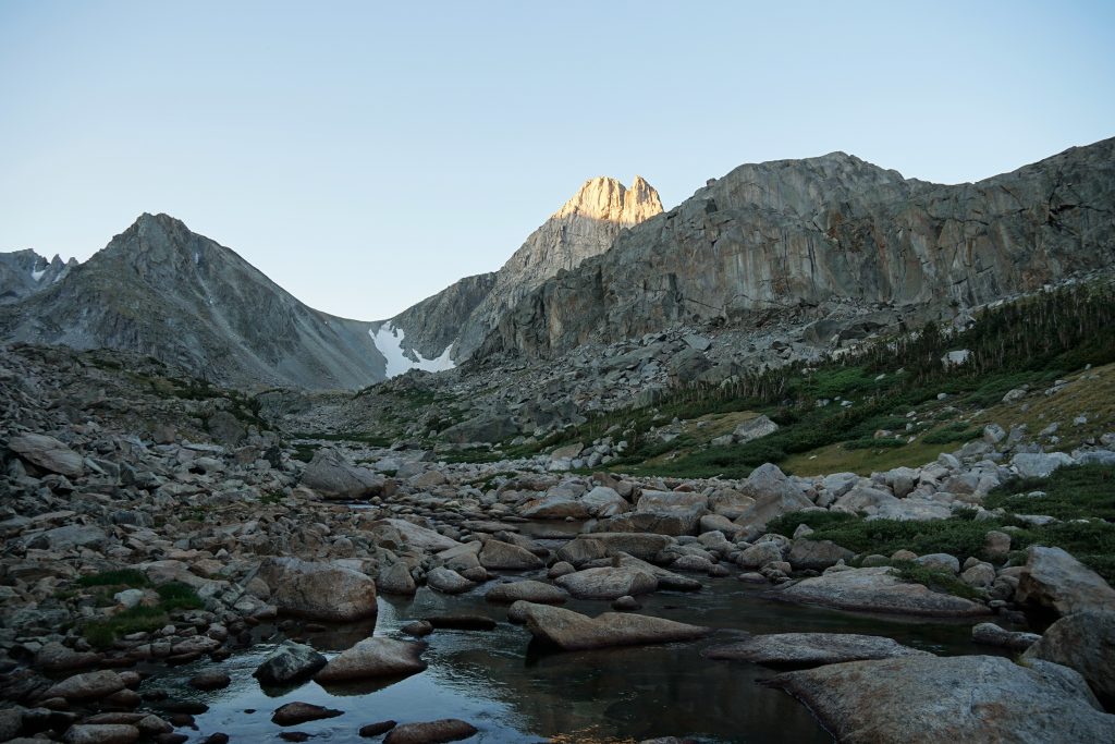
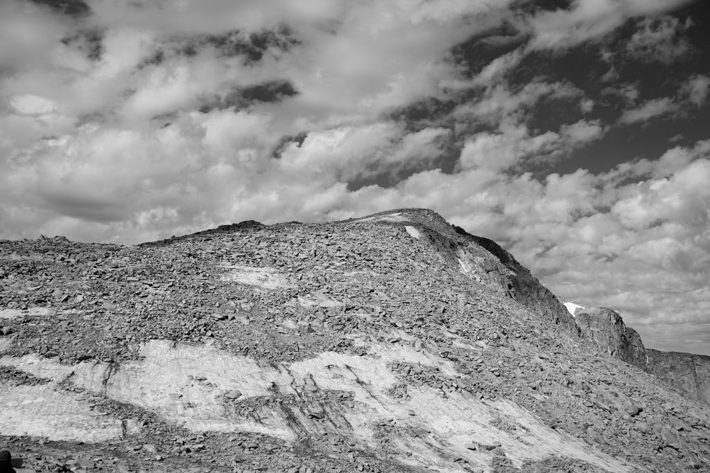
Around 11,000 ft, we left the Glacier Trail at a high pass and headed off into the alpine. On the eastern side of the winds, there are these incredible massive alpine plateaus, much like the Beartooth Range. These unique features have no equivalent in the Cascades. Different sights like this are part of why I like to leave the Cascades once or twice a year. It gives me a unique perspective and keeps my home range fresh when I return.
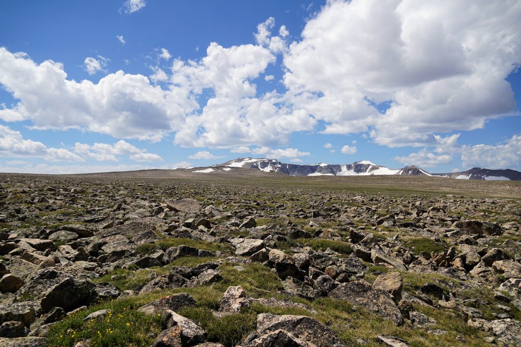
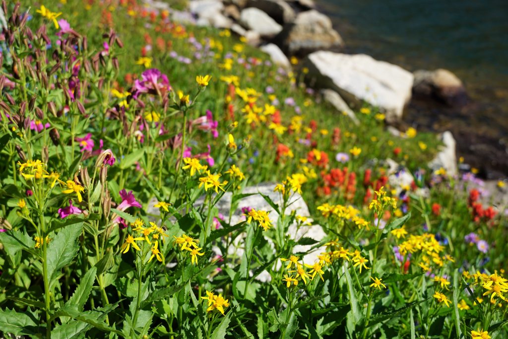
Goat Flats lived up to its name, only partially. It was a remarkably flat plateau of boulders and tundra grass at 12k, but we did not see any goats or bighorn sheep. We did, however, pass two gentlemen trucking out, eager for the burgers in town.
It felt bizarre to stare off this elevated plateau littered with a million boulders to a land of steep walls, lakes, glaciers, and striking peaks. The Winds are truly a range of contrasts – flat valleys, flat plateaus, vertical rock walls. It almost felt like we were not even in a mountain range, but we were looking down upon the highest peaks of some magnificent range to the south.
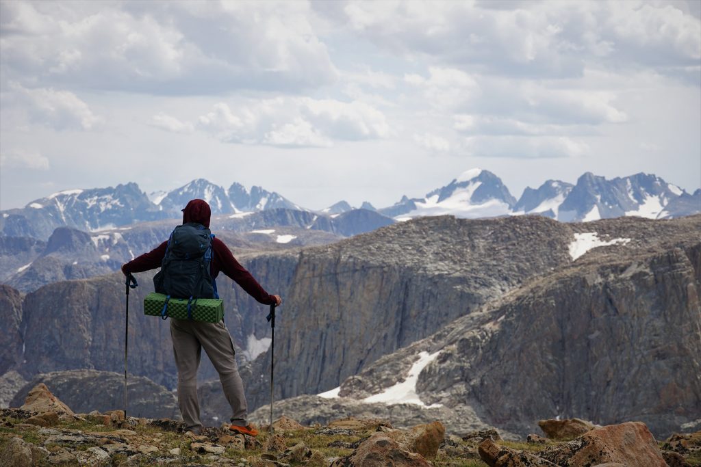
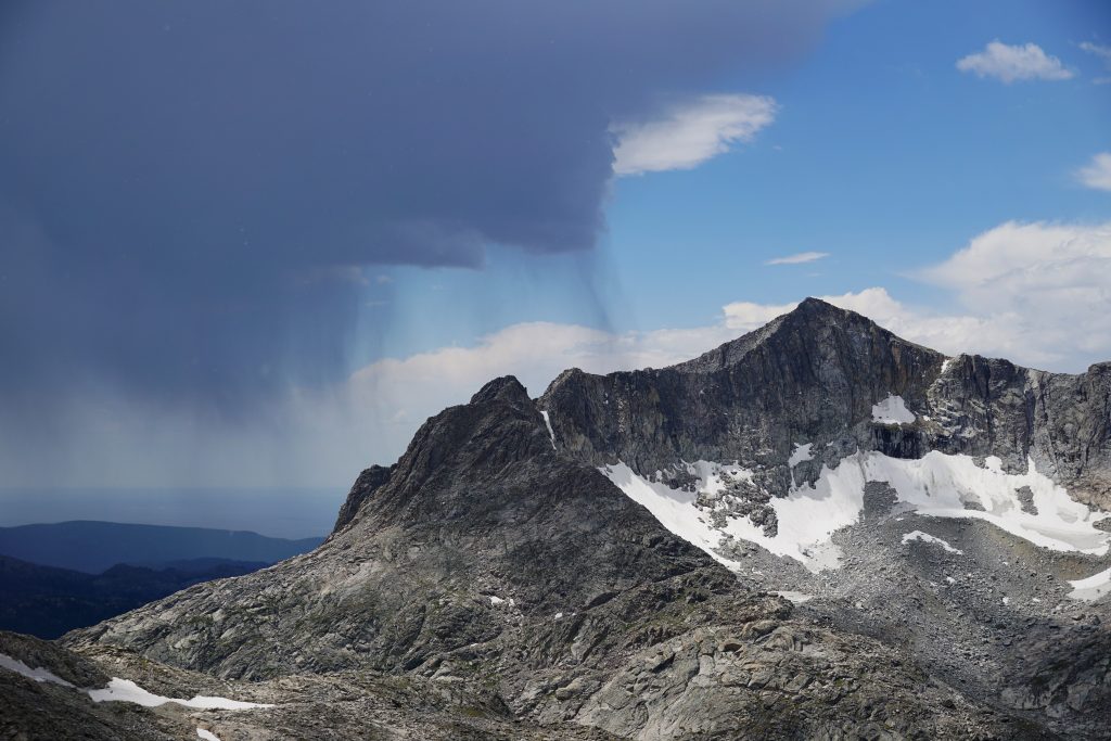
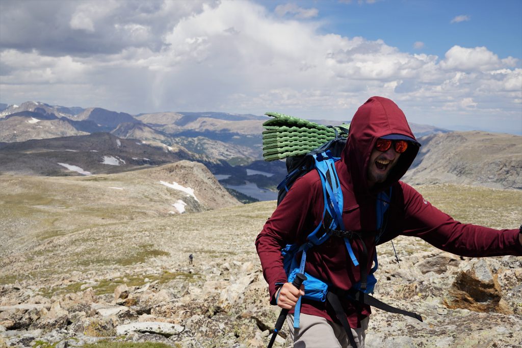
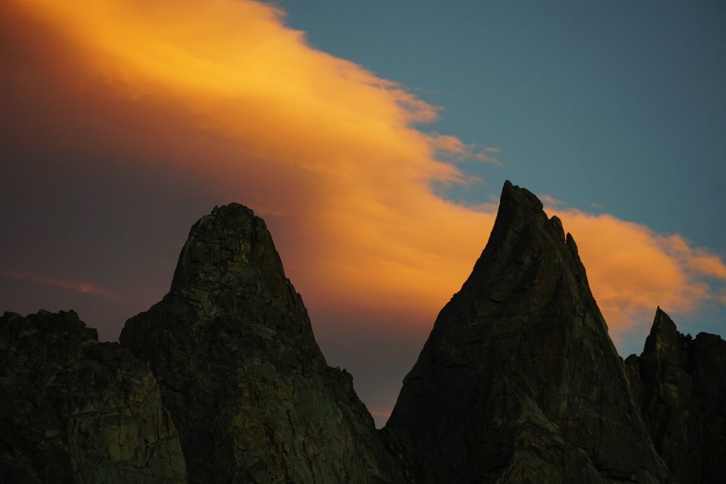
At the base of Downs Mountain, we had a decision to make: continue or not? It was mid afternoon and thunderclouds seemed to be building, but it was not bad yet. The next few hours were incredibly exposed, literally walking on the Continental Divide between 12k and 13k with no places to hide. We waffled a few times, but ultimately decided to stay and camp.
There were a few excavated tent sites with rock walls scattered about in the massive flat boulder field here. We found a few on the way in, but could not locate them again because everything camouflaged into brown and grey. Eventually, we found some sites and settled down for the evening. There was no protection from weather whatsoever, so we hoped for a calm evening.
It was a moody evening with squalls passing through. Logan and I wandered and explored, as we do most evenings in the mountains, ever since we started backpacking together. Some things never change, and it’s nice that way.
Day 2: Downs Mountain to Dinwoody Camp
Around midnight, we were awakened by strong winds. Camping at 12k, we were incredibly exposed. The wind swirled and slammed Logan and me in my Tarptent Motrail. This tent served me well on the Sierra High Route and other trips, but was getting absolutely broadsided by the (estimated) 40 mph winds. I was concerned the tent wouldn’t make it through, but it did. It was quite noisy, however. I was able to get some sleep with ear plugs.
Around 4 am, heavy rainfall joined the winds for an absolutely dreadful cacophony of sound. No further sleep was had, but we did stay completely dry. Finally, around 6 am, the wind and rain suddenly abided and we emerged to assess the situation. I’ve experienced some powerful storms before in the mountains, but never one that lasted this long and had such high winds.
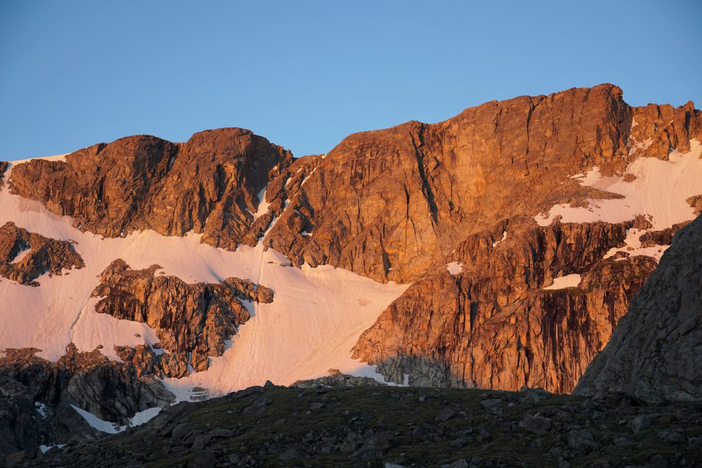
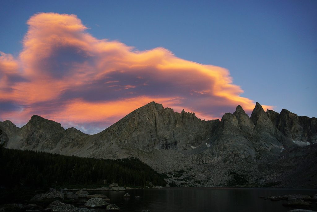
We slept in, waiting for the weather to continue to improve. By 8 am, blue skies were abound and we made our way up Downs.
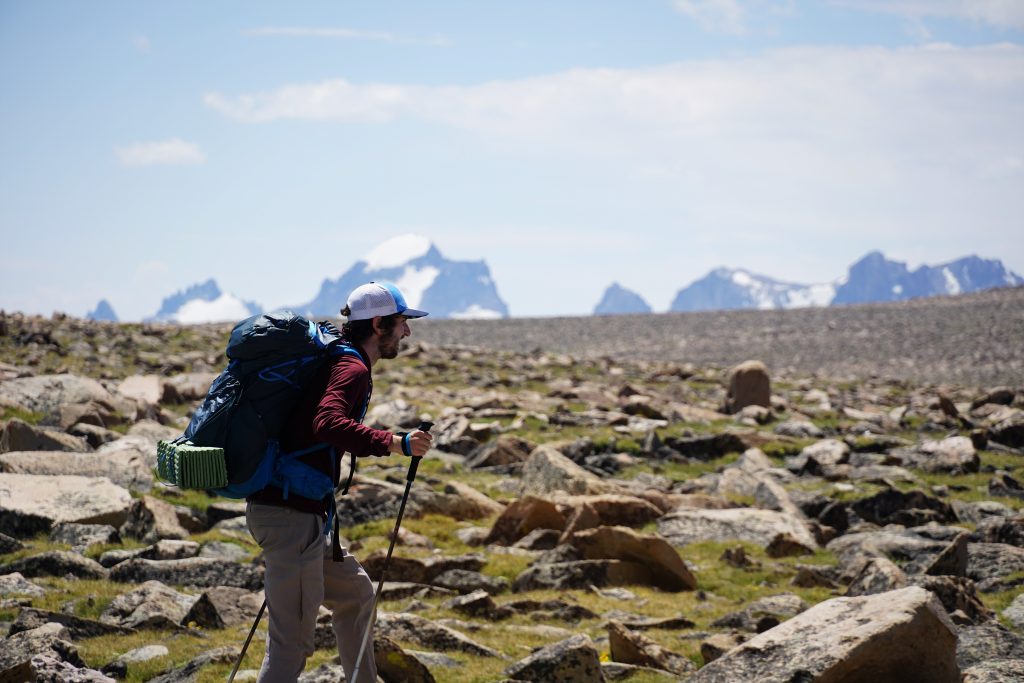
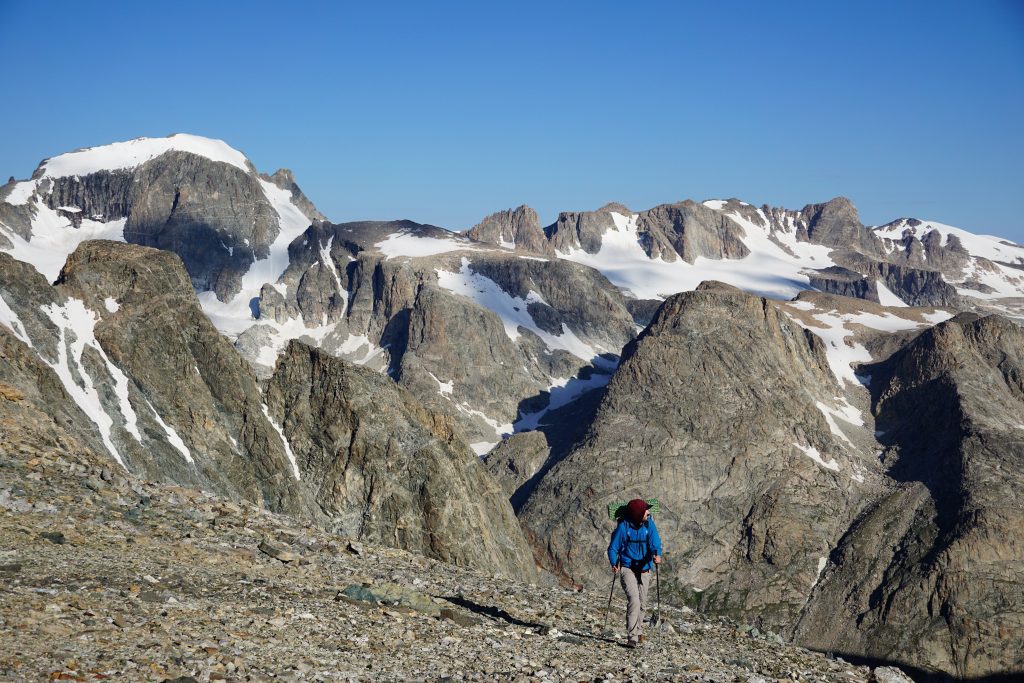
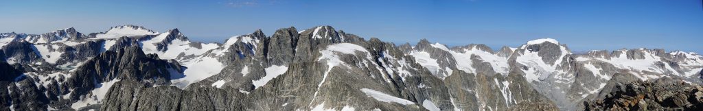
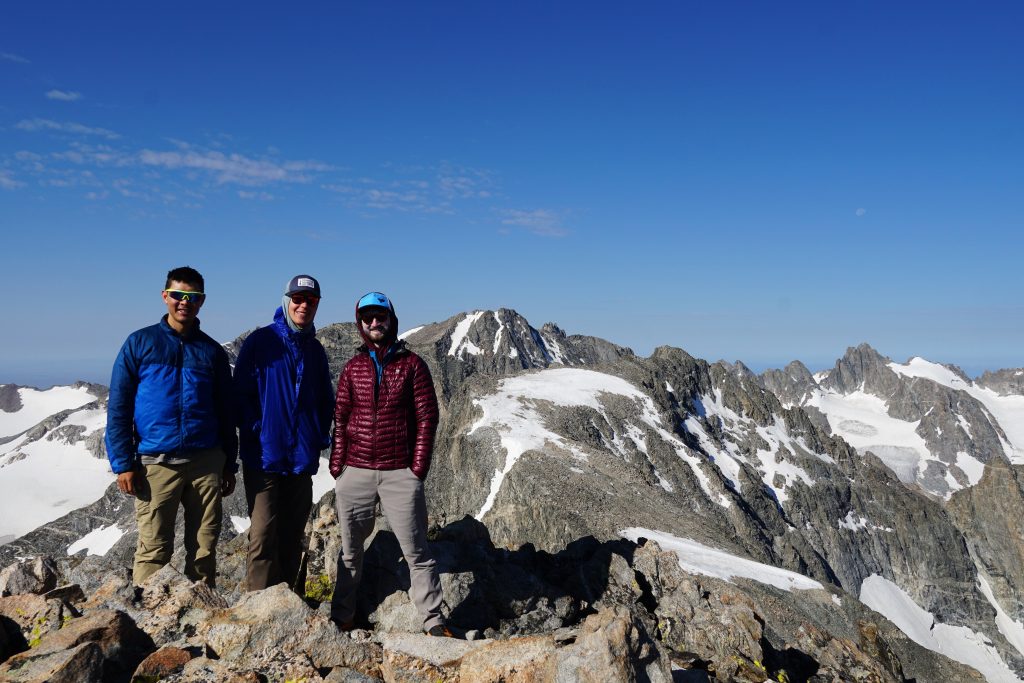
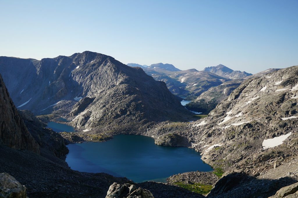
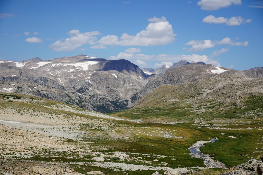
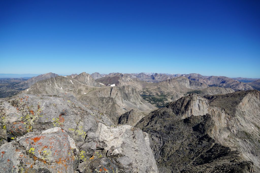
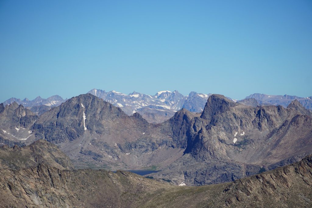
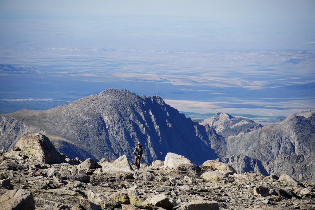
The summit of Downs (13,350 ft) offered a great view of the Absorkas, Gros Ventre, and even the Tetons! The entire northern high route laid out in front of us, marvelous and glorious. The spine of the range – like a sidewalk in the sky. We were all very excited for the next section.
Walking the divide from Downs southward was truly a special experience. There’s nothing really comparable in the lower 48. The scale of the terrain and the position, walking above glaciers, marching towards the biggest peaks of the range, is really powerful. There’s really no words for this section. You have to experience it.
Travel was consistent and moderate – not the slowest and not the fastest. In many ways, it was like the high plateaus of the Beartooth.
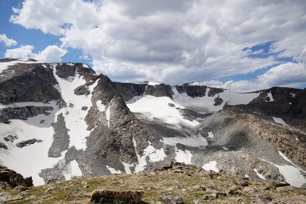
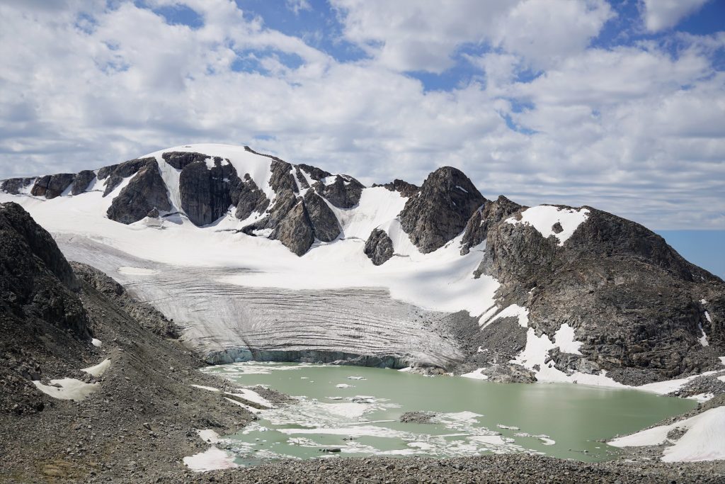
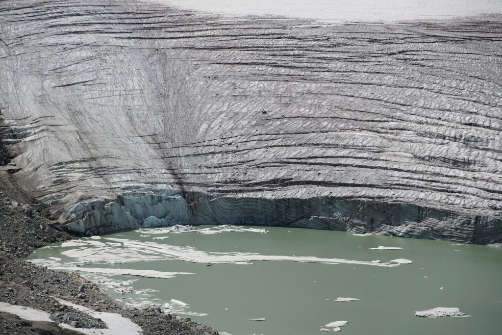
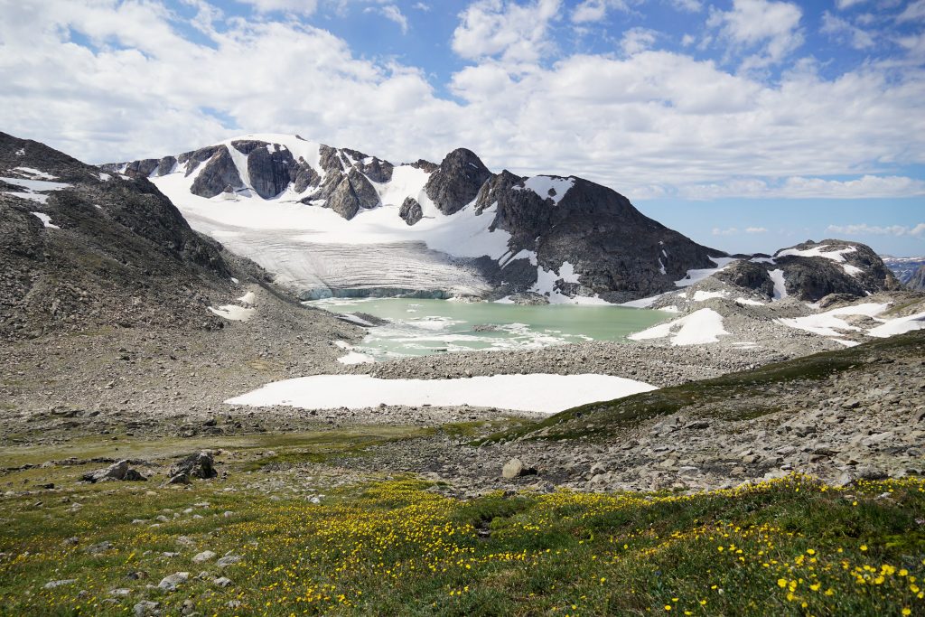
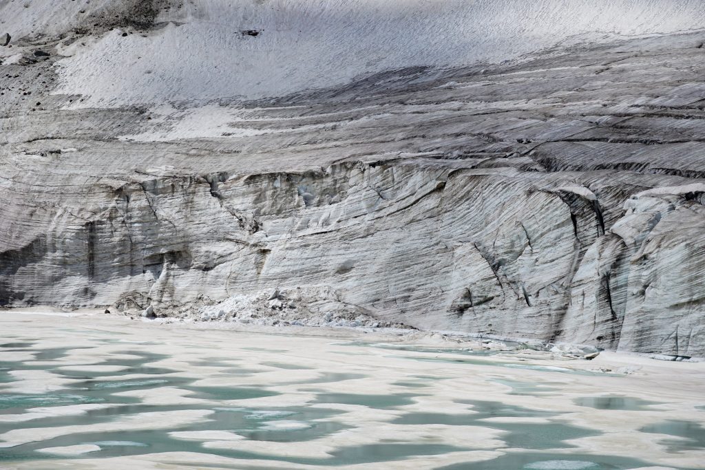
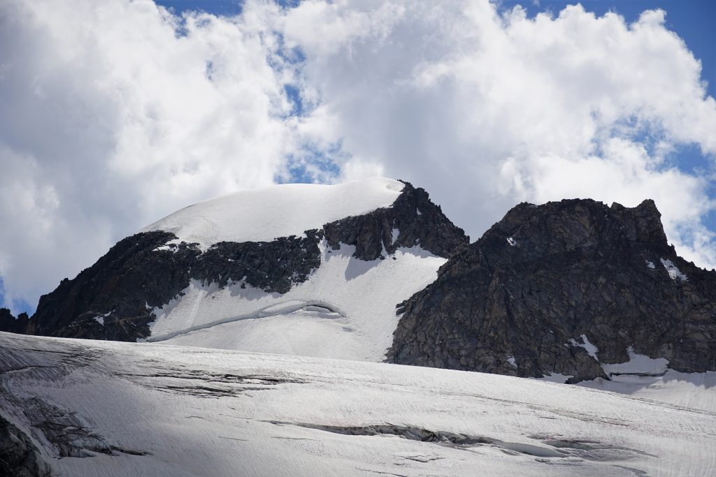
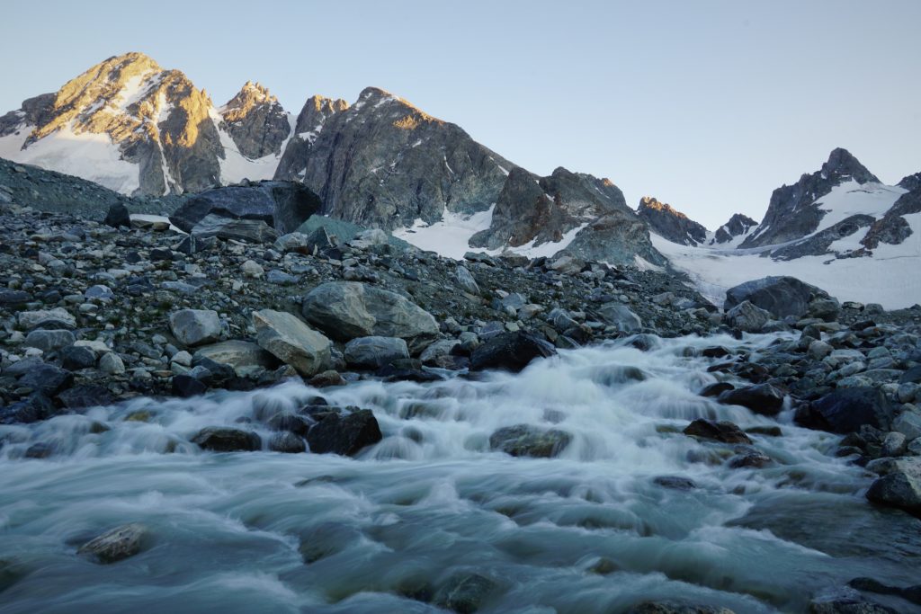
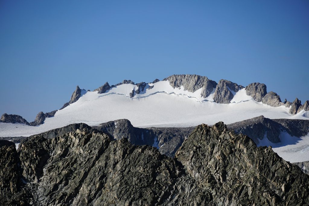
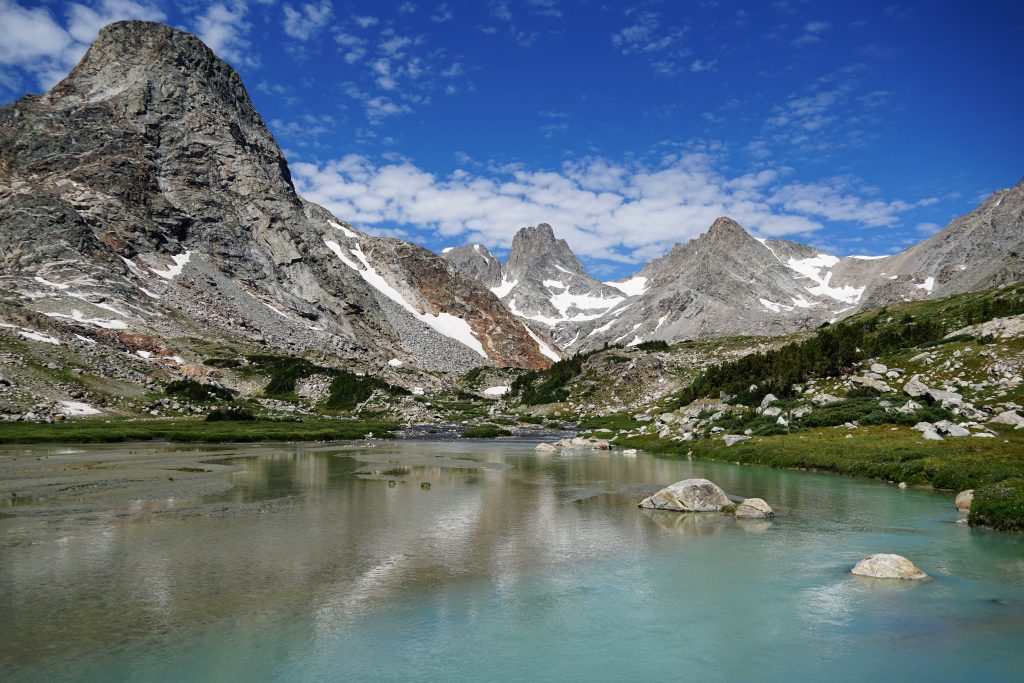
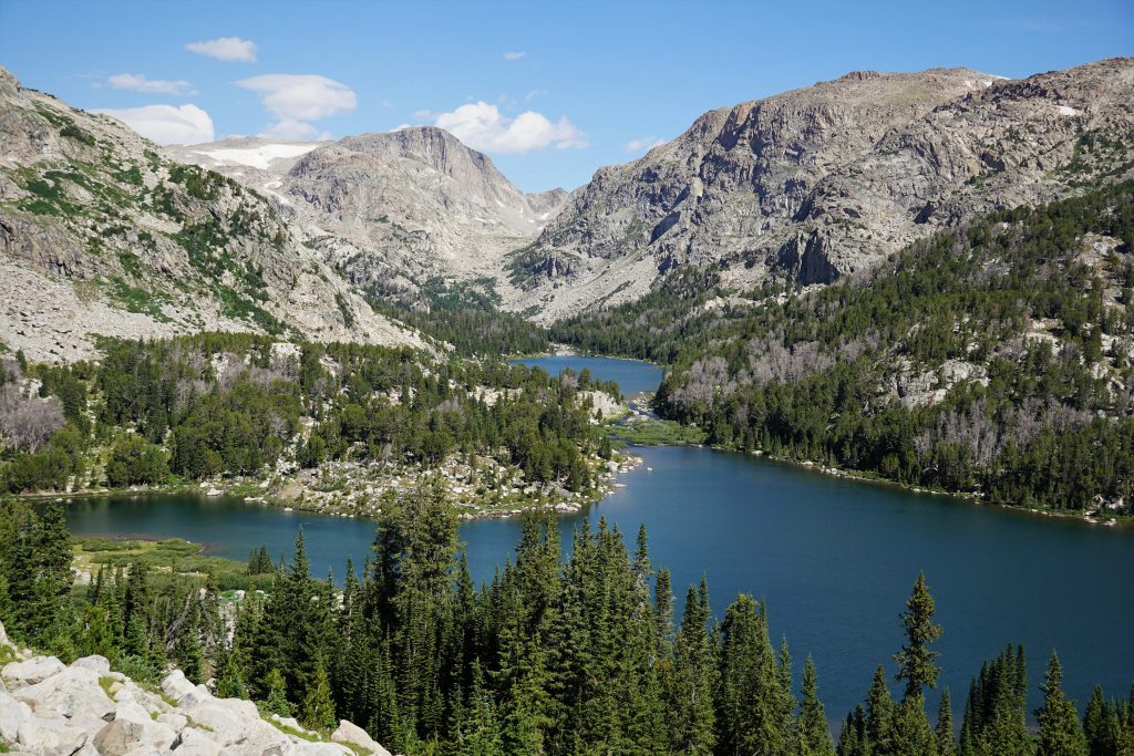
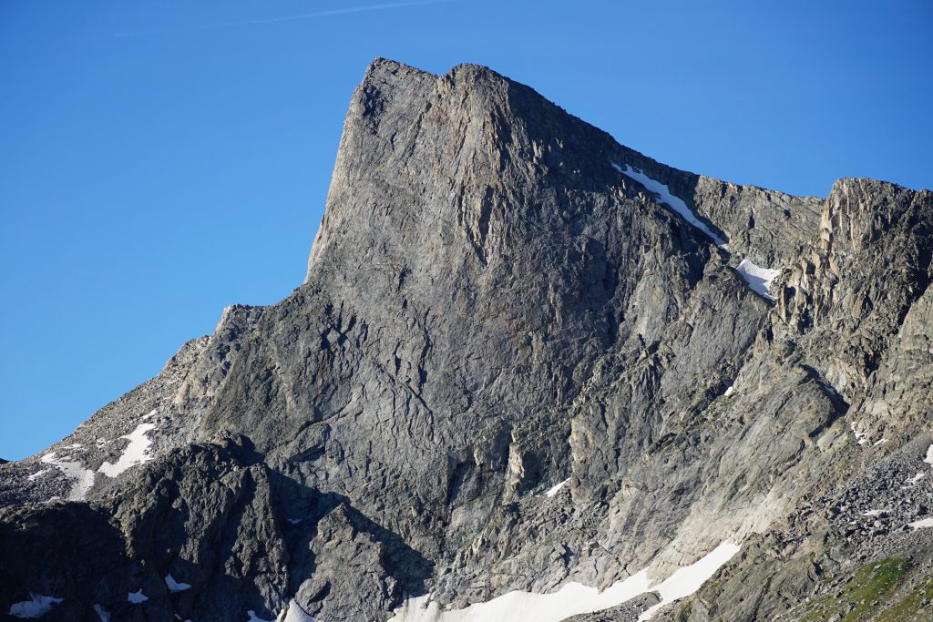
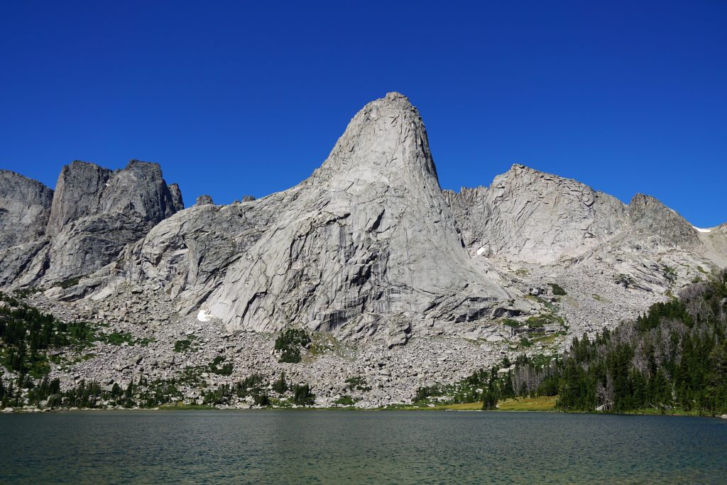
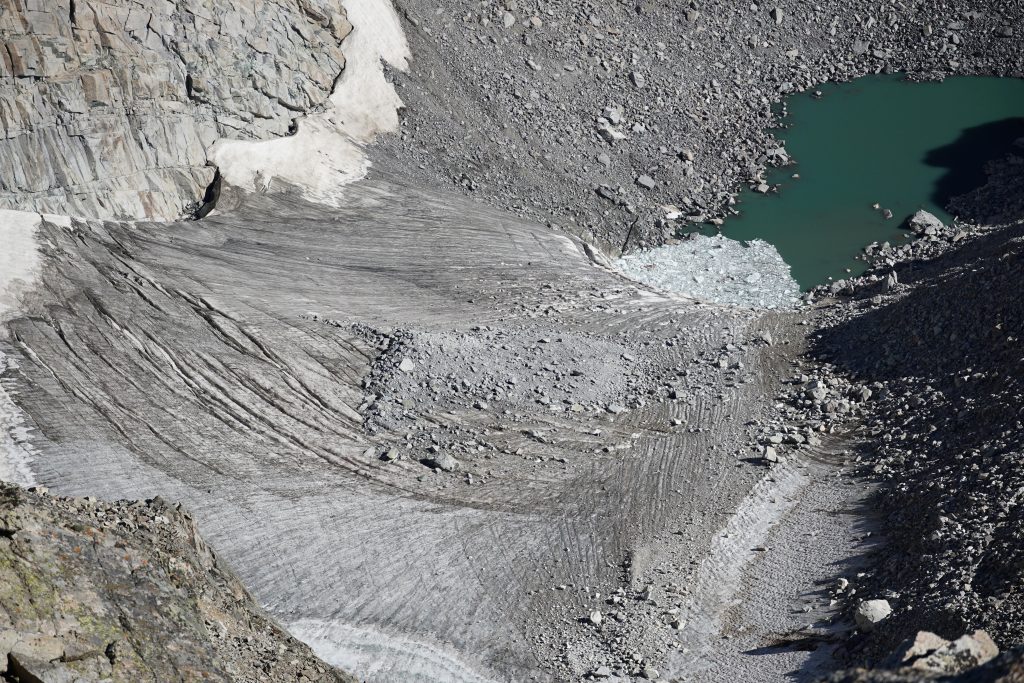
A few hours later, we rounded Yukon Peak and gained the incredible view of Klondike Peak and the Sourdough Glacier. The glacier, one of the more substantial ones in the range, bulldozed its way down from the flanks of the peak, calving into a glacial lake with an ice wall 50 ft high. It’s hard to believe something so glacial exists in Wyoming. It was completely different than anything in the Cascades, so starkly unique and beautiful. I think this was my favorite view of the entire trip.
We took a long break here, mesmerized by the scenery of the northern winds.
If we had pushed further yesterday evening, we would have camped at the Iceberg Lake saddle. While possible, it felt even more exposed than our previous camp and we did not find any developed campsites. We were glad of our decision to stop before Downs.
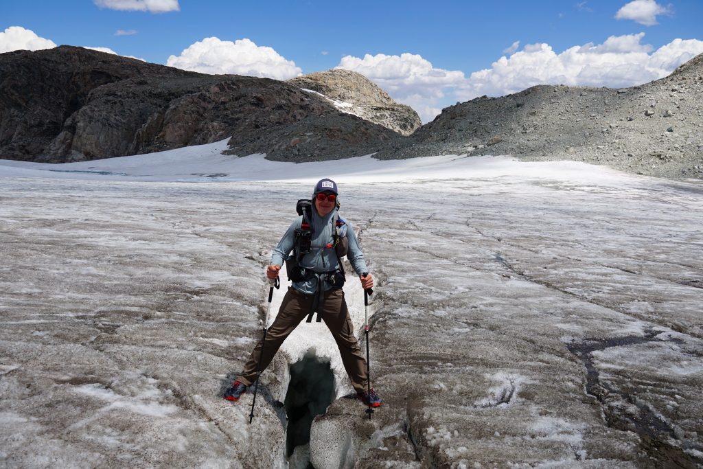
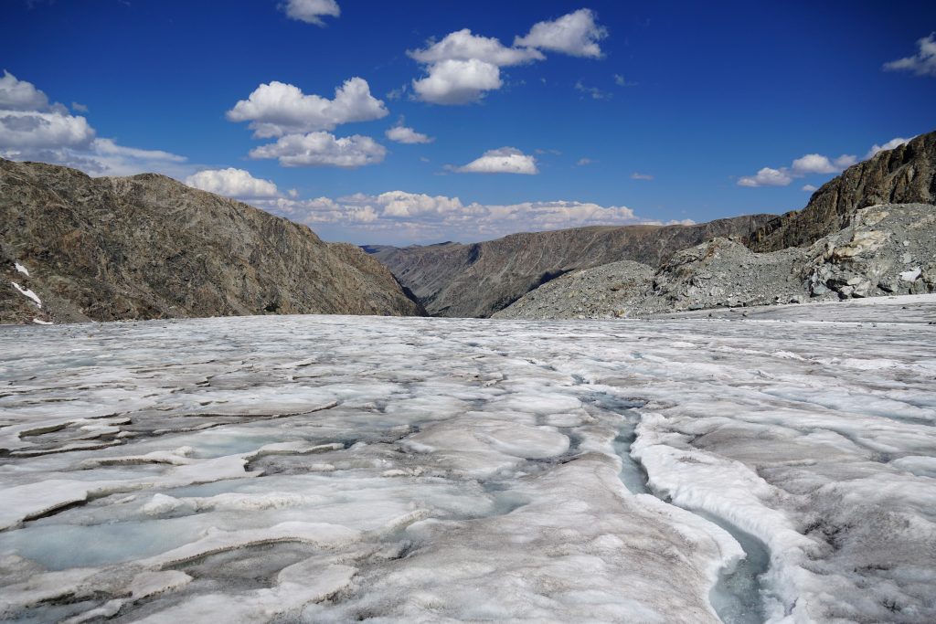
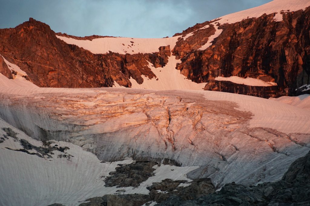
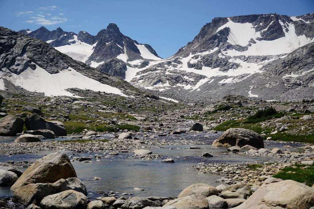
Next, we crossed the Grasshopper Glacier, another surprisingly large valley glacier. The placement of the glaciers is very different than the Cascades, due to different weather patterns. This one occupies the lee side of a high plateau, before spilling down a long valley.
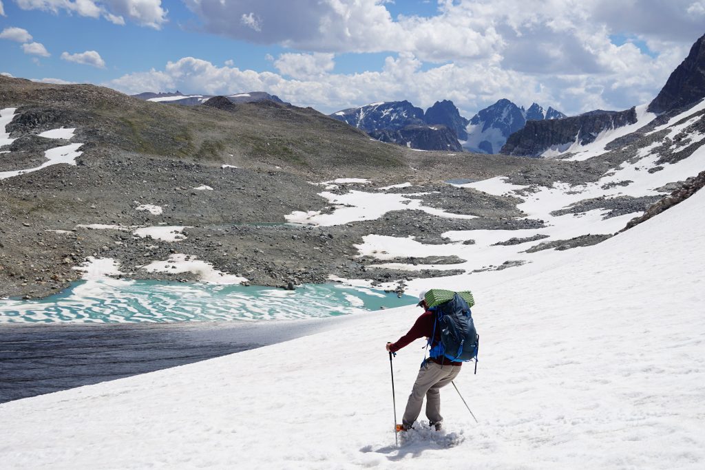
Even though it was early August, much of the glaciers were already exposed down to bare ice, even during a normal snow year. The Grasshopper was so flat that there were hardly any crevasses even big enough to fall into, even if you tried. It was trivial to walk across the small cracks to the other side. I would not say this about most Cascades glaciers late summer.
We wandered through a moraine wasteland (with some surprisingly developed sandy campsites) and continued on towards the Gannet Glacier. Somewhere along the way, we got passed by a soloist aiming for the FKT on the entire WRHR! He was already pretty wobbly and we didn’t think he would make it. A route like this is absolutely insane to attempt an FKT on, in my opinion – 2 to 3 days of tough, rugged, sometimes complex alpine terrain. Honestly, it would feel criminal to pass through some of these beautiful spots in the dark.
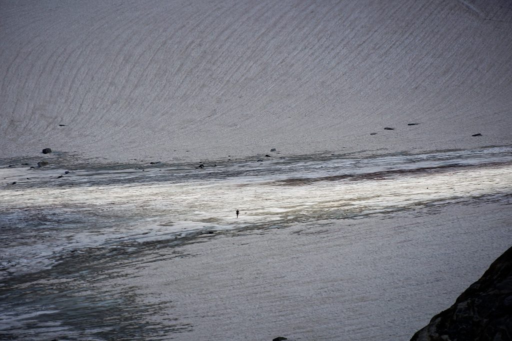
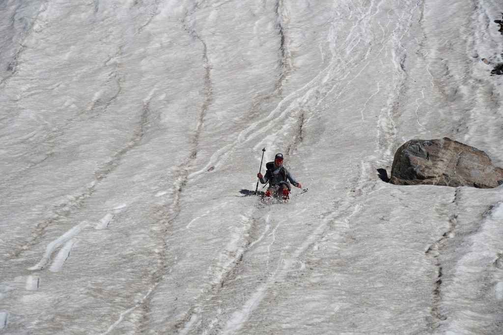
By mid afternoon, the Gannet Glacier was slush city! I think the morning’s deluge had saturated the top layer of snow for the day, because the snow was surprisingly soft all day and we never needed the microspikes we brought. Every step we took, our feet sunk ankle deep into the cold, wet slush and we yelled like the world was ending, part in agony and part in laughter at the ridiculousness of it all. This is high routing, and I love every bit of it.
One more little pass and it was all downhill to our camp at Dinwoody Creek. We were treated to the best boot skiing of the day and some final boulders before arriving at the mini-city of campsites in the moraine around Dinwoody Creek.
After setting up camp, we chatted with some other campers. Some mountaineers returning from climbing Gannet asked us “recovered yet?” They obviously thought we had climbed Gannet earlier. Technically, I had climbed Gannet earlier, just two years earlier.
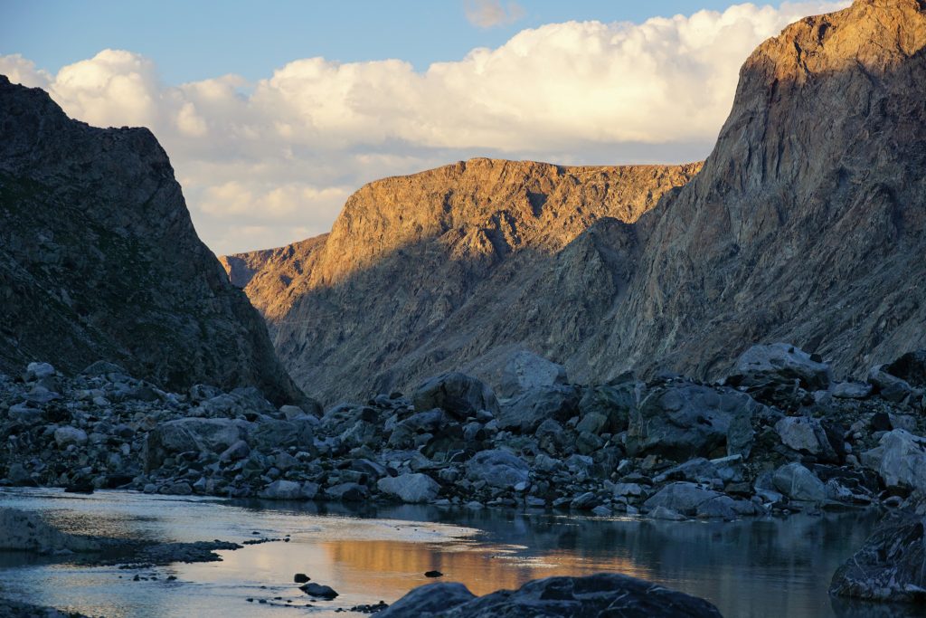
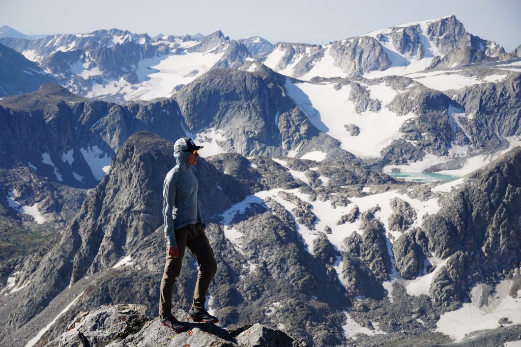
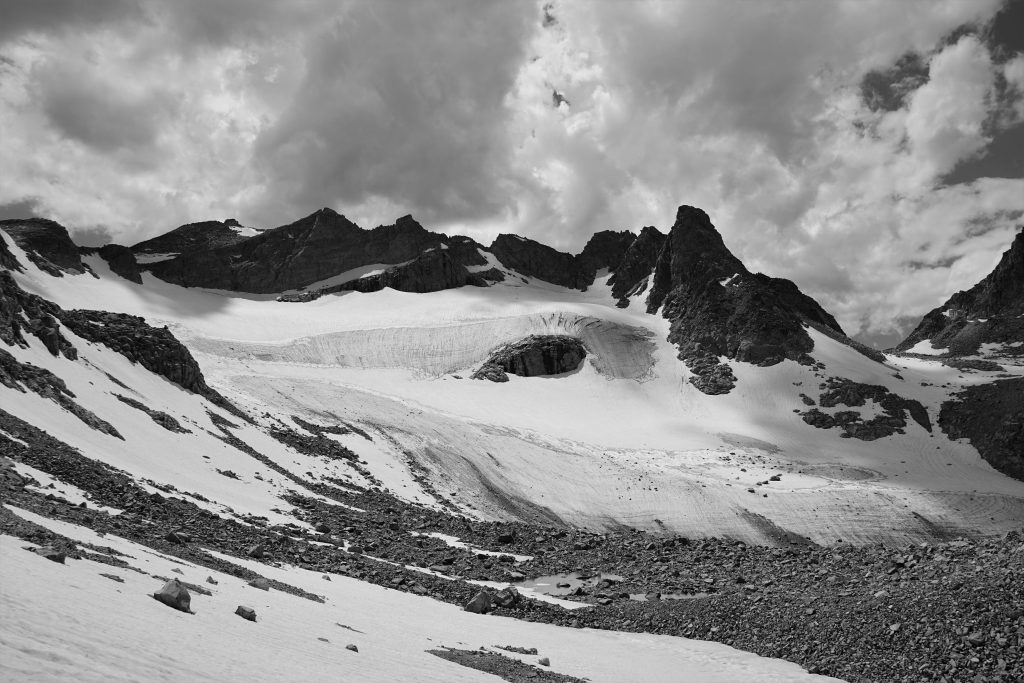
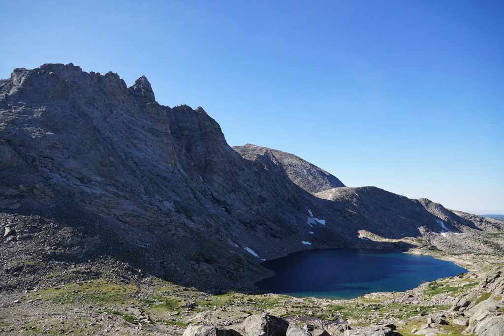
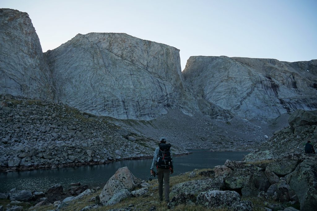
In the evening, I wandered by myself around the Dinwoody Cirque until the sun went down, finding glacial lakes, hidden camps, and marvelous views. This cirque has to be one of the most impressive alpine cirques in the lower 48. On nearly all sides, 13,000 ft peaks rise above you, glaciers and crevasses tumble into a ruin of rock of sand. The once massive Dinwoody Glacier has receded into half a dozen smaller glaciers, leaving behind a barren moraine wasteland. But in the soft evening light, the chattering streams and meltwater lakes seemed to come alive, like blood pulsing from the peaks above. Powerful places – that was the theme of the day.
Day 3: Dinwoody Camp to Alpine Lakes
After a calm night, we got moving and started over to Blaurock Pass.
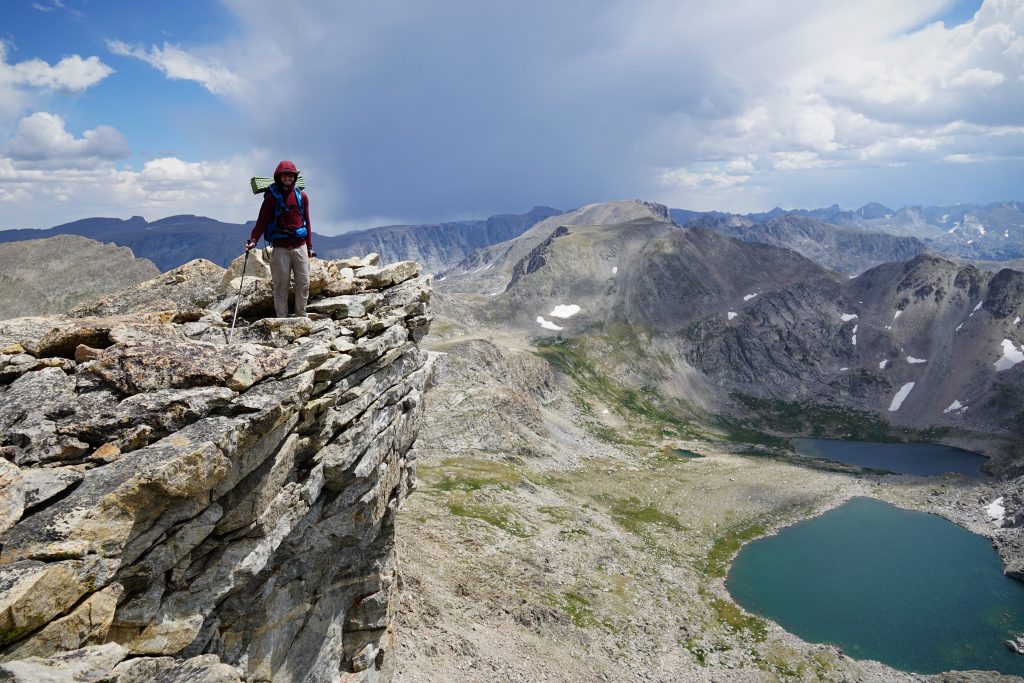
Blaurock Pass is the highest point on the high route, between the two 13k peaks that bookend the route. It was actually a rather pleasant climb on grass and small rocks.
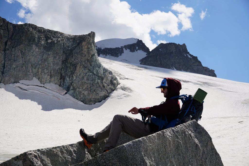
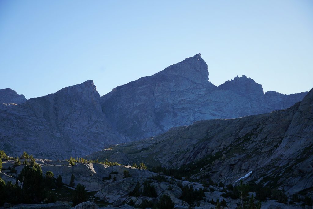
Logan had identified Mt. Febbas (13,468 ft) as an easy side trip with great views. It is one of the only 13ers in the range positioned off the crest, so you have great perspective of the entire northern Winds. We dropped our packs and made the easy class 2-3 climb to the flat summit.
I love mornings in the Rockies – bluebird, calm, relaxing.
Back at Blaurock Pass, we picked up our packs and continued downwards to the massive flood plain beneath the Helen Glacier.
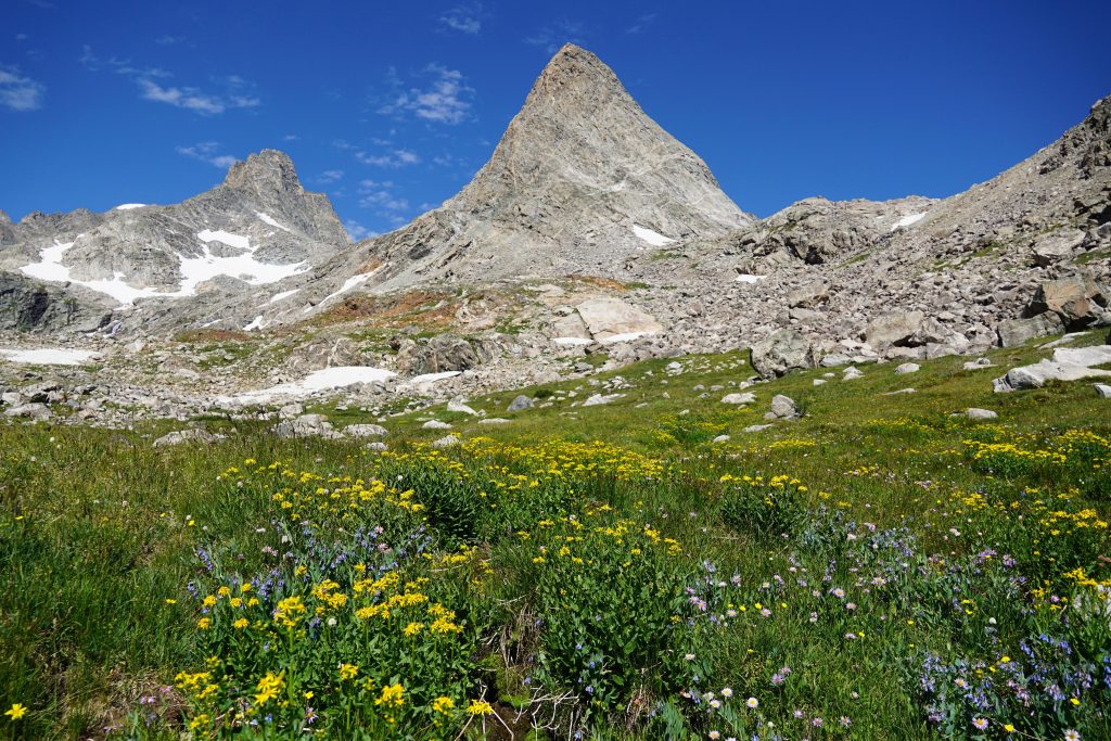
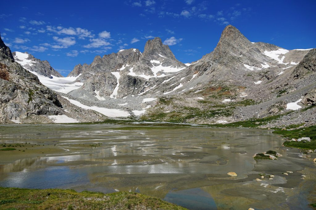
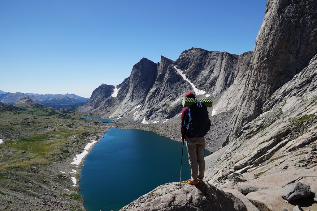
The floodplain was a wondrous sight: silty waters weaving through sand like a river delta meeting the ocean. Warren, Turret, and other dramatic peaks dominated the skyline behind. Despite the mosquitoes, this was one of my favorite spots all trip. It was just so perfect and fairytale like.
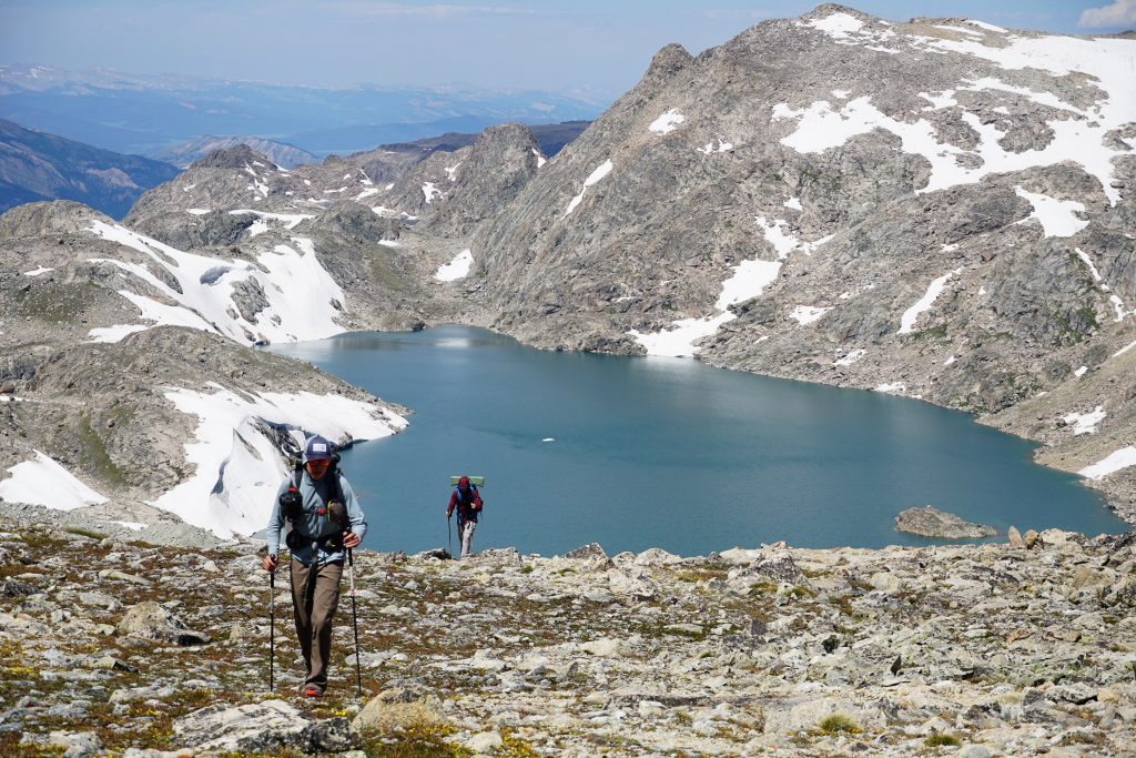
We followed the North Fork Bull Lake Creek as it wandered lazily down valley, transforming into turquoise pools.
After traversing high alpine plateaus, it felt rejuvenating to walk through beautiful meadows, feel the pulsing of the rivers, and gaze at the giants from their base. To me, a good high route both walks the skyline and marvels in the valleys.
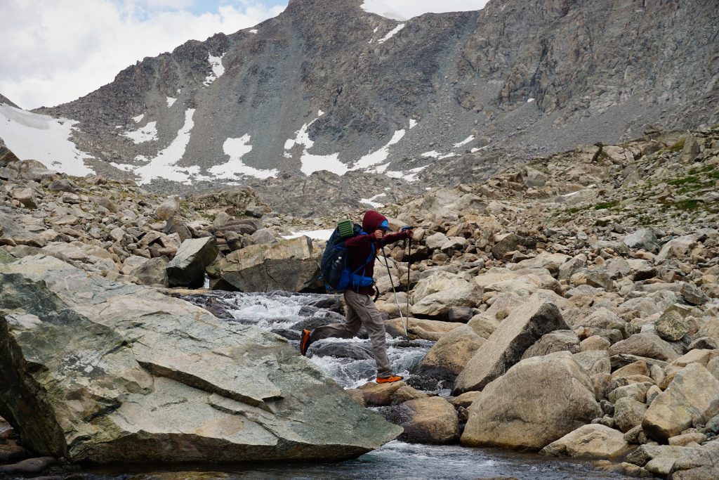
We crossed a small pass, passed a few parties, and then started up the South Fork Bull Lake Creek, another stunning valley. The river was very wide, making for some delightful extended boulder hopping crossings.
It is around here, from Indian Pass, that Adventure Alan’s route joins Skurka’s Route. Given the incredible scenery we had already seen, we were very glad to be doing the more “complete” WRHR.
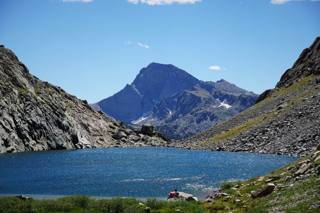
The wind was racing and storms approaching as we headed into the Alpine Lakes Basin. We were hoping to camp either in this lake basin or beyond the next pass, which was probably hours away. It all looked pretty rocky and exposed.
Joining the Adventure Alan route, we started to pass all kinds of parties. We passed a duo moving very slowly on the boulders and talked to multiple parties coming the other way. We took an informal poll of which high route people were doing. It was evident that Alan’s route is much more popular, likely because it is easier and shorter.
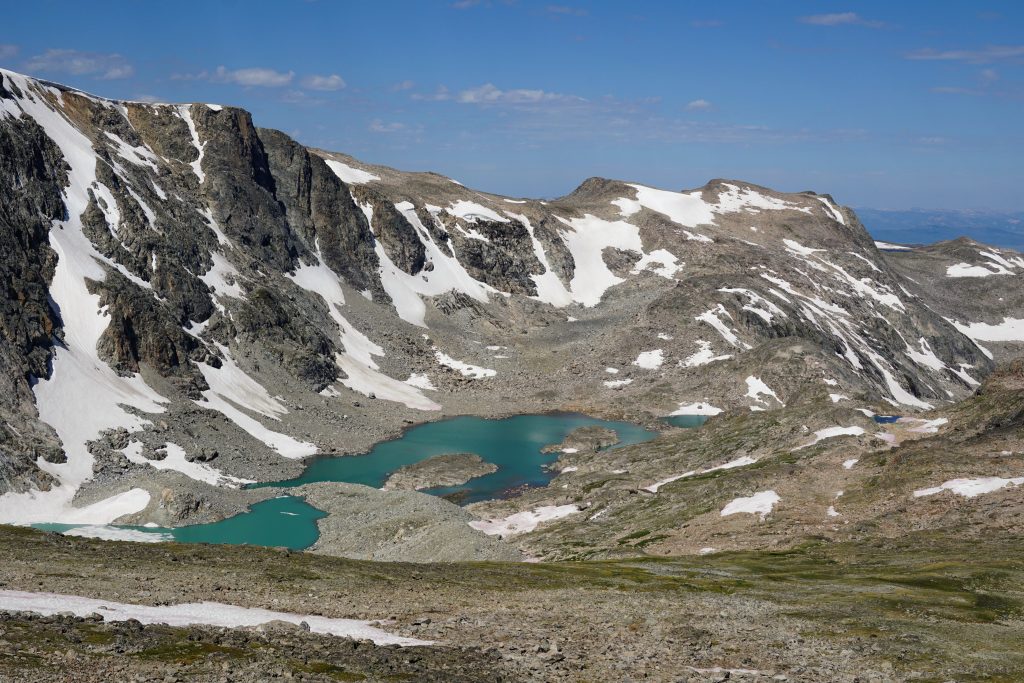
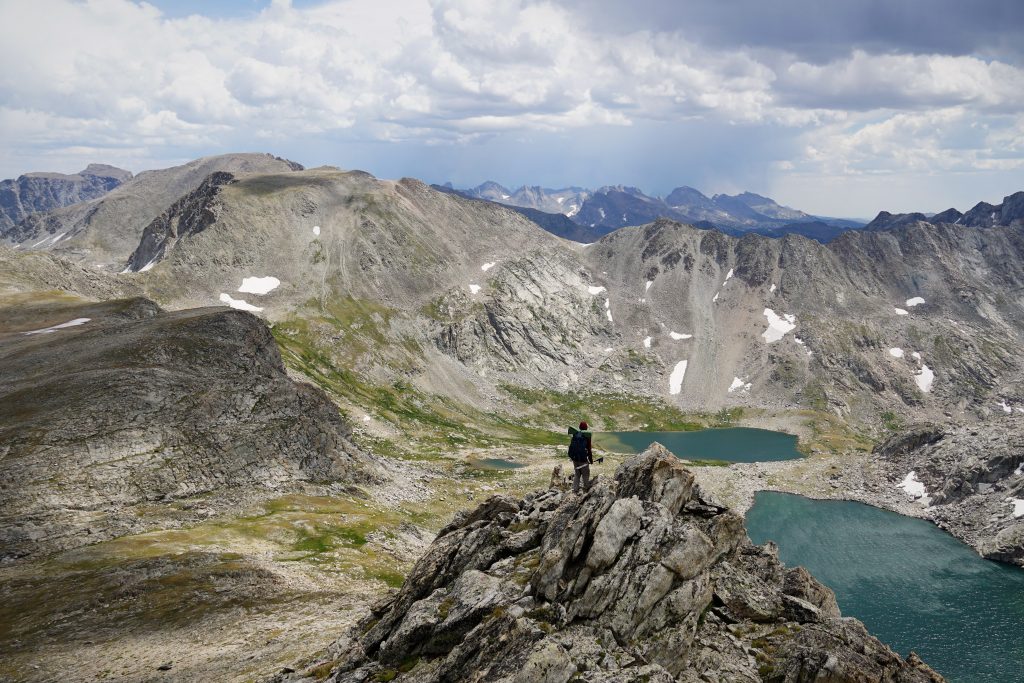
When planning a route in a new range, it is so challenging to know how difficult a section of terrain will be. This lakes basin looked trivial on a map, but was actually probably the slowest section of the trip. The boulder hopping is pretty relentless. The first lake is lined by cliffs on both sides, necessitating some scrambling (some of the only class 3 of the entire trip) up and down. Apparently we went the correct way because we ended up finding some cairns down class 3 ledges through the most difficult sections. It wasn’t anything hard to figure out, even without beta, but it was slow.
At the middle lake, we found some mostly flat ground that was possible for a camp with some excavation of rocks. We were surprised to find no developed camps in the entire lake basin, but other parties we had passed confirmed this was our best option. Given the raindrops starting all around us, we decided to call it here, another short day. I guess some of the beta most parties pay for probably also includes campsites.

It was very windy and cold all afternoon and evening, but the big rainstorms seemed to pass just to our south and north, once again dodging the worst of it. Maybe this wouldn’t be a repeat of the soaking Sierra High Route?
Day 4: Alpine Lakes to Middle Fork Lake
The wind didn’t die down all night, making for another noisy night. Add ear plugs to the list of essential thru-hiking gear.
We were eager to get moving and continued around the last lake towards Douglas Peak Pass. We saw another party going the other way around the lake. After the trip, we learned that Adventure Alan’s route goes this way. Given how the next pass would unfold, we cannot blame him.
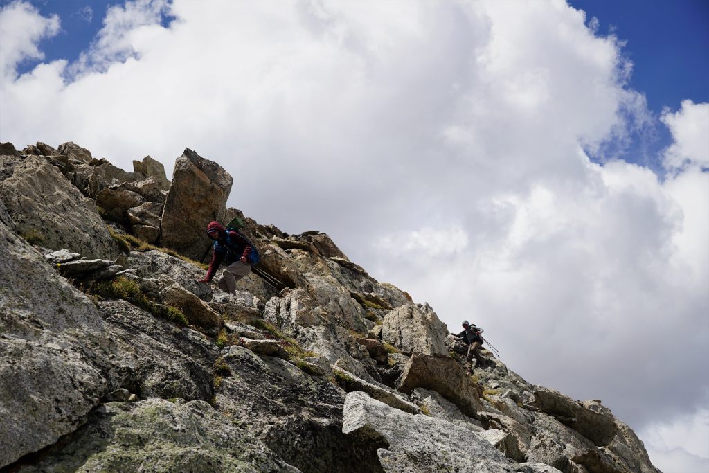
The climb to Douglas Peak Pass was quite loose and frustrating, so we spaced out to stay safe. Unfortunately, the descent down the other side was even worse! We went one by one and still were kicking off big rockslides, sliding out on our butts. The choss here was worse than the entire Sierra High Route combined! We started referring to this pass as “Ass Pass”. In fact, I’d encourage you to sign this petition to rename Douglas Peak Pass to Ass Pass.
The pain didn’t stop there, as getting around the next lake was annoying and complicated with some slick snow. If you’re not tied to taking the highest route, I’d definitely consider Alan’s route here to circumvent this terrible pass.
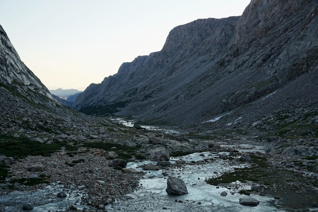
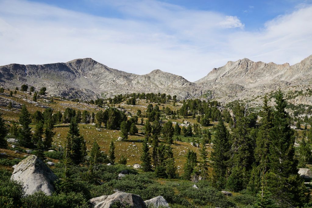
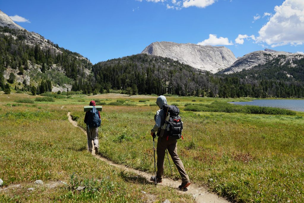
We picked up a faint trail down towards the Golden Lakes. This area is extremely remote so these trails don’t see a lot of traffic. It reminded me a lot of the Sierra, trying to follow these nondescript trails through pristine forests and lakes. After 3 days of relentless alpine terrain, it was nice to be back in the subalpine forests.
Next, we began a long, gentle climb to the summit of Europe Peak. The climb looks long from below, but you can only actually see a third of it. The terrain aligns perfectly for this gentle climb through grassy meadows, subalpine tundra, and finally high boulder plateaus. Travel was fast.
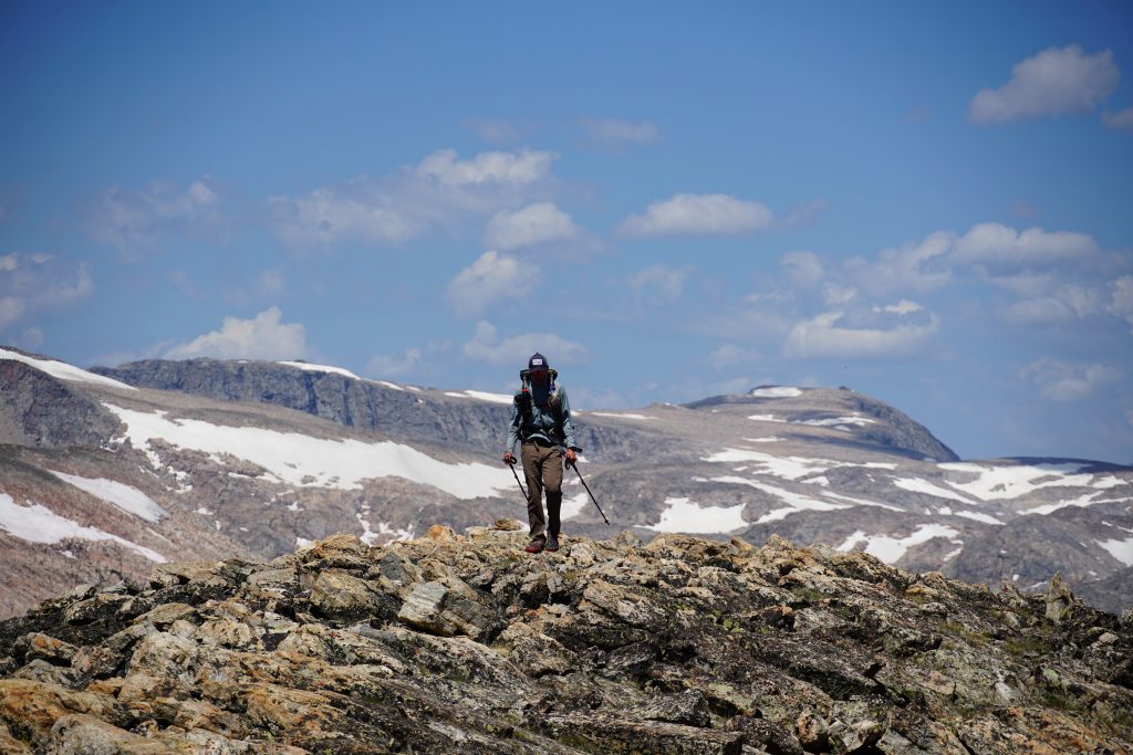
The final few miles to Europe is much like the section after Downs Mountain: easy boulder walking right on the Continental Divide. It was the first time in 20 miles or so that we could see Gannet and Co. and they appeared surprisingly distant.
The wind was absolutely ripping and storm clouds were abundant. We got some intermittent hail, but once again seemed to dodge a bullet and sneak right through in between all the storms.
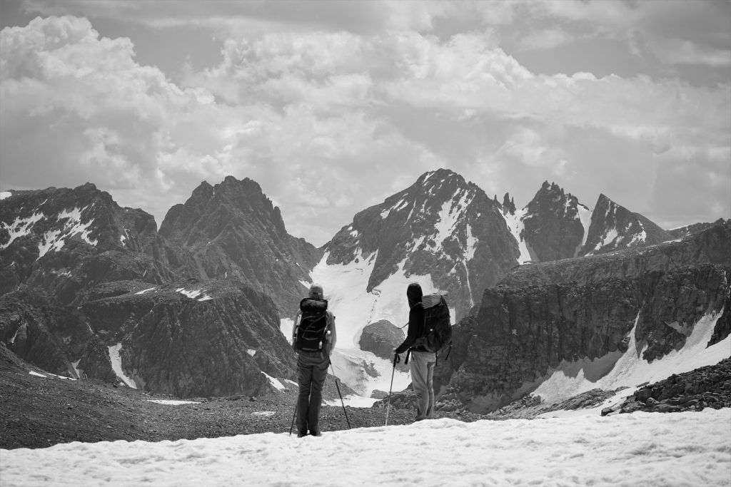
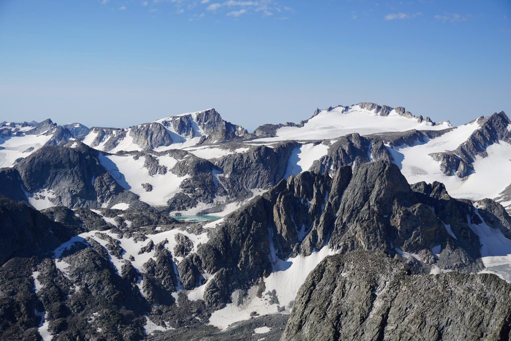
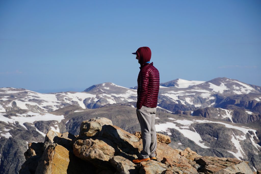
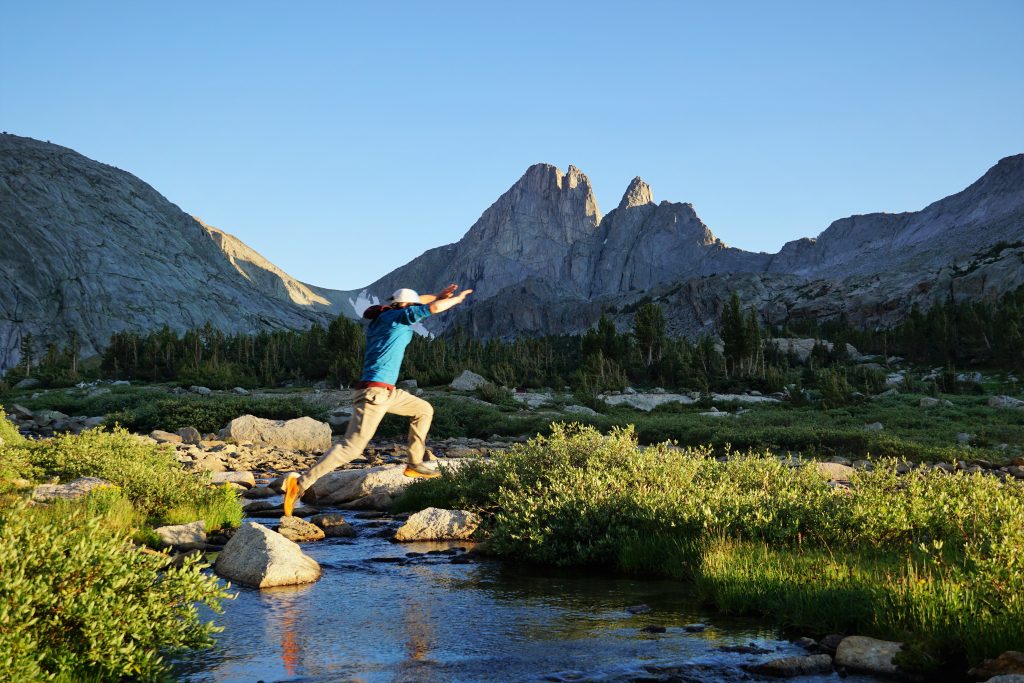
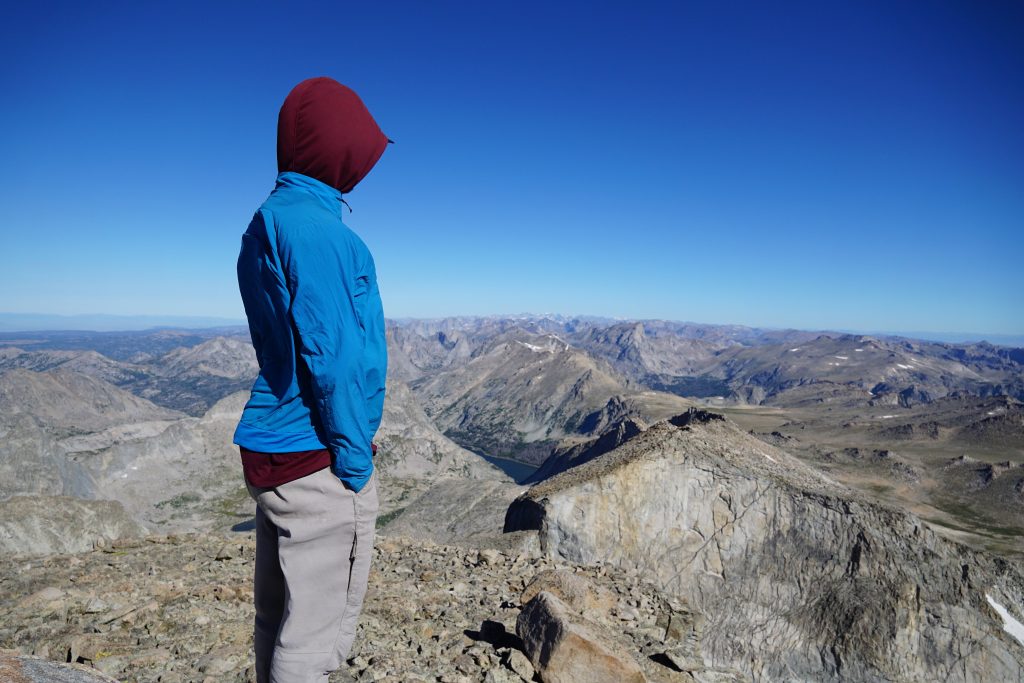
We arrived on the summit of Europe with a perfect little blue hole in the sky above us. The south side dropped off in a vertical cliff. Situated perfectly in the center of the range, we could see nearly the entire high route, from Gannet in the north to the Cirque of the Towers in the south.
We knew nothing about the descent of Europe Peak, but we did recall that some high router going the other direction thought it “might be interesting” for us. Indeed, it was a little interesting, naturally finding the knife edged ridge that led us down, with a little class 3 on superb rock.
Down at the pass, the rain began once again and we put away our cameras and battered down the hatches. We decided that going over the next high pass towards Hall Lake would not be a safe decision in afternoon thunderstorms so we planned to take an alternate route just north of Medina Mountain. Unsurprisingly, this turned out to be Adventure Alan’s prescribed route.
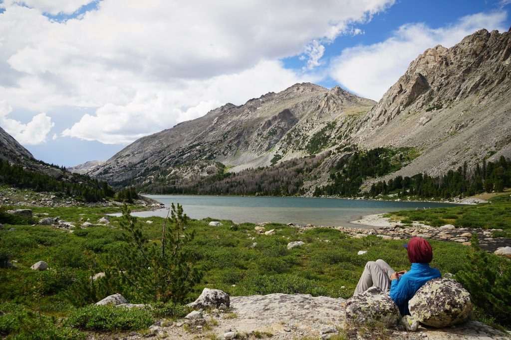
The terrain as we traversed over to Middle Fork Lake was typical subalpine Winds: hummocky, complicated, and varied. But we enjoyed the change of pace, walking through little meadows and tree patches as it drizzled and fizzled above us. After a long traverse, we emerged into a meadow above Middle Fork Lake just as the sun finally came out. The yellow-green grass, well placed boulders, whitebark pines, and granite ridgelines felt so Sierra like.
We were all a little tired when we reached our camp at Middle Fork Lake. This day was nearly 20 miles and the only day where we were on the move for over 10 hours. But it was well worth the push to this beautiful gem.
Day 5: Middle Fork Lake to Shadow Lake
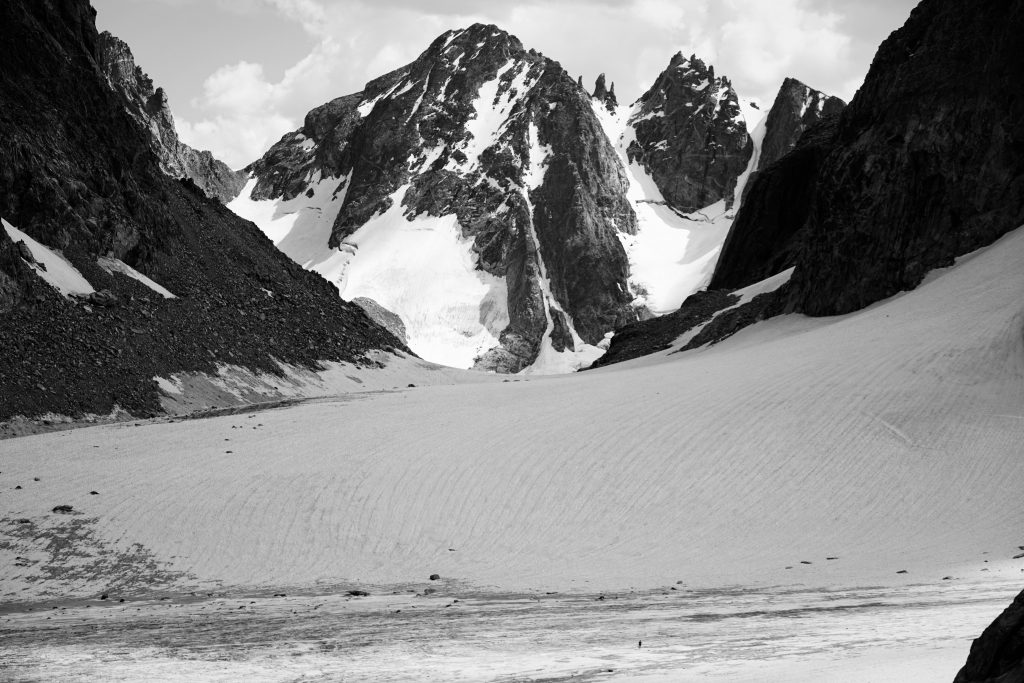
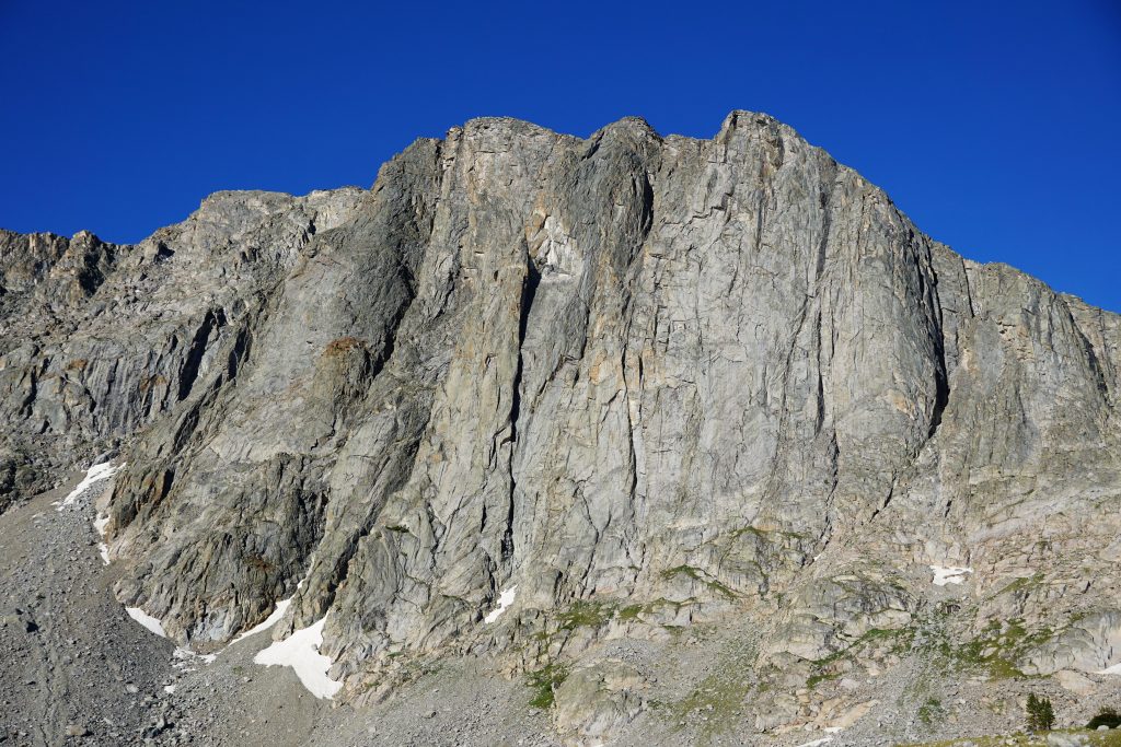
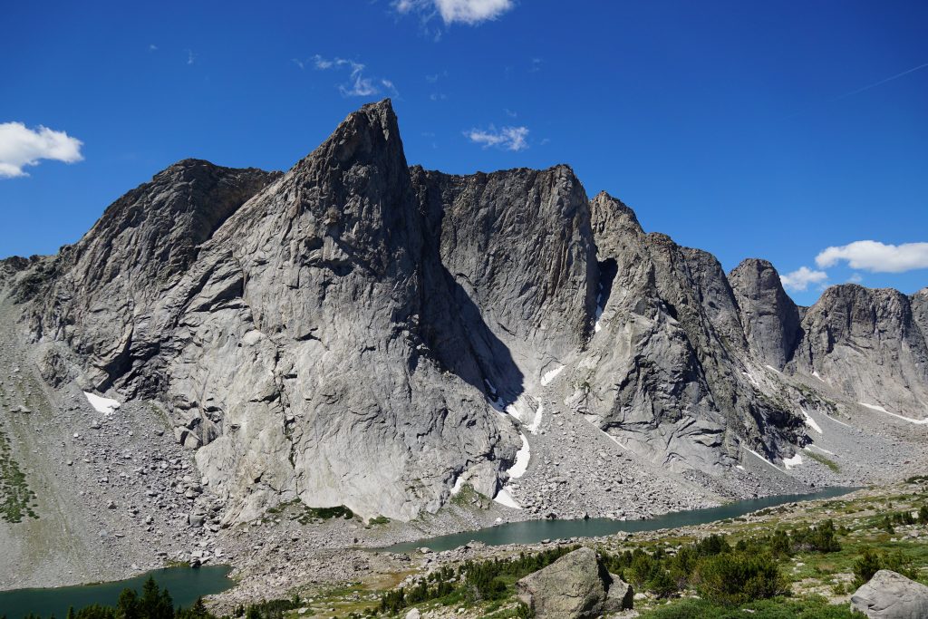
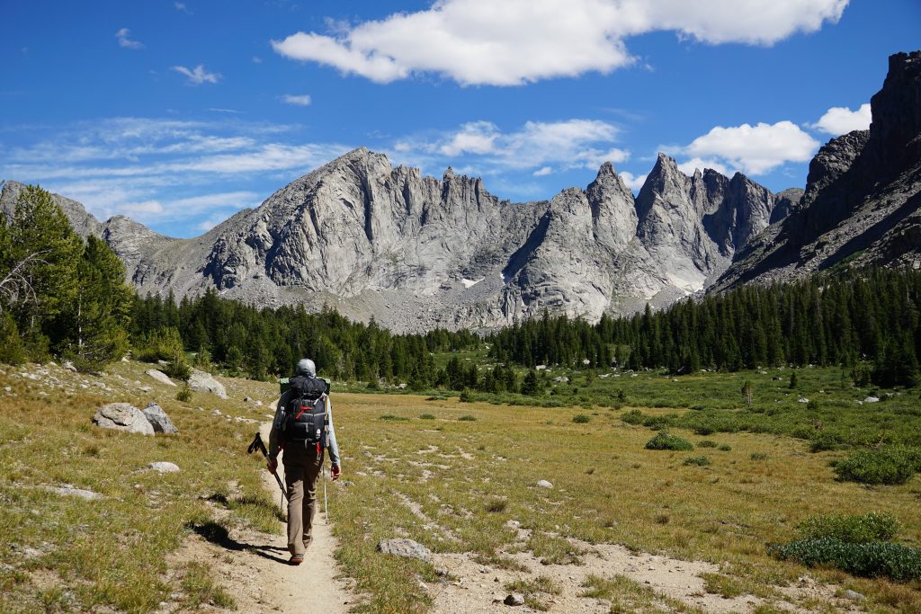
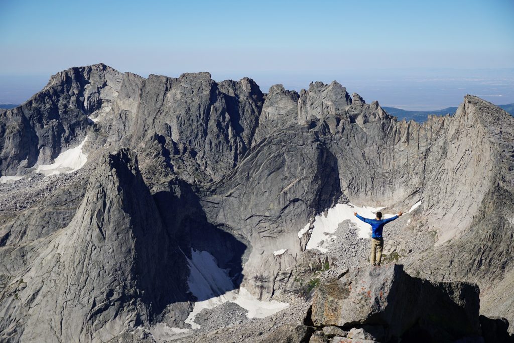
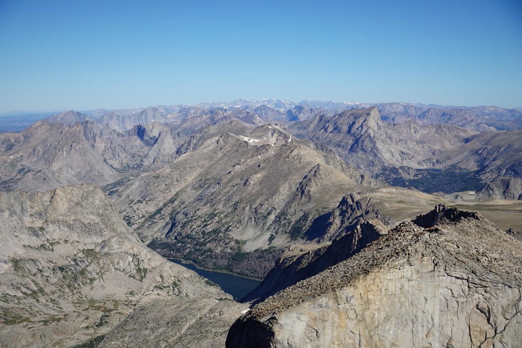
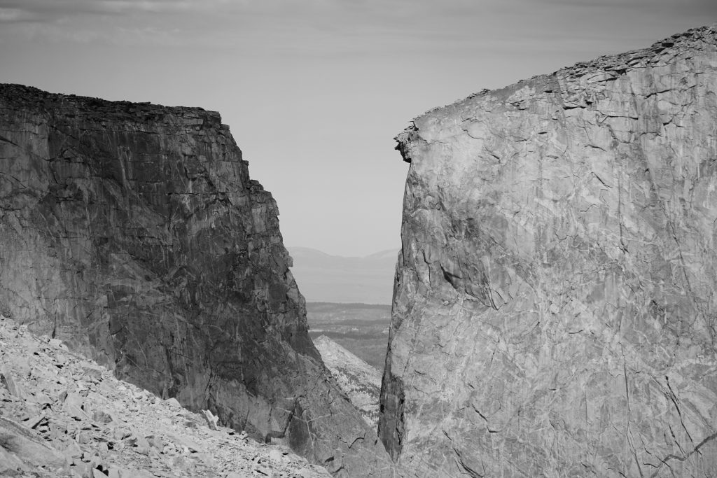
This was the big wall day. The Central and Southern Winds have some of the steepest and cleanest granite walls anywhere, and we were about to get up close and personal with a few.
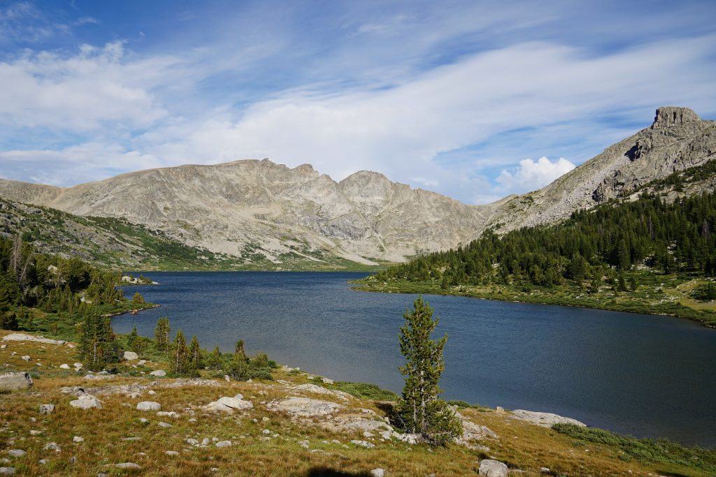
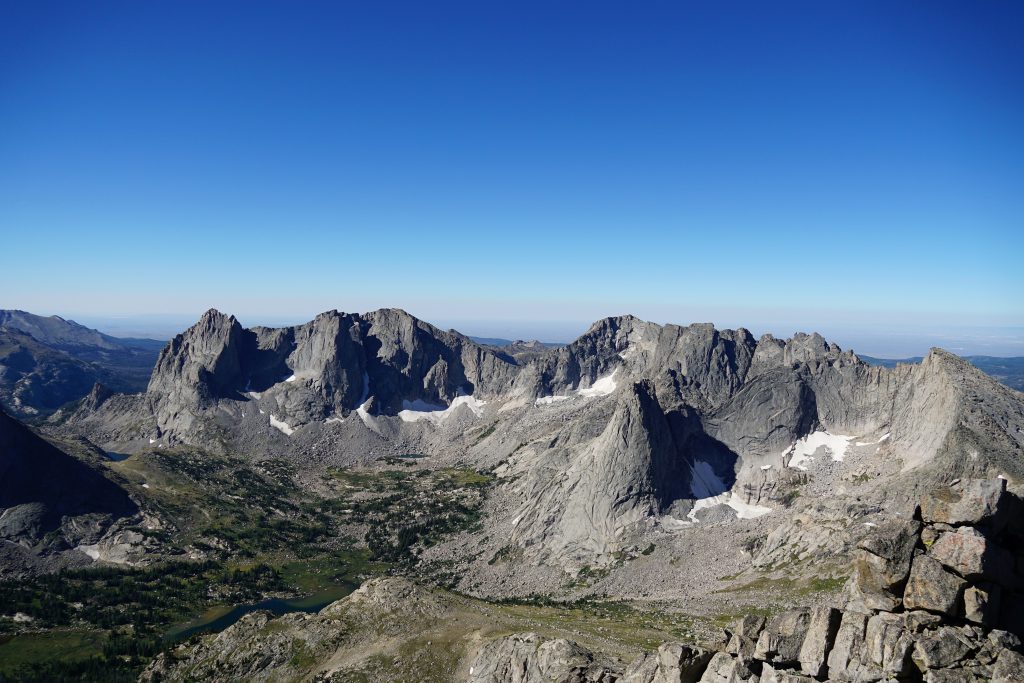
We rounded the corner of Middle Fork Lake and entered a stunning valley with vertical walls on three sides. Gone were the boring, unoriginal names like Middle Fork Lake and Alpine Lakes. Here, we stood below Nylon, Pronghorn, and Dragon Head, inspiring names for a truly inspiring setting.
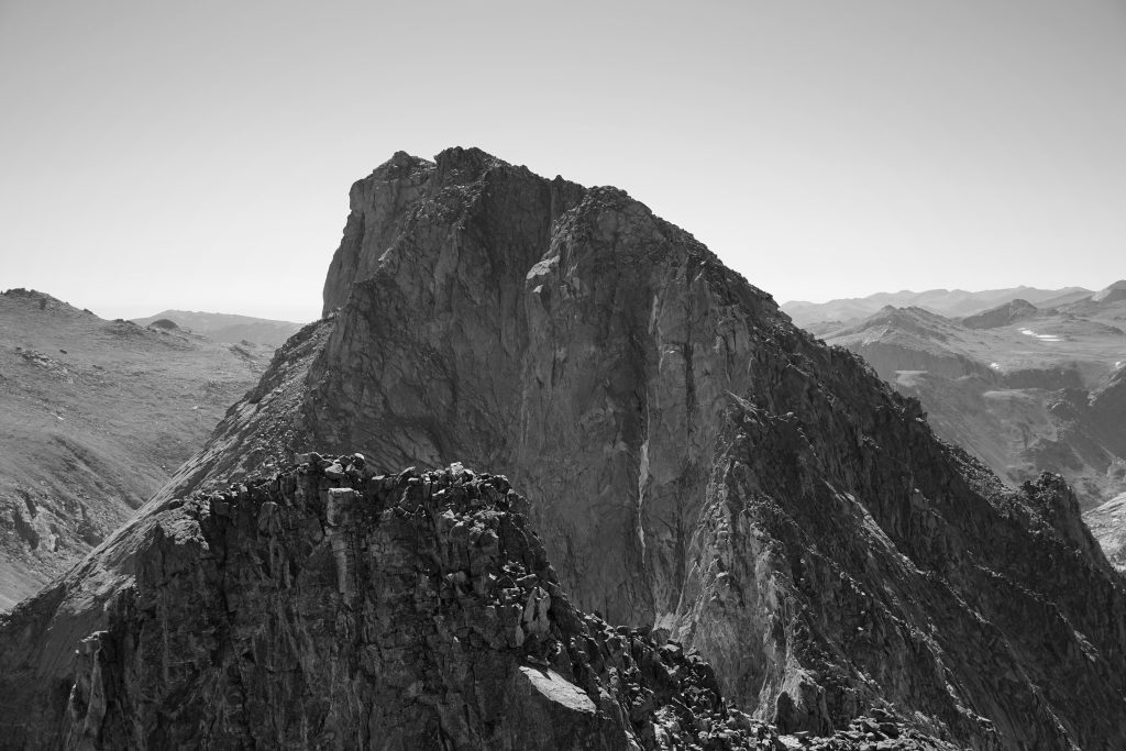
Pronghorn Peak has a thousand foot vertical face directly above Lake Donna. It was marvelous to stare up at the face and imagine free climbing up such a steep, relentless face, but I would guess it has been done.
We rolled over the pass and down into Bonneville Basin.
At the next pass, we encountered three other parties. There was a group of young men from the east coast, heading north on the high route, wide eyed and fresh to the range. There were two older gentlemen, wise-ass and well traveled. It was good fun to chat.
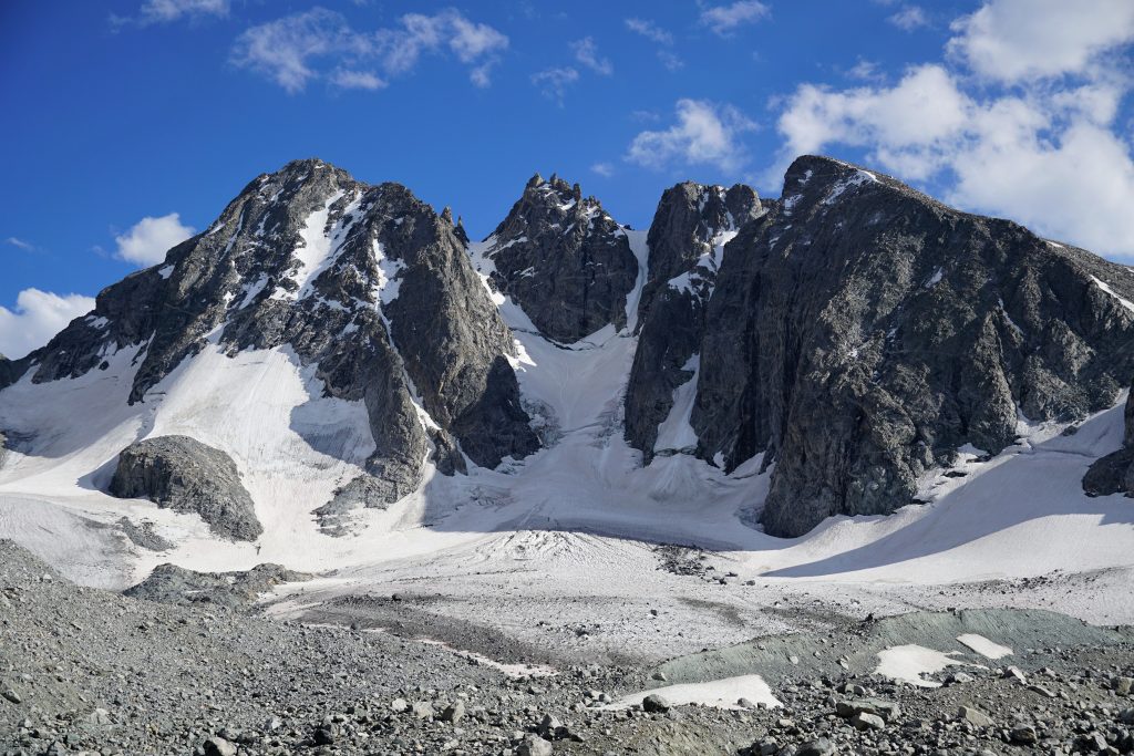
The next valley had some incredible big walls on Raid Peak and Ambush. Hooker was just across the valley, but we were on the wrong side to see its legendary north wall.
Instead of taking a direct line to Pyramid Lake, we wandered down to the beautiful lakes at the base of Ambush for a lunch break and swim. The slabs cut almost all the way down to the lake. That’s one of the beautiful things about alpine rock climbing in the Winds – no thousands of feet of choss to get to the base of the route.
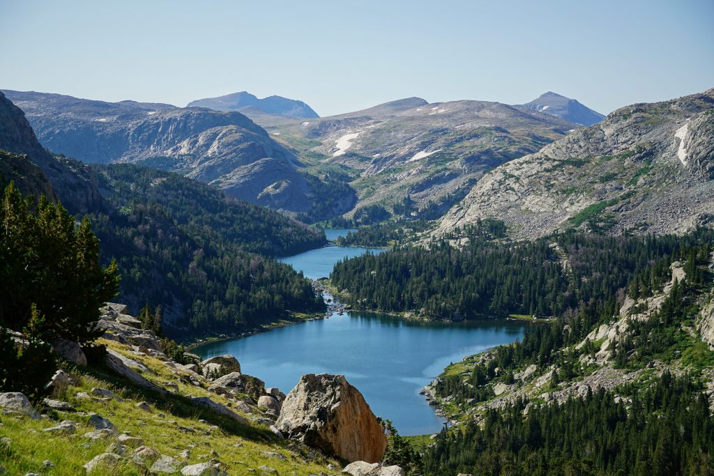
At Pyramid Lake, we found ourselves on the first well defined trail since the start of the trip. By the time we were at the Shadow Lake Trail, we were almost done with our day and way ahead of schedule.
There were dozens of people doing the classic Cirque of the Towers backpacking loop. It was an interesting mix of people with super expensive ultralight packs (never saw so much Hyperlite Mountain Gear) and fishermen-types with very traditional gear. We met one solo guy who we chatted with for a while about ultralight gear and his experience on the AT. We were in no rush at all, so we kept the conversation going. After about 15 minutes, when he must have felt he had properly sized us up, he asked “Do you have any weed?” We disappointed him.
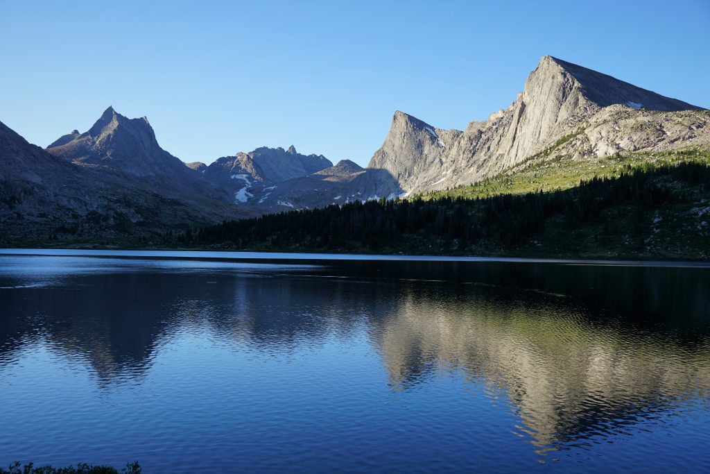
The hike to Shadow Lake was very boring and we reached camp in the early afternoon, finding a nice, wind-sheltered site. We spent the afternoon lounging and telling stories. I stared up at the back side of Wolf’s Head, trying to puzzle how Kylie and I descended off that side when we climbed it two years ago. It looked pretty darn vertical, but I remember traversing and scrambling mostly, with a few rappels mixed in.
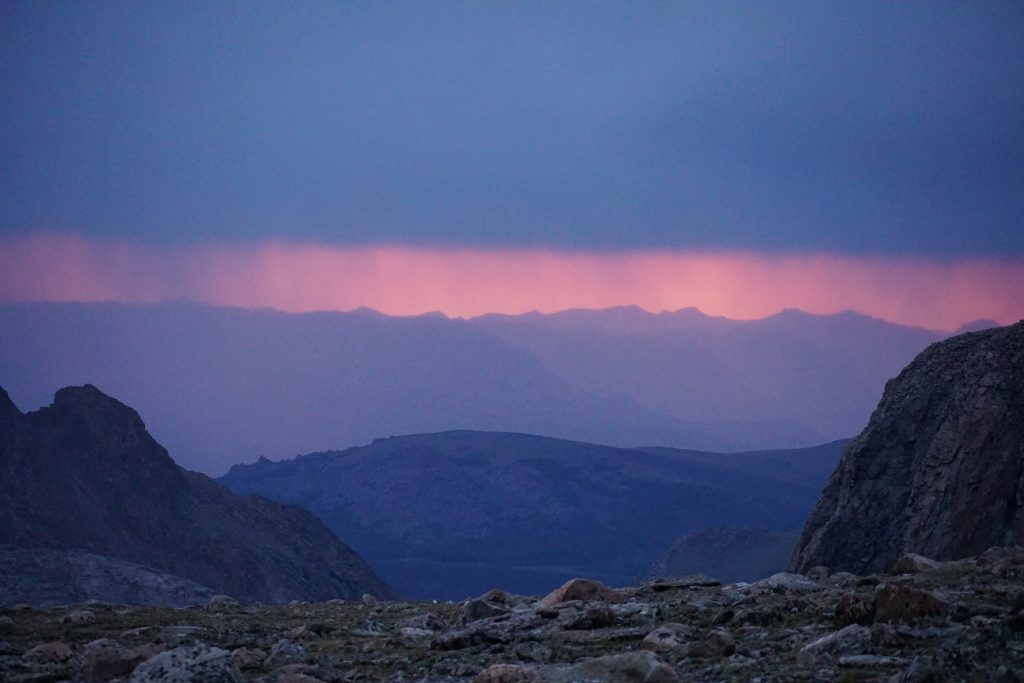
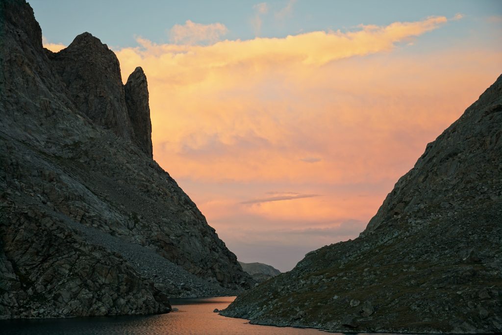
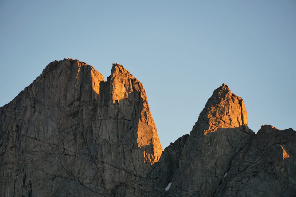
Shadow Lake has a NE aspect, perfect for lighting up the spires at sunset. Finally, we got a clean sunset, with golden light. The Cirque of the Towers lit up beautifully.
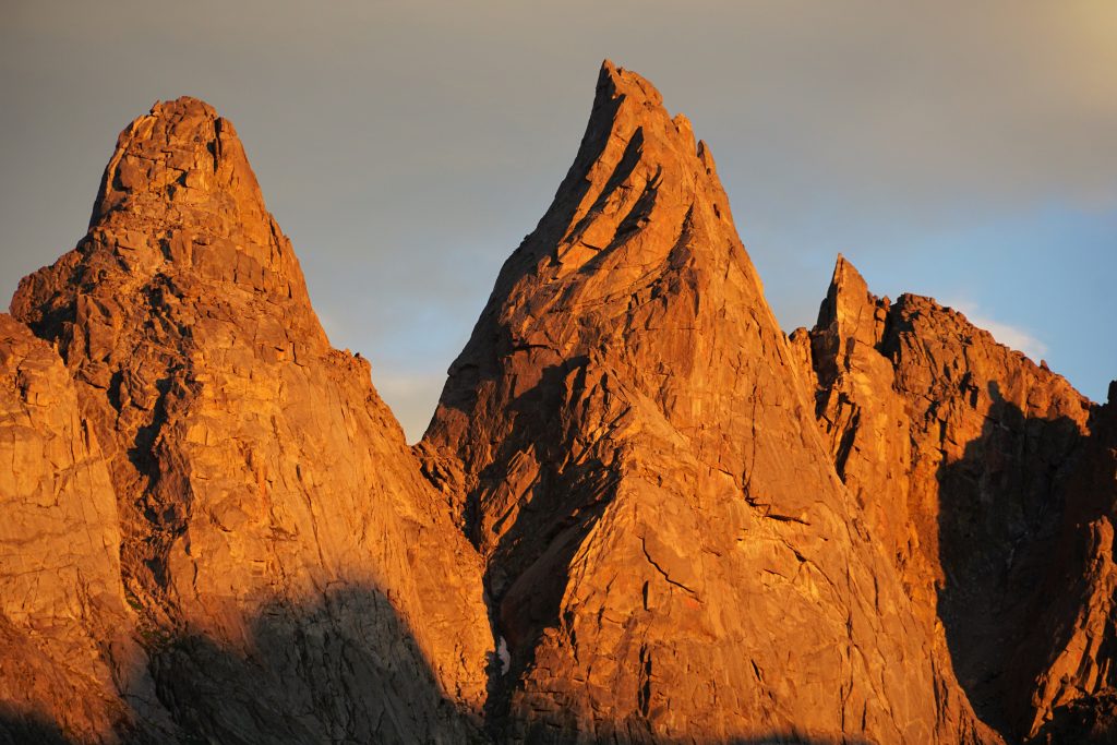
Just when we thought the show was over, the clouds behind became lit underneath in hues of purple, pink, orange and blue. It was quite the encore.
Day 6: Shadow Lake to Black Joe Lake
The day began in confusion. All maps show the trail towards Texas Pass starting before the turnoff to Shadow Lake. However, we walked backwards and found no alternative trail or even turnoff. We began to wonder if the trail simply continued along the shore of Shadow Lake. We searched hard and found a multitude of social trails but nothing definitive. Others we passed were also confused. So we just buschwhacked in the right direction and eventually picked up the trail. Then promptly lost it. Then found it. Then watched it fade slowly, only to join another more defined trail. You get the idea…
Texas Pass is feared by backpackers because there’s no maintained trail through it. I’d compare it to Aasgard Pass, except obviously much shorter.
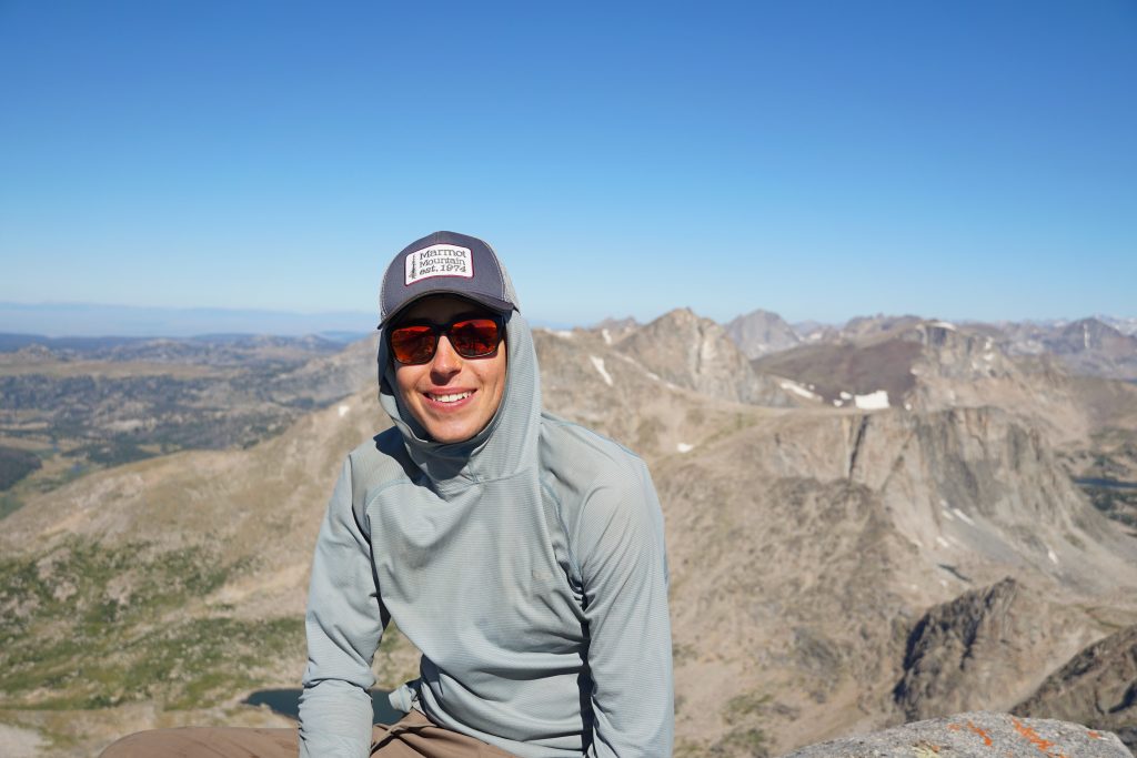
This day was going to be really short, so we figured we would try to get up Camel’s Hump just east of the pass. Judging by its position on the map, I thought it might have an epic view of the Cirque of the Towers. Logan took a break while Sam and I headed up.
I didn’t really know anything about the route. It looked kinda steep and slabby, but we improbably linked class 2 ledges on the right side all the way to the summit. We ended up following cairns, so I guess we went the right way.
There are actually two summits of Camel’s Hump. It appears most people stop at the lower, first summit, but we continued to the higher one.
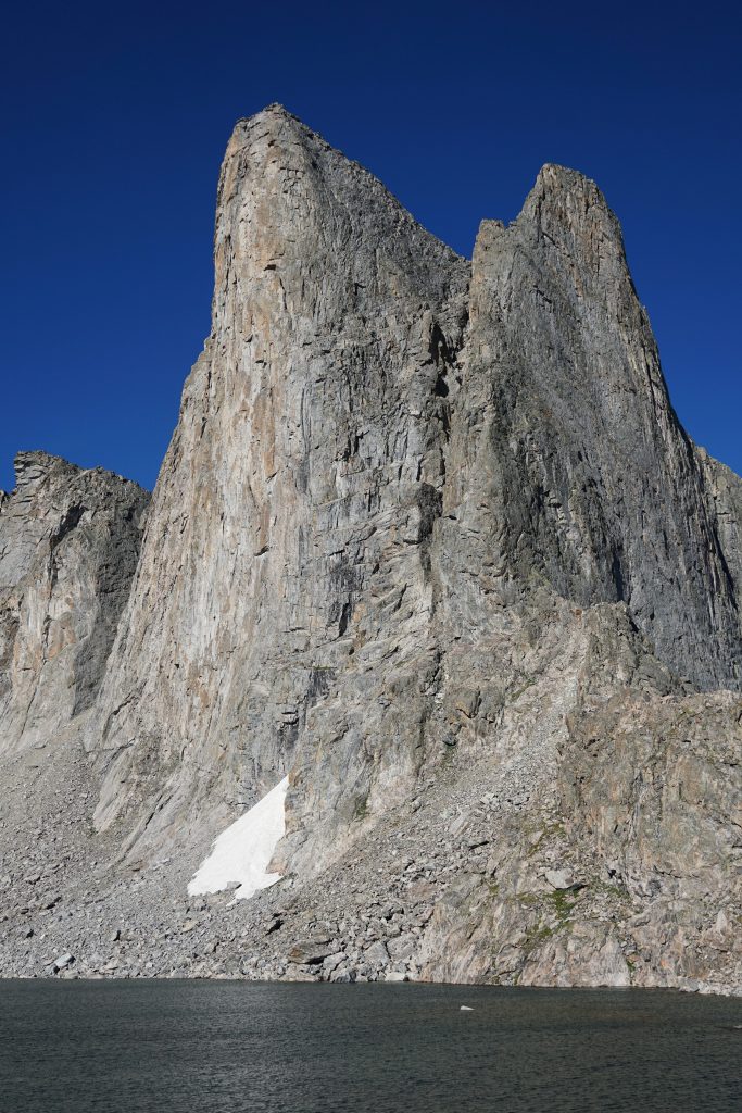
The position of Camel’s Hump was stunning. We had a perfect view of the Cirque and could see the entire Cirque Traverse. I could pick out nearly the entire NE Face of Pingora, which Kylie and I climbed two years ago. We could see the E Ridge of Wolf’s Head, another classic we did. All around us, vertical granite walls cut through the grasslands. Classic Winds.
I had to scramble to the lower summit while Sam stayed on the higher one. The shot was simply calling to us.
Back at the pass, we picked up Logan and headed down to Lonesome Lake.
The trails through the Cirque of Towers are a complete mess. We tried as hard as we could to stay on “the trail” but inevitably our trail would fade out and we’d join a bigger trail. In some places, it seemed there were 10 different use trails that went to the same place. It’s sad to see because it is so easy to fix – the decide on an official trail, put sticks or rocks to indicate that the other trails should not be used, and consolidation will occur – but the forest service here in Wyoming must have no resources. They’re simply not used to hundreds of people per day converging on the Cirque of Towers. I hate to say it, but they really need permits in this part of the Winds. I’ve never seen such a place overrun, not even the Enchantments.
At Jackass Pass, we once again encountered two nice ladies who we had camped next to at Shadow Lake. They were considering camping their last night at Big Sandy Lake but realistically could be back to their cars and eating real food by dinner. We helped them make the decision to hike out that night. Then we asked them if they had any “dead weight” – food they would not be able to consume since their trip was now one night shorter. We scored an extra dinner and some trail mix!
Once we turned off to Black Joe Lake, we said goodbye to the hordes of backpackers and it started to feel like the WRHR again. We went around the right side of Black Joe, which was a complete pain. I’d definitely recommend the left side.
We wanted to make our last day as short as possible, but had learned the value of a protected camp, so we camped in some trees at the end of Black Joe Lake. Even when the wind was howling, our tents hardly wavered. Bingo.
We watched storms race by and somehow mostly miss us again. We did get a half hour or so of harder rain, but once again, it seemed like we missed the worst of it. The Winds really tested us the first night, but they relented for the rest of the trip. The mild weather is part of why each day felt so short – there was no hiding out in caves from lightning or scrambling over ice covered boulders like on the Sierra High Route.
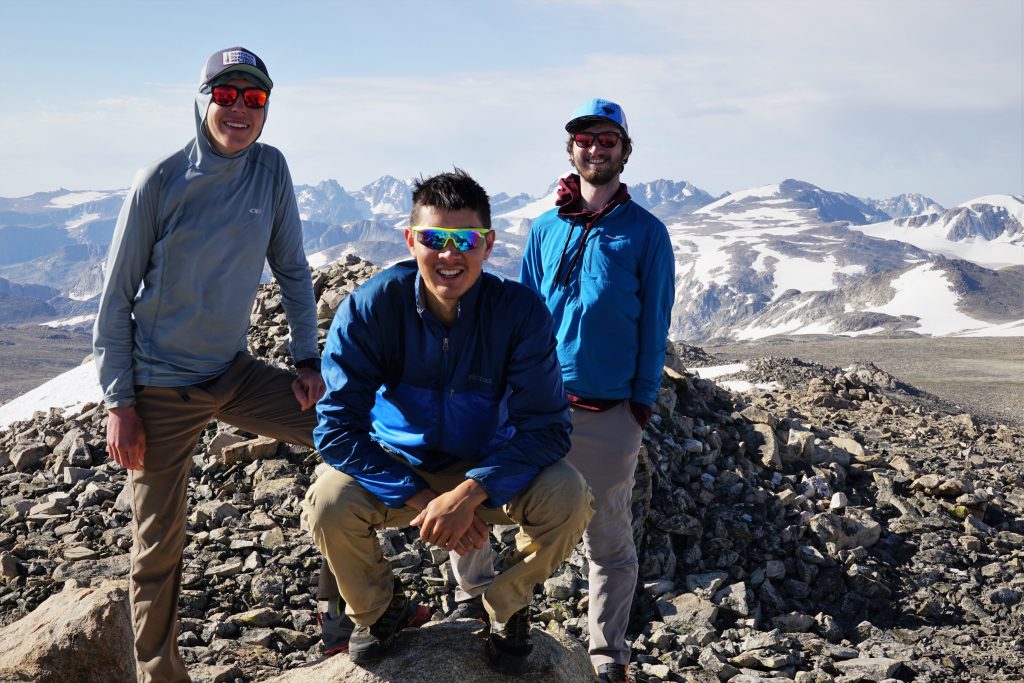
I don’t think I have ever spent so much time lounging at camp before this trip. Really, I didn’t mind. As I’ve been getting older, I’ve lost the need to go all out all the time. I’ve realized that so much of what I treasure about these trips is simply spending time in beautiful places with awesome people. I couldn’t ask for better company on this trip – one new friend, and one old friend.
After dinner, I heard Logan yelling, “I caught a fish!” I grabbed my camera and raced over and snapped the shot.
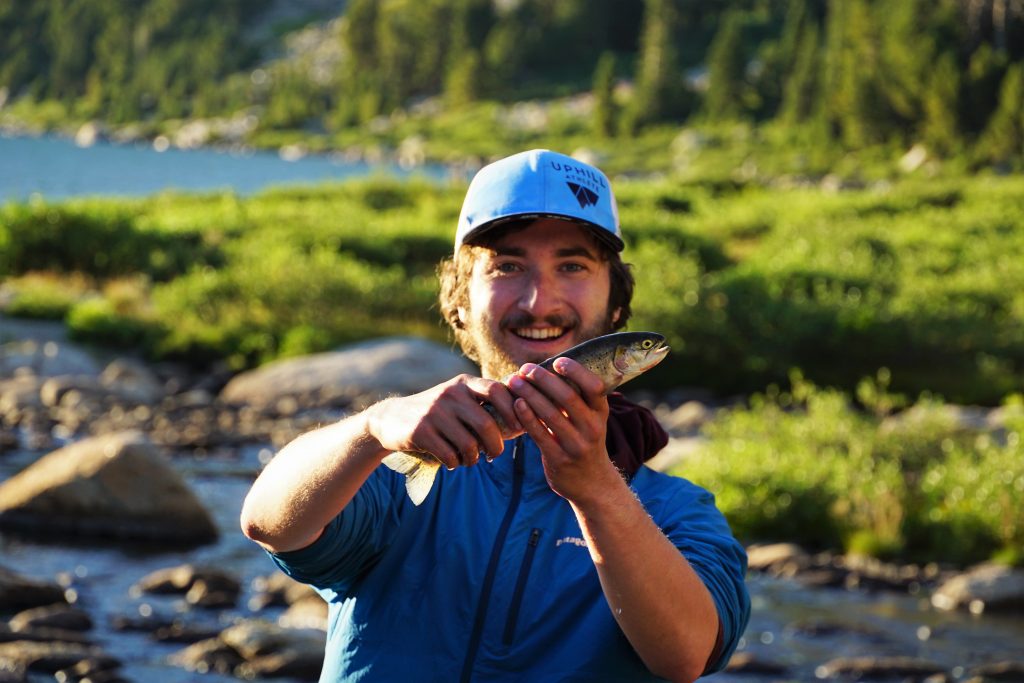
Logan released the fish immediately, but the image of his face, shocked as much as happy, sticks in my mind more than anything this trip. Catching a fish with his bare hands – it was just so ridiculous, so spontaneous, so Logan. We don’t get to spend as much time together these days, but the quality of time has never been greater.
Day 7: Black Joe Lake to Sinks Canyon
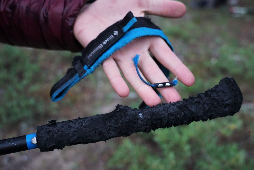
Ever since the goat incident in the Beartooth, I’ve been a light sleeper and hyper aware of any sounds outside of the tent. Partway through the night, I heard some movement and vague gnawing outside. But the first few times I poked my head out, I never saw any creature. The third time I went out, I shined my headlamp and found a creature investigating our Ursack (food bag). It took me a moment, but I realized it was a porcupine! So I kept my distance and eventually got it to move on with some noise and lights. It slinked away slowly, obviously not threatened by us.
When we were packing up the next morning, Logan and I found that our trekking pole handles had been eaten! I then remembered that porcupines eat rubber – that’s why people surround their car tires with chicken wire in the Bugaboos.
Logan and I penned a poem:
Porcupine, oh porcupine
On my poles, why must thou dine?
There was a solo woman camped nearby, but she had fortunately not suffered the plight of the porcupine. She was heading the other direction on the high route, so we wished her good weather and started up the valley.
At the highest lake, there was a camp with a trad rack laying outside, presumably belonging to some big wall climbers. I think any climbing on these walls beneath Wind River Peak is likely rare, but the walls are huge!
Since we didn’t pay for the expensive beta, we weren’t actually sure where the west gully of Wind River Peak was. We thought it would be obvious, but there were multiple options, and none of them looked particularly appealing. We ended up hiking up the moraine basin to the head of the valley before turning left and climbing up that hidden gully.
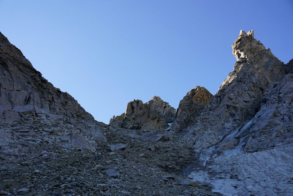
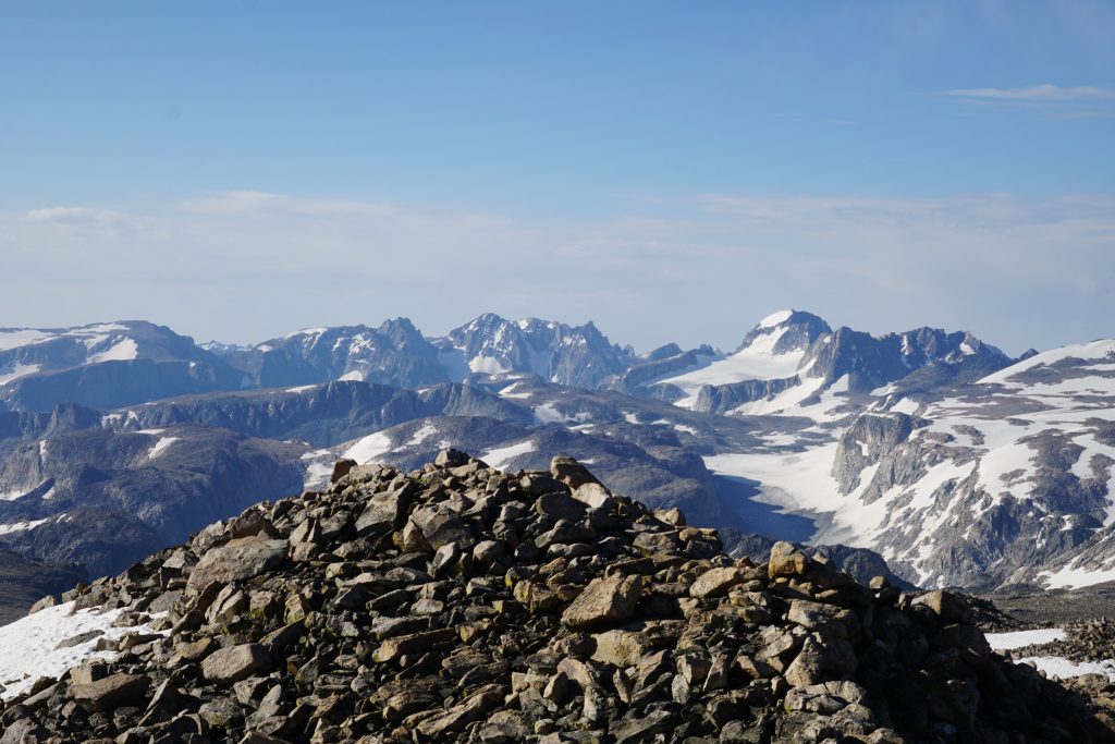
The gully was about as loose as “Ass Pass” and a bit longer. It was probably the worst part of the high route and we moved one by one to avoid hitting each other with rockslides. But finally, we reached the top of the gully and the huge plateau of Wind River Peak. It felt great to enter the warm morning sun with all the difficulties of the WRHR behind us.
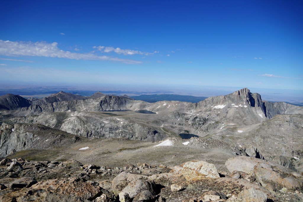
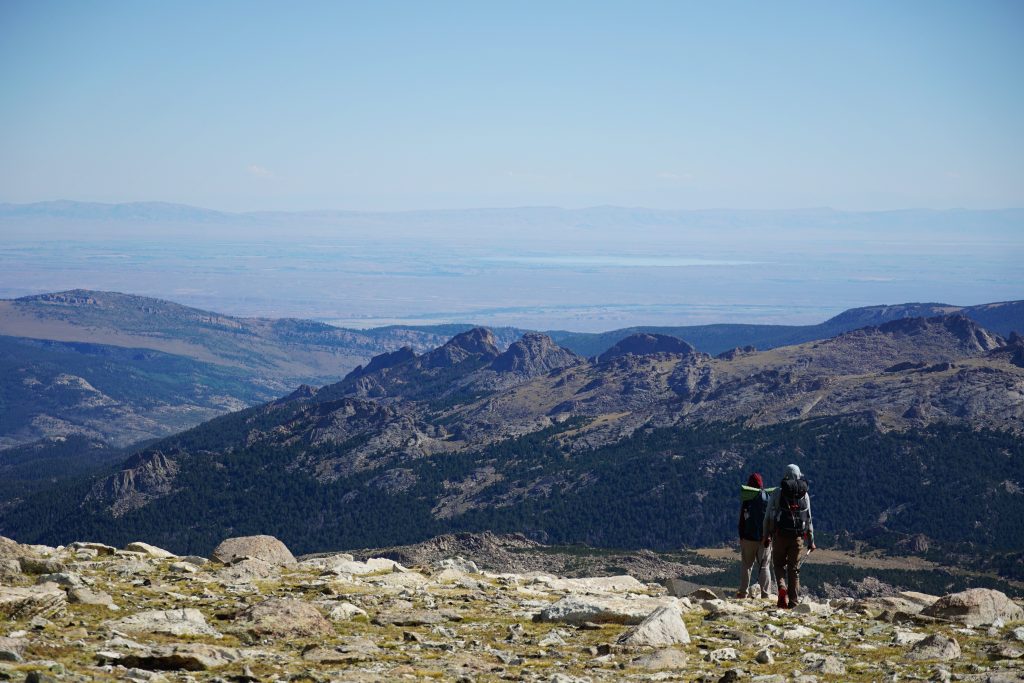
The southern end of the range was clearly visible, with only flatlands beyond. This is the end of continuous mountains all the way north to the Beartooth. Together, this compromises the Greater Yellowstone Ecosystem, one of the wildest and most beautiful landscapes in the country.
I have to hand it to Skurka – starting and ending the high route with 13ers is very aesthetic. From Downs Mountain, we got a preview of the adventure and here on Wind River Peak (13,197 ft), we got closure.
Once we departed the summit, it was just an ungodly long, flat grind to civilization.
The high tundra slopes were moderately enjoyable, but we could see how far away the desert fields of Lander were and knew we had a long ways to go.
Once we reached the trail, we entered some of the most mind numbing forests known to man. I guess I take our beautiful Cascade old growth forests for granted. This one was shades of grey, dry, dusty, hot, and dead feeling. We even walked through an area still smoldering from a campfire gone wrong. Luckily some smokejumpers were on it and putting out the embers. We would have been hearbroken to have to turn around the reverse the high route!
By the time we descended into Sinks Canyon, the land of high tundra, sparkling lakes, and steep glacial cirques was far behind us. These are the memories and photos we take from this magical place – a week in the Winds.
Reflections
I think this is the most completely enjoyable trip I have ever done. There wasn’t really any Type 2 fun; it was just all relaxing and real, Type 1 fun. Our 7 day schedule made for relatively easy 8-10 hour days of hiking, plenty of side trips, and allowances for bad weather. We could have gone a few days faster, but with this special of an experience, I didn’t want to rush it. Who knows when I’ll get to come back?
As a route, the Wind River High Route is remarkable because of how consistently alpine and beautiful it is. I thought the challenges were greatly overhyped – mile for mile, the terrain is easier than the Beartooth, the elevation changes are less than the Sierra, and there’s just minimal bullshit, unlike the Cascades. Passing a few parties every day (and hundreds in the Cirque), it didn’t quite feel as wild as other routes I have done, but it’s not like it felt crowded or overrun. It is what it is – a well known, incredible high route through some of the most beautiful mountains in the entire world.
Notes
- Curious about what gear we used? See this post about my favorite high route gear.
- We measured the route to be 108 miles and 28k ft gain, excluding our side trips of Febbas and Camel’s Hump. That averages about 15 miles and 4k per day.
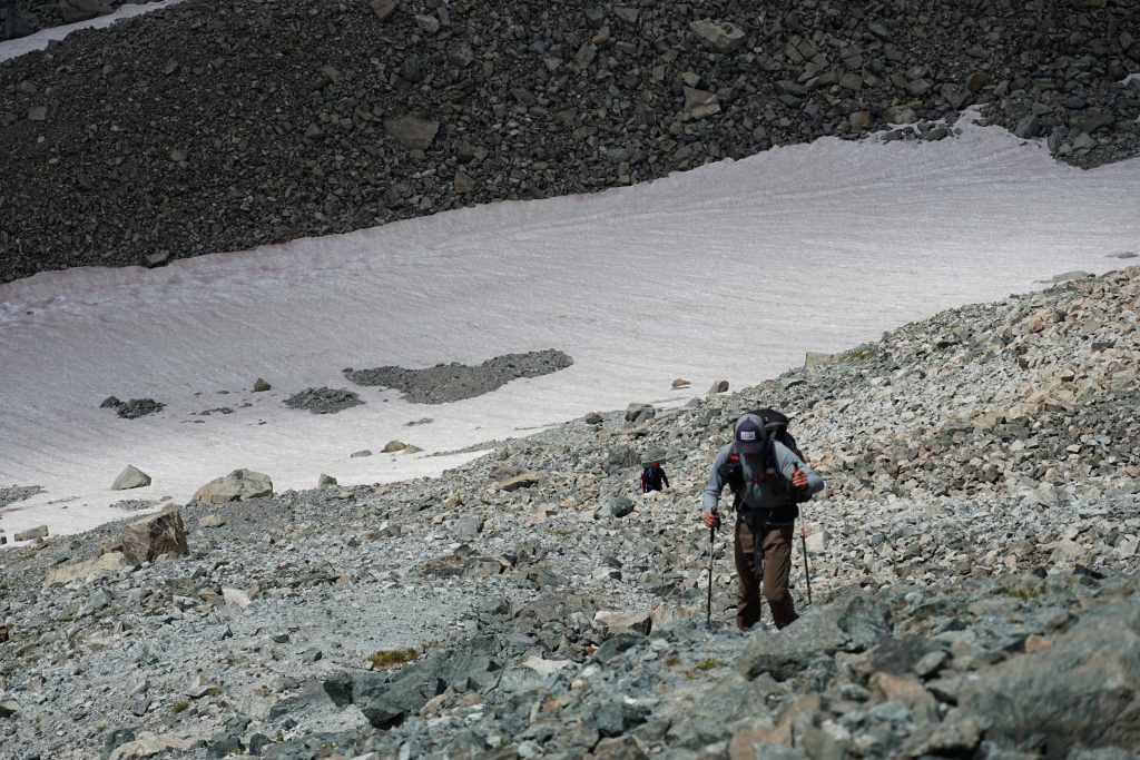
- We brought microspikes but never used them because the snow was so soggy on our second day. Still I would bring them, because the snowfields could be very icy with normal colder temperatures.
- We used an Ursack for food storage and had no issues. There’s not place to hang in the alpine, but critters probably aren’t a concern there.
- We brought one bear spray between all of us and never had any encounters.
- Mosquitoes were annoying at a few spots, but overall not bad.
- The snow cover felt pretty ideal. A little earlier would have made some of the passes more pleasant, but then mosquitoes would have been awful.
- I highly recommend Skurka’s route over Alan’s. It would be so sad to miss out on all the beautiful high terrain from Downs to Indian Pass. And honestly, it is not really any harder than the rest of the route, just maybe more sustained. The most challenging section technically (Alpine Lakes) is shared by both routes.
- There were really only two places with any class 3: around the Alpine Lakes and then getting off Europe Peak. But there is lots of class 2 and boulder hopping.
- Skurka recommends south to north but I think north to south is better: it gets the most consistently difficult, alpine terrain out of the way to start. Then there is more trail walking near the end when you are tired of boulders. Also, approaching Wind River Peak would be awful. If you have a good weather forecast, I’d start north.
- We didn’t have any real beta on the high route and it worked fine. There are no real tricky sections. Navigation is even easier than the Sierra High Route and must easier than the Beartooth. Line of sight.
- Nighttime temperatures were surprisingly warm. It only dropped to freezing probably a few of the nights. I never used my thermals. However, I think it can easily be much colder in August.
- We were pleasantly surprised that we could keep our feet dry most of the trip. There were only one or two river fords, otherwise just strategic boulder hopping. My Ultra Raptors once again reigned supreme as the high route shoe. Logan’s Salomon X Alpine Pros and Sam’s Altra Lone Peaks (which were brand new at the start) both got holes by the end.
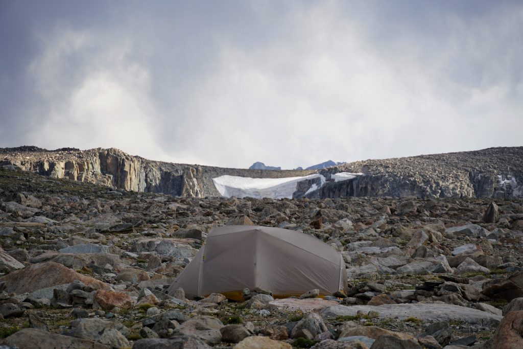
- Good, protected, flat campsites were surprisingly difficult to come by. There are long sections that are completely alpine. Any shelter you bring should be sturdy enough for continuous 40 mph winds. It is, after all, called the Wind River Range.
- Keep your trekking poles in your shelter at night! Or you might suffer the plight of the porcupine.
I’m stunned at the beauty of the Winds and at being legitimately rick rolled for the first time in a while. Congrats on another great trip, great writeup, and great use of petitions.
Thanks John! I’m honestly stunned at myself for rick rolling my readers.
Very detailed. Very well written. Thanks Kyle. That’s my home state. Big country huh. Need your tent up by 2:00 pm or 1 out 3 days you will be putting it up in the wind or rain. Let me know if you want to explore the big horn mountains where I grew up. Pretty amazing adventures and pictures.
Howdy Jim! What a place to grow up. I’ve seen you’ve taken Kanyon on some trips out there so I figured you had a connection. The Big Horns look cool too, just a bit further away. I appreciate you taking the time to read and comment.
Maybe I missed it but what were the dates of your trip?
We started on August 5th, 2020.
Do you have a detailed gear list that you could share? I’m curious about packs, tents, bags, and cook gear, and also curious about pack weight at the beginning. Great report and great pics!
I don’t have a detailed gear list. My pack was I think about 30 lbs starting out, including a liter of water and 7 days of food. We used a Tarptent Motrail and Big Agnes Fly Creek, both of which performed rather poorly in the strong winds. I’d definitely want a shelter that is a little better in high winds. For cooking, we used a Pocket Rocket. I’ve been using the Dan Durston 40L pack and absolutely love it for backpacking. To me it is the perfect backpacking pack: carries weight well, every feature is expertly dialed. It never got too cold at night so we were mostly using 20 degree quilts.
For a late july trip – would an ice axe be over kill?
Depends on the snowpack year to year!
What do you think about ice axe for this year?
Hi Jack! I’m not following what’s going on out there this year. I don’t recall any steep sections of snow, but obviously if you go earlier that could be different.
Amazing trail report and pictures. This one has been on my radar for an entire week now and this really helps gauge if it’s in my skill level zone. I feel like I’ve seen many different variations of this route. Even AllTrails has their own variation of it, and looking at other maps there are a handful of ways you could do it. You could even bail to CDT if you want. When you said “paid beta” are you referring to paying the $25 for Skurka’s resources on his site? Thanks again for putting this together Kyle!
Yeah referring to Skurka and a few other options. You are welcome! Hope you get around to doing this one, it is very impressive.
Just ran into this write up. Spectacular! I’ve been using my Tarptent Stratospire Li. I don’t think I’ve had it in sustained winds like that, Some Sierra gusts, but makes me pause. At the same time, more concerned at finding flat ground to pitch. Seems like especially in your first days this was a problem. The SS has a moderately larger footprint. I have the time, I’d like to drop your mileage down to more like 10, is that a problem with how the flow sets up? I’m also just a backpacker, not a climber, when you say class 3 you aren’t downplaying that with a real climbers view are you? Looking at summer 2023.
I got the Stratospire Li last year also, but it hasn’t seen any real storm yet. Shorter days should work on the WRHR, except the northern part doesn’t have great camps after our first camp for a while, but you could make it work. I’m not downplaying things, but there is a lot of boulder hopping on that route.
I think I’m gonna put this route on hold, focus on a more pedestrian route of lakes and meadows for my first time in the range :). Inspiring route write up, you almost had me 🙂
There are plenty of other great ways to enjoy the Winds!