Chasing Waterfalls
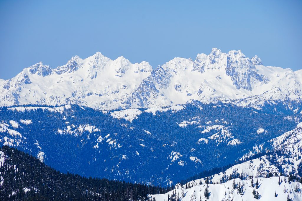
The Alpine Lakes Wilderness is a dense, beautiful region of the Cascades, a region I keep coming back to for high routes and exploration. One area in particular that I love is the Alpine Lakes Crest between Chikamin and Summit Chief. These high peaks form a rugged wall 7000 feet high, with cliffs and glaciers. Both the Alpine Lakes Crest Traverse and Snoqualmie Haute Route pass through this section.
This winter, during the Slammin’ Salmon Traverse, Logan and I got to admire the same Alpine Lakes Crest but from the east side. I realized that I had never explored the entire region between Salmon La Sac and the crest. We decided that we needed to change that.
So I envisioned a loop route from the Salmon La Sac region, climbing up the east side of the Lemahs, circling the backside, and descending next to Chimney Rock. I knew this area had some impressive valleys and towering waterfalls. It seemed like an early summer route that would benefit from decent snow cover.
Summer has arrived early this year, so by mid June it felt like the right time to go. In addition to Logan, I was able to convince Blake, Kelsey, and Brigette to join me.
We started from the Pete Lake trailhead and jogged the rolling terrain to Pete Lake.
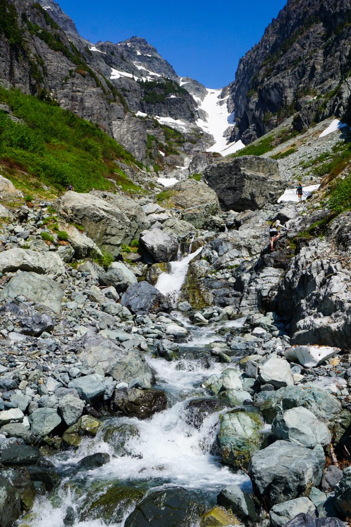
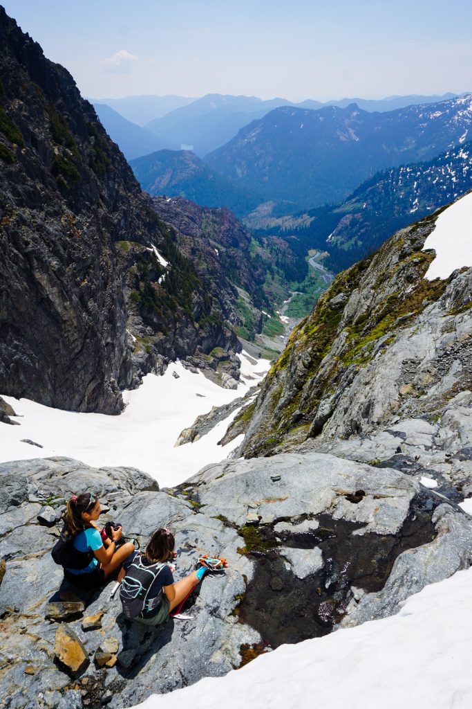
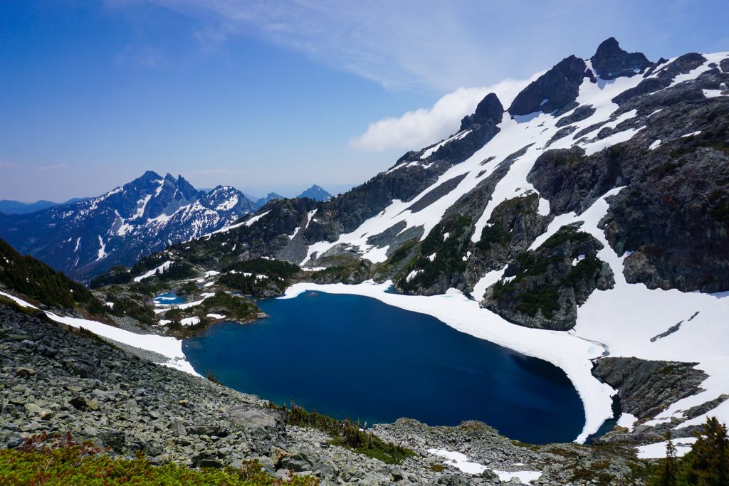
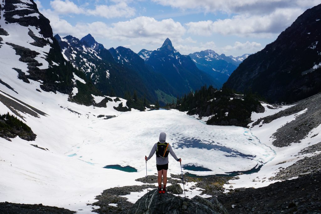
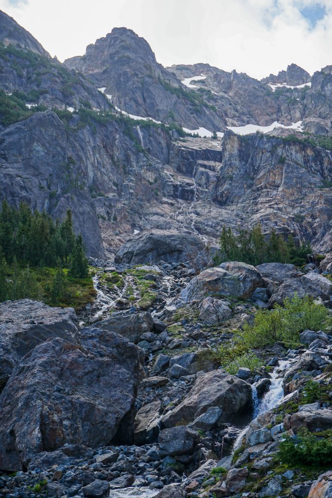
From there, we continued for a few miles to the PCT, heading south until Lemah Creek. Right before the creek, we followed a faint path uphill, passing some nice little waterfalls. Within 20 minutes, the terrain opened up and we ascended some rocky knobs to the most magical view.

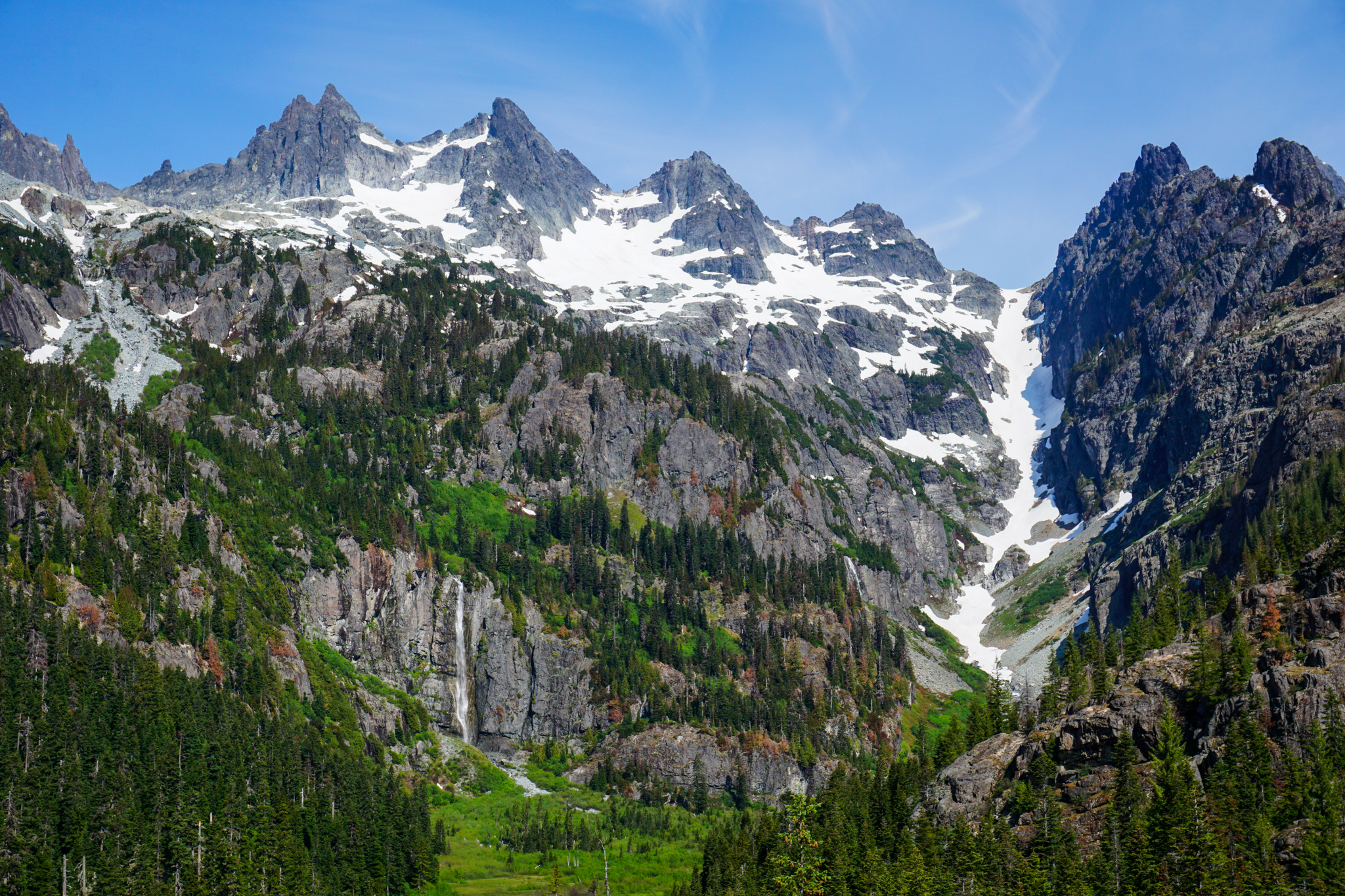
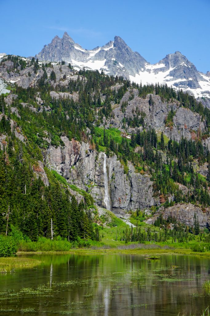
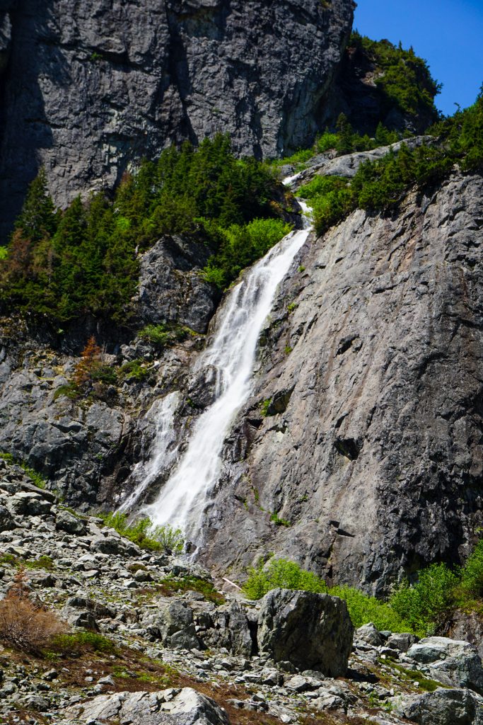
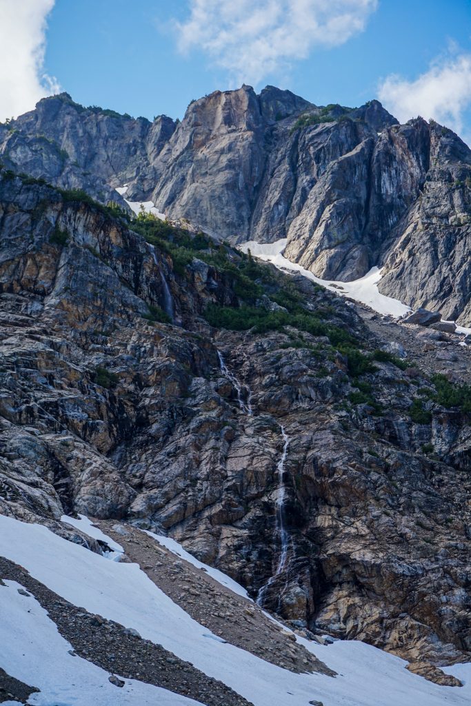
I have known about the Lemah Valley and 330 foot tall Whinnimic Falls for a while, but seeing it in person was absolutely magical. With early season snowmelt, the falls was raging. Set beneath the towering peaks of Lemah, it was as a Cascadian materpiece!
The valley floor at 3700 feet is flat and marshy. There seems to be evidence of 19th century glaciers extending nearly to the valley floor, despite the low elevation and southeastern aspect. The tube of snow between Lemah and Chimney definitely seems post glacial, and the southeastern flanks of Lemah recently held active glaciers. All of the recent glacial history and wickedly steep topography makes this region seem so much more alpine than its modest elevation would suggest.
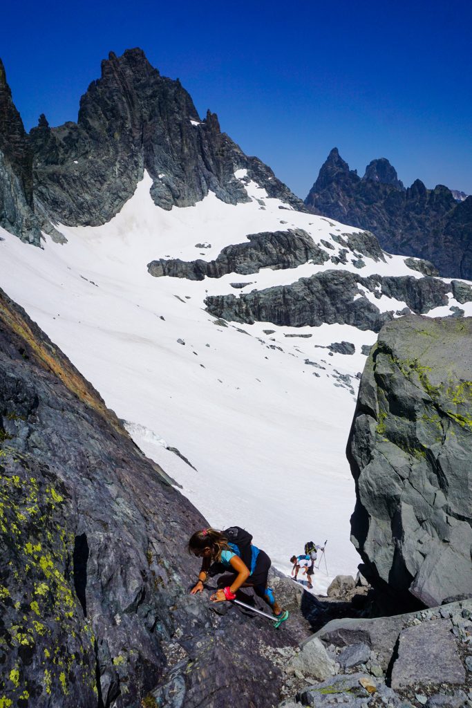
There were some schwacky sections through the marsh, but we found an alder tunnel that helped. But quickly we reached open rocky stream beds and we were in the clear!
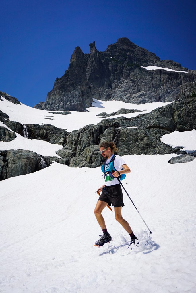
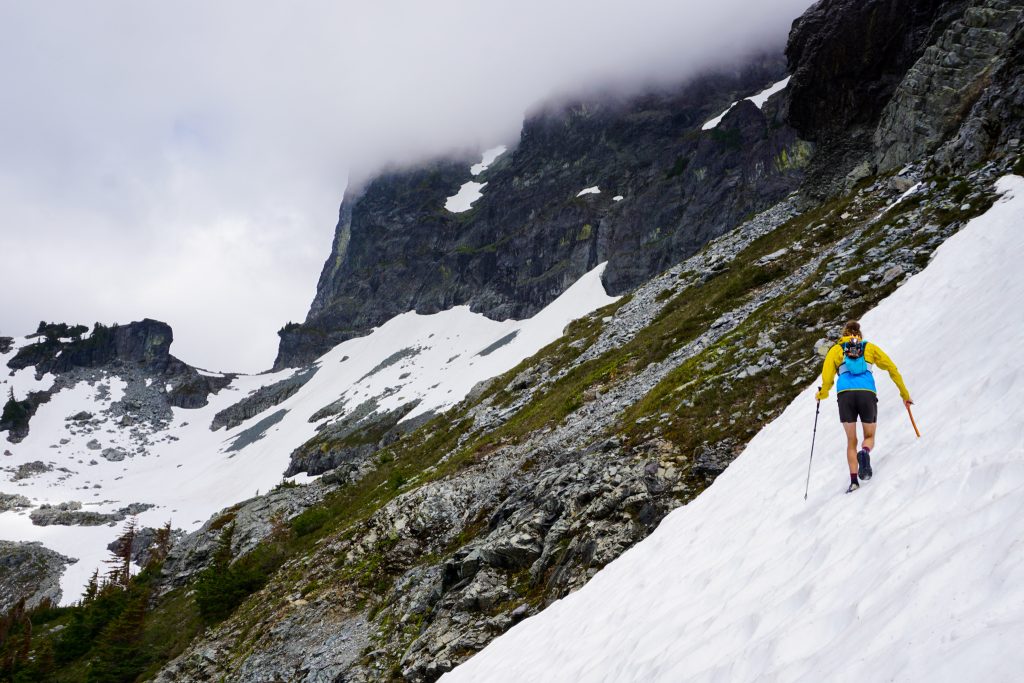
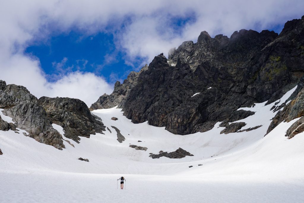
We followed the beautiful creek pouring from the snowfields above, eventually reaching snow around 4300 ft. Blake put on crampons for the first time. As we cruised up the snow finger, some air force jets buzzed us on their training flights through the crest!
We transitioned out of the finger before the top towards the benches beneath Lemah.
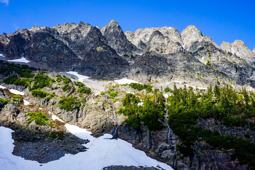
We did an up and down traverse on the post glacial benches beneath Lemah, which were covered nicely in snow. A big of smoky haze obscured the views to the east, but it was still a beautiful setting with the jagged Lemah skyline behind us.
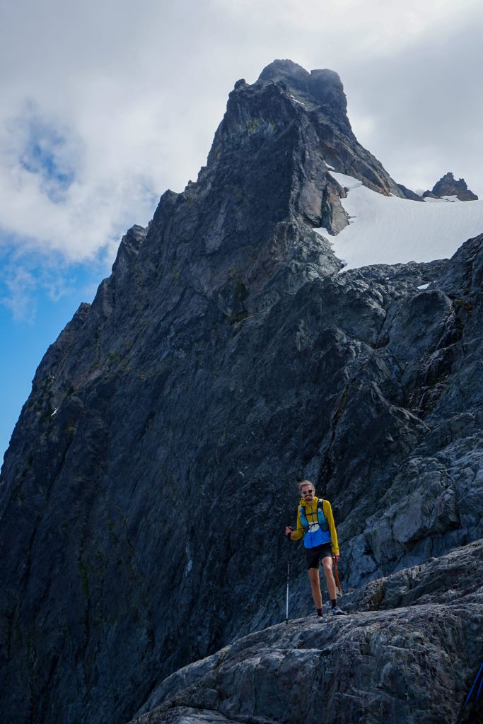
To get out of this basin, we were planning on taking a narrow snow finger westward to the shoulder of Lemah One. However, we noticed that the ridge next to it looked much more pleasant, so we went towards that instead!
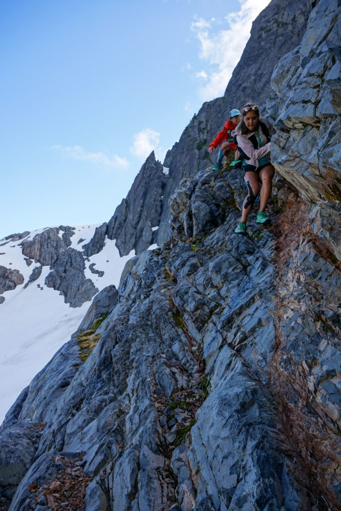
We took a break on the ridge as a cool wind blasted us from the west. The ridge was beautiful and solid, making for fun, easy scrambling. This was an unexpected section of the route that proved exceptionally fun!
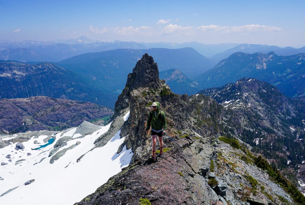
From the top of the ridge, we could follow boulder fields down the south side of Lemah One towards the Lemah Chikamin saddle. Clouds were pouring over from the west side.
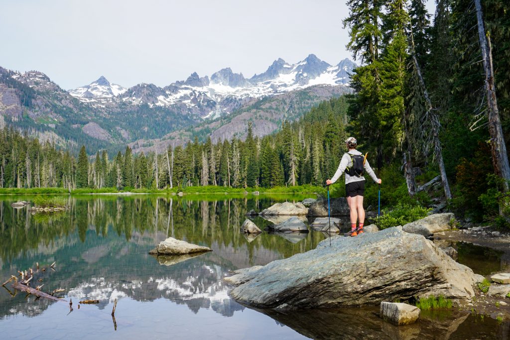
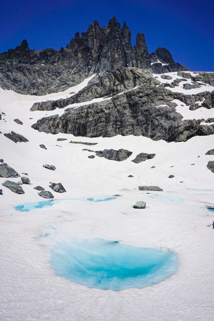
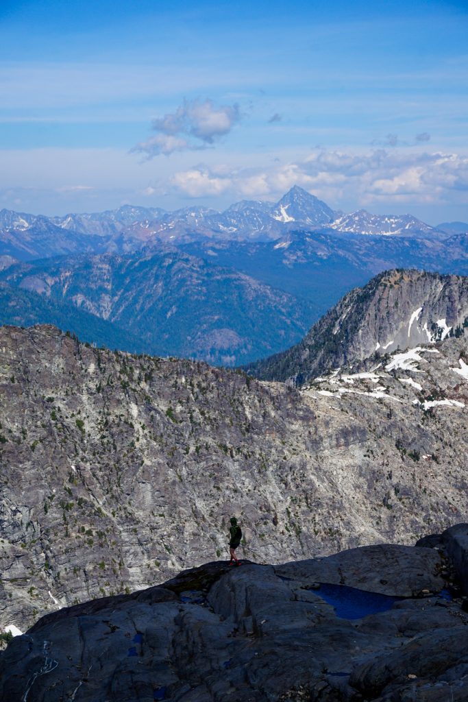
At the saddle, Logan and I were in familiar terrain, joining the Alpine Lakes Crest Traverse. The traverse over to Iceberg Lake surprisingly had no running water despite plenty of snow, so we were a bit thirsty by the time we reached the lake.
Clouds raced over the Lemahs and Chimney Rock as we rested at Iceberg Lake. We hoped it would clear up by the time we reached Overcoat Col!
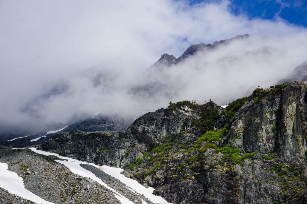
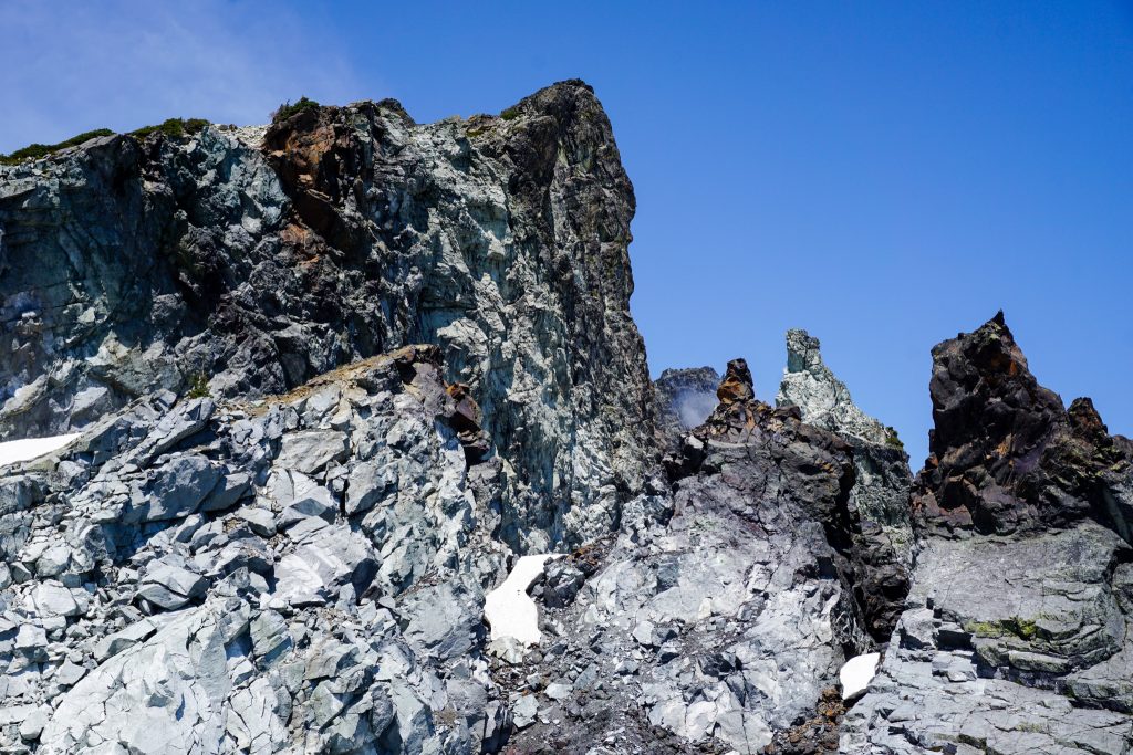
It was cool to see the rugged Lemahs from all sides. These peaks are essentially vertical jungles of choss – both disgusting and inspiring. I would much rather circumnavigate them than climb them!
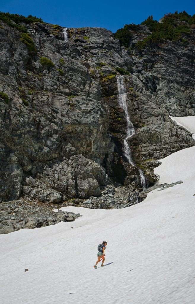
Getting off snow onto the waterfall ledges beneath Overcoat Col was a little tricky. Moats can be the sketchiest part of early season travel!
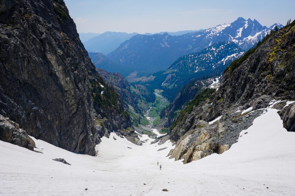
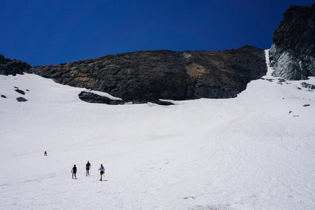
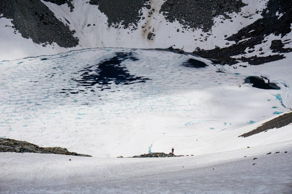
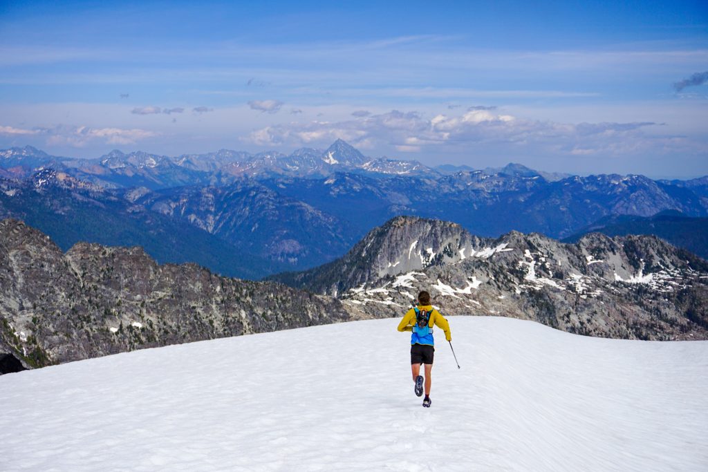
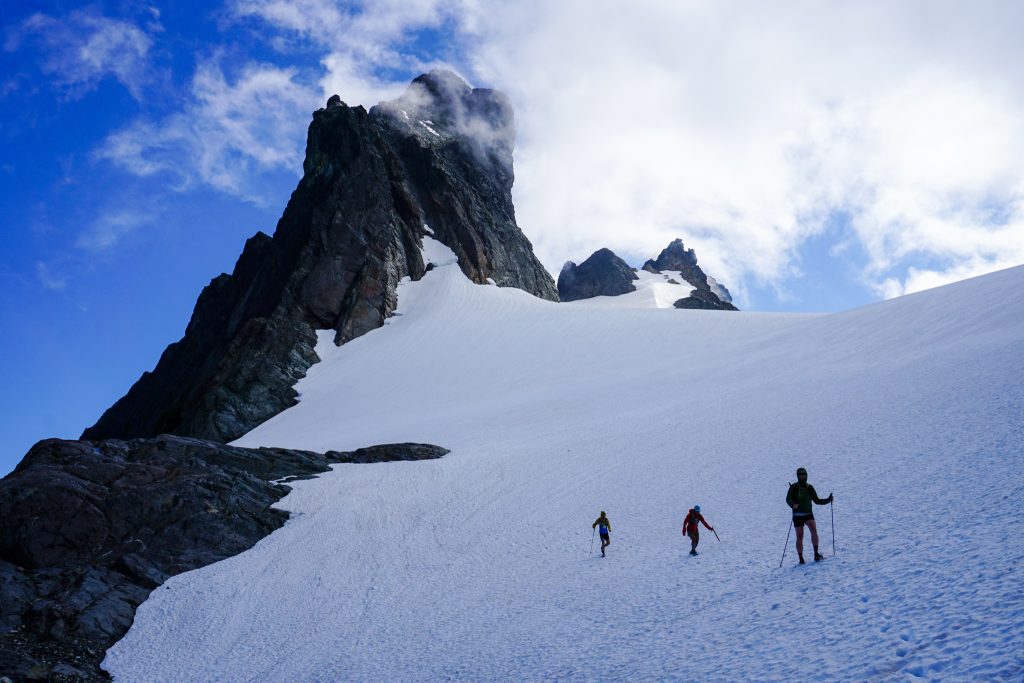
Clouds were lifting slightly at Overcoat Col, but the wind was relentless! We barely paused because of the cold and started down the Overcoat Glacier. The Overcoat Glacier is somewhat unique in that it flows both east and west of the crest – very few glaciers do this! We trended northeast this time, jogging down the snow. The glacier was well filled in.
Our goal was to use a south east facing snow finger to descend to the lower, unnamed glacier east of Chimney Rock. We were sure it would work out one way or another, but were uncertain of specific conditions.
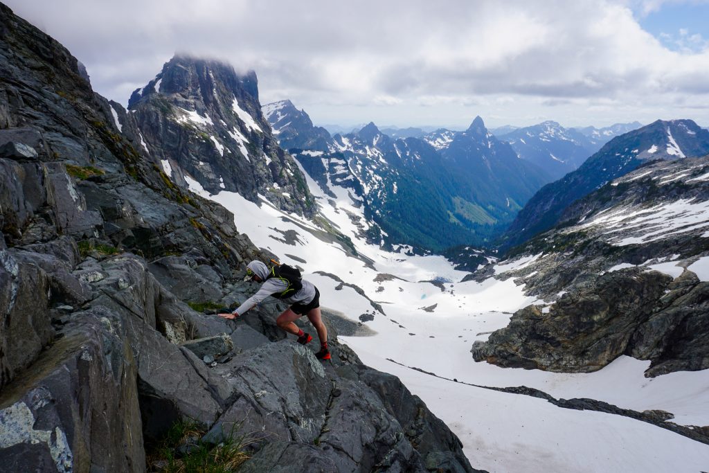
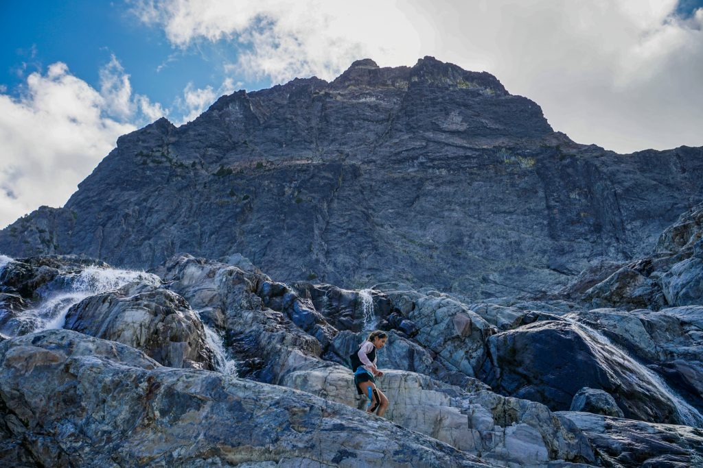
Initially, it looked like we could do the entire descent on snow. But the snow was a little firm in the afternoon shade and strong melt streams underneath the snow threatened other areas. So eventually we decided that the group would be more comfortable on rock. Luckily, we found a fun rock rib with surprisingly solid rock and scrambled our way down. It was definitely slower than snow, but also really fun!
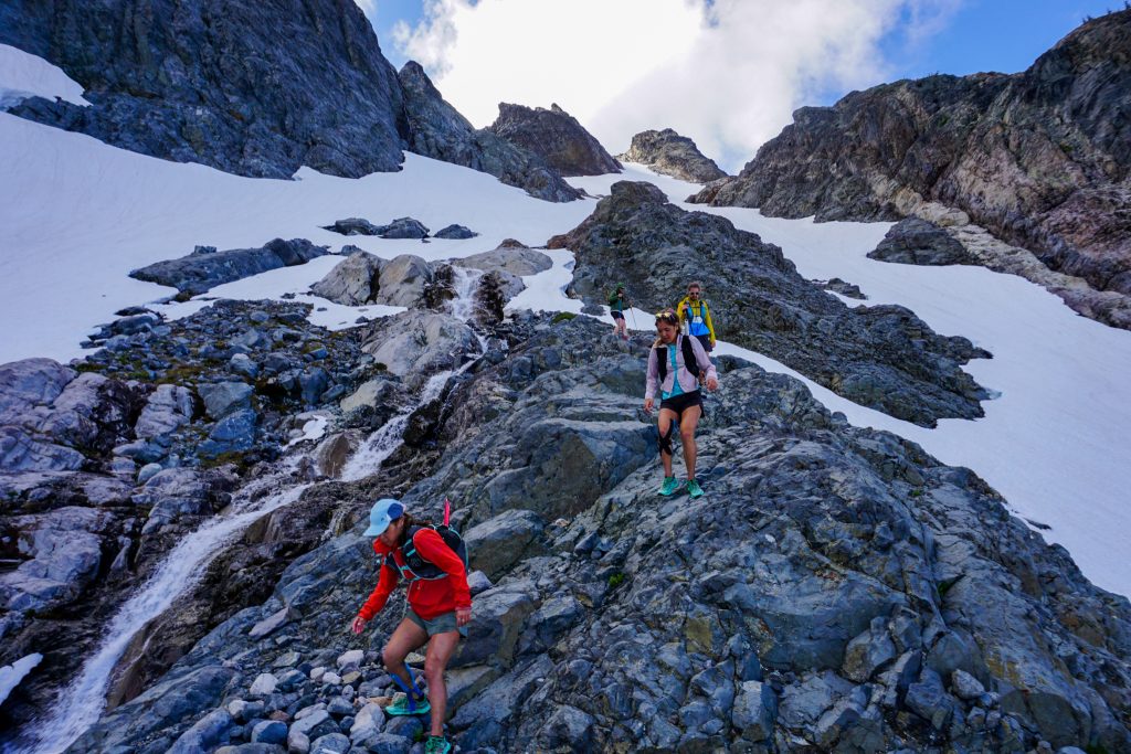
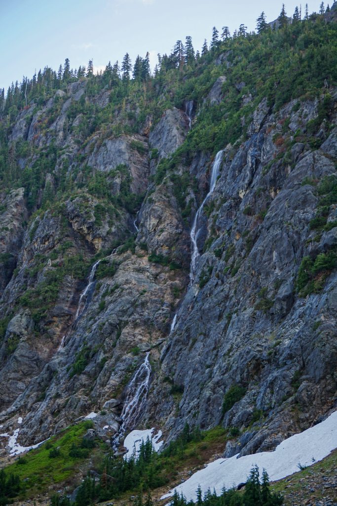
Fun scrambling led us down to the lower glacier. The massive 2000 foot east face of Chimney Rock towered above. All around us, there were steep walls and cascading waterfalls. I could feel the power of water and ice that carved this deep valley and probably held ice all the way down to 4000 feet relatively recently. This was definitely one of the most wild places I have ever visited in the Cascades.
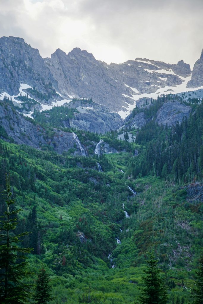
The valley curved southeasterly as we descended. Each valley radiating from the Alpine Lakes Crest is unique. This one was a jumbled, disorganized mess of boulders – some up to 30 by 100 feet! What is common between these valleys is the shockingly low elevation evidence of Little Ice Age glaciation. There is minimal vegetation or even soil towards 4000 feet. Could there have been ice this low in a southeastern facing valley only 150 years ago, where now there is nothing?
At the valley bottom, we embarked on our final bushwhack of the day. Although never too bad, this section was significantly longer than the section near Whinnimic Falls. When we finally reached where the Chimney Rock climber’s trail is marked on Caltopo, we found flagging but no evidence of any trail! So we had another half mile or so of bushwhacking before reaching the PCT finally.
We only had 7 miles of trail left, but there were enough blowdowns and sneaky uphills to keep working us until the end! And if we ever wanted to stop and walk much, the mosquitoes urged us to keep shuffling!
The Lemah Chimney Rock Circumnavigation was a wildly rugged and beautiful route. More than my typical high route, it had so much variety – walking through deep valleys, climbing next to giant waterfalls, scrambling along airy ridges, and crossing high glaciers. This region of the Alpines Lakes Crest is so dense in beauty and adventure. Each valley and ridge holds its own special spot. It was super fun to explore more nooks and crannies in this beautiful area!
Notes:
- This route measured about 26 miles and 8200 ft gain. It took us just over 12 hours. The terrain is definitely slow in places and the approach trail gains very little elevation.
- Getting to the Whinnimic Falls overlook is pretty easy and there is a trail in places. This valley definitely see some traffic. However, the Chimney Chief valley sees probably very little traffic and we found no evidence of people out there. The bushwhacking was definitely worse in this section, but never too bad.
- This route is best in early summer when the approach trails are snow free, but all of the choss up high is covered in snow. I actually think it would have been even easier a week or two earlier than we did it.
- This route is probably more efficient in the other direction. That way, you could climb up the steep snow and rocks to the Overcoat Glacier and get the long easy snow descent down the Lemah Chimney Rock snow finger. However, our direction was probably more scenic because we got to see Whinnimic Falls in morning light.
- We brought crampons and an ice ax. There is a fair amount of steep snow on this route. We did not feel the need for a helmet because the scrambling is mostly solid and not exposed.
- Compared to the Alpine Lakes Crest Traverse, this route is certainly more challenging mile for mile when off-trail. It is less classic but very beautiful in its own way.
I just wrote up a TR over on nwhikers, and someone mentioned that it was your group I saw out there. I was downclimbing that snow finger just west of Lemah #1 when y’all came up on the ridge! I whooped and waved, but I don’t think y’all saw me. Sounds like y’all had an epic day.
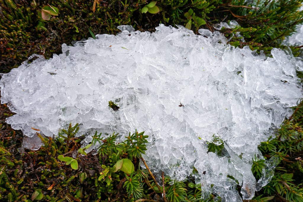
That shaved ice was from freezing rain the previous night that fell off as it warmed up.
Oh we definitely noticed you but it was too windy to communicate! Thanks for explaining what created the ice. Mind sharing your TR?
My bad! I thought one of you might have waved back but wasn’t sure.
My TR is here https://www.nwhikers.net/forums/viewtopic.php?t=8037351