Heineken with the Big Heine
The Monte Cristo Peaks are a dense cluster of craggy, rugged peaks around 7,000 feet tall in the North Central Cascades. For me, they are both very familiar and yet quite mysterious.
From a young age, my dad frequently took my sister and I into the ghost town of Monte Cristo. I have memories of sitting on the railway turntable as my dad pushed it around, exploring up towards the abandoned mines, and complaining bitterly about the long, arduous 4 mile flat gravel ride to and from town.
However, since my childhood, I had never been back to the Monte Cristo area. There were so many other places to see and discover. I learned the peaks had a reputation for loose rock, and some other objective always took priority during that early summer window when there is sufficient snow cover to make travel better.
As I hiked down from White Pass at the end of the Glacier Peak High Route, I was once again reminded of the rugged, wild Monte Cristo Peaks. But the snow was already melting fast during this low-snow year and it seemed like the window was fading fast for that region.
Throughout conversations, Logan and I kept coming back to the Monte Cristo peaks. We both desperately wanted to explore the area before the end of the season. We separately both had come up with an idea to do a high route from Bedal Creek over Heineken Peak (which is of particular interest to Logan because it shares his last name) and over towards the Monte Cristo Peaks. But we could not find a good way to get into Glacier Basin without snow coverage. It was a tough puzzle to crack.
A month ago, I was exchanging beta with Matt Jordan, who found my website and had questions about the Snoqualmie area. Since he mentioned he was familiar with the Monte Cristo area, I asked him if he thought we could go over the U Notch on Monte Cristo Peak late season. He said that it looked pretty bad without snow, but that there was actually a ridge climb up the NE side of Cadet peak that might work. The SummitPost description definitely relied on snow travel, but we suspected there might be a way to avoid the snow and ice. Nonetheless, we would pack crampons and an ice ax just in case.
Our route made for a nice loop with 6 miles of gravel road biking on the Mountain Loop Highway. We brought bikes and stashed them in the forest near Barlow Pass before driving to FS 4096, which leads to Bedal Creek. We parked at the base and started hiking up the road. It was probably drivable with an Outback, but it made no sense considering we were doing a loop.
The Bedal Creek trail was easy to follow but certainly in primitive shape with plenty of blowdowns. There were a few sections of head tall brush that soaked us in the cool morning air. At one point, I got stung twice in the leg by a wasp. At another point, Logan stuck a pole into a nest and simply said “run!” – We both came away from that nest unscathed. After getting stung near the end of the Quinault High Route, my foot and lower leg swelled up so badly it was hard to walk for days. I certainly hoped my reaction would not be as bad this time. We were not off to a good start.
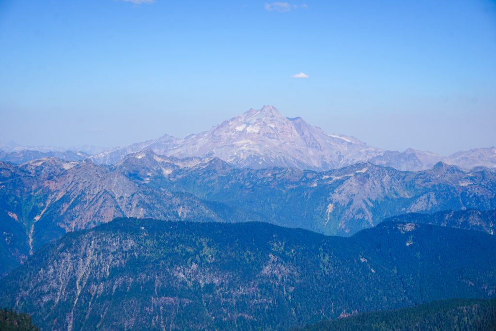
Eventually, we lost the trail in a rocky creek bed and just started hiking up the creek. Here we got our first views of the massive west face of Sloan. It was my first time back up close since my accident in February 2020. Fortunately, I felt very calm and it did not really bother me. I look back on that experience with a sort of matter-of-factness. Sure, I wish it never happened, but I cannot change my past mistakes and I am truly a better person because of it.
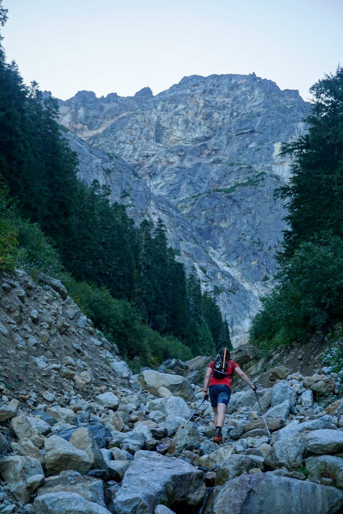
We followed the creek up through one little cruxy step until the trail reappeared on the right side of the gully.
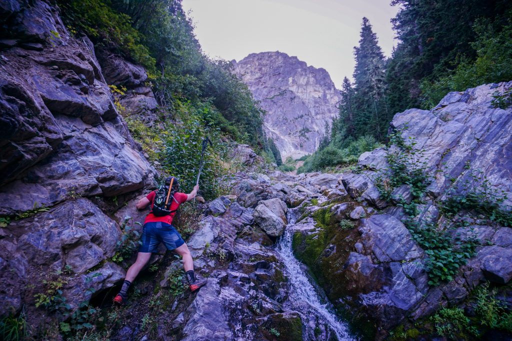
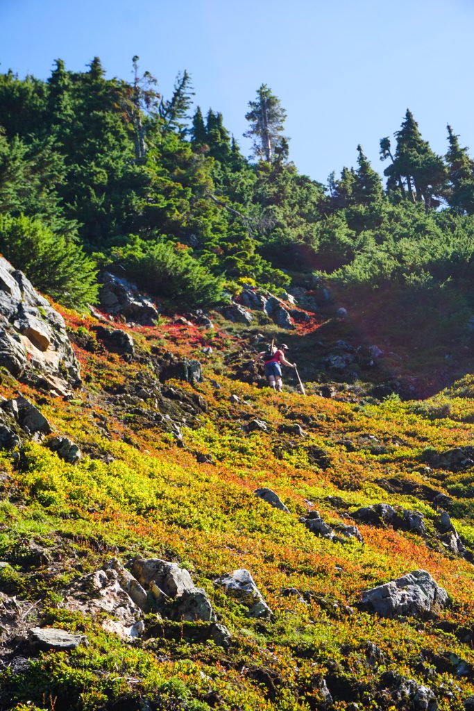
Travel got easier as the forest opened up beneath the west face. The trail was very faint all the way to the ridge, but a footpath was still discernable in the heather.
We broke out into dazzling sunshine beneath the SW Face of Sloan. After a rough start to the day, we began to get stoked.
From this basin, we continued south, climbing another thousand feet to the ridge.
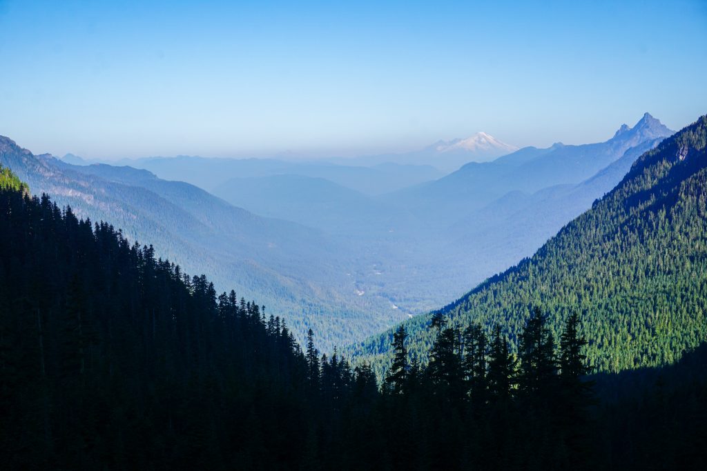
The Airplane Lake Fire was pumping out smoke just to the north and east of us. Fortunately, the skies were clear in the direction we were headed.
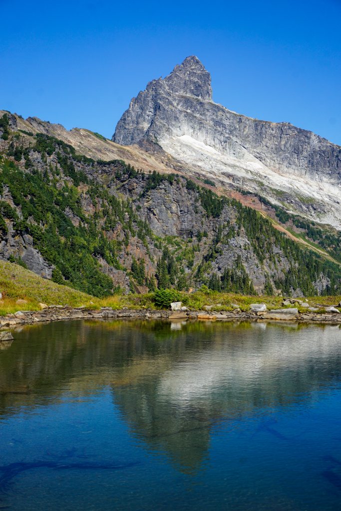
We continued down pleasant grassy and rocky terrain, passing the occasional goat hairs and hoof prints. It was beautiful, expansive country. We eventually found our way down to a small lake, sometimes referred to as “Cadet Lake”. We drank up since we were uncertain when our next water source would be.
After filling up with water, we continued easily up towards the summit of Heineken Peak.
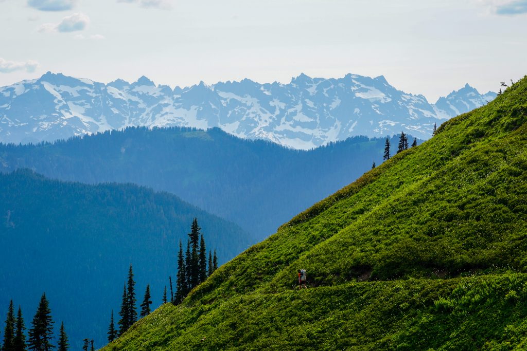
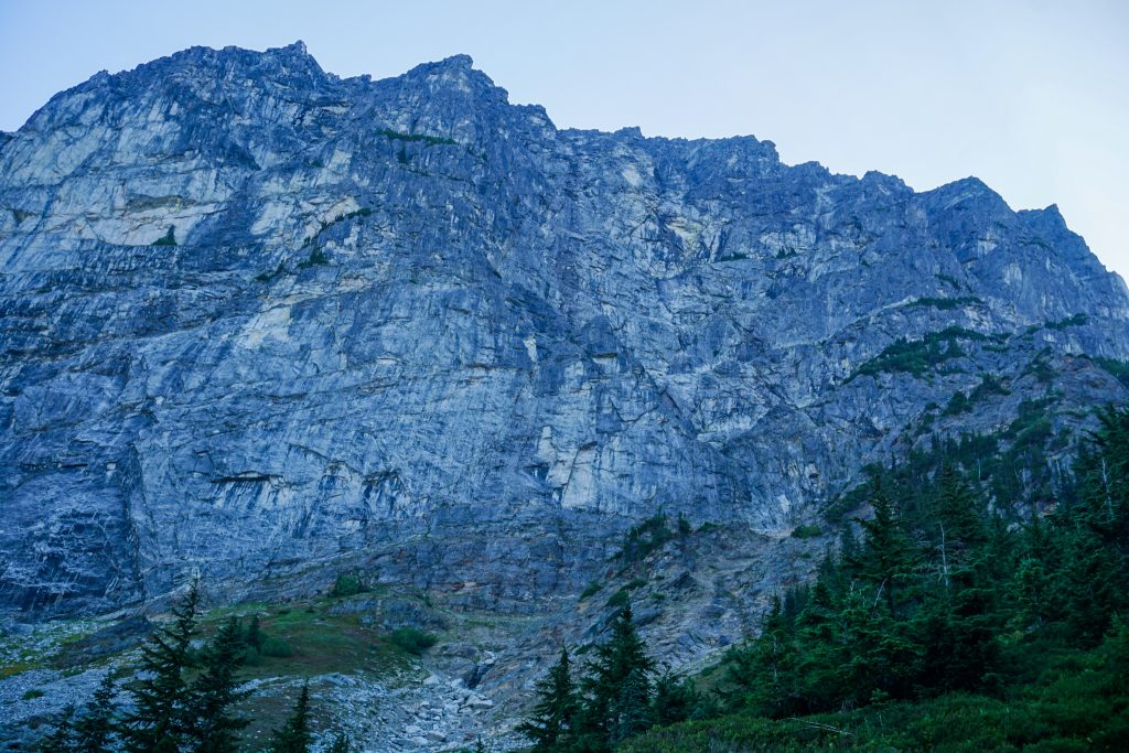
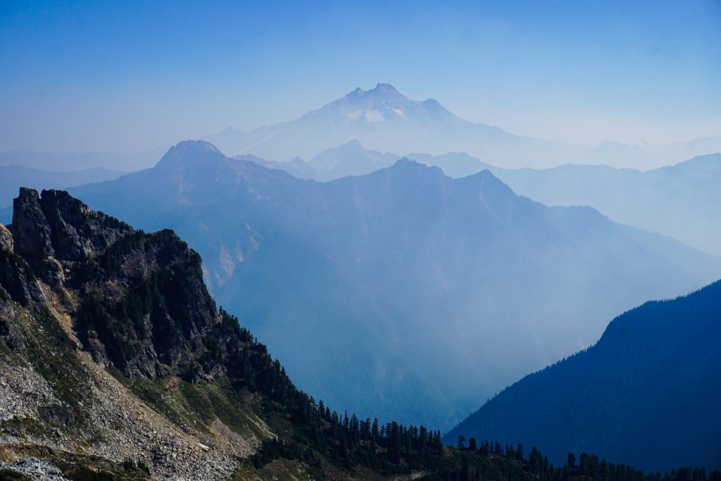
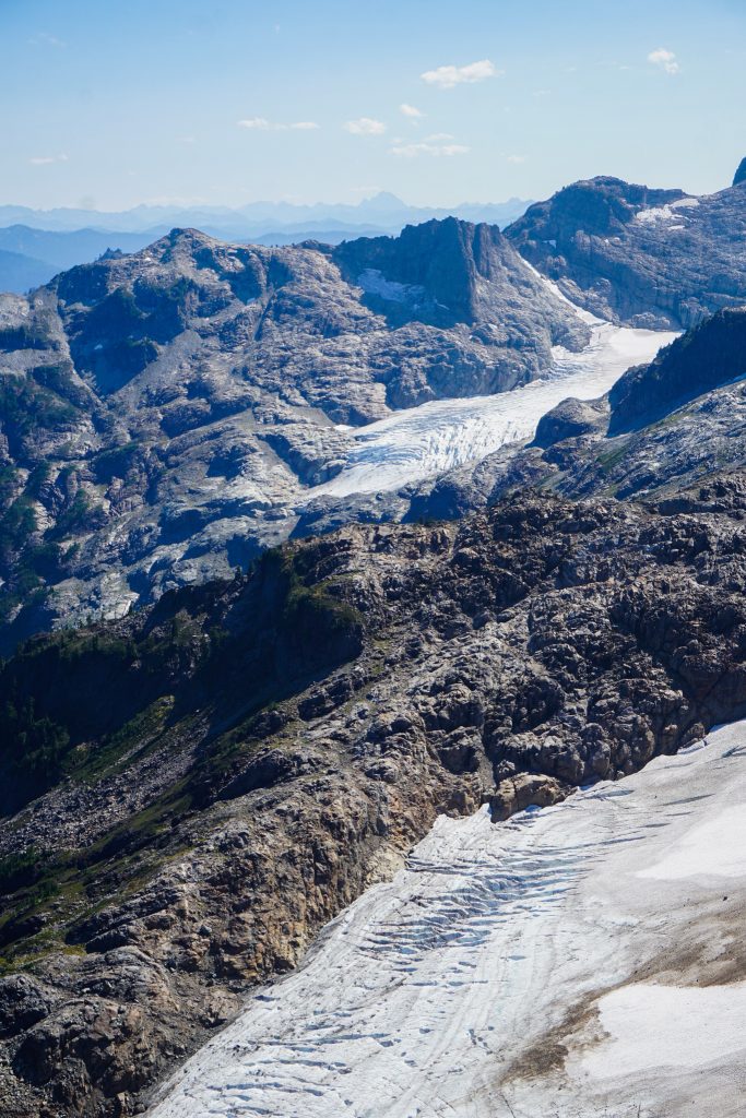
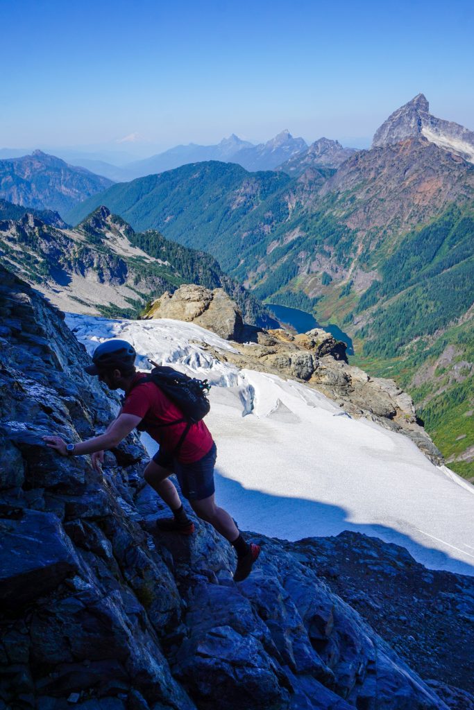
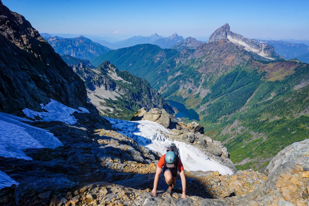
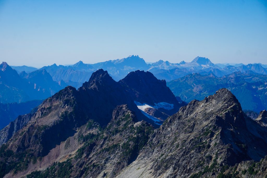
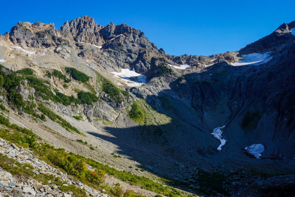
At the summit, we gained our first expansive view of the wild backside of the Monte Cristo Massif. Dozens of high spires join together on this jagged ridge, with a few small ice patches clinging to the steep cliff faces. The Pride Glacier is the only significant glacier remaining on this side, but it is clear that this area was recently far more glaciated. It remains a complex and beautiful landscape.
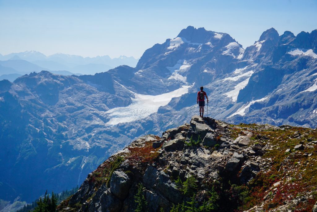
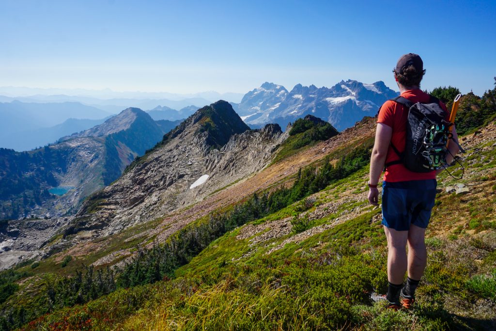
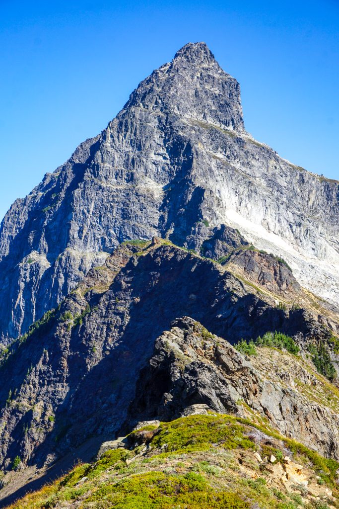
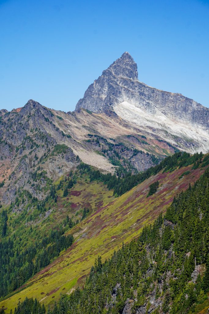
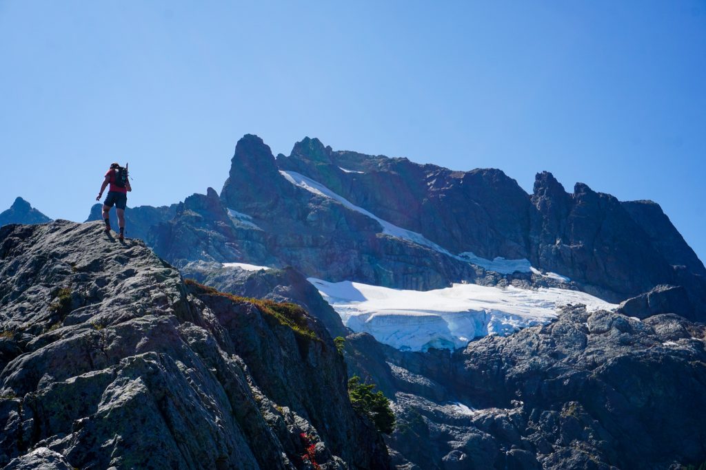
We also got our first view of our route up Cadet Peak. The ridge looked pleasant until steepening near the hanging glacier. It looked like we could possibly avoid the glacier with some steep scrambling, but it was still hard to tell from a distance. It all looked intimidating and steep. But as we have come to learn, terrain almost always looks scarier from afar.
Getting off Heineken was interesting. We dropped off to the right and made our way down some impressively steep grassy gullies. If it was any steeper or wetter, we would have pulled out our crampons and ice ax.
But after getting through the crux, we had some marvelous and pleasant ridge line.
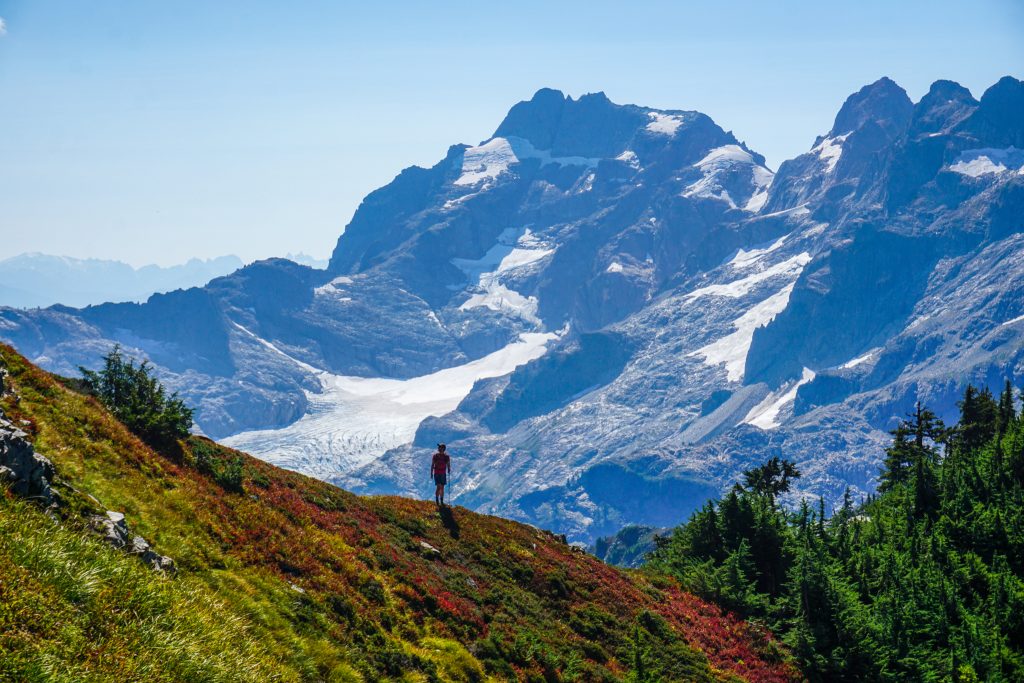
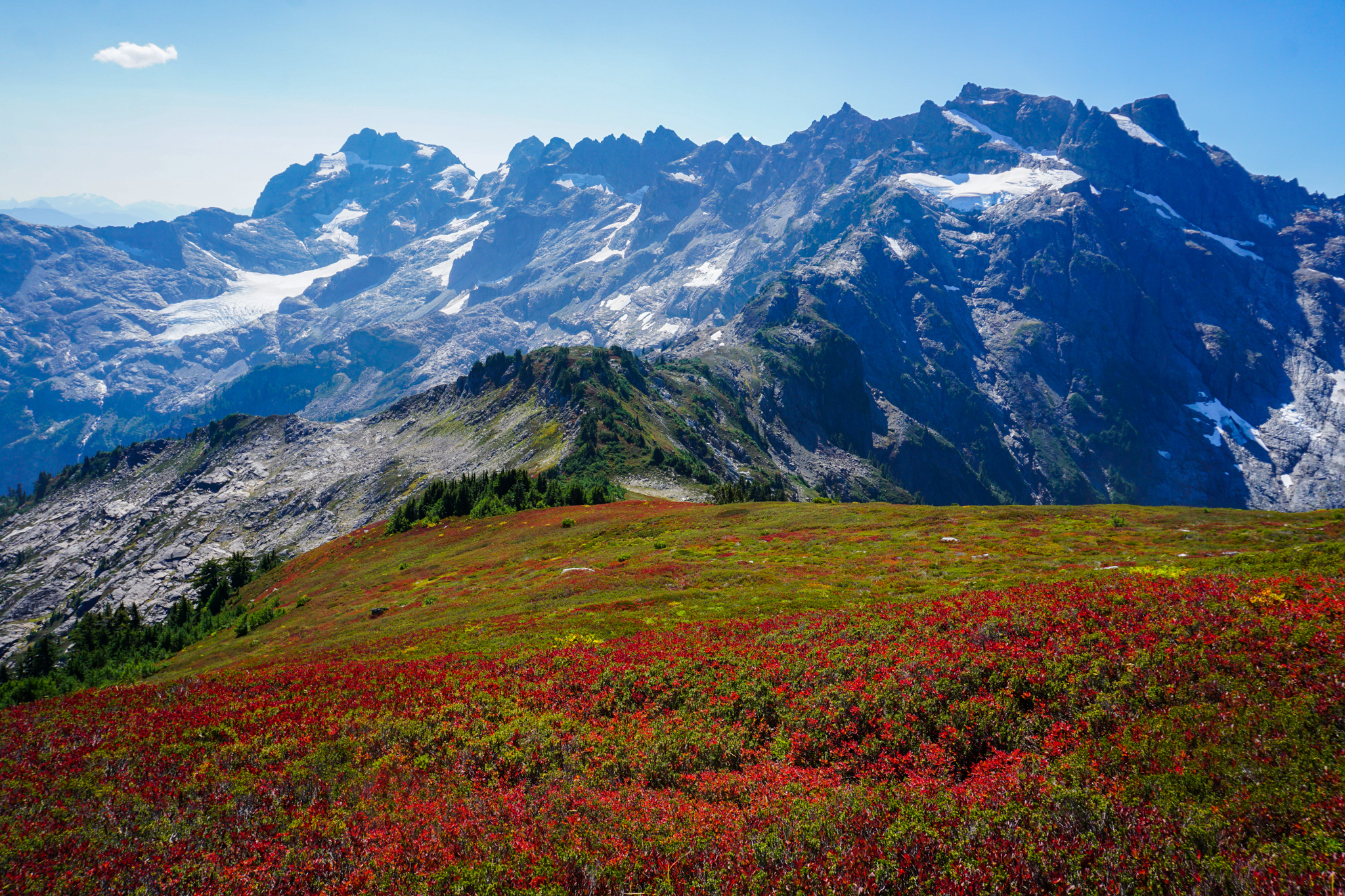
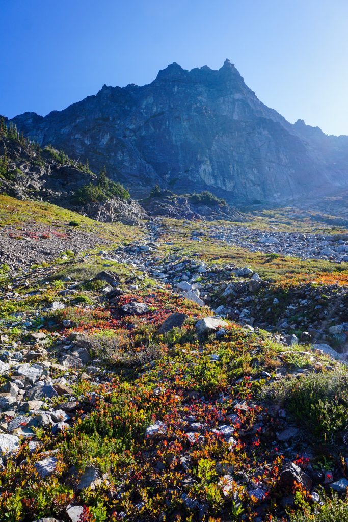
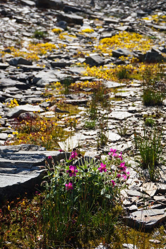
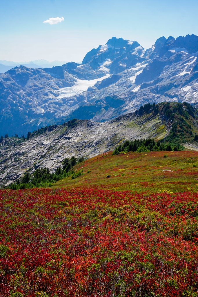
As we continued downwards, we suddenly stumbled into the most vibrant hillside – a literal red carpet. The sun shone at the perfect angle to illuminate every leaf. With the dramatic backdrop of the rocky peaks and ice, it was truly magical.
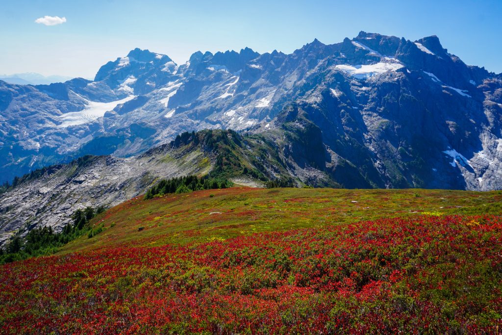
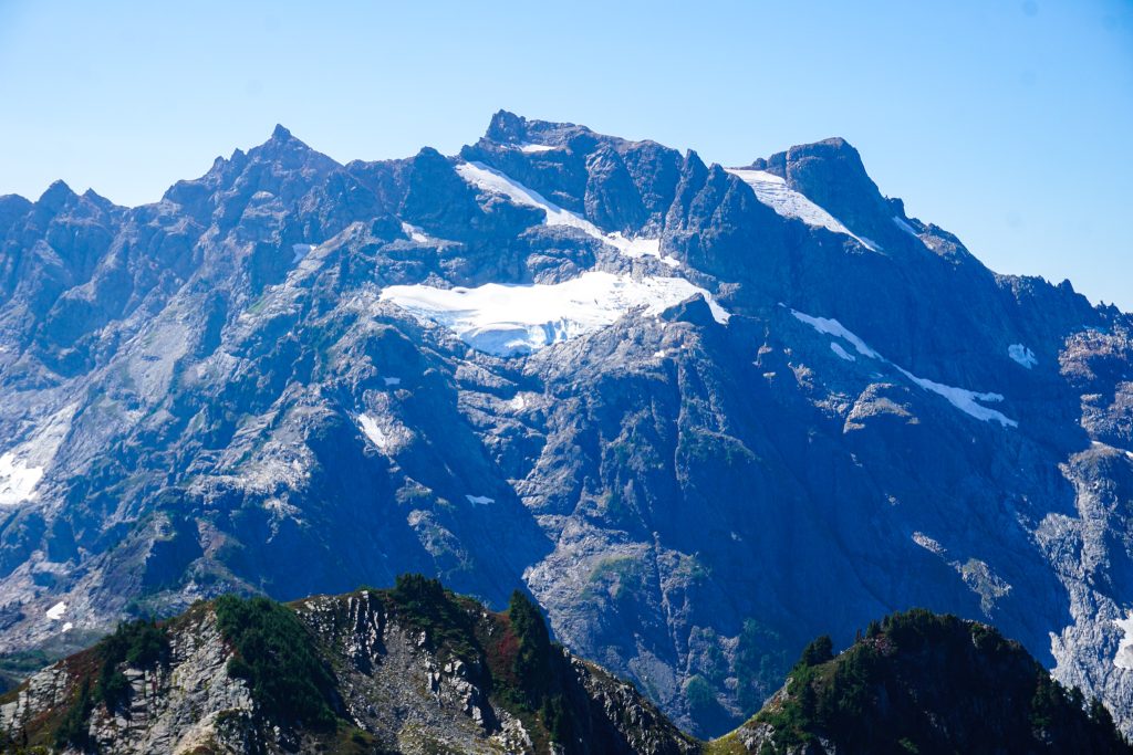
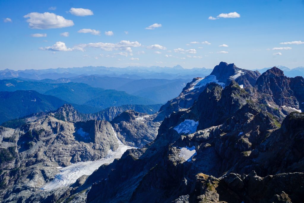
We descended to a low point of about 5600 ft, at which we were still high above the remnants of the Mayflower Glacier. This glacier starts at only 5100 ft and descends all the way down to 4300 ft – incredibly low for a southeast facing ice patch. The largest glacier in the Monte Cristo Group, the south facing Columbia Glacier, stretched down towards 4000 ft in the last century. But all these ice patches are sad shells of their former selves. If we keep having summers like this one, they will soon be all gone.
The ascent up Cadet was mostly simple and aesthetic, on quality rock with great position. As we neared the hanging glacier, we became more optimistic about the scramble bypass.
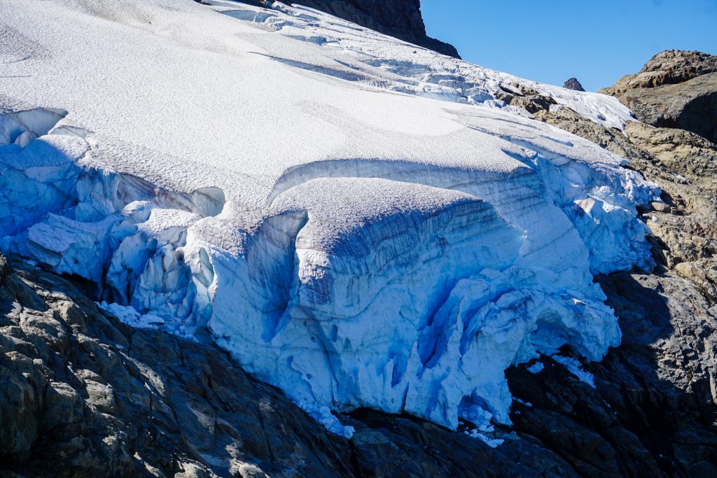
After filling up on some meltwater from the small glacier, we continued directly up blocky rock. For an area known for its awful rock, the scrambling was quite surprising. It was not just acceptable – it was bonafide good!
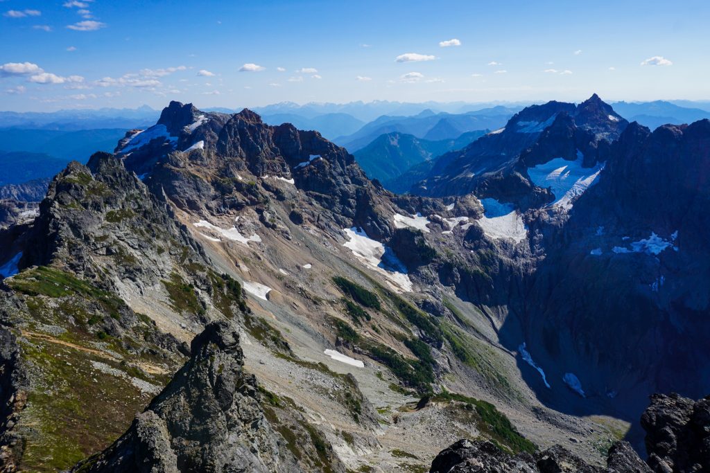
Once we reached the upper left slanting ice patch, we were able to scramble a bench just beneath it all the way to the ridge! No snow needed to be touched!
From here, there were more twists and turns weaving our way around steep gendarmes to the summit plateau of North Cadet. All in all, it was a really fun scramble route with an alpine feel and plenty of solid class 3!
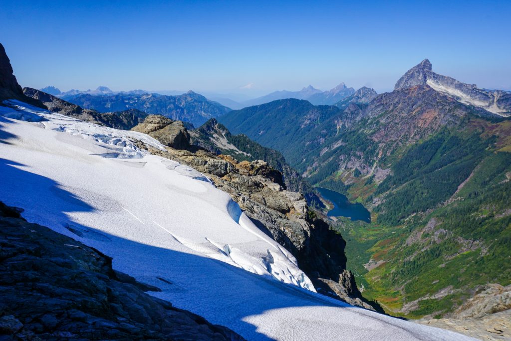
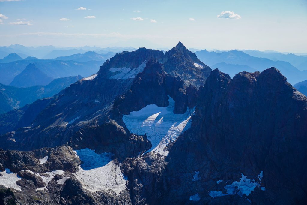
The summit register is strangely on the lower northern summit, but we continued on to the main summit of Cadet Peak. The views were excellent, with many high peaks and dying pocket glaciers in the nearby massif, and distant layers of peaks in all directions.
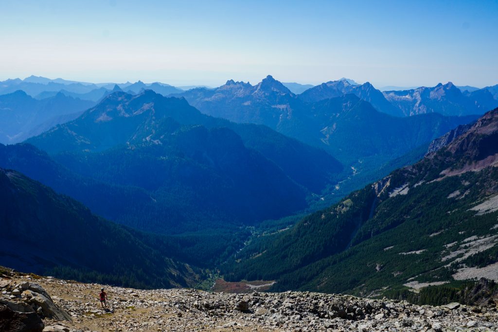
Glacier Basin looked like an awful chossy mess without snow. We are glad we did not try to go over any other passes without snow cover.
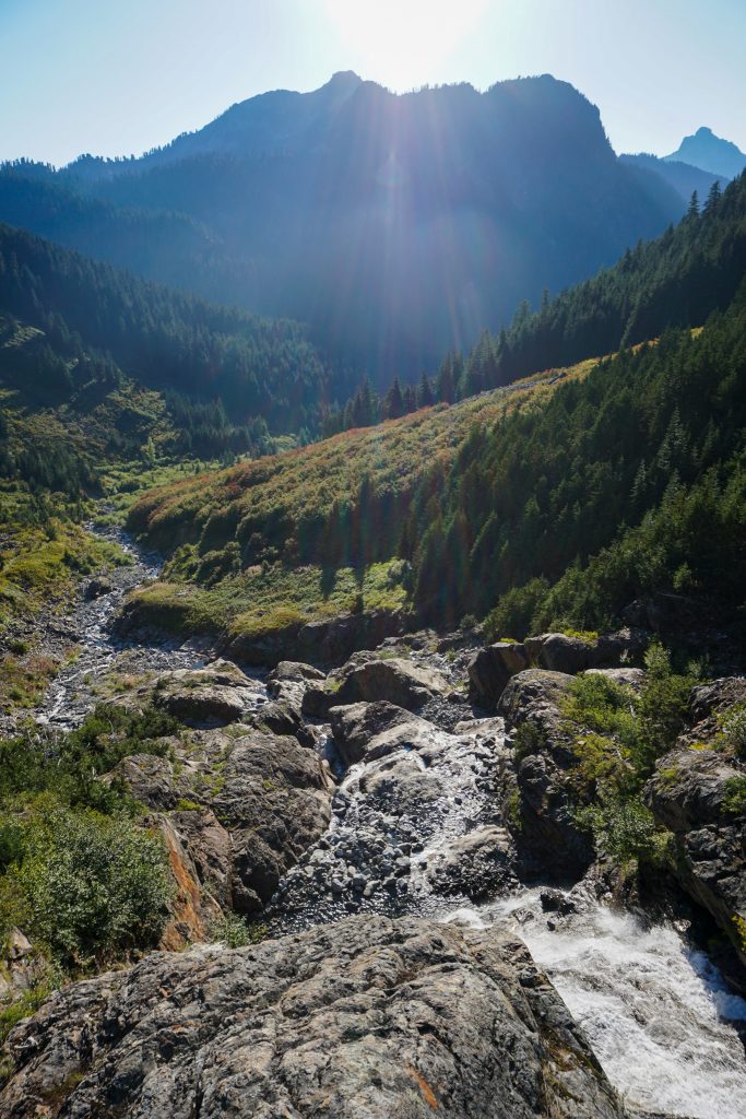
The descent down Cadet was non trivial. Without coming up the standard route, we had to be careful to follow cairns and look for signs of a bootpack to get through the upper cliff band. Lower down, another party helped point us to the brush tunnel that finally leads down into Glacier Basin. Although never very technical, the entire descent is steep and loose, making for a quad-crusher.
We were finally back on trail, but the Glacier Basin trail, an old miner’s trail, is only marginally easier than off trail. It is basically a rocky tunnel through the bushes. We stopped at a waterfall, the same waterfall I remember resting at on my final hike before leaving to college nearly a decade ago. I remember feeling sad to be leaving these mountains for Spokane. Back then, I never could have dreamed of these sorts of experiences that have become commonplace for me.
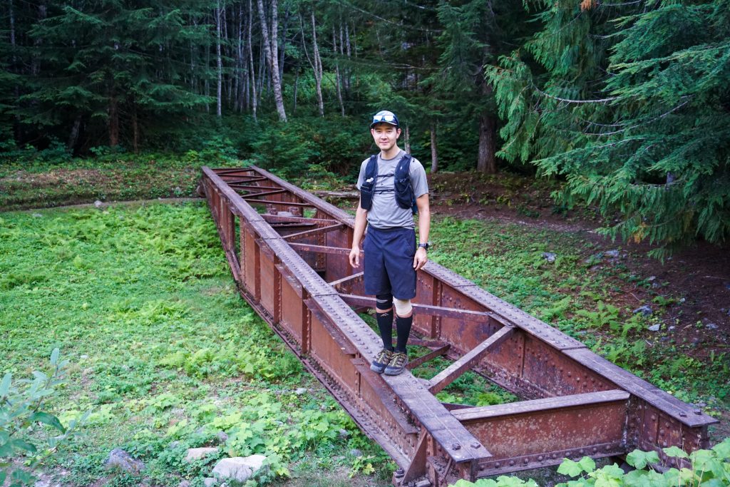
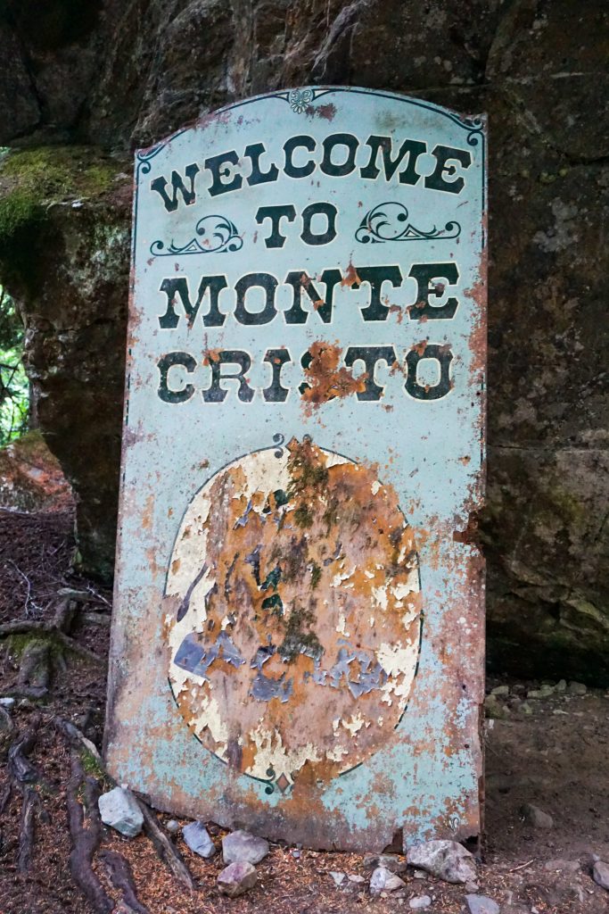
Logan had never been to Monte Cristo, so he was shocked to see… well, not much. Where once a town of a thousand people stood just a few iron artifacts remain. The forest has reclaimed the valley. The most notable remaining structure is the railway turntable. Logan and I took it for a spin – yes, it still works, even after over a hundred years!
Now we only had about four miles of gravel road to jog back to Barlow Pass. The road was far flatter than I remembered, but I guess I really did complain about every little hill when I was younger!
After grabbing our bikes, we cruised downhill six miles on the Mountain Loop, enjoying a wonderful ride as alpenglow lit up the peaks around us. We finished just in time to not need headlamps on both the starting and finishing ends of the day!
I love days like this because they combine the excitement of exploring new places with the nostalgia of formative memories. The Heineken High Route was an incredible little traverse, with beautiful ridge line travel, wonderful fall colors, and a shockingly good alpine scramble to finish. It made me extra appreciative of all the memories I have forged in this area, and all the magical spots I have managed to visit over the years.
Notes:
- The route was 20 miles and 8700 ft gain, including the hiking up FS 4061. The biking was 6 miles of downhill. Our total time was just over 12 hours car to car.
- None of the scrambling exceeded class 3 and the rock was surprisingly good in the steeper sections. I would still take a helmet, especially for the descent of Cadet to Glacier Basin.
- We did not end up touching snow, but earlier in the summer you would likely have to cross some steep snow.
- The crux of the route was definitely the descent down Heineken. That grass was steep!
Your intro reminded me of photos/videos of your earliest trips to Monte Cristo that Grandpa and I very much enjoyed. Alas, they were probably on some long-gone computer, and only exist in my memory now. Though, I do wonder about that box of pix in the basement…
And, how about that wasp? Maybe less lethal than the last few you encountered?
Baba probably has some of those photos in physical form. The wasp stings weren’t as bad this time around. Just very local swelling and the itchiness is mostly gone now.