Our Finest Hour
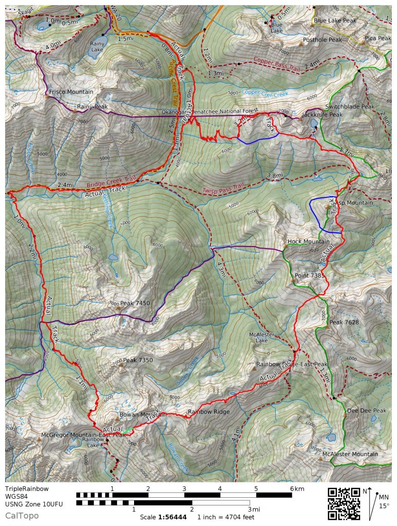
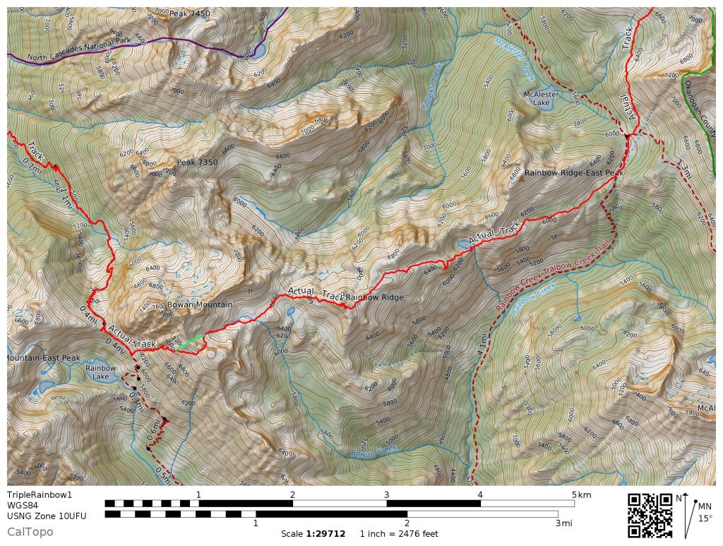
Back home, I have a large wall map of Washington with pins on each notable place I have visited. There are tight groupings in certain areas – the I90 corridor, the Stuart Range – but still there are vast holes. Before summer started, I looked at the biggest gaps and made those areas priorities to explore. One such area was the region between Rainy Pass and Lake Chelan. I figured that area would have lots of larches and fall colors, so I planned a 30 mile off trail traverse, connecting the high terrain of Rainbow Pass, McAlester Pass, and Twisp Pass. I called it the Triple Rainbow High Route.
I was planning on attempting the route solo when a few days before, I saw a new comment on my West McMillan Spire trip report. A guy named Dylan said he would love to come along on an adventure sometime. Having soloed Terror in a day, he seemed legit, so I emailed him and asked him if he wanted to come along on Saturday. I quickly realized that he is the husband of a woman with whom I took my Wilderness First Responder course three years ago! Surprisingly, he agreed to my crazy plans.
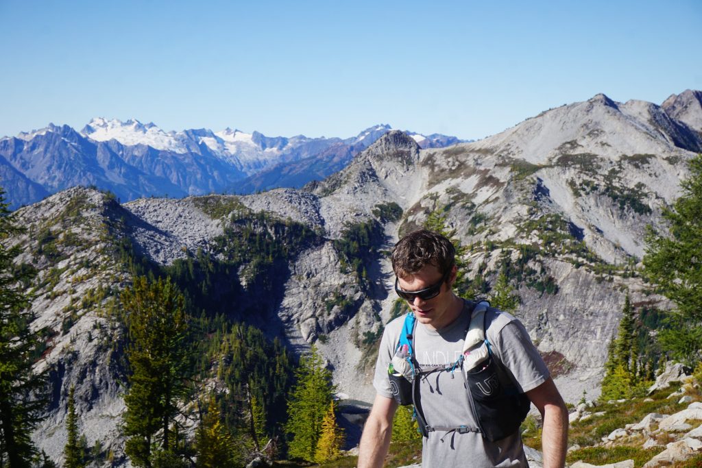
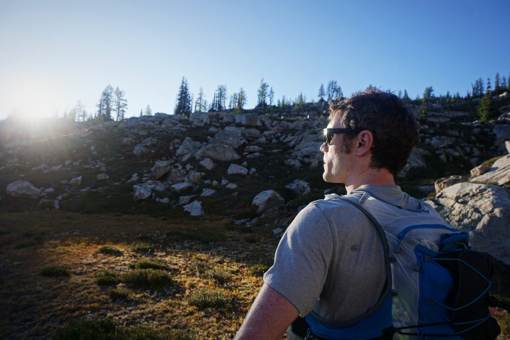
We met in Burlington in the dark morning and drove to Rainy Pass. I quickly realized that Dylan had similar interests as me: combining running and technical climbing to get to the most wild and remote places in the Cascades. We were both software engineers by day and alpine wanderers on the weekend. He just had a good amount of experience on me, both in the mountains and in life.
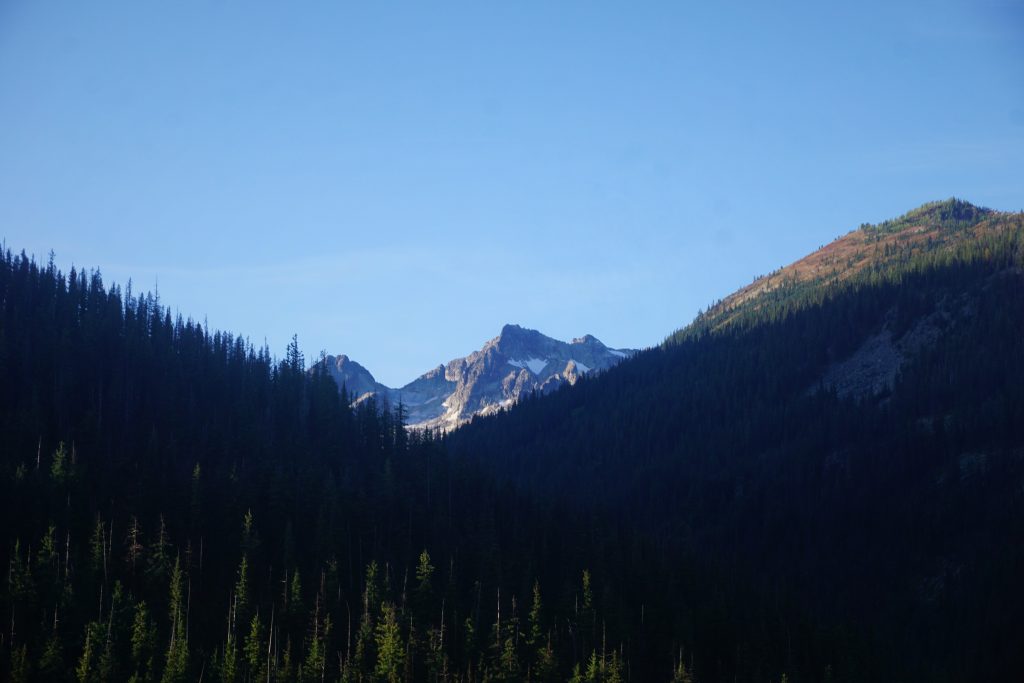
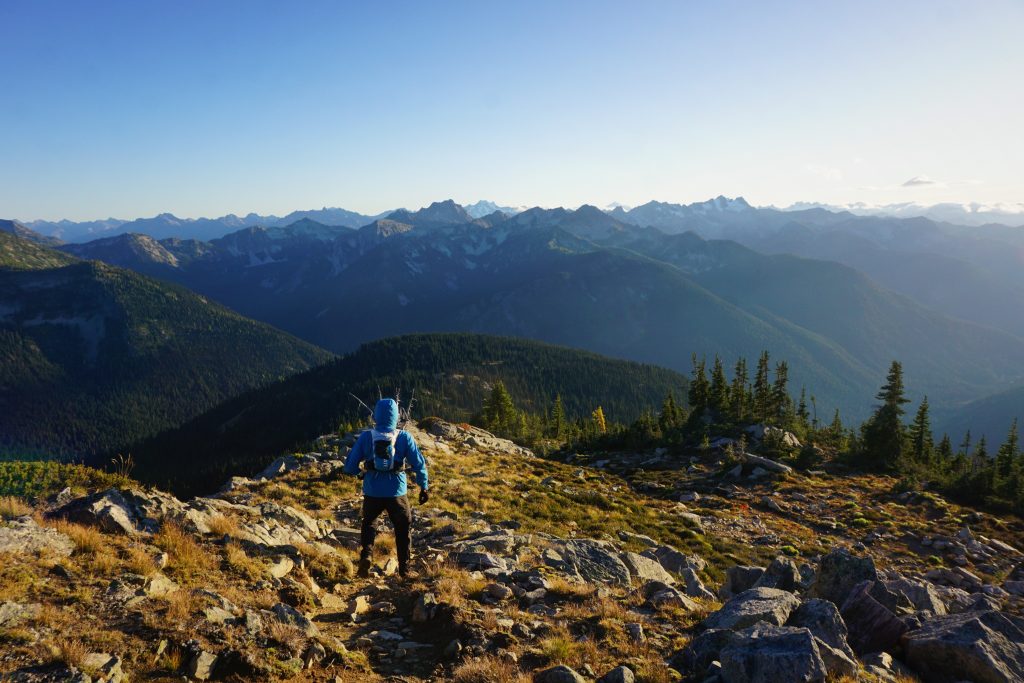
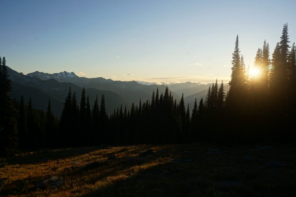
It was a cold, breezy, fall-like morning at the Bridge Creek Trailhead. The clouds were breaking up right at Rainy Pass, but it appeared to be a promising day.
This route was a first for me in that we began with a 6 mile downhill run on the PCT! It was actually a super relaxing way to start the day, flying down the brush-free PCT and soaking in the morning light.
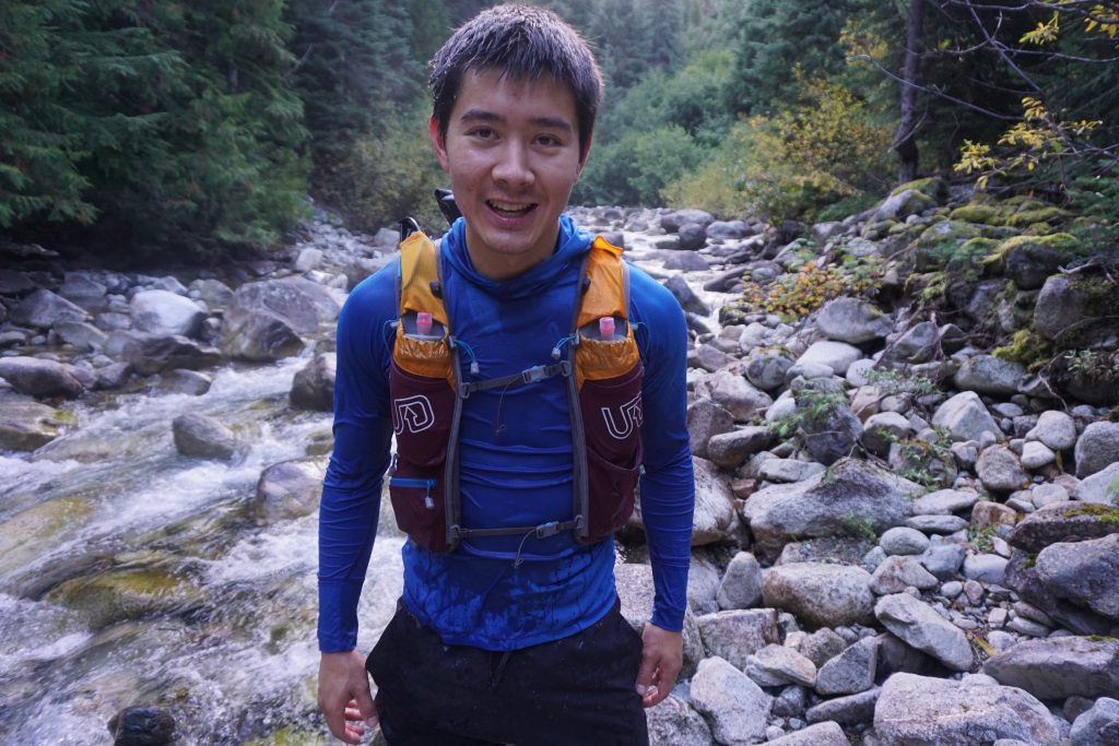
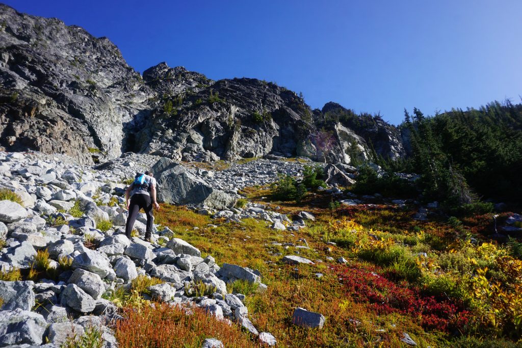
6 miles and one hour into our day, we turned off towards Rainbow Pass. There’s a crossing of Bridge Creek here, which Dylan made look easy. I took it too casually and slipped on some wet boulders, plunging the front of my body into the creek! My camera was completely submerged for a split second, but miraculously seemed to survive the incident. My chest and legs were soaked.
I laughed it off and we started up towards Rainbow Pass. It was impossible to dry off as I got soaked by wet brush, but at least I was able to stay warm by moving. Finally, we started climbing out of the valley and I could start to dry out some.
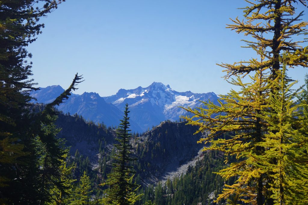
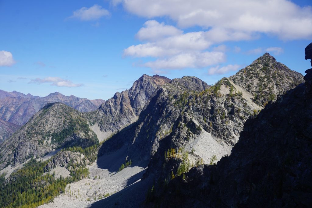
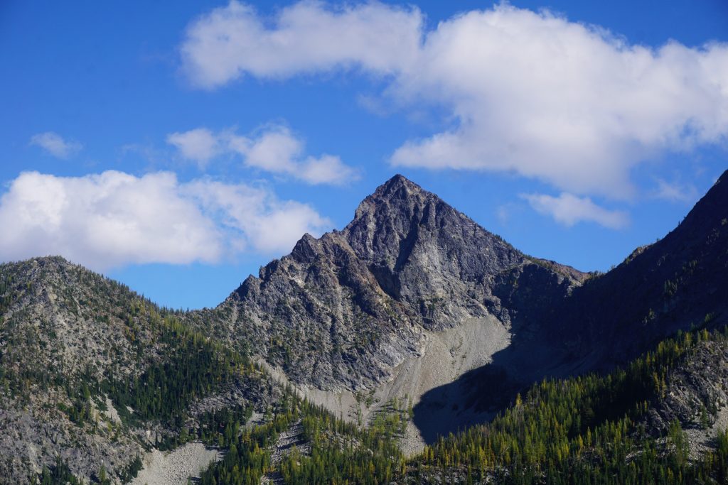
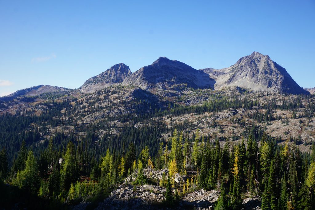
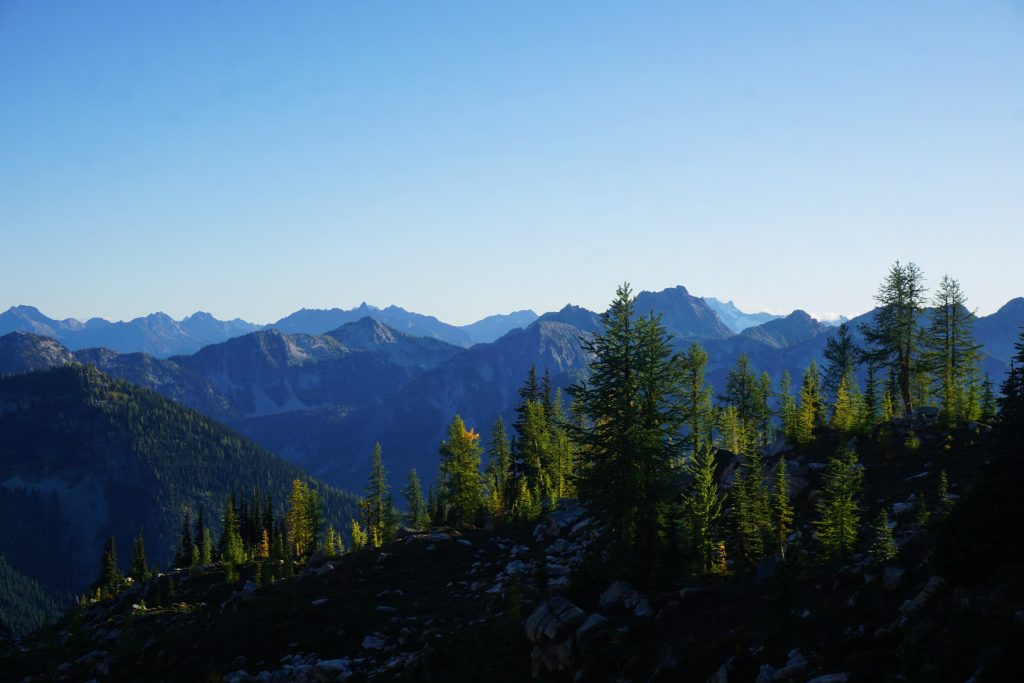
To our west, we gazed at the impressive McGregor Massif. From afar, McGregor is not that impressive looking, but up close, it is huge! Countless granite aretes streak down the north side, some looking like pretty good rock climbs! Pocket glaciers (or rather, small sheets of ice) occupy the cirques between the aretes. It looks like the north side of McGregor could be a wild, scrambling mecca.
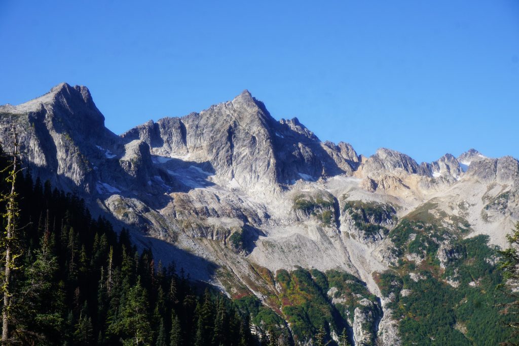
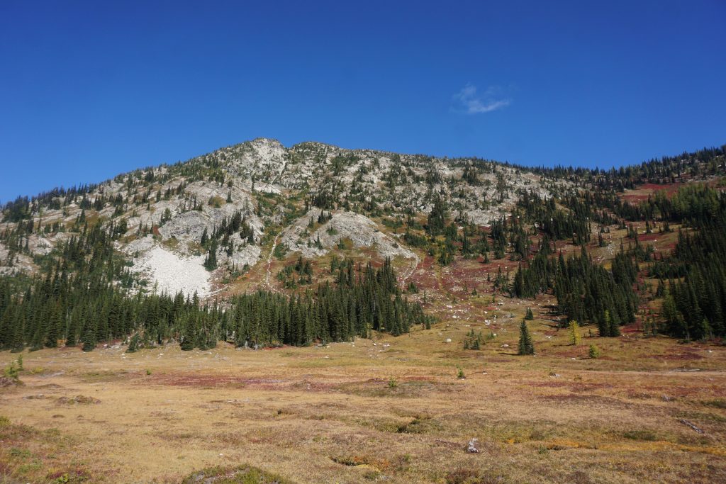
We passed through a wonderful little basin beneath the north face of Bowan Mountain and started switchbacks up to Rainbow Pass. Bowan is a rare nearly 8000 ft mountain in the Cascades that has nearly no climbing beta! I couldn’t find any trip reports online and the Beckey Guide even admits it knows nothing about routes up it! This is truly a remote area.
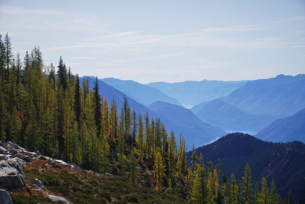
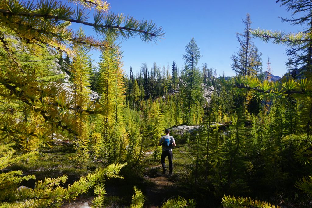
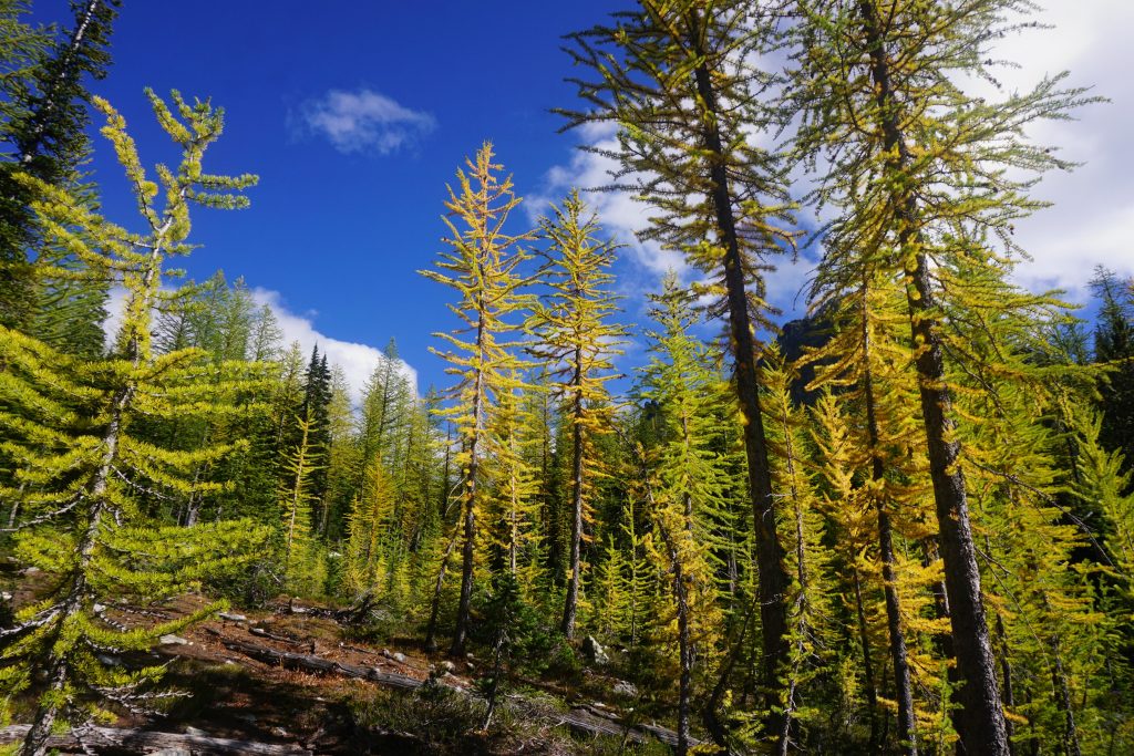
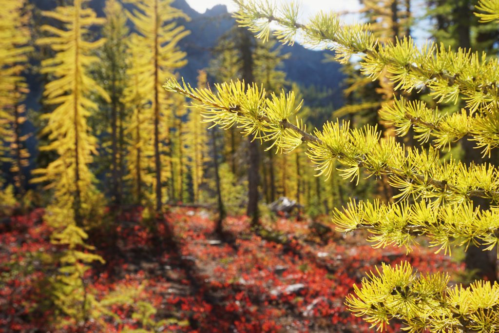
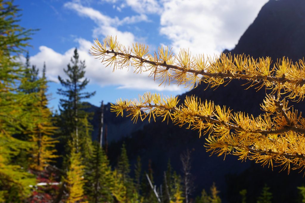
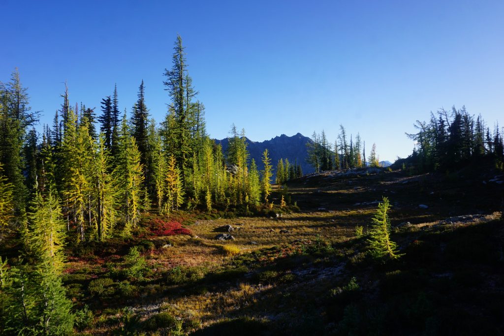
Before the pass, we entered our first larch groves of the trip. The larches were mostly light green, but some were nice and yellow.
We took a break at Rainbow Pass, 12 miles and 3 hours into our day. I tried drying my shoes out in the warm sun. It was a bluebird day, probably the only one of its kind in this two week period. We felt so grateful just to be out here and experiencing the turning of the seasons on such a fine day.
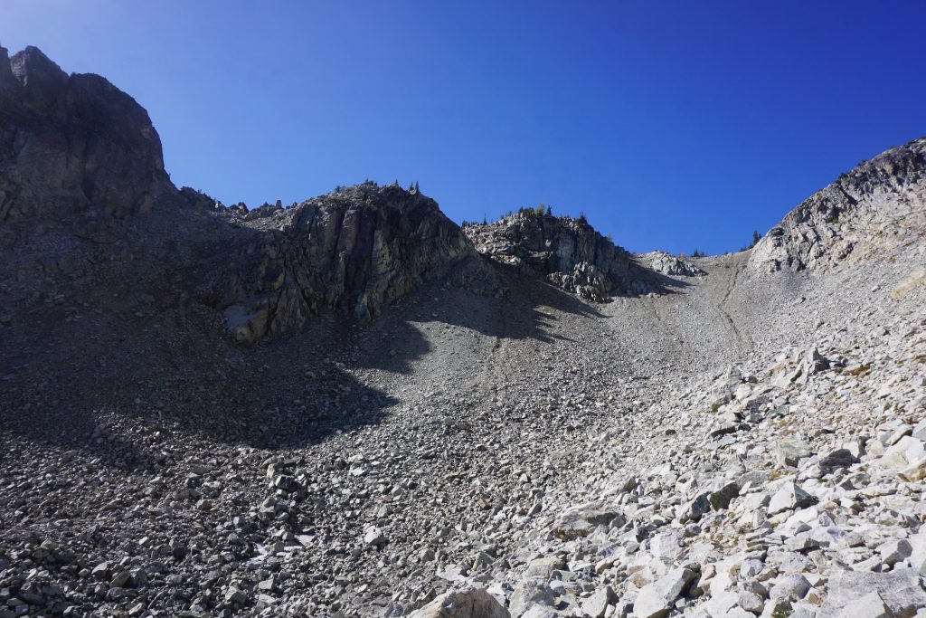
We jogged a few minutes down the other side of the pass before turning left and heading uphill. This was one of the bigger question marks in the route I had drawn. It looked like there was a gully we could take up to the ridge.
In general, we just kept taking the right fork whenever the gullies split. It was mostly just steep hiking with a little bit of easy scrambling.
Eventually, we got close to an open book feature that looked a little harder. The rock was wet and crumbly from all the recent rain, so we decided it was time to bail out of the gully. We traversed right onto a nice face that had easy hiking and scrambling.
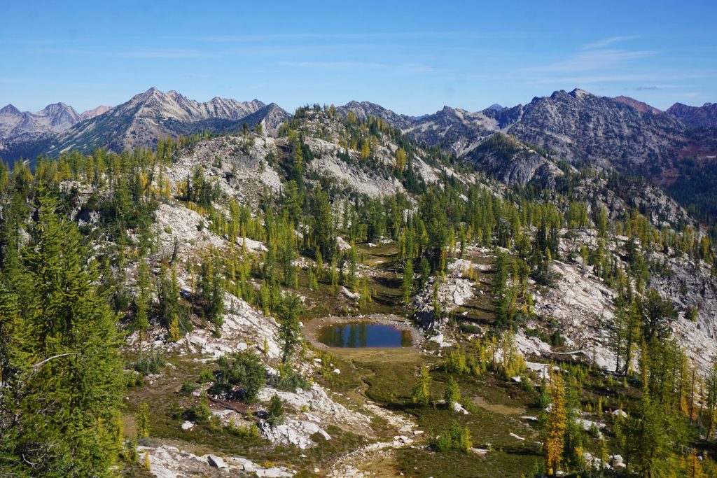
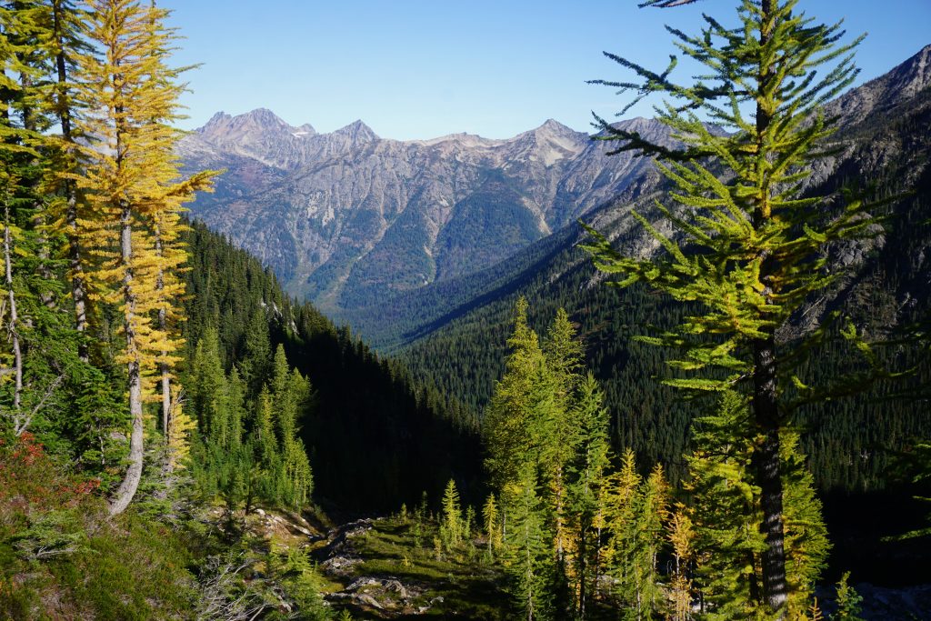
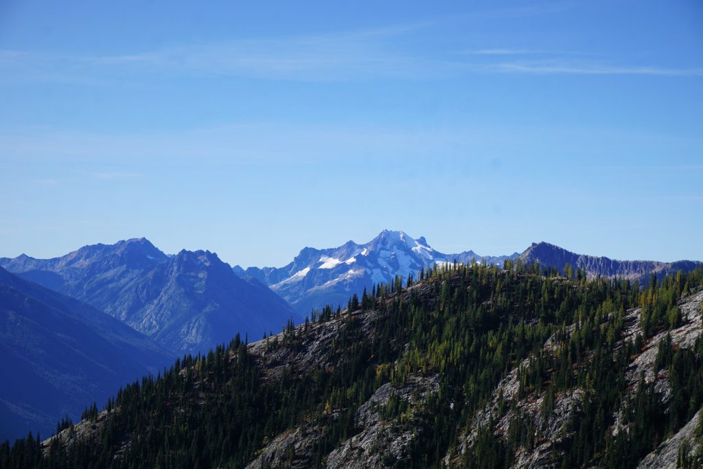
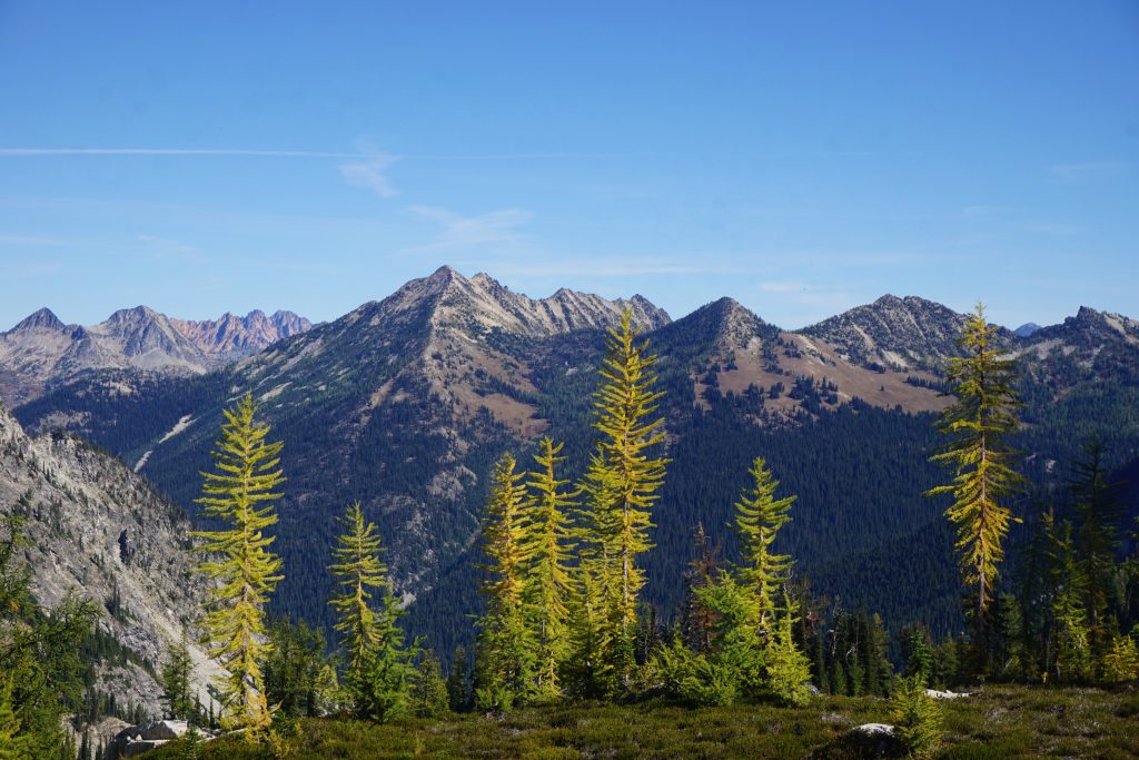
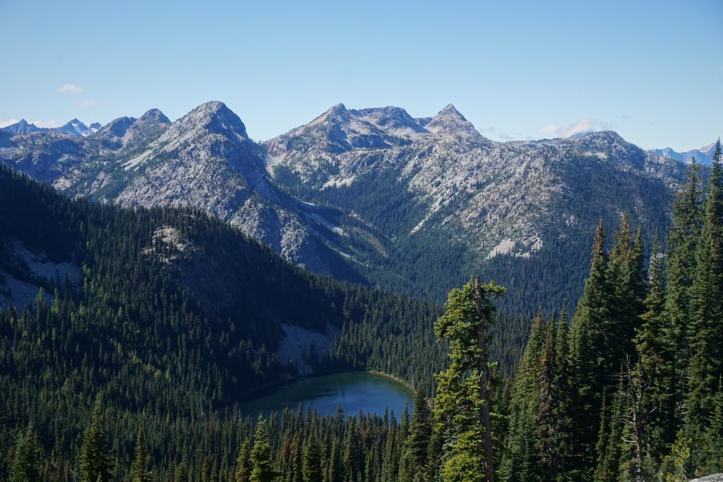
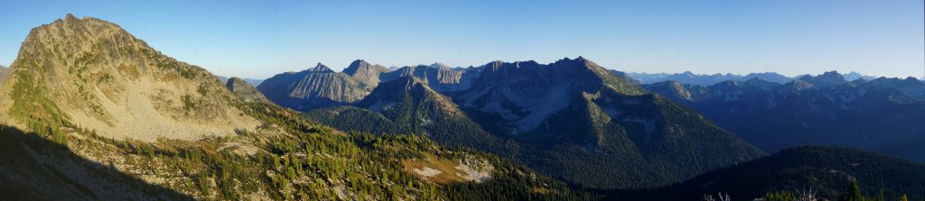
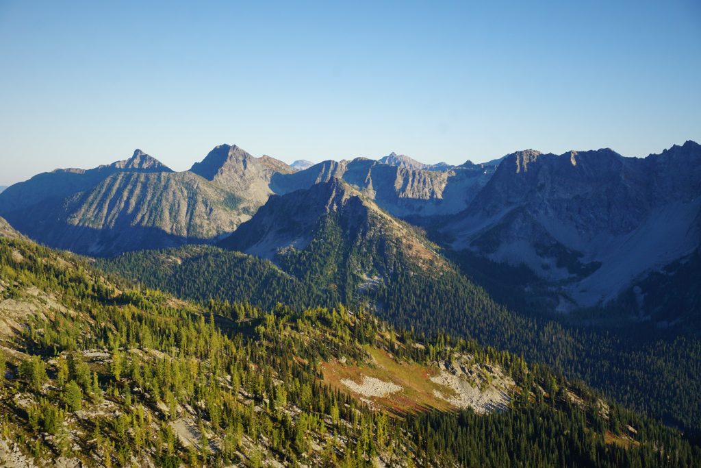
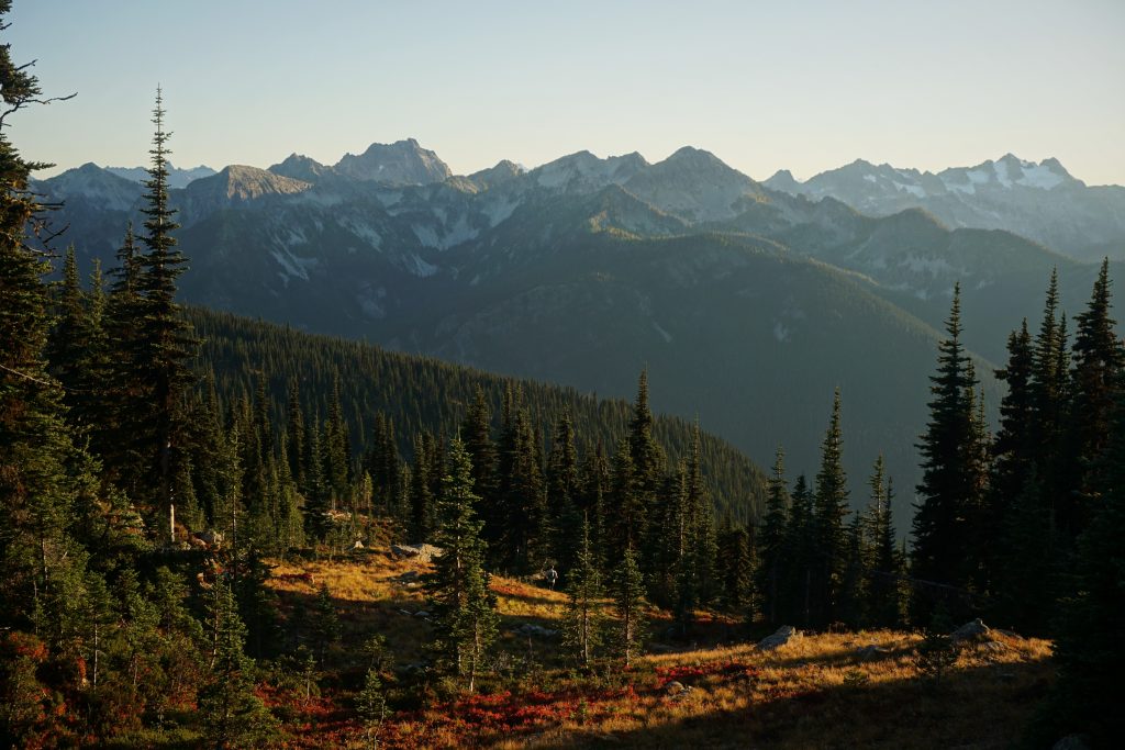
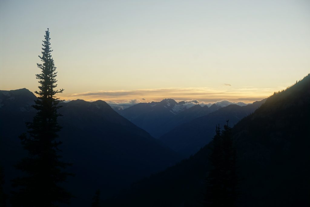
We continued to ascend into lovely larch-filled sub-alpine meadows. We could see Lake Chelan to the south and many mighty peaks of the North Cascades – Bonanza, Glacier, Dome, Logan.
It was difficult to tell where the lowest pass was, so we ended up contouring a lot right. We eventually reached a pass where we got our first view north to the next part of the high route!
Every time I crest a pass like this on an exploratory high route, I get a little nervous and excited. Will it go? What if there are cliffs on the other side? In this case, we peered down at a loose looking moraine. Would it go? Yes. Easily? That is a different question.
It was pretty steep and loose for a few hundred feet, but then was just an easy boulder field. When we looked back, we realized there was a much easier pass just to the north, closer to the summit of Bowan! Whatever, at least our route worked.
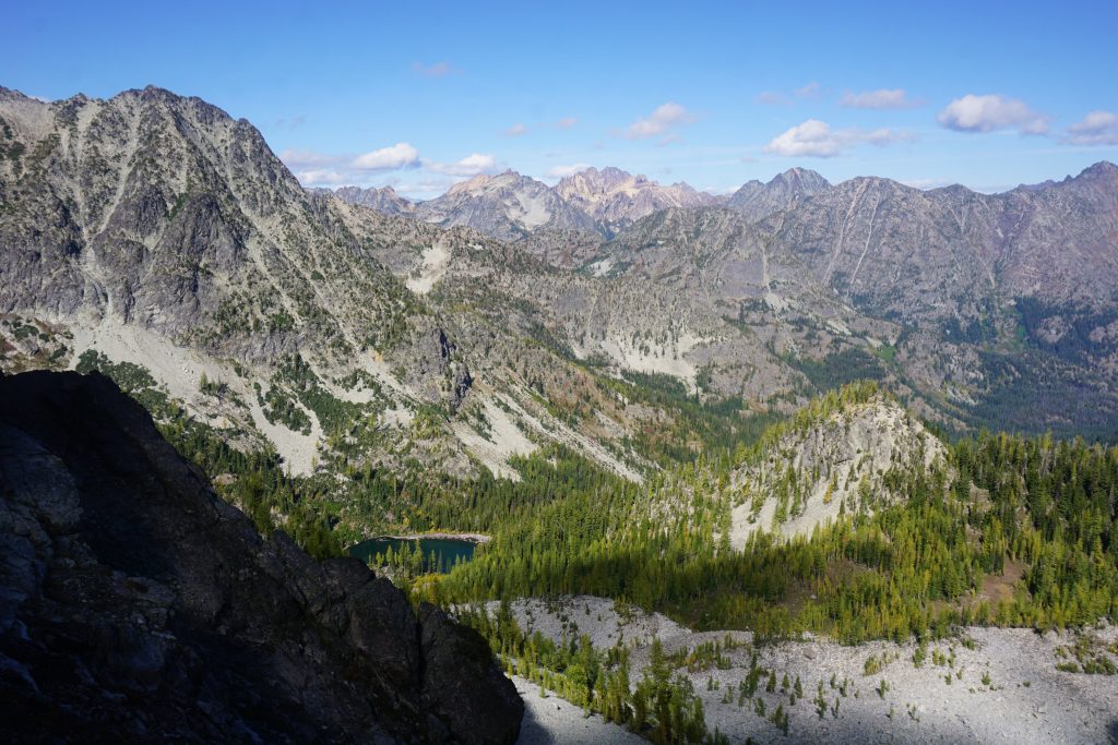
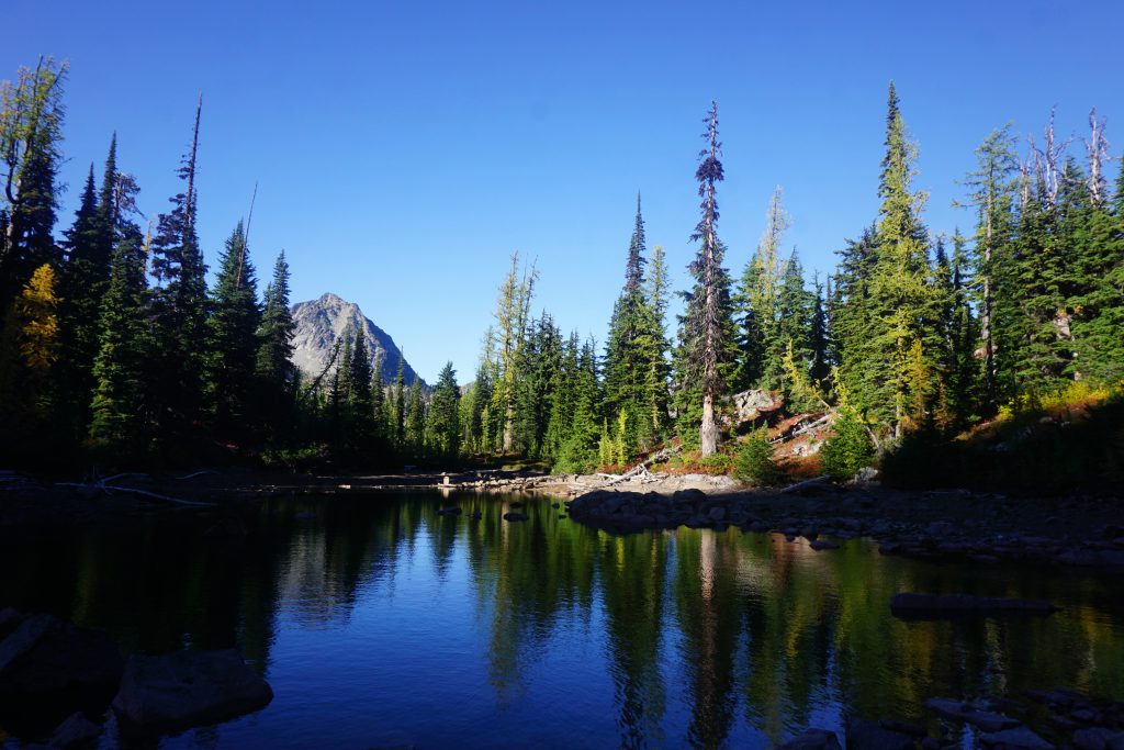
We grabbed some water at a beautiful little stream that emanated from the moraine and continued on our way towards the little unnamed lake.
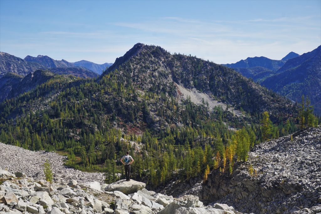
Then we had a gentle ascent up to the high point of Rainbow Ridge.
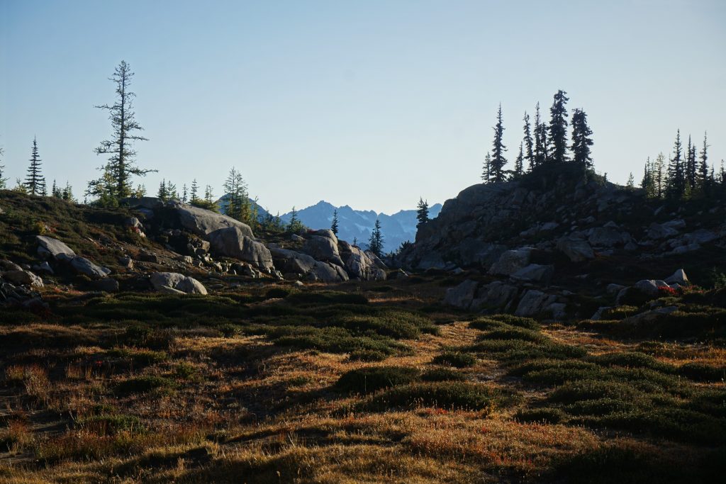
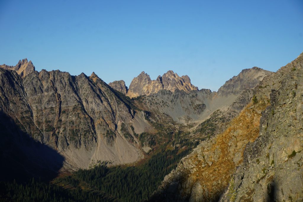
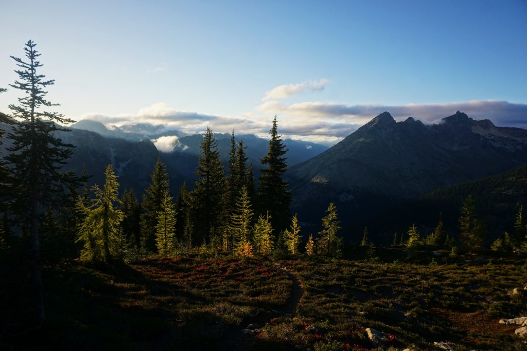
The view from the top of Rainbow Ridge is truly stunning. To our east, we gazed off at an idyllic plateau of tarns, meadows, and larches. To the northwest, we could spot many Cascade giants, including the incredible Picket Range through a narrow slot in the mountains! Clouds poured over the Cascades Crest through Kaiwhat Pass, reminding me of that magical camp at the Hanging Gardens earlier that summer.
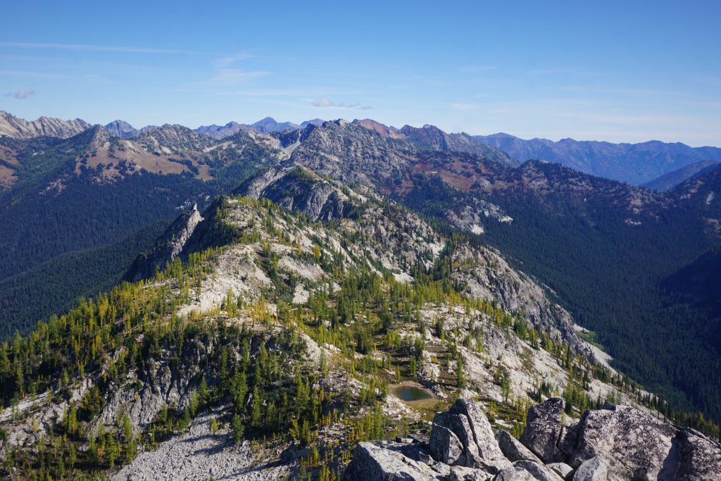
It was a beautiful descent down to the tarn on Rainbow Ridge: dazzling sun and alpine gold. For a few days leading up to this trip, I just had this indescribable feeling that I was on the verge of something great. It was the same feeling I had before the Alpine Lakes Crest Traverse. Now this was the moment when I confirmed those inklings. Rainbow Ridge is simply magical in the fall.
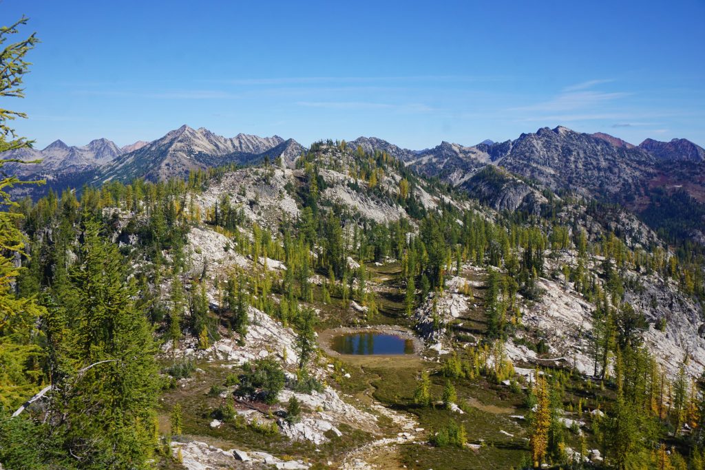
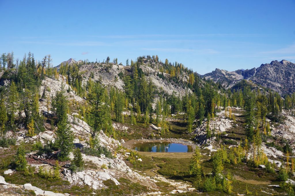
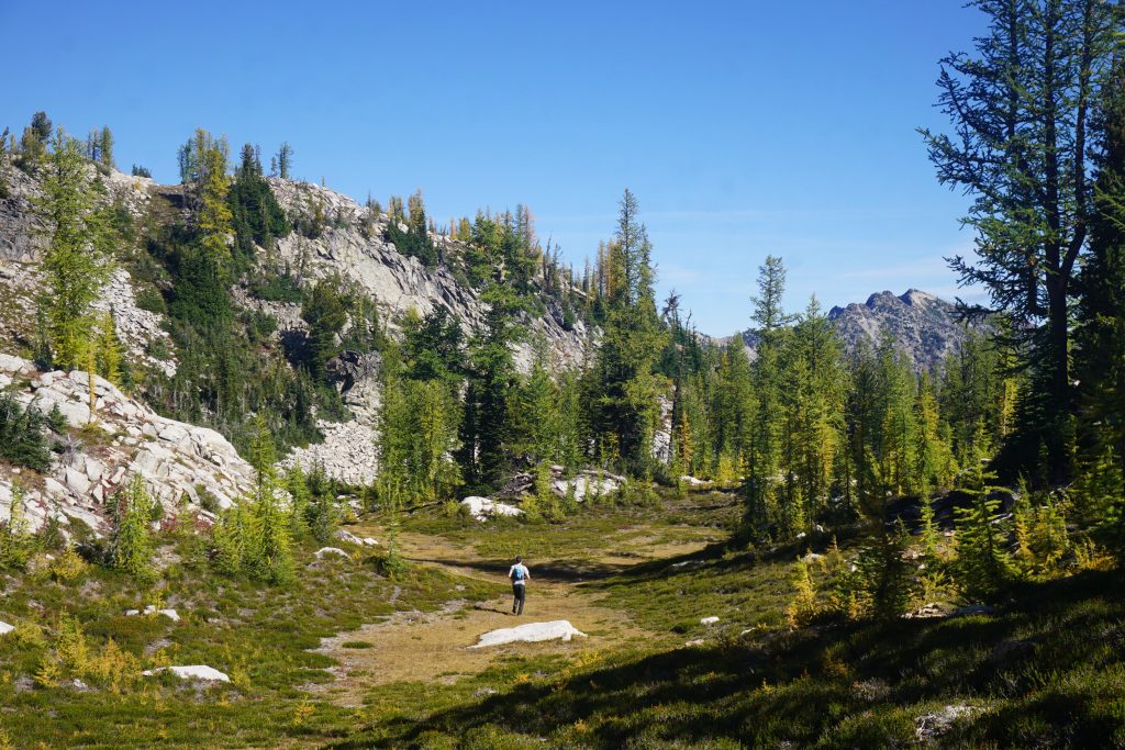
What originally drew me to this route is an incredible geographic feature: a nearly flat bench on the south side of Rainbow Ridge that runs high above the valley all the way to McAlester Pass. It was as if it was made for high route travel. There was a faint trail here and we could even jog through the lovely larch groves!
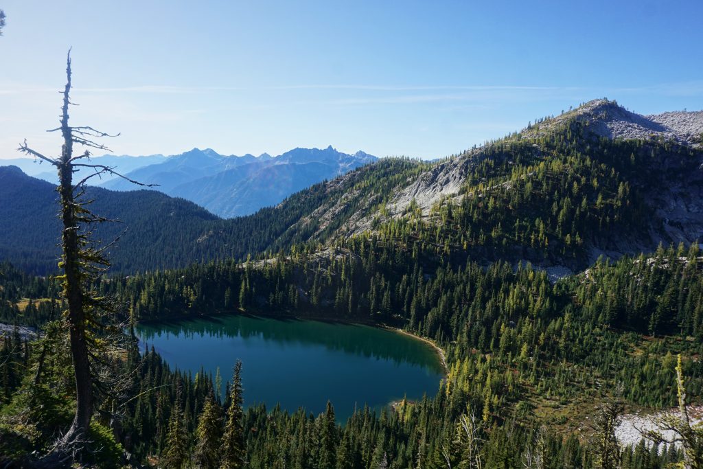
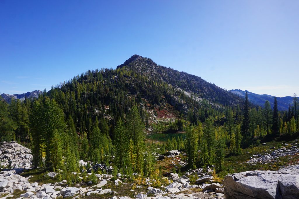
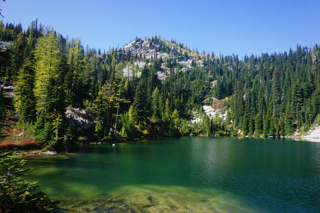
The bench led us down to a bigger lake set in a tight little cirque.
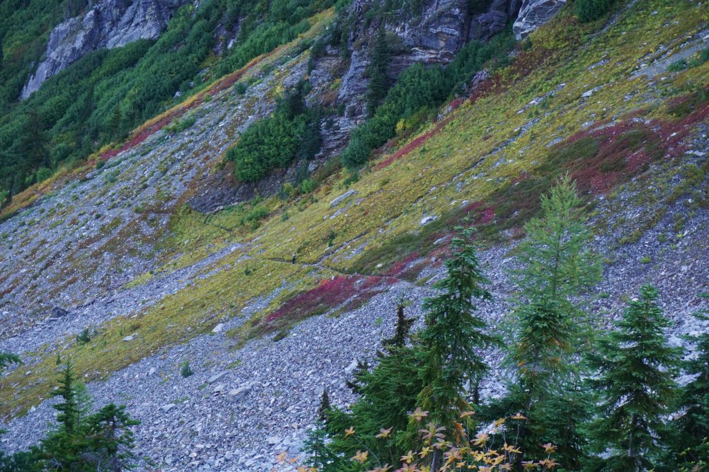
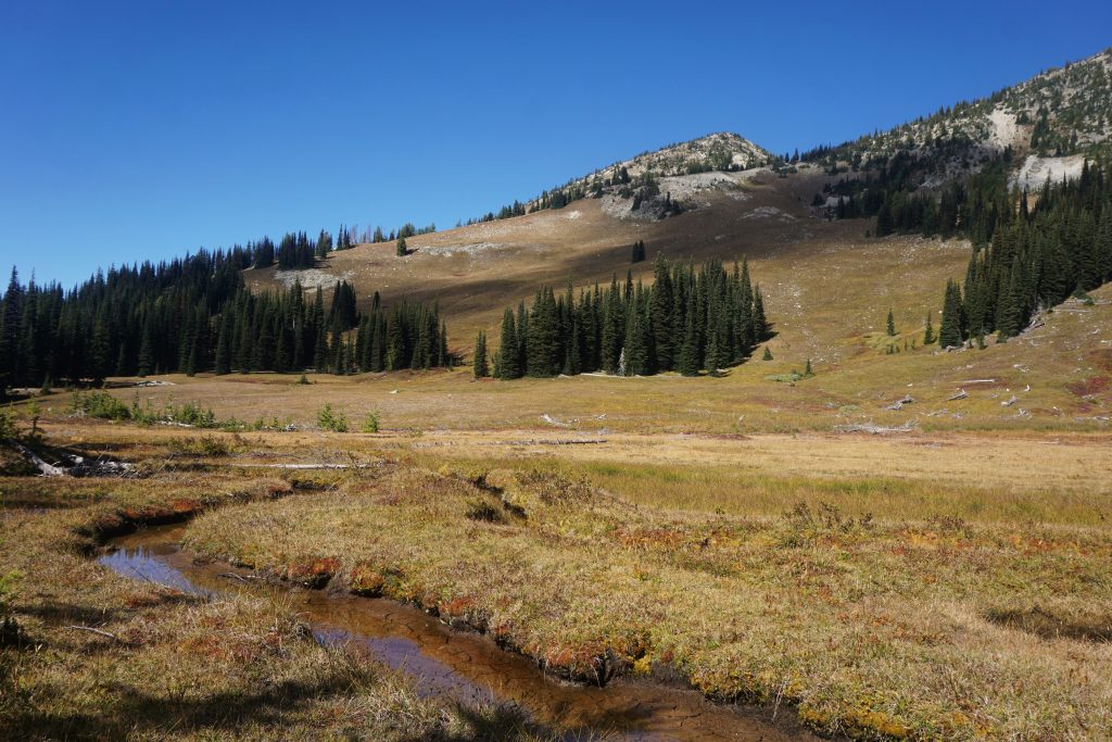
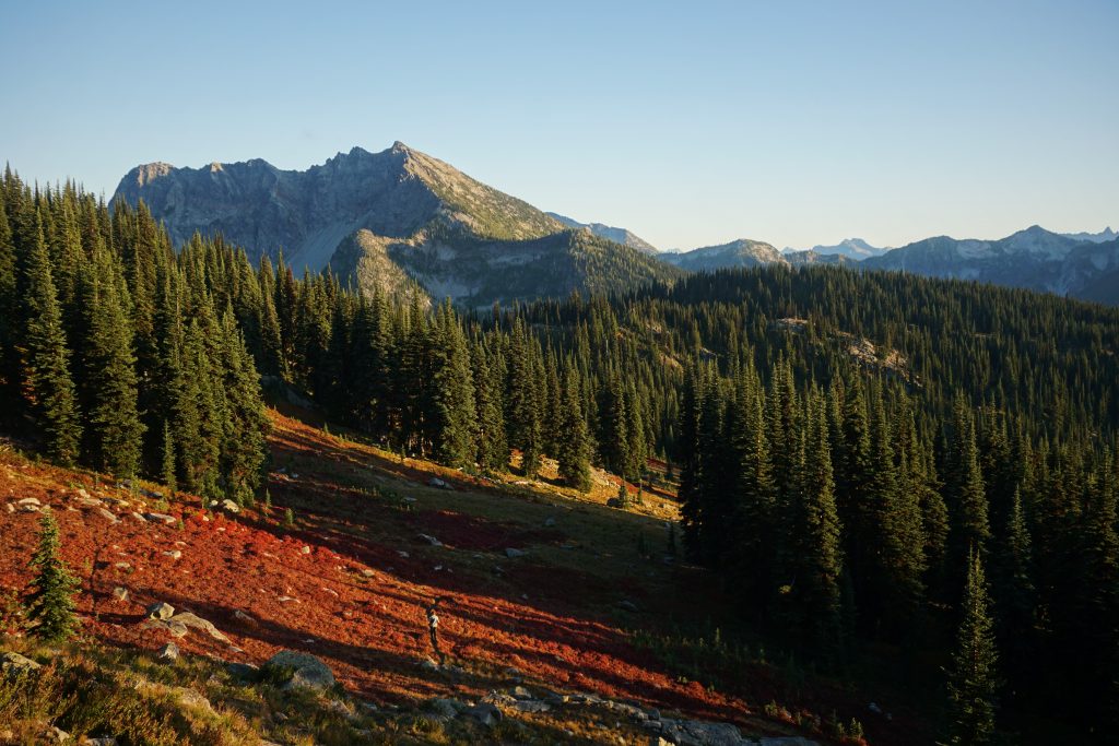
We continued to follow the faint trail all the way until we stumbled out onto the McAlester Pass Trail. We ran through an amazing meadow right at the pass, carpeted in red and yellow.
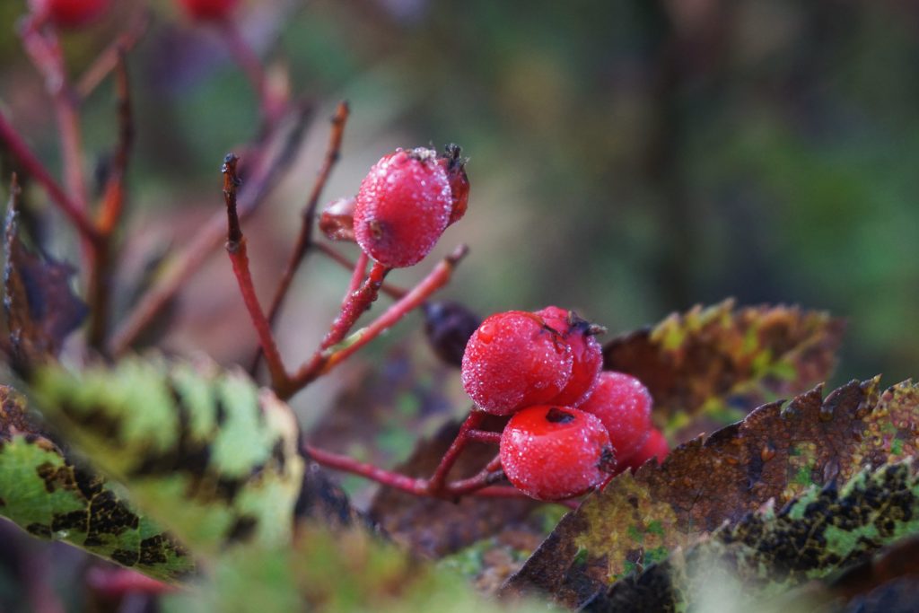
Even though it was still technically summer, fall had already drained so much of the vibrancy from the meadow. In the wake, it left brushstrokes of red across the hillsides, like a painting.
At the pass, we left the trail and started heading north, gradually gaining elevation as we contoured around the hillside.
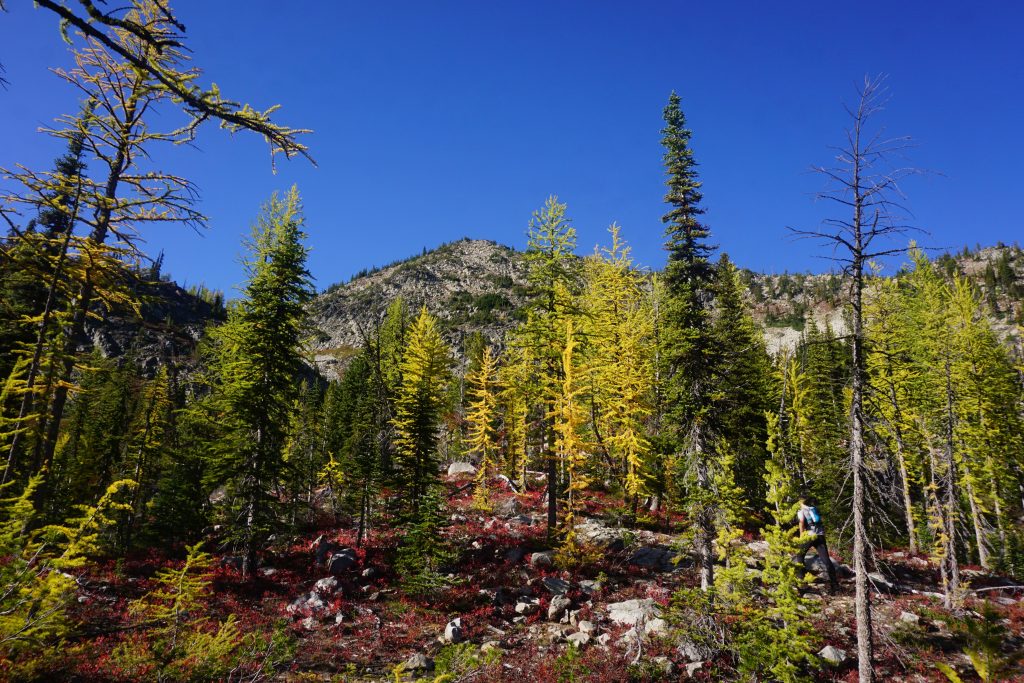
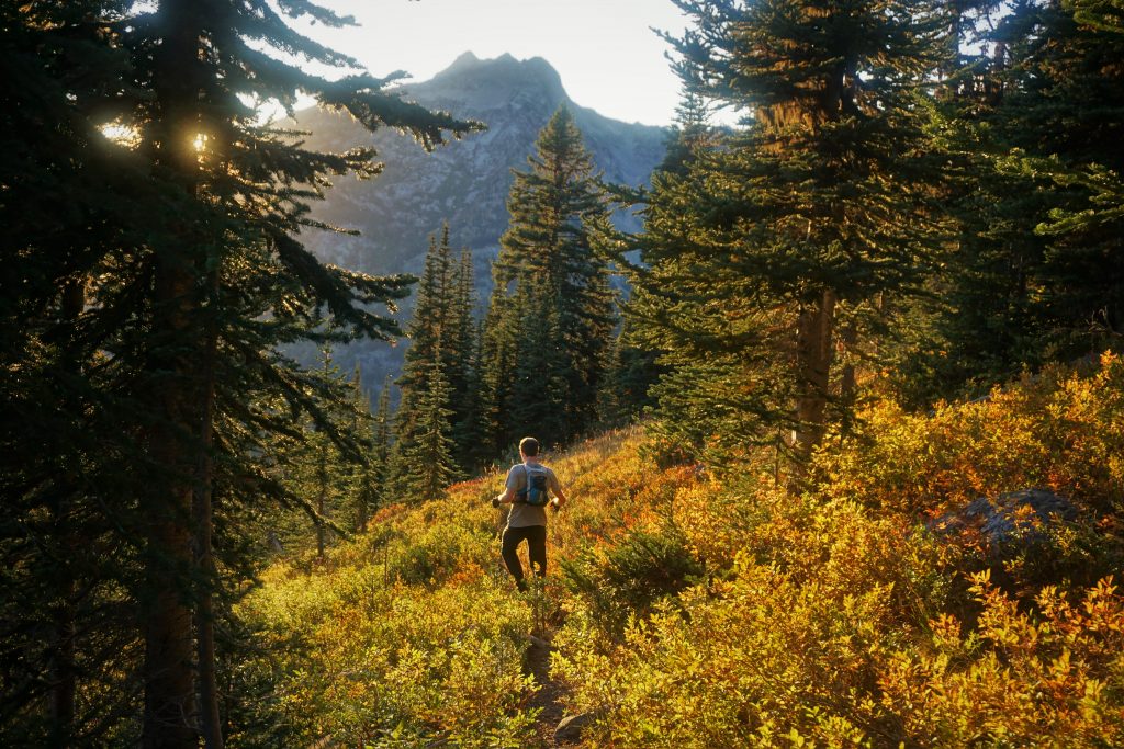
Here we entered yet another beautiful meadow. Larches on the western aspect, and fir trees on the southern aspect. Dylan has been exploring the Cascades far longer than I have and yet he still had not seen anything like this. It felt almost inter-mountain, like we were in Montana or something. The Cascades are so incredibly diverse, even between areas only a dozen miles away. We weren’t far from the rocky Sawtooth, the craggy WA Pass, or the glaciated Goode-Logan area, but this felt like none of the above. It was just so peaceful.
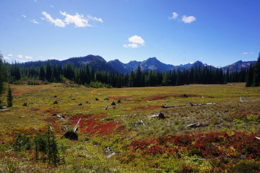
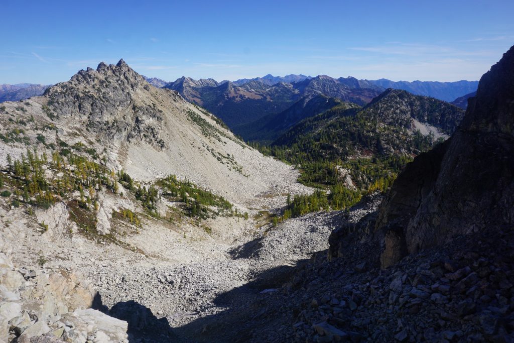
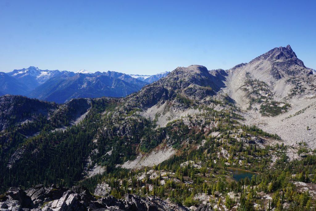
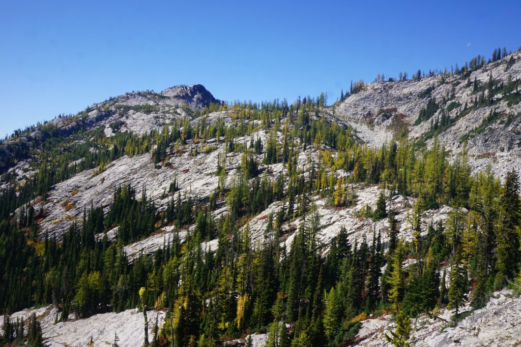
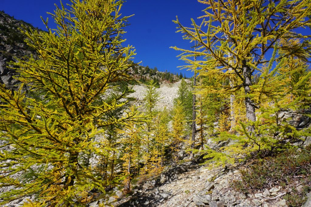
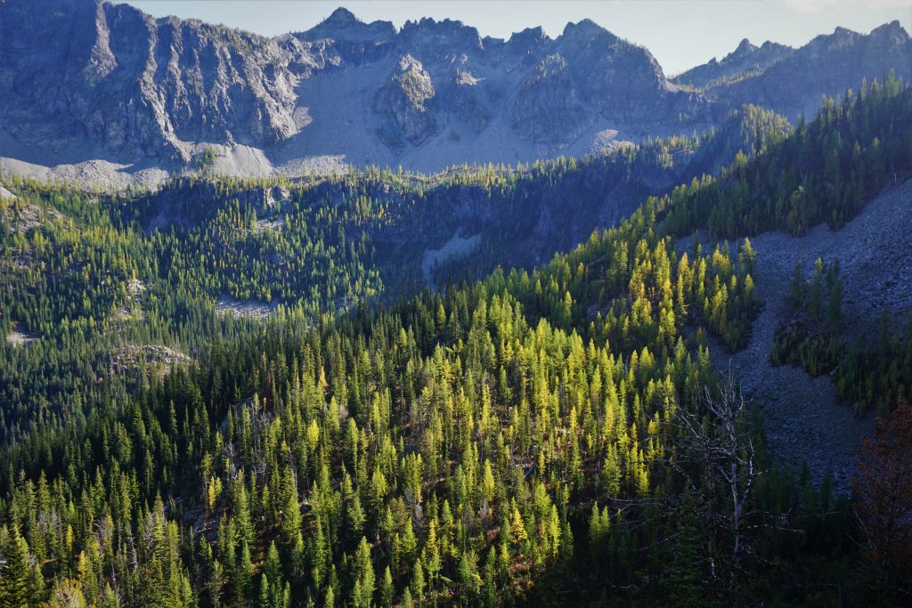
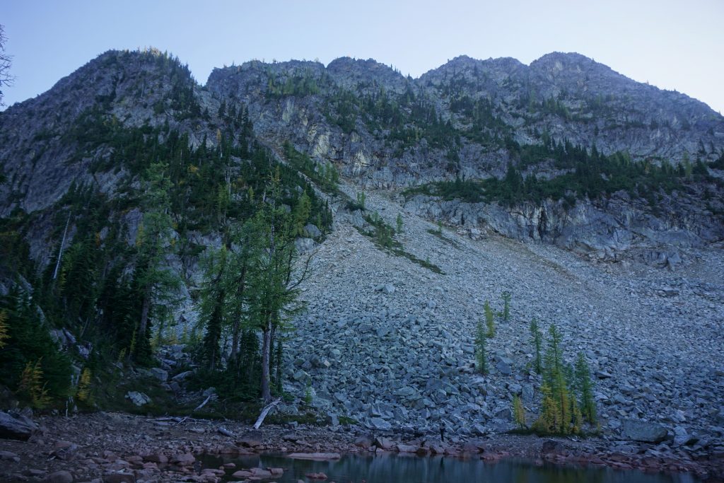
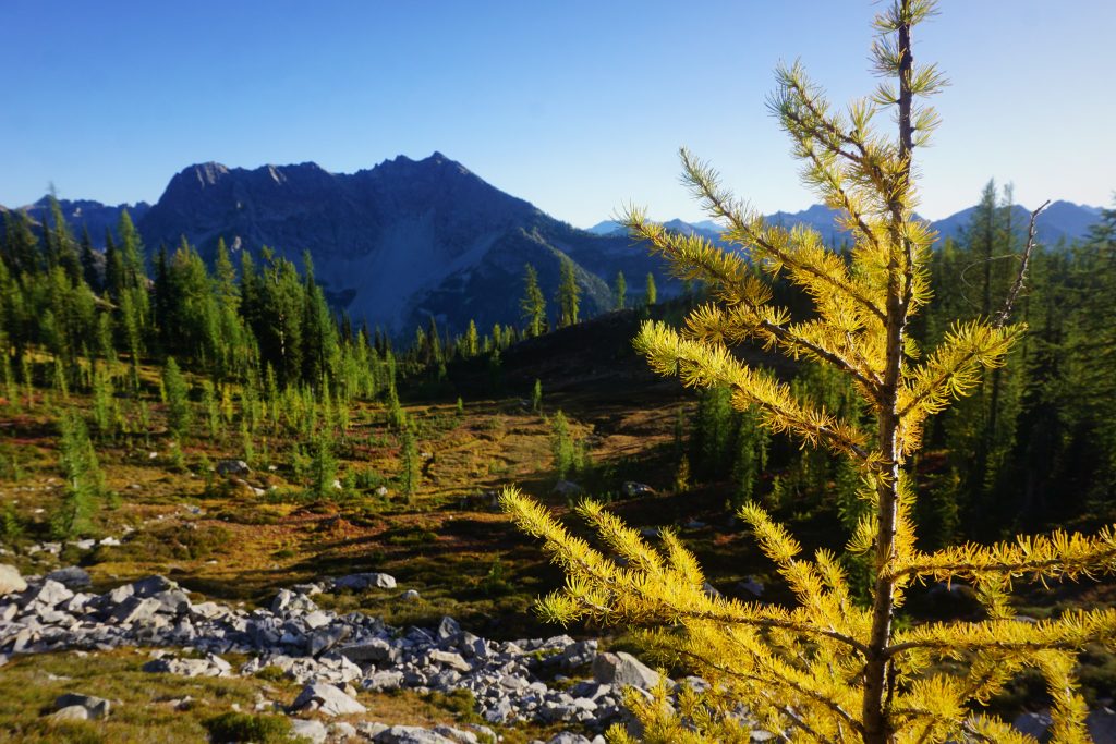
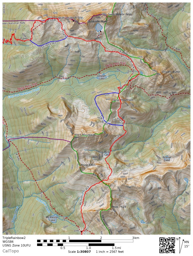
We ascended through some rare-south facing larches to another high pass and peered off to the north. By this point, we knew that any high north aspect would be a glacial moraine. In fact, the geology of this area is super consistent. Nearly every peak or high ridge around 7,000-8,000 ft has a steep, eroded north face with a glacial moraine and often terminal moraine lake beneath. The edges of these moraines are prime larch country. Between this pass and Motherlode Peak, there is an incredible bench miles long formed by moraines that is covered in larches!
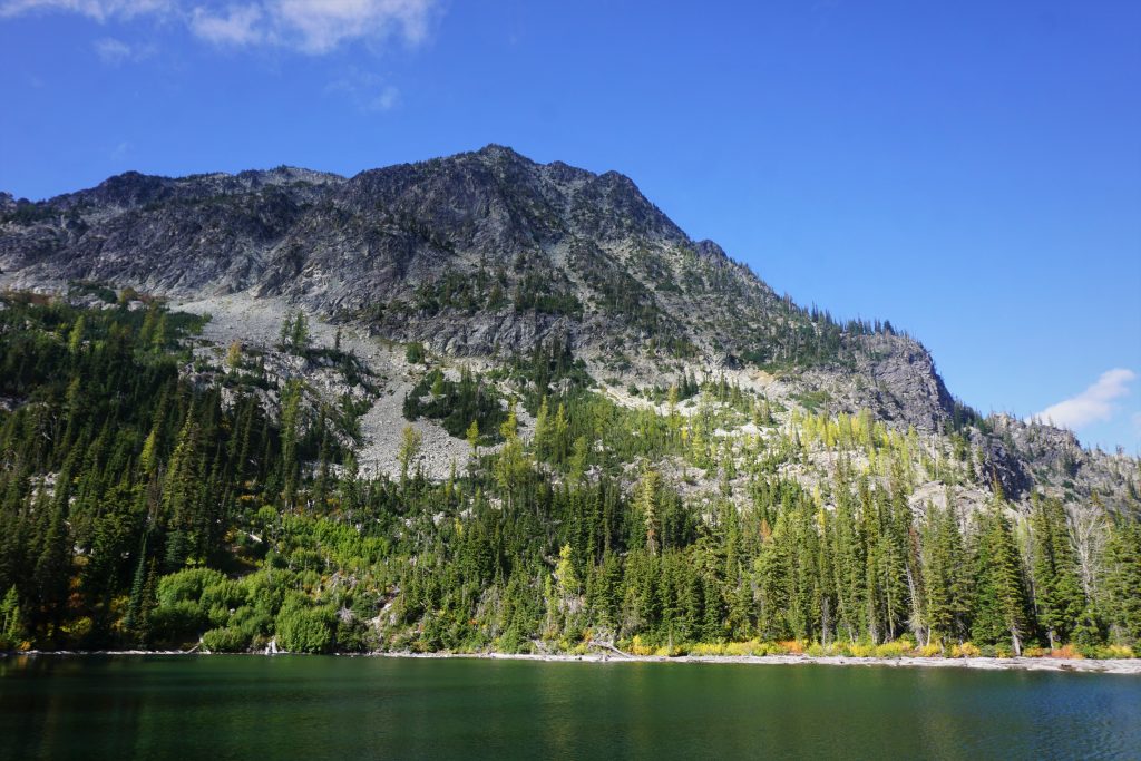
The descent was quite unpleasant. It was medium sized boulders that always shifted under weight. Once we got down to the terminal moraine, we were able to cut over into wondrous larch groves, which made for a pleasant descent down to Twisp Lake.
Twisp Lake surprisingly had some fancy campsites despite the fact there is no easy way to get there. All around, clouds raced above us, casting shadows in the afternoon light.
From Twisp Lake, we followed a faint-to-non-existent trail around the side of Hock Mountain and up the south face of Twisp Mountain.
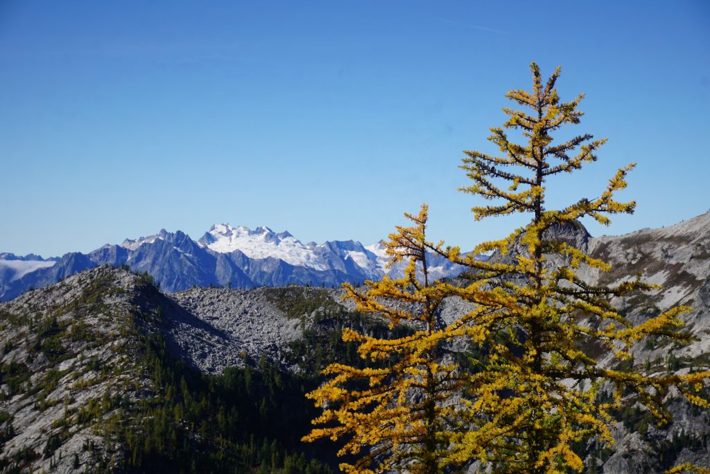
Despite the southerly aspect, the larches here were the best we had seen all trip, ablaze and gold. There is something so magical about how the sunlight filters through the yellow needles, illuminating the canopy. Fall colors may signal death, but they create such a vitality in these mountains. They help us feel accepting of the end. Like most things in life, the emotions they carry are bittersweet. If only we could all go out with such beauty.
Partially from fatigue, and partially from enchantment, Dylan and I slowed down just to let the colors and feelings soak in. This was a special place and a special day. With the incoming snow, we might not get another opportunity this fall to visit such high, remote places.
As we got above treeline, we looked back to the south. The entire valley between Twisp Mountain, Hock Mountain, and Motherlode Peak is absolutely covered in larches, possibly the best valley in the state for larches – truly the motherload of larches.
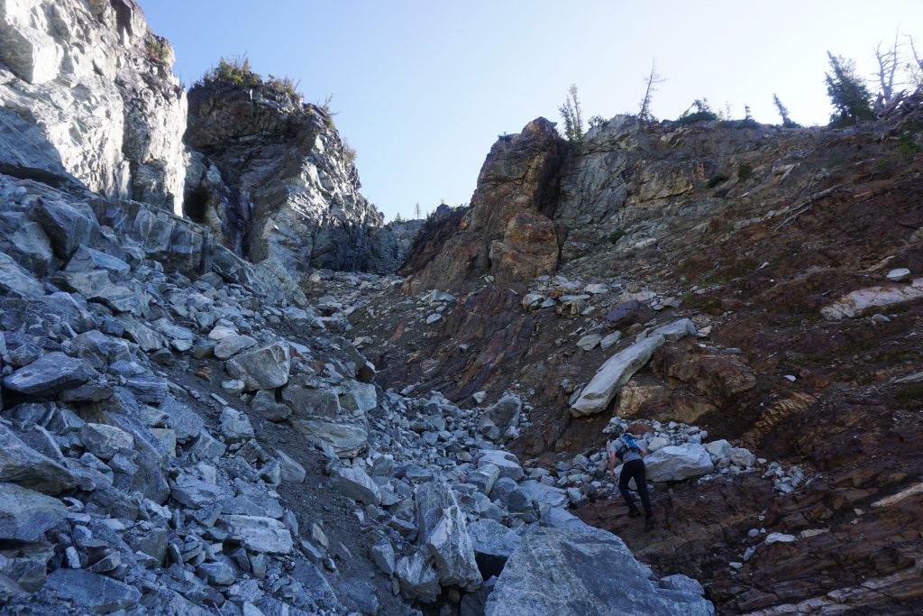
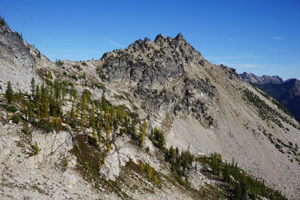
We ascended to a slight notch on the east ridge of Twisp Mountain. The north side of Twisp Mountain is extremely steep but I had spotted a possible weakness while looking at satellite imagery. This was the last big question mark of the traverse, so hopefully it would work out.
To our relief, the other side of the pass was a narrow gully that split the face. It looked gnarly, but at least we could get down it.
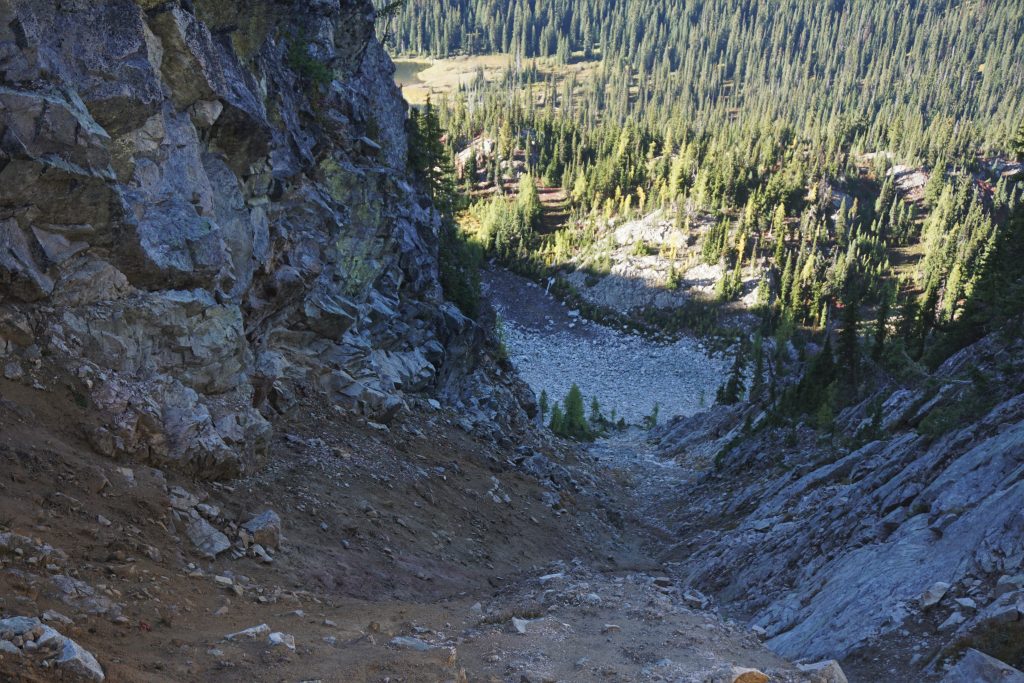
We descended one by one, leap frogging while the other was in a safe place. The upper part was a bowling alley, and all of it was pretty slow and tedious. I am not sure if all the recent rain made it better or worse.
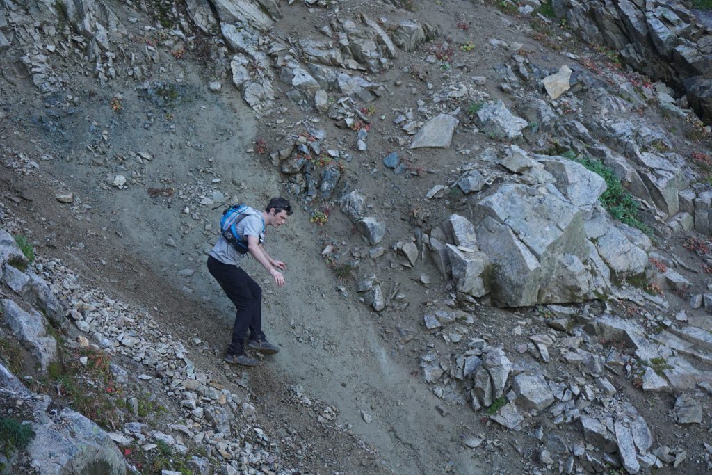
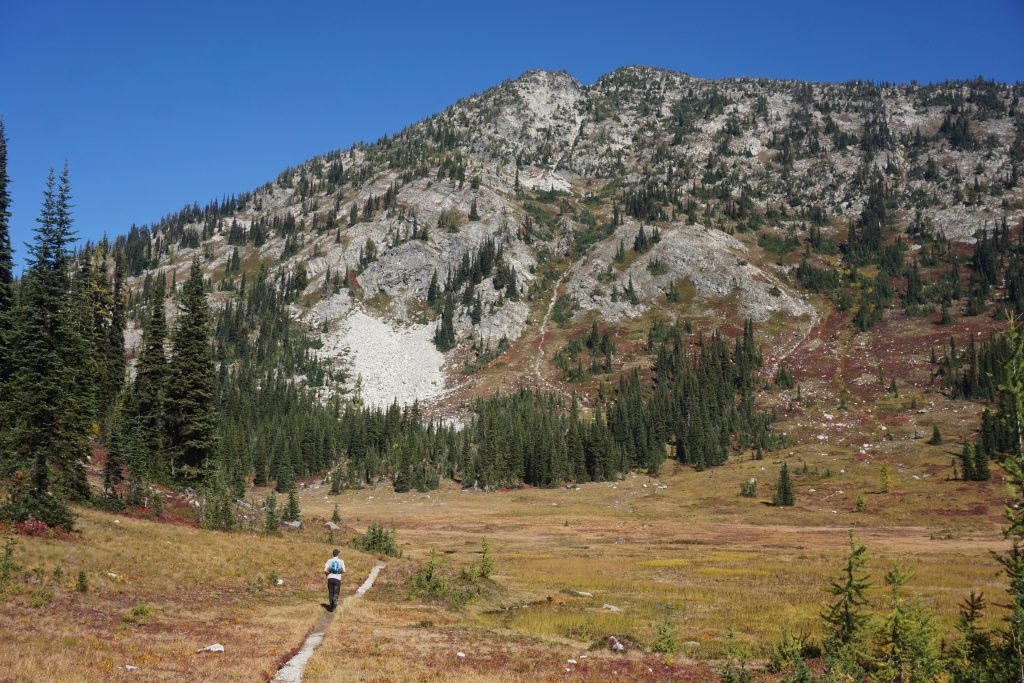
We eventually made it down to lower boulder fields. It was nice to know that the last difficulty of the day had been surmounted. Across the valley, the colorful flanks beneath Stilleto Peak, our end destination, were almost glowing and encouraging us on.
A short traverse led us to Twisp Pass, where we hopped on the trail heading north to the lake beneath Switchblade Peak. It was a beautiful single track and we both still felt surprisingly fresh, so we jogged through through the wonderful colors. Beneath the lake, we entered yet another marvelous basin carpeted in red and dotted in gold.
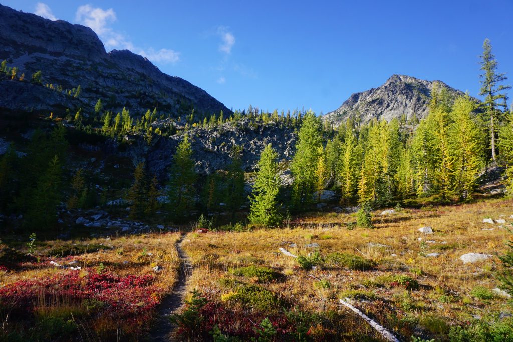
We left the trail and headed up towards a small notch, beginning our final and shortest off trail section. The terrain was easy and stunning, with beautiful views off to the south and west all the way back to Bowan, where we had started only hours earlier.
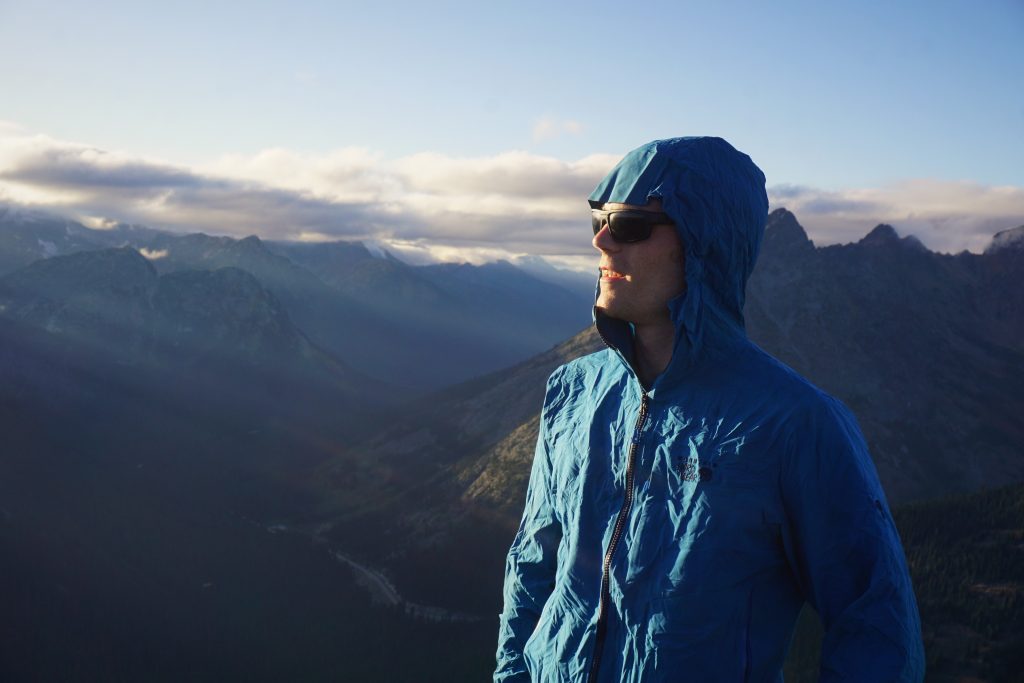
We kept hiking cross country straight into the setting sun. I do not know if it was the distant clouds reflecting light or the vibrant fall ground cover, but the sun seemed even brighter than normal. Even though we were wearing sun glasses, we had trouble seeing our feet or looking anywhere towards the west. So we stumbled forth into the light.
We turned right and started heading north to the saddle between the Stilleto Peak lookout site and Stiletto itself.
At the notch, we gazed down towards Copper Creek and for the the first time all day, we could see the highway once again.
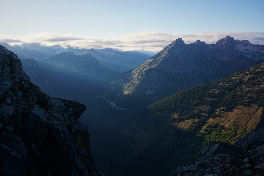
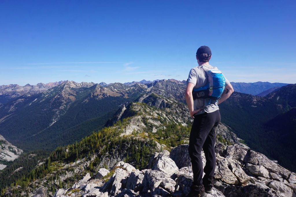
We turned west and began the final ascent to the Stilleto Lookout site. The sun was perfectly aligned with the crest of the ridge, like a gunsight. Every step we took, our heads danced in and out of the dramatic rays. It hit me how incredibly fortunate I was to be here, at this moment, in this place, on this day. Everything was perfect: the light, the mood, the colors; we could not have scripted it any better, even in a fairy tale. There are great days in the mountains, and there are transcendent days. More and more, this was feeling like the latter. This was a golden day, and now it was our finest hour.
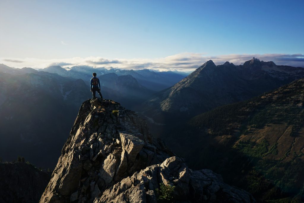
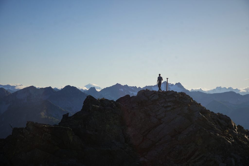
Just past 6 pm, 11 hours after leaving the car, we stood atop the Stilleto Lookout site. And so we looked back at where we came from. Bowan was but a outline on the horizon. In between were enough peaks, meadows, and larch glades to satiate a lifetime of exploration. This is a underappreciated region that has surprised both of us in its loneliness, beauty, and character. And we both know that there are hundreds of other spots just like this in the Cascades if only we continue to dream and explore.
After a short break, we started down towards the valley. The trail was a little faint, but the terrain was super runnable anyways and so we cruised through the open meadows.
As we dropped lower, we flew in and out of the shadows, prancing across the red and yellow carpet. The light on the distant peaks was soft and warm. This section of sunset descent was easily the best run I have ever had. It felt like we were just floating through fields of gold.
People often ask me, “Why do you go so fast? Why don’t you enjoy the experience?” What they fail to understand is that we are simply seeking different experiences. For me, movement and efficiency is an integral part of the experience. When your movement is so in tune with the land, it heightens your senses, broadens your perspectives, and expands your imagination.
Finally, we permanently entered the shade, but our emotions were still so high. The grade of the trail was nice and the ground was soft, making for cruiser downhill running.
We blew right past a trail junction where another trail headed steeply uphill. A few minutes later, we realized we were heading way further down Bridge Creek and not back towards the highway! So we reversed course and started the uphill 2 mile finish to the car.
Somewhere along the way we had to break out our headlamps. The trail is not the best here and we took a few wrong turns in the brush, but we eventually got back to the PCT.
We pulled into the parking lot just before 8 pm, less than 13 hours after we left the car! In total, it was 30 miles and 9,500 ft gain. Both us felt it was an amazing day, high up in the ranks of most memorable ever. We covered so much wonderful high terrain in a single push, without seeing a single other soul! It was one of those days that seem like many days, or even an entire season, packed into one. We saw so much and learned so much about each other. It is difficult to even imagine how stunning this area will be when the larches are at their prime, but even as it was, the colors were breathtaking. This area just felt so peaceful, endearing, and lonely. Thank you to Dylan for reaching out to me and going with my crazy schemes! I know we will have more great adventures in the future.
Notes:
- I really, really loved this route in the fall time. My descriptions were not hyperbole.
- I think doing the loop counter clockwise like we did makes sense: you get the nice long downhill jog to start and you cover the longer high route sections before ending with the easy Stilleto Peak part. Sure, the north facing descents sucked, but going up them would not be great either.
- We did not bring helmets, but had to be pretty careful in a few spots. I definitely appreciated the poles on the steep moraine dirt descents. Crampons and an ice ax could help in a few places with the wet dirt, but I wouldn’t want to carry them.
- If you overnight this, some of it is in the National Park and I am not sure what the deal is for Lake Chelan National Recreation Area, so look into that.
- There are lots of good side summits, like Bowan, Hock, Twisp, and Stilleto.
- If you did not want to go down the gully on the north side of Twisp, you could probably go around Twisp Mountain to the west.
- Generally, the off trail travel is very easy. Most of it is walking and nothing is really harder than class 2, but it does add up and get tiring over time.
- If I had to choose just one off trail section, it would be from Rainbow Pass to McAlester Pass. Rainbow Ridge is unreal.
- I love how different this area is. The Cascades just have so much to offer!
Thanks for letting me tag along! What a way to finish the summer. It’s a good thing you stop to take so many pictures or I’m not sure if I could keep up :-D.
It was a great day out!
Hey! Just stumbled on this report. I have spent time along rainbow ridge during a solo a number of years ago. It is truly wonderful. Great to see how you accessed it. I came in via McAllister trail/lake. After my day on rainbow I made my way over the summit of Hock to dagger lake and beyond to copper pass via a really cool little ledge between Jacknife and Copper pass. An airy moment for a soloist. Came out via Copper trail. I just love that area. You’ve inspired me to return next summer or fall. Great work. I’m not a runner (63 yo) but I can still access cool terrain. Your stamina and speed is incredible. Also, your maps are appreciated. Here’s!
Hey Bruce! That’s truly a special part of the Cascades, eh? I recently did a trip from Stiletto to Copper Pass on the south side of Jacknife, perhaps we took the same ledge?
Hi Kyle! Thank you for sharing your trips, they are an inspiration for me. I have repeated a few in the past years (Glacier Peak, McMillan Spire, Hinman) and enjoyed all of them! I’m hoping to do more of these in the future. This past Tuesday a friend and I repeated Triple Rainbow and it was awesome too.
We did it clockwise because I felt I’d like to be done with the off-trail portions first so that we can finish in the dark (which is exactly what happened). CW Triple Rainbow ended up being 50 km distance with 3 km elevation gain over 16 hours for us. We didn’t run very much, most of the time the terrain was either too rugged or we were too tired so we ended up running only on the descent from Rainbow Pass.
Our track: https://caltopo.com/m/J0JLP
We found the off trail portions mellow except for the descent down to Rainbow Lake. It started raining just before we hit the steep rock band around 6,300 ft which made it feel quite spicy for our taste.
Again, thank you for sharing!
I’m glad you had such a great experience Petr!
Hero!!! Thanks so much for adding a downloadable track!