
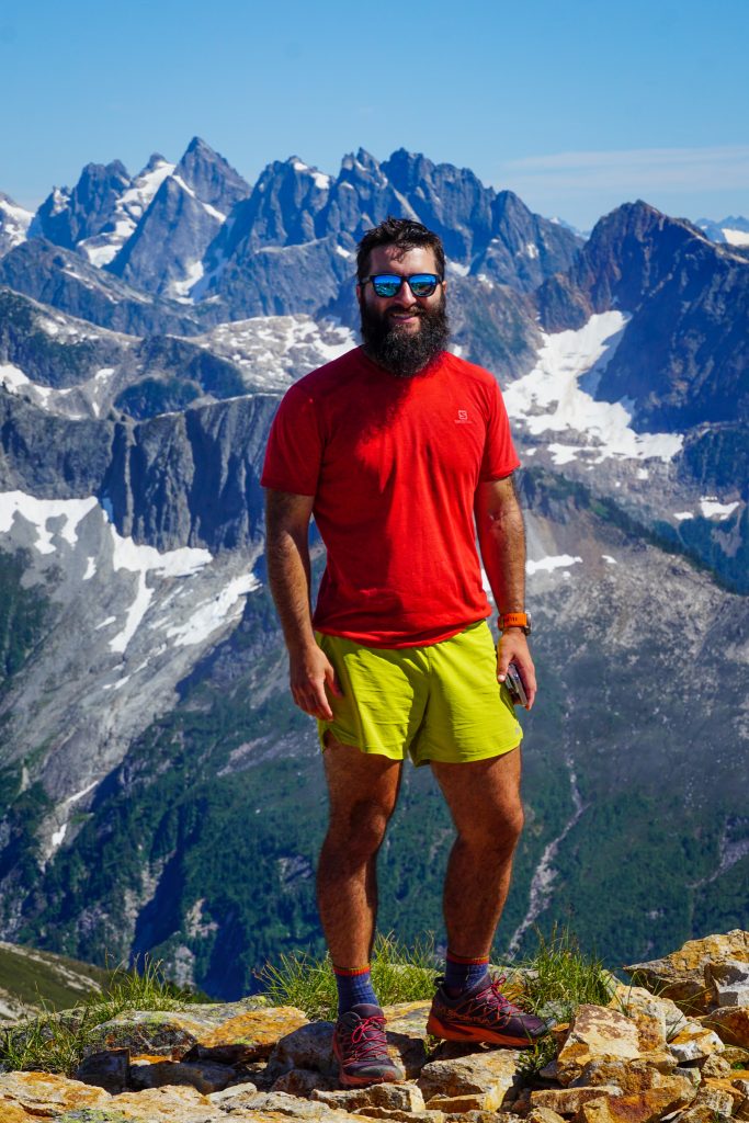
North Cascadian Obscurity
Daniel and Austin had a big goal this summer to do a giant crossing of the North Cascades. They wanted to do a more technical high route across the western portion before running across the Pasayten Wilderness over multiple days. Logan and I offered to be the support for the initial high route. After much deliberation, we eventually settled on a Northern Pickets Traverse.
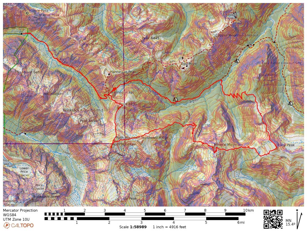
The Northern Pickets Traverse from Hannegan Pass to Ross Lake involves a heinous 3 hour car shuttle, so Logan and I decided it would be simplest if we do an out-and-back from Hannegan to kick off the trip and remove the need to recover a car at the end. Our plan was to accompany Daniel and Austin to Easy Peak before returning via Mineral Mountain and an obscure high route to Ruth.
We all left the Ross Dam Trailhead early Saturday morning and drove over to Hannegan. I had never actually been up to Hannegan Pass, so it was nice to finally see this zone.
Once at Hannegan, we followed the trail dropping into the Chilliwack River Valley on the other side. After a few miles, we noticed a faint use path leading down to the river. This is the junction of the abandoned Easy Ridge Trail.
There were some nice logs so we did not even need to get our feet wet on the crossing. We quickly found the old trail on the other side. Sometimes it was pretty brushy, but it was almost always clear where the footpath was because there would be no growth at your feet. We carefully followed it uphill and it gradually improved. This was in the heat of the day so we were all sweating like crazy.
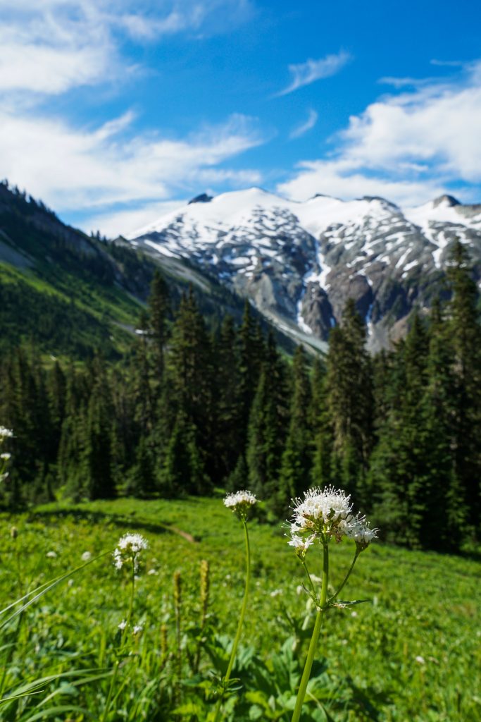
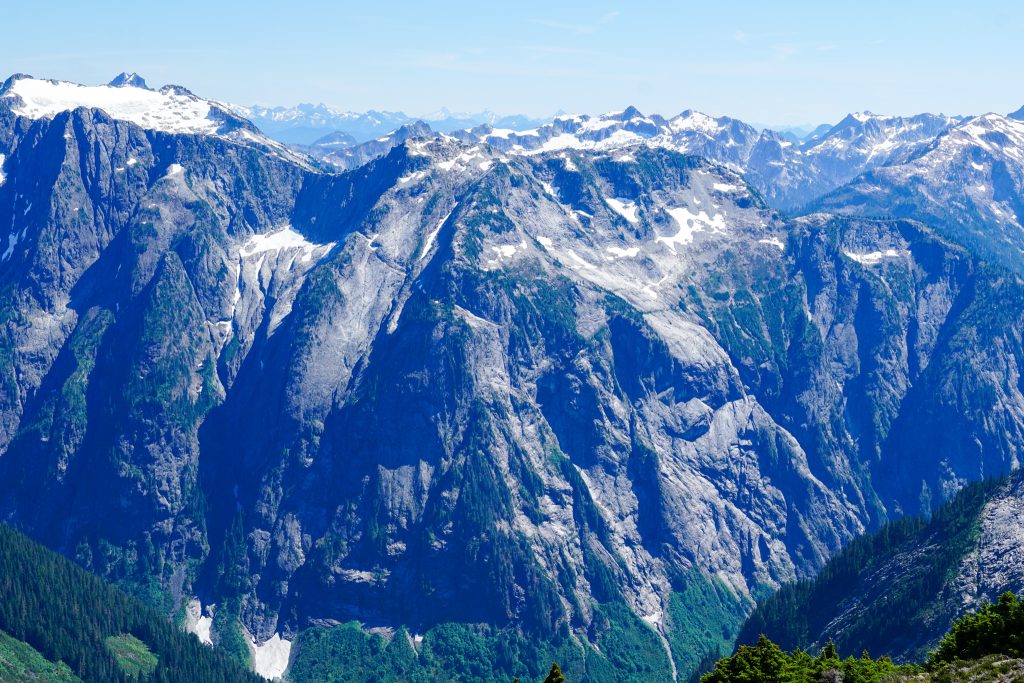
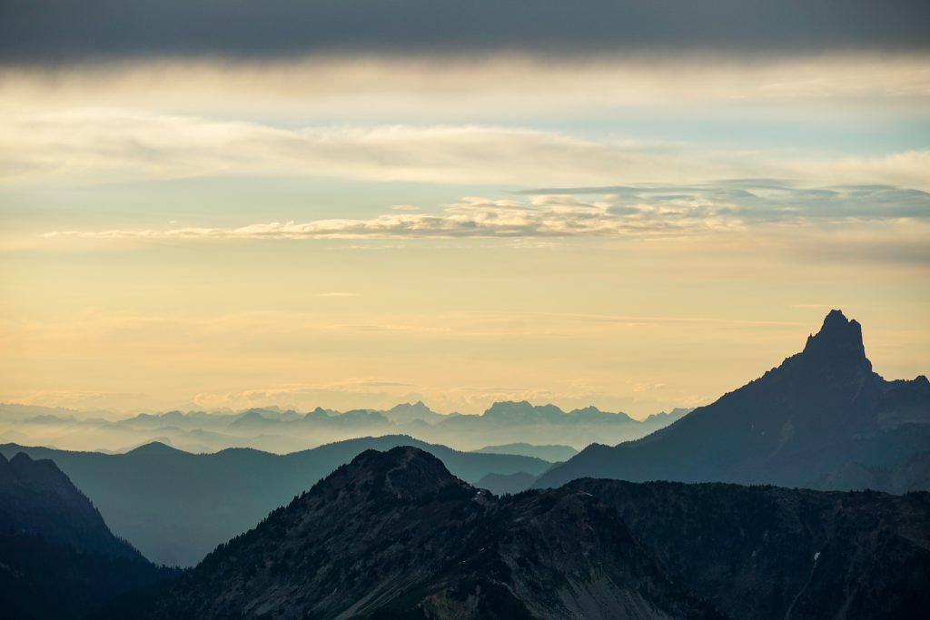
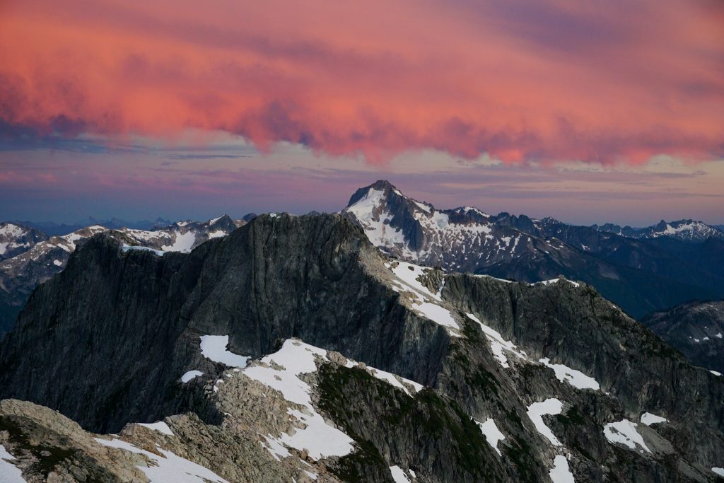
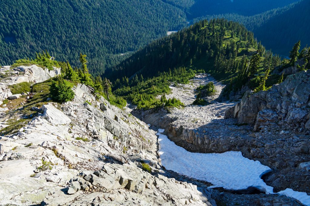
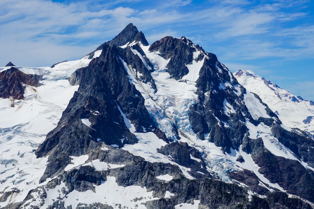
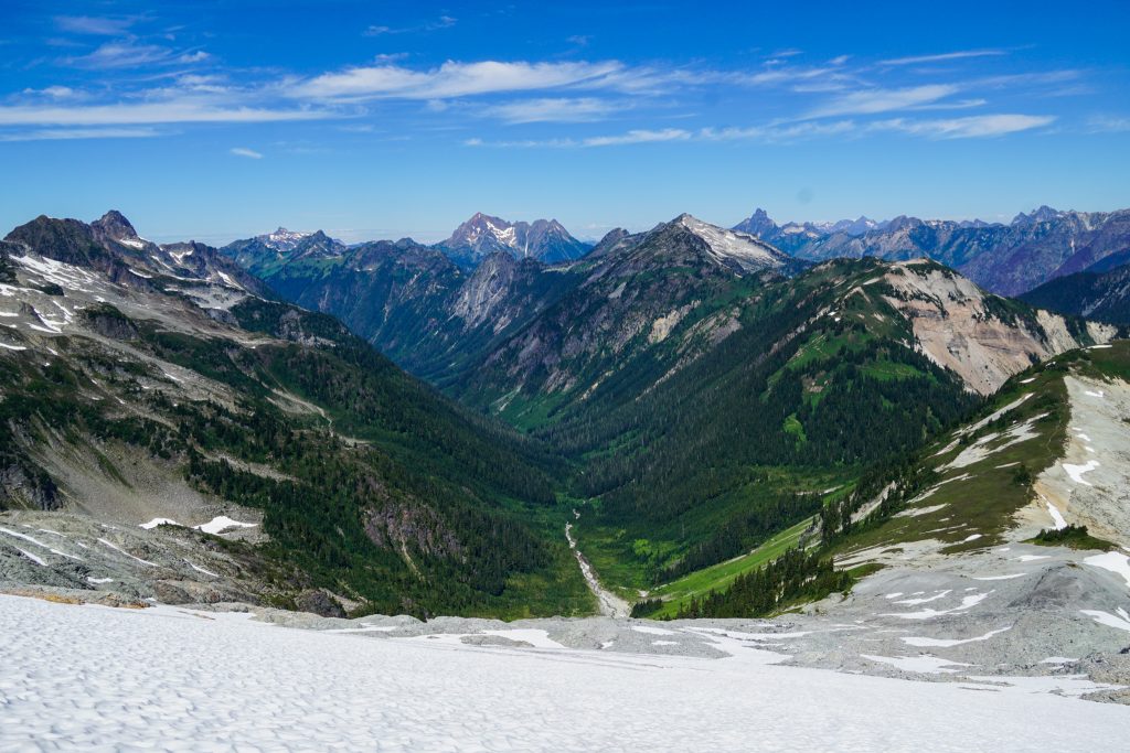
The trail eventually broke into the alpine and we suddenly had wonderful views of the Chilliwack Peaks, Northern Pickets, and Shuksan area. It was beautiful!
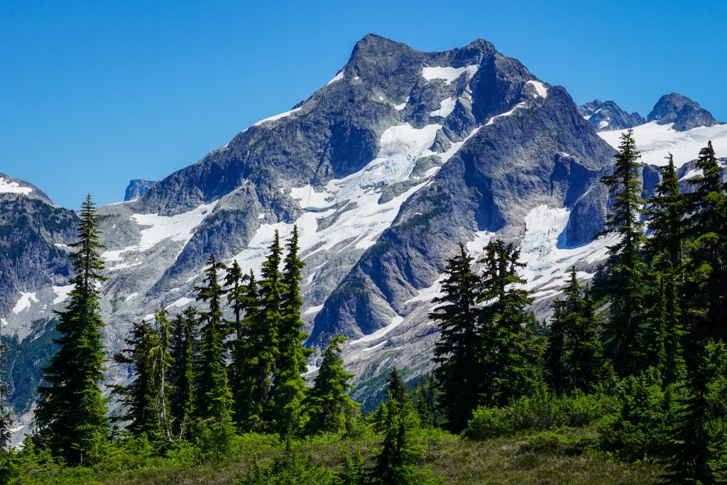
Last fall, there were two massive fires in this area. The fire burned so hot that some of the hillsides were completely incinerated, without even the burned trees remaining.
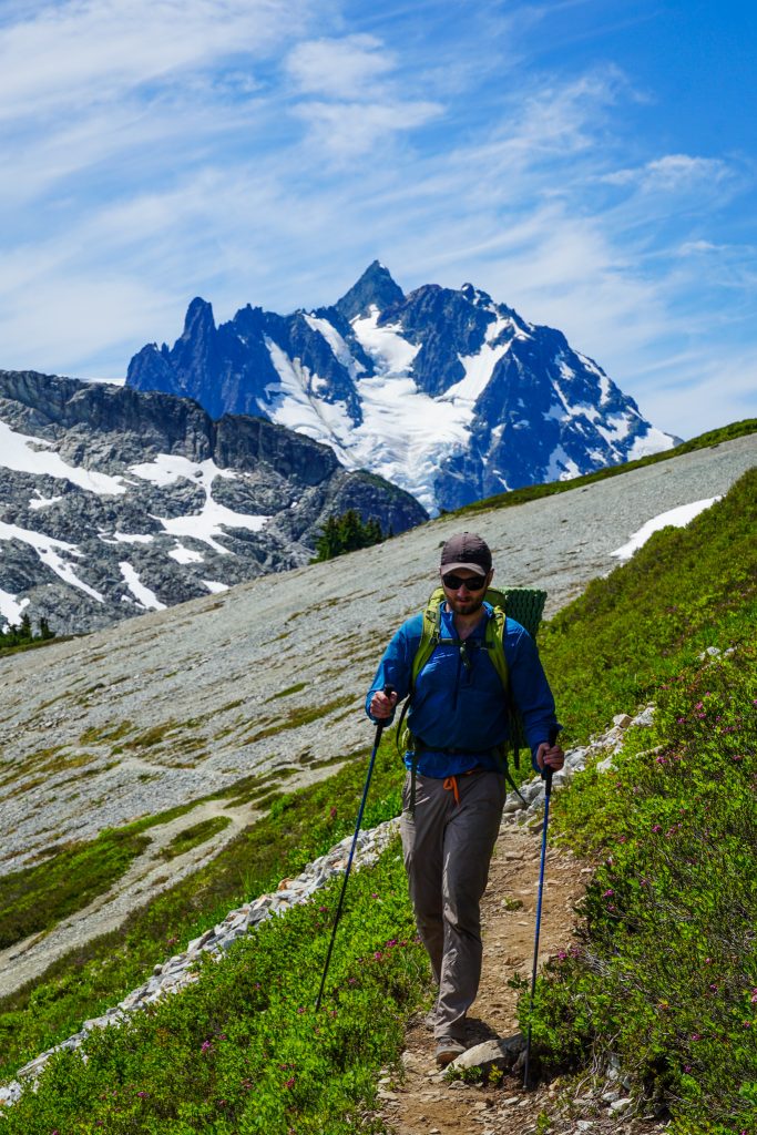
At Easy Peak, we took a break together before parting ways. The Pickets were so close, but they would have to wait for another year for me!
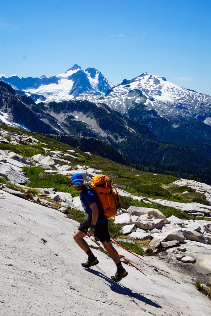
Daniel and Austin proceeded east along Easy Ridge towards the Imperfect Impasse and Perfect Pass, while Logan and I turned west towards Mineral Mountain.
We dropped down past a beautiful lake and filled up on some much needed water. Below the lake, the terrain got a little more complex and brushy, but we worked our way down to the Easy-Mineral saddle.
Just before the Easy-Mineral saddle, we spotted some tall man-made structures deep in the wilderness. I immediately remembered that there was a remote Snotel station at Easy Pass! It was the Snotel site!
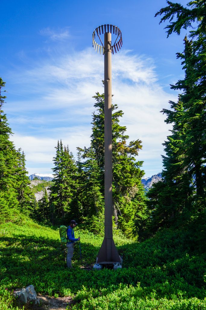
This Snotel site is likely the snowiest site in the lower 48. Its median peak snow water equivalent is about 100 inches, which means that this location likely receives about 1000 inches of snow per year!
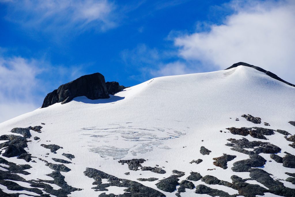
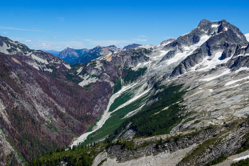
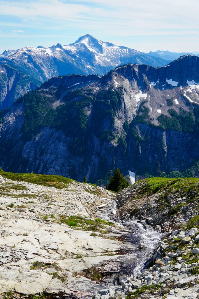
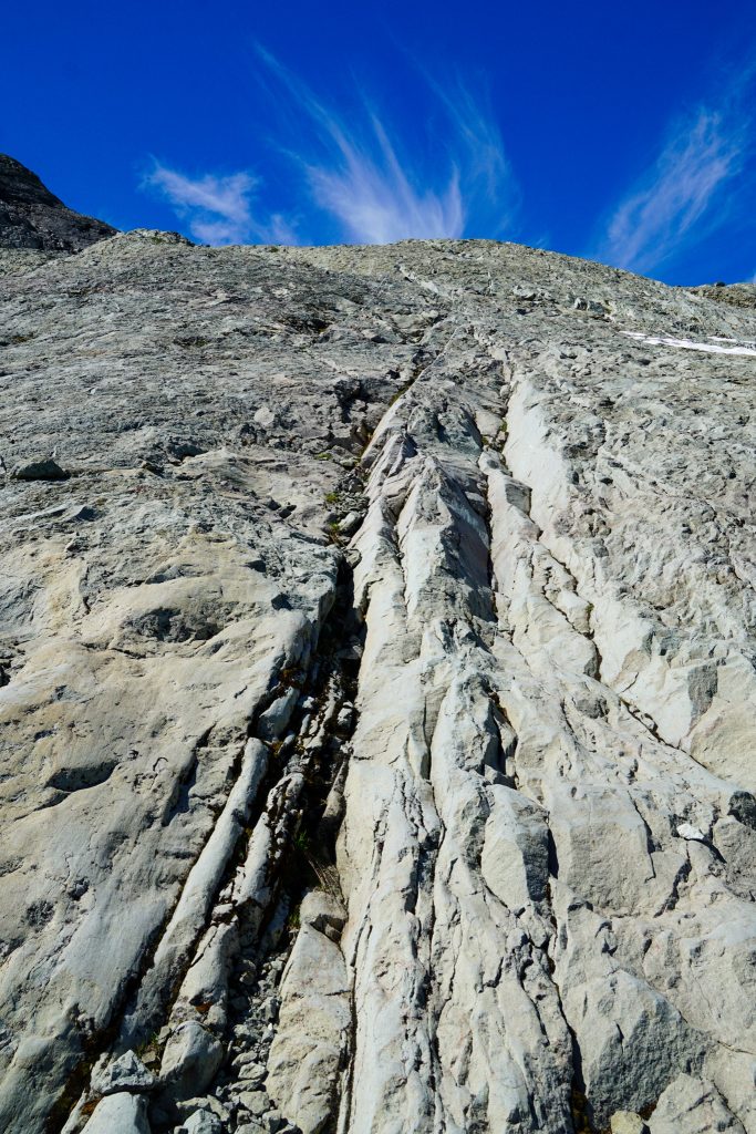
Past the saddle, we ascended the east side of Mineral, transitioning into a beautiful post glacial landscape of granite slabs. I had to wonder how many people had ever been here before.
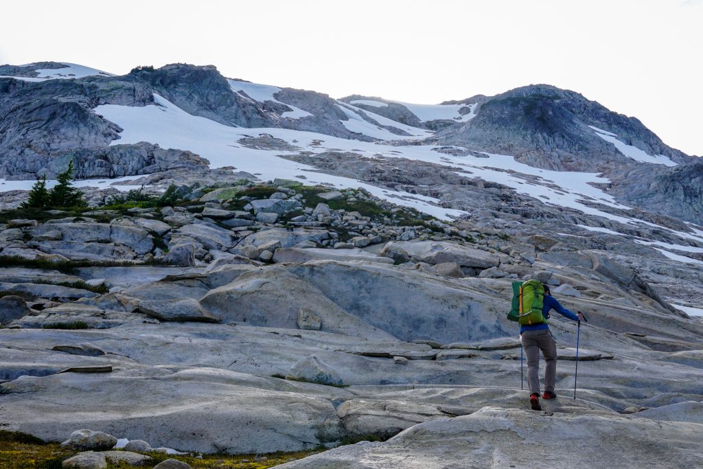
Water gushed down the slabs from the dying glacier above. This water flowed downhill into the Baker River watershed, possibly the most remote part of the Cascades, home to the mysterious 2000 ft granite walls where not a single trail is present.
After a long climb, we reached the high ridge of Mineral Mountain. There was a perfect little flat bench to camp on, so we were sold. All around us was cliffs, snow, and rock, but this little spot was cozy and comfortable.
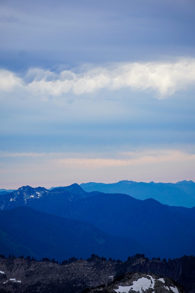
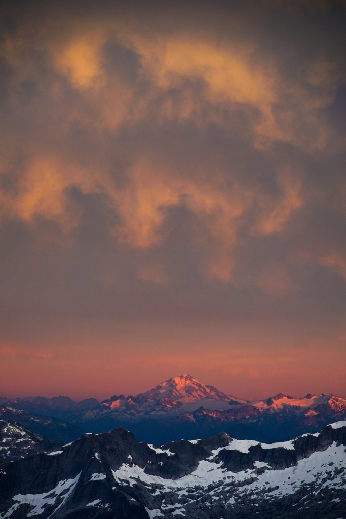
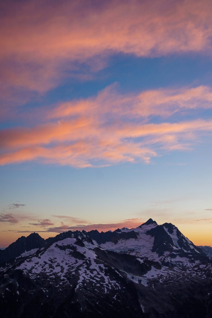
It was a dark evening, as mammatus clouds streamed by from the west overhead. These clouds have these beautiful little pockets of cold sinking air, creating a dimpled surface underneath. Typically there are associated with thunderstorms, but in this case it was just a passing weak low.
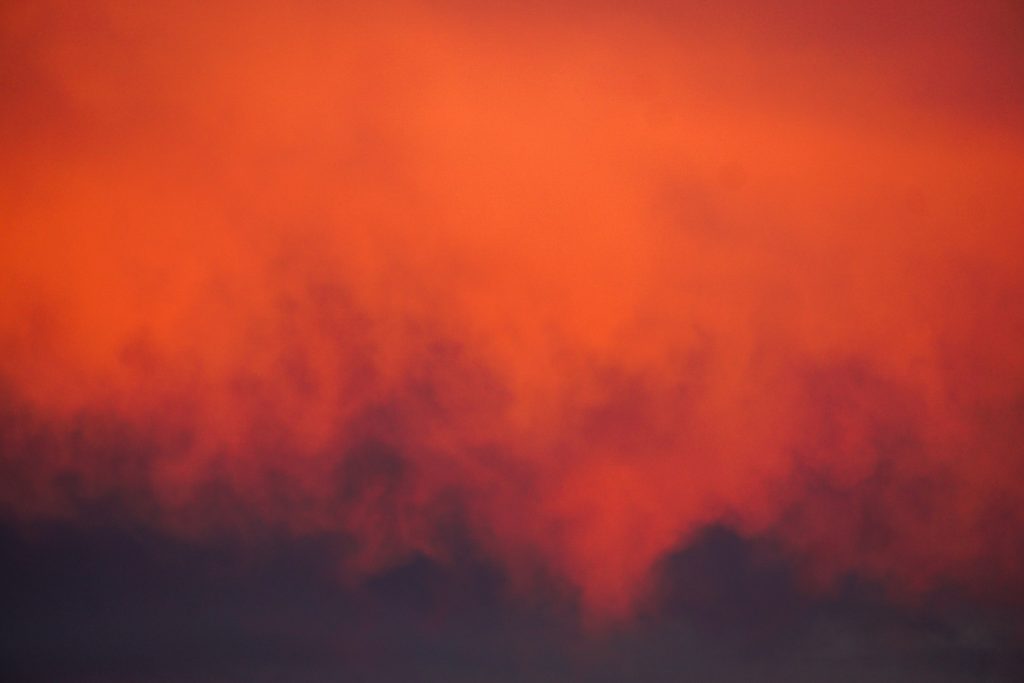
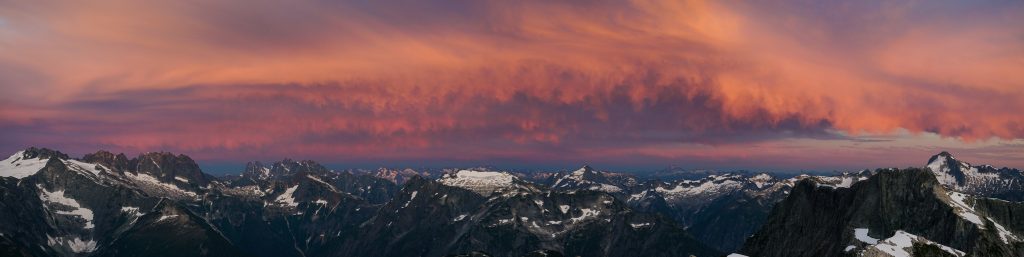
I could tell that we were going to get an incredible sunset with the low clouds and a window of clear sky on the western horizon. Sure enough, this sunset put on a show!
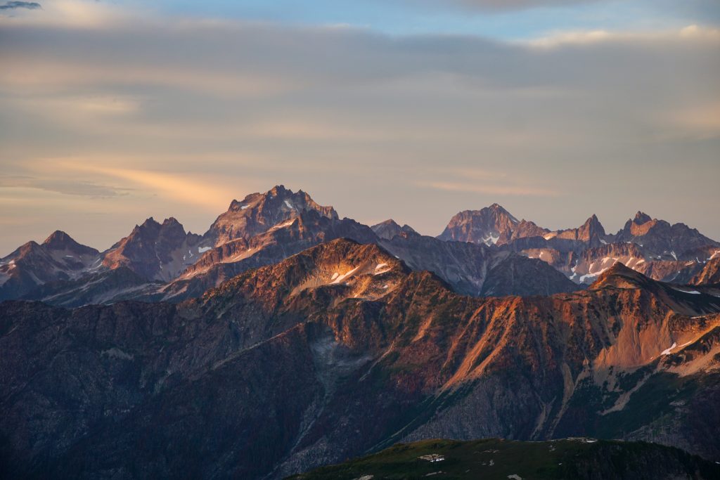
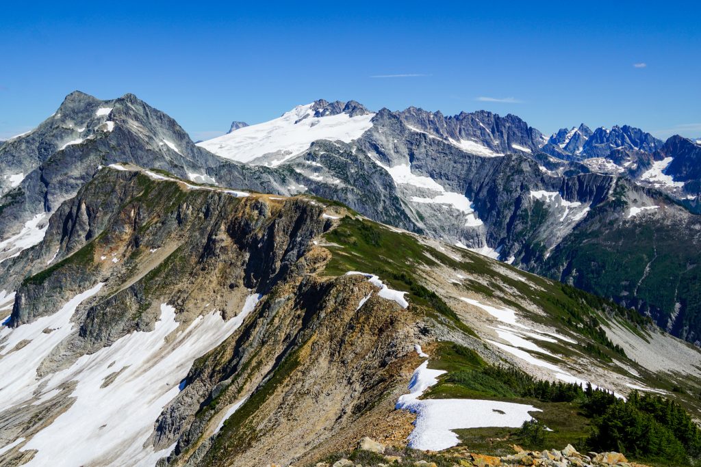
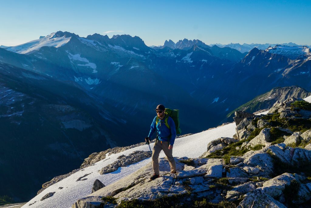
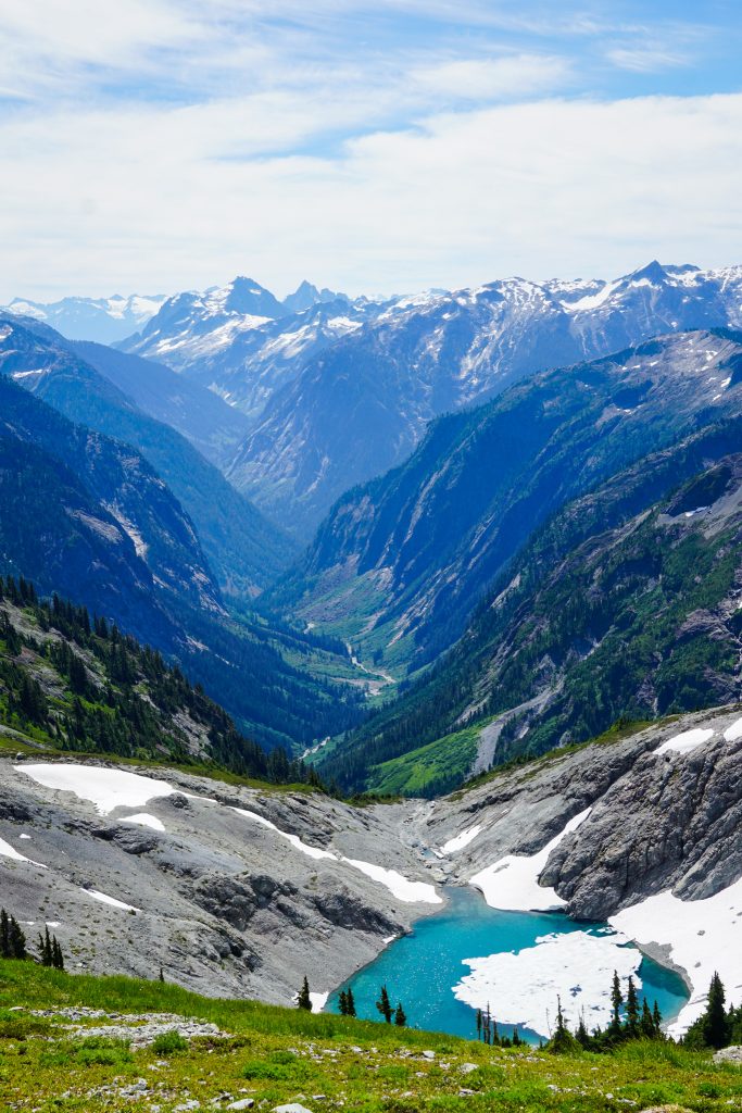
I watched the show from the south summit of Mineral, with incredible 360 degree views into the heart of the North Cascades. This was my first time in this region of the North Cascades, so it was cool to get a new perspective on so many places!
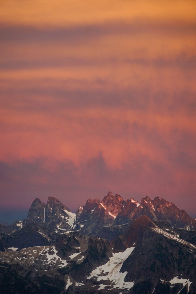
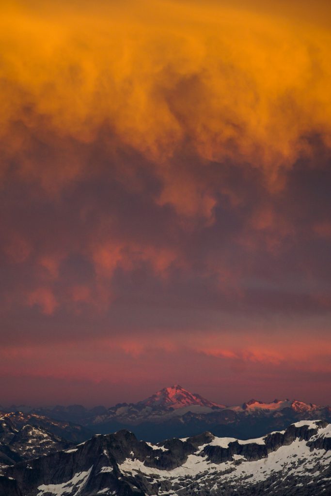
With each passing minute, the colors deepened to pink, purple and finally darkness. It was certainly one of the best sunsets I have ever seen.
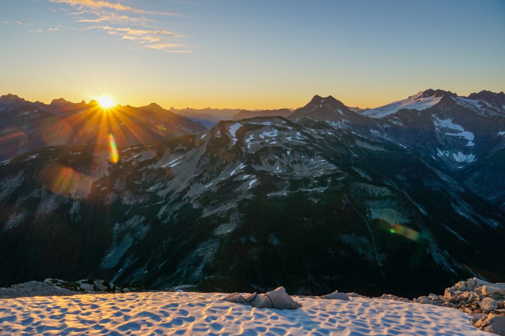
We enjoyed a very warm night and good sleep. Sunrise was nowhere near as spectacular as sunset, but it was still a nice morning.
We went over the true summit of Mineral. The summit register was very thin; there were only about 10 unique parties in the past few decades! My favorite quote was from Jason Hummel:
“3rd time atop Mineral on skis since 2003. Don’t think there will be a 4th.“
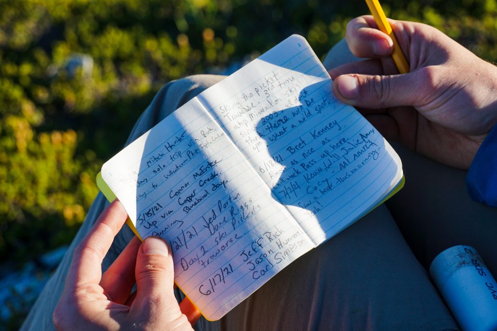
Very few people have ever stood atop Mineral. There are basically only three reasons to climb Mineral:
- It is part of the Washington 2k prominence list.
- It is part of the “standard” approach to the Pickets Ski Traverse.
- You’re weird like me. Actually, all three reasons mean you are weird.
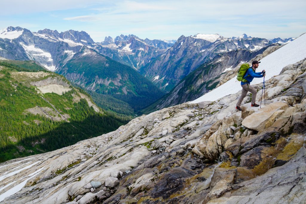
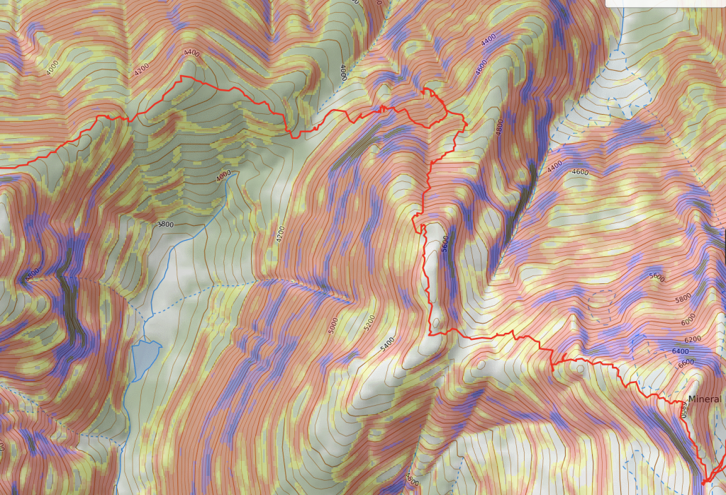
Thus, the only information online about this peak was ski specific or peakbagger specific. Neither was directly relevant to our plans to connect to Ruth Mountain on a “high route”. Logan had read the limited beta carefully and determined that we probably did not want to try to descend directly to the Mineral – Ruth saddle, aka Chilliwack Pass, or we would encounter steep cliffy jungle. There seemed to be some gullies on the north side that might provide slightly easier passage.
The descent was mostly easy to the first saddle. From there, we followed the 5700 ft ridge north until arriving at the steep north facing gullies. We crossed the obvious gully and descended to skier’s right of it. It was a little chossy, but quickly eased up and there was nice heather terrain and even running water below.
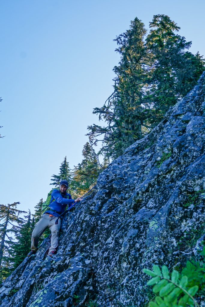
We continued down and left for a while, but eventually ran into a vertical cleft in the mountain. There was certainly no way across this feature. So we had to ascend back up to cross left above it around 4700 ft. Our general strategy was to continue working our way down and left. There was some bushwhacking, multiple steep gullies to cross, and some surprisingly solid scrambling around blind corners. But it all worked shockingly well.
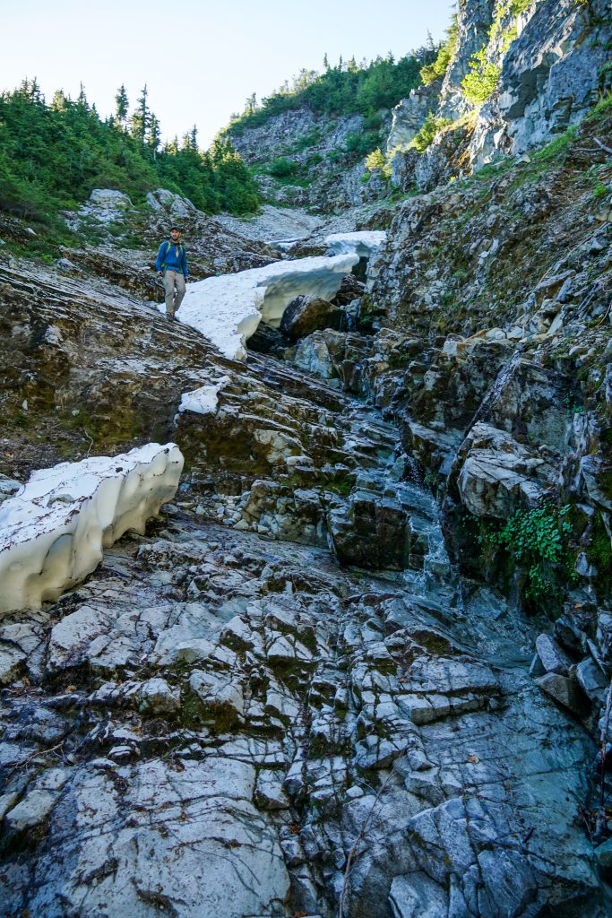
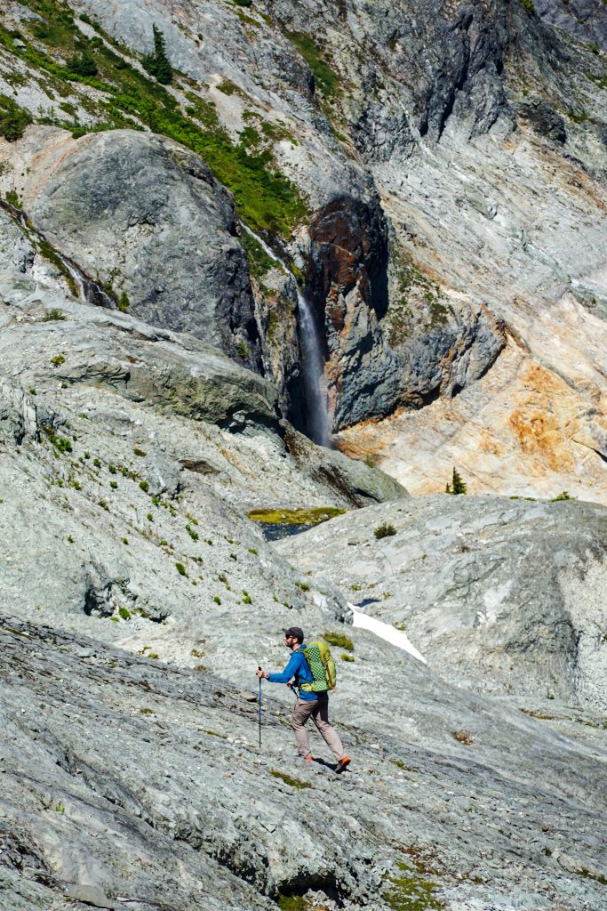
The final bit to Chilliwack Pass featured some treacherously steep pine needles and an alder tunnel but we had made it! Or so we thought. Although we were through the most technical terrain, the next hour or so from Chilliwack Pass towards Ruth featured some pretty real bushwhacking. We were sweaty and tired when we finally broke into the clear beneath Ruth.
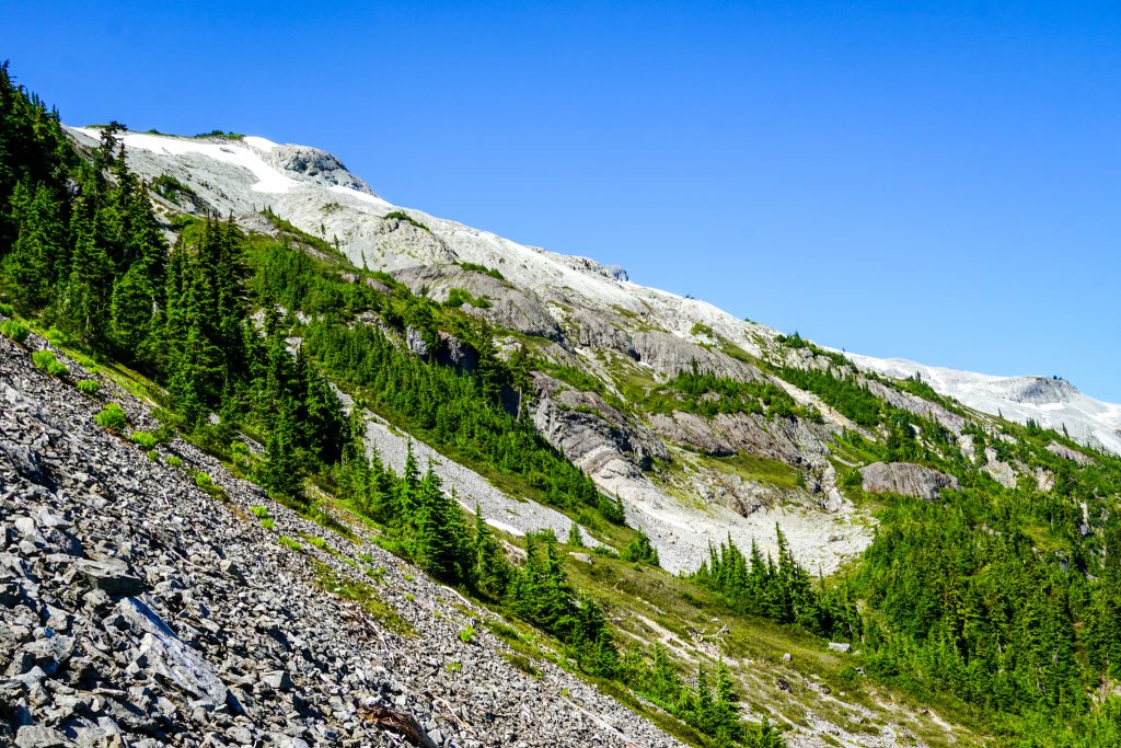
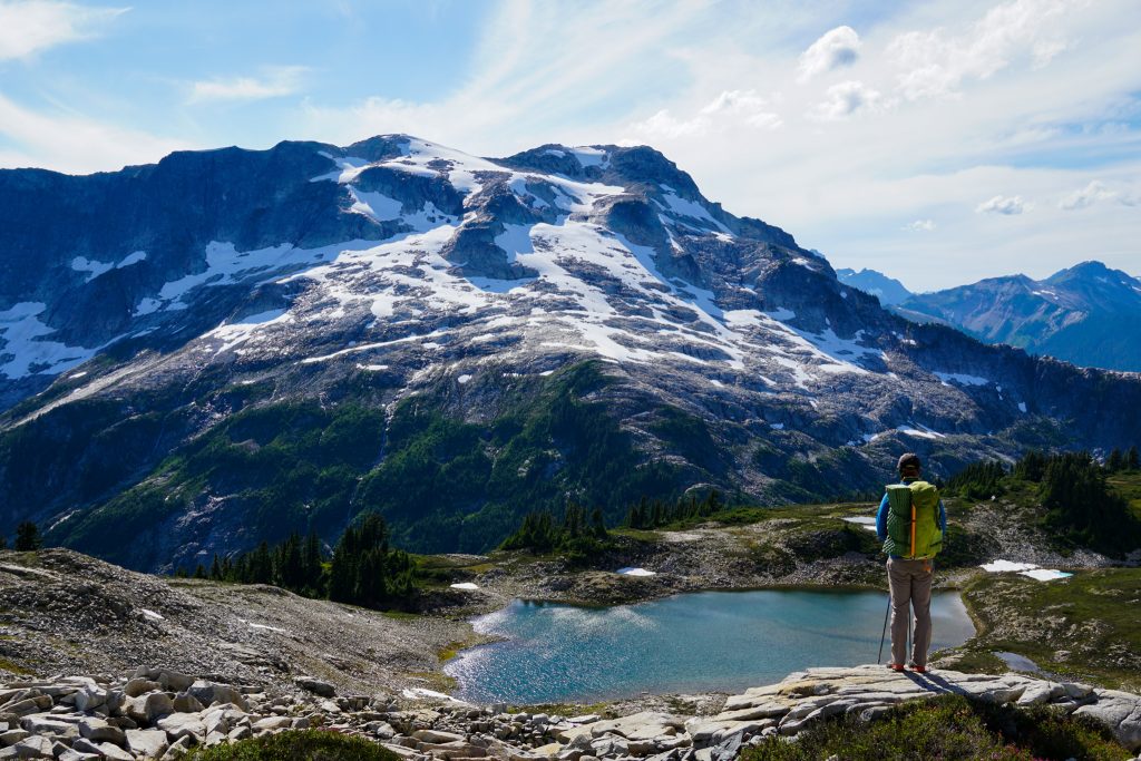
We began a gradual ascending traverse across the post glacial slabs of Ruth. The rock was hugely variable in this area, with all kinds of interesting dikes and formations. Logan learned later on that the Ruth / Hannegan Pass area is part of an ancient collapsed caldera – the same hotspot that eventually formed present day Mt. Baker.
Around 5700 ft, Logan and I split up. I headed for the summit of Ruth while he chose to traverse over to Ruth Arm and take a break.
The east ridge was a pleasant climb, mostly on rock. I arrived on the summit of Ruth all alone.
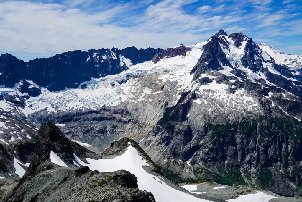
Shuksan has so many beautiful angles, but this was a new one for me. On the right side the Price Glacier tumbled steeply. On the left side, the giant Nooksack Cirque formed a massive bowl of jagged rock, ice, and waterfalls. It is definitely one of the most powerful glacial carved landscapes in the North Cascdes.
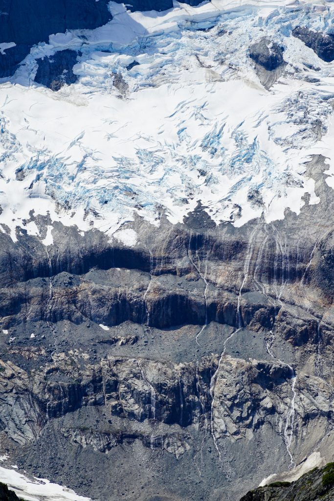
Even though it was only mid July, the glaciers looked like late August. With extended warm, dry weather, I wonder if this will be the worst year for our North Cascade glaciers in recent record. Perhaps 2015 was worse?
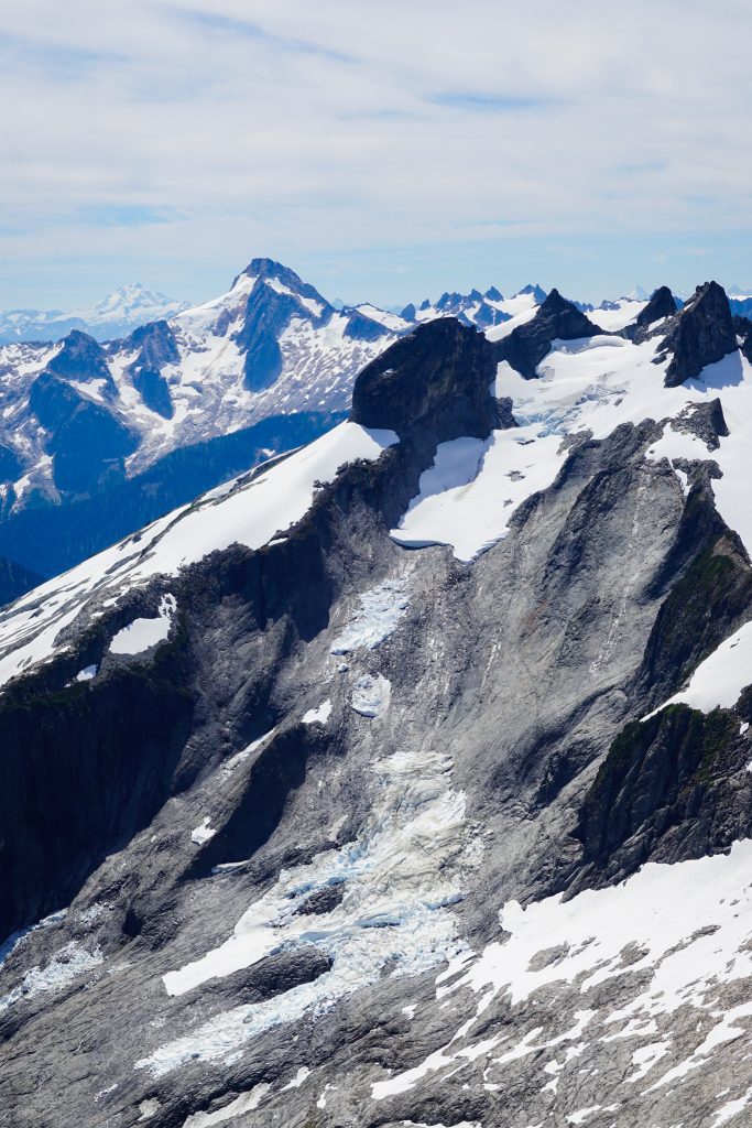
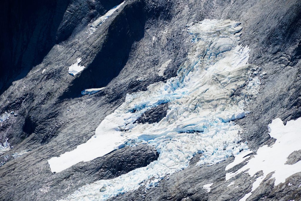
I knew Logan was waiting, so I got going and hiked down the dying Ruth Glacier, which probably won’t last too many more years, back towards Ruth Arm. I picked up Logan and we got going!
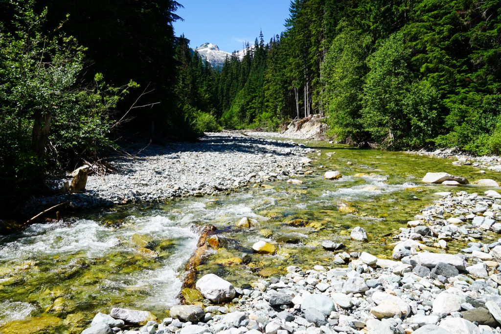
It was a hot but easy hike back to our car at the Hannegan Trailhead.
The Mineral “High Route” was an interesting one! The terrain is rarely visited, which adds to its appeal, but there is a reason few go out that way! I try to do at least one blue-collar North Cascade adventure per year to make sure I am not getting too soft. Most importantly, we were able to support Daniel and Austin in their epic adventure while still getting to explore a new part of the Cascades!
Notes:
- Our route was 30 miles and 12,500 ft gain.
- There was no running water from the snowfields on the east side of Mineral until closer to Chilliwack Pass in the technical descent.
- The descent to Chilliwack Pass was pretty burly and tricky. Nothing exceeded class 3+ and the schwack was never too bad, but we had to be pretty careful and alert. Plan for this section to take a few hours. There obviously might be a better way to do it, but it is challenging to figure out from above. It might be easier going the other way.
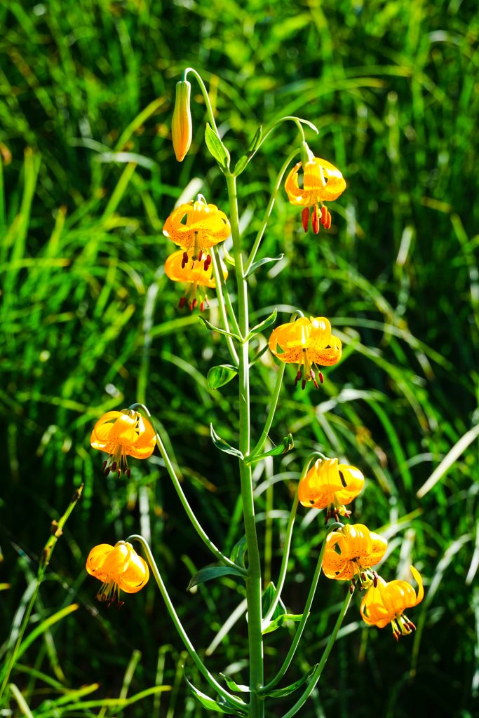
- The Easy Ridge trail is in decent condition and a beautiful place to explore on its own!
Is the trail from Hannegan pass to Whatcom Pass open now?
No, it is closed at some point. You cannot hike all the way to Whatcom Pass on trail from Hannegan due to fire closures. It was open as far as we hiked on it.
This was so fun to read, thanks for your epic post. I’m much less experienced, but got interested in Mineral back in 2015 on a trip just up to imperfect impasse with my sister and kept staring at it on the maps. Along with the classic trek to Challenger. love the beta and photos, inspired! thanks 🙂
Thanks Amelia! Funny that Mineral can feel more mysterious than the Pickets themselves!