Table of Contents
To Rocky Places
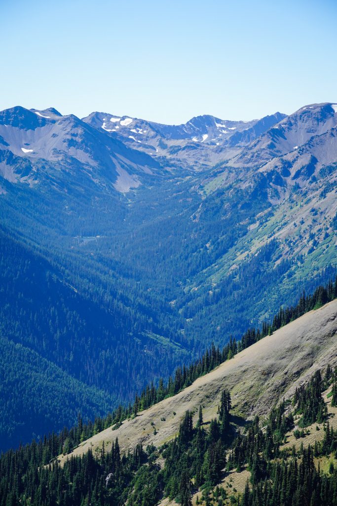
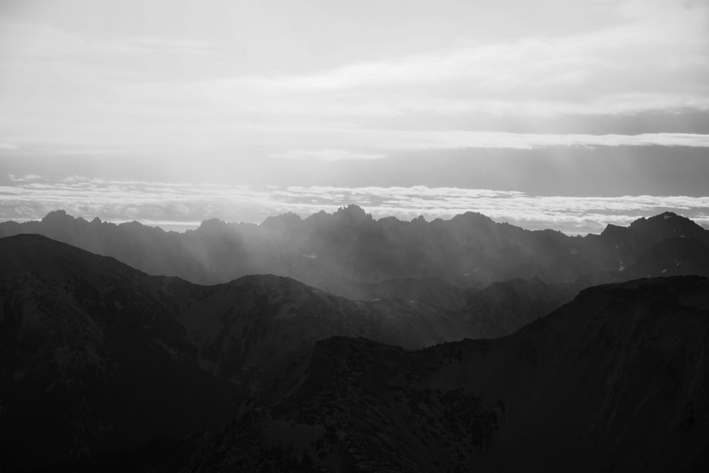
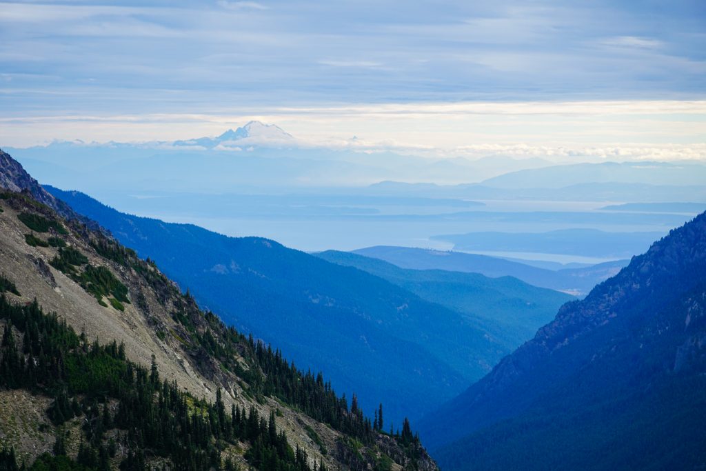
When people think of Olympic National Park, they usually think of the Hoh Rainforest or the Pacific Coast. But the park is vast and diverse, and the northern part of the Olympic Mountains is remarkably dry, rocky, and barren. Outside of Mt. Olympus, nearly all of the 7000 ft peaks are clustered in the northeastern corner of the range, and appear in stark contrast to the giant glaciated massif of Olympus. This part of the Olympics can feel remarkably dry and open, like the Pasayten Wilderness or Rocky Mountains.
Two years ago, I ran the Grand Loop, one of the finest trail loops in the state, if not the country. The access and continuous high terrain was mind boggling. During the run, Peter and I discussed the potential of creating a higher Grand Loop, one that encircled all the high terrain surrounding the Grey Wolf River from Deer Park to Tyler Peak, a near complete loop. I knew that the other end, Grey Wolf Ridge, was an incredible ridge traverse. It seemed like Mt. Cameron could offer beautiful high terrain in between. This was the birth of the idea: the Northern Olympic High Route.
Last summer, I did an impromptu Bailey Range Traverse. This was such an incredible experience, equal to any route in the Cascades, and confirmed a suspicion that I had: that the Olympics had just as much, if not more, high route potential than the Cascades. With a decent Labor Day Weekend forecast, I decided to test this theory by attempting the Northern Olympic High Route.
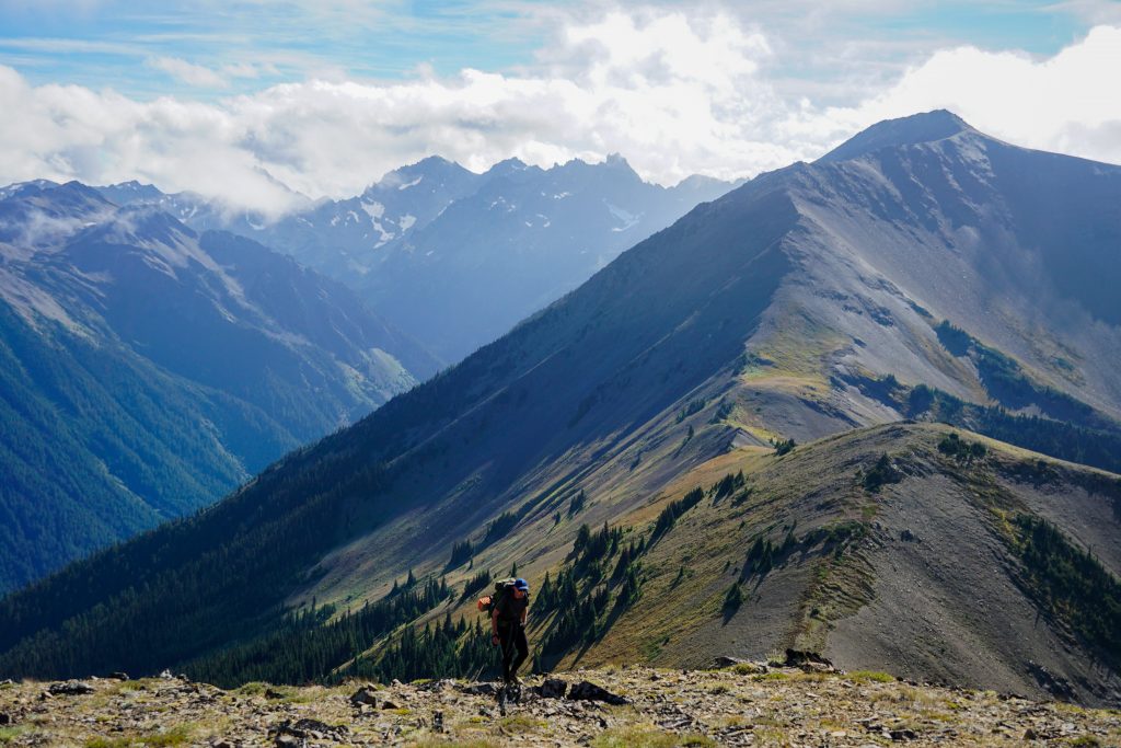
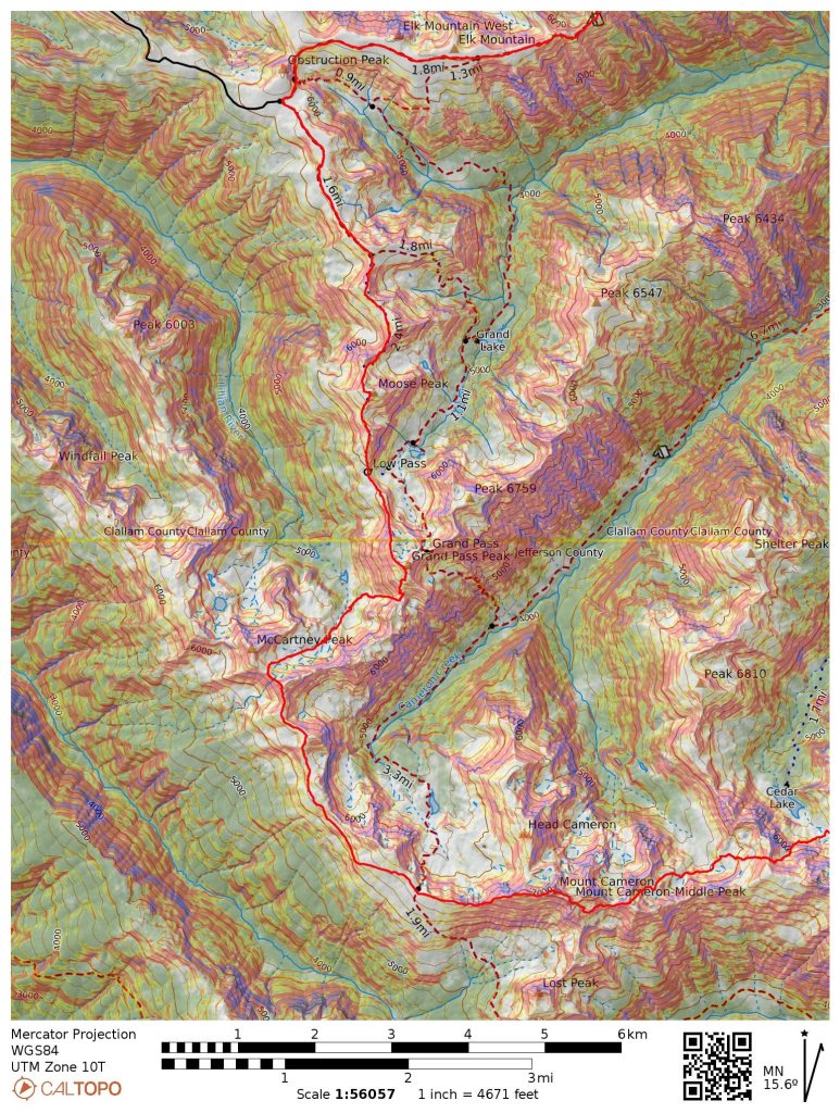
Day 1: Deer Park to McCartney Basin
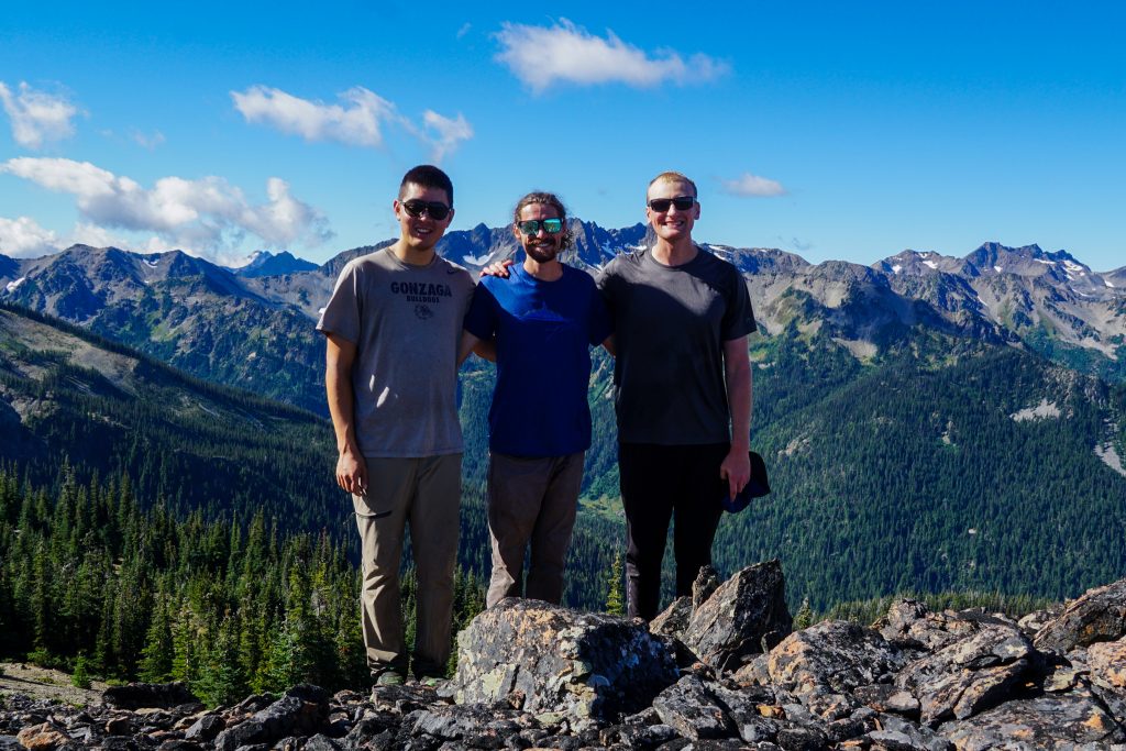
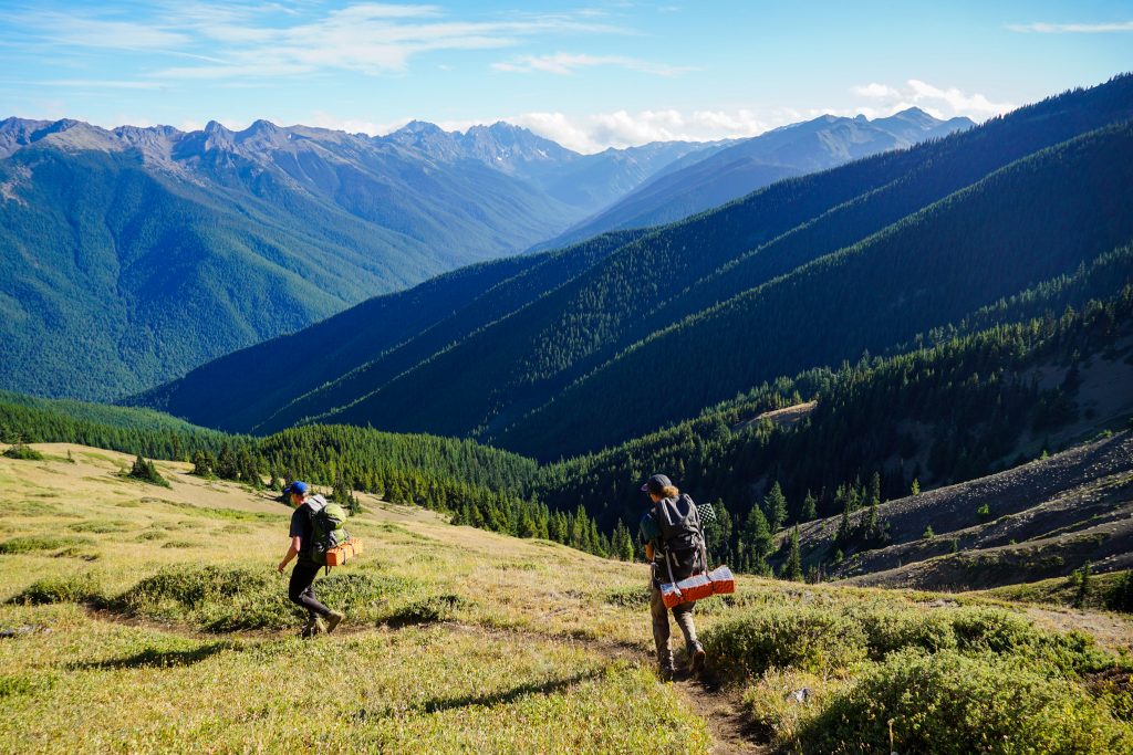
For this journey, I recruited two of my best friends, Blake and Grant. We all went to high school together, running cross country and playing trumpet in marching band. Blake is an insanely fast trail runner, while Grant is a traditional hiker and backpacker. Grant had never been on any significant off trail route like this, and Blake had definitely not been on one of this length, so it was going to be exciting!
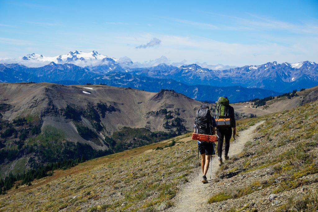
The car shuttle is pretty long for this one. We took the first ferry over to Kingston and drove to the Tyler Peak trailhead and then over to Deer Park, arriving around 10 am. The distance between trailheads is rather small, but the driving time is long.
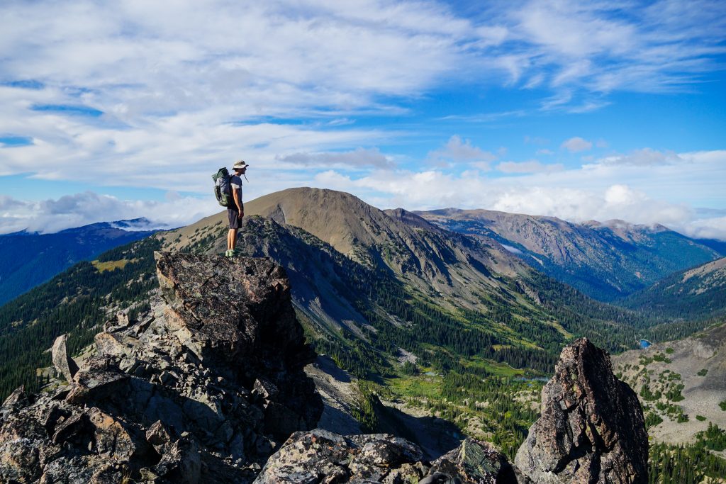
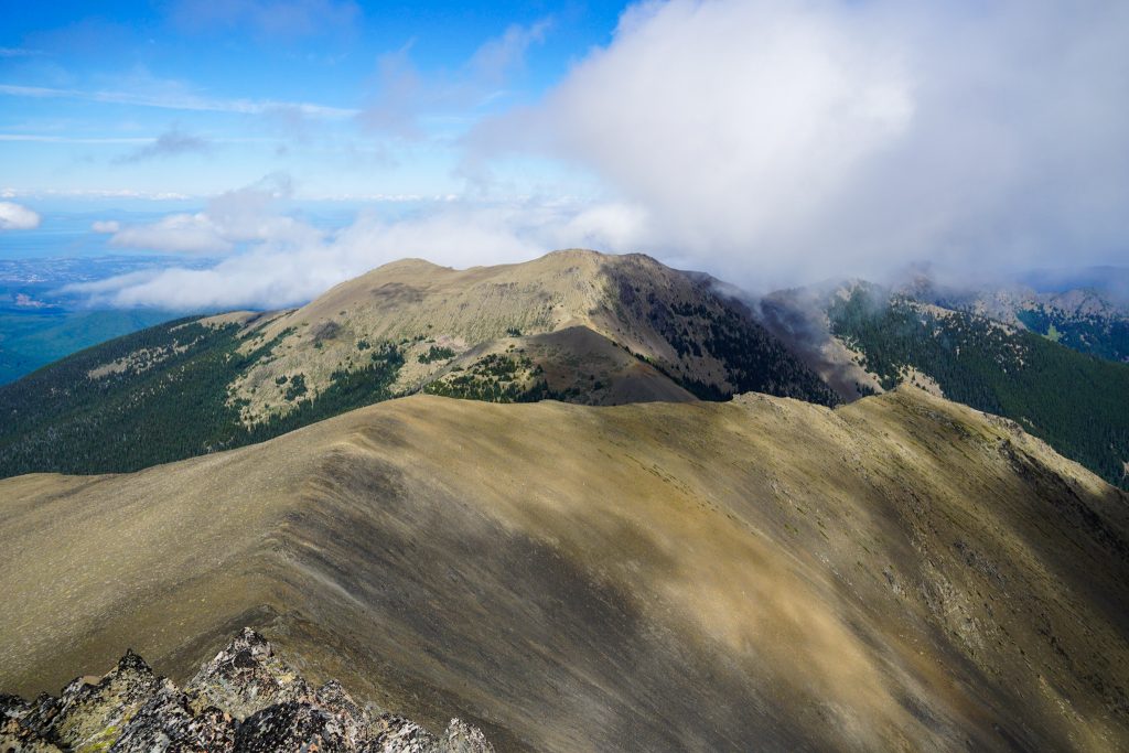
We stuck to the trail from Deer Park to Obstruction Point. We could see nearly the entirety of our route that lay before us, which was exciting. The high trailhead afforded nearly immediate views. It felt too easy for a high route, almost like cheating. I guess that is the Euro way.
Throughout the day, clouds were surrounding us in all directions but we fortunately stayed in the clear.
From Obstruction Point, we took the “Lillian Way” route over Moose Peak.
Once down at the next saddle, we continued along the ridge to Grand Pass Peak. The ridge here gets pretty brushy, so we sidehilled to the left side before scrambling up to the summit of Grand Pass Peak.
I loved the feeling of a gentle breeze, sun, and cool air flowing over my skin. Fall means cooler temps and one of the best times of the year to be out in the mountains. The weather this day was just perfect.
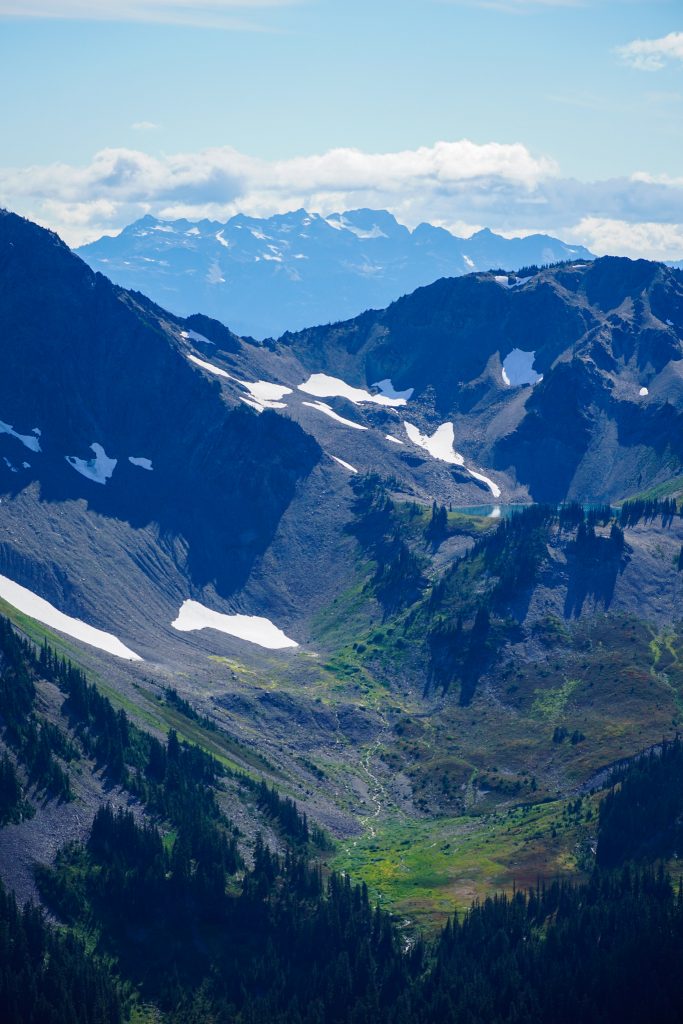
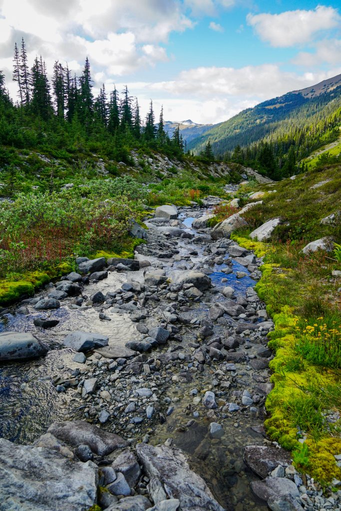
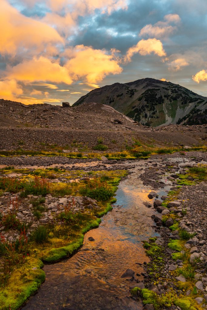
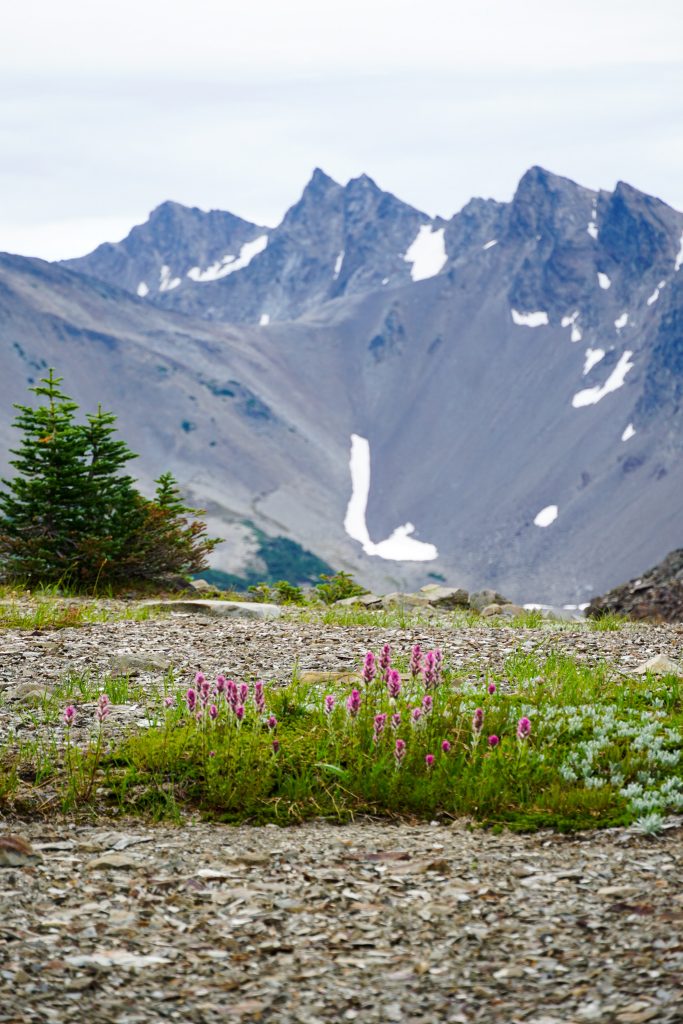
From Grand Pass Peak we dropped down the backside to a saddle, then took a right down scree to a stream beneath a large moraine valley which used to hold the Lillian Glacier. Flowers were still blooming and we took a break here.
We debated camping here, but I had a hunch that the moraine above would hold some nice gravel campsites. So we continued up into the moonscape.
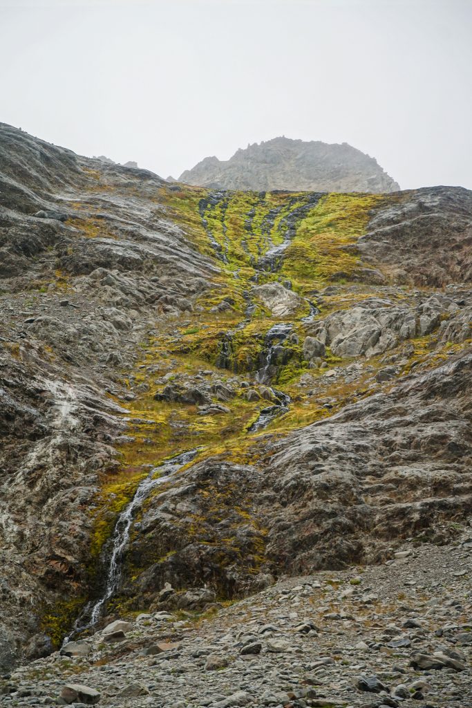
During my time in the Alps, I was struck by two things: 1, that vegetation grew back very quickly in post glacial moraines, and 2, that their post glacial terrain was remarkably dead and ugly. The Olympics, on the other hand, have some of the most beautiful post glacial terrain I have ever seen. Streams emerge from the gravel and boulders, and fluorescent green moss lines the water. The scene is almost alien, but it is so beautiful. The symbolism of vibrant life emerging from the barren landscape is powerful. We found a flat sandy spot next to the stream and set up camp.
We had all just about fallen asleep when strong gusts suddenly came out of nowhere. I brought us trekking pole supported shelters, which are dependent on your stakes holding, and we had not done a good job of installing the stakes in the sandy ground, so our tents were immediately flattened. It was a bit of a struggle to get out and secure everything without it all blowing away. I went to the time tested strategy of using the tent stakes as passive protection in a tower of rocks, and fortunately there was no shortage of big rocks nearby. We finally got to sleep close to midnight, but the wind continued to rage on all night.
Day 2: McCartney Basin to Grey Wolf Pass
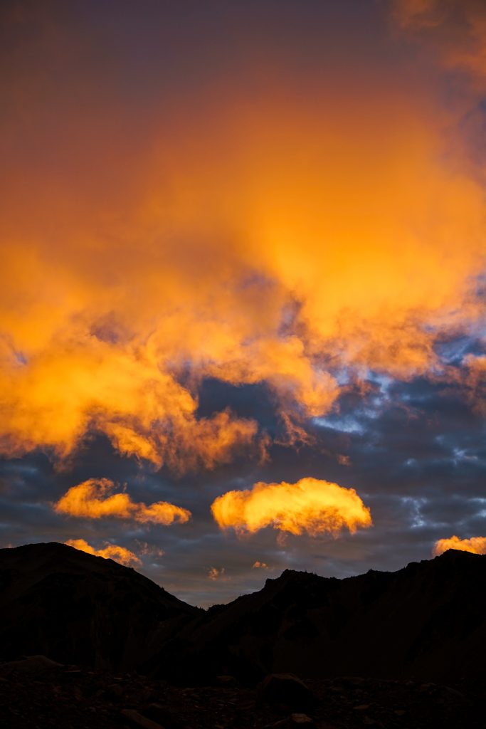
After a windy night, the next morning rose cloudy and blustery. The clouds raced above the peaks at an incredible speed, but we got some beautifully underlit clouds as a result.
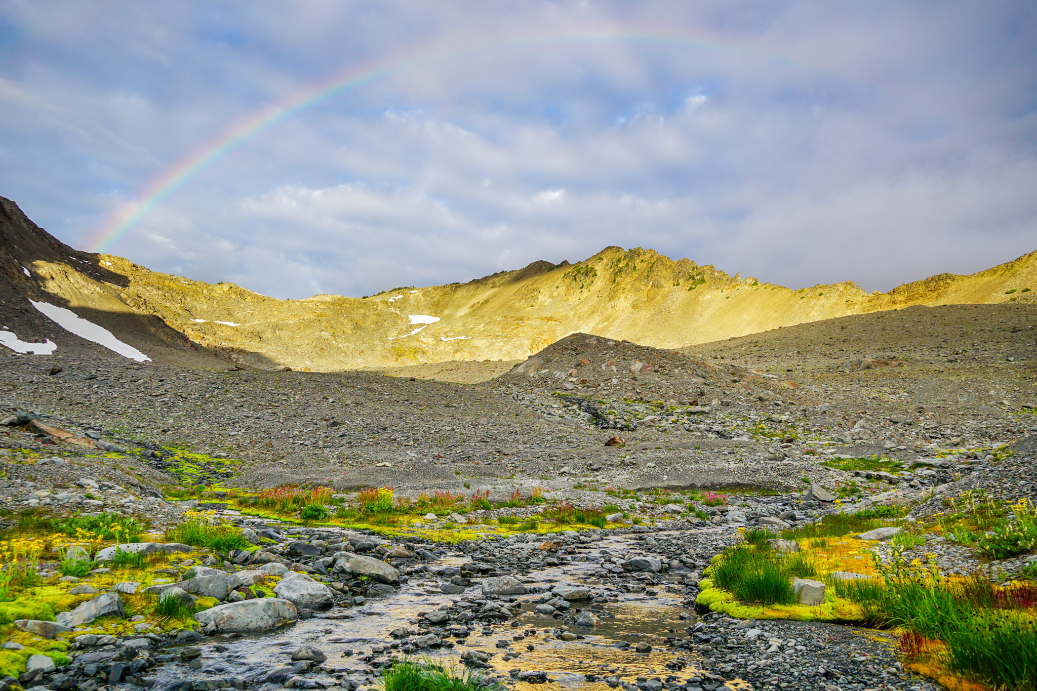
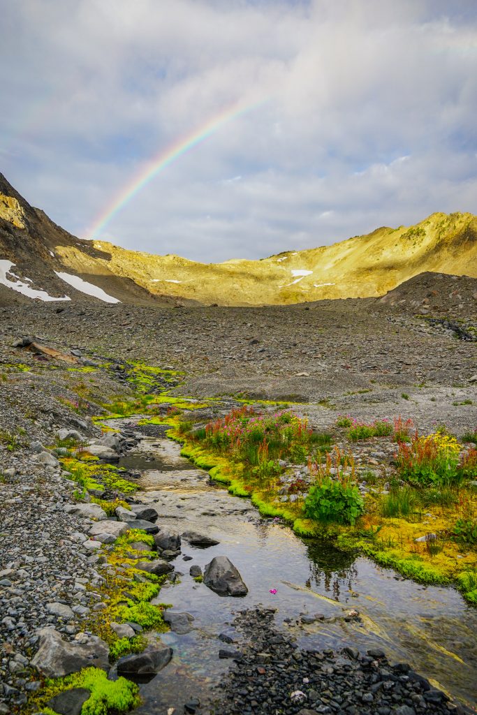
We knew the weather was questionable for this day, with forecasted showers and clouds in the afternoon. We even got a few drops during breakfast, but at least we got a spectacular rainbow as a result!
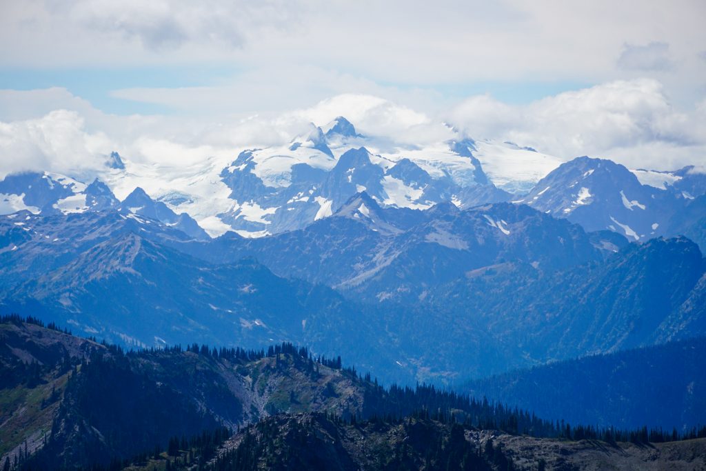
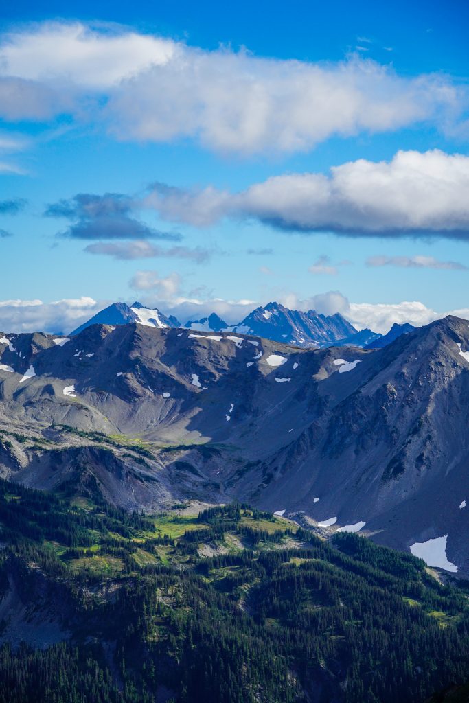
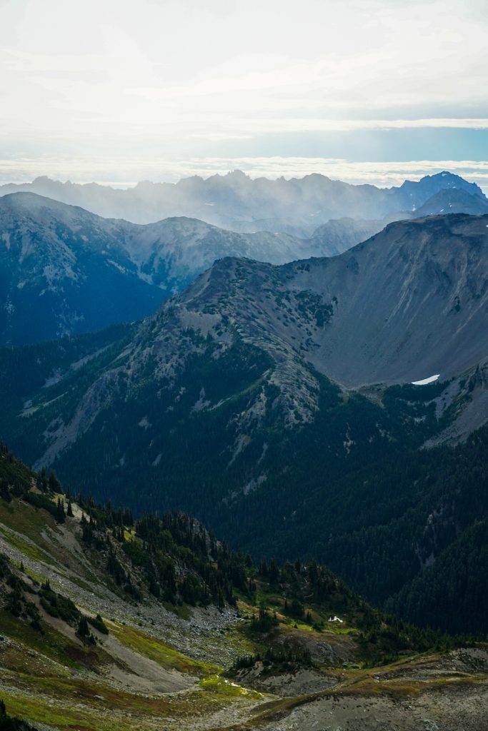
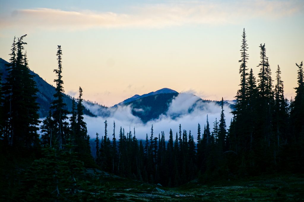
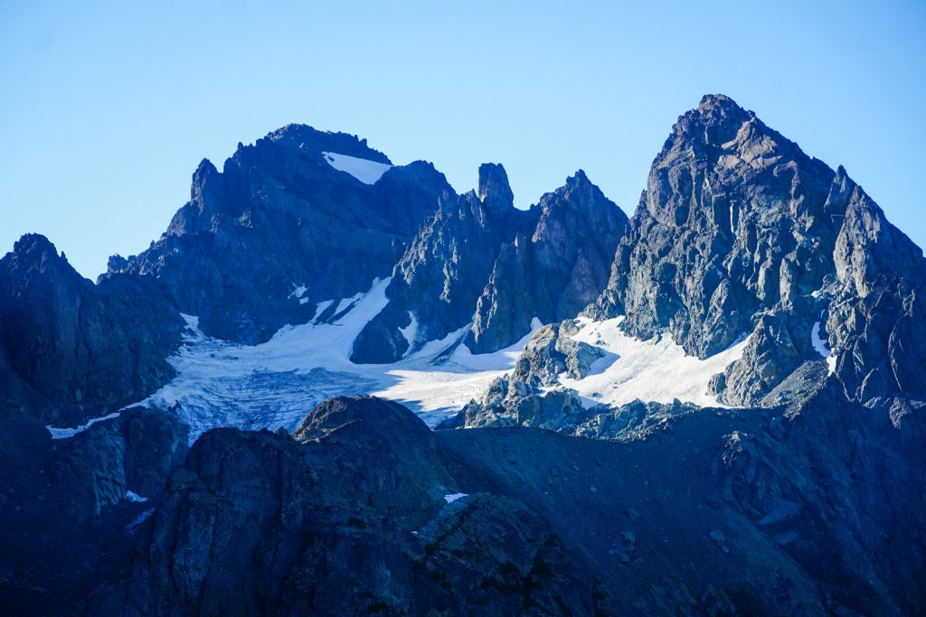
We started with a gentle climb to the ridge and then turned left over to the summit of Pt 6728. Clouds were already engulfing Mt. Olympus and the Bailey Range to the west.
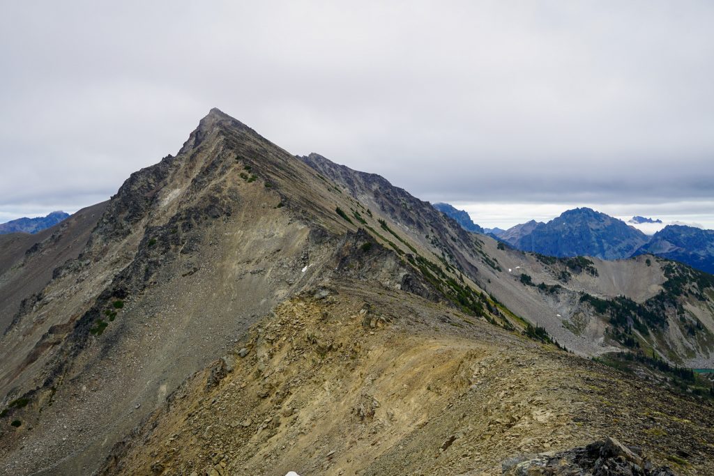
As I peered over the summit, I found our next ridge to be a mess of chossy gendarmes. I did not expect this!
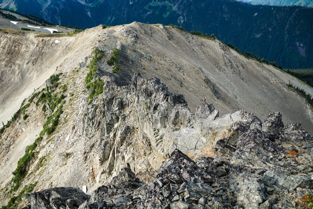
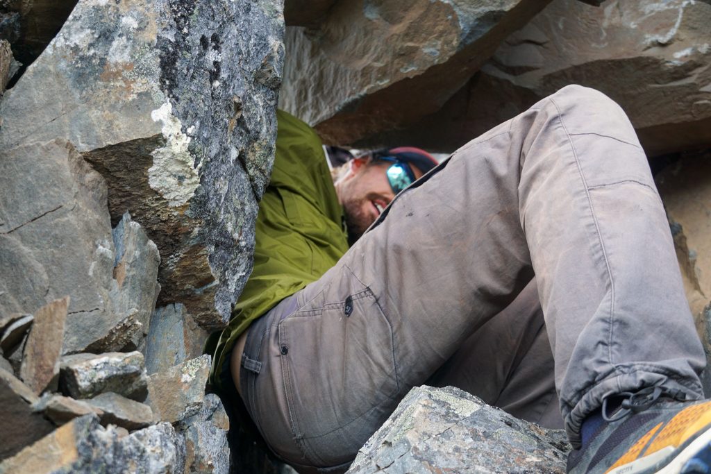
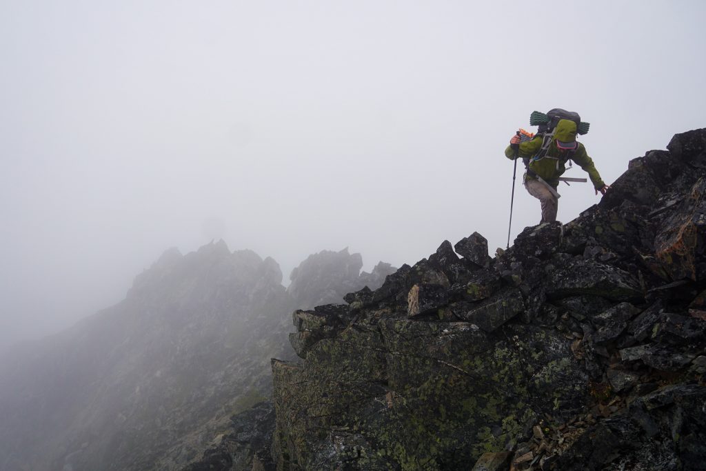
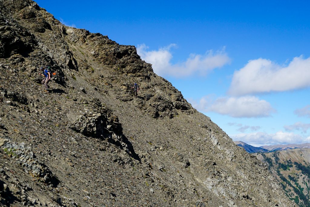
Dropping down beneath the ridge would require a large amount of descending steep, loose terrain, so I tried to navigate us down the ridge, staying either to the right side or on top. Like most Olympics ridges, the rock really was not as bad as expected and there was always a way through at 3rd to 4th class. One spot required a tough downclimb move in a chimney, but fortunately I found a tunnel for Blake and Grant to follow through!
This section took a bit of time, but then the ridge was cruiser after. We bumped over some high points, following faint foot paths towards Cameron Pass. The wind was whipping us and rain clouds to the west continued to encroach upon us, but the dramatic lighting was beautiful.
At Cameron Pass, we hunkered down out of the wind for a few minutes while a few hikers passed us. One woman came over the pass and immediately shouted “I recognize that face!” referring to me. Shoutout to Jen from North Bend!
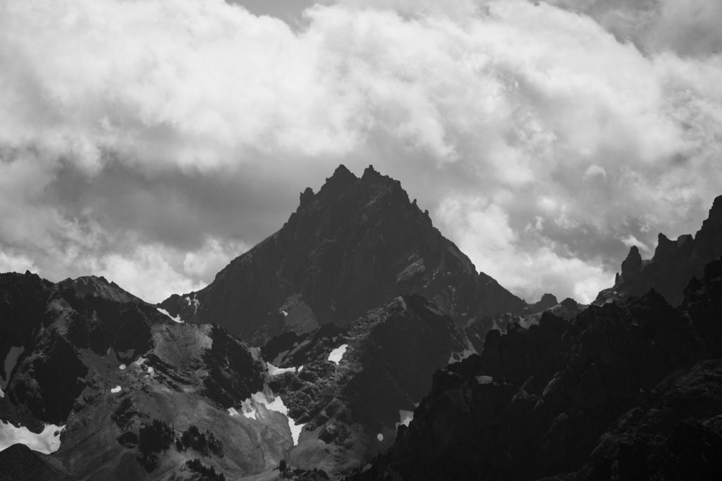
The weather seemed to be deteriorating faster than expected, but it still was not raining, and we felt like if we could get over the summit of Mt. Cameron, the rest of the day was less exposed. So we continued with the planned route.
The climb up Cameron ascends a long gradual ridge and is mostly class 1-2. It climbs over many false summits along the way. Eventually the cloud enveloped us, but it was surprisingly comfortable because at least it was not yet raining.

Finally, we reached the true summit and took a break. It started to rain right as we got going and we immediately became soaked. It was barely raining, more like “misting”, but with the strong winds there was no hope of staying dry.
We stayed directly on the ridge to the Middle Peak of Cameron. There some spots of class 3-4 here. Then we were finally able to drop off the ridge direct and traverse over to the notch just east of the East Peak of Cameron. Another short climb brought us to a pass where we could descend to the northeast, finally getting out of the wind and rain. We were quite cold and wet at this point and greatly relieved to be out of the worst weather.
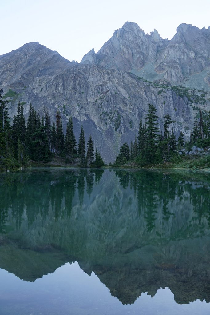
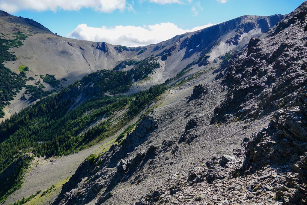
We dropped down steep, techy moraine and traversed above some cliffs, finally coming down to a beautiful moraine lake, flat rocks, and gushing waterfalls. Throughout the day, we moved through such enormous, powerful glacial valleys that looked so small on the map. It would have been incredible to experience this region when every little nook held a small pocket glacier. Even now, it was rugged and wild.
Even though it was still technically raining, we were able to mostly dry out since we were out of the wind. We climbed up to the next 6500 ft pass and dropped into the bowl above Cedar Lake. On the other side, we found a faint foot path that climbed up to our last 6000 ft pass of the day above the lakes near Grey Wolf Pass. It was actually raining at this point, but we knew we were near our camp finally. After a summer of heat, there was something peaceful about the rain.
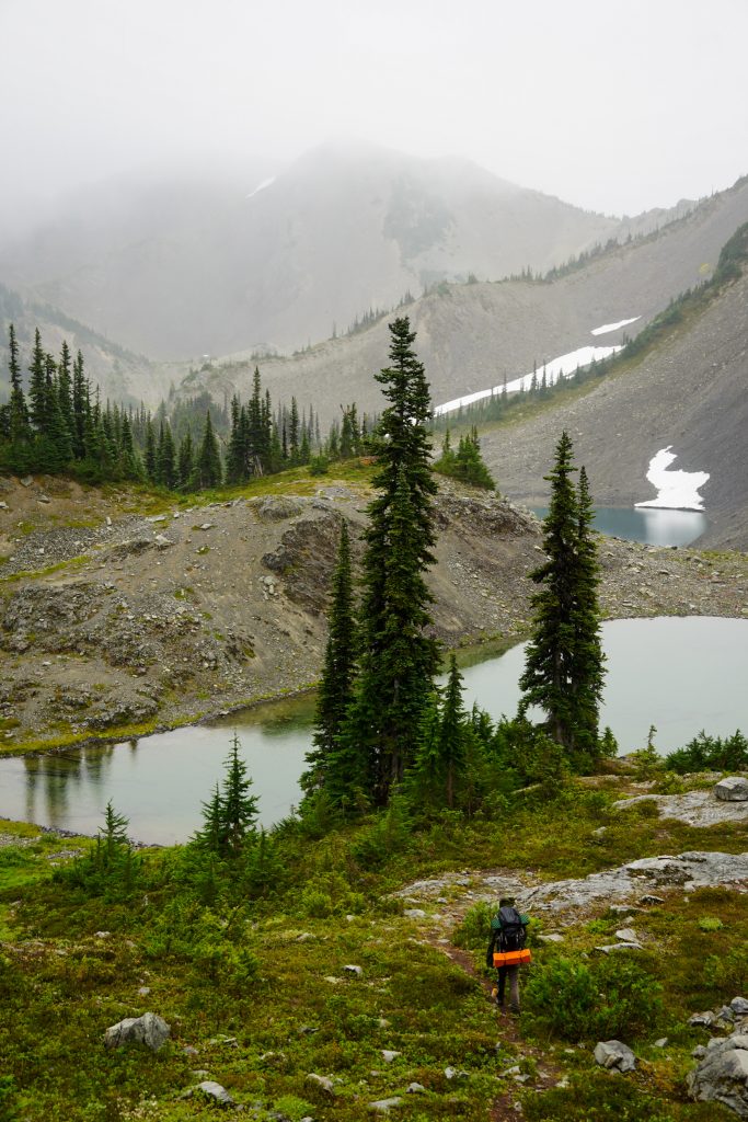
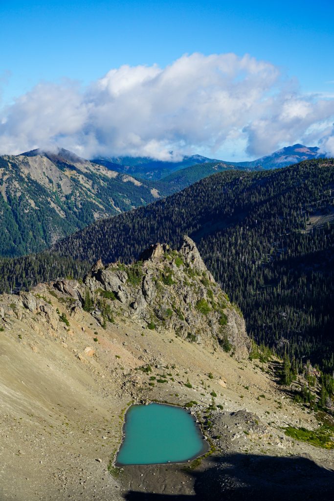
There are yet more beautiful little ponds set beneath Grey Wolf Pass NW. We continued to the main trail and made camp in a tight cluster of trees at the lake near Grey Wolf Pass. After last night, we craved the protection of trees. Even when it rained and blew, we stayed dry.
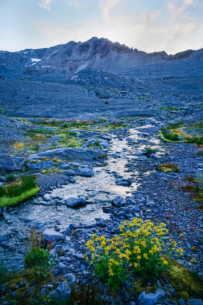
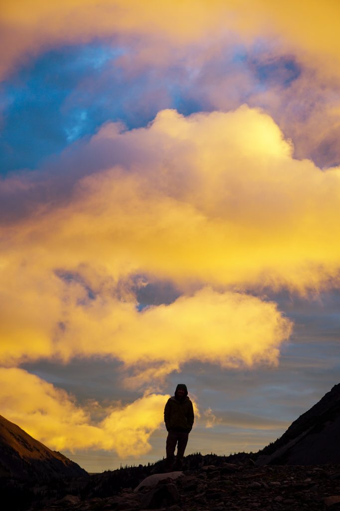
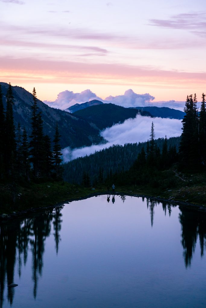
After dinner, the sky cleared up. The sunset was brisk and beautiful. While Grant and Blake were consumed in a never ending game of “20 questions”, I snapped this quiet portrait of an evening in the mountains. After so much travel and so many day trips this summer, this was exactly what I felt was missing – to just relax at camp in the mountains with good friends.
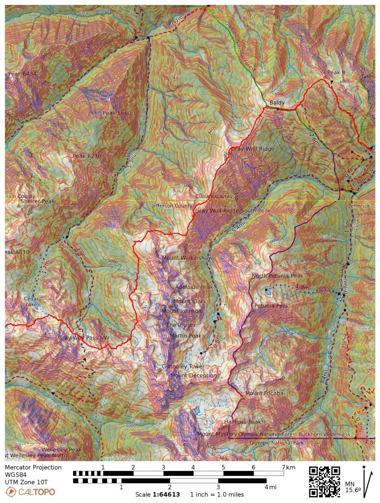
Day 3: Grey Wolf Pass to Tyler Peak Trailhead
We got up early because we had a big day ahead of us. We were moving shortly after sunrise. It got cool overnight, with frost not far above camp.
We moved towards the Needles over a series of basins and passes. Once again, the terrain felt surprisingly big. Every little basin held a glacial moraine, pond, and beautiful stream. There was a fair bit of micro terrain and some bushes, but it was not too bad.
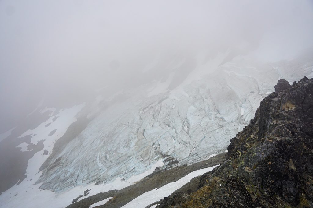
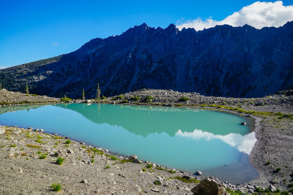
We passed the basin beneath the Deception Glacier. A long sidehill climb around the shoulder of Pt 7070 brought us to a nice view of yet another turquoise blue glacial lake. The glacier here never could have been more than 300 vertical feet, but it had created a substantial moraine.
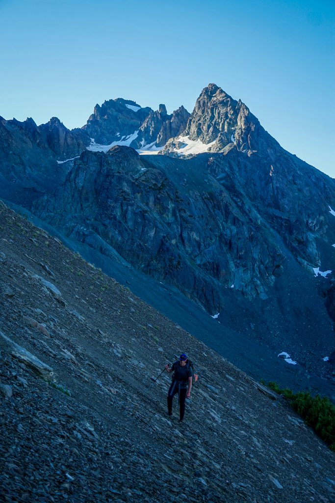
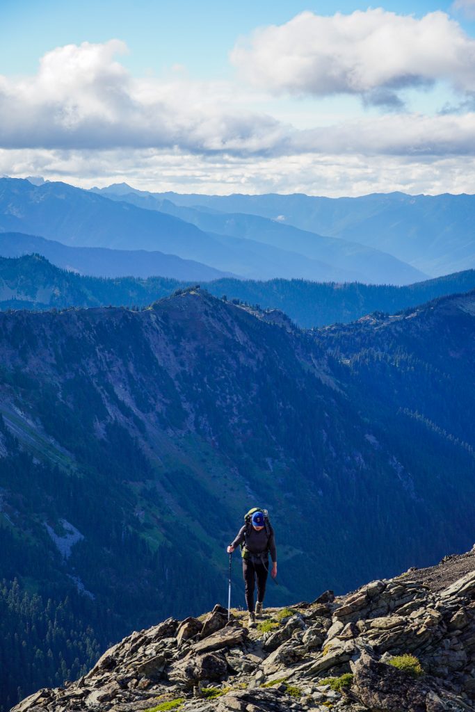
The valley beneath Walkinshaw was the only part of the entire high route that really dropped below tree line. It was easy getting down into the valley initially, following a dry creek bed, but eventually the brush became denser. It was never full on bushwhacking, but a bit slow. The climb up the other side, on the west side of Walkinshaw, was a steep forest. We followed deer and goat trails through the steep forests, traversing up and left. This was the hardest part of the route. We eventually reached a prominent outcropping of rocks around 6250 ft on the NW shoulder of Walkinshaw and took a well deserved break in the sun.
You can go directly over the summit of Walkinshaw, but that adds a lot of scrambling and vert. I wanted to see if we could traverse around the north side. We held an elevation of around 6200-6300 ft and peeked around into the north bowl. It looked scary, but hoof prints encouraged me to continue.
It went! There was a weakness through the cliffs and we carefully made our way down into the basin.
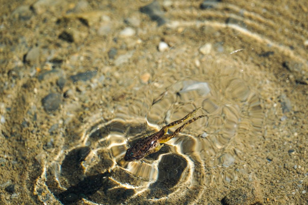
There is a little pond in the basin, which is filled with frogs and tadpoles. I have never seen so many.
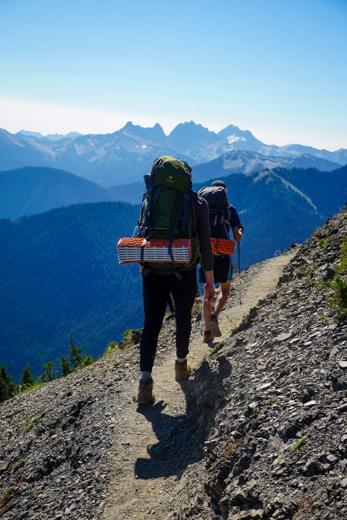
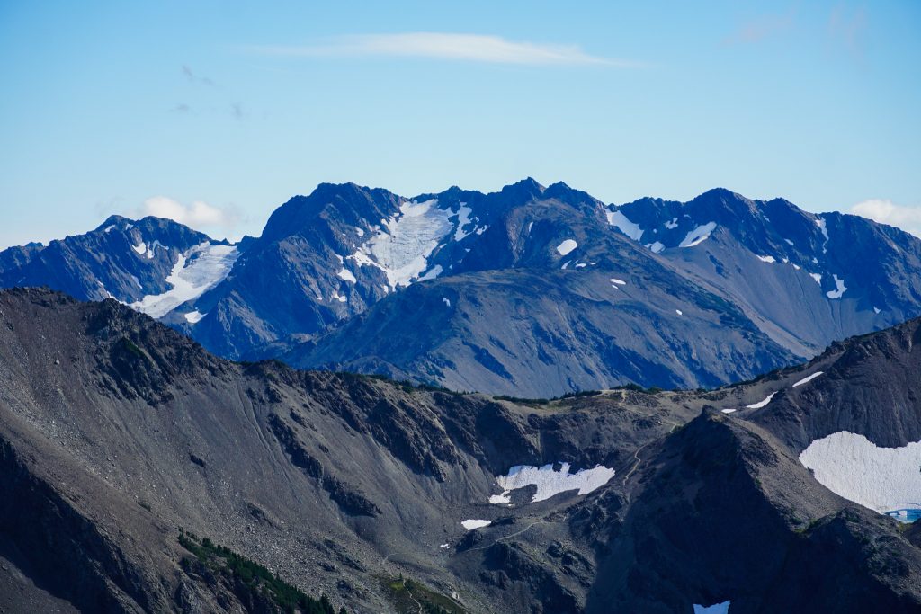
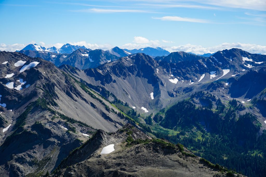
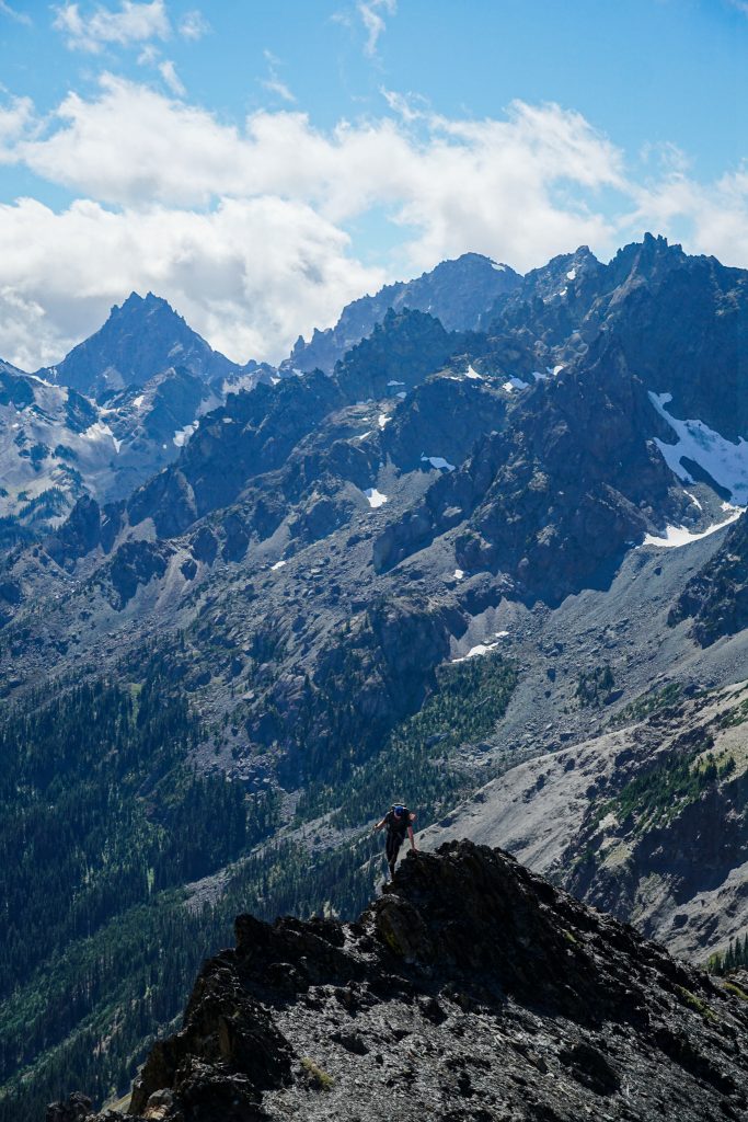
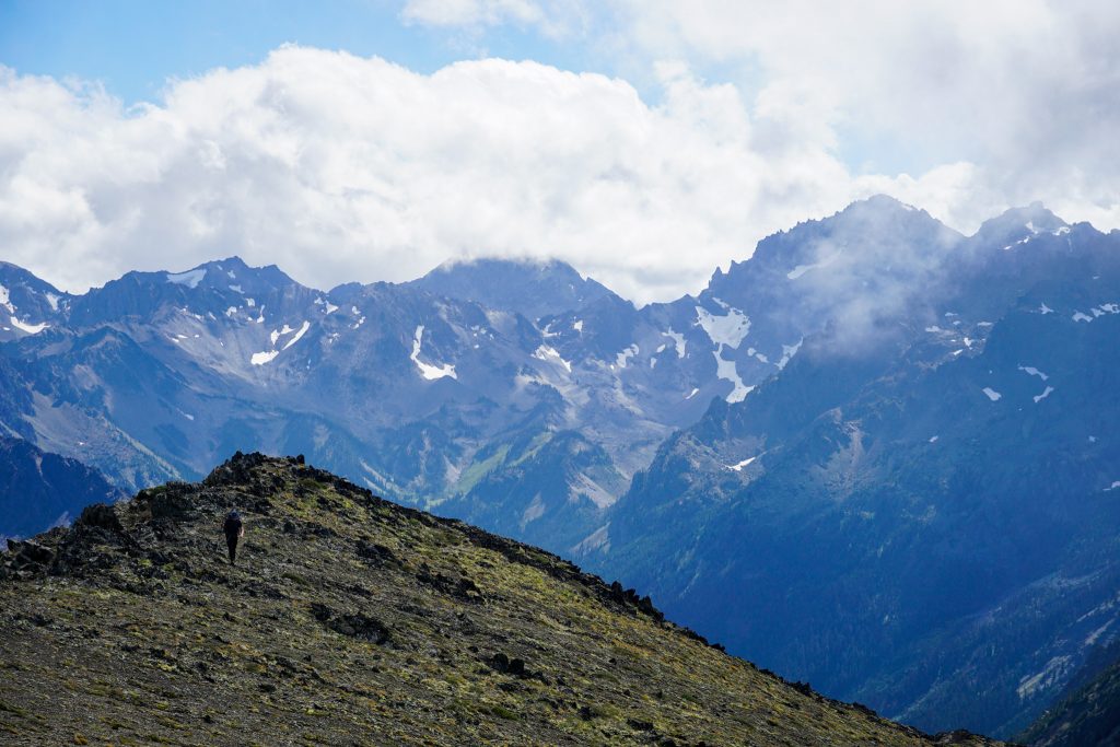
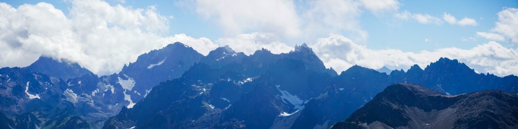
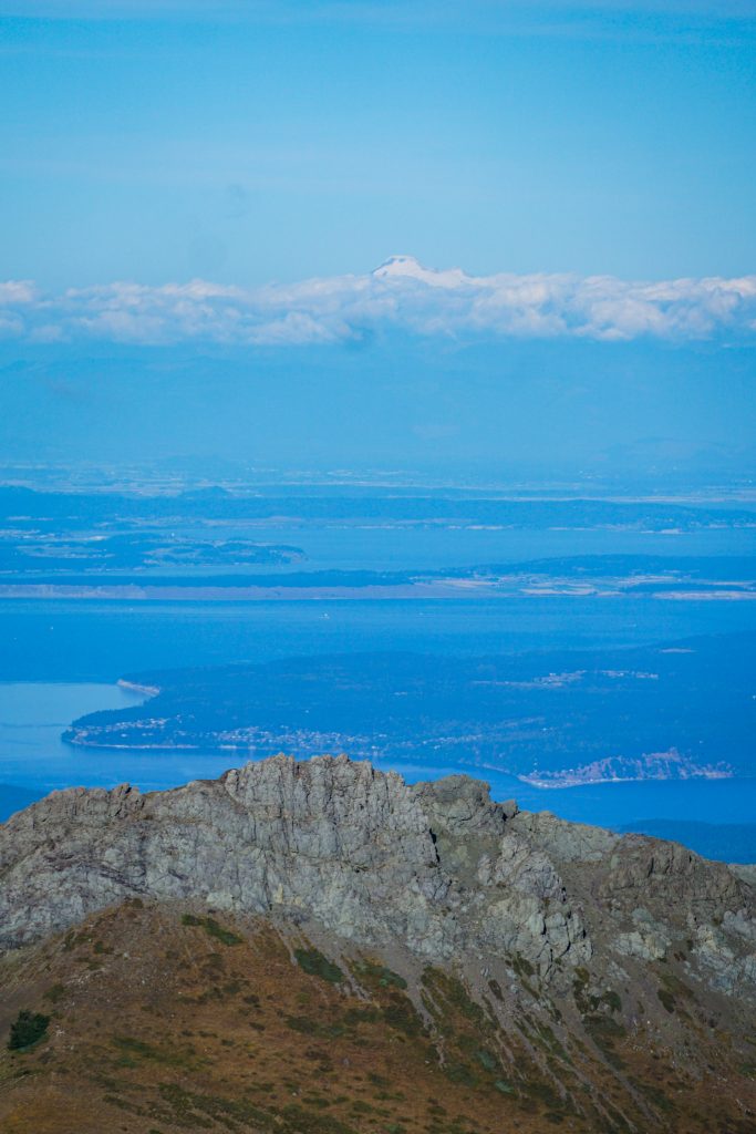
After a short, but loose climb, we were finally at the saddle between Walkinshaw and Grey Wolf Ridge! It was relatively smooth sailing from here! We cruised up to the summit of the South Peak of Grey Wolf Ridge. The view of the Needles, with clouds floating by, was absolutely magnificent. The position of Grey Wolf Ridge, between the Strait of Juan de Fuca, and the steepest peaks of the Olympics, is wonderful.
The difficulties were not entirely over. The descent into the next bowl north was extremely chossy. I had done this in spring previously and can confirm that snow is preferable. It probably holds snow through much of the summer and there were still a few patches left for us.
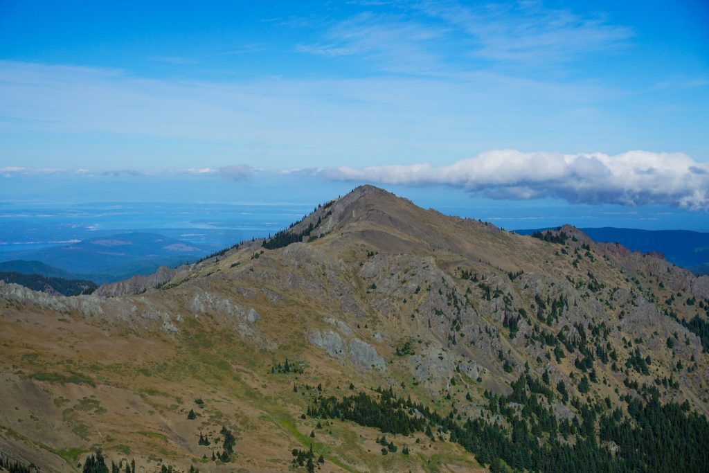
Then we ground out one long climb to the summit of Grey Wolf Ridge. At about 7200 ft, this was our high point for the entire trip!
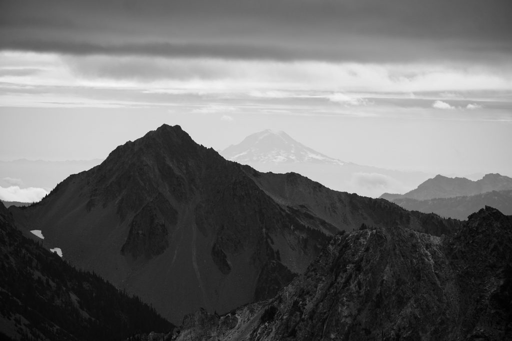
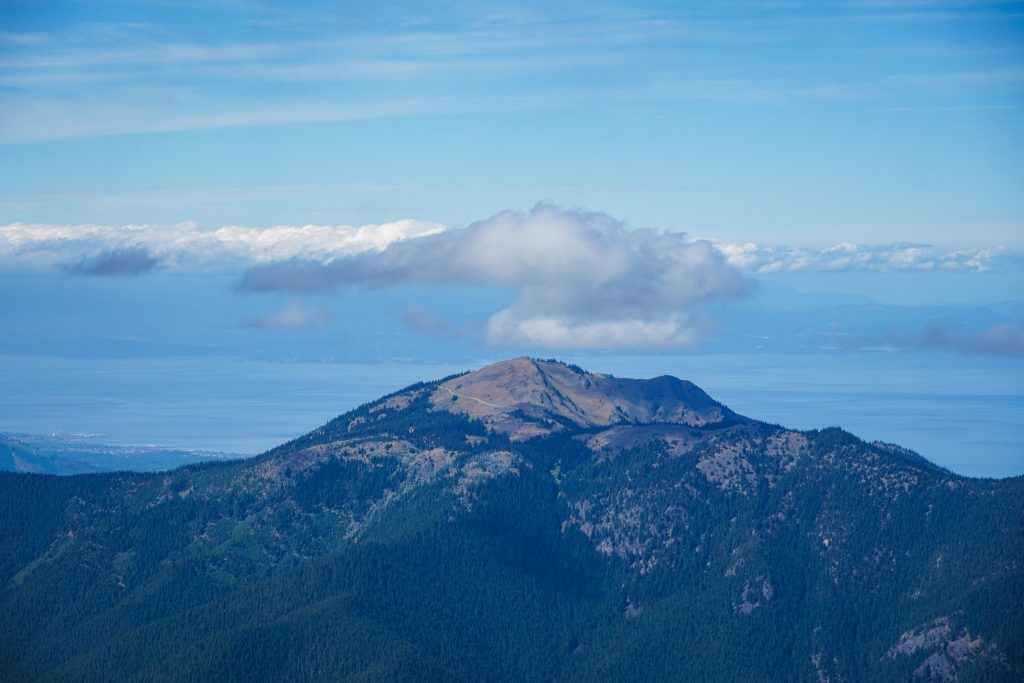
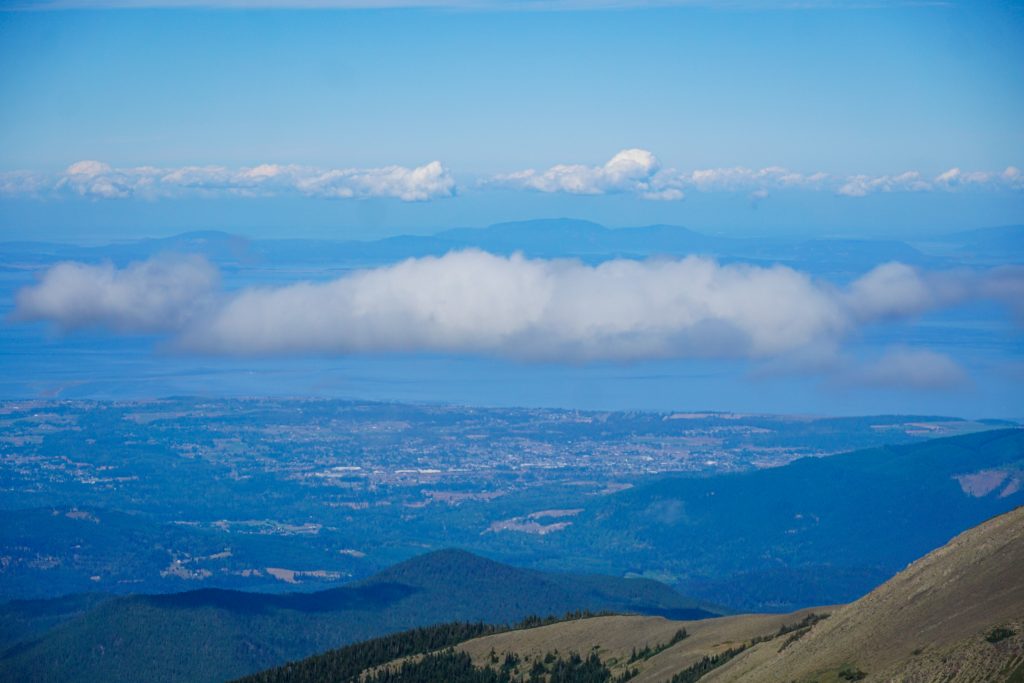
We could see Deer Park, the ridge to Obstruction Point, Mt. Cameron, and so much of the high terrain we had just covered.
From this summit, there is a more well defined trail dropping down to the saddle with Baldy and the final climb up to Baldy. We had done over 6,000 ft of gain for the day, which was actually the most vert Grant has ever done in a day (even without a heavy overnight pack) but he still crushed it!
We took a moment to celebrate on the summit of Baldy and finish our food. Grant had brought probably 4 pounds of food per day: cheese, trail mix, sausage, sweets. This was definitely the best fed I have ever been on a backpacking trip. It was a struggle, but we finished every bit of food by time we got back to the trailhead.
For the first time in two days, we were on a real trail again. The light was soft as we descended through the meadows and back into the trees. The cool air and faded grass had a hint of fall. But we were so happy to have snuck in one last multi day trip before summer’s end.
Routes and Rocks
The Northern Olympic High Route was an incredibly enjoyable trip. It was fun to take two of my best friends and share with them three days exploring off the beaten path. Grant had never done sustained off trail travel, but he improved so quickly throughout the trip and was able to handle all that we asked of him!
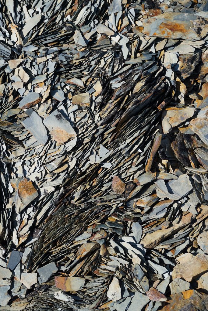
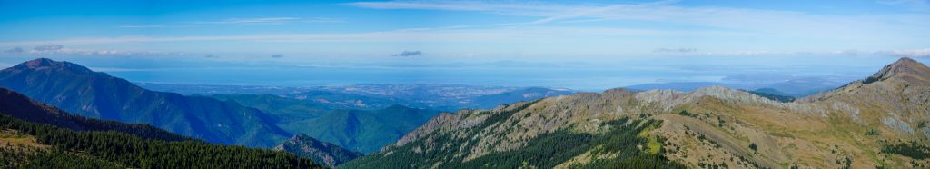
The density of high terrain in the Northern Olympics cannot be represented fully by a map or story; it has to be experienced. There are so many little basins, lakes, meadows and moraines. Green moss accents the gray stone and flaky shards of the landscape. While the Bailey Range may garner the Olympic fame (and deservedly so), the rest of the range is absolutely ripe for cross country travel of comparable views and difficulty. I am very excited by the Olympics right now and have some crazy ideas for the coming years…
Notes:
- Curious about what gear we used? See this post about my favorite high route gear.
- Our route was 34 miles and 15,000 ft gain. Most of that was off trail. Our third day was our longest.
- The car shuttle took around 2 hours between trailheads. You could, of course, start at Obstruction Point to shorten the entire trip, but that car shuttle is longer.
- The scrambling was mostly class 2-3. The chossy descents would give more people trouble than the scrambling. I recommend bringing two poles per person and having shoes with big lugs. Earlier in the summer, you would encounter moderately steep snow, which would be easier.
- There are abundant beautiful flat areas to camp, but do not expect developed campsites off trail.
- How does the overall difficulty compare to other routes? The Baileys have more “trail” because more people do them. I think this route would not feel as hard if there was more snow coverage, but overall it felt more sustained in difficulty than the Baileys, although maybe less physically demanding since you start high. It was far more difficult than the Ptarmigan Traverse, which is just a trail with easy glaciers, or the Alpine Lakes Crest Traverse, which has much simpler terrain.
- When in doubt, follow the hoof prints!
Awesome report! I was excited to see you out this together. Like you, I feel jazzed about the Olympics and look forward to the next few years of intimate exploration in them.
The White Ryno, at first an invasive species in the Olympics, is quickly becoming a sustaining part of the ecosystem!
Thanks for the shout out! Fun to see where you guys went after we saw you on Cameron pass! What camera do you use?
Nice to run into you! I use the Sony A6000 with a 18-135mm lens.
Kyle, what a wonderful trip report! Thank you 🙏. I did a similar high route doing a loop from Obstruction point. I notice the compressed rock formation on Grant Pass Peak and was also stumped by the little knife edge section right before Mc Carthy Peak. My plan was to go up and over Cameron to Wolf Pass and climb Mount Deception. I camped below Cameron and climbed Lost Peak. I was solo and half way up to Cameron I got spooked by the unknown over the summit and descended back the Great Valley gained the ridge at Deer Park, and returned on the trail to Obstruction in the dark 38h later. My question is how sketchy did you feel the traverse was up and over Cameron to Wolf Pass, and how feasible do you think the route to to Deception Peak is from Wolf Pass is? You must of had a good look at it. Again these photos are great, and I appreciate you sharing your trip. I love how the high routes transform you perspective of the Olympics. All best DD.
Hey David! That sounds like such a fun time! So after Cameron, we dropped off the ridge and hopped through the basins to the north. I know for a fact that Grey Wolf NW (the peak just west of Grey Wolf Pass) is not really passable without class 5 and friends have struggled to get around it. From Grey Wolf Pass, you can stay on the ridge most of the way to Deception, but I imagine getting around the Gilhooley Tower area might be tough!
nice report! I’ve been an Olympic junkie myself for the last 10 years and agree with your assessment of that corner of the park. I would be interested to hear your ‘crazy ideas’, I have many myself…
Hmm well I think it would be interesting to do a high orbit of the Elwha…
Awesome. You’ve inspired me to do this route in August. Any chance you could share the GPX data? Still trying to figure out this high route thing.
I think the maps I shared should be sufficient, and if not, you can download my GPX from my strava. But I think with the map I drew, you should have the idea and you’d want to use in-field navigation anyways since you’re never going to follow the exact same path!