A Last Hurrah for Fall
It was mid October, but yet another sunny, hot summer-like weekend was on its way. New wildfires have been popping up with each easterly wind event, especially on the west side of the Cascades, but the drumbeat of rain and snow was finally on the horizon for the following weekend. The key this fall has been to maintain flexibility, anticipate the smoke forecast, and go where the air is best. If you are set on a few classic larch hikes, then that might not work out well for you. I figured that this weekend would be best in the East Central Cascades.
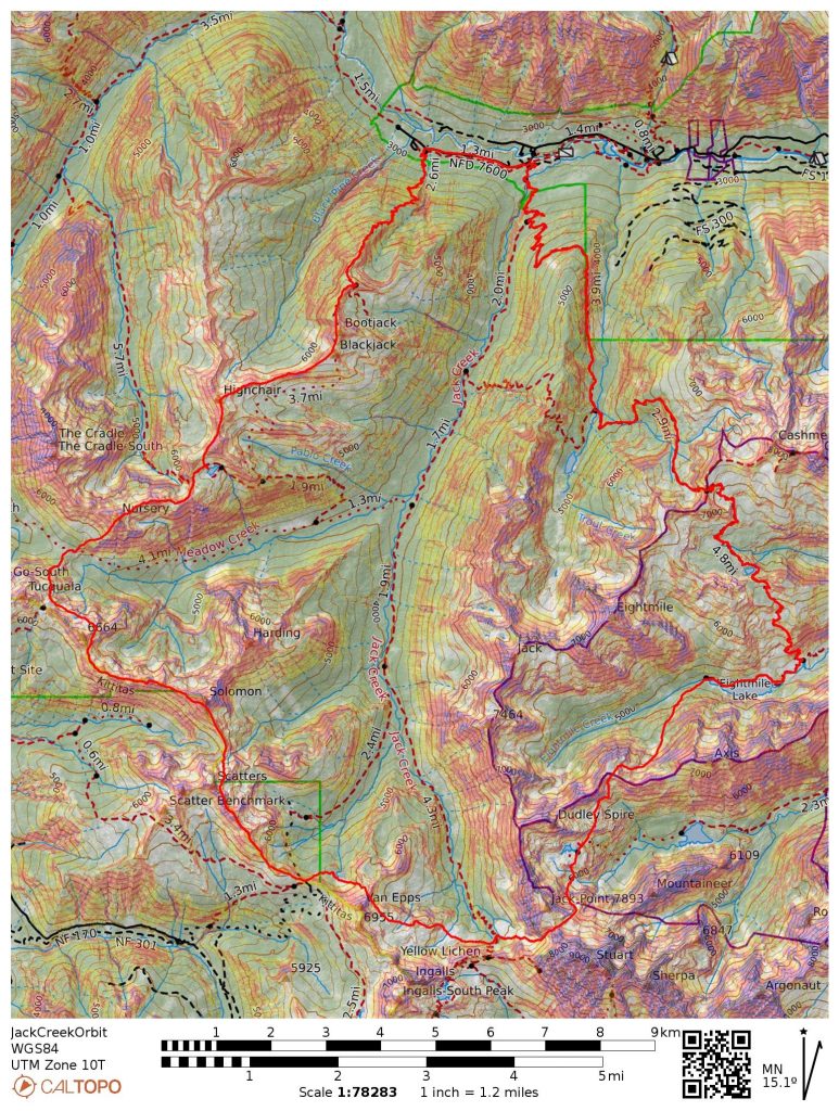
I have been keen on visiting Horseshoe Lake in the Enchantments because of its incredible position beneath Mt. Stuart, but I did not want to deal with the parking situation at the Colchuck Lake Trailhead during larch season. So instead, I devised a loop from Jack Creek, over Windy Pass, towards Horseshoe Lake, over Goat Pass, and out Jack Creek. It leveraged a lot of rarely used trails and made for a nice single day loop. Over the week, I asked around but could not find a partner. Since it appeared I was going to be solo, I figured why not go out for two days? Then I could stay high on the west side of Jack Creek, exploring the Scatter-Solomon region, which had been enticing me as a logical connector from Paddy Go Easy to Ingalls for the obvious Complete Alpine Lakes High Route (a high crossing of the entire wilderness).
It was already Thursday when I thought of this idea, but the opportunity to try a big two day push was both scary and exciting. I had never done back to back big days like this. I had never tried fastpacking (running with overnight gear). Whenever I get excited like this, I know I have to follow through.
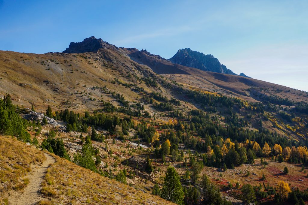
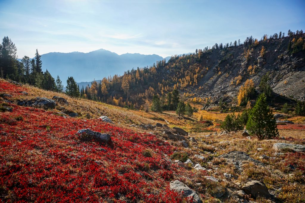
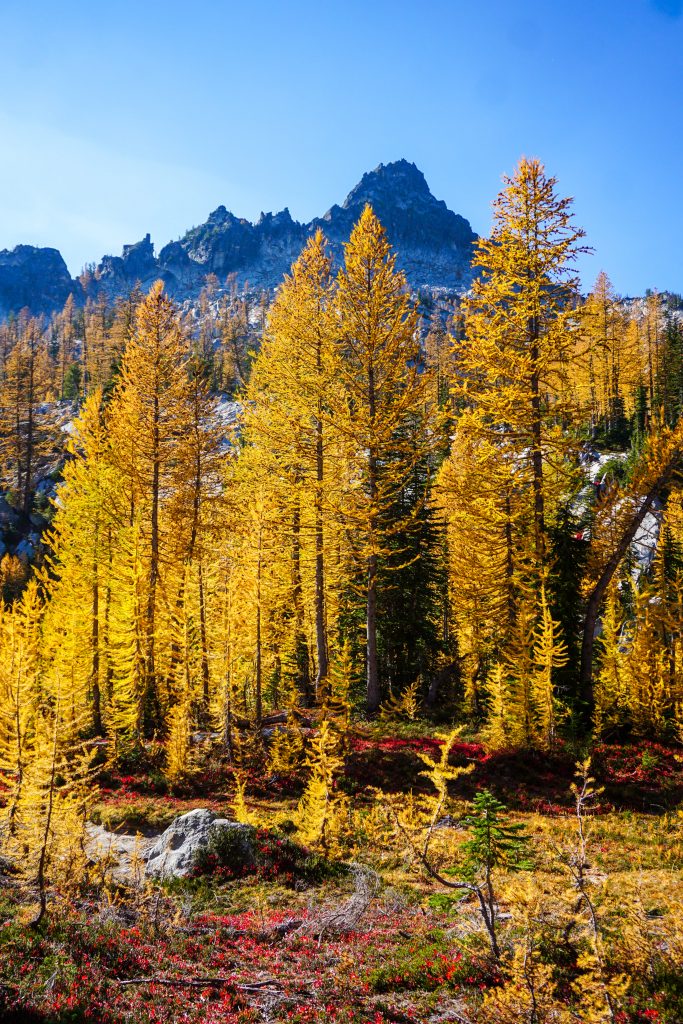
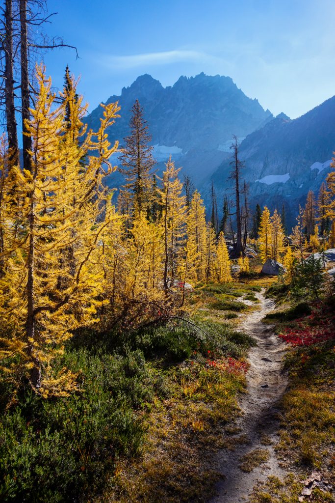
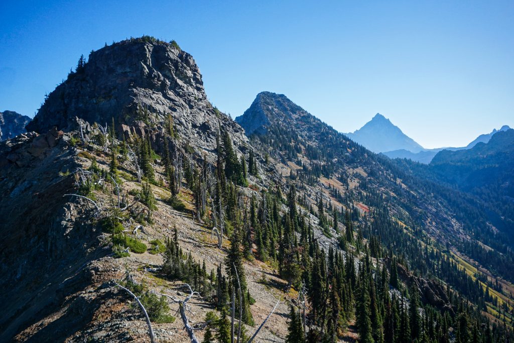
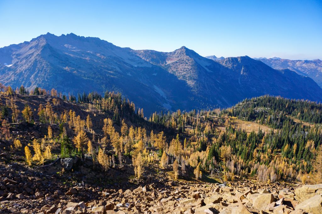
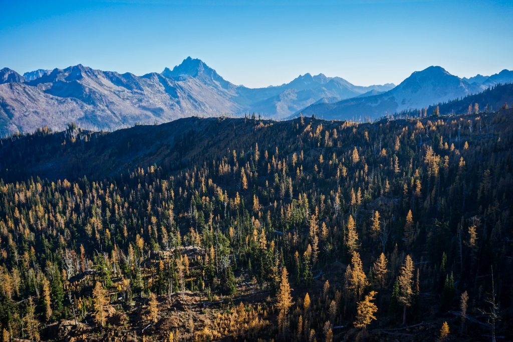
I drove up the Icicle Friday night, leaving all the cars behind at the Eightmile Road. The Jack Creek lot was empty, unsurprisingly. I began the next morning under headlight, taking the turn towards Trout Lake. The trail up to Windy Pass was a bit faint, but easy to follow. Near the pass, I entered into beautiful fall meadows. The wind was whistling overhead, stripping the larches of their needles. The groundcover was getting drained of color. I could tell it was the last gasp of fall.
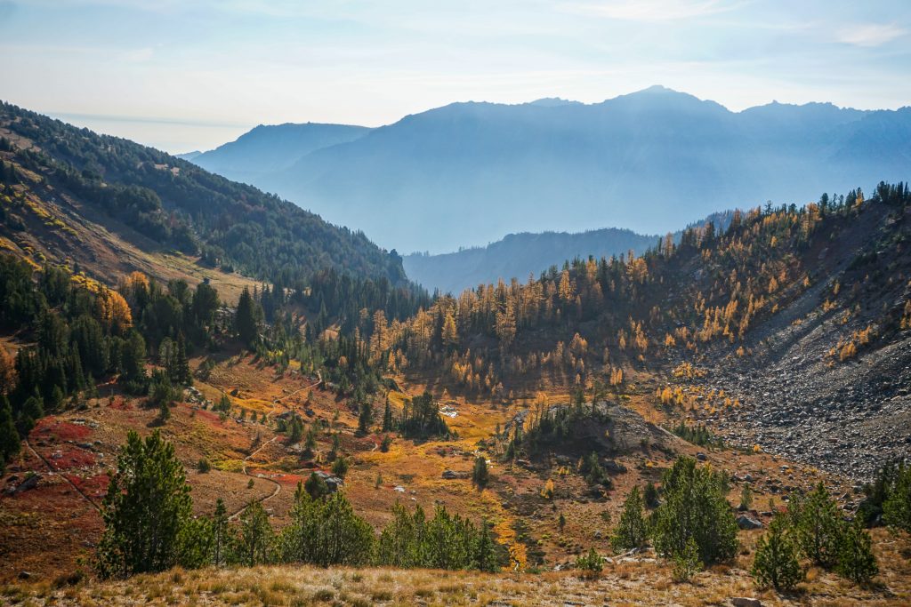
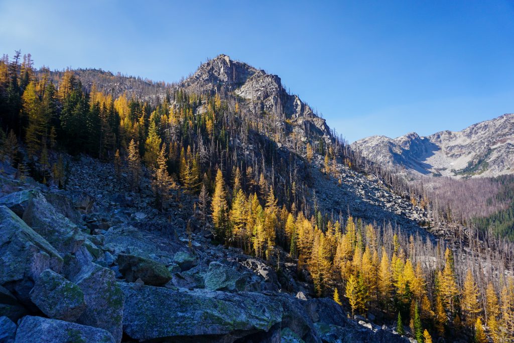
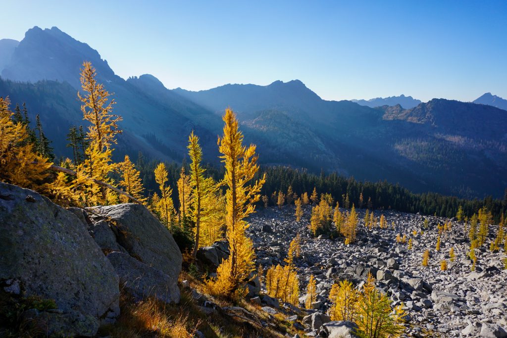
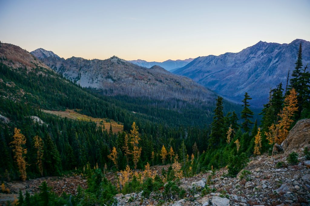
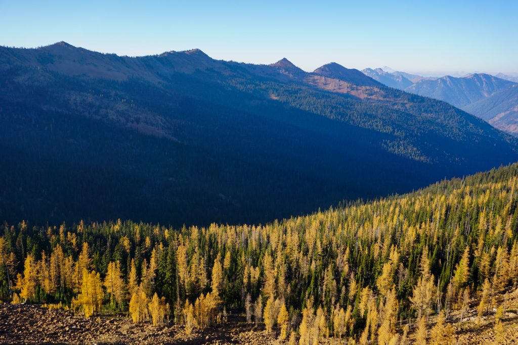
At Windy Pass, I broke into the sunshine and the vibrant orange and yellow colors in the meadows beneath me. The trail here is in good shape, so I started to jog down. My fastpack (basically a 30 liter running vest) was probably about 15 pounds with food and a small amount of water, so it definitely was not the most comfortable to run with, but it was tolerable!
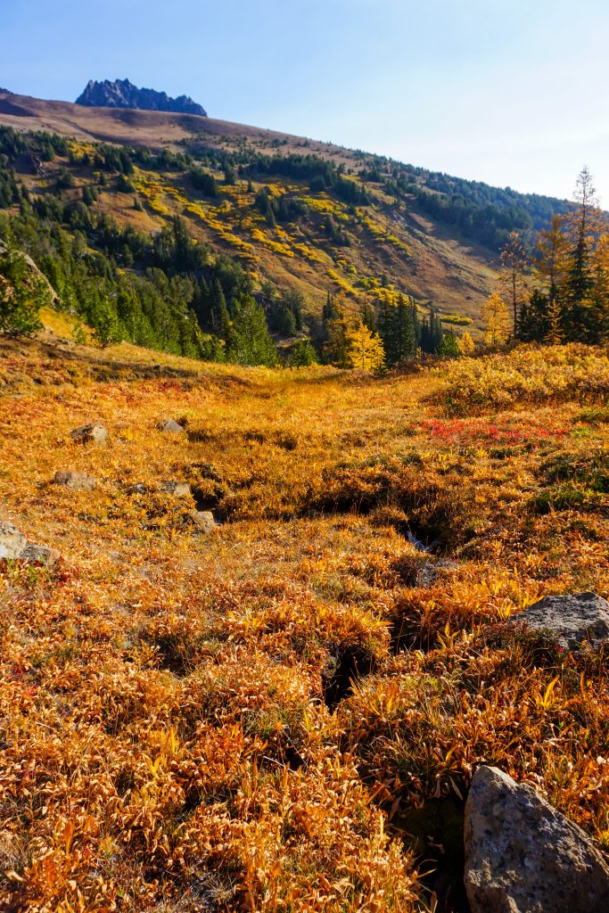
When we think of the Enchantments, we usually think of beautiful granite. But in this part of the Enchantment Permit Zone (the Eightmile / Caroline Zone), the rock is actually red serpentinite, the same rock that is found around Lake Ingalls. It turns out I would be following this intrusion of red rock for most of the two days.
I passed four people around Caroline Lake and the trail down to Eightmile Lake. These would be the only four people I would see the entire trip!
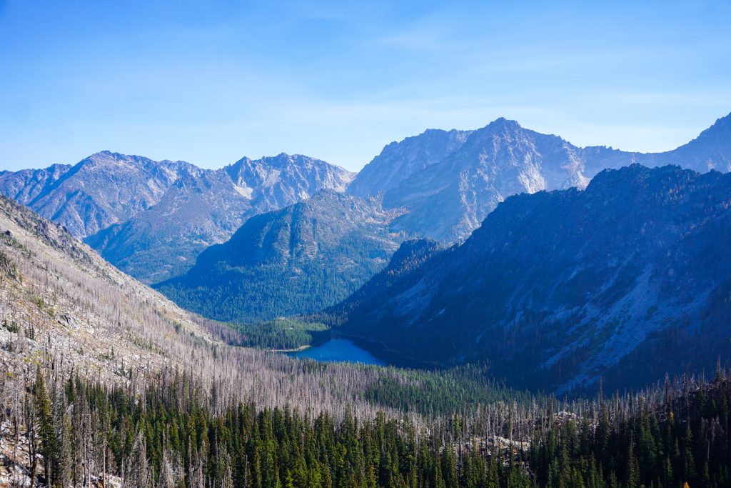
The trail down to Eightmile goes through a burn zone and was overgrown and slow. It has always seemed strange to me that there are permit quotas in this area, since they are pretty run-of-the-mill compared to typical Alpine Lakes Wilderness lakes. It is as if the presence of a quota must mean that these zones are better than the others. I have heard people say before “I did not get a core zone permit, but at least I got an Eightmile Permit!” People just like winning lotteries I guess…
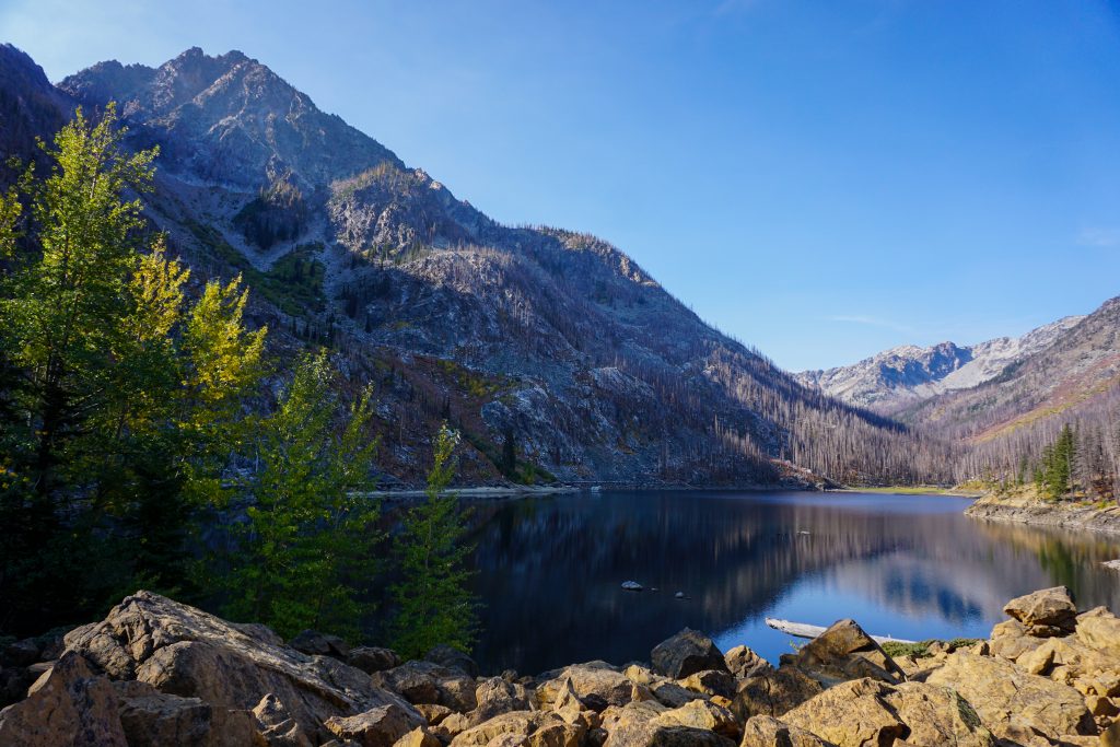
I had been to Eightmile Lake once before, in winter, to ski Axis Peak. Because of the burn around the lake, I think this lake is more beautiful in winter.
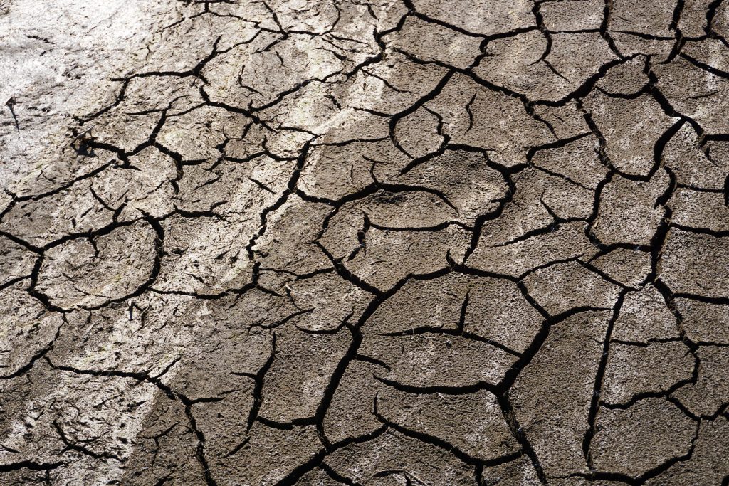
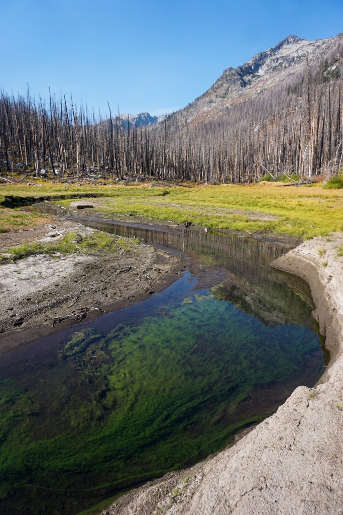
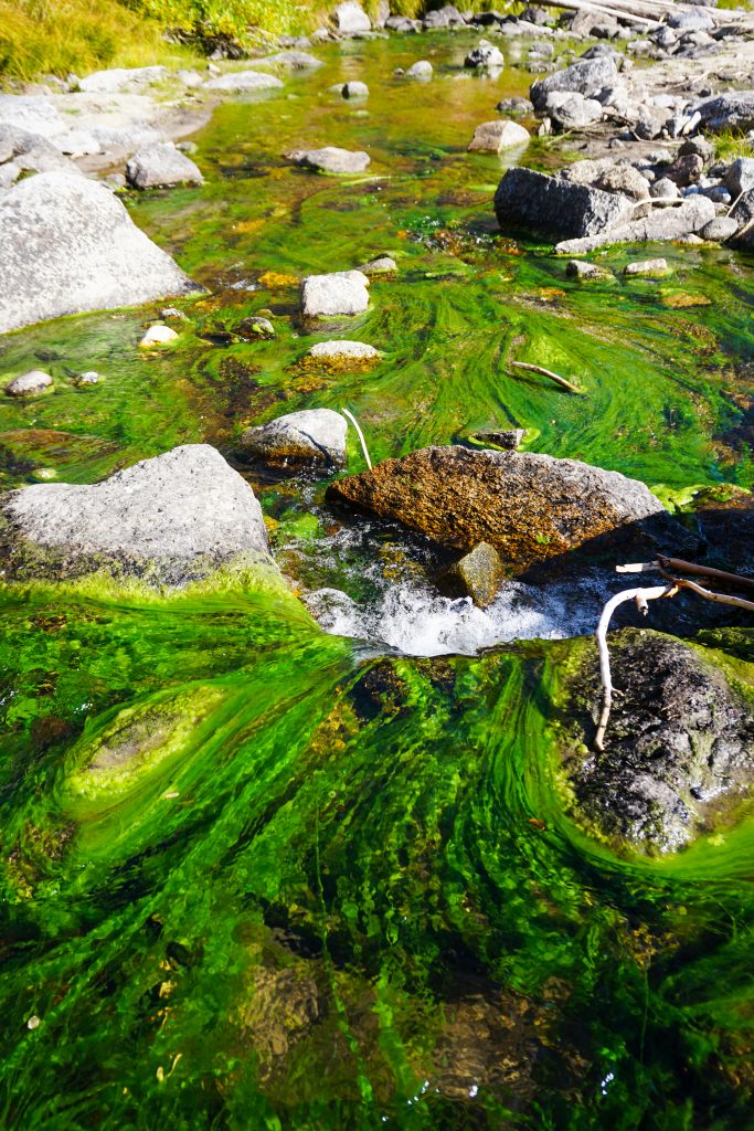
I followed the trail around the right side of the lake to the inlet. Here I found a beautiful stream slowly winding its way through sandy delta. The water contained a translucent green moss, possibly a product of the minerals created by the fire? I had never seen such a green moss before. Perhaps my favorite part of these exploratory routes is finding spots like this that completely take me by surprise. Going in, I knew Horseshoe Lake would be beautiful. But I had no idea that the inlet of Eightmile would be so special.
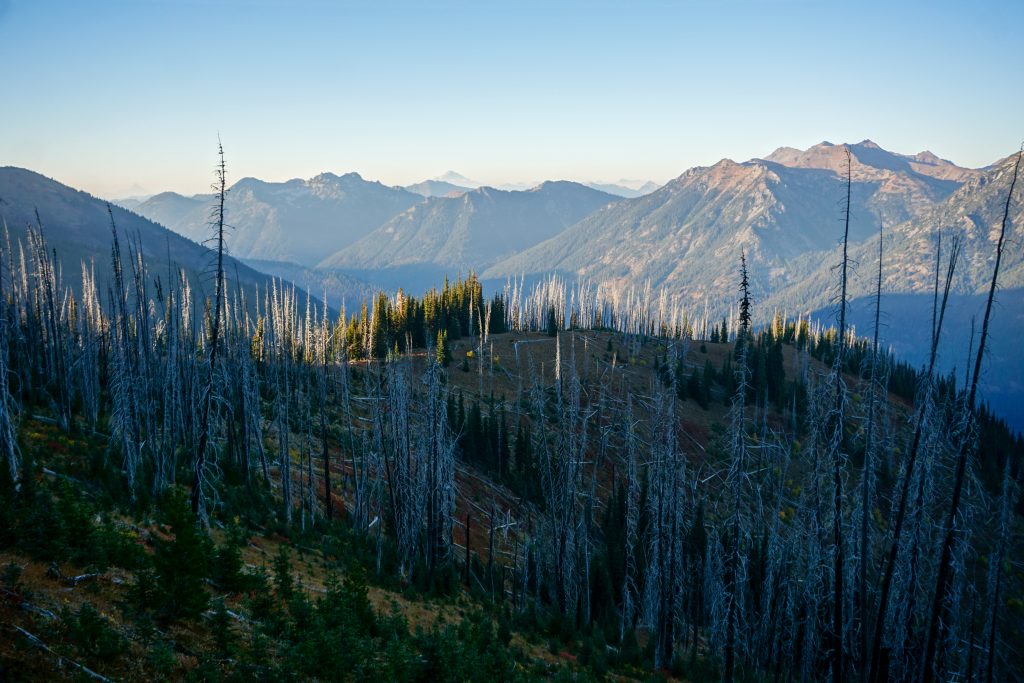
I knew that the next section up to a pass west of Axis Peak would be a little challenging. I bushwhacked through a burn zone which was mellow at first, but got worse. I believe it burned back in 2008 and must have burned extremely hot because most trees were incinerated and the soil was turned to an unsupportable ash. Sometimes stumps would simply disintegrate when I stepped on them. Still, I was able to average about 1 mph, so it was not that bad.
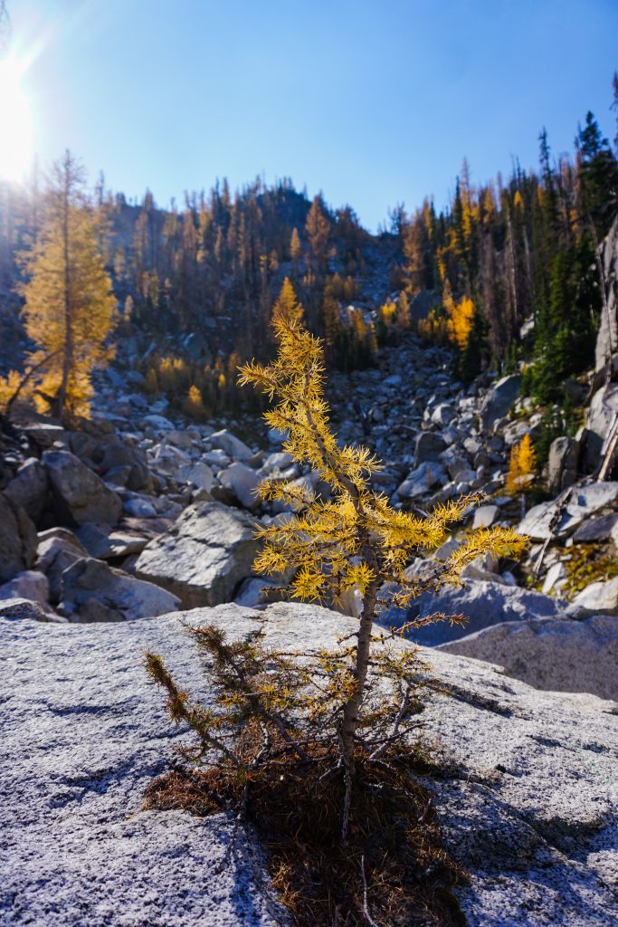
Larches always amaze me with their ability to grow in the most inhospitable environments. I found a big boulder where a tiny larch had somehow amassed enough soil to grow right in the middle of the slab! It had probably spent decades just to get to this point.
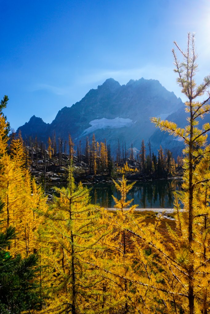
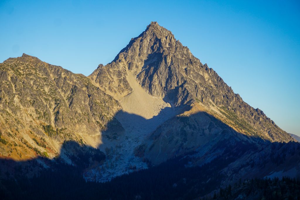
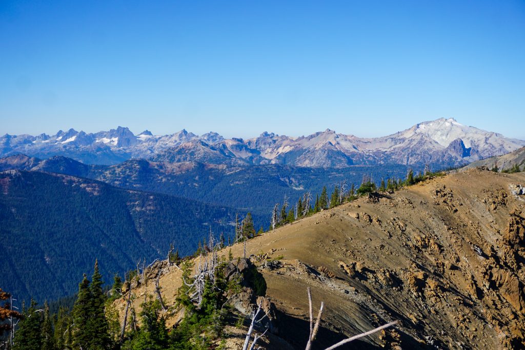
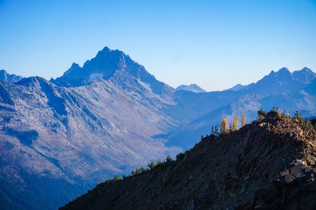
I reached a pass between Dudley Spire and Axis Peak and got a great view of Mt. Stuart. The traverse over towards Horseshoe Lake had a few ups and downs but was generally easy.
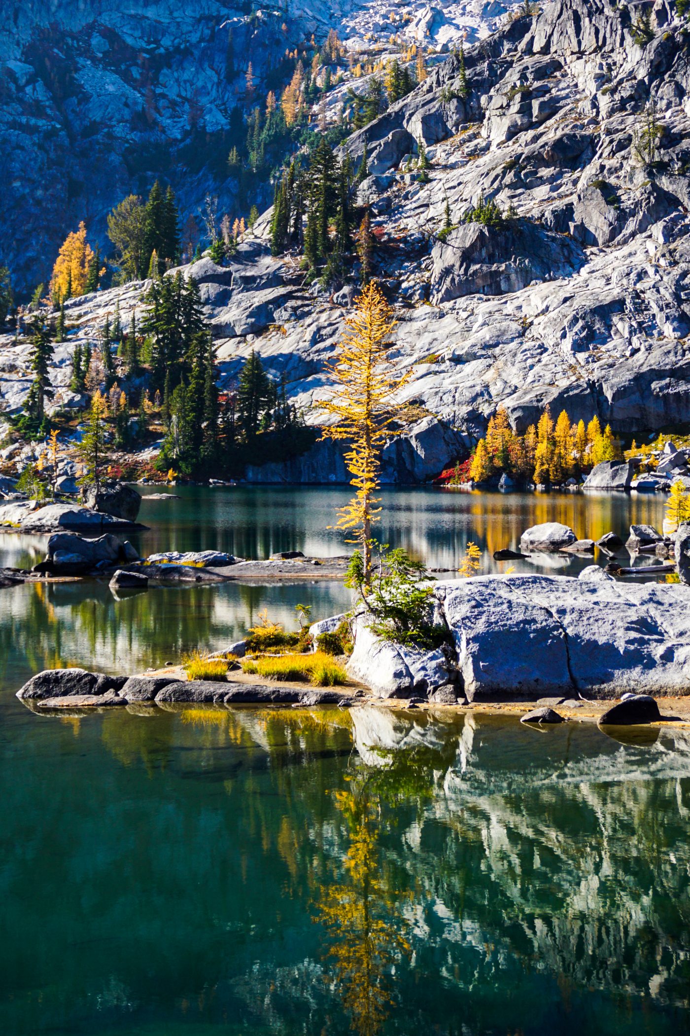
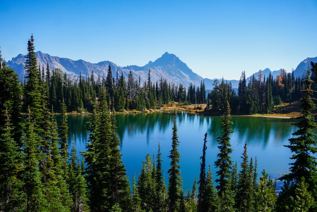
I arrived a Horseshoe Lake to find it surprisingly deserted. It was perfectly calm and I took a moment admiring the granite slabs, clear blue water, and yellow trees. Probably half of the needles had fallen and the shore of the lake was awash with yellow needles.
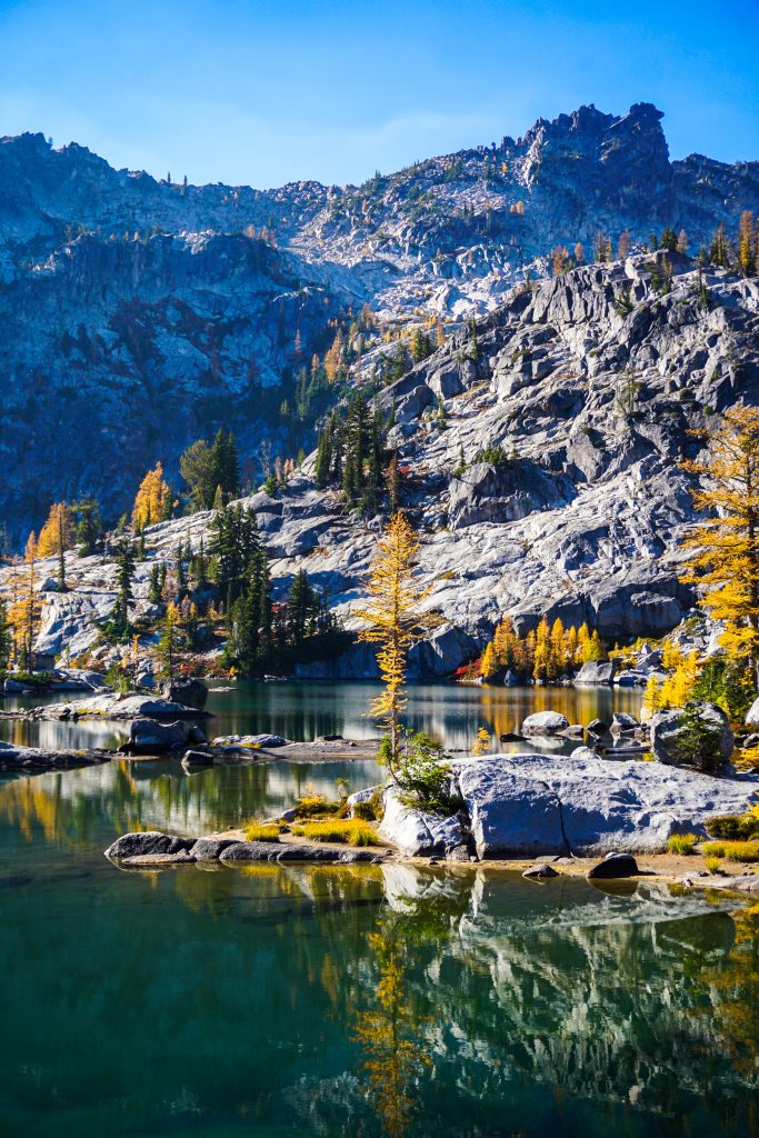
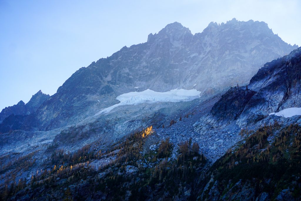
I followed a faint trail past the lake and down towards the deep valley beneath Mt. Stuart. The mighty North Ridge loomed above, which I climbed last summer. The sun barely reaches the depths of this valley at this time of year, but a few larches glimmered above in the fading light.
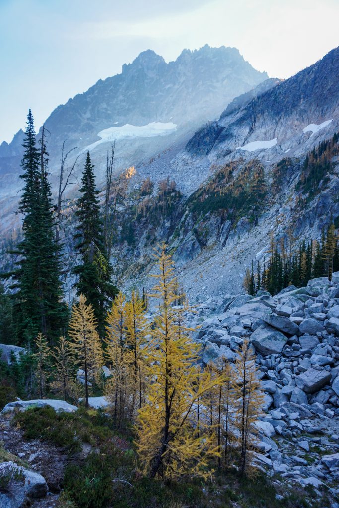
The climb went surprisingly quickly, as the ground was actually pretty stable. I was pleasantly surprised at my ability to crank out the 1800 ft climb in just 45 minutes. The air was cold beneath the giant peak above me, but I blasted out into warmth at Goat Pass.
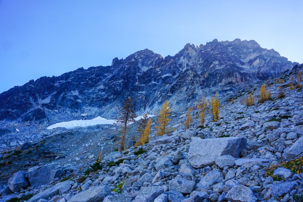
The descent down the other side of Goat Pass went pretty quickly, as I found a trail in the sand on the skier’s right side. Then it was just nice stable granite boulders. This route has more boulder hopping than I have ever done before, especially in the second half, but at least 95% of the boulders were highly stable.
The boulder field beneath Goat Pass and the west side of Stuart is such an interesting feature. On satellite imagery, it looks like the tongue of a glacier, but it is only composed of rocks. I wonder if it was a rock glacier during the Little Ice Age because the shape suggests downward movement as a cohesive mass under gravitational forces.
Down at the bottom, I crossed the Jack Creek trail and took off across the big basins beneath the north side of Ingalls Peak. These were filled with larches, pretty meadows, and giant house sized red serpentinite boulders.

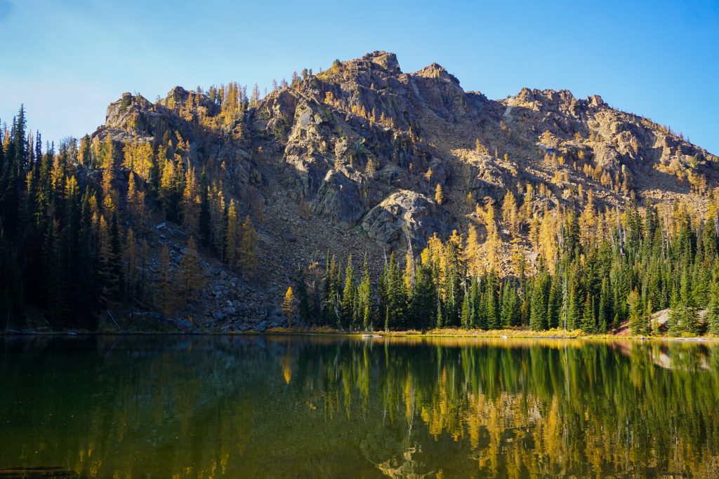
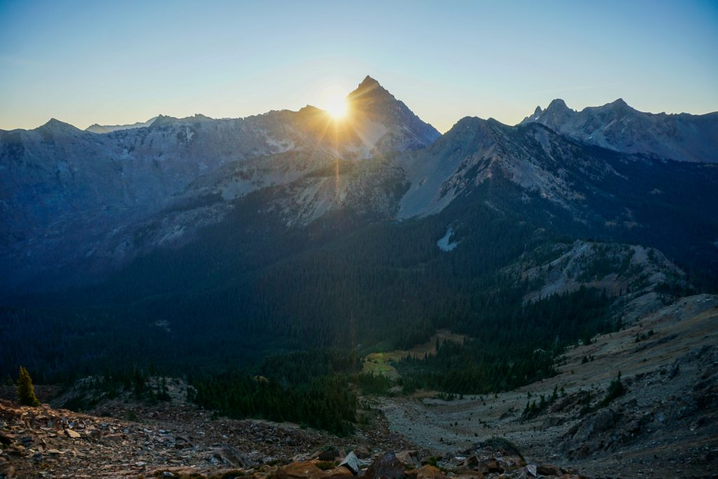
If I did not have to worry about water, I would have gone directly over Van Epps Peak and down to Van Epps Pass. But I wanted to sleep at a water source, I so crested a pass just northeast of Van Epps Peak and dropped down to Spirit Lake for the night. It was only 6 pm, but the sun was setting fast.
Spirit Lake turned out to be rather marshy and uninspiring, but with nice flat campsites in the trees, it would do. The nights are long with not much to do solo at this time of year, but I listened to music, ate food, and stretched out. Shortly after 8 pm, I turned in for the night, sleeping out under the stars on this warm October night.
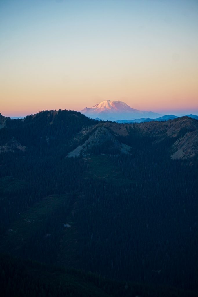
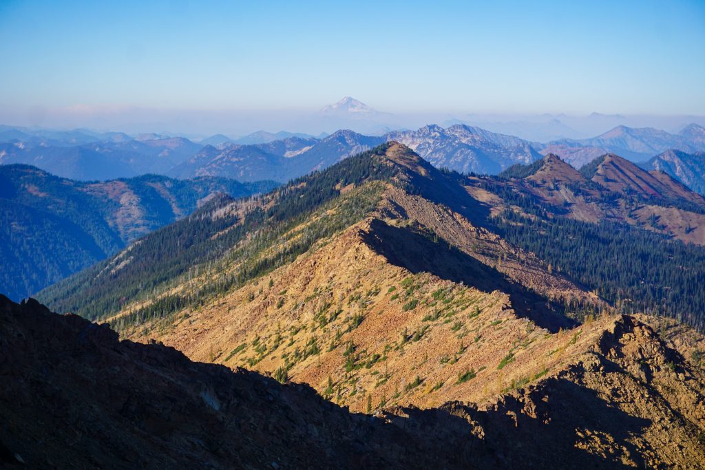
It was warm (probably mid 40s) and generally calm overnight, which allowed me to sleep well, although the moon was annoyingly bright so I tied a wind jacket over my eyes as a blindfold. I got moving in the pre-dawn light towards Van Epps Pass. The distance was tiny but I ran into a formidable schwack, the worst of the entire trip. I really would recommend going over Van Epps Peak to avoid this. One nostril got impaled by a bush and my nose started bleeding. But I had no time to stop and carried on up to the pass, and onto the ridge just as Tahoma was bathing in alpenglow.
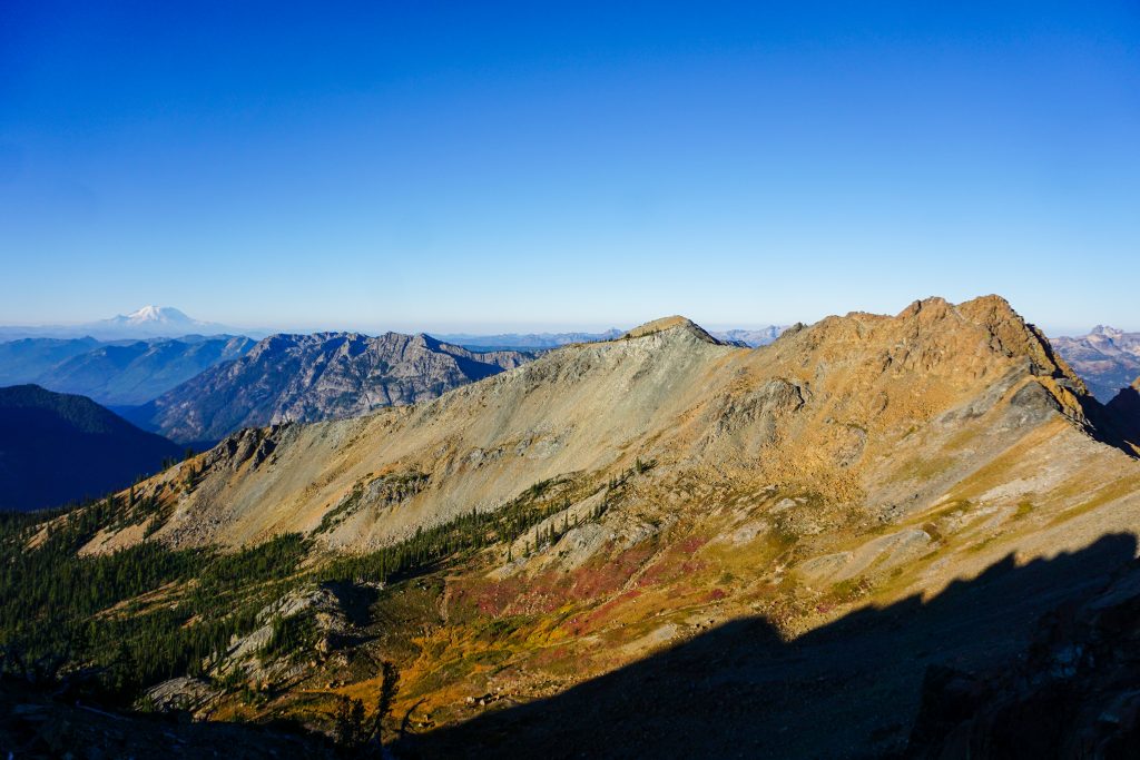
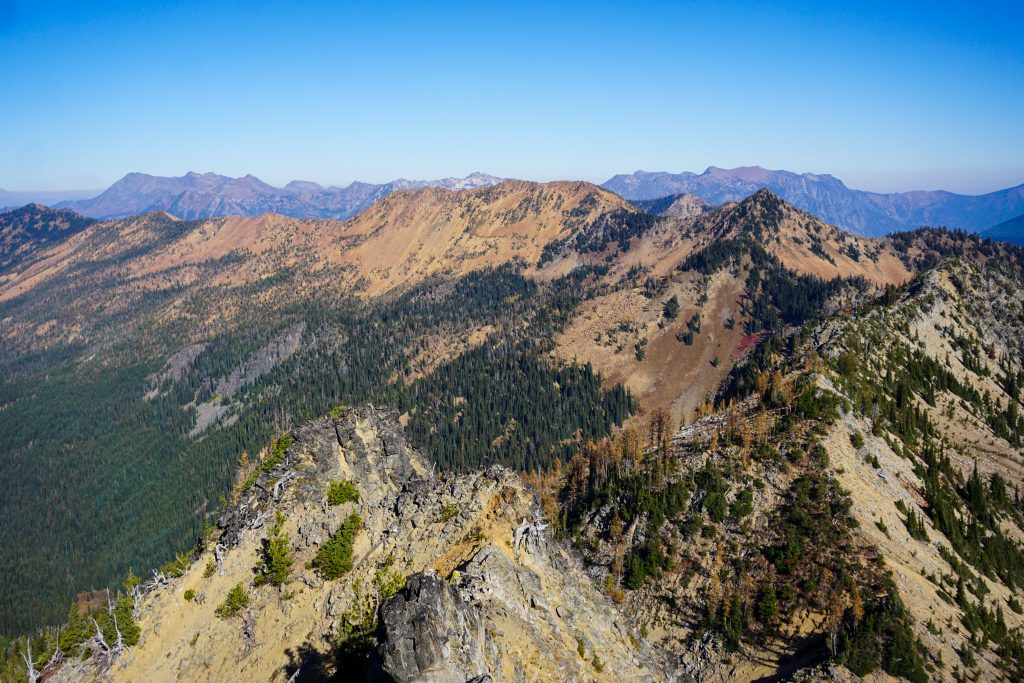
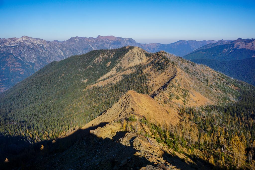
I continued up an easy ridge to the first major bump on the ridge. Before me lay the Scatter Peaks, mysterious and rugged. I knew that this ridge line could be a crux of the trip.
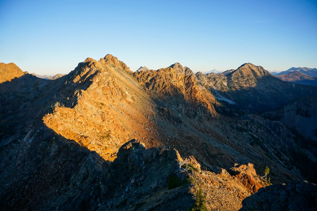
The section between the first two peaks was good fun, mostly class 2-3 with a little bit of exposed class 4. It was that good good serpentinite red rock, sticky and abrasive. The scrambling reminded me a bit of the section between Marys and Bean Peak on the Teanaway Traverse since it is the same type of rock.
After the second peak, I could have dropped off to the right and boulder hopped my way around the rest of the Scatter Peaks. But the ridge was fun and the day was still young, so I decided to try my luck and continue on.
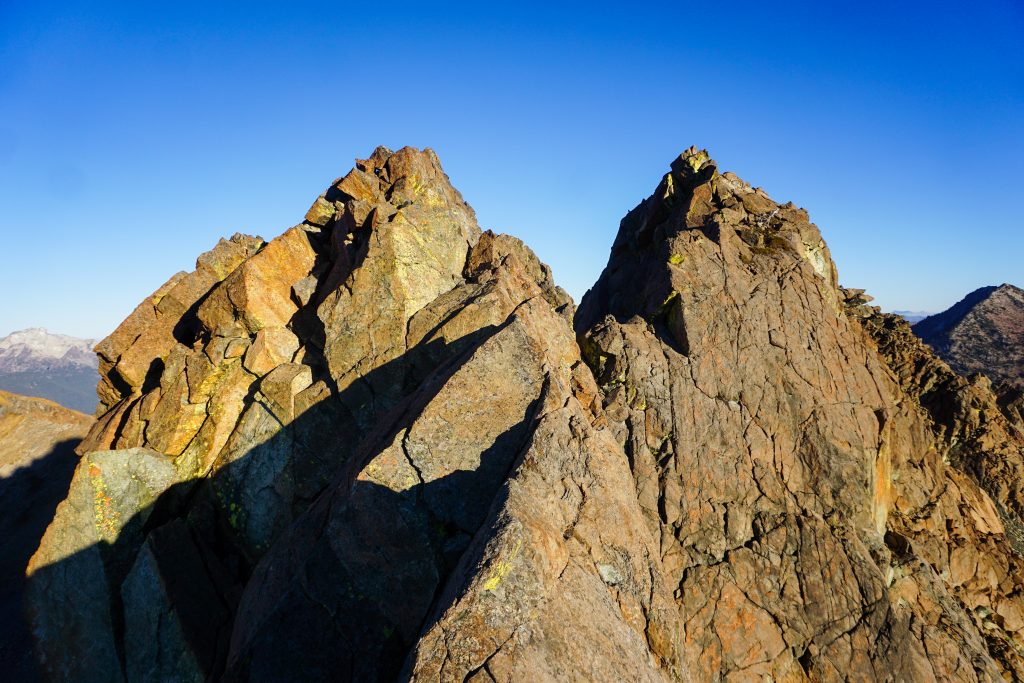
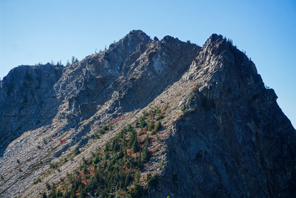
The scrambling stepped up a level to distinctly low fifth class in places. There were steep faces to climb and some incredible airy hand traverses. The rock was not always 100% bomber, but good enough to inspire confidence.
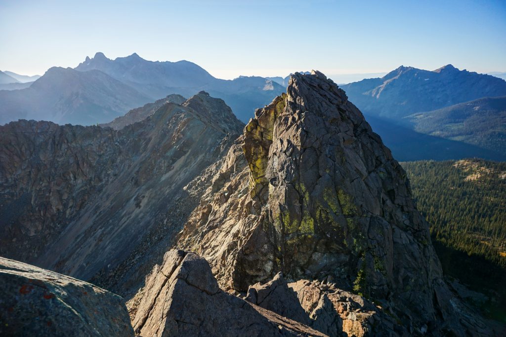
Eventually, I decided I had eaten up enough time, so I dropped off the ridge before the highest Scatter summit down a gully to the right and began to slowly boulder hop my way north. There is so much terrain in this zone that looks like a nice easy basin on a map, but is actually a giant field of large boulders placed at every odd angle.
My next objective was Solomon Peak. The south ridge was pretty easy, although a bit brushy. After the summit, the northwest ridge was annoyingly dense and slow. Even when it seemed the ridge would level out, there was numerous ups and downs. One particularly cruxy knob on the ridge had a vertical cliff on the north side that I could not find passage through. So I retreated and traversed beneath the west side of this feature. It was all slow going.
After another pass, I rounded the east side of Peak 6664 and found an incredibly beautiful tarn set in the deep, red rock basin. It felt so barren and lifeless. The big serpentinite rocks are very acidic and they make it challenging for anything to grow here, although a few larches had managed to put down roots in the boulder field.
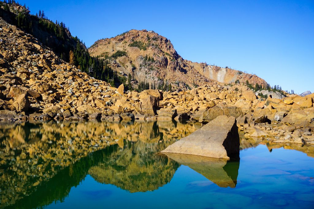
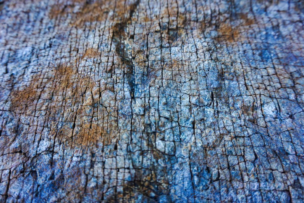
Serpentinite contains Olivine, which is actually green when freshly (fresh in geologic times) exposed. As it oxidizes in the weather, it turns red. I saw more green rock in this area than others but still not a lot. Sometimes the green lock is much more slippery and I had to watch myself on these parts.
It was noon now and I was a bit behind where I was hoping to be. The boulders felt relentless and it was challenging to move faster than 1 mph. I crossed one more basin before bushwhacking down to Meadow Creek Pass.
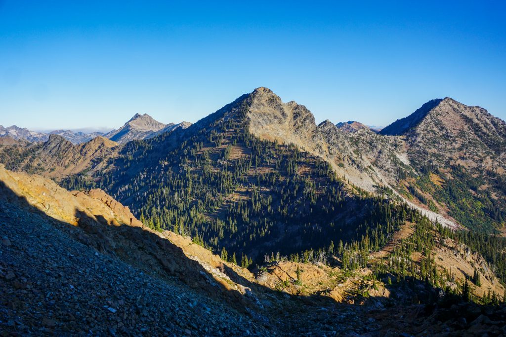
Nursery Peak was rather dense as I climbed in the hot afternoon sun. But I was able to cross a few gullies that had running water and reach the right hand ridgeline, which offered a brush free ascent, although it was rather sandy and tiring. After over 10k ft gain the first day, my body was just generally fatigued. My quads and calves felt overused from the explosive balancy movements boulder hopping. Perhaps I need to go back to playing basketball once a week.
I was only the second person to sign the Nursery Peak register this year. Finding my way off the peak was a bit challenging. I started down the northeast ridge, backtracked, tried a death sand gully, backed off that, and then eventually tenuously made my way down the chossy, exposed northeast ridge. While the scrambling was probably only 3rd class, I was getting tired and this was the mental crux of the trip for me. If I did this again, I would probably try to avoid Nursery altogether and pass through the Nursery/Cradle Col.
I felt like every ridge looked flat from afar but turned into boulders and micro ups and downs. The elongated ridge off of Nursery was no exception, but eventually I dropped down to a saddle and found an unmarked trail that traversed a north facing basin to the pass above Cradle Lake. For once something was easier than expected!
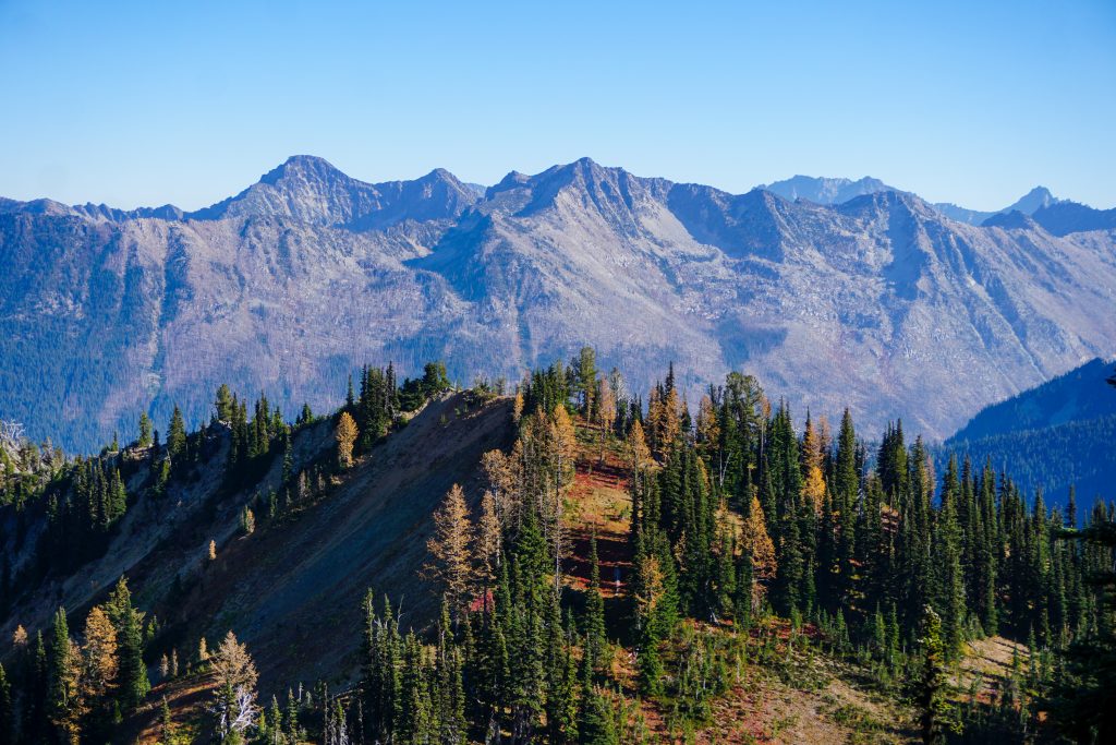
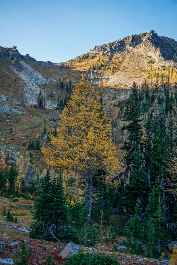
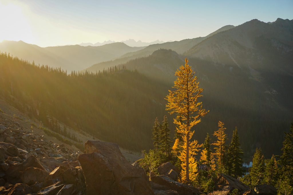
Cradle Lake is another one of those spots that took me completely by surprise. The south facing basin seems to “cradle” Mt. Stuart, giving serious Image Lake vibes. Despite its southerly aspect, there are plentiful larches in the lake basin, mixing with the green pine and fir trees. It felt so quiet and peaceful back here. This is a spot I would definitely return to!
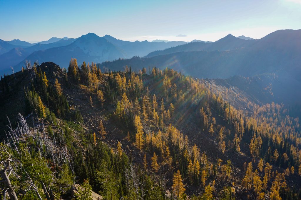
Cradle Lake was my final water source, so I filled up and began the climb towards Highchair. I was once again back in the red boulders and beautiful larch meadows below. The light was already long and soft.
I was only the fourth person to sign the Highchair register all year, and likely the last. It is incredible how few people come out here. It feels like a little wilderness within a wilderness, encircled by the popular spots like the Enchantments, Ingalls, and Robin Lakes, lost in the depths of the Upper Icicle. Sometimes I forgot even where I was. When you think you’ve seen it all, you’ve actually just scratched the surface.
I could have dropped off the ridge to the right for the final long traverse to Bootjack, but I figured that I had come this far on the ridge, so I might as well finish it off. My boulder hopping muscles threatened to go on strike, but I found energy in the glowing larches that lit up in the mixed forest beneath me like little lightbulbs.
And finally, I was there. Bootjack was the final summit and it was all downhill from here. I felt exhausted and happy. This high route had been more than I bargained for – more than 18,000 ft of gain typically feels like – but I was extremely proud of how I got it done.
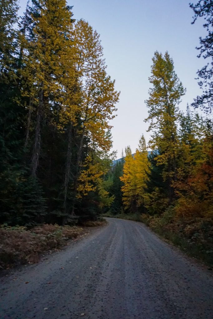
The Bootjack trail has a few blowdowns, but is otherwise soft and a nice grade for jogging down. I did not do much running on this fastpacking adventure, but I did run down the trail and the mile along the road back to my car at the Jack Creek Trailhead, arriving right at dusk.
The Jack Creek High Orbit is not destined to be a classic high route, but it was a beautiful, challenging, and adventurous route through a zone I and many others have overlooked for so long. For me, it was both a mountain adventure and exploration into how my body and mind respond to large multi day efforts. It was my biggest two day push ever, biggest days with an overnight pack, and biggest solo adventure. While it was definitely challenging, it also gave me confidence for bigger multi day objectives in the future.
For me, this is the end of a string of four straight incredible fall weekends (Fisher Outpost, Rainier Eastside, and Golden Lakes). It began with the yellow green needles still on the larches and ended in a carpet of gold beneath my feet. And during this period, I managed to help my company, Rupa Health, launch its biggest initiative in company history. Over the last month, it has felt like my life has been firing on all cylinders, in multiple dimensions. As Neil, our engineering lead, warned us, there will be highs and there also will be lows in startup life. I think this applies to anyone who tries to live to their fullest, take risks, and follow their heart. But while you are at the top, take a moment to look around and appreciate it. Capture that feeling in a bottle, so that next time you are grinding away, you can look back and remember why.
Notes:
- The total stats on this route were 37 miles and 18,500 ft gain. It felt like more gain than that because of all the boulders and ups and downs. Between the two days, I was moving for about 23 hours.
- Anytime I was not on a ridge, there was a surprising amount of water. There were many springs not on the map still flowing even after 4 months without rain.
- If you avoid the harder Scatter Peaks, this entire route goes at class 3 or so.
- There are two main sections I would recommend route alterations:
- Go directly over Van Epps Peak instead of Spirit Lake. There is water in a basin just to the east of Van Epps Peak.
- Go over the Cradle / Nursery col and then traverse beneath Nursery Peak to rejoin the route.
- My pack weighed just under 10 pounds excluding water and food. Here are a few key pieces of gear I used:
- Ultimate Direction Fastpack 30: I have had this pack for a while, but this was my first time using it for its actual purpose. The shoulder straps rubbed a little, but it bounced very little while running. The pockets are actually really well designed and I could hold a camera up front.
- Thermarest Uberlite Sleeping Pad: I usually do not take this on backpacking trips because it is so fragile and leaks so easily, but it saves half a pound over my other pad, so I brought it. No leaks this time and I slept well!
- Window Insulation Kit (ground tarp): Thin window insulation screens make for a 1 oz UL ground tarp.
- Enlightened Equipment Engima 40F quilt: under 1 pound and warm enough for temperatures into the 30s. I use this on most backpacking trips. Make sure to bring a warm hat or down hoodie though.
- Sol Escape Lite Bivy: I have tried multiple “breathable” bivies and none of them ever breathe and instead my sleeping bag just becomes soaked halfway through the night. This one was no exception. I think bivies like this are useless. This was a waste of 8 oz and space in my pack. I was warmer without it.
- La Sportiva Akasha II: I would have preferred Ultra Raptors, but these are what I had at the moment, and they got the job done.
- Food storage: I hung my food in a metal mesh bag, which was probably overkill, but I am scarred from snafflehounds eating my food on Stuart even as I slept with it, so I tend to be cautious with food storage.
- No stove, but I did cold-soak some couscous overnight and ate it for breakfast.
- Mountain Hardwear Ghost Whisperer: My trusty down jacket, has been on literally hundreds of adventures over the last 7 years. Never torn, still warm.
- Mountain Hardwear Airmesh Hoody: an insanely warm little fleece for its 4 oz weight.
- Black Diamond Z Poles: not much to say here except they work.
- Katadyn BeFree Filter: fast enough, light. I don’t usually filter but sometimes it is hard to find springs in the fall.
Thanks for the post!