A Line Across the Sky
Over the last year, I have developed a reputation for “high routes” – off trail, non-technical traverses in the alpine. High Routes exist in a broad space between mountaineering, backpacking, and trail running. These trips inspire me so much because they blend many different skills – route finding, endurance, scrambling, snow travel – into a cohesive experience (you’ll notice I emphasize the entirety of the experience). I have begun to get questions from people about high routes: how do you come up with these ideas? How do you plan them? How do you determine if they are feasible? So I decided to write a post about the process of creating a high route…
Table of Contents
The Vision
High Routes begin with a simple vision – to stay as high possible while remaining non technical. Obviously, “technical” can have different definitions but the main takeaway is that the movement should be fluid, allowing one to cover as much alpine terrain as possible and not be weighed down by technical pitches and cumbersome gear. If there was one word to describe the High Route experience, I believe it would be purity: we move in a way that is pure across a landscape that is pure.
The Area
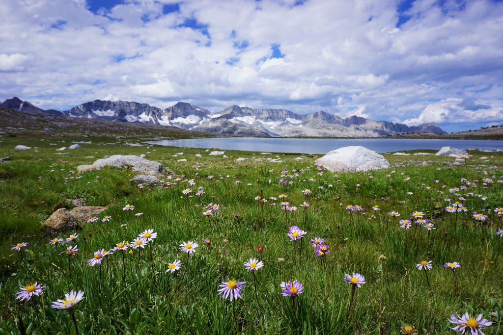
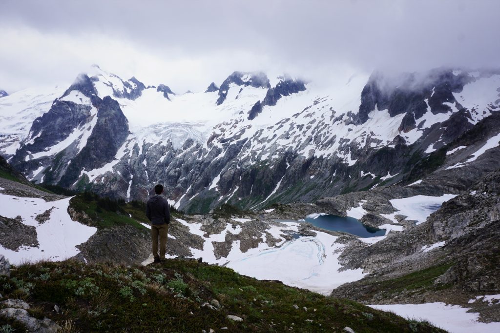
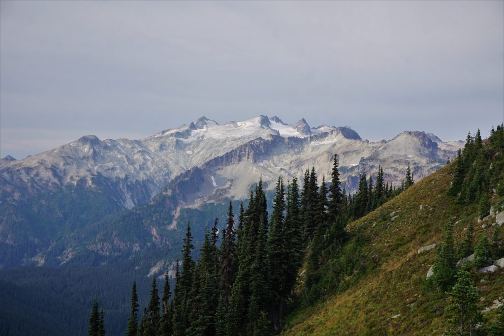
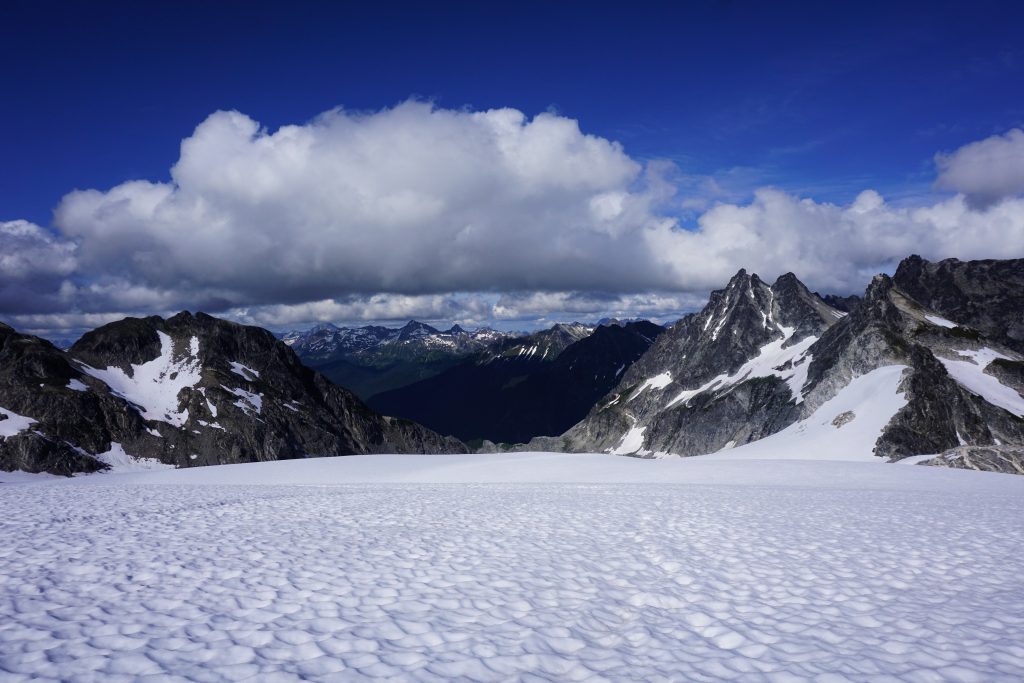
High Routes are all about aesthetics. When you choose an area for a high route, you are selecting a canvas for your artistic creation. There can be many sources of inspiration for a high route. With the Cascade High Route, the greater concept for a high route from Snoqualmie Pass to Canada dictated some of the terrain choices, as I was simply trying to link high routes near the Cascade Crest. With the Dakobed Range Circumnavigation, my obsession with the Napeequa River Valley drove me to scheme a way of exploring yet another magical part of the virgin valley. With the Triple Rainbow High Route, I purposefully sought out an area of the Cascades that feel overlooked and almost mysterious. The Alpine Lakes Crest Traverse was borne out of a winter of staring at these peaks while skiing near Snoqualmie Pass, wondering what secrets they held. This is where you can express who you are, your signature style. Maybe it is a remote serrated granite ridge that draws your eye, or a reclusive pocket glacier, or a pristine alpine lake. What areas are special to you? What is the experience that you seek? Let yourself be inspired.
Access
As much as people like to think so, I don’t actually enjoy bushwhacking. Okay, maybe I like a little wet brush for breakfast in the morning… In the Cascades, one of the biggest challenges to high routes in access. Ideally, you want to use trails to access and leave the alpine. Oftentimes, there are trails crossing passes that we can use to access an alpine ridgeline. Loops are nice, but sometimes car shuttles are needed to execute the purest traverses, such as the Extended Ptarmigan Traverse. If you cannot use trails to approach or descend, look at satellite imagery for boulder fields, moderate timbered ridges, or snow fingers (depending on the season). Avoid avalanche paths and the accompanying slide alder at all costs, which brings me to the subject of terrain selection…
Terrain Selection
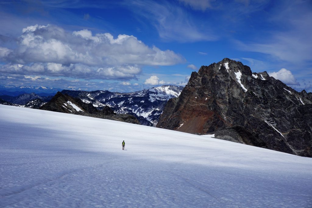
Terrain and route selection is obviously the nitty gritty details of a high route. In general, look for high elevation benches, snowfields, and glaciers to traverse. Don’t be afraid to lose elevation and quickly regain it to avoid cliff bands and difficult sidehilling. When it comes to the local area, you should leverage your local knowledge about common terrain features. For example, in the Eastern Cascades, north and east sides of peaks tend to be steeper, rockier, and more unstable because they were more recently glaciated and less soil has accumulated since glaciation. In the Brooks Range of Northern Alaska, flat terrain at the valley bottoms is incredibly boggy and tiring to move through, while terrain just a hundred feet above on the sides of the valley can be easy travel.
- Ridges: True ridges are usually very slow for travel and have lots of unnecessary ups and downs and possibly technical sections. Usually avoid if you want to cover a good distance. However, sometimes the best rock is found on ridge tops.
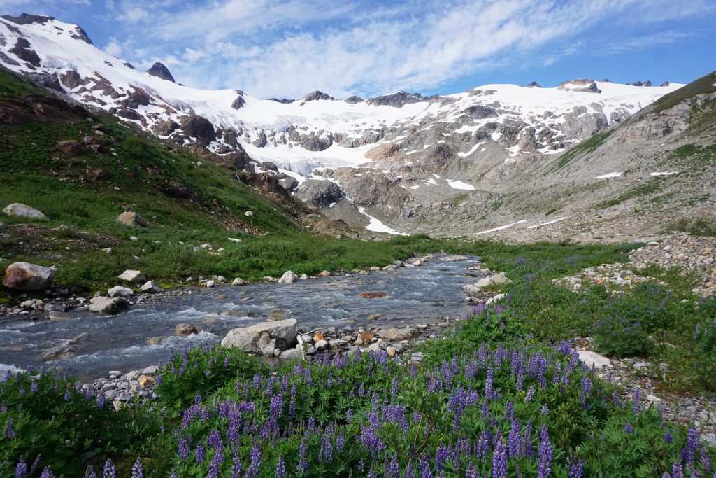
- Glacial Benches: In ranges like the Cascades, there are frequently “hanging valleys” where an older deceased glacier carved away a steeper lower valley, leaving a bench beneath the upper glacier. These can frequently provide aesthetic, brush free, relatively flat travel above steep, brush filled basins. Getting up out of the lower basins into the hanging valleys can be tricky, but there are usually weaknesses.
- Sidehills: Sidehilling is a required skill of the high router. Sometimes it can be relatively easy but other times, especially when wet, quite desperate. Be sure to wear shoes with big tread and good ankle mobility so you can allow your ankles to twist into the hill (I like La Sportiva Ultra Raptors or Mutants). Poles are a must. In general, if vegetation is growing on the hill, you can traverse it, but still consider if you could cross to other side of the ridge, drop a little bit to a bench, or something else because extended sidehilling can be very fatiguing.
- Passes: Passes are like your ticket to freedom. Passes are weaknesses in a ridge that allow you to cross back and forth, giving you varied scenery and aesthetic travel. Maybe it makes sense in one part to ride benches on the west side, then cross a pass and use snowfields on the east side.
- Boulder Fields: Boulder fields are difficult to predict and really require local knowledge of their size and stability. I like to use boulder fields to gain vertical, but not to cover horizontal distance.
- Avalanche Paths: Unless snow covered, these are a bad idea. Slide Alder dominates and will suck your spirit out of you.
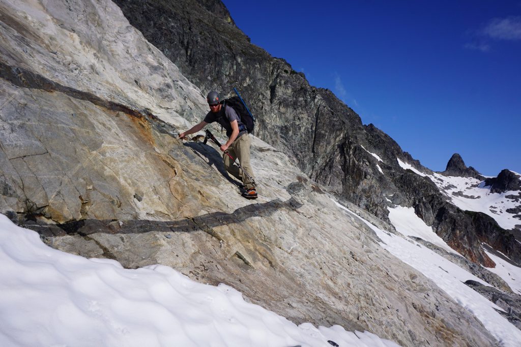
- Slabs: Some areas, like the High Sierra, are littered with slabs. Slabs are often the best terrain for high routes. The only concern with them is how steeper slabs can become dangerous when wet, from rain or snow melt above.
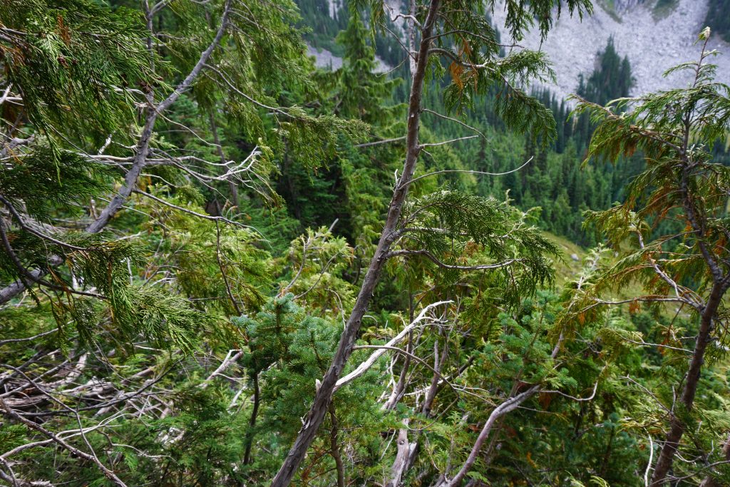
- Forests: Once again, forests vary greatly by location. In the Sierra and higher Cascade valleys, they are usually pretty tame and can actually allow pretty fast travel, although visibility is reduced. Near valley bottoms, there are often many blowdowns and tall brush, making travel difficult.
- Burn Areas: Burn areas often provide relatively fast travel during the first few years after a fire because of no brush, but get very bad in the following decades as the brush regrows and downed timber covers the slopes.
- Rivers and Streams: Rivers can be very difficult to cross without a bridge or good log, especially during peak snowmelt in the spring and early summer. Be considerate of this and try to cross rivers at flatter sections of terrain and higher up, where there is less flow.
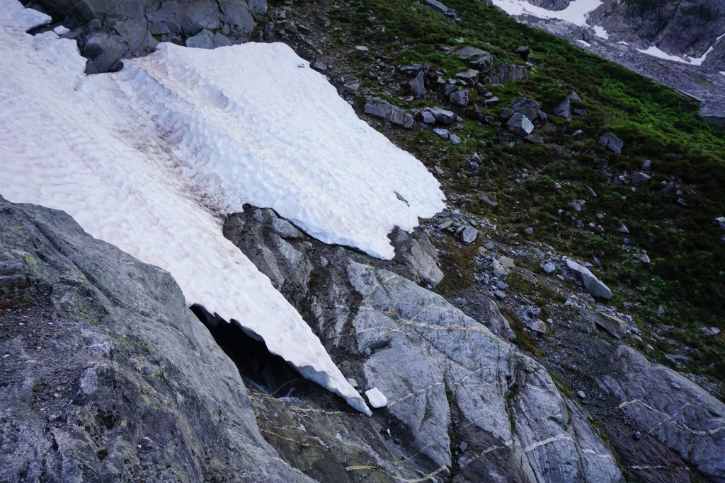
- Snowfields: Snowfields are your friend! Anticipate snow conditions by aspect and temperature: try to cross south facing snowfields earlier in the day and north facing ones later. Whether or not you do a route N-S or S-N can greatly affect the snow conditions you encounter. Even though common knowledge says it’s a bad idea, I often take just aluminum crampons and poles, confident I will not slip and need an ice ax. This is more efficient than using an ice ax on moderate terrain.
- Glaciers: Glaciers can be very helpful in alpine terrain. Generally, try to stay higher on glaciers and in flatter sections. Convexities usually lead to a higher density of crevasses. Access at the tongue of a glacier can be difficult, especially with deep lateral moraines resulting from glacial recession. At the top of glaciers, watch for bergschrunds. People often ask me how I decided whether or not to bring a rope on glaciers. If you’re not sure, then bring a rope! But in all honesty, I research for late season photos of the glacier, look at trip reports, try to find information about how crevassed a glacier is. But if you’re at all uncertain, play it safe.
Research
There are tons of ways to research your proposed high route. Here are a few resources that I frequently leverage:
- Trip Reports: Search the internet, on popular forums, and social media for trip reports of a similar route or specific area you are interested in. The photos and stories can be very helpful in informing your decisions.
- Guidebooks: People think of the Beckey Guides as just for alpine climbing, but there’s actually “High Routes” in the subtitle! In other climbing guidebooks, approach beta for certain routes can directly relate to your high route plans. In the Cascades, owning the archaic “Routes and Rocks” high route books is a must.
- Locals: It’s no secret that a successful high route depends on previous experience in the area. If you don’t have that experience, talk to locals who do. Even if you do, find more experienced travelers and pick their brains about routes they have done and how those trips worked out.
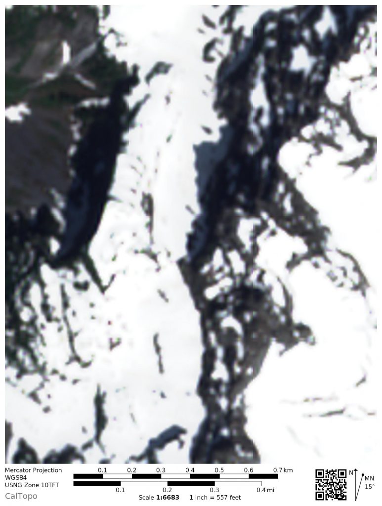
- Maps: I am a big fan of caltopo for planning my routes. The “MapBuilder Hybrid” base layer is super useful because it mixes satellite imagery and a topographical layer, allowing you to see the topography and surface terrain as you draw your route. Turning on slope angle shading can help you see micro terrain features and evaluate the viability of certain snowfields or sidehills. You can even get projected current snow depth over terrain.

- Satellite Imagery: Satellite imagery can reveal so much about terrain surface. This can help you tell if it is brushy, meadows, forests, boulders, etc. Additionally, you can leverage free Sentinel2 (a satellite) imagery to get up to date insight into snow coverage. Caltopo has even integrated this into their website!
Execution
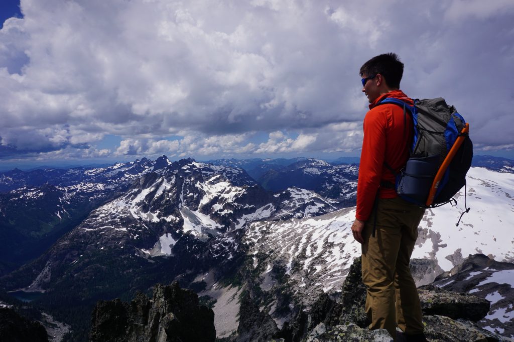
After all the dreaming, the actual execution of the high route is so exciting and important. Obviously, a strong fitness base and variety of mountain skills – snow travel, scrambling, bushwhacking, boulder hopping – are paramount, along with navigation. Remember, no matter what line you drew on the map, the terrain is not going to be exactly what you expected, and you will have to route find and improvise on the way. Trust your instincts; even if they are not good, you will improve them.
A few general ideas to think about:
- Bail Options: I always recommend having bail options planned and mapped in case you fall behind schedule, there is a rolled ankle, a section does not work, or you just are not feeling it anymore.
- Speed: This will take some trial and error to learn how fast you can move in different terrain, but start conservative, like 25-50% of your trail speed. 1 mph can be good for a high route. Pace yourself. High routes are demanding.
- Campsites: Keep in mind where you would want to camp (generally protected flat areas), where it is even possible to camp, and be adaptable to make sure you get a good night’s rest. Don’t get caught on an endless boulder field as the sun is going down.
- Weather: Visibility and dry rock/heather is key to a successful high route. Pay close attention to weather patterns an don’t be afraid to bail if it is not looking good.
- Gear: I generally advocate going light as possible. Sure, you can roll with 30 lbs on a trail, but hopping across boulders? That’s a different story. I try to minimize everything I can, from lighter sleeping gear to simply less water (make use of frequent water sources).
Final Thoughts
In this article, I tried to lay down a framework and explain how I go about creating a high route; I didn’t want to tell you things you can or cannot do. Perhaps the most important part of a successful high route is creativity – the fearlessness to dream and to explore. Lowell Skoog, arguably the greatest ski mountaineer in Cascade history, once told me:
“If you can dream it, you can do it“.
Lowell Skoog, Legendary Cascade Ski Mountaineer
Sometimes, I believe that our greatest obstacle is not some steep cliff or intimidating glacier, but our own conceptions of what traveling in the mountains is supposed to be. In many ways, I believe that we are only limited by our imagination. If you have a clear vision of the experience you seek in the mountains and you take the necessary steps to prepare and execute, you will someday make that vision a reality. It is only a matter of time.
Hi Kyle—great website and trip reports! I’m relatively new to the West, having lived my whole life in the Appalachians of the East. (So I’ve got a LOT more exploring to do.) Your writing is eloquent—and much appreciated. I’m decades older than you, still going strong at 57. If I may venture into the personal, I wonder how long you intend to lead what appears to be such an intensely self-centered lifestyle? That will sound critical but please know it’s not intended that way!
By “self-centered” I mean a lifestyle without a family of your own—without commitments that prevent you from playing in the mountains 100% of your free time? I’ve had two families (and kids) in my life and found the rewards to be every bit as great as any mountain adventure I’ve ever had. And I’m at a point in my life where I’m between relationships and struggling a bit to decide whether I want a lifestyle more like yours? Or one more connected to family and community?
I read your stories and see myself 25 years ago: someone who feels invincible, who has never experienced death up-close and firsthand, someone who surrounds themself with identical people (young, with lots of disposable income, free from obligations and attachments, with no ties to any community because you’re always on the move exploring the world). It’s a heady existence (I’ve done it!)
I mentioned death above: I’ve been a multi sport enthusiast my whole life—I’ve never done any sort of climbing (technical or otherwise), but at various points in my life, I’ve been a hardcore whitewater paddler and racer; a long-distance backpacker; a hang glider pilot (you should try soaring over the mountains sometime in free flight—it’s the only thing even more transcendent than the adventures you describe!) In all those adventures, I’ve witnessed death—on two occasions, the deaths of close friends (who were both expert at what they do).
The funny thing about death is that it always comes when you are at your peak—when you feel the most accomplished, the most healthy, the most ALIVE. And man, when you see it happen to a friend, it is deeply, profoundly, intensely final…and sinks deep into your psyche like mere injury never does. It definitely changes your perspective! You’ll likely have that experience too if you keep this up (I found it has nothing to do with your fitness, skill, or knowledge).
Anyway, apologies if I ramble. Again, I really don’t mean any of this critically. Your site is great. I’ve often considered creating one like it to chronicle all my thoughts and adventures (I now live in Eugene, Oregon), but I don’t have time between my job (working for a nonprofit conservation organization) and my kids.
It appears that you don’t share adventures with anyone outside your age range. I suggest doing it! Because different generations can learn much from each other (and actually have fun together). It’s a sad fact of society that every new generation finds the older one irrelevant. (Mine included.)
I’d enjoy joining you on a non-technical adventure sometime (really). 🙂
Scott in Oregon
Hello Scott,
Thanks for sharing your experiences. In response to your question, I’ll say that my life is not as self-centered as it may appear. I have a full time job and care for my family. In fact, I spent so much of the last 4 years of my life dedicated to another individual, a future, and a dream family. I invested more there – time, money, effort – than I have in my mountain pursuits, only to be broken by the mysterious ways life and fate work. It has been incredibly depressing, and so my family has agreed it has been best recently for me to dedicate my efforts more to climbing. Hopefully, I will be able to find a new relationship and build a family in the future. Honestly, I would give up all this climbing to have it back, but luck has not been on my side. Sometimes, we just have to work with what we have, and right now climbing is one of those positive things in my life.
In regards to seeing death, I empathize with you. I’ve seen some pretty serious accidents and been the subject of an accident myself (just a few days ago). It is terrifying, I agree. It makes us realize how a single misstep can have such terrible consequences.
Most of my partners are relatively young too because these are the friends I grew up with. But increasingly more of my partners are at a different stage in life (married, over 30) so I’m not sure what you mean that I only climb with “young” people. I guess we all have different definitions of youth. I have great respect for the older generations. They have done so much more and given us so much.
Sincerely, Kyle
Thanks for the thoughtful reply Kyle! And apologies for my assumptions about your life. I take them back. 🙂 I’ve known many people who fit the profile of the assumptions I mistakenly made about you (and sometimes it’s hard to avoid generalizing). That is, people who don’t have families, have plenty of disposable income, and devote 100% of their non-working lives to playing. And a part of me has always envied that. But I do sometimes get concerned with the amount of CO2 us obsessively-traveling outdoor fanatics produce in our countless drives to the mountains and back. (And yes, ride sharing helps, a little!)
I too have experienced the loss of a family (I have two young kids who live with me half the time), and I know well how healing the mountains can be. Every weekend I don’t have my kids, I’m in the mountains.
But more importantly, like you I’m really intrigued by the concept of high routes—particularly because they could be applied anywhere.
I might have mentioned it above, but I work for the Pacific Crest Trail, so am lucky to get to travel as part of my job to some of the best places in the mountains of California, Oregon, and Washington. When I first moved out here and started working for the PCT, all I heard from thru-hikers is how stupendous the Sierras are. People just went on and on about them. And they are spectacular! I haven’t done the SHR yet, but I’ve hiked from Kearsarge Pass to Mt. Whitney and it was pretty amazing.
But after seeing the North Cascades, the Sierras paled in comparison. To me, the North Cascades are one of the greatest mountain regions on Earth—and I’m obsessed with seeing more of them over time. (I spent several days with a volunteer crew on the PCT around White Pass this past summer during peak wildflower bloom, and thought I’d died and gone to heaven, LOL. Nothing like that in the Sierras!)
I’m in good shape and have plenty of endurance, but I probably don’t have the speed of someone 20 years younger—still, I love the concept of fast, light alpine travel—and particularly challenging myself to see how far I can go in a day.
Keep writing! Your posts are great, and I’ll keep reading them. 👍
Scott